CARBON BALANCE IN BIOMASS OF MAIN FOREST TREE SPECIES IN POLAND
|
|
|
- Abraham Spencer
- 8 years ago
- Views:
Transcription


1 CARBON BALANCE IN BIOMASS OF MAIN FOREST TREE SPECIES IN POLAND PAWEŁ STRZELIŃSKI Department of Forest Management Poznan University of Life Science TOMASZ ZAWIŁA-NIEDŹWIECKI Forest Research Institute in Sękocin Stary CarboForest Conference Sękocin Stary

2 Project participants 6. University of Sustainable Developement, Eberswalde and LFE Eberswalde, Germany 3. Warsaw University of Life Sciences (SGGW) 4. Warsaw University of Technology 1. Poznan University of Life Sciences 2. Institute of Dendrology (Polish Academy of Sciences), Kórnik 7. Forest Research Institute 5. Agricultural University in Krakow Number of participants: about 50 from 8 institutions
, Kórnik 7.")
3 OBJECTIVES The aims of the project are: to generate the allometric equations, to verify the empirical measures defining quantity of wood biomass of main forest stand species, to prepare the measurement methods concerning the quantity of carbon stored in forest, to prepare the methods of defining changes in carbon accumulations and its dynamics in relation to different forest mnagement practices.

4 WORK EXTEND The research is conducted for: 8 most important tree species, 12 species of shrub layer. Almost 300 research sites, representing different age classes and habitats, as well as economic meaning of analysed tree species. Together: 60 (Pine) + 60 (Spruce) + 24 (Fir) + 18 (Larch) + 48 (Oak) + 48 (Beech) + 18 (Birch) + 18 (Alder) = 294 sample plots.


5 Share of area taken by different dominant tree species in the State Forests 67,4% 6,2% 1,1% 2,0% 5,3% 5,0% 6,3% 6,7% data source: The State Forests National Forest Holding, Annual Report 2005

6 WORK EXTEND After data collection (direct measurement, terrestrial laser scanning) empirical formulas were developed for biomass calculation of trees, shrubs, soil cover and calculation of carbon sequestrated in stands of main species. Additionally changes of carbon sequestration in relation to different forest management scenarios are to be estimated. Final results should let us to estimate stands biomass and carbon sequestration using inventory data, SILP, and results of other research projects.

7 EXPECTED RESULTS Data obtained from model trees let us to create allometric equations for above- and below-ground biomass of trees on the basis of their DBH. Additionally relationship was analysed between results obtained from ground measurments and: LAI instrumental measurement, hemispherical photography, satellite images and aerial photography, airborne and terrain lidar, inventory data, and accumulation of CO 2 in trees biomass (including biomass of assimilation apparatus).

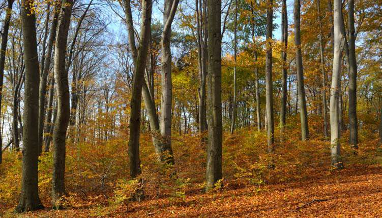
8 112-year old spruce stand (Gryfino Forest District). fot. P. Strzeliński
. fot. P.")
9 112-year old spruce stand (Gryfino Forest District). fot. P. Strzeliński
. fot. P.")
10 112-year old spruce stand (Gryfino Forest District). fot. P. Strzeliński
. fot. P.")
11 What is the meaning of fine roots (usually skipped in this kind of investigations) for carbon balance in stands? photo. A.M. Jagodziński

12 Leaves collection (Rogów Forest Experimental Station) fot. P. Strzeliński
 fot. P.")
13 Fresh biomass measurements (Gryfino Forest District). fot. P. Strzeliński
. fot. P.")
14 ELEMENTAR VarioMax CN Analyzer

15 biomass [t/ha] Comparision of beech biomass between Gryfino Forest District and Sudety Mountains I II III IV V VI sudety gryfino age classes made by M. Zasada at all.

16 Soil analysis (Szklarska Poręba Forest District) fot. I. Patalan-Misiaszek


17 Soil analysis Carbon content - Spruce stand - Gryfino Forest District Mineral level [t/ha] age classes made by M. Skorupski at all.
![District Mineral level [t/ha]](/docs-images/43/4734697/images/page_17.jpg "age classes made by M.")

18 Soil analysis Carbon content Spruce stand - Gryfino Forest District Organic level [t/ha] age classes made by M. Skorupski at all.
![District Organic level [t/ha]](/docs-images/43/4734697/images/page_18.jpg "age classes made by M.")
19 Satellite images and aerial photos Landsat TM 30 m resolution Ikonos MS 4 m resolution Ikonos Pan 1 m resolution Aerial 1: (~0,5 m) IGiK
")
20 LAI instrumental measurement Norway spruce stand, Forest District Ujsoły, August 2006 (photo. P. Strzeliński, A. Damm) LAI-2000 Plant Canopy Analyzer
 LAI-2000 Plant Canopy Analyzer")
21 Hemispherical photography (A): Infrared hemispherical photo (type filter: 87A) (B): Hemispherical photo - natural colours Beech stand, Forest District Milicz, September 2006, (photo. P. Strzeliński)
22 FARO scanning in Milicz (Barycz River)
23
24
25 segment = 2 cm segment =10 cm. Tymków (2009)
26 Vizualization of scub model high of cylinder = 2 cm; max diamter = 5 cm. Tymków (2009)
27 Georadar
28 Oak in Weisswasser Tree parameters year old, d 1.3 = 92 cm, h = 21 m, Crown diameter = 12 m, Crown Lenght = 14 m. fot. A. Degenhardt
29 Oak in Weisswasser oprac. P. Strzeliński
30 fot. P. Strzeliński
31 oprac. P. Strzeliński i S Sułkowski
32 oprac. S Sułkowski
33 Results of georadar scanning oprac. K. Rudnicki (GISPRO)

34 New data for Carbon balance project from another project Development of trans-border decision support system for remote and model assessment of forest dendromass in Pomerania region RGB photo (terrain resolution:10 cm; Drawno Forest District, Sep. 2011) made by GISPro
35 New data for Carbon balance project from another project Development of trans-border decision support system for remote and model assessment of forest dendromass in Pomerania region Airborne Laser Scanning (24 pt/m2; Drawno Forest District, Sep. 2011) all area 4 pt/2; test plots pt/m2 pt/m2 made by GISPro
36 Project output 1. Models of carbon storage for each site and stand type 2. Evaluation of carbon storage and CO2 retention ability of forest ecosystems based on models and State Forests inventory database 3. Forest Digital Map (part of State Forest Information System) is to be used to visualise the results all over the country (from particular forest complex till different State Forest or state administration units) 4. Definition of indexes supporting rapporting the amount of accumulated carbon

37 Thank you
MOVING FORWARD WITH LIDAR REMOTE SENSING: AIRBORNE ASSESSMENT OF FOREST CANOPY PARAMETERS
 MOVING FORWARD WITH LIDAR REMOTE SENSING: AIRBORNE ASSESSMENT OF FOREST CANOPY PARAMETERS Alicia M. Rutledge Sorin C. Popescu Spatial Sciences Laboratory Department of Forest Science Texas A&M University
Planning Tools related to water in Promotional Complex Forest Western Sudety Mountains
 Planning Tools related to water in Promotional Complex Forest Western Sudety Mountains Radomir Balazy Forest Research Institute R.Balazy@ibles.waw.pl Content 1. Introduction 2. Technologies of data collection
The UK Timber Resource and Future Supply Chain. Ben Ditchburn Forest Research
 The UK Timber Resource and Future Supply Chain Ben Ditchburn Forest Research Timber availability The landscape of timber availability in Great Britain and the United Kingdom is moving through a period
Krzysztof Stereńczak, Radomir Bałazy. Forest Research Institute, Warsaw
 Establishment of a forest information system covering the area of the Sudetes and the West Beskids with respect to the forest condition monitoring and assessment project presentation Krzysztof Stereńczak,
National Inventory of Landscapes in Sweden
 Key messages Approaching the landscape perspective in monitoring experiences in the Swedish NILS program Johan Svensson, Future Forest Monitoring, 091112 Landscape level approaches are necessary to deal
Application of airborne remote sensing for forest data collection
 Application of airborne remote sensing for forest data collection Gatis Erins, Foran Baltic The Foran SingleTree method based on a laser system developed by the Swedish Defense Research Agency is the first
Nature Values Screening Using Object-Based Image Analysis of Very High Resolution Remote Sensing Data
 Nature Values Screening Using Object-Based Image Analysis of Very High Resolution Remote Sensing Data Aleksi Räsänen*, Anssi Lensu, Markku Kuitunen Environmental Science and Technology Dept. of Biological
Development of a forest stand top-height model for Airborne Laser Scanning Data (ALS)
") Development of a forest stand top-height model for Airborne Laser Scanning Data (ALS) Under the project ForseenPOMERANIA 2 Table of content 3 Airborne Laser Scanning (ALS) got more and more priority for
Development of a forest stand top-height model for Airborne Laser Scanning Data (ALS) Under the project ForseenPOMERANIA 2 Table of content 3 Airborne Laser Scanning (ALS) got more and more priority for
A two-phase inventory method for calculating standing volume and tree-density of forest stands in central Poland based on airborne laser-scanning data
 DOI: 10.2478/frp-2013-0013 ORIGINAL RESEARCH ARTICLE Leśne Prace Badawcze (Forest Research Papers), June 2013, Vol. 74 (2): 127 136. A two-phase inventory method for calculating standing volume and tree-density
Assessment of cork production in new Quercus suber plantations under future climate. Joana A Paulo Margarida Tomé João HN Palma
 Assessment of cork production in new Quercus suber plantations under future climate Joana A Paulo Margarida Tomé João HN Palma 22 May 2012 1 Introduction Climate is related to several variables that affect
A Streamlined Approach to the Component Ratio Method for RGGI U.S. Forest Projects Outside of California, Oregon, Washington, Alaska and Hawaii
 for RGGI U.S. Forest Projects Outside of California, Oregon, Washington, Alaska and Hawaii May 13, 2015 Background on the Component Ratio Method... 2 Streamlined Approach to the Component Ratio Method...
National and Sub-national Carbon monitoring tools developed at the WHRC
 National and Sub-national Carbon monitoring tools developed at the WHRC Nadine Laporte Woods Hole Research Center A. Baccini, W. Walker, S. Goetz, M. Sun, J. Kellndorfer Kigali, 20 th June 2011 Why measuring
Photogrammetric Point Clouds
 Photogrammetric Point Clouds Origins of digital point clouds: Basics have been around since the 1980s. Images had to be referenced to one another. The user had to specify either where the camera was in
Urban Tree Planting Quantification Guidance
 Urban Tree Planting Quantification Guidance June 2014 This document provides guidance for quantifying an Urban Tree Planting (UTP) Project s carbon stocks, both for purposes of estimating a project s baseline
Estimation of Carbon Stock in Indian Forests. Subhash Ashutosh Joint Director Forest Survey of India sashutosh30@yahoo.com
 Estimation of Carbon Stock in Indian Forests Subhash Ashutosh Joint Director Forest Survey of India sashutosh30@yahoo.com Salient Features of the Methodology most comprehensive assessment so far a GIS
SWOT ANALYSIS: State of forests in north western part of POLAND
 SWOT ANALYSIS: State of forests in north western part of POLAND Author: Piotr Bieniek Szczecin 2014 The State Forest (Lasy Państwowe), full name: The State Forests National Forest Holding (Państwowe Gospodarstwo
Construction Guidelines for Tree Protection. d. DISTRICT DEPARTMENT OF TRANSPORTATION URBAN FORESTRY ADMINISTRATION
 Construction Guidelines for Tree Protection d. DISTRICT DEPARTMENT OF TRANSPORTATION URBAN FORESTRY ADMINISTRATION City of Trees Our time in history Since 1872, when Governor Alexander Shepherd planted
VCS REDD Methodology Module. Methods for monitoring forest cover changes in REDD project activities
 1 VCS REDD Methodology Module Methods for monitoring forest cover changes in REDD project activities Version 1.0 May 2009 I. SCOPE, APPLICABILITY, DATA REQUIREMENT AND OUTPUT PARAMETERS Scope This module
Cost Considerations of Using LiDAR for Timber Inventory 1
 Cost Considerations of Using LiDAR for Timber Inventory 1 Bart K. Tilley, Ian A. Munn 3, David L. Evans 4, Robert C. Parker 5, and Scott D. Roberts 6 Acknowledgements: Mississippi State University College
ICP-Forests Level I grid net and its harmonization with the National Forest Inventory in Europe and in Spain
 CONVERGENCES AND COMPLEMENTARITIES OF FOREST INFORMATION SYSTEMS ICP-Forests Level I grid net and its harmonization with the National Forest Inventory in Europe and in Spain European scope Study of scenarios
JACIE Science Applications of High Resolution Imagery at the USGS EROS Data Center
 JACIE Science Applications of High Resolution Imagery at the USGS EROS Data Center November 8-10, 2004 U.S. Department of the Interior U.S. Geological Survey Michael Coan, SAIC USGS EROS Data Center coan@usgs.gov
DESCARTES & EFIMOD: An Integrated System for Simulation Modelling and Exploration Data Analysis for Decision Support in Sustainable Forestry
 DESCARTES & EFIMOD: An Integrated System for Simulation Modelling and Exploration Data Analysis for Decision Support in Sustainable Forestry A. Komarov a, O. Chertov b, G. Andrienko c, N. Andrienko c,
Forests and Water - a multifunctional relationship. photo: Marco Reinhardt
 Forests and Water - a multifunctional relationship Dr. Dr. Doris Doris Linzmeier Linzmeier Buchenweg Buchenweg 16 16 50321 50321 Brühl Brühl info@bi-50tausendbaeume.de info@bi-50tausendbaeume.de photo:
Inventory Enhancements
 Inventory Enhancements Chapter 6 - Vegetation Inventory Standards and Data Model Documents Resource Information Management Branch, Table of Contents 1. DETECTION OF CONIFEROUS UNDERSTOREY UNDER DECIDUOUS
LiDAR for vegetation applications
 LiDAR for vegetation applications UoL MSc Remote Sensing Dr Lewis plewis@geog.ucl.ac.uk Introduction Introduction to LiDAR RS for vegetation Review instruments and observational concepts Discuss applications
Lidar Remote Sensing for Forestry Applications
 Lidar Remote Sensing for Forestry Applications Ralph O. Dubayah* and Jason B. Drake** Department of Geography, University of Maryland, College Park, MD 0 *rdubayah@geog.umd.edu **jasdrak@geog.umd.edu 1
Häkäpöntöstä pyrolyysikaasuttimeen Development of woodgas generator
 Coal and wood to gas One of the most important technical developments in history was the discovery of gas production from dry-distillation (carbonising/pyrolysing/heating) of coal and wood. The technology
Urban Ecosystem Analysis Atlanta Metro Area Calculating the Value of Nature
 August 2001 Urban Ecosystem Analysis Atlanta Metro Area Calculating the Value of Nature Report Contents 2 Project Overview and Major Findings 3 Regional Analysis 4 Local Analysis 6 Using Regional Data
COMPARTMENT REVIEW RECORD OF CHANGES AND DECISIONS. Michigan Department of Natural Resources. Atlanta Management Unit. 2015 Year-of-Entry
 COMPARTMENT REVIEW RECORD OF CHANGES AND DECISIONS Michigan Department of Natural Resources Atlanta Management Unit 2015 Year-of-Entry Atlanta Field Office October 31, 2013 The following documents the
Life Cycle Of A Plant Population
 Life Cycle Of A Plant Population Seed Rain n=3 Growth And Mortality n=7 Seedling Cohort n=22 Environmental Sieve Seed Bank n=5 Copyright G. Bonan 22 Suvivorship Of Seedlings In A Northern Hardwood Forest
RESOLUTION MERGE OF 1:35.000 SCALE AERIAL PHOTOGRAPHS WITH LANDSAT 7 ETM IMAGERY
 RESOLUTION MERGE OF 1:35.000 SCALE AERIAL PHOTOGRAPHS WITH LANDSAT 7 ETM IMAGERY M. Erdogan, H.H. Maras, A. Yilmaz, Ö.T. Özerbil General Command of Mapping 06100 Dikimevi, Ankara, TURKEY - (mustafa.erdogan;
.FOR. Forest inventory and monitoring quality
 .FOR Forest inventory and monitoring quality FOR : the asset to manage your forest patrimony 2 1..FOR Presentation.FOR is an association of Belgian companies, created in 2010 and supported by a university
Information Contents of High Resolution Satellite Images
 Information Contents of High Resolution Satellite Images H. Topan, G. Büyüksalih Zonguldak Karelmas University K. Jacobsen University of Hannover, Germany Keywords: satellite images, mapping, resolution,
Integrated Global Carbon Observations. Beverly Law Prof. Global Change Forest Science Science Chair, AmeriFlux Network Oregon State University
 Integrated Global Carbon Observations Beverly Law Prof. Global Change Forest Science Science Chair, AmeriFlux Network Oregon State University Total Anthropogenic Emissions 2008 Total Anthropogenic CO 2
Jeongho SEO, Kyeonghak LEE, Raehyun KIM Korea Forest Research Institute. 6~8. Sept. 2007 Kuala Lumpur, Malaysia
 5 th Workshop on GHG Inventory in Asia Jeongho SEO, Kyeonghak LEE, Raehyun KIM Korea Forest Research Institute 6~8. Sept. 2007 Kuala Lumpur, Malaysia Contents 1/ 32 Background 2/ 32 Land Use and Forestry
Norwegian Forests. Policy and Resources
 Norwegian Forests Policy and Resources 21 Forestry in Norway Norway has long traditions in forestry and forest management, and for using wood in construction and as a source of energy. Sawn wood and round
ROOT BIOMASS AND CARBON STORAGE FOR FagusorientalisLipsky. (NORTHEASTERN ANATOLIA)
") International Journal of Education and Research Vol. 1 No. 4 April 2013 ROOT BIOMASS AND CARBON STORAGE FOR FagusorientalisLipsky. (NORTHEASTERN ANATOLIA) Mehmet MISIR Nuray MISIR Karadeniz Technical Faculty
International Journal of Education and Research Vol. 1 No. 4 April 2013 ROOT BIOMASS AND CARBON STORAGE FOR FagusorientalisLipsky. (NORTHEASTERN ANATOLIA) Mehmet MISIR Nuray MISIR Karadeniz Technical Faculty
TOOLS TO MONITOR ECOSYSTEM SERVICES
 TOOLS TO MONITOR ECOSYSTEM SERVICES An Introduction to Forest Inventory, Carbon Biomass, Biodiversity Monitoring and Harvest Assessments Photo by Matt Freeman-Gleason Prepared by Northwest Natural Resource
Data Management Framework for the North American Carbon Program
 Data Management Framework for the North American Carbon Program Bob Cook, Peter Thornton, and the Steering Committee Image courtesy of NASA/GSFC NACP Data Management Planning Workshop New Orleans, LA January
Standard Operating Procedures Field Measurements, Data Collection and Reporting
 BIOTIC CARBON SEQUESTRATION IN SMALL SCALE AGROFORESTRY SYSTEMS IN DEVELOPING COUNTRIES Standard Operating Procedures Field Measurements, Data Collection and Reporting Carbon2Markets Global Observatory
i-tree-eco International Versions
 i-tree-eco International Versions David J. Nowak (US Forest Service, Northern Research Station) June 28, 2010 Executive Summary To enhance the ability of i-tree to work outside the United States, various
Interim report of survey on soil degradation in National Forest Inventory by monitoring forest floor cover, through FAO Japan Fund Project.
 Interim report of survey on soil degradation in National Forest Inventory by monitoring forest floor cover, through FAO Japan Fund Project. Jacinto Samuel García Carreón Ramón Cardoza Vázquez Soil Forest
MAPPING MINNEAPOLIS URBAN TREE CANOPY. Why is Tree Canopy Important? Project Background. Mapping Minneapolis Urban Tree Canopy.
 MAPPING MINNEAPOLIS URBAN TREE CANOPY Why is Tree Canopy Important? Trees are an important component of urban environments. In addition to their aesthetic value, trees have significant economic and environmental
Lesson 9: Introduction to the Landscape Management System (LMS)
") Lesson 9: Introduction to the Landscape Management System (LMS) Review and Introduction In earlier lessons, you learned how to establish and take measurements in sample inventory plots. In Lesson 8, you
Lesson 9: Introduction to the Landscape Management System (LMS) Review and Introduction In earlier lessons, you learned how to establish and take measurements in sample inventory plots. In Lesson 8, you
Coastwide Reference Monitoring System Wetlands (CRMS-Wetlands) Project Update
 Project Update") Coastwide Reference Monitoring System Wetlands (CRMS-Wetlands) Project Update Louisiana Department of Natural Resources Coastal Restoration Division U.S. Geological Survey National Wetlands Research Center
Coastwide Reference Monitoring System Wetlands (CRMS-Wetlands) Project Update Louisiana Department of Natural Resources Coastal Restoration Division U.S. Geological Survey National Wetlands Research Center
THE DETAILS OF REAL-TIME REPORT CARDING THROUGH LOUISIANA S COASTWIDE REFERENCE MONITORING SYSTEM
 THE DETAILS OF REAL-TIME REPORT CARDING THROUGH LOUISIANA S COASTWIDE REFERENCE MONITORING SYSTEM Sarai Piazza, Marc Comeaux, Craig Conzelmann, & Dona Weifenbach CEER July 30, 2014 CRMS - Coastal Wetlands
WORKING PAPER. Institute for Economics
 WORKING PAPER Institute for Economics Quantification and Monetary Valuation of Carbon Storage in the Forests of Germany in the Framework of National Accounting by Matthias Dieter and Peter Elsasser Bundesforschungsanstalt
Tree factsheet images at pages 3, 4, 5
 Forest Ecology and Forest Management Group Tree factsheet images at pages 3, 4, 5 Prunus serotina Ehrh. taxonomy author, year Ehrhart 1783 synonym - Family Rosaceae Eng. Name Black Cherry, Wild Cherry
LiDAR remote sensing to individual tree processing: A comparison between high and low pulse density in Florida, United States of America
 LiDAR remote sensing to individual tree processing: A comparison between high and low pulse density in Florida, United States of America Carlos Alberto Silva 1 Andrew Hudak 2 Robert Liebermann 2 Kevin
monitoring damage und perceiving risk under climate change impacts
 Risk assessment and perception monitoring damage und perceiving risk under climate change impacts Marc Hanewinkel Swiss Federal Institute for Forest, Snow and Landscape Research WSL Research Unit: Forest
Forest Inventory Strategic Plan
 February 2013 Ministry of Forests, Lands and Natural Resource Operations Forest Inventory Strategic Plan The forest inventory program outlined in this strategic plan will help the Ministry of Forests,
ForeCAST : Use of VHR satellite data for forest cartography
 ForeCAST : Use of VHR satellite data for forest cartography I-MAGE CONSULT UCL- Dpt Sciences du Milieu et de l Aménagement du Territoire Description of the partnership I-MAGE Consult Private partner Team
Open Forum: Tree Preservation Town of Morrisville 7.24.14
 Open Forum: Tree Preservation Town of Morrisville 7.24.14 Chad Meadows, AICP Public & Private Sector Planner Drafted 16 Development Codes Co-Author, Local Tree Protection Ordinances in North Carolina Congressional
TREE CANOPY. August 6 2014
 TREE CANOPY August 6 2014 Tree Canopy Benefits 2 Beautification Reduce the heat island effect Reduces Stormwater Runoff SANDY SPRINGS TREE CANOPY July, 2014 Canopy Studies - 1991, 2001 and 2005 4 UGA Institute
Determining Return on Investment for Forests for Tomorrow. Forests For Tomorrow February 2013 (supersedes earlier FFT ROI documents)
") Determining Return on Investment for Forests for Tomorrow Forests For Tomorrow February 2013 (supersedes earlier FFT ROI documents) 1 Table of Contents Introduction... 3 1. ROI field cards... 3 2. ROI
Determining Return on Investment for Forests for Tomorrow Forests For Tomorrow February 2013 (supersedes earlier FFT ROI documents) 1 Table of Contents Introduction... 3 1. ROI field cards... 3 2. ROI
Threats to tropical forests
 Threats to tropical forests and what we can do about it Ryszard Laskowski Institute of Environmental Sciences Jagiellonian University www.eko.uj.edu.pl/laskowski 1/22 Human activities: dangers and hopes
English Glossary for Estimating the Costs of Cable Crane Operations with HeProMo, the Wood Harvesting Productivity Model from WSL
 Interreg Alpine Space project NEWFOR Project number 2 3 2 FR NEW technologies for a better mountain FORest timber mobilization Priority axis 2 Accessibility and Connectivity Workpackage: Costs and benefits
AN INVESTIGATION OF THE GROWTH TYPES OF VEGETATION IN THE BÜKK MOUNTAINS BY THE COMPARISON OF DIGITAL SURFACE MODELS Z. ZBORAY AND E.
 ACTA CLIMATOLOGICA ET CHOROLOGICA Universitatis Szegediensis, Tom. 38-39, 2005, 163-169. AN INVESTIGATION OF THE GROWTH TYPES OF VEGETATION IN THE BÜKK MOUNTAINS BY THE COMPARISON OF DIGITAL SURFACE MODELS
2002 URBAN FOREST CANOPY & LAND USE IN PORTLAND S HOLLYWOOD DISTRICT. Final Report. Michael Lackner, B.A. Geography, 2003
 2002 URBAN FOREST CANOPY & LAND USE IN PORTLAND S HOLLYWOOD DISTRICT Final Report by Michael Lackner, B.A. Geography, 2003 February 2004 - page 1 of 17 - TABLE OF CONTENTS Abstract 3 Introduction 4 Study
Laserscanning experiments and experiences in Norway. Håvard Tveite NOF & UMB Jan R. Lien UiB
 Laserscanning experiments and experiences in Norway Håvard Tveite NOF & UMB Jan R. Lien UiB 1 Experiences WOC 2010, Trondheim Special purpose laser scanning by Terratec Contours only 1.25 meter contour
Multi-scale upscaling approaches of soil properties from soil monitoring data
 local scale landscape scale forest stand/ site level (management unit) Multi-scale upscaling approaches of soil properties from soil monitoring data sampling plot level Motivation: The Need for Regionalization
Using Remote Sensing to Monitor Soil Carbon Sequestration
 Using Remote Sensing to Monitor Soil Carbon Sequestration E. Raymond Hunt, Jr. USDA-ARS Hydrology and Remote Sensing Beltsville Agricultural Research Center Beltsville, Maryland Introduction and Overview
GULF COASTAL URBAN FOREST HAZARD ASSESSMENT AND REMOTE SENSING EFFORTS AFTER HURRICANES KATRINA AND RITA 1
 GULF COASTAL URBAN FOREST HAZARD ASSESSMENT AND REMOTE SENSING EFFORTS AFTER HURRICANES KATRINA AND RITA 1 Kamran K. Abdollahi, Zhu Hua Ning, Daniel Collins, Fulbert Namwamba and Asebe Negatu SU Agricultural
Communities, Biomes, and Ecosystems
 Chapter Test A CHAPTER 3 Communities, Biomes, and Ecosystems Part A: Multiple Choice In the space at the left, write the letter of the term or phrase that best answers each question Part B: Matching 1
Management of Variety Collections. Experience in Germany
 Management of Variety Collections Experience in Germany Beate Rücker Federal Variety Office, Hannover, Germany Seminar on DUS Testing, Geneva, March 18-20, 2010 Variety collection for DUS testing Consideration
Resolutions of Remote Sensing
 Resolutions of Remote Sensing 1. Spatial (what area and how detailed) 2. Spectral (what colors bands) 3. Temporal (time of day/season/year) 4. Radiometric (color depth) Spatial Resolution describes how
Forest Biomass Conference 2013
 Forest Biomass Conference 2013 7-9 October 2013 Mierzęcin, Poland Book of Abstracts Edited by Andrzej M. Jagodziński and Andrzej Węgiel Poznań 2013 In the following we are publishing the abstracts as submitted
Innovation and new land monitoring services for climate change, forests and agroforestry
 Innovation and new land monitoring services for climate change, forests and agroforestry Martin Herold Wageningen University Center for Geoinformation Current distribution of aboveground biomass Terrestrial
Uncertainty assessment of forest carbon balance. HMS seminaari 2.9 Vantaa
 Uncertainty assessment of forest carbon balance Research Team Finnish Forest Research Institute Raisa Mäkipää, Mikko Peltoniemi, Aleksi Lehtonen European Forest Institute (EFI) Taru Palosuo, Terhi Kaipainen
VARMA-project. 20.10.2015 Jori Uusitalo
 VARMA-project 20.10.2015 Jori Uusitalo Collaboration with third parties Prof. Markus Holopainen and Dr. Mikko Vastaranta, Finnish Academy Project, Centre of Excellenge in Laser Scanning Interpretation
Module EN: Developing a Reference Level for Carbon Stock Enhancements
 USAID LEAF TECHNICAL GUIDANCE SERIES FOR THE DEVELOPMENT OF A FOREST CARBON MONITORING SYSTEM FOR REDD+ Module EN: Developing a Reference Level for Carbon Stock Enhancements USAID LEAF TECHNICAL GUIDANCE
Lesson 10: Basic Inventory Calculations
 Lesson 10: Basic Inventory Calculations Review and Introduction In the preceding lessons, you learned how to establish and take measurements in sample plots. You can use a program like LMS to calculate
A Guide to Woodland Carbon for Business
 A Guide to Woodland Carbon for Business Contents: 1. Investing in Woodland Carbon: an overview 2. Why Woodland Carbon? 3. How much does it cost? 4. Woodland Carbon Code 5. Woodland Carbon compliance 6.
Geospatial Software Solutions for the Environment and Natural Resources
 Geospatial Software Solutions for the Environment and Natural Resources Manage and Preserve the Environment and its Natural Resources Our environment and the natural resources it provides play a growing
E-forest Management and Carbon Scenario Analysis
 Assessment of the relative importance of nitrogen deposition, climate change and forest management on the sequestration of carbon by forests in Europe W. de Vries G.W.W. Wamelink G.J. Reinds H.J.J. Wieggers
Objectives. Raster Data Discrete Classes. Spatial Information in Natural Resources FANR 3800. Review the raster data model
 Spatial Information in Natural Resources FANR 3800 Raster Analysis Objectives Review the raster data model Understand how raster analysis fundamentally differs from vector analysis Become familiar with
International consortium on the forest investigation and innovation Permanent Research Plots Network for Peru
 International consortium on the forest investigation and innovation Permanent Research Plots Network for Peru 25 20 Guazuma crinita d 1.3 = 21.8 cm h = 22.9 m 1-15 Crown base Height, m 15 3/5H 10 1/2 Crown
EVALUATION OF AIRBORNE LIDAR DIGITAL TERRAIN MAPPING FOR HIGHWAY CORRIDOR PLANNING AND DESIGN
 Waheed Uddin Director, Center for Advanced Infrastructure Technology, Carrier Hall 203 The University of Mississippi, University, MS 38677-1848, USA cvuddin@olemiss.edu KEY WORDS: Terrain, mapping, airborne,
The following was presented at DMT 14 (June 1-4, 2014, Newark, DE).
.") DMT 2014 The following was presented at DMT 14 (June 1-4, 2014, Newark, DE). The contents are provisional and will be superseded by a paper in the DMT 14 Proceedings. See also presentations and Proceedings
DMT 2014 The following was presented at DMT 14 (June 1-4, 2014, Newark, DE). The contents are provisional and will be superseded by a paper in the DMT 14 Proceedings. See also presentations and Proceedings
Managing Fire Dependent Wildlife Habitat without Fire. A Land Management Practice That: 100 Years of Fire Suppression in Ponderosa pine ecosystems
 Managing Fire Dependent Wildlife Habitat without Fire Dale Swedberg Chairman North Central Washington Prescribed Fire Council Land Management Practices used to Manage Wildlife Habitat A Land Management
POLAND. H.Spławska-Dobroń,P.Andrynowski,M.Jaśkowiak,J.Żak
 POLAND H.Spławska-Dobroń,P.Andrynowski,M.Jaśkowiak,J.Żak Flag of Poland Coat of arms A map of Poland Location of Poland in Europe Bronisław Komorowski the President of Poland Donald Tusk the prime minister
Biodiversity and Ecosystem Services: Arguments for our Future Environment
 Biodiversity and Ecosystem Services: Arguments for our Future Environment How have we advanced our understanding of the links between biodiversity, ecosystem functions and ecosystem services? The issue
Urban Ecosystem Analysis For the Houston Gulf Coast Region Calculating the Value of Nature
 December 2000 Urban Ecosystem Analysis For the Houston Gulf Coast Region Calculating the Value of Nature Report Contents 2-3 Project Overview and Major Findings 4 Regional Level Analysis 5-7 Local Level
INSPIRE implementation pilot project
 INSPIRE implementation pilot project Implementation of INSPIRE directive in Hungarian e-environment sector KEOP-7.6.3.0-2008-0020 Tamás Tomor PhD, project manager Trans-Tisza Environmental Inspectorate
Using Remote Sensing Imagery to Evaluate Post-Wildfire Damage in Southern California
 Graham Emde GEOG 3230 Advanced Remote Sensing February 22, 2013 Lab #1 Using Remote Sensing Imagery to Evaluate Post-Wildfire Damage in Southern California Introduction Wildfires are a common disturbance
FOREST PARAMETER ESTIMATION BY LIDAR DATA PROCESSING
 P.-F. Mursa Forest parameter estimation by LIDAR data processing FOREST PARAMETER ESTIMATION BY LIDAR DATA PROCESSING Paula-Florina MURSA, Master Student Military Technical Academy, paula.mursa@gmail.com
Forest Resources of the Gila National Forest
 United States Department of Agriculture Forest Service Rocky Mountain Research Station May 2008 Forest Resources of the Gila National Forest John D. Shaw New Mexico Gila National Forest About the author
CURLY BIRCH (Betula pendula var. carelica) AND ITS MANAGEMENT IN FINLAND
 AND ITS MANAGEMENT IN FINLAND") CURLY BIRCH (Betula pendula var. carelica) AND ITS MANAGEMENT IN FINLAND Risto Hagqvist Finnish Forest Research Institute Haapastensyrjä Tree Breeding Station Karkkilantie 247, FIN-12600 Läyliäinen e-mail:
CURLY BIRCH (Betula pendula var. carelica) AND ITS MANAGEMENT IN FINLAND Risto Hagqvist Finnish Forest Research Institute Haapastensyrjä Tree Breeding Station Karkkilantie 247, FIN-12600 Läyliäinen e-mail:
Map World Forum Hyderabad, India Introduction: High and very high resolution space images: GIS Development
 Very high resolution satellite images - competition to aerial images Dr. Karsten Jacobsen Leibniz University Hannover, Germany jacobsen@ipi.uni-hannover.de Introduction: Very high resolution images taken
INTEGRATED GEOPHYSICAL AND REMOTE SENSING STUDIES ON GROTTA GIGANTE SHOW CAVE (TRIESTE ITALY) P. Paganini, A. Pavan, F. Coren, A.
 P. Paganini, A. Pavan, F. Coren, A.") INTEGRATED GEOPHYSICAL AND REMOTE SENSING STUDIES ON GROTTA GIGANTE SHOW CAVE (TRIESTE ITALY) P. Paganini, A. Pavan, F. Coren, A. Fabbricatore Aerial lidar survey - strumentation Piper Seneca II - PA34
INTEGRATED GEOPHYSICAL AND REMOTE SENSING STUDIES ON GROTTA GIGANTE SHOW CAVE (TRIESTE ITALY) P. Paganini, A. Pavan, F. Coren, A. Fabbricatore Aerial lidar survey - strumentation Piper Seneca II - PA34
Analysis of Wildfire Likelihood and Opportunities For Mitigation in the Chornobyl Forestscape
 Analysis of Wildfire Likelihood and Opportunities for Mitigation in the Chernobyl Irradiated Forests By James McCarter, Sergiy Zibtsev, Aaron Hohl, Mykhaylo Petrenko LMS Portfolios The Landscape Management
POCKWOCK - BOWATER WATERSHED STUDY
 Contents Location of Study & Treatments..... 1 Site Characteristics.............. 2 Forest Composition.............. 3 Roads.... 3 Harvesting Information........... 4 Literature Cited.................
Mapping Earth from Space Remote sensing and satellite images. Remote sensing developments from war
 Mapping Earth from Space Remote sensing and satellite images Geomatics includes all the following spatial technologies: a. Cartography "The art, science and technology of making maps" b. Geographic Information
The YellowScan system: A test on the oppida of Nages/Roque de Viou (Languedoc, France) Tristan Allouis, PhD Research and Development, L'Avion Jaune
 Tristan Allouis, PhD Research and Development, L'Avion Jaune") The YellowScan system: A test on the oppida of Nages/Roque de Viou (Languedoc, France) Tristan Allouis, PhD Research and Development, L'Avion Jaune L'Avion Jaune : Earth observation data provider UAVs
The YellowScan system: A test on the oppida of Nages/Roque de Viou (Languedoc, France) Tristan Allouis, PhD Research and Development, L'Avion Jaune L'Avion Jaune : Earth observation data provider UAVs
MINISTRY OF AGRICULTURE AND RURAL DEVELOPMENT FORESTRY INVENTORY AND PLANNING INSTITUTE. Report on. National Programme of Vietnam on
 MINISTRY OF AGRICULTURE AND RURAL DEVELOPMENT FORESTRY INVENTORY AND PLANNING INSTITUTE Report on National Programme of Vietnam on Monitoring, Assessment, and Reporting on Forests under the Project: Strengthening
Remote Sensing Method in Implementing REDD+
 Remote Sensing Method in Implementing REDD+ FRIM-FFPRI Research on Development of Carbon Monitoring Methodology for REDD+ in Malaysia Remote Sensing Component Mohd Azahari Faidi, Hamdan Omar, Khali Aziz
Remote Sensing and GIS Application In Change Detection Study In Urban Zone Using Multi Temporal Satellite
 Remote Sensing and GIS Application In Change Detection Study In Urban Zone Using Multi Temporal Satellite R.Manonmani, G.Mary Divya Suganya Institute of Remote Sensing, Anna University, Chennai 600 025
REMOTE SENSING FOR FOREST RESOURCE MANAGEMENT: CCRS ADVANCES IN ELECTRO-OPTICAL AND RADAR IMAGING SYSTEMS
 REMOTE SENSING FOR FOREST RESOURCE MANAGEMENT: CCRS ADVANCES IN ELECTRO-OPTICAL AND RADAR IMAGING SYSTEMS S.M. Till, A.L. Gray and F.J. Ahern Canada Centre for Remote Sensing 2464 Sheffield Road, Ottawa,
Effective immediately, I am directing the staff to observe the following rules regarding tree removal in the public rights-of-way in Beaufort County:
 Policy Statement PS-13 DATE: June 6, 2001 TO: FROM: SUBJ: Randy Wood, Deputy Administrator Morris Campbell, Deputy Administrator Buz Boehm, Deputy Administrator Charles Gatch, Zoning Development Administrator
Preparing for the 21st century career:
 Preparing for the 21st century career: What does it mean for the Forestry and Environmental Science majors? Presented by: Abu M. Nurullah, Ph.D. Olympia, Washington, USA Presentation Outlines Brief history