Copernicus Landmonitoring in Europa: Status und Ausblick
|
|
|
- Hollie Russell
- 10 years ago
- Views:
Transcription
1 Folie 1 > Copernicus Status > Michael Bock> Copernicus Copernicus Landmonitoring in Europa: Status und Ausblick Michael Bock, DLR Raumfahrtmanagement Workshop:Copernicus Land Monitoring Services und Erdbeobachtung: Bedarf und Anwendungen für Ökosystemforschung UFZ, Halle,

2 Folie 2 Agenda Die Copernicus Weltraumkomponente GIO-Land

3 Folie 3 Who s who in Copernicus Europäische Kommission Gesamtverantwortung Dienste Nutzereinbindung Finanzierung Koordination Weltraumkomponente Entwicklung d. Sentinels Satellitenbetrieb Sentinels-1, -2, -3land Nationale in situ Systeme/Daten Betrieb Sentinel 3/4/5 Met. Missionen Mitgliedstaaten der EU/ESA Nationale EO Missionen Nationale Nutzung EU Agenturen Spezifikation und Nutzung der Dienste Koordination von Nutzeranforderungen

4 Folie 4 Weltraum-Segment von Copernicus ESA koordiniert den Aufbau der Weltraumkomponente Bau dedizierter Missionen im ESA-Programm GMES Space Component (GSC) Beschaffung von bzw. Zugang zu Drittmissionen Sentinel-1: Radar Beobachtung von Land und Ozean, sowie Eiskartierung Sentinel-2: multispektraler optischer Sensor Beobachtung von Landbedeckung und nutzung Sentinel-3: Sensoren zur Meeresbeobachtung: Farbe, Temperatur, Höhe Sentinel-4/-5: Atmosphärensensoren (Ozon, Luftqualität, Treibhausgase) in geostationärem und polarem Orbit

5 Sentinel-1

6 Sentinel 1: C-band SAR mission GMES C-band radar imaging mission for ocean, land and emergency services 6-day repeat cycle (with 2 satellites) Sun synchronous orbit at 693 km mean altitude Applications: monitoring sea ice zones and the arctic environment surveillance of marine environment (e.g. oil spill monitoring) maritime security (e.g. ship detection), wind, wave, current monitoring monitoring of land surface motion (subsidence, landslide, tectonics, volcanoes, etc.) support to emergency / risk management (e.g. flooding, etc.) and humanitarian aid in crisis situations mapping of land surfaces: forest, water and soil, agriculture, etc.
 support to emergency / risk management (e.g. flooding, etc.")
7 Sentinel 1 SAR operational modes Data recording / transmission capabilities SAR operation modes: Default modes: Interferometric Wide Swath 250 km swath; level-1 product (IWS): best res.: 20 m Wave (WV): sampled images of 20x20 km at 100 km along the orbit, alternating into 2 incidence angles level-1 product best resolution: 50 m Additional modes: Extra Wide Swath (EWS): 400 km swath; level-1 product best res.: 50 m Strip Map (SM): 80 km swath, 6 possible incidence angles; (exceptionally use only) level-1 product best resolution: 9 m
: 400 km swath; level-1 product best res.")
8 Sentinel-2
9 Sentinel 2: Multispectral Optical Mission 2 satellites in twin formation Orbit: Sun-synchronous at 786 km (14+3/10 revs/day), with LTDN 10:30 AM Revisit: 5 days at equator (with 2 satellites) under same viewing conditions; Multispectral Instrument: pushbroom with 13 bands in the visible, near infra-red (VNIR) and short wave infra-red (SWIR) part of the spectrum High spatial resolution: 10m, 20m and 60m; Wide field of view: 290 km Geographical Coverage: All land masses 56 S bis 83 N incl. major islands (>100 km 2 ) All EU islands < 20 km off the coast All Mediterranean Inland waters and all closed seas We care for a safer world

10 Sentinel 2: 13 Spectral Bands VNIR SWIR VIS NIR SWIR Visible B1 B9 B10 60 m Aerosols Water-vapour Cirrus B5 B7 B8a Snow / ice / cloud discrimination 20 m Vegetation Red-edge B6 B11 B12 10 m Continuity with SPOT5 multispectral 400 nm B2 B3 B4 B8 600 nm 800 nm 1000 nm 1200 nm 1400 nm 1600 nm 1800 nm 2000 nm 2200 nm 2400 nm We care for a safer world

11 Sentinel 2: Swath SPOT4 60 x 60 km x 2 IRS P6 LISS III 141x141 km Landsat ETM+ 180 x 172 km Sentinel x 290 km High revisit time assured by twin satellite observations performed over a very large swath

12 Sentinel-2 simulated repeat rates in summer with 2 Satellites Maximum effective coverage time for SC1 and SC2 (days) (<15% cloud cover with 68% confidence) days days
 (<15% cloud cover with 68%")
13 Sentinel 3: Ocean & land mission 3 core missions for continuity in supporting GMES Marine and Land Services : Sea and land colour data (MERIS) Sea/Land surface temperature (AATSR) Sea surface topography (Envisat RA) Payload design also allows: Spot Vegetation data continuity (SPOT4/5) with enhanced fire monitoring capabilities SAR for coastal zones, in-land water and sea-ice topography Revisit time: 4 days (OLCI), 2 days (SLSTR), 27 days (SRAL) with 1 unit Sun synchronous orbit at km mean altitude over geoid 1250kg spacecraft mass and 7-year design life time (consumables for 12)
 with 1 unit Sun synchronous orbit at 814.")
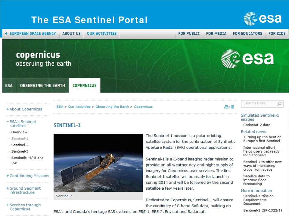
14 The ESA Sentinel Portal
15 Folie 15

16 Folie 16 Source: Hans Dufourmont, EEA Copernicus User Forum,

17 Delegated tasks to the EEA A. GMES land monitoring service: Pan-European Continental Component Providing land cover and land cover change information at Pan-European scale Production of 5 thematic high resolution layers B. GMES land monitoring service: Local Component Providing very High Resolution information on specific areas of interest at European level (as defined in GMES annual work programmes) C. Dissemination + archiving + cataloguing According to Dissemination Plan Source: EEA

18 Land pan-european component, ref. year 2012 Corine Land Cover 2012 Sealed soil Forest type Tree cover density Grassland Wetlands Image mosaics Source: EEA Water bodies

19 Folie 19 Source: Tobias, Langanke, EEA, NRC Land Cover Meeting,

20 Folie 20 Source: Tobias, Langanke, EEA, NRC Land Cover Meeting,

21 Folie 21 Source: Tobias, Langanke, EEA, NRC Land Cover Meeting,
22 Folie 22 Source: Tobias, Langanke, EEA, NRC Land Cover Meeting,
23 Folie 23 Source: Hans Dufourmont, EEA Copernicus User Forum,
24 Folie 24 Degree of Imperviousness 2012, Input Data Content Coding Degree of Imperviousness m x 20m data - two coverages of IMAGE2012 Housing areas Traffic areas Industrial, commercial areas, factories Amusement parks Construction sites with evolving built-up structures Single (farm) houses (where possible to identify) Other sealed surfaces that are part of fuzzy categories, Water edges with paved borders Thematic pixel values 0: all non-impervious areas 1-100: imperviousness values 254: unclassifiable, 255: outside area Draft Michael Bock, table compiled on base of the GUIDELINES FOR VERIFICATION OF HIGH-RESOLUTION LAYERS PRODUCED UNDER GMES/COPERNICUS INITIAL OPERATIONS (GIO) LAND MONITORING , Draft 4
25 Folie 25 Input Data Tree Cover Density and Forest Type two coverages of IMAGE2012, additional Multi-seasonal Image data Layer: Layer One: Forest Cover Density, 20x20m, % Laver Two : Dominant Forest Type (Coniferous, Decidous), Tree Cover density %, MMU 0,5 ha. Support Layer: trees predominantly used for agricultural practices - broadleaved" and "trees in urban context Content Evergreen / non-evergreen broadleaved, sclerophyllous and coniferous trees Orchards, olive groves, fruit and other tree plantations, agro-forestry areas, forest nurseries, regeneration, transitional woodlands Alleys, wooded parks and gardens, urban trees features inside forests (forest roads, firebreaks, thinning, etc. partially burnt are-as, storm damages, insect-infested damages, etc.) Draft Michael Bock, table compiled on base of the GUIDELINES FOR VERIFICATION OF HIGH-RESOLUTION LAYERS PRODUCED UNDER GMES/COPERNICUS INITIAL OPERATIONS (GIO) LAND MONITORING , Draft 4
26 Folie 26 Permanent Grassland , 20m x 20m, Input Data Layer: IMAGE 2006, (20m resolution, resampled) 3-8 AWIFS Images of 2012 (60m resolution) Layer One: Permanent grassland , MMU 0,16ha Support Layer: Urban context, Airports, Sport and Leisure Content Pasture, grassland used for grazing or meadow used for hay production (CLC classes 2.3.1, to 2.4.4). Cultivated or semi-natural grassland within forests and grass-covered surface within transitional woodland Natural grassland in any surrounding (CLC class 3.2.1). Grassy area with low (max. 10%) fraction trees & shrubs. Alpine meadow with low fraction of bare rock or gravel. Dehesa, olive plantation, orchard and fruit plantation where grassy cover fraction is dominant. Draft Michael Bock, table compiled on base of the GUIDELINES FOR VERIFICATION OF HIGH-RESOLUTION LAYERS PRODUCED UNDER GMES/COPERNICUS INITIAL OPERATIONS (GIO) LAND MONITORING , Draft 4
27 Folie 27 Wetlands , 20m x 20m, Input Data Method: Content IMAGE 2006, (20m resolution, resampled) 3-8 AWIFS Images of 2012 (60m resolution) EU-DEM, EU-HYDRO, Soil Sealing 2009 as spatial filters To solve the problem of mapping seasonal development of macrophyte vegetation com-munities covering water bodies, An index [0...1] is computed based on frequency of wetland accurrences across the whole time-series of satellite images. Wetlands will be classified primarily based on the presence of water, therefore temporary water areas will become an essential part of Wetlands products. Wetlands include the following landscape types: Wetlands associated to permanent water bodies Wetlands not associated to permanent water bodies Wetlands with vegetation (macrophyte) cover or without Peatlands (having presence of surface water) Coastal wetlands (salt marshes, salines, intertidal flats) Wetlands include the following e.g. plant communities: Helophytes, Nimfeides (Nymphoides),Pleustophytes, Draft Michael Bock, table compiled on base of the GUIDELINES FOR VERIFICATION OF HIGH-RESOLUTION LAYERS PRODUCED UNDER GMES/COPERNICUS INITIAL OPERATIONS (GIO) LAND MONITORING , Draft 4
28 Folie 28 Input Data Permanent Water bodies , 20m x 20m, IMAGE 2006, (20m resolution, resampled) 3-8 AWIFS Images of 2012 (60m resolution) EU-DEM, EU-HYDRO, Soil Sealing 2009 as spatial filters Layer: Permanent water bodies Temporary water bodies -> wetlands Content Permanent lakes, ponds (artificial and man-made) including fish ponds Rivers, channels permanently with water Coastal water surfaces: lagoons, estuaries Draft Michael Bock, table compiled on base of the GUIDELINES FOR VERIFICATION OF HIGH-RESOLUTION LAYERS PRODUCED UNDER GMES/COPERNICUS INITIAL OPERATIONS (GIO) LAND MONITORING , Draft 4
29 Folie 29 First results of HR Layer verification few countries only < 4-15% of area) Encouraging results are shown by Tree Crown Density, Forest Type and Permanent Water Bodies Most problematic HRLs: Imperviousness (scaling, probable can be improved) Permanent Grassland (insufficient accuracy) Wetland seems partially successful Infos based on: Gyorgy buttner, HRL verification and enhancement, EEA NRC Landcover meeting,
30 GMES land monitoring: local components Urban Atlas Biodiversity: riparian zones 305 Urban Atlas datasets available from Source: EEA Production starts in 2013
31 Folie 31 Source: Hans Dufourmont, EEA Copernicus User Forum,
32 Folie 32 Source: Hans Dufourmont, EEA Copernicus User Forum,
33 Folie 33 Source: Hans Dufourmont, EEA Copernicus User Forum,
34 Folie 34 Source: Hans Dufourmont, EEA Copernicus User Forum, No Member consultation, critizised by several MS in User Forum
35 Folie 35 Detailed specifications of GIO HR- Layer available
36 Folie 36 Source: Hans Dufourmont, EEA Copernicus User Forum,
37 Folie 37 Source: Hans Dufourmont, EEA Copernicus User Forum,
38 Folie 38 Source: Hans Dufourmont, EEA Copernicus User Forum,
39 Folie 39 Source: Hans Dufourmont, EEA Copernicus User Forum,
40 Folie 40 Copernicus Websites Copernicusportal DE Copernicus und Dienstportal EU GMES Data Access, Sentinel und Copernicus portal der ESA
41 Folie 41 Vielen Dank, Rückfragen bitte an: Deutsches Zentrum für Luft- und Raumfahrt e.v. (DLR) Raumfahrtmanagement Erdbeobachtung Königswinterer Str Bonn Michael Bock Telefon Telefax
Sentinel-1 Mission Overview
 Sentinel-1 Mission Overview Pierre Potin Sentinel-1 Mission Manager, ESA Advanced Course on Radar Polarimetry ESRIN, Frascati, 19 January 2011 Global Monitoring for Environment and Security GMES is established
European Space Agency EO Missions. Ola Gråbak ESA Earth Observation Programmes Tromsø, 17 October 2012
 European Space Agency EO Missions Ola Gråbak ESA Earth Observation Programmes Tromsø, 17 October 2012 Europe and Space, A POLICY Article 189 of the Lisbon Treaty (2009) gives the European Union an explicit
Proba-V: Earthwatch Mission as part of ESA s Earth Observation Programmes
 Proba-V: Earthwatch Mission as part of ESA s Earth Observation Programmes Antwerp 05.07.2013 Bianca Hoersch Proba-V Mission Manager Third Party Mission & Sentinel-2 Mission Manager Earth Observation Directorate,
+GIO land. Status GMES Land Services. 18 Juni 2012, DeCover2 Abschlussveranstaltung, DLR. [email protected]
 +GIO land Status GMES Land Services 18 Juni 2012, DeCover2 Abschlussveranstaltung, DLR [email protected] GIO land components Global JRC bio-physical parameters (Essential Terrestrial Variables
Global environmental information Examples of EIS Data sets and applications
 METIER Graduate Training Course n 2 Montpellier - february 2007 Information Management in Environmental Sciences Global environmental information Examples of EIS Data sets and applications Global datasets
SAMPLE MIDTERM QUESTIONS
 Geography 309 Sample MidTerm Questions Page 1 SAMPLE MIDTERM QUESTIONS Textbook Questions Chapter 1 Questions 4, 5, 6, Chapter 2 Questions 4, 7, 10 Chapter 4 Questions 8, 9 Chapter 10 Questions 1, 4, 7
The European Space Agency s Synthetic Aperture Radar Programme From Experiment to Service Provision
 The European Space Agency s Synthetic Aperture Radar Programme From Experiment to Service Provision Evert Attema ESA, Directorate of Earth Observation Programme! The idea of an independent European space
New Space Capabilities for Maritime Surveillance
 www.dlr.de ESA Blue Growth Marititime College, Cork, Ireland 17.4..2013 New Space Capabilities for Maritime Surveillance Susanne Lehner German Aerospace Center DLR Remote Sensing Technology Institute DLR
Methods for Monitoring Forest and Land Cover Changes and Unchanged Areas from Long Time Series
 Methods for Monitoring Forest and Land Cover Changes and Unchanged Areas from Long Time Series Project using historical satellite data from SACCESS (Swedish National Satellite Data Archive) for developing
MASS PROCESSING OF REMOTE SENSING DATA FOR ENVIRONMENTAL EVALUATION IN EUROPE
 MASS PROCESSING OF REMOTE SENSING DATA FOR ENVIRONMENTAL EVALUATION IN EUROPE Lic. Adrián González Applications Research Earth Science Conference 2014 29.07.2014 Earth Science San Conference Francisco
JRC on 9 November 2009 Biosoil Conference 1. http://forest.jrc.ec.europa.eu/
 JRC on 9 November 2009 Biosoil Conference 1 The European Forest Data Centre (EFDAC) Jesús San-Miguel-Ayanz http://forest.jrc.ec.europa.eu/ Outline FOREST Action 2 1. Role of the European Commission Joint
Hyperspectral Satellite Imaging Planning a Mission
 Hyperspectral Satellite Imaging Planning a Mission Victor Gardner University of Maryland 2007 AIAA Region 1 Mid-Atlantic Student Conference National Institute of Aerospace, Langley, VA Outline Objective
16 th IOCCG Committee annual meeting. Plymouth, UK 15 17 February 2011. mission: Present status and near future
 16 th IOCCG Committee annual meeting Plymouth, UK 15 17 February 2011 The Meteor 3M Mt satellite mission: Present status and near future plans MISSION AIMS Satellites of the series METEOR M M are purposed
The use of Earth Observation technology to support the implementation of the Ramsar Convention
 Wetlands: water, life, and culture 8th Meeting of the Conference of the Contracting Parties to the Convention on Wetlands (Ramsar, Iran, 1971) Valencia, Spain, 18-26 November 2002 COP8 DOC. 35 Information
From Whitehall to orbit and back again: using space in government
 From Whitehall to orbit and back again: using space in government 18 th June 2014 Bristol 25 th June 2014 Liverpool 3 rd July 2014 -Newcastle Space for Smarter Government Programme ([email protected])
Spectral Response for DigitalGlobe Earth Imaging Instruments
 Spectral Response for DigitalGlobe Earth Imaging Instruments IKONOS The IKONOS satellite carries a high resolution panchromatic band covering most of the silicon response and four lower resolution spectral
 European Forest Data Centre Biosoil/Biodiversity Forest Type Map 2006 P. Kempeneers, JRC T. Durant F. Sedano, JRC L. Seebach, JRC J. San-Miguel-Ayanz, JRC EC -, IES Land Management and Natural Hazard Unit
Communities, Biomes, and Ecosystems
 Communities, Biomes, and Ecosystems Before You Read Before you read the chapter, respond to these statements. 1. Write an A if you agree with the statement. 2. Write a D if you disagree with the statement.
Remote Sensing Satellite Information Sheets Geophysical Institute University of Alaska Fairbanks
 Remote Sensing Satellite Information Sheets Geophysical Institute University of Alaska Fairbanks ASTER Advanced Spaceborne Thermal Emission and Reflection Radiometer AVHRR Advanced Very High Resolution
Emergency Management Service. early warning FLOOD AND FIRE ALERTS. Space
 Emergency Management Service early warning FLOOD AND FIRE ALERTS Space 1 Copernicus at a Glance Copernicus is the European Union s Earth Observation programme: a user-driven space programme under civil
Review for Introduction to Remote Sensing: Science Concepts and Technology
 Review for Introduction to Remote Sensing: Science Concepts and Technology Ann Johnson Associate Director [email protected] Funded by National Science Foundation Advanced Technological Education program [DUE
Landsat Monitoring our Earth s Condition for over 40 years
 Landsat Monitoring our Earth s Condition for over 40 years Thomas Cecere Land Remote Sensing Program USGS ISPRS:Earth Observing Data and Tools for Health Studies Arlington, VA August 28, 2013 U.S. Department
Big Data Challenge: Mining Heterogeneous Data. Prof. Mihai Datcu. German Aerospace Center (DLR) Munich Aerospace Faculty
 Munich Aerospace Faculty") Big Data Challenge: Mining Heterogeneous Data Prof. Mihai Datcu German Aerospace Center (DLR) Munich Aerospace Faculty Sensing & Big Data Big Data: - Computer hardware and the Cloud - Storage Challenges
Big Data Challenge: Mining Heterogeneous Data Prof. Mihai Datcu German Aerospace Center (DLR) Munich Aerospace Faculty Sensing & Big Data Big Data: - Computer hardware and the Cloud - Storage Challenges
High Resolution Information from Seven Years of ASTER Data
 High Resolution Information from Seven Years of ASTER Data Anna Colvin Michigan Technological University Department of Geological and Mining Engineering and Sciences Outline Part I ASTER mission Terra
APPLICATION OF TERRA/ASTER DATA ON AGRICULTURE LAND MAPPING. Genya SAITO*, Naoki ISHITSUKA*, Yoneharu MATANO**, and Masatane KATO***
 APPLICATION OF TERRA/ASTER DATA ON AGRICULTURE LAND MAPPING Genya SAITO*, Naoki ISHITSUKA*, Yoneharu MATANO**, and Masatane KATO*** *National Institute for Agro-Environmental Sciences 3-1-3 Kannondai Tsukuba
Satellite Snow Monitoring Activities Project CRYOLAND
 Satellite Snow Monitoring Activities Project CRYOLAND Background material for participants to the Workshop on European Snow Monitoring Perspectives, Darmstadt, 4-5 December 2012. CryoLand provides Snow,
Radar interferometric techniques and data validation Terrafirma Essen, March 2011. Page 1
 Radar interferometric techniques and data validation Terrafirma Essen, March 2011 Page 1 Agenda Introduction to InSAR technology Different radarinterferometric techniques Validation of InSAR technology
The RapidEye optical satellite family for high resolution imagery
 'Photogrammetric Week 01' D. Fritsch & R. Spiller, Eds. Wichmann Verlag, Heidelberg 2001. Scherer, Krischke 139 The RapidEye optical satellite family for high resolution imagery STEFAN SCHERER and MANFRED
2.3 Spatial Resolution, Pixel Size, and Scale
 Section 2.3 Spatial Resolution, Pixel Size, and Scale Page 39 2.3 Spatial Resolution, Pixel Size, and Scale For some remote sensing instruments, the distance between the target being imaged and the platform,
Moderate- and high-resolution Earth Observation data based forest and agriculture monitoring in Russia using VEGA Web-Service
 Moderate- and high-resolution Earth Observation data based forest and agriculture monitoring in Russia using VEGA Web-Service Sergey BARTALEV and Evgeny LOUPIAN Space Research Institute, Russian Academy
Remote sensing is the collection of data without directly measuring the object it relies on the
 Chapter 8 Remote Sensing Chapter Overview Remote sensing is the collection of data without directly measuring the object it relies on the reflectance of natural or emitted electromagnetic radiation (EMR).
COASTAL MONITORING & OBSERVATIONS LESSON PLAN Do You Have Change?
 Coastal Change Analysis Lesson Plan COASTAL MONITORING & OBSERVATIONS LESSON PLAN Do You Have Change? NOS Topic Coastal Monitoring and Observations Theme Coastal Change Analysis Links to Overview Essays
Data Warehouse Requirements Version 2.0
 EUROPEAN COMMISSION ENTERPRISE AND INDUSTRY DIRECTORATE-GENERAL Aerospace, Maritime, Security and Defence Industries Copernicus : Infrastructures Data Warehouse Requirements Version 2.0 Copernicus Data
Update on EUMETSAT ocean colour services. Ewa J. Kwiatkowska
 Update on EUMETSAT ocean colour services Ewa J. Kwiatkowska 1 st International Ocean Colour Science meeting, 6 8 May, 2013 EUMETSAT space data provider for operational oceanography Operational data provider
TerraSAR-X Applications Guide
 TerraSAR-X Applications Guide Extract: Maritime Monitoring: Oil Spill Detection April 2015 Airbus Defence and Space Geo-Intelligence Programme Line Maritime Monitoring: Oil Spill Detection Issue As the
Chapter 3 Communities, Biomes, and Ecosystems
 Communities, Biomes, and Ecosystems Section 1: Community Ecology Section 2: Terrestrial Biomes Section 3: Aquatic Ecosystems Click on a lesson name to select. 3.1 Community Ecology Communities A biological
Remote sensing and GIS applications in coastal zone monitoring
 Remote sensing and GIS applications in coastal zone monitoring T. Alexandridis, C. Topaloglou, S. Monachou, G.Tsakoumis, A. Dimitrakos, D. Stavridou Lab of Remote Sensing and GIS School of Agriculture
Senior Advisor for EO Applications, ESA-ESRIN
 Accesso e utilizzo di dati OsservazioneTerra: prospettivegrid [email protected] Senior Advisor for EO Applications, ESA-ESRIN IV Incontro di GARR-B Bologna June 24-26, 2002 Summary ESA and Earth Observation
Istanbul Technical University-Center for Satellite Communications and Remote Sensing (ITU-CSCRS)
") Istanbul Technical University-Center for Satellite Communications and Remote Sensing (ITU-CSCRS) Istanbul Technical University, Center for Satellite Communications and Remote Sensing (ITU-CSCRS) was originally
Istanbul Technical University-Center for Satellite Communications and Remote Sensing (ITU-CSCRS) Istanbul Technical University, Center for Satellite Communications and Remote Sensing (ITU-CSCRS) was originally
'Developments and benefits of hydrographic surveying using multispectral imagery in the coastal zone
 Abstract With the recent launch of enhanced high-resolution commercial satellites, available imagery has improved from four-bands to eight-band multispectral. Simultaneously developments in remote sensing
Recent advances in Satellite Imagery for Oil and Gas Exploration and Production. DESK AND DERRICK APRIL 2016 PRESENTED BY GARY CREWS---RETIRED
 Recent advances in Satellite Imagery for Oil and Gas Exploration and Production. DESK AND DERRICK APRIL 2016 PRESENTED BY GARY CREWS---RETIRED Agenda Brief review of state of the applications in 2010 Basics
The APOLLO cloud product statistics Web service The APOLLO cloud product statistics Web service
 The APOLLO cloud product statistics Web service Introduction DLR and Transvalor are preparing a new Web service to disseminate the statistics of the APOLLO cloud physical parameters as a further help in
Mapping Earth from Space Remote sensing and satellite images. Remote sensing developments from war
 Mapping Earth from Space Remote sensing and satellite images Geomatics includes all the following spatial technologies: a. Cartography "The art, science and technology of making maps" b. Geographic Information
Using Remote Sensing to Monitor Soil Carbon Sequestration
 Using Remote Sensing to Monitor Soil Carbon Sequestration E. Raymond Hunt, Jr. USDA-ARS Hydrology and Remote Sensing Beltsville Agricultural Research Center Beltsville, Maryland Introduction and Overview
SPOT Satellite Earth Observation System Presentation to the JACIE Civil Commercial Imagery Evaluation Workshop March 2007
 SPOT Satellite Earth Observation System Presentation to the JACIE Civil Commercial Imagery Evaluation Workshop March 2007 Topics Presented Quick summary of system characteristics Formosat-2 Satellite Archive
The use of Satellite Remote Sensing for Offshore Environmental Benchmarking
 The use of Satellite Remote Sensing for Offshore Environmental Benchmarking Michael King Fugro NPA Limited Fugro NPA (Formerly Nigel Press Associates) World leading Satellite Remote Sensing & Geoscience
Resolutions of Remote Sensing
 Resolutions of Remote Sensing 1. Spatial (what area and how detailed) 2. Spectral (what colors bands) 3. Temporal (time of day/season/year) 4. Radiometric (color depth) Spatial Resolution describes how
2. VIIRS SDR Tuple and 2Dhistogram MIIC Server-side Filtering. 3. L2 CERES SSF OPeNDAP dds structure (dim_alias and fixed_dim)
") MIIC Server-side Filtering Outline 1. DEMO Web User Interface (leftover from last meeting) 2. VIIRS SDR Tuple and 2Dhistogram MIIC Server-side Filtering 3. L2 CERES SSF OPeNDAP dds structure (dim_alias
MIIC Server-side Filtering Outline 1. DEMO Web User Interface (leftover from last meeting) 2. VIIRS SDR Tuple and 2Dhistogram MIIC Server-side Filtering 3. L2 CERES SSF OPeNDAP dds structure (dim_alias
Remote Sensing and GIS Application In Change Detection Study In Urban Zone Using Multi Temporal Satellite
 Remote Sensing and GIS Application In Change Detection Study In Urban Zone Using Multi Temporal Satellite R.Manonmani, G.Mary Divya Suganya Institute of Remote Sensing, Anna University, Chennai 600 025
River Flood Damage Assessment using IKONOS images, Segmentation Algorithms & Flood Simulation Models
 River Flood Damage Assessment using IKONOS images, Segmentation Algorithms & Flood Simulation Models Steven M. de Jong & Raymond Sluiter Utrecht University Corné van der Sande Netherlands Earth Observation
Land Cover Mapping of the Comoros Islands: Methods and Results. February 2014. ECDD, BCSF & Durrell Lead author: Katie Green
 Land Cover Mapping of the Comoros Islands: Methods and Results February 2014 ECDD, BCSF & Durrell Lead author: Katie Green About the ECDD project The ECDD project was run by Bristol Conservation & Science
Operational Space- Based Crop Mapping Protocols at AAFC A. Davidson, H. McNairn and T. Fisette.
 Operational Space- Based Crop Mapping Protocols at AAFC A. Davidson, H. McNairn and T. Fisette. Science & Technology Branch. Agriculture and Agri-Food Canada. 1. Introduction Space-Based Crop Mapping at
ENVIRONMENTAL MONITORING Vol. I - Remote Sensing (Satellite) System Technologies - Michael A. Okoye and Greg T. Koeln
 System Technologies - Michael A. Okoye and Greg T. Koeln") REMOTE SENSING (SATELLITE) SYSTEM TECHNOLOGIES Michael A. Okoye and Greg T. Earth Satellite Corporation, Rockville Maryland, USA Keywords: active microwave, advantages of satellite remote sensing, atmospheric
REMOTE SENSING (SATELLITE) SYSTEM TECHNOLOGIES Michael A. Okoye and Greg T. Earth Satellite Corporation, Rockville Maryland, USA Keywords: active microwave, advantages of satellite remote sensing, atmospheric
Monitoring of Arctic Conditions from a Virtual Constellation of Synthetic Aperture Radar Satellites
 DISTRIBUTION STATEMENT A. Approved for public release; distribution is unlimited. Monitoring of Arctic Conditions from a Virtual Constellation of Synthetic Aperture Radar Satellites Hans C. Graber RSMAS
Obtaining and Processing MODIS Data
 Obtaining and Processing MODIS Data MODIS is an extensive program using sensors on two satellites that each provide complete daily coverage of the earth. The data have a variety of resolutions; spectral,
How To Plan A Buffer Zone
 Backyard Buffers Protecting Habitat and Water Quality What is a buffer? A buffer (also called a riparian buffer area or zone) is the strip of natural vegetation along the bank of a stream, lake or other
WATER BODY EXTRACTION FROM MULTI SPECTRAL IMAGE BY SPECTRAL PATTERN ANALYSIS
 WATER BODY EXTRACTION FROM MULTI SPECTRAL IMAGE BY SPECTRAL PATTERN ANALYSIS Nguyen Dinh Duong Department of Environmental Information Study and Analysis, Institute of Geography, 18 Hoang Quoc Viet Rd.,
Supervised Classification workflow in ENVI 4.8 using WorldView-2 imagery
 Supervised Classification workflow in ENVI 4.8 using WorldView-2 imagery WorldView-2 is the first commercial high-resolution satellite to provide eight spectral sensors in the visible to near-infrared
U.S. Geological Survey Earth Resources Operation Systems (EROS) Data Center
 Data Center") U.S. Geological Survey Earth Resources Operation Systems (EROS) Data Center World Data Center for Remotely Sensed Land Data USGS EROS DATA CENTER Land Remote Sensing from Space: Acquisition to Applications
U.S. Geological Survey Earth Resources Operation Systems (EROS) Data Center World Data Center for Remotely Sensed Land Data USGS EROS DATA CENTER Land Remote Sensing from Space: Acquisition to Applications
Data Warehouse Phase 2 set-up and data offer. Bianca Hoersch, Veronique Amans, Jolyon Martin, Lena Stern, Silke Bode, Luc Govaert
 Data Warehouse Phase 2 set-up and data offer Bianca Hoersch, Veronique Amans, Jolyon Martin, Lena Stern, Silke Bode, Luc Govaert Content 1. Background & Introduction to Copernicus Data Access 2. DWH Phase
Proposal for a Discovery-level WMO Metadata Standard
 WORLD METEOROLOGICAL ORGANIZATION MEETING OF EXPERT TEAM ON INTEGRATED DATA MANAGEMENT GENEVA, 17-20 SEPTEMBER 2001 ET-IDM/Doc. 3(1) (12.VI.2001) ITEM: 1.2 ENGLISH ONLY Proposal for a Discovery-level WMO
Big Data Analytics for Detailed Urban Mapping. Mihai Datcu Daniela Molina Espinoza, Octavian Dumitru, Gottfried Schwarz
 Big Data Analytics for Detailed Urban Mapping Mihai Datcu Daniela Molina Espinoza, Octavian Dumitru, Gottfried Schwarz Big Data: The German EO Digital Library The data access Folie 2 Information vs. Data
Document Control Sheet
 Document Control Sheet 1. Security Classification For Official Use only 2. Distribution NRSC / ISRO, Online Distribution Through Bhuvan Portal 3. Report / Document version (a) Issue no. 01 4. Report /
Mapping Forest-Fire Damage with Envisat
 Mapping Forest-Fire Damage with Envisat Mapping Forest-Fire Damage Federico González-Alonso, S. Merino-de-Miguel, S. García-Gigorro, A. Roldán-Zamarrón & J.M. Cuevas Remote Sensing Laboratory, INIA, Ministry
Sentinel Collaborative Ground Segment Sweden
 2014 12 18 Sentinel Collaborative Ground Segment Sweden User needs Final Report Photo: ESA Sentinel Collaborative Ground Segment Sweden User needs Coverage, Products and Services Final Report Study for
The needs on big data management for Operational Geo-Info Services: Emergency Response, Maritime surveillance, Agriculture Management
 Copernicus Big-Data Workshop 2014, 13/14 March The needs on big data management for Operational Geo-Info Services: Emergency Response, Maritime surveillance, Agriculture Management Marco Corsi e-geos 1
Description of the table of the in-situ data requirements of GMES services
 Description of the table of the in-situ data requirements of GMES services 1. In-situ data requirement: Contains short description of each in-situ data (including spatial data) requirement defined by GMES
OUTLINES. Earth Observation Satellite Program of Vietnam and applications for disaster management
 UNESCAP ICC & HLDM Meetings, Bangkok 26 28/11/2013 Earth Observation Satellite Program of Vietnam and applications for disaster management OUTLINES 1. VNREDSat-1 (VAST*) - Optical 2. VNREDSat-1B (VAST)
Das Copernicus Collaborative GroundSegment des DLR
 Das Copernicus Collaborative GroundSegment des DLR Gunter Schreier Deutsches Fernerkundungsdatenzentrum DFD Earth Observation Center EOC DLR November 2015 Earth Observation Center DLR German Aerospace
The Future of Geospatial Big Data Giovanni Marchisio, Ph.D., Director Product Development
 The Future of Geospatial Big Data Giovanni Marchisio, Ph.D., Director Product Development Nuclear Power Plant, Doel, Belgium December 10, 2011 WorldView-2 Why Geospatial Big Data? We Are the Innovators
Research on Soil Moisture and Evapotranspiration using Remote Sensing
 Research on Soil Moisture and Evapotranspiration using Remote Sensing Prof. dr. hab Katarzyna Dabrowska Zielinska Remote Sensing Center Institute of Geodesy and Cartography 00-950 Warszawa Jasna 2/4 Field
Monitoring a Changing Environment with Synthetic Aperture Radar. Alaska Satellite Facility National Park Service Don Atwood
 Monitoring a Changing Environment with Synthetic Aperture Radar Don Atwood Alaska Satellite Facility 1 Entering the SAR Age 2 SAR Satellites RADARSAT-1 Launched 1995 by CSA 5.6 cm (C-Band) HH Polarization
Towards Operational Monitoring of the Baltic Sea by Remote Sensing
 G. Schernewski & N. Löser (eds.): Managing the Baltic Sea. Coastline Reports 2 (2004), ISSN 0928-2734 S. 211-218 Towards Operational Monitoring of the Baltic Sea by Remote Sensing Andreas Neumann 1, Harald
LANDSAT 7 - GROUND SEGMENT ACTIVITIES AT THE GERMAN REMOTE SENSING DATA CENTER. Deutsches Fernerkundungsdatenzentrum (DFD) DLR (*)
 DLR (*)") LANDSAT 7 - GROUND SEGMENT ACTIVITIES AT THE GERMAN REMOTE SENSING DATA CENTER Günter Strunz (*), Hans-Dietrich Bettac (**), Jörg Gredel (*), Klaus-Dieter Reiniger (*) & Gunter Schreier (*) Deutsches Fernerkundungsdatenzentrum
LANDSAT 7 - GROUND SEGMENT ACTIVITIES AT THE GERMAN REMOTE SENSING DATA CENTER Günter Strunz (*), Hans-Dietrich Bettac (**), Jörg Gredel (*), Klaus-Dieter Reiniger (*) & Gunter Schreier (*) Deutsches Fernerkundungsdatenzentrum
Using Remote Sensing Imagery to Evaluate Post-Wildfire Damage in Southern California
 Graham Emde GEOG 3230 Advanced Remote Sensing February 22, 2013 Lab #1 Using Remote Sensing Imagery to Evaluate Post-Wildfire Damage in Southern California Introduction Wildfires are a common disturbance
The National Strategy, Current Activities for Space Technology Development and Application
 14-18 November 2011, Putrajaya, Malaysia The National Strategy, Current Activities for Space Technology Development and Application Lai Anh Khoi Space Technology Institute, VAST, Vietnam Bief History Space
2002 URBAN FOREST CANOPY & LAND USE IN PORTLAND S HOLLYWOOD DISTRICT. Final Report. Michael Lackner, B.A. Geography, 2003
 2002 URBAN FOREST CANOPY & LAND USE IN PORTLAND S HOLLYWOOD DISTRICT Final Report by Michael Lackner, B.A. Geography, 2003 February 2004 - page 1 of 17 - TABLE OF CONTENTS Abstract 3 Introduction 4 Study
How To Find Natural Oil Seepage In The Dreki Area Using An Envisat Image
 rn ORKUSTOFNUN National Energy Authority Searching for natural oil seepage in the Dreki area using ENVISAT radar images. Ingibjorg J6nsd6ttir and Arni Freyr Valdimarsson, Faculty of Earth Sciences School
Global land cover mapping: conceptual and historical background
 Space Research Institute Russian Academy of Sciences Global land cover mapping: conceptual and historical background Sergey BARTALEV with acknowledged contribution from: Etienne Bartholomé and Philippe
Space radar technologies for oil spills management, detection of illegal fishing and logging activities
 Space radar technologies for oil spills management, detection of illegal fishing and logging activities VIGISAT The French satellite ground receiving station VIGISAT 2009 know today, live better tomorrow
Land Use/Land Cover Map of the Central Facility of ARM in the Southern Great Plains Site Using DOE s Multi-Spectral Thermal Imager Satellite Images
 Land Use/Land Cover Map of the Central Facility of ARM in the Southern Great Plains Site Using DOE s Multi-Spectral Thermal Imager Satellite Images S. E. Báez Cazull Pre-Service Teacher Program University
Joint Polar Satellite System (JPSS)
") Joint Polar Satellite System (JPSS) John Furgerson, User Liaison Joint Polar Satellite System National Environmental Satellite, Data, and Information Service National Oceanic and Atmospheric Administration
Joint Polar Satellite System (JPSS) John Furgerson, User Liaison Joint Polar Satellite System National Environmental Satellite, Data, and Information Service National Oceanic and Atmospheric Administration
Active and Passive Microwave Remote Sensing
 Active and Passive Microwave Remote Sensing Passive remote sensing system record EMR that was reflected (e.g., blue, green, red, and near IR) or emitted (e.g., thermal IR) from the surface of the Earth.
The APOLLO cloud product statistics Web service
 The APOLLO cloud product statistics Web service Introduction DLR and Transvalor are preparing a new Web service to disseminate the statistics of the APOLLO cloud physical parameters as a further help in
APPLICATION OF GOOGLE EARTH FOR THE DEVELOPMENT OF BASE MAP IN THE CASE OF GISH ABBAY SEKELA, AMHARA STATE, ETHIOPIA
 APPLICATION OF GOOGLE EARTH FOR THE DEVELOPMENT OF BASE MAP IN THE CASE OF GISH ABBAY SEKELA, AMHARA STATE, ETHIOPIA Abineh Tilahun Department of Geography and environmental studies, Adigrat University,