Improving Access in Florida International University Biscayne Bay Campus Executive Summary
|
|
|
- Brianna Cobb
- 10 years ago
- Views:
Transcription
1 EXECUTIVE SUMMARY
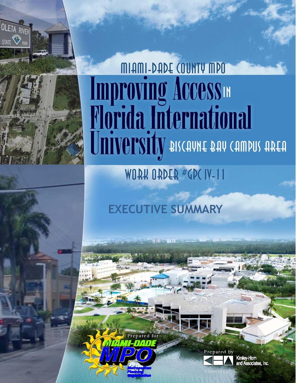
2 Improving Access in Florida International University Biscayne Bay Campus Executive Summary Prepared for: Miami-Dade County Metropolitan Planning Organization (Miami-Dade MPO) Prepared by: Kimley-Horn and Associates, Inc. Fort Lauderdale, Florida Work Order # GPC IV-11 October 2011

3 The preparation of this report has been financed in part from the U.S. Department of Transportation (USDOT) through the Federal Highway Administration (FHWA) and/or the Federal Transit Administration (FTA), the State Planning and Research Program (Section 505 of Title 23, U.S. Code) and Miami-Dade County, Florida. The contents of this report do not necessarily reflect the official views or policy of the U.S. Department of Transportation.

4 EXECUTIVE SUMMARY BACKGROUND At the request of MPO Governing Board, this study was conducted to evaluate the feasibility of adding another entrance to the Florida International University (FIU) Biscayne Bay Campus. Currently, only one entrance is provided via NE 151 st Street. Four alternatives were considered including: Bay Vista Boulevard/NE 135 th Street NE 143 rd Street NE 151 st Street (Improvements) NE 163 rd Street (Oleta River State Park) SUMMARY This study examined the feasibility of providing an additional access connection to the FIU Biscayne Bay Campus. Only one access connection is currently provided via NE 151 st Street. NE 151 st Street also serves as primary access to the 193-acre Biscayne Landing master planned community, as well as the only access connection to the David Lawrence Jr. K-8 School and the Alonzo and Tracy Mourning Senior High School. These conditions have resulted in heavy traffic congestion along NE 151 st Street and Biscayne Boulevard. Existing conditions in the study area and project needs were analyzed. This assessment included reviewing and evaluating transportation improvement plans, FIU Biscayne Bay Campus population projections and future expansion plans, area school enrollment, area transit accommodations, Biscayne Landing development proposals, the NE 135 th Street pedestrian bridge replacement project, environmental constraints, and traffic operations. Several contributing factors demonstrate that additional access to the FIU Biscayne Bay Campus is needed. These factors are listed below in two categories, existing needs and future needs. ES-1

5 Existing Project Needs Only one existing access to the FIU Biscayne Bay Campus and adjacent public schools. Poor drainage along NE 151 st Street. School zones along NE 151 st Street and Bay Vista Boulevard slow traffic. Poor operating level of service of several intersections in the study area including Biscayne Boulevard and NE 151 st Street and Biscayne Boulevard and NE 163 rd Street. Future Project Needs No proposed future roadway capacity improvements in study area. Future FIU Biscayne Bay Campus growth. Future growth at the K-8 school and high school. Future degradation of level of service at Biscayne Boulevard and NE 151 st Street. Future Biscayne Landing Development. ALTERNATIVES SUMMARY/ACTION PLAN The three (3) new corridor alternatives (Bay Vista Boulevard/NE 135 th Street, NE 143 rd Street, and NE 163 rd Street/Oleta River State Park) evaluated during the development of this study are feasible possibilities to be used as additional access to FIU Biscayne Bay Campus. However, all of these alternatives present environmental concerns and funding issues that are beyond the scope of this study. Furthermore, these alternatives are not fully within the direct jurisdiction of Miami-Dade County. Therefore, any decision to pursue one of these alternatives has to be coordinated between the City of North Miami, FIU, Miami Dade County Public Schools, and the private sector (Biscayne Landing Development). During the development of this study, several issues were identified with the existing access provided via NE 151 st Street. However, there are improvements that can be considered in order to alleviate traffic congestion in the area. An action plan was developed based on proposed ES-2

6 improvement/project time horizons. Time horizons defined for this study were short-term (0-2 years), medium-term (2-5 years), and long-term (5+ years). Table ES-1 provides a summary of short-term projects and recommended implementation tasks, Table ES-2 provides a summary of midterm projects and recommended implementation tasks, and Table ES-3 provides a summary of long-term projects and implementation tasks. Improvements/projects were prioritized based on needs as well as costs. Since NE 151 st Street is the only access to the FIU Biscayne Bay Campus and area schools, an emergency access route is proposed in case NE 151 st Street is blocked due to an emergency or incident. An emergency access route through the North District Wastewater Treatment Plant is the preferred route, as this route is the shortest in length, provides access on paved facilities, and connects to Biscayne Boulevard via the signalized intersection with NE 156 th Street. Table ES-1: Short-Term Action Plan Improvement 1. Replace non-standard stop signs (Northbound Bay Vista Boulevard and FIU Biscayne Bay Campus Main Entrance) Implementation Tasks City of North Miami Maintenance 2. Improve drainage along NE 151 st Street Currently part of a Miami- Dade County Public Works project 3. Implement Emergency Access Plan via NE 156 th Street through the North District Wastewater Treatment Plant and/or via Oleta State River Park 4. Relocate bus stops at High School next to crosswalk and provide bus shelters 5. NE 151 st Street and Biscayne Boulevard Intersection Improvement (westbound left-turn lane) Coordination with Miami- Dade County Water and Sewer Department and State Parks and Recreation Department Coordination with Miami- Dade Transit Possible Funding Sources Cost City of North Miami $1,500 Miami-Dade County N/A Federal 5309 Grants Bus Capital, MDT Local, Local N/A N/A $43,000 $120,000 (1) ES-3

7 Improvement 6. NE 151 st Street and Biscayne Boulevard Intersection Improvement (westbound right-turn overlap phase) Implementation Tasks Possible Funding Sources Cost $60, NE 151 st Street and Biscayne Boulevard Intersection Improvement (southbound left-turn lane) 8. Construct sidewalk (railing and canopy medium-term) along north side of NE 151 st Street from Biscayne Boulevard to FIU Biscayne Bay Campus and FDOT Work Program FDOT: Other arterial construction and/or TMA Funds, County Fuel Tax, Local Option Gas Tax $130,000 (1) $130,800 (1) 9. Extend sidewalk on south side of NE 151 st Street from K-8 School to FIU Biscayne Bay Campus (railing and canopy medium-term) 10. Construct bicycle lane along north side of NE 151 st Street from Biscayne Boulevard to FIU Biscayne Bay Campus 11. Construct bicycle lane along south side of NE 151 st Street from K-8 School to FIU Biscayne Bay Campus 12. Provide transit amenities for bus stops at Biscayne Boulevard and NE 151 st Street 13. Examine transit transfer facility on southeast corner of Biscayne Boulevard and NE 151 st Street /TDP TDP Note: (1) Does not include potential wetland mitigation costs along NE 151 st Street. Federal 5309 Grants Bus Capital, MDT Local, Local State Grants Bus, MDT Local, Local $19,200 (1) $131,000 (1) $63,000 (1) $42,000 N/A ES-4
 $130,800 (1) 9.")
8 Table ES-2: Medium-Term Action Plan Improvement Implementation Tasks Possible Funding Sources Cost 1. NE 151 st Street and Biscayne Boulevard Intersection Improvements (northbound right-turn lane) requires additional right-of-way 2. NE 151 st Street and Biscayne Boulevard Intersection Improvements (extend eastbound left-turn lane) 3. Sidewalk railing and canopy along north side of NE 151 st Street from Biscayne Boulevard to FIU Biscayne Bay Campus 4. Sidewalk railing and canopy along south side of NE 151 st Street from Biscayne Boulevard to FIU Biscayne Bay Campus 5. Construct transit transfer facility on southeast corner of Biscayne Boulevard and NE 151st Street (illustrated in Figures ES-1 and ES-2) 6. Provide shuttle service from transit transfer facility to FIU Biscayne Bay Campus Program improvements in and FDOT work program Program improvements in Program improvements in Program improvements in Program improvements in Note: (1) Does not include potential wetland mitigation costs along NE 151 st Street. FDOT: Other arterial construction and/or TMA Funds, County Fuel Tax, Local FDOT: Other arterial construction and/or TMA Funds, County Fuel Tax, Local State Grants Bus, MDT Local, Local, Road Impact Fee $85,200 (1) $9,600 $1,094,400 (1) $1,094,400 (1) TBD Coordinate with FIU FIU Operating Budget TBD ES-5

9 Table ES-3: Long-Term Action Plan Improvement 1. Widen NE 151 st Street to six (6) lanes from Biscayne Boulevard to Bay Vista Boulevard (High School and K-8 School). 2. Implement Bus Rapid Transit (BRT) along Biscayne Boulevard Implementation Task Fund project in TDP Possible Funding Sources, Road Impact Fee FDOT Transit, PTP Sales Tax Revenue Cost $2,300,000 (1) TBD 3. Grade separate Biscayne Boulevard at NE 151st Street Include project in LRTP FDOT: Other arterial construction, TMA Funds $38,500,000 Note: (1) Does not include potential wetland mitigation costs along NE 151 st Street. The Improving Access in Florida International University Biscayne Bay Campus Area Study provides the framework for the programming of transportation improvements in the area of the FIU Biscayne Bay Campus. Agencies have been identified for implementing the improvements based on jurisdictional responsibility. The improvements should be adopted into the appropriate plans and programs of the specified agencies. Finally, the study should be examined periodically to assess the status of the implementation of the identified improvements. The key stakeholders that will directly benefit from the proposed improvements include FIU, City of North Miami, Biscayne Landing, and Miami-Dade County Schools. Therefore, these stakeholders should contribute to the funding of the proposed improvements. Furthermore, stakeholder contribution would help in expediting these improvements toward implementation. ES-6
 Does not include potential wetland mitigation costs")
10 FIGURE ES-1 Transit Hub NE 151 st Street and Biscayne Boulevard

11 FIGURE ES-2 Transit Hub NE 151 st Street and Biscayne Boulevard

AIR QUALITY TECHNICAL MEMORANDUM
 AIR QUALITY TECHNICAL MEMORANDUM AIR QUALITY TECHNICAL MEMORANDUM GOLDEN GLADES INTERCHANGE PD&E STUDY Miami-Dade County, Florida Financial Management Number: 428358-1-22-01 Efficient Transportation Decision
The financial plan was prepared in conjunction with the Technical Working Group. Refer to Table 3-1: Funding and Implementation Plan.
 3 Financial Plan The purpose of the financial plan is to identify funding options that would be likely sources of money to advance recommendations made by this study. The Capitol Region Transportation
Downtown Tampa Transportation Vision
 Downtown Tampa Transportation Vision Executive Summary August 1, 2006 Hillsborough County Metropolitan Planning Organization County Center, 18 th Floor Tampa, Florida 33602 813-272-5940 www.hillsboroughmpo.org
Executive Summary. Transportation Needs CHAPTER. Existing Conditions
 CHAPTER 1 Executive Summary The City of Forest Grove Transportation System Plan (TSP) was updated to keep it consistent with recent growth trends in the city and other transportation planning efforts in
Corridor Goals and Objectives
 Corridor Goals and Objectives This chapter presents the goals and objectives, developed by the Corridor Study Committee, that serve as the purpose and intent of the Corridor Plan. This plan covers a twenty
Executive Summary. Literature/Community Review. Traffic Flows and Projections. Final Report Truck Route System for Miami-Dade County CORRADINO
 Executive Summary The Miami-Dade County Metropolitan Planning Organization (MPO) has prepared a Truck Route System Plan for Miami-Dade County. The MPO and its consultants have worked closely with the MPO
Chapter VIII: Long-Term Outlook and the Financial Plan
 A. Long-Term Outlook Chapter VIII: Long-Term Outlook and the Financial Plan When examining the long-term outlook for transportation planning and programming over the foreseeable future, there are several
North Avenue Corridor Study. Advisory Committee Meeting #5 June 11, 2014
 North Avenue Corridor Study Advisory Committee Meeting #5 June 11, 2014 Agenda Welcome and introductions Concept refinement and evaluation: Public meeting and web survey General cross-section concepts
8+ %!0"% 8+1!%"'$%,$"$
 8+ 8+ %!0"% The next step in developing recommendations for improvements to Grand Avenue was to identify, develop and evaluate alternatives to address the issues and needs identified in the previous chapter.
APPLICATION LAFAYETTE METROPOLITAN PLANNING ORGANIZATION (MPO) SURFACE TRANSPORTATION PROGRAM (STP) FUNDS TRANSPORTATION IMPROVEMENT PROGRAM (TIP)
 SURFACE TRANSPORTATION PROGRAM (STP) FUNDS TRANSPORTATION IMPROVEMENT PROGRAM (TIP)") APPLICATION LAFAYETTE METROPOLITAN PLANNING ORGANIZATION (MPO) SURFACE TRANSPORTATION PROGRAM (STP) FUNDS TRANSPORTATION IMPROVEMENT PROGRAM (TIP) To be considered for STP funding, a proposed project must
APPLICATION LAFAYETTE METROPOLITAN PLANNING ORGANIZATION (MPO) SURFACE TRANSPORTATION PROGRAM (STP) FUNDS TRANSPORTATION IMPROVEMENT PROGRAM (TIP) To be considered for STP funding, a proposed project must
Multi Modal Roadway Transportation Impact Fees and Asset Value
 January 2010 SB 360 Article Series: Factors to be Considered in Transitioning from a Road Impact Fee to a Mobility Fee Contributing Authors: Steven A. Tindale, P.E., AICP Robert P. Wallace, P.E., AICP
Orange County Transportation Impact Fee Update FINAL REPORT
 Transportation Impact Fee Update FINAL REPORT Prepared for: Transportation Planning Department 4200 S. John Young Parkway, Second Floor Orlando, FL 32839 ph (407) 836-8070 September 5, 2012 (amended November
Alternatives to the Circ Project Prioritization Methodology Prepared for Circ Task Force July 28, 2011
 Alternatives to the Circ Project Prioritization Methodology Prepared for Circ Task Force July 28, 2011 CCRPC staff has developed a draft methodology described below and detailed in the attached pages for
Implementation Strategy
 Implementation Strategy 6 The following implementation strategy defines strategic points of intervention for complete streets programming, including visioning, goal-setting, local agency plans, coordination
SR-18 Corridor Improvements in Wood County
 Public Meeting Information Package SR- Corridor Improvements in Wood County Thursday, May 19, 2011 10:00 a.m. to 1:00 p.m. Meeting Location: Hancock-Wood Electric Cooperative Building 1399 Business Park
Partnering for 21 st Century Prosperity
 Partnering for 21 st Century Prosperity UniversityCity, A Catalytic Local Project of Regional Significance FLORIDA INTERNATIONAL UNIVERSITY F L O R I D A I N T E R N A T I O N A L U N I V E R S I T Y F
INDOT 2000-2025 Long Range Plan
 Chapter 9 INDOT 2000-2025 Long Range Plan Highway Needs Analysis Overview The statewide transportation planning process provides for the identification of highway needs through a comprehensive process
SEMINOLE PRATT WHITNEY ROAD & NORTHLAKE BLVD. FREQUENTLY ASKED QUESTIONS
 UPDATED: 01/31/14 SEMINOLE PRATT WHITNEY ROAD & NORTHLAKE BLVD. FREQUENTLY ASKED QUESTIONS Q. 1. What are the County s plans for Seminole Pratt Whitney Road between SR 80 (Southern Blvd) and the Bee Line
Transportation Improvement Program FY 2006-2008
 Transportation Improvement Program FY 2006-2008 Hidalgo County Metropolitan Planning Organization Adopted By Policy Committee: March 24, 2005 Public Meeting Date: March 1, 2005 Public Meeting Date: April
Near Westside Neighborhood and University Avenue Corridor Transportation Study. Public Workshop #2. September 12 and 23, 2013
 Near Westside Neighborhood and University Avenue Corridor Transportation Study Public Workshop #2 September 12 and 23, 2013 Presentation Outline: Brief Review of Study Scope, Background, and Current Conditions
Goals & Objectives. Chapter 9. Transportation
 Goals & Objectives Chapter 9 Transportation Transportation MISSION STATEMENT: TO PROVIDE A TRANSPORTATION NETWORK CAPABLE OF MOVING PEOPLE AND GOODS EFFICIENTLY AND SAFELY. T he transportation system
EPA Technical Assistance for Sustainable Communities Building Blocks
 EPA Technical Assistance for Sustainable Communities Technical Assistance Tool: Complete Streets Deerfield Beach, Florida February 16, 2012 To: CC: Amanda Martinez, City of Deerfield Beach Roger Millar,
Maryland Invests $845 Million in New Highway and Bridge Projects
 Maryland Invests $845 Million in New Highway and Bridge Projects Completing Widening of MD 404 Talbot And Caroline Counties Top Regional Priority Queen Anne s, Talbot, and Caroline Counties Widening MD
ORANGE COUNTY TRANSPORTATION AUTHORITY. Final Long-Range Transportation Plan - Destination 2035. Attachment A
 ORANGE COUNTY TRANSPORTATION AUTHORITY Final Long-Range Transportation Plan - Destination 2035 Attachment A DESTINATION 2035 DESTINATION 2035 EXECUTIVE SUMMARY ATTACHMENT A Moving Toward a Greener Tomorrow
The partnership has selected three intersections where enforcement, education, and engineering initiatives are being implemented to improve safety:
 Hamilton-Finn Suite 310 Tel. (403) 207-6000 Road Safety 3016 5th Avenue N.E. Fax. (403) 273-3440 Consultants Ltd. Calgary, Alberta dawatt.dawatt.com www.hamiltonfinn.ca January 19, 2005 Mr. Don Szarko,
Tier 1 Strategies. WV Route 14 Corridor Management Plan
 1.1 1.2 1.3 1.4 Signal timing optimization system improvements. Improve geometry traffic control at high crash intersections. Construct intersection capacity improvement projects. Widen longer sections
City of Rockville Regional Development Impacts: Transportation Capacity Analysis. June, 2013
 City of Rockville Regional Development Impacts: Transportation Capacity Analysis June, 2013 Purpose and Need Response to Council and Public Evaluate use of more advanced traffic analysis methodology and
CHAPTER 5-CMPO TRANSPORTATION VISION PLANS (2035 & BEYOND)
") Regional Transportation Plan 2035 28 CHAPTER 5-CMPO TRANSPORTATION VISION PLANS (2035 & BEYOND) The Cache Transportation Vision Plan shows roadway, bicycle, transit and pedestrian projects that attempt
Regional Transportation Plan 2035 28 CHAPTER 5-CMPO TRANSPORTATION VISION PLANS (2035 & BEYOND) The Cache Transportation Vision Plan shows roadway, bicycle, transit and pedestrian projects that attempt
Measuring the Street:
 Measuring the Street: New Metrics for 21st Century Streets 1 Measuring the Street: New Metrics for 21st Century Streets New York City s streets are constantly called on to the meet new and varied needs
Los Angeles Metro Rapid
 Los Angeles Metro Rapid Why BRT In Los Angeles Public dissatisfied with slow bus service Average bus speeds had declined by 10% since late- 1980s LADOT found that 50% of the time a bus is in service it
KENTUCKY TRANSPORTATION CABINET. Department of Rural and Municipal Aid. Office of Local Programs
 KENTUCKY TRANSPORTATION CABINET Department of Rural and Municipal Aid Office of Local Programs Office of Local Programs Transportation Enhancements Safe Routes to School Congestion Mitigation and Air Quality
Accident Analysis of Sheridan Road between Isabella Street and South Boulevard
 Accident Analysis of Sheridan Road between Isabella Street and South Boulevard Prepared for TranSystems Corporation for the City of Evanston Submitted by Regina Webster & Associates, Inc. Date: 08/15/2008
2035 LONG RANGE TRANSPORTATION PLAN FINAL REPORT
 2035 LONG RANGE TRANSPORTATION PLAN FINAL REPORT Prepared for: Sarasota/Manatee Metropolitan Planning Organization Prepared by: RENAISSANCE PLANNING GROUP Adopted - December 2010 Amended - January 27,
2009-3. The Preservation of Local Truck Routes: A Primary Connection between Commerce and the Regional Freight Network
 2009-3 The Preservation of Local Truck Routes: A Primary Connection between Commerce and the Regional Freight Network July 2009 This Goods Movement Challenges and Opportunities Report was prepared jointly
Mayors Welcome Strong Surrey Votes Yes Coalition Support. Yes Vote Would Vastly Improve Transit and Transportation in Fast Growing City
 Mayors Welcome Strong Surrey Votes Yes Coalition Support Yes Vote Would Vastly Improve Transit and Transportation in Fast Growing City February 11, 2015 Vancouver, BC The Mayors Council on Regional Transportation
FTP/SIS/FMTP Regional Workshop - Miami
 FTP/SIS/FMTP Regional Workshop - Miami September 24, 2015 FDOT District 6 Auditorium 1000 N.W. 111 Avenue Miami, Florida 33172 Meeting Highlights Welcome and Introductions Gus Pego, FDOT District 6 Secretary,
FLC 4th Annual Summer Research Symposium: Planes, Trains, Ports & Highways What Keeps Florida Moving?
 FLC 4th Annual Summer Research Symposium: Planes, Trains, Ports & Highways What Keeps Florida Moving? Jose Gonzalez SVP - Florida East Coast Industries Wednesday, August 12, 2015 1 Florida East Coast Industries
Section 6 Traffic Analysis
 Section 6 Traffic Analysis Traffic Operations of the Preferred Network Alternative After the Preferred Network was identified and confirmed by local policy makers and area residents, detailed traffic analysis
 Walkable Communities Florida Department of Transportation State Safety Office Pedestrian and Bicycle Program April 1995 www.dot.state.fl.us/safety Twelve Steps for an Effective Program Page 1 Twelve Steps
Transportation Policy and Design Strategies. Freight Intensive. Level of Freight Presence
 Appendix G Transportation Policy and Design Strategies CONTEXT SENSITIVE SOLUTIONS To address the need to describe freight systems which account for the population distress which may result, an analysis
Mobility Management Plan Study of the Busch Boulevard Corridor
 Mobility Management Plan Study of the Busch Boulevard Corridor March 2000 Hillsborough County Metropolitan Planning Organization 601 E. Kennedy, 18th Floor Tampa, Florida 33602-5117 813/272-5940 FAX NO:
CHAPTER 4 SURFACE TRANSPORTATION PROGRAM (STP)
") Local Assistance Program Guidelines Chapter 4 CHAPTER 4 SURFACE TRANSPORTATION PROGRAM (STP) CONTENTS Section Subject Page Number 4.1 INTRODUCTION... 4-1 4.2 ELIGIBILITY CRITERIA... 4-1 General... 4-1
Local Assistance Program Guidelines Chapter 4 CHAPTER 4 SURFACE TRANSPORTATION PROGRAM (STP) CONTENTS Section Subject Page Number 4.1 INTRODUCTION... 4-1 4.2 ELIGIBILITY CRITERIA... 4-1 General... 4-1
Technical Memorandum PERFORMANCE MEASURES. Prepared by:
 Technical Memorandum PERFORMANCE MEASURES Prepared by: March 2014 TABLE OF CONTENTS Executive Summary... 1 1. Introduction... 2 1.1 Performance Measures and the Public Sector... 2 1.2 National Focus: MAP
Light Rail Transit in Phoenix
 4. Presentation and Discussion: Phoenix Light Rail Implementation Wulf Grote Planning and Development Director, Phoenix Valley Metro Light Rail Transit in Phoenix Broadway Citizen s Task Force February
Comment #1: Provide an interchange at Route 7 and Farm Market Road/White Gate Road. This was studied in the late 1990 s.
 Proposed Truck Climbing Lane Route 7 Westbound Between West Market Street and Route 9 UPC# 58599, Project # 6007-053-133, P101 Date of Meeting: August 24, 2010 Time: 6:00PM to 8:00PM Location: Rust Library
Aerial View E Looking West
 Figure 3-9 Aerial View E Looking West 3-19 Urban Design Figure 3-10 Aerial View F Looking North West 3-20 Urban Design Figure 3-11 Skyline and Massachusetts Avenue Gateway 3-21 Urban Design 4.0 TRANSPORTATION
3.1 Historical Considerations
 3. Recommended Scope of Bridge improvements 3.1 Historical Considerations In the fall of 2000, an outside consultant, Fraser Design, suggested that the existing 4 th St. Bridge is potentially eligible
SECTION 6: TRANSPORTATION
 6.0 INTRODUCTION SECTION 6: TRANSPORTATION This section covers the design of the transportation system including but not limited to roadways, lanes, sidewalks and pathways located within road right of
Jess Linn Principal Planner, Development Services Division Miami-Dade Regulatory and Economic Resources
 Eric Silva, AICP Assistant Director, Development Services Division Miami-Dade Regulatory and Economic Resources Albert Hernandez, P.E. Deputy Director, Planning and Engineering Miami-Dade Transit Jess
2040 Southeast Florida Regional Freight Plan
 2040 Southeast Florida Regional Freight Plan Presented to Palm Beach MPO Board Presented by Michael Williamson & Erin Kersh Cambridge Systematics, Inc. May 21, 2015 Southeast Florida Has Made Significant
Examples of Transportation Plan Goals, Objectives and Performance Measures
 Examples of Transportation Plan Goals, Objectives and Performance Measures The next step in the Long Range Transportation Plan (LRTP) process is to develop goals, objectives, and performance measures.
South Florida East Coast Corridor (SFECC) Projects. February 7, 2012
 Projects. February 7, 2012") Project Update to City of Ft. Lauderdale Central lbroward deast West ttransit it& South Florida East Coast Corridor (SFECC) Projects February 7, 2012 Transit Studies Building a network of premium transit.
Project Update to City of Ft. Lauderdale Central lbroward deast West ttransit it& South Florida East Coast Corridor (SFECC) Projects February 7, 2012 Transit Studies Building a network of premium transit.
Surface Transportation Program (STP) Projects
 Projects") Toledo Metropolitan Area Council of Governments American Reinvestment and Recovery Act (Economic Stimulus Program) Application Packet for: Surface Transportation Program (STP) Projects APPLICATIONS DUE
Toledo Metropolitan Area Council of Governments American Reinvestment and Recovery Act (Economic Stimulus Program) Application Packet for: Surface Transportation Program (STP) Projects APPLICATIONS DUE
This section summarizes the relevant transportation policies, laws, and regulations that apply to the proposed project.
 6. Transportation 6.1 OVERVIEW This chapter describes the existing transportation conditions in the Southwest Fresno Specific Plan Area. This includes the existing roadway, transit, bicycle, and pedestrian
Mount Royal College Transit Service Plan
 Mount Royal College Transit Service Plan Background In 2007 November response to Council Report C2007-78 West LRT Alignment, Budget and Project Delivery, Council directed the Administration to report back
MEMORANDUM. Robert Nichols, Acting Corridor Design Manager Northgate Link Extension
 MEMORANDUM DATE: September 23, 2014 TO: Robert Nichols, Acting Corridor Design Manager Northgate Link Extension FROM: SUBJECT: COPIES: Katherine Casseday, PE, PTOE, Casseday Consulting Tony Lo, PE, Parsons
SURFACE TRANSPORTATION PROGRAM (STP) PROCEDURES FOR THE OKLAHOMA CITY URBANIZED AREA FUNDS
 PROCEDURES FOR THE OKLAHOMA CITY URBANIZED AREA FUNDS") SURFACE TRANSPORTATION PROGRAM (STP) PROCEDURES FOR THE OKLAHOMA CITY URBANIZED AREA FUNDS October 2015 Background The Surface Transportation Program (STP) was originally established as Section 133 of
SURFACE TRANSPORTATION PROGRAM (STP) PROCEDURES FOR THE OKLAHOMA CITY URBANIZED AREA FUNDS October 2015 Background The Surface Transportation Program (STP) was originally established as Section 133 of
Draft Type 2 Categorical Exclusion
 SR 847 / NW 47 th Avenue Project Development & Environment Study From SR 860/NW 183 rd Street to Premier Parkway County: Miami-Dade and Broward Efficient Transportation Decision Making Number: 13768 Financial
Surface Transportation Program (STP)
") Project Name: Project Sponsor: FEDERAL FUNDS PROJECT APPLICATION TRANSPORTATION IMPROVEMENT PROGRAM 2008-2013 SALT LAKE and OGDEN/ LAYTON URBAN AREAS Surface Transportation Program (STP) Urban Surface
Project Name: Project Sponsor: FEDERAL FUNDS PROJECT APPLICATION TRANSPORTATION IMPROVEMENT PROGRAM 2008-2013 SALT LAKE and OGDEN/ LAYTON URBAN AREAS Surface Transportation Program (STP) Urban Surface
Multi-Modal Corridor Degree of Complexity: High Cost/Benefit: High
 Multi-Modal Corridor Degree of Complexity: Cost/Benefit: Maintain the same level of service for Ensures continuous flow through the Might impact other transportation Consider road diet and/or different
Chapter 5 Financial Plan
 The Safe, Accountable, Flexible, Efficient Transportation Equity Act: A Legacy for Users (SAFETEA_LU) requires that the MTP incorporate a financial plan for the planning period. The MTP is required to
Executive Director s Recommendation Commission Meeting: July 11, 2013
 Executive Director s Recommendation Commission Meeting: July 11, 2013 PROJECT Russell Road Widening Phase 2 United States Marine Corps Base Quantico Prince William County, Virginia SUBMITTED BY United
TABLE OF CONTENTS TABLES FIGURES
 TABLE OF CONTENTS Introduction...1 1. On-Site Stacking...2 2. Number of School Driveways...2 3. School Driveway Standards...3 3A. Driveway Spacing...3 3B. Driveway Location...4 3C. Driveway Lane Widths
New Jersey SRTS Travel Plan Guide
 New Jersey SRTS Travel Plan Guide Prepared For: Funded By: Prepared By: New Jersey Department of Transportation Federal Highway Administration Alan M. Voorhees Transportation Center Edward J. Bloustein
Citizen s Version 20-THIRTEEN
 20-THIRTEEN TRANSPORTATION IMPROVEMENT PROGRAM FISCAL YEARS 2012/2013 to 2016/2017 Citizen s Version METROPOLITAN PLANNING ORGANIZATION FOR THE MIAMI URBANIZED AREA April, 2012 This document was prepared
LOCATIONS OF UTILITIES IN PUBLIC RIGHTS-OF-WAY Examples from various Cities
 LOCATIONS OF UTILITIES IN PUBLIC RIGHTS-OF-WAY Examples from various Cities American Public Works Association Utilities & Public Right of Way Committee February 29, 2000 Table o of Contents Index...Page
PUBLIC SCHOOL FACILITIES ELEMENT
 PUBLIC SCHOOL FACILITIES ELEMENT GOALS, OBJECTIVES AND POLICIES JULY 2006 Prepared By: The City of Miami Gardens Planning and Zoning Department 1515 NW 167 th Street, Building 5, Suite 200 Miami Gardens,
CHAPTERTWO. Alternatives 2.1 ALTERNATIVES DEVELOPMENT PROCESS
 2. Section 2 TWO CHAPTERTWO 2.1 ALTERNATIVES DEVELOPMENT PROCESS This EIS has been prepared in compliance with the Council on Environmental Quality (CEQ) regulations for implementing NEPA (40 CFR 1500-1508).
General Obligation Bond Projects FYE 2013-2018
 General Obligation Bond Projects FYE 2013-2018 2009 City of Norman Community Survey Final Report 2011 CTP Survey Results Storm Drainage and Street Widening Projects Combined Storm Water/Transportation
RESOLUTIONS FOR APPROVAL OF AMENDMENTS TO THE 2015-2018 TRANSPORTATION IMPROVEMENT PROGRAM (TIP) AND 2040 REGIONAL TRANSPORTATION PLAN (RTP)
 AND 2040 REGIONAL TRANSPORTATION PLAN (RTP)") TPC Agenda Item 6A Mailout - 10/16/15 RESOLUTIONS FOR APPROVAL OF AMENDMENTS TO THE 2015-2018 TRANSPORTATION IMPROVEMENT PROGRAM (TIP) AND 2040 REGIONAL TRANSPORTATION PLAN (RTP) OCTOBER AMENDMENTS Amendment
TPC Agenda Item 6A Mailout - 10/16/15 RESOLUTIONS FOR APPROVAL OF AMENDMENTS TO THE 2015-2018 TRANSPORTATION IMPROVEMENT PROGRAM (TIP) AND 2040 REGIONAL TRANSPORTATION PLAN (RTP) OCTOBER AMENDMENTS Amendment
INSTITUTIONAL MASTER PLAN NOTIFICATION FORM / PROJECT NOTIFICATION FORM BOSTON UNIVERSITY MEDICAL CENTER
 INSTITUTIONAL MASTER PLAN NOTIFICATION FORM / PROJECT NOTIFICATION FORM BOSTON UNIVERSITY MEDICAL CENTER JUNE 7, 2013 SUBMITTED TO: BOSTON REDEVELOPMENT AUTHORITY ONE CITY HALL SQUARE BOSTON, MA 02201
A Connected Region for Our Future. Tampa Bay Area Regional Transportation Authority Regional Transportation Master Plan
 A Connected Region for Our Future Tampa Bay Area Regional Transportation Authority Regional Transportation Master Plan Our Community Need In the past 3 decades Population has doubled Employment has tripled
Miami-Dade County s Freight System:
 Miami-Dade County s Freight System: Implications for the Commercial Real Estate Industry presented to Miami Association of Realtors' Annual Commercial Conference presented by Michael Williamson, Cambridge
Florida Transportation Commission: A Meeting of the Modes
 Florida Transportation Commission: A Meeting of the Modes Corridors of the Future: A National and I-95 Corridor Perspective George Schoener, Executive Director I-95 Corridor Coalition February 12, 2007
IN THE CITY COUNCIL OF THE CITY OF LIVERMORE, CALIFORNIA A RESOLUTION TO APPROVE A COMPLETE STREETS POLICY
 IN THE CITY COUNCIL OF THE CITY OF LIVERMORE, CALIFORNIA A RESOLUTION TO APPROVE A COMPLETE STREETS POLICY The term " Complete Streets" describes a comprehensive, integrated transportation network with
ARIZONA-SONORA BORDER MASTER PLAN
 Introduction Travel between the State of Arizona in the United States and the State of Sonora in Mexico at the international border has increased over the last ten years. There are nine specific land ports
Evaluation Criteria and Mode Progression for RouteAhead Rapid Transit Projects
 Evaluation Criteria and Mode Progression for RouteAhead Rapid Transit Projects C2012-0684 ATTACHMENT 2 The RouteAhead draft 30-year rapid transit plan was developed in coordination with the Investing in
EXHIBIT A Accessible Truck Routes Map
 EXHIBIT A Accessible Truck Routes Map ASHEVILLE, NORTH CAROLINA ROUTE: A ROUTE: B ROUTE: C ROUTE: D ROUTE: E EXHIBIT A EXHIBIT B Craven Street Improvements Map ASHEVILLE, NORTH CAROLINA EXHIBIT B EXHIBIT