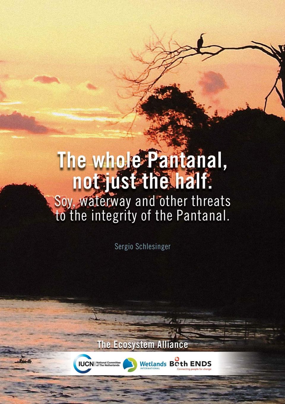
1 ST EDITION MATO GROSSO, BRAZIL, 2014
|
|
|
- Myron Sullivan
- 8 years ago
- Views:
Transcription
1
2

3 1 ST EDITION MATO GROSSO, BRAZIL,

4 The whole Pantanal, not just the half. Soy, waterway and other threats to the integrity of the Pantanal. 2014, Ecosystem Alliance TEXT Sergio Schlesinger PUBLICATION Ecosystem Alliance PARTNERSHIP FASE Federação de Órgãos para Assistência Social e Educacional SUPPORT Instituto GAIA Sociedade Fé e Vida PROJECT TEAM Sergio Schlesinger Vilmon Alves Ferreira GRAPHIC DESIGN Mais Programação Visual COVER Art from photos by Sergio Schlesinger PHOTOS Sergio Schlesinger SATELLITE IMAGES Google Earth PRINTED BY Walprint Gráfica e Editora PRINT RUN 150 copies Copyleft: Complete or partial reproduction of this text is permitted, as long as the author is cited and reference is made to the original article. The content of this publication does not necessarily represent the point of view of Ecosystem Alliance.

5 Table of Contents Introduction... 5 The Pantanal... 7 Main Threats to the Integrity of the Pantanal...10 Diamantino and Alto Paraguai: The Headwaters of the Paraguay River...21 Diamantino...22 Alto Paraguai...26 Poconé and Cáceres: Gateways to the Pantanal...31 Poconé...31 Cáceres Recommendations...40 References...44

6 4
7 Introduction The Pantanal is part of the so-called Paraguay-Paraná Humid Zone System, a complex that covers, in addition to Brazil, Argentina, Bolivia, Paraguay and Uruguay. Humid zones provide essential ecological services for fauna, flora and the well-being of human populations. They also play a vital role in mitigating climate change, since they are large carbon reserves. Watered by the Paraguay and Paraná River basins, this system of wetlands is located in the center of South America, a region of high ecological value. It is a special environmental asset due to its complexity and uniqueness. It fulfills essential functions, like regulating river systems, mitigating large floods and droughts, recharging large aquifers, and maintaining natural fish breeding areas, in addition to providing and purifying large amounts of fresh water. Conservation and sustainable management of these natural resources are essential for maintenance of ecological cycles and biodiversity, disaster prevention and preservation of ecosystems and their communities (Nicola et al., 2006). The Brazilian Pantanal is located in the states of Mato Grosso and Mato Grosso do Sul. It extends into Bolivia and Paraguay, where it is called the Chaco. Traditional communities, such as riverside, indigenous, maroon and bait collector communities, live there. Like these traditional human populations, plants and animals are adapted to its conditions. Just as the environmental benefits the Pantanal provides go beyond its geographical borders, its survival depends on conservation of an area larger than that occupied by the biome, restricted to the Pantanal plain. A floodplain depends on its forming rivers. Consequently, it is impossible to think about conservation without considering the Upper Paraguay Basin (UPB) as a whole. The Paraguay River and the other formers of the Pantanal plain are born in the plateau area of the states of Mato Grosso and Mato Grosso do Sul. They are responsible for recharging the waters that flood the Pantanal. The greatest threats to the Pantanal today are in these plateau areas. Among them, monoculture, ranching, mining, hydroelectric power plants and steel mills stand out. Deforestation of headwater areas, silting of the rivers, pollution and modification of the natural flow of the waters and a sharp reduction in the number of fish are the main consequences. Of these threats, growth in the area of soybeans planted in non-flooding parts of the Upper Paraguay Basin stands out. Currently, close to 10% of the total area in all Brazil planted with soybean is found in this region. Unlike what occurs with sugarcane, whose territorial growth is prohibited in the Amazon, in the Pantanal and the Upper Paraguay Basin there is no legal mechanism for containing soybean expansion in the UPB. Associated with soybean expansion, not only in the UPB but also in its surroundings, is another major threat: the project to extend the Paraguay-Paraná waterway to the city of Cáceres, in Mato Grosso, where soybeans would be the main product to be shipped. At the same time, with the presence of the waterway, a new push to expand soybean cultivation in the entire surroundings can be expected. Brazilian legislation does not offer the region the protection necessary for its conservation. On the contrary, different mechanisms of the new Forestry Code, such as reduction of permanent preservation areas (PPAs) along riverbanks, expose the region even more to uncontrolled growth of predatory activities. The same occurs in relation to bills and other provisions, such as the Socioeconomic and Ecological Zoning for the State of Mato Grosso, which is currently blocked in the state s legislature, and that of Mato Grosso do Sul, as well as the water resources plans of the two states. To this can be added deficient oversight and limited resources for creation and maintenance of conservation units. In the same way, no initiatives or actions on the part of the business community or governments, whether at the federal, state or municipal level, should be expected. The planned infrastructure works, expansion of mining and agribusiness, hydroelectric power use and use by other sectors of the natural resources in an intensive manner are part of the current development model. And this model charges a high price to local populations. They already have to overcome major difficulties to continue living by farming and fishing. The disposal of pesticides used in monoculture and grazing areas causes damages not only to family food production, but also the health of rural populations. In the same way, the inhabitants of large urban centers 5

8 who depend on these waters also are threatened by supply shortages and health problems as a function of the reduced volume and contamination of the waters. For all these reasons, it is urgent that civil society be mobilized to conserve the Pantanal and its people. Diverse social movement institutions and NGOs in the region have been organizing around the Movement to Defend the Entire Pantanal. It is important for organizations at the national and international level to also support this movement, which is designed to deter the accelerated process degrading the Pantanal and the entire Upper Paraguay Basin. With the objective of supplying new elements for mobilization, this work focuses on the expansion of soybeans in two regions of the Upper Paraguay Basin located in the state of Mato Grosso: The neighboring municipalities of Diamantino and Alto Paraguai, located in the headwater areas of the Paraguay River, where soybean cultivation has already been established for several decades; The neighboring municipalities of Cáceres and Poconé, whose territories are located in areas partially flooded by the Pantanal, where soybean cultivation has recently been growing. In addition to soybeans, we briefly address other activities, such as implementation of the Paraguay-Paraná waterway, construction of new hydroelectric power plants, mining, extension of sugarcane cultivation and others that are the main threats to conservation of the UPB and the Pantanal. Our field work in these municipalities, as well as our meetings held throughout the project, were organized and supported by FASE Mato Grosso, in the person of Vilmon Ferreira Alves. They also counted on the collaboration of members of municipal governments and representatives of small producer associations and agrarian reform settlements. We highlight and are thankful for the special support of Antonio Augusto Martins, an employee of the Instituto Centro de Vida (ICV) in Diamantino. The testimonies presented in highlighted color were collected over the course of this work. 6

9 The Pantanal Located within the Upper Paraguay Basin, the Pantanal occupies an area of approximately 200 thousand km 2, of which 70% is in Brazil, 20% in Bolivia and 10% in Paraguay. The Paraguay River, which, together with its tributaries, is responsible for recharging the waters of the Pantanal, is born in Brazilian territory and its hydrographic region covers an area of 1,095,000 km 2. The basin occupies an area of approximately 600,000 km 2 in South America, of which 363,442 km 2 is in Brazilian territory. The Brazilian Pantanal extends close to 150,000 km 2, representing 40% of the area of the UPB. The region of its rivers headwaters occupies an area of 215,813 km 2 in the plateaus located in its surroundings (Harris et al., 2006). The Hydrographic Region of Paraguay Source: ANA 7

10 The fauna and flora of the Brazilian Pantanal are extremely dependent on the adjacent regions, mainly the Cerrado, located along the northern, eastern and southern edges of the Pantanal plateau. The rural populations of the Pantanal are strongly influenced by the hydrological oscillations that occur annually in the region. The water cycle, the water dynamics of the region, represented mainly by alternating periods of drought and flood, is the conditioning environment that maintains the ecological functioning of the entire region, ensuring high biodiversity. The surrounding areas of the Pantanal plateau, where the headwaters of the rivers that constitute the Pantanal are found, are refuges for fauna in unfavorable periods, sheltering species that move there to avoid floods and climatic extremes. During floods, rivers, ponds and streams are interconnected by canals and lagoons or disappear into the sea of waters, allowing movement of aquatic species, seeds, eggs and larvae. The process of flooding large extensions is one of the main ones responsible for the constant renewal of life and for supplying nutrients. At the beginning of the dry season, isolated ponds and small canals form, which hold large numbers of fish and aquatic plants. These bodies of water slowly dry, attracting birds and other animals in search of food and promoting large concentrations of fauna. The Pantanal is also one of the most important areas for waterfowl and other migratory species, offering shelter, food and nesting grounds (ISA, 2007). All this dynamic, resulting from the cyclic movement of water, makes it one of the richest biomes in Brazil, but also one of the most fragile. A large variety of animal species live there: 263 species of fish, 113 of reptiles, 41 of amphibians, 463 of birds (such as the Jabiru, the bird-symbol of the Pantanal), 1,032 of butterflies and 132 of mammals. 1 Due to its importance, the Pantanal was declared National Heritage by the 1988 Brazilian Constitution, and it also contains sites considered to be of significant international importance by the Convention on Wetlands of International Importance (Ramsar Convention). It also includes areas recognized as biosphere reserves by UNESCO, which also classifies the biome as Natural Heritage of Humanity. Despite all this formal recognition, legal provisions designed to preserve the Pantanal are practically inexistent. Only 2.9% of the UPB and 4.5% of the Pantanal plain are protected today by conservation units and private natural heritage reserves. In truth, the only legal instrument in effect designed to provide special protection to the UPB in its entirety is the federal decree that, in 2009, established the Sugarcane Agroecological Zoning. The decree is today threatened by bills that would allow expansion of planting in the region. It is within this panorama that the process of occupying the UPB is accelerating. The region, which until the beginning of the 1970s had undergone some economic cycles, such as mining and rubber, in addition to having significant herds of cattle, is now receiving large waves of migrants, coming mainly from the South and Southeast regions of Brazil. On lands where, until then, the presence of small farms, Indians, maroon communities and other Pantanal peoples predominated, new economic activities are being developed with the arrival of monoculture and expansion of cattle herds into areas of the Cerrado. In addition to agriculture and livestock, infrastructure works will strongly impact this territory. In the plain region, periodic flooding impedes various human activities. The waters thus work to protect the biome, even if only partially. Consequently, the plant life on the plain is still mostly preserved. Monitoring undertaken between 2002 and 2012 shows that 14.3% of its surface had been destroyed by human activity (WWF, 2014). Causes of UPB Deforestation on the Plain by 2012 Type of use Area (km 2 ) % of the total plain Grazing 17, Human modification 3, Farming Reforestation Urban influence Degradation from mining Total 21, Source: WWF,

11 In the area of the UPB plateau, however, deforestation of areas vital for conservation of the Pantanal has been occurring at an accelerated pace in recent decades. On it, destruction had already affected 60% of the territory by 2012, as the same study shows. And farming has been accounting for an increasing portion of the deforestation: by 2008, it accounted for 4.2% of total deforestation. In 2012, this percentage had already hit approximately 11%. UPB Deforestation on the Plateau by 2012 Type of use Area (km 2 ) % of the total plateau Grazing 95, Human change 23, Farming 9, Reforestation Urban influence Degradation from mining 35 0,02 Total 130, Source: WWF,
 % of the total plateau Grazing 95,852 44.")
12 Main Threats to the Integrity of the Pantanal We briefly describe below the activities that account for most of the social and environmental impacts on the UPB, threatening the integrity of the Pantanal. Cattle Mato Grosso is the Brazilian state with the largest herd of cattle in Brazil, and Mato Grosso do Sul has the fourth largest. As can be seen on the table below, the pace of growth of the herd between 1992 and 2012 in Mato Grosso (183%) was much higher than the average for the country (37%). The same occurred in the four municipalities studied here. Cattle Herd in the Four Municipalities Studied (head) % Growth Brazil 154,229, ,279, Mato Grosso 10,138,376 28,740, Alto Paraguai 38,599 66, Cáceres 429, , Diamantino 37, , Poconé 250, , Source: IBGE Cattle ranching continues to be the main economic activity in the region. Originally, cattle ranching in the Pantanal used natural pasture areas, with native grasses and reduced impact on the environment. In recent decades, this practice has been replaced by use of exotic species, such as brachiaria grasses. Just as on the plain, cattle ranching was the major factor responsible for the deforestation that has occurred to date in the UPB plateau region, as shown by the following map. 10

13 Map of Natural Vegetation and Soil Use in the UPB 2012 Source: WWF, Sugarcane Sugarcane production in Mato Grosso is not significant in relation to other crops in the state, nor to its production in the country. There were close to 302 thousand hectares according to Canasat/Inpe 2, which corresponds to only 3% of the surface planted in Brazil, which was 8.5 million hectares in the 2012/2013 harvest (CONAB, 2013)

14 In Mato Grosso do Sul, the area planted with sugarcane, in the same period, was approximately 755 thousand hectares according to Canasat/Inpe, which corresponds to approximately 9% of the total planted area in Brazil. However, in Mato Grosso, close to 80% of all sugarcane planted is in municipalities located in the UPB (226 thousand hectares). In the case of Mato Grosso do Sul, the 149 thousand hectares planted in municipalities in the UPB correspond to 23% of the total planted in the state. Corn and Cotton Corn and cotton are planted in rotation with soybeans in the Mid-Western region. Although they partially occupy the same areas as soybeans, the planting of soybeans is what determines the opening of new areas. It is important to mention, however, that their production in the region, and the consequent need for transport, result in greater pressure to build the Paraguay-Paraná waterway, as well as in additional use of pesticides and fertilizers. Corn Production in the 2013/2014 Harvest Source: Conab/IBGE. 12

15 Area Occupied by Corn and Cotton in MT and MS during the 2013/2014 Harvest (thousand hectares) Corn Cotton MT 3, MS 1, Source: Conab, Eucalyptus The planting of artificial forests is another monoculture with a growing presence in the region. Although there is no specific information on planting in the Upper Paraguay Basin area, it is noteworthy that Mato Grosso do Sul is already the state with the fifth largest area planted with eucalyptus and pine in Brazil. The planted area in this state went from 148 thousand hectares to 597 thousand in only six years, between 2006 and 2012, according to the Brazilian Association of Planted Forest Producers (ABRAF, 2013). In the UPB, cultivation of eucalyptus and pine is concentrated in the municipalities of Aquidauana, Anastácio and Dois Irmãos do Buriti. Expansion of Area Planted with Pine and Eucalyptus between 2006 and 2012, MS and MT (thousand hectares) MS MT Source: 2013 ABRAF Yearbook. The municipality of Três Lagoas has become a large pulp production center in Mato Grosso do Sul. Três Lagoas produces 1.3 million tons of pulp per year, with the largest part exported by Fibria and the remainder supplied directly to neighboring International Paper, from where 200 thousand tons of paper is shipped per year. 3 Although Três Lagoas is not located in the UPB, paper and pulp production represents additional pressure demanding increased transportation infrastructure in the region. The Paraguay-Paraná Waterway The Paraguay-Paraná waterway today daily transports significant amounts of iron ore and manganese between the ports of Ladário and Corumbá (MS), and the mouth of the Apa River on the border with Paraguay. Most of the works planned for the next years are concentrated in the stretch between Corumbá and Cáceres. These works are designed to allow navigation of vessels with greater drafts throughout the year on the Paraguay River, starting at Port of Morrinhos, in Cáceres. They include dredging, regularization of the riverbed, rock removal and, especially, modification of the natural canal (Ministério dos Transportes, 2013). The works, as well as navigation by larger vessels, will have a strong impact on the natural characteristics of the river, such as water speed and flood pulse. For many years, civil society organizations were able, through the courts, to impede the works. However, in December 2013, the Federal Regional Court definitively denied a Federal Public Ministry appeal that would prevent environmental licensing of the Port of Morrinhos, located 86 km from the Cáceres municipal seat, the main project focused on shipping production by means of the waterway. With this, completion of an Environmental Impact Study and Environmental Impact Report (EIA-Rima) is no longer necessary for each project along the route, as provided for by the prior decision exibir.asp?noticia=trf_nega_recurso_do_mpf_em_acao_movida_por_taques_e_libera_licenca_do_porto_de_morrinhos&id=

16 The federal government s Accelerated Growth Program (PAC 2) includes, in addition to dredging works, studies and projects for implementation of cargo terminals, from Cáceres to Mato Grosso do Sul. A variety of organizations linked to agribusiness have been pressuring the federal government to release the funding necessary for undertaking the works. The topic is on the list of priorities of entities like the Agriculture and Livestock Federation of the State of Mato Grosso (Famato), Association of Soybean and Corn Producers of the State of Mato Grosso (Aprosoja) and the Agriculture and Livestock Parliamentary Front (FPA). Works Planned for the Paraguay-Paraná Waterway Source: Ministry of Transportation. 14
 and the Agriculture and Livestock Parliamentary Front (FPA).")
17 In addition to the works along the Paraguay River, there are also studies conducted by the Federal University of Santa Catarina, at the request of the Ministry of Transportation, designed to extend the waterway, by means of the Cuiabá River, a tributary of the Paraguay River, to the city of Rosário d Oeste, in Mato Grosso (Antaq, 2013). The region of the UPB around Cáceres would be most impacted, both by these transportation works and by the increased interest in land closer to the new port, attractive for gain cultivation due to the reduced cost of transporting production. Later, in the section dedicated to the municipality of Cáceres, we will analyze the impacts of the number of construction works for the waterway and its related infrastructure. Mining There are a variety of mining activities in the Upper Paraguay Basin, with consequences like pollution and silting of the rivers. Gold, diamonds, iron, manganese and limestone stand out. In the northern portion of the UPB, diamond and gold mining is still significant today. Engaged in primarily by companies, mining is the cause of pollution and silting of the rivers, as has occurred in the municipalities of Alto Paraguai, Poconé and Diamantino, among others. In Mirassol d Oeste, the recent discovery of large deposits of iron ore and phosphate is a reason for major concern on the part of the rural population, as we could see on a visit to the Roseli Nunes settlement. Hydroelectric Power Plants According to biologist Dr. Débora Calheiros, there are currently 44 dams located on rivers in the UPB and there are 110 new projects under analysis, totaling 154 dams. 5 Each project is separately licensed and this is worrying because it does not allow an overall view. 6 The concern is that these projects will affect the dynamics of the cycle of rivers forming the Pantanal plain, as well as the hydrodynamics of the Pantanal system as a whole. Furthermore, according to Débora, damming rivers for power generation, especially when several dams are constructed on the same river, is the major factor with regard to maintaining the flood flow on the plain and the factor that governs the ecological functioning of the Pantanal. This view is shared by a number of experts in fish ecology and fishing management, who expressed their concerns at a meeting organized by the Chico Mendes Institute for Biodiversity Conservation (ICMBio) in May 2014: The hydroelectric power generation projects proposed for the basin have the potential to alter the water cycle of the Pantanal in quality and quantity, consequently affecting the fish, fauna and flora of the region and, as a consequence, its social and economic activities. These effects can occur at the site, upstream or downstream of the projects, both in an immediate way, or in a manner perceivable only in the medium and long terms. The negative impacts include interfering with the free movement of migratory fish between their spawning, growth and feeding areas. As a result of dams, modifications upstream occur from the sudden transformation of rivers into lakes, changing physical and chemical patterns of water and the distribution of organisms. Consequently, dams lead to alteration of the species mix, with a high proliferation of some and reduction or extinction of others. In the stretch below the dam, the impacts are even worse, since the reservoirs promote redistribution of flows, raising the minimum level of the river during droughts and reducing it during floods, undermining the connection of the river with the aquatic environments along the banks, compromising the reproduction, feeding, recruitment and production processes and biodiversity as a whole #

18 Fishing at Risk Fishing is one of the main social, economic and environmental activities realized in the UPB, where it is practiced in the professional-artisanal, amateur (or sporting) and subsistence modalities. More than 14,000 professional fishermen, according to Embrapa Pantanal (2013) are involved in the activity in the basin, with 9,500 in Mato Grosso and 4,700 in Mato Grosso do Sul, according to records of the Ministry of Fishing and Aquaculture in August All were working in an artisanal fishing regime. In recent years, fishing has been suffering the impact of the various activities already mentioned, particularly those occurring in the plateau areas. The result has been river silting and pollution from pesticides, threatening the survival of fish eggs and larvae, and an increase in the nutrient load, with loss of biodiversity. Fragmentation of the rivers by dams that impede migrations and eliminate spawning fish is considered the main cause of the reduction of fishery production. It also causes a change in the flood flow and transport of sediments and nutrients, with effects on the entire ecosystem. Another threat to fishery activity is the socalled Law of the Pantanal, a bill sponsored by Senator Blairo Maggi, which we will address below. Basic Sanitation According to the National Water Agency (ANA, 2010), close to 2.2 million people lived in the Paraguay Water Region in 2010, a number equal to 1.1% of the Brazilian population, with 87% in urban areas. Only 29% of the population in the water region were connected to the sewage network, far below the national percentage (46%). 8 Nineteen percent of the region s sewage is treated, also below the national average, which was 30%. 9 Another issue that merits attention is the pollution caused by industrial waste, mainly that generated by slaughterhouses, increasingly present in the region. Growth of the swine herd is also worrying. The raising of pigs in pens represents a high risk of water resource contamination. Swine Herd (head) % growth Brasil 31,918,749 38,795, Mato Grosso do Sul 787,960 1,205, Mato Grosso 1,034,608 1,789, Source: IBGE. New Laws and Regulations New legal provisions, if approved, may accelerate the deterioration of the ecological processes that govern the Pantanal and the traditional means of subsistence of its people. Bill No. 750/11, sponsored by Senator Blairo Maggi and known as the Law of the Pantanal, copies a number of worrying aspects found in Mato Grosso State Law 8830, of 2008, and adds others. In addition to not fighting the true factors reducing fishery resources in the region, its temporary provisions provide for a 5-year moratorium on fishing in the Pantanal. In the view of different social and fishermen organizations in the region, this prohibition originates from pressures by sectors tied to tourism and agribusiness, which want to eliminate it in favor of sports fishing and pisciculture (Arach, 2014). By not recognizing the intimate relationship between the plateau areas and the Pantanal plain, the bill violates the Water Resources Law (9433/97), which determines that the territorial unit for planning and management should be the water basin. Neither does it provide obstacles to expansion of hunting and fishing activities in the UPB plateau area. In addition, it maintains the prohibition against establishing new rural settlements in floodplain areas

19 Another source of concern is the Mato Grosso Social, Economic and Ecological Zoning. Since February 2012, several legal provisions that established the zoning have been temporarily suspended at the request of the Public Ministry, which when taking such action alleged that the technical studies presented by the Legislative Assembly as being those that provided support for zoning were divorced from reality, insufficient, contradictory and absurd. The zoning was also rejected by the Coordinating Commission for Ecological-Economic Zoning of the National Territory, formed by members of 14 ministries, which guides and approves these instruments in Brazil, due to lack of compliance with its methodological guidelines. According to Inácio Werner, of the Centro Burnier Fé e Justiça, the zoning reduces conservation areas, with some of them simply ceasing to exist. It reduces indigenous areas, further harming the peoples. It allows planting of sugarcane anywhere in the state, contrary to current legislation that protects the Pantanal and the Amazon from this type of agricultural production. 10 The process of the Sugarcane Agroecological Zoning bill that prohibits expansion of cane planting in the Amazon and Pantanal biomes, as well as in the UPB, also merits attention. The zoning was established by presidential decree in 2009 and, at the same time, sent to the congress to be transformed into law. The agribusiness caucus in congress has proposed amendments to the bill that allow expansion of cane in degraded areas of these biomes. A new Mining Code is also working its way through congress. With it, the federal government intends to establish the 2030 National Mining Plan, for the purpose of expanding mining by somewhere between three and five times the current production in Brazil. Soybeans in the Upper Paraguay Basin Field of soybeans in Diamantino

20 Area Planted with Soybeans in the Municipalities of the Upper Paraguay Basin 2002 and Source: IBGE. Art: ICV. In Brazil, according to the IBGE 11, the total area of soybean cultivation in 2012 was 25 million hectares. In Mato Grosso, it was approximately 7 million hectares. And in Mato Grosso do Sul, 1.8 million. In Mato Grosso, the area planted in soybean in the municipalities within the UPB in 2012 was 1.6 million hectares, with growth of 33% from 2002 to In 2012, soybeans planted in the UPB-MT represented close to 22% of the total area planted with soybeans in the state. In Mato Grosso do Sul, the area planted in soybean in the municipalities within the UPB in 2012 was 879 thousand hectares, and growth from 2002 to 2012 was close to 39%. In 2012, soybeans planted in the UPB-MS represented close to 48% of the total area planted with soybeans in the state. Combined, the areas planted with soybeans in MT and MS represented almost 10% of the total area planted with soybeans in Brazil. Expansion of Soybean in the UPB, Total UPB MS 631, ,150 39% Total UPB MT 1,183,356 1,568,067 32% Total UPB 1,814,734 2,447,217 35% Source: IBGE. 11 The information on the cultivation of soybeans and others produced by CONAB are more up-to-date than those presented by the IBGE. However, only the IBGE provides, through its database, data on production by municipality. For this reason, the information presented here on soybean cultivation in the UPB is that provided by the IBGE. 18

21 Why so much soybean? Soybean is the agricultural crop that, overall, has grown at the fastest pace in recent decades, stimulated by the strong increase in meat consumption, mainly in the so-called emerging countries. It is estimated that 90% of the soybeans produced in the world are used for production of meal for animal feed, as a source of protein. The crop is concentrated in a few number of countries. The United States, Brazil and Argentina account for 80% of production and 85% of global exports, according to data from the U.S. Department of Agriculture (USDA). China is the largest importer. Its purchases represent 63% of all global trade. The European Union is in second place, with 12%. Brazil has alternated with the United States in recent years as the largest exporter of soybeans. Soybeans are increasingly important in Brazilian exports. Total sales of the complex (beans, meal and oil) reached US$ billion in 2013, corresponding to 31% of the agricultural sector s foreign sales and 12.8% of total Brazilian exports. The amount exported was 57.5 million tons, or 70% of Brazilian production during the 2012/2013 harvest. Commercialization is also strongly concentrated in a small number of companies. In the case of Mato Grosso, exports of only five companies accounted for 51.7% of the state s total agricultural exports in 2013; the multinationals Bunge, ADM, Cargill and Dreyfus and the Brazilian Amaggi. 12 The main destination of Brazilian soy complex exports are China and the European Union, as indicated on the following graph. Destination of Brazilian Soy Complex Exports (US$ billion) Source: Abiove. The municipalities of the Upper Paraguay Basin accounted, in 2013, for 6.7% of the soybeans exported by Brazil. Of exports to China, this percentage was 7.4%. And to the European Union and the Netherlands, 3.3%. Destination of Soybeans Exports from the UPB 2013 tons China EU Netherlands Others Total Total UPB 2,379, ,323 52, ,770 2,876,457 Total Brazil 32,247,228 5,141,926 1,585,897 5,511,262 42,900,416 % UPB Source: Aliceweb MDIC The state of Mato Grosso is the largest producer of soybeans in the country, with a forecasted area of 8.4 million hectares for the 2013/2014 harvest, representing more than 28% of the area occupied by soybeans in Brazil, and a 7% increase in relation to the prior year. Mato Grosso do Sul is the fifth largest producer, and the area forecast for the next harvest is 2.1 million hectares, 5.1% higher than that of the 2012/2013 harvest (Conab, 2014)
22 Forecasts The official forecasts of the Ministry of Agriculture (MAPA, 2013) indicate that, between 2013 and 2023, Brazilian production should grow 22%. With this, the area planted with soybeans should increase 6.7 million hectares, reaching 34.4 million hectares in 2023, an increase of 24.2% in relation to the area occupied during the 2012/2013 harvest. The main area of expansion should be that called Matopiba, because it includes land located in Maranhão, Tocantins, Piauí and Bahia. Mato Grosso should lose strength in this expansion process, due primarily to the prices of land in this state, which are more than double agricultural land prices in the Matopiba states. Since the new projects include vast areas, the price of land is a decisive factor. With regard to the Upper Paraguay Basin, Aprosoja, in news published in July 2013, highlights the fact that the possibilities for expansion of soybean production in the Jauru Valley, which includes municipalities such as Figueirópolis d Oeste, Rio Branco, Cáceres, Lambari d Oeste, Jauru, Mirassol d Oeste, São José dos Quatro Marcos and Reserva do Cabaçal, are especially favorable. 13 Soybean Production during the 2013/2014 Harvest Source: Conab/IBGE. 20
23 Diamantino and Alto Paraguai: The Headwaters of the Paraguay River The Paraguay River springs from the Araporé Mountains, on the southern slope of the Parecis Mountains in Mato Grosso. The region of these headwaters extends over a marshy plateau called Brejal das Sete Lagoas, where the Prata and Amazon basins separate. The Diamantino, Cuiabá, Sepotuba, Cabaçal and Jauru Rivers also spring from this region, which are part of the Prata basin, and the Arinos, Parecis, Sangue, Papagaio, Buriti and Juruena Rivers, tributaries of the Tapajós River in the Amazon basin 14. Headwater area of the Paraguay River The initial core of the seat of the current municipality of Diamantino, located only 30 km from the headwaters of the Paraguay River, was established in 1728 with the discovery of gold, followed by diamonds, in the region. In 1820, the settlement became Vila de Diamantino, the third town created in Mato Grosso. The region was inhabited by different indigenous peoples, such as the Paresis, Kaiabis, Nambiquaras and Apiakás. They would soon be decimated or enslaved for work in the mines, together with blacks brought from other regions. Over the centuries, the region would experience different economic cycles: gold, rubber, diamonds, livestock and, today, agriculture. Until 1950, it would maintain its original surface area of over 100 thousand square kilometers. Thereafter, but especially starting in the 1980s, Diamantino would be successively dismembered to form another fifteen new municipalities (Sobrinho, 2006)
24 Diamantino Starting at the end of the 1960s, the Diamantino region, just as others in Mato Grosso, received a large number of immigrants from other parts of the country, mainly the South and Southeast regions, attracted by the federal government s so-called colonization programs that offered incentives for agricultural activities (Passos et al., 2006). In the second half of the 1980s, land reform settlements also began to be established. So a mosaic of peoples of different origins formed, which needed to share land and water in the region. On one hand, immigrants and their descendents who, with the incentives received from the federal government, became large rural producers. On the other, small farmers, settlers, indigenous and maroon communities, whose productive activities are mainly family farming and fishing. Thus, since the 1970s, Diamantino began to become a large producer of grains like soybeans, corn and cotton. A milestone of this period was the founding, in 1975, of the Itamarati Norte company in the municipality. Its owner was the businessman Olacyr de Moraes who, years later, would be known as the soybean king. In the 1980s, Olacyr became the largest individual producer of soybeans in the world. In Diamantino, the company occupied a total area of 110,000 hectares, where it primarily produced soybeans, corn and cotton. 15 In addition to grains, the region began to be occupied, still in this period, by sugarcane. In 1980, the Diamantino Cane Producers Agricultural Cooperative (Coprodia) was founded. With the progressive dismemberment of areas of Diamantino the land occupied by Coprodia is today located, for the most part, in the municipality of Campo Novo do Parecis, in headwater areas of the rivers in the Amazon basin. In 1987, the Libra plant was established in Diamantino, whose land also extended into the neighboring municipality of São José do Rio Claro (Cruz, 2012). Diamantino Today Diamantino is currently a municipality of close to 21,000 inhabitants, whose main activities are farming and ranching. In agriculture, the production of soybeans, corn and cotton stand out. In ranching, cattle and pigs. In agribusiness, large companies are present, with a JBS slaughterhouse and new investments by the Amaggi group, in a complex designed for grain storage, standing out. 16 Soybeans in Diamantino Soybean production occupies the largest agricultural area in the municipality. For the 2013/2014 harvest, the Mato Grosso Institute of Agricultural Economics (Imea) estimates that Diamantino will be the municipality with the fifth largest soybean area in the state, totaling 366,700 hectares. 17 In addition to the Amaggi group, other large companies are active in the sector. The SLC Group, from Rio Grande do Sul, occupies, between its own and leased areas, more than 48,000 hectares planted with soybeans, corn and cotton, in its Paiaguás and Pejuçara farms. Also present are: the Bom Futuro Group, the largest soybean producer in Mato Grosso, with an area greater than 200,000 hectares, belonging to the cousins of Senator Blairo Maggio; Agropecuária Vanguarda, which has Otaviano Pivetta, mayor of Lucas do Rio Verde, as majority partner, with the Guapirama and Sete Placas farms, which total 30,300 hectares; and the El Tejar Group (Telhar Agropecuária, in Brazil) headquartered in Argentina, which grows more than 600,000 hectares of soybeans on its own and leased lands in that country, Brazil, Uruguay and Bolivia _12_13_Tratamento_semeadura_13-14.pdf
25 Several of these large properties are in source areas of the Paraguay River. In 2011, the Public Ministry in the state, through the 2 nd District Attorney of Diamantino, sued the Mato Grosso government, demanding effective implementation of the Permanent Preservation Area for the sources of the Paraguay River. In the suit, evidence that soybean farms extend to approximately 10 meters of the sources is presented, and that during the rainy season, pesticides used in the planting of the grain are carried directly into the river. Property inspections conducted by the Public Ministry, included land currently leased to Vanguarda by the Zortea group, and land owned by Talher. In a portion of the suit, it states that: The photos that accompany the report attached to the suit make it clear that deforestation in the headwaters of the Paraguay River goes far beyond permitted rates, making immediate recovery of the already degraded areas necessary. In our field study, we observed that the suit had not produced the expected results. These headwater areas continue to be illegally occupied by the large farms, both in Diamantino and in Alto Paraguai, as we describe later. The prospect of extending navigation on the Paraguay-Paraná waterway to the Port of Morrinhos, as well as extension of the highway network in the region, may certainly accelerate expansion of soybean cultivation in Diamantino and neighboring municipalities. And this expansion should make the lives of its rural population even more difficult, something we will focus on below. Pesticides in the Sources In addition to the reduced volume of water as a result of deforestation, the population of Diamantino is also facing its contamination by pesticides. Jacildo de Siqueira, responsible for public health surveillance for the Municipal Health Secretariat of Diamantino, tells us that, in spite of the fact that the municipality is not equipped to detect and prove the presence of pesticides in the water, the presence of soybeans in source areas is worrying: We already have a large water problem here in the municipality. All this soybean planting and mining is all spreading toward three locations where water is captured to supply Diamantino, the Areinha stream and the Caju stream. Agribusiness is in their surroundings. The Diamantino River and the recreational area closest to the city are already compromised. It is a problem that we are already discussing here, but I believe that there is a lack of commitment, because we are talking alone, there is resistance. Itamar Bonfim, who has held the position of Health Secretary in the municipality for eight years, recognizes the problem and expresses his concern: We still haven t paid attention to this, we have no analysis, no action focused on this. Some types of diseases may be connected to this. We still do not know, have not studied, because there is a lot of water here and we are surrounded by large farms. We have a different perspective on health, and we have to see how we are going to resolve this with the producers, because people already think this will be a problem for production. In the region (Diamantino Regional Health Office) there are records of deaths from stomach cancer. Caused by what? The water? We have to look for answers to these questions and deal with the problems in partnership with the bodies in the area. Aparício Valeriano De Siqueira, General Coordinator of the Union of Family Agriculture Workers of Diamantino (Sintraf), also notes the difficulty that exists in overcoming the power of the business community in the region, with respect to identification of the origin of the occupational health problems in Diamantino and the neighboring municipalities growing soybeans: What is happening here is that these events are being hidden. A few days ago, we participated in a meeting of the Regional Health Forum, which involves seven municipalities in the region, on worker health, and the accusations that are being made are serious, involving slaughterhouses and farms. And here in Diamantino, the problem is deviation of the diagnosis of workers who arrive after exposure to pesticides. They put another cause. The cases of poisoning by pesticides do not appear in the health center and hospital reports. They are prohibiting the doctors from providing the workers with medical certificates. The employees themselves are told not to make accusations about the contamination, under threat of being fired. 23
26 Family Farming In Diamantino, as Antonio Martins tells us, close to 600 families live in rural settlements. There are also close to 600 to 700 small rural properties, of which approximately 30% are family farm production units, with self-employed professionals, public employees and others living in the others. The main family farm products are milk, cassava, banana and small animals. Small-scale pisciculture and vegetable production for the federal government food purchasing programs has also been growing in recent years. These families are in the surroundings of the municipal seat, in a radius of approximately thirty kilometers, a distance that offers good potential for attending to the local food consumption needs. The capital Cuiabá, located 180 kilometers from Diamantino, strengthens this potential consumer market. Aparício, from SINTRAF, tells us that: What we see on the small properties today are grass and fences. Those who are still raising dairy cattle manage to survive. The traditional communities no longer plant subsistence crops: rice, beans, corn. The allegation is that the cost is very high, there is no profit. At the market, you see the scarcity of local products. Here, watermelon from Goiás is sold, oranges are coming from São Paulo, beans from Maranhão, rice from Sinop (MT). I participated in a meeting with supermarket owners in Cuiabá. They begged us to plant using the least amount of poison possible, to even make the transition to organic agriculture. We invited them to come to Diamantino, and they met with the people here. They want to take the production there, because they are not receiving it. They are bringing product from Goiás and São Paulo, but they want production from here in Mato Grosso, with the use of less poison. The testimonies gathered, however, point to a number of difficulties for production and commercialization of family farming. In particular, the lack of support by the municipal and state governments and the growing presence of the soybean, corn and cotton monocultures that prevail in the rest of the municipal territory and already occupy a large part of the belt around the city, where most of the family farms are located. The largest settlements in Diamantino, those of Bojuí and Caeté, concentrate more than 500 of the 600 families settled in the municipality. In our field studies, we visited the Caeté and Piraputanga settlements. The latter is a small community located in a region far from these monoculture areas. The Caeté Settlement At the Caeté settlement, where 236 families live, we found a variety of problems resulting from living alongside soybeans. In addition to being present in the large farms in the surroundings, the crop is also found in areas leased to various settlers. Pollution and the reduction of water are the main problems mentioned by its residents. The same occurs in almost all the Diamantino settlements, such as Bojuí, the largest of them. Food production was never easy in the settlement. A lack of credit, low quality soils and scarce water in various lots are obstacles to production faced since its creation. With soybeans coming closer, the farmers are noticing the reduction of water volume in the rivers and streams and an almost complete disappearance of fish. Rusiveth Martins, Rutimara Cruz de Mello and Odílio João de Souza, who live in the settlement, talk about these problems: In 1998, we had water way up here. There were large fish, but it s all gone. They harrow the land, it dries out, after six months, all that remains is the red earth. And that over there was a little Cerrado, and it had water. And listen, I don t cut down any trees. Odílio Here on the Preto River, when we arrived, we went fishing here in the river for piau, lambari. Today fishing is a lot of work. You go down to the river and can see clear to the bottom, the sand is clear. A few years ago you couldn t see this sand. It appeared to have a black curtain. It was full of piau, all close to each other. Rusiveth This poison burns our eyes. I was riding my motorcycle and the plane passed over the road. Down came that rain of poison, and we had nowhere to run. I couldn t breathe and almost suffocated to death. Rutimara With regard to the water pollution, a resident who preferred not to provide a name observed: I can no longer drink the water there at my house. If you drink it, you get sick. Diarrhea, stomach ache, infection. Meanwhile, the farmer is there in the city, drinking mineral water. When I came here, 24
27 the water was first class. The problem appeared after they began planting soybeans. The well at my house is shallow, 10, 12 meters, if it rains the poison gets there. The growing scarcity of water and the presence of pesticides, together with the lack of technical assistance, the difficulty in obtaining credit and the consumer market, all make the production of many farmers unviable. Organic food production is becoming impossible. Pesticides used in soybean areas make pests previously unseen attack the production of other crops in the surroundings. Consequently, farmers are often forced to also use pesticides to protect their vegetable gardens from these pests. In addition, desiccants spread over areas planted with soybeans end up also drying out the production of family farmers. And the poison used on the soybeans contaminates the food produced. Odílio, who produces milk, cheese and other foodstuffs to sell door-to-door in the city, talks about these difficulties: It is impossible to produce organic food. If you analyze it, you will find the pesticides used on soybeans. I plant a field here and nothing grows because they throw poison there and it kills here. All the orange trees are dying. I have a neighbor right in front of my house who leased his land for soybeans. I have a vegetable garden, and when they spread the poison, it gets there. I went to the Health Secretariat to complain, they said that nothing can be done, that if it is because of soybeans, there s nothing they can do. Facing all these problems, the younger generations of Caeté are migrating to the city in search of work, where they have a tough time adapting to a new life. And their parents, who still are looking for alternatives in order to remain in the settlement, also fear they will lose their identity as food producers: Until a few years ago, we went to the city to buy oil, salt and sugar, because we had everything else on the farm. Today, I m ashamed to have to buy a head of lettuce in the market. The Piraputanga Settlement Rutimara With only nine families, all related, and occupying a total area of 900 hectares, three quarters of which is preserved, the Piraputanga settlement is an exception to the rule, both in terms of its counterparts in Diamantino and the majority of Brazilian settlements. Piraputanga is close to 2 kilometers away from the closest soybean field, and its waters are clean, since they spring from the very settlement and flow into the Cuiabá River. The settlement was created in 1996 to legalize the lands already occupied since the 1950s by Luiz Carlos de Macedo s family, which welcomed us to the place. Subsequently, it received funds for construction of homes, and the families obtained credit to begin cattle ranching, buy a tractor, a truck and set up a mill. Starting in 1998, they could count on ICV training courses on seed collection and other economic activities that help to preserve the environment. Recently, the settlement signed a contract with the incubator of solidarity economic enterprises of the Federal University of Mato Grosso (UFMT) to receive technical assistance from food engineers and other specialized professionals. Piraputanga settlement, Diamantino. Piraputanga is diversifying its production: pisciculture, seed collection, beef and dairy cattle, subsistence agriculture, apiculture and Cerrado fruit pulp are the main activities. With this, family members who left the settlement during the hard times are already making plans to return. For this, says Luiz Carlos, it would be necessary to expand settlement activities. In this direction, the UFMT incubator has been 25
Brazil s Response to Lower Commodity Prices Will Infrastructure Improvements Support Further Expansion?
 Brazil s Response to Lower Commodity Prices Will Infrastructure Improvements Support Further Expansion? By Dr. Michael Cordonnier www.soybeansandcorn.com soycorn@comcast.net 630-325-0192 (Chicago) Overview
Integrated conservation vision
 forever programme Seeking about the balance between economic production and the conservation of the wetlands, the actions carried out by WWF-Brazil in the Upper Paraguay River Basin have a transboundary
The Pantanal ---- People, Places, Priorities. Can integrated water management serve society and ecosystems?
 The Pantanal ---- People, Places, Priorities Can integrated water management serve society and ecosystems? The Pantanal Program (2001-2009) U$400 Million IDB project to: a) restore ecosystem quality b)
Agricultural Production and Research in Heilongjiang Province, China. Jiang Enchen. Professor, Department of Agricultural Engineering, Northeast
 1 Agricultural Production and Research in Heilongjiang Province, China Jiang Enchen Professor, Department of Agricultural Engineering, Northeast Agricultural University, Harbin, China. Post code: 150030
ABIOVE and the production chain promote good socio-environmental practices in Brazilian soybean production, reveals a TNC study
 ABIOVE and the production chain promote good socio-environmental practices in Brazilian soybean production, reveals a TNC study In a recent publication, TNC, one of the world s largest environmental conservation
Deforestation in the Amazon
 Deforestation in the Amazon By Rhett A Butler Rainforests once covered 14% of the earth's land surface; now they cover a mere 6% and experts estimate that the last remaining rainforests could be consumed
October 16, 2014. UNICA s Comments on Brazilian Sugarcane Ethanol Availability for the LCFS.
 October 16, 2014 VIA ELECTRONIC MAIL Mike Waug Branch Chief, Alternative Fuels Section California Air Resources Board 1001 I Street Sacramento, CA 95814 RE: UNICA s Comments on Brazilian Sugarcane Ethanol
REPORT: MAPPING AND MONITORING OF THE SOY MORATORIUM.
 REPORT: MAPPING AND MONITORING OF THE SOY MORATORIUM. MARCH, 2008. SUMMARY To carry out the Soy Moratorium Mapping and Monitoring in the Amazon Biome, ABIOVE - Brazilian Vegetable Oilseed Industries Association,
Madagascar: Makira REDD+
 project focus Madagascar: Makira REDD+ Madagascar is considered to be one of the top five biodiversity hotspots in the world due to more than 75% of all animal and plant species being endemic while less
Monitoring alterations in vegetation cover and land use in the Upper Paraguay River Basin Brazilian Portion Period of Analysis: 2002 to 2008
 Monitoring alterations in vegetation cover and land use in the Upper Paraguay River Basin Brazilian Portion Period of Analysis: 2002 to 2008 Introduction The Upper Paraguay River Basin encompasses international
Lesson Overview. Biodiversity. Lesson Overview. 6.3 Biodiversity
 Lesson Overview 6.3 6.3 Objectives Define biodiversity and explain its value. Identify current threats to biodiversity. Describe how biodiversity can be preserved. THINK ABOUT IT From multicolored coral
INSTITUTO DE DESENVOLVIMENTO INTEGRADO DE MINAS GERAIS. The Minas Gerais Investment Promotion Agency
 The Minas Gerais Investment Promotion Agency INDI MISSION To attract, consolidate and retain industrial, commercial and services projects in Minas Gerais. ATTRIBUTION INDI is: The official investment promotion
Water management planning for Naurzum National Nature Reserve, Kazakhstan. Abstract. By Y. A. Bragin
 SIBERIAN CRANE WETLAND PROJECT TECHNICAL BRIEF SIBERIAN CRANE WETLAND PRO ECT Water management planning for Naurzum National Nature Reserve, Kazakhstan By Y. A. Bragin Abstract The closed hydrological
Population Ecology. Life History Traits as Evolutionary Adaptations
 Population Ecology An Overview of Population Ecology Population ecology is the study of factors that affect population: Density Growth A population is a group of individuals of a single species that occupy
CONTENTS AREA STUDIES - REGIONAL SUSTAINABLE DEVELOPMENT: BRAZIL
 CONTENTS AREA STUDIES - REGIONAL SUSTAINABLE DEVELOPMENT: BRAZIL Area Studies - Regional Sustainable Development: Brazil - Volume 1 No. of Pages: 400 ISBN: 978-1-84826-171-6 (ebook) ISBN: 978-1-84826-621-6
Amherst County Public Schools. AP Environmental Science Curriculum Pacing Guide. College Board AP Environmental Science Site
 Amherst County Public Schools AP Environmental Science Curriculum Pacing Guide College Board AP Environmental Science Site REV: 8/12 1 st 9 weeks AP Objectives Energy Resources and Consumption A. Energy
An overview of the Brazil-China soybean trade and its strategic implications for conservation
 An overview of the Brazil-China soybean trade and its strategic implications for conservation The Nature Conservancy Latin America Region Prepared by Carrie Brown-Lima Melissa Cooney David Cleary Foreword
RESTORATION & REVITALIZATION
 RESTORATION & REVITALIZATION Legal preservation has not proved to be sufficient to preserve natural communities. Restoration activities are diverse and includes revitalization of natural communities which
Application of Invest`s Sedimentation Retention model for restoration benefits forecast at Cantareira Water Supply System
 Application of Invest`s Sedimentation Retention model for restoration benefits forecast at Cantareira Water Supply System Introduction Healthy forests regulate water flows, protect watercourses and maintain
INDONESIA - LAW ON WATER RESOURCES,
 Environment and Development Journal Law LEAD INDONESIA - LAW ON WATER RESOURCES, 2004 VOLUME 2/1 LEAD Journal (Law, Environment and Development Journal) is a peer-reviewed academic publication based in
How To Plan A Buffer Zone
 Backyard Buffers Protecting Habitat and Water Quality What is a buffer? A buffer (also called a riparian buffer area or zone) is the strip of natural vegetation along the bank of a stream, lake or other
Answer Keys to Unit Tests
 Reading Geography Series Answer Keys to Unit Tests Unit 1 The Five Themes of Geography Unit 2 Patterns in Physical Geography Unit 3 Natural Resources 7 Portage & Main Press Unit Test for The Five Themes
4 th WORLD WATER FORUM. Risk Management in the Iullemeden Aquifer System. 4th World Water Forum, Mexico 2006
 4 th WORLD WATER FORUM Risk Management in the Iullemeden Aquifer System Mexico, Marsh 17 th, 2006 GEOGRAPHIC OVERVIEW IAS OVERVIEW Countries : Mali, Niger, Nigeria Mali Area : 525 000 km² Mali : 31000
Pantanal. Promoting sustainable development PROGRAMME. Fotos: WWF / Gustavo YBARRA
 Pantanal PROGRAMME Promoting sustainable development Fotos: The Upper Paraguay River Basin Pantanal, an internationally important wetland With its 600,00 km 2 and expanding across Boliva, Brazil and Paraguay,
The Colorado River Delta
 The Colorado River Delta An Invaluable Resource for People and Wildlife the colorado river delta The Colorado River Delta and its waters support a rich and diverse treasure of plants and animals in an
FOUR RIVERS RESTORATION PROJECT
 MLTM Republic of Korea Making Every Drop Count International Workshop on Integrated Urban Water Management WATER & GREEN GROWTH FOUR RIVERS RESTORATION PROJECT Office of National River Restoration, Korea
HOW TO FUND BASIN MANAGEMENT PLANS? Invest in IWRM - it pays back!
 HOW TO FUND BASIN MANAGEMENT PLANS? Invest in IWRM - it pays back! Jean-François DONZIER Permanent Technical Secretary of the International Network of Basin Organizations (INBO), General Manager of the
Green Infrastructure Case Study Template
 Green Infrastructure Case Study Template The aim of the exercise is to provide information on how the elements of the Green Infrastructure Strategy are implemented at national level and to provide case
ARIMNet 2 Call 2014-15
 Coordination of the Agricultural Research In the Mediterranean Area Call i text ARIMNet 2 Call 2014-15 SUBMISSION Pre-proposal by December 1 st, 2014 Full Proposal by May 11 th 2015 on http://arimnet-call.eu/
3. Which relationship can correctly be inferred from the data presented in the graphs below?
 1. Recent evidence indicates that lakes in large areas of New York State are being affected by acid rain. The major effect of acid rain in the lakes is (1) an increase in game fish population levels (3)
Using Aerial Photography to Measure Habitat Changes. Method
 Then and Now Using Aerial Photography to Measure Habitat Changes Method Subject Areas: environmental education, science, social studies Conceptual Framework Topic References: HIIIB, HIIIB1, HIIIB2, HIIIB3,
Physical Environment. There are economic reasons for countries to cut down their rainforests.
 Tropical Rainforests Reasons for their Destruction Tropical Rainforests are found in the Amazon Basin of South America, (e.g. Brazil) Central Africa (e.g. Congo) and South East Asia (e.g. Indonesia). There
Ranger Report About Deforestation of the Rainforest
 Ranger Report About Deforestation of the Rainforest About deforestation Forests are cut down for many reasons, but most of them are related to money or to people s need to provide for their families. The
Aquatic Ecosystems Restoration
 Presenter s name Aquatic Ecosystems Restoration Lessons Learned from Asian Development Bank Operations Qingfeng Zhang, Senior Water Resources Engineer Asian Development Bank This Presentation will discuss
Creating Green Jobs within the Environment and Culture sector.
 Creating Green Jobs within the Environment and Culture sector. Matilda Skosana Environmental Programmes (ILO Definition): 1. DEFINITION OF GREEN JOB. Jobs are green when they help reduce negative environmental
1 Introduction. 1.1 Key objective. 1.2 Why the South Esk
 1 Introduction 1.1 Key objective The aim of this study is to identify and assess possible options for improving the quality of the river channel and habitats in the River South Esk catchment whilst helping
Facts on biodiversity
 Facts on biodiversity What is biodiversity? Biological diversity (biodiversity) comprises diversity of species and habitats as well as the genetic diversity within the individual species of fauna and flora.
WATER: ENVIRONMENTAL SCIENCE Syllabus
 WATER: ENVIRONMENTAL SCIENCE Syllabus Course Title Water: Environmental Science Course Description Central to all ecosystems, water is essential to life as we know it. It shapes our planet on every level,
Water from the Air: Cloud Forests
 Water from the Air: Cloud Forests Alden Wicker Water from the Air: Cloud Forests In the Americas, Asia, and Africa, there s a special kind of forest. It s rare, beautiful, and incredibly important to the
Inland Waterway Infrastructure - Mekong River cruise promoting factor. Tokyo September 2010
 Inland Waterway Infrastructure - Mekong River cruise promoting factor Tokyo September 2010 Mekong river system Mekong river system Land and resources: Parts of China, Myanmar and Viet Nam, nearly 1/3 of
Opportunities for Environmental Research in Brazil
 Opportunities for Environmental Research in Brazil ADRIANA M. M. PIRES Research and Development Head at Embrapa Environment adriana@cnpma.embrapa.br http://www.cnpma.embrapa.br /brazil WHY HAVING PROJECTS
Ane Alencar CONDESSA BR163
 Roads, conservation and governance: lessons from BR-163 regional planning process Ane Alencar CONDESSA BR163 PAN-AMAZON Cuiabá-Santarém Highway Santarem Cuiaba 996 km Not paved Cost and benefits of BR-163
THE NATURAL RESOURCES AND ENVIRONMENT ORDINANCE (CAP. 84 - LAWS OF SARAWAK, 1958 Ed.)
") THE NATURAL RESOURCES AND ENVIRONMENT ORDINANCE (CAP. 84 - LAWS OF SARAWAK, 1958 Ed.) THE NATURAL RESOURCES AND ENVIRONMENT (PRESCRIBED ACTIVITIES) ORDER, 1994 (Made under section 11A(1)) (Incorporating
THE NATURAL RESOURCES AND ENVIRONMENT ORDINANCE (CAP. 84 - LAWS OF SARAWAK, 1958 Ed.) THE NATURAL RESOURCES AND ENVIRONMENT (PRESCRIBED ACTIVITIES) ORDER, 1994 (Made under section 11A(1)) (Incorporating
Environmental Law Enforcement in Zimbabwe. Farai Michael Nyahwa
 Environmental Law Enforcement in Zimbabwe By Farai Michael Nyahwa Presentation Breakdown Institutional Arrangement for Environmental Law Enforcement in Zimbabwe Major Environmental Issues of Concern In
Agri Commodities ABN AMRO Bank NV
 Agri Commodities ABN AMRO Bank NV Fausto Caron Head of Commodities Brazil Chicago, June 2013 1 Agenda Brazilian Agriculture A Historical Perspective Infra-Structure: The Brazilian quest for competitiveness
Cameroon CFSVA April/May 2011. Cameroon Comprehensive Food Security and Vulnerability Analysis. April/May 2011. Page 1
 Cameroon CFSVA April/May 2011 Cameroon Comprehensive Food Security and Vulnerability Analysis April/May 2011 Page 1 Cameroon CFSVA April/May 2011 Photo: Jane Howard Food insecurity high despite great agricultural
Chapter 18 Introduction to. A f r i c a
 Chapter 18 Introduction to A f r i c a Ch. 18:1 Landforms & Resources 1. Africa s shape & landforms are the result of its location in the southern part of the ancient supercontinent of. Pangaea Over thousands
Seminário Sociedade Civil, Empresas e Biodiversidade Fundação Calouste Gulbenkian 26 de Setembro de 2007
 Seminário Sociedade Civil, Empresas e Biodiversidade Fundação Calouste Gulbenkian 26 de Setembro de 2007 Biodiversity loss is recognized by the private sector in the early 90 s Earth Summit Rio de Janeiro
Biodiversity Concepts
 Biodiversity Concepts WHAT IS BIODIVERSITY? Biodiversity is the variety of life on Earth. For any kind of animal or plant each individual is not exactly the same as any other; nor are species or ecosystems.
COMPREHENSIVE PLAN SECTION B, ELEMENT 4 WATER RESOURCES. April 20, 2010 EXHIBIT 1
 COMPREHENSIVE PLAN SECTION B, ELEMENT 4 WATER RESOURCES April 20, 2010 EXHIBIT 1 ELEMENT 4 WATER RESOURCES TABLE OF CONTENTS 4.1 INTRODUCTION 4.2 GOALS AND POLICIES 4.2.A General Goals and Policies 1 4.2.B
Status of the World s Soil Resources
 5 December 2015 Status of the World s Soil Resources The Intergovernmental Technical Panel on Soils (ITPS), the main scientific advisory body to the Global Soil Partnership (GSP) hosted by the Food and
Brazil February Production Update and Weekly Crop Condition Report
 February 27, 2014 Informa Economics South American Crop Reporting Service Brazil February Production Update and Weekly Crop Condition Report The Informa Economics staff in Brazil conducted its survey between
WILLOCHRA BASIN GROUNDWATER STATUS REPORT 2009-10
 WILLOCHRA BASIN GROUNDWATER STATUS REPORT 2009-10 SUMMARY 2009-10 The Willochra Basin is situated in the southern Flinders Ranges in the Mid-North of South Australia, approximately 50 km east of Port Augusta
12 ENERGY. 12.1 Introduction
 12 Energy 12.1 Introduction Otago is a hydro-electric power producing region and a major exporter of electricity in New Zealand today. The two large existing hydro-electric schemes in the region, Roxburgh
France s biodiversity at risk
 France s biodiversity at risk A call for action France hosts a large proportion of the species that are threatened at the European level, and has the important responsibility for protecting these species
Industrial area with Hangar. Land area: 90.000 sqm Hangar area: 5.000 sqm Office area: 250 sqm Brazil Espírito Santo Serra Highway BR 101 North
 Industrial area with Hangar Land area: 90.000 sqm Hangar area: 5.000 sqm Office area: 250 sqm Brazil Espírito Santo Serra Highway BR 101 North Property Location Brasil, Espírito Santo, Serra - Highway
Forests and Water: A Policy Perspective
 Forests and Water: A Policy Perspective David Kaimowitz Center for International Forestry Research (CIFOR) P.O. Box 6596 JKPWB Jakarta 10065 Indonesia telephone: 62-251-622622 fax: 62-251-622100 dkaimowitz@cgiar.org
Agricultural and Forestry Activities
 Agricultural and Forestry Activities EROSION AND SEDIMENTATION CONTROL PLANNING AND DESIGN WORKSHOP APRIL 14, 2015 Presentation Overview Agricultural Exemption Sedimentation Pollution Control Act (SPCA)
THE GREAT RUAHA RIVER PROFILE
 THE GREAT RUAHA RIVER PROFILE By Willie Mwaruvanda A Paper presented at the Clivet Project Inception Workshop,Blue Pearl Hotel Ubungo Plaza, Dar es Salaam 27 th November, 2009. 1 The Rufiji Basin Tanzania
AN INITIATIVE TO IMPROVE
 L OW E R C A R M E L R I V E R A N D L AG O O N F L O O D P L A I N R E S TO R AT I O N A N D E N H A N C E M E N T P R O J E C T AN INITIATIVE TO IMPROVE FLOOD PROTECTION RESTORE AND PROTECT RIPARIAN
Restoring Anadromous Fish Habitat in Big Canyon Creek Watershed. Summary Report 2002
 Restoring Anadromous Fish Habitat in Big Canyon Creek Watershed Summary Report 2002 DOE/BP-00005268-5 November 2002 This Document should be cited as follows: "Restoring Anadromous Fish Habitat in Big Canyon
Laws to promote environmental sustainability of oceans and seas
 Laws to promote environmental sustainability of oceans and seas Laws regulations and other measures for conservation and sustainable use of living marine resources and biodiversity including those beyond
National Marine Sanctuaries Act
 Please note: This text is from the fourth edition of Federal Historic Preservation Laws, published in 2006 by the National Center for Cultural Resources, National Park Service, Department of the Interior.
U.S. SOYBEAN SUSTAINABILITY ASSURANCE PROTOCOL
 US SOYBEAN SUSTAINABILITY ASSURANCE PROTOCOL A Sustainability System That Delivers MARCH 2013 Since 1980, US farmers increased soy production by 96% while using 8% less energy US SOYBEAN SUSTAINABILITY
ENDANGERED AND THREATENED
 ENDANGERED AND THREATENED Understand how species in the Sonoran Desert Region may become endangered or threatened and what is being done to protect them. ARIZONA SCIENCE STANDARDS SC03-S4C3-03&04, SC08-S1C3-07,
Management of Water and Fisheries Resources to Improve Community Livelihoods in Battambang
 GEF Small Grants Programme Community-Based Adaptation in Small Island Developing States - SIDS CBA Management of Water and Fisheries Resources to Improve Community Livelihoods in Battambang Project No:
TURKEY ANATOLIA WATERSHED REHABILITATION PROJECT Sedat Kadioglu Ministry of Environment Abdulmecit Yesil Ministry of Agriculture and Rural Affairs
 TURKEY ANATOLIA WATERSHED REHABILITATION PROJECT Sedat Kadioglu Ministry of Environment Abdulmecit Yesil Ministry of Agriculture and Rural Affairs PROJECT TITLE : Anatolia Watershed Rehabilitation Project
Water resources. The main problems of pollution that need to be addressed in the country are the following:
 Translated from Spanish Water resources 1. The issue of water resources At the present time, sustainable standards for the development and use of water resources are not maintained in many parts of the
EU China River Basin Management Programme
 Ministry of Water Resources Ministry of Environmental Protection EU China River Basin Management Programme Technical Report 075 Water Resource Supply Security Strategy Analysis Ben Piper, Zhang Wang and
Chapter 1 Key Themes in Environmental Science
 Key Themes in Environmental Science Case Study: Shrimp, Mangroves, and Pickup Trucks This case study highlights the plight of a small farmer in Thailand in the shrimp farming business. He makes his living
Doing Business, Small & Medium Enterprise Support and Information Access
 Doing Business, Small & Medium Enterprise Support and Information Access Vietnam, a nation of 92 million people, aspires to be more fully integrated into the global economy and community and an industrialized
INTRODUCTION 1. DELAYED RESPONSE TO ENVIRONMENTAL DAMAGE. Nordic Journal of African Studies 2(2): 103 108 (1993)
: 103 108 (1993)") Nordic Journal of African Studies 2(2): 103 108 (1993) Resolution of Conflicts Between Agriculture and Environment Protection in Uganda VICTORIA SEKITOLEKO Ministry of Agriculture, Animal Industry and
Nordic Journal of African Studies 2(2): 103 108 (1993) Resolution of Conflicts Between Agriculture and Environment Protection in Uganda VICTORIA SEKITOLEKO Ministry of Agriculture, Animal Industry and
Regulatory Role of ANTAQ. Transportation) and Brazilian foreign trade. Tiago Lima Director of ANTAQ
 and Brazilian foreign trade. Tiago Lima Director of ANTAQ") Regulatory Role of ANTAQ (National i lagency for Waterway Transportation) and Brazilian foreign trade MEDLOG Conférence Mediterranéenne de la Logistique Les perspective des échanges internationaux de l
Regulatory Role of ANTAQ (National i lagency for Waterway Transportation) and Brazilian foreign trade MEDLOG Conférence Mediterranéenne de la Logistique Les perspective des échanges internationaux de l
So far the effort, outlined in the state s Nutrient Reduction Strategy to reduce hypoxia in the Gulf, has been voluntary.
 Push is on for Iowa to clean up its water State leaders are counting on farmers to adopt conservation practices to protect waterways, soil By Donnelle Eller, Des Moines Register; Nov. 9, 2013 EAGLE GROVE,
FORECASTING MODEL FOR THE PRODUCTION AND CONSUMPTION OF COTTON FIBER VERSUS POLYESTER
 1 FORECASTING MODEL FOR THE PRODUCTION AND CONSUMPTION OF COTTON FIBER VERSUS POLYESTER Elisa Mauro Gomes Otávio Lemos de Melo Celidonio Daniel Latorraca Ferreira Leandro Gustavo Alves Johnnattann Pimenta
The River Ribble is one of the longest rivers in the North West of England
 River Ribble The River Ribble is one of the longest rivers in the North West of England Did you know? The tidal limit of the Ribble is 11 miles inland (above Preston); The River Ribble is home to a variety
DEPARTMENT OF FORESTRY DRAFT REVISED NATIONAL FOREST POLICY OF MALAWI
 DEPARTMENT OF FORESTRY DRAFT REVISED NATIONAL FOREST POLICY OF MALAWI July, 2013 1. Foreword 2. Preface 3. Introduction 4. Policy linkages 5. Broad Policy Direction 6. Policy Priority Areas Provides the
Policy Opportunities for Human Dimensions Science: The Challenge of Frontier Governance
 Policy Opportunities for Human Dimensions Science: The Challenge of Frontier Governance How can we avoid the typical sequence of resource depletion on the expanding frontier? Amazon Jobs/Income Most tropical
2 nd Annual LatAm International Mining Conference 13 14 March 2013, Rio de Janeiro, Brazil
 2 nd Annual LatAm International Mining Conference 13 14 March 2013, Rio de Janeiro, Brazil The Significance of the Mining Industry for Brazil 13 March, 2013 PRESENTATION IBRAM Brazilian Mining Association
Pamela Birak, Jordan Lake State Park, Chatham County, NC
 Pamela Birak, Jordan Lake State Park, Chatham County, NC 3 Lakes, Reservoirs, and Ponds Forty-six states, Puerto Rico, and the District of Columbia (collectively referred to as states in the rest of this
Water Security : Experts Propose a UN Definition on Which Much Depends
 Embargo: 9 am EDT, Friday March 22 World Water Day 2013 International Year of Water Cooperation Contacts: Mr. Terry Collins, +1-416-538-8712; +1-416-878-8712; tc@tca.tc Advance interviews are available.
Q:\COMP\FORESTS\BANKHEAD
 3. TITLE III OF THE BANKHEAD-JONES FARM TENANT ACT [As Amended through the end of the First Session of the 108th Congress (Public Law 108 198, Dec. 31, 2003)] 3 1 3. TITLE III OF THE BANKHEAD-JONES FARM
Passion for Grass. Great in Grass. The Royal Barenbrug Group. Group Board. Europe North America South America Australasia Asia Africa
 The Royal Barenbrug Group The Royal Barenbrug Group Group Board Operating companies Europe North America South America Australasia Asia Africa Operating companies Research locations Research LOCATIONS
Kristina Veidemane, Baltic Environmental Forum Panevezys, 12.05.2015
 Priority 2 Protection and restoration of biodiversity and soil and promotion of ecosystem services, including through Natura 2000, and green infrastructure Kristina Veidemane, Baltic Environmental Forum
Environmental Engineering, University of Seoul, Jennong-dong, Dongdaemun-gu, Seoul, Korea.
 WATER QUALITY MANAGEMENT FOR ECOLOGICAL RESTORATION IN ANYANG STREAM Yu, M.J., Cho, Y.M. 2, Lee, S.K. 3 Environmental Engineering, University of Seoul, Jennong-dong, Dongdaemun-gu, Seoul, Korea. 2 Department
Research to improve the use and conservation of agricultural biodiversity for smallholder farmers
 Research to improve the use and conservation of agricultural biodiversity for smallholder farmers Agricultural biodiversity the variability of crops and their wild relatives, trees, animals, arthropods,
Climate Change and Sri Lanka. Ajith Silva Director/ Policy and Planning Ministry of Environment and Natural Resources Sri Lanka
 Climate Change and Sri Lanka Ajith Silva Director/ Policy and Planning Ministry of Environment and Natural Resources Sri Lanka Asia Total Area: 65610 Km Land Area : 62705 Km Inland water : 2905 Km 2 Coastal
Environment Situation in Timor-Leste
 Environment Situation in Timor-Leste Historically; 1. East-Timor or Timor-Leste, the Portuguese name of the country. 2. It was colonialised by Portuguese 450 years and Occupied by Indonesian 24 years.
Healthy Forests Resilient Water Supply Vibrant Economy. Ecological Restoration Institute
 Healthy Forests Resilient Water Supply Vibrant Economy Ecological Restoration Institute How Water Gets to Your Home MOST OF THE VALLEY S WATER SUPPLY comes from winter precipitation and runoff from Arizona
FEDERATIVE REPUBLIC OF BRAZIL Ministry of Agriculture, Livestock and Food Supply Secretariat of Animal and Plant Health and Inspection
 FEDERATIVE REPUBLIC OF BRAZIL Ministry of Agriculture, Livestock and Food Supply Secretariat of Animal and Plant Health and Inspection Eradication of a FMD outbreak in Mato Grosso do Sul, Brazil Animal
Living & Working Managing Natural Resources and Waste
 Living & Working Managing Natural Resources and Waste 5.13 Managing Natural Resources and Waste Background 5.13.1 This chapter focuses on how we manage resources within the AONB. It includes renewable
Proposed Terms of Reference for EIA studies
 1 Proposed Terms of Reference for EIA studies Base line data collection will be collected for the Post-Monsoon season 2016 (September to November 2016) in study area and 10 kms radius from project site.
The Need for International Weather Data and Related Products at the U.S. Department of Agriculture. Presented to. CoCoRaHS
 The Need for International Weather Data and Related Products at the U.S. Department of Agriculture Presented to CoCoRaHS Weather Talk Webinar Series February 26, 2015 WASDE Report USDA Situation and Outlook
Costa Monteiro Participações. MC Logistica. Logistic Barge Company: 120.000 Ton/Mo. US$ 450 MM (2006) Capacity Largest Pig Iron
 Capacity Largest Pig Iron") Mar 2007 Who we are... Costa Monteiro Participações Cosipar Usipar Pig Iron Producer 8 yr. Project 20 years Start-up: 01/2007 634 (Valor 1000 Brasil 2006) Pig Iron 200 Largest Brazilian Exporter (2005)
Mar 2007 Who we are... Costa Monteiro Participações Cosipar Usipar Pig Iron Producer 8 yr. Project 20 years Start-up: 01/2007 634 (Valor 1000 Brasil 2006) Pig Iron 200 Largest Brazilian Exporter (2005)
Additional Criteria and Indicators for Cocoa Production
 Additional Criteria and Indicators for Cocoa Production November 2005 (SAN): Conservación y Desarrollo (CyD), Ecuador Fundación Interamericana de Investigación Tropical (FIIT), Guatemala Fundación Natura,
Farming. In the Standard Grade Geography exam there are three types of farming you need to know about arable, livestock and mixed.
 Types of Farming In the Standard Grade Geography exam there are three types of farming you need to know about arable, livestock and mixed. Arable farms are ones where the main way of making money is by
ARGENTINE NON GMO SOYBEAN CHAIN
 Instituto Nacional de Tecnología Agropecuaria Secretaría de Agricultura, Ganadería, Pesca y Alimentos ARGENTINE NON GMO SOYBEAN CHAIN Description of current Traceability and segregation system. Non-GMO
SECTOR ASSESSMENT (SUMMARY): AGRICULTURE AND NATURAL RESOURCES 1
: AGRICULTURE AND NATURAL RESOURCES 1") Country Operations Business Plan: Philippines, 2013 2015 SECTOR ASSESSMENT (SUMMARY): AGRICULTURE AND NATURAL RESOURCES 1 A. Sector Performance, Problems, and Opportunities 1. Sector importance and growth
Country Operations Business Plan: Philippines, 2013 2015 SECTOR ASSESSMENT (SUMMARY): AGRICULTURE AND NATURAL RESOURCES 1 A. Sector Performance, Problems, and Opportunities 1. Sector importance and growth
WaterPartners International Project Funding Proposal: Gulomekeda and Ganta-afeshum, Ethiopia
 WaterPartners International Project Funding Proposal: Gulomekeda and Ganta-afeshum, Ethiopia Project Summary: Location: Eastern Region of the Tigray Regional State Number of Individual Beneficiaries: 1,720
Clean Water Services. Ecosystems Services Case Study: Tualatin River, Washington
 Viewed broadly, the concept of ecosystem services describes the many resources and services provided by nature. Typically, traditional planning and development practices do not adequately represent the