USE OF STATE FLEET VEHICLE GPS DATA FOR TRAVEL TIME ANALYSIS
|
|
|
- Lester Brent Waters
- 10 years ago
- Views:
Transcription
1 USE OF STATE FLEET VEHICLE GPS DATA FOR TRAVEL TIME ANALYSIS David P. Racca Center for Applied Demography and Survey Research (CADSR) University of Delaware Graham Hall, Rm 284, Newark, Delaware Phone: (302)
 University of Delaware Graham Hall, Rm 284, Newark,")
2 State of Delaware Public Vehicle GPS Data About 2400 vehicles broadcasting location every two minutes. 2 million point measures per month Providing 5 to 10 million travel way measures per month Does not include public safety, transit buses, or road maintenance vehicles. 40% passenger cars, 34% passenger vans, 23% pickups and SUVs Data as far back as year 2007

3 An Opportunity to Develop a Statewide Travel Time / Speed Survey Besides safety measures, travel time and speed throughout the day is the most important performance measure Addresses roads large and small Collection costs already covered Includes detailed trip data allowing for analysis of turning movement statistics

4 State Vehicle GPS Measurements
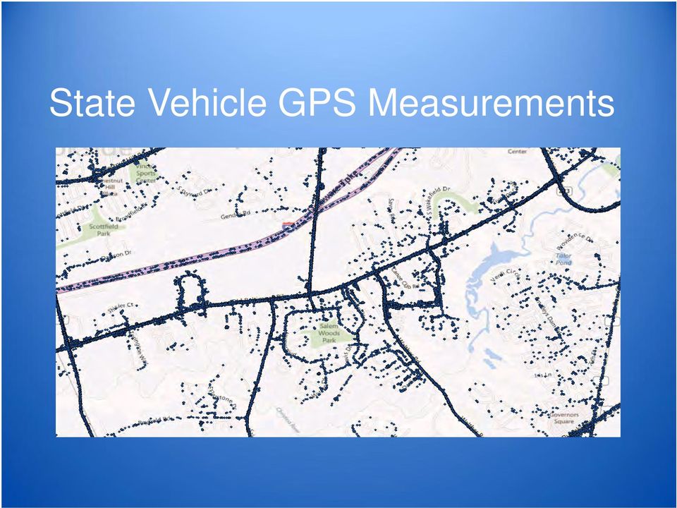
5

6 State Vehicle GPS Measurements Sample Trip

7 Northern New Castle County Weekday Observations 2012 to 2013

8 Sussex County Weekday Observations

9 Hourly 8am Observations

10 Processing Capture historical GPS data by querying Networkfleet web services for Delaware vehicles. Process GPS XML response data Create GPS point databases and GIS files Extract and associate GPS points with particular trips taken through time Build a trip and link based version of the GPS data - Estimate the path taken between GPS readings - Associate speed measures with a particular road link, direction, and tuning movement Screen the data for errors and anomalies.

11 The primary issues associated with traffic data and managing it and processing it in GIS are: Travel flow. Most of the data is directional Standard and effective ways of referencing traffic data to models of the transportation network Integrating data of different spatial types, point, line, and polygon. Examples: speed probe data, capacity data, device counters, travel demand Integration of data from different time dimensions. Dealing with large volumes of data. Aggregation and disaggregation. Integrating across various portions of the transportation network.

12 Desired Features For Referencing Traffic Data is related to an established standard can reference the smallest portions of road as well as the largest is not dependent on a particular cartographic source can relate data from various sources and measurement schemes can be generalized to relate information about small and large road segments can capture the direction of traffic flow. Traffic data for a particular portion of road is directional Provide a fixed identifier for use by those who cannot work with advanced DBMS or linear referencing systems (route and mile point)

13 Identification illustration To relate a measure to a particular turning movement a S, L, R, or U is appended to the LRSID, for example. Left turn from Sudlers Row LRSID = L

14 Sample Output Weekday Hourly S Straight or Thru Shown Also available are Right & Left Segments statewide included

15 Example Detail Captured for Road Links Routing network is segmented at every major or minor intersection

16 Comparison of Segment Length, VehGPS vs NPMRDS State Vehicle GPS Data NPMRDS Data

17 Comparison of Coverage, State GPS vs NPMRDS For State GPS Weekday , NPMRDS in Black

18 Comparison of Coverage, State GPS vs NPMRDS For State GPS Weekday , NPMRDS in Black

19 Summary of Features of the State Vehicle GPS Data available for up to 6 past years Wide coverage, data for small and large roads Captures speeds and travel times relative to turning movement Measures available at great detail, road link breaks at all intersections, large and small Delay at intersections by turning movement, incorporated into road link speed / travel times. Ideal for generation of time sensitive routing network impedance. Cost of collection covered in existing program

20 Aggregations Over 100 million measurements each year available for very detailed road segments throughout the State creates a large data set that requires aggregations to examine conditions with respect to various factors of interest. These factors include: Time of day intervals, i.e. 30 minute, 60 minute intervals Periods of the day, AM Peak, Midday, PM Peak, Evening Day of week Season, i.e Summer or Non-Summer Holiday, non-holiday Year

21 Aggregation By Road Segment
22 Calculation of Free Flow Speed as the 75 percentile Of Hourly Averages (just major roads shown)
23 Calculation of Percent Degradation at 8am, weekdays Percent degradation = 100 * (freeflow75 speed) / freeflow75 Calculated from weekday hourly averages
24 Calculation of Percent Degradation at 8am, weekdays Percent degradation = 100 * (freeflow75 speed) / freeflow75 Calculated from weekday hourly averages
25 Travel Time Reliability
26 Intersection Study Left turns that are most effected ( > 40% degradation) by morning (8am) congestions
27 Other potential applications Establishment of a statewide routing network populated with DOW, time of day, impedances Before and after studies, land use and facility changes Examining delay at intersections Estimations of capacity and studies of volume speed relationship Relating traffic flow to land use and travel demand Multimodal studies Applications of a detailed time sensitive routing network, such as accessibility studies
28 Some observations Little experience in general working with this kind of data. Capabilities with huge amounts of traffic data are often lacking. the data accurate? Can we trust it? What accuracy do we need? How does it compare to other sources? Number of measures Resolution Time of Day, Day of Week, Season Turning movement Different data sets may measure differently Value depends on intended use. Corridor performance? congestion at intersections, effects of land use?
29 Blue Tooth Locations
30 Blue Tooth Travel Times by Hour of the Day Station 3 to Station 4, Sussex County
31 Blue Tooth Compared to Fleet GPS Estimates
32 Other CADSR Work Travel surveys Development of internet mapping and data query Population, employment, and housing projections and allocations Accessibility studies Markets for transit Environmental and land use studies Place and address files Network modeling and routing
How To Use Vehicle Gps Data To Understand Travel Time And Speed In Delaware
 USE OF STATE FLEET VEHICLE GPS DATA FOR TRAVEL TIME ANALYSIS David P. Racca Center for Applied Demography and Survey Research (CADSR) University of Delaware Graham Hall, Rm 284, Newark, Delaware 19716
Study and Calculation of Travel Time Reliability Measures
 Center for Applied Demography & Survey Research University of Delaware Study and Calculation of Travel Time Reliability Measures by David P. Racca Daniel T. Brown Prepared for the Delaware Department of
Congestion (average speed during the weekday morning peak) on Local A Roads Methodology
 on Local A Roads Methodology") Congestion (average speed during the weekday morning peak) on Local A Roads Methodology IMPORTANT NOTE This methodology document refers to the previous Congestion on local A road statistics, published
Congestion (average speed during the weekday morning peak) on Local A Roads Methodology IMPORTANT NOTE This methodology document refers to the previous Congestion on local A road statistics, published
Presented by: Dr. Senanu Ashiabor, Intermodal Logistics Consulting Inc. at 2015 North Carolina MPO Conference April 30, 2015
 Presented by: Dr. Senanu Ashiabor, Intermodal Logistics Consulting Inc. at 2015 North Carolina MPO Conference April 30, 2015 What is Big Data? Big data is a broad term for large datasets that are so large
Nearly 38,000 vehicles cross the Shinnecock Canal on Sunrise Highway (NYS Route 27) daily, during peak summer months.
 daily, during peak summer months.") 2. Traffic Characteristics Traffic volumes have increased in concert with population growth in the Towns of Southampton and East Hampton. The New York State Department of Transportation (NYSDOT) maintains
2. Traffic Characteristics Traffic volumes have increased in concert with population growth in the Towns of Southampton and East Hampton. The New York State Department of Transportation (NYSDOT) maintains
VERMONT TRAFFIC MONITORING STANDARDS
 VERMONT TRAFFIC MONITORING STANDARDS FOR CONTRACTUAL AGREEMENTS Vermont Agency of Transportation Traffic Research January 2001 Introduction This document presents the traffic monitoring standards in effect
Office of Fleet and Asset Management (OFAM) www.dgs.ca.gov/ofam (Reserve a State Vehicle) Online Vehicle Reservation Instructions
 www.dgs.ca.gov/ofam (Reserve a State Vehicle) Online Vehicle Reservation Instructions") Office of Fleet and Asset Management (OFAM) www.dgs.ca.gov/ofam (Reserve a State Vehicle) Online Vehicle Reservation Instructions Revised March 2, 2012 1 You must be an active California State Employee
Office of Fleet and Asset Management (OFAM) www.dgs.ca.gov/ofam (Reserve a State Vehicle) Online Vehicle Reservation Instructions Revised March 2, 2012 1 You must be an active California State Employee
Traffic Volume Counts
 Traffic Volume Counts Prepare 1. Communicate with other staff/departments 2. Review historical data trends 3. Review citizen input 4. Request traffic control Select Location 1. Select the proper location
Anchorage Travel Model Calibration and Validation
 Final Draft Anchorage Travel Model Calibration and Validation Prepared for Anchorage Metropolitan Transportation Solutions (AMATS) February 2005 301 West Northern Lights Boulevard Suite 601 Anchorage,
Integrating the I-95 Vehicle Probe Project Data and Analysis Tools into the FAMPO Planning Program
 Integrating the I-95 Vehicle Probe Project Data and Analysis Tools into the FAMPO Planning Program I-95 Corridor Coalition Background The I-95 Corridor Coalition is an alliance of transportation agencies,
Performance Measures for RIDOT s Traffic Management Center
 Performance Measures for RIDOT s Traffic Management Center Catherine Burns, EIT Transportation Engineer Sudhir Murthy, PE, PTOE President 5/2011 Presentation Outline RIDOT Performance Measures Public Outreach
BIG DATA FOR MODELLING 2.0
 BIG DATA FOR MODELLING 2.0 ENHANCING MODELS WITH MASSIVE REAL MOBILITY DATA DATA INTEGRATION www.ptvgroup.com Lorenzo Meschini - CEO, PTV SISTeMA COST TU1004 final Conference www.ptvgroup.com Paris, 11
GPS TRUCK DATA PERFORMANCE MEASURES PROGRAM IN WASHINGTON STATE
 Draft Research Report Agreement T4118, Task 31 Truck Performance Measure Research Project GPS TRUCK DATA PERFORMANCE MEASURES PROGRAM IN WASHINGTON STATE by Edward McCormack and Wenjuan Zhao University
BICYCLE TRENDS IN CAMBRIDGE
 BICYCLE TRENDS IN CAMBRIDGE Cambridge promotes bicycling as a healthy, environmentally friendly way of getting around as an important part of the City's efforts to improve mobility and protect our environment.
Performance and Limitations of Cellular-Based Traffic Monitoring Systems. Cellint Traffic Solutions
 www.cellint.com Performance and Limitations of Cellular-Based Traffic Monitoring Systems Cellint Traffic Solutions 1 Leading provider of cellular-based traffic data collection solutions 2 Introduction
USING ARCHIVED DATA TO GENERATE TRANSIT PERFORMANCE MEASURES
 USING ARCHIVED DATA TO GENERATE TRANSIT PERFORMANCE MEASURES Robert L. Bertini, Assistant Professor Department of Civil & Environmental Engineering Portland State University P.O. Box 751 Portland, OR 97207-0751
Congestion Pricing Experiences in Singapore. Dr Kian-Keong Chin Chief Engineer, Transportation Land Transport Authority Singapore
 Congestion Pricing Experiences in Singapore Dr Kian-Keong Chin Chief Engineer, Transportation Land Transport Authority Singapore Congestion Pricing just one component of a Transport Strategy Cannot work
Ohio Standard Small/Medium MPO Travel Demand Forecasting Model. Theoretical Training May 10-11, 2006 Abridged to Freight Focus Sept 2010
 Ohio Standard Small/Medium MPO Travel Demand Forecasting Model Theoretical Training May 10-11, 2006 Abridged to Freight Focus Sept 2010 Model Overview Key Features Modeling of highway and non highway modes
FINAL REPORT DEVELOPMENT OF CONGESTION PERFORMANCE MEASURES USING ITS INFORMATION. Sarah B. Medley Graduate Research Assistant
 FINAL REPORT DEVELOPMENT OF CONGESTION PERFORMANCE MEASURES USING ITS INFORMATION Sarah B. Medley Graduate Research Assistant Michael J. Demetsky, Ph.D., P.E. Faculty Research Scientist and Professor of
STATISTICS OF FATAL AND INJURY ROAD ACCIDENTS IN LITHUANIA,
 Vilnius 215 STATISTICS OF FATAL AND INJURY ROAD ACCIDENTS IN LITHUANIA, 211 214 TABLE OF CONTENTS INTRODUCTION... 9 GENERAL INFORMATION... 1 1. VEHICLE FLEET... 11 1.1. Number of vehicles, 1995 214...
Better Bus Area Monitoring and Evaluation Framework
 Do Better Bus Area Monitoring and Evaluation Framework March 2014 The Department for Transport has actively considered the needs of blind and partially sighted people in accessing this document. The text
Comparing data from mobile and static traffic sensors for travel time assessment
 Comparing data from mobile and static traffic sensors for travel time assessment Nicolas Saunier and Catherine Morency Department of civil, geological and mining engineering, École Polytechnique de Montréal,
Practical Approach to Deriving Peak-Hour Estimates from 24-Hour Travel Demand Models
 Practical Approach to Deriving Peak-Hour Estimates from 24-Hour Travel Demand Models CHARLES C. CREVO AND UDAY VIRKUD 1 The Clean Air Act Amendments of 1990 have created a need for accurate and reliable
VEHICLE TRACKING SYSTEM
 Real-Time Vehicle tracking solution Vehicle tracking solution enables to monitor the entire fleet in transit spread across India, which can be monitored from a central location. These locations are subject
Los Angeles Metro Rapid
 Los Angeles Metro Rapid Why BRT In Los Angeles Public dissatisfied with slow bus service Average bus speeds had declined by 10% since late- 1980s LADOT found that 50% of the time a bus is in service it
Transportation Education Series: Travel Demand Modeling. David Reinke November 2012
 Transportation Education Series: Travel Demand Modeling David Reinke November 2012 Presentation overview What are travel demand models? Why use them? How do they work? What goes into building them? What
Chapter 3 - GPS Data Collection Description and Validation
 Chapter 3 - GPS Data Collection Description and Validation The first step toward the analysis of accuracy and reliability of AVI system was to identify a suitable benchmark for measuring AVI system performance.
Use of a Web-Based GIS for Real-Time Traffic Information Fusion and Presentation over the Internet
 Use of a Web-Based GIS for Real-Time Traffic Information Fusion and Presentation over the Internet SUMMARY Dimitris Kotzinos 1, Poulicos Prastacos 2 1 Department of Computer Science, University of Crete
Overview of the Travel Demand Forecasting Methodology
 Overview of the Travel Demand Forecasting Methodology Prepared by the Central Transportation Planning Staff (CTPS) Authors: Scott A. Peterson, Manager Ian Harrington, Chief Planner March 29, 2008 1 OVERVIEW
Integrated Data System Structure for Active Traffic Management - Planning and Operation
 Integrated Data System Structure for Active Traffic Management - Planning and Operation NATMEC 2010 Dr. Xiao-Yun Lu, Research Engineer California PATH, U. C. Berkeley J. Palen, Caltrans DRI 1 Outlines
Evaluation Criteria and Mode Progression for RouteAhead Rapid Transit Projects
 Evaluation Criteria and Mode Progression for RouteAhead Rapid Transit Projects C2012-0684 ATTACHMENT 2 The RouteAhead draft 30-year rapid transit plan was developed in coordination with the Investing in
TRAVEL TIME DATA COLLECTION AND SPATIAL INFORMATION TECHNOLOGIES FOR RELIABLE TRANSPORTATION SYSTEMS PLANNING
 TRAVEL TIME DATA COLLECTION AND SPATIAL INFORMATION TECHNOLOGIES FOR RELIABLE TRANSPORTATION SYSTEMS PLANNING Srinivas S. Pulugurtha, Ph.D., P.E. Venkata R. Duddu, Ph.D., E.I. The University of North Carolina
MEMORANDUM. Stanley E. Young University of Maryland, Center for Advanced Transportation Technology [email protected] 301-792-8180
 MEMORANDUM To: From: Vehicle Probe Project Arterial Data Quality Committee Stanley E. Young University of Maryland, Center for Advanced Transportation Technology [email protected] 301-792-8180 Date: Subject:
May 2012 Oracle Spatial User Conference
 1 May 2012 Oracle Spatial User Conference May 23, 2012 Ronald Reagan Building and International Trade Center Washington, DC USA Amit Ghosh Lead Architect, Nokia How Nokia Uses Oracle Spatial to Create
GTFS: GENERAL TRANSIT FEED SPECIFICATION
 GTFS: GENERAL TRANSIT FEED SPECIFICATION What is GTFS? A standard in representing schedule and route information Public Transportation Schedules GIS Data Route, trip, and stop information in one zipfile
CAPACITY AND LEVEL-OF-SERVICE CONCEPTS
 CHAPTER 2 CAPACITY AND LEVEL-OF-SERVICE CONCEPTS CONTENTS I. INTRODUCTION...2-1 II. CAPACITY...2-2 III. DEMAND...2-2 IV. QUALITY AND LEVELS OF SERVICE...2-2 Service Flow Rates...2-3 Performance Measures...2-3
Mount Royal College Transit Service Plan
 Mount Royal College Transit Service Plan Background In 2007 November response to Council Report C2007-78 West LRT Alignment, Budget and Project Delivery, Council directed the Administration to report back
TRUCK ROUTE ENFORCEMENT AND REGULATIONS
 TRUCK ROUTE ENFORCEMENT AND REGULATIONS LEGAL BASIS per the CALIFORNIA VEHICLE CODE Section 21101 allows the restriction of certain vehicles, by stating that, "Local authorities...may adopt rules and regulations
The TomTom Manifesto Reducing Congestion for All Big traffic data for smart mobility, traffic planning and traffic management
 The TomTom Manifesto Reducing Congestion for All Big traffic data for smart mobility, traffic planning and traffic management Ralf-Peter Schäfer Fellow & VP Traffic and Travel Information Product Unit
TERMINAL 91 TRAFFIC MONITORING STUDY
 REVISED DRAFT TERMINAL 9 TRAFFIC MONITORING STUDY Prepared for: Port of Seattle Prepared by: 6544 NE 6st Street, Seattle, WA 985 ph: (26) 523-3939 fx: (26) 523-4949 NOVEMBER 22, 2 TABLE OF CONTENTS. INTRODUCTION...
Independence Day 2016 Holiday Period Traffic Fatality Estimate
 Independence Day 2016 Holiday Period Traffic Fatality Estimate The 2016 Independence Day holiday period begins at 6:00 p.m., Friday, July 1, and ends at 11:59 p.m., Monday, July 4. Our estimate of traffic
Cloud ITS: Reducing Congestion & Saving Lives
 Cloud ITS: Reducing Congestion & Saving Lives In 2008, for the first time in human history, the proportion of the worlds population based in urban areas was greater than 50 percent. *IBM Report: Transportation
URBAN PUBLIC TRANSPORT PLANNING IN TEHRAN AND THE OUTCOME OF THE IMPLEMENTED BRT LINES
 United Nations Forum on Climate Change Mitigation, Fuel Efficiency and Sustainable Urban Transport URBAN PUBLIC TRANSPORT PLANNING IN TEHRAN AND THE OUTCOME OF THE IMPLEMENTED BRT LINES S. MEHDI TASHAKKORI
1 FIXED ROUTE OVERVIEW
 1 FIXED ROUTE OVERVIEW Thirty transit agencies in Ohio operate fixed route or deviated fixed route service, representing a little less than half of the 62 transit agencies in Ohio. While many transit agencies
How To Manage Big Data For The Ohio Department Of Transportation
 Big Data & Asset Management Ohio Planning Conference 2014 John R. Kasich, Governor Jerry Wray, Director Ohio Department of Transportation Big Data: Asset Management Andrew Williams, Administrator Office
Transportation Management Plan Template
 DATE: TO: FROM: SUBJECT: Date Name Position Transportation Service Center Name Position Transportation Service Center Transportation Management Plan Job Number(s) Control Section(s) Route Details County
Simulating Traffic for Incident Management and ITS Investment Decisions
 1998 TRANSPORTATION CONFERENCE PROCEEDINGS 7 Simulating Traffic for Incident Management and ITS Investment Decisions MICHAEL D. ANDERSON AND REGINALD R. SOULEYRETTE UTPS-type models were designed to adequately
Integrating GIS-Based Videolog and Asset Data With Commonly Used Systems Provides Major Benefits With Minimal Effort
 Integrating GIS-Based Videolog and Asset Data With Commonly Used Systems Provides Major Benefits With Minimal Effort Presented By: Debbie Burns, GIS Manager Michael Nieminen, Project Manager Introduction
Central London ongestion charging
 Transport for London Central London ongestion charging Impacts monitoring Fourth Annual Report, June 2006 Overview MAYOR OF LONDON Transport for London 2006 All rights reserved. Reproduction permitted
Technical Memorandum PERFORMANCE MEASURES. Prepared by:
 Technical Memorandum PERFORMANCE MEASURES Prepared by: March 2014 TABLE OF CONTENTS Executive Summary... 1 1. Introduction... 2 1.1 Performance Measures and the Public Sector... 2 1.2 National Focus: MAP
4. Technology Assessment
 4. Technology Assessment KAT Transit Development Plan A technology study for KAT was prepared in 2005. That work provides the basis for this chapter as much of the information is germane and tied to the
Illinois Tollway: Development of Incident Management Based Performance Measures. Jeff Hochmuth, PE, PTOE Wilbur Smith Associates
 Illinois Tollway: Development of Incident Management Based Performance Measures Jeff Hochmuth, PE, PTOE Wilbur Smith Associates Tollways and Data Toll authorities have always been data heavy Need to verify
Comparing Arterial Speeds from Big-Data Sources in Southeast Florida (Bluetooth, HERE and INRIX)
") Comparing Arterial Speeds from Big-Data Sources in Southeast Florida (Bluetooth, HERE and INRIX) Sujith Rapolu Ashutosh Kumar TRB National Transportation Planning Applications Conference (Atlantic City,
Comparing Arterial Speeds from Big-Data Sources in Southeast Florida (Bluetooth, HERE and INRIX) Sujith Rapolu Ashutosh Kumar TRB National Transportation Planning Applications Conference (Atlantic City,
Nashville Freight Model. Max Baker, Nashville MPO Rob Bostrom, WSA July 17, 2008 Tennessee MUG
 Nashville Freight Model Max Baker, Nashville MPO Rob Bostrom, WSA July 17, 2008 Tennessee MUG Overview of Presentation Nashville Area Study Background Truck Model Nashville Area Nashville Area MPO 7 County
Orange County Transportation Impact Fee Update FINAL REPORT
 Transportation Impact Fee Update FINAL REPORT Prepared for: Transportation Planning Department 4200 S. John Young Parkway, Second Floor Orlando, FL 32839 ph (407) 836-8070 September 5, 2012 (amended November
Measuring real-time traffic data quality based on Floating Car Data
 Measuring real-time traffic data quality based on Floating Car Data Jeroen Brouwer TomTom De Ruyterkade 154, 1011 AC Amsterdam, The Netherlands +31 20 75 75441, [email protected] Abstract Congestion
Big Data Collection and Utilization for Operational Support of Smarter Social Infrastructure
 Hitachi Review Vol. 63 (2014), No. 1 18 Big Data Collection and Utilization for Operational Support of Smarter Social Infrastructure Kazuaki Iwamura Hideki Tonooka Yoshihiro Mizuno Yuichi Mashita OVERVIEW:
Wilmington to Newark Commuter Rail Improvement Project
 Wilmington to Newark Commuter Rail Improvement Project The Delaware Transit Corporation (DTC), a subsidiary of the Delaware Department of Transportation (DelDOT), is undertaking a rail capacity expansion
Cost and Benefits of Advanced Public Transportation Systems at Dart First State
 DCT 178 Cost and Benefits of Advanced Public Transportation Systems at Dart First State by DAVID P. RACCA Center for Applied Demography and Survey Research College of Human Services, Education and Public
Cycle Network Modelling A new evidence-based approach to the creation of cycling strategy
 Cycle Network Modelling A new evidence-based approach to the creation of cycling strategy A The Business Cycle, London, mapping of commuter cycle routes and hotspots, 2000. A It is refreshing to see an
As part of the grant effort, research will be conducted in two phases:
 Research Methodology Phase I Site Selection and Field Data Collection BACKGROUND King County Metro has been awarded a grant in the Federal Highway Administration (FHWA) Value Pricing Program. The project
Ne w J e r s e y Tr a f f i c Co n g e s t i o n :
 Ne w J e r s e y Tr a f f i c Co n g e s t i o n : A Growing Crisis January 2008 Cover photo : Route 3, Passaic County introduction A rising tide of traffic congestion threatens to increase roadway gridlock,
CELL PHONE TRACKING. Index. Purpose. Description. Relevance for Large Scale Events. Options. Technologies. Impacts. Integration potential
 CELL PHONE TRACKING Index Purpose Description Relevance for Large Scale Events Options Technologies Impacts Integration potential Implementation Best Cases and Examples 1 of 10 Purpose Cell phone tracking
Estimating Light-Rail Ridership from APC Data
 Estimating Light-Rail Ridership from APC Data Zach Van Gemert, Service Development Applications Expert, Denver RTD Richard Lehman, Senior Applications Developer, RSM Services Corporation The Denver RTD
9988 REDWOOD AVENUE PROJECT TRAFFIC IMPACT ANALYSIS. April 24, 2015
 9988 REDWOOD AVENUE PROJECT TRAFFIC IMPACT ANALYSIS April 24, 2015 Kunzman Associates, Inc. 9988 REDWOOD AVENUE PROJECT TRAFFIC IMPACT ANALYSIS April 24, 2015 Prepared by: Bryan Crawford Carl Ballard,
Insurance Telematics:
 Insurance Telematics: Big Data, Big Potential, Big Headache Dave Huber, President Kairos Solutions IFSUG March 2012 Big Data 2 ne of the few products whose price is set before costs are known Known costs
A TRAFFIC INFORMATION SYSTEM BY MEANS OF REAL-TIME FLOATING-CAR DATA. Ralf-Peter Schäfer, Kai-Uwe Thiessenhusen, Peter Wagner
 A TRAFFIC INFORMATION SYSTEM BY MEANS OF REAL-TIME FLOATING-CAR DATA Ralf-Peter Schäfer, Kai-Uwe Thiessenhusen, Peter Wagner German Aerospace Center (DLR), Institute of Transport Research Rutherfordstr.
Public Sector Solutions
 Public Sector Solutions The New Jersey DOT Command Center uses INRIX real-time data and analytics to monitor congestion and deploy resources proactively to manage traffic flow and inform travelers. INRIX
FREDericksburg Regional Transit (FRED) REAL-TIME SCHEDULING SOFTWARE, BUS STOP ANNUNCIATOR AND TRANSIT WEBSITE PROCUREMENT
 REAL-TIME SCHEDULING SOFTWARE, BUS STOP ANNUNCIATOR AND TRANSIT WEBSITE PROCUREMENT") FREDericksburg Regional Transit (FRED) REAL-TIME SCHEDULING SOFTWARE, BUS STOP ANNUNCIATOR AND TRANSIT WEBSITE PROCUREMENT Technical Memorandum and Concept of Operations Prepared for: Prepared by: March
FREDericksburg Regional Transit (FRED) REAL-TIME SCHEDULING SOFTWARE, BUS STOP ANNUNCIATOR AND TRANSIT WEBSITE PROCUREMENT Technical Memorandum and Concept of Operations Prepared for: Prepared by: March
Virginia's Transportation Performance Management System
 Virginia's Transportation Performance Management System Office of Intermodal Planning and Investment Commonwealth Transportation Board Presented by: David Tyeryar, Deputy Secretary of Transportation September
Private Sector Data for Performance Management Final Report
 Private Sector Data for Performance Management Final Report July 2011 QUALITY ASSURANCE STATEMENT The U.S. Department of Transportation provides high-quality information to serve Government, industry,
Proposed Service Design Guidelines
 Proposed Service Design Guidelines July 2015 I. Introduction During Phase II of the Reimagining CityBus project, feedback from public outreach and data analysis conducted during Phase I of the project
A Low Cost Vehicle Monitoring System for Fixed Routes Using Global Positioning System (GPS)
") A Low Cost Vehicle Monitoring System for Fixed Routes Using Global Positioning System (GPS) Mark Darren Savuriar, Chandrasekharan Nataraj, Chitturi Venkatratnam, Sardar Ali School of Engineering Asia Pacific
A Low Cost Vehicle Monitoring System for Fixed Routes Using Global Positioning System (GPS) Mark Darren Savuriar, Chandrasekharan Nataraj, Chitturi Venkatratnam, Sardar Ali School of Engineering Asia Pacific
Where Do We Want to Go? How Can We Get There?
 Where Do We Want to Go? How Can We Get There? The BRTB has adopted nine goals, with supporting strategies, performance measures, and performance targets. Together, these goals, strategies, measures, and
This document is part of a series of Building a Stronger South Australia policy initiatives from the Government of South Australia.
 3. Public Transport This document is part of a series of Building a Stronger South Australia policy initiatives from the Government of South Australia. 1. Future Fund 2. Jobs and Skills 3. Public Transport
Customer Satisfaction Index 2014
 Customer Satisfaction Index 01 Contents Executive summary Customer satisfaction methodology Initiatives to improve customer satisfaction November 01 results Overall train network Overall bus regions Overall
Public Transport Planning and Regulation: An Introduction
 VII. Service Monitoring Public Transport Planning and Regulation: An Introduction VII-1 Planning and Analysis Building Blocks Schedule Building Cost Analysis and Financial Planning Measures & Standards
Roads Task Force - Technical Note 10 What is the capacity of the road network for private motorised traffic and how has this changed over time?
 Roads Task Force - Technical Note 10 What is the capacity of the road network for private motorised traffic and how has this changed over time? Introduction This paper forms one of a series of thematic
Managing the Transit Network A Primer on Key Concepts
 Managing the Transit Network A Primer on Key Concepts translink.ca Introduction As the integrated, multi-modal transportation authority for Metro Vancouver, TransLink plans and delivers the transit network
Mayors Welcome Strong Surrey Votes Yes Coalition Support. Yes Vote Would Vastly Improve Transit and Transportation in Fast Growing City
 Mayors Welcome Strong Surrey Votes Yes Coalition Support Yes Vote Would Vastly Improve Transit and Transportation in Fast Growing City February 11, 2015 Vancouver, BC The Mayors Council on Regional Transportation