Leveraging Cloud-Based Mapping Solutions
|
|
|
- Austin Edwards
- 8 years ago
- Views:
Transcription

1 Leveraging Cloud-Based Mapping Solutions GeoAlberta October 28, 2014 Laura Kerssens Safe Software
2 Agenda To the Cloud Using Basic Services Cloud Applications Web Services Cloud-Hosted Databases Real-time
3 So Much is Moving to the Cloud
4 It s a Big World Cloud computing How to define it?
5 Advantages Lower cost Scalable Reliable Accessible


6 Making the Most of the Cloud Infrastructure as a Service

7 Making the Most of the Cloud Platform as a Service Infrastructure as a Service
8 Making the Most of the Cloud Software as a Service Platform as a Service Infrastructure as a Service

9 Making the Most of the Cloud Software as a Service Platform as a Service Infrastructure as a Service
10 Data in the Cloud Cloud Data Services Geocoding Mapping services Routing Online Data Portals Socrata Google Maps Engine ArcGIS Online Cloud Data Storage Amazon RDS SQLAzure Google Fusion Tables
11 Online Data Portals Socrata Google Maps Engine ArcGIS Online And more
12 Socrata Open data platform Data upload and updating Share publically or create privately View tables and maps directly in the browser
13 Open Data Portal
14 City of Edmonton s Data Portal
15 Socrata: The Basics Publish Update View Query Visualize Demo
16 City of San Francisco 311 Data
17 Demo Directly import data into Socrata Create new datasets Update existing
18 Questions?

 Make data findable within the")
19 What is Google Maps Engine? Upload data to the cloud to create custom web maps Share spatial data (publically or internally) Make data findable within the Google universe #GMEandFME
20 Google Drive for maps. Google Maps Engine is Google Drive for maps Allows for document sharing #GMEandFME

21 Historical and educational maps from around the world WHAT IS GOOGLE MAPS GALLERY
22 Map Gallery: San Jose

23 The Basics

24 Demo GME Vector Writing

25 Demo GME Raster Writing
26 San Jose Workflow Update Google Maps Engine tables

27 Demo Updating
28 City of Edmonton: Part Two Socrata to Google Maps Engine synchronization
29 Workflow
30 Workflow
31 Automating the updates
32 Questions?
33 What is ArcGIS Online? Cloud based platform for creating and sharing data Upload and publish data layers Create and style web maps Incorporate Spatial Analysis tools into maps and custom applications
34 ArcGIS Online Gallery
35 Map Portals Iowa Department of Transportation
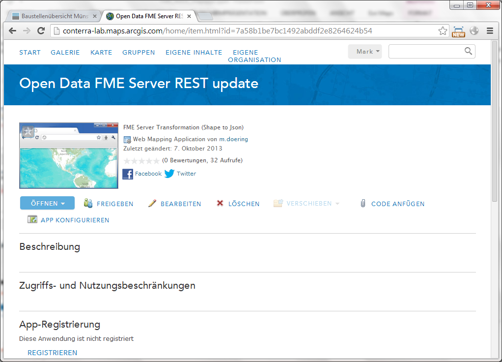
36 ArcGIS Online: The Basics
37 Demo AGOL Feature Service Writing
38 Demo AGOL Feature Service Reading
39 Live Data Tracking
40 Demo AGOL Updating
41 Creating Apps


42 ArcGIS Online App for Airports
43 Architecture
44 Open Data Bridge Combining Technologies ArcGIS Online FME Server CKAN

45 Workflow. ArcMap AGOL FME Desktop FME Server map.apps service definition REST Service Shape to Json Scheduled Job customized App data processing ETL data update (scheduled job) User friendly data access Cartography Cloud data storage

46 Data Source Open Data Portal.


47 Step 1: ArcMap Initial ArcGIS Online Service Definition

48 Step 2: ArcMap Creating an ArcGIS Online REST service

49 Step 3: FME Desktop Update Process (Shape to JSON)

50 Step 4: Automated Data update based on FME Server

51 Goal: Get Easy Access to Open Data (map.apps)
52

53 ArcGIS Online App
54 CKAN City of Surrey
55 Others St Louis County Writing to Socrata and GitHub IDE Rioja Oracle to GitHub
56 Why GitHub GitHub is a web-based Version Control System (VCS) which records changes to a file or set of files over time. Allows: commit files to a public repository revert files back to a previous state review changes made over time see who last modified something, and more...
57 Sharing Public Data
58 Workflow

59 The Beauty of GeoJSON in GitHub GitHub supports automatic rendering of GeoJSON repositories using Leaflet.js Looking ahead geojson.io a Chrome extension for editing IDE Rioja plans open collaboration on spatial data with GitHub FME can include links to image data when writing GeoJSON (automatic download service)
60 Things to know Some APIs services have limits Maximum time to be connected Maximum features to load
61 Cloud Services for Spatial Data REST JSON Standards for communication
62 Online Mapping Services What does this mean? Google maps Bing maps Arcgis maps
63 Online Mapping Services In web applications Desktop applications
64 Demo Data Validation


65 Background Maps.
66 OGC Web Services WMS, WFS, etc OGC standards
67 Other Web Services Directions via mapping services Geocoding services Geoprocessing services
68 ArcGIS Online Web Services Accessed via REST Results as JSON is/rest/services/world/servi ceareas/naserver/servicearea _World/solveServiceArea?toke n=<yourtoken>&facilities= ,37.757&outSR=102100& f=json { "sapolygons": { "spatialreference": { <spatialreference> }, "features": [ { "attributes": { "<field1>": <value11>, "<field2>": <value12> }, "geometry": { <polygon1> } }, { "attributes": { "<field1>": <value21>, "<field2>": <value22>
69 ArcGIS Online Web Services Geocoding GeoEnrichment Directions and Routing
70 AGOL Services (Geocoding, Routing, and Drive Time)
71 AGOL Services (GeoEnrichment)
72 Geocoding Tools ArcGIS Online Google Microsoft Geocode Dataflow API BatchGeo And more
73 Demo Work with spatial data using cloud-based GIS services

74 Using REST to easily combine technologies. map.apps ArcGIS Plattform REST FME Plattform


75 Web app integration map.apps FME ArcGIS Online
76 Workspace.

77 ArcGIS Online REST request.
78 Calculate bush fire risk before construction Barrett Higman, GIS Officer of Alpine Shire Council
79 Cloud-Hosted Databases storage and software included easy to share data many have extra tools to get more from your data offload work to external servers built to handle it

80 Amazon Web Services Amazon RDS Dynamo DB Redshift
81 RDS Relational Database Service Scalable database in the cloud PostGres/PostGIS Oracle MySQL SQLServer
82 Demo Read and write to database the same as you would with a local database
83 NoSQL SSD-based database service No limit on size of Database Specify the needed performance Autoscale through Dynamic DynamoDB

84 MarkLogic NoSQL database XML optimized Powerful search and analysis Native Spatial Support XML based data model (GML, XML, etc.)
85 Example Use REST to upload XML to MarkLogic HTTP PUT e696-43c9-b7a9-fa510e xml XML <xml> <docid>{fme:get-attribute("_uuid")}</docid> <docauthor>{fme:get-attribute("user")}</docauthor> <modtype>{fme:get-attribute("updatetype")}</modtype> <UpdateDate>{fme:get-attribute("_timestamp")}</UpdateDate> <filepath>{fme:get-attribute("filepath")}</filepath> <comment>{fme:get-attribute("comment")}</comment> <doc_xml>{fme:get-xml-attribute("_file_contents")}</doc_xml> </xml>
86 Google Fusion Tables Support for large tables Create charts, maps, and graphs Save and share through Google Drive
87 Others SQLAzure: Microsoft Azure hosted SQL Server database Google Cloud SQL: MySQL database in the Google Cloud platform
88 Bringing Cloud Technologies Together Create complete solutions using a combination of tools
89 Internet of things Sensor data Asset tracking Databases that can handle the data
90 Real-Time Building an event driven architecture
91 Live Data Weather Network lightning alerts
92
93 ipaas Cloud integration platforms Zapier IFTTT FME Cloud

94 Zapier
95 Database Triggers When database is modified, send REST request to a Cloud service
96 All of the Above Iowa DoT


97 Automatic Vehicle Location Invisible to driver Real-time flow of data position, status, material usage, conditions Data uploading to Amazon cloud FME moves data to Oracle Spatial for internal usage, then to AGOL for public viewing

98 Dashcams Dash-mounted iphones send image stream when vehicle is in motion FME handles KML generation and upload to Windows Azure
99 AGOL Public Data Access ArcGIS Online keeps public informed with current plow status and conditions
100 Dashcam Feeds Public can also see what the driver is seeing for better awareness of road and weather conditions making winter driving safer.
101 Wrap Up Advantages of the Cloud Web based data portals Cloud services Cloud-hosted databases Integrating systems
102 Thank You Laura Kerssens Product Support Specialist Safe Software
Portal for ArcGIS. Satish Sankaran Robert Kircher
 Portal for ArcGIS Satish Sankaran Robert Kircher ArcGIS A Complete GIS Data Management Planning & Analysis Field Mobility Operational Awareness Constituent Engagement End to End Integration Collect, Organize,
How To Use Gis
 Welcome Understanding Purpose Creating Relationships You A Global Community of GIS Professionals Changing the World Together Applying Geography Everywhere Your WORK Showcasing Your Web Apps Vision Applying
ArcGIS. Server. A Complete and Integrated Server GIS
 ArcGIS Server A Complete and Integrated Server GIS ArcGIS Server A Complete and Integrated Server GIS ArcGIS Server enables you to distribute maps, models, and tools to others within your organization
County of Los Angeles. Chief Information Office Preferred Technologies for Geographic Information Systems (GIS) September 2014
 September 2014") County of Los Angeles Chief Information Office Preferred Technologies for Geographic Information Systems (GIS) September 2014 CIO Preferred Technologies for GIS This document lists the preferred Geographic
County of Los Angeles Chief Information Office Preferred Technologies for Geographic Information Systems (GIS) September 2014 CIO Preferred Technologies for GIS This document lists the preferred Geographic
Petroleum Web Applications to Support your Business. David Jacob & Vanessa Ramirez Esri Natural Resources Team
 Petroleum Web Applications to Support your Business David Jacob & Vanessa Ramirez Esri Natural Resources Team Agenda Petroleum Web Apps to Support your Business The ArcGIS Location Platform Introduction
Data Integration for ArcGIS Users Data Interoperability. Charmel Menzel, ESRI Don Murray, Safe Software
 Data Integration for ArcGIS Users Data Interoperability Charmel Menzel, ESRI Don Murray, Safe Software Product overview Extension to ArcGIS (optional) Jointly developed with Safe Software Based on Feature
Enterprise GIS Solutions to GIS Data Dissemination
 Enterprise GIS Solutions to GIS Data Dissemination ESRI International User Conference July 13 17, 2009 Wendy M. Turner Senior GIS Engineer & Program Manager Freedom Consulting Group, LLC Building the Enterprise
Visualize your World. Democratization i of Geographic Data
 Visualize your World Democratization i of Geographic Data Session Agenda Google GEO Solutions - More than just a Map Enabling our Government Customers- Examples Summary & Invite to Learn More About Google
SuperGIS Server 3.2 Standard Edition Specification
 SuperGIS Server 3.2 Standard Edition Specification 20140826 Specification 1. All of the services support SOAP (Simple Object Access Protocol). 2. Use map file created by SuperGIS Desktop as map services
Big Data, Cloud Computing, Spatial Databases Steven Hagan Vice President Server Technologies
 Big Data, Cloud Computing, Spatial Databases Steven Hagan Vice President Server Technologies Big Data: Global Digital Data Growth Growing leaps and bounds by 40+% Year over Year! 2009 =.8 Zetabytes =.08
MAY 18, 2015 ARCGIS 10.3.1 FOR SERVER FUNCTIONALITY MATRIX
 MAY 18, 2015 ARCGIS 10.3.1 FOR SERVER FUNCTIONALITY MATRIX Copyright 2015 Esri All rights reserved. Printed in the United States of America. The information contained in this document is the exclusive
Deploying ArcGIS for Server Using Esri Managed Services
 Federal GIS Conference 2014 February 10 11, 2014 Washington DC Deploying ArcGIS for Server Using Esri Managed Services Andrew Sakowicz Erin Ross Cloud Overview Deploying ArcGIS for Server What is Cloud:
ishare in the Cloud Service Definition v5.0
 Service Definition v5.0 An overview of ishare in the Cloud ishare is an end to end Enterprise GIS for public sector comprising a spatial data warehouse, rich functionality browser based GIS including editing
Introduction to Web AppBuilder for ArcGIS: JavaScript Apps Made Easy
 Introduction to Web AppBuilder for ArcGIS: JavaScript Apps Made Easy OKSCAUG Pamela Kersh September 22, 2015 The ArcGIS Platform enables Web GIS Enabling GIS Everywhere Desktop Web Device Simple Integrated
Developing Fleet and Asset Tracking Solutions with Web Maps
 Developing Fleet and Asset Tracking Solutions with Web Maps Introduction Many organizations have mobile field staff that perform business processes away from the office which include sales, service, maintenance,
Deploying ArcGIS for Server Using Managed Services
 Deploying ArcGIS for Server Using Managed Services Andrew Sakowicz Erin Ross Sridhar Karra Agenda Introduction Program Overview - Overview - Methodology - Tools Customer Deployments - Architecture and
Geodatabase Programming with SQL
 DevSummit DC February 11, 2015 Washington, DC Geodatabase Programming with SQL Craig Gillgrass Assumptions Basic knowledge of SQL and relational databases Basic knowledge of the Geodatabase We ll hold
ArcGIS Platform. An Integrated System. Portal
 Platform An Integrated System Portal An Integrated Web GIS Platform Knowledge Workers Executive Access Public Engagement Work Anywhere Enterprise Integration Providing Mapping, Analysis, Data Management,
Intro to Web App Builder. Mark Scott, Solutions Engineer, Esri County Government Team mscott@esri.com
 Intro to Web App Builder Mark Scott, Solutions Engineer, Esri County Government Team mscott@esri.com The ArcGIS Platform enables Web GIS Enabling GIS Everywhere Desktop Web Device Simple Integrated Open
Implementing ArcGIS for SharePoint Habitat for Humanity of Omaha April, 2013
 Ingenuity Innovation Integrity Implementing ArcGIS for SharePoint Habitat for Humanity of Omaha April, 2013 1851 Alexander Bell Drive Suite 350 Reston, VA 20191 703.463.2059 800.483.2434 www.vistronix.com
ArcGIS Web Mapping. Sam Berg, esri sberg@esri.com
 ArcGIS Web Mapping Sam Berg, esri sberg@esri.com Agenda ArcGIS and WebMaps The APIs ArcGIS for Flex Viewer ArcGIS for Silverlight Builder ArcGIS for Sharepoint ArcGIS Application Templates ArcGIS Runtime
ArcGIS Server Implementation HIGHS and lows
 ArcGIS Server Implementation HIGHS and lows GIS-T March 2011 Eric Abrams Iowa DOT Eric.abrams@dot.iowa.gov Agenda The Problem Timeline Future Discussion/Questions The Problem - 2006 How does Iowa DOT integrate
Building and Deploying Web Applications
 Building and Deploying Web Applications Dal Hunter and Jeff Shaner Friday, Nov 6 10:30-12:00 Agenda Product overview Web AppBuilder for ArcGIS tour What s New July 2015 ArcGIS Online update Customization
Chapter 1: Introduction to ArcGIS Server
 Chapter 1: Introduction to ArcGIS Server At a high level you can think of ArcGIS Server as software that helps you take your geographic information and make it available to others. This data can be distributed
Esri Maps for Office, SharePoint & Dynamics CRM. Tony Howser Sentha Sivabalan Scott Ball
 Esri Maps for Office, SharePoint & Dynamics CRM Tony Howser Sentha Sivabalan Scott Ball Agenda Location Analytics Esri Maps for - SharePoint - Office - Dynamics CRM Pricing Road Map Q & A Evolving the
Smart Cities require Geospatial Data Providing services to citizens, enterprises, visitors...
 Cloud-based Spatial Data Infrastructures for Smart Cities Geospatial World Forum 2015 Hans Viehmann Product Manager EMEA ORACLE Corporation Smart Cities require Geospatial Data Providing services to citizens,
Scott Moore, Esri April 4, 2016 2016 Intermountain, Great Falls, MT
 Create Great Web Apps No Coding Required Scott Moore, Esri April 4, 2016 2016 Intermountain, Great Falls, MT Agenda Product overview Web AppBuilder for ArcGIS tour What s New November 2015 ArcGIS Online
ESRI Mobile GIS Solutions Overview. Shane Clarke ESRI
 ESRI Mobile GIS Solutions Overview Shane Clarke ESRI Agenda Overview of mobile GIS ESRI mobile GIS Solutions Selecting a mobile GIS solution Q & A 2 Mobile GIS Overview 3 What is mobile GIS? Extension
Developing Apps with the ArcGIS Runtime SDK for Android. Ben Ramseth Esri Inc. Instructor Technical Lead
 Developing Apps with the ArcGIS Runtime SDK for Android Ben Ramseth Esri Inc. Instructor Technical Lead Ben Ramseth Instructor Technical Lead Esri Inc USA, Charlotte, NC bramseth@esri.com @EsriMapNinja
Network Analysis with ArcGIS Online
 Federal GIS Conference February 9 10, 2015 Washington, DC Network Analysis with ArcGIS Online Matt Kennedy Topics Online versus on-premise network analysis services How to access online services How to
ArcGIS 10.1 Web Apps and APIs. John Hasthorpe & Kai Hübner
 ArcGIS 10.1 Web Apps and APIs John Hasthorpe & Kai Hübner Overview Options for leveraging ArcGIS Server using Esri s Web APIs Alternatives to the Web ADF application builder (Gone in 10.1) When and how
Pennsylvania Geospatial Data Sharing Standards (PGDSS) V 2.5
 V 2.5") Submitted to: Pennsylvania Geospatial Data Sharing Standards (PGDSS) V 2.5 Spatial Data Migration Tools Report May 2, 2007 Table of Contents 1.0 Document Purpose...B-1 2.0 Overview of Spatial Data Migration
Submitted to: Pennsylvania Geospatial Data Sharing Standards (PGDSS) V 2.5 Spatial Data Migration Tools Report May 2, 2007 Table of Contents 1.0 Document Purpose...B-1 2.0 Overview of Spatial Data Migration
_ LUCIADRIA PRODUCT DATA SHEET
 _ LUCIADRIA PRODUCT DATA SHEET V2015.1 LuciadRIA offers browser-based geospatial situational awareness with the fluidity and speed of a desktop application. The software components of LuciadRIA have been
Esri Maps for Salesforce and Microsoft Dynamics CRM
 Esri Maps for Salesforce and Microsoft Dynamics CRM Daniel Lee, Lucy Guerra Esri UC 2014 Technical Workshop Agenda CRM and Esri Esri Maps for Demos Road Ahead Esri UC 2014 Technical Workshop Esri Maps
Mobile Solutions in ArcGIS. Justin Fan
 Mobile Solutions in ArcGIS Justin Fan Agenda Introducing Mobile GIS Esri Mobile GIS solutions Selecting the right Mobile GIS solution Resources Q&A Introducing Mobile GIS What is Mobile GIS? Extends the
AN INTRODUCTION TO MAPBOX TOOLS AND SOFTWARE. Matt Gregory 24 July 2013
 AN INTRODUCTION TO MAPBOX TOOLS AND SOFTWARE Matt Gregory 24 July 2013 BACKGROUND AND MOTIVATION Research involves regionalscale vegetation modeling (mapping) where every pixel is associated with a treelist
A Web services solution for Work Management Operations. Venu Kanaparthy Dr. Charles O Hara, Ph. D. Abstract
 A Web services solution for Work Management Operations Venu Kanaparthy Dr. Charles O Hara, Ph. D Abstract The GeoResources Institute at Mississippi State University is leveraging Spatial Technologies and
Editing Strategies for Enterprise Geodatabase
 Federal GIS Conference February 9 10, 2015 Washington, DC Editing Strategies for Enterprise Geodatabase Ty Fabling Esri Solution Engineer A Complete Platform Enabling GIS Everywhere Desktop Web Device
Welcome to the second half ofour orientation on Spotfire Administration.
 Welcome to the second half ofour orientation on Spotfire Administration. In this presentation, I ll give a quick overview of the products that can be used to enhance a Spotfire environment: TIBCO Metrics,
Portal. from the trenches!
 from the trenches! Deployment Patterns Scaling and High Availability Reference Implementations Common Challenges Extending Engagement patterns Esri UC 2014 Technical Workshop for ArcGIS Technology Transfer
GeoKettle: A powerful open source spatial ETL tool
 GeoKettle: A powerful open source spatial ETL tool FOSS4G 2010 Dr. Thierry Badard, CTO Spatialytics inc. Quebec, Canada tbadard@spatialytics.com Barcelona, Spain Sept 9th, 2010 What is GeoKettle? It is
GIS Databases With focused on ArcSDE
 Linköpings universitet / IDA / Div. for human-centered systems GIS Databases With focused on ArcSDE Imad Abugessaisa g-imaab@ida.liu.se 20071004 1 GIS and SDBMS Geographical data is spatial data whose
ArcGIS GeoEvent Extension for Server: Working with Community Connectors and Processors
 ArcGIS GeoEvent Extension for Server: Working with Community Connectors and Processors Greg Tieman gtieman@esri.com Patrick Hill patrick_hill@esri.com Real-Time GIS Integration and exploitation of streaming
Cloud-based Data Logging, Monitoring and Analysis
 Industry 4.0, Internet of Things (IoT), Cloud Computing Cloud-based Data Logging, Monitoring and Analysis Measurement System Using Windows Azure, SQL Server, LabVIEW and Visual Studio/C# Hans-Petter Halvorsen,
Deploy. Friction-free self-service BI solutions for everyone Scalable analytics on a modern architecture
 Friction-free self-service BI solutions for everyone Scalable analytics on a modern architecture Apps and data source extensions with APIs Future white label, embed or integrate Power BI Deploy Intelligent
What's new in gvsig Desktop 2.0
 What's new in gvsig Desktop 2.0 What are the novelties? 2.0 1.12 Migrating and building... Some examples... Please pardon our appearance during construction Pie and bar chart legends Table in layout 1.12
100% NO CODING NO DEVELOPING IMMEDIATE BUSINESS -25% -70% UNLIMITED SCALABILITY DEVELOPMENT TIME SOFTWARE STABILITY
 100% UNLIMITED SCALABILITY TOTAL COST OF OWNERSHIP -25% +50% EFFICENCY INCREASE -70% +65% DEVELOPMENT TIME SOFTWARE STABILITY NO CODING NO DEVELOPING IMMEDIATE BUSINESS FlexyGo Rapid Application Builder
Federal GIS Conference 2014. February 10 11, 2014 Washington DC
 Federal GIS Conference 2014 February 10 11, 2014 Washington DC Integrating with your Enterprise Systems: Part 2- CRM and SharePoint Marcella Cavallaro Evan Caldwell Kevin Sigwart Imran Bashir, InfoReliance:
Using CAD Data in ArcGIS
 Esri International User Conference San Diego, California Technical Workshops July 27, 2012 Using CAD Data in ArcGIS Jeff Reinhart & Phil Sanchez Agenda Overview of ArcGIS CAD Support Using CAD Datasets
How to Setup and Manage Spatial Assets with ArcGIS Online for a Mobile Workforce
 How to Setup and Manage Spatial Assets with ArcGIS Online for a Mobile Workforce W A U R I S A 2 0 1 4 Presented By Engineer Technician II Pierce County Public Works and Utilities Road Operations Division
FME Server Tutorial. FME 2014 Edition
 FME Server Tutorial FME 2014 Edition Document and Copyright Information Safe Software Inc. makes no warranty either expressed or implied, including, but not limited to, any implied warranties of merchantability
GeoMedia Product Update. Title of Presentation. Lorilie Barteski October 15, 2008 Edmonton, AB
 Product Update Title of Presentation Lorilie Barteski Edmonton, AB Know the audience poll Existing /Pro users Version 6.1 Version 6.0 Version 5.2 or earlier Existing WebMap users Version 6.1 Version 6.0
How To Use Arcgis For Free On A Gdb 2.2.2 (For A Gis Server) For A Small Business
 For A Small Business") Esri Middle East and Africa User Conference December 10 12 Abu Dhabi, UAE Understanding ArcGIS in Virtualization and Cloud Environments Marwa Mabrouk Powerful GIS capabilities Delivered as Web services
Esri Middle East and Africa User Conference December 10 12 Abu Dhabi, UAE Understanding ArcGIS in Virtualization and Cloud Environments Marwa Mabrouk Powerful GIS capabilities Delivered as Web services
Agenda. What is GIS? GIS and SAP Real Examples
 Agenda What is GIS? GIS and SAP Real Examples Life Without GIS My Stuff My Paper Maps Features Three Elements of a GIS Attributes What parcels are adjacent to Main Street? Behavior Display Query Analysis
Harnessing the Power of the Microsoft Cloud for Deep Data Analytics
 1 Harnessing the Power of the Microsoft Cloud for Deep Data Analytics Today's Focus How you can operate your business more efficiently and effectively by tapping into Cloud based data analytics solutions
Lecture 8. Online GIS
 Lecture 8 Online GIS Lecture 8: Outline I. Online GIS 1. Google Earth 2. MSN Live Maps II. Open Source GIS III. ArcGIS Server and the ESRI suite of online software utility options IV. Advanced Data Mining
Note: Hands On workshops are Bring Your Own Laptop (BYOL), unless otherwise noted. Some workshops are Bring Your Own Mobile Device(BYOD).
, unless otherwise noted. Some workshops are Bring Your Own Mobile Device(BYOD).") 2015 MN GIS/LIS Consortium Pre Conference Workshops The Minnesota GIS/LIS Consortium is pleased to offer a diverse list of workshops on Wednesday, October 7th, 2015 at the DECC, Duluth, Minnesota Charting
2015 MN GIS/LIS Consortium Pre Conference Workshops The Minnesota GIS/LIS Consortium is pleased to offer a diverse list of workshops on Wednesday, October 7th, 2015 at the DECC, Duluth, Minnesota Charting
Developing Business Intelligence and Data Visualization Applications with Web Maps
 Developing Business Intelligence and Data Visualization Applications with Web Maps Introduction Business Intelligence (BI) means different things to different organizations and users. BI often refers to
Supporting High-Quality Printing in Web Applications with ArcGIS for Server
 2013 Esri International User Conference July 8 12, 2013 San Diego, California Technical Workshop Supporting High-Quality Printing in Web Applications with ArcGIS for Server Craig Williams Tanu Hoque Esri
Advances in the Application of Geographic Information Systems (GIS) Carmelle J. Terborgh, Ph.D. ESRI Federal/Global Affairs
 Carmelle J. Terborgh, Ph.D. ESRI Federal/Global Affairs") Advances in the Application of Geographic Information Systems (GIS) Carmelle J. Terborgh, Ph.D. ESRI Federal/Global Affairs Highlights GIS in our World Advancements in GIS Visualization and Analysis Geographic
Advances in the Application of Geographic Information Systems (GIS) Carmelle J. Terborgh, Ph.D. ESRI Federal/Global Affairs Highlights GIS in our World Advancements in GIS Visualization and Analysis Geographic
Linux A first-class citizen in Windows Azure. Bruno Terkaly bterkaly@microsoft.com Principal Software Engineer Mobile/Cloud/Startup/Enterprise
 Linux A first-class citizen in Windows Azure Bruno Terkaly bterkaly@microsoft.com Principal Software Engineer Mobile/Cloud/Startup/Enterprise 1 First, I am software developer (C/C++, ASM, C#, Java, Node.js,
Publishing geospatial data to the web using the EEA infrastructure
 Publishing geospatial data to the web using the EEA infrastructure *Note: Map Services should be published using the EEA Map Services Tick Sheet for guidance. Contact Sebastien Petit (Sebastien.Petit@eea.europa.eu)
Oracle Platform GIS & Location-Based Services. Fred Louis Solution Architect Ohio Valley
 Oracle Platform GIS & Location-Based Services Fred Louis Solution Architect Ohio Valley Overview Geospatial Technology Trends Oracle s Spatial Technologies Oracle10g Locator Spatial Oracle Application
Vision. South Pacific GIS/RS Conference 2015 11/17/2015. Applying Geography Everywhere. Applying Geography Everywhere
 South Pacific GIS/RS Conference 2015 Applying Geography Everywhere Jithen (J) Singh Eagle Technology Group Ltd (Esri New Zealand) Suva, Fiji Vision Applying Geography Everywhere 1 GIS Is Evolving A Whole
Web and Mobile GIS Applications Development
 Web and Mobile GIS Applications Development Presented by : Aamir Ali Manager Section Head (GIS Software Customization) Pakistan Space and Upper Atmosphere Research Commission (SUPARCO) Geographical Information
Geospatially Enabling the World: The Convergence of Geospatial and Architectural and Engineering Design
 Geospatially Enabling the World: The Convergence of Geospatial and Architectural and Engineering Design Geoff Zeiss Director of Technology Autodesk Map Middle East Dubai 2007 1 Overview Geospatial inflection
Vector Web Mapping Past, Present and Future. Jing Wang MRF Geosystems Corporation
 Vector Web Mapping Past, Present and Future Jing Wang MRF Geosystems Corporation Oct 27, 2014 Terms Raster and Vector [1] Cells and Pixel Geometrical primitives 2 Early 2000s From static to interactive
ArcGIS Server 9.3.1 mashups
 Welcome to ArcGIS Server 9.3.1: Creating Fast Web Mapping Applications With JavaScript Scott Moore ESRI Olympia, WA smoore@esri.com Seminar agenda ArcGIS API for JavaScript: An Overview ArcGIS Server Resource
From Business Intelligence to Location Intelligence with the Lily Library
 From Business Intelligence to Location Intelligence with the Lily Library Matteo Golfarelli Stefano Rizzi Marco Mantovani Federico Ravaldi Agenda Location Intelligence State of the art Lily Features Architecture
Deploying ArcGIS for Server using Managed Services
 2013 Esri International User Conference July 8 12, 2013 San Diego, California Technical Workshop Deploying ArcGIS for Server using Managed Services Erin Ross Andrew Sakowicz Esri UC2013. Technical cal
Big Data and Analytics: Getting Started with ArcGIS. Mike Park Erik Hoel
 Big Data and Analytics: Getting Started with ArcGIS Mike Park Erik Hoel Agenda Overview of big data Distributed computation User experience Data management Big data What is it? Big Data is a loosely defined
Databases for 3D Data Management: From Point Cloud to City Model
 Databases for 3D Data Management: From Point Cloud to City Model Xavier Lopez, Ph.D. Senior Director, Spatial and Graph Technologies Oracle Program Agenda Approach: Spatially-enable the Enterprise Oracle
There are various ways to find data using the Hennepin County GIS Open Data site:
 Finding Data There are various ways to find data using the Hennepin County GIS Open Data site: Type in a subject or keyword in the search bar at the top of the page and press the Enter key or click the
ACTIVITY & LOCATION BASED ANALYTICS APPLICATIONS
 ACTIVITY & LOCATION BASED ANALYTICS APPLICATIONS SEAMLESS, REAL TIME MERGING OF GIS AND ERP SYSTEMS ALLOWING THE VISUALIZATION OF RELATIONSHIPS, CONNECTIONS AND PATTERNS IN THE DATA FOR INTELLIGENT, INFORMED
ArcGIS Viewer for Silverlight An Introduction
 Esri International User Conference San Diego, California Technical Workshops July 26, 2012 ArcGIS Viewer for Silverlight An Introduction Rich Zwaap Agenda Background Product overview Getting started and
ArcGIS Online School Locator
 ArcGIS Online School Locator G-Cloud Services RM 1557vi Service Definition Esri UK G-Cloud 6 Lot 3 SaaS Services Crown Commercial Service Acknowledgement Esri and ArcGIS are trademarks, registered trademarks,
Getting your app together with Web AppBuilder for ArcGIS
 Getting your app together with Web AppBuilder for ArcGIS Walter Simonazzi Walter Simonazzi Session path What is Web AppBuilder for ArcGIS? Web AppBuilder for ArcGIS tour What s new? July 2015 Demos Community
Open spatial data platform for visualization and analytics of geospatial data
 Open spatial data platform for visualization and analytics of geospatial data Bill Simpson-Young Director, Engineering and Technology Development, NICTA. Co-founder, Terria. Geospatial World Forum, 25
THE CLOUD DATA BRIEF. Big Data Transitions to the Cloud
 THE CLOUD DATA BRIEF Big Data Transitions to the Cloud Most businesses strive to capture and analyze their data. But how and where does this happen? Solutions were once limited to databases deployed exclusively
ArcGIS 10.1 Geodatabase Administration. Gordon Sumerling & Christopher Brown
 ArcGIS 10.1 Geodatabase Administration Gordon Sumerling & Christopher Brown Key Improvements at ArcGIS 10.1 1. Easier Administration through Graphic Interfaces 2. Greater Seamless integration with Open
DLT Solutions and Amazon Web Services
 DLT Solutions and Amazon Web Services For a seamless, cost-effective migration to the cloud PREMIER CONSULTING PARTNER DLT Solutions 2411 Dulles Corner Park, Suite 800 Herndon, VA 20171 Duane Thorpe Phone:
Oracle Application Express Cloud Development. Jan Huyzentruyt - Stijn Van Raes
 Oracle Application Express Cloud Development Jan Huyzentruyt - Stijn Van Raes Join the buzz: Wifi available Twitter #oracleopenxperience @oopenxperience 2 Agenda What is? in the Database Cloud Q & A 3
INTEROPERABLE IMAGE DATA ACCESS THROUGH ARCGIS SERVER
 INTEROPERABLE IMAGE DATA ACCESS THROUGH ARCGIS SERVER Qian Liu Environmental Systems Research Institute 380 New York Street Redlands, CA92373, U.S.A - qliu@esri.com KEY WORDS: OGC, Standard, Interoperability,
Design Requirements for an AJAX and Web-Service Based Generic Internet GIS Client
 11th AGILE International Conference on Geographic Information Science 2008 Page 1 of 6 Design Requirements for an AJAX and Web-Service Based Generic Internet GIS Client Edward Nash 1, Peter Korduan 1,
Mobile GIS Guide. About The Author. Getting your mobile GIS project off the ground
 About The Author Matt Sheehan is a mobile GIS pioneer. He and his staff at WebMapSolutions have been providing clients with mobile GIS solutions since the earliest days of smartphones and tablets. We live
SUMMER SCHOOL ON ADVANCES IN GIS
 SUMMER SCHOOL ON ADVANCES IN GIS Six Workshops Overview The workshop sequence at the UMD Center for Geospatial Information Science is designed to provide a comprehensive overview of current state-of-the-art
<Insert Picture Here> Data Management Innovations for Massive Point Cloud, DEM, and 3D Vector Databases
 Data Management Innovations for Massive Point Cloud, DEM, and 3D Vector Databases Xavier Lopez, Director, Product Management 3D Data Management Technology Drivers: Challenges & Benefits
Addendum 1 RFP #154D-16F CityWorks System Cloud Hosting
 Addendum 1 CityWorks System Cloud Hosting This addendum is issued to answer questions submitted via email and to make the following revisions to this solicitation. All information provided herein is hereby
Building Applications with the ArcGIS Runtime SDK for Windows Mobile
 Esri International User Conference San Diego, California Technical Workshops July 25th Building Applications with the ArcGIS Runtime SDK for Windows Mobile Jay Chen Justin Colville What we will cover today
WHAT IS AN APPLICATION PLATFORM?
 David Chappell December 2011 WHAT IS AN APPLICATION PLATFORM? Sponsored by Microsoft Corporation Copyright 2011 Chappell & Associates Just about every application today relies on other software: operating
Oklahoma s Open Source Spatial Data Clearinghouse: OKMaps
 Oklahoma s Open Source Spatial Data Clearinghouse: OKMaps Presented by: Mike Sharp State Geographic Information Coordinator Oklahoma Office of Geographic Information MAGIC 2014 Symposium April 28-May1,
Gladinet Cloud Access Solution Simple, Secure Access to Online Storage
 A Gladinet White Paper http://www.gladinet.com Gladinet Cloud Access Solution Simple, Secure Access to Online Storage October 12 Contents Introduction 2 Problem Statement 2 Previous Options Error! Bookmark
http://www.esri.com/bia
 ArcGIS for Tribal Transportation Management David Gadsden Federal Account Manager dgadsden@esri.com d d 1 David Gadsden GIS Background UW Geography (1995) Peace Corps Tanzania Environmental Social Science
EPA PARCELS PROJECT. Cadastral Data Exchange and RESTful APIs. Funded by US EPA Grant 83431001. Prepared for EN2014
 EPA PARCELS PROJECT Cadastral Data Exchange and RESTful APIs Funded by US EPA Grant 83431001 Prepared for EN2014 February 20, 2014 2 Today s Topics Collaboration in North Carolina Parcels Business Case
EXPLORING AND SHARING GEOSPATIAL INFORMATION THROUGH MYGDI EXPLORER
 EXPLORING AND SHARING GEOSPATIAL INFORMATION THROUGH MYGDI EXPLORER Subashini Panchanathan Malaysian Centre For Geospatial Data Infrastructure ( MaCGDI ) Ministry of National Resources and Environment
Enabling High-Quality Printing in Web Applications with ArcGIS for Server. Craig Williams - @williamscraigm Scott Moore - @ScottMooreInOly
 Enabling High-Quality Printing in Web Applications with ArcGIS for Server Craig Williams - @williamscraigm Scott Moore - @ScottMooreInOly High Quality Printing on the Web Primary Goals: - Create a printable
Cloud-based Infrastructures. Serving INSPIRE needs
 Cloud-based Infrastructures Serving INSPIRE needs INSPIRE Conference 2014 Workshop Sessions Benoit BAURENS, AKKA Technologies (F) Claudio LUCCHESE, CNR (I) June 16th, 2014 This content by the InGeoCloudS
The Courses. Covering complete breadth of GIS technology from ESRI including ArcGIS, ArcGIS Server and ArcGIS Engine.
 ESRI India: Corporate profile ESRI India A profile India s Premier GIS Company Strategic alliance between ESRI Inc. and NIIT Technologies Adjudged as India s Best GIS Solutions Company - Map India 2001
Enterprise GIS Architecture Deployment Options. Andrew Sakowicz
 Enterprise GIS Architecture Deployment Options Andrew Sakowicz Audience Audience - Architects - Developers - Administrators - Project Managers Level: - Beginner / Intermediate Introduction Andrew Sakowicz
Making MAGIC with Your Data: Interactive Maps, Map Mashups, and Data Visualization Tools
 Making MAGIC with Your Data: Interactive Maps, Map Mashups, and Data Visualization Tools Michael Howser Connecticut State Data Center Coordinator & Undergraduate Education & GIS Librarian What is the Connecticut