Oklahoma s Open Source Spatial Data Clearinghouse: OKMaps
|
|
|
- Christiana Hill
- 8 years ago
- Views:
Transcription
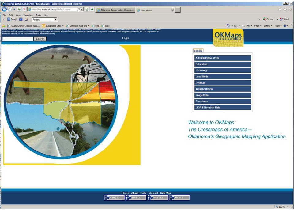
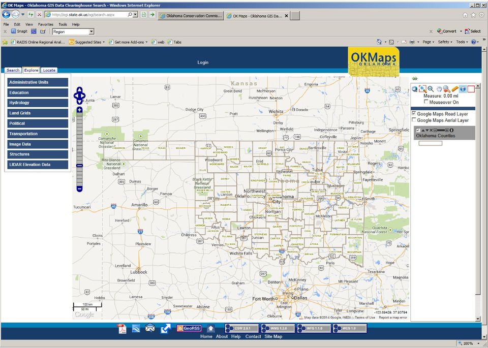
1 Oklahoma s Open Source Spatial Data Clearinghouse: OKMaps Presented by: Mike Sharp State Geographic Information Coordinator Oklahoma Office of Geographic Information MAGIC 2014 Symposium April 28-May1, 2014 Kansas City, MO

2
3
4 Why OKMaps? Sub-section D-3 of OS 82: : Establish a central statewide geographic information clearinghouse A definite need existed for a central, authoritative source of geospatial data but no funding was available Growing awareness at OK Office of Homeland Security that GIS can help fulfill missions In 2008 funding became available through OK OHS from US Department of Homeland Security to support geospatial data development and distribution

5 System Goals Low or no ongoing maintenance costs Not technology or software-specific No license fees Open Geospatial Consortium (OGC) Web Service Standards (WMS, WFS, WCS, KML,CSW, SQL) Core software code is extensible and open- Java,JavaScript, AJAX, ASP.NET, HTML, CSS Integrated Catalog, Metadata Manager and Search Engine Output for Google Earth visualization Point, Line, Polygon, and Raster (including floating point for DEM/LIDAR) support for storage, view, download, and web services Download by area (state, county, USGS quad, PLSS, visible extent) with many data format choices in any commonly recognized projection Support for frequently updated layers (vehicle tracking, weather radar) Security (Data and system functionality limited by Role/User) Scalability
 with many data format choices in any commonly recognized projection Support for")
6 High-Level Architecture Clients Google Earth Users Web Service Consumers Data Downloaders Data Catalog Data Layer Selection Metadata OGC Standard Web Services (KML, WMS, WFS, WCS) Data Storage
 Data")
7 Architecture Detail Google Earth KML Download SHP,DWG MAP etc Web Service Client WMS WFS WCF Feature Input/ Update Data Catalog Data Layer Selection Metadata Inter-layer analysis (eg buffer etc.) Raster Tiling or Caching (optional) File Download Generator KML, WFS Feature Server WMS Server WCS Server Data Conversion Raster Storage Vector Storage Raw Data
 Raster Tiling or Caching (optional) File Download Generator KML, WFS Feature Server")
8 Open-Source Architecture Web Server GeoServer GeoWebCache Catalog GeoNetworks Database PostgreSQL/PostGIS Data Translator GeoTools-GDAL/OGR GUI-Viewer OpenLayers

9 Clearinghouse Clients Google Earth KML Web Service Client WMS WFS WCS Download SHP, CSV KML etc Feature Input/ Update Google Earth KML User will select different layers (both raster and vector) from the catalog. These will then appear in GE. It is possible to have GE request updates every few seconds or minutes to display realtime data. GE handles all the network connections and layers once they are set up. Web Service Client A web service client, such as OpenLayers, ArcMap, AutoCAD Map, Global Mapper, QGIS, udig, and many others make standard WMS, WFS, WCS requests to the warehouse and gets back data. The user will first select layers from the catalog, and add these to their client. Then, the client will talk directly to the WMS, WFS and WCS server(s).

10 Clearinghouse Clients (Continued) Google Earth KML Web Service Client WMS WFS WCS Download SHP,CSV KML etc Feature Input/ Update Download SHP, CSV, KML, etc Users that need downloaded files in a variety of formats, projections, datums, etc, will first select the data layers, formats, options and AOI using the catalog. The request is passed to the file download generator which returns the file for download. Feature I/O Client Adds and updates features in the warehouse. This can be done using a feature client like OpenLayers, QGIS, TinyOWS, or another client that supports WFS-T, or input-output of KML. The user would select an updateable layer from the catalog, then the software would talk directly to the feature I/O server.

11 Clearinghouse Data Catalog Data Layer Selection Metadata Data Warehouse Catalog The catalog is the central location where users choose their data from the warehouse. Metadata about the geographic data within the warehouse is presented in an easily searchable, easy to read fashion. The data can then be previewed on a map within the catalog. Once the user is happy with their choice, they can choose the method of receiving the data, in Google Earth, files, or via web services. The catalog has a secure way of allowing a fine degree of access rights depending on userid/password or other access control method. Metadata is published to FGDC standards. GeoRSS subscription service is available to notify user when new data layers are added or existing ones updated. Open Source: these tasks. an open source Java server that does most of

12 Clearinghouse WMS Server WMS Server A WMS (Web Map Service) server creates images of the underlying vector or raster data according to a standard request. The images can then be displayed in most clients, including Google Earth, OpenLayers, ArcGIS, AutoCAD Map, udig, and QGIS. In addition, WMS images are used in the Catalog to show previews of the warehouse data. Open Source: an open source Java server provides this service. - a Java web application used to cache tiles from the WMS that is bundled with GeoServer.

13 WFS Server Clearinghouse WFS Server A WFS (Web Feature Service) server returns the actual source of the underlying vector data according to a standard request. This raw data can then be displayed and analyzed in most clients, including OpenLayers, ArcGIS, AutoCAD Map, udig and QGIS. Open Source: an open source Java server provides this service.

14 Clearinghouse WCS Server WCS Server The OGC Web Coverage Service (WCS) defines a standard interface and operations that enables interoperable access to geospatial grid coverage's". The term "grid coverage" typically refers to content such as satellite images, digital aerial photos, digital elevation data, and other phenomena represented by values (color, intensity, elevation) at each measurement point (pixel). Clients include OpenLayers and Global Mapper. Open Source: -an open source Java server provides this service.
 at each measurement point (pixel).")
15 Clearinghouse File Download Generator File Download Generator This component constructs downloadable vector and raster files in a wide variety of formats, projections, and options. Given the user's requirements, it creates the files, then makes them available for download. This component can read from both the underlying raster and vector storage, as well as from WFS, KML, WMS and WCS sources. Open Source: -an open source Java library coupled with GDAL/OGR libraries provides this functionality.

16 Vector (Feature) Storage Clearinghouse Vector Storage Vector features can be stored either in flat files (e.g. SHP files), or in a geodatabase. A geodatabase has a number of advantages over flat files, such as built-in analysis and query tools that make them much preferable in a data warehouse application. Additionally, a geodatabase is not fragmented into many different files. Interoperability: If the geodatabase supports standards like the OGC SQL standards, one geodatabase can be substituted for another if required. Open Source: the spatial-enabled database used worldwide in many applications.

17

18 Clearinghouse Raster Storage Raster Storage Large raster images can be stored as flat files in a variety of formats, such as GeoTiff, MrSID, JPEG2000, ERDAS, JPEG. There are also ways to store them in databases, or in proprietary servers. Besides the image data itself, each image file needs to have metadata information that describes the image, such as spatial location, projection, date, source. Aerial photo/drg/dem images in OKMaps are stored as jpeg compressed GeoTiff quarter-quad files bound together in mosaic coverage's generated by GeoServer. LiDAR LAS data is stored in a database utilizing PDAL (Point Data Abstraction Library) and the pgpointcloud extension for PostgreSQL developed by Paul Ramsey in early Data is stored in the database as patches where a patch = 1 row and a patch consists of 400 LiDAR points. Currently there are Million rows in the database representing approximately 2.5 TB of data.

19
20

21 Clearinghouse Data Conversion Raw Data Data Conversion of Raw Data Data for the warehouse will need to be converted into common formats for storage. The same tools that are used for the file download generator can be used for this. Additionally, standardized metadata needs to be tracked, and added to the catalog for the data as it is input into the warehouse. Open Source: control software. - -GDAL/OGR with some custom for metadata creation/maintenance.
22 Clearinghouse Raster Tiling or Caching Raster Tiling/Caching This component provides faster access to raster data. Many client software, including Google Earth, and OpenLayers can consume standard sized image tiles much more quickly and seamlessly than arbitrarily sized images. A tiling/caching system can increase the perceived speed of both WMS servers, and raw imagery access. In particular, Google Earth provides a way to consume tiles that appears much more seamless than access to WMS servers. Open Source:
23 Clearinghouse Inter-layer analysis (eg buffer etc.) Inter Layer Analysis It may be useful to include a component that allows for inter-layer analysis. For example, you may have a road feature that comes from one WFS server, and you need to find all schools that are within 1km of this road which is on a KML server (buffer analysis). It is possible to provide an intermediate analysis component that has access to both servers and can perform the operation. Possible Software: Custom software using tools such as GDAL/OGR and a GeoDatabase like PostGIS or new OGC-WPS extension to GeoServer.
24 Clearinghouse
Standardized data sharing through an open-source Spatial Data Infrastructure: the Afromaison project
 Standardized data sharing through an open-source Spatial Data Infrastructure: the Afromaison project Yaniss Guigoz - University of Geneva/GRID-Geneva 1 EcoARM2ERA and AFROMAISON Why Afromaison in this
Implementation of information system to respond to a nuclear emergency affecting agriculture and food products - Case of Morocco
 Centre National de l énergie des sciences et techniques nucléaires (CNESTEN-Morocco) Implementation of information system to respond to a nuclear emergency affecting agriculture and food products - Case
ArcGIS. Server. A Complete and Integrated Server GIS
 ArcGIS Server A Complete and Integrated Server GIS ArcGIS Server A Complete and Integrated Server GIS ArcGIS Server enables you to distribute maps, models, and tools to others within your organization
The ORIENTGATE data platform
 Seminar on Proposed and Revised set of indicators June 4-5, 2014 - Belgrade (Serbia) The ORIENTGATE data platform WP2, Action 2.4 Alessandra Nuzzo, Sandro Fiore, Giovanni Aloisio Scientific Computing and
SuperGIS Server 3.2 Standard Edition Specification
 SuperGIS Server 3.2 Standard Edition Specification 20140826 Specification 1. All of the services support SOAP (Simple Object Access Protocol). 2. Use map file created by SuperGIS Desktop as map services
Web and Mobile GIS Applications Development
 Web and Mobile GIS Applications Development Presented by : Aamir Ali Manager Section Head (GIS Software Customization) Pakistan Space and Upper Atmosphere Research Commission (SUPARCO) Geographical Information
Institute of Computational Modeling SB RAS
 Institute of Computational Modeling SB RAS ORGANIZATION OF ACCESS TO OBSERVATIONAL DATA USING WEB SERVICES FOR MONITORING SYSTEMS THE STATE OF THE ENVIRONMENT Kadochnikov Aleksey A. Russia, Krasnoyarsk
Advanced Image Management using the Mosaic Dataset
 Esri International User Conference San Diego, California Technical Workshops July 25, 2012 Advanced Image Management using the Mosaic Dataset Vinay Viswambharan, Mike Muller Agenda ArcGIS Image Management
INTEROPERABLE IMAGE DATA ACCESS THROUGH ARCGIS SERVER
 INTEROPERABLE IMAGE DATA ACCESS THROUGH ARCGIS SERVER Qian Liu Environmental Systems Research Institute 380 New York Street Redlands, CA92373, U.S.A - qliu@esri.com KEY WORDS: OGC, Standard, Interoperability,
Chapter 6: Data Acquisition Methods, Procedures, and Issues
 Chapter 6: Data Acquisition Methods, Procedures, and Issues In this Exercise: Data Acquisition Downloading Geographic Data Accessing Data Via Web Map Service Using Data from a Text File or Spreadsheet
Choosing the right GIS framework for an informed Enterprise Web GIS Solution
 13 ANNUAL INTERNATIONAL CONFERENCE AND EXHIBITION ON GEOSPATIAL INFORMATION TECHNOLOGY AND APPLICATIONS Epicentre; Gurgaon, India; 19-21 January, 2010 Choosing the right GIS framework for an informed Enterprise
Enterprise GIS Solutions to GIS Data Dissemination
 Enterprise GIS Solutions to GIS Data Dissemination ESRI International User Conference July 13 17, 2009 Wendy M. Turner Senior GIS Engineer & Program Manager Freedom Consulting Group, LLC Building the Enterprise
ArcGIS Framework Plug-In: Extending the ArcGIS Desktop for ANSI Standard Framework Data to Support Government Decision Making
 ArcGIS Framework Plug-In: Extending the ArcGIS Desktop for ANSI Standard Framework Data to Support Government Decision Making Final Project Report October 28, 2008 Agreement Number Organization Project
Correspondence can be sent to: GeoConnections Natural Resources Canada 615 Booth Street Ottawa, Ontario K1A 0E9
 Quick Guide for CGDI Service Compliance Testing and Performance Optimization May 12, 2009 Correspondence can be sent to: GeoConnections Natural Resources Canada 615 Booth Street Ottawa, Ontario K1A 0E9
Big Data Volume & velocity data management with ERDAS APOLLO. Alain Kabamba Hexagon Geospatial
 Big Data Volume & velocity data management with ERDAS APOLLO Alain Kabamba Hexagon Geospatial Intergraph is Part of the Hexagon Family Hexagon is dedicated to delivering actionable information through
County of Los Angeles. Chief Information Office Preferred Technologies for Geographic Information Systems (GIS) September 2014
 September 2014") County of Los Angeles Chief Information Office Preferred Technologies for Geographic Information Systems (GIS) September 2014 CIO Preferred Technologies for GIS This document lists the preferred Geographic
County of Los Angeles Chief Information Office Preferred Technologies for Geographic Information Systems (GIS) September 2014 CIO Preferred Technologies for GIS This document lists the preferred Geographic
MrSID Plug-in for 3D Analyst
 LizardTech MrSID Plug-in for 3D Analyst User Manual Copyrights Copyright 2009 2010 LizardTech. All rights reserved. Information in this document is subject to change without notice. The software described
A Hybrid Architecture for Mobile Geographical Data Acquisition and Validation Systems
 A Hybrid Architecture for Mobile Geographical Data Acquisition and Validation Systems Claudio Henrique Bogossian 1, Karine Reis Ferreira 1, Antônio Miguel Vieira Monteiro 1, Lúbia Vinhas 1 1 DPI Instituto
LAR-IAC4 Status and User Group Meeting. October 8, 2015
 LAR-IAC4 Status and User Group Meeting October 8, 2015 Agenda LARIAC Imagery Update LARIAC Status Update LARIAC Update and Training Schedule LARIAC Data Access Methods Additional Derived Data User Presentations
An Introduction to Open Source Geospatial Tools
 An Introduction to Open Source Geospatial Tools by Tyler Mitchell, author of Web Mapping Illustrated GRSS would like to thank Mr. Mitchell for this tutorial. Geospatial technologies come in many forms,
Introduction to GIS. http://libguides.mit.edu/gis
 Introduction to GIS http://libguides.mit.edu/gis 1 Overview What is GIS? Types of Data and Projections What can I do with GIS? Data Sources and Formats Software Data Management Tips 2 What is GIS? 3 Characteristics
From Geoportal to Spatial Data Service Platform. Jani Kylmäaho National Land Survey of Finland Development Centre
 From Geoportal to Spatial Data Service Platform Jani Kylmäaho National Land Survey of Finland Development Centre 29.6.2012 Introduction National Land Survey of Finland - 1900 employees Development Centre
Open Source Geospatial Software. Bob Bruce, P.Eng Mapping and Lands Branch, Manitoba Conservation WWW.HWPS.CA Bob.Bruce@gov.mb.ca
 A Survey of Open Source Geospatial Software Bob Bruce, P.Eng Mapping and Lands Branch, Manitoba Conservation WWW.HWPS.CA Bob.Bruce@gov.mb.ca APEGM PD Breakfast Tuesday, 12 June 2007 access this presentation
Centre for EcologicalNoosphere Studies NAS RA CENS
 SCOPES 2009-2012 Scientific Co-operation between Eastern Europe and Switzerland Accessing Armenian Environmental data through CENS Spatial Data Infrastructure Centre for EcologicalNoosphere Studies NAS
Analysis of the Free GIS Software Applications in respect to INSPIRE services and OGC standards
 Analysis of the Free GIS Software Applications in respect to INSPIRE services and OGC standards Authors: Francesco D'Alesio Peter Hopfgartner Paolo Viskanic June 2011 Executive Summary This document analyses
GEOENGINE MSc in Geomatics Engineering, Master Thesis Gina Campuzano
 Master Thesis Gina CAMPUZANO Gina Campuzano Development of a GIS web application as a tool for learning of environmental protection -Comparison between MapServer and GeoServer constructing a tool for not
WP 3. Elaboration database Architecture Features (Software Architecture Document)
") Architecture Features (Software Architecture Document) o Best in class solution, using EC recommendations for IT in this field o Implementation based on free open source o Based on OGC standards, high
Architecture Features (Software Architecture Document) o Best in class solution, using EC recommendations for IT in this field o Implementation based on free open source o Based on OGC standards, high
ARCHITECTURE OF INTEGRATED GIS AND GPS FOR VEHICLE MONITORING
 1 st Logistics International Conference Belgrade, Serbia 28-30 November 2013 ARCHITECTURE OF INTEGRATED GIS AND GPS FOR VEHICLE MONITORING Adela B. Crnišanin * State University of Novi Pazar, Department
GIS Beyond the Basics: Web Maps and File Sharing Services
 GIS Beyond the Basics: Web Maps and File Sharing Services by Julie Coco, PE I. INTRODUCING WEB-BASED GIS SERVICES A GIS service, or Geoservice, provides a way to retrieve maps, images, or geoprocessing
GeoMedia Product Update. Title of Presentation. Lorilie Barteski October 15, 2008 Edmonton, AB
 Product Update Title of Presentation Lorilie Barteski Edmonton, AB Know the audience poll Existing /Pro users Version 6.1 Version 6.0 Version 5.2 or earlier Existing WebMap users Version 6.1 Version 6.0
Open Source GIS Blitz!
 Open Source GIS Blitz! Startwiththisvideo http://vimeo.com/2598878 Openstreetmap.org Crown copyright no expiration all government map data in England. Rest of Europe not much better Volunteer mapping effort.
smespire - Exercises for the Hands-on Training on INSPIRE Network Services April 2014 Jacxsens Paul SADL KU Leuven
 smespire - Exercises for the Hands-on Training on INSPIRE Network Services April 2014 Jacxsens Paul SADL KU Leuven These exercises aim at people who already have some basic knowledge of INSPIRE Network
How To Use Gis
 Welcome Understanding Purpose Creating Relationships You A Global Community of GIS Professionals Changing the World Together Applying Geography Everywhere Your WORK Showcasing Your Web Apps Vision Applying
A GIS helps you answer questions and solve problems by looking at your data in a way that is quickly understood and easily shared.
 A Geographic Information System (GIS) integrates hardware, software, and data for capturing, managing, analyzing, and displaying all forms of geographically referenced information. GIS allows us to view,
Clinton County GIS Program
 Clinton County GIS Program The Clinton County GIS Program consists of several unique means of disseminating GIS and related data. Joe Merritt, County GIS Manager 1 Clinton County GIS Program 2 What? Google
Open Source Software and Open Interoperability Standards at EDINA National Datacentre
 Open Source Software and Open Interoperability Standards at EDINA National Datacentre Joe Vernon November 25, 2009 Slide 1 of 18 Overview of Presentation Introducing EDINA national datacentre Our thoughts
ArcGIS Reference Document
 Migration of GIS Data to ArcSDE Page 1 of 10 Table of Contents A Brief Summary of DEP s GIS Data Storage o The Y Drive o ArcSDE (Spatial Database) Keeping Your GIS Project Data Current o Checking Your
GEO 425, Spring 2012 LAB 3: Introduction to Web Map Services
 GEO 425, Spring 2012 LAB 3: Introduction to Web Map Services Objectives: If you have your own web server, it's great to be able to host your own geospatial data. That data can then be accessed through
Version 3.0, April 16, 2012, updated for ArcGIS 10.0 Produced by the Geographic Information Network of Alaska http://www.gina.alaska.
 Using the AlaskaMapped Web Services in ESRI ArcGIS Version 3.0, April 16, 2012, updated for ArcGIS 10.0 Produced by the Geographic Information Network of Alaska http://www.gina.alaska.edu AlaskaMapped
A Web Service based U.S. Cropland Visualization, Dissemination and Querying System
 A Web Service based U.S. Cropland Visualization, Dissemination and Querying System Rick Mueller, Zhengwei Yang, and Dave Johnson USDA/National Agricultural Statistics Service Weiguo Han and Liping Di GMU/Center
There are various ways to find data using the Hennepin County GIS Open Data site:
 Finding Data There are various ways to find data using the Hennepin County GIS Open Data site: Type in a subject or keyword in the search bar at the top of the page and press the Enter key or click the
DataTube: web services voor data
 DataTube: web services voor data Gerben de Boer Onno van de Akker Gerrit Hendriksen Deltares, Matroos Deltares, FEWS Deltares, NHI FEWS & Matroos: database > viewers VIEWER client 3 rd party viewer Matroos
Creating Maps in QGIS: A Quick Guide
 Creating Maps in QGIS: A Quick Guide Overview Quantum GIS, which is often called QGIS, is an open source GIS desktop application. Comparing to ArcGIS, QGIS can be installed on various operating systems,
MSDI: Workflows, Software and Related Data Standards
 MSDI: Workflows, Software and Related Data Standards By Andy Hoggarth October 2009 Introduction Leveraging SDI principles for hydrographic operational efficiency French INFRAGEOS example (SHOM - Service
Open Source Visualisation with ADAGUC Web Map Services
 Open Source Visualisation with ADAGUC Web Map Services Maarten Plieger Ernst de Vreede John van de Vegte, Wim Som de Cerff, Raymond Sluiter, Ian van der Neut, Jan Willem Noteboom 1 ADAGUC project Cooperative
Web Map Service Architecture for Topographic Data in Finland
 Web Map Service Architecture for Topographic Data in Finland Teemu Sipilä National Land Survey of Finland Abstract. Since 2012 National Land Survey of Finland has been renewing its web map services and
Archival Challenges Associated with the Esri Personal Geodatabase and File Geodatabase Formats
 Geospatial Multistate Archive and Preservation Partnership (GeoMAPP) Archival Challenges Associated with the Esri Personal Geodatabase and File Geodatabase Formats December 6, 2011 Introduction Spatial
gvsig: Open Source GIS client. Spatial Data Infrastructure Client.
 Séminaire gvsig Rennes, 31 Mars 2006 gvsig: Open Source GIS client. Spatial Data Infrastructure Client. Luis W. Sevilla Gabriel Carrión Rico Martín García Hernández Francisco J. Peñarrubia Alvaro A. Anguix
OPEN STANDARD WEB SERVICES FOR VISUALISATION OF TIME SERIES DATA OF FLOOD MODELS
 OPEN STANDARD WEB SERVICES FOR VISUALISATION OF TIME SERIES DATA OF FLOOD MODELS Barend Köbben FRMRC RPA 7 Workshop visualisations and flow simulations as flood risk communication tools
UK Location Programme
 Location Information Interoperability Board Data Publisher How To Guide Understand the background to establishing an INSPIRE View Service using GeoServer DOCUMENT CONTROL Change Summary Version Date Author/Editor
Institute of Natural Resources Departament of General Geology and Land use planning Work with a MAPS
 Institute of Natural Resources Departament of General Geology and Land use planning Work with a MAPS Lecturers: Berchuk V.Y. Gutareva N.Y. Contents: 1. Qgis; 2. General information; 3. Qgis desktop; 4.
Cloud application for water resources modeling. Faculty of Computer Science, University Goce Delcev Shtip, Republic of Macedonia
 Cloud application for water resources modeling Assist. Prof. Dr. Blagoj Delipetrev 1, Assist. Prof. Dr. Marjan Delipetrev 2 1 Faculty of Computer Science, University Goce Delcev Shtip, Republic of Macedonia
EUMETSAT EO Portal. End User Image Access using OGC WMS/WCS services. EUM/OPS/VWG/10/0095 Issue <1> <14/01/2010> Slide: 1
 EUMETSAT EO Portal End User Image Access using OGC WMS/WCS services Slide: 1 Overview Introduction: status of data access and visualization EUMETSAT datasets Architecture Web Map Service implementation
Lecture 8. Online GIS
 Lecture 8 Online GIS Lecture 8: Outline I. Online GIS 1. Google Earth 2. MSN Live Maps II. Open Source GIS III. ArcGIS Server and the ESRI suite of online software utility options IV. Advanced Data Mining
Duke Riding the Geospatial Wave
 Duke Riding the Geospatial Wave Chris Holmes (OpenGeo) Steve Citron-Pousty (decarta) James Macgill (Google) Wilfred Springer (TomTom) @DukeSpatial PAN-5773 decarta 2008 JavaOneSM Conference java.sun.com/javaone
APFO Data Provisioning and Services
 Who We Are APFO is the primary source of aerial imagery for the U.S. Department of Agriculture. Data Stewards for NAIP, and historical aerial photography collected for USDA dating back to 1955. Who We
FME 2007 Release Giving Raster the Vector Treatment. By Mary Jo Wagner
 FME 2007 Release Giving Raster the Vector Treatment By Mary Jo Wagner Giving Raster the Vector Treatment By Mary Jo Wagner Spatial extract, transform and load (ETL) tools such as Safe Software s FME have
Standards based spatial data management, GIS and web mapping. Spatial data management, analysis & sharing the free & easy way!
 or Spatial data management, analysis & sharing the free & easy way! Premise: Traditional GIS is inherently flawed, especially when it comes to many fisheries/maritime datasets Premise: Traditional GIS
Server GIS. What Server GIS software do we provide?
 Server GIS Distribute maps, models, and tools via the Web in a way that fits well into your workflows. SuperGeo offers numerous Server GIS solutions to fulfill the demands of corporate Intranets and the
Publishing KML Services Tutorial
 Publishing KML Services Tutorial Copyright 1995-2010 Esri All rights reserved. Table of Contents Tutorial: Publishing a KML service............................ 3 Copyright 1995-2010 ESRI, Inc. All rights
Getting Started With LP360
 Getting Started With LP360 10/30/2014 1 Contents What is LP360?... 3 System Requirements... 3 Installing LP360... 4 How to Enable the LP360 Extension... 4 How to Display the LP360 Toolbar... 4 How to Import
Combining Drupal Content Management System with OGC Web Services
 Combining Drupal Content Management System with OGC Web Services By Terefe Hanchiso Sodango (Haramaya University, Ethiopia) Dr. U.D. (Ulanbek) Turdukulov & Drs. B.J. (Barend) Köbben(University of Twente,
Web Mapping in Archaeology
 Non-invasive methods in the contemporary archaeological practice 25th February 2014 http://www.pborycki.pl/pdf/webmapping.pdf Plan of the presentation 1 Web Mapping General Idea History of Web Mapping
CURSO Inspire INSPIRE. SPEAKER: Pablo Echamendi Lorente. JEUDI 23/ THURSDAY 23 rd W S V : G E O S P A T I A L D A T A A C C E S S
 CURSO Inspire JEUDI 23/ THURSDAY 23 rd SPEAKER: Pablo Echamendi Lorente WS 5 SCHEDULE WMS OVERVIEW ACTIONS OGC SPECIFICATIONS OTHER SERVICES OVERVIEW proposal: Member States shall establish and operate
GIS Databases With focused on ArcSDE
 Linköpings universitet / IDA / Div. for human-centered systems GIS Databases With focused on ArcSDE Imad Abugessaisa g-imaab@ida.liu.se 20071004 1 GIS and SDBMS Geographical data is spatial data whose
GEOGRAPHIC INFORMATION SYSTEMS Lecture 20: Adding and Creating Data
 Adding Existing Data Into ArcGIS - there are many different ways to get data into ArcGIS GEOGRAPHIC INFORMATION SYSTEMS Lecture 20: Adding and Creating Data Add Data - normally we use the Add Data button
Application Development Using Image Services Web APIs. Hong Xu, Wenxue Ju
 Application Development Using Image Services Web APIs Hong Xu, Wenxue Ju Session Outline Discuss and demonstrate the following image service web application patterns: Display image service in your web
Insight for location-powered decision making.
 Location Intelligence Geographic Information Systems MapInfo Pro Insight for location-powered decision making. Data drives our decisions every day. Blend this data with geography and you can visualise
2009 CAP Grant Kickoff USGS, Reston, VA May 21, 2009
 Leveraging GOS Map and Data Services for Search and Rescue Operations using NASA WorldWind Open Source 3D Visualization Platform Nadine Alameh, Ph.D. MobiLaps LLC 2009 CAP Grant Kickoff USGS, Reston, VA
Open Source GIS The Future?
 Open Source GIS The Future? Daniel Morissette DM Solutions Group Inc. Open Source Licensing No licensing costs Unlimited rights to: Use the software View and analyse the source Copy, reuse in other systems
Project eharta: a collaborative initiative to digitally preserve and freely share old cartographic documents in Romania
 Vasile Crăciunescu, Ştefan Constantinescu, IonuŃ Ovejanu, Ioan Rus Project eharta: a collaborative initiative to digitally preserve and freely share old cartographic documents in Romania Keywords: geo-spatial.org;
Finding GIS Data and Preparing it for Use
 Finding_Data_Tutorial.Doc Page 1 of 19 Getting Ready for the Tutorial Sign Up for the GIS-L Listserv Finding GIS Data and Preparing it for Use The Yale University GIS-L Listserv is an internal University
PART 1. Representations of atmospheric phenomena
 PART 1 Representations of atmospheric phenomena Atmospheric data meet all of the criteria for big data : they are large (high volume), generated or captured frequently (high velocity), and represent a
GeoServer, The Open Source Solution for the interoperable management of geospatial data
 GeoServer, The Open Source Solution for the interoperable management of geospatial data Ing. Andrea Aime, GeoSolutions Ing. Simone Giannecchini, GeoSolutions Founded in Italy in late 2006 Expertise GeoSolutions
Data Visualization Using Web GIS Software
 Data Visualization Using Web GIS Software Tuomas Peltonen Radiation and Nuclear Safety Authority (STUK), Finland NKS NordDSS Workshop, Copenhagen, 1.-2.10.2009 RADIATION AND NUCLEAR SAFETY AUTHORITY Preface
 Development tools to create Web-GIS applications DbMAP ASJ the best solution to easily publish GIS data from existing spatial databases and distributed GIS data sources Easily designs, produces, and publishes
Enabling embedded maps
 Enabling embedded maps Case: National geoportal of Finland Antti Rainio National Land Survey of Finland Trends: Web Services, Mapping Mashup, Open Source, Open Data Decentralised data s Service interfaces
MAY 18, 2015 ARCGIS 10.3.1 FOR SERVER FUNCTIONALITY MATRIX
 MAY 18, 2015 ARCGIS 10.3.1 FOR SERVER FUNCTIONALITY MATRIX Copyright 2015 Esri All rights reserved. Printed in the United States of America. The information contained in this document is the exclusive
Web Map Service. Messtischblätter/Urmesstischblätter Brandenburgs Displaying landscape history to the public
 Scientific Research Project Forest Information Technology 3. Semester Web Map Service Messtischblätter/Urmesstischblätter Brandenburgs Displaying landscape history to the public Tobias Herrmann FIT2008
GIS Architecture and Data Management Practices Boone County GIS Created and Maintained by the Boone County Planning Commission GIS Services Division
 GIS Architecture and Data Management Practices Boone County GIS Created and Maintained by the Boone County Planning Commission June 2008 Background Boone County s GIS program has been in existence for
Texas Develops Online Geospatial Data Repository to Support Emergency Management
 Bing Maps for Enterprise Microsoft Customer Solution Case Study Texas Develops Online Geospatial Data Repository to Support Emergency Management Overview Country or Region: United States Industry: Government
VISUAL INSPECTION OF EO DATA AND PRODUCTS - OVERVIEW
 WMS services from the EUMETSAT real-time Image Gallery Uwe Voges (1), Michael Schick (2), Udo Einspanier (1) (1) con terra GmbH Martin-Luther-King-Weg 24, 48155, Münster, Germany EMail: (U.Voges U.Einspanier)@conterra.de
INPE Spatial Data Infrastructure for Big Spatiotemporal Data Sets. Karine Reis Ferreira (INPE-Brazil)
") INPE Spatial Data Infrastructure for Big Spatiotemporal Data Sets Karine Reis Ferreira (INPE-Brazil) INPE (Brazil) and Big Data I work at INPE (Brazilian National Institute for Space Research). Main gate
INPE Spatial Data Infrastructure for Big Spatiotemporal Data Sets Karine Reis Ferreira (INPE-Brazil) INPE (Brazil) and Big Data I work at INPE (Brazilian National Institute for Space Research). Main gate
MD imap 2.0 THE NEXT GENERATION OF MARYLAND S ENTERPRISE GIS. Esri MUG Conference Baltimore, MD December 3, 2014 http://imap.maryland.
 THE NEXT GENERATION OF MARYLAND S ENTERPRISE GIS MD imap 2.0 Matt Sokol, GISP Senior GIS Analyst Maryland Department of Information Technology Geographic Information Office Julia Fischer, GISP Senior GIS
NATIONAL CLIMATE CHANGE & WILDLIFE SCIENCE CENTER & CLIMATE SCIENCE CENTERS DATA MANAGEMENT PLAN GUIDANCE
 NATIONAL CLIMATE CHANGE & WILDLIFE SCIENCE CENTER & CLIMATE SCIENCE CENTERS DATA MANAGEMENT PLAN GUIDANCE Prepared by: NCCWSC/CSC Data Management Working Group US Geological Survey February 26, 2013 Version
Contents. General Overview... 1-2 Common Work Flow... 3 Full Feature List... 4 Additional Information... 5. Website... GIS.Garafa.
 Contents Contents General Overview... 1-2 Common Work Flow... 3 Full Feature List... 4 Additional Information... 5 Website... GIS.Garafa.com 1 Ease of Use Traditional mobile software for data collection
GeoNetwork, The Open Source Solution for the interoperable management of geospatial metadata
 GeoNetwork, The Open Source Solution for the interoperable management of geospatial metadata Ing. Emanuele Tajariol, GeoSolutions Ing. Simone Giannecchini, GeoSolutions GeoSolutions GeoSolutions GeoNetwork
GIS AS A DECISION SUPPORT FOR SUPPLY CHAIN MANAGEMENT
 Paper Reference No.: PN-253 GIS AS A DECISION SUPPORT FOR SUPPLY CHAIN MANAGEMENT Sanjay Kumar 1 and Suneeta Agrawal 2 1. M. Tech. (GIS & Remote Sensing); GIS Cell; MNNIT, Allahabad, India (E-mail: saj.mnnit@gmail.com)
How To Use The Alabama Data Portal
 113 The Alabama Metadata Portal: http://portal.gsa.state.al.us By Philip T. Patterson Geological Survey of Alabama 420 Hackberry Lane P.O. Box 869999 Tuscaloosa, AL 35468-6999 Telephone: (205) 247-3611
Design/build and visualization of political and social-statistics. statistics geodatabase by open source tools
 Design/build and visualization of political and social-statistics statistics geodatabase by open source tools Ferenc Speiser Post-graduate distance learning course in Geoinformatics Contents The goals
Geospatially Enabling the World: The Convergence of Geospatial and Architectural and Engineering Design
 Geospatially Enabling the World: The Convergence of Geospatial and Architectural and Engineering Design Geoff Zeiss Director of Technology Autodesk Map Middle East Dubai 2007 1 Overview Geospatial inflection
WP6. e-soter Web Services: Status and Way Ahead to a Global Soil Information Service Yusuf YIGINI EU Joint Research Centre
 e-soter Regional pilot platform as EU contribution to a Global Soil Observing System WP6. e-soter Web Services: Status and Way Ahead to a Global Soil Information Service Yusuf YIGINI EU Joint Research
Pennsylvania Geospatial Data Sharing Standards (PGDSS) V 2.5
 V 2.5") Submitted to: Pennsylvania Geospatial Data Sharing Standards (PGDSS) V 2.5 Spatial Data Migration Tools Report May 2, 2007 Table of Contents 1.0 Document Purpose...B-1 2.0 Overview of Spatial Data Migration
Submitted to: Pennsylvania Geospatial Data Sharing Standards (PGDSS) V 2.5 Spatial Data Migration Tools Report May 2, 2007 Table of Contents 1.0 Document Purpose...B-1 2.0 Overview of Spatial Data Migration
Agile Retrieval of Big Data with. EarthServer. ECMWF Visualization Week, Reading, 2015-sep-29
 Agile Retrieval of Big Data with EarthServer ECMWF Visualization Week, Reading, 2015-sep-29 Peter Baumann Jacobs University rasdaman GmbH baumann@rasdaman.com [co-funded by EU through EarthServer, PublicaMundi]
TerraAmazon - The Amazon Deforestation Monitoring System - Karine Reis Ferreira
 TerraAmazon - The Amazon Deforestation Monitoring System - Karine Reis Ferreira GEOSS Users & Architecture Workshop XXIV: Water Security & Governance - Accra Ghana / October 2008 INPE National Institute
Design Requirements for an AJAX and Web-Service Based Generic Internet GIS Client
 11th AGILE International Conference on Geographic Information Science 2008 Page 1 of 6 Design Requirements for an AJAX and Web-Service Based Generic Internet GIS Client Edward Nash 1, Peter Korduan 1,
GIS Initiative: Developing an atmospheric data model for GIS. Olga Wilhelmi (ESIG), Jennifer Boehnert (RAP/ESIG) and Terri Betancourt (RAP)
, Jennifer Boehnert (RAP/ESIG) and Terri Betancourt (RAP)") GIS Initiative: Developing an atmospheric data model for GIS Olga Wilhelmi (ESIG), Jennifer Boehnert (RAP/ESIG) and Terri Betancourt (RAP) Unidata seminar August 30, 2004 Presentation Outline Overview
GIS Initiative: Developing an atmospheric data model for GIS Olga Wilhelmi (ESIG), Jennifer Boehnert (RAP/ESIG) and Terri Betancourt (RAP) Unidata seminar August 30, 2004 Presentation Outline Overview
INSTRUCTIONS FOR MAKING 3D,.DWG CONTOUR LINES
 INSTRUCTIONS FOR MAKING 3D,.DWG CONTOUR LINES A TUTORIAL FROM SPATIAL AND NUMERIC DATA SERVICES NICOLE SCHOLTZ AND GEOFF IVERSON Overview... 2 A. Get a Digital Elevation Model (DEM)... 3 B. Open ArcMap,
Google Earth Digitale Wege in eine bekannte Welt Sep. 2006
 Google Earth Digitale Wege in eine bekannte Welt Sep. 2006 Joachim Glaubrecht Google Enterprise joachim@google.com What is Google Enterprise? 2 1 Focus.de: "Der Papst-Besuch in Google Earth" 3 How to Geo
Cookbook 23 September 2013 GIS Analysis Part 1 - A GIS is NOT a Map!
 Cookbook 23 September 2013 GIS Analysis Part 1 - A GIS is NOT a Map! Overview 1. A GIS is NOT a Map! 2. How does a GIS handle its data? Data Formats! GARP 0344 (Fall 2013) Page 1 Dr. Carsten Braun 1) A