|
|
|
- Daisy Ray
- 7 years ago
- Views:
Transcription
1 ArcGIS for Tribal Transportation Management David Gadsden Federal Account Manager d d 1

2 David Gadsden GIS Background UW Geography (1995) Peace Corps Tanzania Environmental Social Science Public Safety Salt Lake Olympics Crime and Social Research ESRI International United Nations Humanitarian NGOs Dept. of State USAID Rwanda USAID Tanzania ESRI Federal Tribes

3 Environmental Systems Research Institute Inc.

4 ESRI s Mission Provide the Most Robust GIS Software Programs in the World and Continuous Development of GIS Technology Support Our Users in the Successful Implementation of GIS Conduct Meaningful GIS Application Projects That Push the Technology and Demonstrate the Effective and Innovative Use of GIS

5 ESRI s DOI Enterprise License Free ESRI software for Federally Recognized Tribes Technical Support through BIA BIA Provided Training Events Bureau of Indian Affairs National Geospatial Resource Center (NGRC) 1011 Indian School Road, NW Suite 177 Albuquerque, NM Help Desk Phone : ESRI Licensing (Bryon Yepa) : Nat l Indian Programs Training Center : Nat l Indian Programs Training Center Fax :

6 A Geographic Information System (GIS) A GIS is a system for the Management, Analysis, Visualization and Dissemination of Geographic Information Enterprise Lab 6

7 GIS Data Geographic Data Points (Sensors, street signs, manholes) Lines (roads, rivers, utility cables) Polygons (parcels, land use, depots) Attribute Data Databases (road conditions, los, volumes) Spreadsheets, Text, Real time feeds (RSS, Satellite, Field Crews) GIS in Transportation 7
 GIS in")
8 GIS Links Geography and Attributes Each feature corresponds to a record in the table Geographic Data Geographic Link Attribute Information FID = 4103 (Feature Identifier) GIS in Transportation 8
 GIS in")
9 GIS Integrates Diverse Information Key Concepts Reference System Map Overlay Members Realty Transportation Public Safety Cultural Resources Planning Natural Resources and Helps to Identify Relationships

10 GIS Evolution Enterprise Departmental (Centralized data or applications) Web Services & Messaging Environmental Business Applications Roads Utilities Planning Police Desktop (Stand Alone, Point to Point) Loosely Coupled Dynamic Integrated Business Systems File Server Project Specific Stable Well Managed Controlled Workflows

11 GIS is Scalable Desktop/Workgroup Individual / Team Client Enterprise Organizational / Inter- Organizational Mobile Internet Web (2.0) Desktop Server Server... deployed in mainstream applications, transforming business capabilities 11

12 ArcGIS Desktop Server Mobile A Complete Integrated System Online ArcReader ArcView ArcEditor ArcInfo Engine Work Group Enterprise ArcGIS Mobile ArcPad Content Resource Centers 12

13 ArcGIS DESKTOP ArcInfo ArcEditor ArcView ArcReader For Authoring & Applying Geographic Knowledge Compilation Data Management Mapping Analysis Advanced Geoprocessing Compilation Data Management Mapping Mapping Using View Mapping & Visualization Compilation & Editing Catalog & Metadata Spatial la Analysis & Modeling

14 Mapping & Cartography Multiple Views Curved Graticules Polygon Labels Improved PDF Support Geologic Symbols WYSIWYG Editing Contour Labeling Street Numbering Placement Stacked Asian Characters... A Complete System for Data Driven Mapping

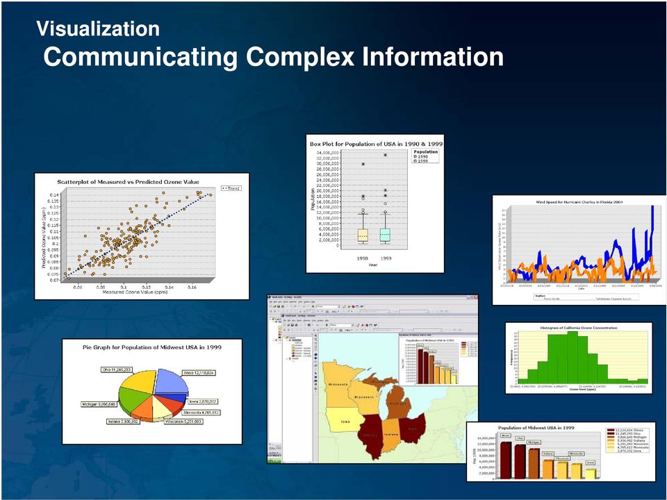
15 Visualization Communicating Complex Information
16 3D Visualization & Analysis Authoring, Analyzing & Viewing 3D Data Visualization KML Analysis 3D Geometry Labeling Lidar Viewshed Terrain

17 GIS is a New Language of Applied Geography Data Tool Data Complex Data Modeling Interactive Mapping Geoprocessing Integrating ti Data Visualization Modeling... Making Geographical Science Actionable

18 Geoprocessing Support for Very Large Data Sets Spatial Analysis Tools Solar Radiation Random Sampling Statistics / Geostatistics Cartographic Tools Vector-Raster Improvements Fast Geocoding (5-10x) Time Based Modeling / Simulation Batch Geoprocessing Server Based ArcGIS Server Spatial Modeling Geoprocessing on Server Solar Radiation

19 The Foundation of a Modern GIS is a Geodatabase Organizing & Managing Geospatial Data Comprehensive Information Model (Any Type of Data) ArcGIS 3D Objects Networks Attributes t Geodatabase Terrain Cartography Topology Annotation Schematics Vectors Surveys Cadastral Dimensions Images Addresses... Essential for Leveraging the Full Capabilities of ArcGIS

20 Transportation Geodatabase Elements Administrative Areas Water Bodies Parcels Transportation Orthophotos Speed Limit Number of Lanes Linear Reference Systems Dynamic Segmentation Routes Measures Events Pavement Condition Projects

21 Dynamic Segmentation Computing map locations of linearly referenced data at run time Line features don t have to be split (i.e.; "segmented") each time an attribute value changes Dynamically" locate
22 Route Linear features in a polyline feature class Have an identifier and measurement system often used interchangeably with LRM Linear feature Unique identifier Route
23 Measures Distances along a linear feature Measures start at route origin x,y,m x,y,m x,y,m x,y,m x,y,m x,y,m Can be miles, meters, feet, time and don t have to match x,y units Can increase, decrease or be NaN (not measured)
24 Events Point route locations Describe a discrete location along a route Line route locations Line Events Describe a portion of a route Point Events
25 Transportation Geodatabase Elements Facility RD3302 Offset (Linear LRM Measure) ML ML ML 4.37 Point Events: Intersections ML 5.81 ML 8.92 ML 9.47 ML Real World 8 Field Measure 8
26 Ad-Hoc Transportation Workflow GIS GIS in Transportation 26
27 Structured Transportation Capital Programming Right of Way Crash Data Projects Traffic Volumes Construction GIS Assets Environmental Pavement GIS in Transportation 27
28 28 GIS in Transportation
29 Multi-User Editing and Viewing GDB
30 ArcGIS MOBILE Desktop Mobile ArcPad
31 ArcGIS Supports Mobile Applications Multiple Solutions for Working in the Field ArcPad Mapping Editing Query GPS ArcGIS Desktop & Engine General Purpose Synchronized with Geodatabase Full Feature ArcGIS Mobile Desktop Mobile ArcPad Server Based... Connecting & Integrating the Mobile Work Force
32 Field Data Collection GIS in Transportation 32
33 ArcGIS Server Mobile A Small Lightweight Client for Focused Application Supports Mapping Editing Query GPS Application Runs On Many Devices Phones PDA s Laptops... Data is Synchronized When Connected
34 Job Tracking Workflow Management ArcGIS 9.3 Seminar Series 34
35 ArcGIS SERVER Basic Standard Advanced Open & Scalable GIS Server Data Management Mapping 3D Visualization Data Management Analysis Mobile Mapping 3D Visualization Data Management Desktop Web Mobile Open APIs OGC KML SOAP SQL Comprehensive Server-based GIS GDB ArcGIS Server
36 ArcGIS is a Complete System To Manage and Disseminate Geographic Knowledge Author/Serve/Use Maps Data Models Globes Metadata t Use Desktop Explorer Web Map Viewer Mobile Open APIs Enterprise Service Bus Serve ArcGIS Server Author... Integrates With Other Systems Via Standards and other systems via Web Services
37 GIS Services can be used to Display Data
38 GIS Services can be used to Answer Questions
39 Web Based Editing Standard Networks ArcGIS Server GDB
40 Web Based Transportation Management Framework
41 Query / Discovery 41 GIS in Transportation
42 Reports GIS in Transportation 42
43 Construction and Project Management GIS in Transportation 43
44 Asset and Work Order Management GIS in Transportation 44
45 Asset Management GIS in Transportation 45
46 Design and Estimating GIS in Transportation 46
47 Project and Construction Management GIS in Transportation 47
48 Facility (Asset) Management GIS in Transportation 48
49 ArcGIS Provides a Complete GIS For Authoring, Serving and Using GIS Knowledge Desktop Explorer Web Map Viewer Mobile Open APIs Enterprise Service Bus 3 Tiers Use Metadata Services Globe Services Map Services Analysis & Modeling Services Image Services Open OGC Services Serve Open Interoperable Standards Based Author... And Integrates With Other Geospatial Technology and Standard IT Infrastructure
50 ArcGIS Explorer Integrating, Visualizing & Analyzing Geographic Information Fast Intuitive Web Centric Accessing Maps, Models & Globe Services ArcGIS Online ArcGIS Server
51 Complete Tribal Transportation Planning, Management and Reporting Framework A Documented and Shared Best Practice Decision Support Replication/Integration Web Mobile Explorer GIS Infrastructure
52 Optimized Tribal Road Inventory / Reporting Workflow Tribal Govt. Review / Approvals Mobile Field Crews Inventory GIS / Transportation Analyst QA / QC IRR Reports 52
53 Tribal Transportation Management Workflow ArcGIS 9.3 Seminar Series 53
54 Tribal Enterprise GIS Framework Provides a Framework for Sharing for Tribal Government Community Development Transportation Natural Resources Health Finance Planning Cultural Protecting Sovereignty Through Information Management and Sharing Tib Tribal Council
55 ArcGIS SUPPORT Technical Support Professional Services Business Partner Program Helping Users Be More Productive Telephone Web Resource Center Planning Design Development Implementation Services Solutions Technology Data Resource Center Training & Education Service
56 ArcGIS EDUCATION Training User Conference Knowledge is Power Virtual Campus Podcasts Web Resources Complimentary Registrations
57 ESRI International User Conference Full Day Program 4 Sessions 12 Speakers Special Interest Group Meeting Tribal Indigenous Map Display GIS.Com Booth
58 ESRI Tribal / Indigenous Initiatives Tribal GIS Map Book
59 ArcGIS for Tribal Transportation Management David Gadsden Federal Account Manager d d Questions? 59
60 ArcGIS Desktop Authors ArcGIS Servers GIS Users Geodatabase Web Users Web GIS Raster Files Desktop Desktop Desktop Mobile Mobile Mobile Mobile Mashups Explorer ArcGIS Server ArcGIS Online Map Map Map Web Map Mashups Browser Browser Web Blog Web Blog Web Map Web Map Open Standards Web Map
61 Designing & Planning Models Layers Professional Services Professional Services Situational Awareness Education Education Tech Support Tech Support Business Partner
62 Files Documentation Internet Data Appliance GIS GIS ArcGIS ArcGIS CD/DVD ArcGIS ArcGIS Database Satellite Satellite
Mapping Mashup/Data Integration Development Resources
 Mapping Mashup/Data Integration Development Resources David Hart GIS Specialist University of Wisconsin Sea Grant Institute October 6, 2008 Virtual Globes A virtual globe is a 3D software model or representation
ArcGIS. Server. A Complete and Integrated Server GIS
 ArcGIS Server A Complete and Integrated Server GIS ArcGIS Server A Complete and Integrated Server GIS ArcGIS Server enables you to distribute maps, models, and tools to others within your organization
GIS Databases With focused on ArcSDE
 Linköpings universitet / IDA / Div. for human-centered systems GIS Databases With focused on ArcSDE Imad Abugessaisa g-imaab@ida.liu.se 20071004 1 GIS and SDBMS Geographical data is spatial data whose
GIS and Mapping Solutions for Developers. ESRI Developer Network (EDN SM)
") GIS and Mapping Solutions for Developers ESRI Developer Network (EDN SM) GIS and Mapping Solutions for Developers If you are a software developer looking for an effective way to bring geographic and mapping
GIS and Mapping Solutions for Developers ESRI Developer Network (EDN SM) GIS and Mapping Solutions for Developers If you are a software developer looking for an effective way to bring geographic and mapping
About As. In a team with the best. ESRI Bulgaria is the exclusive distributor of Esri Inc. for Bulgaria. Esri Inc.
 About As ESRI Bulgaria is an IT company, leader in the field of Geographic Information Systems (GIS) on the Bulgarian market. Offering the most advanced high-tech products, solutions and services, ESRI
Mapping Mashup/Data Integration Development Resources Teaching with Google Earth and Google Ocean Stone Lab August 13, 2010
 Mapping Mashup/Data Integration Development Resources Teaching with Google Earth and Google Ocean Stone Lab August 13, 2010 David Hart GIS Specialist University of Wisconsin Sea Grant Institute Virtual
ESRI Technical Certification Overview. Amy Daniels Instructor, Greenville Tech
 ESRI Technical Certification Overview Amy Daniels Instructor, Greenville Tech Why have certification by ESRI? It communicates your proficiency in ESRI software Similar to Microsoft Certification, it can
Data Fusion Centers. Transforming Public Safety Information into Actionable Knowledge
 Data Fusion Centers Transforming Public Safety Information into Actionable Knowledge Defining Geospatial Data Fusion Homeland security relies on fusion the ability to capture and analyze data from multiple
Advances in the Application of Geographic Information Systems (GIS) Carmelle J. Terborgh, Ph.D. ESRI Federal/Global Affairs
 Carmelle J. Terborgh, Ph.D. ESRI Federal/Global Affairs") Advances in the Application of Geographic Information Systems (GIS) Carmelle J. Terborgh, Ph.D. ESRI Federal/Global Affairs Highlights GIS in our World Advancements in GIS Visualization and Analysis Geographic
Advances in the Application of Geographic Information Systems (GIS) Carmelle J. Terborgh, Ph.D. ESRI Federal/Global Affairs Highlights GIS in our World Advancements in GIS Visualization and Analysis Geographic
An ESRI White Paper December 2007 Enterprise GIS for Local Government
 An ESRI White Paper December 2007 Enterprise GIS for Local Government ESRI 380 New York St., Redlands, CA 92373-8100 USA TEL 909-793-2853 FAX 909-793-5953 E-MAIL info@esri.com WEB www.esri.com Copyright
Editing Strategies for Enterprise Geodatabase
 Federal GIS Conference February 9 10, 2015 Washington, DC Editing Strategies for Enterprise Geodatabase Ty Fabling Esri Solution Engineer A Complete Platform Enabling GIS Everywhere Desktop Web Device
ESRI Experience in the Use of GIS for Census Mapping Applications
 United Nations Statistical Division Workshop on Census Mapping with GIS ESRI Experience in the Use of GIS for Census Mapping Applications Pieter van Jaarsveld (GIMS) And Peter Kelly (Kelly + Kelly) kenna@kellyandkelly.co.zm
The Courses. Covering complete breadth of GIS technology from ESRI including ArcGIS, ArcGIS Server and ArcGIS Engine.
 ESRI India: Corporate profile ESRI India A profile India s Premier GIS Company Strategic alliance between ESRI Inc. and NIIT Technologies Adjudged as India s Best GIS Solutions Company - Map India 2001
An Esri White Paper July 2010 Highway Data Management in ArcGIS
 An Esri White Paper July 2010 Highway Data Management in ArcGIS Esri, 380 New York St., Redlands, CA 92373-8100 USA TEL 909-793-2853 FAX 909-793-5953 E-MAIL info@esri.com WEB www.esri.com Copyright 2010
Office of Trust Services Geospatial Support. GEOSPATIAL TRAINING SCHEDULE APRIL 2014 SEPTEMBER 2014 Version: 24 February 2014
 UNITED STATES DEPARTMENT OF THE INTERIOR BUREAU OF INDIAN AFFAIRS Office of Trust Services Geospatial Support 13922 Denver West Parkway, Building 54, Suite 300 Lakewood, CO 80401 Email: OTSGS@bia.gov BIA
ArcGIS Data Models Practical Templates for Implementing GIS Projects
 ArcGIS Data Models Practical Templates for Implementing GIS Projects GIS Database Design According to C.J. Date (1995), database design deals with the logical representation of data in a database. The
What is GIS. What is GIS? University of Tsukuba. What do you image of GIS? Copyright(C) ESRI Japan Corporation. All rights reserved.
 ESRI Japan Corporation. All rights reserved.") What is GIS University of Tsukuba Graduate School of Life and Environmental Science April 21 st, 2011 What is GIS? What do you image of GIS? Gas Insulated Switch Groupe Interventional Speciale Geographic
What is GIS University of Tsukuba Graduate School of Life and Environmental Science April 21 st, 2011 What is GIS? What do you image of GIS? Gas Insulated Switch Groupe Interventional Speciale Geographic
GIS Data in ArcGIS. Pay Attention to Data!!!
 GIS Data in ArcGIS Pay Attention to Data!!! 1 GIS Data Models Vector Points, lines, polygons, multi-part, multi-patch Composite & secondary features Regions, dynamic segmentation (routes) Raster Grids,
GIS: Geographic Information Systems A short introduction
 GIS: Geographic Information Systems A short introduction Outline The Center for Digital Scholarship What is GIS? Data types GIS software and analysis Campus GIS resources Center for Digital Scholarship
Agenda. What is GIS? GIS and SAP Real Examples
 Agenda What is GIS? GIS and SAP Real Examples Life Without GIS My Stuff My Paper Maps Features Three Elements of a GIS Attributes What parcels are adjacent to Main Street? Behavior Display Query Analysis
INTRODUCTION TO ARCGIS SOFTWARE
 INTRODUCTION TO ARCGIS SOFTWARE I. History of Software Development a. Developer ESRI - Environmental Systems Research Institute, Inc., in 1969 as a privately held consulting firm that specialized in landuse
ENVI THE PREMIER SOFTWARE FOR EXTRACTING INFORMATION FROM GEOSPATIAL IMAGERY.
 ENVI THE PREMIER SOFTWARE FOR EXTRACTING INFORMATION FROM GEOSPATIAL IMAGERY. ENVI Imagery Becomes Knowledge ENVI software uses proven scientific methods and automated processes to help you turn geospatial
Microsoft and Esri - Together in Singapore
 icrosoft Esri >> Giving you the power to think and plan geographically Contents partners since 1986 02 Increase productivity 04 inspire Creativity 06 Organize Information 08 Go Mobile 10 ENCouraGE Awareness
Data Validation Online References
 Data Validation Online References Submitted To: Program Manager GeoConnections Victoria, BC, Canada Submitted By: Jody Garnett Brent Owens Refractions Research Inc. Suite 400, 1207 Douglas Street Victoria,
Database Production and Map Series Management. Using. The Production Line Tool Set
 Database Production and Map Series Management Using The Production Line Tool Set Dewey Marino - ESRI Redlands Production Line Tool Set ArcGIS Solution for high volume database and map creation Creates
A GIS helps you answer questions and solve problems by looking at your data in a way that is quickly understood and easily shared.
 A Geographic Information System (GIS) integrates hardware, software, and data for capturing, managing, analyzing, and displaying all forms of geographically referenced information. GIS allows us to view,
GeoMedia Product Update. Title of Presentation. Lorilie Barteski October 15, 2008 Edmonton, AB
 Product Update Title of Presentation Lorilie Barteski Edmonton, AB Know the audience poll Existing /Pro users Version 6.1 Version 6.0 Version 5.2 or earlier Existing WebMap users Version 6.1 Version 6.0
A Web services solution for Work Management Operations. Venu Kanaparthy Dr. Charles O Hara, Ph. D. Abstract
 A Web services solution for Work Management Operations Venu Kanaparthy Dr. Charles O Hara, Ph. D Abstract The GeoResources Institute at Mississippi State University is leveraging Spatial Technologies and
ESRI Mobile GIS Solutions Overview. Shane Clarke ESRI
 ESRI Mobile GIS Solutions Overview Shane Clarke ESRI Agenda Overview of mobile GIS ESRI mobile GIS Solutions Selecting a mobile GIS solution Q & A 2 Mobile GIS Overview 3 What is mobile GIS? Extension
How To Use Arcgis For Free On A Gdb 2.2.2 (For A Gis Server) For A Small Business
 For A Small Business") Esri Middle East and Africa User Conference December 10 12 Abu Dhabi, UAE Understanding ArcGIS in Virtualization and Cloud Environments Marwa Mabrouk Powerful GIS capabilities Delivered as Web services
Esri Middle East and Africa User Conference December 10 12 Abu Dhabi, UAE Understanding ArcGIS in Virtualization and Cloud Environments Marwa Mabrouk Powerful GIS capabilities Delivered as Web services
WHAT IS GIS - AN INRODUCTION
 WHAT IS GIS - AN INRODUCTION GIS DEFINITION GIS is an acronym for: Geographic Information Systems Geographic This term is used because GIS tend to deal primarily with geographic or spatial features. Information
Chapter 1: Introduction to ArcGIS Server
 Chapter 1: Introduction to ArcGIS Server At a high level you can think of ArcGIS Server as software that helps you take your geographic information and make it available to others. This data can be distributed
An Esri White Paper June 2011 ArcGIS for INSPIRE
 An Esri White Paper June 2011 ArcGIS for INSPIRE Esri, 380 New York St., Redlands, CA 92373-8100 USA TEL 909-793-2853 FAX 909-793-5953 E-MAIL info@esri.com WEB esri.com Copyright 2011 Esri All rights reserved.
GIS Support RFP Questions and Answers
 GIS Support RFP Questions and Answers 4.6 Vendor Support/Training reference to standard support offerings, which is more appropriate for a software vendor than for a services provider ANSWER: This is a
Oracle Platform GIS & Location-Based Services. Fred Louis Solution Architect Ohio Valley
 Oracle Platform GIS & Location-Based Services Fred Louis Solution Architect Ohio Valley Overview Geospatial Technology Trends Oracle s Spatial Technologies Oracle10g Locator Spatial Oracle Application
Branch of Geospatial Support. GEOSPATIAL TRAINING SCHEDULE APRIL 2015 SEPTEMBER 2015 Version: 27 APRIL 2015
 UNITED STATES DEPARTMENT OF THE INTERIOR BUREAU OF INDIAN AFFAIRS Office of Trust Services Division of Land Titles and Records Branch of Geospatial Support 13922 Denver West Parkway, Building 54, Suite
Kingdom Of Bahrain Ministry of Works. Enterprise Asset Management System A Geocentric Approach. Presented By Hisham Y.
 Kingdom Of Bahrain Ministry of Works Enterprise Asset Management System A Geocentric Approach Presented By Hisham Y. Sater April 2012 Ministry Of Works Bahrain MOW The construction arm of the Kingdom of
Syllabus AGET 782. GIS for Agricultural and Natural Resources Management
 Syllabus AGET 782 Course Title: GIS for Agricultural and Natural Resources Management Course Abbreviation: AGET 782 Course Credits: Instructor: Course Description: Required Text: 3 hours Timothy N. Burcham,
Lecture 8. Online GIS
 Lecture 8 Online GIS Lecture 8: Outline I. Online GIS 1. Google Earth 2. MSN Live Maps II. Open Source GIS III. ArcGIS Server and the ESRI suite of online software utility options IV. Advanced Data Mining
GEOGRAPHIC INFORMATION SYSTEMS
 GIS GEOGRAPHIC INFORMATION SYSTEMS FOR CADASTRAL MAPPING Chapter 7 2015 Cadastral Mapping Manual 7-0 GIS - GEOGRAPHIC INFORMATION SYSTEMS What is GIS For a long time people have sketched, drawn and studied
Advanced Image Management using the Mosaic Dataset
 Esri International User Conference San Diego, California Technical Workshops July 25, 2012 Advanced Image Management using the Mosaic Dataset Vinay Viswambharan, Mike Muller Agenda ArcGIS Image Management
An ESRI White Paper August 2007 Building a Public Works Information System
 An ESRI White Paper August 2007 Building a Public Works Information System ESRI 380 New York St., Redlands, CA 92373-8100 USA TEL 909-793-2853 FAX 909-793-5953 E-MAIL info@esri.com WEB www.esri.com Copyright
ArcGIS Pro. James Tedrick, Esri
 ArcGIS Pro James Tedrick, Esri What you already know Why ArcGIS PRO? Vision The next generation ArcGIS desktop application for the GIS community who need a clean and comprehensive user experience which
SAMPLE: DO NOT COMPLETE
 EXP: EXPERIENCE POINT PROCEDURE Use the EXP-W experience worksheets, EXP-P professional profiles and EXP-S summary sheet to document your GIS professional experience. The Experience Schedule (next page)
MAY 18, 2015 ARCGIS 10.3.1 FOR SERVER FUNCTIONALITY MATRIX
 MAY 18, 2015 ARCGIS 10.3.1 FOR SERVER FUNCTIONALITY MATRIX Copyright 2015 Esri All rights reserved. Printed in the United States of America. The information contained in this document is the exclusive
GEOGRAPHIC INFORMATION SYSTEMS
 GIS GEOGRAPHIC INFORMATION SYSTEMS FOR CADASTRAL MAPPING Chapter 6 2015 Cadastral Mapping Manual 6-0 GIS - GEOGRAPHIC INFORMATION SYSTEMS What is GIS For a long time people have sketched, drawn and studied
Emerging Trends in SDI.
 Emerging Trends in SDI. Jeanne Foust ESRI gsdi 1 Spatial Data Infrastructure TRENDS GIS use continues to rapidly grow. Recognition Of GIS As Critical Infrastructure growing. Alignment of SDI and National
13/10/2011. Data Integration and Interoperability. Gordon Sumerling & Maree Wilson
 Data Integration and Interoperability Gordon Sumerling & Maree Wilson 1 Agenda Seamless integration between GIS and CAD CAD Support in ArcGIS Using GIS Data in CAD Editing GIS Data in CAD Introduction
Esri Training Apply what you learn to your job now
 Esri Training Apply what you learn to your job now January 2014 Instructor-Led Courses Esri Course Catalog Dear Colleague: The latest release of ArcGIS transforms how geographic information will be accessed
Spatial data models (types) Not taught yet
 Not taught yet") Spatial data models (types) Not taught yet A new data model in ArcGIS Geodatabase data model Use a relational database that stores geographic data A type of database in which the data is organized across
Spatial data models (types) Not taught yet A new data model in ArcGIS Geodatabase data model Use a relational database that stores geographic data A type of database in which the data is organized across
GIS. Digital Humanities Boot Camp Series
 GIS Digital Humanities Boot Camp Series GIS Fundamentals GIS Fundamentals Definition of GIS A geographic information system (GIS) is used to describe and characterize spatial data for the purpose of visualizing
Introduction to GIS (Basics, Data, Analysis) & Case Studies. 13 th May 2004. Content. What is GIS?
 & Case Studies. 13 th May 2004. Content. What is GIS?") Introduction to GIS (Basics, Data, Analysis) & Case Studies 13 th May 2004 Content Introduction to GIS Data concepts Data input Analysis Applications selected examples What is GIS? Geographic Information
Introduction to GIS (Basics, Data, Analysis) & Case Studies 13 th May 2004 Content Introduction to GIS Data concepts Data input Analysis Applications selected examples What is GIS? Geographic Information
ArcGIS Desktop I: Getting Started with GIS
 ArcGIS Desktop I: Getting Started with GIS All rights reserved. Course version 1.0. Revised May 2008. Printed in the United States of America. The information contained in this document is the exclusive
GIS Solutions for Highway and Roadway Management. Average Lane Speed (mph)
") GIS Solutions for Highway and Roadway Management Average Lane Speed (mph) Collect Information from the Field with Mobile GIS Esri s mobile GIS technology allows transportation maintenance and inspection
GIS Solutions for Highway and Roadway Management Average Lane Speed (mph) Collect Information from the Field with Mobile GIS Esri s mobile GIS technology allows transportation maintenance and inspection
Making Your Mobile Workforce More Efficient
 ArcGIS for Mobile Making Your Mobile Workforce More Efficient What Is Mobile GIS? Mobile geographic information system (GIS) technology extends GIS beyond the office and allows organizations to make accurate,
Network Analysis with ArcGIS for Server
 Esri International User Conference San Diego, California Technical Workshops July 24, 2012 Network Analysis with ArcGIS for Server Deelesh Mandloi Dmitry Kudinov Introduction Who are we? - Network Analyst
Technology Trends In Geoinformation
 Technology Trends In Geoinformation Dato Prof. Sr Dr. Abdul Kadir Bin Taib Department of Survey and Mapping Malaysia (JUPEM) Email: drkadir@jupem.gov.my www.jupem.gov.my NGIS 2008 3 rd. National GIS Conference
NatureServe s Environmental Review Tool
 NatureServe s Environmental Review Tool A Repeatable Online Software Solution for Agencies For More Information, Contact: Lori Scott Rob Solomon lori_scott@natureserve.org rob_solomon@natureserve.org 703-908-1877
Extending ArcGIS Server capabilities through customization - A technology perspective
 Extending ArcGIS Server capabilities through customization - A technology perspective Abstract: Ramesh Babu R 1, G K Viswanathan 2, Tina Mary Francis 3 1 Delivery Manager, NeST Information Technologies
INTEROPERABLE IMAGE DATA ACCESS THROUGH ARCGIS SERVER
 INTEROPERABLE IMAGE DATA ACCESS THROUGH ARCGIS SERVER Qian Liu Environmental Systems Research Institute 380 New York Street Redlands, CA92373, U.S.A - qliu@esri.com KEY WORDS: OGC, Standard, Interoperability,
Data Integration for ArcGIS Users Data Interoperability. Charmel Menzel, ESRI Don Murray, Safe Software
 Data Integration for ArcGIS Users Data Interoperability Charmel Menzel, ESRI Don Murray, Safe Software Product overview Extension to ArcGIS (optional) Jointly developed with Safe Software Based on Feature
7/12/2011. Roadmap. GreenInfo Network. Wait, What IS GIS? Larry Orman, GreenInfo Network Ex. Dir. (plus Rhonda Friberg)
") Roadmap 1. Trails, Maps & GIS - Overview Best GIS Practices for Trails 2. Whoa, Nellie a word about GIS! 3. BARTC Evolution of GIS Use 4. GIS Opportunities and Practices Larry Orman, GreenInfo Network
Roadmap 1. Trails, Maps & GIS - Overview Best GIS Practices for Trails 2. Whoa, Nellie a word about GIS! 3. BARTC Evolution of GIS Use 4. GIS Opportunities and Practices Larry Orman, GreenInfo Network
MD imap 2.0 THE NEXT GENERATION OF MARYLAND S ENTERPRISE GIS. Esri MUG Conference Baltimore, MD December 3, 2014 http://imap.maryland.
 THE NEXT GENERATION OF MARYLAND S ENTERPRISE GIS MD imap 2.0 Matt Sokol, GISP Senior GIS Analyst Maryland Department of Information Technology Geographic Information Office Julia Fischer, GISP Senior GIS
Texas Develops Online Geospatial Data Repository to Support Emergency Management
 Bing Maps for Enterprise Microsoft Customer Solution Case Study Texas Develops Online Geospatial Data Repository to Support Emergency Management Overview Country or Region: United States Industry: Government
How To Build Gis Applications With An Arcgis Engine
 Delivering Custom GIS Applications With ArcGIS Engine An ESRI White Paper February 2004 ESRI 380 New York St., Redlands, CA 92373-8100, USA TEL 909-793-2853 FAX 909-793-5953 E-MAIL info@esri.com WEB www.esri.com
Enterprise GIS: Designing, Testing, & Monitoring
 FedGIS Conference February 24 25, 2016 Washington, DC Enterprise GIS: Designing, Testing, & Monitoring Jim VanOstenbridge, Solution Architect jvanostenbridge@esri.com Andrew Sakowicz, Enterprise Implementation
Databases for 3D Data Management: From Point Cloud to City Model
 Databases for 3D Data Management: From Point Cloud to City Model Xavier Lopez, Ph.D. Senior Director, Spatial and Graph Technologies Oracle Program Agenda Approach: Spatially-enable the Enterprise Oracle
GIS Architecture and Data Management Practices Boone County GIS Created and Maintained by the Boone County Planning Commission GIS Services Division
 GIS Architecture and Data Management Practices Boone County GIS Created and Maintained by the Boone County Planning Commission June 2008 Background Boone County s GIS program has been in existence for
Working with Geodatabase Topology
 Developed and Presented by Juniper GIS 1/38 Course Objectives Understanding how Geodatabase Topology works Geodatabase Rules Creating Geodatabase Topology Editing with Geodatabase Topology Geometric Networks
Implementing an Imagery Management System at Mexican Navy
 Implementing an Imagery Management System at Mexican Navy The Mexican Navy safeguards 11,000 kilometers of Mexican coastlines, inland water bodies suitable for navigation, and the territorial sea and maritime
Free Google Tools for Creating Interactive Mapping Mashups
 Free Google Tools for Creating Interactive Mapping Mashups Cary Chadwick Emily Wilson Tuesday, May 10, 2011 2pm Welcome to the CLEAR Webinar Series! This is the fourth in the 2011 series Riparian Corridors,
SkylineGlobe - Products Overview
 SkylineGlobe - Products Overview Skyline Software Systems, Inc. is a leading provider of 3D earth visualization software and services. The company offers a comprehensive platform of applications, tools
ArcGIS for. Intelligence
 ArcGIS for ArcGIS for solutions.arcgis.com/intelligence Copyright 2015 Esri. All rights reserved. 146660 DUAL3M7/15rk Briefing Book ArcGIS for Briefing Book ArcGIS Web Application ArcGIS for Create and
Questions and Answers for Citrix Ready Software
 AutoCAD Map 3D 2009 Questions and Answers for Citrix Ready Software AutoCAD Map 3D software is one of the leading engineering platforms for creating and managing spatial data. Bridging the gap between
An Esri White Paper October 2010 Esri Production Mapping Product Library: Spatially Enabled Document Management System
 An Esri White Paper October 2010 Esri Production Mapping Product Library: Spatially Enabled Document Management System Esri, 380 New York St., Redlands, CA 92373-8100 USA TEL 909-793-2853 FAX 909-793-5953
ADWR GIS Metadata Policy
 ADWR GIS Metadata Policy 1 PURPOSE OF POLICY.. 3 INTRODUCTION.... 4 What is metadata?... 4 Why is it important? 4 When to fill metadata...4 STANDARDS. 5 FGDC content standards for geospatial metadata...5
COUNTY OF LOS ANGELES CHIEF INFORMATION OFFICE 500 West Temple Street 493 Kenneth Hahn Hall of Administration Los Angeles, CA 90012
 COUNTY OF LOS ANGELES CHIEF INFORMATION OFFICE 500 West Temple Street 493 Kenneth Hahn Hall of Administration Los Angeles, CA 90012 RICHARD SANCHEZ ACTING CHIEF INFORMATION OFFICER Telephone: (213) 974-2008
Cookbook 23 September 2013 GIS Analysis Part 1 - A GIS is NOT a Map!
 Cookbook 23 September 2013 GIS Analysis Part 1 - A GIS is NOT a Map! Overview 1. A GIS is NOT a Map! 2. How does a GIS handle its data? Data Formats! GARP 0344 (Fall 2013) Page 1 Dr. Carsten Braun 1) A
Location Referencing for An Asset Management System A State DOT Approach
 Location Referencing for An Asset Management System A State DOT Approach Jack Stickel Alaska Department of Transportation and Public Facilities Traditional Asset Management System Maintenance Management
GIS Spatial Data Standards
 GIS Spatial Data Standards Manatee County, FL GIS Section, Information Services Department TABLE OF CONTENTS I. Introduction 2 A. Purpose 2 B. Reference 2 II. Spatial Reference Information 2 A. Projection:
Five Steps to Better Performance
 Effective Web maps have a specific focus and are designed so users can interact with them to accomplish meaningful tasks. Five Steps to Better Performance Sample methodology for creating a great Web map
GEOGRAPHIC INFORMATION SYSTEMS STRATEGIC PLAN
 GEOGRAPHIC INFORMATION SYSTEMS STRATEGIC PLAN Table of Contents Executive Summary...04 Introduction...03 Success to Date....06 The Next Steps.07 Organization Needs Review..08 GIS Organization Needs..09
Implementing ArcGIS for SharePoint Habitat for Humanity of Omaha April, 2013
 Ingenuity Innovation Integrity Implementing ArcGIS for SharePoint Habitat for Humanity of Omaha April, 2013 1851 Alexander Bell Drive Suite 350 Reston, VA 20191 703.463.2059 800.483.2434 www.vistronix.com
Portal for ArcGIS. Satish Sankaran Robert Kircher
 Portal for ArcGIS Satish Sankaran Robert Kircher ArcGIS A Complete GIS Data Management Planning & Analysis Field Mobility Operational Awareness Constituent Engagement End to End Integration Collect, Organize,
Introduction to GIS. http://libguides.mit.edu/gis
 Introduction to GIS http://libguides.mit.edu/gis 1 Overview What is GIS? Types of Data and Projections What can I do with GIS? Data Sources and Formats Software Data Management Tips 2 What is GIS? 3 Characteristics
Professional Labeling and Text Annotation Techniques with ArcMap
 Professional Labeling and Text Annotation Techniques with ArcMap Makram A. Murad-al-shaikh M.S. Cartography Senior instructor Educational Services Environmental Systems Research Institute (ESRI), Inc.
Basic GIS Modeling: Improving Campus Maintenance, Management, and Planning August 8 th, 2007. Matt Davis mdavis@esri.com
 NCFMTC- Modeling Your Campus Basic GIS Modeling: Improving Campus Maintenance, Management, and Planning August 8 th, 2007 Matt Davis mdavis@esri.com 1 Abstract Basic GIS Modeling: Improving Campus Maintenance,
Basics on Geodatabases
 Basics on Geodatabases 1 GIS Data Management 2 File and Folder System A storage system which uses the default file and folder structure found in operating systems. Uses the non-db formats we mentioned
Branch of Geospatial Support. GEOSPATIAL TRAINING BROCHURE AND SCHEDULE OCTOBER 2015 MARCH 2016 Version: 17 JULY 2015
 UNITED STATES DEPARTMENT OF THE INTERIOR BUREAU OF INDIAN AFFAIRS Office of Trust Services Division of Land Titles and Records Branch of Geospatial Support 13922 Denver West Parkway, Building 54, Suite
Making Your Mobile Workforce More Efficient
 ArcGIS for Mobile Making Your Mobile Workforce More Efficient What Is Mobile GIS? Mobile geographic information system (GIS) technology extends GIS beyond the office and allows organizations to make accurate,
Using CAD Data in ArcGIS
 Esri International User Conference San Diego, California Technical Workshops July 27, 2012 Using CAD Data in ArcGIS Jeff Reinhart & Phil Sanchez Agenda Overview of ArcGIS CAD Support Using CAD Datasets
RELEASE NOTES. Introduction. New in this release. Trimble Positions Mobile extension
 RELEASE NOTES Trimble Positions Mobile extension These release notes provide important information about the Trimble Positions Mobile extension version 10.2.0.1. Please read these release notes carefully.
IBM Software Tivoli Geospatially enabled enterprise asset management
 IBM Software Tivoli Geospatially enabled enterprise asset management March 2010 2 Geospatially enabled enterprise asset management Contents 2 Executive summary 3 Introduction 4 GIS and enterprise asset
Eastern Michigan University & ESRI Michigan s K-12 GIS License Program
 Eastern Michigan University & ESRI Michigan s K-12 GIS License Program Presented by: Mike Dueweke EMU/ESRI K-12 GIS License Administrator mdueweke@emich.edu http://esrik-12gis.emich.edu/k12/ PRESENTATION
ERDAS PRO600. A state-of-the-art package for 3D feature collection and editing
 ERDAS PRO600 A state-of-the-art package for 3D feature collection and editing MicroStation design file graphics are displayed by PRO600 in full 3D stereo. PRO600 PRO600 is a highly sophisticated, function-rich
Providing the Public with Data Visualization using Google Maps
 GIS - T March 30 th, 2011 Providing the Public with Data Visualization using Google Maps Patrick Kielty and Matt Allen Pennsylvania Department of Transportation Purpose Quickly and Easily create web based
Business Analyst Server
 ESRI Business Analyst Server The GIS and Data Solution for Enterprise Business Analysis The Geographic Advantage Challenge To fully understand how Business Analyst Server enables collaboration by helping
SUMMER SCHOOL ON ADVANCES IN GIS
 SUMMER SCHOOL ON ADVANCES IN GIS Six Workshops Overview The workshop sequence at the UMD Center for Geospatial Information Science is designed to provide a comprehensive overview of current state-of-the-art
Big Data and Analytics: Getting Started with ArcGIS. Mike Park Erik Hoel
 Big Data and Analytics: Getting Started with ArcGIS Mike Park Erik Hoel Agenda Overview of big data Distributed computation User experience Data management Big data What is it? Big Data is a loosely defined
Understanding Raster Data
 Introduction The following document is intended to provide a basic understanding of raster data. Raster data layers (commonly referred to as grids) are the essential data layers used in all tools developed