Databases for 3D Data Management: From Point Cloud to City Model
|
|
|
- Christina Allen
- 10 years ago
- Views:
Transcription


1 Databases for 3D Data Management: From Point Cloud to City Model Xavier Lopez, Ph.D. Senior Director, Spatial and Graph Technologies Oracle

2 Program Agenda Approach: Spatially-enable the Enterprise Oracle Spatial Feature Overview Customer Use Cases Partner Tools Demo

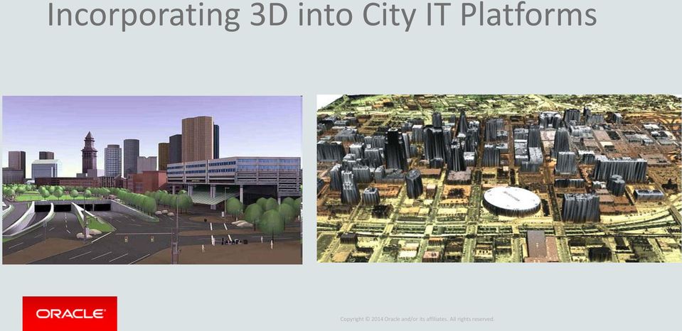
3 Incorporating 3D into City IT Platforms


4 Powering GIS and Raster Applications Geometry Topology Georaster Networks LRS Geodetic Long Transactions 3D


5 Supporting Integrated Business Applications Development Tools (SQL Developer, APEX) Oracle BI EE Applications Mobile Apps

6 Challenges: Managing 3D Point Cloud Data Robust Data Management Challenges: High Density LIDAR: Sub-meter point spacing (billions of points) Combine with multi-spectral gridded data (terabytes of data) Versioning, Archiving (terabytes, petabytes) Data Transformation LIDAR point filtering, visualization, analysis Surfaces and 3D vector models Attribute Data Integration Visualization & Analytics Associate 3D objects/features to attributes Spatial query across point cloud features Managing updates

7 Managing All Spatial Data Types Bring location analysis and secure storage to enterprise data Points Lines Polygons Web Services (OGC) SPARQL End Point SQL access Oracle Spatial and Graph Geocoding Routing Inferencing Rasters Network Graphs e1 f1 e2 n2 n1 f2 e4 Topologies e3 RDF Semantic Graphs 3D, point clouds (Lidar)

8 3D COORDINATE SYSTEMS 3D Functionality in Oracle Spatial 12c Types Building Models,.. Efficient SDO_GEOMETRY (3D) SDO_TIN SDO_POINT_CLOUD Surface Modeling Scene, Object Modeling Storage Query Analysis

9 Point Clouds: LIDAR Large volumes of point data acquired by sensors LIDAR (Light Detection and Ranging) Seismic sensors Millions of points used to model a scene New data type introduced to efficiently manage this type of point data TIN to create triangulation of such points 9


10 CityGML 3D Models LOD1 Building LOD2 Building LOD3 Building LOD4 Building Semantically structured model Structures at multiple levels of detail Textures and facades Orthophotos Versioning Source: Research Center Karlsruhe

11 Building Information Modeling (BIM): From Design to Operations

12 3D Coordinate Systems Vertical Coordinate Systems: Essentially 1-d coordinate system (w.r.t sea-level etc.) Geocentric: 3-d Cartesian Geographic-2d, Projected-2d: 2-d Ellipsoidal Geographic-3d: 3-d Ellipsoidal Compound Coordinate System Combines A Vertical Coordinate System with Either Geographic-2D or Projected-2D Coordinate System Support transform between different 3D Coordinate Systems


13 3D Queries 3D visibility queries Volumetric analysis Spatial and attribute queries

14 Spatial Database in a 3D Production Workflow: Data Collection Production Dissemination & Exploitation LIDAR Surveys Model/Scene Generation 3D Mapping Photogrammetry Image Texture Wrapping Fly Through Aerial Photos Versioning 3D analysis LIDAR CAD Ortho- Photos Satellite Imagery CAD Designs Editing/Updates Engineering Design Quality Control Predictive Analysis Spatial Database

15 Point Cloud Change Detection Screenshot courtesy of Rico Richter, HPI 15

16 Maintenance of 3D City Models Screenshot courtesy of Rico Richter, HPI 16


17 Maintenance of 3D City Models Screenshot courtesy of Rico Richter, HPI 17


18 Linked Data Services Web Analyst 1 Web Analyst 2 Rest SPARQL Spatial Vocabularies Linked Data Graphs Coverage Graph 3D Feature Graph Coverage Schema Feature Schema Coverage Server Federated Data Servers 3D Feature Server Social Graphs (DBPedia)


19 Enabling a Rich Ecosystem of 3 rd Party Tools Geospatial Tool Providers Specialty Systems Integrators Data Providers NAVIGATE

20 Summary How to proceed in Smart 3D Cities Efforts Begin to harmonize your 3D data sources Leverage existing IT software investments Location-enabling your operational systems Use open standards for interoperability Test performance, reliability, and security


21 Resources Spatial & Graph on the Oracle Technology Network: blogs.oracle.com oraclespatial oracle_maps_blog Fast data & OEP: oracle.com/fastdata
<Insert Picture Here> Data Management Innovations for Massive Point Cloud, DEM, and 3D Vector Databases
 Data Management Innovations for Massive Point Cloud, DEM, and 3D Vector Databases Xavier Lopez, Director, Product Management 3D Data Management Technology Drivers: Challenges & Benefits
Geospatial Platforms For Enabling Workflows
 Geospatial Platforms For Enabling Workflows Steven Hagan Vice President Oracle Database Server Technologies November, 2015 Evolution of Enabling Workflows HENRY FORD 100 YEARS AGO Industrialized the Manufacturing
3D Data Management From Point Cloud to City Model GeoSmart Africa 2016, Cape Town
 3D Data Management From Point Cloud to City Model GeoSmart Africa 2016, Cape Town Albert Godfrind Spatial Solutions Architect ORACLE Corporation April 13, 2016 Copyright 2014 Oracle and/or its affiliates.
Geospatial Platforms For Enabling Workflows
 Geospatial Platforms For Enabling Workflows Steven Hagan Vice President Oracle Database Server Technologies May, 2015 Evolution of Enabling Workflows HENRY FORD 100 YEARS AGO Industrialized the Manufacturing
Big Data, Cloud Computing, Spatial Databases Steven Hagan Vice President Server Technologies
 Big Data, Cloud Computing, Spatial Databases Steven Hagan Vice President Server Technologies Big Data: Global Digital Data Growth Growing leaps and bounds by 40+% Year over Year! 2009 =.8 Zetabytes =.08
Geospatial Technology Innovations and Convergence
 Geospatial Technology Innovations and Convergence Processing Big and Fast Data: Best with a Multi-Model Database Steven Hagan Vice President Oracle Database Server Technologies August, 2015 Data Volume
Smart Cities require Geospatial Data Providing services to citizens, enterprises, visitors...
 Cloud-based Spatial Data Infrastructures for Smart Cities Geospatial World Forum 2015 Hans Viehmann Product Manager EMEA ORACLE Corporation Smart Cities require Geospatial Data Providing services to citizens,
Big Data Spatial Performance with Oracle Database 12c A Practitioner s Panel
 Big Data Spatial Performance with Oracle Database 12c A Practitioner s Panel Siva Ravada Senior Director, Software Development Oracle Spatial Technologies Presented with Big Data Spatial Performance with
Big Data Spatial Performance with Oracle Database 12c A Practitioner s Panel
 Big Data Spatial Performance with Oracle Database 12c A Practitioner s Panel Siva Ravada Senior Director, Software Development Oracle Spatial Technologies Presented with Big Data Spatial Performance with
Deploying a Geospatial Cloud
 Deploying a Geospatial Cloud Traditional Public Sector Computing Environment Traditional Computing Infrastructure Silos of dedicated hardware and software Single application per silo Expensive to size
Oracle Platform GIS & Location-Based Services. Fred Louis Solution Architect Ohio Valley
 Oracle Platform GIS & Location-Based Services Fred Louis Solution Architect Ohio Valley Overview Geospatial Technology Trends Oracle s Spatial Technologies Oracle10g Locator Spatial Oracle Application
3D GIS: It s a Brave New World
 3D GIS: It s a Brave New World Reida ELWANNAS, United Arab Emirates Key words: 3D Models, CityGML, GIS SUMMARY For the past several decades we have been enjoying the power of GIS. The introduction of 2.5D
3D Point Cloud Analytics for Updating 3D City Models
 3D Point Cloud Analytics for Updating 3D City Models Rico Richter 25 th May 2015 INSPIRE - Geospatial World Forum 2015 Background Hasso Plattner Institute (HPI): Computer Graphics Systems group of Prof.
Geospatially Enabling the World: The Convergence of Geospatial and Architectural and Engineering Design
 Geospatially Enabling the World: The Convergence of Geospatial and Architectural and Engineering Design Geoff Zeiss Director of Technology Autodesk Map Middle East Dubai 2007 1 Overview Geospatial inflection
Big Data and Analytics: Getting Started with ArcGIS. Mike Park Erik Hoel
 Big Data and Analytics: Getting Started with ArcGIS Mike Park Erik Hoel Agenda Overview of big data Distributed computation User experience Data management Big data What is it? Big Data is a loosely defined
Semantic Data Management. Xavier Lopez, Ph.D., Director, Spatial & Semantic Technologies
 Semantic Data Management Xavier Lopez, Ph.D., Director, Spatial & Semantic Technologies 1 Enterprise Information Challenge Source: Oracle customer 2 Vision of Semantically Linked Data The Network of Collaborative
Using OBIEE for Location-Aware Predictive Analytics
 Using OBIEE for Location-Aware Predictive Analytics Jean Ihm, Principal Product Manager, Oracle Spatial and Graph Jayant Sharma, Director, Product Management, Oracle Spatial and Graph, MapViewer Oracle
Implementing an Imagery Management System at Mexican Navy
 Implementing an Imagery Management System at Mexican Navy The Mexican Navy safeguards 11,000 kilometers of Mexican coastlines, inland water bodies suitable for navigation, and the territorial sea and maritime
Oracle Big Data Spatial and Graph
 Oracle Big Data Spatial and Graph Oracle Big Data Spatial and Graph offers a set of analytic services and data models that support Big Data workloads on Apache Hadoop and NoSQL database technologies. For
The benefits and implications of the Cloud and Software as a Service (SaaS) for the Location Services Market. John Caulfield Solutions Director
 for the Location Services Market. John Caulfield Solutions Director") The benefits and implications of the Cloud and Software as a Service (SaaS) for the Location Services Market John Caulfield Solutions Director What Is Cloud Computing Cloud Computing Everyone Is Talking
The benefits and implications of the Cloud and Software as a Service (SaaS) for the Location Services Market John Caulfield Solutions Director What Is Cloud Computing Cloud Computing Everyone Is Talking
Technologies Enabling the Evolution of a Smart City. Brad Schmidt, Intergraph Canada
 Technologies Enabling the Evolution of a Smart City Brad Schmidt, Intergraph Canada AGENDA The Smart City Key Challenges Facing Cities Technology Challenges Smart Sensor Integration Smart Apps Smart Data
Big Data for Official Statistics Processing Big and Fast Data Optimizing Results with a Multi-Model Database
 Big Data for Official Statistics Processing Big and Fast Data Optimizing Results with a Multi-Model Database Steven Hagan Vice President Oracle Database Server Technologies October, 2015 Global Digital
Geomatica Image Management System (GIMS)
") Geomatica Image Management System (GIMS) A PCI Geomatics White Paper October 2006 Table of Contents 1. Introduction...2 2. GIMS controls costs in a spatially enabled enterprise...3 3. GIMS eases the challenge
Geomatica Image Management System (GIMS) A PCI Geomatics White Paper October 2006 Table of Contents 1. Introduction...2 2. GIMS controls costs in a spatially enabled enterprise...3 3. GIMS eases the challenge
Assessment Tasks Pass theory exams at > 70%. Meet, or exceed, outcome criteria for projects and assignments.
 CENTRAL OREGON COMMUNITY COLLEGE: GEOGRAPHIC INFORMATION SYSTEM PROGRAM 1 CENTRAL OREGON COMMUNITY COLLEGE Associate Degree Geographic Information Systems Program Outcome Guide (POG) Program Outcome Guide
GIS Databases With focused on ArcSDE
 Linköpings universitet / IDA / Div. for human-centered systems GIS Databases With focused on ArcSDE Imad Abugessaisa [email protected] 20071004 1 GIS and SDBMS Geographical data is spatial data whose
Mining Big Data with RDF Graph Technology:
 Mining Big Data with RDF Graph Technology: Xavier Lopez, Ph.D. Director, Product Mgmt. Zhe Wu, Ph.D. Consulting Member Technical Staff 1 Copyright 2012, Oracle and/or its affiliates. All rights reserved.
CityGML goes to Broadway
 CityGML goes to Broadway Thomas H. Kolbe, Barbara Burger, Berit Cantzler Chair of Geoinformatics [email protected] September 11, 2015 Photogrammetric Week 2015, Stuttgart The New York City Open Data
the Cloud Dean McCormick Regional Sales Manager Geospatial MEA Region
 Powering Big Data: From Creation to the Cloud Dean McCormick Regional Sales Manager Geospatial MEA Region The only constant is change, continuing change, inevitable change, that is the dominant factor
An Oracle White Paper February 2009. Managing Unstructured Data with Oracle Database 11g
 An Oracle White Paper February 2009 Managing Unstructured Data with Oracle Database 11g Introduction The vast majority of the information used by corporations, enterprises, and other organizations is referred
Leveraging Cloud-Based Mapping Solutions
 Leveraging Cloud-Based Mapping Solutions GeoAlberta October 28, 2014 Laura Kerssens Safe Software Agenda To the Cloud Using Basic Services Cloud Applications Web Services Cloud-Hosted Databases Real-time
Oracle Spatial 10g. An Oracle White Paper August 2005
 Oracle Spatial 10g An Oracle White Paper August 2005 Oracle Spatial 10g INTRODUCTION Oracle Spatial, an option for Oracle Database 10g Enterprise Edition, includes advanced spatial capabilities to support
How To Use Gis
 Welcome Understanding Purpose Creating Relationships You A Global Community of GIS Professionals Changing the World Together Applying Geography Everywhere Your WORK Showcasing Your Web Apps Vision Applying
The following was presented at DMT 14 (June 1-4, 2014, Newark, DE).
.") DMT 2014 The following was presented at DMT 14 (June 1-4, 2014, Newark, DE). The contents are provisional and will be superseded by a paper in the DMT 14 Proceedings. See also presentations and Proceedings
DMT 2014 The following was presented at DMT 14 (June 1-4, 2014, Newark, DE). The contents are provisional and will be superseded by a paper in the DMT 14 Proceedings. See also presentations and Proceedings
Dr. Rinaldo Wurglitsch Solution Development Manger
 Data Management Integrative End-To-End Geo Collection: From Sensor to GIS Dr. Rinaldo Wurglitsch Solution Development Manger Austrian Federal Railways The Austrian Federal Railways (de: Österreichische
GeoMedia Product Update. Title of Presentation. Lorilie Barteski October 15, 2008 Edmonton, AB
 Product Update Title of Presentation Lorilie Barteski Edmonton, AB Know the audience poll Existing /Pro users Version 6.1 Version 6.0 Version 5.2 or earlier Existing WebMap users Version 6.1 Version 6.0
massive aerial LiDAR point clouds
 Visualization, storage, analysis and distribution of massive aerial LiDAR point clouds Gerwin de Haan and Hugo Ledoux Data Visualization group GIS technology group GeoWeb 2010, Vancouver July 28 2010 1
http://www.esri.com/bia
 ArcGIS for Tribal Transportation Management David Gadsden Federal Account Manager [email protected] d d 1 David Gadsden GIS Background UW Geography (1995) Peace Corps Tanzania Environmental Social Science
Using PCI Geomatics Software with Oracle 10g Spatial and GeoRaster A PCI Geomatics Whitepaper
 Using PCI Geomatics Software with Oracle 10g Spatial and GeoRaster A PCI Geomatics Whitepaper November 2005 Table of Contents Table of Contents...1 1. Introduction...2 2. How Geomatica adds value to Oracle
data has become increasingly important in many industries
 ing Spatial Databases to Efficiently Mana Objects at a National Level a Geospatial Forum 2015 Viehmann uct Manager EMEA CLE Corporation st 19, 2015 Copyright 2014 Oracle and/or its affiliates. All rights
ERDAS IMAGINE The world s most widely-used remote sensing software package
 ERDAS IMAGINE The world s most widely-used remote sensing software package ERDAS IMAGINE Geographic imaging professionals need to process vast amounts of geospatial data every day often relying on software
ArcGIS Platform. An Integrated System. Portal
 Platform An Integrated System Portal An Integrated Web GIS Platform Knowledge Workers Executive Access Public Engagement Work Anywhere Enterprise Integration Providing Mapping, Analysis, Data Management,
Emerging Geospatial Trends The Convergence of Technologies. Jim Steiner Vice President, Product Management
 Emerging Geospatial Trends The Convergence of Technologies Jim Steiner Vice President, Product Management United Nation Analysis Initiative on Global GeoSpatial Information Management Future Trends Technology
Developing Business Intelligence and Data Visualization Applications with Web Maps
 Developing Business Intelligence and Data Visualization Applications with Web Maps Introduction Business Intelligence (BI) means different things to different organizations and users. BI often refers to
Intergraph Geospatial Portfolio 2013
 W H A T S N E W? Intergraph Geospatial Portfolio 2013 Photogrammetry LPS ImageStation Remote Sensing ERDAS IMAGINE GIS GeoMedia Server GeoMedia WebMap GeoMedia Smart Client ERDAS APOLLO Geospatial SDI
ERDAS ADE Enterprise Suite Products Overview and Position
 ERDAS ADE Enterprise Suite Products Overview and Position ERDAS ADE Suite Technical Overview Iryna Wetzel ERDAS Inc Switzerland Introduction to Products and Target Market what we will cover in this module
SDI Program at the University of Chicago. Scott Stocking, GISP Facilities Services Department
 Scott Stocking, GISP Facilities Services Department Discussion Outline University/Facilities Services The Story Begins Major Components of SDI Program Support Operations Current & Future Conceptual Design
MSDI: Workflows, Software and Related Data Standards
 MSDI: Workflows, Software and Related Data Standards By Andy Hoggarth October 2009 Introduction Leveraging SDI principles for hydrographic operational efficiency French INFRAGEOS example (SHOM - Service
ArcGIS for. Intelligence
 ArcGIS for ArcGIS for solutions.arcgis.com/intelligence Copyright 2015 Esri. All rights reserved. 146660 DUAL3M7/15rk Briefing Book ArcGIS for Briefing Book ArcGIS Web Application ArcGIS for Create and
ArcGIS. Server. A Complete and Integrated Server GIS
 ArcGIS Server A Complete and Integrated Server GIS ArcGIS Server A Complete and Integrated Server GIS ArcGIS Server enables you to distribute maps, models, and tools to others within your organization
GIS Initiative: Developing an atmospheric data model for GIS. Olga Wilhelmi (ESIG), Jennifer Boehnert (RAP/ESIG) and Terri Betancourt (RAP)
, Jennifer Boehnert (RAP/ESIG) and Terri Betancourt (RAP)") GIS Initiative: Developing an atmospheric data model for GIS Olga Wilhelmi (ESIG), Jennifer Boehnert (RAP/ESIG) and Terri Betancourt (RAP) Unidata seminar August 30, 2004 Presentation Outline Overview
GIS Initiative: Developing an atmospheric data model for GIS Olga Wilhelmi (ESIG), Jennifer Boehnert (RAP/ESIG) and Terri Betancourt (RAP) Unidata seminar August 30, 2004 Presentation Outline Overview
Oracle BI 11g R1: Create Analyses and Dashboards
 Oracle University Contact Us: Local: 1800 103 4775 Intl: +91 80 67863102 Oracle BI 11g R1: Create Analyses and Dashboards Duration: 5 Days What you will learn This Oracle BI 11g R1: Create Analyses and
Big Data Volume & velocity data management with ERDAS APOLLO. Alain Kabamba Hexagon Geospatial
 Big Data Volume & velocity data management with ERDAS APOLLO Alain Kabamba Hexagon Geospatial Intergraph is Part of the Hexagon Family Hexagon is dedicated to delivering actionable information through
Files Used in this Tutorial
 Generate Point Clouds Tutorial This tutorial shows how to generate point clouds from IKONOS satellite stereo imagery. You will view the point clouds in the ENVI LiDAR Viewer. The estimated time to complete
MrSID Plug-in for 3D Analyst
 LizardTech MrSID Plug-in for 3D Analyst User Manual Copyrights Copyright 2009 2010 LizardTech. All rights reserved. Information in this document is subject to change without notice. The software described
Big Data and Advanced Analytics Applications and Capabilities Steven Hagan, Vice President, Server Technologies
 Big Data and Advanced Analytics Applications and Capabilities Steven Hagan, Vice President, Server Technologies 1 Copyright 2011, Oracle and/or its affiliates. All rights Big Data, Advanced Analytics:
LSD APC Part I Workshop Geographic Information System. Danny Yeung 14 November 2015
 LSD APC Part I Workshop Geographic Information System Danny Yeung 14 November 2015 Purposes To help LSD probationers to prepare for the LSD APC Part I Written Assessment to be held in December 2015. To
ENVI THE PREMIER SOFTWARE FOR EXTRACTING INFORMATION FROM GEOSPATIAL IMAGERY.
 ENVI THE PREMIER SOFTWARE FOR EXTRACTING INFORMATION FROM GEOSPATIAL IMAGERY. ENVI Imagery Becomes Knowledge ENVI software uses proven scientific methods and automated processes to help you turn geospatial
Harmonizing Survey Deliverables Emerging Standards and Smart Data Exchange
 Harmonizing Survey Deliverables Emerging Standards and Smart Data Exchange Andy Hoggarth and Karen Cove, CARIS, Fredericton, Canada Introduction When a survey company plans a project the deliverables are
Unstructured Data Management with Oracle Database 12c O R A C L E W H I T E P A P E R S E P T E M B E R 2 0 1 4
 Unstructured Data Management with Oracle Database 12c O R A C L E W H I T E P A P E R S E P T E M B E R 2 0 1 4 Disclaimer The following is intended to outline our general product direction. It is intended
A Big Picture for Big Data
 Supported by EU FP7 SCIDIP-ES, EU FP7 EarthServer A Big Picture for Big Data FOSS4G-Europe, Bremen, 2014-07-15 Peter Baumann Jacobs University rasdaman GmbH [email protected] Our Stds Involvement
Developing Fleet and Asset Tracking Solutions with Web Maps
 Developing Fleet and Asset Tracking Solutions with Web Maps Introduction Many organizations have mobile field staff that perform business processes away from the office which include sales, service, maintenance,
Texas Develops Online Geospatial Data Repository to Support Emergency Management
 Bing Maps for Enterprise Microsoft Customer Solution Case Study Texas Develops Online Geospatial Data Repository to Support Emergency Management Overview Country or Region: United States Industry: Government
Where is... How do I get to...
 Big Data, Fast Data, Spatial Data Making Sense of Location Data in a Smart City Hans Viehmann Product Manager EMEA ORACLE Corporation August 19, 2015 Copyright 2014, Oracle and/or its affiliates. All rights
Sextant. Spatial Data Infrastructure for Marine Environment. C. Satra Le Bris, E. Quimbert, M. Treguer
 Sextant On-Line information system for marine geographical information E. Quimbert, M. Bellouis, F. Lecuy, M. Treguer Centre de Bretagne BP 70, Plouzané 29280 France E-mail: [email protected] Sextant
Big Data Spatial Analytics An Introduction
 2013 Esri International User Conference July 8 12, 2013 San Diego, California Technical Workshop Big Data Spatial Analytics An Introduction Marwa Mabrouk Mansour Raad Esri iu UC2013. Technical Workshop
Big Data Analytics Platform @ Nokia
 Big Data Analytics Platform @ Nokia 1 Selecting the Right Tool for the Right Workload Yekesa Kosuru Nokia Location & Commerce Strata + Hadoop World NY - Oct 25, 2012 Agenda Big Data Analytics Platform
Advanced Image Management using the Mosaic Dataset
 Esri International User Conference San Diego, California Technical Workshops July 25, 2012 Advanced Image Management using the Mosaic Dataset Vinay Viswambharan, Mike Muller Agenda ArcGIS Image Management
A quick overview of geographic information systems (GIS) Uwe Deichmann, DECRG <[email protected]>
 Uwe Deichmann, DECRG <udeichmann@worldbank.org>") A quick overview of geographic information systems (GIS) Uwe Deichmann, DECRG Why is GIS important? A very large share of all types of information has a spatial component ( 80
A quick overview of geographic information systems (GIS) Uwe Deichmann, DECRG Why is GIS important? A very large share of all types of information has a spatial component ( 80
ERDAS PRO600. A state-of-the-art package for 3D feature collection and editing
 ERDAS PRO600 A state-of-the-art package for 3D feature collection and editing MicroStation design file graphics are displayed by PRO600 in full 3D stereo. PRO600 PRO600 is a highly sophisticated, function-rich
Alejandro Vaisman Esteban Zimanyi. Data. Warehouse. Systems. Design and Implementation. ^ Springer
 Alejandro Vaisman Esteban Zimanyi Data Warehouse Systems Design and Implementation ^ Springer Contents Part I Fundamental Concepts 1 Introduction 3 1.1 A Historical Overview of Data Warehousing 4 1.2 Spatial
Cityzenith s 5D Smart City platform empowers users with a simple way to make sense of the torrent of data in our cities, corporate
 5D Smart City Cityzenith s 5D Smart City platform empowers users with a simple way to make sense of the torrent of data in our cities, corporate campuses, and universities, revolutionizing the way we access,
IP-S2 Compact+ 3D Mobile Mapping System
 IP-S2 Compact+ 3D Mobile Mapping System 3D scanning of road and roadside features Delivers high density point clouds and 360 spherical imagery High accuracy IMU options without export control Simple Map,
Visual Analysis of Statistical Data on Maps using Linked Open Data
 Visual Analysis of Statistical Data on Maps using Linked Open Data Petar Ristoski and Heiko Paulheim University of Mannheim, Germany Research Group Data and Web Science {petar.ristoski,heiko}@informatik.uni-mannheim.de
Immersed 3D Visualization of the University of Chicago Campus. Scott Stocking, GISP Facilities Services Department
 Immersed 3D Visualization of the University of Chicago Campus Scott Stocking, GISP Facilities Services Department Discussion Outline - Objectives of the Project - Data Utilized - Methods Used to build
AV-18 Introduction of the GIS Integration
 Slide 1 AV-18 Introduction of the GIS Integration Authors Victor Lough Dan Marsillo Geoff Tarcha social.invensys.com @InvensysOpsMgmt / #SoftwareRevolution /InvensysVideos /InvensysOpsMgmt /company/invensys
Visualize your World. Democratization i of Geographic Data
 Visualize your World Democratization i of Geographic Data Session Agenda Google GEO Solutions - More than just a Map Enabling our Government Customers- Examples Summary & Invite to Learn More About Google
GetLOD - Linked Open Data and Spatial Data Infrastructures
 GetLOD - Linked Open Data and Spatial Data Infrastructures W3C Linked Open Data LOD2014 Roma, 20-21 February 2014 Stefano Pezzi, Massimo Zotti, Giovanni Ciardi, Massimo Fustini Agenda Context Geoportal
ADVANCED DATA STRUCTURES FOR SURFACE STORAGE
 1Department of Mathematics, Univerzitni Karel, Faculty 22, JANECKA1, 323 of 00, Applied Pilsen, Michal, Sciences, Czech KARA2 Republic University of West Bohemia, ADVANCED DATA STRUCTURES FOR SURFACE STORAGE
Oklahoma s Open Source Spatial Data Clearinghouse: OKMaps
 Oklahoma s Open Source Spatial Data Clearinghouse: OKMaps Presented by: Mike Sharp State Geographic Information Coordinator Oklahoma Office of Geographic Information MAGIC 2014 Symposium April 28-May1,
Oracle Spatial and Graph. Jayant Sharma Director, Product Management
 Oracle Spatial and Graph Jayant Sharma Director, Product Management Agenda Oracle Spatial and Graph Graph Capabilities Q&A 2 Oracle Spatial and Graph Complete Open Integrated Most Widely Used 3 Open and
A Web services solution for Work Management Operations. Venu Kanaparthy Dr. Charles O Hara, Ph. D. Abstract
 A Web services solution for Work Management Operations Venu Kanaparthy Dr. Charles O Hara, Ph. D Abstract The GeoResources Institute at Mississippi State University is leveraging Spatial Technologies and
DATA INTEGRATION FROM DIFFERENT SOURCES TO CREATE 3D VIRTUAL MODEL
 DATA INTEGRATION FROM DIFFERENT SOURCES TO CREATE 3D VIRTUAL MODEL A. Erving, P. Rönnholm, and M. Nuikka Institute of Photogrammetry and Remote Sensing, Department of Surveying, Helsinki University of
Harmonizing Survey Deliverables Emerging Standards and Smart Data Exchange
 Harmonizing Survey Deliverables Emerging Standards and Smart Data Exchange Andy Hoggarth, CARIS 115 Waggoners Lane, Fredericton, New Brunswick, Canada [email protected] Karen Cove, CARIS 115 Waggoners
GIS Solutions for FTTx Design. David Nelson, GISP
 GIS Solutions for FTTx Design David Nelson, GISP Telecom GIS Manager, Black & Veatch Agenda Intro to GIS Telecom GIS Vision GIS Strategy Project Execution Mobile Online Services Dashboards Client Deliverables
Managing Lidar (and other point cloud) Data. Lindsay Weitz Cody Benkelman
 Data. Lindsay Weitz Cody Benkelman") (and other point cloud) Data Lindsay Weitz Cody Benkelman Presentation Context What is lidar, and how does it work? Not this presentation! What can you do with lidar in ArcGIS? What does Esri recommend
(and other point cloud) Data Lindsay Weitz Cody Benkelman Presentation Context What is lidar, and how does it work? Not this presentation! What can you do with lidar in ArcGIS? What does Esri recommend
Technology Trends In Geoinformation
 Technology Trends In Geoinformation Dato Prof. Sr Dr. Abdul Kadir Bin Taib Department of Survey and Mapping Malaysia (JUPEM) Email: [email protected] www.jupem.gov.my NGIS 2008 3 rd. National GIS Conference
Graph Database Performance: An Oracle Perspective
 Graph Database Performance: An Oracle Perspective Xavier Lopez, Ph.D. Senior Director, Product Management 1 Copyright 2012, Oracle and/or its affiliates. All rights reserved. Program Agenda Broad Perspective
Enterprise GIS Solutions to GIS Data Dissemination
 Enterprise GIS Solutions to GIS Data Dissemination ESRI International User Conference July 13 17, 2009 Wendy M. Turner Senior GIS Engineer & Program Manager Freedom Consulting Group, LLC Building the Enterprise
Institute of Natural Resources Departament of General Geology and Land use planning Work with a MAPS
 Institute of Natural Resources Departament of General Geology and Land use planning Work with a MAPS Lecturers: Berchuk V.Y. Gutareva N.Y. Contents: 1. Qgis; 2. General information; 3. Qgis desktop; 4.
SeeMore. The 2013 Geospatial Portfolio Desktop. Geospatial for Smarter Decisions
 SeeMore The 2013 Geospatial Portfolio Desktop Geospatial for Smarter Decisions united. Modern. Dynamic. domore Geospatial for Smarter Decisions powering the geospatial enterprise More than ever before,
GEOGRAPHIC INFORMATION SYSTEMS CERTIFICATION
 GEOGRAPHIC INFORMATION SYSTEMS CERTIFICATION GIS Syllabus - Version 1.2 January 2007 Copyright AICA-CEPIS 2009 1 Version 1 January 2007 GIS Certification Programme 1. Target The GIS certification is aimed
Oracle Database 12c: An Introduction to Oracle s Location Technologies O R A C L E W H I T E P A P E R S E P T E M B E R 2 0 1 4
 Oracle Database 12c: An Introduction to Oracle s Location Technologies O R A C L E W H I T E P A P E R S E P T E M B E R 2 0 1 4 Table of Contents Introduction 1 Oracle Location Technologies 3 Oracle Database
Oracle Big Data SQL Technical Update
 Oracle Big Data SQL Technical Update Jean-Pierre Dijcks Oracle Redwood City, CA, USA Keywords: Big Data, Hadoop, NoSQL Databases, Relational Databases, SQL, Security, Performance Introduction This technical