Intro to Web App Builder. Mark Scott, Solutions Engineer, Esri County Government Team
|
|
|
- Tabitha Peters
- 8 years ago
- Views:
Transcription
1 Intro to Web App Builder Mark Scott, Solutions Engineer, Esri County Government Team

2 The ArcGIS Platform enables Web GIS Enabling GIS Everywhere Desktop Web Device Simple Integrated Open portal Server Online Content and Services Available in the Cloud and On-Premises A

3 Creating web apps with ArcGIS

4 ArcGIS Web Application Templates ArcGIS Online and Portal for ArcGIS Web Map A

5

6 30+ widgets Web AppBuilder for ArcGIS Create new web apps without programming


7 Web AppBuilder for ArcGIS Functionality within ArcGIS Online and Portal for ArcGIS - ArcGIS Online since Dec Portal for ArcGIS in 10.3 and later Enables new apps to be created without coding - Interactive WYSIWYG user experience - Runs on any device, in a web browser Fully integrated with the ArcGIS Platform Built with ArcGIS API for JavaScript and HTML 5 technology Extensible

8 2 Options to Work with Web AppBuilder 1. Within ArcGIS Online or Portal for ArcGIS - Embedded in the web site - Activate from the map viewer or My Contents 2. Developer Edition - Separate download and installed locally - Sign into ArcGIS Online or Portal for ArcGIS - Support for custom widgets and themes Both offer the same builder user experience, same capabilities

9 By the Numbers # of apps made in ArcGIS Online: 10,000+ # of Developer Edition downloads: v , v (early June 2015) Pre-UC Survey: 70% are using it now Very active user community on GeoNet - Web AppBuilder for ArcGIS - 8 th most active - Web AppBuilder Custom Widgets - 6 th most active - Custom widgets by the community: over downloads A


10 Workflow for Creating a new App


11 Available Widgets Widget: a chunk of code that can be added in a modular fashion; provides functionality 30+ available; enable core web mapping application capabilities


12 Some Notable Widgets Navigation Query Search Geocoding Editing Geoprocessing Printing Legend Layer List Overview Map Attribute HeaderController

13 Deploy Apps on Any Device

14 Leverage your organization s Utility Services ArcGIS Online or Portal for ArcGIS Organization settings panel Locators Basemaps Print services

15 Web Apps from Web AppBuilder Apps are hosted in ArcGIS Online or Portal for ArcGIS Become items in App author s My Contents Option to download source code for the app from Item Details page - Customize web app - Host in your own web server ArcGIS Online Portal for ArcGIS Production Web Server Web App1 Web App2 Web App2 A

16 2 Tiers of Customization Enabling custom functionality Configurator - Add custom widgets to your apps - Non-developer Extending custom functionality Developer - Create new widgets from scratch - Programmer

17 Using Custom Widgets/Themes in Your Apps Workflow - Download the source code for the app - Apply customizations as desired - Host in your own web server

18 GeoNet: Custom Widgets shared by Community Mixture of enhanced and brand new widgets Approx. 20+ widgets Some supporting docs

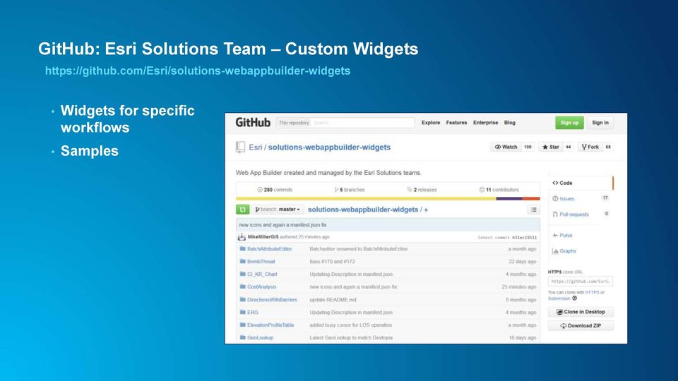
19 GitHub: Esri Solutions Team Custom Widgets Widgets for specific workflows Samples
20 Web AppBuilder Developer Edition Developers.ArcGIS.com/web-appbuilder Download and install locally - Sign into ArcGIS Online or Portal for ArcGIS - Same builder user experience as embedded Web AppBuilder - Work with custom widgets and themes Provides extensibility framework for apps Leverages ArcGIS API for JavaScript Create web apps on your own computer

21 GeoNet Esri Community 2 places for Web AppBuilder user community Both are very active Top GeoNet contributors post in these forums/places
22 GeoNet: Web AppBuilder Developer Edition Customization Resource List Created, owned, and maintained by the community Rebecca Strauch
23 Web AppBuilder for ArcGIS Resources Online help documentation Developer Edition help documentation Esri Live Training Seminar: Get Started with Web AppBuilder for ArcGIS (60 mins) Esri Web course: Creating Web Applications Using Templates and Web AppBuilder for ArcGIS (2-4 hours)
24 Esri Training Options Free Live Training Seminars - Recorded Archive E-Learning Instructor-led
25 Questions


26
Introduction to Web AppBuilder for ArcGIS: JavaScript Apps Made Easy
 Introduction to Web AppBuilder for ArcGIS: JavaScript Apps Made Easy OKSCAUG Pamela Kersh September 22, 2015 The ArcGIS Platform enables Web GIS Enabling GIS Everywhere Desktop Web Device Simple Integrated
Scott Moore, Esri April 4, 2016 2016 Intermountain, Great Falls, MT
 Create Great Web Apps No Coding Required Scott Moore, Esri April 4, 2016 2016 Intermountain, Great Falls, MT Agenda Product overview Web AppBuilder for ArcGIS tour What s New November 2015 ArcGIS Online
Building and Deploying Web Applications
 Building and Deploying Web Applications Dal Hunter and Jeff Shaner Friday, Nov 6 10:30-12:00 Agenda Product overview Web AppBuilder for ArcGIS tour What s New July 2015 ArcGIS Online update Customization
Petroleum Web Applications to Support your Business. David Jacob & Vanessa Ramirez Esri Natural Resources Team
 Petroleum Web Applications to Support your Business David Jacob & Vanessa Ramirez Esri Natural Resources Team Agenda Petroleum Web Apps to Support your Business The ArcGIS Location Platform Introduction
Getting your app together with Web AppBuilder for ArcGIS
 Getting your app together with Web AppBuilder for ArcGIS Walter Simonazzi Walter Simonazzi Session path What is Web AppBuilder for ArcGIS? Web AppBuilder for ArcGIS tour What s new? July 2015 Demos Community
ArcGIS 10.1 Web Apps and APIs. John Hasthorpe & Kai Hübner
 ArcGIS 10.1 Web Apps and APIs John Hasthorpe & Kai Hübner Overview Options for leveraging ArcGIS Server using Esri s Web APIs Alternatives to the Web ADF application builder (Gone in 10.1) When and how
Configuring and Extending ArcGIS Solutions Web Applications
 Esri Developer Summit March 8 11, 2016 Palm Springs, CA Configuring and Extending ArcGIS Solutions Web Applications Allison Muise & Mike Tschudi ArcGIS Solutions? ArcGIS as a Platform Simple, Open, and
Raise of hands on anyone whos used the Flex or Silverlight Application Builders?
 Raise of hands on whos used the Beta for Web Application Builder? Raise of hands on anyone whos done any web development? Raise of hands on anyone whos used the Flex or Silverlight Application Builders?
ArcGIS Viewer for Silverlight An Introduction
 Esri International User Conference San Diego, California Technical Workshops July 26, 2012 ArcGIS Viewer for Silverlight An Introduction Rich Zwaap Agenda Background Product overview Getting started and
ArcGIS Platform. An Integrated System. Portal
 Platform An Integrated System Portal An Integrated Web GIS Platform Knowledge Workers Executive Access Public Engagement Work Anywhere Enterprise Integration Providing Mapping, Analysis, Data Management,
ArcGIS Web Mapping. Sam Berg, esri sberg@esri.com
 ArcGIS Web Mapping Sam Berg, esri sberg@esri.com Agenda ArcGIS and WebMaps The APIs ArcGIS for Flex Viewer ArcGIS for Silverlight Builder ArcGIS for Sharepoint ArcGIS Application Templates ArcGIS Runtime
Portal for ArcGIS: An Introduction
 2013 Esri Mid-Atlantic User Conference December 10-11 Baltimore, MD Portal for ArcGIS: An Introduction Derek Law Esri, Redlands Agenda Web GIS Deployment patterns Portal for ArcGIS overview Security Integration
ArcGIS Web App Builder (AWAB) In BETA. John Bocan MES/DoIT john.bocan@maryland.gov
 In BETA. John Bocan MES/DoIT john.bocan@maryland.gov") ArcGIS Web App Builder (AWAB) In BETA John Bocan MES/DoIT john.bocan@maryland.gov Some Facts (1 slide) The Pros (5 slides) The Cons (2 slides) Some Bugs/Issues (1 slide) What s to Come (1 slide) What This
ArcGIS Web App Builder (AWAB) In BETA John Bocan MES/DoIT john.bocan@maryland.gov Some Facts (1 slide) The Pros (5 slides) The Cons (2 slides) Some Bugs/Issues (1 slide) What s to Come (1 slide) What This
Portal. from the trenches!
 from the trenches! Deployment Patterns Scaling and High Availability Reference Implementations Common Challenges Extending Engagement patterns Esri UC 2014 Technical Workshop for ArcGIS Technology Transfer
Portal for ArcGIS. Satish Sankaran Robert Kircher
 Portal for ArcGIS Satish Sankaran Robert Kircher ArcGIS A Complete GIS Data Management Planning & Analysis Field Mobility Operational Awareness Constituent Engagement End to End Integration Collect, Organize,
Developing Apps with the ArcGIS Runtime SDK for Android. Ben Ramseth Esri Inc. Instructor Technical Lead
 Developing Apps with the ArcGIS Runtime SDK for Android Ben Ramseth Esri Inc. Instructor Technical Lead Ben Ramseth Instructor Technical Lead Esri Inc USA, Charlotte, NC bramseth@esri.com @EsriMapNinja
Chapter 1: Introduction to ArcGIS Server
 Chapter 1: Introduction to ArcGIS Server At a high level you can think of ArcGIS Server as software that helps you take your geographic information and make it available to others. This data can be distributed
Mobile Solutions in ArcGIS. Justin Fan
 Mobile Solutions in ArcGIS Justin Fan Agenda Introducing Mobile GIS Esri Mobile GIS solutions Selecting the right Mobile GIS solution Resources Q&A Introducing Mobile GIS What is Mobile GIS? Extends the
Esri GIS Mobile Solutions. John Sharrard jsharrard@esri.com
 Esri GIS Mobile Solutions John Sharrard jsharrard@esri.com If I had asked people what they wanted, they would have said faster horses. Henry Ford Trend: Increase demand for location services Pew Research
Introduce Web3D Development and Visualization. Moxie Zhang Esri R&D Center Beijing
 Introduce Web3D Development and Visualization Moxie Zhang Esri R&D Center Beijing Web Scene Desktop Web Device New in ArcGIS Online and Portal Web Scene Mash-up of 3D / 2D layers Web Scene Viewer and
UNGIWG 14. Steve Maddison, George Davis, Latitude Geographics Friday, May 16 th 2014
 UNGIWG 14 Steve Maddison, George Davis, Latitude Geographics Friday, May 16 th 2014 GIS Challenges Today Spatial Application Infrastructure (SAI) The Geocortex Approach 2 1 Geocortex Essentials Web-based
Five Steps to Better Performance
 Effective Web maps have a specific focus and are designed so users can interact with them to accomplish meaningful tasks. Five Steps to Better Performance Sample methodology for creating a great Web map
Network Analysis with ArcGIS Online
 Federal GIS Conference February 9 10, 2015 Washington, DC Network Analysis with ArcGIS Online Matt Kennedy Topics Online versus on-premise network analysis services How to access online services How to
NatureServe s Environmental Review Tool
 NatureServe s Environmental Review Tool A Repeatable Online Software Solution for Agencies For More Information, Contact: Lori Scott Rob Solomon lori_scott@natureserve.org rob_solomon@natureserve.org 703-908-1877
Build an ArcGIS Online Application
 Build an ArcGIS Online Application Sign into ArcGIS Online for Maryland 1. Open a web browser 2. Go to URL http://maryland.maps.arcgis.com/ 3. Click Sign In in the upper right corner of the web page 4.
Note: Hands On workshops are Bring Your Own Laptop (BYOL), unless otherwise noted. Some workshops are Bring Your Own Mobile Device(BYOD).
, unless otherwise noted. Some workshops are Bring Your Own Mobile Device(BYOD).") 2015 MN GIS/LIS Consortium Pre Conference Workshops The Minnesota GIS/LIS Consortium is pleased to offer a diverse list of workshops on Wednesday, October 7th, 2015 at the DECC, Duluth, Minnesota Charting
2015 MN GIS/LIS Consortium Pre Conference Workshops The Minnesota GIS/LIS Consortium is pleased to offer a diverse list of workshops on Wednesday, October 7th, 2015 at the DECC, Duluth, Minnesota Charting
Esri Maps for Office, SharePoint & Dynamics CRM. Tony Howser Sentha Sivabalan Scott Ball
 Esri Maps for Office, SharePoint & Dynamics CRM Tony Howser Sentha Sivabalan Scott Ball Agenda Location Analytics Esri Maps for - SharePoint - Office - Dynamics CRM Pricing Road Map Q & A Evolving the
How To Use Gis
 Welcome Understanding Purpose Creating Relationships You A Global Community of GIS Professionals Changing the World Together Applying Geography Everywhere Your WORK Showcasing Your Web Apps Vision Applying
Enterprise GIS Architecture Deployment Options. Andrew Sakowicz
 Enterprise GIS Architecture Deployment Options Andrew Sakowicz Audience Audience - Architects - Developers - Administrators - Project Managers Level: - Beginner / Intermediate Introduction Andrew Sakowicz
Vision. South Pacific GIS/RS Conference 2015 11/17/2015. Applying Geography Everywhere. Applying Geography Everywhere
 South Pacific GIS/RS Conference 2015 Applying Geography Everywhere Jithen (J) Singh Eagle Technology Group Ltd (Esri New Zealand) Suva, Fiji Vision Applying Geography Everywhere 1 GIS Is Evolving A Whole
Deploying ArcGIS for Server Using Esri Managed Services
 Federal GIS Conference 2014 February 10 11, 2014 Washington DC Deploying ArcGIS for Server Using Esri Managed Services Andrew Sakowicz Erin Ross Cloud Overview Deploying ArcGIS for Server What is Cloud:
Embracing ArcGIS for Local Government. Robert Parsons Delaware County, Ohio Auditor s Office Steve Koenig Bruce Harris & Associates
 Embracing ArcGIS for Local Government Robert Parsons Delaware County, Ohio Auditor s Office Steve Koenig Bruce Harris & Associates Background Project began in April 2013 At that time ArcIMS 9.2 was the
How to Setup and Manage Spatial Assets with ArcGIS Online for a Mobile Workforce
 How to Setup and Manage Spatial Assets with ArcGIS Online for a Mobile Workforce W A U R I S A 2 0 1 4 Presented By Engineer Technician II Pierce County Public Works and Utilities Road Operations Division
Essential Mapping Apps
 Essential Mapping Apps 74% of adults use their smartphone to look at maps or other information based on their current location (of the 58% that own a smart phone) Pew Research Center Maps for Directions
Conservation Workshop ArcGIS Explorer
 Conservation Workshop ArcGIS Explorer Bern Szukalski bszukalski@esri.com Topics for this session Introduction Overview of features Using ArcGIS Explorer effectively New features & capabilities Customization
Implementing ArcGIS for SharePoint Habitat for Humanity of Omaha April, 2013
 Ingenuity Innovation Integrity Implementing ArcGIS for SharePoint Habitat for Humanity of Omaha April, 2013 1851 Alexander Bell Drive Suite 350 Reston, VA 20191 703.463.2059 800.483.2434 www.vistronix.com
ArcGIS Server 9.3.1 mashups
 Welcome to ArcGIS Server 9.3.1: Creating Fast Web Mapping Applications With JavaScript Scott Moore ESRI Olympia, WA smoore@esri.com Seminar agenda ArcGIS API for JavaScript: An Overview ArcGIS Server Resource
Making Your Mobile Workforce More Efficient
 ArcGIS for Mobile Making Your Mobile Workforce More Efficient What Is Mobile GIS? Mobile geographic information system (GIS) technology extends GIS beyond the office and allows organizations to make accurate,
Online Data Services. Security Guidelines. Online Data Services by Esri UK. Security Best Practice
 Online Data Services Security Guidelines Online Data Services by Esri UK Security Best Practice 28 November 2014 Contents Contents... 1 1. Introduction... 2 2. Data Service Accounts, Security and Fair
ArcGIS Pro. James Tedrick, Esri
 ArcGIS Pro James Tedrick, Esri What you already know Why ArcGIS PRO? Vision The next generation ArcGIS desktop application for the GIS community who need a clean and comprehensive user experience which
Deploying ArcGIS for Server Using Managed Services
 Deploying ArcGIS for Server Using Managed Services Andrew Sakowicz Erin Ross Sridhar Karra Agenda Introduction Program Overview - Overview - Methodology - Tools Customer Deployments - Architecture and
Editing Strategies for Enterprise Geodatabase
 Federal GIS Conference February 9 10, 2015 Washington, DC Editing Strategies for Enterprise Geodatabase Ty Fabling Esri Solution Engineer A Complete Platform Enabling GIS Everywhere Desktop Web Device
Developing Microsoft SharePoint Server 2013 Core Solutions
 Course 20488B: Developing Microsoft SharePoint Server 2013 Core Solutions Course Details Course Outline Module 1: SharePoint as a Developer Platform This module examines different approaches that can be
ORACLE APPLICATION EXPRESS 5.0
 ORACLE APPLICATION EXPRESS 5.0 Key Features Fully supported nocost feature of the Oracle Database Simple 2-Tier Architecture Develop desktop and mobile applications 100% Browserbased Development and Runtime
Introduce Configurable Mobile App Development. Moxie Zhang Esri R&D Center Beijing
 Introduce Configurable Mobile App Development Moxie Zhang Esri R&D Center Beijing Mobile app development starts with many options and there are different approaches to build an app and there are different
GIS and Mapping Solutions for Developers. ESRI Developer Network (EDN SM)
") GIS and Mapping Solutions for Developers ESRI Developer Network (EDN SM) GIS and Mapping Solutions for Developers If you are a software developer looking for an effective way to bring geographic and mapping
GIS and Mapping Solutions for Developers ESRI Developer Network (EDN SM) GIS and Mapping Solutions for Developers If you are a software developer looking for an effective way to bring geographic and mapping
MetroGIS Project Proposal Template Version 1.0
 MetroGIS Project Proposal Template Version 1.0 1 MetroGIS provides an on-going opportunity for collaborative projects among its stakeholders. Crucial to the success of collaborative projects are the identification
Operations Dashboard for ArcGIS: Extending the Functionality
 Operations Dashboard for ArcGIS: Extending the Functionality Jay Chen Kylie Donia Tif Pun Esri UC 2014 Technical Workshop Esri UC 2014 Technical Workshop Agenda Operations Dashboard In 45 seconds Esri
MD imap 2.0 THE NEXT GENERATION OF MARYLAND S ENTERPRISE GIS. Esri MUG Conference Baltimore, MD December 3, 2014 http://imap.maryland.
 THE NEXT GENERATION OF MARYLAND S ENTERPRISE GIS MD imap 2.0 Matt Sokol, GISP Senior GIS Analyst Maryland Department of Information Technology Geographic Information Office Julia Fischer, GISP Senior GIS
Quick Start Guide to. ArcGISSM. Online
 Quick Start Guide to ArcGISSM Online ArcGIS Online Quick Start Guide ArcGIS SM Online is a cloud-based mapping platform for organizations. Users get access to dynamic, authoritative content to create,
Making Your Mobile Workforce More Efficient
 ArcGIS for Mobile Making Your Mobile Workforce More Efficient What Is Mobile GIS? Mobile geographic information system (GIS) technology extends GIS beyond the office and allows organizations to make accurate,
MAY 18, 2015 ARCGIS 10.3.1 FOR SERVER FUNCTIONALITY MATRIX
 MAY 18, 2015 ARCGIS 10.3.1 FOR SERVER FUNCTIONALITY MATRIX Copyright 2015 Esri All rights reserved. Printed in the United States of America. The information contained in this document is the exclusive
Building your Server for High Availability and Disaster Recovery. Witt Mathot Danny Krouk
 Building your Server for High Availability and Disaster Recovery Witt Mathot Danny Krouk Terminology Whoa! Resiliency High Availability RTO Round Robin Business Continuity A Spectrum, Not a Switch Backup
Storytelling with Maps: Workflows and Best Practices
 Storytelling with Maps: Workflows and Best Practices Introduction What is a story map? Story maps are interactive maps combined with text and other content to tell a story about the world. Typically story
Use ArcGIS Online to Manage
 Use ArcGIS Online to Manage Your Own Custom Map Gallery By Keith Mann, Esri Start customizing the template by changing the graphics and the web page title. Wouldn t it be great if you could create a dynamic
Please contact Cyber and Technology Training at (410)777-1333/technologytraining@aacc.edu for registration and pricing information.
777-1333/technologytraining@aacc.edu for registration and pricing information.") Course Name Start Date End Date Start Time End Time Active Directory Services with Windows Server 8/31/2015 9/4/2015 9:00 AM 5:00 PM Active Directory Services with Windows Server 9/28/2015 10/2/2015 9:00
Course Name Start Date End Date Start Time End Time Active Directory Services with Windows Server 8/31/2015 9/4/2015 9:00 AM 5:00 PM Active Directory Services with Windows Server 9/28/2015 10/2/2015 9:00
SAP HANA Cloud Portal Overview and Scenarios
 SAP HANA Cloud Portal Overview and Scenarios HERUG 2014 Conference - Montevideo April 2014 Twitter: @portal_sap / #hanacloudportal HERUG 2014 Conference Event Website Event overview Information and Agenda
Extending the Survey123 for ArcGIS Mobile App
 Esri Developer Summit March 8 11, 2016 Palm Springs, CA Extending the Survey123 for ArcGIS Mobile App Elvin Slavik, Sathya Prasad THE FOLLOWING TECH PREVIEW HAS BEEN APPROVED FOR ALL RESTRICTED DEVELOPER
City of Corpus Christi. Mobile GIS Viewer. For ipad
 City of Corpus Christi Mobile GIS Viewer For ipad MIS - GIS 3/9/2012 P a g e 1 Contents Requirements... 2 Installation... 2 Using the ArcGIS Mobile App... 4 Connect to the Corpus Christi Mobile GIS Map
Supporting High-Quality Printing in Web Applications with ArcGIS for Server
 2013 Esri International User Conference July 8 12, 2013 San Diego, California Technical Workshop Supporting High-Quality Printing in Web Applications with ArcGIS for Server Craig Williams Tanu Hoque Esri
GIS: Transforming the Business. Presented by: Catherine Fitzgerald Manager, Information Services Municipality of Chatham-Kent
 GIS: Transforming the Business Presented by: Catherine Fitzgerald Manager, Information Services Municipality of Chatham-Kent Organization Overview Municipality of Chatham-Kent Single Tier Local Government
Improving Access to GIS Data With Targeted Web Apps. Joyce Green, City of Norman John McIntosh, City of Norman
 Improving Access to GIS Data With Targeted Web Apps Joyce Green, City of Norman John McIntosh, City of Norman Improving Access to GIS Data with Targeted Web Apps Background Objective Development Environment
Enabling High-Quality Printing in Web Applications with ArcGIS for Server. Craig Williams - @williamscraigm Scott Moore - @ScottMooreInOly
 Enabling High-Quality Printing in Web Applications with ArcGIS for Server Craig Williams - @williamscraigm Scott Moore - @ScottMooreInOly High Quality Printing on the Web Primary Goals: - Create a printable
County of Los Angeles. Chief Information Office Preferred Technologies for Geographic Information Systems (GIS) September 2014
 September 2014") County of Los Angeles Chief Information Office Preferred Technologies for Geographic Information Systems (GIS) September 2014 CIO Preferred Technologies for GIS This document lists the preferred Geographic
County of Los Angeles Chief Information Office Preferred Technologies for Geographic Information Systems (GIS) September 2014 CIO Preferred Technologies for GIS This document lists the preferred Geographic
How To Use Arcgis For Free On A Gdb 2.2.2 (For A Gis Server) For A Small Business
 For A Small Business") Esri Middle East and Africa User Conference December 10 12 Abu Dhabi, UAE Understanding ArcGIS in Virtualization and Cloud Environments Marwa Mabrouk Powerful GIS capabilities Delivered as Web services
Esri Middle East and Africa User Conference December 10 12 Abu Dhabi, UAE Understanding ArcGIS in Virtualization and Cloud Environments Marwa Mabrouk Powerful GIS capabilities Delivered as Web services
An ESRI White Paper December 2007 Enterprise GIS for Local Government
 An ESRI White Paper December 2007 Enterprise GIS for Local Government ESRI 380 New York St., Redlands, CA 92373-8100 USA TEL 909-793-2853 FAX 909-793-5953 E-MAIL info@esri.com WEB www.esri.com Copyright
Office 365 SharePoint Online White Paper
 Office 365 SharePoint Online White Paper Introduction Overview Cloud computing is slowly changing the way IT companies are offering their software solutions and services. Through cloud computing, IT companies
ESRI Mobile GIS Solutions Overview. Shane Clarke ESRI
 ESRI Mobile GIS Solutions Overview Shane Clarke ESRI Agenda Overview of mobile GIS ESRI mobile GIS Solutions Selecting a mobile GIS solution Q & A 2 Mobile GIS Overview 3 What is mobile GIS? Extension
QML and JavaScript for Native App Development
 Esri Developer Summit March 8 11, 2016 Palm Springs, CA QML and JavaScript for Native App Development Michael Tims Lucas Danzinger Agenda Native apps. Why? Overview of Qt and QML How to use JavaScript
ArcGIS for Server in the Cloud
 Esri Developer Summit March 8 11, 2016 Palm Springs, CA ArcGIS for Server in the Cloud Cherry Lin, Nikhil Shampur, and Derek Law March 10, 2016 Quick Survey 1. How many attendees are using the Cloud today?
Fall 2015 GES 4120/5120 Internet GIS
 Fall 2015 GES 4120/5120 Internet GIS Instructor: Dr. Somayeh Dodge Assistant Professor Department of Geography & Environmental Studies website: http://www.uccs.edu/~sdodge/ e-mail: sdodge3@uccs.edu Office:
Promoting Your Location Platform
 Promoting Your Location Platform A Change Management Kit www.esri.com/changekit Publication Date: November 23, 2015 Esri: Promoting Your Location Platform 1 What is the Change Management Kit? The launch
Copyright 2012, Oracle and/or its affiliates. All rights reserved.
 1 Oracle WebCenter Strategy and Vision Rob Schootman Principal Sales Consultant Oracle Fusion Middleware 2 Insert Information Protection Policy Classification from Slide 13 Let s introduce myself... 3
Leveraging Cloud-Based Mapping Solutions
 Leveraging Cloud-Based Mapping Solutions GeoAlberta October 28, 2014 Laura Kerssens Safe Software Agenda To the Cloud Using Basic Services Cloud Applications Web Services Cloud-Hosted Databases Real-time
Developing Android Apps with the ArcGIS Runtime SDK for Android. Dan O Neill @jdoneill @doneill
 Developing Android Apps with the ArcGIS Runtime SDK for Android Dan O Neill @jdoneill @doneill Xueming Wu @xuemingrocks Agenda Introduction to the ArcGIS Android SDK Maps & Layers Basemaps (Portal) Location
MicroStrategy Course Catalog
 MicroStrategy Course Catalog 1 microstrategy.com/education 3 MicroStrategy course matrix 4 MicroStrategy 9 8 MicroStrategy 10 table of contents MicroStrategy course matrix MICROSTRATEGY 9 MICROSTRATEGY
Drupal and ArcGIS Yes, it can be done. Frank McLean Developer
 Drupal and ArcGIS Yes, it can be done Frank McLean Developer Who we are NatureServe is a conservation non-profit Network of member programs Track endangered species and habitats Across North America Environmental
Managing Bathymetry in the Cloud with GIS
 Esri Maritime Professional Services GEBCO Science Day Tuesday, October 4, 2011 Managing Bathymetry in the Cloud with GIS Timothy Kearns & Beata Van Esch Overview The challenges of bathymetry in GIS - What
Emerging Applications at Seattle Public Utilities
 Emerging Applications at Seattle Public Utilities Presented at: 2011 Washington URISA Conference May 11, 2011 Lynnwood, Washington Harvey Arnone and Stephen Beimborn with special guest, Dana Trethewy Presentation
Seamless integration Connect our solution to your business applications thanks to our open architecture
 t b Product data management Manage Product Breakdown Structure and their configurations Process and change management Track and organize changes on your parts, products and documents Seamless integration
AV-18 Introduction of the GIS Integration
 Slide 1 AV-18 Introduction of the GIS Integration Authors Victor Lough Dan Marsillo Geoff Tarcha social.invensys.com @InvensysOpsMgmt / #SoftwareRevolution /InvensysVideos /InvensysOpsMgmt /company/invensys
Welcome to Esri's Software Export Control Classification Number (ECCN) Matrix
 Matrix") Welcome to Esri's Software Export Control Classification Number (ECCN) Matrix Updated September 30, 2015 This portion of the Esri web site is to provide information regarding the export control classification
Welcome to Esri's Software Export Control Classification Number (ECCN) Matrix Updated September 30, 2015 This portion of the Esri web site is to provide information regarding the export control classification
Lecture 8. Online GIS
 Lecture 8 Online GIS Lecture 8: Outline I. Online GIS 1. Google Earth 2. MSN Live Maps II. Open Source GIS III. ArcGIS Server and the ESRI suite of online software utility options IV. Advanced Data Mining
IBM Digital Experience. Using Modern Web Development Tools and Technology with IBM Digital Experience
 IBM Digital Experience Using Modern Web Development Tools and Technology with IBM Digital Experience Agenda The 2015 web development landscape and IBM Digital Experience Modern web applications and frameworks
Customizing ArcPad solutions
 Esri International User Conference San Diego, California Technical Workshops 25 July 2012 Customizing ArcPad solutions Marika Vertzonis, Gareth Walters, Stephen Quan Session Outline What can be customized?
GIS WEB APPLICATIONS STANDARDS
 GIS WEB APPLICATIONS STANDARDS DRAFTED BY THE GIS WEB APPLICATIONS TASK TEAM UNDER THE PERVIEW OF THE ARCHITECTURE AND APPLICATIONS SUBCOMMITTEE OF THE ENTERPRISE GIS COMMITTEE TABLE OF CONTENTS Overview...
Visualize your World. Democratization i of Geographic Data
 Visualize your World Democratization i of Geographic Data Session Agenda Google GEO Solutions - More than just a Map Enabling our Government Customers- Examples Summary & Invite to Learn More About Google
Say hello to.. ..in the Cloud! Enterprise Web Content Management. ptools Software 2011. All rights reserved. www.ptools.com
 Say hello to....in the Cloud! Enterprise Web Content Management ptools Software 2011. All rights reserved. www.ptools.com Introduction 1 ptools System6, Enterprise Web Content Management for Cloud Computing,
Prepare Data ArcMap Open Trees.mpk Chrome ArcGIS Online New Map Chrome Esri Blogs Chrome Local Government Resources Reflector Phone Connected
 Prepare Data ArcMap Open Trees.mpk Chrome ArcGIS Online New Map Chrome Esri Blogs Chrome Local Government Resources Reflector Phone Connected Kate Firefox http://doc.arcgis.com/en/operations dashboard/
A Workflow for Creating and Sharing Maps
 A Workflow for Creating and Sharing Maps By Keith Mann, Esri What You Will Need Item Source ArcGIS Online for Organizations subscription ArcGIS 10.1 for Desktop (Any license level) ArcGIS Spatial Analyst
What is ArcGIS Comprised Of?
 ArcGIS Server 9.1 What is ArcGIS Comprised Of? ArcGIS Desktop Integrated suite of GIS applications ArcGIS Engine Embeddable developer components Server GIS ArcSDE, ArcIMS, ArcGIS Server Mobile GIS ArcPad
Connecting Space and Time OSIsoft & Esri
 Connecting Space and Time OSIsoft & Esri Presented by Michelle Kuiee Product Manager 2 3 Which of these describe your need? Operating Engineers & Analysts Evironmental Heath and Safety Maintenance Coordinators
Making GIS web apps. (at DWR)
") Making GIS web apps (at DWR) Who is this guy Wyatt Pearsall https://github.com/wpears Why web apps really, why web apps? Why web apps Web apps turn data into information Why web apps FTP Catalog Email
Making GIS web apps (at DWR) Who is this guy Wyatt Pearsall https://github.com/wpears Why web apps really, why web apps? Why web apps Web apps turn data into information Why web apps FTP Catalog Email
Implementing a Mobile GIS. Tom Brenneman Esri
 Implementing a Mobile GIS Tom Brenneman Esri Agenda Mobile GIS Overview ESRI Mobile GIS Solutions - ArcPad - ArcGIS Mobile - ArcGIS for ios Select a Mobile GIS Solution Q&A Mobile GIS Overview ArcGIS 10
INFORMATION MANAGERS ROUNDTABLE SHELLEY COOKE, WHITNEY WEBER MONDAY APRIL 23, 2012 1:30 3:00 PM PST
 INFORMATION MANAGERS ROUNDTABLE SHELLEY COOKE, WHITNEY WEBER MONDAY APRIL 23, 2012 1:30 3:00 PM PST I. Biotics 4 Session Topics Compatibility issues, other common challenges, support for Biotics 4 (Informational,
Supporting High-Quality Printing in Web Applications with ArcGIS 10.1 for Server
 Esri International User Conference San Diego, California Technical Workshops July 25, 2012 Supporting High-Quality Printing in Web Applications with ArcGIS 10.1 for Server Craig Williams and Tanu Hoque
ArcGIS 10.3 Server on Amazon Web Services
 ArcGIS 10.3 Server on Amazon Web Services Copyright 1995-2015 Esri. All rights reserved. Table of Contents Introduction What is ArcGIS Server on Amazon Web Services?............................... 5 Quick
GIS IN THE CLOUD THE ESRI EXAMPLE DAVID CHAPPELL SEPTEMBER 2010 SPONSORED BY ESRI
 GIS IN THE CLOUD THE ESRI EXAMPLE DAVID CHAPPELL SEPTEMBER 2010 SPONSORED BY ESRI CONTENTS Contents... 2 Cloud Computing Basics... 3 Cloud Applications and Cloud Platforms... 3 An Example Cloud Platform:
ArcGIS and Enterprise Security
 ArcGIS and Enterprise Security Leveraging ArcGIS in Cybersecurity Ken Stoni Secure Enterprise ArcGIS Best Practices Michael Young Visualizing the Virtual: A geospatial approach to cyber operations and
Building Applications with the ArcGIS Runtime SDK for Windows Mobile
 Esri International User Conference San Diego, California Technical Workshops July 25th Building Applications with the ArcGIS Runtime SDK for Windows Mobile Jay Chen Justin Colville What we will cover today