Satellite remote sensing using AVHRR, ATSR, MODIS, METEOSAT, MSG
|
|
|
- Theodora Gilbert
- 8 years ago
- Views:
Transcription
1 Satellite remote sensing using AVHRR, ATSR, MODIS, METEOSAT, MSG Ralf Meerkötter, Luca Bugliaro, Knut Dammann, Gerhard Gesell, Christine König, Waldemar Krebs, Hermann Mannstein, Bernhard Mayer, presented by Ulrich Schumann, DLR, Germany

2 NOAA/AVHRR Longterm observations of lineshaped contrails and of water/ice cloud properties over Europe

3 A European Cloud Climatology from NOAA/AVHRR data Monthly means of total cloud cover averaged over 11 years January April % July September R. Meerkötter (IPA) C. König (IPA) H. Mannstein (IPA) G. Gesell (DFD)
 C. König (IPA) H. Mannstein (IPA) G.")
4 Monthly means of total cloud cover from NOAA/AVHRR data in comparison to data of the global circulation model ECHAM4.L39/CHEM Averaging area Summer 2003 R. Meerkötter (IPA) C. König (IPA) V. Grewe (IPA)

5 Cloud masks of two methods detecting high and thin clouds other thin NOAA/AVHRR DLR high other Ci thin Ci NOAA/TOVS LMD Cb R. Meerkötter (IPA) C. Stubenrauch (LMD)

6 Comparison of different data sets containing cloud cover related to high clouds (Cb + thick cirrus) + thin cirrus Monthly means, spatially averaged over Europe R. Meerkötter (IPA) C. Stubenrauch (LMD)
 C.")
7 Comparison of different times series of cloud cover related to thin clouds Monthly means, spatially averaged over Europe R. Meerkötter (IPA) C. Stubenrauch (LMD)
 C.")
8 Which contrail properties are most important? Optical depth Contrail area Microphysics for visible optical depth of 0.5 Radiative forcing at top the of atmosphere for visible optical depth at 0.55 um derived from 1-D radiative transfer (Meerkötter et al. 1999) related to 100 % contrail coverage

9 Two years of contrails in AVHRR data over Europe Many over sea, less over land, poor detection over mountains H. Mannstein (IPA) R. Meyer (IPA)
 R.")
10 Average of the coverage by line-shaped contrails ( ) with an overlay of flight routes from EUROCONTROL data of May R. Meyer (IPA) H. Mannstein (IPA)
 H.")
11 Time series of monthly mean contrail coverage for the full lifetime of NOAA Daytime Nightime Data refer to the region 6 W to26 E and 42 N to 54 N % R. Meyer (IPA)

12 Mean contrail forcing for Europe Averaging day and night Averaging summer and winter Resulting in an annual average of 0.03 W/m 2 R. Meyer (IPA)

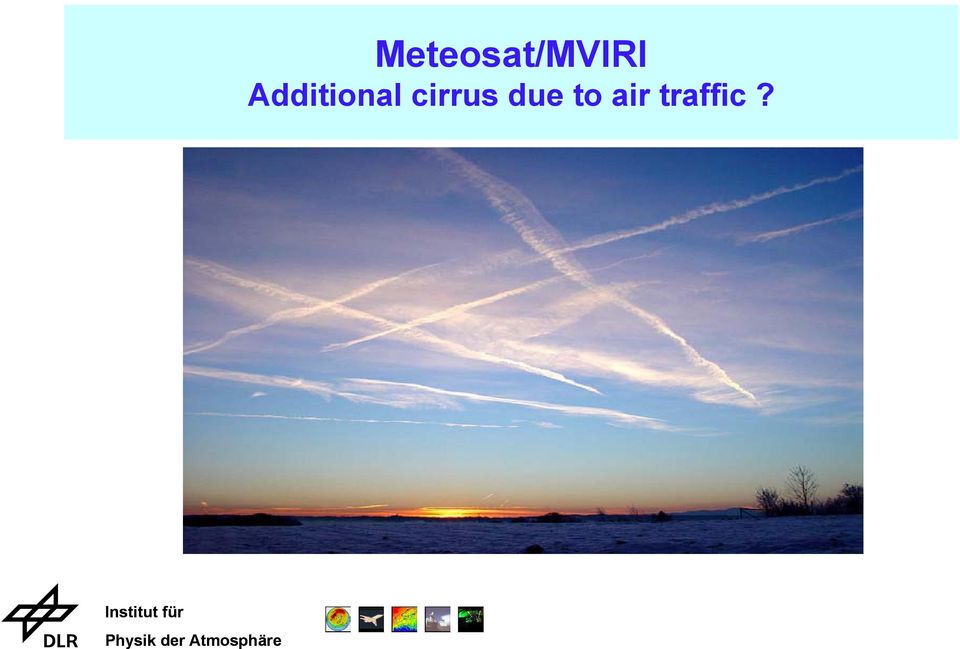
13 Meteosat/MVIRI Additional cirrus due to air traffic?
14 Meteosat: Cirrus cover and air traffic Meteosat image Air traffic density Thin cirrus algorithm 1.0 Thin cirrus cover actual slot sum of slots 0.0 Air traffic density (km/km 2 /h) 1.0 H. Mannstein (IPA)

15 Coverage Coverage Cirrus Mean air traffic density (km/km 2 /h) Thin cirrus Meteosat: Cirrus coverage and air traffic Result: ~ 3% additional cirrus due to air traffic and ~0.3 % due to linear contrails Mean air traffic density (km/km 2 /h) H. Mannstein (IPA)

16 Temperature [K] Temperature [K] Thermal IR window channel Mean air traffic density (km/km 2 /h) Water vapour channel Meteosat: Blackbody temperatures and air traffic Result: Temperatures decrease in areas with heavy air traffic compared to areas without air traffic thermal IR: ~ 6.5K lower water vapour: ~ 2.5K lower Mean air traffic density (km/km 2 /h) H. Mannstein (IPA)
 H.")
17 Meteosat Second Generation New horizons for cloud remote sensing Meteosat MSG NOAA/AVHRR [micron]

18 MSG: Retrieval of optical depth and effective radius for water clouds MSG color composit Optical depth Effective radius , 13:30 UTC New software package at DLR/IPA based on EUMETSAT scenes analysis L. Bugliaro (IPA) W. Krebs (IPA)

19 , 8:42 UTC MSG: Detection of cirrus clouds SEVIRI color composit Cirrus from A: brightness temperature difference TIR8 -TIR20 B: brightness temperature TIR08 A+B: both tests L. Bugliaro (IPA) W. Krebs (IPA)

20 Cirrus parameters from ERS-2/ATSR-2 ATSR-2 Image Effective Radius Cloud optical depth (0.55 µm) South of Shetland Island , 10:34 UTC (µm) K. Dammann (IPA)
 1 3 5 K.")
21 Cirrus parameters from ERS-2/ATSR-2 ATSR-2 Image Effective Radius Cloud optical depth (0.55 µm) Channel area , 11:06 UTC (µm) K. Dammann (IPA)
22 MODIS: Cloud mask example for over Europe Color composit Land Cirrus Snow or Ci German Remote Sensing Data Center Wat. Cloud Snow G.Gesell (DFD)
23 Conclusions Done: Line-shaped contrail cover, optical thickness, radiative forcing, understood METEOSAT/air traffic correlation analysis indicates that additional cirrus cover induced by aircraft is far larger than the cover by line-shaped contrails Tools developed (but still to be refined) for cirrus analysis from AVHRR, METEOSAT, MSG, ATSR, MODIS Open: Complete and verify remote sensing estimates of cirrus properties Quantify cirrus changes and related RF from air traffic by long-term and largescale correlation between remote sensing data (MSG etc.) and air traffic data Identify the impact of aerosols on cloud and precipitation properties
How To Understand The Climate Impact Of Aviation
 Aviation Climate Impact: Scientific Status Ulrich Schumann, DLR Institut für Physik der Atmosphäre Understanding of Aviation climate impact - History 1971/72: Johnston, Crutzen: NO x from super-sonic transport
SATELLITE OBSERVATION OF THE DAILY VARIATION OF THIN CIRRUS
 SATELLITE OBSERVATION OF THE DAILY VARIATION OF THIN CIRRUS Hermann Mannstein and Stephan Kox ATMOS 2012 Bruges, 2012-06-21 Folie 1 Why cirrus? Folie 2 Warum Eiswolken? Folie 3 Folie 4 Folie 5 Folie 6
Outline of RGB Composite Imagery
 Outline of RGB Composite Imagery Data Processing Division, Data Processing Department Meteorological Satellite Center (MSC) JMA Akihiro SHIMIZU 29 September, 2014 Updated 6 July, 2015 1 Contents What s
More and different clouds from transport
 More and different clouds from transport Klaus Gierens Deutsches Zentrum für Luft- und Raumfahrt (DLR) Institut für Physik der Atmosphäre Oberpfaffenhofen, Germany Transport Emissions: The Climate Challenge
Authors: Thierry Phulpin, CNES Lydie Lavanant, Meteo France Claude Camy-Peyret, LPMAA/CNRS. Date: 15 June 2005
 Comments on the number of cloud free observations per day and location- LEO constellation vs. GEO - Annex in the final Technical Note on geostationary mission concepts Authors: Thierry Phulpin, CNES Lydie
Best practices for RGB compositing of multi-spectral imagery
 Best practices for RGB compositing of multi-spectral imagery User Service Division, EUMETSAT Introduction Until recently imagers on geostationary satellites were limited to 2-3 spectral channels, i.e.
SAFNWC/MSG Cloud type/height. Application for fog/low cloud situations
 SAFNWC/MSG Cloud type/height. Application for fog/low cloud situations 22 September 2011 Hervé LE GLEAU, Marcel DERRIEN Centre de météorologie Spatiale. Lannion Météo-France 1 Fog or low level clouds?
Volcanic Ash Monitoring: Product Guide
 Doc.No. Issue : : EUM/TSS/MAN/15/802120 v1a EUMETSAT Eumetsat-Allee 1, D-64295 Darmstadt, Germany Tel: +49 6151 807-7 Fax: +49 6151 807 555 Date : 2 June 2015 http://www.eumetsat.int WBS/DBS : EUMETSAT
Measurement of the effect of biomass burning aerosol on inhibition of cloud formation over the Amazon
 Supporting Online Material for Koren et al. Measurement of the effect of biomass burning aerosol on inhibition of cloud formation over the Amazon 1. MODIS new cloud detection algorithm The operational
A comparison of NOAA/AVHRR derived cloud amount with MODIS and surface observation
 A comparison of NOAA/AVHRR derived cloud amount with MODIS and surface observation LIU Jian YANG Xiaofeng and CUI Peng National Satellite Meteorological Center, CMA, CHINA outline 1. Introduction 2. Data
Overview of the IR channels and their applications
 Ján Kaňák Slovak Hydrometeorological Institute Jan.kanak@shmu.sk Overview of the IR channels and their applications EUMeTrain, 14 June 2011 Ján Kaňák, SHMÚ 1 Basics in satellite Infrared image interpretation
EUMETSAT Satellite Programmes
 EUMETSAT Satellite Programmes Nowcasting Applications Developing Countries Marianne König marianne.koenig@eumetsat.int WSN-12 Rio de Janeiro 06-10 August 2012 27 Member States & 4 Cooperating States Member
Night Microphysics RGB Nephanalysis in night time
 Copyright, JMA Night Microphysics RGB Nephanalysis in night time Meteorological Satellite Center, JMA What s Night Microphysics RGB? R : B15(I2 12.3)-B13(IR 10.4) Range : -4 2 [K] Gamma : 1.0 G : B13(IR
CLOUD CLASSIFICATION EXTRACTED FROM AVHRR AND GOES IMAGERY. M.Derrien, H.Le Gléau
 CLOUD CLASSIFICATION EXTRACTED FROM AVHRR AND GOES IMAGERY M.Derrien, H.Le Gléau Météo-France / SCEM / Centre de Météorologie Spatiale BP 147 22302 Lannion. France ABSTRACT We developed an automated pixel-scale
Active Fire Monitoring: Product Guide
 Active Fire Monitoring: Product Guide Doc.No. Issue : : EUM/TSS/MAN/15/801989 v1c EUMETSAT Eumetsat-Allee 1, D-64295 Darmstadt, Germany Tel: +49 6151 807-7 Fax: +49 6151 807 555 Date : 14 April 2015 http://www.eumetsat.int
MSG-SEVIRI cloud physical properties for model evaluations
 Rob Roebeling Weather Research Thanks to: Hartwig Deneke, Bastiaan Jonkheid, Wouter Greuell, Jan Fokke Meirink and Erwin Wolters (KNMI) MSG-SEVIRI cloud physical properties for model evaluations Cloud
Denis Botambekov 1, Andrew Heidinger 2, Andi Walther 1, and Nick Bearson 1
 Denis Botambekov 1, Andrew Heidinger 2, Andi Walther 1, and Nick Bearson 1 1 - CIMSS / SSEC / University of Wisconsin Madison, WI, USA 2 NOAA / NESDIS / STAR @ University of Wisconsin Madison, WI, USA
REMOTE SENSING OF CLOUD-AEROSOL RADIATIVE EFFECTS FROM SATELLITE DATA: A CASE STUDY OVER THE SOUTH OF PORTUGAL
 REMOTE SENSING OF CLOUD-AEROSOL RADIATIVE EFFECTS FROM SATELLITE DATA: A CASE STUDY OVER THE SOUTH OF PORTUGAL D. Santos (1), M. J. Costa (1,2), D. Bortoli (1,3) and A. M. Silva (1,2) (1) Évora Geophysics
The APOLLO cloud product statistics Web service The APOLLO cloud product statistics Web service
 The APOLLO cloud product statistics Web service Introduction DLR and Transvalor are preparing a new Web service to disseminate the statistics of the APOLLO cloud physical parameters as a further help in
GOES-R AWG Cloud Team: ABI Cloud Height
 GOES-R AWG Cloud Team: ABI Cloud Height June 8, 2010 Presented By: Andrew Heidinger 1 1 NOAA/NESDIS/STAR 1 Outline Executive Summary Algorithm Description ADEB and IV&V Response Summary Requirements Specification
Satellite Remote Sensing of Volcanic Ash
 Marco Fulle www.stromboli.net Satellite Remote Sensing of Volcanic Ash Michael Pavolonis NOAA/NESDIS/STAR SCOPE Nowcasting 1 Meeting November 19 22, 2013 1 Outline Getty Images Volcanic ash satellite remote
Advances in Cloud Imager Remote Sensing
 Advances in Cloud Imager Remote Sensing Andrew Heidinger NOAA/NESDIS/ORA Madison, Wisconsin With material from Mike Pavolonis, Robert Holz, Amato Evan and Fred Nagle STAR Science Symposium November 9,
Diurnal evolution of cloud base heights in convective cloud fields from MSG/SEVIRI data
 Atmos. Chem. Phys., 9, 1767 1778, 2009 Author(s) 2009. This work is distributed under the Creative Commons Attribution 3.0 License. Atmospheric Chemistry and Physics Diurnal evolution of cloud base heights
How To Understand Cloud Properties From Satellite Imagery
 P1.70 NIGHTTIME RETRIEVAL OF CLOUD MICROPHYSICAL PROPERTIES FOR GOES-R Patrick W. Heck * Cooperative Institute for Meteorological Satellite Studies, University of Wisconsin-Madison Madison, Wisconsin P.
Remote Sensing of Contrails and Aircraft Altered Cirrus Clouds
 Remote Sensing of Contrails and Aircraft Altered Cirrus Clouds R. Palikonda 1, P. Minnis 2, L. Nguyen 1, D. P. Garber 1, W. L. Smith, r. 1, D. F. Young 2 1 Analytical Services and Materials, Inc. Hampton,
3.4 Cryosphere-related Algorithms
 3.4 Cryosphere-related Algorithms GLI Algorithm Description 3.4.-1 3.4.1 CTSK1 A. Algorithm Outline (1) Algorithm Code: CTSK1 (2) Product Code: CLFLG_p (3) PI Name: Dr. Knut Stamnes (4) Overview of Algorithm
The NASA NEESPI Data Portal to Support Studies of Climate and Environmental Changes in Non-boreal Europe
 The NASA NEESPI Data Portal to Support Studies of Climate and Environmental Changes in Non-boreal Europe Suhung Shen NASA Goddard Space Flight Center/George Mason University Gregory Leptoukh, Tatiana Loboda,
VALIDATION OF SAFNWC / MSG CLOUD PRODUCTS WITH ONE YEAR OF SEVIRI DATA
 VALIDATION OF SAFNWC / MSG CLOUD PRODUCTS WITH ONE YEAR OF SEVIRI DATA M.Derrien 1, H.Le Gléau 1, Jean-François Daloze 2, Martial Haeffelin 2 1 Météo-France / DP / Centre de Météorologie Spatiale. BP 50747.
The APOLLO cloud product statistics Web service
 The APOLLO cloud product statistics Web service Introduction DLR and Transvalor are preparing a new Web service to disseminate the statistics of the APOLLO cloud physical parameters as a further help in
Cloud Masking and Cloud Products
 Cloud Masking and Cloud Products MODIS Operational Algorithm MOD35 Paul Menzel, Steve Ackerman, Richard Frey, Kathy Strabala, Chris Moeller, Liam Gumley, Bryan Baum MODIS Cloud Masking Often done with
Studying cloud properties from space using sounder data: A preparatory study for INSAT-3D
 Studying cloud properties from space using sounder data: A preparatory study for INSAT-3D Munn V. Shukla and P. K. Thapliyal Atmospheric Sciences Division Atmospheric and Oceanic Sciences Group Space Applications
Comparison between current and future environmental satellite imagers on cloud classification using MODIS
 Remote Sensing of Environment 108 (2007) 311 326 www.elsevier.com/locate/rse Comparison between current and future environmental satellite imagers on cloud classification using MODIS Zhenglong Li a,, Jun
Evaluation of the Effect of Upper-Level Cirrus Clouds on Satellite Retrievals of Low-Level Cloud Droplet Effective Radius
 Evaluation of the Effect of Upper-Level Cirrus Clouds on Satellite Retrievals of Low-Level Cloud Droplet Effective Radius F.-L. Chang and Z. Li Earth System Science Interdisciplinary Center University
Cloud Climatology for New Zealand and Implications for Radiation Fields
 Cloud Climatology for New Zealand and Implications for Radiation Fields G. Pfister, R.L. McKenzie, J.B. Liley, A. Thomas National Institute of Water and Atmospheric Research, Lauder, New Zealand M.J. Uddstrom
Validation of SEVIRI cloud-top height retrievals from A-Train data
 Validation of SEVIRI cloud-top height retrievals from A-Train data Chu-Yong Chung, Pete N Francis, and Roger Saunders Contents Introduction MO GeoCloud AVAC-S Long-term monitoring Comparison with OCA Summary
DISCRIMINATING CLEAR-SKY FROM CLOUD WITH MODIS ALGORITHM THEORETICAL BASIS DOCUMENT (MOD35) MODIS Cloud Mask Team
 MODIS Cloud Mask Team") DISCRIMINATING CLEAR-SKY FROM CLOUD WITH MODIS ALGORITHM THEORETICAL BASIS DOCUMENT (MOD35) MODIS Cloud Mask Team Steve Ackerman, Richard Frey, Kathleen Strabala, Yinghui Liu, Liam Gumley, Bryan Baum,
DISCRIMINATING CLEAR-SKY FROM CLOUD WITH MODIS ALGORITHM THEORETICAL BASIS DOCUMENT (MOD35) MODIS Cloud Mask Team Steve Ackerman, Richard Frey, Kathleen Strabala, Yinghui Liu, Liam Gumley, Bryan Baum,
Clear Sky Radiance (CSR) Product from MTSAT-1R. UESAWA Daisaku* Abstract
 Product from MTSAT-1R. UESAWA Daisaku* Abstract") Clear Sky Radiance (CSR) Product from MTSAT-1R UESAWA Daisaku* Abstract The Meteorological Satellite Center (MSC) has developed a Clear Sky Radiance (CSR) product from MTSAT-1R and has been disseminating
Clear Sky Radiance (CSR) Product from MTSAT-1R UESAWA Daisaku* Abstract The Meteorological Satellite Center (MSC) has developed a Clear Sky Radiance (CSR) product from MTSAT-1R and has been disseminating
DISCRIMINATING CLEAR-SKY FROM CLOUD WITH MODIS ALGORITHM THEORETICAL BASIS DOCUMENT (MOD35) MODIS Cloud Mask Team
 MODIS Cloud Mask Team") DISCRIMINATING CLEAR-SKY FROM CLOUD WITH MODIS ALGORITHM THEORETICAL BASIS DOCUMENT (MOD35) MODIS Cloud Mask Team Steve Ackerman 1, Kathleen Strabala 1, Paul Menzel 1,2, Richard Frey 1, Chris Moeller 1,
DISCRIMINATING CLEAR-SKY FROM CLOUD WITH MODIS ALGORITHM THEORETICAL BASIS DOCUMENT (MOD35) MODIS Cloud Mask Team Steve Ackerman 1, Kathleen Strabala 1, Paul Menzel 1,2, Richard Frey 1, Chris Moeller 1,
Number of activated CCN as a key property in cloud-aerosol interactions. Or, More on simplicity in complex systems
 Number of activated CCN as a key property in cloud-aerosol interactions Or, More on simplicity in complex systems 1 Daniel Rosenfeld and Eyal Freud The Hebrew University of Jerusalem, Israel Uncertainties
CERES Edition 2 & Edition 3 Cloud Cover, Cloud Altitude and Temperature
 CERES Edition 2 & Edition 3 Cloud Cover, Cloud Altitude and Temperature S. Sun-Mack 1, P. Minnis 2, Y. Chen 1, R. Smith 1, Q. Z. Trepte 1, F. -L. Chang, D. Winker 2 (1) SSAI, Hampton, VA (2) NASA Langley
Passive Remote Sensing of Clouds from Airborne Platforms
 Passive Remote Sensing of Clouds from Airborne Platforms Why airborne measurements? My instrument: the Solar Spectral Flux Radiometer (SSFR) Some spectrometry/radiometry basics How can we infer cloud properties
Use of ARM/NSA Data to Validate and Improve the Remote Sensing Retrieval of Cloud and Surface Properties in the Arctic from AVHRR Data
 Use of ARM/NSA Data to Validate and Improve the Remote Sensing Retrieval of Cloud and Surface Properties in the Arctic from AVHRR Data X. Xiong QSS Group, Inc. National Oceanic and Atmospheric Administration
1861-35. European Conference on Severe Storms (ECSS 2007) 10-14 September 2007
 10-14 September 2007") 1861-35 European Conference on Severe Storms (ECSS 2007) 10-14 September 2007 Development of an operational thunderstorm forecast system for air traffic FORSTER Caroline Institut fuer Physik der Atmosphere,
1861-35 European Conference on Severe Storms (ECSS 2007) 10-14 September 2007 Development of an operational thunderstorm forecast system for air traffic FORSTER Caroline Institut fuer Physik der Atmosphere,
AATSR Technical Note. Improvements to the AATSR IPF relating to Land Surface Temperature Retrieval and Cloud Clearing over Land
 AATSR Technical Note Improvements to the AATSR IPF relating to Land Surface Temperature Retrieval and Cloud Clearing over Land Author: Andrew R. Birks RUTHERFORD APPLETON LABORATORY Chilton, Didcot, Oxfordshire
GOES-R Advanced Baseline Imager (ABI) Algorithm Theoretical Basis Document For Low Cloud and Fog
 Algorithm Theoretical Basis Document For Low Cloud and Fog") NOAA NESDIS CENTER for SATELLITE APPLICATIONS and RESEARCH GOES-R Advanced Baseline Imager (ABI) Algorithm Theoretical Basis Document For Low Cloud and Fog Corey Calvert, UW/CIMSS Mike Pavolonis, NOAA/NESDIS/STAR
NOAA NESDIS CENTER for SATELLITE APPLICATIONS and RESEARCH GOES-R Advanced Baseline Imager (ABI) Algorithm Theoretical Basis Document For Low Cloud and Fog Corey Calvert, UW/CIMSS Mike Pavolonis, NOAA/NESDIS/STAR
USING THE GOES 3.9 µm SHORTWAVE INFRARED CHANNEL TO TRACK LOW-LEVEL CLOUD-DRIFT WINDS ABSTRACT
 USING THE GOES 3.9 µm SHORTWAVE INFRARED CHANNEL TO TRACK LOW-LEVEL CLOUD-DRIFT WINDS Jason P. Dunion 1 and Christopher S. Velden 2 1 NOAA/AOML/Hurricane Research Division, 2 UW/CIMSS ABSTRACT Low-level
Climatology and Monitoring of Dust and Sand Storms in the Arabian Peninsula
 Climatology and Monitoring of Dust and Sand Storms in the Arabian Peninsula Mansour Almazroui Center of Excellence for Climate Change Research (CECCR) King Abdulaziz University, Jeddah, Saudi Arabia E-mail:
Vulnerability assessment of ecosystem services for climate change impacts and adaptation (VACCIA)
") Vulnerability assessment of ecosystem services for climate change impacts and adaptation (VACCIA) Action 2: Derivation of GMES-related remote sensing data Deliverable 1: Time-series of Earth Observation
Vulnerability assessment of ecosystem services for climate change impacts and adaptation (VACCIA) Action 2: Derivation of GMES-related remote sensing data Deliverable 1: Time-series of Earth Observation
Expert System for Solar Thermal Power Stations. Deutsches Zentrum für Luft- und Raumfahrt e.v. Institute of Technical Thermodynamics
 Expert System for Solar Thermal Power Stations Institute of Technical Thermodynamics Stuttgart, July 2001 - Expert System for Solar Thermal Power Stations 2 Solar radiation and land resources for solar
The Effect of Droplet Size Distribution on the Determination of Cloud Droplet Effective Radius
 Eleventh ARM Science Team Meeting Proceedings, Atlanta, Georgia, March 9-, The Effect of Droplet Size Distribution on the Determination of Cloud Droplet Effective Radius F.-L. Chang and Z. Li ESSIC/Department
Meteorological Forecasting of DNI, clouds and aerosols
 Meteorological Forecasting of DNI, clouds and aerosols DNICast 1st End-User Workshop, Madrid, 2014-05-07 Heiner Körnich (SMHI), Jan Remund (Meteotest), Marion Schroedter-Homscheidt (DLR) Overview What
Improved diagnosis of low-level cloud from MSG SEVIRI data for assimilation into Met Office limited area models
 Improved diagnosis of low-level cloud from MSG SEVIRI data for assimilation into Met Office limited area models Peter N. Francis, James A. Hocking & Roger W. Saunders Met Office, Exeter, U.K. Abstract
Cloud Thickness Estimation from GOES-8 Satellite Data Over the ARM-SGP Site
 Cloud Thickness Estimation from GOES-8 Satellite Data Over the ARM-SGP Site V. Chakrapani, D. R. Doelling, and A. D. Rapp Analytical Services and Materials, Inc. Hampton, Virginia P. Minnis National Aeronautics
Remote Sensing of Clouds from Polarization
 Remote Sensing of Clouds from Polarization What polarization can tell us about clouds... and what not? J. Riedi Laboratoire d'optique Atmosphérique University of Science and Technology Lille / CNRS FRANCE
Cloud detection and clearing for the MOPITT instrument
 Cloud detection and clearing for the MOPITT instrument Juying Warner, John Gille, David P. Edwards and Paul Bailey National Center for Atmospheric Research, Boulder, Colorado ABSTRACT The Measurement Of
REACT4C (FP7) Climate optimised Flight Planning
 Climate optimised Flight Planning") REACT4C (FP7) Climate optimised Flight Planning Sigrun Matthes DLR, Institut für Physik der Atmosphäre and REACT4C Project Team Volker Grewe (DLR), Peter Hullah (Eurocontrol), David Lee (MMU), Christophe
REACT4C (FP7) Climate optimised Flight Planning Sigrun Matthes DLR, Institut für Physik der Atmosphäre and REACT4C Project Team Volker Grewe (DLR), Peter Hullah (Eurocontrol), David Lee (MMU), Christophe
Assessing Cloud Spatial and Vertical Distribution with Infrared Cloud Analyzer
 Assessing Cloud Spatial and Vertical Distribution with Infrared Cloud Analyzer I. Genkova and C. N. Long Pacific Northwest National Laboratory Richland, Washington T. Besnard ATMOS SARL Le Mans, France
Final report on RAD service chain evolution
 MACC-II Deliverable D_122.5 Final report on RAD service chain evolution Date: 07/2014 Lead Beneficiary: DLR (#11) Nature: R Dissemination level: PP Grant agreement n 283576 2 / 9 Table of Contents 1. Hardware
IMPACT OF DRIZZLE AND 3D CLOUD STRUCTURE ON REMOTE SENSING OF CLOUD EFFECTIVE RADIUS
 IMPACT OF DRIZZLE AND 3D CLOUD STRUCTURE ON REMOTE SENSING OF CLOUD EFFECTIVE RADIUS Tobias Zinner 1, Gala Wind 2, Steven Platnick 2, Andy Ackerman 3 1 Deutsches Zentrum für Luft- und Raumfahrt (DLR) Oberpfaffenhofen,
MSG MPEF Products focus on GII Simon Elliott Meteorological Operations Division simon.elliott@eumetsat.int
 MSG MPEF focus on GII Simon Elliott Meteorological Operations Division simon.elliott@eumetsat.int MSG Application Workshop, 15-19 March 2010, Alanya, Türkiye Slide: 1 1. What is the MPEF? Meteorological
Contrails, contrail cirrus and hole-punch clouds
 Contrails, contrail cirrus and hole-punch clouds Philip R.A. Brown, Andy Heymsfield, Jean-Francois Gayet Cloud Microphysics Instrumentation Workshop, Seaside, OR, 25-27 June 2010 Issues Aviation impacts
Synoptic assessment of AMV errors
 NWP SAF Satellite Application Facility for Numerical Weather Prediction Visiting Scientist mission report Document NWPSAF-MO-VS-038 Version 1.0 4 June 2009 Synoptic assessment of AMV errors Renato Galante
A Contrail Cirrus Prediction Tool
 A Contrail Cirrus Prediction Tool U. Schumann Deutsches Zentrum für Luft- und Raumfahrt (DLR) Institut für Physik der Atmosphäre Oberpfaffenhofen, Germany Keywords: contrails, contrail cirrus, simulation
Remote Sensing of Cloud Properties from the Communication, Ocean and Meteorological Satellite (COMS) Imagery
 Imagery") Remote Sensing of Cloud Properties from the Communication, Ocean and Meteorological Satellite (COMS) Imagery Choi, Yong-Sang, 1 Chang-Hoi Ho, 1 Myoung-Hwan Ahn, and Young-Mi Kim 1 1 School of Earth and
Remote Sensing of Cloud Properties from the Communication, Ocean and Meteorological Satellite (COMS) Imagery Choi, Yong-Sang, 1 Chang-Hoi Ho, 1 Myoung-Hwan Ahn, and Young-Mi Kim 1 1 School of Earth and
P1.24 USE OF ACTIVE REMOTE SENSORS TO IMPROVE THE ACCURACY OF CLOUD TOP HEIGHTS DERIVED FROM THERMAL SATELLITE OBSERVATIONS
 P1.24 USE OF ACTIVE REMOTE SENSORS TO IMPROVE THE ACCURACY OF CLOUD TOP HEIGHTS DERIVED FROM THERMAL SATELLITE OBSERVATIONS Chris R. Yost* Patrick Minnis NASA Langley Research Center, Hampton, Virginia
On the use of Synthetic Satellite Imagery to Evaluate Numerically Simulated Clouds
 On the use of Synthetic Satellite Imagery to Evaluate Numerically Simulated Clouds Lewis D. Grasso (1) Cooperative Institute for Research in the Atmosphere, Fort Collins, Colorado Don Hillger NOAA/NESDIS/STAR/RAMMB,
CALIPSO, CloudSat, CERES, and MODIS Merged Data Product
 CALIPSO, CloudSat, CERES, and MODIS Merged Data Product Seiji Kato 1, Sunny Sun-Mack 2, Walter F. Miller 2, Fred G. Rose 2, and Victor E. Sothcott 2 1 NASA Langley Research Center 2 Science and Systems
Deutsches Zentrum für Luft- und Raumfahrt (DLR) Earth Observation Center (EOC) Deutsches Fernerkundungsdatenzentrum (DFD)
 Earth Observation Center (EOC) Deutsches Fernerkundungsdatenzentrum (DFD)") Evaluierung von Global- und Direktstrahlungsvorhersagen des ECMWF insbesondere auch von Strahlungsvorhersagen basierend auf den neuen MACC Aerosolvorhersagen Deutsches Zentrum für Luft- und Raumfahrt (DLR)
Evaluierung von Global- und Direktstrahlungsvorhersagen des ECMWF insbesondere auch von Strahlungsvorhersagen basierend auf den neuen MACC Aerosolvorhersagen Deutsches Zentrum für Luft- und Raumfahrt (DLR)
Obtaining and Processing MODIS Data
 Obtaining and Processing MODIS Data MODIS is an extensive program using sensors on two satellites that each provide complete daily coverage of the earth. The data have a variety of resolutions; spectral,
Cloud Remote Sensing during VOCALS- REx: Selected U.S. Efforts
 Cloud Remote Sensing during VOCALS- REx: Selected U.S. Efforts Paquita Zuidema, U of Miami Qabs ~ 4xI{(m 2-1)/(m 2 +2)} Qscat ~ 8/3 x 4 (m 2-1)/(m 2 +2) 2 x=2 r/ VOCALS Educational Talk 10/31/08 1. Satellite
Comparison of NOAA's Operational AVHRR Derived Cloud Amount to other Satellite Derived Cloud Climatologies.
 Comparison of NOAA's Operational AVHRR Derived Cloud Amount to other Satellite Derived Cloud Climatologies. Sarah M. Thomas University of Wisconsin, Cooperative Institute for Meteorological Satellite Studies
Joint Polar Satellite System (JPSS)
") Joint Polar Satellite System (JPSS) John Furgerson, User Liaison Joint Polar Satellite System National Environmental Satellite, Data, and Information Service National Oceanic and Atmospheric Administration
Joint Polar Satellite System (JPSS) John Furgerson, User Liaison Joint Polar Satellite System National Environmental Satellite, Data, and Information Service National Oceanic and Atmospheric Administration
A review of cloud top height and optical depth histograms from MISR, ISCCP, and MODIS
 JOURNAL OF GEOPHYSICAL RESEARCH, VOL. 115,, doi:10.1029/2009jd013422, 2010 A review of cloud top height and optical depth histograms from MISR, ISCCP, and MODIS Roger Marchand, 1 Thomas Ackerman, 1 Mike
METEOSAT 8 SEVIRI and NOAA AVHRR Cloud Products. A Climate Monitoring SAF Comparison Study. Meteorologi. Sheldon Johnston and Karl-Göran Karlsson
 Nr 127, 2007 Meteorologi METEOSAT 8 SEVIRI and NOAA AVHRR Cloud Products A Climate Monitoring SAF Comparison Study Sheldon Johnston and Karl-Göran Karlsson Cover Image The difference between the mean cloudiness
RESULTS FROM A SIMPLE INFRARED CLOUD DETECTOR
 RESULTS FROM A SIMPLE INFRARED CLOUD DETECTOR A. Maghrabi 1 and R. Clay 2 1 Institute of Astronomical and Geophysical Research, King Abdulaziz City For Science and Technology, P.O. Box 6086 Riyadh 11442,
Cloud Radiation and the Law of Attraction
 Convec,on, cloud and radia,on Convection redistributes the thermal energy yielding (globally-averaged), a mean lapse rate of ~ -6.5 o C/km. Radiative processes tend to produce a more negative temperature
GEOMETRIC ACCURACY ASSESSMENT OF MSG-SEVIRI LEVEL 1.5 IMAGERY
 GEOMETRIC ACCURACY ASSESSMENT OF MSG-SEVIRI LEVEL 1.5 IMAGERY Sultan Kocaman Aksakal, Emmanuel Baltsavias, Konrad Schindler ETH Zurich, Institute of Geodesy and Photogrammetry CH-8093 Zurich, Switzerland
Physical properties of mesoscale high-level cloud systems in relation to their atmospheric environment deduced from Sounders
 Physical properties of mesoscale high-level cloud systems in relation to their atmospheric environment deduced from Sounders Claudia Stubenrauch, Sofia Protopapadaki, Artem Feofilov, Theodore Nicolas &
Daily High-resolution Blended Analyses for Sea Surface Temperature
 Daily High-resolution Blended Analyses for Sea Surface Temperature by Richard W. Reynolds 1, Thomas M. Smith 2, Chunying Liu 1, Dudley B. Chelton 3, Kenneth S. Casey 4, and Michael G. Schlax 3 1 NOAA National
Quantifying Seasonal Variation in Cloud Cover with Predictive Models
 Quantifying Seasonal Variation in Cloud Cover with Predictive Models Ashok N. Srivastava, Ph.D. ashok@email.arc.nasa.gov Deputy Area Lead, Discovery and Systems Health Group Leader, Intelligent Data Understanding
Primary author: Kaspar, Frank (DWD - Deutscher Wetterdienst), Frank.Kaspar@dwd.de
, Frank.Kaspar@dwd.de") Primary author: Kaspar, Frank (DWD - Deutscher Wetterdienst), Frank.Kaspar@dwd.de Co-authors: Johannes Behrendt (DWD - Deutscher Wetterdienst), Klaus-Jürgen Schreiber (DWD - Deutscher Wetterdienst) Abstract
Primary author: Kaspar, Frank (DWD - Deutscher Wetterdienst), Frank.Kaspar@dwd.de Co-authors: Johannes Behrendt (DWD - Deutscher Wetterdienst), Klaus-Jürgen Schreiber (DWD - Deutscher Wetterdienst) Abstract
High Resolution Information from Seven Years of ASTER Data
 High Resolution Information from Seven Years of ASTER Data Anna Colvin Michigan Technological University Department of Geological and Mining Engineering and Sciences Outline Part I ASTER mission Terra
Authors and Affiliations Kristopher Bedka 1, Cecilia Wang 1, Ryan Rogers 2, Larry Carey 2, Wayne Feltz 3, and Jan Kanak 4
 1. Title Slide Title: Analysis of the Co-Evolution of Total Lightning, Ground-Based Radar-Derived Fields, and GOES-14 1-Minute Super Rapid Scan Satellite Observations of Deep Convective Cloud Tops Authors
ICSU/WMO World Data Center for Remote Sensing of the Atmosphere (WDC RSAT)
") ICSU/WMO World Data Center for Remote Sensing of the Atmosphere (WDC RSAT) Beate Hildenbrand (et al.) German Aerospace Center (DLR) GAW 2009, Geneva, 05 07 May 2009 http://wdc.dlr.de WDC RSAT overview
ICSU/WMO World Data Center for Remote Sensing of the Atmosphere (WDC RSAT) Beate Hildenbrand (et al.) German Aerospace Center (DLR) GAW 2009, Geneva, 05 07 May 2009 http://wdc.dlr.de WDC RSAT overview
Universidad Nacional de Rosario Facultad de Ciencias Exactas, Ingeniería y Agrimensura Centro de Sensores Remotos CONICET CONAE NASA
 Monitoring Urban Night-Time Lights Related to Economic Activity (Gross Domestic Product), Urban Heat Island (UHI) and Fires detection in the Paraná Flooding Valley - Argentina using the Observatory SAC-
Remote sensing of precipitable water vapour and cloud cover for site selection of the European Extremely Large Telescope (E-ELT) using MERIS
 using MERIS") Remote sensing of precipitable water vapour and cloud cover for site selection of the European Extremely Large Telescope (E-ELT) using MERIS H. Kurlandczyk 1 M.Sarazin 1 1 European Organisation for Astronomical
Remote sensing of precipitable water vapour and cloud cover for site selection of the European Extremely Large Telescope (E-ELT) using MERIS H. Kurlandczyk 1 M.Sarazin 1 1 European Organisation for Astronomical
World Data Center for Remote Sensing of the Atmosphere, WDC-RSAT
 World Data Center for Remote Sensing of the Atmosphere, WDC-RSAT Michael Bittner http://wdc.dlr.de Folie 1 WDC-RSAT Mission Provide a portal for free and simplified access to atmosphere related satellite
The Surface Energy Budget
 The Surface Energy Budget The radiation (R) budget Shortwave (solar) Radiation Longwave Radiation R SW R SW α α = surface albedo R LW εσt 4 ε = emissivity σ = Stefan-Boltzman constant T = temperature Subsurface
NOAA NESDIS CENTER for SATELLITE APPLICATIONS and RESEARCH ALGORITHM THEORETICAL BASIS DOCUMENT. ABI Cloud Mask
 NOAA NESDIS CENTER for SATELLITE APPLICATIONS and RESEARCH ALGORITHM THEORETICAL BASIS DOCUMENT ABI Cloud Mask Andrew Heidinger, NOAA/NESDIS/STAR William C. Straka III, SSEC/CIMSS Version 3.0 June 11,
Total radiative heating/cooling rates.
 Lecture. Total radiative heating/cooling rates. Objectives:. Solar heating rates.. Total radiative heating/cooling rates in a cloudy atmosphere.. Total radiative heating/cooling rates in different aerosol-laden
CLOUD MASKING AND CLOUD PRODUCTS ROUNDTABLE EXPECTED PARTICIPANTS: ACKERMAN, HALL, WAN, VERMOTE, BARKER, HUETE, BROWN, GORDON, KAUFMAN, SCHAAF, BAUM
 CLOUD MASKING AND CLOUD PRODUCTS ROUNDTABLE EXPECTED PARTICIPANTS: ACKERMAN, HALL, WAN, VERMOTE, BARKER, HUETE, BROWN, GORDON, KAUFMAN, SCHAAF, BAUM NOMINAL PURPOSE: DISCUSSION OF TESTS FOR ACCURACY AND
163 ANALYSIS OF THE URBAN HEAT ISLAND EFFECT COMPARISON OF GROUND-BASED AND REMOTELY SENSED TEMPERATURE OBSERVATIONS
 ANALYSIS OF THE URBAN HEAT ISLAND EFFECT COMPARISON OF GROUND-BASED AND REMOTELY SENSED TEMPERATURE OBSERVATIONS Rita Pongrácz *, Judit Bartholy, Enikő Lelovics, Zsuzsanna Dezső Eötvös Loránd University,
Sky Monitoring Techniques using Thermal Infrared Sensors. sabino piazzolla Optical Communications Group JPL
 Sky Monitoring Techniques using Thermal Infrared Sensors sabino piazzolla Optical Communications Group JPL Atmospheric Monitoring The atmospheric channel has a great impact on the channel capacity at optical
A climatology of cirrus clouds from ground-based lidar measurements over Lille
 A climatology of cirrus clouds from ground-based lidar measurements over Lille Rita Nohra, Frédéric Parol, Philippe Dubuisson Laboratoire d Optique Atmosphérique université de Lille, CNRS UMR 8518 Objectives
Data processing (3) Cloud and Aerosol Imager (CAI)
 Cloud and Aerosol Imager (CAI)") Data processing (3) Cloud and Aerosol Imager (CAI) 1) Nobuyuki Kikuchi, 2) Haruma Ishida, 2) Takashi Nakajima, 3) Satoru Fukuda, 3) Nick Schutgens, 3) Teruyuki Nakajima 1) National Institute for Environmental
Data processing (3) Cloud and Aerosol Imager (CAI) 1) Nobuyuki Kikuchi, 2) Haruma Ishida, 2) Takashi Nakajima, 3) Satoru Fukuda, 3) Nick Schutgens, 3) Teruyuki Nakajima 1) National Institute for Environmental
Contrails developed under frontal influences of the North Atlantic
 JOURNAL OF GEOPHYSICAL RESEARCH, VOL. 117,, doi:10.1029/2011jd017019, 2012 Contrails developed under frontal influences of the North Atlantic B. A. Laken, 1,2 E. Pallé, 1,2 D. R. Kniveton, 3 C. J. R. Williams,
Atmospheric Processes
 Atmospheric Processes Steven Sherwood Climate Change Research Centre, UNSW Yann Arthus-Bertrand / Altitude Where do atmospheric processes come into AR5 WGI? 1. The main feedbacks that control equilibrium
Long term cloud cover trends over the U.S. from ground based data and satellite products
 Long term cloud cover trends over the U.S. from ground based data and satellite products Hye Lim Yoo 12 Melissa Free 1, Bomin Sun 34 1 NOAA Air Resources Laboratory, College Park, MD, USA 2 Cooperative
Climatology of aerosol and cloud properties at the ARM sites:
 Climatology of aerosol and cloud properties at the ARM sites: MFRSR combined with other measurements Qilong Min ASRC, SUNY at Albany MFRSR: Spectral irradiances at 6 six wavelength passbands: 415, 500,
Present Status of Coastal Environmental Monitoring in Korean Waters. Using Remote Sensing Data
 Present Status of Coastal Environmental Monitoring in Korean Waters Using Remote Sensing Data Sang-Woo Kim, Young-Sang Suh National Fisheries Research & Development Institute #408-1, Shirang-ri, Gijang-up,