Document Control Sheet
|
|
|
- Hector Doyle
- 9 years ago
- Views:
Transcription
1
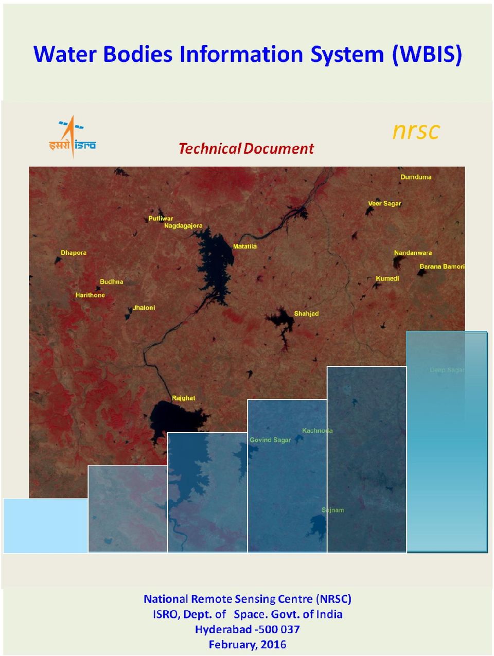
2 Document Control Sheet 1. Security Classification For Official Use only 2. Distribution NRSC / ISRO, Online Distribution Through Bhuvan Portal 3. Report / Document version (a) Issue no Report / Document Type Technical Document 5. Document Control Number NRSC /February, 2016/TR-796 (b) Revision & Date 6. Title Water Bodies Information System (WBIS)-Technical Document 7. Particulars of collation Pages 11 Figures 3 Tables 1 References 5 8. Project Team /Authors Algorithm Development and Updation, Development of Water Bodies Information System (WBIS) Software Development and Productization in IMGEOS from DPSD&DBG/SDAPSA Support for hosting on Bhuvan Dr. A.V. Suresh Babu, S/E-SF Shri. S. Karthik Reddy, S/E-SC Water Informatics and Quality Division Water Resources Group, RSAA, NRSC Core Implementation :Ms. Adiba F, S/E-SC, Ms. N. Sai Kumari, S/E-SE Scheduler : Mr. Uzair Mujeeb, S/E-SD Dr. Naresh Kumar, S/E-SE UOPS& Utilities : Ms. Richa Goyal, S/E-SD Mr. Amit Kumar, S/E-SD Sri. M. Arul Raj, S/E-SE Ms. Sonal Aggarwal, S/E-SD 9. Affiliation of authors NRSC,Hyderabad 10. Scrutiny mechanism 11. Originating unit NRSC 12. Sponsor(s) / Name and Address Guidance / Reviewed by : Shri. K. Abdul Hakeem, Head, WIQD,WRG,RSAA Ms. Manju Sarma, S/E-SG, Group Head, Dr. V. Venkateshwar Rao, Group Director, WRG,RSAA Dr. Vinod M Bothale, Group Director-G &WGS,DPPA&WAA Approved /Controlled by : Dr. P.G. Diwakar, DD-RSAA Dr. B. Gopalakrishna, DD-DPPA & WAA In-house R & D 13. Date of Initiation Date of Publication P a g e
 Software Development and Productization in IMGEOS from DPSD&DBG/SDAPSA Support for")
3 15 Abstract Automated water bodies extraction algorithms were developed using Resourcesat-1 AWiFS (56m) / RISAT-1 MRS (18m) Sensor datasets. Spectral knowledge based hierarchical automated algorithm was developed for quick processing of satellite data and to extract water bodies information in near real time. As there are number of inland water bodies that are useful for agriculture and drinking water purposes exist, it is necessary to monitor them on a regular basis. NRSC had made efforts to process the satellite data at every 15 day interval and host the water bodies information on Bhuvan portal. Water Bodies Information System (WBIS) has been developed for integral view of dynamic satellite derived water spread area information to understand the variations within a water body over pre-identified Water bodies (~2,00,000 No. which are greater than 2 Ha) and also at regional level such as River basin, River sub basin, District, and State level. This facilitates visualization along with analysis tools for understanding the water bodies dynamics. This document describes the technical procedures used for processing of the satellite data and presentation of the same in Water Bodies Information System (WBIS). The accuracy, limitations, possible applications are summarized in this document. 2 P a g e

4 Water Bodies Information System (WBIS) 1. Introduction Satellite sensors can capture the scenario of surface features at frequent intervals facilitating mapping and monitoring of surface water bodies at regular intervals. Satellite data utilization for inventory, mapping and monitoring water bodies over larger areas is a popular technique for generation of dynamic databases. There are several water bodies in India in the form of major/ medium artificial reservoirs, irrigation tanks, lakes, ponds, which are primarily used for agriculture and drinking water purposes. Variation in water spread occurs as a function of rainfall amounts, intensity of rainfall, etc. over season / year. Indian Remote Sensing Missions like Resourcesat-2 is provided with AWiFS sensor (56m, 5 days revisit) & LISS III sensor (24m, 24 Days repetivity) and RISAT-1 (microwave satellite) is with MRS Sensor (18m, 23 Days repetivity) and CRS Sensor (36m, programmable coverage) can provide frequent coverage of India. This is useful for the generation of water bodies information at fortnightly / monthly time interval. Currently, these datasets are being utilized for the generation of fortnightly / monthly water bodies information. In view of huge datasets that are to be processed on daily basis to cover entire India, NRSC has developed automated water bodies extraction algorithms for quick processing and automation of satellite data processing in IMGEOS as soon as it is acquired. Thus the water bodies layers derived are integrated into a common geospatial database. View of information updated in the geospatial dynamic water bodies database is presented over pre-identified water bodies ( for about ~2,00,000 No (>2 Ha)) is presented in the form of Water Bodies Information System (WBIS)for better visualization and analysis of water spread over India. The brief methodology for satellite data processing and development of water bodies information system is described in this document. 2. Automated algorithms for extraction of surface water bodies Water bodies database has been generated with a combined use of Reourcesat-2 AWiFS (optical data) and RISAT-1 MRS (microwave data) for which automated algorithms have been developed & operationally implemented in IMGEOS in near real time. 3 P a g e

5 2.1. Processing of Resourcesat-2 AWiFS/LISS III data Space-borne multi-spectral satellite images are analyzed using supervised/unsupervised classification techniques available in commercial /open source image processing softwares. The parameters for image classification are provided manually for each of the scene and the process is repeated for all. This process is time consuming and manual interpretation is required for identification of thresholds and assigning clusters to water feature class. Automatic algorithm developed by NRSC (S. Subramaniam, A.V. Suresh Babu and P.S. Roy 2011) for quick processing of satellite data was used for generation of a spatial water layers. Automated algorithm is a spectral knowledge driven, developed after spectral characterization and transformation to mathematical relationships viz. band ratios, band thresholds & other combination of relationships across the spectral data of four bands µm (Green), µm (Red), µm (NIR) and µm (SWIR) and hierarchical, multi-logic algorithm is developed. The few logics used are :Water has lower reflectance in the Visible-SWIR spectral region compared to other surface cover features ;Very high contrast between Green & NIR (except turbid water pixels) and Green & SWIR due to the absorption of NIR & SWIR radiation by water ; Reflectance of water in NIR is lower than that of Red band. (Ref.4) Algorithm is well trained over larger datasets across the country and is scene independent, which is operationally used for extracting water feature. A typical satellite derived water bodies layer is shown in Figure.1. Figure.1. Example showing Resourcesat-2 AWiFS image and the corresponding water layer 4 P a g e
 for quick processing of satellite data was used for generation of a spatial water layers.")
6 2.2. Processing of RISAT-1 MRS / CRS Data RISAT-1, a microwave satellite data has been used in addition Resourcesat-2 AWiFS for taking of advantage of microwave imaging in case of cloud cover and also to have additional frequency of coverage for generation of fortnightly / monthly water layer. RISAT-1 MRS sensor (18m and 128km swath) has systematic coverage over India with C Band, dual polarization (HH, HV). Back scatter coefficient (σ o ) was estimated for each of HH, HV images and this information was used for the generation of knowledge base, and to develop an algorithm for identifying water pixels. Methodology consists of characterization of microwave response to various types of water features, observations on behavior of back scatter coefficient (σ o ) from these features through generation knowledge base, and identification of thresholds for back scattering coefficients to enable water pixel detection. Legacy database on water bodies was also used for improving the thematic accuracy. (Ref.5). A typical satellite derived water bodies layer is shown in Figure.2. Figure.2. Example showing RISAT-1 MRS image and water layer 3. Productization in IMGEOS IMGEOS is a ground segment infrastructure designed as a multi layer architecture having User Services, Data reception & Processing systems and Storage along with Security and Monitoring components to meet the increasing demand of varied types of satellite data products acquired from all IRS Earth Observation missions. In IMGEOS the data product generation chain (Figure.3) is triggered by work-orders from User order processing system (UOPS). The chain comprising of dedicated processing systems controlled by Data product work-flow manager (DPWFM), generates products as per the defined processing level. ( Ref.2, Ref.3) 5 P a g e
 was estimated for each of HH, HV images and this information was used for the generation of knowledge base, and to develop an algorithm for identifying water pixels.")
7 The Information product generation system (IPGS ) is a newly added work-flow in IMGEOS to automatically generate water layers from standard products of Resourcesat-2 AWIFS sensor in near real time. Every day 1-2 passes of AWIFS sensor data covering Indian region are processed in near real time to generate scene based water layers. These scene based layers are used to generate fifteen day composite mosaic of Indian region. Figure.3. Flow chart IPGS chain The major elements under IPGS production chain are: Product generation Initiation through Work Order generation: IPGS Data processing Chain is initiated with IPGS Work Order generated at User Ordering system. DPWFM routes this work-order to DPGS work-centre to generate terrain corrected products Information Product Generation System : IPGS Scheduler at IPGS work-centre processes the scene wise work-orders, invokes and manages the IPGS Layer Generation Software to generate scene wise water layer. Once all scene based water layers of the path are generated the path wise Mosaic generation 6 P a g e

8 is initiated. Once in five days all the path wise mosaics are used to generate Indian region mosaic. The three, five day Indian region mosaics are time composited to generate the fifteen day mosaic product. Product Dissemination to FTP: The generated water mosaic layers are then transferred to FTP Server via Data Exchange (DEG) system and are downloadable from FTP Server through a FTP user-account. Chain Monitoring and Routing through DPWFM and EMC: DPWFM generates status messages of processing done at each work-centre in the chain for the use by EMC software to allow graphical monitoring of progress done in IPGS Chain. IPGS System and Software architecture: User access Tier: work-order generation, User access for finished Products on FTP Control tier: Routing and work-order management (DPWFM), IPGS Scheduler Production tier: Level-0 processing subsystem, Data Product generation. Information Product generation system(ipgs) (IPGS), Mosaic generation Monitoring tier: Production Monitoring, & Reports (EMC) Data tier: (SAN Storage) Work-order Data base, Reference Masks, Ancillary Meta database, Satellite Products Water Layers IPGS software is a new component in IMGEOS consisting of Information Layers, Mosaic generation and Scheduler software. The layer and Mosaic generation software is developed and optimized in IMGEOS framework with standardized interfaces for automation and error handling in production chain using open source tools. The synchronization of Mosaic generation and time composition are achieved using system level daemon services. The IPGS scheduler is capable of distributed scheduling to take advantage of available processing nodes. 7 P a g e

9 3. Availability of water layers The availability of water layers is provided in the following table.1. Table.1. List of time series water layer information hosted on Bhuvan January February March April May June July August September October November December Data available Data to be processed 4. Water Bodies Information System (WBIS) WBIS is developed using latest front end and backend open source web technologies. The front end is developed on top of Angular JS. Leaflet along with a few plugins, Angular material framework, d3 and its derivative libraries are utilized in developing the user interface, data visualization and map elements. Raster data is automatically pooled from time-series water layers into a Relational database and processed to generate individual 8 P a g e
 WBIS is developed using latest front end and backend open source web technologies. The front end is developed on top of Angular JS.")
10 water body wise, regional (River Basin, River Sub-basin, State, District) spread area statistics using a software written in C++. A REST API for this data is hosted using node.js. Components of WBIS : 1. Home Page: Interface for selection of water body/region. Link for layer selection, map facilities: Layer manager, search by location, selection of time series spatial water layer view 2. Water Spread area visualization widgets 9 P a g e

11 3. Region wise statistics 5. Accuracy assessment and Limitations Accuracy assessment of AWiFS derived water layer was carried out with random grid sampling (75 x 75pixels) representing different geographical regions spread across the country, for different time periods. The overall accuracy is found to be 93.5% with kappa coefficient of Cloud cover will limit the satellite data acquisition and hence, partial data will be available. Cloud free regions were only represented in Water Bodies Information System. The accuracy of water pixel identification is influenced by hazy cloud, cloud shadows and also land water boundary pixels (mixed area). There is possibility of over estimation in smaller water bodies : Ha as there are more number of land water boundary pixels and moist pixels around which contiguous to the main water body. In case of microwave data processing, the vegetation over smaller water bodies is influencing roughness on the surface resulting in higher back scatter coefficient and hence, accuracy of detection of water pixel is affected in some areas. Glacial lakes are not part of this database. There could be errors due to cloud or non detection of water pixels from the knowledge based automated algorithm and such inaccuracies observed will be considered for updating the knowledge base and improve the automated water bodies extraction algorithms. 6. Possible Applications Facilitates study of water surface dynamics at regional/ river basin/river sub basin level for trend analysis and generate scenario of inter / intra annual / seasonal dynamics. 10 P a g e

12 Analysis of relationships between regional rainfall scenarios vs. water spread in major, medium reservoirs and status of smaller irrigation tanks. This will help in understanding water storages and utilization across the time periods. Inventory, mapping and monitoring of surface water area at frequent interval. 7. References [1] S. Subramaniam, A.V. Suresh Babu and P.S. Roy, Automated Water Spread Mapping Using ResourceSat-1 AWiFS Data for Water Bodies Information System. IEEE Journal of Selected Topics in Applied Earth Observations and Remote Sensing, vol.4, pp , [2] IPGS Design Document,NRSC-DPSD&DBS-RS2-Aug2013. [3] IMGEOS Design document : NRSC-DPS-IMGEOS-Sept 10-TR187. [4] NRSC Document. Satellite derived Information on Water Bodies (WBA) and Water Bodies Fraction (WBF). NRSC SDAPSA-RSAA-Feb 2014-TR-580. [5] NRSC Document. Near Real Time Extraction of Water bodies through Automated Algorithm from RISAT-1 MRS Datasets in IMGEOSNRSC RSA /SDAPSA Jun Acronyms IMGEOS - Integrated Multi-mission Ground Segment for Earth Observation Satellites RISAT-1 Radar Imaging SATellite -1 MRS Medium Resolution Sensor IPGS-Information Product Generation System UOPS User order Processing System SAN Storage Area Network SWFM Station Work Flow Manager EMC Enterprise Monitor and Controller DPGS Data Product Generation System SWFM Station Work Flow Manager AOI- Area of Interest DEG-Data Exchange Gateway. 11 P a g e

WATER BODY EXTRACTION FROM MULTI SPECTRAL IMAGE BY SPECTRAL PATTERN ANALYSIS
 WATER BODY EXTRACTION FROM MULTI SPECTRAL IMAGE BY SPECTRAL PATTERN ANALYSIS Nguyen Dinh Duong Department of Environmental Information Study and Analysis, Institute of Geography, 18 Hoang Quoc Viet Rd.,
Archiving and Managing Remote Sensing Data Using State of the Art Storage Technologies
 Archiving and Managing Remote Sensing Data Using State of the Art Storage Technologies Ms B Lakshmi C Chandrasekhar Reddy SVSRK Kishore SDAPSA, NRSC, Hyderabad NRSC Functions Remote Sensing Data Acquisition
Bhuvan. Indian Earth Observation Visualization. Indian Space Research Organisation. http://bhuvan.nrsc.gov.in. Multi Resolution. Societal Applications
 Multi Resolution Bhuvan Societal Applications Indian Earth Observation Visualization http://bhuvan.nrsc.gov.in 3D Geographic Models Seamless Fly Through Indian Space Research Organisation Thematic Vectors
Vinay K Dadhwal Director. 50 th Session of Scientific & Technical Subcommittee of COPUOS, 11-22 Feb., 2013, Vienna
 Vinay K Dadhwal Director 50 th Session of Scientific & Technical Subcommittee of COPUOS, 11-22 Feb., 2013, Vienna Demonstrated applications of EO for natural resources, infrastructure, planning & disaster
APPLICATION OF TERRA/ASTER DATA ON AGRICULTURE LAND MAPPING. Genya SAITO*, Naoki ISHITSUKA*, Yoneharu MATANO**, and Masatane KATO***
 APPLICATION OF TERRA/ASTER DATA ON AGRICULTURE LAND MAPPING Genya SAITO*, Naoki ISHITSUKA*, Yoneharu MATANO**, and Masatane KATO*** *National Institute for Agro-Environmental Sciences 3-1-3 Kannondai Tsukuba
Near Real Time Flood Mapping & Monitoring
 Near Real Time Flood Mapping & Monitoring C.M.BHATT Disaster Management Support Division National Remote Sensing Centre (NRSC / ISRO) Hyderabad, India [email protected] 7-8 December, 2014 ISPRS PRE-SYMPOSIUM
Review for Introduction to Remote Sensing: Science Concepts and Technology
 Review for Introduction to Remote Sensing: Science Concepts and Technology Ann Johnson Associate Director [email protected] Funded by National Science Foundation Advanced Technological Education program [DUE
Digital Remote Sensing Data Processing Digital Remote Sensing Data Processing and Analysis: An Introduction and Analysis: An Introduction
 Digital Remote Sensing Data Processing Digital Remote Sensing Data Processing and Analysis: An Introduction and Analysis: An Introduction Content Remote sensing data Spatial, spectral, radiometric and
Automated Spacecraft Scheduling The ASTER Example
 Automated Spacecraft Scheduling The ASTER Example Ron Cohen [email protected] Ground System Architectures Workshop 2002 Jet Propulsion Laboratory The Concept Scheduling by software instead of
Advanced Image Management using the Mosaic Dataset
 Esri International User Conference San Diego, California Technical Workshops July 25, 2012 Advanced Image Management using the Mosaic Dataset Vinay Viswambharan, Mike Muller Agenda ArcGIS Image Management
MODIS IMAGES RESTORATION FOR VNIR BANDS ON FIRE SMOKE AFFECTED AREA
 MODIS IMAGES RESTORATION FOR VNIR BANDS ON FIRE SMOKE AFFECTED AREA Li-Yu Chang and Chi-Farn Chen Center for Space and Remote Sensing Research, National Central University, No. 300, Zhongda Rd., Zhongli
Methods for Monitoring Forest and Land Cover Changes and Unchanged Areas from Long Time Series
 Methods for Monitoring Forest and Land Cover Changes and Unchanged Areas from Long Time Series Project using historical satellite data from SACCESS (Swedish National Satellite Data Archive) for developing
ArcGIS Agricultural Land Use Maps from the Mississippi Cropland Data Layer
 ArcGIS Agricultural Land Use Maps from the Mississippi Cropland Data Layer Fred L. Shore, Ph.D. Mississippi Department of Agriculture and Commerce Jackson, MS, USA [email protected] Rick Mueller
Generation of Cloud-free Imagery Using Landsat-8
 Generation of Cloud-free Imagery Using Landsat-8 Byeonghee Kim 1, Youkyung Han 2, Yonghyun Kim 3, Yongil Kim 4 Department of Civil and Environmental Engineering, Seoul National University (SNU), Seoul,
Environmental Remote Sensing GEOG 2021
 Environmental Remote Sensing GEOG 2021 Lecture 4 Image classification 2 Purpose categorising data data abstraction / simplification data interpretation mapping for land cover mapping use land cover class
Resolutions of Remote Sensing
 Resolutions of Remote Sensing 1. Spatial (what area and how detailed) 2. Spectral (what colors bands) 3. Temporal (time of day/season/year) 4. Radiometric (color depth) Spatial Resolution describes how
Monitoring Soil Moisture from Space. Dr. Heather McNairn Science and Technology Branch Agriculture and Agri-Food Canada [email protected].
 Monitoring Soil Moisture from Space Dr. Heather McNairn Science and Technology Branch Agriculture and Agri-Food Canada [email protected] What is Remote Sensing? Scientists turn the raw data collected
25 Years of Indian Remote Sensing Satellite (IRS) Series
 Series") 25 Years of Indian Remote Sensing Satellite (IRS) Series Vinay K Dadhwal Director National Remote Sensing Centre (NRSC), ISRO Hyderabad, INDIA 50 th Session of Scientific & Technical Subcommittee of COPUOS,
25 Years of Indian Remote Sensing Satellite (IRS) Series Vinay K Dadhwal Director National Remote Sensing Centre (NRSC), ISRO Hyderabad, INDIA 50 th Session of Scientific & Technical Subcommittee of COPUOS,
The USGS Landsat Big Data Challenge
 The USGS Landsat Big Data Challenge Brian Sauer Engineering and Development USGS EROS [email protected] U.S. Department of the Interior U.S. Geological Survey USGS EROS and Landsat 2 Data Utility and Exploitation
MASS PROCESSING OF REMOTE SENSING DATA FOR ENVIRONMENTAL EVALUATION IN EUROPE
 MASS PROCESSING OF REMOTE SENSING DATA FOR ENVIRONMENTAL EVALUATION IN EUROPE Lic. Adrián González Applications Research Earth Science Conference 2014 29.07.2014 Earth Science San Conference Francisco
COMPARISON OF OBJECT BASED AND PIXEL BASED CLASSIFICATION OF HIGH RESOLUTION SATELLITE IMAGES USING ARTIFICIAL NEURAL NETWORKS
 COMPARISON OF OBJECT BASED AND PIXEL BASED CLASSIFICATION OF HIGH RESOLUTION SATELLITE IMAGES USING ARTIFICIAL NEURAL NETWORKS B.K. Mohan and S. N. Ladha Centre for Studies in Resources Engineering IIT
Landsat Monitoring our Earth s Condition for over 40 years
 Landsat Monitoring our Earth s Condition for over 40 years Thomas Cecere Land Remote Sensing Program USGS ISPRS:Earth Observing Data and Tools for Health Studies Arlington, VA August 28, 2013 U.S. Department
Land Use/ Land Cover Mapping Initiative for Kansas and the Kansas River Watershed
 Land Use/ Land Cover Mapping Initiative for Kansas and the Kansas River Watershed Kansas Biological Survey Kansas Applied Remote Sensing Program April 2008 Previous Kansas LULC Projects Kansas LULC Map
Chapter Contents Page No
 Chapter Contents Page No Preface Acknowledgement 1 Basics of Remote Sensing 1 1.1. Introduction 1 1.2. Definition of Remote Sensing 1 1.3. Principles of Remote Sensing 1 1.4. Various Stages in Remote Sensing
Remote Sensing and GIS Application In Change Detection Study In Urban Zone Using Multi Temporal Satellite
 Remote Sensing and GIS Application In Change Detection Study In Urban Zone Using Multi Temporal Satellite R.Manonmani, G.Mary Divya Suganya Institute of Remote Sensing, Anna University, Chennai 600 025
Data Processing Flow Chart
 Legend Start V1 V2 V3 Completed Version 2 Completion date Data Processing Flow Chart Data: Download a) AVHRR: 1981-1999 b) MODIS:2000-2010 c) SPOT : 1998-2002 No Progressing Started Did not start 03/12/12
ENVIRONMENTAL MONITORING Vol. I - Remote Sensing (Satellite) System Technologies - Michael A. Okoye and Greg T. Koeln
 System Technologies - Michael A. Okoye and Greg T. Koeln") REMOTE SENSING (SATELLITE) SYSTEM TECHNOLOGIES Michael A. Okoye and Greg T. Earth Satellite Corporation, Rockville Maryland, USA Keywords: active microwave, advantages of satellite remote sensing, atmospheric
REMOTE SENSING (SATELLITE) SYSTEM TECHNOLOGIES Michael A. Okoye and Greg T. Earth Satellite Corporation, Rockville Maryland, USA Keywords: active microwave, advantages of satellite remote sensing, atmospheric
2.3 Spatial Resolution, Pixel Size, and Scale
 Section 2.3 Spatial Resolution, Pixel Size, and Scale Page 39 2.3 Spatial Resolution, Pixel Size, and Scale For some remote sensing instruments, the distance between the target being imaged and the platform,
OBJECT BASED IMAGE CLASSIFICATION AND WEB-MAPPING TECHNIQUES FOR FLOOD DAMAGE ASSESSMENT
 OBJECT BASED IMAGE CLASSIFICATION AND WEB-MAPPING TECHNIQUES FOR FLOOD DAMAGE ASSESSMENT Ejaz Hussain, KyoHyouk Kim, Jie Shan {ehussain, kim458, jshan}@ecn.purdue.edu Geomatics Engineering, School of Civil
Lake Monitoring in Wisconsin using Satellite Remote Sensing
 Lake Monitoring in Wisconsin using Satellite Remote Sensing D. Gurlin and S. Greb Wisconsin Department of Natural Resources 2015 Wisconsin Lakes Partnership Convention April 23 25, 2105 Holiday Inn Convention
'Developments and benefits of hydrographic surveying using multispectral imagery in the coastal zone
 Abstract With the recent launch of enhanced high-resolution commercial satellites, available imagery has improved from four-bands to eight-band multispectral. Simultaneously developments in remote sensing
The Role of SPOT Satellite Images in Mapping Air Pollution Caused by Cement Factories
 The Role of SPOT Satellite Images in Mapping Air Pollution Caused by Cement Factories Dr. Farrag Ali FARRAG Assistant Prof. at Civil Engineering Dept. Faculty of Engineering Assiut University Assiut, Egypt.
Global environmental information Examples of EIS Data sets and applications
 METIER Graduate Training Course n 2 Montpellier - february 2007 Information Management in Environmental Sciences Global environmental information Examples of EIS Data sets and applications Global datasets
Moderate- and high-resolution Earth Observation data based forest and agriculture monitoring in Russia using VEGA Web-Service
 Moderate- and high-resolution Earth Observation data based forest and agriculture monitoring in Russia using VEGA Web-Service Sergey BARTALEV and Evgeny LOUPIAN Space Research Institute, Russian Academy
Hyperspectral Satellite Imaging Planning a Mission
 Hyperspectral Satellite Imaging Planning a Mission Victor Gardner University of Maryland 2007 AIAA Region 1 Mid-Atlantic Student Conference National Institute of Aerospace, Langley, VA Outline Objective
Figure 2: System Flow Diagram for Workflow Management
 5. WORKFLOW MANAGEMENT The developed system EASKB uses the open source content management system called Drupal ([2]). A Content Management System - CMS is a tool that enables many user friendly features
ENVI THE PREMIER SOFTWARE FOR EXTRACTING INFORMATION FROM GEOSPATIAL IMAGERY.
 ENVI THE PREMIER SOFTWARE FOR EXTRACTING INFORMATION FROM GEOSPATIAL IMAGERY. ENVI Imagery Becomes Knowledge ENVI software uses proven scientific methods and automated processes to help you turn geospatial
Satellite Snow Monitoring Activities Project CRYOLAND
 Satellite Snow Monitoring Activities Project CRYOLAND Background material for participants to the Workshop on European Snow Monitoring Perspectives, Darmstadt, 4-5 December 2012. CryoLand provides Snow,
TerraColor White Paper
 TerraColor White Paper TerraColor is a simulated true color digital earth imagery product developed by Earthstar Geographics LLC. This product was built from imagery captured by the US Landsat 7 (ETM+)
Supervised Classification workflow in ENVI 4.8 using WorldView-2 imagery
 Supervised Classification workflow in ENVI 4.8 using WorldView-2 imagery WorldView-2 is the first commercial high-resolution satellite to provide eight spectral sensors in the visible to near-infrared
APPLICATION OF GOOGLE EARTH FOR THE DEVELOPMENT OF BASE MAP IN THE CASE OF GISH ABBAY SEKELA, AMHARA STATE, ETHIOPIA
 APPLICATION OF GOOGLE EARTH FOR THE DEVELOPMENT OF BASE MAP IN THE CASE OF GISH ABBAY SEKELA, AMHARA STATE, ETHIOPIA Abineh Tilahun Department of Geography and environmental studies, Adigrat University,
How Landsat Images are Made
 How Landsat Images are Made Presentation by: NASA s Landsat Education and Public Outreach team June 2006 1 More than just a pretty picture Landsat makes pretty weird looking maps, and it isn t always easy
Project Title: Project PI(s) (who is doing the work; contact Project Coordinator (contact information): information):
 (who is doing the work; contact Project Coordinator (contact information): information):") Project Title: Great Northern Landscape Conservation Cooperative Geospatial Data Portal Extension: Implementing a GNLCC Spatial Toolkit and Phenology Server Project PI(s) (who is doing the work; contact
Project Title: Great Northern Landscape Conservation Cooperative Geospatial Data Portal Extension: Implementing a GNLCC Spatial Toolkit and Phenology Server Project PI(s) (who is doing the work; contact
Keystone Image Management System
 Image management solutions for satellite and airborne sensors Overview The Keystone Image Management System offers solutions that archive, catalogue, process and deliver digital images from a vast number
3D Model of the City Using LiDAR and Visualization of Flood in Three-Dimension
 3D Model of the City Using LiDAR and Visualization of Flood in Three-Dimension R.Queen Suraajini, Department of Civil Engineering, College of Engineering Guindy, Anna University, India, [email protected]
Object-Oriented Approach of Information Extraction from High Resolution Satellite Imagery
 IOSR Journal of Computer Engineering (IOSR-JCE) e-issn: 2278-0661,p-ISSN: 2278-8727, Volume 17, Issue 3, Ver. IV (May Jun. 2015), PP 47-52 www.iosrjournals.org Object-Oriented Approach of Information Extraction
Monitoring of Arctic Conditions from a Virtual Constellation of Synthetic Aperture Radar Satellites
 DISTRIBUTION STATEMENT A. Approved for public release; distribution is unlimited. Monitoring of Arctic Conditions from a Virtual Constellation of Synthetic Aperture Radar Satellites Hans C. Graber RSMAS
SAMPLE MIDTERM QUESTIONS
 Geography 309 Sample MidTerm Questions Page 1 SAMPLE MIDTERM QUESTIONS Textbook Questions Chapter 1 Questions 4, 5, 6, Chapter 2 Questions 4, 7, 10 Chapter 4 Questions 8, 9 Chapter 10 Questions 1, 4, 7
BLACKBRIDGE SATELLITE IMAGERY THROUGH CLOUD COMPUTING
 BLACKBRIDGE SATELLITE IMAGERY THROUGH CLOUD COMPUTING Jason Setzer Cloud Product Manager Slide 1 THE RAPID EYE CONSTELLATION 5 Identical Satellites in same obit Up to 5 million km² collected daily 1 billion
16 th IOCCG Committee annual meeting. Plymouth, UK 15 17 February 2011. mission: Present status and near future
 16 th IOCCG Committee annual meeting Plymouth, UK 15 17 February 2011 The Meteor 3M Mt satellite mission: Present status and near future plans MISSION AIMS Satellites of the series METEOR M M are purposed
VCS REDD Methodology Module. Methods for monitoring forest cover changes in REDD project activities
 1 VCS REDD Methodology Module Methods for monitoring forest cover changes in REDD project activities Version 1.0 May 2009 I. SCOPE, APPLICABILITY, DATA REQUIREMENT AND OUTPUT PARAMETERS Scope This module
LANDSAT 8 Level 1 Product Performance
 Réf: IDEAS-TN-10-QualityReport LANDSAT 8 Level 1 Product Performance Quality Report Month/Year: January 2016 Date: 26/01/2016 Issue/Rev:1/9 1. Scope of this document On May 30, 2013, data from the Landsat
Updation of Cadastral Maps Using High Resolution Remotely Sensed Data
 International Journal of Engineering and Advanced Technology (IJEAT) Updation of Cadastral Maps Using High Resolution Remotely Sensed Data V. V.Govind Kumar, K. Venkata Reddy, Deva Pratap Abstract:A cadastral
Using Remote Sensing Imagery to Evaluate Post-Wildfire Damage in Southern California
 Graham Emde GEOG 3230 Advanced Remote Sensing February 22, 2013 Lab #1 Using Remote Sensing Imagery to Evaluate Post-Wildfire Damage in Southern California Introduction Wildfires are a common disturbance
Aneeqa Syed [Hatfield Consultants] Vancouver GIS Users Group Meeting December 8, 2010
![Aneeqa Syed [Hatfield Consultants] Vancouver GIS Users Group Meeting December 8, 2010](/thumbs/27/11179985.jpg "Aneeqa Syed [Hatfield Consultants] Vancouver GIS Users Group Meeting December 8, 2010") NEAR-REAL-TIME FLOOD MAPPING AND MONITORING SERVICE Aneeqa Syed [Hatfield Consultants] Vancouver GIS Users Group Meeting December 8, 2010 SLIDE 1 MRC Flood Service Project Partners and Client Hatfield
NEAR-REAL-TIME FLOOD MAPPING AND MONITORING SERVICE Aneeqa Syed [Hatfield Consultants] Vancouver GIS Users Group Meeting December 8, 2010 SLIDE 1 MRC Flood Service Project Partners and Client Hatfield
Welcome to NASA Applied Remote Sensing Training (ARSET) Webinar Series
 Webinar Series") Welcome to NASA Applied Remote Sensing Training (ARSET) Webinar Series Introduction to Remote Sensing Data for Water Resources Management Course Dates: October 17, 24, 31 November 7, 14 Time: 8-9 a.m.
Welcome to NASA Applied Remote Sensing Training (ARSET) Webinar Series Introduction to Remote Sensing Data for Water Resources Management Course Dates: October 17, 24, 31 November 7, 14 Time: 8-9 a.m.
CBERS Program Update Jacie 2011. Frederico dos Santos Liporace AMS Kepler [email protected]
 CBERS Program Update Jacie 2011 Frederico dos Santos Liporace AMS Kepler [email protected] Overview CBERS 3 and 4 characteristics Differences from previous CBERS satellites (CBERS 1/2/2B) Geometric
SPOT Satellite Earth Observation System Presentation to the JACIE Civil Commercial Imagery Evaluation Workshop March 2007
 SPOT Satellite Earth Observation System Presentation to the JACIE Civil Commercial Imagery Evaluation Workshop March 2007 Topics Presented Quick summary of system characteristics Formosat-2 Satellite Archive
Accuracy Assessment of Land Use Land Cover Classification using Google Earth
 American Journal of Environmental Protection 25; 4(4): 9-98 Published online July 2, 25 (http://www.sciencepublishinggroup.com/j/ajep) doi:.648/j.ajep.2544.4 ISSN: 228-568 (Print); ISSN: 228-5699 (Online)
June 2011. TerraSAR-X-based Flood Mapping Service
 June 2011 TerraSAR-X-based Flood Mapping Service Service TerraSAR-X-based Flood Mapping Product Flood extent map Product specifications Flood mask / water mask Input / output data Summary Content Date
A KNOWLEDGE-BASED APPROACH FOR REDUCING CLOUD AND SHADOW ABSTRACT
 A KNOWLEDGE-BASED APPROACH FOR REDUCING CLOUD AND SHADOW Mingjun Song, Graduate Research Assistant Daniel L. Civco, Director Laboratory for Earth Resources Information Systems Department of Natural Resources
GIS Initiative: Developing an atmospheric data model for GIS. Olga Wilhelmi (ESIG), Jennifer Boehnert (RAP/ESIG) and Terri Betancourt (RAP)
, Jennifer Boehnert (RAP/ESIG) and Terri Betancourt (RAP)") GIS Initiative: Developing an atmospheric data model for GIS Olga Wilhelmi (ESIG), Jennifer Boehnert (RAP/ESIG) and Terri Betancourt (RAP) Unidata seminar August 30, 2004 Presentation Outline Overview
GIS Initiative: Developing an atmospheric data model for GIS Olga Wilhelmi (ESIG), Jennifer Boehnert (RAP/ESIG) and Terri Betancourt (RAP) Unidata seminar August 30, 2004 Presentation Outline Overview
Calculation of Minimum Distances. Minimum Distance to Means. Σi i = 1
 Minimum Distance to Means Similar to Parallelepiped classifier, but instead of bounding areas, the user supplies spectral class means in n-dimensional space and the algorithm calculates the distance between
Vulnerability assessment of ecosystem services for climate change impacts and adaptation (VACCIA)
") Vulnerability assessment of ecosystem services for climate change impacts and adaptation (VACCIA) Action 2: Derivation of GMES-related remote sensing data Deliverable 1: Time-series of Earth Observation
Vulnerability assessment of ecosystem services for climate change impacts and adaptation (VACCIA) Action 2: Derivation of GMES-related remote sensing data Deliverable 1: Time-series of Earth Observation
Earth Data Science in The Era of Big Data and Compute
 Earth Data Science in The Era of Big Data and Compute E. Lynn Usery U.S. Geological Survey [email protected] http://cegis.usgs.gov U.S. Department of the Interior U.S. Geological Survey Board on Earth Sciences
ARCHIVING AND MANAGING REMOTE SENSING DATA USING STATE OF THE ART STORAGE TECHNOLOGIES
 ARCHIVING AND MANAGING REMOTE SENSING DATA USING STATE OF THE ART STORAGE TECHNOLOGIES B Lakshmi a, C Chandrasekhara Reddy a, *, SVSRK Kishore a a NRSC, SDAPSA, Hyderabad, India (lakshmi_b,sekharareddy_cc,kishore_svsr)@nrsc.gov.in
Electromagnetic Radiation (EMR) and Remote Sensing
 and Remote Sensing") Electromagnetic Radiation (EMR) and Remote Sensing 1 Atmosphere Anything missing in between? Electromagnetic Radiation (EMR) is radiated by atomic particles at the source (the Sun), propagates through
Electromagnetic Radiation (EMR) and Remote Sensing 1 Atmosphere Anything missing in between? Electromagnetic Radiation (EMR) is radiated by atomic particles at the source (the Sun), propagates through
Big data and Earth observation New challenges in remote sensing images interpretation
 Big data and Earth observation New challenges in remote sensing images interpretation Pierre Gançarski ICube CNRS - Université de Strasbourg 2014 Pierre Gançarski Big data and Earth observation 1/58 1
Spectral Response for DigitalGlobe Earth Imaging Instruments
 Spectral Response for DigitalGlobe Earth Imaging Instruments IKONOS The IKONOS satellite carries a high resolution panchromatic band covering most of the silicon response and four lower resolution spectral
Research On The Classification Of High Resolution Image Based On Object-oriented And Class Rule
 Research On The Classification Of High Resolution Image Based On Object-oriented And Class Rule Li Chaokui a,b, Fang Wen a,b, Dong Xiaojiao a,b a National-Local Joint Engineering Laboratory of Geo-Spatial
Using Remote Sensing to Monitor Soil Carbon Sequestration
 Using Remote Sensing to Monitor Soil Carbon Sequestration E. Raymond Hunt, Jr. USDA-ARS Hydrology and Remote Sensing Beltsville Agricultural Research Center Beltsville, Maryland Introduction and Overview
Implementing an Imagery Management System at Mexican Navy
 Implementing an Imagery Management System at Mexican Navy The Mexican Navy safeguards 11,000 kilometers of Mexican coastlines, inland water bodies suitable for navigation, and the territorial sea and maritime
Introduction to Imagery and Raster Data in ArcGIS
 Esri International User Conference San Diego, California Technical Workshops July 25, 2012 Introduction to Imagery and Raster Data in ArcGIS Simon Woo slides Cody Benkelman - demos Overview of Presentation
Forestry Thematic Exploitation Platform Earth Observation Open Science 2.0
 Forestry Thematic Exploitation Platform Earth Observation Open Science 2.0 Tuomas Häme VTT Technical Research of Finland Ltd and the Forestry TEP Team Objective One-stop shop for forestry remote sensing
Monitoring Global Crop Condition Indicators Using a Web-Based Visualization Tool
 Monitoring Global Crop Condition Indicators Using a Web-Based Visualization Tool Bob Tetrault, Regional Commodity Analyst, and Bob Baldwin, GIS Specialist, USDA, Foreign Agricultural Service, Washington,
A remote sensing instrument collects information about an object or phenomenon within the
 Satellite Remote Sensing GE 4150- Natural Hazards Some slides taken from Ann Maclean: Introduction to Digital Image Processing Remote Sensing the art, science, and technology of obtaining reliable information
Analysis of Landsat ETM+ Image Enhancement for Lithological Classification Improvement in Eagle Plain Area, Northern Yukon
 Analysis of Landsat ETM+ Image Enhancement for Lithological Classification Improvement in Eagle Plain Area, Northern Yukon Shihua Zhao, Department of Geology, University of Calgary, [email protected],
Cartosat-1 10 years and beyond
 nrsc Cartosat-1 10 years and beyond Cartosat-1 : 10 years completion in Orbit (2005-2015) 5th May 2015 National Remote Sensing Centre Indian Space Research Organisation Dept. of Space, Govt. of India Balanagar,
The Use of Geographic Information Systems in Risk Assessment
 The Use of Geographic Information Systems in Risk Assessment With Specific Focus on the RiVAMP Methodology Presented by Nadine Brown August 27, 2012 Climate Studies Group Mona Climate Change Workshop Presentation
Signal Strength Measurements and Coverage Estimation of Mobile Communication Network Using IRS-IC Multispectral and CARTOSAT-1 Stereo Images
 Signal Strength Measurements and Coverage Estimation of Mobile Communication Network Using IRS-IC Multispectral and CARTOSAT-1 Stereo Images B. NAVEENCHANDRA 1, K. N. LOKESH 2, USHA 3, AND H.GANGADHARA
Operational Space- Based Crop Mapping Protocols at AAFC A. Davidson, H. McNairn and T. Fisette.
 Operational Space- Based Crop Mapping Protocols at AAFC A. Davidson, H. McNairn and T. Fisette. Science & Technology Branch. Agriculture and Agri-Food Canada. 1. Introduction Space-Based Crop Mapping at
CLOUD FREE MOSAIC IMAGES
 CLOUD FREE MOSAIC IMAGES T. Hosomura, P.K.M.M. Pallewatta Division of Computer Science Asian Institute of Technology GPO Box 2754, Bangkok 10501, Thailand ABSTRACT Certain areas of the earth's surface
TerraAmazon - The Amazon Deforestation Monitoring System - Karine Reis Ferreira
 TerraAmazon - The Amazon Deforestation Monitoring System - Karine Reis Ferreira GEOSS Users & Architecture Workshop XXIV: Water Security & Governance - Accra Ghana / October 2008 INPE National Institute
MULTIPURPOSE USE OF ORTHOPHOTO MAPS FORMING BASIS TO DIGITAL CADASTRE DATA AND THE VISION OF THE GENERAL DIRECTORATE OF LAND REGISTRY AND CADASTRE
 MULTIPURPOSE USE OF ORTHOPHOTO MAPS FORMING BASIS TO DIGITAL CADASTRE DATA AND THE VISION OF THE GENERAL DIRECTORATE OF LAND REGISTRY AND CADASTRE E.ÖZER, H.TUNA, F.Ç.ACAR, B.ERKEK, S.BAKICI General Directorate
GLOBAL MONITORING FOR FOOD SECURITY IM SUDAN
 GLOBAL MONITORING FOR FOOD SECURITY IM SUDAN GMFS 3 Carsten Haub & Klaus-Ulrich Komp 18.11.2010 www.eftas.com 1 World hunger World Summit on Food Security FAO, Rome 11.2009 Mehr als 1 Milliarde Mensche
IT services for analyses of various data samples
 IT services for analyses of various data samples Ján Paralič, František Babič, Martin Sarnovský, Peter Butka, Cecília Havrilová, Miroslava Muchová, Michal Puheim, Martin Mikula, Gabriel Tutoky Technical
Estimating Firn Emissivity, from 1994 to1998, at the Ski Hi Automatic Weather Station on the West Antarctic Ice Sheet Using Passive Microwave Data
 Estimating Firn Emissivity, from 1994 to1998, at the Ski Hi Automatic Weather Station on the West Antarctic Ice Sheet Using Passive Microwave Data Mentor: Dr. Malcolm LeCompte Elizabeth City State University
163 ANALYSIS OF THE URBAN HEAT ISLAND EFFECT COMPARISON OF GROUND-BASED AND REMOTELY SENSED TEMPERATURE OBSERVATIONS
 ANALYSIS OF THE URBAN HEAT ISLAND EFFECT COMPARISON OF GROUND-BASED AND REMOTELY SENSED TEMPERATURE OBSERVATIONS Rita Pongrácz *, Judit Bartholy, Enikő Lelovics, Zsuzsanna Dezső Eötvös Loránd University,