Agricultural and Land Use: ENVISAT applications in Fujian Province
|
|
|
- Brendan Briggs
- 9 years ago
- Views:
Transcription
1 Agricultural and Land Use: ENVISAT applications in Fujian Province Spatial Information Research Center, Fujian Province, Fuzhou University (

2 Main topics! About SIRC! The Chinese team members! Information on the project area and ground data! Some extended studies! Examples of the relevant studies

3 About SIRC! Spatial Information Research Center, Fujian Province (SIRC) belongs to Fuzhou University ( Head office: Level 13, Science & Technology Building, Fuzhou University! R & D Base: Building 11, Fuzhou Software Base

4 About SIRC: Scientific Research! Geo-information science and technology " GIS " Remote Sensing! Computer and network technology! Communication technology Especially their crossing fields Research direction: # Remote sensing # WebGIS and information sharing # Spatial data mining # Virtual reality Computer & network Geo-Information Communication

5 Projects! About 25, Including " Several projects of national high-tech development plans (863 Program) " National key scientific and technical projects " International collaborative projects " Provincial great scientific research projects " etc! Research Results " national-level rewarded or determined: 4 " provincial or ministerial level rewarded or appraised:

6 Construction of Research Teams $ High-level research persons (professors and associate professors): 14 $ Middle-level & assistant research persons :14 $ software developers: 45 $ Graduate students :28 $ Visiting scholars from other units nearly

7 Chinese Partners! SIRC, Fuzhou University " Prof. Wang Qinmin, " Dr. Wang Xiaoqin, " Prof. Lan Zhangren, " Dr. Chen Chongcheng, " Ms. Zhu Qindong, " Some graduate students! Inst. of Forest Resources Information Techniques, The Chinese Academy of Forestry, Beijing, " Prof. Li Zengyuan, Technological guidance in processing SAR data

8 !Prof. Wang Qinmin $ Director of SIRC $ Chief of the Science and Technology Agency, Fujian Province Chinese principal of the project: agriculture application in Fujian

9 $ Got his doctoral degree in $ Engage in the Geo-information science, remote sensing technical application and research, industrialization popularizing $ Devote to the Tenth Five Year planning in remote sensing and ocean monitor field of Ministry of Science and Technology $ dedicate himself to organization and research with the international collaborative projects $ Advocate, plan and organize the project of " Digital Fujian "

10 Main Projects: $ The Tenth Five Year country 863 information field project: Demonstration for trade 3S use and service. $ the State Ministry of Science and Technology project: the South cloudy area forest resource remote sensing monitor technological development. $ Digital Fujian 131 core key project -Fujian Province government information sharing platform with the information resources to develop. $ Collaborative project between China and Japan: Chinese environmental remote sensing and GIS joint study. $ the scientific and technological great project in Fujian Province -the marine function zoning information management system of Fujian Province. $ the scientific and technological great project in Fujian Province - forestry of the radar satellite data, agriculture monitors and demonstrates

11 Test site describtion E N the annual average temperature is 21 The area is 12897km 2, 77% is below the height of 500m. Main land use type: $ arable land (12.91%) $ garden plot(13.45%) $ forest(52.49%) Zhang Zhou
 $ garden plot(13.45%) $ forest(52.")
12 Main agriculture land use types! Crops (rice, sweet potato, potato, sugarcane... )! Vegetable garden! Orchard (bananas, litchi, longan, orange and grapefruit... )

13 Rice Growth season of all crop types spreads all year round, from spring to winter. The rice growth calendar is approximately from April to October

14 Bananas In Zhangzhou, banana is planted extensively and is provided all the year, and reached its production climax during June or July

15 Litchi and longan The trees are Evergreen, bloom in spring, ripe in summer/autumn. Litchi and longan are similar in growth and fruiting habit

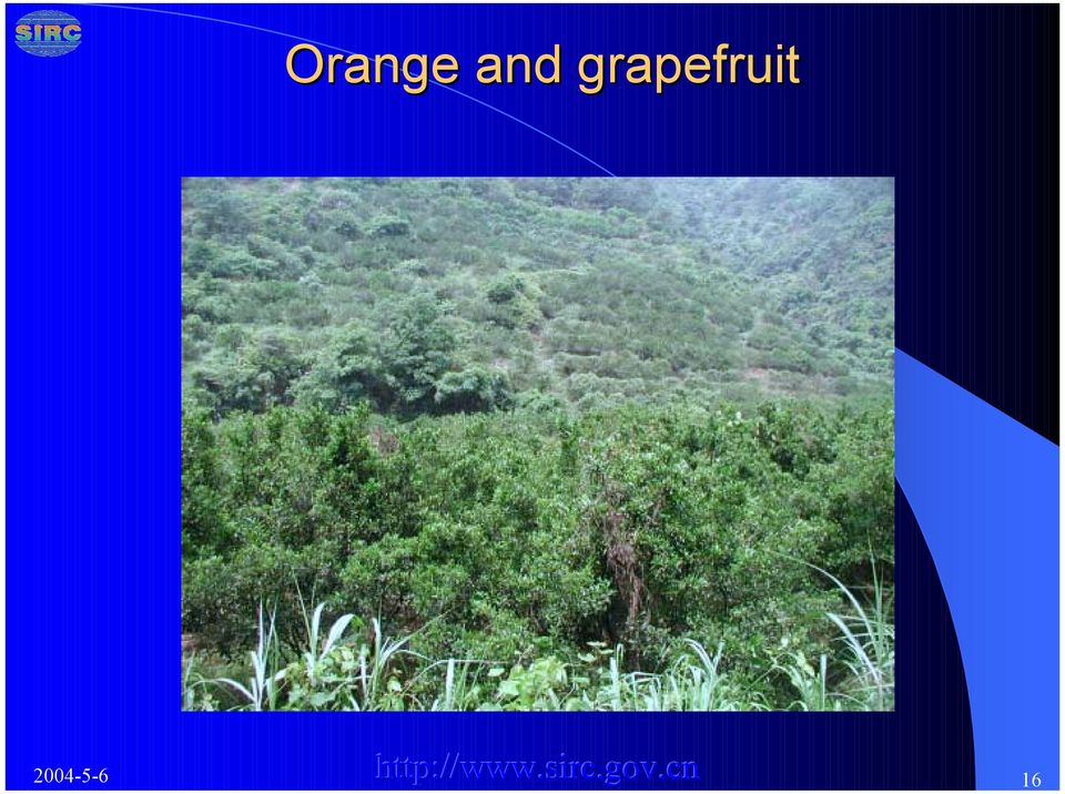
16 Orange and grapefruit
17 narcissus the growing period of Narcissus is about 3 years, it grows best during December, After that the leaves begin to turn yellow and wither

18 Ground data! Field survey is no problem during ! Rice phenological stages may be collected.! As for the collection the rice yield for sampled fields, we have to contact with local government. So it s impossible to decide whether we could collect the data now. But the historical total area and yield for main crop of every county will be collected

19 Some extended studies(1)! Xiamen local government pays much attention to this cooperation, and hopes some relevant units in Xiamen may participate in our project.! Relevant units: " Information Center of Xiamen Environmental Protection Bureau " Key Laboratory of Marine Environmental Science, Xiamen University " Third Institute of Oceanography, SOA (State Oceanic Administration) experience in ocean color remote sensing

20 Some extended studies (content)! Coastal water quality (like suspended sediment, chlorophyll ) with ocean color sensor MERIS! Sea surface temperature (AATSR)! Shallow water bathymetry with SAR/ASAR
!")
21 Relevant studies! ERS SAR & Jers-1 SAR processing " Ortho-rectification " Speckle noise suppression " Data fusion for SAR and TM! Relevant studies in Zhangzhou district
22 Ortho-rectification rectification ERS SAR Jers-1 SAR
23 Speckle noise suppression (different algorithms) Media Mean Original Frost Local-region Lee-Sigma Gamma-MAP Lee
24 Speckle noise suppression (different filtering window size) original
25 Data fusion of SAR and TM (different decomposed level for the fusion algorithm based on wavelet transform) TM 1 4 SAR
26 Data fusion of SAR and TM (different fusion algorithm) TM SAR Biorthogonal wavelet Orthogonal wavelet Brovey PCA IHS multiplication
27 TM Typical agriculture zone Typical agriculture zone % Bananas: along river % Orange & grapefruit: ChangTai, NanJing, PingHe % Litchi & longan:zhangpu, YunXiao, Zhao an % Flowers: near Zhangzhou city, along road


28 Forest remote sensing monitoring in Zhangpu County TM and SPOT5 TM Fused imgae
29 The main change types of forest resource in Zhangpu County
30 The change type distribution of Pine
31 The change type distribution of fruiter

32 Land use and Land Cover change monitoring from remote sensing
33 The distribution of changed land use

34 The distribution of main changed land use type
35
Multi-Temporal Wild Fire Monitoring in Lao PDR using MODIS Data
 Multi-Temporal Wild Fire Monitoring in Lao PDR using MODIS Data Vivarad Phonekeo Ph. D. Geoinformatics Center (GIC) Asian Institute of Technology [email protected], [email protected] www.vivarad.info Thatheva
ANALYSIS OF GIS HIGHER EDUCATION IN CHINA
 ANALYSIS OF GIS HIGHER EDUCATION IN CHINA Liu Yaolin Shen Yuanchun School of Resource and Environmental Science, Wuhan University, Wuhan City (430079),P.R. China ([email protected]) KEY WORDS: GIS Higher
Work Report for Sino-Italian Cooperation Project (2005-2007) Application of Vallerani System Technology in Demonstration Forestation in Inner Mongolia
 Application of Vallerani System Technology in Demonstration Forestation in Inner Mongolia") Work Report for Sino-Italian Cooperation Project (2005-) Application of Vallerani System Technology in Demonstration Forestation in Inner Mongolia Key Technology for Mechanized Rain Collection and Vegetation
Work Report for Sino-Italian Cooperation Project (2005-) Application of Vallerani System Technology in Demonstration Forestation in Inner Mongolia Key Technology for Mechanized Rain Collection and Vegetation
Satellite Monitoring of Urbanization in Megacities
 Satellite Monitoring of Urbanization in Megacities Yifang Ban Professor of Geoinformatics Department of Urban Planning & Environment KTH Royal Institute of Technology Stockholm, Sweden Introduction In
Development of Method for LST (Land Surface Temperature) Detection Using Big Data of Landsat TM Images and AWS
 Detection Using Big Data of Landsat TM Images and AWS") Development of Method for LST (Land Surface Temperature) Detection Using Big Data of Landsat TM Images and AWS Myung-Hee Jo¹, Sung Jae Kim², Jin-Ho Lee 3 ¹ Department of Aeronautical Satellite System Engineering,
Development of Method for LST (Land Surface Temperature) Detection Using Big Data of Landsat TM Images and AWS Myung-Hee Jo¹, Sung Jae Kim², Jin-Ho Lee 3 ¹ Department of Aeronautical Satellite System Engineering,
The Development of Soil Survey and Soil Mapping in China
 The Development of Soil Survey and Soil Mapping in China Gan-Lin Zhang, Zi-Tong Gong State Key Laboratory of Soil and Sustainable Agriculture, Institute of Soil Science, Chinese Academy of Sciences, Nanjing
Preliminary advances in Climate Risk Management in China Meteorological Administration
 Preliminary advances in Climate Risk Management in China Meteorological Administration Gao Ge Guayaquil,Ecuador, Oct.2011 Contents China Framework of Climate Service Experience in Climate/disaster risk
International Research Training Group Sustainable Resource Use in the North China Plain
 International Research Training Group Sustainable Resource Use in the North China Plain Prof. Dr. Reiner Doluschitz Prof. Dr. Zhang Fusuo Dr. Diana Ebersberger Universität Hohenheim, Stuttgart China Agricultural
BIOGRAPHICAL DETAILS OF DIRECTORS AND SENIOR MANAGEMENT
 Director & Chief Financial Officer Mr. Ding Donghua Chairman & Chief Executive Officer Mr. Wang Xiaochu Vice Chairman & Chief Operating Officer Mr. Li Zhenqun 9 EXECUTIVE DIRECTORS Mr. Wang Xiaochu Mr.
Present Status of Coastal Environmental Monitoring in Korean Waters. Using Remote Sensing Data
 Present Status of Coastal Environmental Monitoring in Korean Waters Using Remote Sensing Data Sang-Woo Kim, Young-Sang Suh National Fisheries Research & Development Institute #408-1, Shirang-ri, Gijang-up,
Development of a Web-based Information Service Platform for Protected Crop Pests
 Development of a Web-based Information Service Platform for Protected Crop Pests Chong Huang 1, Haiguang Wang 1 1 Department of Plant Pathology, China Agricultural University, Beijing, P. R. China 100193
Introduction. Fujian Agriculture and Forestry University
 Fujian Agriculture and Forestry University Introduction Fujian Agriculture and Forestry University (FAFU) is a major higher education institution in Fujian Province, China. Its history can be traced back
Global environmental information Examples of EIS Data sets and applications
 METIER Graduate Training Course n 2 Montpellier - february 2007 Information Management in Environmental Sciences Global environmental information Examples of EIS Data sets and applications Global datasets
CIESIN Columbia University
 Conference on Climate Change and Official Statistics Oslo, Norway, 14-16 April 2008 The Role of Spatial Data Infrastructure in Integrating Climate Change Information with a Focus on Monitoring Observed
Remote sensing and GIS applications in coastal zone monitoring
 Remote sensing and GIS applications in coastal zone monitoring T. Alexandridis, C. Topaloglou, S. Monachou, G.Tsakoumis, A. Dimitrakos, D. Stavridou Lab of Remote Sensing and GIS School of Agriculture
Land Use/Land Cover Map of the Central Facility of ARM in the Southern Great Plains Site Using DOE s Multi-Spectral Thermal Imager Satellite Images
 Land Use/Land Cover Map of the Central Facility of ARM in the Southern Great Plains Site Using DOE s Multi-Spectral Thermal Imager Satellite Images S. E. Báez Cazull Pre-Service Teacher Program University
Backyard Buffers that Work for People and Nature by Restoring Ecological Function
 Backyard Buffers that Work for People and Nature by Restoring Ecological Function What is a Wetland Buffer? A wetland buffer is a simple land management practice that is employed by municipalities to protect
Small Joint-stock Commercial Bank Lending to Small Business Risk Analysis
 Small Joint-stock Commercial Bank Lending to Small Business Risk Analysis WANG Shuying, YAN Chao School of Management, Zhengzhou University, P.R.China, 450001 [email protected] Abstract: in China
Beasley Lake Watershed National Sedimentation Laboratory Water Quality & Ecology Research Unit USDA ARS Oxford, Mississippi
 Beasley Lake Watershed National Sedimentation Laboratory Water Quality & Ecology Research Unit USDA ARS Oxford, Mississippi M. A. Locke, S. S. Knight, C. M. Cooper, S. Smith, Jr., M. T. Moore, F. D. Shields,
Agricultural Production and Research in Heilongjiang Province, China. Jiang Enchen. Professor, Department of Agricultural Engineering, Northeast
 1 Agricultural Production and Research in Heilongjiang Province, China Jiang Enchen Professor, Department of Agricultural Engineering, Northeast Agricultural University, Harbin, China. Post code: 150030
Asia-Pacific Environmental Innovation Strategy (APEIS)
") Asia-Pacific Environmental Innovation Strategy (APEIS) Integrated Environmental Monitoring IEM) Dust Storm Over-cultivation Desertification Urbanization Floods Deforestation Masataka WATANABE, National
Asia-Pacific Environmental Innovation Strategy (APEIS) Integrated Environmental Monitoring IEM) Dust Storm Over-cultivation Desertification Urbanization Floods Deforestation Masataka WATANABE, National
Application of Space Technology for Disaster monitoring and assessment current state in Vietnam
 Application of Space Technology for Disaster monitoring and assessment current state in Vietnam Lai Anh Khoi SPACE TECHNOLOGY INSTITUTE 8th GEOSS Asian Pacific Symposium Beijing, Sep. 09-11, 2015 Types
SatelliteRemoteSensing for Precision Agriculture
 SatelliteRemoteSensing for Precision Agriculture Managing Director WasatSp. z o.o. Copernicus the road to economic development Warsaw, 26-27 February 2015 Activitiesof WasatSp. z o.o. The company provides
Correlation Analysis of Factors Influencing Changes in Land Use in the Lower Songkhram River Basin, the Northeast of Thailand
 Correlation Analysis of Factors Influencing Changes in Land Use in the Lower Songkhram River Basin, the Northeast of Thailand Rasamee SUWANWERAKAMTORN and Chat CHANTHALUECHA Geo-informatics Centre for
RESEARCH ON THE FRAMEWORK OF SPATIO-TEMPORAL DATA WAREHOUSE
 RESEARCH ON THE FRAMEWORK OF SPATIO-TEMPORAL DATA WAREHOUSE WANG Jizhou, LI Chengming Institute of GIS, Chinese Academy of Surveying and Mapping No.16, Road Beitaiping, District Haidian, Beijing, P.R.China,
Operational Space- Based Crop Mapping Protocols at AAFC A. Davidson, H. McNairn and T. Fisette.
 Operational Space- Based Crop Mapping Protocols at AAFC A. Davidson, H. McNairn and T. Fisette. Science & Technology Branch. Agriculture and Agri-Food Canada. 1. Introduction Space-Based Crop Mapping at
The Status of Geospatial Information Management in China
 The Status of Geospatial Information Management in China Submitted by the National Administration of Surveying, Mapping and Geoinformation of China 1. Administration System The National Administration
CROPS: Intelligent sensing and manipulation for sustainable production and harvesting of high valued crops, clever robots for crops.
 CROPS GA 246252 www.crops-robots.eu CROPS: Intelligent sensing and manipulation for sustainable production and harvesting of high valued crops, clever robots for crops. The main objective of CROPS is to
China Earth Observation
 China High-resolution Earth Observation China Earth Observation System (CHEOS) and its Lastest Development The Earth Observation System and Data Center, CNSA 2014-2 Outlines 1 Introduction 2 The composition
China s Land Registration:Situation, Challenges and Efforts
 China s Land Registration:Situation, Challenges and Efforts Huanle He, China 1. Overview of China's Land Registration 1.1 History of China s Land Registration China's land registration has a very long
A FRAMEWORK OF WEB-BASED SERVICE SYSTEM FOR SATELLITE IMAGES AUTOMATIC ORTHORECTIFICATION
 A FRAMEWORK OF WEB-BASED SERVICE SYSTEM FOR SATELLITE IMAGES AUTOMATIC ORTHORECTIFICATION Jiaojiao Tian, Xinming Tang, Huabin Wang Key Laboratory of Geo-informatics of State Bureau of Surveying and Mapping,
Cloud-based Geospatial Data services and analysis
 Cloud-based Geospatial Data services and analysis Xuezhi Wang Scientific Data Center Computer Network Information Center Chinese Academy of Sciences 2014-08-25 Outlines 1 Introduction of Geospatial Data
CRS 610 Ventura County Flood Warning System Website
 CRS 610 Ventura County Flood Warning System Website Purpose This document gives instructions and a description of the information available via the Ventura County Watershed Protection District s (VCWPD)
Modern Agricultural Digital Management Network Information System of Heilongjiang Reclamation Area Farm
 Modern Agricultural Digital Management Network Information System of Heilongjiang Reclamation Area Farm Xi Wang, Chun Wang, Wei Dong Zhuang, and Hui Yang Engineering Collage, Heilongjiang August the First
Biographical notes of the Chinese delegation China Europe Exchange on Curriculum Exchange May 29 30, 2007, Geneva
 Ms. Muju ZHU is Deputy Director General of the Department of Basic Education and Director General of the National Center for School Curriculum and Textbook Development, Ministry of Education, Beijing.
The soil nutrient monitoring system
 Advanced Science and Technology Letters, pp.88-95 http://dx.doi.org/10.14257/astl.2014.77.17 The soil nutrient monitoring system Di Zu 1,2,3, Xiaodong Yang 2,3, Zhongbin Su 1*, Xiaohe Gu 2,3, Yancang Wang
Integrated Geographic Information Services for Wenchuan Earthquake *
 UNITED NATIONS E/CONF.99/CRP.3 ECONOMIC AND SOCIAL COUNCIL Ninth United Nations Regional Cartographic Conference for the Americas New York, 10-14 August 2009 Item 5(b) of the provisional agenda Country
THE GREAT RUAHA RIVER PROFILE
 THE GREAT RUAHA RIVER PROFILE By Willie Mwaruvanda A Paper presented at the Clivet Project Inception Workshop,Blue Pearl Hotel Ubungo Plaza, Dar es Salaam 27 th November, 2009. 1 The Rufiji Basin Tanzania
LIVING WITH FLOOD IN THE MEKONG DELTA, VIETNAM. Tran Thi Trieu, Nguyen Hieu Trung, Le Anh Tuan
 LIVING WITH FLOOD IN THE MEKONG DELTA, VIETNAM Tran Thi Trieu, Nguyen Hieu Trung, Le Anh Tuan THE MEKONG RIVER DELTA Mekong River Delta is in the most southern of Vietnam. The MD is considered as a biggest
The European Space Agency s Synthetic Aperture Radar Programme From Experiment to Service Provision
 The European Space Agency s Synthetic Aperture Radar Programme From Experiment to Service Provision Evert Attema ESA, Directorate of Earth Observation Programme! The idea of an independent European space
Key contributions to GIScience and Geography (June 16, 2015)
") Key contributions to GIScience and Geography (June 16, 2015) Scholarship and Creative Accomplishments I am a broadly trained geographer with substantive interests in geographical information techniques.
Key contributions to GIScience and Geography (June 16, 2015) Scholarship and Creative Accomplishments I am a broadly trained geographer with substantive interests in geographical information techniques.
Hyperspectral Satellite Imaging Planning a Mission
 Hyperspectral Satellite Imaging Planning a Mission Victor Gardner University of Maryland 2007 AIAA Region 1 Mid-Atlantic Student Conference National Institute of Aerospace, Langley, VA Outline Objective
Inland Waterway Infrastructure - Mekong River cruise promoting factor. Tokyo September 2010
 Inland Waterway Infrastructure - Mekong River cruise promoting factor Tokyo September 2010 Mekong river system Mekong river system Land and resources: Parts of China, Myanmar and Viet Nam, nearly 1/3 of
Moderate- and high-resolution Earth Observation data based forest and agriculture monitoring in Russia using VEGA Web-Service
 Moderate- and high-resolution Earth Observation data based forest and agriculture monitoring in Russia using VEGA Web-Service Sergey BARTALEV and Evgeny LOUPIAN Space Research Institute, Russian Academy
INVESTIGA I+D+i 2013/2014
 INVESTIGA I+D+i 2013/2014 SPECIFIC GUIDELINES ON AEROSPACE OBSERVATION OF EARTH Text by D. Eduardo de Miguel October, 2013 Introducction Earth observation is the use of remote sensing techniques to better
How To Find Natural Oil Seepage In The Dreki Area Using An Envisat Image
 rn ORKUSTOFNUN National Energy Authority Searching for natural oil seepage in the Dreki area using ENVISAT radar images. Ingibjorg J6nsd6ttir and Arni Freyr Valdimarsson, Faculty of Earth Sciences School
RESOLUTION MERGE OF 1:35.000 SCALE AERIAL PHOTOGRAPHS WITH LANDSAT 7 ETM IMAGERY
 RESOLUTION MERGE OF 1:35.000 SCALE AERIAL PHOTOGRAPHS WITH LANDSAT 7 ETM IMAGERY M. Erdogan, H.H. Maras, A. Yilmaz, Ö.T. Özerbil General Command of Mapping 06100 Dikimevi, Ankara, TURKEY - (mustafa.erdogan;
Early Childhood Education Policy Development in China
 International Journal of Child Care and Education Policy Copyright 2011 by Korea Institute of Child Care and Education 2011, Vol. 5, No.1, 29-39 Early Childhood Education Policy Development in China Xin
Development of information management system of dams in China based on. WebGIS
 Development of information management system of dams in China based on WebGIS ZHU Xing-ming 1, GENG Qing-zhai 1,2 (1.China Institute of Water Resources and Hydropower Research, Beijing 100044, China, [email protected];
How To Plan A Buffer Zone
 Backyard Buffers Protecting Habitat and Water Quality What is a buffer? A buffer (also called a riparian buffer area or zone) is the strip of natural vegetation along the bank of a stream, lake or other
WATER BODY EXTRACTION FROM MULTI SPECTRAL IMAGE BY SPECTRAL PATTERN ANALYSIS
 WATER BODY EXTRACTION FROM MULTI SPECTRAL IMAGE BY SPECTRAL PATTERN ANALYSIS Nguyen Dinh Duong Department of Environmental Information Study and Analysis, Institute of Geography, 18 Hoang Quoc Viet Rd.,
Monitoring Overview with a Focus on Land Use Sustainability Metrics
 Monitoring Overview with a Focus on Land Use Sustainability Metrics Canadian Roundtable for Sustainable Crops. Nov 26, 2014 Agriclimate, Geomatics, and Earth Observation Division (ACGEO). Presentation
Apricot Tree Prunus armeniaca
 Apricot Tree Prunus armeniaca Up to 25-30 tall x 15-20 wide or partial shade 10 degrees F. General: The Apricot Tree is a subspecies of the peach and dates back 3,000 years to northeastern China. Apricots
Selecting the appropriate band combination for an RGB image using Landsat imagery
 Selecting the appropriate band combination for an RGB image using Landsat imagery Ned Horning Version: 1.0 Creation Date: 2004-01-01 Revision Date: 2004-01-01 License: This document is licensed under a
COASTAL WIND ANALYSIS BASED ON ACTIVE RADAR IN QINGDAO FOR OLYMPIC SAILING EVENT
 COASTAL WIND ANALYSIS BASED ON ACTIVE RADAR IN QINGDAO FOR OLYMPIC SAILING EVENT XIAOMING LI a, b, * a Remote Sensing Technology Institute, German Aerospace Center (DLR), Oberpfaffenhofen, 82234, Germany
ENVIRONMENTAL MONITORING Vol. I - Remote Sensing (Satellite) System Technologies - Michael A. Okoye and Greg T. Koeln
 System Technologies - Michael A. Okoye and Greg T. Koeln") REMOTE SENSING (SATELLITE) SYSTEM TECHNOLOGIES Michael A. Okoye and Greg T. Earth Satellite Corporation, Rockville Maryland, USA Keywords: active microwave, advantages of satellite remote sensing, atmospheric
REMOTE SENSING (SATELLITE) SYSTEM TECHNOLOGIES Michael A. Okoye and Greg T. Earth Satellite Corporation, Rockville Maryland, USA Keywords: active microwave, advantages of satellite remote sensing, atmospheric
Resolutions of Remote Sensing
 Resolutions of Remote Sensing 1. Spatial (what area and how detailed) 2. Spectral (what colors bands) 3. Temporal (time of day/season/year) 4. Radiometric (color depth) Spatial Resolution describes how
ANNOUNCEMENT ON THE APPROVALS CONCERNING THE QUALIFICATION OF DIRECTORS
 Hong Kong Exchanges and Clearing Limited and The Stock Exchange of Hong Kong Limited take no responsibility for the contents of this announcement, make no representation as to its accuracy or completeness
Mapping Forest-Fire Damage with Envisat
 Mapping Forest-Fire Damage with Envisat Mapping Forest-Fire Damage Federico González-Alonso, S. Merino-de-Miguel, S. García-Gigorro, A. Roldán-Zamarrón & J.M. Cuevas Remote Sensing Laboratory, INIA, Ministry
How To Monitor Sea Level With Satellite Radar
 Satellite Altimetry Wolfgang Bosch Deutsches Geodätisches Forschungsinstitut (DGFI), München email: [email protected] Objectives You shall recognize satellite altimetry as an operational remote sensing
DISMAR: Data Integration System for Marine Pollution and Water Quality
 DISMAR: Data Integration System for Marine Pollution and Water Quality T. Hamre a,, S. Sandven a, É. Ó Tuama b a Nansen Environmental and Remote Sensing Center, Thormøhlensgate 47, N-5006 Bergen, Norway
NASA Earth System Science: Structure and data centers
 SUPPLEMENT MATERIALS NASA Earth System Science: Structure and data centers NASA http://nasa.gov/ NASA Mission Directorates Aeronautics Research Exploration Systems Science http://nasascience.nasa.gov/
A remote sensing instrument collects information about an object or phenomenon within the
 Satellite Remote Sensing GE 4150- Natural Hazards Some slides taken from Ann Maclean: Introduction to Digital Image Processing Remote Sensing the art, science, and technology of obtaining reliable information
AC 2011-194: THE PRACTICE AND THOUGHTS ABOUT ACCREDITA- TION OF MINERALS PROCESSING ENGINEERING PROGRAM
 AC 2011-194: THE PRACTICE AND THOUGHTS ABOUT ACCREDITA- TION OF MINERALS PROCESSING ENGINEERING PROGRAM Yuemin Zhao, China University of Mining and Technology YOUJUN TAO, China University of Mining & Technology
Istanbul Technical University-Center for Satellite Communications and Remote Sensing (ITU-CSCRS)
") Istanbul Technical University-Center for Satellite Communications and Remote Sensing (ITU-CSCRS) Istanbul Technical University, Center for Satellite Communications and Remote Sensing (ITU-CSCRS) was originally
Istanbul Technical University-Center for Satellite Communications and Remote Sensing (ITU-CSCRS) Istanbul Technical University, Center for Satellite Communications and Remote Sensing (ITU-CSCRS) was originally
CLASSIFICATION is a fundamental part of the rational
 Published online December 2, 2005 Cross-Reference System for Translating Between Genetic Soil Classification of China and Soil Taxonomy X. Z. Shi, D. S. Yu, E. D. Warner,* W. X. Sun, G. W. Petersen, Z.
PIXEL-LEVEL IMAGE FUSION USING BROVEY TRANSFORME AND WAVELET TRANSFORM
 PIXEL-LEVEL IMAGE FUSION USING BROVEY TRANSFORME AND WAVELET TRANSFORM Rohan Ashok Mandhare 1, Pragati Upadhyay 2,Sudha Gupta 3 ME Student, K.J.SOMIYA College of Engineering, Vidyavihar, Mumbai, Maharashtra,
OUTLINES. Earth Observation Satellite Program of Vietnam and applications for disaster management
 UNESCAP ICC & HLDM Meetings, Bangkok 26 28/11/2013 Earth Observation Satellite Program of Vietnam and applications for disaster management OUTLINES 1. VNREDSat-1 (VAST*) - Optical 2. VNREDSat-1B (VAST)
NEW GEN SUPPORT SYSTEM FOR AGRICULTURAL CROPS FOR KANCHEEPURAM DISTRICT SOUTH INDIA
 NEW GEN SUPPORT SYSTEM FOR AGRICULTURAL CROPS FOR KANCHEEPURAM DISTRICT SOUTH INDIA D. Soundarrajan 1, Priyadharshini 2, Dr.M.M.Vijayalakshmi 3, Dr.E. Natarajan 4 1 Research Scholar, 3 Professor, Department
Directors, Supervisors and Senior Management
 CHINA COMMUNICATIONS SERVICES CORPORATION LIMITED // ANNUAL REPORT 2006 Directors, Supervisors and Senior Management DIRECTORS Mr. WANG Xiaochu, age 49, is the Chairman of our Board of Directors and a
Royal University o f of A gricultur gricultur Agricultur Graduate School Low carbon activities and re Low carbon activities and r sear
 Royal University of Agriculture Graduate School Low carbon activities and research by Royal University of Agriculture Present by : Mr. KIM Soben 29 th May, 2012 Contents 1. About RUA 2. Research and development
The Design Study of High-Quality Resource Shared Classes in China: A Case Study of the Abnormal Psychology Course
 The Design Study of High-Quality Resource Shared Classes in China: A Case Study of the Abnormal Psychology Course Juan WANG College of Educational Science, JiangSu Normal University, Jiangsu, Xuzhou, China
Real-time observation monitoring and analysis network
 Real-time observation monitoring and analysis network Haihe LIANG 1, Chunhui ZHANG 2,Zhaolin MENG 1 1 Meteorological Observation Centre of China Meteorological Administration, No.46, Zhongguancun South
Xiamen University, Xiamen, Fujian Province, China. Ph.D in Mathematics,2008, Department of Cognitive Science, Advisor: Professor Zhou Changle
 Zhu Weina, PhD School of Information Science and Technology, Yunnan University State Key Laboratory of Brain and Cognition, Kunming Institute of Zoology China Academy of Science [email protected] Education:
SHANGHAI: TRENDS TOWARDS SPECIALISED AND CAPITAL-INTENSIVE URBAN AGRICULTURE
 SHANGHAI: TRENDS TOWARDS SPECIALISED AND CAPITAL-INTENSIVE URBAN AGRICULTURE Cai Yi-Zhong and Zhang Zhangen 1. Introduction The Chinese are famous for their highly intensive urban cropping systems and
TEXAS SMARTSCAPE Landscape Design
 TEXAS SMARTSCAPE Landscape Design and Maintenance for Water Quality Water Conservation Dotty Woodson Extension Program Specialist Texas AgriLife Extension Texas A&M University System Texas SmartScape Developed
Remote Sensing and GIS Application In Change Detection Study In Urban Zone Using Multi Temporal Satellite
 Remote Sensing and GIS Application In Change Detection Study In Urban Zone Using Multi Temporal Satellite R.Manonmani, G.Mary Divya Suganya Institute of Remote Sensing, Anna University, Chennai 600 025
A STUDY ON OWN FUND REVENUE GENERATION THROUGH COMMON PROPERTY RESOURCE MANAGEMENT IN MADANMOHANPUR GRAM PANCHAYAT, WEST BENGAL
 A STUDY ON OWN FUND REVENUE GENERATION THROUGH COMMON PROPERTY RESOURCE MANAGEMENT IN MADANMOHANPUR GRAM PANCHAYAT, WEST BENGAL INTRODUCTION:- Self-Governing Institutions are an integral part of the Indian
PROBLEMS IN THE FUSION OF COMMERCIAL HIGH-RESOLUTION SATELLITE AS WELL AS LANDSAT 7 IMAGES AND INITIAL SOLUTIONS
 ISPRS SIPT IGU UCI CIG ACSG Table of contents Table des matières Authors index Index des auteurs Search Recherches Exit Sortir PROBLEMS IN THE FUSION OF COMMERCIAL HIGH-RESOLUTION SATELLITE AS WELL AS
The Effects of Climate Change on Water Resources in Spain
 Marqués de Leganés 12-28004 Madrid Tel: 915312739 Fax: 915312611 [email protected] www.ecologistasenaccion.org The Effects of Climate Change on Water Resources in Spain In order to achieve
Operational methodology to assess flood damages in Europe
 IIASA-DPRI 2008 Operational methodology to assess flood damages in Europe Contributors: Nicola Lugeri, Carlo Lavalle, Elisabetta Genovese 1 Focus of ADAM work on extremes Types Floods, Heat-wave, Drought
From Whitehall to orbit and back again: using space in government
 From Whitehall to orbit and back again: using space in government 18 th June 2014 Bristol 25 th June 2014 Liverpool 3 rd July 2014 -Newcastle Space for Smarter Government Programme ([email protected])
Plan on establishment of National Committee on Geographical Names and Spatial Data Infrastructure in Viet Nam *
 UNITED NATIONS E/CONF.104/IP.23 ECONOMIC AND SOCIAL COUNCIL Twentieth United Nations Regional Cartographic Conference for Asia and the Pacific Jeju, 6-9 October 2015 Item 7(b) of the provisional agenda
ABSTRACT INTRODUCTION PURPOSE
 EVALUATION OF TSUNAMI DISASTER BY THE 2011 OFF THE PACIFIC COAST OF TOHOKU EARTHQUAKE IN JAPAN BY USING TIME SERIES SATELLITE IMAGES WITH MULTI RESOLUTION Hideki Hashiba Associate Professor Department
DEVELOPMENT OF A WEB-BASED WIRELESS TELEMONITORING SYSTEM FOR AGRO- ENVIRONMENT
 DEVELOPMENT OF A WEB-BASED WIRELESS TELEMONITORING SYSTEM FOR AGRO- ENVIRONMENT Keming Du 1, Zhongfu Sun 1,*, Huafeng Han 1, Shuang Liu 1 1 Institute of Environment and Sustainable Development in Agriculture(IEDA),
16 th IOCCG Committee annual meeting. Plymouth, UK 15 17 February 2011. mission: Present status and near future
 16 th IOCCG Committee annual meeting Plymouth, UK 15 17 February 2011 The Meteor 3M Mt satellite mission: Present status and near future plans MISSION AIMS Satellites of the series METEOR M M are purposed
AN INVESTIGATION OF THE GROWTH TYPES OF VEGETATION IN THE BÜKK MOUNTAINS BY THE COMPARISON OF DIGITAL SURFACE MODELS Z. ZBORAY AND E.
 ACTA CLIMATOLOGICA ET CHOROLOGICA Universitatis Szegediensis, Tom. 38-39, 2005, 163-169. AN INVESTIGATION OF THE GROWTH TYPES OF VEGETATION IN THE BÜKK MOUNTAINS BY THE COMPARISON OF DIGITAL SURFACE MODELS
GROUNDWATER BANKING AN AGRICULTURAL SYSTEMS APPROACH FOR WATER SECURITY IN CALIFORNIA
 GROUNDWATER BANKING AN AGRICULTURAL SYSTEMS APPROACH FOR WATER SECURITY IN CALIFORNIA Helen Dahlke Assistant Professor in Integrated Hydrologic Sciences LAWR, UC Davis FEBRUARY 13, 2015 EMAIL: [email protected]
SINOPEC Engineering (Group) Co., Ltd. * (a joint stock limited liability company incorporated in the People s Republic of China)
 Co., Ltd. * (a joint stock limited liability company incorporated in the People s Republic of China)") Hong Kong Exchanges and Clearing Limited and The Stock Exchange of Hong Kong Limited take no responsibility for the contents of this announcement, make no representation as to its accuracy or completeness
Hong Kong Exchanges and Clearing Limited and The Stock Exchange of Hong Kong Limited take no responsibility for the contents of this announcement, make no representation as to its accuracy or completeness
VISUALIZATION OF A CROP SEASON THE INTEGRATION OF REMOTELY SENSED DATA AND SURVEY DATA
 VISUALIZATION OF A CROP SEASON THE INTEGRATION OF REMOTELY SENSED DATA AND SURVEY DATA Gail Wade GIS Analyst, Spatial Analysis Research Section George Hanuschak Chief, Geospatial Information Branch Research