UNGIWG 14. Steve Maddison, George Davis, Latitude Geographics Friday, May 16 th 2014
|
|
|
- Moses Gordon Higgins
- 8 years ago
- Views:
Transcription
1 UNGIWG 14 Steve Maddison, George Davis, Latitude Geographics Friday, May 16 th 2014

2 GIS Challenges Today Spatial Application Infrastructure (SAI) The Geocortex Approach 2

3 1 Geocortex Essentials Web-based mapping, commercial-off-the-shelf (COTS) application framework designed for Esri ArcGIS Server platform 2 Geocortex Optimizer Performance monitoring / ROI solution for ArcGIS Server 3

4 For Web-GIS Consumers We do everything possible to ensure end users have a positive experience and get done what they need to do. For Web-GIS Producers We make it as easy as possible for organizations to create, deliver and maintain the web-based GIS capabilities that their end-users need. 4

5 Do more Faster Off-the-shelf software and universally required configurable features give you a substantial head start. Accelerate your time to success. Less Cost and Risk Administrators can easily configure applications to specific needs and requirements without having to rely on custom coding. Better Results Leverage a reusable set of tools, routines and supportable infrastructure to consistently deploy high quality ArcGIS Server applications 5

6 6

7 GIS professionals are challenged in developing and maintaining web-based applications: Too much time spent doing menial tasks Proliferation of platforms (mobile apps, web sites, desktop) and stakeholders makes managing the environment difficult Not enough budget Difficult to keep up with new/shifting stakeholder requests Rapid technology changes make it hard to keep up Data proliferation Time for a change and to adopt a new approach! 7

8 Client Centric: One Off Application 8
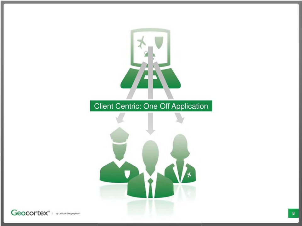
9 Client Centric: One Off Server Application Centric : Purposeful Application 9

10 Viewer Application ArcGIS Server Map Services Database Connections Custom Tools Security Integration Reports Search Workflows Custom Code 10

11 Viewer Application Custom Code Barriers to rapidly change and grow: Difficult to manage Poor reuse and redundancy Costly to maintain (extend and enhance) Lack of standardization Risky staff turnover, minimal documentation ArcGIS Server 11

12 A Spatial Application Infrastructure provides the ability to build multiple, standardized applications; reducing the tension between delivering the kind of application GIS consumers require, and the resources required to deliver those capabilities. 12

13 Key SAI tenets: Applications are technology agnostic/neutral Offer centralized management of applications Minimizes custom code Instead of putting business logic into each individual application, centralize the business logic so it can be shared and reused by any applications Accommodate the evolution of applications over time Emphasize "workflow" (or "task-driven applications), instead of an overwhelming option of features, functions, and tools Adopting SAI helps future-proof your GIS investment. 13
, instead of an overwhelming option of features, functions, and tools Adopting SAI helps future-proof your GIS")
14 Searching and reviewing information (Silverlight) ArcGIS Server 14
")
15 Silverlight Web App Loading new data layers ArcGIS Server 15

16 Silverlight Web App Flex Web App Generating reports (HTML5) ArcGIS Server 16
 ArcGIS")
17 Silverlight Web App Flex Web App HTML Mobile App Dashboards (ipad) ArcGIS Server 17
")
18 Silverlight Web App Flex Web App HTML Mobile App ipad Mobile App Custom Code Map Services Database Connections Custom Tools Security Integration Reports Search Workflows Platform Shared Code ArcGIS Server 18

19 Geocortex Essentials supports SAI by enabling organizations to build standardized applications through integrated components in a common platform: 1. Standardized application creation and management with Geocortex Essentials Manager. 2. Targeted, technology-agnostic applications with Workflow and Forms. 3. Delivery to multiple platforms/technologies today and in the future with Viewer Template Engine. 19

20 Geocortex Essentials Components 20

21 Management Tools Geocortex Manager: Provides central control of all services and applications Smartphones / Tablets (e.g. ipad) Web (e.g. Silverlight, Flex, JavaScript / HTML5) 21
22 Core Elements 22
23 Integration / Extensibility 23
24 Workflow Tools 24
25 Workflow Tools Workflow Technology for building purpose specific applications that automate spatial and non-spatial business processes. 25
26 Workflow Tools Workflow Technology for building purpose specific applications that automate spatial and non-spatial business processes. 26
27 Workflow Tools Workflow Example for purpose specific application: 1. Provide user with list of desired tasks ( I Want To menu); select one 2. Prompt user to enter physical mailing address (manual) 3. Geocode address (automated step) 4. Querying of spacial and non-spatial data; parcels identified (automated) 5. Report generated and distributed to user (automated) 27
28 Viewers Map Viewers with easy to use web-based administration tools 28
29 Viewers Map Viewers with easy to use web-based administration tools 29
30 30
31 What do they all have in common? 31
32 Large and complex SDI s Disseminate large amounts of data (collected over many years) to a wide audience. 32
33 33
34 34
35 35
36 36
37 37
38 38
39 39
40 Steve Maddison Latitude Geographics Group Ltd. All rights reserved.
ArcGIS 10.1 Web Apps and APIs. John Hasthorpe & Kai Hübner
 ArcGIS 10.1 Web Apps and APIs John Hasthorpe & Kai Hübner Overview Options for leveraging ArcGIS Server using Esri s Web APIs Alternatives to the Web ADF application builder (Gone in 10.1) When and how
Off The Shelf Approach to ArcGIS Server & The Dashboard Approach to Gaining Insight to ArcGIS Server
 Off The Shelf Approach to ArcGIS Server & The Dashboard Approach to Gaining Insight to ArcGIS Server Robert Lenarcic Latitude Geographics rlenarcic@latitudegeo.co AGENDA Out of the box ArcGIS Server web-mapping
Portal for ArcGIS. Satish Sankaran Robert Kircher
 Portal for ArcGIS Satish Sankaran Robert Kircher ArcGIS A Complete GIS Data Management Planning & Analysis Field Mobility Operational Awareness Constituent Engagement End to End Integration Collect, Organize,
Intro to Web App Builder. Mark Scott, Solutions Engineer, Esri County Government Team mscott@esri.com
 Intro to Web App Builder Mark Scott, Solutions Engineer, Esri County Government Team mscott@esri.com The ArcGIS Platform enables Web GIS Enabling GIS Everywhere Desktop Web Device Simple Integrated Open
County of Los Angeles. Chief Information Office Preferred Technologies for Geographic Information Systems (GIS) September 2014
 September 2014") County of Los Angeles Chief Information Office Preferred Technologies for Geographic Information Systems (GIS) September 2014 CIO Preferred Technologies for GIS This document lists the preferred Geographic
County of Los Angeles Chief Information Office Preferred Technologies for Geographic Information Systems (GIS) September 2014 CIO Preferred Technologies for GIS This document lists the preferred Geographic
ArcGIS Web Mapping. Sam Berg, esri sberg@esri.com
 ArcGIS Web Mapping Sam Berg, esri sberg@esri.com Agenda ArcGIS and WebMaps The APIs ArcGIS for Flex Viewer ArcGIS for Silverlight Builder ArcGIS for Sharepoint ArcGIS Application Templates ArcGIS Runtime
Chapter 1: Introduction to ArcGIS Server
 Chapter 1: Introduction to ArcGIS Server At a high level you can think of ArcGIS Server as software that helps you take your geographic information and make it available to others. This data can be distributed
ArcGIS Pro. James Tedrick, Esri
 ArcGIS Pro James Tedrick, Esri What you already know Why ArcGIS PRO? Vision The next generation ArcGIS desktop application for the GIS community who need a clean and comprehensive user experience which
Introduction to Web AppBuilder for ArcGIS: JavaScript Apps Made Easy
 Introduction to Web AppBuilder for ArcGIS: JavaScript Apps Made Easy OKSCAUG Pamela Kersh September 22, 2015 The ArcGIS Platform enables Web GIS Enabling GIS Everywhere Desktop Web Device Simple Integrated
Making Your Mobile Workforce More Efficient
 ArcGIS for Mobile Making Your Mobile Workforce More Efficient What Is Mobile GIS? Mobile geographic information system (GIS) technology extends GIS beyond the office and allows organizations to make accurate,
Making Your Mobile Workforce More Efficient
 ArcGIS for Mobile Making Your Mobile Workforce More Efficient What Is Mobile GIS? Mobile geographic information system (GIS) technology extends GIS beyond the office and allows organizations to make accurate,
ArcGIS Viewer for Silverlight An Introduction
 Esri International User Conference San Diego, California Technical Workshops July 26, 2012 ArcGIS Viewer for Silverlight An Introduction Rich Zwaap Agenda Background Product overview Getting started and
Mobile Solutions in ArcGIS. Justin Fan
 Mobile Solutions in ArcGIS Justin Fan Agenda Introducing Mobile GIS Esri Mobile GIS solutions Selecting the right Mobile GIS solution Resources Q&A Introducing Mobile GIS What is Mobile GIS? Extends the
Portal for ArcGIS: An Introduction
 2013 Esri Mid-Atlantic User Conference December 10-11 Baltimore, MD Portal for ArcGIS: An Introduction Derek Law Esri, Redlands Agenda Web GIS Deployment patterns Portal for ArcGIS overview Security Integration
Lecture 8. Online GIS
 Lecture 8 Online GIS Lecture 8: Outline I. Online GIS 1. Google Earth 2. MSN Live Maps II. Open Source GIS III. ArcGIS Server and the ESRI suite of online software utility options IV. Advanced Data Mining
GIS: Transforming the Business. Presented by: Catherine Fitzgerald Manager, Information Services Municipality of Chatham-Kent
 GIS: Transforming the Business Presented by: Catherine Fitzgerald Manager, Information Services Municipality of Chatham-Kent Organization Overview Municipality of Chatham-Kent Single Tier Local Government
An ESRI White Paper December 2007 Enterprise GIS for Local Government
 An ESRI White Paper December 2007 Enterprise GIS for Local Government ESRI 380 New York St., Redlands, CA 92373-8100 USA TEL 909-793-2853 FAX 909-793-5953 E-MAIL info@esri.com WEB www.esri.com Copyright
Cloud+ Experiences with New Technologies bringing GIS to the World. Eamon Walsh CTO, espatial
 Cloud+ Experiences with New Technologies bringing GIS to the World Eamon Walsh CTO, espatial Agenda 1. Introduction to Cloud Computing for GIS 2. Examples 3. The Next Step Multi-Tenancy 4. Business Impact
Essential Mapping Apps
 Essential Mapping Apps 74% of adults use their smartphone to look at maps or other information based on their current location (of the 58% that own a smart phone) Pew Research Center Maps for Directions
White Paper. Freeance Mobile for Cityworks
 White Paper Freeance Mobile for Cityworks Version 1.1 May 2012 Freeance Mobile for Cityworks Freeance Mobile for Cityworks 2012.1 is a mobile application for the following smartphones and tablets: iphone
BC Community Health Atlas An interactive mapping tool for population health data
 An interactive mapping tool for population health data Rita Zhang, MPH Epidemiologist Population & Public Health Program Provincial Health Services Authority Bob Nicholson, MA Business Analyst Strategic
Building and Deploying Web Applications
 Building and Deploying Web Applications Dal Hunter and Jeff Shaner Friday, Nov 6 10:30-12:00 Agenda Product overview Web AppBuilder for ArcGIS tour What s New July 2015 ArcGIS Online update Customization
Extending Enterprise GIS Into The Field with Mobile GIS Technology
 Extending Enterprise GIS Into The Field with Mobile GIS Technology A White Paper January 10, 2014 1525 Oregon Pike Suite 202 Lancaster, PA 17601-7300 Phone (717) 399-7007 Fax (717) 399-7015 www.geographit.com
Benefits of Mobile GIS for Public Works
 Benefits of Mobile GIS for Public Works Freese and Nichols, Inc. NCAFPM 2013 Agenda General GIS Concepts Mobile GIS Overview Benefits of Mobile GIS Mobile GIS Project Examples Questions What is GIS? Geographic
Esri Maps for Salesforce and Microsoft Dynamics CRM
 Esri Maps for Salesforce and Microsoft Dynamics CRM Daniel Lee, Lucy Guerra Esri UC 2014 Technical Workshop Agenda CRM and Esri Esri Maps for Demos Road Ahead Esri UC 2014 Technical Workshop Esri Maps
Petroleum Web Applications to Support your Business. David Jacob & Vanessa Ramirez Esri Natural Resources Team
 Petroleum Web Applications to Support your Business David Jacob & Vanessa Ramirez Esri Natural Resources Team Agenda Petroleum Web Apps to Support your Business The ArcGIS Location Platform Introduction
An Esri White Paper June 2011 ArcGIS for INSPIRE
 An Esri White Paper June 2011 ArcGIS for INSPIRE Esri, 380 New York St., Redlands, CA 92373-8100 USA TEL 909-793-2853 FAX 909-793-5953 E-MAIL info@esri.com WEB esri.com Copyright 2011 Esri All rights reserved.
Configuring and Extending ArcGIS Solutions Web Applications
 Esri Developer Summit March 8 11, 2016 Palm Springs, CA Configuring and Extending ArcGIS Solutions Web Applications Allison Muise & Mike Tschudi ArcGIS Solutions? ArcGIS as a Platform Simple, Open, and
Embracing ArcGIS for Local Government. Robert Parsons Delaware County, Ohio Auditor s Office Steve Koenig Bruce Harris & Associates
 Embracing ArcGIS for Local Government Robert Parsons Delaware County, Ohio Auditor s Office Steve Koenig Bruce Harris & Associates Background Project began in April 2013 At that time ArcIMS 9.2 was the
Esri Maps for Office, SharePoint & Dynamics CRM. Tony Howser Sentha Sivabalan Scott Ball
 Esri Maps for Office, SharePoint & Dynamics CRM Tony Howser Sentha Sivabalan Scott Ball Agenda Location Analytics Esri Maps for - SharePoint - Office - Dynamics CRM Pricing Road Map Q & A Evolving the
Reducing Costs and Raising Effectiveness with a GIScentric Asset Management System
 Reducing Costs and Raising Effectiveness with a GIScentric Asset Management System Jay Clark GIS Specialist City of Shoreline jclark@shorelinewa.gov Chris Brussow Account Manager Cityworks cbrussow@cityworks.com
SUMMER SCHOOL ON ADVANCES IN GIS
 SUMMER SCHOOL ON ADVANCES IN GIS Six Workshops Overview The workshop sequence at the UMD Center for Geospatial Information Science is designed to provide a comprehensive overview of current state-of-the-art
Taking Control of your System and Planning Your Future: Real Time Monitoring
 Advances in GIS Technology Taking Control of your System and Planning Your Future: Real Time Monitoring November 11, 2015 Topics Real-Time Monitoring Capabilities Quick Demo How do we improve uptime, increase
Cross Platform Mobile Gis System For Data Collection Based On Gps And Emerging Gis Technologies
 International Conference of Advance Research and Innovation (-2014) Cross Platform Mobile Gis System For Data Collection Based On Gps And Emerging Gis Technologies Mohammad Nasim a,*, Prashant Kumar b
Scott Moore, Esri April 4, 2016 2016 Intermountain, Great Falls, MT
 Create Great Web Apps No Coding Required Scott Moore, Esri April 4, 2016 2016 Intermountain, Great Falls, MT Agenda Product overview Web AppBuilder for ArcGIS tour What s New November 2015 ArcGIS Online
Note: Hands On workshops are Bring Your Own Laptop (BYOL), unless otherwise noted. Some workshops are Bring Your Own Mobile Device(BYOD).
, unless otherwise noted. Some workshops are Bring Your Own Mobile Device(BYOD).") 2015 MN GIS/LIS Consortium Pre Conference Workshops The Minnesota GIS/LIS Consortium is pleased to offer a diverse list of workshops on Wednesday, October 7th, 2015 at the DECC, Duluth, Minnesota Charting
2015 MN GIS/LIS Consortium Pre Conference Workshops The Minnesota GIS/LIS Consortium is pleased to offer a diverse list of workshops on Wednesday, October 7th, 2015 at the DECC, Duluth, Minnesota Charting
An Esri White Paper June 2010 Tracking Server 10
 An Esri White Paper June 2010 Tracking Server 10 Esri 380 New York St., Redlands, CA 92373-8100 USA TEL 909-793-2853 FAX 909-793-5953 E-MAIL info@esri.com WEB www.esri.com Copyright 2010 Esri All rights
How to Setup and Manage Spatial Assets with ArcGIS Online for a Mobile Workforce
 How to Setup and Manage Spatial Assets with ArcGIS Online for a Mobile Workforce W A U R I S A 2 0 1 4 Presented By Engineer Technician II Pierce County Public Works and Utilities Road Operations Division
Leveraging Geospatial Web Platforms to Advance the Organization
 Leveraging Geospatial Web Platforms to Advance the Organization PSSG-Transforming Information into Insight PRESENTED BY: Kevin Willis, Supervisory Geographer, MBA, GISP, PMP, SSGB ESRI International Users
Oracle Business Intelligence Mobile
 Oracle Business Intelligence Mobile Jon Ainsworth Director of Business Development Oracle EMEA Business Analytics 1 Copyright 2011, Oracle and/or its affiliates. All rights reserved. Fact: Today Mobile
Developing Business Intelligence and Data Visualization Applications with Web Maps
 Developing Business Intelligence and Data Visualization Applications with Web Maps Introduction Business Intelligence (BI) means different things to different organizations and users. BI often refers to
LEVERAGE VBLOCK SYSTEMS FOR Esri s ArcGIS SYSTEM
 Leverage Vblock Systems for Esri's ArcGIS System Table of Contents www.vce.com LEVERAGE VBLOCK SYSTEMS FOR Esri s ArcGIS SYSTEM August 2012 1 Contents Executive summary...3 The challenge...3 The solution...3
Step 1 Preparation and Planning
 Its daunting starting any GIS Web or Mobile project. Where does one begin? This 3 step guide should help you get past your project inertia and start things moving rapidly forward. Step 1 Preparation and
WILLAMALANE PARK AND RECREATION DISTRICT. Springfield, Oregon GIS ASSET MANAGEMENT IN A PARK AND RECREATION DISTRICT ESRI USER CONFERENCE JULY 2014
 WILLAMALANE PARK AND RECREATION DISTRICT Springfield, Oregon GIS ASSET MANAGEMENT IN A PARK AND RECREATION DISTRICT ESRI USER CONFERENCE JULY 2014 SESSION GOALS Share our process of implementing and developing
An Esri White Paper April 2011 Esri Business Analyst Server System Design Strategies
 An Esri White Paper April 2011 Esri Business Analyst Server System Design Strategies Esri, 380 New York St., Redlands, CA 92373-8100 USA TEL 909-793-2853 FAX 909-793-5953 E-MAIL info@esri.com WEB esri.com
ArcGIS. Server. A Complete and Integrated Server GIS
 ArcGIS Server A Complete and Integrated Server GIS ArcGIS Server A Complete and Integrated Server GIS ArcGIS Server enables you to distribute maps, models, and tools to others within your organization
GIS and Mapping Solutions for Developers. ESRI Developer Network (EDN SM)
") GIS and Mapping Solutions for Developers ESRI Developer Network (EDN SM) GIS and Mapping Solutions for Developers If you are a software developer looking for an effective way to bring geographic and mapping
GIS and Mapping Solutions for Developers ESRI Developer Network (EDN SM) GIS and Mapping Solutions for Developers If you are a software developer looking for an effective way to bring geographic and mapping
Building Applications with the ArcGIS Runtime SDK for Windows Mobile
 Esri International User Conference San Diego, California Technical Workshops July 25th Building Applications with the ArcGIS Runtime SDK for Windows Mobile Jay Chen Justin Colville What we will cover today
Advanced Enterprise Work and Asset Management for Performance-Driven Utilities
 Advanced Enterprise Work and Asset Management for Performance-Driven Utilities Asset & Resource Management (ARM) 2 CGI s Asset & Resource Management (ARM) 2 suite is a solution designed to streamline the
AV-18 Introduction of the GIS Integration
 Slide 1 AV-18 Introduction of the GIS Integration Authors Victor Lough Dan Marsillo Geoff Tarcha social.invensys.com @InvensysOpsMgmt / #SoftwareRevolution /InvensysVideos /InvensysOpsMgmt /company/invensys
ESRI Mobile GIS Solutions Overview. Shane Clarke ESRI
 ESRI Mobile GIS Solutions Overview Shane Clarke ESRI Agenda Overview of mobile GIS ESRI mobile GIS Solutions Selecting a mobile GIS solution Q & A 2 Mobile GIS Overview 3 What is mobile GIS? Extension
Emerging Applications at Seattle Public Utilities
 Emerging Applications at Seattle Public Utilities Presented at: 2011 Washington URISA Conference May 11, 2011 Lynnwood, Washington Harvey Arnone and Stephen Beimborn with special guest, Dana Trethewy Presentation
Esri GIS Mobile Solutions. John Sharrard jsharrard@esri.com
 Esri GIS Mobile Solutions John Sharrard jsharrard@esri.com If I had asked people what they wanted, they would have said faster horses. Henry Ford Trend: Increase demand for location services Pew Research
Geospatial-Enabled Field Inspection Management. Sean Graebner Alliances Manager Geospatial sean.graebner@schneider-electric.com
 Geospatial-Enabled Field Inspection Management Sean Graebner Alliances Manager Geospatial sean.graebner@schneider-electric.com Agenda Mobile Utility - Business Drivers and Challenges Lincoln Electric System
GIS Services for Iowa DOT
 GIS Services for Iowa DOT Request For Proposal Iowa Department of Transportation Introduction The Iowa Department of Transportation s (Iowa DOT) Office of Location and Environment, on behalf of the Performance
Implementing ArcGIS for SharePoint Habitat for Humanity of Omaha April, 2013
 Ingenuity Innovation Integrity Implementing ArcGIS for SharePoint Habitat for Humanity of Omaha April, 2013 1851 Alexander Bell Drive Suite 350 Reston, VA 20191 703.463.2059 800.483.2434 www.vistronix.com
Five Steps to Better Performance
 Effective Web maps have a specific focus and are designed so users can interact with them to accomplish meaningful tasks. Five Steps to Better Performance Sample methodology for creating a great Web map
MD imap 2.0 THE NEXT GENERATION OF MARYLAND S ENTERPRISE GIS. Esri MUG Conference Baltimore, MD December 3, 2014 http://imap.maryland.
 THE NEXT GENERATION OF MARYLAND S ENTERPRISE GIS MD imap 2.0 Matt Sokol, GISP Senior GIS Analyst Maryland Department of Information Technology Geographic Information Office Julia Fischer, GISP Senior GIS
Raise of hands on anyone whos used the Flex or Silverlight Application Builders?
 Raise of hands on whos used the Beta for Web Application Builder? Raise of hands on anyone whos done any web development? Raise of hands on anyone whos used the Flex or Silverlight Application Builders?
Urban Planning -794 Internet Geographic Information Systems Fall 2012
 Urban Planning -794 Internet Geographic Information Systems Fall 2012 Instructor: Melissa Mann (mmann@uwm.edu) Manager: Kurt Meingast (kurtm@uwm.edu) Schedule: Class: Monday, 5:30 6:45, SARUP 158 : Monday,
GIS IN THE CLOUD THE ESRI EXAMPLE DAVID CHAPPELL SEPTEMBER 2010 SPONSORED BY ESRI
 GIS IN THE CLOUD THE ESRI EXAMPLE DAVID CHAPPELL SEPTEMBER 2010 SPONSORED BY ESRI CONTENTS Contents... 2 Cloud Computing Basics... 3 Cloud Applications and Cloud Platforms... 3 An Example Cloud Platform:
An Esri White Paper October 2010 Developing with Esri Business Analyst Server
 An Esri White Paper October 2010 Developing with Esri Business Analyst Server Esri, 380 New York St., Redlands, CA 92373-8100 USA TEL 909-793-2853 FAX 909-793-5953 E-MAIL info@esri.com WEB esri.com Copyright
An ESRI White Paper October 2009 ESRI Geoportal Technology
 An ESRI White Paper October 2009 ESRI Geoportal Technology ESRI 380 New York St., Redlands, CA 92373-8100 USA TEL 909-793-2853 FAX 909-793-5953 E-MAIL info@esri.com WEB www.esri.com Copyright 2009 ESRI
Monitoring Your Spatial Enterprise: How IT/GIS Managers are Improving System Reliability with XMF Alerter.
 : How IT/GIS Managers are Improving System Reliability with XMF Alerter. December, 2007 Page 1 Overview IT/GIS managers in both the public and private sector are facing everincreasing pressure to deliver
What is ArcGIS Comprised Of?
 ArcGIS Server 9.1 What is ArcGIS Comprised Of? ArcGIS Desktop Integrated suite of GIS applications ArcGIS Engine Embeddable developer components Server GIS ArcSDE, ArcIMS, ArcGIS Server Mobile GIS ArcPad
1. Abstract. 2. The Problem / Need for the Program
 Program Information: Montgomery County, Maryland Program Title: Integration of GIS Web Services with the 311 Call Center Program Category: # 14 Information Technology 1. Abstract Montgomery County s Department
ArcGIS Data Models Practical Templates for Implementing GIS Projects
 ArcGIS Data Models Practical Templates for Implementing GIS Projects GIS Database Design According to C.J. Date (1995), database design deals with the logical representation of data in a database. The
Studio. Rapid Single-Source Content Development. Author XYLEME STUDIO DATA SHEET
 Studio Xyleme delivers content management for learning and development. We transform the way you author, publish, deliver, and analyze learning content to drive business performance. With Xyleme, you have
Current status and future directions of mobile GIS
 Current status and future directions of mobile GIS Markus U. Müller 1, David Medyckyj-Scott 2, Andrew Cowie 2, Tim-Hinnerk Heuer 2 and Pierre Roudier 2 1 Landcare Research Manaaki Whenua University of
INFORMATION TECHNOLOGY
 INFORMATION TECHNOLOGY MISSION: The mission of the Information Technology Department is to provide the most innovative, highest quality technology-based services in the most cost-effective manner, and
A User Satisfaction Evaluation of Web GIS Platforms in Public Service Delivery: A Case Study of Winona County
 A User Satisfaction Evaluation of Web GIS Platforms in Public Service Delivery: A Case Study of Winona County Frankie Xavier D. Mpagi Department of Resource Analysis, Saint Mary s University of Minnesota,
MAY 18, 2015 ARCGIS 10.3.1 FOR SERVER FUNCTIONALITY MATRIX
 MAY 18, 2015 ARCGIS 10.3.1 FOR SERVER FUNCTIONALITY MATRIX Copyright 2015 Esri All rights reserved. Printed in the United States of America. The information contained in this document is the exclusive
E-Business Analytics Tutorial: Spatially Enabling Employees
 Spatially Enabling Commercial Organizations Presented to: Toronto User Conference Presented by: Paul Voegtle October 6 th, 2014 Seminar Overview This seminar was designated to understand; How to spatially
SaaS business experience platform for content lifecycle management
 Tango INTRODUCING Tango SaaS business experience platform for content lifecycle management Rethink and reshape your approach to customer correspondence Tango is a SaaS platform that creates variable business
How To Develop A Gis Based College Information System
 Development of Web-GIS based College Information System Giridhar M.V.S.S. 1, Md.Nazia Firdouse 2, Durga Bhavani.S 3, Viswanadh.G.K 4, Chandra Bose A.S 5 1- Assistant Professor, CWR, IST, JNTUH, Hyderabad,
ACTIVITY & LOCATION BASED ANALYTICS APPLICATIONS
 ACTIVITY & LOCATION BASED ANALYTICS APPLICATIONS SEAMLESS, REAL TIME MERGING OF GIS AND ERP SYSTEMS ALLOWING THE VISUALIZATION OF RELATIONSHIPS, CONNECTIONS AND PATTERNS IN THE DATA FOR INTELLIGENT, INFORMED
Getting your app together with Web AppBuilder for ArcGIS
 Getting your app together with Web AppBuilder for ArcGIS Walter Simonazzi Walter Simonazzi Session path What is Web AppBuilder for ArcGIS? Web AppBuilder for ArcGIS tour What s new? July 2015 Demos Community
Supporting High-Quality Printing in Web Applications with ArcGIS for Server
 2013 Esri International User Conference July 8 12, 2013 San Diego, California Technical Workshop Supporting High-Quality Printing in Web Applications with ArcGIS for Server Craig Williams Tanu Hoque Esri
Spatial Technology Supporting Collaboration in Endangered Species Recovery Efforts. Presenter: Martin Slimin New Zealand Department of Conservation
 Spatial Technology Supporting Collaboration in Endangered Species Recovery Efforts Presenter: Martin Slimin New Zealand Department of Conservation New Zealand Last major landmass to be colonised by
WHITE PAPER MATTERSPHERE TECHNOLOGY AND FUNCTIONALITY REVIEW CONNECTING YOU WITH WHAT MATTERS
 WHITE PAPER MATTERSPHERE TECHNOLOGY AND FUNCTIONALITY REVIEW CONNECTING YOU WITH WHAT MATTERS MATTERSPHERE A MATTER-FOCUSED, INTEGRATED FRONT-OFFICE SOLUTION MatterSphere from Thomson Reuters Elite is
How To Improve Gis Data Quality
 An Esri White Paper July 2011 GIS Data Quality Best Practices for Water, Wastewater, and Stormwater Utilities Esri, 380 New York St., Redlands, CA 92373-8100 USA TEL 909-793-2853 FAX 909-793-5953 E-MAIL
Enhancing Asset Management with a GIS Program. Lori A. Burkert, P.G. lburkert@entecheng.com 610-373-6667
 Enhancing Asset Management with a GIS Program Lori A. Burkert, P.G. lburkert@entecheng.com 610-373-6667 presentation overview Definitions Its all about your assets Components of a GIS Why use GIS for asset
Statement of Direction
 Mobile First: Taking Mobile CRM to the Next Level 1 January 2013 Mobile First: Taking Mobile CRM to the Next Level Whitepaper Mobile First: Taking Mobile CRM to the Next Level 2 Table of Contents Notes...
SAULT COLLEGE OF APPLIED ARTS AND TECHNOLOGY SAULT STE. MARIE, ONTARIO COURSE OUTLINE
 SAULT COLLEGE OF APPLIED ARTS AND TECHNOLOGY SAULT STE. MARIE, ONTARIO COURSE OUTLINE COURSE TITLE: Web GIS CODE NO. : SEMESTER: 15W PROGRAM: AUTHOR: GIS Dan Kachur DATE: Jan 2015 PREVIOUS OUTLINE DATED:
FLORIDA LOCAL GOVERNMENT INFORMATION SYSTEMS ASSOCIATION TECHNOLOGY ACHIEVEMENT AWARD PROGRAM
 Name of Nominee: Tony Curtis Nominee s Jurisdiction: City of Kissimmee Jurisdiction Population: 2010 Census: 58,698 Nominee s Title: Nominee s Email: Assistant Director, Information Technology Tcurtis@kissimmee.org
NatureServe s Environmental Review Tool
 NatureServe s Environmental Review Tool A Repeatable Online Software Solution for Agencies For More Information, Contact: Lori Scott Rob Solomon lori_scott@natureserve.org rob_solomon@natureserve.org 703-908-1877
ArcGIS Platform. An Integrated System. Portal
 Platform An Integrated System Portal An Integrated Web GIS Platform Knowledge Workers Executive Access Public Engagement Work Anywhere Enterprise Integration Providing Mapping, Analysis, Data Management,
Embedding Maps into Microsoft Office and Microsoft SharePoint
 Embedding Maps into Microsoft Office and Microsoft SharePoint Toronto Esri Canada User Conference Tuesday, October 16, 2012 Presented By: Heather Hainsworth hhainsworth@esri.ca Agenda This seminar is designed
Features of agileemail
 Features of agileemail support@movableink.com Follow: @movableink www.movableink.com Features of agileemail Contents 2 Contents Features of agileemail...3 Workflow... 3 Content... 4 Action... 4 Insight...
What s new in Carmenta Server 4.2
 What s new in Carmenta Server 4.2 A complete solution for cost-effective visualisation and distribution of GIS data through web services Carmenta Server provides cost-effective technology for building
Developing Apps with the ArcGIS Runtime SDK for Android. Ben Ramseth Esri Inc. Instructor Technical Lead
 Developing Apps with the ArcGIS Runtime SDK for Android Ben Ramseth Esri Inc. Instructor Technical Lead Ben Ramseth Instructor Technical Lead Esri Inc USA, Charlotte, NC bramseth@esri.com @EsriMapNinja
Welcome to Esri's Software Export Control Classification Number (ECCN) Matrix
 Matrix") Welcome to Esri's Software Export Control Classification Number (ECCN) Matrix Updated September 30, 2015 This portion of the Esri web site is to provide information regarding the export control classification
Welcome to Esri's Software Export Control Classification Number (ECCN) Matrix Updated September 30, 2015 This portion of the Esri web site is to provide information regarding the export control classification
Developing an Integrated Business Solution with Telemetry and Geographical Information System
 Developing an Integrated Business Solution with Telemetry and Geographical Information System Standards Certification Education & Training Publishing Conferences & Exhibits Speaker: Michael Waddell 2012
Extending ArcGIS Server capabilities through customization - A technology perspective
 Extending ArcGIS Server capabilities through customization - A technology perspective Abstract: Ramesh Babu R 1, G K Viswanathan 2, Tina Mary Francis 3 1 Delivery Manager, NeST Information Technologies
Developing Fleet and Asset Tracking Solutions with Web Maps
 Developing Fleet and Asset Tracking Solutions with Web Maps Introduction Many organizations have mobile field staff that perform business processes away from the office which include sales, service, maintenance,
ArcGIS Web App Builder (AWAB) In BETA. John Bocan MES/DoIT john.bocan@maryland.gov
 In BETA. John Bocan MES/DoIT john.bocan@maryland.gov") ArcGIS Web App Builder (AWAB) In BETA John Bocan MES/DoIT john.bocan@maryland.gov Some Facts (1 slide) The Pros (5 slides) The Cons (2 slides) Some Bugs/Issues (1 slide) What s to Come (1 slide) What This
ArcGIS Web App Builder (AWAB) In BETA John Bocan MES/DoIT john.bocan@maryland.gov Some Facts (1 slide) The Pros (5 slides) The Cons (2 slides) Some Bugs/Issues (1 slide) What s to Come (1 slide) What This
The Importance of Data Quality in your Enterprise
 Federal GIS Conference February 9 10, 2015 Washington, DC The Importance of Data Quality in your Enterprise Heather Murnane & Sherry Fagin Workshop Agenda Importance of Data Quality What is ArcGIS Data
Laserfiche for Federal Government MEET YOUR AGENCY S MISSION
 Laserfiche for Federal Government MEET YOUR AGENCY S MISSION HOW ENTERPRISE CONTENT MANAGEMENT Serves Civilian and Defense Agencies Whether a federal agency supports farmers in the field, soldiers overseas
Kingdom Of Bahrain Ministry of Works. Enterprise Asset Management System A Geocentric Approach. Presented By Hisham Y.
 Kingdom Of Bahrain Ministry of Works Enterprise Asset Management System A Geocentric Approach Presented By Hisham Y. Sater April 2012 Ministry Of Works Bahrain MOW The construction arm of the Kingdom of
GeoManitoba Spatial Data Infrastructure Update. Presented by: Jim Aberdeen Shawn Cruise
 GeoManitoba Spatial Data Infrastructure Update Presented by: Jim Aberdeen Shawn Cruise Organization Overview Manitoba Innovation Energy and Mines Business Transformation and Technology (BTT) Application