ArcGIS Pro. James Tedrick, Esri
|
|
|
- Barry Harris
- 8 years ago
- Views:
Transcription

1 ArcGIS Pro James Tedrick, Esri

2 What you already know

3
4 Why ArcGIS PRO?

5 Vision The next generation ArcGIS desktop application for the GIS community who need a clean and comprehensive user experience which is incredibly fast and efficient, and that will increase productivity for integrated 2D and 3D workflows supporting visualization, data management, and spatial analysis.


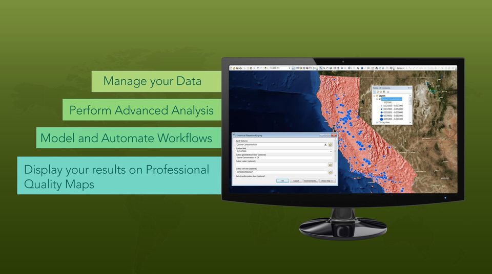
6 Application fusion Single, always responsive application ArcMap ArcCatalog ArcGlobe / ArcScene

7 What you get with ArcGIS Desktop = + ArcGIS for Desktop ArcMap & ArcGIS Pro *Desktop Users now have ALL the Online Apps

8 Is ArcGIS Pro a replacement for ArcMap? No It s a new application, not a replacement ArcMap continues to get better ArcMap and Pro run side by side ArcMap ArcGIS Pro Desktop Files DBMS Server Cloud

9 ArcGIS Desktop 10.3 ArcMap Desktop Files DBMS Server Cloud Continues to Improve and Evolve


10 ArcGIS Desktop 10.3 ArcMap ArcGIS Pro Desktop Files DBMS Server Cloud Continues to Improve and Evolve


11 ArcGIS Pro Faster 2D and 3D Powerful

12 ArcGIS Pro 64 Bit, multi-threaded Always responsive application Simplified contextual user interface Integration with ArcGIS Online New, fast, 2D/3D graphics engine Integrated 2D/3D experience Enhanced map layout capability Project centric workflows Simple search and query

13 ArcGIS Pro Powerful analysis Editing in 2D and 3D Simpler data modeling Integrated with Esri solutions Tasks - guiding workflows Improved help system Web based installation and automatic updates Simplified licensing model Customization (Python and Net)

14 ArcGIS Pro Customization UI Customization with Task Automation and Execution with Python Extensibility with New.NET API

15 Familiar Extensions Spatial Analyst 3D Analyst Network Analyst Geostatistical Analyst Data Reviewer Workflow Manager


16 ArcGIS Pro in the Platform Tight integration with ArcGIS Online and Server - Powerful client to the ArcGIS Platform - Premier authoring application for Online content - Online as the content management system for Pro Provisioning content for Runtime Apps


17 How are Licenses managed in ArcGIS Online? Access controlled by - Named User entitlement of ArcGIS Pro - Online Organization or Portal Organization Admin can: - Grant access of Pro by Named-User - Control product level and extension - Re-assign access as needed Pro User can: - Download and install ArcGIS Pro - Sign-in at startup - Go offline if needed

18 Basic Standard Advanced What you get with ArcGIS Desktop = + ArcGIS for Desktop ArcMap & ArcGIS Pro *Desktop Users now have ALL the Online Apps


19 When Own Desktop Buying into ArcGIS at the Professional Level ArcMap ArcCatalog ArcScene ArcGlobe ArcReader Living Atlas ArcGIS Pro Content Services All the Web Apps Native Apps Online Features

20 Demo: ArcGIS Pro

21 Mapping and Visualization - Vision Improve drawing performance and quality Provide an intuitive and efficient map authoring experience in 2D and 3D - Creating 2D maps, 3D maps, and layers - Layer symbology including symbol selection and editing - Layer properties - Labeling Support existing maps you have today and extend them with new capabilities - e.g. Procedural Modelling
 Some 3D layers aren t useful")
22 2D and 3D Maps 2D Maps and 3D Maps are similar - Have layers, coordinate system, bookmarks..but they usually have different goals - Different symbology, including different classification fields (ex Utility Poles) Some 3D layers aren t useful in 2D - Elevation surfaces, mutlipatches, extruded features.
23 Layout Enhancements Multiple layouts 3D Maps in layouts Layout contents Map decoupled from the layout Removed printer dependencies

24 Export Improvements Support for transparency in PDF Anti-aliasing and improved graphics Faster Smaller file sizes
25 Map Automation Continue to use arcpy.mapping scripts with some modifications Script redundant mapping workflows Create map books Update projects, maps and layers (data sources, symbology) Automate the sharing of maps via export or publishing What changes? - Python 3.4 (in ArcGIS Pro) - Projects (aprx) - Layer file changes - Multiple layouts
26 Editing Basics Always editing all layers you have permissions for - Multiple workspaces edited at same time - Contents pane can be used to disable individual layers Tools available in multiple places (toolbar, modify pane, context menu) - Different users require different ways to access tools Tools always enabled - User prompted to make or update a selection if required ArcGIS Pro: What's New in Editing
27 Editing Options
28 Task Management Streamline workflows for efficiency Implement best practices Create interactive tutorial steps Create workflows with: - Designer - Recording option
29 Data Management Design Views for Data Modeling - Fields - Domains - Subtypes Tabular arrangement - Familiar, spreadsheet-like experience - Display all relevant info all at once - Copy/paste within the view and between views
30 Post ArcGIS 10.3 What is not in the first release? - Land Records - Parcel fabric - Topology - COGO - Utilities Networks - Annotation - Dimensions - Spatial Adjustment


31 Many Apps - Not just Desktop Collector for ArcGIS Operations Dashboard for ArcGIS Explorer for ArcGIS Esri Maps for ArcGIS Viewer Web AppBuilder for ArcGIS ArcGIS Open Data Story Maps for ArcGIS Esri Maps for Office ArcGIS Templates My essential mapping apps Mapping my business data

32
33
ArcGIS Platform. An Integrated System. Portal
 Platform An Integrated System Portal An Integrated Web GIS Platform Knowledge Workers Executive Access Public Engagement Work Anywhere Enterprise Integration Providing Mapping, Analysis, Data Management,
Supporting High-Quality Printing in Web Applications with ArcGIS for Server
 2013 Esri International User Conference July 8 12, 2013 San Diego, California Technical Workshop Supporting High-Quality Printing in Web Applications with ArcGIS for Server Craig Williams Tanu Hoque Esri
ArcGIS 10.1 Geodatabase Administration. Gordon Sumerling & Christopher Brown
 ArcGIS 10.1 Geodatabase Administration Gordon Sumerling & Christopher Brown Key Improvements at ArcGIS 10.1 1. Easier Administration through Graphic Interfaces 2. Greater Seamless integration with Open
Managing Lidar (and other point cloud) Data. Lindsay Weitz Cody Benkelman
 Data. Lindsay Weitz Cody Benkelman") (and other point cloud) Data Lindsay Weitz Cody Benkelman Presentation Context What is lidar, and how does it work? Not this presentation! What can you do with lidar in ArcGIS? What does Esri recommend
(and other point cloud) Data Lindsay Weitz Cody Benkelman Presentation Context What is lidar, and how does it work? Not this presentation! What can you do with lidar in ArcGIS? What does Esri recommend
ArcGIS Web Mapping. Sam Berg, esri sberg@esri.com
 ArcGIS Web Mapping Sam Berg, esri sberg@esri.com Agenda ArcGIS and WebMaps The APIs ArcGIS for Flex Viewer ArcGIS for Silverlight Builder ArcGIS for Sharepoint ArcGIS Application Templates ArcGIS Runtime
Scott Moore, Esri April 4, 2016 2016 Intermountain, Great Falls, MT
 Create Great Web Apps No Coding Required Scott Moore, Esri April 4, 2016 2016 Intermountain, Great Falls, MT Agenda Product overview Web AppBuilder for ArcGIS tour What s New November 2015 ArcGIS Online
Petroleum Web Applications to Support your Business. David Jacob & Vanessa Ramirez Esri Natural Resources Team
 Petroleum Web Applications to Support your Business David Jacob & Vanessa Ramirez Esri Natural Resources Team Agenda Petroleum Web Apps to Support your Business The ArcGIS Location Platform Introduction
Vision. South Pacific GIS/RS Conference 2015 11/17/2015. Applying Geography Everywhere. Applying Geography Everywhere
 South Pacific GIS/RS Conference 2015 Applying Geography Everywhere Jithen (J) Singh Eagle Technology Group Ltd (Esri New Zealand) Suva, Fiji Vision Applying Geography Everywhere 1 GIS Is Evolving A Whole
Enabling High-Quality Printing in Web Applications with ArcGIS for Server. Craig Williams - @williamscraigm Scott Moore - @ScottMooreInOly
 Enabling High-Quality Printing in Web Applications with ArcGIS for Server Craig Williams - @williamscraigm Scott Moore - @ScottMooreInOly High Quality Printing on the Web Primary Goals: - Create a printable
GIS and Mapping Solutions for Developers. ESRI Developer Network (EDN SM)
") GIS and Mapping Solutions for Developers ESRI Developer Network (EDN SM) GIS and Mapping Solutions for Developers If you are a software developer looking for an effective way to bring geographic and mapping
GIS and Mapping Solutions for Developers ESRI Developer Network (EDN SM) GIS and Mapping Solutions for Developers If you are a software developer looking for an effective way to bring geographic and mapping
ArcGIS 10.1 Web Apps and APIs. John Hasthorpe & Kai Hübner
 ArcGIS 10.1 Web Apps and APIs John Hasthorpe & Kai Hübner Overview Options for leveraging ArcGIS Server using Esri s Web APIs Alternatives to the Web ADF application builder (Gone in 10.1) When and how
Network Analysis with Python. Deelesh Mandloi
 Deelesh Mandloi Slides and code samples from this demo theater http://esriurl.com/uc15nawpy Topics ArcGIS Network Analyst extension and concepts Network analysis using ArcGIS Online Network analysis using
How To Build Gis Applications With An Arcgis Engine
 Delivering Custom GIS Applications With ArcGIS Engine An ESRI White Paper February 2004 ESRI 380 New York St., Redlands, CA 92373-8100, USA TEL 909-793-2853 FAX 909-793-5953 E-MAIL info@esri.com WEB www.esri.com
ArcGIS Data Models Practical Templates for Implementing GIS Projects
 ArcGIS Data Models Practical Templates for Implementing GIS Projects GIS Database Design According to C.J. Date (1995), database design deals with the logical representation of data in a database. The
UNGIWG 14. Steve Maddison, George Davis, Latitude Geographics Friday, May 16 th 2014
 UNGIWG 14 Steve Maddison, George Davis, Latitude Geographics Friday, May 16 th 2014 GIS Challenges Today Spatial Application Infrastructure (SAI) The Geocortex Approach 2 1 Geocortex Essentials Web-based
Introduce Web3D Development and Visualization. Moxie Zhang Esri R&D Center Beijing
 Introduce Web3D Development and Visualization Moxie Zhang Esri R&D Center Beijing Web Scene Desktop Web Device New in ArcGIS Online and Portal Web Scene Mash-up of 3D / 2D layers Web Scene Viewer and
What is GIS. What is GIS? University of Tsukuba. What do you image of GIS? Copyright(C) ESRI Japan Corporation. All rights reserved.
 ESRI Japan Corporation. All rights reserved.") What is GIS University of Tsukuba Graduate School of Life and Environmental Science April 21 st, 2011 What is GIS? What do you image of GIS? Gas Insulated Switch Groupe Interventional Speciale Geographic
What is GIS University of Tsukuba Graduate School of Life and Environmental Science April 21 st, 2011 What is GIS? What do you image of GIS? Gas Insulated Switch Groupe Interventional Speciale Geographic
Five Steps to Better Performance
 Effective Web maps have a specific focus and are designed so users can interact with them to accomplish meaningful tasks. Five Steps to Better Performance Sample methodology for creating a great Web map
Getting your app together with Web AppBuilder for ArcGIS
 Getting your app together with Web AppBuilder for ArcGIS Walter Simonazzi Walter Simonazzi Session path What is Web AppBuilder for ArcGIS? Web AppBuilder for ArcGIS tour What s new? July 2015 Demos Community
Getting Started With LP360
 Getting Started With LP360 10/30/2014 1 Contents What is LP360?... 3 System Requirements... 3 Installing LP360... 4 How to Enable the LP360 Extension... 4 How to Display the LP360 Toolbar... 4 How to Import
Supporting High-Quality Printing in Web Applications with ArcGIS 10.1 for Server
 Esri International User Conference San Diego, California Technical Workshops July 25, 2012 Supporting High-Quality Printing in Web Applications with ArcGIS 10.1 for Server Craig Williams and Tanu Hoque
Esri GIS Mobile Solutions. John Sharrard jsharrard@esri.com
 Esri GIS Mobile Solutions John Sharrard jsharrard@esri.com If I had asked people what they wanted, they would have said faster horses. Henry Ford Trend: Increase demand for location services Pew Research
Lecture 8. Online GIS
 Lecture 8 Online GIS Lecture 8: Outline I. Online GIS 1. Google Earth 2. MSN Live Maps II. Open Source GIS III. ArcGIS Server and the ESRI suite of online software utility options IV. Advanced Data Mining
Developing Apps with the ArcGIS Runtime SDK for Android. Ben Ramseth Esri Inc. Instructor Technical Lead
 Developing Apps with the ArcGIS Runtime SDK for Android Ben Ramseth Esri Inc. Instructor Technical Lead Ben Ramseth Instructor Technical Lead Esri Inc USA, Charlotte, NC bramseth@esri.com @EsriMapNinja
Intro to Web App Builder. Mark Scott, Solutions Engineer, Esri County Government Team mscott@esri.com
 Intro to Web App Builder Mark Scott, Solutions Engineer, Esri County Government Team mscott@esri.com The ArcGIS Platform enables Web GIS Enabling GIS Everywhere Desktop Web Device Simple Integrated Open
Data Integration for ArcGIS Users Data Interoperability. Charmel Menzel, ESRI Don Murray, Safe Software
 Data Integration for ArcGIS Users Data Interoperability Charmel Menzel, ESRI Don Murray, Safe Software Product overview Extension to ArcGIS (optional) Jointly developed with Safe Software Based on Feature
Publishing geospatial data to the web using the EEA infrastructure
 Publishing geospatial data to the web using the EEA infrastructure *Note: Map Services should be published using the EEA Map Services Tick Sheet for guidance. Contact Sebastien Petit (Sebastien.Petit@eea.europa.eu)
Esri Maps for Salesforce and Microsoft Dynamics CRM
 Esri Maps for Salesforce and Microsoft Dynamics CRM Daniel Lee, Lucy Guerra Esri UC 2014 Technical Workshop Agenda CRM and Esri Esri Maps for Demos Road Ahead Esri UC 2014 Technical Workshop Esri Maps
Editing Strategies for Enterprise Geodatabase
 Federal GIS Conference February 9 10, 2015 Washington, DC Editing Strategies for Enterprise Geodatabase Ty Fabling Esri Solution Engineer A Complete Platform Enabling GIS Everywhere Desktop Web Device
Note: Hands On workshops are Bring Your Own Laptop (BYOL), unless otherwise noted. Some workshops are Bring Your Own Mobile Device(BYOD).
, unless otherwise noted. Some workshops are Bring Your Own Mobile Device(BYOD).") 2015 MN GIS/LIS Consortium Pre Conference Workshops The Minnesota GIS/LIS Consortium is pleased to offer a diverse list of workshops on Wednesday, October 7th, 2015 at the DECC, Duluth, Minnesota Charting
2015 MN GIS/LIS Consortium Pre Conference Workshops The Minnesota GIS/LIS Consortium is pleased to offer a diverse list of workshops on Wednesday, October 7th, 2015 at the DECC, Duluth, Minnesota Charting
Introduction to Web AppBuilder for ArcGIS: JavaScript Apps Made Easy
 Introduction to Web AppBuilder for ArcGIS: JavaScript Apps Made Easy OKSCAUG Pamela Kersh September 22, 2015 The ArcGIS Platform enables Web GIS Enabling GIS Everywhere Desktop Web Device Simple Integrated
Step 1 Preparation and Planning
 Its daunting starting any GIS Web or Mobile project. Where does one begin? This 3 step guide should help you get past your project inertia and start things moving rapidly forward. Step 1 Preparation and
Network Analysis with ArcGIS Online
 Federal GIS Conference February 9 10, 2015 Washington, DC Network Analysis with ArcGIS Online Matt Kennedy Topics Online versus on-premise network analysis services How to access online services How to
Network Analysis with ArcGIS for Server
 Esri International User Conference San Diego, California Technical Workshops July 24, 2012 Network Analysis with ArcGIS for Server Deelesh Mandloi Dmitry Kudinov Introduction Who are we? - Network Analyst
What is ArcGIS Comprised Of?
 ArcGIS Server 9.1 What is ArcGIS Comprised Of? ArcGIS Desktop Integrated suite of GIS applications ArcGIS Engine Embeddable developer components Server GIS ArcSDE, ArcIMS, ArcGIS Server Mobile GIS ArcPad
ArcGIS for Desktop Best Practices in a Citrix XenApp Environment. Jeff DeWeese Sr. Technical Architect Esri January 4, 2013
 ArcGIS for Desktop Best Practices in a Citrix XenApp Environment Jeff DeWeese Sr. Technical Architect Esri January 4, 2013 Primer - How Compute Intensive is GIS? Processing Intensive (CPU) - Analysis and
Welcome to Esri's Software Export Control Classification Number (ECCN) Matrix
 Matrix") Welcome to Esri's Software Export Control Classification Number (ECCN) Matrix Updated September 30, 2015 This portion of the Esri web site is to provide information regarding the export control classification
Welcome to Esri's Software Export Control Classification Number (ECCN) Matrix Updated September 30, 2015 This portion of the Esri web site is to provide information regarding the export control classification
WILLAMALANE PARK AND RECREATION DISTRICT. Springfield, Oregon GIS ASSET MANAGEMENT IN A PARK AND RECREATION DISTRICT ESRI USER CONFERENCE JULY 2014
 WILLAMALANE PARK AND RECREATION DISTRICT Springfield, Oregon GIS ASSET MANAGEMENT IN A PARK AND RECREATION DISTRICT ESRI USER CONFERENCE JULY 2014 SESSION GOALS Share our process of implementing and developing
ArcGIS 10.2 Enterprise Deployment. An Esri Technical Paper August 2013
 ArcGIS 10.2 Enterprise Deployment An Esri Technical Paper August 2013 Copyright 2013 Esri All rights reserved. Printed in the United States of America. The information contained in this document is the
Customizing ArcPad solutions
 Esri International User Conference San Diego, California Technical Workshops 25 July 2012 Customizing ArcPad solutions Marika Vertzonis, Gareth Walters, Stephen Quan Session Outline What can be customized?
Working with Temporal Data
 Esri International User Conference San Diego, California Technical Workshops July 26 2012 Working with Temporal Data Aileen Buckley Mark Smithgall This technical workshop Visualizing temporal data recurring
How to Setup and Manage Spatial Assets with ArcGIS Online for a Mobile Workforce
 How to Setup and Manage Spatial Assets with ArcGIS Online for a Mobile Workforce W A U R I S A 2 0 1 4 Presented By Engineer Technician II Pierce County Public Works and Utilities Road Operations Division
ArcGIS Viewer for Silverlight An Introduction
 Esri International User Conference San Diego, California Technical Workshops July 26, 2012 ArcGIS Viewer for Silverlight An Introduction Rich Zwaap Agenda Background Product overview Getting started and
ESRI China (Hong Kong) Limited
 Limited") Tips for Creating 3D Graphics in ArcScene 9.x Article ID : 100003 Software : ArcGIS 3D Analyst 9.x Platform : Windows 2000, Windows XP Date : June 28, 2005 Background Prior to ArcGIS Desktop 9.0, we cannot
Tips for Creating 3D Graphics in ArcScene 9.x Article ID : 100003 Software : ArcGIS 3D Analyst 9.x Platform : Windows 2000, Windows XP Date : June 28, 2005 Background Prior to ArcGIS Desktop 9.0, we cannot
SAP Lumira Cloud: True Self-Service BI Without The Server
 September 9 11, 2013 Anaheim, California SAP Lumira Cloud: True Self-Service BI Without The Server Ashish Morzaria, SAP Christina Obry, SAP Learning Points How to enable self-service BI using Lumira on
Data Interoperability Extension Tutorial
 Data Interoperability Extension Tutorial Copyright 1995-2010 Esri All rights reserved. Table of Contents About the Data Interoperability extension tutorial...................... 3 Exercise 1: Using direct-read
Building and Deploying Web Applications
 Building and Deploying Web Applications Dal Hunter and Jeff Shaner Friday, Nov 6 10:30-12:00 Agenda Product overview Web AppBuilder for ArcGIS tour What s New July 2015 ArcGIS Online update Customization
ArcGIS Workflow Manager: An Overview
 Federal GIS Conference February 9 10, 2015 Washington, DC ArcGIS Workflow Manager: An Overview Heather Murnane & Elizabeth Wilcox Session Topics Overview Key Features Notification & Reporting Overview
The Courses. Covering complete breadth of GIS technology from ESRI including ArcGIS, ArcGIS Server and ArcGIS Engine.
 ESRI India: Corporate profile ESRI India A profile India s Premier GIS Company Strategic alliance between ESRI Inc. and NIIT Technologies Adjudged as India s Best GIS Solutions Company - Map India 2001
13/10/2011. Data Integration and Interoperability. Gordon Sumerling & Maree Wilson
 Data Integration and Interoperability Gordon Sumerling & Maree Wilson 1 Agenda Seamless integration between GIS and CAD CAD Support in ArcGIS Using GIS Data in CAD Editing GIS Data in CAD Introduction
ArcGIS Business Analyst Premium* ~ Help Guide ~ Revised October 3, 2012
 ArcGIS Business Analyst Premium* ~ Help Guide ~ Revised October 3, 2012 ArcGIS Business Analyst Premium is an Esri software package that combines GIS analysis and visualization with data to provide a better
Mobile GIS Guide. About The Author. Getting your mobile GIS project off the ground
 About The Author Matt Sheehan is a mobile GIS pioneer. He and his staff at WebMapSolutions have been providing clients with mobile GIS solutions since the earliest days of smartphones and tablets. We live
How To Use Gis
 Welcome Understanding Purpose Creating Relationships You A Global Community of GIS Professionals Changing the World Together Applying Geography Everywhere Your WORK Showcasing Your Web Apps Vision Applying
Essential Mapping Apps
 Essential Mapping Apps 74% of adults use their smartphone to look at maps or other information based on their current location (of the 58% that own a smart phone) Pew Research Center Maps for Directions
A Workflow for Creating and Sharing Maps
 A Workflow for Creating and Sharing Maps By Keith Mann, Esri What You Will Need Item Source ArcGIS Online for Organizations subscription ArcGIS 10.1 for Desktop (Any license level) ArcGIS Spatial Analyst
Portal for ArcGIS. Satish Sankaran Robert Kircher
 Portal for ArcGIS Satish Sankaran Robert Kircher ArcGIS A Complete GIS Data Management Planning & Analysis Field Mobility Operational Awareness Constituent Engagement End to End Integration Collect, Organize,
Bentley ArcGIS. Connector
 Bentley ArcGIS Connector Introduction ESRI, as a GIS software products company, and Bentley Systems, Incorporated, as a developer of solutions for architecture/engineering/construction (AEC) professionals,
WFP Liberia Country Office
 1 Oscar Gobbato oscar.gobbato@wfp.org oscar.gobbato@libero.it WFP Liberia Country Office GIS training - Summary Objectives 1 To introduce to participants the basic concepts and techniques in using Geographic
ArcGIS 10.3 Enterprise Deployment. An Esri Technical Paper December 2014
 ArcGIS 10.3 Enterprise Deployment An Esri Technical Paper December 2014 Copyright 2014 Esri All rights reserved. Printed in the United States of America. The information contained in this document is the
An Esri White Paper October 2010 Esri Production Mapping Product Library: Spatially Enabled Document Management System
 An Esri White Paper October 2010 Esri Production Mapping Product Library: Spatially Enabled Document Management System Esri, 380 New York St., Redlands, CA 92373-8100 USA TEL 909-793-2853 FAX 909-793-5953
Database Production and Map Series Management. Using. The Production Line Tool Set
 Database Production and Map Series Management Using The Production Line Tool Set Dewey Marino - ESRI Redlands Production Line Tool Set ArcGIS Solution for high volume database and map creation Creates
GIS. Digital Humanities Boot Camp Series
 GIS Digital Humanities Boot Camp Series GIS Fundamentals GIS Fundamentals Definition of GIS A geographic information system (GIS) is used to describe and characterize spatial data for the purpose of visualizing
Chapter 1: Introduction to ArcGIS Server
 Chapter 1: Introduction to ArcGIS Server At a high level you can think of ArcGIS Server as software that helps you take your geographic information and make it available to others. This data can be distributed
Web-Based Enterprise Data Visualization a 3D Approach. Oleg Kachirski, Black and Veatch
 Web-Based Enterprise Data Visualization a 3D Approach Oleg Kachirski, Black and Veatch Contents - Introduction - Why 3D? - Applications of 3D - 3D Content Authoring - 3D/4D in GIS - Challenges of Presenting
Prepare Data ArcMap Open Trees.mpk Chrome ArcGIS Online New Map Chrome Esri Blogs Chrome Local Government Resources Reflector Phone Connected
 Prepare Data ArcMap Open Trees.mpk Chrome ArcGIS Online New Map Chrome Esri Blogs Chrome Local Government Resources Reflector Phone Connected Kate Firefox http://doc.arcgis.com/en/operations dashboard/
{ { { Meeting Date 08/03/10. City of Largo Agenda Item 24. Leland Dicus, P.E., City Engineer
 City of Largo Agenda Item 24 Form Revision Date: 10/19/09: Meeting Date 08/03/10 Presenter: Leland Dicus, P.E., City Engineer Department: CD Community Development TITLE: GIS PROGRAM UPDATE The implementation
ArcGIS. Server. A Complete and Integrated Server GIS
 ArcGIS Server A Complete and Integrated Server GIS ArcGIS Server A Complete and Integrated Server GIS ArcGIS Server enables you to distribute maps, models, and tools to others within your organization
MAY 18, 2015 ARCGIS 10.3.1 FOR SERVER FUNCTIONALITY MATRIX
 MAY 18, 2015 ARCGIS 10.3.1 FOR SERVER FUNCTIONALITY MATRIX Copyright 2015 Esri All rights reserved. Printed in the United States of America. The information contained in this document is the exclusive
Developing Business Intelligence and Data Visualization Applications with Web Maps
 Developing Business Intelligence and Data Visualization Applications with Web Maps Introduction Business Intelligence (BI) means different things to different organizations and users. BI often refers to
Prepare your data in ArcGIS for Desktop
 Collector for ArcGIS (ios) Tutorials Prepare your data in ArcGIS for Desktop Create and share a map for data collection Track where collectors went Additional help FAQs Supported data Configure map capabilities
Building 3D PDFs to Visualize Geological Data
 PDFs to Visualize Geological Data Daniel W. Eungard and David A. Jeschke Digital Mapping Techniques 2015 Part 1: Subsurface geometry using Python and ArcScene David A. Jeschke Part 2: Building professional-quality
ESRI Mobile GIS Solutions Overview. Shane Clarke ESRI
 ESRI Mobile GIS Solutions Overview Shane Clarke ESRI Agenda Overview of mobile GIS ESRI mobile GIS Solutions Selecting a mobile GIS solution Q & A 2 Mobile GIS Overview 3 What is mobile GIS? Extension
Configuring and Extending ArcGIS Solutions Web Applications
 Esri Developer Summit March 8 11, 2016 Palm Springs, CA Configuring and Extending ArcGIS Solutions Web Applications Allison Muise & Mike Tschudi ArcGIS Solutions? ArcGIS as a Platform Simple, Open, and
Benefits of Mobile GIS for Public Works
 Benefits of Mobile GIS for Public Works Freese and Nichols, Inc. NCAFPM 2013 Agenda General GIS Concepts Mobile GIS Overview Benefits of Mobile GIS Mobile GIS Project Examples Questions What is GIS? Geographic
EXPLORING AND SHARING GEOSPATIAL INFORMATION THROUGH MYGDI EXPLORER
 EXPLORING AND SHARING GEOSPATIAL INFORMATION THROUGH MYGDI EXPLORER Subashini Panchanathan Malaysian Centre For Geospatial Data Infrastructure ( MaCGDI ) Ministry of National Resources and Environment
SQL Server 2016 BI Any Data, Anytime, Anywhere. Phua Chiu Kiang PCK CONSULTING MVP (Data Platform)
") SQL Server 2016 BI Any Data, Anytime, Anywhere Phua Chiu Kiang PCK CONSULTING MVP (Data Platform) SQL Server 2016 Pin paginated report items to Power BI dashboards Visualization Mobile and paginated reports
SQL Server 2016 BI Any Data, Anytime, Anywhere Phua Chiu Kiang PCK CONSULTING MVP (Data Platform) SQL Server 2016 Pin paginated report items to Power BI dashboards Visualization Mobile and paginated reports
The Importance of Data Quality in your Enterprise
 Federal GIS Conference February 9 10, 2015 Washington, DC The Importance of Data Quality in your Enterprise Heather Murnane & Sherry Fagin Workshop Agenda Importance of Data Quality What is ArcGIS Data
MobileMap and Spatial Content Management: Integrating Field Data Collection, Document Management and Enterprise GIS for Natural Resources
 MobileMap and Spatial Content Management: Integrating Field Data Collection, Document Management and Enterprise GIS for Natural Resources BRIAN GRASS MASON, BRUCE & GIRARD The Mobile Revolution Proliferation
ArcGIS ArcMap: Printing, Exporting, and ArcPress
 Esri International User Conference San Diego, California Technical Workshops July 25th, 2012 ArcGIS ArcMap: Printing, Exporting, and ArcPress Michael Grossman Jeremy Wright Workshop Overview Output in
Esri Maps for Office, SharePoint & Dynamics CRM. Tony Howser Sentha Sivabalan Scott Ball
 Esri Maps for Office, SharePoint & Dynamics CRM Tony Howser Sentha Sivabalan Scott Ball Agenda Location Analytics Esri Maps for - SharePoint - Office - Dynamics CRM Pricing Road Map Q & A Evolving the
Developing Web Apps with ArcGIS API for JavaScript TM. Student Edition
 Developing Web Apps with ArcGIS API for JavaScript TM Student Edition Copyright 2014 Esri All rights reserved. Course version 1.1. Version release date December 2014. Printed in the United States of America.
Texas Develops Online Geospatial Data Repository to Support Emergency Management
 Bing Maps for Enterprise Microsoft Customer Solution Case Study Texas Develops Online Geospatial Data Repository to Support Emergency Management Overview Country or Region: United States Industry: Government
Introduction to the ArcGIS Data Model and Application Structure
 Introduction to the ArcGIS Data Model and Application Structure RNR/GEOG 417/517 Lab 6 Presentation Overview The georelational data model Structure of ArcGIS software Structure of an ArcGIS workspace Demonstrations/previews
How To Improve Gis Data Quality
 An Esri White Paper July 2011 GIS Data Quality Best Practices for Water, Wastewater, and Stormwater Utilities Esri, 380 New York St., Redlands, CA 92373-8100 USA TEL 909-793-2853 FAX 909-793-5953 E-MAIL
Using CAD Data in ArcGIS
 Esri International User Conference San Diego, California Technical Workshops July 27, 2012 Using CAD Data in ArcGIS Jeff Reinhart & Phil Sanchez Agenda Overview of ArcGIS CAD Support Using CAD Datasets
BLM Personnel & REA Collaborator Access. Accessing REA Data, Maps, & Models through SharePoint
 Accessing REA Data, Maps, & Models through SharePoint BLM Personnel & REA Collaborator Access To access REA data and map services through the BLM network, follow the steps provided below. They will take
Developing Mapping Applications with ArcGIS Runtime SDK for Windows Mobile. Jay Chen Justin Colville
 Developing Mapping Applications with ArcGIS Runtime SDK for Windows Mobile Jay Chen Justin Colville Agenda What is ArcGIS Runtime for Windows Mobile Software Development Kit Application SDK - Introduction
INTRODUCTION TO ARCGIS SOFTWARE
 INTRODUCTION TO ARCGIS SOFTWARE I. History of Software Development a. Developer ESRI - Environmental Systems Research Institute, Inc., in 1969 as a privately held consulting firm that specialized in landuse
Esri Training. Prepare to Innovate. Instructor-Led Courses Course Catalog
 Esri Training Prepare to Innovate 2015 Esri Instructor-Led Courses Course Catalog Dear Colleague: The latest release of ArcGIS transforms how geographic information will be accessed and managed by geographic
Eastern Michigan University & ESRI Michigan s K-12 GIS License Program
 Eastern Michigan University & ESRI Michigan s K-12 GIS License Program Presented by: Mike Dueweke EMU/ESRI K-12 GIS License Administrator mdueweke@emich.edu http://esrik-12gis.emich.edu/k12/ PRESENTATION
SAP BusinessObjects Design Studio Overview. Jie Deng, Product Management Analysis Clients November 2012
 SAP BusinessObjects Design Studio Overview Jie Deng, Product Management Analysis Clients November 2012 Legal Disclaimer 2 SAP BusinessObjects Dashboarding Strategy Self Service Dashboarding Professional
Ernesto Ongaro BI Consultant February 19, 2013. The 5 Levels of Embedded BI
 Ernesto Ongaro BI Consultant February 19, 2013 The 5 Levels of Embedded BI Saleforce.com CRM 2013 Jaspersoft Corporation. 2 Blogger 2013 Jaspersoft Corporation. 3 Linked In 2013 Jaspersoft Corporation.
ArcGIS Reference Document
 Migration of GIS Data to ArcSDE Page 1 of 10 Table of Contents A Brief Summary of DEP s GIS Data Storage o The Y Drive o ArcSDE (Spatial Database) Keeping Your GIS Project Data Current o Checking Your
Raise of hands on anyone whos used the Flex or Silverlight Application Builders?
 Raise of hands on whos used the Beta for Web Application Builder? Raise of hands on anyone whos done any web development? Raise of hands on anyone whos used the Flex or Silverlight Application Builders?
Syllabus AGET 782. GIS for Agricultural and Natural Resources Management
 Syllabus AGET 782 Course Title: GIS for Agricultural and Natural Resources Management Course Abbreviation: AGET 782 Course Credits: Instructor: Course Description: Required Text: 3 hours Timothy N. Burcham,
Well there is a way. We don t have an elegant user experience for this right now, but if you are a GIS geek you can do it!
 How to Update Your Hosted Feature Service Schemas in ArcGIS Online When considering the flow of data between the office and the field one of the biggest challenges you face is how to manage change. Though
Publishing Geoprocessing Services Tutorial
 Publishing Geoprocessing Services Tutorial Copyright 1995-2010 Esri All rights reserved. Table of Contents Tutorial: Publishing a geoprocessing service........................ 3 Copyright 1995-2010 ESRI,
Software Development Kit
 Open EMS Suite by Nokia Software Development Kit Functional Overview Version 1.3 Nokia Siemens Networks 1 (21) Software Development Kit The information in this document is subject to change without notice
- Update 2.0.3. IBM Content Navigator Experience Platform. Sven Hapke Leading Technical Professional, Enterprise Content Management
 New insights. Better outcomes. IBM Content Navigator Experience Platform - Update 2.0.3 Sven Hapke Leading Technical Professional, Enterprise Content Management Introducing IBM Content Navigator IBM s
Data source, type, and file naming convention
 Exercise 1: Basic visualization of LiDAR Digital Elevation Models using ArcGIS Introduction This exercise covers activities associated with basic visualization of LiDAR Digital Elevation Models using ArcGIS.