Deserts. Sahara isolated the southern part of Africa from the north Separated people from one another leads to different cultures Sparsely populated
|
|
|
- Pamela O’Connor’
- 7 years ago
- Views:
Transcription

1 Geography

2 Main features of Africa

3 Deserts Sahara isolated the southern part of Africa from the north Separated people from one another leads to different cultures Sparsely populated
4 Isolated people Source of medicines Rainforest
5 Smooth coastline Protection from invasion Made trade and travel more difficult

6 Rivers with rapids and waterfalls Made trade and travel more difficult Made communication more difficult Isolated people

7 Savanna Better farmland area Many people live there

8 Natural Resources Source of wealth Reason for European imperialism

9 Main features of Latin America

10 Amazon River Allows trade and transportation easily navigable

11 Rainforest Poor soil= lack of farmland Source of medicines

12 Pampas and llanos Provide food for raising animals Many people live there

13 Near the equator Most people live in higher altitudes where it is cooler

14 Andes Mountains Separates people from one another Led to cultural diversity Prevented unification

15 Caribbean Islands Led to use of slaves on sugar plantations

16 Japan

17 Archipelago Island allowed it to keep its own culture and selectively borrow Barrier to invasion

18 Mountains Covers large part of island > little fertile land Terrace farming Most of population lives in coastal plains

19 Few Natural Resources Must import most natural resources Led to Japan s imperialism and militarism Must trade with other countries
20 Ring of Fire Religion of Shinto relates to many volcanoes, earthquakes, and tidal waves that Japan experiences People have a resilient nature
21 Irregular coastline Good seaports Good for trade Importance of fishing and shipbuilding
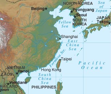
22 China
23 China was isolated from other civilizations Allowed China to develop an independent culture Promoted the idea of ethnocentrism
24 Mountains Protection from invasion Isolated from other parts of world Unified people within China Sparsely populated
25 Deserts Protection from invasion Isolated from other parts of the world Mineral resources Sparsely populated
26 Rivers and River Valleys Provides water for crops > fertile topsoil from flooding Good for trade Most people live there (Eastern China) Flooding can destroy crops, homes and people

27 Heavy Rainfall and Wet Climate Promotes the growth of rice as a staple crop > rapid population growth Need rain for crops

28 South Asia
29 Subcontinent Separated from the rest of Asia >development of its own culture

30 Mountains Himalaya Mountains to north separated people >developed its own cultures Hindu Kush Mountains Khyber Pass

31 Rivers Indus, Ganges, and Brahmaputra Sites of early civilizations Provided water from irrigation fertile land Most people live along rivers Ganges considered holy

32 Nearness to Middle East Invasions through Khyber Pass Spread of Islam

33 Monsoons Can bring needed rainfall or cause flooding Too little rainfall, crops may die

34 Southeast Asia

35 Monsoon climate Brings needed rainfall Can also cause flooding, property damage and death

36 Natural Resources Source of spices, teas, rice, palm oils and tropical woods Cause for imperialism
37 Location Provided the shortest trade route between the Pacific and Indian Oceans Has been deeply influenced by traders and merchants > cultural diffusion [especially Indian and Chinese]
38 Many Islands Allowed people to develop separate cultures > cultural diversity

39 Rivers Serve as water routes connecting people

40 Middle East
41 Connects Africa, Asia, and Europe Crossroads of trade and cultural diffusion
42 Deserts Little good farmland Difficult to travel People live nomadic lifestyle

43 Rivers Tigris and Euphrates Rivers birthplace of civilization Nile River site of ancient civilization Source of irrigation
44 Natural Resources (Oil) Source of wealth for region Has led to wars
45 Scarcity of water Competition for source of water may led to war Desalinization projects
46 Europe

47 Mountains Protection by creating defensible borders Development of separate nationalities with own languages and culture
48 Natural Resources Abundance of coal and iron ore made Industrial Revolution possible
49 Location Allowed Europeans to borrow from the cultures of all other regions [Africa, Middle East, Asia]
50 Coastline Provides many harbors Some European nations became great commercial and seafaring countries
51 Seas and Rivers Allows easy access across the continent Water to irrigate farmland Fishing is major occupation in some countries
52 Plains Great European Plain provides fertile farmland Made it easy for Poland to be invaded
Regional Atlas: Introduction to South Asia
 Name Regional Atlas: Introduction to South Asia Study the map on page 593 of the textbook. 1. The Khyber Pass connects which two countries? CHAPTER 28 2. What capital city is located at 80 E longitude?
GLOBAL REGENTS REVIEW PACKET NUMBER TWO - PAGE 1 of 23 THIS IS GLOBAL REGENTS REVIEW PACKET NUMBER TWO
 GLOBAL REGENTS REVIEW PACKET NUMBER TWO - PAGE 1 of 23 THIS IS GLOBAL REGENTS REVIEW PACKET NUMBER TWO THE TOPICS OF STUDY IN THIS PACKET ARE: GEOGRAPHY IMPACTS HOW PEOPLE DEVELOP - This topic is divided
3. The Buddha followed some Hindu ideas and changed others, but he did not consider himself to be a god.
 True / False Indicate whether the statement is true or false. 1. Like the ancient Greeks, Indian astronomers proposed the theory that the Earth was round and revolved around the sun. 2. During his time
BALBHARATI PUBLIC SCHOOL, PITAMPURA,NEW DELHI COMPREHENSIVE NOTES CHAPTER-6 HUMAN RESOURCES CLASS-VIII SUBJECT-GEOGRAPHY FINAL TERM
 BALBHARATI PUBLIC SCHOOL, PITAMPURA,NEW DELHI COMPREHENSIVE NOTES CHAPTER-6 HUMAN RESOURCES CLASS-VIII SUBJECT-GEOGRAPHY FINAL TERM Q1. Why are people considered as a resource? A1. People are a nation
Ch.1. Name: Class: Date: Matching
 Name: Class: Date: Ch.1 Matching Match each item with the correct statement below. a. technology e. democracy b. diffusion f. extended family c. exports g. interdependence d. climate 1. goods sent to markets
1. Incredible India. Shade the map on the next page, to show India s relief. The correct shading is shown on the final page! Incredible India India
 1. Incredible India Shade the map on the next page, to show India s relief. The correct shading is shown on the final page! Incredible India India The DCSF supported Action plan for Geography is delivered
Chapter 18 Introduction to. A f r i c a
 Chapter 18 Introduction to A f r i c a Ch. 18:1 Landforms & Resources 1. Africa s shape & landforms are the result of its location in the southern part of the ancient supercontinent of. Pangaea Over thousands
Send all inquiries to: Glencoe/McGraw-Hill 8787 Orion Place Columbus, Ohio 43240-4027 ISBN 0-07-824996-1. Printed in the United States of America
 Copyright by The McGraw-Hill Companies, Inc. All rights reserved. Permission is granted to reproduce the material contained herein on the condition that such material be reproduced only for classroom use;
Geography at GISSV: An Introduction to the Curriculum
 Geography at GISSV: An Introduction to the Curriculum Classes Geography is taught for two hours per week in Grades 5-9. The only exception is in Grade 8, where class is taught for one hour per week for
AFRICAN KINGDOMS. Ghana. Around AD 800 the rulers of many farming villages united to create the kingdom of Ghana.
 AFRICAN KINGDOMS In Africa, towns soon became part of an important trade network. Gold and salt were the most important products traded. People needed salt in their diets to prevent dehydration. There
Here is the list of history courses with cross listings and how they fit in each of the sections of the History Major.
 Here is the list of history courses with cross listings and how they fit in each of the sections of the History Major. Note: if you take a History course that is cross listed and you take it under the
The atmosphere has a number of gases, often in tiny amounts, which trap the heat given out by the Earth.
 The Earth is wrapped in a blanket of air called the atmosphere, which is made up of several layers of gases. The sun is much hotter than the Earth and it gives off rays of heat (radiation) that travel
STANDARD 3.1 Greece & Rome. STANDARD 3.2 - Mali
 2008 Curriculum Framework Grade Three Social Studies Standards Condensed format created by SOLpass. www.solpass.org Key: red text highlights NEW (2008 revision) content; crossout indicates content cut
Essential Question: What was the impact of European imperialism in Africa and India?
 Essential Question: What was the impact of European imperialism in Africa and India? Unit X Quiz 2 1. When did the Suez Canal open? 2. Why was it initially difficult for European powers to control their
North America North American Diversity
 Non-fiction: North America North American Diversity North America North American Diversity North America is diverse in many ways. Every type of ecosystem 1 that exists on Earth exists somewhere in North
World History 2007-2008
 Brief Description of Course World History 2007-2008 The AP program was started in 1955 by the College Board to construct standard achievement exams that would allow highly motivated high school students
2015.16 Seventh Grade, Social Studies, Quarter 1
 2015.16 Seventh Grade, Social Studies, Quarter 1 The Fall and Legacy of Rome and the Early Modern World Civilizations of Africa, China, and the Islamic World: Students analyze the legacy of the Roman Empire
The IPCC Special Report on Managing the Risks of Extreme Events and Disasters to Advance Climate Change Adaptation
 The IPCC Special Report on Managing the Risks of Extreme Events and Disasters to Advance Climate Change Adaptation A changing climate leads to changes in extreme weather and climate events 2 How do changes
not to be republished NCERT MAJOR LANDFORMS OF THE EARTH
 6 You must have seen some of the landform features as shown in the Figure 6.1 below. You will notice that the surface of the earth is not the same everywhere. The earth has an infinite variety of landforms.
Unit 01 - Study Questions 1. In what ways did geography and climate affect the development of human society? 2. What were the economic and social
 Unit 01 - Study Questions 1. In what ways did geography and climate affect the development of human society? 2. What were the economic and social results of the agricultural revolution? 3. What are the
UNIT I INTRODUCTION. This unit deals with Location space relations and India s place in the world
 UNIT I INTRODUCTION This unit deals with Location space relations and India s place in the world CHAPTER INDIA LOCATION You have already seen the map of India in the previous classes. Now you closely examine
Ancient Egypt Handouts
 Ancient Egypt Handouts Map of Egypt Lower Egypt Upper Egypt Ancient Egypt 1 Map of Egypt-Answer Sheet 30ºE 40ºE 50ºN Mediterranean Sea 40ºN Africa Alexandria Rosetta Giza Memphis Sinai Pen. Middle East
Climate Change Impacts in the Asia/Pacific Region
 Climate Change Impacts in the Asia/Pacific Region Global CC threat CC in the A/P region The Stern Review and IPCC 4 th Assessment Report both state that climate change will have adverse impact on people
Prentice Hall World Geography: Building a Global Perspective 2007
 Prentice Hall World Geography: Building a Global Perspective 2007 Grades 9-12 C O R R E L A T E D T O Louisiana Grade-Level Expectations for World Geography Grades 9-12 Geography The World in Spatial Terms
West Africa: Bantu Migration and the Stainless Society
 West Africa: Bantu Migration and the Stainless Society Bantu Migration Around 1500 BCE farmers of the Niger and Benue River valleys in West Africa began migrating south and east, bringing with them their
ES Chapter 10 Review. Name: Class: Date: Multiple Choice Identify the choice that best completes the statement or answers the question.
 Name: Class: Date: ES Chapter 10 Review Multiple Choice Identify the choice that best completes the statement or answers the question. 1. Scientists used the pattern of alternating normal and reversed
Advice For the multiple-choice questions, completely fill in the circle alongside the appropriate answer(s).
.") SPECIMEN ASSESSMENT MATERIAL GCSE GEOGRAPHY Paper 1 Living with the physical environment Specimen Materials For this paper you must have: a pencil a ruler. Time allowed: 1 hour 30 minutes Instructions
SPECIMEN ASSESSMENT MATERIAL GCSE GEOGRAPHY Paper 1 Living with the physical environment Specimen Materials For this paper you must have: a pencil a ruler. Time allowed: 1 hour 30 minutes Instructions
GLOBAL REGENTS REVIEW PACKET NUMBER 8 - PAGE 1 of 19 THIS IS GLOBAL REGENTS REVIEW PACKET NUMBER EIGHT
 GLOBAL REGENTS REVIEW PACKET NUMBER 8 - PAGE 1 of 19 THIS IS GLOBAL REGENTS REVIEW PACKET NUMBER EIGHT THE TOPICS OF STUDY IN THIS PACKET ARE: AFRICAN TRADING KINGDOMS JAPANESE FEUDALISM INDIA S CASTE
Answer Keys to Unit Tests
 Reading Geography Series Answer Keys to Unit Tests Unit 1 The Five Themes of Geography Unit 2 Patterns in Physical Geography Unit 3 Natural Resources 7 Portage & Main Press Unit Test for The Five Themes
CHINA OVERVIEW: A BRIEF HISTORY OF CHINESE DYNASTIES. Student Handouts, Inc.
 CHINA OVERVIEW: A BRIEF HISTORY OF CHINESE DYNASTIES Student Handouts, Inc. GEOGRAPHY OF CHINA Larger than the United States Climate varies North Temperate and cold South Subtropical Erosion Floods and
Physiography, Geography and Climate of Latin America (Lecture 3)
") Physiography, Geography and Climate of Latin America (Lecture 3) Natural Landmarks in Latin America World's longest and second highest mountain range, and the world's highest active volcanoes. Biggest
Physiography, Geography and Climate of Latin America (Lecture 3) Natural Landmarks in Latin America World's longest and second highest mountain range, and the world's highest active volcanoes. Biggest
Teacher s Masters California Education and the Environment Initiative. History-Social Science Standards 6.2.6. and 6.2.8. Egypt and Kush: A Tale of
 6 Teacher s Masters California Education and the Environment Initiative History-Social Science Standards 6.2.6. and 6.2.8. Egypt and Kush: A Tale of Two Kingdoms California Education and the Environment
Ghana: A West African Trading Empire
 Ghana: A West African Trading Empire The kingdom of Ghana lasted from 500 C.E. to the 11 th century C.E. The kingdom arose from the Sahel of Africa and spread to the valley between the Senegal and Niger
SOUTH AMERICA CONTENTS. What s in This Book... 2. Section 1: South America in the World... 3. Section 2: Political Divisions of South America...
 SOUTH CONTENTS What s in This Book 2 Section 1: 3 Section 2: Political Divisions of 1 Section 3: Physical Features of 41 Section 4: Valuable Resources of 67 Section : n Culture 89 Section 6: Assessment
Mesopotamia is the first known civilization. Mesopotamia means land between two rivers. This civilization began on the plains between the Tigris and
 Mesopotamia Review Mesopotamia is the first known civilization. Mesopotamia means land between two rivers. This civilization began on the plains between the Tigris and Euphrates Rivers. This curving strip
AGRICULTURE & NATURAL RESOURCES. East Asia: Agriculture & Natural Resources
 EAST ASIA: AGRICULTURE & NATURAL RESOURCES East Asia: Agriculture & Natural Resources BTheme Mary Lou Luebbehusen Forest Park Junior/Senior High School PURPOSE To show the effect that physical geography
Week 1. Week 2. Week 3
 Week 1 1. What US city has the largest population? 2. Where is Aachen? 3. What is the capitol of Florida? 4. What is the longest mountain range in Spain? 5. What countries border Equador? Week 2 1. What
You re One in Seven Billion!
 You re One in Seven Billion! We ve all heard the expression, You re one in a million!. With the ever-growing number of people on the planet, it might be more accurate to say, You re one in seven billion!
Chapter 3 Communities, Biomes, and Ecosystems
 Communities, Biomes, and Ecosystems Section 1: Community Ecology Section 2: Terrestrial Biomes Section 3: Aquatic Ecosystems Click on a lesson name to select. 3.1 Community Ecology Communities A biological
Five Themes of Geography
 Five Themes of Geography Studying the geography of the entire world is a huge task. You can make that task easier by using the five themes of geography: location, regions, place, movement, and humanenvironment
Human Heritage A World History 2006
 Academic Content Standards Social Studies Minnesota Arizona Human Heritage A World History 2006 STANDARDS Strand 2: World History Concept 1: Research Skills for History PO 1. Construct charts, graphs,
6.E.2.2 Plate Tectonics, Earthquakes and Volcanoes
 Name: Date: 1. The road shown below was suddenly broken by a natural event. 3. The convergence of two continental plates would produce Which natural event most likely caused the crack in the road? island
SOCIAL STUDIES UNIT OUTLINES - SIXTH GRADE
 SOCIAL STUDIES UNIT OUTLINES - SIXTH GRADE In sixth grade, students are ready to deepen their understanding of the Earth and its peoples through the study of history, geography, politics, culture, and
The Sudanic African Empires: Ghana / Mali / Songhay & The Swahili City States of East Africa
 The Sudanic African Empires: Ghana / Mali / Songhay & The Swahili City States of East Africa AP World History Mr. Blankenship Ghana Mali Songhay Swahili States The Kingdom of Ghana emerged c. 5 th century
NATURAL REGIONS OF KENTUCKY
 NATURAL WONDERS As you travel around Kentucky taking pictures, you are excited by what you see. Kentucky offers diverse and amazing sights. The Six Regions In the West, you see the Mississippi River, the
Prentice Hall World Studies 2005, 8 Book Series Correlated to: Millard Public School District (Nebraska) Social Studies Standards (Grades 6-7)
 Social Studies Standards (Grades 6-7)") Millard Public School District (Nebraska) Social Studies Standards (Grades 6-7) Note: This is a sample correlation based on four available titles of the new 2005 series in development. Titles include:,
Millard Public School District (Nebraska) Social Studies Standards (Grades 6-7) Note: This is a sample correlation based on four available titles of the new 2005 series in development. Titles include:,
The concepts developed in this standard include the following: Oceans cover about 70% of the surface of the Earth.
 Name Date Grade 5 SOL 5.6 Review Oceans Made by SOLpass - www.solpass.org solpass100@comcast.net Reproduction is permitted for SOLpass subscribers only. The concepts developed in this standard include
GLOBAL REGENTS REVIEW PACKET NUMBER THREE - PAGE 1 of 19 THIS IS GLOBAL REGENTS REVIEW PACKET NUMBER THREE CHARACTERISTICS (ELEMENTS) OF CIVILIZATIONS
 OF CIVILIZATIONS") GLOBAL REGENTS REVIEW PACKET NUMBER THREE - PAGE 1 of 19 THIS IS GLOBAL REGENTS REVIEW PACKET NUMBER THREE THE TOPICS OF STUDY IN THIS PACKET ARE: THE NEOLITHIC REVOLUTION CHARACTERISTICS (ELEMENTS) OF
GLOBAL REGENTS REVIEW PACKET NUMBER THREE - PAGE 1 of 19 THIS IS GLOBAL REGENTS REVIEW PACKET NUMBER THREE THE TOPICS OF STUDY IN THIS PACKET ARE: THE NEOLITHIC REVOLUTION CHARACTERISTICS (ELEMENTS) OF
Oklahoma C 3 Grade 7 World Geography Standards
 A Correlation of Pearson myworld Geography To The The Why of Where: Places, Patterns of Settlement, and Global Interactions A Correlation of, Table of Contents PROCESS AND LITERACY SKILLS FOR LEARNING...
Ninth Grade History & Social Science World History I
 SEPTEMBER WHI.1 Historical Research and Geographical Analysis *(ongoing throughout year) identify, analyze, and interpret primary and secondary sources use maps, globes, artifacts, pictures identify major
North Carolina Essential Standards Seventh Grade Social Studies
 North Carolina s Focus: Time Period: World Geography, History and Culture: Patterns of Continuity and Change The Great Global Convergence (1400-1800) to the Present - Represents the last five Eras of the
7 WHERE AND WHY DID THE FIRST CITIES APPEAR?
 7 WHERE AND WHY DID THE FIRST CITIES APPEAR? In this three-part video David Christian explains how the rise of agriculture led to the formation of the world s first large-scale civilizations. Fueled by
Stage 4. Geography. Blackline Masters. By Karen Devine
 1 Devine Educational Consultancy Services Stage 4 Geography Blackline Masters By Karen Devine Updated January 2010 2 This book is intended for the exclusive use in NSW Secondary Schools. It is meant to
How To Predict Climate Change
 A changing climate leads to changes in extreme weather and climate events the focus of Chapter 3 Presented by: David R. Easterling Chapter 3:Changes in Climate Extremes & their Impacts on the Natural Physical
Year 2 History: Ancient Egypt Resource Pack
 Year 2 History: Ancient Egypt Resource Pack This pack includes the following lessons: Locating Egypt The River Nile Archeology Hieroglyphics Pharaohs Every effort has been made to seek permission for the
Social Studies World History Unit 01 Early Civilizations (8000 BC 500 BC) 2013 2014
 2013 2014") Social Studies World History Unit 01 Early Civilizations (8000 BC 500 BC) 2013 2014 1 Which geographic factor likely contributed to the beginning of the Neolithic Revolution? A changing sea levels forced
Social Studies World History Unit 01 Early Civilizations (8000 BC 500 BC) 2013 2014 1 Which geographic factor likely contributed to the beginning of the Neolithic Revolution? A changing sea levels forced
ACCOUNTING FOR ASIA S NATURAL CAPITAL
 ACCOUNTING FOR S NATURAL CAPITAL DRIVING THE TRANSITION TO A RESOURCE-EFFICIENT GREEN ECONOMY Asia s rapid economic growth during recent decades has been accompanied by serious depletion of the region
CLIMATE, WATER & LIVING PATTERNS THINGS
 CLIMATE, WATER & LIVING PATTERNS NAME THE SIX MAJOR CLIMATE REGIONS DESCRIBE EACH CLIMATE REGION TELL THE FIVE FACTORS THAT AFFECT CLIMATE EXPLAIN HOW THOSE FACTORS AFFECT CLIMATE DESCRIBE HOW CLIMATES
Chapter 8: Plate Tectonics -- Multi-format Test
 Name: Class: Date: ID: A Chapter 8: Plate Tectonics -- Multi-format Test Modified True/False Indicate whether the statement is true or false. If false, change the identified word or phrase to make the
Physical Environment. There are economic reasons for countries to cut down their rainforests.
 Tropical Rainforests Reasons for their Destruction Tropical Rainforests are found in the Amazon Basin of South America, (e.g. Brazil) Central Africa (e.g. Congo) and South East Asia (e.g. Indonesia). There
Speaker Summary Note
 2020 CONFERENCE MAY 2014 Session: Speaker: Speaker Summary Note Building Resilience by Innovating and Investing in Agricultural Systems Mark Rosegrant Director, Environment and Production Technology Division
CH10 Practice Test 2015
 Name Date Mastering the Content Circle the letter next to the best answer. CH10 Practice Test 2015 1. An important way historians learn about ancient Kush is through A. Syrian trade agreements. B. Sumerian
Desertification: Cause and Effect Students learn about the causes and effects of desertification threatening the African Sahel.
 Students learn about the causes and effects of desertification threatening the African Sahel. Author Grade Level Duration Barbara Stout 6-8 and 4-5 class periods National Geography Standards ELEMENT TWO:
Ancient India Lesson 2
 Name: Date: Ancient India Lesson 2 Early Indian Civilization Over 1,000 miles separate the Indus River valley from Iraq, the region once known as Mesopotamia. This distance did not keep people from traveling
TANZANIA. The land area of Tanzania is about 1 million square kilometres. This includes the offshore islands of Zanzibar, Pemba and Mafia.
 TANZANIA 1. INTRODUCTION 1.1 THE COUNTRY Tanzania lies on the East Coast of Africa between 1 O and 11 O S latitude and between 29o and 40 o E Longitude. It is bordered by Kenya in the North and shares
International Flood Network
 International Flood Network Flood Devastation Increasing Floods are natural phenomena caused by rain, but flood damage is influenced by various social as well as natural factors. The scale and form of
Earthquakes and Plate Boundaries Deborah Jordan and Samuel Spiegel
 Earthquakes and Plate Boundaries Deborah Jordan and Samuel Spiegel Jordan, Deborah and Spiegel, Samuel: Learning Research Development Center, University of Pittsburgh. Earthquakes and Plate Boundaries.
Human Environment Interaction in Africa Using National Geographic Maps in the Classroom
 Human Environment Interaction in Africa Using National Geographic Maps in the Classroom Michigan Geographic Alliance Teacher Consultant Stan Masters Overview: Many of the important issues facing modern
Today, we re going to tackle your GUM U7, L2 & L3 Cause and Effect Essay! Chat me your best sentence using the word conscientious.
 Good Morning Conscientious 7 th Graders! Today, we re going to tackle your GUM U7, L2 & L3 Cause and Effect Essay! Chat me your best sentence using the word conscientious. Rainforest Destruction: Causes
History of Horticulture: Lecture 34
 Lecture 34 Horticulture, Politics, and World Affairs: Sugarcane, Plantation Agriculture & Slavery Horticulture, the source of valuable commodities, has influenced world affairs since antiquity Ancient
Unit 2 Lesson 4 Early Human Migration and Stone Age Tools
 Unit 2 Lesson 4 Early Human Migration and Stone Age Tools Daily Warm-up True/False Read the False statements below. Replace each underlined word with one from the word bank that makes each sentence True.
11A Plate Tectonics. What is plate tectonics? Setting up. Materials
 11A Plate Tectonics What is plate tectonics? Earth s crust plus the upper mantle forms the lithosphere. Earth s lithosphere is broken in a number of different pieces. How these pieces move and interact
Kindergarten-Grade 8
 A Correlation of Pearson myworld Social Studies To Pearson Learning Kindergarten-Grade 8 Introduction This document demonstrates where for Social Studies, Grades K-8, are covered in myworld Social Studies
BASICS OF GEOGRAPHY A UNIT OF STUDY. Includes Two Videos... 1. WATER AND LANDFORMS 2. CLIMATE AND NATURAL RESOURCES.
 BASICS OF GEOGRAPHY A UNIT OF STUDY Includes Two Videos... 1. WATER AND LANDFORMS 2. CLIMATE AND NATURAL RESOURCES Teacher's Guide Video Produced by VIDEO DIALOG, INC. Teacher's Guide and Blackline Master
CONFEDERATION OF ASIA-PACIFIC CHAMBERS OF COMMERCE AND INDUSTRY (CACCI)
") CONFEDERATION OF ASIA-PACIFIC CHAMBERS OF COMMERCE AND INDUSTRY (CACCI) Policy Paper on Flexible Responses to Environmental Uncertainty and Infrastructure Resolved as of 3 rd October,. A. BACKGROUND 1.
CONFEDERATION OF ASIA-PACIFIC CHAMBERS OF COMMERCE AND INDUSTRY (CACCI) Policy Paper on Flexible Responses to Environmental Uncertainty and Infrastructure Resolved as of 3 rd October,. A. BACKGROUND 1.
VISUAL 6.1 GREAT BRITAIN S AMERICAN COLONIES
 SPECIALIZATION AND TRADE IN THE THIRTEEN COLONIES LESSON 6 VISUAL 6.1 GREAT BRITAIN S AMERICAN COLONIES GREAT BRITAIN S COLONIES All colonies are rich in natural resources but short on labor. PRODUCTIVE
Prentice Hall World Geography: Building a Global Perspective 2003 Correlated to: Arkansas Social Studies Curriculum Frameworks (Grades 9-12)
") Arkansas Social Studies Curriculum Frameworks (Grades 9-12) Strand 1: Time, Continuity, and Change Content Standard 1: Students will demonstrate an understanding of the chronology and concepts of history
Arkansas Social Studies Curriculum Frameworks (Grades 9-12) Strand 1: Time, Continuity, and Change Content Standard 1: Students will demonstrate an understanding of the chronology and concepts of history
GLOBAL REGENTS REVIEW PACKET 6 - PAGE 1 of 22. The BYZANTINE EMPIRE (divided into 3 parts) PART 1: The BYZANTINE EMPIRE - INFLUENCE ON RUSSIA
 PART 1: The BYZANTINE EMPIRE - INFLUENCE ON RUSSIA") GLOBAL REGENTS REVIEW PACKET 6 - PAGE 1 of 22 The BYZANTINE EMPIRE (divided into 3 parts) PART 1: The BYZANTINE EMPIRE - INFLUENCE ON RUSSIA (The Byzantine Empire influenced the development of early [Kievian]
GLOBAL REGENTS REVIEW PACKET 6 - PAGE 1 of 22 The BYZANTINE EMPIRE (divided into 3 parts) PART 1: The BYZANTINE EMPIRE - INFLUENCE ON RUSSIA (The Byzantine Empire influenced the development of early [Kievian]
Jamestown Questions and Answers
 Jamestown Questions and Answers Why is Jamestown important? Jamestown was the first permanent English settlement in North America. It is America s birthplace. Who were the first Europeans to explore Virginia?
WORLD REGIONAL GEOGRAPHY. By Brett Lucas
 WORLD REGIONAL GEOGRAPHY By Brett Lucas SOUTH ASIA Part 1 Defining the Realm The Geographic Panorama Subcontinent: Divides oceans Divided by mountains, deserts, and fertile valleys Cultural diversity:
African-American History
 African-American History Reader and Workbook Richard Beck Royal Fireworks Press Unionville, New York Table of Contents Introduction...1 General Reading List...4 Vocabulary Words...6 Famous African-Americans...8
SUGGESTED UNIT OUTLINES FOR SOCIAL STUDIES GLES
 SEVENTH GRADE UNIT OUTLINES In seventh grade, students become more proficient with the core concepts in social studies. There are two recommended contexts in which students can demonstrate this proficiency
The Regions of the United States
 CHAPTER 1 Identify characteristic landforms of the five major regions of the United States. Describe, compare, and contrast regional climates of the United States. Identify regional resources of the United
Summarize how Portugal built a trading empire
 Objectives Summarize how Portugal built a trading empire in. Analyze the rise of Dutch and Spanish dominance in the region. Understand how the decline of Mughal India affected European traders in the region.
World Population Growth
 3 World Population Growth Why is world population growing faster than ever before? Population dynamics are one of the key factors to consider when thinking about development. In the past years the world
SUGGESTED UNIT OUTLINES FOR SOCIAL STUDIES GLES
 NINTH-TENTH GRADES SUGGESTED UNIT OUTLINES In ninth and tenth grade, students apply their deeper understanding of social studies concepts on a global scale. The recommended context in the ninth and tenth
Geography affects climate.
 KEY CONCEPT Climate is a long-term weather pattern. BEFORE, you learned The Sun s energy heats Earth s surface unevenly The atmosphere s temperature changes with altitude Oceans affect wind flow NOW, you
LIVING WITH FLOOD IN THE MEKONG DELTA, VIETNAM. Tran Thi Trieu, Nguyen Hieu Trung, Le Anh Tuan
 LIVING WITH FLOOD IN THE MEKONG DELTA, VIETNAM Tran Thi Trieu, Nguyen Hieu Trung, Le Anh Tuan THE MEKONG RIVER DELTA Mekong River Delta is in the most southern of Vietnam. The MD is considered as a biggest
- 7. Oracle bones were used a. to practice written Chinese. b. to try to predict the future. p Ch 14 Ancient China section 1
 Name: Class: Date: ID: A p Ch 14 Ancient China section 1 Multiple Choice Identzh the choice that best completes the statement or answers the question. - I. Before the Shang kingdom arose, Chinese civilization
List A: Economics course options (all students must take at least 1 course from this list)
") MASTERS PROGRAM IN INTERNATIONAL AND AREA STUDIES SUGGESTED COURSES Note that the below are suggested courses. For other possible courses, please check with the Graduate Assistant and the Chair of the
MASTERS PROGRAM IN INTERNATIONAL AND AREA STUDIES SUGGESTED COURSES Note that the below are suggested courses. For other possible courses, please check with the Graduate Assistant and the Chair of the
Name Date Hour. Plants grow in layers. The canopy receives about 95% of the sunlight leaving little sun for the forest floor.
 Name Date Hour Directions: You are to complete the table by using your environmental text book and the example given here. You want to locate all the abiotic (non-living) and biotic (living) factors in
Grades 3-5. Benchmark A: Use map elements or coordinates to locate physical and human features of North America.
 Grades 3-5 Students use knowledge of geographic locations, patterns and processes to show the interrelationship between the physical environment and human activity, and to explain the interactions that
STANDARD 1: The student understands historical chronology and the historical perspective.
 Prentice Hall World Studies, The Eight Book Series Foundations of Geography 2005 Florida Sunshine State Standards, Social Studies Benchmarks and STRAND A: TIME, CONTINUITY, AND CHANGE [HISTORY] STANDARD
Tropical Cloud Population
 Tropical Cloud Population Before Satellites Visual Observation View from and aircraft flying over the South China Sea Radiosonde Data Hot tower hypothesis Riehl & Malkus 1958 Satellite Observations Post
1. You are about to begin a unit on geology. Can anyone tell me what geology is? The study of the physical earth I.
 PLATE TECTONICS ACTIVITY The purpose of this lab is to introduce the concept of plate tectonics and the formation of mountains. Students will discuss the properties of the earth s crust and plate tectonics.
Lesson Plan: The Silk Road
 Lesson Plan: The Silk Road Provided by the Art Institute of Chicago Department of Museum Education Suggested grade level: 7 10 Estimated time: 2 3 hours Introduction The "Silk Road" was an ancient network
KS2: Baghdad AD 900 (6 lessons)
") KS2: Baghdad AD 900 (6 lessons) Contents Include: An Introduction to Mesopotamia Building Baghdad The House of Wisdom The Mongol Attack on Baghdad in 1258 This pack of lessons has been designed for Key
KS2: Baghdad AD 900 (6 lessons) Contents Include: An Introduction to Mesopotamia Building Baghdad The House of Wisdom The Mongol Attack on Baghdad in 1258 This pack of lessons has been designed for Key
CHAPTER ONE: A CONTINENT OF VILLAGES, TO 1500
 CHAPTER ONE: A CONTINENT OF VILLAGES, TO 1500 SETTLING THE CONTINENT Who Are the Indian People? Migration from Asia Clovis: The First American Technology NEW WAYS OF LIVING ON THE LAND Hunting Traditions