EXPLORE! A Cooperative Project of the Lunar and Planetary Institute, NASA's Office of Space Science and public libraries
|
|
|
- Briana Welch
- 7 years ago
- Views:
Transcription
1 EXPLORE! A Cooperative Project of the Lunar and Planetary Institute, NASA's Office of Space Science and public libraries Activity: Remote Sensing: Mapping Other Worlds Level: Grades 5-8 To Take Home: False Color Image of Simulated Planetary Surface Background Information Remote Sensing Remote sensing is the process of obtaining information from a source without actually coming in contact with that source. The human eye is a remote-sensing device, and so is the ear. In planetary science, a variety of sensors onboard satellites and spacecraft gather data about the planets. Visible light, a particular wavelength range of electromagnetic radiation, passes over a distance until it encounters and is captured by sensors your eyes which then send a signal to a processor your brain. The human sensory organs gather their awareness of the external world by perceiving signals. You hear disturbances in the atmosphere carried as sound waves, experience the sensation of heat, react to chemical signals from food through smell, and recognize the shape, color, size, and position of objects by means of the visible light coming from them. Sensations that are not received through direct contact are remotely sensed. The formal definition of remote sensing is: "The acquisition and measurement of data/information on some property(ies) of a phenomenon, object, or material by a recording device not in physical, intimate contact with the feature(s) under surveillance; techniques involve amassing knowledge

2 pertinent to environments by measuring force fields, electromagnetic radiation, or acoustic energy employing cameras, lasers, radio frequency receivers, radar systems, sonar, thermal devices, seismographs, magnetometers, gravimeters, scintillometers, and other instruments". For planetary science, remote sensing seeks to acquire data remotely, to develop information about planets and moons in our solar system. Remote sensing has allowed us to see through the clouds of Venus and through the oceans of Earth. How do remote sensing satellites work? Remote-sensing satellites collect data either actively or passively. For example, radar satellites collect data actively by sending a known signal from the satellite and measuring the portion of the signal that is returned. Passive devices only make measurements, such as the intensity and wavelength of natural light reflected by an object. All objects reflect electromagnetic energy in various wavelengths depending on the object's physical and chemical structure. The important characteristics of remote-sensing systems that measure electromagnetic radiation include spatial resolution, spectral coverage, and temporal frequency. Spatial resolution describes the level of detail, or smallest size of an object, which can be identified. Spectral coverage refers to how many different colors and different parts of the electromagnetic spectrum are measured. Temporal frequency refers to the cycle of coverage or how often data is collected from a particular satellite or spacecraft. Remote sensing systems make trade-offs between spatial resolution, spectral coverage, and temporal frequency. In some cases fine spatial detail is crucial, as with topographic mapping. In other cases, information is needed frequently, but does not require as much detail. For example, a weather instrument may require data several times a day. For other remote sensing instruments, having more measurements in the spectral range may be more important. False Color Images False color images are created using remotely sensed data to make visual representations. These pictures use specific colors to represent elevation, temperature, or other data. Scientists use these images to study the topography, geology, or weather of a planet. A false color image of the surface of Venus created from data taken by the Magellan spacecraft is shown on the next page.


3 Magellan radar data of Venus in false color to emphasize surface topography: (warm colors = highest areas; cool colors = lowest areas). Magellan and the Planet Venus Pioneer Venus image taken in ultraviolet wavelengths shows cloud patterns in the atmosphere The Magellan spacecraft mission was designed to help understand the geological structure of Venus. During its four-year orbital tour from 1990 to 1994, Magellan (named after the Portuguese explorer who first circumnavigated Earth) provided detailed topographic maps and image maps of Venus' surface using radar to penetrate the planet's thick cloud cover. The radar mapped 98 percent of the surface with an image resolution of about 100 meters, and the surface topography was measured with a spatial resolution of 10 kilometers. Additional studies included measurements of the planet's gravitational field using precision radio tracking. At the end of its useful life, Magellan was commanded into a gradual dive into the Venusian atmosphere to obtain information about its properties. It finally burned up on Oct.12, Drawing of Magellan at Venus (not to scale) Galileo image taken through a violet filter and false-colored in yellows shows a featureless atmosphere similar to what our eyes could see.
 provided detailed topographic maps and image maps of Venus' surface")

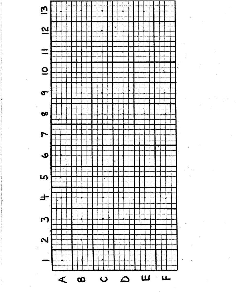
4 Venus Boxes How do we map the surface of a planet we can t see? The Magellan spacecraft used radar to penetrate the thick clouds that shroud the planet s surface. To map the planet s topography, Magellan carefully measured the time it took for a radar pulse beamed at Venus to bounce back from the planet s surface. If the signal bounced back in a short time, it had reflected off something of high elevation; if the signal took longer to return, it had touched a low area of the surface. The spacecraft continued taking measurements as it orbited the slowly rotating planet until a topographic map of almost the entire surface was made. A similar procedure using sound pulses instead of radar pulses has been used to map the shape of portions of the ocean floor. This activity simulates Magellan s topographic mapping, but uses ruler measurements of the probing device (a coffee stir or cocktail straw) instead of timing a radar pulse. The lid of a shoebox represents the cloud cover of Venus through which your probe must penetrate. You can make the mystery planetary surfaces ahead of time by cutting up styrofoam and gluing pieces inside the shoeboxes to make a landscape with varied topography. You can scrape out impact craters, carve out river channels, and construct mountains or volcanoes. If there is more time in your session you can have students create the mystery boxes and then switch with other teams. You can also tape the graph paper to the lids and prepunch the holes (evenly spaced about 1-inch apart) according to the samples included in this guide. Students will make two topographic maps, one at low resolution and one at higher resolution. If there is not enough time to get to the second map, have one already made to show to the group. Activity Timeframe - 90 minutes Venus Boxes Materials Shoeboxes (one per student) Graph paper 8 1/2 x 11 inches (or larger) Marker Package of cocktail straws or coffee stirs Several sets of crayons with 24 colors Pieces of styrofoam (sheets and/or forms, available at craft supply stores) Scissors and craft knife White craft glue Nails to poke holes in the shoebox lids


5 Preparation 1. Make the mystery planetary surface by cutting up styrofoam and gluing pieces inside the shoeboxes to make a landscape with varied topography. You can scrape out impact craters, carve out river channels, and construct mountains or volcanoes. If you have more time you can have the student teams make the landscapes and exchange boxes with other teams so that what is inside the box will be a mystery when the groups begin mapping. 2. Cut a sheet of graph paper along the grid lines to fit the lid of the shoebox and glue it on top of the lid. Cut two pieces of graph paper to the exact dimensions used for the box lid. (These will become the maps.) Punch holes about every inch depending on the spacing of the grid on your graph paper. The holes should be evenly spaced. Make the holes large enough for the cocktail straws to fit in them. 3. Make a key for mapping the surface in color, using the colors (crayon or pencil) that you have available. For example, the key given in this guide uses warm colors for high, cool colors for medium, and dark colors for low topography. The precise colors don t matter a rainbow effect from high to low is the goal. Introduction You may choose to read an article about the Magellan Spacecraft or the planet Venus to the young group. Share with the group some of the history of remote sensing and the reasons for it. Describe some of the remote sensing instruments used by spacecraft and share some of the false color images (included in this guide) of Venus' surface seen through its clouds. NASA fact sheets and additioinal images can be printed from several of the Websites given in the Related Internet Sites. You can also show a video about the planet Venus. The simulated flyover of Venus, from Magellan data seen in the IMAX film Destiny in Space is excellent (see book and video lists). Timeframe minutes. Remote Sensing Activity Pass out the shoeboxes with the mystery surfaces of regions on the planet Venus. Explain to the group that you cannot see visually through the clouds on Venus. The spacecraft will send radar data back to Earth by bouncing signals off the surface. Then the data processors on Earth can put the data together to form a map of the entire region or planet surface as in the composite image in this guide. Have each two person team get one box of crayons and crayon chart, a straw and a ruler (with centimeters). As they poke the straw through every other hole (and then for the

6 second map, through every hole) they should measure the depth in centimeters and match that to the color chart. Then they should fill in that color on their separate piece of graph paper. The resulting image will be a false color representation of the surface with the gray, pink and reds being the highest and the greens, blues, purple, and black being the lowest areas. If there is not enough time to get to the second mapping activity, have one already made to share with the group. Timeframe - 45 minutes. Procedure 1. Low-resolution map: Begin mapping by inserting the straw probe into the first hole at one corner of the shoebox. Push the straw in gently just until it encounters the surface. Grasp the straw where it enters the box lid and remove it using thumb and forefinger to mark the place. Measure how much of the straw was below the lid with a ruler and note the measurement lightly in pencil on the piece of graph paper. Low numbers will represent the highest elevations, and high numbers represent the lowest elevations. For the low-resolution map, you will measure every other hole in the box lid. Each measurement will correspond to an area about two inches square on the graph paper (this will vary a little depending on what kind of graph paper you are using). The idea is to have each measurement represent a fairly large area. Using the color key, select the right color and color in the entire ~2-inch square with it. Continue measuring every other hole until you have measured and colored the entire surface at low resolution. 2. High-resolution map: Using another piece of graph paper that matches the lid of the box, remap the surface at high resolution by measuring through every hole in the box lid. This time, the area to color in for each hole will be about half as large, or about one square inch (again depending on the kind of graph paper you are using). Using the same technique as before, measure the surface through each hole until you have completely colored in the high-resolution map. 3. Compare the two maps, noting similarities and differences. Make some hypotheses about the kind of surface that you have mapped. Finally, remove the shoebox lids and examine the ground truth. Follow Up Questions 1. Do your maps give a good idea of the actual topography? 2. Are there features that were missed by low resolution mapping that you can see from the high-resolution measurements?

7 Sending Signals Demonstration This simple demonstration shows how data, in this case a visual image, is sent back to Earth is in a series of single lines of data to eventually form a complete picture. Using a slide projector and a slide of the Earth globe (Venus, Jupiter, or another planet) stand approximately 10 feet from the projector lens. Using a yardstick slowly start at the top of the projected globe image and move the yardstick down the image revealing one line of "data" at a time. Now move the yardstick very quickly up and down, it will appear to create a complete image. The planet will appear as a full globe as the images are connected by your brain. This is also how images are sent to your television. Light images are momentarily retained on your retina (called persistence of vision ) an analogy of the imaging process used by computers that reassemble some types of image data sent by spacecraft, satellites and space telescopes. Timeframe - 10 minutes. Recommended Videos Destiny in Space 1994, Sony IMAX pictures Includes a flyover sequence of Venus produced by NASA's Jet Propulsion Laboratory. Magellan - Mapping The Planet Venus $10.00, Grade 7-adult, 10 minutes, Solar System and Beyond - Mapping Venus 40 Minutes, 1994, Timeless Video Inc. "Mission for Mariner," "Magellan: Mapping the Planet Venus," "Collection of Magellan: Venus Radar Mapping Results," and "Magellan: Exploration of Venus." Solar System and Beyond - Venus - The Second Planet 60 Minutes, 1994, Timeless Video Inc. Two programs take a closer look at Venus: "Clouds of Venus" and "Veil of Venus." NASA footage and animation. Books you can borrow from your library Non-fiction Magellan Branley, Franklyn Mansfield. Venus: Magellan Explores Our Twin Planet (A Voyage into Space Book). HarperCollins Children's Books, ISBN:

8 Venus Reddy, Frank and Greg Walz-Chojnacki, Isaac Asimov, Francis Reddy. Earth's Twin: The Planet Venus (Isaac Asimov's New Library of the Universe). Gareth Stevens, ISBN: Vogt, Gregory L. Venus (Gateway Solar System). Millbrook Press, ISBN: X. Fiction Loewen, Nancy. Venus (Greek and Roman Mythology Series). Franklin Watts, Incorporated, ISBN: X. Bradbury, Ray. "The Long Rain" (a short story), from R is for Rocket. Bantam, Related Internet Sites: Magellan and Venus and Remote Sensing NASA's Observatorium Remote Sensing Page Hawaii Space Grant College Remote Sensing Activities Canadian Remote Sensing Tutorial NASA Remote Sensing Tutorial Center for Space Research Remote Sensing

9 JPL Imaging Radar Solar System Windows to the Universe The Nine Planets Views of the Solar System Our Solar System

10 Color Key for Mapping Venus Boxes DEPTH (centimeters) COLOR (Crayola Crayons) ELEVATION RED HIGH SCARLET RED ORANGE YELLOW ORANGE YELLOW YELLOW GREEN GREEN BLUE GREEN BLUE BLUE VIOLET BLACK LOW

11 COLOR KEY FOR MAPPING VENUS BOXES DEPTH (centimeters) COLOR (Crayola Crayons) ELEVATION RED HIGH SCARLET RED ORANGE YELLOW ORANGE YELLOW YELLOW GREEN GREEN BLUE GREEN BLUE BLUE VIOLET BLACK LOW

12

13
14

15
Review for Introduction to Remote Sensing: Science Concepts and Technology
 Review for Introduction to Remote Sensing: Science Concepts and Technology Ann Johnson Associate Director ann@baremt.com Funded by National Science Foundation Advanced Technological Education program [DUE
How Landsat Images are Made
 How Landsat Images are Made Presentation by: NASA s Landsat Education and Public Outreach team June 2006 1 More than just a pretty picture Landsat makes pretty weird looking maps, and it isn t always easy
Rosaly Lopes, Jet Propulsion Laboratory, California Institute of Technology
 Saturn s Moon Titan: Cassini-Huygens Reveals a New World Rosaly Lopes, Jet Propulsion Laboratory, California Institute of Technology The year 2005 will be remembered in the history of space exploration
STAAR Science Tutorial 30 TEK 8.8C: Electromagnetic Waves
 Name: Teacher: Pd. Date: STAAR Science Tutorial 30 TEK 8.8C: Electromagnetic Waves TEK 8.8C: Explore how different wavelengths of the electromagnetic spectrum such as light and radio waves are used to
A remote sensing instrument collects information about an object or phenomenon within the
 Satellite Remote Sensing GE 4150- Natural Hazards Some slides taken from Ann Maclean: Introduction to Digital Image Processing Remote Sensing the art, science, and technology of obtaining reliable information
Effect of Light Colors on Bean Plant Growth
 Effect of Light Colors on Bean Plant Growth Teacher Edition Grade: Grades 6-8 Delaware State Science Standard: Science Standard 6 - Life Processes Strand: Structure/Function Relationship Strand: Matter
After a wave passes through a medium, how does the position of that medium compare to its original position?
 Light Waves Test Question Bank Standard/Advanced Name: Question 1 (1 point) The electromagnetic waves with the highest frequencies are called A. radio waves. B. gamma rays. C. X-rays. D. visible light.
Interaction of Energy and Matter Gravity Measurement: Using Doppler Shifts to Measure Mass Concentration TEACHER GUIDE
 Interaction of Energy and Matter Gravity Measurement: Using Doppler Shifts to Measure Mass Concentration TEACHER GUIDE EMR and the Dawn Mission Electromagnetic radiation (EMR) will play a major role in
3-D Workshop AT A GLANCE:
 3-D Workshop AT A GLANCE: Kids will learn about perception and how we can trick our eyes into seeing 3-dimensional images with the physics of color. They also will make their own working 3-D glasses with
A long time ago, people looked
 Supercool Space Tools! By Linda Hermans-Killam A long time ago, people looked into the dark night sky and wondered about the stars, meteors, comets and planets they saw. The only tools they had to study
CHAPTER 2 Energy and Earth
 CHAPTER 2 Energy and Earth This chapter is concerned with the nature of energy and how it interacts with Earth. At this stage we are looking at energy in an abstract form though relate it to how it affect
Color and Light. DELTA SCIENCE READER Overview... 125 Before Reading... 126 Guide the Reading... 127 After Reading... 133
 Color and Light T ABLE OF CONTENTS ABOUT DELTA SCIENCE MODULES Program Introduction................... iii Teacher s Guide..................... iv Delta Science Readers............... vi Equipment and
DESCRIPTION ACADEMIC STANDARDS INSTRUCTIONAL GOALS VOCABULARY BEFORE SHOWING. Subject Area: Science
 DESCRIPTION Host Tom Selleck conducts a stellar tour of Jupiter, Saturn, Uranus, Neptune, and Pluto--the outer planets of Earth's solar system. Information from the Voyager space probes plus computer models
GOODNIGHT, MOON (AND STARS)
") 2 WEEK GOODNIGHT, MOON (AND STARS) EXPERIMENT: STARLIGHT FLASHLIGHT AND MOON JOURNAL Do you ever notice how the night sky changes above you? The moon s shape changes throughout the month, and the constellations
2 WEEK GOODNIGHT, MOON (AND STARS) EXPERIMENT: STARLIGHT FLASHLIGHT AND MOON JOURNAL Do you ever notice how the night sky changes above you? The moon s shape changes throughout the month, and the constellations
Saturn V Straw Rocket
 Saturn V Straw Rocket Saturn V Rocket Activity Background Information As part of our NASA Tram Tour, you have the opportunity to view a Saturn V Rocket at our Rocket Park. This particular rocket was slated
KINDERGARTEN 1 WEEK LESSON PLANS AND ACTIVITIES
 KINDERGARTEN 1 WEEK LESSON PLANS AND ACTIVITIES UNIVERSE CYCLE OVERVIEW OF KINDERGARTEN UNIVERSE WEEK 1. PRE: Discovering misconceptions of the Universe. LAB: Comparing size and distances in space. POST:
MAKING SENSE OF ENERGY Electromagnetic Waves
 Adapted from State of Delaware TOE Unit MAKING SENSE OF ENERGY Electromagnetic Waves GOALS: In this Part of the unit you will Learn about electromagnetic waves, how they are grouped, and how each group
Cosmic Journey: Teacher Packet
 Cosmic Journey: Teacher Packet Compiled by: Morehead State University Star Theatre with help from Bethany DeMoss Table of Contents Table of Contents 1 Corresponding Standards 2 Vocabulary 4 Sizing up the
California Standards Grades 9 12 Boardworks 2009 Science Contents Standards Mapping
 California Standards Grades 912 Boardworks 2009 Science Contents Standards Mapping Earth Sciences Earth s Place in the Universe 1. Astronomy and planetary exploration reveal the solar system s structure,
Science In Action 8 Unit C - Light and Optical Systems. 1.1 The Challenge of light
 1.1 The Challenge of light 1. Pythagoras' thoughts about light were proven wrong because it was impossible to see A. the light beams B. dark objects C. in the dark D. shiny objects 2. Sir Isaac Newton
Digital Remote Sensing Data Processing Digital Remote Sensing Data Processing and Analysis: An Introduction and Analysis: An Introduction
 Digital Remote Sensing Data Processing Digital Remote Sensing Data Processing and Analysis: An Introduction and Analysis: An Introduction Content Remote sensing data Spatial, spectral, radiometric and
What s better than a milliondollar
 F o r k i d s o f a l l a g e s BY MEMORIE YASUDA What s better than a milliondollar view from the top of a skyscraper? Try a multimillion-dollar view from a satellite flying around Earth. A satellite
Europa and Titan: Oceans in the Outer Solar System? Walter S. Kiefer, Lunar and Planetary Institute, Houston TX
 Europa and Titan: Oceans in the Outer Solar System? Walter S. Kiefer, Lunar and Planetary Institute, Houston TX Biologists believe that life requires the presence of some sort of liquid to serve as a medium
Grade 6 Standard 3 Unit Test A Astronomy. 1. The four inner planets are rocky and small. Which description best fits the next four outer planets?
 Grade 6 Standard 3 Unit Test A Astronomy Multiple Choice 1. The four inner planets are rocky and small. Which description best fits the next four outer planets? A. They are also rocky and small. B. They
Journey to other celestial objects. learning outcomes
 The eight planets Journey to other celestial objects C 44 time 80 minutes. learning outcomes To: know which planets have moons know which planets have rings know the colours of the different planets know
ILLUSTRATIVE EXAMPLE: Given: A = 3 and B = 4 if we now want the value of C=? C = 3 + 4 = 9 + 16 = 25 or 2
 Forensic Spectral Anaylysis: Warm up! The study of triangles has been done since ancient times. Many of the early discoveries about triangles are still used today. We will only be concerned with the "right
Pantone Matching System Color Chart PMS Colors Used For Printing
 Pantone Matching System Color Chart PMS Colors Used For Printing Use this guide to assist your color selection and specification process. This chart is a reference guide only. Pantone colors on computer
CHAPTER 6 THE TERRESTRIAL PLANETS
 CHAPTER 6 THE TERRESTRIAL PLANETS MULTIPLE CHOICE 1. Which of the following is NOT one of the four stages in the development of a terrestrial planet? 2. That Earth, evidence that Earth differentiated.
COOL ART WITH MATH & SCIENCE OPTICAL ILLUSIONS CREATIVE ACTIVITIES THAT MAKE MATH & SCIENCE FUN FOR KIDS! A NDERS HANSON AND ELISSA MANN
 CHECKERBOARD HOW-TO LIBRARY COOL ART WITH MATH & SCIENCE OPTICAL ILLUSIONS CREATIVE ACTIVITIES THAT MAKE MATH & SCIENCE FUN FOR KIDS! A NDERS HANSON AND ELISSA MANN C O O L A R T W I T H M A T H & S C
NASA Explorer Schools Pre-Algebra Unit Lesson 2 Student Workbook. Solar System Math. Comparing Mass, Gravity, Composition, & Density
 National Aeronautics and Space Administration NASA Explorer Schools Pre-Algebra Unit Lesson 2 Student Workbook Solar System Math Comparing Mass, Gravity, Composition, & Density What interval of values
Science 9 Worksheet 13-1 The Solar System
 Name Date Due Date Science 9 Read pages 264-287 of SP to help you answer the following questions: Also, go to a school computer connected to the internet. Go to Mr. Colgur s Webpage at http://sd67.bc.ca/teachers/dcolgur
1 laser altimeter. Background & Instructions. exploration extension. Instructions. Background
 extension 1 laser altimeter Background & First 3-D view of the north pole of Mars from MOLA (Image credit: MOLA science Team/NASA/GSFC SVS) Background A laser altimeter is a device used aboard planet-orbiting
Earth Is Not the Center of the Universe
 Earth Is Not the Center of the Universe Source: Utah State Office of Education Introduction Have you ever looked up at the night sky and wondered about all the pinpoint lights? People through the ages
Science Standard 4 Earth in Space Grade Level Expectations
 Science Standard 4 Earth in Space Grade Level Expectations Science Standard 4 Earth in Space Our Solar System is a collection of gravitationally interacting bodies that include Earth and the Moon. Universal
Earth Sciences -- Grades 9, 10, 11, and 12. California State Science Content Standards. Mobile Climate Science Labs
 Earth Sciences -- Grades 9, 10, 11, and 12 California State Science Content Standards Covered in: Hands-on science labs, demonstrations, & activities. Investigation and Experimentation. Lesson Plans. Presented
From lowest energy to highest energy, which of the following correctly orders the different categories of electromagnetic radiation?
 From lowest energy to highest energy, which of the following correctly orders the different categories of electromagnetic radiation? From lowest energy to highest energy, which of the following correctly
Materials Needed: Choose one of the following methods depending on how familiar your students are with the internet and how to use it.
 Teacher Information Lesson Title: Global Warming, Green House Effect and Climate Changes Lesson Description: This lesson helps students to understand or review their understanding of global warming, the
Which month has larger and smaller day time?
 ACTIVITY-1 Which month has larger and smaller day time? Problem: Which month has larger and smaller day time? Aim: Finding out which month has larger and smaller duration of day in the Year 2006. Format
Light Energy. Countdown: Experiment 1: 1 tomato paste can (without top or bottom) table lamp white poster board, 7 x 9
 table lamp white poster board, 7 x 9") Light Energy Grade Level: 5 Time Required: 1-2 class periods Suggested TEKS: Science - 5.8 Suggested SCANS: Information. Acquires and evaluates information. National Science and Math Standards Science
Light Energy Grade Level: 5 Time Required: 1-2 class periods Suggested TEKS: Science - 5.8 Suggested SCANS: Information. Acquires and evaluates information. National Science and Math Standards Science
Module 2 Educator s Guide Investigation 4
 Module 2 Educator s Guide Investigation 4 Is life on Mars possible and could humans establish settlements there? Investigation Overview Humans will, within the next few decades, travel to Mars to explore
Use the following image to answer the next question. 1. Which of the following rows identifies the electrical charge on A and B shown above?
 Old Science 30 Physics Practice Test A on Fields and EMR Test Solutions on the Portal Site Use the following image to answer the next question 1. Which of the following rows identifies the electrical charge
Physical Science Study Guide Unit 7 Wave properties and behaviors, electromagnetic spectrum, Doppler Effect
 Objectives: PS-7.1 Physical Science Study Guide Unit 7 Wave properties and behaviors, electromagnetic spectrum, Doppler Effect Illustrate ways that the energy of waves is transferred by interaction with
THE NATURE OF LIGHT AND COLOR
 THE NATURE OF LIGHT AND COLOR THE PHYSICS OF LIGHT Electromagnetic radiation travels through space as electric energy and magnetic energy. At times the energy acts like a wave and at other times it acts
Automated Spacecraft Scheduling The ASTER Example
 Automated Spacecraft Scheduling The ASTER Example Ron Cohen ronald.h.cohen@jpl.nasa.gov Ground System Architectures Workshop 2002 Jet Propulsion Laboratory The Concept Scheduling by software instead of
CHARACTERISTICS OF THE SOLAR SYSTEM
 reflect Our solar system is made up of thousands of objects, at the center of which is a star, the Sun. The objects beyond the Sun include 8 planets, at least 5 dwarf planets, and more than 170 moons.
Water Cycle. DELTA SCIENCE READER Overview... 123 Before Reading... 124 Guide the Reading... 125 After Reading... 130
 Water Cycle T ABLE OF CONTENTS ABOUT DELTA SCIENCE MODULES Program Introduction................... iii Teacher s Guide..................... iv Delta Science Readers............... vi Equipment and Materials
WELCOME to Aurorae In the Solar System. J.E. Klemaszewski
 WELCOME to Aurorae In the Solar System Aurorae in the Solar System Sponsoring Projects Galileo Europa Mission Jupiter System Data Analysis Program ACRIMSAT Supporting Projects Ulysses Project Outer Planets
Project-Based Learning Unit Earth/Moon/Sun Systems Marcie Owen Pilot Elementary
 Project-Based Learning Unit Earth/Moon/Sun Systems Marcie Owen Pilot Elementary Grade Level:3 Essential Question: How do the Earth, Moon, and Sun Interact? Subquestions: 1. Does the moon change shape?
Atmospheric Layers. Ionosphere. Exosphere. Thermosphere. Mesosphere. Stratosphere. Troposphere. mi (km) above sea level 250 (400) 50 (80) 30 (50)
 above sea level 250 (400) 50 (80) 30 (50)") mi (km) above sea level Atmospheric Layers Exosphere 250 (400) Thermosphere Ionosphere 50 (80) Mesosphere Ozone Layer 30 (50) 7 (12) Stratosphere Troposphere Atmospheric Layers Earth s atmosphere is held
mi (km) above sea level Atmospheric Layers Exosphere 250 (400) Thermosphere Ionosphere 50 (80) Mesosphere Ozone Layer 30 (50) 7 (12) Stratosphere Troposphere Atmospheric Layers Earth s atmosphere is held
8.2 Cells and Energy. What is photosynthesis? Photosynthesis takes place in the chloroplasts. CHAPTER 8. Solar cells and chloroplasts
 CHAPTER 8 CELL PROCESSES 8.2 Cells and Energy To stay alive, you need a constant supply of energy. You need energy to move, think, grow, and even sleep. Where does that energy come from? It all starts
Related Standards and Background Information
 Related Standards and Background Information Earth Patterns, Cycles and Changes This strand focuses on student understanding of patterns in nature, natural cycles, and changes that occur both quickly and
UC Irvine FOCUS! 5 E Lesson Plan
 UC Irvine FOCUS! 5 E Lesson Plan Title: Astronomical Units and The Solar System Grade Level and Course: 8th grade Physical Science Materials: Visual introduction for solar system (slides, video, posters,
Assignment Discovery Online Curriculum
 Assignment Discovery Online Curriculum Lesson title: Reading Satellite Images Grade level: 6-8, with adaptation for older students Subject areas: Earth Science, Physical Science Duration: One to two class
Georgia Performance Standards Framework for Science Grade 6. Unit Organizer: UNIVERSE AND SOLAR SYSTEM (Approximate Time 3 Weeks)
") The following instructional plan is part of a GaDOE collection of Unit Frameworks, Performance Tasks, examples of Student Work, and Teacher Commentary. Many more GaDOE approved instructional plans are
The following instructional plan is part of a GaDOE collection of Unit Frameworks, Performance Tasks, examples of Student Work, and Teacher Commentary. Many more GaDOE approved instructional plans are
1. Three-Color Light. Introduction to Three-Color Light. Chapter 1. Adding Color Pigments. Difference Between Pigments and Light. Adding Color Light
 1. Three-Color Light Chapter 1 Introduction to Three-Color Light Many of us were taught at a young age that the primary colors are red, yellow, and blue. Our early experiences with color mixing were blending
Remote sensing is the collection of data without directly measuring the object it relies on the
 Chapter 8 Remote Sensing Chapter Overview Remote sensing is the collection of data without directly measuring the object it relies on the reflectance of natural or emitted electromagnetic radiation (EMR).
Standards A complete list of the standards covered by this lesson is included in the Appendix at the end of the lesson.
 Lesson 3: Albedo Time: approximately 40-50 minutes, plus 30 minutes for students to paint pop bottles Materials: Text: Albedo (from web site 1 per group) Small thermometers, at least 0ºC to 100ºC range
DETERMINING WHICH COLOR UV BEAD CHANGES COLORS THE FASTEST
 DETERMINING WHICH COLOR UV BEAD CHANGES COLORS THE FASTEST Helen C Cary Academy ABSTRACT The purpose of this experiment was to determine which color UV bead changes colors the fastest. The bead colors
APS Science Curriculum Unit Planner
 APS Science Curriculum Unit Planner Grade Level/Topic Science 6 Earth/Space Interrelationships Stage 1: Desired Results Enduring Understanding Our solar system is made up of many different bodies in relationship
teaching materials Here s Lookin at You, Kids!
 1 S U M M A R Y With the increase in digital image technology, cameras are becoming increasingly present in modern society. When developing and improving cameras, scientists and inventors have used the
PTYS/ASTR 206 Section 2 Spring 2007 Homework #2 (Page 1/5) NAME: KEY
 NAME: KEY") PTYS/ASTR 206 Section 2 Spring 2007 Homework #2 (Page 1/5) NAME: KEY Due Date: start of class 2/6/2007 5 pts extra credit if turned in before 9:00AM (early!) (To get the extra credit, the assignment must
PTYS/ASTR 206 Section 2 Spring 2007 Homework #2 (Page 1/5) NAME: KEY Due Date: start of class 2/6/2007 5 pts extra credit if turned in before 9:00AM (early!) (To get the extra credit, the assignment must
Look at Our Galaxy. by Eve Beck. Space and Technology. Scott Foresman Reading Street 2.1.2
 Suggested levels for Guided Reading, DRA, Lexile, and Reading Recovery are provided in the Pearson Scott Foresman Leveling Guide. Space and Technology Look at Our Galaxy Genre Expository nonfiction Comprehension
Space Exploration Classroom Activity
 Space Exploration Classroom Activity The Classroom Activity introduces students to the context of a performance task, so they are not disadvantaged in demonstrating the skills the task intends to assess.
Digital Versus Analog Lesson 2 of 2
 Digital Versus Analog Lesson 2 of 2 HDTV Grade Level: 9-12 Subject(s): Science, Technology Prep Time: < 10 minutes Activity Duration: 50 minutes Materials Category: General classroom National Education
THE EFFECT OF COLOUR FILTERS ON SOLAR PANELS. Katie Fitzgerald Expo Project Grade 7
 THE EFFECT OF COLOUR FILTERS ON SOLAR PANELS Katie Fitzgerald Expo Project Grade 7 OBSERVATION By using a solar light instead of electricity, one can assist in lightening the load on our environment. By
Solar System Fact Sheet
 Solar System Fact Sheet (Source: http://solarsystem.nasa.gov; http://solarviews.com) The Solar System Categories Mercury Venus Earth Mars Jupiter Saturn Uranus Neptune Rocky or Gas Rocky Rocky Rocky Rocky
Probing for Information
 Name Class Date Inquiry Lab Probing for Information Using Scientific Methods Information about planets in our solar system has been collected by observation from Earth and from probes, or scientific instruments,
Exploring Creation with Astronomy Learning Lapbook - Full Color Version
 Exploring Creation with Astronomy Learning Lapbook - Full Color Version Authors: Nancy Fileccia and Paula Winget Copyright 2010 A Journey Through Learning Pages may be copied for other members of household
Photosynthesis and Light in the Ocean Adapted from The Fluid Earth / Living Ocean Heather Spalding, UH GK-12 program
 Photosynthesis and Light in the Ocean Adapted from The Fluid Earth / Living Ocean Heather Spalding, UH GK-12 program Algae, like your Halimeda, and plants live in very different environments, but they
8.1 Radio Emission from Solar System objects
 8.1 Radio Emission from Solar System objects 8.1.1 Moon and Terrestrial planets At visible wavelengths all the emission seen from these objects is due to light reflected from the sun. However at radio
The Expanding Universe
 Stars, Galaxies, Guided Reading and Study This section explains how astronomers think the universe and the solar system formed. Use Target Reading Skills As you read about the evidence that supports the
Review Vocabulary spectrum: a range of values or properties
 Standards 7.3.19: Explain that human eyes respond to a narrow range of wavelengths of the electromagnetic spectrum. 7.3.20: Describe that something can be seen when light waves emitted or reflected by
Plotting Earthquake Epicenters an activity for seismic discovery
 Plotting Earthquake Epicenters an activity for seismic discovery Tammy K Bravo Anne M Ortiz Plotting Activity adapted from: Larry Braile and Sheryl Braile Department of Earth and Atmospheric Sciences Purdue
Clouds and the Energy Cycle
 August 1999 NF-207 The Earth Science Enterprise Series These articles discuss Earth's many dynamic processes and their interactions Clouds and the Energy Cycle he study of clouds, where they occur, and
LIGHT SECTION 6-REFRACTION-BENDING LIGHT From Hands on Science by Linda Poore, 2003.
 LIGHT SECTION 6-REFRACTION-BENDING LIGHT From Hands on Science by Linda Poore, 2003. STANDARDS: Students know an object is seen when light traveling from an object enters our eye. Students will differentiate
2.3 Spatial Resolution, Pixel Size, and Scale
 Section 2.3 Spatial Resolution, Pixel Size, and Scale Page 39 2.3 Spatial Resolution, Pixel Size, and Scale For some remote sensing instruments, the distance between the target being imaged and the platform,
Class 2 Solar System Characteristics Formation Exosolar Planets
 Class 1 Introduction, Background History of Modern Astronomy The Night Sky, Eclipses and the Seasons Kepler's Laws Newtonian Gravity General Relativity Matter and Light Telescopes Class 2 Solar System
The University of Texas at Austin. Gravity and Orbits
 UTeach Outreach The University of Texas at Austin Gravity and Orbits Time of Lesson: 60-75 minutes Content Standards Addressed in Lesson: TEKS6.11B understand that gravity is the force that governs the
Build Your Own Solar Car Teach build learn renewable Energy! Page 1 of 1
 Solar Car Teach build learn renewable Energy! Page 1 of 1 Background Not only is the sun a source of heat and light, it s a source of electricity too! Solar cells, also called photovoltaic cells, are used
Model the Sun and Earth
 Model the Sun and Earth How big is the Sun compared with Earth? Description Make scale models of the Sun and Earth out of paper mache. Age Level: 10 and up Materials one yellow balloon ruler thread of
Mission To Mars! A dialogue activity for upper KS2
 Mission To Mars! A dialogue activity for upper KS2 Teacher s Sheet Mission to Mars: Dialogue activity for upper KS2 Part One: As a class or in groups. pupils read the Fact or Fiction cards. On each card
Filters for Black & White Photography
 Filters for Black & White Photography Panchromatic Film How it works. Panchromatic film records all colors of light in the same tones of grey. Light Intensity (the number of photons per square inch) is
UNIT V. Earth and Space. Earth and the Solar System
 UNIT V Earth and Space Chapter 9 Earth and the Solar System EARTH AND OTHER PLANETS A solar system contains planets, moons, and other objects that orbit around a star or the star system. The solar system
Electromagnetic Radiation (EMR) and Remote Sensing
 and Remote Sensing") Electromagnetic Radiation (EMR) and Remote Sensing 1 Atmosphere Anything missing in between? Electromagnetic Radiation (EMR) is radiated by atomic particles at the source (the Sun), propagates through
Electromagnetic Radiation (EMR) and Remote Sensing 1 Atmosphere Anything missing in between? Electromagnetic Radiation (EMR) is radiated by atomic particles at the source (the Sun), propagates through
The Earth's Atmosphere. Layers of the Earth's Atmosphere
 The Earth's Atmosphere The atmosphere surrounds Earth and protects us by blocking out dangerous rays from the sun. The atmosphere is a mixture of gases that becomes thinner until it gradually reaches space.
GRAVITY CONCEPTS. Gravity is the universal force of attraction between all matter
 IT S UNIVERSAL GRAVITY CONCEPTS Gravity is the universal force of attraction between all matter Weight is a measure of the gravitational force pulling objects toward Earth Objects seem weightless when
TELESCOPE AS TIME MACHINE
 TELESCOPE AS TIME MACHINE Read this article about NASA s latest high-tech space telescope. Then, have fun doing one or both of the word puzzles that use the important words in the article. A TELESCOPE
Suggested Activities Processes that Shape the Earth: Earth s Structure and Plate Tectonics
 Suggested Activities Processes that Shape the Earth: Earth s Structure and Plate Tectonics From Harcourt Science Teacher Ed. Source (Grade Level) Title Pages Concept Harcourt Science (4) The Layers of
How To Color Print
 Pantone Matching System Color Chart PMS Colors Used For Printing Use this guide to assist your color selection and specification process. This chart is a reference guide only. Pantone colors on computer
SketchUp Instructions
 SketchUp Instructions Every architect needs to know how to use SketchUp! SketchUp is free from Google just Google it and download to your computer. You can do just about anything with it, but it is especially
Name Class Date. spectrum. White is not a color, but is a combination of all colors. Black is not a color; it is the absence of all light.
 Exercises 28.1 The Spectrum (pages 555 556) 1. Isaac Newton was the first person to do a systematic study of color. 2. Circle the letter of each statement that is true about Newton s study of color. a.
Energy Pathways in Earth s Atmosphere
 BRSP - 10 Page 1 Solar radiation reaching Earth s atmosphere includes a wide spectrum of wavelengths. In addition to visible light there is radiation of higher energy and shorter wavelength called ultraviolet
THE SOLAR SYSTEM - EXERCISES 1
 THE SOLAR SYSTEM - EXERCISES 1 THE SUN AND THE SOLAR SYSTEM Name the planets in their order from the sun. 1 2 3 4 5 6 7 8 The asteroid belt is between and Which planet has the most moons? About how many?
FIRST GRADE ROCKS 2 WEEKS LESSON PLANS AND ACTIVITIES
 FIRST GRADE ROCKS 2 WEEKS LESSON PLANS AND ACTIVITIES ROCK CYCLE OVERVIEW OF FIRST GRADE CHEMISTRY WEEK 1. PRE: Comparing solids, gases, liquids, and plasma. LAB: Exploring how states of matter can change.
6. The greatest atmospheric pressure occurs in the 1) troposphere 3) mesosphere 2) stratosphere 4) thermosphere
 troposphere 3) mesosphere 2) stratosphere 4) thermosphere") 1. The best evidence of the Earth's nearly spherical shape is obtained through telescopic observations of other planets photographs of the Earth from an orbiting satellite observations of the Sun's altitude
1. The best evidence of the Earth's nearly spherical shape is obtained through telescopic observations of other planets photographs of the Earth from an orbiting satellite observations of the Sun's altitude
Energy - Heat, Light, and Sound
 Science Benchmark: 06:06 Heat, light, and sound are all forms of energy. Heat can be transferred by radiation, conduction and convection. Visible light can be produced, reflected, refracted, and separated
CLEANING WATER. Student Section
 National Aeronautics and Space Administration CLEANING WATER Student Section Student Name This lesson challenges you to create and test a water filtration system. During this lesson, you will design and
The Electromagnetic Spectrum
 INTRODUCTION The Electromagnetic Spectrum I. What is electromagnetic radiation and the electromagnetic spectrum? What do light, X-rays, heat radiation, microwaves, radio waves, and gamma radiation have
Activity One: Activate Prior Knowledge: Powers of Ten Video and Explore the sizes of various objects in the solar system
 Scale in the Solar System ------------------------------------------------------------------------------------------------------------ SIXTH GRADE SCIENCE STANDARDS: STANDARD FOUR Students will understand
D.S. Boyd School of Earth Sciences and Geography, Kingston University, U.K.
 PHYSICAL BASIS OF REMOTE SENSING D.S. Boyd School of Earth Sciences and Geography, Kingston University, U.K. Keywords: Remote sensing, electromagnetic radiation, wavelengths, target, atmosphere, sensor,