Cloud. The Great British Weather Cloud Spotting Guide
|
|
|
- Silas Willis
- 10 years ago
- Views:
Transcription
1 Cloud spotting guide i
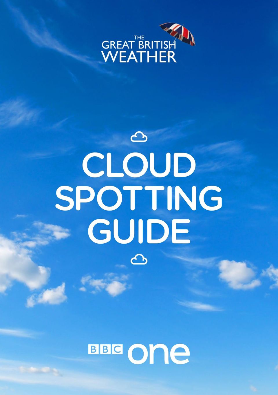
2 Welcome Alexander Armstrong Carol Kirkwood Chris Hollins The Great British Weather Team have put together this guide. We hope it will help you identify those different fluffy (and not so fluffy) objects in the sky. Even if you ve never tried cloud spotting before, get started with our easy-to-use cloud manual. Once you think you know your Cumulus from your Cumulonimbus why not use the cloud spotter score card which rates the top ten clouds to spot. Can you spot all ten? There are more things to discover about the weather at bbc.co.uk/greatbritishweather, including How to videos on building a rain gauge and understanding weather terminology. There s also a safety guide for taking photographs of the weather (mostly common sense of course), but worth a look. You can get involved with the production too by sending your best snaps to [email protected] and they may be broadcast live on the BBC One show, on our special BBC Weather galleries or on a live weather forecast. And don t forget to join in the weather and #BBCgbw from now till 5 August Happy cloud spotting! ii

3 Introduction Clouds are made of water tiny droplets of water in the case of the low clouds and ice crystals in the high clouds (mid-level clouds often contain a mixture of the two). There are ten basic types of cloud and they are grouped according to the way they look whether they re made up of individual clumps, or layers or streaks and how high they are whether low, mid-level or high clouds. The ten types are divided up into many other species and varieties. This guide contains just a few of the many different cloud types some common and easy to spot, some rare. You never know when an interesting formation is going to appear, so always keep an eye on what is happening above. bbc.co.uk/greatbritishweather 1

4 1. Cumulus Cumulus Cumulus Inverness Cumulus clouds are the cotton wool puffs, with flat bases and cauliflower tops, which drift lazily across the sky on a sunny day. They generally form a few hours after daybreak and tend to scatter before sundown. They form on invisible columns of air (known as thermals) which rise from the ground as it is warmed by the Sun. Most forms of Cumulus produce no rain or snow, and so are known as fair-weather clouds. When a Cumulus is fraying at the edges as it breaks up, having reached the ripe old age of 15 minutes or so, it is known as Cumulus fractus. The smaller Cumulus humilis never produce any rain or snow, but large Cumulus clouds can produce light to moderate showers. When Cumulus build upwards through the morning they re a warning of heavy showers by the afternoon: in the morning mountains, in the afternoon fountains. Cumulus humilis If you were to add together all the droplets in a medium sized Cumulus cloud, they d weigh the same as 80 elephants. 60 (because they are easy to recognise) 2

5 2. Stratocumulus Stratocumulus Culbin Stratocumulus The most widespread of all cloud types in the UK, as well as many other regions of the world, Stratocumulus is a low layer or patch of cloud that has a clumpy base. The patches are either joined up, or have gaps in between. When the sky is overcast with a cloud base that appears to be low and the tones of the cloud vary from white to darker grey, you can be confident that you are looking at a Stratocumulus. Stratocumulus clouds do sometimes produce rain or snow, but this is generally quite light. Their main effect is of blocking out our beloved sunshine. Often in the UK, Cumulus clouds can become more and more plentiful through the morning, spreading out and joining together into a Stratocumulus layer that covers the sky. Sometimes you can see fingers of sunlight shining down through breaks in a Stratocumulus cloud. These are known as crepuscular rays. 30 (because they are so common) My favourite cloud is the cumulus as it normally means we can expect fair weather. Those white puffy clouds in a blue sky on a summer s day are a view hard to beat. Carol Kirkwood 3

6 3. Cumulonimbus Cumulonimbus Cumulonimbus Often described as the King of Clouds, the Cumulonimbus is an awesome powerhouse of the atmosphere. This enormous storm cloud can reach over 10 miles into the sky, often spreading out in its upper reaches to form a huge canopy of ice crystals that can give it the appearance of a blacksmith s anvil. The anvil shape can only be seen when viewed from many miles away. Above you, it looks like a very dark, often ragged cloud base which extends across most of the sky. Cumulonimbus are the storm clouds. They produce heavy rain, snow or hailstones, as well as sometimes leading to thunder and lightning. Unlike the other main rain-bearing cloud, the dark, featureless wet blanket called Nimbostratus that produces prolonged and continuous rain, Cumulonimbus delivers its load in dramatic, sudden downpours. Aircraft pilots are careful to avoid flying through these monsters because the powerful up and down draughts within them can be strong enough to flip a plane over. 100 (especially if you see its anvil shape from afar) i flew through clouds on a hang glider for the series. It was terrifying and exhilarating. The sky was so blue and the clouds a brilliant white. You simply don t appreciate the enormous size, and inherent magnitude of a cloud from the ground. Carol Kirkwood 4

7 4. Altocumulus Altocumulus Altocumulus This mid-level cloud is in the form of layers or patches of individual clumps or rolls of cloud, known as cloudlets. If you see a layer of cloud that looks like it is made of lots of regular cotton-wool balls, it might be an Altocumulus. A similar looking cloud, though one that is rarer, is the higher Cirrocumulus. This is also a layer or patch composed of little cloudlets but they appear much smaller than the Altocumulus ones. To distinguish between the two, you need to hold a finger up at arm s length towards the cloud directly above you. If the cloudlets are smaller than the width of your finger, the cloud is Cirrocumulus; if they are wider, it is probably Altocumulus. The rain and snow from Altocumulus may not tend to reach ground level but, to the keen cloud spotter, these clouds can be early indicators of storms ahead. If the cloudlets have very bumpy tops they suggest that that atmosphere at that level is unstable. This means that any Cumulus clouds building up from below are likely to grow into Cumulonimbus storm clouds that will bring heavy showers in the afternoon. Cirrocumulus Altocumulus clouds sometimes produce rain or snow but it rarely reaches the ground, usually drying up as it falls. This creates trails below them which make the cloudlets look like jellyfish. 70 (especially if they are arranged in a beautiful organised layer, like a quilted blanket) 5

8 5. The Layer Clouds Altostratus Stratus Generally speaking, layer clouds are the most boring looking of all the cloud types. With no variation in tone from one part to the next, they are just a flat, overcast sky. Layer clouds form at all three cloud levels. The low ones are called Stratus, and can be right down at ground level, when they are known as fog or mist. They often block the Sun completely. Mid-level layer clouds are called Altostratus, and often make the Sun appear as if through frosted glass. The high layer clouds are called Cirrostratus, which are made of ice crystals rather than droplets. Altostratus can produce light to moderate rain or snow, but the fourth layer cloud that produces most precipitation is the Nimbostratus. This thick blanket of cloud often extends through all three levels and rains and rains. Stratus clouds have bases at anywhere from the ground to 1,500ft. Altostratus are at 6,500-16,500ft. Cirrostratus have bases at 16,500-30,000ft, while Nimbostratus can be over 10,000ft deep. 45 6

9 6. Cirrus Cirrus Hampstead Heath Cirrus The most beautiful of the main cloud types, Cirrus clouds are like watercolour brush strokes across the blue. Composed of ice crystals cascading through the high atmosphere they are generally see-through. As the ice crystals fall downwards through different regions of the atmosphere, they pass through faster and slower winds and drier and moister air, which give the cloud its distinctive wavy strokes, known as fallstreaks. The falling ice crystals of Cirrus clouds never reach the ground, tending instead to evaporate on the way down. If they are seen to join together and thicken into the high layer cloud Cirrostratus, they can be an early indication of a change in the weather that will lead to steady rain. Other than that, they just look nice. Being up in the clouds was awesome. I couldn t taste anything fear probably played a part in that but thinking about it now, the smell was probably similar to when you open up the door of your deep freeze and you get that cold/icy smell. Carol Kirkwood Cirrus Bristol Cirrus clouds are named after the Latin for a lock of hair. 60 7

10 7. Contrails Contrails Contrails Short for condensation trails, these are the lines of cloud that can sometimes form behind aircraft up at cruising height. Formed from the water vapour (water in gas form) that is part of the aircraft exhaust, these straight, crisp lines of condensation could hardly look more different from the wild, chaotic forms of the natural clouds. They only appear when the air up at cruising height is cold enough and moist enough. At other times, no cloud appears behind the plane. Contrails are the most visible signs of human effect on our atmosphere sharp lines of progress, dividing and dissecting the sky man s marks on what, for many of us, is the last wilderness to gaze out at. Our atmosphere often consists of differing layers of air so it is not uncommon to see the contrails behind an aircraft appear to turn on and off as it climbs or descends. 60 (because they are so common these days) 8

11 8. Lenticularis Lenticularis Lenticularis Named after the Latin word for a lentil, these are discs of cloud with smooth, streamlined edges. They often look rather like UFOs. Lenticularis clouds form in stable conditions when moist winds have to rise to pass over raised ground such as a hill or mountain peak. While lenticularis clouds are most often seen in hilly or mountainous regions, they can appear downwind of even gentle, rolling hills when the conditions are right. The water droplets of lenticularis clouds form at one end of the cloud and rush through it with the wind, only to disappear again at the back of the cloud. Though the droplets are moving, the cloud as a whole appears stationary in the steady wind at cloud level. Only very occasionally do lenticularis clouds produce any rain or snow that reaches the ground. Lenticularis Sometimes known as lennies for short, these clouds can form at any of the three cloud levels but the most dramatic and impressive ones are found in the mid-level clouds, and are known as Altocumulus lenticularis

12 9. Mamma Mammatus Waterloo Bridge Mammatus Also known as mammatus, these are pouches that hang down from the underside of a cloud layer. They are easiest to spot when the Sun is low, and is shining across the base of the cloud layer, picking out the udder-like formations (the name Mamma comes from the Latin for udders). They can be spotted hanging from the base of clouds at all three of the cloud levels. Mamma clouds are fairly rare so you have to keep an eye out for them. Mamma clouds tend to appear attached to the rear of the advancing storm and so they usually indicate that the heavy showers are falling some distance away, or that the storm has already passed over. Mamma are defined as supplementary features. The most dramatic-looking ones form on the underside of the huge anvils that spread out at the top of Cumulonimbus storm clouds. 150 You can carry on spotting when you re abroad I saw mammatus in the USA. It s shaped like cows udders and had the setting sunlight behind it. It looks heavy (it s descending air) almost like it is going to fall on top of you! Carol Kirkwood 10

13 10. Noctilucent Noctilucent Noctilucent Noctilucent clouds form so high up in the atmosphere often around 50 miles up that they are way higher than the miles or so in which our normal weather clouds form. These strange clouds have an eerie, bluish-white appearance, and often exhibit delicate ripples or billows that can extend across huge areas of the sky. Their name means night shining. Being so high, they still catch the sunlight when the rest of the sky is dark. These clouds are rare, and only form in the summer typically between the end of May and mid-august. Look for them when the sky is clear of lower clouds and within a few hours of sunset or sunrise. Noctilucent clouds are far, far too high to have any direct effect on weather down on the ground. The shifting patterns in the formation of these mysterious clouds are increasingly considered valuable indicators of our changing climate. 300 Before you head out to take some pictures of clouds, make sure your camera is fully charged. I have come unstuck with this one in the past! If you have one, stick a spare battery in your pocket too. Carol Kirkwood 11

14 Get spotting! Use our handy score card to see how many of the clouds in our guide you can spot over the coming weeks and see if you can reach our grand total of 1,000. Don t forget Carol s helpful tips about remembering to do some cloud spotting when you re on holiday. Happy cloud spotting from the Great British Weather team. 1. Cumulus Altitude: Low: 1-5k ft Rarity score: Stratocumulus Altitude: Low: 1-4.5k ft Rarity score: Cumulonimbus 4. Altocumulus Altitude: Multi-level: 2-45k ft Rarity score: 100 Altitude: Mid-level: k ft Rarity score: 70 12

15 5. The Layer Clouds Altitude: All 3 layers Rarity score: Cirrus Altitude: High: 20-40k ft Rarity score: Contrails Altitude: High: 20-40k ft Rarity score: Lenticularis Altitude: Low: 1-5k ft Rarity score: Mamma Altitude: All 3 layers Rarity score: Noctilucent Altitude: V.V. high: miles Rarity score: 300 Grand total 13

16 Cloud spotting guide bbc.co.uk/greatbritishweather Writer Gavin Pretor-Pinney, author of The Cloud Collector s Handbook and founder of The Cloud Appreciation Society. Photography Page 3/12: Stratocumulus Heather Reid Page 10/12: Mamma Shevaun Mendelsohn Design red-stone.com Our thanks to BBC Weather and members of the public for photographs contributed. Thanks also to Carol Kirkwood and the Met Office. BBC Learning 2011

Common Cloud Names, Shapes, and Altitudes:
 Common Cloud Names, Shapes, and Altitudes: Low Clouds Middle Clouds High Clouds Genus Cumulus Cumulonimbus (extend through all 3 levels) Stratus Stratocumulus Altocumulus Altostratus Nimbostratus (extend
Formation & Classification
 CLOUDS Formation & Classification DR. K. K. CHANDRA Department of forestry, Wildlife & Environmental Sciences, GGV, Bilaspur What is Cloud It is mass of tiny water droplets or ice crystals or both of size
If wispy, no significant icing or turbulence. If dense or in bands turbulence is likely. Nil icing risk. Cirrocumulus (CC)
") Cirrus (CI) Detached clouds in the form of delicate white filaments or white patches or narrow bands. These clouds have a fibrous or hair like appearance, or a silky sheen or both. with frontal lifting
Cirrus (CI) Detached clouds in the form of delicate white filaments or white patches or narrow bands. These clouds have a fibrous or hair like appearance, or a silky sheen or both. with frontal lifting
Make a Cloud Finder. How to Fold the Cloud Finder: Play the Weather Word Game:
 Make a Cloud Finder Make a Cloud Finder. The pattern is included here. Learn the names of the beautiful clouds that may appear in the sky where you live. Color your Cloud Finder, and cut it out on the
The Clouds Outside My Window. National Weather Service NOAA
 The Clouds Outside My Window National Weather Service NOAA The Clouds Out My Window Written and illustrated by John Jensenius My window With help from Owlie Skywarn 1 The Clouds Outside My Window Whether
Education and Outreach Lesson Plan
 Education and Outreach Lesson Plan Visit our online activities collection http://education.arm.gov/ Grade levels K 2 Common Covering Clouds Common Covering Clouds Approximate Time 1 1/2 hours, or two 45-minute
Droplets. The Kiwi Kids Cloud Identification Guide. Written by Paula McKean
 Droplets The Kiwi Kids Cloud Identification Guide Written by Paula McKean Droplets The Kiwi Kids Cloud Identification Guide ISBN 1-877264-27-X Paula McKean MEd Hons (Science Ed), BEd, DipTchg 2009 Crown
Not all clouds are easily classified! Cloud Classification schemes. Clouds by level 9/23/15
 Cloud Classification schemes 1) classified by where they occur (for example: high, middle, low) 2) classified by amount of water content and vertical extent (thick, thin, shallow, deep) 3) classified by
[7] SD3.1 The student demonstrates an understanding of cycles influenced by energy from the
![[7] SD3.1 The student demonstrates an understanding of cycles influenced by energy from the](/thumbs/27/12373649.jpg "[7] SD3.1 The student demonstrates an understanding of cycles influenced by energy from the") Cloud Types Levels Overview: During this project, students learn about different types of clouds and determine which type of cloud is most commonly overhead in their area over a period of four weeks. Objectives:
Cloud Types Levels Overview: During this project, students learn about different types of clouds and determine which type of cloud is most commonly overhead in their area over a period of four weeks. Objectives:
Clouds and What They Mean
 Vocabulary and Writing Worksheet 1. Choose the best vocabulary word for each sentence and write it in the blank. dew point evaporation fog gas precipitation relative humidity a. Relative humidity refers
Temperature affects water in the air.
 KEY CONCEPT Most clouds form as air rises and cools. BEFORE, you learned Water vapor circulates from Earth to the atmosphere Warm air is less dense than cool air and tends to rise NOW, you will learn How
FOR SUBSCRIBERS ONLY! - TRIAL PASSWORD USERS MAY NOT REPRODUCE AND DISTRIBUTE PRINTABLE MATERIALS OFF THE SOLPASS WEBSITE!
 FOR SUBSCRIBERS ONLY! - TRIAL PASSWORD USERS MAY NOT REPRODUCE AND DISTRIBUTE PRINTABLE MATERIALS OFF THE SOLPASS WEBSITE! 1 NAME DATE GRADE 5 SCIENCE SOL REVIEW WEATHER LABEL the 3 stages of the water
Cumulifor m clouds develop as air slowly rises over Lake Powell in Utah.
 Cumulifor m clouds develop as air slowly rises over Lake Powell in Utah. Figure 6.1 Dew forms on clear nightswhen objects on the surface cool to a temperature below the dew point. If these beads of water
Satellites, Weather and Climate Module 2b: Cloud identification & classification. SSEC MODIS Today
 Satellites, Weather and Climate Module 2b: Cloud identification & classification SSEC MODIS Today Our Cloud Watching and Identification Goals describe cloud classification system used by meteorologists
Clouds. A simple scientific explanation for the weather-curious. By Kira R. Erickson
 Clouds A simple scientific explanation for the weather-curious By Kira R. Erickson Table of Contents 1 3 4 INTRO 2 Page 3 How Clouds Are Formed Types of Clouds Clouds and Weather More Information Page
Clouds/WX Codes. B.1 Introduction
 Clouds/WX Codes B.1 Introduction This appendix provides the necessary tables and specific instructions to enter Clouds/Wx at the Surface Data screen. This guidance assumes no previous knowledge of synoptic
Cloud Unit. Materials Needed: The Cloud Book by Tomie de Poala See the seven activities below for materials need for each activity.
 Cloud Unit Submitted by: Lisa Johnson Van-Far Elementary (573)594-2731 E-mail: [email protected] Materials Needed: The Cloud Book by Tomie de Poala See the seven activities below for materials need
Chapter 6 - Cloud Development and Forms. Interesting Cloud
 Chapter 6 - Cloud Development and Forms Understanding Weather and Climate Aguado and Burt Interesting Cloud 1 Mechanisms that Lift Air Orographic lifting Frontal Lifting Convergence Localized convective
Chapter 7 Stability and Cloud Development. Atmospheric Stability
 Chapter 7 Stability and Cloud Development Atmospheric Stability 1 Cloud Development - stable environment Stable air (parcel) - vertical motion is inhibited if clouds form, they will be shallow, layered
Activity 4 Clouds Over Your Head Level 1
 Activity 4 Clouds Over Your Head Level 1 1 Objectives: Students will become familiar with the four main types of clouds: stratus, cirrus, cumulus, and cumulonimbus and their characteristics. Students will
Read and study the following information. After reading complete the review questions. Clouds
 Name: Pd: Read and study the following information. After reading complete the review questions. Clouds What are clouds? A cloud is a large collection of very tiny droplets of water or ice crystals. The
TOPIC: CLOUD CLASSIFICATION
 INDIAN INSTITUTE OF TECHNOLOGY, DELHI DEPARTMENT OF ATMOSPHERIC SCIENCE ASL720: Satellite Meteorology and Remote Sensing TERM PAPER TOPIC: CLOUD CLASSIFICATION Group Members: Anil Kumar (2010ME10649) Mayank
Water, Phase Changes, Clouds
 TUESDAY: air & water & clouds Water, Phase Changes, Clouds How can freezing make something warmer? 'warm air can hold more water' why? How do clouds form? The (extraordinary) properties of Water Physical
Analyze Weather in Cold Regions and Mountainous Terrain
 Analyze Weather in Cold Regions and Mountainous Terrain Terminal Learning Objective Action: Analyze weather of cold regions and mountainous terrain Condition: Given a training mission that involves a specified
Cloud Development and Forms. LIFTING MECHANISMS 1. Orographic 2. Frontal 3. Convergence 4. Convection. Orographic Cloud. The Orographic Cloud
 Introduction to Climatology GEOGRAPHY 300 Cloud Development and Forms Tom Giambelluca University of Hawai i at Mānoa LIFTING MECHANISMS 1. Orographic 2. Frontal 3. Convergence 4. Convection Cloud Development
Satellite Weather And Climate (SWAC) Satellite and cloud interpretation
 Satellite and cloud interpretation") Satellite Weather And Climate (SWAC) Satellite and cloud interpretation Vermont State Climatologist s Office University of Vermont Dr. Lesley-Ann Dupigny-Giroux Vermont State Climatologist [email protected]
Satellite Weather And Climate (SWAC) Satellite and cloud interpretation Vermont State Climatologist s Office University of Vermont Dr. Lesley-Ann Dupigny-Giroux Vermont State Climatologist [email protected]
Cloud Protocols. Welcome Introduction Protocols. Learning Activities Appendix. Purpose. Overview. Student Outcomes. Time. Level.
 Cloud Protocols Purpose To observe the type and cover of clouds including contrails Overview Students observe which of ten types of clouds and how many of three types of contrails are visible and how much
A Teaching Unit for Years 3 6 children
 A Teaching Unit for Years 3 6 children 1 SEREAD and ARGO: Concept Overview for Years 3-6 Teaching Programme This is the overview for the first part of the SEREAD programme link with ARGO. The overview
Lecture 7a: Cloud Development and Forms
 Lecture 7a: Cloud Development and Forms Why Clouds Form Cloud Types (from The Blue Planet ) Why Clouds Form? Clouds form when air rises and becomes saturated in response to adiabatic cooling. Four Ways
Clouds for pilots. Ed Williams. http://williams.best.vwh.net/
 Clouds for pilots Ed Williams http://williams.best.vwh.net/ Clouds are important to pilots! Many of our weather problems are associated with clouds: Fog Thunderstorms Cloud In flight icing Cloud physics
Do You Know That Clouds Have Names?
 Do You Know That Clouds Have Names? Text by Becca Hatheway, Kerry Zarlengo, and Peggy LeMone Illustrations by Lisa Gardiner Do You Know That Clouds Have Names? Text by Becca Hatheway, Kerry Zarlengo,
Chapter 6: Cloud Development and Forms
 Chapter 6: Cloud Development and Forms (from The Blue Planet ) Why Clouds Form Static Stability Cloud Types Why Clouds Form? Clouds form when air rises and becomes saturated in response to adiabatic cooling.
WEATHER AND CLIMATE practice test
 WEATHER AND CLIMATE practice test Multiple Choice Identify the choice that best completes the statement or answers the question. 1. What role does runoff play in the water cycle? a. It is the process in
Cloud types for observers. Reading the sky
 Cloud types for observers Reading the sky Cloud types for observers Reading the sky Cloud types for obser vers 1 Introduction Clouds are continually changing and appear in an infinite variety of forms.
Chapter 10 Weather. Weather in Antarctica is characterized by extremes: extreme temperatures, extreme
 Field Manual for the U.S. Antarctic Program Chapter 10 Weather Figure 10-1: Storm approaching. (photo by Tim Cully) Weather in Antarctica is characterized by extremes: extreme temperatures, extreme winds,
Precipitation forms from water droplets or ice crystals.
 KEY CONCEPT Water falls to Earth s surface as precipitation. BEFORE, you learned Water moves between Earth's surface and the atmosphere Water vapor condenses into clouds NOW, you will learn How precipitation
Clouds, Clouds, Everywhere
 1 Clouds, Clouds, Everywhere Grade Level 1 st Grade_ Standards Connection(s): Earth Science: Weather can be observed, measured, and described. Physical Science: States of Materials. Solids, liquids, gases
WeatherBug Vocabulary Bingo
 Type of Activity: Game: Interactive activity that is competitive, and allows students to learn at the same time. Activity Overview: WeatherBug Bingo is a fun and engaging game for you to play with students!
Teacher s Guide. Clouds. Grades 5-9 CLTV
 Teacher s Guide Clouds Grades 5-9 CLTV CREDITS Program Production Sunburst Visual Media Teacher s Guide Print Material Design Rose Bulau, M.Ed. National Board Certification Desktop Productions 2004 Sunburst
Hazardous Weather Primer. CERT Basic Training Unit 0
 Hazardous Weather Primer Unit 0 Topic Overview: CERT Activation Basic Weather Weather Hazards: Flooding, Winter Weather, Extreme temperatures, severe thunderstorms, tornados Weather Safety Personal Preparedness
CHAPTER 5 - SKY CONDITION
 CHAPTER 5 SKY CONDITION ADDITIONAL MATERIAL TO STUDY: Chapter 9, paragraphs 9.2.1g & h, ceiling and sky condition criteria for SPECI. 5.1 Introduction This chapter provides information on sky condition
COMMON CORE Lessons & Activities
 T E AC H I T SA M PL E COMMON CORE Lessons & Activities DAY! O T Common Core Lessons & Activities: Weather By Carole Marsh Published by Gallopade International, Inc. Carole Marsh/Gallopade Printed in the
An Essential Guide. part one
 An Essential Guide to the Weather part one FREE INSIDE TOMORROW In this booklet we give an insight into how weather works and why it happens in the first place. What are the global atmospheric systems
Clouds. National Meteorological Library and Archive Fact sheet 1 An introduction to clouds. (version 01)
") Clouds National Meteorological Library and Archive Fact sheet 1 An introduction to clouds (version 01) The National Meteorological Library and Archive Many people have an interest in the weather and the
Clouds National Meteorological Library and Archive Fact sheet 1 An introduction to clouds (version 01) The National Meteorological Library and Archive Many people have an interest in the weather and the
This chapter discusses: 1. Definitions and causes of stable and unstable atmospheric air. 2. Processes that cause instability and cloud development
 Stability & Cloud Development This chapter discusses: 1. Definitions and causes of stable and unstable atmospheric air 2. Processes that cause instability and cloud development Stability & Movement A rock,
Cloud seeding. Frequently Asked Questions. What are clouds and how are they formed? How do we know cloud seeding works in Tasmania?
 What are clouds and how are they formed? Clouds are composed of water droplets and sometimes ice crystals. Clouds form when air that is rich in moisture near the Earth s surface rises higher into the atmosphere,
Clouds, Fog, & Precipitation
 firecatching.blogspot.com Kids.brittanica.com Clouds and fog are physically the same just location is different Fog is considered a stratus cloud at or near the surface What does one see when looking at
An Online School for Weather. www.srh.noaa.gov/jetstream/atmos/ll_whatacycle_aquifers.pdf
 JetStream An Online School for Weather Aquifers Aquifers Aquifers 1 3 5 Aquifers Aquifers Aquifers 2 4 6 /atmos/ll_whatacycle_aquifers.pdf There are over 35 lesson plans in the National Weather Service
In a majority of ice-crystal icing engine events, convective weather occurs in a very warm, moist, tropical-like environment. aero quarterly qtr_01 10
 In a majority of ice-crystal icing engine events, convective weather occurs in a very warm, moist, tropical-like environment. 22 avoiding convective Weather linked to Ice-crystal Icing engine events understanding
Partnerships Implementing Engineering Education Worcester Polytechnic Institute Worcester Public Schools
 Partnerships Implementing Engineering Education Worcester Polytechnic Institute Worcester Public Schools Supported by: National Science Foundation Weather: 4.H.3 Weather and Classical Instruments Grade
Name: Date: LAB: Dew Point and Cloud Formation Adapted from Exploration in Earth Science, The Physical Setting, United Publishing Company, Inc.
 Name: _ Date: LAB: Dew Point and Cloud Formation Adapted from Exploration in Earth Science, The Physical Setting, United Publishing Company, Inc. Introduction: Cumulus clouds are our puffy fair weather
Cloud type identification by satellites
 Chapter 2 Cloud type identification by satellites 2.1 Features of cloud type identification Unlike ground observation, which visually observes the cloud forms from the earth s surface, the satellites observe
The Importance of Understanding Clouds
 NASA Facts National Aeronautics and Space Administration www.nasa.gov The Importance of Understanding Clouds One of the most interesting features of Earth, as seen from space, is the ever-changing distribution
Cloudette A RIF GUIDE FOR COMMUNITY COORDINATORS TIME TO READ! RELATED ACTIVITIES ADDITIONAL RESOURCES AN A-MAZE-ING CLOUD RACE (AGES 5-12)
") A RIF GUIDE FOR COMMUNITY COORDINATORS Themes: Weather, Water Cycle, Determination, Perseverance Book Brief: Cloudette is a small cloud who wants to do big things. When a big storm blows her into an unknown
A RIF GUIDE FOR COMMUNITY COORDINATORS Themes: Weather, Water Cycle, Determination, Perseverance Book Brief: Cloudette is a small cloud who wants to do big things. When a big storm blows her into an unknown
Clouds and the Energy Cycle
 August 1999 NF-207 The Earth Science Enterprise Series These articles discuss Earth's many dynamic processes and their interactions Clouds and the Energy Cycle he study of clouds, where they occur, and
National Meteorological Library and Archive
 National Meteorological Library and Archive Fact sheet No. 11 Interpreting weather charts Weather systems On a weather chart, lines joining places with equal sea-level pressures are called isobars. Charts
Severe Weather A Reading A Z Level T Leveled Book Word Count: 1,775
 Severe Weather A Reading A Z Level T Leveled Book Word Count: 1,775 LEVELED BOOK T SEVERE WEATHER Written by Bruce D. Cooper Illustrated by Cende Hill Visit www.readinga-z.com for thousands of books and
YEAR 1: Seasons and Weather
 YEAR 1: Seasons and Weather Contents Include: The four seasons Tools to record the weather Making graphs Clouds Weather forecasts Weather around the world Please Note: The activities included in this pack
Glaciogenic Cloud Seeding to Increase Orographic Precipitation Bruce A. Boe [email protected] Director of Meteorology
 Glaciogenic Cloud Seeding to Increase Orographic Precipitation Bruce A. Boe [email protected] Director of Meteorology Weather Modification, Inc. Fargo, North Dakota, USA www.weathermodification.com Content
Fluffy Cloud Walk. Materials Used: Pictures of three types of clouds: cirrus, stratus, cumulus
 Fluffy Cloud Walk Standard Addressed: Earth Science Students know how to use simple tools (e.g. thermometer, wind vane) to measure weather conditions and record changes from day to day and across the seasons.
Convective Clouds. Convective clouds 1
 Convective clouds 1 Convective Clouds Introduction Convective clouds are formed in vertical motions that result from the instability of the atmosphere. This instability can be caused by: a. heating at
The Anatomy of a Forecast
 The Anatomy of a Forecast The Met Service issues forecasts for sky condition, precipitation probability, wind, seas state and temperature on a routine basis. Because the weather is always changing, the
Thunderstorm Basics. Updraft Characteristics (Rising Air) Downdraft Characteristics (Air Descends to the Ground)
 Downdraft Characteristics (Air Descends to the Ground)") Thunderstorm Basics Updraft Characteristics (Rising Air) Cumulus Tower Upward Cloud Motion Updraft Dominant Downdraft/Updraft Downdraft Dominant Rain-Free Base Downdraft Characteristics (Air Descends to
Thunderstorm Basics Updraft Characteristics (Rising Air) Cumulus Tower Upward Cloud Motion Updraft Dominant Downdraft/Updraft Downdraft Dominant Rain-Free Base Downdraft Characteristics (Air Descends to
Clouds and Cloud Formation
 I Clouds and Cloud Formation Cloud Classification and Occurrence Clouds on Earth appear in seemingly endless variety, from wisps of fog or steam over lakes to huge and imposing thunderstorm anvils. To
Air Masses and Fronts
 Air Masses and Fronts Air Masses The weather of the United States east of the Rocky Mountains is dominated by large masses of air that travel south from the wide expanses of land in Canada, and north from
6 th Grade Science Assessment: Weather & Water Select the best answer on the answer sheet. Please do not make any marks on this test.
 Select the be answer on the answer sheet. Please do not make any marks on this te. 1. Weather is be defined as the A. changes that occur in cloud formations from day to day. B. amount of rain or snow that
WEATHER THEORY Temperature, Pressure And Moisture
 WEATHER THEORY Temperature, Pressure And Moisture Air Masses And Fronts Weather Theory- Page 77 Every physical process of weather is a result of a heat exchange. The standard sea level temperature is 59
FIRST GRADE AIR AND WEATHER STUDY
 CLASS: AIR AND WEATHER: AIR PRESSURE Students will learn that air exerts pressure on all matter through a variety of hands-on experiments and teacher-led demonstrations. Capturing Air For this teacher
Clouds: What They Are and What They Mean. Susannah Lopez. Introduction to Meteorology. 2 December 2008
 Clouds: What They 1 Clouds: What They Are and What They Mean Susannah Lopez Introduction to Meteorology 2 December 2008 Clouds: What They 2 Clouds: What They Are and What They Mean Clouds are composed
CLOUDS TELL A STORY. Overview: Objectives: Targeted Alaska Grade Level Expectations: Vocabulary:
 CLOUDS TELL A STORY Overview: Students investigate cloud types with a focus on noctilucent clouds, a rare cloud type scientists think could be a climate-change indicator, then interview Elders about cloud
Atmosphere. Cloud Protocols. Draft 9/15/00. GLOBE 2000 Cloud Protocols - 1 Atmosphere
 Atmosphere Cloud Protocols Draft 9/15/00 GLOBE 2000 Cloud Protocols - 1 Atmosphere Cloud Protocols Purpose To observe cloud type and cover Student Outcomes Students learn how to make estimates from observations
Chapter 7 CLOUDS IDENTIFICATION
 Chapter 7 CLOUDS Clouds, to almost everyone, have some meaning. But to you as a pilot, clouds are your weather "signposts in the sky." They give you an indication of air motion, stability, and moisture.
SIXTH GRADE WEATHER 1 WEEK LESSON PLANS AND ACTIVITIES
 SIXTH GRADE WEATHER 1 WEEK LESSON PLANS AND ACTIVITIES WATER CYCLE OVERVIEW OF SIXTH GRADE WATER WEEK 1. PRE: Evaluating components of the water cycle. LAB: Experimenting with porosity and permeability.
Fry Phrases Set 1. TeacherHelpForParents.com help for all areas of your child s education
 Set 1 The people Write it down By the water Who will make it? You and I What will they do? He called me. We had their dog. What did they say? When would you go? No way A number of people One or two How
Kindergarten Seasons and Weather Assessment
 Kindergarten Seasons and Weather Assessment 1a. Circle the pictures that represent the four seasons: snowman going to a teacher harvest fruits colorful flowers the beach 1b. Write the name of the season
1/2/3. Finding out about the Water Cycle
 The Water Cycle 1/2/3. Finding out about the Water Cycle Aims: To enable pupils to learn and understand what happens at each stage of the Water Cycle To introduce specific vocabulary related to the Water
Types of Clouds Accordion Book
 Types of Accordion Book by Shelly Anton www.teacherspayteachers.com/store/promoting-success Directions Page 1 Supplies: Two Pieces Oak Tag/Construction Paper, Glue, Scissors, String (Optional) Step 1:
Floods are too much water on normally dry land. Rivers can flood after heavy rain has fallen over a long period of time. River flooding can last
 Floods are too much water on normally dry land. Rivers can flood after heavy rain has fallen over a long period of time. River flooding can last weeks or longer. River floods usually occur slowly enough
Tune In to The Zula Patrol
 Family Take-Home Pages Dear Family, In school, your child has been studying Sky-High Science. Inspired by the award-winning public television program The Zula Patrol, this program helps your child: build
Stability and Cloud Development. Stability in the atmosphere AT350. Why did this cloud form, whereas the sky was clear 4 hours ago?
 Stability and Cloud Development AT350 Why did this cloud form, whereas the sky was clear 4 hours ago? Stability in the atmosphere An Initial Perturbation Stable Unstable Neutral If an air parcel is displaced
THIRD GRADE WEATHER 1 WEEK LESSON PLANS AND ACTIVITIES
 THIRD GRADE WEATHER 1 WEEK LESSON PLANS AND ACTIVITIES WATER CYCLE OVERVIEW OF THIRD GRADE WATER WEEK 1. PRE: Comparing the different components of the water cycle. LAB: Contrasting water with hydrogen
Weather Theory. Chapter 11. Introduction
 Chapter 11 Weather Theory Introduction Weather is an important factor that influences aircraft performance and flying safety. It is the state of the atmosphere at a given time and place, with respect to
EDUCATOR S GUIDE Grades 3 8
 EDUCATOR S GUIDE Grades 3 8 TABLE OF CONTENTS About this topic........................ 2 Connecting with the classroom............ 4 Resources.............................. 5 Minnesota Academic Standards............6
In most cases problem images are caused by the environment. Here are some of the most common issues:
 PROBLEM IMAGES In most cases problem images are caused by the environment. Here are some of the most common issues: Rain, snow, & condensation will distort images Light levels can change the apparent color
IN A SMALL PART OF THE CITY WEST OF
 p T h e L a s t L e a f IN A SMALL PART OF THE CITY WEST OF Washington Square, the streets have gone wild. They turn in different directions. They are broken into small pieces called places. One street
Flight Operations Briefing Notes
 Flight Operations Briefing Notes I Introduction Although more and more aircraft are equipped with one or two airborne weather radars, incursions into very active cumulonimbus still occur, resulting in
Safe Operating Procedure
 Safe Operating Procedure (Revised 11/11) OPACITY OF EMISSIONS FROM COMBUSTION SOURCES (For assistance, please contact EHS at (402) 472-4925, or visit our web site at http://ehs.unl.edu/) The University
How To Plan For A Cold Weather Operation
 United States Army Northern Warfare Training Center Cold Weather (CWLC, CWOC & ALIT) Student Handout Winter 2011-2012 Battle Cold and Conquer Mountains Edition 11 October 2011 Table of Contents Subject
SECOND GRADE 1 WEEK LESSON PLANS AND ACTIVITIES
 SECOND GRADE 1 WEEK LESSON PLANS AND ACTIVITIES WATER CYCLE OVERVIEW OF SECOND GRADE WATER WEEK 1. PRE: Exploring the properties of water. LAB: Experimenting with different soap mixtures. POST: Analyzing
Seasonal & Daily Temperatures. Seasons & Sun's Distance. Solstice & Equinox. Seasons & Solar Intensity
 Seasonal & Daily Temperatures Seasons & Sun's Distance The role of Earth's tilt, revolution, & rotation in causing spatial, seasonal, & daily temperature variations Please read Chapter 3 in Ahrens Figure
Ell STEERING COLUMN CONTROLS STEERING COLUMN CONTROLS
 STEERING COLUMN CONTROLS Ignition Switch........ 2-1 LightinglTurn Signal Control Lever... 2-5 Windshield Wiper and Washer Lever... 2-6 Rear Window Wiper/Washer Switch (if equipped)... 2-8 Tilt Steering
Fog and Cloud Development. Bows and Flows of Angel Hair
 Fog and Cloud Development Bows and Flows of Angel Hair 1 Ch. 5: Condensation Achieving Saturation Evaporation Cooling of Air Adiabatic and Diabatic Processes Lapse Rates Condensation Condensation Nuclei
Solar Solutions Copyright, The Environmental Center 2013
 Solar Solutions Copyright, The Environmental Center 2013 Subject: Science Grades: 4-8 Length: 30-60 minutes Focus: Renewable Energy, Solar Energy Rationale: We depend on energy for every aspect of our
Photography and Filming in Antarctica
 Photography and Filming in Antarctica Image Frederique Olivier The extreme cold of the Antarctic environment can stress cameras, film, and other equipment. Antarctic conditions can also stress the photographer
Document Name: Driving Skills. Purpose: To outline necessary driving skills required to maximize driving safety.
 Document Name: Driving Skills Date Created: 8 October 2013 Date Reviewed: 4 February 2014 Date Approved: 29 July 2015 Purpose: To outline necessary driving skills required to maximize driving safety. Overview:
CHAPTER 5 Lectures 10 & 11 Air Temperature and Air Temperature Cycles
 CHAPTER 5 Lectures 10 & 11 Air Temperature and Air Temperature Cycles I. Air Temperature: Five important factors influence air temperature: A. Insolation B. Latitude C. Surface types D. Coastal vs. interior