DESIMETERSYSTEM FOR HØYNØYAKTIG POSISJONERING OG NAVIGASJON
|
|
|
- Lucas Green
- 9 years ago
- Views:
Transcription
1 DESIMETERSYSTEM FOR HØYNØYAKTIG POSISJONERING OG NAVIGASJON John A. Vint Survey Manager Thales GeoSolutions Norge AS Hønefoss, 7. november 2003

2 Scope of Presentation Introduction Summary of GPS Errors. Review of Principles of Differential GPS. Principles of SkyFix XP Satellite Differential GPS (Decimetre Accuracy). Overview of MultiFix4 SDGPS QC Software. System Performance and Accuracy. Offshore Applications for Systems with Decimetre Accuracy. Geodesy Associated with for Global Decimetric Systems.

3 GPS System Performance Standalone GPS 5-15 m Differential GPS 1-3 m Satellite Differential GPS 10 cm 5m 1m 10 cm

4 GPS Error Sources Satellite Clocks Orbits Atmospheric Delays Multipath Receiver Noise

5 Principles of Differential GPS Based on monitoring and correcting systematic errors in the GPS System. Establish a GPS receiver on an accurately co-ordinated point (Reference Station). Observe the GPS System s systematic errors at this point (pseudorange corrections) estimated errors. Transfer these corrections to a mobile user via a data link. Apply these corrections to the GPS measurements observed at the mobile user and compute a position. System accuracy dependant on range from mobile to reference station.

6 Principles of Satellite Differential GPS Satellite Differential GPS SDGPS approaches the differential technique from a different perspective. No reference station range restrictions. Global coverage from a single set of corrections transmitted over communications satellite links. Extremely High Accuracy Positioning 10cm Horizontal 15cm Vertical

7 Main Features of SDGPS Corrections are applied to the main GPS error sources: Satellite Orbits Satellite Clocks SDGPS Corrections Ionosphere Troposphere SDGPS Software Multipath Receiver Noise Carrier Phase & Receiver Technology Results in an error free GPS position

8 SDGPS Satellite Corrections Satellite Orbit Corrections: Each individual error source on each satellite is identified and uniquely corrected for. Thales GeoSolutions network of reference stations are used to continuously track all satellites simultaneously. By tracking each satellite throughout its orbit a precise orbit correction can be generated. Satellite Clock Corrections: The global network of reference stations are also used to generate highly accurate clock corrections. These corrections are transmitted over the SDGPS Link.

9 SDGPS Software Functionality Ionosphere Delays: Dual frequency GPS observations used by SDGPS software to compute the ionospheric delays. Tropospheric Delays: Tropospheric delays are no longer modelled. These are computed by the SDGPS software. Multipath & Receiver Noise: Use of carrier phase data in addition to code minimises these effects. Use of new GPS receiver technology, e.g. Strobe Edge correlator technology in the Thales ZX-Sensor receiver.

10 SDGPS QC SOFTWARE

11 MultiFix4 QC Software MultiFix4 Software New Generation of GPS QC Software from Thales GeoSolutions. The result of several year s of precision GPS software development. Runs on Microsoft Windows 2000 / XP Incorporates the proven MultiFix3 technology.

12 MultiFix4 QC Software Calculation Status Display Complete Summary of MultiFix4 s Performance. Easily Understood Traffic Light Display. Automatic Computation Switching. Solution Status Summary. UKOOA Statistics / Quality Indicators Summary.

13 MultiFix4 QC Software Extensive Quality Displays Position Quality Satellite Tracking Monitoring DGPS / SDGPS Status Monitoring

14 Thales GeoSolutions Norge AS MultiFix4 QC Software Full Display of all UKOOA Recommended DGPS Quality Figures

15 SYSTEM PERFORMANCE AND ACCURACY Thales GeoSolutions Norge AS

16 System Performance and Accuracy SDGPS versus DGPS 24 Hour Plots for Norwich, England

17 System Performance and Accuracy Singapore 24 Hour Plot

18 System Performance and Accuracy Macae, Brazil 24 Hour Plot

19 System Performance and Accuracy Perth, Australia 24 Hour Plot

20 OFFSHORE APPLICATIONS
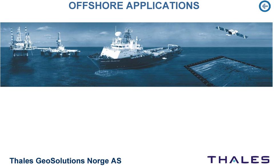
21 Offshore Applications Replacement for Tide Data for Subsea Engineering Projects: Depth data traditionally corrected to vertical datum using tide data. We now have the vertical accuracy to replace this data type. Determine the height of vessel reference point / sensors with the aid of a motion sensor. Can utilise a geoid model to produce geoid heights or use ellipsoidal heights as reference. Thales Tide / Offset add-on to MultiFix4 available December High Precision Engineering: Offshore platform installation. Drilling rig positioning in critical areas.
22 Offshore Applications Replacement for Subsea LBL Acoustic Arrays: LBL arrays are time consuming and expensive to deploy and calibrate. A more elegant solution is SkyFix XP / MultiFix / HiPAP USBL. Accuracy 20 cm to 50 cm subsea depending on water depth. Vessel Dynamic Positioning Systems High accuracy = Less fuel used (savings in fuel costs). Less fuel used = environmentally friendly. Less thruster noise = quieter environment for survey sensors. Other Applications Requiring Decimetre Accuracy
23 SkyFix XP SDGPS Service & MultiFix4 were Launched as a Commercial Product in May 2003 QUESTIONS?
Global Positioning System
 B. Hofmann-Wellenhof, H. Lichtenegger, and J. Collins Global Positioning System Theory and Practice Third, revised edition Springer-Verlag Wien New York Contents Abbreviations Numerical constants xix xxiii
Guidelines for GNSS Positioning in the Oil and Gas Industry
 Guidelines for GNSS Positioning in the Oil and Gas Industry The Hydrographic Society in Scotland Aberdeen Wednesday 20th April Gordon Johnston [email protected] Introduction The motivation to
Post Processing Service
 Post Processing Service The delay of propagation of the signal due to the ionosphere is the main source of generation of positioning errors. This problem can be bypassed using a dual-frequency receivers
A GPS Digital Phased Array Antenna and Receiver
 A GPS Digital Phased Array Antenna and Receiver Dr. Alison Brown, Randy Silva; NAVSYS Corporation ABSTRACT NAVSYS High Gain Advanced GPS Receiver (HAGR) uses a digital beam-steering antenna array to enable
Marine Technology Society
 Marine Technology Society Dynamic Positioning Conference 21-22 October, 1997 Session 9 Control Systems Improved DP Performance in Deep Water Operations Through Advanced Reference System Processing and
AOG 2015 Acoustic System to Monitor Wellhead Fatigue in Real-time. March 12 th 2015. www.pulse-monitoring.com
 AOG 2015 Acoustic System to Monitor Wellhead Fatigue in Real-time March 12 th 2015 Agenda Monitoring method currently used Online monitoring New generation wireless monitoring Benefits of active monitoring
GEOGRAPHIC INFORMATION SYSTEMS Lecture 21: The Global Positioning System
 GEOGRAPHIC INFORMATION SYSTEMS Lecture 21: The Global Positioning System The Global Positioning System - recognize that GPS is only one of several Global Navigation Satellite Systems (GNSS) - the Russian
IMCA Competence Assessment Portfolio May 2012
 S/S30/000/01 Safety (S30 refers to Grade II core competences which are applicable to roles S31, S32, S33, S34 and S35, as described in IMCA C 004) Safe working practices Identify different areas in the
Enabling RTK-like positioning offshore using the global VERIPOS GNSS network. Pieter Toor GNSS Technology Manager
 Enabling RTK-like positioning offshore using the global VERIPOS GNSS network Pieter Toor GNSS Technology Manager Introduction PPP/RTK Positioning Techniques PPP-AR Technology Presentation Overview PPP-AR
SURVEYING WITH GPS. GPS has become a standard surveying technique in most surveying practices
 SURVEYING WITH GPS Key Words: Static, Fast-static, Kinematic, Pseudo- Kinematic, Real-time kinematic, Receiver Initialization, On The Fly (OTF), Baselines, Redundant baselines, Base Receiver, Rover GPS
Leica SmartNet UK & Ireland Network RTK User Guide
 Leica SmartNet UK & Ireland Network RTK User Guide Contents Background.. Page 3 Single Base RTK.... Page 3 Advantages & Disadvantages of Single Base RTK Page 4 Network RTK... Page 4 Advantages & Disadvantages
GENERAL INFORMATION ON GNSS AUGMENTATION SYSTEMS
 GENERAL INFORMATION ON GNSS AUGMENTATION SYSTEMS 1. INTRODUCTION Navigation technologies with precision approach and landing systems, for civilian and military purposes, enable aircrafts to perform their
Trimble CenterPoint RTX Post-Processing Services FAQs
 Trimble CenterPoint RTX Post-Processing Services FAQs What is Trimble RTX technology? 30 September 2013 Trimble RTX TM (Real Time extended) is a high-accuracy, global GNSS correction technology that combines
Bi-Directional DGPS for Range Safety Applications
 Bi-Directional DGPS for Range Safety Applications Ranjeet Shetty 234-A, Avionics Engineering Center, Russ College of Engineering and Technology, Ohio University Advisor: Dr. Chris Bartone Outline Background
Satellite Altimetry Missions
 Satellite Altimetry Missions SINGAPORE SPACE SYMPOSIUM 30 TH SEPTEMBER 2015 AUTHORS: LUCA SIMONINI/ ERICK LANSARD/ JOSE M GONZALEZ www.thalesgroup.com Table of Content General Principles and Applications
Prof. Ludovico Biagi. Satellite Navigation and Monitoring
 Prof. Ludovico Biagi Satellite Navigation and Monitoring Navigation: trajectories control positions estimations in real time, at high frequency popular applications: low accuracy (10 m) required specific
How To Monitor Sea Level With Satellite Radar
 Satellite Altimetry Wolfgang Bosch Deutsches Geodätisches Forschungsinstitut (DGFI), München email: [email protected] Objectives You shall recognize satellite altimetry as an operational remote sensing
GPS Positioning Modes
 5 GPS Positioning Modes Positioning with GPS can be performed in either of two ways: point (absolute) positioning or relative positioning. Classical GPS point positioning employs one GPS receiver that
Günter Seeber. Satellite Geodesy 2nd completely revised and extended edition
 Günter Seeber Satellite Geodesy 2nd completely revised and extended edition Walter de Gruyter Berlin New York 2003 Contents Preface Abbreviations vii xvii 1 Introduction 1 1.1 Subject of Satellite Geodesy...
Satellite Derived Dynamic Ocean Currents in the Arctic. Jens Olaf Pepke Pedersen Polar DTU / DTU Space www.polar.dtu.dk www.space.dtu.
 Satellite Derived Dynamic Ocean Currents in the Arctic Jens Olaf Pepke Pedersen Polar DTU / DTU Space www.polar.dtu.dk www.space.dtu.dk Benefits of exploiting ocean currents Benjamin Franklins map of the
GPS: A Primer. presented by Jim Pugh, GISP GIS Project Manager. 2007, EMH&T, Inc.
 GPS: A Primer presented by Jim Pugh, GISP GIS Project Manager GPS: A Primer GPS = Global Positioning System 24 Satellites in Orbit around Earth Each Broadcasts precise time and known location Receivers
GPS Precise Point Positioning as a Method to Evaluate Global TanDEM-X Digital Elevation Model
 GPS Precise Point Positioning as a Method to Evaluate Global TanDEM-X Digital Elevation Model 7 th FIG Regional Conference TS 1C Advances in GNSS Positioning and Applications I Volker Schwieger 1, Jürgen
GPS Precise Point Positioning with a Difference*
 GPS Precise Point Positioning with a Difference* Pierre Héroux and Jan Kouba Geodetic Survey Division, Geomatics Canada Natural Resources Canada 615 Booth Street Ottawa, Ontario K1A E9 [email protected]
Introduction into Real-Time Network Adjustment with Geo++ GNSMART
 Introduction into Real-Time Network Adjustment with Geo++ GNSMART Andreas Bagge Gerhard Wübbena, Martin Schmitz Geo++ GmbH D-30827 Garbsen, Germany www.geopp.de GeoInformation Workshop 2004, Istanbul Kultur
TI GPS PPS Timing Application Note
 Application Note Version 0.6 January 2012 1 Contents Table of Contents 1 INTRODUCTION... 3 2 1PPS CHARACTERISTICS... 3 3 TEST SETUP... 4 4 PPS TEST RESULTS... 6 Figures Figure 1 - Simplified GPS Receiver
GPS Receiver Test. Conducted by the Department of Mathematical Geodesy and Positioning Delft University of Technology
 GPS Receiver Test Conducted by the Department of Mathematical Geodesy and Positioning Delft University of Technology A. Amiri-Simkooei R. Kremers C. Tiberius May 24 Preface For the purpose of a receiver
MUX Control of subsea BOP without an Umbilical
 MUX Control of subsea BOP without an Umbilical Acoustic-based MUX for BOP control The challenges of subsea acoustics Benefits Objectives Example Design strategies Qualification Conclusions Subsea acoustics
The Applanix SmartBase TM Software for Improved Robustness, Accuracy, and Productivity of Mobile Mapping and Positioning
 The Applanix SmartBase TM Software for Improved Robustness, Accuracy, and Productivity of Mobile Mapping and Positioning Joe Hutton and Edith Roy, Applanix Corporation Introduction Applanix, along with
REAL-TIME GPS MONITORING OF ATOMIC FREQUENCY STANDARDS IN THE CANADIAN ACTIVE CONTROL SYSTEM (CACS)
") 30th Annual Pmbe Time and Time Internal (PTTI) Meeting REAL-TIME GPS MONITORING OF ATOMIC FREQUENCY STANDARDS IN THE CANADIAN ACTIVE CONTROL SYSTEM (CACS) F. Lahaye, M. Caissy, J. Popelar Geodetic Survey
30th Annual Pmbe Time and Time Internal (PTTI) Meeting REAL-TIME GPS MONITORING OF ATOMIC FREQUENCY STANDARDS IN THE CANADIAN ACTIVE CONTROL SYSTEM (CACS) F. Lahaye, M. Caissy, J. Popelar Geodetic Survey
MSAS current status. Japan Civil Aviation Bureau S TSAT A ATELLITE-BASED S UGMENTATION. MTSAT Satellite-based Augmentation System
 MSAS current status Japan Civil Aviation Bureau Civil Aviation Bureau Ministry of Land, Infrastructure and Transport 1 Contents Overview of MSAS MSAS Status Process for MSAS Commissioning Results of OT&E
Greg Keel P.Eng. Parallel Geo Services [email protected]
 Greg Keel P.Eng. Parallel Geo Services [email protected] Presentation Outline GNSS: Global Navigation Satellite System GPS: overview, current signals, modernization GLONASS: history (rise fall rise),
GNSS and Heighting, Practical Considerations. A Parker National Geo-spatial Information Department of Rural Development and Land Reform
 GNSS and Heighting, Practical Considerations A Parker National Geo-spatial Information Department of Rural Development and Land Reform GNSS Global Navigation Satellite Systems (GNSS) Global Positioning
Radio Technical Commission for Maritime Services. GPS Update. Bob Markle RTCM Arlington, VA USA. NMEA Convention & Expo 2010
 Radio Technical Commission for Maritime Services GPS Update NMEA Convention & Expo 2010 Bob Markle RTCM Arlington, VA USA What is RTCM? International non-profit scientific, professional and membership
Analysis of RTN Measurement Results Referring to ASG-EUPOS Network
 GEOMATICS AND ENVIRONMENTAL ENGINEERING Volume 4 Number 1/1 2010 Andrzej Uznañski* Analysis of RTN Measurement Results Referring to ASG-EUPOS Network 1. Introduction In June 2008 ASG-EUPOS network system,
GPS LOCATIONS FOR GIS: GETTING THEM RIGHT THE FIRST TIME
 GPS LOCATIONS FOR GIS: GETTING THEM RIGHT THE FIRST TIME Caroline Erickson and Pierre Héroux Geodetic Survey Division, Geomatics Canada Natural Resources Canada 615 Booth Street Ottawa, Ontario K1A 0E9
PLM PRODUCT INFORMATION
 PLM PRODUCT INFORMATION Agricultural Equipment UK & ROI Precision Farming Reference UK- PLM_03_13 Date: 1st May 2013 Announcing the new RangePoint RTX Correction Service RangePoint RTX is a GPS and GLONASS
Marine route optimization. Jens Olaf Pepke Pedersen Polar DTU / DTU Space www.polar.dtu.dk www.space.dtu.dk
 Marine route optimization Jens Olaf Pepke Pedersen Polar DTU / DTU Space www.polar.dtu.dk www.space.dtu.dk Early attempt at route optimization Jens Munk (1579-1628) Tries to find a way to India through
Waypoint. Best-in-Class GNSS and GNSS+INS Processing Software
 Waypoint Best-in-Class GNSS and GNSS+INS Processing Software Waypoint Exceptional Post-Processing Software Enhance your GNSS Position, Velocity and Attitude Accuracy For applications requiring highly
Learning about GPS and GIS
 Learning about GPS and GIS Standards 4.4 Understand geographic information systems (G.I.S.). B12.1 Understand common surveying techniques used in agriculture (e.g., leveling, land measurement, building
The Map Grid of Australia 1994 A Simplified Computational Manual
 The Map Grid of Australia 1994 A Simplified Computational Manual The Map Grid of Australia 1994 A Simplified Computational Manual 'What's the good of Mercator's North Poles and Equators, Tropics, Zones
The IGS: A Multi-GNSS Service
 The IGS: A Multi-GNSS Service Chris Rizos, Urs Hugentobler, Ruth Neilan IUGG IAG Structure International Union of Geodesy and Geophysics (IUGG) 65 Member Countries (Adhering Bodies), 8 Associations International
Online GPS processing services: an initial study
 GPS Solut (2006) 10: 12 20 DOI 10.1007/s10291-005-0147-5 ORIGINAL ARTICLE Reza Ghoddousi-Fard Peter Dare Online GPS processing services: an initial study Received: 15 September 2004 Accepted: 3 May 2005
Woods Hole Group, Inc. Oceanography and Measurement Systems Division INTEGRATED REAL-TIME MONITORING SYSTEM
 Woods Hole Group, Inc. INTEGRATED REAL-TIME MONITORING SYSTEM Woods Hole Group, Inc. (WHG) has developed the Integrated Real-time Monitoring System (IRMS) as a general-purpose data acquisition and telemetry
CHAPTER 11 SATELLITE NAVIGATION
 CHAPTER 11 SATELLITE NAVIGATION INTRODUCTION 1100. Development The idea that led to development of the satellite navigation systems dates back to 1957 and the first launch of an artificial satellite into
Using Handheld GPS Receivers for Precise Positioning
 Using Handheld GPS Receivers for Precise Positioning Volker SCHWIEGER, Germany Key words: GPS, handheld GPS receivers, static positioning, kinematic positioning. SUMMARY In general handheld GPS receivers
Case Study Australia. Dr John Dawson A/g Branch Head Geodesy and Seismic Monitoring Geoscience Australia. Chair UN-GGIM-AP WG1 Chair APREF.
 Case Study Australia Dr John Dawson A/g Branch Head Geodesy and Seismic Monitoring Geoscience Australia Chair UN-GGIM-AP WG1 Chair APREF Page 1 Overview 1. Australian height system Australian Height Datum
Guidelines for RTK/RTN GNSS Surveying in Canada
 Guidelines for RTK/RTN GNSS Surveying in Canada July 2013 Version 1.1 Ministry of Transportation Ministère des Transports EARTH SCIENCES SECTOR GENERAL INFORMATION PRODUCT 100-E Main Authors: Brian Donahue,
GEOScaN Remote Data Acquisition for Hydrographic, Topographic and GIS Surveying
 GEOScaN Remote Data Acquisition for Hydrographic, Topographic and GIS Surveying Laurence WATERHOUSE, United Kingdom Key words: remote sensing, hydrographic, laser scanning, GIS SUMMARY British Waterways
NaviPac Training Course
 NaviPac Training Course Training Schedule: Day 1: Day 2: Day 3: Introduction Installation of the Software NaviPac Configuration NaviPac Online NaviPac (Helmsman s Display) Scope of the NaviPac Course Learning
PPP: Precise Point Positioning Constraints and Opportunities
 PPP: Precise Point Positioning Constraints and Opportunities Katrin HUBER, Florian HEUBERGER, Christoph ABART, Ana KARABATIC, Robert WEBER and Philipp BERGLEZ, Austria Key words PPP, GNSS, positioning,
Lidar 101: Intro to Lidar. Jason Stoker USGS EROS / SAIC
 Lidar 101: Intro to Lidar Jason Stoker USGS EROS / SAIC Lidar Light Detection and Ranging Laser altimetry ALTM (Airborne laser terrain mapping) Airborne laser scanning Lidar Laser IMU (INS) GPS Scanning
Swedish User Guidelines for Network RTK
 Swedish User Guidelines for Network RTK Robert Odolinski GNSS Research Centre, Curtin University of Technology (Previously Geodetic Research Department of Lantmäteriet, Sweden) Perth, WA, Australia [email protected]
GLOBAL POSITIONING SYSTEM IN TRANSPORTATION PLANNING
 GLOBAL POSITIONING SYSTEM IN TRANSPORTATION PLANNING N.Thilagavathi and G.N.Mallikarjuna Rao Sona College of Technology Salem KEY WORDS:. 1. INTRODUCTION Global Positioning System, a worldwide satellite
[3] beautiful visualisation of the satellites positions by HSR / ICOM
![[3] beautiful visualisation of the satellites positions by HSR / ICOM](/thumbs/40/21057207.jpg "[3] beautiful visualisation of the satellites positions by HSR / ICOM") GPS (Introduction) MSE, Rumc, GPS, 1 Terms NAVSTAR GPS ( Navigational Satellite Timing and Ranging - Global Positioning System) is a GNSS (Global Navigation Satellite System), developed by the US-DoD in
GPS (Introduction) MSE, Rumc, GPS, 1 Terms NAVSTAR GPS ( Navigational Satellite Timing and Ranging - Global Positioning System) is a GNSS (Global Navigation Satellite System), developed by the US-DoD in
Outline. Application of AUVs for Hydrography. AUVs for hydrographic surveying AUV horizontal mapping accuracy
 Application of AUVs for Hydrography Øyvind Hegrenæs, Ph.D. AUV Department Outline AUVs for hydrographic surveying AUV horizontal mapping accuracy HUGIN 1000 with HISAS 1030 SAS HiPAP 500 USBL or GPS surface
Survey Sensors Hydrofest 2014. Ross Leitch Project Surveyor
 Survey Sensors Hydrofest 2014 Ross Leitch Project Surveyor Satellite Positioning Only provides position of antenna Acoustic Positioning Only provides position of transponder relative to transceiver How
GNSS Reflectometry at GFZ: ocean altimetry and land surface monitoring
 GNSS Reflectometry at GFZ: ocean altimetry and land surface monitoring M. Semmling 1 S. Vey 1 J. Beckheinrich 1 V. Leister 1,2 J. Saynisch 1 J. Wickert 1 1 Research Centre for Geoscience GFZ, Potsdam 2
GNSS FIELD DATA COLLECTION GUIDELINES
 AD-SDI DATA STANDARD GNSS FIELD DATA COLLECTION GUIDELINES Version 1.0 September 2011 Prepared by Abu Dhabi Spatial Data Infrastructure (AD-SDI) Abu Dhabi Systems and Information Centre (ADSIC) Abu Dhabi,
Truck Automation for the Ready Mixed Concrete Industry. Michael J. Hoagland (205) 879-3282 ext. 1164 [email protected]
 879-3282 ext. 1164 mhoagland@commandalkon.com") Truck Automation for the Ready Mixed Concrete Industry Michael J. Hoagland (205) 879-3282 ext. 1164 [email protected] Session Agenda What is GPS and How does it work? Auto Signaling Explained
Truck Automation for the Ready Mixed Concrete Industry Michael J. Hoagland (205) 879-3282 ext. 1164 [email protected] Session Agenda What is GPS and How does it work? Auto Signaling Explained
Rapid Mapping with Post-Processed Garmin Data
 Rapid Mapping with Post-Processed Garmin Data C J Hill and T Moore, IESSG, The University of Nottingham M E Napier, IT Consultant BIOGRAPHIES Chris Hill is a Senior Research Officer at the Institute of
a Brief Background DEFINITION
 GNSS FOR AVIATION a Brief Background ANC informal briefing DEFINITION GNSS: A worldwide position and time determination ti system that t includes one or more satellite constellations, aircraft receivers
The Impact of GPS Jamming on the Safety of Navigation
 The Impact of GPS Jamming on the Safety of Navigation Dr S Basker, Dr A Grant, Dr P Williams, Dr N Ward Presented to the Civil GPS Service Interface Committee, Savannah GA, 15 September 2008 Presentation
Towed Streamer Positioning System
 Towed Streamer Positioning System Performance Data s towed streamer positioning system reduces the positional uncertainty for the entire towed streamer array by integrating horizontal and vertical streamer
Improving Hydrographic Rate of Effort
 Improving Hydrographic Rate of Effort Presented by Scott Elson Australia s Surveying Responsibility Source: http://www.hydro.gov.au/business-publications/hydroscheme-2010-2012.pdf Company Proprietary 2
NAVICOM DYNAMICS RTK BASE STATION INSTALLATION AND COMMISSIONING INSTRUCTIONS
 NAVICOM DYNAMICS RTK BASE STATION INSTALLATION AND COMMISSIONING INSTRUCTIONS 1. Locate a suitable position inside the building to install the Base Station enclosure where mains power (240V AC) is available
Monitoring of Open Pit Mines using Combined GNSS Satellite Receivers and Robotic Total Stations
 Monitoring of Open Pit Mines using Combined GNSS Satellite Receivers and Robotic Total Stations N. Brown Leica Geosystems, Switzerland S. Kaloustian Leica Geosystems, Switzerland M. Roeckle Leica Geosystems,
Good Practice for Hydrographic Surveys in New Zealand Ports and Harbours. Maritime Safety MARITIME SAFETY AUTHORITY OF NEW ZEALAND Kia Maanu Kia Ora
 FINAL GUIDELINES OF Good Practice for Hydrographic Surveys in New Zealand Ports and Harbours KEEPING YOUR SEA SAFE FOR LIFE Maritime Safety MARITIME SAFETY AUTHORITY OF NEW ZEALAND Kia Maanu Kia Ora Disclaimer:
TRIMBLE ATS TOTAL STATION ADVANCED TRACKING SYSTEMS FOR HIGH-PRECISION CONSTRUCTION APPLICATIONS
 TRIMBLE ATS TOTAL STATION ADVANCED TRACKING SYSTEMS FOR HIGH-PRECISION CONSTRUCTION APPLICATIONS BY MARTIN WAGENER APPLICATIONS ENGINEER, TRIMBLE EUROPE OVERVIEW Today s construction industry demands more
GNSS integrity monitoring for the detection and mitigation of interference
 GNSS integrity monitoring for the detection and mitigation of interference Dr. Shaojun Feng Centre for Transport Studies Outline GNSS vulnerability GNSS integrity monitoring Cases study GAARDIAN ERAIM
Discussions on RF Signal Propagation and Multipath
 Now, what s tomorrow s challenge? APN-008 Rev 1 February 3, 2000 Discussions on RF Signal Propagation and Multipath Radio frequency (RF) signal multipathing is a phenomenon common to virtually all types
CDMA Technology : Pr. S. Flament www.greyc.fr/user/99. Pr. Dr. W. sk www.htwg-konstanz.de. On line Course on CDMA Technology
 CDMA Technology : Pr. Dr. W. sk www.htwg-konstanz.de Pr. S. Flament www.greyc.fr/user/99 On line Course on CDMA Technology CDMA Technology : CDMA / DS : Principle of operation Generation of PN Spreading
SURVEY PRO. GPS Quick Start Guide
 SURVEY PRO GPS Quick Start Guide ii Table of Contents Before You Leave the Office...1 Survey Method: RTK or Post Processing...2 Receiver Setup...2 Receiver Settings...3 RTK Data Collection and Stake Out...4
INTEGRITY AND CONTINUITY ANALYSIS OCTOBER TO DECEMBER 2013 QUARTERLY REPORT FROM GPS. Integrity and Continuity Analysis 08/01/14 08/01/14 08/01/14
 INTEGRITY AND CONTINUITY ANALYSIS FROM GPS OCTOBER TO DECEMBER 2013 QUARTERLY REPORT Prepared by: M Pattinson (NSL) 08/01/14 Checked by: L Banfield (NSL) 08/01/14 Approved by: M Dumville (NSL) 08/01/14
УДК 528 Nguyen Thanh Le APPLYING MULTIBEAM ECHO-SOUNDER SYSTEM IN MAKING MULTISCALE SEABED TOPOGRAPHY MAP IN VIETNAM
 Новый университет. 2013. 11-12(21-22). ISSN 2221-9552 УДК 528 Nguyen Thanh Le APPLYING MULTIBEAM ECHO-SOUNDER SYSTEM IN MAKING MULTISCALE SEABED TOPOGRAPHY MAP IN VIETNAM Making multiscale seabed topography
Pressure in Fluids. Introduction
 Pressure in Fluids Introduction In this laboratory we begin to study another important physical quantity associated with fluids: pressure. For the time being we will concentrate on static pressure: pressure
Trimble R8 Base and Rover Quick Setup Guide. Inland GPS Inc.
 Trimble R8 Base and Rover Quick Setup Guide Inland GPS Inc. Setting up the GPS Base Equipment Hardware First Find the best, most advantageous secure place to setup the GPS base equipment. Look for a high
RELEASE NOTES. Trimble. SPS Series Receivers. Introduction. New features and changes
 RELEASE NOTES Trimble SPS Series Receivers Introduction New features and changes Version 4.41 Revision A April 2011 F Corporate office Trimble Navigation Limited Engineering and Construction group 5475
Agenda. Agilent GPS Receiver Test Solutions. GPS technology concepts. Basic tests required for GPS receiver verification Test solutions
 Agenda GPS technology concepts GPS and GNSS overview Assisted GPS (A-GPS) Basic tests required for GPS receiver verification Test solutions Signal creation for GPS receiver test A-GPS test systems Agilent
THE USE OF MEASUREMENTS & GPS FOR NOISE MAPPING. Douglas Manvell
 THE USE OF MEASUREMENTS & GPS FOR NOISE MAPPING Douglas Manvell Brüel & Kjær Sound & Vibration Measurements A/S Skodsborgvej 307, 2850 Nærum [email protected] BNAM2004-1 1. INTRODUCTION The following gives
SYSTEM GLOBAL NAVIGATION SATELLITE SYSTEM LANDING TECHNOLOGY/PRODUCT DEVELOPMENT
 GLOBAL NAVIGATION SATELLITE SYSTEM LANDING SYSTEM The aviation industry is developing a new positioning and landing system based on the Global Navigation Satellite System (GNSS). The GNSS landing system
VE464 ASSURING HIGH PRODUCTIVITY AND QUALITY FOR VIBROSEIS OPERATIONS. Ahead of the Curve SM
 VE464 ASSURING HIGH PRODUCTIVITY AND QUALITY FOR VIBROSEIS OPERATIONS Ahead of the Curve SM VE464 For decades the VE416, followed by the VE432, have been the most advanced Vibrator Digital Control Systems
PLOTTING SURVEYING DATA IN GOOGLE EARTH
 PLOTTING SURVEYING DATA IN GOOGLE EARTH D M STILLMAN Abstract Detail surveys measured with a total station use local coordinate systems. To make the data obtained from such surveys compatible with Google
GPS Data Collection Procedures for Georeferencing Vegetation Resources Inventory and National Forest Inventory Field Sample Plots
 Province of British Columbia GPS Data Collection Procedures for Georeferencing Vegetation Resources Inventory and National Forest Inventory Field Sample Plots Resources Information Branch Ministry of Sustainable
CHARACTERISTICS OF DEEP GPS SIGNAL FADING DUE TO IONOSPHERIC SCINTILLATION FOR AVIATION RECEIVER DESIGN
 CHARACTERISTICS OF DEEP GPS SIGNAL FADING DUE TO IONOSPHERIC SCINTILLATION FOR AVIATION RECEIVER DESIGN Jiwon Seo, Todd Walter, Tsung-Yu Chiou, and Per Enge Stanford University ABSTRACT Aircraft navigation
GPS Data Collection Guidelines
 GPS Data Collection Guidelines Prepared by the Standards & Data Coordination Work Group of the NYS GIS Coordination Program Last Updated: April 2007 1 Executive Summary Purpose The goal of this document
Remote Calibration of a GPS Timing Receiver to UTC(NIST) via the Internet*
 via the Internet*") Remote Calibration of a GPS Timing Receiver to UTC(NIST) via the Internet* Michael A. Lombardi and Andrew N. Novick National Institute of Standards and Technology Boulder, Colorado [email protected]
Remote Calibration of a GPS Timing Receiver to UTC(NIST) via the Internet* Michael A. Lombardi and Andrew N. Novick National Institute of Standards and Technology Boulder, Colorado [email protected]
Subsea Market Review. Subsea 2011 February 9 10, 2011. 2011 Quest Offshore Resources, Inc. 1
 Subsea Market Review Subsea 211 February 9 1, 211 211 Quest Offshore Resources, Inc. 1 Presentation Summary Quest Offshore Recent activity and trends Forecast activity Contractor s perspective 211 Quest
Using geospatial technology, web-mapping and digital data services to deliver offshore project efficiencies
 Using geospatial technology, web-mapping and digital data services to deliver offshore project efficiencies IOGP / IMCA / THSiS Industry Day 20 th April 2016 Martin Day Head of Survey & Geospatial LR Senergy
The Use and Integrity Monitoring of IGS Products at Geoscience Australia (GA)
") Australian Government Geoscience Australia The Use and Integrity Monitoring of IGS Products at Geoscience Australia (GA) Ramesh Govind, John Dawson, John Manning IGS-2004 Workshop and Symposium Berne,
Australian Government Geoscience Australia The Use and Integrity Monitoring of IGS Products at Geoscience Australia (GA) Ramesh Govind, John Dawson, John Manning IGS-2004 Workshop and Symposium Berne,
International Global Navigation Satellite Systems Service
 International Global Navigation Satellite Systems Service IGS Multi-GNSS Experiment IGS M-GEX Call for Participation www.igs.org Response to this Call for Participation in IGS M-GEX via Web Form Submission
GOLIATH DPIII OFFSHORE SUPPORT VESSEL. Vessel Specification - December 2011
 Vessel Specification - December 2011 GOLIATH DPIII OFFSHORE SUPPORT VESSEL This technical specification sheet is subject to change without notice.whilst every effort has been made to ensure that accuracy
Tidal Correction Using GPS Determination of the Chart Datum. October 9, FIG Congress 2006
 Tidal Correction Using GPS Determination of the Chart Datum October 9, FIG Congress 2006 Inhalt The Traditional Way of Tide Correction Tide Correction Using GNSS Task I: Realisation of the Chart Datum
GAGAN-FOP/PMR-05. Indian SBAS System - GAGAN
 GAGAN-FOP/PMR-05 Indian SBAS System - GAGAN GAGAN GPS Aided GEO Augmented Navigation (GAGAN) is India s regional Satellite Based Augmentation System (SBAS) India is working towards attaining APV 1 capability
Development of new hybrid geoid model for Japan, GSIGEO2011. Basara MIYAHARA, Tokuro KODAMA, Yuki KUROISHI
 Development of new hybrid geoid model for Japan, GSIGEO2011 11 Development of new hybrid geoid model for Japan, GSIGEO2011 Basara MIYAHARA, Tokuro KODAMA, Yuki KUROISHI (Published online: 26 December 2014)
GPS Applications in Agriculture. Gary T. Roberson Agricultural Machinery Systems
 GPS Applications in Agriculture Gary T. Roberson Agricultural Machinery Systems What is a Positioning System? A position information system enables the user to determine absolute or relative location of
New Customer Activation Guide for Sprint-Nextel Customers
 New Customer Activation Guide for Sprint-Nextel Customers Easy-to-implement tips on how to get started 2003-2008 TeleNav, Inc. All rights reserved. TeleNav is a trademark of TeleNav, Inc. All other trademarks
NJDEP GPS Data Collection Standards For GIS Data Development
 NJDEP GPS Data Collection Standards For GIS Data Development Bureau of Geographic Information Systems Office of Information Resource Management June 8, 2011 1.0 Introduction... 3 2.0 GPS Receiver Hardware
Gravity Field Services coordinating global gravity field activities
 Gravity Field Services coordinating global gravity field activities Rene Forsberg National Space Institute (DTU-Space), Denmark Steve Kenyon National Geospatial-Intelligence Agency, USA International Gravity