A n t h r o p o g e n i c P r e s s u r e o n C o a s t a l z o n e s
|
|
|
- Paulina Dawson
- 7 years ago
- Views:
Transcription
1 A n t h r o p o g e n i c P r e s s u r e o n C o a s t a l z o n e s Copernicus for Coastal Zone Management Copernicus EU Copernicus EU Copernicus EU

2 I n t r o d u c t i o n o f p r o b l e m User Uptake Almost half of European population lives on coastal areas
3 I n t r o d u c t i o n o f p r o b l e m User Uptake High impact on the natural evolution of coastline Natural erosion of coastline become a problem Impact on houses, economic activities and infrastractures
4 M o n i t o r i n g t h e c h a n g e s User Uptake In order to understand the threats on coastal areas is important to monitor the evolution of urbanization in those areas Use case 1: The Italian Imperviousness layer at 5/10 m spatial resolution for monitoring changes in sensible zones Use case 2: Coastal anthropogenic pressure indicator for urban planner and coastal manager
5 User Uptake USE CASE 1
6 I t a l i a n d o w n s t r e a m a t 5 / 1 0 m User Uptake A very high resolution Imperviousness layer was product for Italy (2012, 2015) Spatial resolution of 5 m for 2012 and 10 m for 2015 (Sentinel-2 data used) Product for Italian National Institute for Environmental Protection and Research
")
7 T h e I t a l i a n 5 m r e s o l u t i o n i m p e r v i o u s n e s s l a y e r User Uptake With respect to the European scale (20 m), the better spatial resolution data allowed the classification of minor sealed soil elements (including small road and railway network) Rome
8 C o m p a r i s o n H R L a n d 5 m l a y e r User Uptake EEA imperviousness layer 5 m imperviousness layer (the specifications are similar but not the same)
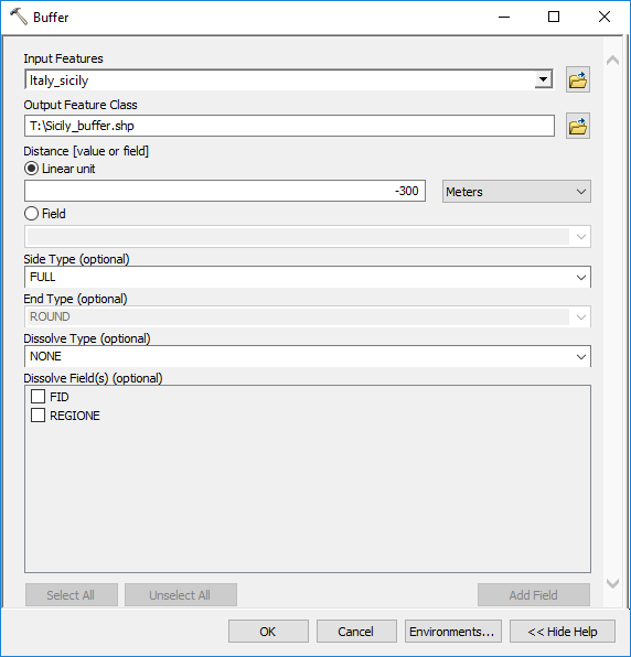
9 A n a l y s i s o f c h a n g e s User Uptake The changes on sensible coastal areas (300 m from coastline in Italy) New impervious areas in sensible zone
10 Built-up map m spatial resolution Copernicus Basemap Zoom Impervious areas Cloud areas
11 Built-up map m spatial resolution Copernicus Basemap Zoom Impervious areas Cloud areas
12 Built-up map m spatial resolution Copernicus Sicily map Coastal buffer (300 m) Resampled 10 m Impervious areas Cloud areas
13 Built-up map m spatial resolution Copernicus Sicily map Coastal buffer (300 m) Resampled 10 m Impervious areas Cloud areas
14 Built-up map m spatial resolution Copernicus Sicily map Coastal buffer (300 m) Built-up map 2015 Impervious areas Cloud areas
15 Built-up map m spatial resolution Copernicus Sicily map Coastal buffer (300 m) Built-up map 2015 Impervious areas Cloud areas
16 Built-up map m spatial resolution Copernicus Sicily map Coastal buffer (300 m) Built-up map 2012 Change map Impervious areas Cloud areas
17 Built-up map m spatial resolution Copernicus Sicily map Coastal buffer (300 m) Built-up map 2012 Change map Impervious areas Cloud areas

18 Change map m spatial resolution Copernicus Sicily map Built-up map 2012 Built-up map 2015 Sentinel-2 image New impervious areas Unchanged impervious areas

19 Sentinel 2-10 m spatial resolution Copernicus Sicily map Built-up map 2012 Built-up map 2015 Sentinel 2 + maps Basemap + maps Change image Quit
20 Sentinel 2-10 m spatial resolution Copernicus Sicily map Built-up map 2012 Built-up map 2015 Sentinel 2 Basemap + maps Change image 2012 impervious areas 2016 impervious areas Quit

21 Copernicus Sicily map Built-up map 2012 Built-up map 2015 Sentinel 2 Sentinel 2 + maps Change image 2012 impervious areas 2016 impervious areas Quit
22 User Uptake USE CASE 2

23 I n t r o d u c t i o n o f p r o b l e m User Uptake Homogeneous time series of thirty part input data allow a consistent estimation of the human impact through the years for an independent evaluation of them
24 I n t r o d u c t i o n o f u s e c a s e User Uptake Aim of indicator To quantify the urbanization on coastal areas It provides a measurement of the impact of the urbanization on coastal areas It provides information useful for urban planner and coastal manager
25 D e s c r i p t i o n User Uptake 3 buffer areas are defined from coastline 300 m 1 km 10 km
26 D e s c r i p t i o n User Uptake To compute the amount of impervious areas in these buffer zones for the entire region and for the administrative units (provinces)

27 I n p u t D a t a User Uptake HLR Imperviousness Time series Shapefile of administrative units HLR Imperviousness degree HLR Imperviousness degree HLR Imperviousness degree


28 T o o l u s e d User Uptake Any good GIS Software
29 D e m o n s t r a t i o n User Uptake Interactive ppt
30 HRL Imperviousness m spatial resolution Copernicus HRL Imperv HRL Imperv Zoom Step 1 - Recode
31 HRL Imperviousness m spatial resolution Copernicus HRL Imperv HRL Imperv Zoom Step 1 - Recode
32 HRL Imperviousness m spatial resolution Copernicus HRL Imperv HRL Imperv Zoom Step 1 - Recode
33 Copernicus HRL Imperv HRL Imperv Sicilian Map 2006 Step 1 - Recode HRL Imperviousness 2006

34 Copernicus HRL Imperv HRL Imperv Sicilian Map 2006 Step 1 - Recode HRL Imperviousness 2009
35 Copernicus HRL Imperv HRL Imperv Sicilian Map 2006 Step 1 - Recode HRL Imperviousness 2012
36 STEP 1 Recode HRL Imperviousness to have Built-up map Copernicus HRL Imperv HRL Imperv Zoom
37 HRL Imperviousness m spatial resolution Copernicus HRL Imperv HRL Imperv Zoom
38 Built-up map 2006 Copernicus Built-up map 2009 Built-up map 2012 Step 2
39 Built-up map 2009 Copernicus Built-up map 2006 Built-up map 2012 Step 2
40 Built-up map 2012 Copernicus Built-up map 2006 Built-up map 2009 Step 2
41 Shapefile region Copernicus Create buffer zones
42 Copernicus
43 Copernicus Erase buffer

44 Copernicus
45 Copernicus 1 km buffer 10 km buffer All buffers Step m buffer area
46 Copernicus 300 m buffer 10 km buffer All buffers Step 3 1 km buffer area
47 Copernicus 300 m buffer 1 km buffer All buffers Step 3 10 km buffer area

48 Copernicus 300 m buffer 1 km buffer 10 km buffer Step 3 All buffer areas
49 Copernicus Zonal statistics

50 Copernicus
51 2006 Copernicus Provincial analysis Legend 0 1 prov300 Sicily_x_visualization Percentage of impervious areas respect Regionthe total area of the buffer 0-10% 10,1-25% 25,1-35% 35,1-45% 45,1-50% 06_sicily_only_buffer10km 30% 25% 20% 15% 10% 5% 0% Regional percentage of built-up series by coastal buffers m 1 km 10 km
52 2009 Copernicus Provincial analysis Legend 0 1 prov300 Sicily_x_visualization Percentage of impervious areas respect Regionthe total area of the buffer 0-10% 10,1-25% 25,1-35% 35,1-45% 45,1-50% 06_sicily_only_buffer10km 30% 25% 20% 15% 10% 5% 0% Regional percentage of built-up series by coastal buffers m 1 km 10 km
53 2012 Copernicus Provincial analysis Legend 0 1 prov300 Sicily_x_visualization Percentage of impervious areas respect Regionthe total area of the buffer 0-10% 10,1-25% 25,1-35% 35,1-45% 45,1-50% 06_sicily_only_buffer10km 30% 25% 20% 15% 10% 5% 0% Regional percentage of built-up series by coastal buffers m 1 km 10 km
54 Sicilian provinces and built-up map 2006 Copernicus Create new buffers

55 Sicilian provinces and built-up map 2006 Copernicus

56 Copernicus Analysis results
57 2006 Copernicus Quit 10 km buffer km buffer Legend Built-up percentage by provinces and coastal buffer % 10-20% 20-30% 30-40% 40-50% m buffer
58 2009 Copernicus Quit 10 km buffer km buffer Legend Built-up percentage by provinces and coastal buffer % 10-20% 20-30% 30-40% 40-50% m buffer
59 2012 Copernicus Quit 10 km buffer km buffer Legend Built-up percentage by provinces and coastal buffer % 10-20% 20-30% 30-40% 40-50% m buffer
60 User Uptake Thank you
Create and share a map with GIScloud.com
 Create and share a map with GIScloud.com GIS Cloud is a web based Geographic Information System powered by Cloud Computing and with the full power of desktop GIS. It allows users to create and access your
Shoreline Change Prediction Model for Coastal Zone Management in Thailand
 Journal of Shipping and Ocean Engineering 2 (2012) 238-243 D DAVID PUBLISHING Shoreline Change Prediction Model for Coastal Zone Management in Thailand Siriluk Prukpitikul, Varatip Buakaew, Watchara Keshdet,
MASS PROCESSING OF REMOTE SENSING DATA FOR ENVIRONMENTAL EVALUATION IN EUROPE
 MASS PROCESSING OF REMOTE SENSING DATA FOR ENVIRONMENTAL EVALUATION IN EUROPE Lic. Adrián González Applications Research Earth Science Conference 2014 29.07.2014 Earth Science San Conference Francisco
Remote Sensing and GIS Application In Change Detection Study In Urban Zone Using Multi Temporal Satellite
 Remote Sensing and GIS Application In Change Detection Study In Urban Zone Using Multi Temporal Satellite R.Manonmani, G.Mary Divya Suganya Institute of Remote Sensing, Anna University, Chennai 600 025
GeoSEE WebGIS. Document for activity 5.4 WP 5
 GeoSEE WebGIS Document for activity 5.4 WP 5 1 Contents 1 Introduction... 4 2 GeoSEE webgis description... 4 2.1 URL... 4 2.1 Overview... 4 2.2 Navigation toolbar... 6 2.1 Map... 6 2.2 Layers list and
VHR Thematic Maps from Aerospace for Regional and Provincial Urban Planning
 VHR Thematic Maps from Aerospace for Regional and Provincial Urban Planning Massimo Zotti pkm026-428-1.0 Soil loss index Which soil type has been lost in the urban sprawl? Land use 2006 Class description
Developments toward a European Land Monitoring Framework. Geoff Smith. Seminar 2 nd December, 2015 Department of Geography, University of Cambridge
 Developments toward a European Land Monitoring Framework Geoff Smith Specto Natura Limited Enable clients to deliver useful, accurate and reliable environmental information from EO. Positioned at the interface
Levee Assessment via Remote Sensing Levee Assessment Tool Prototype Design & Implementation
 Levee Assessment via Remote Sensing Levee Assessment Tool Prototype Design & Implementation User-Friendly Map Viewer Novel Tab-GIS Interface Extensible GIS Framework Pluggable Tools & Classifiers December,
Application of Space Technology for Disaster monitoring and assessment current state in Vietnam
 Application of Space Technology for Disaster monitoring and assessment current state in Vietnam Lai Anh Khoi SPACE TECHNOLOGY INSTITUTE 8th GEOSS Asian Pacific Symposium Beijing, Sep. 09-11, 2015 Types
+GIO land. Status GMES Land Services. 18 Juni 2012, DeCover2 Abschlussveranstaltung, DLR. Tobias.langanke@eea.europa.eu
 +GIO land Status GMES Land Services 18 Juni 2012, DeCover2 Abschlussveranstaltung, DLR Tobias.langanke@eea.europa.eu GIO land components Global JRC bio-physical parameters (Essential Terrestrial Variables
GEOLOGY AND GEOMORPHOLOGY Level. bachelor Semester. winter ECTS 9
 GEOLOGY AND GEOMORPHOLOGY ECTS 9 The subject includes knowledge of the construction of the Earth and the natural processes occurring deeply inside and on the surface of the Earth. It contains characteristics
How to use PGS: Basic Services Provision Map App
 How to use PGS: Basic Services Provision Map App The PGS: Basic Services Provision Map App The main features of the PGP Basic Services web application includes: Navigation Tools Map Tools Main Map Links
Building & Developing the Environmental
 Building & Developing the Environmental Web Explorer for Riyadh City Authors: Engineer Yousef Bin Othman Al-Fariheedi Manager of Environmental Data Unit Environmental Management and Protection Department
State of Green Infrastructure in the Gauteng City-Region
 State of Green Infrastructure in the Gauteng City-Region Valuing Natural Capital Dialogue City of Johannesburg 26 th February 2014 Kerry Bobbins Researcher GCRO kerry.bobbins@gcro.ac.za Overview Structure
ArcGIS Online. Visualizing Data: Tutorial 3 of 4. Created by: Julianna Kelly
 ArcGIS Online Visualizing Data: Tutorial 3 of 4 2014 Created by: Julianna Kelly Contents of This Tutorial The Goal of This Tutorial In this tutorial we will learn about the analysis tools that ArcGIS Online
Government 98dn Mapping Social and Environmental Space
 Government 98dn Mapping Social and Environmental Space LAB EXERCISE 5: The Analysis of Fields Objectives of this lab: Visualizing raster data Using Spatial Analyst functions to create new data Analysis
IMPERVIOUS SURFACE MAPPING UTILIZING HIGH RESOLUTION IMAGERIES. Authors: B. Acharya, K. Pomper, B. Gyawali, K. Bhattarai, T.
 IMPERVIOUS SURFACE MAPPING UTILIZING HIGH RESOLUTION IMAGERIES Authors: B. Acharya, K. Pomper, B. Gyawali, K. Bhattarai, T. Tsegaye ABSTRACT Accurate mapping of artificial or natural impervious surfaces
Commercial satellite supported maritime and water monitoring services, and their co-existence with public space innitiatives
 Commercial satellite supported maritime and water monitoring services, and their co-existence with public space innitiatives Thomas Heege EOMAP GmbH & Co.KG Germany Singapore USA www.eomap.com Content
PLURIS 2014-6º Congresso Luso-Brasileiro para Planeamento Urbano, Regional, Integrado e Sustentável. - re-inventar-a-cidade-em-tempos-de mudança
 - 6º Congresso Luso-Brasileiro para Planeamento Urbano, Regional, Integrado e Sustentável. - re-inventar-a-cidade-em-tempos-de mudança 24 a 26 de setembro de 2014. Fundação Calouste Gulbenkian, Lisboa,
Urban Climatic Map of Arnhem City
 Urban Climatic Map of Arnhem City Renè Burghardt, Lutz Katzschner, Sebastian Kupski, University Kassel Ren Chao, Tejo Spit University Utrecht May 2010 1 1 INTRODUCTION In the framework of urban planning
HIDDEN BUILDINGS PROJECT
 UNECE Working Party on Land Administration HIDDEN BUILDINGS PROJECT an Italian best practice for a more effective land administration Eng. Marco SELLERI WPLA SIXTH SESSION Geneva, 19 th of June, 2009 Agenzia
SPOT4 (Take5) Contribution of Sentinel-2 to coast management
 Contribution of Sentinel-2 to coast management") SPOT4 (Take5) Contribution of Sentinel-2 to coast management Take 5 User s Day 2/10/2013 CNES Toulouse V. Lafon A. Robinet L. Barillé D. Bru S. Capo C. Cerisier A. Dehouck D. Doxaran D. Ducrot P. Gernez
SPOT4 (Take5) Contribution of Sentinel-2 to coast management Take 5 User s Day 2/10/2013 CNES Toulouse V. Lafon A. Robinet L. Barillé D. Bru S. Capo C. Cerisier A. Dehouck D. Doxaran D. Ducrot P. Gernez
Copernicus Services: State of Play and Future Perspective. Dr. Silvo Žlebir DG GROW, Copernicus Services. Follow us on:
 Copernicus Services: State of Play and Future Perspective Dr. Silvo Žlebir DG GROW, Copernicus Services Follow us on: Copernicus EU CopernicusEU www.copernicus.eu Space Outline Copernicus Services: Current
DESURBS Deliverable 3.1: Specification of mapping and visualization
 DESURBS Deliverable 3.1: Specification of mapping and visualization Project full title: Designing Safer Urban Spaces Grant agreement no.: 261652 Lead beneficiary for Deliverable 3.1: Centre Internacional
Spatial Data Store How to Order Imagery
 Login: Click on the login link in the upper most top right corner of the page to log in. If you have an account, simply enter your email address and password. If you do not have an existing account, click
Tutorial 8 Raster Data Analysis
 Objectives Tutorial 8 Raster Data Analysis This tutorial is designed to introduce you to a basic set of raster-based analyses including: 1. Displaying Digital Elevation Model (DEM) 2. Slope calculations
Reef Explorer User Guide
 Reef Explorer User Guide Contents USER INTERFACE...2 DATA CONTENT...3 BASEMAPS...4 ESRI BASEMAPS...4 National Geographic World Map...4 Light Gray Canvas Map...4 Ocean Basemap...4 World Terrain Base...4
SatelliteRemoteSensing for Precision Agriculture
 SatelliteRemoteSensing for Precision Agriculture Managing Director WasatSp. z o.o. Copernicus the road to economic development Warsaw, 26-27 February 2015 Activitiesof WasatSp. z o.o. The company provides
Entry to Geographic Information System
 1 Table of Contents Entry to Geographic Information System... 4 Geographic Information System... 7 1.1 Search by Name... 10 1.1.1 Screen buttons: Search by name :... 10 1.2 Find a Health Facility by Location
focus track 1 The San Diego Public Market Alessandro Boca FOCUS Unit Sapienza University of Rome Urban Agriculture, Food Network and Farmers Markets
 focus track 1 Urban Agriculture, Food Network and Farmers Markets The San Diego Public Market Alessandro Boca FOCUS Unit Sapienza University of Rome The San Diego Public Market WP2 Territorial Milieu THE
MONITORING IRRIGATION SEASON - A SUPPORT TOOL FOR WATER MANAGEMENT AND SHORT-TERM ACTIONS
 OECD WORKSHOP ON IMPROVING THE INFORMATION BASE TO BETTER GUIDE WATER RESOURCE DECISION-MAKING 4-7 May, 2010, Zaragoza MONITORING IRRIGATION SEASON - A SUPPORT TOOL FOR WATER MANAGEMENT AND SHORT-TERM
OUTLINES. Earth Observation Satellite Program of Vietnam and applications for disaster management
 UNESCAP ICC & HLDM Meetings, Bangkok 26 28/11/2013 Earth Observation Satellite Program of Vietnam and applications for disaster management OUTLINES 1. VNREDSat-1 (VAST*) - Optical 2. VNREDSat-1B (VAST)
EO Information Services in support of West Africa Coastal vulnerability - Service Utility Review -
 EO Information Services in support of West Africa Coastal vulnerability - Service Utility Review - Christian Hoffmann, GeoVille World Bank HQ, Washington DC Date : 24 February 2012 Content - Project background
Climate change impacts on city of Gdansk and its vicinity (Vistula Delta, Poland)
") Final International ASTRA Conference Espoo, 10-11 December, 2007 Climate change impacts on city of Gdansk and its vicinity (Vistula Delta, Poland) Dorota Kaulbarsz, Zbigniew Kordalski, Wojciech Jeglinski
Final International ASTRA Conference Espoo, 10-11 December, 2007 Climate change impacts on city of Gdansk and its vicinity (Vistula Delta, Poland) Dorota Kaulbarsz, Zbigniew Kordalski, Wojciech Jeglinski
GIT Geology and Information Technology
 Luca Fallati Università degli Studi di Milano-Bicocca: MaRHE Marine Research and High Educational Centre Land Use Changes (LUC) in developing countries are: - faster and widespread; - often not surveyed
HELCOM Data and Map Service. User Manual
 HELCOM Data and Map Service User Manual Version 2.2 - February 2015 1 Table of contents 1. General Information... 3 1.1 Background... 3 1.2 Technical requirements... 3 1.3 Contact... 3 2. Accessing HELCOM
Development of an Impervious-Surface Database for the Little Blackwater River Watershed, Dorchester County, Maryland
 Development of an Impervious-Surface Database for the Little Blackwater River Watershed, Dorchester County, Maryland By Lesley E. Milheim, John W. Jones, and Roger A. Barlow Open-File Report 2007 1308
Watershed Ecosystem & Restoration Services (WERS Mapping Application) User s Guide
 User s Guide") Watershed Ecosystem & Restoration Services (WERS Mapping Application) User s Guide CONTACT Site Administrators: David Gillum, GISP, AACO, OIT Rick Fisher, AACO, WERS ITGILL00@aacounty.org rfisher@aacounty.org
Watershed Ecosystem & Restoration Services (WERS Mapping Application) User s Guide CONTACT Site Administrators: David Gillum, GISP, AACO, OIT Rick Fisher, AACO, WERS ITGILL00@aacounty.org rfisher@aacounty.org
GEOGRAPHIC INFORMATION SYSTEMS CERTIFICATION
 GEOGRAPHIC INFORMATION SYSTEMS CERTIFICATION GIS Syllabus - Version 1.2 January 2007 Copyright AICA-CEPIS 2009 1 Version 1 January 2007 GIS Certification Programme 1. Target The GIS certification is aimed
CityGML goes to Broadway
 CityGML goes to Broadway Thomas H. Kolbe, Barbara Burger, Berit Cantzler Chair of Geoinformatics thomas.kolbe@tum.de September 11, 2015 Photogrammetric Week 2015, Stuttgart The New York City Open Data
Geographic Information Systems. ASM 215 Feb 2013 Larry Theller
 Geographic Information Systems ASM 215 Feb 2013 Larry Theller Schedule Wednesday GIS lecture Disc of homework Lab Thursday GPS Feb 28 Lab ABE 105 or 116 computer labs GIS Lecture today History Software
Using ArcGIS for ios with Data on ArcGIS Online
 Using ArcGIS for ios with Data on ArcGIS Online Article ID : TT100038 Software : ArcGIS for ios, ArcGIS.com Platform : Windows XP, Windows Vista, Windows 7 Date : 1 st July, 2011 Introduction This Smart
The politics of water management: bathing waters in Italy
 The politics of water management: bathing waters in Italy Anna Trono University of the Salento, Italy 1. Introduction As stated in European Union Directive 2006/7/EC, concerning the management of water
Data Warehouse Phase 2 set-up and data offer. Bianca Hoersch, Veronique Amans, Jolyon Martin, Lena Stern, Silke Bode, Luc Govaert
 Data Warehouse Phase 2 set-up and data offer Bianca Hoersch, Veronique Amans, Jolyon Martin, Lena Stern, Silke Bode, Luc Govaert Content 1. Background & Introduction to Copernicus Data Access 2. DWH Phase
Local Climate Zone mapping using GIS methods in Szeged
 Hungarian Geographical Bulletin 63 (1) (2014) 29 41. DOI: 10.15201/hungeobull.63.1.3 Local Climate Zone mapping using GIS methods in Szeged János UNGER 1, Enikő LELOVICS 1 and Tamás GÁL 1 Abstract Owing
Remote sensing and GIS applications in coastal zone monitoring
 Remote sensing and GIS applications in coastal zone monitoring T. Alexandridis, C. Topaloglou, S. Monachou, G.Tsakoumis, A. Dimitrakos, D. Stavridou Lab of Remote Sensing and GIS School of Agriculture
Processes of urban regionalization in Italy: a focus on mobility practices explained through mobile phone data in the Milan urban region
 Processes of urban regionalization in Italy: a focus on mobility practices explained through mobile phone data in the Milan urban region (DAStU, Politecnico di Milano) New «urban questions» and challenges
Smart control and Big Data in PV
 Copernicus Institute of Sustainable Development Smart control and Big Data in PV Wilfried van Sark Sunday 2015 18 November 2015 1/36 Contents Big data PV developments Example projects with Big Data Advanced
Using Built Environment Indicators in Public Health: Proximity to a Community Focal Point Indicator
 Using Built Environment Indicators in Public Health: Proximity to a Community Focal Point Indicator APHEO Built Environment Sub-group September 15, 2014 Built Environment Sub-Group The built environment
Monitoring a Changing Environment with Synthetic Aperture Radar. Alaska Satellite Facility National Park Service Don Atwood
 Monitoring a Changing Environment with Synthetic Aperture Radar Don Atwood Alaska Satellite Facility 1 Entering the SAR Age 2 SAR Satellites RADARSAT-1 Launched 1995 by CSA 5.6 cm (C-Band) HH Polarization
MobileMap and Spatial Content Management: Integrating Field Data Collection, Document Management and Enterprise GIS for Natural Resources
 MobileMap and Spatial Content Management: Integrating Field Data Collection, Document Management and Enterprise GIS for Natural Resources BRIAN GRASS MASON, BRUCE & GIRARD The Mobile Revolution Proliferation
Basic Steps to Using the Wildlife Application
 Basic Steps to Using the Wildlife Application The intent of the Wildlife Application (http://gisweb1.serm.gov.sk.ca/wildlifelogin/form.asp) is to provide a tool to search an area in the province of Saskatchewan
12-3-2014. After MGI. MGI celebration series. Hilbert Davelaar Project Manager GIS&ICT. Wageningen, 12 March 2013
 After MGI MGI celebration series Hilbert Davelaar Project Manager GIS&ICT Wageningen, 12 March 2013 1 Introduction 2 Hilbert Davelaar MSc 2000 2003 WUR BLP 2003 2005 WUR MGI Thesis: Participatory planning
State Environmental Monitoring (PMŚ) for Copernicus
 for Copernicus") State Environmental Monitoring (PMŚ) for Copernicus Dr Andrzej Jagusiewicz Chief Inspectorate of Environmental Protection Inspection of Environmental Protection and State Environmental Monitoring (SEM)
State Environmental Monitoring (PMŚ) for Copernicus Dr Andrzej Jagusiewicz Chief Inspectorate of Environmental Protection Inspection of Environmental Protection and State Environmental Monitoring (SEM)
HALF A CENTURY OF LAND USE CHANGES IN ANDALUSIA.
 HALF A CENTURY OF LAND USE CHANGES IN ANDALUSIA. Sealing soils. Analysis of urban expansion and perspective for future monitoring. REGIONAL MINISTRY FOR ENVIRONMENT AND SPATIAL PLANNING. Junta de Andalucia.
Land Cover Mapping of the Comoros Islands: Methods and Results. February 2014. ECDD, BCSF & Durrell Lead author: Katie Green
 Land Cover Mapping of the Comoros Islands: Methods and Results February 2014 ECDD, BCSF & Durrell Lead author: Katie Green About the ECDD project The ECDD project was run by Bristol Conservation & Science
"Cloud Adoption by the Italian Public Administration: State of Art and Plans" Roberto Masiero, President, THINK! The Innovation Knowledge Foundation
 "Cloud Adoption by the Italian Public Administration: State of Art and Plans" Roberto Masiero, President, THINK! The Innovation Knowledge Foundation SUCRE Workshop: Open Source Clouds in the public sector
Italian approach to develop a National Adaptation Strategy: lessons learnt from other European efforts
 Italian approach to develop a National Adaptation Strategy: lessons learnt from other European efforts ECCA Conference Session Adaptation strategies and planning - on national, regional Hamburg, March
U.S. Geological Survey Earth Resources Operation Systems (EROS) Data Center
 Data Center") U.S. Geological Survey Earth Resources Operation Systems (EROS) Data Center World Data Center for Remotely Sensed Land Data USGS EROS DATA CENTER Land Remote Sensing from Space: Acquisition to Applications
U.S. Geological Survey Earth Resources Operation Systems (EROS) Data Center World Data Center for Remotely Sensed Land Data USGS EROS DATA CENTER Land Remote Sensing from Space: Acquisition to Applications
Supervised Classification workflow in ENVI 4.8 using WorldView-2 imagery
 Supervised Classification workflow in ENVI 4.8 using WorldView-2 imagery WorldView-2 is the first commercial high-resolution satellite to provide eight spectral sensors in the visible to near-infrared
Exercise 5: Working with tables
 The Scenario You have been hired as a GIS consultant with the county school board. They need to get a better idea of where school age children live and where they should consider building additional schools.
Origins and causes of river basin sediment degradation and available remediation and mitigation options. Feedback from the Riskbase workshop
 Origins and causes of river basin sediment degradation and available remediation and mitigation options Feedback from the Riskbase workshop Corinne Merly 1, Olivier Cerdan 1, Laurence Gourcy 1 Emmanuelle
VULNERABILITY ASSESSMENT FOR THE MEGACITY ISTANBUL WITH REMOTE SENSING
 VULNERABILITY ASSESSMENT FOR THE MEGACITY ISTANBUL WITH REMOTE SENSING Hannes Taubenböck*, Semiha Caliskan, Achim Roth* *DLR, (DFD) Technical University Munich Contents 1. Introduction and Project overview
SimplyMap Canada Tutorial
 SimplyMap Canada Tutorial SimplyMap Canada is a web mapping application developed by Geographic Research Inc. The application enables users to create thematic maps and reports using demographic, business,
landusemonitoring bysatelliteimages
 landusemonitoring bysatelliteimages --- urban growth descripted by satellite images --- statistical comparison of the results by Ingrid Christ and Dr. Rolf Lessing agenda. methodology of satellite image
DATA VISUALIZATION GABRIEL PARODI STUDY MATERIAL: PRINCIPLES OF GEOGRAPHIC INFORMATION SYSTEMS AN INTRODUCTORY TEXTBOOK CHAPTER 7
 DATA VISUALIZATION GABRIEL PARODI STUDY MATERIAL: PRINCIPLES OF GEOGRAPHIC INFORMATION SYSTEMS AN INTRODUCTORY TEXTBOOK CHAPTER 7 Contents GIS and maps The visualization process Visualization and strategies
Operational Space- Based Crop Mapping Protocols at AAFC A. Davidson, H. McNairn and T. Fisette.
 Operational Space- Based Crop Mapping Protocols at AAFC A. Davidson, H. McNairn and T. Fisette. Science & Technology Branch. Agriculture and Agri-Food Canada. 1. Introduction Space-Based Crop Mapping at
WEB MAPPING TOOL DOCUMENTATION
 ENTERPRISE ZONES RE DESIGNATION WEB MAPPING TOOL DOCUMENTATION January 26, 2015 COVER PAGE TABLE OF CONTENTS INTRODUCTION 1 APPLICATION LAYOUT 2 WEB MAP NAVIGATION 3 LOCATION SEARCH 4 MAP LEGEND 5 BASEMAP
Final Report of the Town Owned Lands Improvement Project for the Town of Brentwood, NH
 Final Report of the Town Owned Lands Improvement Project for the Town of Brentwood, NH Project Background In November of 2013 the Green Infrastructure for Sustainable Coastal Communities (GISCC) project
Mangroves monitoring using VHR Pléiades data
 Mangroves monitoring using VHR Pléiades data Under mining constraints Rémi Andreoli Bluecham SAS Cyril Marchand IRD Audrey Léopold UNC/IRD Claire Tinel CNES Delphine Fontanaz CNES Pléiades Days 2014, April
Air quality in European cities
 22 June 2010 Air quality in an cities 2004-2008 ISTAT presents an analysis of air quality 1 in an cities for the 2004-2008 period using data from the an Environment Agency's (EEA) AirBase database. Elementary
Mosaicking and Subsetting Images
 Mosaicking and Subsetting Images Using SAGA GIS Tutorial ID: IGET_RS_005 This tutorial has been developed by BVIEER as part of the IGET web portal intended to provide easy access to geospatial education.
Flood Risk Management Plans
 Flood Risk Management Plans Main topics of interest and the workshop programme Jos van Alphen 26-01-2010 Content 1. Floods in Europe and related measures 2. The Floods Directive and Flood Risk Management
GROUNDWATER MONITORING AND DATA MANAGEMENT IN THE MEDITERRANEAN REGION. Marrakech, May 2005
 GROUNDWATER MONITORING AND DATA MANAGEMENT IN THE MEDITERRANEAN REGION Marrakech, May 2005 WATER RESOURCES IN THE MEDITERRANEAN REGION Water resources are limited, fragile and threatened Different conditions
Data Warehouse Requirements Version 2.0
 EUROPEAN COMMISSION ENTERPRISE AND INDUSTRY DIRECTORATE-GENERAL Aerospace, Maritime, Security and Defence Industries Copernicus : Infrastructures Data Warehouse Requirements Version 2.0 Copernicus Data
ANALYSIS 3 - RASTER What kinds of analysis can we do with GIS?
 ANALYSIS 3 - RASTER What kinds of analysis can we do with GIS? 1. Measurements 2. Layer statistics 3. Queries 4. Buffering (vector); Proximity (raster) 5. Filtering (raster) 6. Map overlay (layer on layer
The Role of Spatial Data in EU Agricultural Policy Analysis
 The Role of Spatial Data in EU Agricultural Policy Analysis Wolfgang Britz Institute for Food and Resource Economics, University Bonn Geospatial Open Source Hosting of Agriculture, Resource and Environmental
Methods for Monitoring Forest and Land Cover Changes and Unchanged Areas from Long Time Series
 Methods for Monitoring Forest and Land Cover Changes and Unchanged Areas from Long Time Series Project using historical satellite data from SACCESS (Swedish National Satellite Data Archive) for developing
Digital Classification and Mapping of Urban Tree Cover: City of Minneapolis
 Digital Classification and Mapping of Urban Tree Cover: City of Minneapolis FINAL REPORT April 12, 2011 Marvin Bauer, Donald Kilberg, Molly Martin and Zecharya Tagar Remote Sensing and Geospatial Analysis
Risk & Vulnerability Assessment tool applicability to coastal zones of SE Baltic
 Risk & Vulnerability Assessment tool applicability to coastal zones of SE Baltic N. Blažauskas, S. Suzdalev Klaipeda University Coastal Research and Planning Institute OBJECTIVE: To test the applicability
Geoscientific spatial data
 SDIC European Sustainable Development related policies and legislation INSPIRE and geoscientific data P. Christmann, K. Asch, Rafaelle Pignone, I. Jackson, F. Robida, P. Ryghaug, R. Tomas, L. Persson,
3D-GIS in the Cloud USER MANUAL. August, 2014
 3D-GIS in the Cloud USER MANUAL August, 2014 3D GIS in the Cloud User Manual August, 2014 Table of Contents 1. Quick Reference: Navigating and Exploring in the 3D GIS in the Cloud... 2 1.1 Using the Mouse...
Stanfords For Business. Price List. Stanfords For Business Price List - 1 -
 - 1 - Stanfords For Business Price List Stanfords Digital 29 Corn Street, BS1 1HT CONTENTS - Stanfords For Business Price List - 2 - OS Master Map in dxf/ dwg/ shp format 3 Planning Application Maps 4
Air Quality Monitoring in Italy
 MACC-III user workshop Rome, 11 May 2015 An overview of the Italian availability of air quality monitoring data Anna Maria Caricchia, Domenico Gaudioso Italian National Institute for Environmental Protection
Dataflow national level Reporting Tool
 Reporting under the EU nature Directives in practice: reporting tool, reference portal, range tool, use of Reportnet Birds in Europe 3 kick-off meeting 08-10/02/2012 Mikulov Želmíra Šípková & Brian Mac
Francesco Tortorelli
 Francesco Tortorelli Joint CEN/TC 287 and OGC Workshop Bringing GI Standards-making bodies together Frascati (Rome), 30 September 2013 (AgID) AgID (previously CNIPA and DigitPA) is a government agency
The Horizon 2020 FREEWAT project: FREE and open source software tools for WATer management
 The Horizon 2020 FREEWAT project: FREE and open source software tools for WATer management Rudy Rossetto r.rossetto@sssup.it Joint International Workshop EU FP7 MARSOL and EU HORIZON 2020 FREEWAT projects
Progress of SIGC -Coastal Geographical Information System
 Progress of SIGC -Coastal Geographical Information System Filippo D Ascola, Angela Barbano ISPRA -Istituto Superiore per la Protezione e la Ricerca Ambientale Dip.to Tutela Acque Interne e Marine - Servizio
The role of the Ina-SDI in supporting the development of the geospatial industry in Indonesia
 GEOGRAFIA Online TM Malaysia Journal of Society and Space 8 issue 1 (69-79) 69 The role of the Ina-SDI in supporting the development of the geospatial industry in Indonesia Asep Karsidi 1 National Coordinating
What is Where? Getting Started With Geographic Information Systems Chapter 5
 What is Where? Getting Started With Geographic Information Systems Chapter 5 You can use a GIS to answer the question: What is where? WHAT: Characteristics of attributes or features WHERE: In geographic
MAREMED kick off meeting
 MAREMED kick off meeting MEDITERRANEAN BASIN (Italy) Spatial Planning Department Orietta Gattulli economic management Marino Fiorito computer service center 22 June 2010 REGION PROVENCE-ALPES-CÔTE D AZUR
A GIS helps you answer questions and solve problems by looking at your data in a way that is quickly understood and easily shared.
 A Geographic Information System (GIS) integrates hardware, software, and data for capturing, managing, analyzing, and displaying all forms of geographically referenced information. GIS allows us to view,
Challenges for tourism in the Mediterranean
 Challenges for tourism in the Mediterranean Zoran Klarić PhD Associate Professor, Institute for Tourism Zagreb SUSTAINABLE DEVELOPMENT is a form of development which uses the natural ecosystem as resources
Development of information management system of dams in China based on. WebGIS
 Development of information management system of dams in China based on WebGIS ZHU Xing-ming 1, GENG Qing-zhai 1,2 (1.China Institute of Water Resources and Hydropower Research, Beijing 100044, China, zhuxm@iwhr.com;
RESOLUTION NO. 10/E. Rome, January 15, 2014
 RESOLUTION NO. 10/E Direzione Centrale Normativa Rome, January 15, 2014 SUBJECT: VAT - EXPO 2015 tax exemption provided for by Article 10, paragraph 5 of the Agreement between the Government of the Italian
Tools and Methods for Global Urban Analysis
 European Commission Joint Research Centre 1st Urbanization Workshop Day 2, Session 1: Tools and Methods for Global Urban Analysis Ellen Hamilton Lead Urban Specialist World Bank 1 Outline Global Agendas:
EVALUATING ALTERNATIVES FOR COASTAL DEVELOPMENT
 EVALUATING ALTERNATIVES FOR COASTAL DEVELOPMENT Nancy Cofer-Shabica, Perot Systems Government Services at Amanda Rutherford, Perot Systems Government Services at Patty McIntosh, Georgia Conservancy Fred
A Brief Explanation of Basic Web Services
 A Brief Explanation of Basic Web Services What is REST? REpresentational State Transfer (REST) is a way for software to work when distributed across a network. For example, if I want to view the Iowa Dept
GRASS GIS processing to detect thermal anomalies with TABI sensor
 GRASS GIS processing to detect thermal anomalies with TABI sensor Carmine Massarelli, Raffaella Matarrese, Vito Felice Uricchio, Michele Vurro Water Research Institute - Italian National Research Council