Field/Lab Exercise 2 Surveying Offsets and Handheld Survey Tools
|
|
|
- Wesley Skinner
- 9 years ago
- Views:
Transcription
1 Field/Lab Exercise 2 Surveying Offsets and Handheld Survey Tools Field Data Goal of this Exercise: to explore surveying methods as offsets from GPS points. Background: Cartesian and Polar Coordinates, Absolute and Relative Cartesian coordinates are positions related to orthogonal XYZ axes. Relative coordinates are relative to an arbitrary origin, like a stake hammered in the ground and east-west and north-south axes, also defined arbitrarily. Absolute coordinates are relative to a universally defined horizontal global datum, like spheroidal geographic coordinates, or projected coordinates tied to those spheroidal coordinates. Polar coordinates are vectors of distance, direction, and vertical angle, and are almost always relative. Land surveying has a similar purpose to GPS, in fact GPS is sometimes considered a technology that can be used to replace traditional surveying methods. This is only partially true, and it s best to think of their relationship is as a mutually beneficial one, with each having its benefits: Positioning Advantages Disadvantages GPS Absolute, using trilateration from satellites. Doesn't require known ground features. Points don't need to be close to other points. Doesn't work everywhere. To get to submeter or especially decimeter accuracy, may require a lot of time per point feature. Surveying Relative. Instruments measure polar coordinate angles and distances from other features, and can compute relative Cartesian coordinates. Works everywhere you can see. For local surveys, can measure with very fine accuracy. To derive absolute locations, needs known locations to survey from, and at least one known and accurate direction or known second location. Absolute accuracy is limited by known locations. GPS is an absolute positioning system, so determines position on the planet based on trilateration from satellites of known locations. Note that absolute does not mean absolutely accurate; it just means that it doesn't need to reference ground features. Total station surveys are relative surveys, but can be used for absolute locations if control points are needed. Two ways in which surveying and GPS come together nicely are: 1. Offsets. There are always situations where you cannot get a GPS position. There are also situations where the GPS position you apparently get is problematic especially in multipath situations such as near buildings or rock outcrops and you should not use the positions you are collecting. To capture a point in a problematic location, like in a canyon or forest, you may need to determine it as an offset from a GPS point. 2. Benchmarking. To determine absolute coordinates for a GIS, a surveying instrument needs known locations to work from. Traditionally this was done by using fixed benchmarks, and this is still done in urban areas where benchmarks are common. Using a GPS to establish benchmarks can greatly aid a surveying project. 1

2 Accuracy and Appropriate Technology Of course, accuracy considerations are crucial here, and here we should consider our purpose and appropriate technology. For benchmarking a total station survey, for a purpose that requires something approximating centimeter accuracy, a handheld GPS with an accuracy of 3-5 m just isn't going to cut it. Your total station may be able to survey relative positions to centimeter accuracy, but its absolute positions are limited by the accuracy of its benchmarks. At the same time, if the purpose only requires 3-5 m accuracy, where a handheld GPS instrument will do the trick, it may be overkill to use a total station; handheld survey instruments like compasses and clinometers may work. This table is a rough guide of the current situations Accuracy needs Appropriate GPS Technology Appropriate Survey Technology 3-5 m handheld GPS like Garmin or Juno Handheld Brunton or Suunto compass and clinometer accurate to 1, tape or laser rangefinder distances. Pacing also may suffice. ~ 1 m submeter GPS like GeoXT laser rangefinder, with compass for relatively short shots (< 50 m). ~ 2 m accuracy at 100 m m GeoXH with Zephyr total station (5" accuracy) In this exercise, we ll look at the use of handheld survey instruments (high-quality compasses and clinometers) and distance devices to record vector offsets from points. We ll be able to use these offsets to (a) make it possible to determine positions where we can t use a GPS; and, by extension, to (b) continue along a traverse to collect a sequence of new positions. We're shifting focus here from absolute to relative position, and using polar coordinates to derive those relative positions. As a general rule, if you're working in a small area, relative position is more accurate than absolute. However, relative position depends on both (1) the accuracy of both the position you re relative to, and (2) the accuracy of its ability to measure the vector offset. Most surveying equipment use highly accurate means of measuring vector offset, but may be starting from a GPS point to get an absolute position. SD Z V D 2

3 Measuring relative position with vector offsets Vector offset uses polar coordinates instead of Cartesian coordinates. Polar coordinates are vectors of distance and direction. Direction is divided into horizontal (azimuth) direction and vertical angle. Azimuth is as measured on a compass 0-360, with 0 or 360 being north, 90 east, 180 south, 270 being west. Vertical angle is measured from horizontal 0 up to vertical, 90. Vertical angle can also be measured in percent, or rise/run from 0% to very high numbers, where vertical would be infinite (so can t be used for such); 100% corresponds to 45. SD = slope distance (direct) D = horizontal distance (on a map) = SD * cos(v ) V = vertical angle ( or %) tan V = Z/D V(%) = Z/D * 100% Z = SD * sin(v ) SD V Fig. 4. Vertical angle relationships and equations. D Z 300º 330º N 0º 30º 50 60º Az = 50 sighting to some object X = D * sin(az) Y = D * cos(az) W 270º 90º E 240º 120º 210º 180º S 150º Fig. 5. Horizontal angle (azimuth) & equations 3
; 100% corresponds to 45.")
4 Manual Offsets As before, we'll start with a manual process, which will always work, even with a GPS receiver that doesn't know how to do it the fancy way (we'll see that next). Find a location where you cannot get GPS reception, preferably somewhere in your previously sketched area. The instructor may have some ideas, but typical locations are in densely forested areas, in canyons, or both. Find a nearby spot where you can get reception and record a position, using averaging for the best accuracy. Using UTM coordinates, make note of this location and its ID: ID: X: Y: Z: Note: you can also store this waypoint in the GPS to download later. You should make a careful note in your notebook about what the point represents, that it s not the actual location but will need the vector offset. Measure the offset with handheld instruments, pacing, survey tape, and laser rangefinder. Measure all distances directly as "slope distances" in metres. If measuring to a tree, measure this distance from a given height above the ground (e.g. chest height) to the same height on the Z tree. Hold the tape tightly directly V between the GPS point and the target D location. Read vertical angles in degrees with + or indicating if the reading is upslope or downslope. Read compass azimuths in degrees (0 to 360 ). Read foresights and backsights. If the backsight differs by more than 1 from the foresight (for azimuth, add or subtract 180 ; for V, change the sign), shoot again until you are within that tolerance (for shorter distances, you can opt to go for 2 ). Note that magnetic interference may affect compass readings, so you may need to ignore one or the other reading; cross out the one you don't trust. Feature ID GPS SD T SD L V V B D T D P D L AZ mag AZ B T= taped, L = laser, B = backsight Use the calculator (set to 'degrees') to derive the following: D = SD * cos(v) AZ = AZ mag = ΔX = X + sin(az)*d = X tree = X + ΔX = ΔY = Y + cos(az)*d = Y tree = Y + ΔY = 4

5 Using TerraSync to do Offsets TerraSync and Pathfinder know all about offsets, and make this process pretty easy. An offset can be recorded with a collected point or vertex, and this is retained with the data. The actual GPS point might get real-time differentially processed or post-processed, and then the saved offset is applied to the feature you are after. As with the manual method, the offset is always from the GPS toward the feature. This convention makes it easy to use solo methods where the user is holding the GPS and might be using a laser rangefinder to shoot distances to a desired feature. First we need to set up the GPS to use the offset format we are going to provide. In Setup... Units set the Offset Format to Slope/Inclination (instead of Horizontal/Vertical where we would need both of those distances); and set the North Reference to Magnetic (since our compasses read magnetic directions) and the magnetic declination correctly set (to 14.1 for SFSU in 2012). Also make sure the Distance Units are set to Meters. Open your Quadfeatures data file, and go to Collect Features mode, and survey a tree that you can't stand next to and get a decent point. Measure the slope distance, vertical angle and compass direction (for best accuracy, do a backsight of the compass direction), and while (or before, if log later is set,) collecting your GPS point, use the Options button to go to Offset, set to Distance-Bearing, and enter the compass bearing in degrees, the slope distance and the inclination (make sure to enter negative or positive as appropriate). Collect some more. Try staying at one GPS point, and "spraying out" to multiple tree features. Each point needs to be collected as a GPS point, since only one offset is saved with each point, but this will illustrate a process we will use with submeter GPS. UTM Coordinates of GPS Point to spray from: Tree Description SD Foresight Backsight Vertical 5

6 Complex Offsets TerraSync also has the capability of doing "complex offsets" where you use two or three GPS positions together with either distances or compass bearings. These are handy in two situations: 1. You don't have a compass or clinometer with you, but you either (a) have a distance device like a tape or a rangefinder; or (b) you know how to pace your distance. You can use trilateration with 2 or 3 distances 2. You can't physically get to the point you need to locate, but you have a compass and can see the point from three surrounding GPS points, using triangulation with 2 or 3 compass readings. Offset Options GPS pts Requires Distance - Bearing 1 1 Slope distance and 1 compass bearing (simple offset) Distance - Distance 2 2 Distances and left vs. right setting Triple Distance 3 3 Distances Bearing Bearing 2 2 Compass bearings Triple Bearing 3 3 Compass bearings must have an error check Considerations for complex offsets Using more than one GPS points to find a desired feature point employs triangle, either using triangulation or trilateration methods. Triangles work best when they are not too skinny, with the ideal shape being equilateral with each corner at 60. So, in creating either a single triangle with two GPS points and a feature, or creating multiple triangles, you should try to spread your points out. With three points, you should try to surround your feature on all sides. This is the same issue as with GPS where we minimize the PDOP by collecting when satellites are spread apart. Simple Azimuth 78 Complex Offset: 2 or more azimuths or distances, from 2 or more GPS points Setup: Pacing Distances. We'll do both, starting with pacing distances. For the 3-5 m accuracy of the handheld GPS, pacing accuracy is sufficiently accurate. First, we need our pace distance. Count your extended paces over the 100-m course that the instructor specifies. Note that a pace is two steps, so starting with your left foot it's each time you put your right foot down. Extended paces are stretched out, more consistent than normal walking. Do this four times, back and forth twice, and record the number of paces here: 6

7 sum = Go to the calculator program on the Juno, add them up and divide 400 by this number to get the length of your pace in meters, and write this down, to two decimal places: We ll do various kinds of complex offsets for the field assignment. Refer to the Juno_Terrasync guide for instructions on each of the methods. There is further information in the Terrasync Getting Started manual. On-screen instructions also guide you through the process, which works pretty well as long as you take the time to read and understand what it s telling you. Check the Units settings to make sure they are correct for your methods and equipment, most likely: Distance Units Meters Offset Format Slope/Inclination North Reference Magnetic (since we re using a compass) Magnetic Declination 14.1 which I got by using: Collect at least one tree location using each of the following methods. For each, create a point with the Log Later setting in force, and go to Options to set the Offset method. As with other points, you ll use the data dictionary so you can record data on the type of tree, etc. You should try to record the same tree with different offset methods, to compare how they work, but feel free to record some other ones. 1. Distance Distance Pay careful attention to the instructions, and you ll need to note which side left or right the (tree) feature is in relation to a line from your first to second GPS point. 2. Triple Distance Notes: This will require three GPS points. It actually derives three intersections, and will average these to give the best estimate. 3. Bearing Bearing Be careful reading the compass. Remember it reads from right to left move it left and right to see how the numbers go. Some compass show a backsight reading as well, but you should use the bolder foresight reading. Also the Quad has a lot of places with magnetic interference from buried cables, so you might confirm its readings by backing up several meters and shooting through your GPS point (leave a partner holding a rod on the point) to the feature to see if it matches. 4. Triple Bearing Note: as with the Triple Distance, it averages three intersections to derive a resulting location. 7

8 Control Points with Submeter GPS At the end of the first day, we need to capture some control points for controlling a sketch. We haven't talked about this in class yet, but we need to get enough GPS points to accurately control our map. We'll try to leave some survey pins behind to use the next day. As part of this exercise, we will use higher accuracy carrier-phase GPS, at the submeter or possibly subfoot level. Carrier-phase collection can be much more complex and there are various methods we can use suitable for different situations. Learn more about these in the Terrasync Software Getting Software Guide section on High Accuracy Data Collection. We'll be using the ProXH and GeoXH GPS units to capture features using H-Star technology, but it's useful to see how this compares with other methods. Each high-accuracy method uses a different part of the GPS signal called carrier phase. The three modes of using carrier phase are: 1. H-Star technology down to cm (1-3 dm, "subfoot") accuracy in real-time or after postprocessing. usable soon after collection to 30-cm or so accuracy. moderately priced equipment can use public base station data Requires a period of uninterrupted carrier phase logging of ~2 minutes to achieve cm accuracy. 2. Carrier Phase Post-processing 1-30 cm accuracy after post-processing can use public base station data Requires a period of uninterrupted carrier phase logging of minutes to achieve 1-30 cm accuracy Positions are not usable until the minimum continuous carrier lock time has elapsed. Accuracy degrades rapidly with distance from base station. 3. Real-time Kinematic cm accuracy in real-time, with no need for post-processing not able to operate in difficult GPS situations needs short distance to base station, usually employed nearby. As a group, we'll capture high-accuracy points at points that we'll use to survey offsets later. Label these with their ids on the trail map provided in the first exercise. We'll download and post-process the data in the morning. Note: Carrier Lock must be maintained to get high accuracies. Must maintain lock with at least 5 satellites. In difficult situations, code may be used instead, but with less accuracy. If you consider the above properties, there really are two purposes for this type of GPS: 1. Submeter feature collection. It's reasonably easy to capture ~1 m accuracy features using these units, though still more difficult (and much more expensive) than using the 8

9 handheld units. The units are larger and require a range pole setup to really get the accuracy we're after. 2. Benchmarking. As you can see, it takes more time per point and ideal conditions to approach a decimeter accuracy level, and a lot of time per point and perfect conditions to get to centimeter accuracy. So this is really in the realm of benchmarking, where we establish a control point to survey from with a total station. Compass Traverse (optional) An extension of a vector offset is to continue from a known point through a traverse of points. This is similar to the field sketch with GPS points we did earlier, but we ll get the points from processing the traverse. You re provided with an example of a field notebook page, with a data recording area on the left, and a sketch area to the right. Assuming ID 201 is a known location, we record a series of offsets as shown here. Note that data are stored on the line with the ID of the target location. Refer to Fig. 2 for a corresponding sketch. Id SD Az Back Az V Back V Survey a traverse assigned by the instructor, starting at a known point. Record features such as larger trees, etc., in the sketch. Hold the tape tight and directly between the two points (or at a constant height above both points). Make sure to check all backsights that they fit within 1 of your foresights, and record both foresights and backsights (don t convert the backsights to foresights, just record them as you have them, but re-measure them and change them as necessary.) Finish the survey by closing back to the first point. 9
 An extension of a vector offset is to continue from a known point through a traverse of points.")
10 Lab Processing Field Survey Data Lab In the previous field exercise, you collected: 1. Survey readings from handheld instruments 2. TerraSync features with built-in offsets 3. Possibly, a compass/clinometer traverse from a known point 1. Vector offset (optional) For our manual offset, we could also do the computations in Excel before importing into ArcMap. You'll need the GPS coordinates you're surveying from and the various offset readings. You could either put the formulas in or use one I've provided. Open travclose.xls copied from the class data folder, and go to the Simple Offset worksheet. Cells in green should be set mag decl D factor uncorrected sta sd az (fs) bs vert bsrev erraddtoaz corr Az hd dx dy dz x' y' z' There are several things to set: a. Magnetic Declination: 14.1 is currently accurate for this area; change if necessary. b. D factor: if your horizontal distances are in feet and you want to convert to meters (e.g. to match UTM), put in this cell, currently set to 1 (in green). c. Enter your X (easting), Y (northing), Z XYZ coordinates (UTM or other) for your known point, the first line in the table, row 9: cells N9, O9, P9. d. Your slope distance (SD, direct tape measurement), azimuth foresight, azimuth backsight, and vertical angle. Now copy the resulting XYZ coordinates in row 10, into your spreadsheet you re going to bring into ArcGIS, after the corresponding source GPS point (e.g. put 2091 after 209). You may need to insert a row, and Edit/Paste Special (Values) to make this work well. Then continue to export this worksheet into dbf, and bring it into ArcMap. Display both your normal waypoints, your source waypoint, and your offset point.? Despite that fact that your target point is likely to hidden by trees, does it seem to make sense?? Are there any serious blunders in your survey (like being obviously off by 180 )? 2. TerraSync Offsets Download your saved GPS features with offsets using Pathfinder, and refer to the Guide. See how it deals with each of the types of offsets saved with the features. 10

11 3. Traverse (optional) This is really just an extension of the previous process. The difference is that your data is a full traverse, and in fact a closed traverse in that you finish on the first point. Use the same travclos spreadsheet, but use the ClosedTraverseDataEntry worksheet to enter your data. The same data entry needs exist as the simple data entry above (magnetic declination, D factor, starting known point), but you ll have more lines of survey data. One difference with the closed traverse is that the last point is automatically assumed to be the same as the first point, so an automatic closure is performed. Have a look at the two maps created (Excel doesn t really make decent maps unless you force X and Y spacing to be the same, but you can get a rough view) to see how much alteration is created, and check the traverse closure error shown in red in cell Q3. It should be less than a meter for a reasonably good survey, and I ve usually gotten to a half meter. Enter your data, check the closure error, and if it s ok, save the document, and then bring the output worksheet into ArcMap as before. Compare the location of points to the aerial orthophoto though your ability to do so will be limited by tree cover the reason you had to use survey methods in the first place. 11
, but you ll have more lines of survey data.")
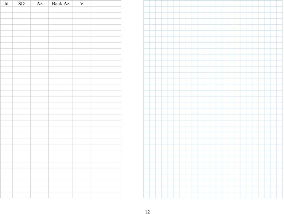
12 Id SD Az Back Az V 12
Trimble TerraSync User Guide for Laser GPS Offset
 Trimble TerraSync User Guide for Laser GPS Offset Intro Trimble TerraSync software is designed for fast and efficient field GIS data collection and maintenance. Integrating all the ways you collect data
Exer. 1 Using Handheld GPS for location & recording points
 Exer. 1 Using Handheld GPS for location & recording points Field Objectives: 1. Familiarity with handheld receivers (Trimble Juno) 2. Basic positioning in Lat/Long and UTM 3. Familiarity with changing
GeoExplorer 2008 Series GeoXH Handheld: FAQs for Customers
 7 December 2009 GeoExplorer 2008 Series GeoXH Handheld: FAQs for Customers This document provides information that is common to all models of handheld in the Trimble GeoExplorer 2008 series, followed by
NJDEP GPS Data Collection Standards For GIS Data Development
 NJDEP GPS Data Collection Standards For GIS Data Development Bureau of Geographic Information Systems Office of Information Resource Management June 8, 2011 1.0 Introduction... 3 2.0 GPS Receiver Hardware
GPS Data Collection. 1. Field Reconnaissance 2. Mission Planning. 3. Equipment Setup 4. Data Collection/Data Update 5.
 GPS 1. Field Reconnaissance 2. Mission Planning 1. Create a project 2. Build a data dictionary 3. Check satellite availability 3. Equipment Setup 4. /Data Update 5. Data Processing Plan/prepare for conditions
Total Station Setup and Operation. Sokkia SET Total Station
 Total Station Setup and Operation Sokkia SET Total Station Parts of the SET Total Station Parts of the SET Total Station Sokkia SET 550 Total Station Keys/Screen SET 550 Menu Pages SET 550 Menu Pages Leveling
SURVEYING WITH GPS. GPS has become a standard surveying technique in most surveying practices
 SURVEYING WITH GPS Key Words: Static, Fast-static, Kinematic, Pseudo- Kinematic, Real-time kinematic, Receiver Initialization, On The Fly (OTF), Baselines, Redundant baselines, Base Receiver, Rover GPS
GPS accuracy: Hand-held versus RTK
 GPS accuracy GPS accuracy: Hand-held versus RTK Kevin W. Hall, Joanna K. Cooper, and Don C. Lawton ABSTRACT Source and receiver points for seismic lines recorded during the geophysics field school near
FUNDAMENTALS OF LANDSCAPE TECHNOLOGY GSD Harvard University Graduate School of Design Department of Landscape Architecture Fall 2006
 FUNDAMENTALS OF LANDSCAPE TECHNOLOGY GSD Harvard University Graduate School of Design Department of Landscape Architecture Fall 2006 6106/ M2 BASICS OF GRADING AND SURVEYING Laura Solano, Lecturer Name
PeopleGIS Leica RTK GPS Instructions
 PeopleGIS Leica RTK GPS Instructions Equipment List GG02 Receiver (Antenna) GPS Range Pole Zeno Tablet MiFi MiFi External Battery Carrying Case 1) Turning on the MiFi Power on the MiFi. This little gadget
Magnetic Fields and Their Effects
 Name Date Time to Complete h m Partner Course/ Section / Grade Magnetic Fields and Their Effects This experiment is intended to give you some hands-on experience with the effects of, and in some cases
Learning about GPS and GIS
 Learning about GPS and GIS Standards 4.4 Understand geographic information systems (G.I.S.). B12.1 Understand common surveying techniques used in agriculture (e.g., leveling, land measurement, building
Using the Quadrant. Protractor. Eye Piece. You can measure angles of incline from 0º ( horizontal ) to 90º (vertical ). Ignore measurements >90º.
 to 90º (vertical ). Ignore measurements >90º.") Using the Quadrant Eye Piece Protractor Handle You can measure angles of incline from 0º ( horizontal ) to 90º (vertical ). Ignore measurements 90º. Plumb Bob ø
Using the Quadrant Eye Piece Protractor Handle You can measure angles of incline from 0º ( horizontal ) to 90º (vertical ). Ignore measurements 90º. Plumb Bob ø
RELEASE NOTES. Introduction. New in this release. Trimble Positions Mobile extension
 RELEASE NOTES Trimble Positions Mobile extension These release notes provide important information about the Trimble Positions Mobile extension version 10.2.0.1. Please read these release notes carefully.
Tutorial 6 GPS/Point Shapefile Creation
 Tutorial 6 GPS/Point Shapefile Creation The objectives of this tutorial include: 1. Converting GPS field collected point information into a shapefile 2. Creating a shapefile from a simple x,y coordinate
CHAPTER 7 TRAVERSE Section I. SELECTION OF TRAVERSE DEFINITION
 CHAPTER 7 TRAVERSE Section I. SELECTION OF TRAVERSE DEFINITION A traverse is a series of straight lines called traverse legs. The surveyor uses them to connect a series of selected points called traverse
Lesson 26: Reflection & Mirror Diagrams
 Lesson 26: Reflection & Mirror Diagrams The Law of Reflection There is nothing really mysterious about reflection, but some people try to make it more difficult than it really is. All EMR will reflect
A comparison of radio direction-finding technologies. Paul Denisowski, Applications Engineer Rohde & Schwarz
 A comparison of radio direction-finding technologies Paul Denisowski, Applications Engineer Rohde & Schwarz Topics General introduction to radiolocation Manual DF techniques Doppler DF Time difference
The purposes of this experiment are to test Faraday's Law qualitatively and to test Lenz's Law.
 260 17-1 I. THEORY EXPERIMENT 17 QUALITATIVE STUDY OF INDUCED EMF Along the extended central axis of a bar magnet, the magnetic field vector B r, on the side nearer the North pole, points away from this
GPS Data Collection Procedures for Georeferencing Vegetation Resources Inventory and National Forest Inventory Field Sample Plots
 Province of British Columbia GPS Data Collection Procedures for Georeferencing Vegetation Resources Inventory and National Forest Inventory Field Sample Plots Resources Information Branch Ministry of Sustainable
MobileMapper 6 White Paper
 MobileMapper 6 White Paper Meter-Level Mapping Accuracy With Post-Processing Introduction Since its introduction in February 2008, the Magellan MobileMapper 6 has been welcomed by the market as the only
FREE FALL. Introduction. Reference Young and Freedman, University Physics, 12 th Edition: Chapter 2, section 2.5
 Physics 161 FREE FALL Introduction This experiment is designed to study the motion of an object that is accelerated by the force of gravity. It also serves as an introduction to the data analysis capabilities
Ted MacKinnon & Jonathan Murphy
 Introduction & Simple Guide to Using the Leica Total Station Ted MacKinnon & Jonathan Murphy This document was originally submitted as part of a requirement for the Applied Geomatics Research advanced
Subdivision Mapping: Making the Pieces Fit David P. Thaler, GIS Analyst A geographit White Paper, June 2009
 Subdivision Mapping: Making the Pieces Fit P David P. Thaler, GIS Analyst A geographit White Paper, June 2009 1525 Oregon Pike, Suite 202 Lancaster, PA USA 17601-7300 Phone: 717-399-7007 Fax: 717-399-7015
Elev. A = 200.05, Elev. B = 325.25, horizontal distance = 1625 feet a. 7.7 b..077 c. 12.98 d. 1.28
 1. If the percent grade is 7.25 % and the horizontal length of grade is 1625 feet, what is the change in elevation? a. 117.81 feet b. 1178.13 feet c. 11.78 feet d. 1.17 feet 2. In surveying, the distance
Wind Direction Smart Sensor (S-WDA-M003)
") (S-WDA-M003) The Wind Direction smart sensor is designed to work with HOBO Stations. The smart sensor has a plug-in modular connector that allows it to be added easily to a HOBO Station. All sensor parameters
(S-WDA-M003) The Wind Direction smart sensor is designed to work with HOBO Stations. The smart sensor has a plug-in modular connector that allows it to be added easily to a HOBO Station. All sensor parameters
GPSMAP 62 series quick start manual. For use with the GPSMAP 62, 62s, 62st, 62sc, and 62stc
 GPSMAP 62 series quick start manual For use with the GPSMAP 62, 62s, 62st, 62sc, and 62stc Getting Started warning See the Important Safety and Product Information guide in the product box for product
Tutorial for Tracker and Supporting Software By David Chandler
 Tutorial for Tracker and Supporting Software By David Chandler I use a number of free, open source programs to do video analysis. 1. Avidemux, to exerpt the video clip, read the video properties, and save
6. Vectors. 1 2009-2016 Scott Surgent ([email protected])
") 6. Vectors For purposes of applications in calculus and physics, a vector has both a direction and a magnitude (length), and is usually represented as an arrow. The start of the arrow is the vector s foot,
6. Vectors For purposes of applications in calculus and physics, a vector has both a direction and a magnitude (length), and is usually represented as an arrow. The start of the arrow is the vector s foot,
GPSMAP 78 series. quick start manual. for use with the GPSMAP 78, GPSMAP 78s, and GPSMAP 78sc
 GPSMAP 78 series quick start manual for use with the GPSMAP 78, GPSMAP 78s, and GPSMAP 78sc Getting Started warning See the Important Safety and Product Information guide in the product box for product
Elements of a graph. Click on the links below to jump directly to the relevant section
 Click on the links below to jump directly to the relevant section Elements of a graph Linear equations and their graphs What is slope? Slope and y-intercept in the equation of a line Comparing lines on
CHAPTER 3 PROJECT CONTROL
 CHAPTER 3 PROJECT CONTROL Marking Survey Control Points 3-2 Horizontal Control 3-2 Vertical Control 3-3 Preconstruction Bench Marks 3-3 Bench Mark Levels 3-3 Bench Mark Check Levels 3-5 Total Station Leveling
1 One Dimensional Horizontal Motion Position vs. time Velocity vs. time
 PHY132 Experiment 1 One Dimensional Horizontal Motion Position vs. time Velocity vs. time One of the most effective methods of describing motion is to plot graphs of distance, velocity, and acceleration
Experiment 2 Free Fall and Projectile Motion
 Name Partner(s): Experiment 2 Free Fall and Projectile Motion Objectives Preparation Pre-Lab Learn how to solve projectile motion problems. Understand that the acceleration due to gravity is constant (9.8
ITS Training Class Charts and PivotTables Using Excel 2007
 When you have a large amount of data and you need to get summary information and graph it, the PivotTable and PivotChart tools in Microsoft Excel will be the answer. The data does not need to be in one
ELECTRIC FIELD LINES AND EQUIPOTENTIAL SURFACES
 ELECTRIC FIELD LINES AND EQUIPOTENTIAL SURFACES The purpose of this lab session is to experimentally investigate the relation between electric field lines of force and equipotential surfaces in two dimensions.
PLOTTING SURVEYING DATA IN GOOGLE EARTH
 PLOTTING SURVEYING DATA IN GOOGLE EARTH D M STILLMAN Abstract Detail surveys measured with a total station use local coordinate systems. To make the data obtained from such surveys compatible with Google
SECTION 01 78 29 AS-BUILT DOCUMENTATION
 SECTION 01 78 29 AS-BUILT DOCUMENTATION PART 1: GENERAL 1.01 AS-BUILTS Where identified as a product of the Work, provide as-built drawings adhering to the criteria provided here and in the special conditions.
The Map Grid of Australia 1994 A Simplified Computational Manual
 The Map Grid of Australia 1994 A Simplified Computational Manual The Map Grid of Australia 1994 A Simplified Computational Manual 'What's the good of Mercator's North Poles and Equators, Tropics, Zones
Experiment 2: Conservation of Momentum
 Experiment 2: Conservation of Momentum Learning Goals After you finish this lab, you will be able to: 1. Use Logger Pro to analyze video and calculate position, velocity, and acceleration. 2. Use the equations
How to Make the Most of Excel Spreadsheets
 How to Make the Most of Excel Spreadsheets Analyzing data is often easier when it s in an Excel spreadsheet rather than a PDF for example, you can filter to view just a particular grade, sort to view which
Using the Garmin etrex 10 GPS
 Using the Garmin etrex 10 GPS Topic 1: Getting started... 2 1. What is Garmin etrex 10 GPS?... 2 2. About this guide... 2 Topic 2: Getting to know your etrex 10... 3 1. Buttons and components... 3 2. Getting
ROAD SURVEYING Section I. RECONNAISSANCE SURVEY PREPARATION AND SCOPE
 CHAPTER 2 ROAD SURVEYING Section I. RECONNAISSANCE SURVEY PREPARATION AND SCOPE The reconnaissance survey is an extensive study of an entire area that might be used for a road or airfield. Its purpose
Trimble Field Link Software
 Trimble Field Link Software This document explains how to quickly begin using Trimble Field Link software. Trimble Field Link software enables you to easily lay out your projects with a task-based workflow.
ArcGIS Mobile Application User s Guide
 ArcGIS Mobile Application User s Guide 1 Contents Chapter 1 Chapter 2 Chapter 3 Chapter 4 2 5 5 6 7 7 8 8 11 12 14 15 19 21 22 23 37 38 ArcGIS Mobile User Interface Essentials Title Bar Menu Bar Hardware
2.2 Derivative as a Function
 2.2 Derivative as a Function Recall that we defined the derivative as f (a) = lim h 0 f(a + h) f(a) h But since a is really just an arbitrary number that represents an x-value, why don t we just use x
GPS 72. Personal Navigator. Read This First! quick start guide
 GPS 72 Personal Navigator Read This First! quick start guide Internal Antenna Quick Start Unit Overview Interface keys MOB ZOOM Battery Compartment MARK External Data/Auxilary Power Port 120 x 160 Four
How to setup a VRS or Single Base connection with a Trimble 2005 GeoXH receiver using an AT&T cell phone
 How to setup a VRS or Single Base connection with a Trimble 2005 GeoXH receiver using an AT&T cell phone GeoXM, GeoXT, GeoXH Summary Steps 1. Turn on the Bluetooth radio in your GeoCE 2. Setup the connection
Digital Photogrammetric System. Version 6.0.2 USER MANUAL. Block adjustment
 Digital Photogrammetric System Version 6.0.2 USER MANUAL Table of Contents 1. Purpose of the document... 4 2. General information... 4 3. The toolbar... 5 4. Adjustment batch mode... 6 5. Objects displaying
The Force Table Vector Addition and Resolution
 Name School Date The Force Table Vector Addition and Resolution Vectors? I don't have any vectors, I'm just a kid. From Flight of the Navigator Explore the Apparatus/Theory We ll use the Force Table Apparatus
4.03 Vertical Control Surveys: 4-1
 4. HORIZONTAL AND VERTICAL CONTROL 4.01 General: Sufficient horizontal and, if applicable, vertical control surveys shall be established by the Contractor for all photogrammetric mapping purposes. Prior
Mapping the Magnetic Field
 I Mapping the Magnetic Field Mapping the Magnetic Field Vector Fields The electric field, E, and the magnetic field, B, are two examples of what are termed vector fields, quantities which have both magnitude
Updates to Graphing with Excel
 Updates to Graphing with Excel NCC has recently upgraded to a new version of the Microsoft Office suite of programs. As such, many of the directions in the Biology Student Handbook for how to graph with
Experiment 5: Magnetic Fields of a Bar Magnet and of the Earth
 MASSACHUSETTS INSTITUTE OF TECHNOLOGY Department of Physics 8.02 Spring 2005 Experiment 5: Magnetic Fields of a Bar Magnet and of the Earth OBJECTIVES 1. To examine the magnetic field associated with a
Shear Force and Moment Diagrams
 C h a p t e r 9 Shear Force and Moment Diagrams In this chapter, you will learn the following to World Class standards: Making a Shear Force Diagram Simple Shear Force Diagram Practice Problems More Complex
MoTeC USA GPS. Part # M GPS BL Available in 10 Hz or 20 Hz. USER MANUAL Version 1.4
 MoTeC USA GPS Part # M GPS BL Available in 10 Hz or 20 Hz. USER MANUAL Version 1.4 MoTeC USA GPS Copyright Motec Systems USA 2008 The information in this document is subject to change without notice. While
G-100/200 Operation & Installation
 G-100/200 Operation & Installation 2 Contents 7 Installation 15 Getting Started 16 GPS Mode Setup 18 Wheel Sensor Mode Setup 20 Fuel Calibration 23 Basic Operation 24 Telemetery Screen 27 Entering a Distance
Tutorial 8 Raster Data Analysis
 Objectives Tutorial 8 Raster Data Analysis This tutorial is designed to introduce you to a basic set of raster-based analyses including: 1. Displaying Digital Elevation Model (DEM) 2. Slope calculations
GPSMAP 62 series quick start manual. For use with the GPSMAP 62, 62s, 62st, 62sc, and 62stc
 GPSMAP 62 series quick start manual For use with the GPSMAP 62, 62s, 62st, 62sc, and 62stc Getting Started warning See the Important Safety and Product Information guide in the product box for product
Esri s ArcPad vs. ArcGIS Mobile vs. Trimble s TerraSync vs. TerraFlex Comparison By: Electronic Data Solutions
 Esri s ArcPad vs. ArcGIS Mobile vs. Trimble s TerraSync vs. TerraFlex Comparison By: Electronic Data Solutions ArcPad is mobile field mapping and data collection software designed for GIS professionals.
Excel macros made easy
 IT Training Excel macros made easy Jane Barrett, IT Training & Engagement Team Information System Services Version 1.1 Scope Learning outcomes Understand the concept of what a macro is and what it does.
TerraSync Software and GPS Pathfinder Office Software
 ORIENTATION GUIDE TerraSync Software and GPS Pathfinder Office Software Orientation Guide Version 7.0 Revision A / May 2012 Version 5.3 TerraSync Version 5.3 GPS Pathfinder Office Corporate Office Trimble
Garmin GNC 300XL Pilot s Quick Reference Guide ---------------------------------------------------------------
 Garmin GNC 300XL Pilot s Quick Reference Guide --------------------------------------------------------------- CURSOR/ DATA ENTRY Cursor control: The cursor key is used to activate the cursor in the comm
Tutorial Creating Vector Graphics
 Tutorial Creating Vector Graphics This tutorial will guide you through the creation of your own vector graphic and show you how best to meet the specific criteria for our print process. We recommend designing
To launch the Microsoft Excel program, locate the Microsoft Excel icon, and double click.
 EDIT202 Spreadsheet Lab Assignment Guidelines Getting Started 1. For this lab you will modify a sample spreadsheet file named Starter- Spreadsheet.xls which is available for download from the Spreadsheet
Quantitative vs. Categorical Data: A Difference Worth Knowing Stephen Few April 2005
 Quantitative vs. Categorical Data: A Difference Worth Knowing Stephen Few April 2005 When you create a graph, you step through a series of choices, including which type of graph you should use and several
Lecture 2. Map Projections and GIS Coordinate Systems. Tomislav Sapic GIS Technologist Faculty of Natural Resources Management Lakehead University
 Lecture 2 Map Projections and GIS Coordinate Systems Tomislav Sapic GIS Technologist Faculty of Natural Resources Management Lakehead University Map Projections Map projections are mathematical formulas
Microsoft Excel 2013 Splitting Windows and Fixing Panes (Level 3)
") IT Training Microsoft Excel 2013 Splitting Windows and Fixing Panes (Level 3) Contents Introduction...1 Splitting the Window...1 Removing the Split...2 Viewing Different Worksheets...2 Freezing Panes...4
IT Training Microsoft Excel 2013 Splitting Windows and Fixing Panes (Level 3) Contents Introduction...1 Splitting the Window...1 Removing the Split...2 Viewing Different Worksheets...2 Freezing Panes...4
Total Program's Units
 Associate Degree Program Department of Civil and Architectural Technology Major : Survey Technology First Semester NO 5 6 Code SRV 0 SRV 0 SRV 0 ENG 0 MTH 7 CMT 0 Course Title Land survey Survey drawing
Receiver and Remote Controls
 9242_4_Ch2_eng 6/11/07 9:29 AM Page 1 2 Receiver and Remote Controls ABOUT YOUR SATELLITE RECEIVER This chapter helps you get to know your remote control, which lets you use all the functions of your receiver.
2 Session Two - Complex Numbers and Vectors
 PH2011 Physics 2A Maths Revision - Session 2: Complex Numbers and Vectors 1 2 Session Two - Complex Numbers and Vectors 2.1 What is a Complex Number? The material on complex numbers should be familiar
When the fluid velocity is zero, called the hydrostatic condition, the pressure variation is due only to the weight of the fluid.
 Fluid Statics When the fluid velocity is zero, called the hydrostatic condition, the pressure variation is due only to the weight of the fluid. Consider a small wedge of fluid at rest of size Δx, Δz, Δs
Page 18. Using Software To Make More Money With Surveys. Visit us on the web at: www.takesurveysforcash.com
 Page 18 Page 1 Using Software To Make More Money With Surveys by Jason White Page 2 Introduction So you re off and running with making money by taking surveys online, good for you! The problem, as you
Ampere's Law. Introduction. times the current enclosed in that loop: Ampere's Law states that the line integral of B and dl over a closed path is 0
 1 Ampere's Law Purpose: To investigate Ampere's Law by measuring how magnetic field varies over a closed path; to examine how magnetic field depends upon current. Apparatus: Solenoid and path integral
Trimble R8 Base and Rover Quick Setup Guide. Inland GPS Inc.
 Trimble R8 Base and Rover Quick Setup Guide Inland GPS Inc. Setting up the GPS Base Equipment Hardware First Find the best, most advantageous secure place to setup the GPS base equipment. Look for a high
Excel -- Creating Charts
 Excel -- Creating Charts The saying goes, A picture is worth a thousand words, and so true. Professional looking charts give visual enhancement to your statistics, fiscal reports or presentation. Excel
From GPS Data Collection to GIS Data Display A Walk-Through Example
 From GPS Data Collection to GIS Data Display A Walk-Through Example The Global Positioning System (GPS) is a satellite based navigation system consisting of 24 satellites, a worldwide network of tracking
CASE HISTORY #2. APPLICATION: Piping Movement Survey using Permalign Laser Measurement System
 CASE HISTORY #2 APPLICATION: Piping Movement Survey using Permalign Laser Measurement System EQUIPMENT: Dresser-Clark Hot Gas Expander (Turbine), 60-inch Inlet Flange HISTORY: Piping support modifications
Earth Coordinates & Grid Coordinate Systems
 Earth Coordinates & Grid Coordinate Systems How do we model the earth? Datums Datums mathematically describe the surface of the Earth. Accounts for mean sea level, topography, and gravity models. Projections
MD5-26 Stacking Blocks Pages 115 116
 MD5-26 Stacking Blocks Pages 115 116 STANDARDS 5.MD.C.4 Goals Students will find the number of cubes in a rectangular stack and develop the formula length width height for the number of cubes in a stack.
National Register of Historic Places: GIS Webinar Cultural Resource GIS Facility National Park Service June 2012
 National Register of Historic Places: GIS Webinar Cultural Resource GIS Facility National Park Service June 2012 In February and March 2012 the National Register of Historic Places held webinars in conjunction
Introduction to Microsoft Excel 2010
 Introduction to Microsoft Excel 2010 Screen Elements Quick Access Toolbar The Ribbon Formula Bar Expand Formula Bar Button File Menu Vertical Scroll Worksheet Navigation Tabs Horizontal Scroll Bar Zoom
Using an Abney Level to Measure Relative Heights
 1) Introduction Using an Abney Level to Measure Relative Heights An Abney level is a small surveying instrument that consists of a sighting tube and a spirit level linked to a protractor and this allows
Determining Polar Axis Alignment Accuracy
 Determining Polar Axis Alignment Accuracy by Frank Barrett 7/6/008 Abstract: In order to photograph dim celestial objects, long exposures on the order of minutes or hours are required. To perform this
Geometry Notes RIGHT TRIANGLE TRIGONOMETRY
 Right Triangle Trigonometry Page 1 of 15 RIGHT TRIANGLE TRIGONOMETRY Objectives: After completing this section, you should be able to do the following: Calculate the lengths of sides and angles of a right
= δx x + δy y. df ds = dx. ds y + xdy ds. Now multiply by ds to get the form of the equation in terms of differentials: df = y dx + x dy.
 ERROR PROPAGATION For sums, differences, products, and quotients, propagation of errors is done as follows. (These formulas can easily be calculated using calculus, using the differential as the associated
GPS: A Primer. presented by Jim Pugh, GISP GIS Project Manager. 2007, EMH&T, Inc.
 GPS: A Primer presented by Jim Pugh, GISP GIS Project Manager GPS: A Primer GPS = Global Positioning System 24 Satellites in Orbit around Earth Each Broadcasts precise time and known location Receivers
PERSONAL LEARNING PLAN- STUDENT GUIDE
 PERSONAL LEARNING PLAN- STUDENT GUIDE TABLE OF CONTENTS SECTION 1: GETTING STARTED WITH PERSONAL LEARNING STEP 1: REGISTERING FOR CONNECT P.2 STEP 2: LOCATING AND ACCESSING YOUR PERSONAL LEARNING ASSIGNMENT
PHASE 2_3 RD SESSION REPORT KU GIS LABS ARCGIS TRAINING: USING ARCGIS (APPLICATIONS) 18 TH - 22 ND AUGUST 2014 SCHOOL OF ENGINEERING COMPUTER LAB
 18 TH - 22 ND AUGUST 2014 SCHOOL OF ENGINEERING COMPUTER LAB") PHASE 2_3 RD SESSION REPORT KU GIS LABS ARCGIS TRAINING: USING ARCGIS (APPLICATIONS) 18 TH - 22 ND AUGUST 2014 SCHOOL OF ENGINEERING COMPUTER LAB PHASE 2_3 rd SESSION REPORT ARCGIS TRAINING: 18 TH - 22
PHASE 2_3 RD SESSION REPORT KU GIS LABS ARCGIS TRAINING: USING ARCGIS (APPLICATIONS) 18 TH - 22 ND AUGUST 2014 SCHOOL OF ENGINEERING COMPUTER LAB PHASE 2_3 rd SESSION REPORT ARCGIS TRAINING: 18 TH - 22
Microsoft Excel Basics
 COMMUNITY TECHNICAL SUPPORT Microsoft Excel Basics Introduction to Excel Click on the program icon in Launcher or the Microsoft Office Shortcut Bar. A worksheet is a grid, made up of columns, which are
MATH 10034 Fundamental Mathematics IV
 MATH 0034 Fundamental Mathematics IV http://www.math.kent.edu/ebooks/0034/funmath4.pdf Department of Mathematical Sciences Kent State University January 2, 2009 ii Contents To the Instructor v Polynomials.
GEOGRAPHIC INFORMATION SYSTEMS
 GIS GEOGRAPHIC INFORMATION SYSTEMS FOR CADASTRAL MAPPING Chapter 7 2015 Cadastral Mapping Manual 7-0 GIS - GEOGRAPHIC INFORMATION SYSTEMS What is GIS For a long time people have sketched, drawn and studied
Parallel and Perpendicular. We show a small box in one of the angles to show that the lines are perpendicular.
 CONDENSED L E S S O N. Parallel and Perpendicular In this lesson you will learn the meaning of parallel and perpendicular discover how the slopes of parallel and perpendicular lines are related use slopes
EPS 101/271 Lecture 11: GPS Data Collection, Mapping Using GPS and Uncertainties in GPS Positioning
 EPS 101/271 Lecture 11: GPS Data Collection, Mapping Using GPS and Uncertainties in GPS Positioning How GPS data is collected in GeoMapper Setting Time interval for reporting GPS measurements Modes of
Grade 7 & 8 Math Circles Circles, Circles, Circles March 19/20, 2013
 Faculty of Mathematics Waterloo, Ontario N2L 3G Introduction Grade 7 & 8 Math Circles Circles, Circles, Circles March 9/20, 203 The circle is a very important shape. In fact of all shapes, the circle is
Using Handheld GPS Units in the Field Overview
 Using Handheld GPS Units in the Field Overview Most recently revised 3/13/12 Equipment to have with you in the field PC laptop loaded with: - ESRI ArcMap 10 (get from Tufts GIS Support) - DNR Garmin (freeware
Step by step guide to installing your own Ku Band satellite dish
 Step by step guide to installing your own Ku Band satellite dish If you don't feel comfortable installing your own system, your local TV Aerial or Handyman can easily follow these helpful guidelines for
Exploring Magnetism. DataQuest
 Exploring Magnetism Magnetism is the force of attraction or repulsion between a magnet and something else. Magnets attract materials made of iron, nickel, or cobalt. Can you think of five things to which