How To Help Your Gis System Work More Smoothly
|
|
|
- Sara Thompson
- 3 years ago
- Views:
Transcription
1 4th GML Relay 26 januari 2006 Frank Langelaan

2 Agenda Intergraph & OGC Interoperability Webservices Data Interoperability & Application Interoperability Web Map Service Web Feature Service GML relay

3 Intergraph 37 years GIS experience, Software & Services End-to-end Solutions, Specific markets Innovative Technology Totally Open GIS Global Presence, 4300 employees in 65 countries Large and growing customer base

4 Intergraph s Mission Intergraph s proven solutions empower governments and businesses around the world to make better and faster decisions, enabling them to create and view complex information in an understandable way.

5 Intergraph Business Overview Spatial Information Management (SIM) Security, Government & Infrastructure Process, Power & Marine Geospatially-enabled security, military and infrastructure software & services Annual Revenue: $400 million Industry-leading plant & ship design and information management software Annual Revenue: $150 million Public safety agencies protecting hundreds of millions of people around the world National, regional and local governments in 80% of the world s largest countries 39 of the 50 state departments of transportation in the United States 30 of the top 35 Fortune Global 500 chemical, petroleum & pharmaceutical companies

6 Intergraph Security Government & Infrastructure Total Solutions specifically for: Local, Regional, Federal and National government Public Safety Utility & Telecom Transport Defense Remote Sensing & Fotogrammetry

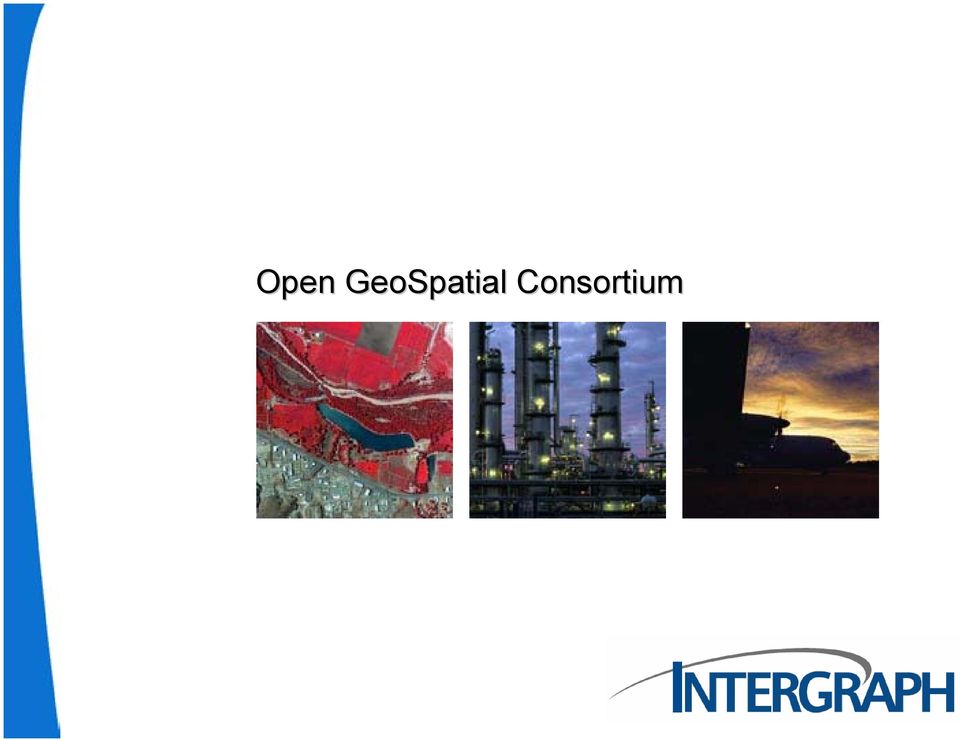
7 Open GeoSpatial Consortium
8 Principal members: 25th Septembre 1994 Autodesk, Inc. Boeing S&IS Mission Systems Department of Science & Technology ESRI GeoConnections Secretariat Google Intergraph Corporation MapInfo Corporation Northrop Grumman Corporation Oracle Inc. PCI Geomatics Inc. US Army Corps of Engineers (ACE) US Geological Survey (USGS) National Mapping Division
 US Geological Survey (USGS) National Mapping Division http://www.")
9 Intergraph s relation to OGC Intergraph is Founding and Principal member of the Open Geospatial Consortium Inc. (OGC). Intergraph takes an undeniable lead in supporting interoperable solutions that geo-enable mainstream IT and the Web. Intergraph s long-standing support of OGC, coupled with the top membership level, affirms its strong commitment to open geospatial interoperability. Intergraph s membership in OGC coincides with our commitment to provide open, extensible geospatial technology for mapping, GIS, and IT professionals in the global industries we serve, said Preetha Pulusani, President, Security, Government & Infrastructure and a member of the OGC board of directors. Intergraph provides significant resources over and above those provided by other members. Special functions include taking an active role in setting the direction of OGC technology specification activities and facilitating the use and acceptance of its technology in markets of strategic value to the OGC and its member organizations. Intergraph has entered into an agreement to work closely with the Consortium s members and staff to create special programs designed to enhance effectiveness in selected areas of OGC operation. Intergraph is dedicating a staff resource to OGC, focusing on advancing interoperability in the area of Critical Infrastructure Protection. Intergraph engages in strategic planning as a member of both the OGC Planning Committee and the OGC Strategic Advisory Committee. The company also participates in OGC Technical Committee programs to collaboratively define and approve spatial interface specifications that support interoperability.

10 Interoperability

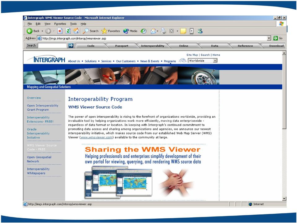
11 OGC Interoperability & Intergraph Interoperability Extensions - FREE! Applicatie interoperability met WMS, WFS, GML. Oracle Interoperability Initiative FREE! Data interoperability op Oracle Spatial (Oracle, LaserScan, Autodesk, MapInfo en Intergraph Interoperability Kit) Open Interoperability Grant Program bevorderen van interoperability initiatieven WMS Viewer Source Code - FREE Open Geospatial Network Interoperability Whitepapers Interoperability Program

12

13
14 WMS viewer

15 Web Map Service Desktop GIS Gemeente Nijmegen WMS Percelen 1832 WCS WFS WMSviewer WMS GBKN WCS WFS WMS Stadsplatte grond Meta Data: Beschrijving bron Beschikbare features Coördinaatsysteem Geografisch bereik WCS WFS

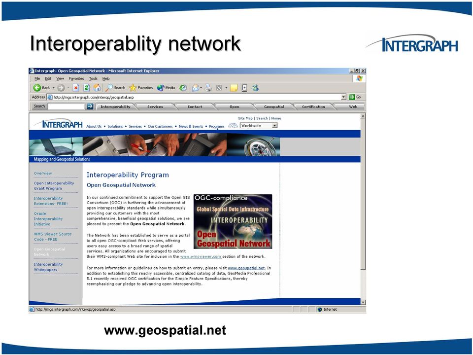
16 Interoperablity network
17 Interoperability (data) other.. Interoperability kit GML-dataserver GML NEN1878, ODBC, ASCII,

18 Interoperability (application) Other Desktop and Web applications WMS-, WFS dataserver Webservices (WFS, WMS) Other WMS, WFS Webservices Etc.
 Other WMS, WFS")
19 Service Oriented Architectuur (SOA) Enterprise applications Mobile applications File systems Desktop applications Portals Occasionally connected applications Databases Web Services Spatial applications

20 Interoperability & Intergraph Interoperability between products Other Desktop and and data Web applications WMS-, WFS dataserver Open architecture maximizes configuration flexibility and extendibility via customization Webservices (WFS, WMS) Other WMS, WFS Webservices Only SQL between you and your data Only a URL between you and the world s data sources Etc.

21 GML-relay
22 GML Relay Workflow 1 GML Dataserver Read-only 3 Export to GML 2 Read/Write dataserver IBM DB2 1. Direct connection to GML-file 2. Transfer to & modify in (geo)-warehouse 3. Export directly to GML-file
23 GML Relay Workflow 1 GML Dataserver Read-only 1. Direct connection to GML-file
24 GML Relay Workflow 1 GML Dataserver Read-only 2 Read/Write dataserver 1. Direct connection to GML-file 2. Transfer to (geo)-warehouse IBM DB2
25 IBM DB2
26
27 GML Relay Workflow 1 GML Dataserver Read-only 3 Export to GML 2 Read/Write dataserver 1. Direct connection to GML-file 2. Modify in (geo)-warehouse IBM DB2 3. Export directly to GML-file
28 Export to GML
29 Batton transfer to..
GeoMedia & Geostandaarden. Frank Langelaan
 GeoMedia & Geostandaarden Frank Langelaan Invloeden van standaarden 2 Industrie trends 3 Technolgie trends 4 5 Architectuur trends Keeping up with advances in hardware and operating systems Windows XP
Introduction to Geospatial Web Services
 Geospatial Web Services Introduction to Geospatial Web Services An introduction and inventory of geospatial web services and their importance to interoperability in the geospatial domain. vers. 20100604
The GeoMedia Architecture Advantage. White Paper. April 2002. The GeoMedia Architecture Advantage Page 1
 The GeoMedia Architecture Advantage White Paper April 2002 The GeoMedia Architecture Advantage Page 1 Introduction What is wrong with GIS? GIS is primarily about data not software. Data should be independent
ArcGIS. Server. A Complete and Integrated Server GIS
 ArcGIS Server A Complete and Integrated Server GIS ArcGIS Server A Complete and Integrated Server GIS ArcGIS Server enables you to distribute maps, models, and tools to others within your organization
Pennsylvania Geospatial Data Sharing Standards (PGDSS) V 2.5
 V 2.5") Submitted to: Pennsylvania Geospatial Data Sharing Standards (PGDSS) V 2.5 Spatial Data Migration Tools Report May 2, 2007 Table of Contents 1.0 Document Purpose...B-1 2.0 Overview of Spatial Data Migration
Submitted to: Pennsylvania Geospatial Data Sharing Standards (PGDSS) V 2.5 Spatial Data Migration Tools Report May 2, 2007 Table of Contents 1.0 Document Purpose...B-1 2.0 Overview of Spatial Data Migration
Leveraging Geospatial Information Across the Enterprise: Bentley s Flexible Geospatial Approach
 Leveraging Geospatial Information Across the Enterprise: Bentley s Flexible Geospatial Approach A Bentley White Paper Gijsbert Noordam Product Manager Nicolas Loubier Senior Product Manager July 2012 www.bentley.com
GeoMedia Product Update. Title of Presentation. Lorilie Barteski October 15, 2008 Edmonton, AB
 Product Update Title of Presentation Lorilie Barteski Edmonton, AB Know the audience poll Existing /Pro users Version 6.1 Version 6.0 Version 5.2 or earlier Existing WebMap users Version 6.1 Version 6.0
Y R T S TransporTaTion U D IN solutions
 I N D U S T R Y Transportation Solutions Keeping people and products moving safely and efficiently In a world of constant change, keeping people and products moving safely and efficiently is a complex,
Leveraging Geospatial Information Across the Enterprise: Bentley s Flexible Geospatial Approach
 Leveraging Geospatial Information Across the Enterprise: Bentley s Flexible Geospatial Approach A Bentley White Paper Gijsbert Noordam Senior Consultant, Geospatial Center of Excellence www.bentley.com
Solutions for Central and Federal Governments
 Solutions for Central and Federal Governments Intergraph s Advanced Geospatial Solutions for for Central and Federal Government Operations Central and federal governments are continually asked to do more
Web and Mobile GIS Applications Development
 Web and Mobile GIS Applications Development Presented by : Aamir Ali Manager Section Head (GIS Software Customization) Pakistan Space and Upper Atmosphere Research Commission (SUPARCO) Geographical Information
County of Los Angeles. Chief Information Office Preferred Technologies for Geographic Information Systems (GIS) September 2014
 September 2014") County of Los Angeles Chief Information Office Preferred Technologies for Geographic Information Systems (GIS) September 2014 CIO Preferred Technologies for GIS This document lists the preferred Geographic
County of Los Angeles Chief Information Office Preferred Technologies for Geographic Information Systems (GIS) September 2014 CIO Preferred Technologies for GIS This document lists the preferred Geographic
ArcGIS Framework Plug-In: Extending the ArcGIS Desktop for ANSI Standard Framework Data to Support Government Decision Making
 ArcGIS Framework Plug-In: Extending the ArcGIS Desktop for ANSI Standard Framework Data to Support Government Decision Making Final Project Report October 28, 2008 Agreement Number Organization Project
About scope of OpenGIS technology in oceanographic data management and visualization Andrey V. Golik, Vitaly K. Fischenko, Stepan G.
 About scope of OpenGIS technology in oceanographic data management and visualization Andrey V. Golik, Vitaly K. Fischenko, Stepan G. Antushev V.I.Il ichev Pacific Oceanological Institute Far-Eastern Branch
Green Move Web Viewer: critical issues and implementation
 GIT Geology and Information Technology 8a Riunione del Gruppo di Geologia informatica Sezione della Società Geologica Italiana Chiavenna, 17-19 giugno 2013 Polo Territoriale di Como Laboratorio di Geomatica
Interoperable Solutions in Web-based Mapping
 ISPRS SIPT IGU UCI CIG ACSG Table of contents Table des matières Authors index Index des auteurs Search Recherches Exit Sortir Interoperable Solutions in Web-based Mapping Marta Wojnarowska and Bridget
ArcGIS Server Implementation HIGHS and lows
 ArcGIS Server Implementation HIGHS and lows GIS-T March 2011 Eric Abrams Iowa DOT Eric.abrams@dot.iowa.gov Agenda The Problem Timeline Future Discussion/Questions The Problem - 2006 How does Iowa DOT integrate
Introduction to the Mapbender OWS Security Proxy
 Introduction to the Mapbender OWS Security Proxy Arnulf Christl, WhereGroup GmbH & Co. KG, Bonn, Germany 1/16 Agenda 1 Introduction to the Architecture OWS from Bottom Up with the OSGeo SDI Software Stack
EXPLORING AND SHARING GEOSPATIAL INFORMATION THROUGH MYGDI EXPLORER
 EXPLORING AND SHARING GEOSPATIAL INFORMATION THROUGH MYGDI EXPLORER Subashini Panchanathan Malaysian Centre For Geospatial Data Infrastructure ( MaCGDI ) Ministry of National Resources and Environment
How To Use Gis
 Welcome Understanding Purpose Creating Relationships You A Global Community of GIS Professionals Changing the World Together Applying Geography Everywhere Your WORK Showcasing Your Web Apps Vision Applying
An Esri White Paper June 2011 ArcGIS for INSPIRE
 An Esri White Paper June 2011 ArcGIS for INSPIRE Esri, 380 New York St., Redlands, CA 92373-8100 USA TEL 909-793-2853 FAX 909-793-5953 E-MAIL info@esri.com WEB esri.com Copyright 2011 Esri All rights reserved.
MSDI: Workflows, Software and Related Data Standards
 MSDI: Workflows, Software and Related Data Standards By Andy Hoggarth October 2009 Introduction Leveraging SDI principles for hydrographic operational efficiency French INFRAGEOS example (SHOM - Service
INSPIRE in practice: Experiences with INSPIRE data and services
 INSPIRE in practice: Experiences with INSPIRE data and services Peter Parslow Principal Geographic Information Architect June 2014: ISO TC211 Standards in Practice workshop What s INSPIRE? European Commission
13 th EC GI & GIS Workshop WIN: A new OGC compliant SOA. for risk management. GMV, 2007 Property of GMV All rights reserved
 13 th EC GI & GIS Workshop WIN: A new OGC compliant SOA for risk management GMV, 2007 Property of GMV All rights reserved Content 1. Introduction 2. Objectives 3. Architecture and Model 4. Technical aspects
Data Integration for ArcGIS Users Data Interoperability. Charmel Menzel, ESRI Don Murray, Safe Software
 Data Integration for ArcGIS Users Data Interoperability Charmel Menzel, ESRI Don Murray, Safe Software Product overview Extension to ArcGIS (optional) Jointly developed with Safe Software Based on Feature
Data interchange between Web client based task controllers and management information systems using ISO and OGC standards
 Data interchange between Web client based task controllers and management information systems using ISO and OGC standards Michael Nørremark 1*, Ole Jørgensen 1, Jens Bligaard 2 and Claus G. Sørensen 1
Geospatially Enabling the World: The Convergence of Geospatial and Architectural and Engineering Design
 Geospatially Enabling the World: The Convergence of Geospatial and Architectural and Engineering Design Geoff Zeiss Director of Technology Autodesk Map Middle East Dubai 2007 1 Overview Geospatial inflection
ArcGIS : Engineered for Interoperability
 ArcGIS : Engineered for Interoperability An ESRI White Paper January 2006 ESRI 380 New York St., Redlands, CA 92373 8100, USA TEL 909 793 2853 FAX 909 793 5953 E MAIL info@esri.com WEB www.esri.com Copyright
Distributed Computing. Mark Govett Global Systems Division
 Distributed Computing Mark Govett Global Systems Division Modeling Activities Prediction & Research Weather forecasts, climate prediction, earth system science Observing Systems Denial experiments Observing
Open Source GIS The Future?
 Open Source GIS The Future? Daniel Morissette DM Solutions Group Inc. Open Source Licensing No licensing costs Unlimited rights to: Use the software View and analyse the source Copy, reuse in other systems
Enterprise GIS Solutions to GIS Data Dissemination
 Enterprise GIS Solutions to GIS Data Dissemination ESRI International User Conference July 13 17, 2009 Wendy M. Turner Senior GIS Engineer & Program Manager Freedom Consulting Group, LLC Building the Enterprise
Open spatial data platform for visualization and analytics of geospatial data
 Open spatial data platform for visualization and analytics of geospatial data Bill Simpson-Young Director, Engineering and Technology Development, NICTA. Co-founder, Terria. Geospatial World Forum, 25
UK Location Programme
 Location Information Interoperability Board Data Publisher How To Guide Understand the background to establishing an INSPIRE View Service using GeoServer DOCUMENT CONTROL Change Summary Version Date Author/Editor
Vision. South Pacific GIS/RS Conference 2015 11/17/2015. Applying Geography Everywhere. Applying Geography Everywhere
 South Pacific GIS/RS Conference 2015 Applying Geography Everywhere Jithen (J) Singh Eagle Technology Group Ltd (Esri New Zealand) Suva, Fiji Vision Applying Geography Everywhere 1 GIS Is Evolving A Whole
A Web Service based U.S. Cropland Visualization, Dissemination and Querying System
 A Web Service based U.S. Cropland Visualization, Dissemination and Querying System Rick Mueller, Zhengwei Yang, and Dave Johnson USDA/National Agricultural Statistics Service Weiguo Han and Liping Di GMU/Center
Distributed System Architectures, Standardization, and Web-Service Solutions in Precision Agriculture
 1 Distributed System Architectures, Standardization, and Web-Service Solutions in Precision Agriculture KATJA POLOJÄRVI Oulu University of Applied Sciences, School of Renewable Natural Resources, Oulu,
Geospatial Information Management with Autodesk MapGuide and Oracle9i
 Geospatial Information Management with Autodesk MapGuide and Introduction This paper presents the value and benefits of the integrated Autodesk MapGuide / Spatial Information Management Solution, which
AN INTEGRATED SOLUTION FOR MANAGING EXPLORATION DATA
 www.wipro.com AN INTEGRATED SOLUTION FOR MANAGING EXPLORATION DATA Sandipan Chakraborti, Senior Architect ENU Table of Contents 03... Introduction 04... Lack of Holistic View 06... Figure 1: Conceptual
CubeWerx USA. Role-based Access Control. Best Practices for Geospatial SOA. 2008 NSDI CAP Project. 2007, CubeWerx USA
 Role-based Access Control Best Practices for Geospatial SOA 2008 NSDI CAP Project Key Points Participants, Scope and Objectives Project Design Best Practices Use Case Examples Participants U.S. Army Corps
OPEN STANDARD WEB SERVICES FOR VISUALISATION OF TIME SERIES DATA OF FLOOD MODELS
 OPEN STANDARD WEB SERVICES FOR VISUALISATION OF TIME SERIES DATA OF FLOOD MODELS Barend Köbben FRMRC RPA 7 Workshop visualisations and flow simulations as flood risk communication tools
Cloud Computing and Government Services August 2013 Serdar Yümlü SAMPAŞ Information & Communication Systems
 eenviper White Paper #4 Cloud Computing and Government Services August 2013 Serdar Yümlü SAMPAŞ Information & Communication Systems 1 Executive Summary Cloud computing could revolutionise public services
Standards based spatial data management, GIS and web mapping. Spatial data management, analysis & sharing the free & easy way!
 or Spatial data management, analysis & sharing the free & easy way! Premise: Traditional GIS is inherently flawed, especially when it comes to many fisheries/maritime datasets Premise: Traditional GIS
 Development tools to create Web-GIS applications DbMAP ASJ the best solution to easily publish GIS data from existing spatial databases and distributed GIS data sources Easily designs, produces, and publishes
Bryan Tuft Sr. Sales Consultant Global Embedded Business Unit bryan.tuft@oracle.com
 Bryan Tuft Sr. Sales Consultant Global Embedded Business Unit bryan.tuft@oracle.com Agenda Oracle Approach Embedded Databases TimesTen In-Memory Database Snapshots Q&A Real-Time Infrastructure Challenges
Publishing geospatial data to the web using the EEA infrastructure
 Publishing geospatial data to the web using the EEA infrastructure *Note: Map Services should be published using the EEA Map Services Tick Sheet for guidance. Contact Sebastien Petit (Sebastien.Petit@eea.europa.eu)
Oklahoma s Open Source Spatial Data Clearinghouse: OKMaps
 Oklahoma s Open Source Spatial Data Clearinghouse: OKMaps Presented by: Mike Sharp State Geographic Information Coordinator Oklahoma Office of Geographic Information MAGIC 2014 Symposium April 28-May1,
Data Visualization Using Web GIS Software
 Data Visualization Using Web GIS Software Tuomas Peltonen Radiation and Nuclear Safety Authority (STUK), Finland NKS NordDSS Workshop, Copenhagen, 1.-2.10.2009 RADIATION AND NUCLEAR SAFETY AUTHORITY Preface
Intergraph Roadway Information Management Solution. Title Title. Title Title. A White Paper
 Intergraph Roadway Information Management Solution A White Paper Security, Government & Infrastructure, a division of Intergraph Title Title Title Title Table of Contents 1. Introduction... 1 2. Intergraph
Design Requirements for an AJAX and Web-Service Based Generic Internet GIS Client
 11th AGILE International Conference on Geographic Information Science 2008 Page 1 of 6 Design Requirements for an AJAX and Web-Service Based Generic Internet GIS Client Edward Nash 1, Peter Korduan 1,
Managing a Geographic Database From Mobile Devices Through OGC Web Services
 Managing a Geographic Database From Mobile Devices Through OGC Web Services Nieves R. Brisaboa 1, Miguel R. Luaces 1, Jose R. Parama 1, and Jose R. Viqueira 2 1 Database Laboratory, University of A Coruña,
Spanish examples IPR: Up to Date & Zones
 Spanish examples IPR: Up to Date & Zones 1 Spanish IPR examples We have chosen the open source option: Python Why Python? Easy to learn and understand for not it people and code can be freely used and
CDI/THREDDS Interoperability: the SeaDataNet developments. P. Mazzetti 1,2, S. Nativi 1,2, 1. CNR-IMAA; 2. PIN-UNIFI
 CDI/THREDDS Interoperability: the SeaDataNet developments P. Mazzetti 1,2, S. Nativi 1,2, 1. CNR-IMAA; 2. PIN-UNIFI Outline Interoperability Issues in SeaDataNet A broker solution for CDI/THREDDS interoperability
MAY 18, 2015 ARCGIS 10.3.1 FOR SERVER FUNCTIONALITY MATRIX
 MAY 18, 2015 ARCGIS 10.3.1 FOR SERVER FUNCTIONALITY MATRIX Copyright 2015 Esri All rights reserved. Printed in the United States of America. The information contained in this document is the exclusive
Open Source Visualisation with ADAGUC Web Map Services
 Open Source Visualisation with ADAGUC Web Map Services Maarten Plieger Ernst de Vreede John van de Vegte, Wim Som de Cerff, Raymond Sluiter, Ian van der Neut, Jan Willem Noteboom 1 ADAGUC project Cooperative
Secure your GIS. Protecting GIS applications suites. camptocamp / 9. septembre 2010 / www.camptocamp.com / info@camptocamp.com
 Secure your GIS Protecting GIS applications suites camptocamp / 9. septembre 2010 / www.camptocamp.com / info@camptocamp.com Outline - Camptocamp SA - Introduction Green field Heterogenous FOSS applications
gvsig: A GIS desktop solution for an open SDI.
 gvsig: A GIS desktop solution for an open SDI. ALVARO ANGUIX1, LAURA DÍAZ1, MARIO CARRERA2 1 IVER Tecnologías de la Información. Valencia, Spain. Tel. +34 96 316 34 00; Fax. +34 96 316 34 00 Email: alvaro.anguix@iver.es
Building a Spatial Database in PostgreSQL
 Building a Spatial Database in PostgreSQL David Blasby Refractions Research dblasby@refractions.net http://postgis.refractions.net Introduction PostGIS is a spatial extension for PostgreSQL PostGIS aims
WP6. e-soter Web Services: Status and Way Ahead to a Global Soil Information Service Yusuf YIGINI EU Joint Research Centre
 e-soter Regional pilot platform as EU contribution to a Global Soil Observing System WP6. e-soter Web Services: Status and Way Ahead to a Global Soil Information Service Yusuf YIGINI EU Joint Research
Choosing the right GIS framework for an informed Enterprise Web GIS Solution
 13 ANNUAL INTERNATIONAL CONFERENCE AND EXHIBITION ON GEOSPATIAL INFORMATION TECHNOLOGY AND APPLICATIONS Epicentre; Gurgaon, India; 19-21 January, 2010 Choosing the right GIS framework for an informed Enterprise
EMC Documentum #1 Ranked ECM technology for Oil & Gas From Basic ECM needs to E&P Content Aware solutions
 EMC Documentum #1 Ranked ECM technology for Oil & Gas From Basic ECM needs to E&P Content Aware solutions 1 Energy & Engineering Sector Market Leadership o Industry Validation ECM Leader in Gartner s Magic
Solution. SmartPlant. Leveraging the Engineering Design Basis Across the Plant Life Cycle
 Solution Enterprise FOR owner Operators Leveraging the Engineering Design Basis Across the Plant Life Cycle BUSINESS CASE Owner operators currently face unprecedented demands to: Deliver multiple new
SDI at Grontmij. Ronald van Lanen
 SDI at Grontmij Ronald van Lanen Content 2 Introduction Grontmij overview Metadata in the Netherlands Pause Case I Roles of organizations Asset management and SDI Case II Best practice in projects Discussion
PDOK Kaart, the Dutch Mapping API
 PDOK Kaart, the Dutch Mapping API Haico van der Vegt*, Leo van der Sluijs* * Cadastre, Land Registry and Mapping Agency of the Netherlands Abstract. PDOK (public services on the map) is a partnership of
GeoMedia Smart Client
 GEOSPATIAL GeoMedia Smart Client Dynamically Jumpstart Your GIS GeoMedia Smart Client Is your geographic information system (GIS) at a gridlock, stuck in a department, limited to a few, contained and
Curriculum Path & Training Guidelines
 Curriculum Path & Training Guidelines Intergraph recommends that SmartPlant Foundation (SPF) users select one of the following training tracks described below. 1. SPF Administrator For those interested
Open Source Geospatial: An Alternative Business Model for Municipal Governments
 Open Source Geospatial: An Alternative Business Model for Municipal Governments Dave McIlhagga DM Solutions Group 30 Rosemount Ave. Suite 200 Ottawa, Ontario, Canada K1Y 1P4 dmcilhagga@dmsolutions.ca Geoff
Centre for EcologicalNoosphere Studies NAS RA CENS
 SCOPES 2009-2012 Scientific Co-operation between Eastern Europe and Switzerland Accessing Armenian Environmental data through CENS Spatial Data Infrastructure Centre for EcologicalNoosphere Studies NAS
The ORIENTGATE data platform
 Seminar on Proposed and Revised set of indicators June 4-5, 2014 - Belgrade (Serbia) The ORIENTGATE data platform WP2, Action 2.4 Alessandra Nuzzo, Sandro Fiore, Giovanni Aloisio Scientific Computing and
IBM asset and service management solutions White paper. Geospatially enabled asset and service management.
 IBM asset and service management solutions White paper Geospatially enabled asset and service management. December 2007 2 Contents 2 Executive summary 3 Introduction 5 GIS and asset and service management
Sextant. Spatial Data Infrastructure for Marine Environment. C. Satra Le Bris, E. Quimbert, M. Treguer
 Sextant On-Line information system for marine geographical information E. Quimbert, M. Bellouis, F. Lecuy, M. Treguer Centre de Bretagne BP 70, Plouzané 29280 France E-mail: sextant@ifremer.fr Sextant
Internet GIS and Geospatial Web Services
 Internet GIS and Geospatial Web Services Introduction Section 1 -- What is Internet GIS? Section 2 -- Internet GIS: state of practice Section 3 -- Future development of Internet GIS Section 4 -- Function
IBM Informix. Reference Documentation on Why Informix Spatial for GIS Projects
 IBM Informix Reference Documentation on Why Informix Spatial for GIS Projects Page 1 of 10 Contents Compliant with OGC... 3 Addressing the SQL standards... 3 Native Spatial, Intuitive Data Types... 3 Powerful
ACTIVITY & LOCATION BASED ANALYTICS APPLICATIONS
 ACTIVITY & LOCATION BASED ANALYTICS APPLICATIONS SEAMLESS, REAL TIME MERGING OF GIS AND ERP SYSTEMS ALLOWING THE VISUALIZATION OF RELATIONSHIPS, CONNECTIONS AND PATTERNS IN THE DATA FOR INTELLIGENT, INFORMED
Implementing ArcGIS for SharePoint Habitat for Humanity of Omaha April, 2013
 Ingenuity Innovation Integrity Implementing ArcGIS for SharePoint Habitat for Humanity of Omaha April, 2013 1851 Alexander Bell Drive Suite 350 Reston, VA 20191 703.463.2059 800.483.2434 www.vistronix.com
Cloud-based Infrastructures. Serving INSPIRE needs
 Cloud-based Infrastructures Serving INSPIRE needs INSPIRE Conference 2014 Workshop Sessions Benoit BAURENS, AKKA Technologies (F) Claudio LUCCHESE, CNR (I) June 16th, 2014 This content by the InGeoCloudS
OPEN BIM and the future: BIM and GIS integration. Building the DND Real Property Spatial Data Framework
 OPEN BIM and the future: BIM and GIS integration Building the DND Real Property Spatial Data Framework Assistant Deputy Minister (Infrastructure & Environment) Director Real Property Planning Director
Editing Strategies for Enterprise Geodatabase
 Federal GIS Conference February 9 10, 2015 Washington, DC Editing Strategies for Enterprise Geodatabase Ty Fabling Esri Solution Engineer A Complete Platform Enabling GIS Everywhere Desktop Web Device
Leveraging Cloud-Based Mapping Solutions
 Leveraging Cloud-Based Mapping Solutions GeoAlberta October 28, 2014 Laura Kerssens Safe Software Agenda To the Cloud Using Basic Services Cloud Applications Web Services Cloud-Hosted Databases Real-time
GetLOD - Linked Open Data and Spatial Data Infrastructures
 GetLOD - Linked Open Data and Spatial Data Infrastructures W3C Linked Open Data LOD2014 Roma, 20-21 February 2014 Stefano Pezzi, Massimo Zotti, Giovanni Ciardi, Massimo Fustini Agenda Context Geoportal
Standardized data sharing through an open-source Spatial Data Infrastructure: the Afromaison project
 Standardized data sharing through an open-source Spatial Data Infrastructure: the Afromaison project Yaniss Guigoz - University of Geneva/GRID-Geneva 1 EcoARM2ERA and AFROMAISON Why Afromaison in this
Deploying ArcGIS for Server Using Managed Services
 Deploying ArcGIS for Server Using Managed Services Andrew Sakowicz Erin Ross Sridhar Karra Agenda Introduction Program Overview - Overview - Methodology - Tools Customer Deployments - Architecture and
National Geothermal Data System and Global Geosciences Data Integration
 National Geothermal Data System and Global Geosciences Data Integration Lee Allison, AZGS Stephen Richard, AZGS Arlene Anderson, US DOE David Cuyler, US DOE & Sandia Natl Lab NERC 2008 Outline Rational
Creating Service Definition file while disconnected from the server
 Service Definition File Creating Service Definition file while disconnected from the server When disconnected from the server you will configure your service definition with no available connection to
About As. In a team with the best. ESRI Bulgaria is the exclusive distributor of Esri Inc. for Bulgaria. Esri Inc.
 About As ESRI Bulgaria is an IT company, leader in the field of Geographic Information Systems (GIS) on the Bulgarian market. Offering the most advanced high-tech products, solutions and services, ESRI
ACE GIS Project Overview: Adaptable and Composable E-commerce and Geographic Information Services
 ACE GIS Project Overview: Adaptable and Composable E-commerce and Geographic Information Services José Poveda, Michael Gould, Carlos Granell 64 Departamento de Lenguajes y Sistemas Informáticos Universitat
A Web services solution for Work Management Operations. Venu Kanaparthy Dr. Charles O Hara, Ph. D. Abstract
 A Web services solution for Work Management Operations Venu Kanaparthy Dr. Charles O Hara, Ph. D Abstract The GeoResources Institute at Mississippi State University is leveraging Spatial Technologies and
GEOSPATIAL SERVICE PLATFORM FOR EDUCATION AND RESEARCH
 GEOSPATIAL SERVICE PLATFORM FOR EDUCATION AND RESEARCH Jianya Gong, Huayi Wu, Wanshou Jiang, Wei Guo, Xi Zhai, Peng Yue State Key Laboratory of Information Engineering in Surveying, Mapping and Remote
GEOCOM PROJECT INTEGRATING DATA & TECHONOLOGIES
 GEOCOM PROJECT INTEGRATING DATA & TECHONOLOGIES Lucio Colaiacomo Chief Technology Officer l.colaiacomo@eusc.europa.eu Rationale for the project Providing support through our domain background & tech. expertise
ishare in the Cloud Service Definition v5.0
 Service Definition v5.0 An overview of ishare in the Cloud ishare is an end to end Enterprise GIS for public sector comprising a spatial data warehouse, rich functionality browser based GIS including editing
Integrating AJAX Approach into GIS Visualization Web Services
 Integrating AJAX Approach into GIS Visualization Web Services Ahmet Sayar 1, 2, *, Marlon Pierce 1 1, 2, 3, 4 and Geoffrey Fox 1 Community Grids Lab, Indiana University, Bloomington, Indiana, 47404, USA
GeoNetwork, The Open Source Solution for the interoperable management of geospatial metadata
 GeoNetwork, The Open Source Solution for the interoperable management of geospatial metadata Ing. Emanuele Tajariol, GeoSolutions Ing. Simone Giannecchini, GeoSolutions GeoSolutions GeoSolutions GeoNetwork
African European Georesources Observation System
 African European Georesources Observation System Spatial Data Infrastructure (SDI) Dr. Andreas Barth, Bernd Torchala Beak, Germany Outline Project Overview AEGOS SDI data / services hardware / software
Off-the-shelf Packaged Software Systems And Custom Software Analysis By Gamal Balady MASS Group, Inc.
 Off-the-shelf Packaged Software Systems And Custom Software Analysis By Gamal Balady MASS Group, Inc. April 1, 2004 1 Presentation Overview I. Packaged Software Systems vs. Custom Software Systems II.
Spatial RDBMS: A Key to Increased ROI WHITE PAPER. Ash Vadujkar Asia Pacific Product Manager, Pitney Bowes MapInfo Corporation
 Spatial RDBMS: A Key to Increased ROI WHITE PAPER Ash Vadujkar Asia Pacific Product Manager, Pitney Bowes MapInfo Corporation WHITE PAPER Spatial RDBMS: A Key to Increased ROI 2 ABSTRACT MAPINFO SPATIALWARE
Integrated Facility Planning using BIM Web Portals
 Author: Kimon G. Onuma, AIA, Onuma, Inc., KG@onuma.com Co-author: Dianne Davis, AEC Infosystems, Inc., d.davis@aecinfosystems.com October 9, 2006 for The Federal Facilities Council of the National Academies,
WP 3. Elaboration database Architecture Features (Software Architecture Document)
") Architecture Features (Software Architecture Document) o Best in class solution, using EC recommendations for IT in this field o Implementation based on free open source o Based on OGC standards, high
Architecture Features (Software Architecture Document) o Best in class solution, using EC recommendations for IT in this field o Implementation based on free open source o Based on OGC standards, high
ERDAS APOLLO 2009. How to manage/catalog/share Raster & vector data. ERDAS, Inc. A Hexagon Company. All Rights Reserved 1
 ERDAS APOLLO 2009 How to manage/catalog/share Raster & vector data ERDAS, Inc. A Hexagon Company. All Rights Reserved 1 Here we are; Again Leica Geosystems Geospatial Imaging is now ERDAS, Inc. ERDAS,
DEVELOPMENT OF THE INTEGRATING AND SHARING PLATFORM OF SPATIAL WEBSERVICES
 DEVELOPMENT OF THE INTEGRATING AND SHARING PLATFORM OF SPATIAL WEBSERVICES Lan Xiaoji 1,2 Lu Guonian 1 Zhang Shuliang 1 Shi Miaomiao 1 Yin Lili 1 1. Jiangsu Provincial Key Lab of GIS Science, Nanjing Normal
LSD APC Part I Workshop Geographic Information System. Danny Yeung 14 November 2015
 LSD APC Part I Workshop Geographic Information System Danny Yeung 14 November 2015 Purposes To help LSD probationers to prepare for the LSD APC Part I Written Assessment to be held in December 2015. To
Correspondence can be sent to: GeoConnections Natural Resources Canada 615 Booth Street Ottawa, Ontario K1A 0E9
 Quick Guide for CGDI Service Compliance Testing and Performance Optimization May 12, 2009 Correspondence can be sent to: GeoConnections Natural Resources Canada 615 Booth Street Ottawa, Ontario K1A 0E9