Flood Recovery Update Boulder County Parks & Open Space
|
|
|
- Madlyn Ward
- 8 years ago
- Views:
Transcription


1 Flood Recovery Update Boulder County Parks & Open Space Girl Scouts help with restoration on St. Vrain Creek near Breach 1 Board of County Commissioners January 20, 2015

2 THE IMPACT OF THE FLOOD ON PARKS & OPEN SPACE 1. INFRASTRUCTURE REPAIRS ($21M) FEMA and State funded FEMA PWs to repair county-owned facilities: buildings, roads, parks, trails, reservoirs, and ditches 2. UNFUNDED AREAS OF URGENT NEED ($15M) Local match 12.5% of PW value Priority Waterways Recovery Projects (Comprehensive Creek Plans) Share of damage to ditches not receiving FEMA assistance (assessments) 3. EROSION, SEDIMENTATION & DEBRIS ON OPEN SPACE ($30M+) Damage to lands with agriculture uses and important ecosystem functions: croplands, uplands, pasture, riparian areas, and wetlands
 Share of damage to ditches not receiving FEMA assistance")
3 FEMA PROJECT WORKSHEETS 23 Project Worksheets (PWs) to: reimburse cost to repair eligible facilities Current obligated value of $21 million (FEMA 75%, State 12.5%, Local Match 12.5%) EMERGENCY ACTIONS ($1M); completed -Temporary repair of 3 breaches along St. Vrain Creek -Debris removal on Open Space that is also a hazard PARKS AND TRAILS ($3.5M) (Only Pella & Anne U White remain closed) -Trails -Trailheads -Access Roads -Buildings -Fencing RESERVOIRS AND DITCHES ($16.5M) Only those which the county owns and/or manages
 (Only Pella & Anne U White remain closed) -Trails -Trailheads -Access Roads -Buildings -Fencing RESERVOIRS AND DITCHES ($16.")

4 WORK COMPLETE HIGHLIGHTS ST. VRAIN WATERSHED Picture Rock Trail (Heil) St. Vrain Creek Initial Breach Repairs South Branch Ditch Repairs Ag Heritage Center Buildings LEFTHAND WATERSHED Heil / Geer Canyon Trailhead LoBo Trail / Niwot Area Trails Beech Access Road BOULDER CREEK WATERSHED Howell Ditch Assay Office Museum Grounds and Parking Betasso: Brick House & Four Mile Connector Boulder Canyon Trail Initial Repairs Walker Ranch Trails Walden/Heatherwood Trails ROCK CREEK/COAL CREEK WATERSHEDS Coal Creek Trail TN Willis Ditch Goodhue House Rock Creek Trail Meadowlark/Coalton Area Trails COUNTY WIDE EFFORTS Debris Removal Property Fencing

 Volunteers helped make it happen!")
5 Completed Trail/Trailhead Repairs 25 miles of trail reopened Cost = Approx. $1M Meadowlark Trail (Superior Area) Volunteers helped make it happen! Walker Ranch

6 HEIL VALLEY RANCH (PW = $136k) Property reopened last summer Trailhead entry, September 2013 Trailhead repairs, July 2014 Flood damage at creek on Wapiti Trail, September 2013 Low-water crossing repairs on Wapiti Trail, July 2014

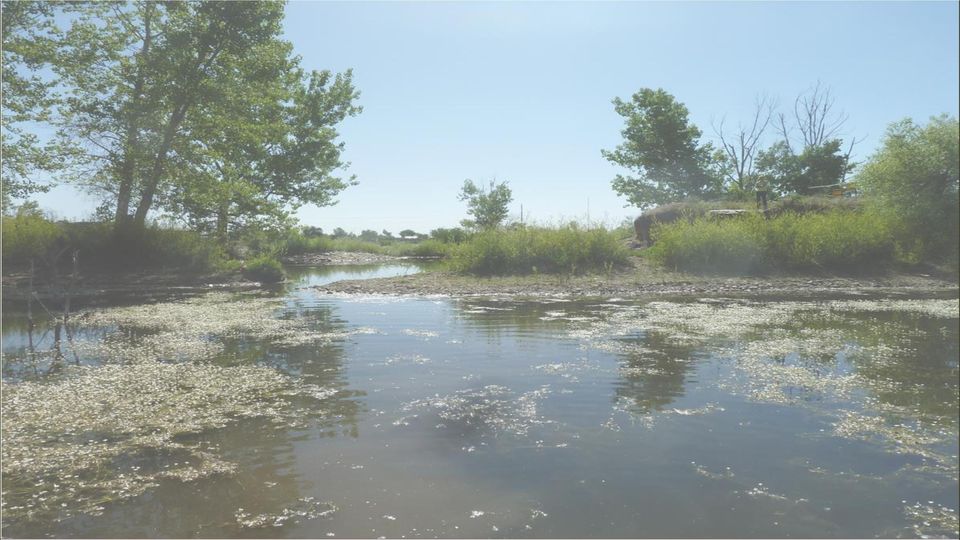
7 LEFTHAND WATERSHED CCP PROJECTS (unfunded) Ecosystem restoration progress (Pre-flood) Geer Canyon Drive, Heil Valley Ranch (with BC Transportation FEMA PW) Bielins-Hoch (Lefthand at 95 th, Longmont) Brewbaker (Oxford Rd. West of Haystack Mtn.)
 Brewbaker (Oxford Rd.")

8 BOULDER CANYON TRAIL Permanent Repairs

9 BOULDER CANYON TRAIL Complete March 2015; Cost $220K Crusher fines repairs occurring during January and February 2015

10 WALDEN PROJECT WORKSHEET: PW cost est. = $540k MAJOR REMAINING * * REPAIRS

11 WALDEN: Heatherwood Trail Completed Dec. 2014; Cost $200K

12 WALDEN: Breach Repairs To be completed in 2015; Cost $300k Bass/Cottonwood Breach Cottonwood/Wally T. Breach

13
 Provide for trail/maintenance")
14 PURPOSE OF LOW-WATER CROSSINGS AT BREACHES (FEMA HMP) Water level control for habitat/fisheries management Flood hazard mitigation in future event (constructed breach) Provide for trail/maintenance access
 Provide for trail/maintenance")
15 ANNE U WHITE TRAIL September 2013 January 2014

16 Pre-flood : Trailhead area

17 Pre-flood : Creek crossing (quaint)
")
18 Post-flood

19 ANNE U WHITE TRAIL PW cost est. = $220k NEXT STEPS - Spring 2015: Complete preliminary design for 1 ¼ mi of impacted trail - Permitting and Compliance (USFWS, FPD) - Construct 25 boulder low-water crossings - Trail reroutes in 11 locations - Repair parking area at end of Pinto Dr.

20 FOURMILE LINK BRIDGE (BETASSO) (Trail currently open during low flows when safe)

21 FOURMILE LINK BRIDGE (BETASSO) PW cost est. = $60k NEXT STEPS - Wait for spring flows to subside - Reconstruct abutments about 100 ft upstream - Using brute strength, lift and reset bridge (block and tackle) - Construct new approach trails - Fall 2015: Another ribbon cutting
22 ASSAY OFFICE MUSEUM Youth Corps at work in 2012 September 2013
23 ASSAY OFFICE MUSEUM PW Cost Est.=$85k NEXT STEPS - Water well design/build (2015) (Also coming: wildfire defensible space) New Parking Area Historic well (SHPO: preserve in-place)


24 RAMEY HOMESTEAD FEMA Ineligible NEXT STEPS - A priority unmet need for funding - First appeal response due in February from FEMA - Structural engineer selected - Engineering plans by Summer - Historic Preservation staff to complete repairs in-house - Grounds restoration plans to-be determined
 Repairs to")
 Critical")
25 BUFFALO GULCH (Rock Creek Farm area) Small Water Project ($28k) Repairs to enhance habitat protection for Species of Special Concern (CWH#78) Critical Wildlife Habitat
 Repairs to further enhance habitat diversity for SSCs associated with adjacent CWHs (e.g.")
26 BAILEY PONDS (Boulder Creek, near Kenosha & Hwy 52) Critical Wildlife Habitat Bailey Ponds Kenosha Heronry Kenosha Wetlands Small Water Project ($70k) (2016?; by staff ) Repairs to further enhance habitat diversity for SSCs associated with adjacent CWHs (e.g., eagle, heron, harrier and others) Lower Boulder Creek Restoration coming soon just upstream Pond 4 Boulder Creek
27 DITCH PROJECTS TN Willis Ditch CWCB Grant and FEMA PW ($65k) Project nearly complete Relocated headgate downstream onto county property (Warembourg-Lafayette; Coal Creek at Public Rd.) Hake Ditch Minor repairs ($5k) Staff completing work this week Erin Arsenault property (Superior area)
28 THE MIGHTY ST. VRAIN Hall Meadows * * * Hall 2/Andesite Mine WMobile/Braly/Ramey * * Pella/Marlatt Keyes and Peschel * *
29 THE MIGHTY ST. VRAIN (Hall II area) HALL II ANDESITE AREA Tier 1 CCP site Determine permanent location of creek first CWCB rec d and applying for CDBG-DR for Hall Meadows and Hall II (3.2 miles total) CCP Estimate for restoration work in reach = $14.6M (much on open space) -Hall II Access Road (PW = $260k) -Otto Ditch (PW = $318k); serves Hall Ranch
30 THE MIGHTY ST. VRAIN (Hall Meadows area) Holcomb Ditch and Mathews Ditch (PW=$120k) Served Hall Meadows, now gone Tier 1 CCP site Work with neighbors to determine permanent location of creek first Coordinate with Transportation on Old South St Vrain bridge and road ROAD HEADGATE?
31 PELLA CROSSING (PW = $3.4M) Repairs to trails, trailhead, and other amenities coming soon 5 reservoirs seriously impacted Sunset dam currently not eligible for FEMA assistance (As much as $1M of unmet need) Preliminary Engineering due at end of month Staff to develop recommendations/schedule in February Striving to open at least portions of property in 2015
 West Lake ($1M*) A-Frame Pond ($1M*) Clough & True Ditch ($1.")
32 THE MIGHTY ST. VRAIN (Hwy 36 to Hygiene Road) Breach 1 area ($2M) Breach 2 ($1.5K) South Branch ($400k*) Lake 2 ($2M) Lake 3 ($3M) Lake 4 ($10.3M*) West Lake ($1M*) A-Frame Pond ($1M*) Clough & True Ditch ($1.4M*) Ramey ($800k) Breaches 5 to 9 ($3M) TOTAL $27M (*only $14M funded) Developing two additional CDBG-DR grants for this corridor to address breach repair need
33 SOUTH BRANCH DITCH REPAIRS ($400k) - Project recently completed - Multiple partners - Became incorporated ditch - Collaborated on CWCB grant(s) - County-led design & construction
34 CLOUGH & TRUE DITCH REPAIRS (PW = $1.4M) - Breached in multiple locations - Considering Improved or Alternate - Supports Preble s habitat FEMA Project - Water Rights/Court Limit Alternatives
35 Lake 3
36 LAKE 4 AREA (PWs = $13.5M) A-Frame Pond Lake 3 West Lake Lake 4 Lake 4 ($10M) West Lake ($1M) A MASSIVE SCALE PROJECT A-Frame Pond ($1M) Ramey
37 LAKE 4 AREA (PWs = $14M) solution: use our staff of experts to plan for a more resilient future!
38 STATUS OF CURRENT FLOOD RECOVERY PROJECTS COMPLETE or ON-TRACK FOR COMPLETION THIS SUMMER WATER ENGINEERING WATER RESOURCES REC & FACILITIES AG/ECOSYSTEMS St Vrain Breaches W286 (Temporary repairs) Fairgrounds Inlet Ditch Heil Ranch Trailhead/Trail Alaska Site Logs (debris) staged for use in creek restoration South Branch Ditch repairs Hake Ditch Fourmile Link Bridge Debris removal operations Heron Outlet with Longmont at Pella Ditch system repairs (Non-FEMA) Boulder Canyon Trail LoBo Trail Plains/Mtns Trails Consultation support for PWs Prebles/USFWS CCPs and Stream Team participation AHC barns, Goodhue House, Betasso House, Ramey House
39 WORK COMPLETE HIGHLIGHTS ST. VRAIN WATERSHED Picture Rock Trail (Heil) St. Vrain Creek Initial Breach Repairs South Branch Ditch Repairs Ag Heritage Center Buildings LEFTHAND WATERSHED Heil / Geer Canyon Trailhead LoBo Trail / Niwot Area Trails Beech Access Road BOULDER CREEK WATERSHED Howell Ditch Assay Office Museum Grounds and Parking Betasso: Brick House & Four Mile Connector Boulder Canyon Trail Initial Repairs Walker Ranch Trails Walden/Heatherwood Trails ROCK CREEK/COAL CREEK WATERSHEDS Coal Creek Trail TN Willis Ditch Goodhue House Rock Creek Trail Meadowlark/Coalton Area Trails COUNTY WIDE EFFORTS Debris Removal Property Fencing
40 STATUS OF CURRENT FLOOD RECOVERY PROJECTS MEDIUM LEVEL OF PLANNING/DESIGN EFFORT REMAINS Likely able to complete construction in 2015; some interdependencies could slow things down. WATER RESOURCES REC & FACILITIES AG/ECOSYSTEMS Otto Ditch (1)(4) Walden Ponds Breaches (HMP) (1)(3)(4) Property Fencing (1) TN Willis Ditch (2)(4) Pella Crossing Trails (3)(4)(6) Pella- Webster Wetland (2)(3)(5) Buffalo Gulch (5) Anne U. White (1)(3)(5) Hall Meadows Planning Grant(2)(4)(5) Highland Rubicon (1)(2)(3)(4)(5) Assay Office Grounds(1)(3)(4) Dry Creek Trail (2) Stearns Outfall Crossing (HMP)(1)(2) Meadowlark Trail Area Restoration (2) INTERDEPENDENCY FACTORS (1) Requires version of PW to assure eligibility (2) Requires cooperation of project partner (3) Additional permitting may be needed (4) Relies on contracted services (5) Relies on specialized staff
41 STATUS OF CURRENT FLOOD RECOVERY PROJECTS PROJECTS WITH HIGH LEVEL OF PLANNING/DESIGN EFFORT REMAINS Construction completion in 2015 is uncertain; there are still a lot of issues to work through. WATER ENGINEERING WATER RESOURCES REC & FACILITIES AG/ECOSYSTEMS Breach 1 and 2 Permanent Repairs** (2)(3)(4)(5) Breach 5 to 9 Permanent Repairs** (2)(3)(4)(5)(6) Lake 4 (1)(2)(3)(4)(5)(6) A-Frame and West Lake (1)(2)(3)(4)(5)(6) Pella Crossing Reservoirs* (1)(2)(3)(4)(5) Clough and True Ditch (1)(3)(4)(6) Mathews and Holcomb Ditches* (1)(3)(4)(6) Bailey Ponds (1)(2)(4) Hall II Access Road* (1)(2)(4)(5) Ramey Homestead** (1)(2)(4)(5) Hall Meadows Restoration** (3)(4)(5)(6)(7) Hall II Restoration** (3)(4)(5)(6)(7) Western Mobile Area Creek Restoration** (3)(4)(5)(6)(7) Lake 2 and Lake 3** (3)(4)(5)(6)(7) Peschel, Longmont led, Sandstone Ranch area (1)(2)(3)(4)(5)(6)(7) Defensible Space Grant (2)(4)(5) **=Unfunded Priority Project *=Some elements unfunded (1) Requires version of PW to assure eligibility (2) Requires Engineering Design (3) Will need cooperation of project partner (4) Additional permitting will be needed (5) Relies on contracted services (6) Dependent on planning of other projects (7) Planning/Implementation known to be beyond 2016
42 SUMMARY OF FLOOD-RELATED EXPENDITURES Anticipated FEMA/State reimbursements (IFAS thru 12/2) 2015 (estimated) $240,000 $1,020,000 $9,500,000* Grants $0 $330,000 $600,000 Unmet Need $45,000 $250,000 $900,000 Total expenditures $285,000 $1,600,000 $11,000,000* * Includes St. Vrain Left Hand Water Conservancy District s 50% participation in repairs at Lake 4
43 Coming back stronger!!!
St. Vrain Watershed Master Plan Thursday, January 23 10:00 a.m. 12:15 p.m.
 St. Vrain Watershed Master Plan Thursday, January 23 10:00 a.m. 12:15 p.m. City Council Study Session Room City of Longmont Civic Center, 350 Kimbark Street, Longmont Minutes 1. Introductions a. Jeff Crane
Watersheds, Streams, & Highways: Resiliency in Disaster Recovery Through Partnerships and Innovation
 Watersheds, Streams, & Highways: Resiliency in Disaster Recovery Through Partnerships and Innovation Chris Sturm Colorado Water Conservation Board Stream Restoration Coordinator 303 866 3441 chris.sturm@state.co.us
ESCAMBIA COUNTY FLOOD RECOVERY: 1- YEAR ANNIVERSARY REPORT
 Joy D. Blackmon, P.E. Director, County Engineer Public Works Department ESCAMBIA COUNTY FLOOD RECOVERY: 1- YEAR ANNIVERSARY REPORT EXECUTIVE SUMMARY One year after the devastating April 2014 floods hit
Arapaho & Roosevelt National Forests 2013 Flood: Long-term Recovery in a Changed Landscape
 Arapaho & Roosevelt National Forests 2013 Flood: Long-term Recovery in a Changed Landscape Spring 2014 The flood of September 2013 changed the landscape of the Boulder and Canyon Lakes Ranger Districts.
The answers to some of the following questions are separated into two major categories:
 Following the recent flooding events for Front Range communities in Colorado, property owners, communities, and the National Flood Insurance Program are being presented with some new challenges in the
Disaster Recovery in Stages
 Disaster Recovery in Stages Reconstructing Lyons River Corridor St Vrain Creek and North/South Tributaries No Name Horseshoe Bend Two Rivers 2013 Flooding Damages: Over $50 million in damage to the Town
FLOOD RECOVERY RESOURCE GUIDE
 FLOOD RECOVERY RESOURCE GUIDE Winter 2014 For our residents who have been impacted by the flood, we are committed to helping you navigate the many steps towards recovery. We are engaged and involved in
Appendix A. Lists of Accomplishments and Project Costs. UMRWD 10 Year Plan Update. Appendix A UPPER MINNESOTA RIVER WATERSHED DISTRICT
 UPPER MINNESOTA RIVER WATERSHED DISTRICT Lists of Accomplishments and Project Costs 10 Year Plan Update UMRWD 10 Year Plan Update Page A 1 UMRWD LIST OF ACCOMPLISHMENTS Since its inception in 1967, the
Flood Risk Management
 Flood Risk Management Value of Flood Risk Management Every year floods sweep through communities across the United States taking lives, destroying property, shutting down businesses, harming the environment
Flood Risk Management
 Flood Risk Management Value of Flood Risk Management Value to Individuals and Communities Every year floods sweep through communities across the United States taking lives, destroying property, shutting
The Basics of Chapter 105 Waterways and Wetlands Permitting in PA
 The Basics of Chapter 105 Waterways and Wetlands Permitting in PA April 17, 2013 Goal To develop a basic understanding of PA Department of Environmental Protection (DEP) and US Army Corps of Engineers
Little Thompson Watershed Restoration Coalition (LTWRC) Floodplain Rehabilitation Planning Grant Application (Priority 2 of 3)
 Floodplain Rehabilitation Planning Grant Application (Priority 2 of 3)") Little Thompson Watershed Restoration Coalition (LTWRC) Floodplain Rehabilitation Planning Grant Application (Priority 2 of 3) #8 Describe the proposed purpose and scope of the plan, study, or analysis,
Little Thompson Watershed Restoration Coalition (LTWRC) Floodplain Rehabilitation Planning Grant Application (Priority 2 of 3) #8 Describe the proposed purpose and scope of the plan, study, or analysis,
Post-Flood Assessment
 Page 1 of 7 Post-Flood Assessment CHAPTER 4 AGENCY COORDINATION Agency coordination is an essential element for the operation of the flood management systems in the Central Valley. Due to the nature of
Colorado Department of Transportation. Flood Disaster Study Committee November 5, 2013
 Colorado Department of Transportation Flood Disaster Study Committee November 5, 2013 1 Immediate Goals Restore access by December 1, 2013 Temporary repairs to restore mobility Reconnect communities Long
Mission Creek Flood Control & Restoration Project. City of Fremont, Alameda County
 Mission Creek Flood Control & Restoration Project City of Fremont, Alameda County Agenda Background Why are proposed improvements necessary? Proposed project components Challenges Construction schedule/phasing
River Management 2013 Colorado Flood
 River Management 2013 Colorado Flood Damages, Countermeasures, Socio-Economic Impacts Miles Blair, Allen Chestnut, Hwayoung Kim, & Caroline Ubing CIVE 717 Spring 2014 Flood Statistics Sept 9 th 16 th,
Integrated Restoration Prioritization
 Integrated Restoration Prioritization Habitat Restoration and Environmental Monitoring Projects Section Restoration Services Division Definition Restoration Prioritization is a process of combining various
Background Information: The Mamquam River Floodplain Restoration Project
 Background Information: The Mamquam River Floodplain Restoration Project The Mamquam River Floodplain Restoration project is being undertaken in partnership with the Squamish River Watershed Society, Fisheries
Gold Ray Dam Interagency Technical Team Meeting
 Gold Ray Dam Interagency Technical Team Meeting Agenda Public Outreach, Funding, Monitoring EA/BA/Permit Updates Deconstruction Plans Fish Passage & Salvage Plan Hydraulic Modeling Next Steps Public Outreach,
Waldo Canyon Fire. Mark Shea Watershed Planning Supervisor August 23, 2012
 Mark Shea Watershed Planning Supervisor August 23, 2012 Fire Started: Saturday June 23, 2012 Fire Progression June 23 2500 acres June 24 3600 acres June 25 4500 acres June 26 15622 acres June 27-28
Urban Stream Restoration Defining the Full Benefits of a Project. Warren C. High MACTEC Engineering and Consulting
 Urban Stream Restoration Defining the Full Benefits of a Project Warren C. High MACTEC Engineering and Consulting Economics in the Decision Process Return on Investment Willingness to Pay Municipal Growth
Restoring Anadromous Fish Habitat in Big Canyon Creek Watershed. Summary Report 2002
 Restoring Anadromous Fish Habitat in Big Canyon Creek Watershed Summary Report 2002 DOE/BP-00005268-5 November 2002 This Document should be cited as follows: "Restoring Anadromous Fish Habitat in Big Canyon
Wildfire & Flash Flood Recovery Emergency Watershed Protection (EWP) Flood Mitigation Efforts April 2014. Fall 2013
 Flood Mitigation Efforts April 2014. Fall 2013") Wildfire & Flash Flood Recovery Emergency Watershed Protection (EWP) Flood Mitigation Efforts April 2014 Fall 2013 Recovery Specific to Incident Recovery Efforts Depend on: Population Impacted Topography
Wildfire & Flash Flood Recovery Emergency Watershed Protection (EWP) Flood Mitigation Efforts April 2014 Fall 2013 Recovery Specific to Incident Recovery Efforts Depend on: Population Impacted Topography
Final Report. Dixie Creek Restoration Project. Funded by Plumas Watershed Forum
 Final Report Dixie Creek Restoration Project Funded by Plumas Watershed Forum Plumas Corporation January 2009 1 Background FR-CRM staff presented this project to the Dixie Valley Landowners Association
WATERSHED COORDINATOR FOR FOURMILE WATERSHED COALITION
 Position Title: Watershed Coordinator Employment Status: Full-time, Salaried Reports To: Four Mile Fire Protection District Board Location: Salina Station Salary Range: $62,000 to $68,000 WATERSHED COORDINATOR
LEAGUE NOTES ON APPROVED COMMUNITY WATER SUPPLY PLAN
 1 AUGUST 2011 LEAGUE NOTES ON APPROVED COMMUNITY WATER SUPPLY PLAN KEY ELEMENTS OF THE PLAN: 1. Replace the existing unsafe Ragged Mountain dam with a new dam and raise the reservoir pool level initially
ANGORA FIRE RESTORATION PROJECT
 ANGORA FIRE RESTORATION PROJECT U.S. Forest Service LAKE TAHOE BASIN MANAGEMENT UNIT Duncan Leao Vegetation Management Planner Richard Vacirca Forest Aquatics Biologist 3 PHASES OF FIRE REHAB Phase I Rehab:
DRAFT SOUTH FORK SKYKOMISH RIVER
 DRAFT SOUTH FORK SKYKOMISH RIVER 9 levees and revetments / Approximately 1.1 miles of river bank are armored Revetments provide limited, localized erosion protection, but impact habitat Frequent and costly
DELAWARE COUNTY STREAM CORRIDOR MANAGEMENT PROGRAM TWO-YEAR ACTION PLAN FOR THE WEST BRANCH DELAWARE RIVER CANNONSVILLE RESERVOIR BASIN
 DELAWARE COUNTY STREAM CORRIDOR MANAGEMENT PROGRAM TWO-YEAR ACTION PLAN FOR THE WEST BRANCH DELAWARE RIVER CANNONSVILLE RESERVOIR BASIN May 2011 - April 2013 1. Introduction 2. Recommendations Table of
House Research Department General Fund Appropriations in Flood Relief Bills
 House Research Department General Fund Appropriations in Flood Relief Bills These tables included state funding from the major disaster bills enacted to respond to a disaster. Appropriations may have been
Chehalis River Basin Flood Damage Reduction 2013-2015 Capital Budget Approved by Legislature in June 2013
 Chehalis River Basin Flood Damage Reduction 2013-2015 Capital Budget Approved by Legislature in June 2013 1. Design alternatives for large capital flood projects (basinlevel water retention and Interstate
District 5 Ditch and Reservoir Flood Damage and Recovery Report:
 District 5 Ditch and Reservoir Flood Damage and Recovery Report: Last Updated: September 16, 2014 Disclaimer This report and all of its contents should be considered preliminary and provisional. The St
AN INITIATIVE TO IMPROVE
 L OW E R C A R M E L R I V E R A N D L AG O O N F L O O D P L A I N R E S TO R AT I O N A N D E N H A N C E M E N T P R O J E C T AN INITIATIVE TO IMPROVE FLOOD PROTECTION RESTORE AND PROTECT RIPARIAN
Emergency Conservation Program
 Materials Prepared for Federation of Southern Cooperatives Epes, Alabama September 11, 2009 Emergency Conservation Program by Karen R. Krub Farmers Legal Action Group, Inc. 360 North Robert Street, Suite
Lower Crooked Creek Watershed Conservation Plan EXECUTIVE SUMMARY
 EXECUTIVE SUMMARY Project Background Located in southwestern Pennsylvania, Crooked Creek is a major tributary of the Allegheny River, entering near Ford City in Armstrong County. It is rich in natural
CHAD R. GOURLEY SPECIALTY EMPLOYMENT
 CHAD R. GOURLEY P.O. Box 919 Verdi, Nevada 89439 phone 775.345.9960 cell 775.250.8140 chad_gourley at att.net SPECIALTY Restoration of riverine, spring, and wetland ecosystems, specializing in a process
PUBLIC NOTICE Application for Permit
 PUBLIC NOTICE Application for Permit 30-Day Notice Issue Date: June 20, 2016 Expiration Date: July 20, 2016 US Army Corps of Engineers No: NWP-2010-535 Oregon Department of State Lands No: 58311-RF Interested
Restoration Planning and Development of a Restoration Bank
 Restoration Planning and Development of a Restoration Bank Black Creek Pioneer Village, South Theatre 8:30 a.m. to 3:30 p.m. Habitat Restoration and Environmental Monitoring Projects Section Restoration
IMPROVING SOUTH FORK PEACHTREE CREEK WATERSHED USING THE TRIPLE BOTTOM LINE DEKALB COUNTY, GEORGIA
 IMPROVING SOUTH FORK PEACHTREE CREEK WATERSHED USING THE TRIPLE BOTTOM LINE DEKALB COUNTY, GEORGIA David Chastant AUTHORS:DeKalb County, 330 West Ponce De Leon Ave, Decatur, Georgia 30030 REFERENCE:Proceedings
General Permit for Activities Promoting Waterway - Floodplain Connectivity [working title]
![General Permit for Activities Promoting Waterway - Floodplain Connectivity [working title]](/thumbs/39/18645965.jpg "General Permit for Activities Promoting Waterway - Floodplain Connectivity [working title]") General Permit for Activities Promoting Waterway - Floodplain Connectivity [working title] Purpose These rules set forth the conditions under which a person may, without an individual removal-fill permit
General Permit for Activities Promoting Waterway - Floodplain Connectivity [working title] Purpose These rules set forth the conditions under which a person may, without an individual removal-fill permit
Arkansas River Corridor Vision & Master Plan
 A r k a n s a s R I v e r C o r r I d o r P l a n Arkansas River Corridor Vision & Master Plan July 2005 Indian Nations Council of Governments A r k a n s a s R I v e r C o r r I d o r P l a n Partnership
The 2007 Flood Relief Package and Natural Resources Grants
 2007 Special Session Fiscal Summary of Disaster Relief Money Matters 07.07 October 2007 Flood Relief...1 I-35W Bridge Disaster Relief...6 Other Statewide Disaster Relief...6 Fiscal Analysis Department
Small Dam Hazard Assessment Inventory
 Small Dam Hazard Assessment Inventory What would happen if your dam were to fail? This is a question that most dam owners hope they will never have to answer. However it is a question you, as a responsible
Angora Fire Restoration Activities June 24, 2007. Presented by: Judy Clot Forest Health Enhancement Program
 Angora Fire Restoration Activities June 24, 2007 Presented by: Judy Clot Forest Health Enhancement Program California Tahoe Conservancy Independent California State Agency within the Resources Agency Governed
Public Meeting #1 Summary
 Public Meeting #1 Summary DATE/TIME/LOCATION Wednesday May 14, 2014/4:00 7:00pm/Estes Park Museum, 200 Fourth Street, Estes Park, CO TAC AND PROJECT TEAM MEETING ATTENDEES Larimer County: Kyle Arend Town
Concepts for Post Flood River Corridor Restoration
 Concepts for Post-Flood River Corridor Restoration Dave Rosgen, P.H., Ph.D. Wildland Hydrology Fort Collins, Colorado A Special Thanks to our Sponsors: Copyright 2014 Wildland Hydrology 1 Workshop Goals
Lower Raritan Watershed Management Area Stormwater & Flooding Subcommittee Strategy Worksheet LRSW-S3C1
 Strategy Name: Reduce Existing Potential for Flood Damages LRSW-S3C1. Develop and implement a program to: Minimize flood damages through the use of structural measures. Minimize flood damages through the
Big Thompson River Restoration Coalition Best Practice Recommendations and Resources for river front land owners impacted by the flood.
 Big Thompson River Restoration Coalition Best Practice Recommendations and Resources for river front land owners impacted by the flood. The Big Thompson River Restoration Coalition (BTRRC) is a group of
King County Flood Hazard Management Plan Update Cedar/ Sammamish Rivers. Public Meeting December 5, 2012
 King County Flood Hazard Management Plan Update Cedar/ Sammamish Rivers Public Meeting December 5, 2012 Goals of the Presentation Cedar and Sammamish R. Plan Update Context - Brief summary info about the
Wildfire & Flash Flood Recovery NACo Justice & Public Safety Symposium January 2014
 Wildfire & Flash Flood Recovery NACo Justice & Public Safety Symposium January 2014 Fall 2013 Jim Reid Executive Director Public Service El Paso County, Colorado Recovery Specific to Incident Recovery
Untreated (left) and treated (right) Sierra Nevada forests in Amador County, CA. Photos: Sierra Nevada Conservancy
 and treated (right) Sierra Nevada forests in Amador County, CA. Photos: Sierra Nevada Conservancy") Case Study Mokelumne Watershed, CA and Santa Fe, NM Avoided Costs: The Economics of Watershed Restoration Forested headwaters are the source of much of the West s drinking water. Protecting and restoring
Case Study Mokelumne Watershed, CA and Santa Fe, NM Avoided Costs: The Economics of Watershed Restoration Forested headwaters are the source of much of the West s drinking water. Protecting and restoring
Assiniboine River and Lake Manitoba Basins Flood Mitigation Study: Providing Greater Protection For Manitobans From Flood Risks
 Assiniboine River and Lake Manitoba Basins Flood Mitigation Study: Providing Greater Protection For Manitobans From Flood Risks Welcome! Manitoba Infrastructure and Transportation is studying flooding
Passive Restoration 101: Framework and Techniques Overview. Amy Chadwick, Great West Engineering August 26, 2015 Butte, America
 Passive Restoration 101: Framework and Techniques Overview Amy Chadwick, Great West Engineering August 26, 2015 Butte, America What Defines Passive Restoration? Process-based, nature-driven Minimal equipment
Barre City City-wide Policy and Program Options
 Barre City (VERI Land Use Regulations Update policies allowing fill in flood hazard areas. RPC, DEC River Management, VLCT, Allowing landowners to elevate buildings using fill may help protect an individual
GROWER ADVISORY Agriculture Regulations of the Wetlands Protection Act
 Cape Cod Cranberry Growers Association GROWER ADVISORY Agriculture Regulations of the Wetlands Protection Act Cranberry Bogs and the Agricultural Exemption The Massachusetts Wetlands Protection Act (WPA)
 Coldwater Heritage Partnership Implementation Grant Final Report Morrison Run Watershed Restoration Project Western Pennsylvania Conservancy Project Summary The goal of the Morrison Run Watershed Restoration
STATE LEVEL AGREEMENT BETWEEN THE NATURAL RESOURCES CONSERVATION SERVICE (NRCS) AND THE NEW JERSEY OFFICE OF HISTORIC PRESERVATION
 AND THE NEW JERSEY OFFICE OF HISTORIC PRESERVATION") STATE LEVEL AGREEMENT BETWEEN THE NATRAL RESORCES CONSERVATION SERVICE (NRCS) AND THE NEW JERSEY OFFICE OF HISTORIC PRESERVATION PRPOSE The NRCS, and New Jersey State Historic Preservation Officer (SHPO)
STATE LEVEL AGREEMENT BETWEEN THE NATRAL RESORCES CONSERVATION SERVICE (NRCS) AND THE NEW JERSEY OFFICE OF HISTORIC PRESERVATION PRPOSE The NRCS, and New Jersey State Historic Preservation Officer (SHPO)
Revising the Nantahala and Pisgah Land Management Plan Preliminary Need to Change the Existing Land Management Plan
 Revising the Nantahala and Pisgah Land Management Plan Preliminary Need to Change the Existing Land Management Plan Throughout the Plan 1. There is a fundamental need for the revised plan to address how
Exhibit A CWCB FLOOD RECOVERY GRANT PROGRAM Statement of Work
 Exhibit A CWCB FLOOD RECOVERY GRANT PROGRAM Statement of Work Emergency Flood Recovery Assessment, Design and Recovery Project Description: The purpose of this grant is to provide technical assistance
Public Law 84-99 and Non-Structural Alternatives to Levee Repairs
 Public Law 84-99 and Non-Structural Alternatives to Levee Repairs Presented by: Mr. Jerry A. Skalak, CFM U.S. Army Corps of Engineers Rock Island District and Mr. Tom Oswald Iowa Homeland Security and
Salt Lake County June 2010 Flooding and Restoration
 Salt Lake County June 2010 Flooding and Restoration Little Cottonwood (LCC) and Big Cottonwood (BCC) Kade Moncur, PE, CFM Salt Lake County Engineering August 10 th - 12 th SLCo Symposium 2011 August 10
Community Workshop 5. Overarching Goals for Machado Lake Ecosystem and Wilmington Drain Multi-Use Projects
 City of Los Angeles Department of Public Works Bureau of Engineering Machado Lake Ecosystem Rehabilitation Project & Wilmington Drain Multi-Use Project Community Workshop 5 February 24, 2009 In association
2014 SMALL PROJECT LOAN REPORT
 Colorado Water Conservation Board CONSTRUCTION FUND AND SEVERANCE TAX PERPETUAL BASE FUND 2014 SMALL PROJECT LOAN REPORT Colorado Water Conservation Board Department of Natural Resources January 15, 2015
Swannanoa River Flood Risk Management Study
 Swannanoa River Flood Risk Management Study Measures Evaluated to Reduce Future Flood Damages City of Asheville U.S. Army Corps of Engineers Flooding History Part of the 132 square mile Swannanoa River
Hawlings River Watershed Restoration Action Plan December 2003
 Hawlings River Watershed Restoration Action Plan December 2003 MONTGOMERY COUNTY DEPARTMENT OF ENVIRONMENTAL PROTECTION Montgomery County s Water Quality Goals Montgomery County has a rich and diverse
2015 STATE OF THE URBAN TRAILS. Accomplishments, Active Projects, and Next Steps
 2015 STATE OF THE URBAN TRAILS Accomplishments, Active Projects, and Next Steps Agenda What is an Urban Trail? Accomplishments Active Projects Next Steps What is an Urban Trail? Goals of Urban Trail Program:
Upper Des Plaines River & Tributaries, IL & WI Feasibility Study
 Upper Des Plaines River & Tributaries, IL & WI Feasibility Study Jeffrey Zuercher Project Manager Chicago District February 19, 2014 Study Partnership: US Army Corps of Engineers Agenda Background Study
Section 19. Basin-wide Mitigation Action Plans
 Section 19. Basin-wide Mitigation Action Plans This Mitigation Plan identifies twelve specific hazards that could affect the Basin. Section 20 of this Plan set forth mitigation action plans to be carried
Colorado s Long Term Recovery and Resiliency. Together. A stronger Colorado.
 Colorado s Long Term Recovery and Resiliency Together. A stronger Colorado. What is Resiliency? His continued dedication to the emergency response and preparation of the citizens of the San Luis Valley
JULY 15-16, 2015 Board Meeting Agenda
 John W. Hickenlooper Governor Mike King DNR Executive Director James Eklund CWCB Director JULY 15-16, 2015 Board Meeting Agenda A meeting of the CWCB will be held on Wednesday, July 15, 2015 commencing
ALTERNATIVE SOURCES OF FUNDING FOR
 November 2015 ALTERNATIVE SOURCES OF FUNDING FOR Flood-Related General Water Management Water Supply Projects The following inventory contains information about a variety of funding programs offered by
United States Depmiment of the Interior Bureau of Reclamation Western Colorado Area Office Grand Junction, Colorado
 WCAO-GJ-FONSI -14-01 United States Depmiment of the Interior Bureau of Reclamation Western Colorado Area Office Grand Junction, Colorado FINDING OF NO SIGNIFICANT IMPACT SPURLIN MESA LATERAL OF THE CRAWFORD
REPORT TO REGIONAL WATER SUPPLY COMMISSION MEETING OF WEDNESDAY, SEPTEMBER 4, 2013 LEECH WATER SUPPLY AREA RESTORATION UPDATE
 Making a difference... together Agenda Item #9 REPORT #RWSC 2013-17 REPORT TO REGIONAL WATER SUPPLY COMMISSION MEETING OF WEDNESDAY, SEPTEMBER 4, 2013 SUBJECT LEECH WATER SUPPLY AREA RESTORATION UPDATE
CITY OF BOULDER CITY COUNCIL AGENDA ITEM MEETING DATE: December 3, 2013
 CITY OF BOULDER CITY COUNCIL AGENDA ITEM MEETING DATE: December 3, 2013 To: From: Members of City Council Jane S. Brautigam, City Manager Paul J. Fetherston, Deputy City Manager Date: December 3, 2013
ECONOMIC ANALYSIS FLOOD DAMAGE REDUCTION. Lower Carmel River Floodplain Restoration and Enhancement Project
 ECONOMIC ANALYSIS FLOOD DAMAGE REDUCTION Lower Carmel River Floodplain Restoration and Enhancement Project I. Description of the Project and its Relationship to Other Projects in the Proposal The Lower
Environmental Case Study Decatur, Georgia, DeKalb County A Suburban Creek Resists Channelization
 Introduction A visual examination of Doolittle Creek in a highly developed suburban county in Georgia yielded telltale signs of a creek whose original streambed had been altered. Examination of official
Community Outreach Kickoff Summaries. Boulder Creek and South Boulder Creek Meeting held Jan. 8, 2014, approximately 80 attendees
 Boulder Creek and South Boulder Creek Meeting held Jan. 8, 2014, approximately 80 attendees Key issues Discussed Roads & Access Damaged roads. The Oil & Gas company access roads acted like dams Public
Village of Spring Valley Comprehensive Plan 2009-2029
 Chapter 8: Intergovernmental Cooperation Introduction Intergovernmental communication, coordination, and cooperation can make a significant difference in the implementation and administration of a comprehensive
FINAL TECHNICAL MEMORANDUM AWD-00002 FLOWS THROUGH FLOOD DAMAGE REDUCTION AREA July 16, 2012
 FINAL TECHNICAL MEMORANDUM AWD-00002 FLOWS THROUGH FLOOD DAMAGE REDUCTION AREA July 16, 2012 Table of Contents TABLE OF CONTENTS Table of Contents... 1 Executive Summary... 2 1 Objective... 4 2 Study Approach...
Disaster Recovery Assistance Program Guidance. Important
 Disaster Recovery Assistance Program Guidance April 2015 Purpose: This document provides detailed guidance for implementation of the Disaster Recovery Assistance Program (DRAP) when state and/or federal
SKAGIT COUNTY HABITAT IMPROVEMENT PLAN
 SKAGIT COUNTY HABITAT IMPROVEMENT PLAN Public Works Department Natural Resources Division August 2012 Mission To create and advance restoration strategies that support Skagit County goals for promoting
A Comprehensive Summary
 Minnesota Department of Public Safety Division of Homeland Security and Emergency Management Minnesota Recovers Task Force Fact Sheet 2015 A Comprehensive Summary Purpose This document will review the
HCP Team Meeting. November 18, 2015. icfi.com
 HCP Team Meeting November 18, 2015 icfi.com 1 Welcome and Introductions Where are we in the HCP process Hydrology modeling update Native fish survey Fish translocation Finalize covered activities Next
Penticton Creek May 4, 2015 Council Meeting
 Penticton Creek May 4, 2015 Council Meeting Penticton Creek Council Meeting May 4, 2015 Penticton Creek in the Early Years Penticton Creek Council Meeting May 4, 2015 Penticton Creek Today Penticton Creek
OVERVIEW MIDDLE CREEK FLOOD DAMAGE REDUCTION AND ECOSYSTEM RESTORATION PROJECT October 3, 2012 INTRODUCTION
 OVERVIEW MIDDLE CREEK FLOOD DAMAGE REDUCTION AND ECOSYSTEM RESTORATION PROJECT October 3, 2012 INTRODUCTION The Middle Creek Flood Damage Reduction and Ecosystem Restoration Project (Project) will eliminate
Wetlands in MN: Resource, Regulation, Restoration
 in MN: Resource, Regulation, Restoration Ben Meyer, Wetland Specialist Hennepin County Natural Resources Partnership January 27, 2015 What is a wetland? Definition (Federal Register): Those areas inundated
BLACK/HARMONY/FAREWELL CREEK WATERSHED EXISTING CONDITIONS REPORT CHAPTER 12 - STORMWATER MANAGEMENT
 Harmony Creek subwatershed Harmony Creek subwatershed BLACK/HARMONY/FAREWELL CREEK WATERSHED EXISTING CONDITIONS REPORT CHAPTER 12 - STORMWATER MANAGEMENT April 2011 TABLE OF CONTENTS 1.0 INTRODUCTION...
A. Flood Management in Nevada
 Nevada Division of Water Planning A. Flood Management in Nevada Introduction Flooding has been a concern for Nevada communities since the first settlers moved to the territory in the mid-1800 s. Fourteen
SUSTAINABILITY ON A LARGE SCALE
 Urban Drainage and Flood Control District SUSTAINABILITY ON A LARGE SCALE Action: In 1972 the Board of Directors of the Urban Drainage and Flood Control District decided to pursue a two-pronged approach
How To Fix A Creek In Sandon
 Valhalla Wilderness Society Box 329, New Denver, British Columbia, Canada V0G 1S0 Phone: (250) 358-2333, Fax: (250) 358-7950, E-mail: vws@vws.org, Web: http://www.vws.org Robyn Roome Regional Director,
Interim Technical Guidelines for the Development of Environmental Management Plans for Underground Infrastructure Revised - July 2013.
 Interim Technical Guidelines for the Development of Environmental Management Plans for Underground Infrastructure Revised - July 2013 Rationale Underground infrastructure may be at risk from valley, streambank
Oregon. Climate Change Adaptation Framework
 Oregon Climate Change Adaptation Framework Oregon Environmental Quality Commission Climate Change Adaptation Framework Presentation at a glance: Purposes of the framework Participating agencies Climate
Chapter 3 CULVERTS. Description. Importance to Maintenance & Water Quality. Culvert Profile
 Chapter 3 CULVERTS Description A culvert is a closed conduit used to convey water from one area to another, usually from one side of a road to the other side. Importance to Maintenance & Water Quality
Rhode Island NRCS received approximately $2.4 million in ARRA funds to implement four floodplain easement projects.
 American Recovery and Reinvestment Act (ARRA) Emergency Watershed Protection Program Floodplain Easements Rhode Island Natural Resources Conservation Service Rhode Island NRCS received approximately $2.4
Prattsville Berm Removal Project. 1.0 Project Location
 Prattsville Berm Removal Project 1.0 Project Location The project site is located between the New York State Route 23 Bridge over the Schoharie Creek and the Schoharie Reservoir. The restoration plan encompassed
Flood Plain Reclamation to Enhance Resiliency Conserving Land in Urban New Jersey
 Flood Plain Reclamation to Enhance Resiliency Conserving Land in Urban New Jersey Rutgers Cooperative Extension Water Resources Program Christopher C. Obropta, Ph.D., P.E. Email: obropta@envsci.rutgers.edu
ESF 14. Long-Term Community Recovery
 1. Purpose This annex provides an overview of the general process to be followed in recovering from the economic results of a natural disaster or other major emergency that may impact Coos County. It outlines
THE CITY OF MEMPHIS, TENNESSEE ACTION PLAN FOR DISASTER RECOVERY
 THE CITY OF MEMPHIS, TENNESSEE ACTION PLAN FOR DISASTER RECOVERY DRAFT FOR PUBLIC REVIEW Proposed Uses of Supplemental CDBG Disaster Recovery Grant Funding Authorized by the Supplemental Appropriations
The 25 Year Saskatchewan Water Security Plan. February 2013
 The 25 Year Saskatchewan Water Security Plan February 2013 OUTLINE Challenges The Plan The Agency Implications for Agriculture Water Security Plan Development Consultation in 2011 with 174 individuals
LYNDE CREEK WATERSHED EXISTING CONDITIONS REPORT CHAPTER 12 - STORMWATER MANAGEMENT
 Whitby CLOCA Whitby CLOCA LYNDE CREEK WATERSHED EXISTING CONDITIONS REPORT CHAPTER 12 - STORMWATER MANAGEMENT June 2008 TABLE OF CONTENTS 1.0 INTRODUCTION... 3 2.0 STUDY AREA AND SCOPE... 4 3.0 METHODOLOGY...