Sodankylä National Satellite Data Center (NSDC): Current and Future Satellite Missions and Products
|
|
|
- Vincent Beasley
- 10 years ago
- Views:
Transcription
1 Sodankylä National Satellite Data Center (NSDC): Current and Future Satellite Missions and Products Timo Ryyppö, CSPP Users Group Meeting 2015

2 Content Introduction to Sodankylä site Facilities Satellites and missions Processing software CSPP and IMAPP Other software Satellite products and services

3 Sodankylä National Satellite Data Centre Finnish Meteorological Institute Arctic Research Centre (FMI-ARC) National satellite data center (NSDC) provides satellite data reception and data processing services to Finnish and international partners

4 2.4 m System Item 7.3 m System 2.4 m X-band Cassegrain Reflector 7.3 m X-band Cassegrain Hemispherical No keyholes Coverage Hemispherical No keyholes GHz Frequency GHz 22.8 db/k G/T 31.2 db/k RHCP/LHCP Polarizations Data Tracking Accuracy Pointing Tracking RHCP+LHCP RHCP/LHCP Auto and Program Track Tracking Auto and Program Track Radome De-/anti-icing Electrical heating NASA EOS and S-NPP Satellite support LEO 250 km, MEO, GEO 1 Data channels to 20.8 Mbps Data rate 2 to 320 Mbps (expandable) Fully automated Station control Fully automated 2003 Operational 2011 Data distribution using 10 Gbps data link

5 Computer facility Full scale computer building for processing of satellite and environmental data Security and Safety standards according to ESA data processing requirements. UPS + backup generator Dual cooling and air-conditioning Fire extinguisher system High speed 10 Gbit /s network connection between Sodankylä and Helsinki (HQ)

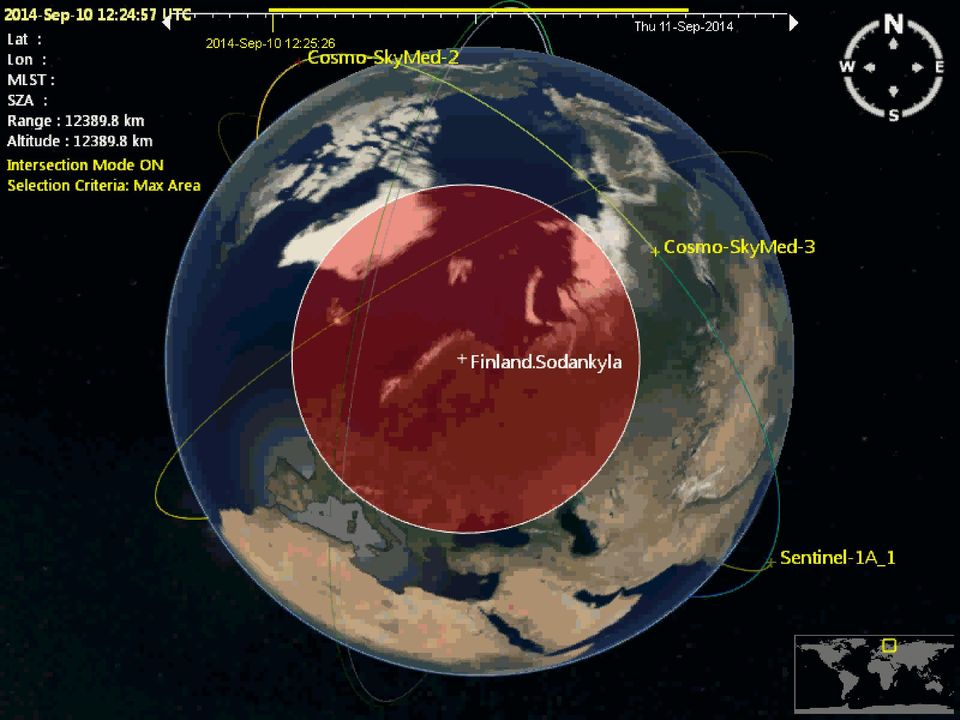
6 Satellite data availability from Sodankylä NSDC Free access EOS-Terra and Aqua/MODIS EOS-Aura/OMI Suomi-NPP/VIIRS & OMPS FY-3B/C/MERSI On-demand (commercial) COSMO-SkyMed/SAR (4 satellite constellation)
 COSMO-SkyMed/SAR (4 satellite")
7

8

9 IMAPP and CSPP usage at FMI IMAPP Since 2008 Fully automated processing chain 2009 together with RT-STPS and MODIS L1 DB Daily products and images CSPP Since 2012 First as a beta tester Daily SDR and EDR products Processing an overpass to L1 takes 25 min (SDR 2.0.) 10 cores (2.53 GHz), 144 GB mem Need for granuled processing like RT-STPS 5.1 with DB6 patch
 10 cores (2.53 GHz), 144 GB mem Need for granuled processing like RT-STPS 5.")
10 First Suomi NPP image using CSPP software was processed by FMI March 5th 2012

11 Baltic Sea Ice Charting and Monitoring Commercial and environmental needs Finland is essentially an island ~90% of Finland s import and export via sea routes Gulf of Finland is one of the most busiest marine routes for oil transport Satellite data for sea ice charting Optical and radar satellite data combined with in-situ data S1 and S-NPP Day-Night-Band data welcomed addition Daily products for ice breakers and ships COSMO-SkyMed Product ASI Distributed by e-geos. All Rights Reserved

12 RGB: I3, I2, I1 DNB On Thursday morning Martin Raspaud, SMHI


13 Baltic Sea ice coverage Winter Date Coverage 14/ km2 13/ km2 12/ km2 11/ km2 10/ km2 09/ km2 08/ km2 07/ km2 06/ km2 05/ km2 04/ km2 03/ km2 02/ km2 01/ km

14 Forest Fire Detection with Satellite Sensors AVHRR, MODIS, and VIIRS


15 Forest fires in 2014 AVHRR MODIS/VIIRS

16

17

18 VIIRS Snow Extent

19 New SAMPO service Satellite Measurements from Polar Orbit Instantly delivered Direct Readout products Replaces OMI-VFD web service Includes both OMI and OMPS OMPS Ozone Mapping and Profiler Suite On-board S-NPP Lauched Oct 28 th

20 Fengyun 3 Only MERSI data is transmitted in X-band Processor for 3B and 3C installed on February by KSPT L1 visualization with Pytroll For ice and water quality monitoring 3C oneline elements seem to not update often enough March 18 th 2015

21 Flood extent products COSMO-SkyMed (SAR) Active microwave (X-band) instrument Uses signal doppler effect to improve resolution Insensitive to illumination conditions Works day and night Insensitive to weather Works in rain Works in cloudy weather Process Identification of water bodies Removal of known lakes (Corine) Flood depth estimation by utilizing high-res DEM Generation of map products for authorities and public COSMO-SkyMed Product ASI Distributed by e-geos. All Rights Reserved
22 The next step: Sentinels Image: ESA/Sentinel-1


23 Finnish Collaborative Ground Segment 1. Local reception of Sentinel-1 Direct Broadcast Focus on NRT and Quasi-Real- Time products Special Interests: S1 -> Baltic Sea Ice monitoring, Oil spill monitoring 2. National Sentinel mirror site Provision of Sentinel data to Finnish Data users S1, S2, S3 and S5P Medium-term data archive Automated data processing lines for specific products Hosting of processing services N E 23
24 Contact information: Timo Ryyppö Head of satellites and observation operations Finnish Meteorological Institute/ Arctic Research Tähteläntie 62 FIN Sodankylä Finland Tel: Photo: Matias Takala
Satellite Snow Monitoring Activities Project CRYOLAND
 Satellite Snow Monitoring Activities Project CRYOLAND Background material for participants to the Workshop on European Snow Monitoring Perspectives, Darmstadt, 4-5 December 2012. CryoLand provides Snow,
NOAA Direct Broadcast Real-Time Network: Current Status and Plans for Delivering Sounder Data to DRARS
 NOAA Direct Broadcast Real-Time Network: Current Status and Plans for Delivering Sounder Data to DRARS Liam Gumley (NOAA DB Demonstration Technical Manager), Bruce Flynn, Heath Skarlupka, David Santek,
Satellite Communication Systems. mgr inż. Krzysztof Włostowski Instytut Telekomunikacji PW [email protected]
 Satellite Communication Systems mgr inż. Krzysztof Włostowski Instytut Telekomunikacji PW [email protected] Satellite Communication Satellite Communication combines the missile and microwave technologies
Joint Polar Satellite System (JPSS)
") Joint Polar Satellite System (JPSS) John Furgerson, User Liaison Joint Polar Satellite System National Environmental Satellite, Data, and Information Service National Oceanic and Atmospheric Administration
Joint Polar Satellite System (JPSS) John Furgerson, User Liaison Joint Polar Satellite System National Environmental Satellite, Data, and Information Service National Oceanic and Atmospheric Administration
Finnish Meteorological Institute s Services for Insurance Sector
 Finnish Meteorological Institute s Services for Insurance Sector Regional training workshop Role of the NMHSs in support of DRR- related activities in the field of insurance Janne Miettinen, Account Manager,
From Whitehall to orbit and back again: using space in government
 From Whitehall to orbit and back again: using space in government 18 th June 2014 Bristol 25 th June 2014 Liverpool 3 rd July 2014 -Newcastle Space for Smarter Government Programme ([email protected])
Sentinel-1 Mission Overview
 Sentinel-1 Mission Overview Pierre Potin Sentinel-1 Mission Manager, ESA Advanced Course on Radar Polarimetry ESRIN, Frascati, 19 January 2011 Global Monitoring for Environment and Security GMES is established
ADAGUC & PyTROLL. Maarten Plieger Ernst de Vreede. Application of polar orbiter products in weather forecasting Using open source tools and standards
 Application of polar orbiter products in weather forecasting Using open source tools and standards ADAGUC & PyTROLL Maarten Plieger Ernst de Vreede Royal Netherlands Meteorological Institute (KNMI) R&D
Istanbul Technical University-Center for Satellite Communications and Remote Sensing (ITU-CSCRS)
") Istanbul Technical University-Center for Satellite Communications and Remote Sensing (ITU-CSCRS) Istanbul Technical University, Center for Satellite Communications and Remote Sensing (ITU-CSCRS) was originally
Istanbul Technical University-Center for Satellite Communications and Remote Sensing (ITU-CSCRS) Istanbul Technical University, Center for Satellite Communications and Remote Sensing (ITU-CSCRS) was originally
Ensuring the Preparedness of Users: NOAA Satellites GOES R, JPSS Laura K. Furgione
 Ensuring the Preparedness of Users: NOAA Satellites GOES R, JPSS Laura K. Furgione U.S. Permanent Representative with the WMO Deputy Director, NOAA s s National Weather Service WMO Executive Council 65
8. Communications Subsystem
 PM-1.1-03 Rev C 8. Communications Subsystem The GOES-NOP spacecraft communications subsystem provides requisite conditioning, transmission, reception, and routing of mission data signals and telemetry
POLAR ICE Integrated Arctic and Antarctic Sea Ice monitoring Services
 VTT TECHNICAL RESEARCH CENTRE OF FINLAND LTD Place for a photo (no lines around photo) Photo: Tapio Nyman http://www.polarice.eu/ POLAR ICE Integrated Arctic and Antarctic Sea Ice monitoring Services Robin
Update on EUMETSAT ocean colour services. Ewa J. Kwiatkowska
 Update on EUMETSAT ocean colour services Ewa J. Kwiatkowska 1 st International Ocean Colour Science meeting, 6 8 May, 2013 EUMETSAT space data provider for operational oceanography Operational data provider
Finnish Marine Research Infrastructure FINMARI
 Finnish Marine Research Infrastructure FINMARI Lauri Laakso, Finnish Meteorological Institute Timo Tamminen, Finnish Environment Institute Finnish Meteorological Institute 1. National roadmap for key research
Earth remote sensing systems of middle and low resolution
 Earth remote sensing systems of middle and low resolution Serial on-line remote sensing satellites delivering data available on the world market V.I. Gershenzon (ScanEx R&D Center) In 1980, graduated from
16 th IOCCG Committee annual meeting. Plymouth, UK 15 17 February 2011. mission: Present status and near future
 16 th IOCCG Committee annual meeting Plymouth, UK 15 17 February 2011 The Meteor 3M Mt satellite mission: Present status and near future plans MISSION AIMS Satellites of the series METEOR M M are purposed
Advantages and limitations of using satellite images for flood mapping
 Advantages and limitations of using satellite images for flood mapping Domenico Grandoni e-geos Headquarter Contrada Terlecchie 75100 Matera - Italy Commercial Office Via Cannizzaro 71 00156 Roma - Italy
Monitoring a Changing Environment with Synthetic Aperture Radar. Alaska Satellite Facility National Park Service Don Atwood
 Monitoring a Changing Environment with Synthetic Aperture Radar Don Atwood Alaska Satellite Facility 1 Entering the SAR Age 2 SAR Satellites RADARSAT-1 Launched 1995 by CSA 5.6 cm (C-Band) HH Polarization
WATERWAYS in Finland
 WATERWAYS in Finland The efficient and economical running of Finland s vital international transport demands a comprehensive and safe network of fairways. The mission of the Finnish Maritime Administration
STAR Algorithm and Data Products (ADP) Beta Review. Suomi NPP Surface Reflectance IP ARP Product
 Beta Review. Suomi NPP Surface Reflectance IP ARP Product") STAR Algorithm and Data Products (ADP) Beta Review Suomi NPP Surface Reflectance IP ARP Product Alexei Lyapustin Surface Reflectance Cal Val Team 11/26/2012 STAR ADP Surface Reflectance ARP Team Member
STAR Algorithm and Data Products (ADP) Beta Review Suomi NPP Surface Reflectance IP ARP Product Alexei Lyapustin Surface Reflectance Cal Val Team 11/26/2012 STAR ADP Surface Reflectance ARP Team Member
Active and Passive Microwave Remote Sensing
 Active and Passive Microwave Remote Sensing Passive remote sensing system record EMR that was reflected (e.g., blue, green, red, and near IR) or emitted (e.g., thermal IR) from the surface of the Earth.
Proba-V: Earthwatch Mission as part of ESA s Earth Observation Programmes
 Proba-V: Earthwatch Mission as part of ESA s Earth Observation Programmes Antwerp 05.07.2013 Bianca Hoersch Proba-V Mission Manager Third Party Mission & Sentinel-2 Mission Manager Earth Observation Directorate,
German Antarctic Receiving Station GARS O Higgins: Remote sensing as core for a broader range of activities
 DLR.de Chart 1 > Kathrin Hoeppner > EU-Chile-Workshop > November 28-29, 2013 > Punta Arenas, Chile German Antarctic Receiving Station GARS O Higgins: Remote sensing as core for a broader range of activities
EUMETSAT Satellite Programmes
 EUMETSAT Satellite Programmes Nowcasting Applications Developing Countries Marianne König [email protected] WSN-12 Rio de Janeiro 06-10 August 2012 27 Member States & 4 Cooperating States Member
Remote Sensing Applications in Support of Sustainable Development and Disaster Management by DLR Current Activities
 Remote Sensing Applications in Support of Sustainable Development and Disaster Management by DLR Current Activities Dr. Günter Strunz German Aerospace Center (DLR) German Remote Sensing Data Center 43rd
SARAL ACCESS TO OFF-LINE DATA
 SARAL AltiKa introduction Plot of the SARAL/AltiKa ground track over Africa (Credits: Google). S ARAL/AltiKa is a new mission in cooperation between CNES and ISRO (Indian Space Research Organization),
Multisensor Data Integration in O&G Business Lutz Petrat Hélène Lemonnier Michael Hall
 Multisensor Data in O&G Business Lutz Petrat Hélène Lemonnier Michael Hall ESA Oil and Gas Workshop 15/09/2010, Frascati, Italy Satellite Products and Services during a typical O&G project Project Life
International coordination for continuity and interoperability: a CGMS perspective
 International coordination for continuity and interoperability: a CGMS perspective Peng Zhang, CGMS WG-III Co-Chair NSMC/CMA In Cooperation with Suzanne Hilding, CGMS WG-III Co-Chair OPPA/NESDIS/NOAA 1
TerraSAR-X Applications Guide
 TerraSAR-X Applications Guide Extract: Maritime Monitoring: Oil Spill Detection April 2015 Airbus Defence and Space Geo-Intelligence Programme Line Maritime Monitoring: Oil Spill Detection Issue As the
Hyperspectral Satellite Imaging Planning a Mission
 Hyperspectral Satellite Imaging Planning a Mission Victor Gardner University of Maryland 2007 AIAA Region 1 Mid-Atlantic Student Conference National Institute of Aerospace, Langley, VA Outline Objective
Space radar technologies for oil spills management, detection of illegal fishing and logging activities
 Space radar technologies for oil spills management, detection of illegal fishing and logging activities VIGISAT The French satellite ground receiving station VIGISAT 2009 know today, live better tomorrow
Monitoring of Arctic Conditions from a Virtual Constellation of Synthetic Aperture Radar Satellites
 DISTRIBUTION STATEMENT A. Approved for public release; distribution is unlimited. Monitoring of Arctic Conditions from a Virtual Constellation of Synthetic Aperture Radar Satellites Hans C. Graber RSMAS
Marine route optimization. Jens Olaf Pepke Pedersen Polar DTU / DTU Space www.polar.dtu.dk www.space.dtu.dk
 Marine route optimization Jens Olaf Pepke Pedersen Polar DTU / DTU Space www.polar.dtu.dk www.space.dtu.dk Early attempt at route optimization Jens Munk (1579-1628) Tries to find a way to India through
Welcome to NASA Applied Remote Sensing Training (ARSET) Webinar Series
 Webinar Series") Welcome to NASA Applied Remote Sensing Training (ARSET) Webinar Series Introduction to Remote Sensing Data for Water Resources Management Course Dates: October 17, 24, 31 November 7, 14 Time: 8-9 a.m.
Welcome to NASA Applied Remote Sensing Training (ARSET) Webinar Series Introduction to Remote Sensing Data for Water Resources Management Course Dates: October 17, 24, 31 November 7, 14 Time: 8-9 a.m.
Our Antarctic Facilities
 Our Antarctic Facilities Australian Activities in Antarctica Tony Worby IICWG Chile, October 2014 3 days Macquarie Island Wilkins aerodrome Hobart is Australia s Gateway to East Antarctica and the Southern
Radar interferometric techniques and data validation Terrafirma Essen, March 2011. Page 1
 Radar interferometric techniques and data validation Terrafirma Essen, March 2011 Page 1 Agenda Introduction to InSAR technology Different radarinterferometric techniques Validation of InSAR technology
NASA's Earth Observing Data and Information System (EOSDIS)
") NASA's Earth Observing Data and Information System (EOSDIS) Copernicus Big Data Workshop 13 March 2014 Brussels, Belgium Kevin Murphy EOSDIS System Architect NASA Goddard Space Flight Center Topics to
NASA's Earth Observing Data and Information System (EOSDIS) Copernicus Big Data Workshop 13 March 2014 Brussels, Belgium Kevin Murphy EOSDIS System Architect NASA Goddard Space Flight Center Topics to
How To Find Natural Oil Seepage In The Dreki Area Using An Envisat Image
 rn ORKUSTOFNUN National Energy Authority Searching for natural oil seepage in the Dreki area using ENVISAT radar images. Ingibjorg J6nsd6ttir and Arni Freyr Valdimarsson, Faculty of Earth Sciences School
TECHNICAL REPORTS. Authors: Tatsuhiro Noguchi* and Takaaki Ishikawa*
 Application and Evaluation of Observation Data by Advanced Microwave Scanning Radiometer 2 Achievement of World s Top-Class Microwave Radiometer AMSR Series Authors: Tatsuhiro Noguchi* and Takaaki Ishikawa*
Launch-Ready Operations Code Chain ESDT ShortNames, LongNames, and Generating PGE or Ingest Source
 Launch-Ready Operations Code Chain ESDT ShortNames, LongNames, and Generating PGE or Ingest Source Generating PGE Name/Description or Ingest Source Product ESDT ShortName Product ESDT LongName NPP_VMAE_L1
Forest Fire Information System (EFFIS): Rapid Damage Assessment
: Rapid Damage Assessment") Forest Fire Information System (EFFIS): Fire Danger D Rating Rapid Damage Assessment G. Amatulli, A. Camia, P. Barbosa, J. San-Miguel-Ayanz OUTLINE 1. Introduction: what is the JRC 2. What is EFFIS 3.
Forest Fire Information System (EFFIS): Fire Danger D Rating Rapid Damage Assessment G. Amatulli, A. Camia, P. Barbosa, J. San-Miguel-Ayanz OUTLINE 1. Introduction: what is the JRC 2. What is EFFIS 3.
1. Introduction. FER-Zagreb, Satellite communication systems 2011/12
 1. Introduction Topics History Characteristics of satellite communications Frequencies Application 1 History Arthur C. Clark suggested in 1945. Earth coverage with 3 geostationary satellites. On 4th of
COSMO-SKYMED SATELLITES FOR SCIENTIFIC RESEARCH AND DISASTER MONITORING
 Hans C. Graber Executive Director Center for Southeastern Tropical Advanced Remote Sensing Division of Applied Marine Physics Rosenstiel School of Marine & Atmospheric Science University of Miami COSMO-SKYMED
Marcus A. Watkins Director of the Joint Agency Satellite Division, Science Mission Directorate, NASA HQ, Washington DC
 Marcus A. Watkins Director of the Joint Agency Satellite Division, Science Mission Directorate, NASA HQ, Washington DC Leads the Joint Agency Satellite Division (JASD) at NASA HQ in Washington, DC and
ESA Earth Observation and the need for high speed networking
 ESA Earth Observation and the need for high speed networking Pisa, 11 th May 25 11 th May 25 GARR Conference 5 1 ESA Earth Observation 11 th May 25 GARR Conference 5 2 The European Space Agency The European
Overview of Data Visualization Tools. (Submitted by the Secretariat) Summary and Purpose of Document
 Summary and Purpose of Document") WORLD METEOROLOGICAL ORGANIZATION COMMISSION FOR BASIC SYSTEMS OPEN PROGRAMME AREA GROUP ON INTEGRATED OBSERVING SYSTEMS EXPERT TEAM ON SATELLITE UTILIZATION AND PRODUCTS SCOPE-Nowcasting Ad-hoc Steering
WORLD METEOROLOGICAL ORGANIZATION COMMISSION FOR BASIC SYSTEMS OPEN PROGRAMME AREA GROUP ON INTEGRATED OBSERVING SYSTEMS EXPERT TEAM ON SATELLITE UTILIZATION AND PRODUCTS SCOPE-Nowcasting Ad-hoc Steering
Satellite Remote Sensing of Volcanic Ash
 Marco Fulle www.stromboli.net Satellite Remote Sensing of Volcanic Ash Michael Pavolonis NOAA/NESDIS/STAR SCOPE Nowcasting 1 Meeting November 19 22, 2013 1 Outline Getty Images Volcanic ash satellite remote
The DLR Multi Mission EO Ground Segment
 The DLR Multi Mission EO Ground Segment Payload Ground Segment Erhard Diedrich Remote Sensing Workshop Mexico 22-24 April 2008 DLR Ground Segment for Earth Observation: Servicing GMES, national and commercial
Satellite Basics. Benefits of Satellite
 Satellite Basics Benefits of Satellite People need access to enterprise-class, high-speed voice, video and data applications wherever they happen to be. Satellite connectivity has the power to drive communications
Heikki Turtiainen *, Pauli Nylander and Pekka Puura Vaisala Oyj, Helsinki, Finland. Risto Hölttä Vaisala Inc, Boulder, Colorado
 4.1 A NEW HIGH ACCURACY, LOW MAINTENANCE ALL WEATHER PRECIPITATION GAUGE FOR METEOROLOGICAL, HYDROLOGICAL AND CLIMATOLOGICAL APPLICATIONS Heikki Turtiainen *, Pauli Nylander and Pekka Puura Vaisala Oyj,
Estimating Firn Emissivity, from 1994 to1998, at the Ski Hi Automatic Weather Station on the West Antarctic Ice Sheet Using Passive Microwave Data
 Estimating Firn Emissivity, from 1994 to1998, at the Ski Hi Automatic Weather Station on the West Antarctic Ice Sheet Using Passive Microwave Data Mentor: Dr. Malcolm LeCompte Elizabeth City State University
The NASA NEESPI Data Portal to Support Studies of Climate and Environmental Changes in Non-boreal Europe
 The NASA NEESPI Data Portal to Support Studies of Climate and Environmental Changes in Non-boreal Europe Suhung Shen NASA Goddard Space Flight Center/George Mason University Gregory Leptoukh, Tatiana Loboda,
Development of an Integrated Data Product for Hawaii Climate
 Development of an Integrated Data Product for Hawaii Climate Jan Hafner, Shang-Ping Xie (PI)(IPRC/SOEST U. of Hawaii) Yi-Leng Chen (Co-I) (Meteorology Dept. Univ. of Hawaii) contribution Georgette Holmes
NASA Earth System Science: Structure and data centers
 SUPPLEMENT MATERIALS NASA Earth System Science: Structure and data centers NASA http://nasa.gov/ NASA Mission Directorates Aeronautics Research Exploration Systems Science http://nasascience.nasa.gov/
A comparison of NOAA/AVHRR derived cloud amount with MODIS and surface observation
 A comparison of NOAA/AVHRR derived cloud amount with MODIS and surface observation LIU Jian YANG Xiaofeng and CUI Peng National Satellite Meteorological Center, CMA, CHINA outline 1. Introduction 2. Data
RAIM for Ship and Rig Management
 RAIM for Ship and Rig Management Maritime Applications Institute of Space Technology and Space Applications University FAF Munich, Germany PhD Student Diana Fontanella [email protected] PhD Student
The Benefits and Challenges in Global Meteorological Satellite Data Sharing
 The Benefits and Challenges in Global Meteorological Satellite Data Sharing Ninghai Sun and Fuzhong Weng Center for Satellite Applica0ons and Research Na0onal Oceanic and Atmospheric Administra0on Presented
How To Monitor Sea Level With Satellite Radar
 Satellite Altimetry Wolfgang Bosch Deutsches Geodätisches Forschungsinstitut (DGFI), München email: [email protected] Objectives You shall recognize satellite altimetry as an operational remote sensing
GLOBAL FORUM London, October 24 & 25, 2012
 GLOBAL FORUM London, October 24 & 25, 2012-1 - Global Observations of Gas Flares Improving Global Observations of Gas Flares With Data From the Suomi NPP Visible Infrared Imaging Radiometer Suite (VIIRS)
The use of Satellite Remote Sensing for Offshore Environmental Benchmarking
 The use of Satellite Remote Sensing for Offshore Environmental Benchmarking Michael King Fugro NPA Limited Fugro NPA (Formerly Nigel Press Associates) World leading Satellite Remote Sensing & Geoscience
UAV Road Surface Monitoring and Traffic Information
 UAV Road Surface Monitoring and Traffic Information Czech Road and Motorway Network New capabilities for Unmanned Aerial Systems Current usage (military operation service) Possible civil usage (possible
An exactearth Technical White Paper April 2015. Satellite AIS
 An exactearth Technical White Paper April 2015 Satellite AIS Executive Summary exactearth Ltd (www.exactearth.com) is a private data services company delivering global locationbased maritime vessel tracking
The needs on big data management for Operational Geo-Info Services: Emergency Response, Maritime surveillance, Agriculture Management
 Copernicus Big-Data Workshop 2014, 13/14 March The needs on big data management for Operational Geo-Info Services: Emergency Response, Maritime surveillance, Agriculture Management Marco Corsi e-geos 1
RS platforms. Fabio Dell Acqua - Gruppo di Telerilevamento
 RS platforms Platform vs. instrument Sensor Platform Instrument The remote sensor can be ideally represented as an instrument carried by a platform Platforms Remote Sensing: Ground-based air-borne space-borne
NCDC s SATELLITE DATA, PRODUCTS, and SERVICES
 **** NCDC s SATELLITE DATA, PRODUCTS, and SERVICES Satellite data and derived products from NOAA s satellite systems are available through the National Climatic Data Center. The two primary systems are
The European Space Agency s Synthetic Aperture Radar Programme From Experiment to Service Provision
 The European Space Agency s Synthetic Aperture Radar Programme From Experiment to Service Provision Evert Attema ESA, Directorate of Earth Observation Programme! The idea of an independent European space
Geospatial Software Solutions for the Environment and Natural Resources
 Geospatial Software Solutions for the Environment and Natural Resources Manage and Preserve the Environment and its Natural Resources Our environment and the natural resources it provides play a growing
Senior Advisor for EO Applications, ESA-ESRIN
 Accesso e utilizzo di dati OsservazioneTerra: prospettivegrid [email protected] Senior Advisor for EO Applications, ESA-ESRIN IV Incontro di GARR-B Bologna June 24-26, 2002 Summary ESA and Earth Observation
THE CURRENT EVOLUTIONS OF THE DORIS SYSTEM
 THE CURRENT EVOLUTIONS OF THE DORIS SYSTEM TAVERNIER, G.; GRANIER, J.P.; JAYLES, C.; SENGENES, P. (CNES) ROZO, F. (COFRAMI) presented by P. VINCENT (CNES) Table of Contents System and Missions Satellites:
Satellite Altimetry Missions
 Satellite Altimetry Missions SINGAPORE SPACE SYMPOSIUM 30 TH SEPTEMBER 2015 AUTHORS: LUCA SIMONINI/ ERICK LANSARD/ JOSE M GONZALEZ www.thalesgroup.com Table of Content General Principles and Applications
Summary Report on National and Regional Projects set-up in Russian Federation to integrate different Ground-based Observing Systems
 WORLD METEOROLOGICAL ORGANIZATION COMMISSION FOR INSTRUMENT AND METHODS OF OBSERVATION OPAG-UPPER AIR EXPERT TEAM ON REMOTE SENSING UPPER-AIR TECHNOLOGY AND TECHNIQUES First Session Geneva, Switzerland,
From hemispheric snow cover products towards an integrated view on the land cryosphere: Remote sensing & snow & carbon cycle
 From hemispheric snow cover products towards an integrated view on the land cryosphere: Remote sensing & snow & carbon cycle J. Pulliainen, K. Luojus, S. Metsämäki*, K. Rautiainen, J. Lemmetyinen, T. Ryyppö,
University of Wisconsin SSEC Datacenter
 University of Wisconsin SSEC Datacenter 2015 McIDAS Users Group Meeting June 8, 2015 SSEC Data Center Mission Statement The SSEC Data Center mission is to create and maintain the facilities, human expertise
German Aerospace Center A member of the Helmholtz Association. Microwaves and Radar Institute. Digital- & Offsetdruck Wolfertstetter KG, Gilching
 Institute s Brochure Microwaves and Radar Institute Overview of Projects and Research Activities 1 German Aerospace Center A member of the Helmholtz Association Microwaves and Radar Institute Director
Ksat Infrastructure and architecture for Multi-Mission Applications. dr. Kris Nackaerts dr. Martin Krynitz dr. Jan Petter Pedersen
 Ksat Infrastructure and architecture for Multi-Mission Applications dr. Kris Nackaerts dr. Martin Krynitz dr. Jan Petter Pedersen Riyadh, 2016 Tromsø Capital of space activities in the North Tromsø Capital
STUDY ON FOREST FIRE DETECTION WITH SATELLITE DATA
 STUDY ON FOREST FIRE DETECTION WITH SATELLITE DATA Mathias Milz Avdelning Rymdteknik Institutionen för System- och rymdteknik (SRT) Luleå tekniska universitet Kiruna March 8, 2013 1 Introduction Countries
Satellite Communications
 Satellite Communications Department of Electrical Engineering Faculty of Engineering Chiangmai University Origin of Satellite Communications Arthur C. Clark (1945) British Science fiction writer propose
Mobile Communications: Satellite Systems
 Mobile Communications: Satellite Systems Mobile Communication: Satellite Systems - Jochen Schiller http://www.jochenschiller.de 1 History of satellite communication 1945 Arthur C. Clarke publishes an essay
Mobile Computing. Chapter 5: Satellite Systems
 Mobile Computing Chapter 5: Satellite Systems Prof. Sang-Jo Yoo History of satellite communication 1945 Arthur C. Clarke publishes an essay about Extra Terrestrial Relays 1957 First satellite SPUTNIK by
MITSUBISHI ELECTRIC ANNOUNCES THE SUCCESSFUL DEVELOPMENT OF AN AIRBORNE Ku-BAND ANTENNA SUBSYSTEM FOR SATELLITE COMMUNICATIONS
 FOR IMMEDIATE RELEASE No. 2330 Product Inquiries: Media Contact: Yutaka Kamada Oliver Cox Mitsubishi Electric Corporation Mitsubishi Electric Corporation Tel: +81-3-3218-2391 Tel: +81-3-3218-2346 [email protected]
June 2011. TerraSAR-X-based Flood Mapping Service
 June 2011 TerraSAR-X-based Flood Mapping Service Service TerraSAR-X-based Flood Mapping Product Flood extent map Product specifications Flood mask / water mask Input / output data Summary Content Date
Huai-Min Zhang & NOAAGlobalTemp Team
 Improving Global Observations for Climate Change Monitoring using Global Surface Temperature (& beyond) Huai-Min Zhang & NOAAGlobalTemp Team NOAA National Centers for Environmental Information (NCEI) [formerly:
THE IMPROVEMENT OF WINTER NAVIGATION WITH RISK-BASED APPROACHES Tapio Nyman VTT Industrial Systems [email protected]
 THE IMPROVEMENT OF WINTER NAVIGATION WITH RISK-BASED APPROACHES Tapio Nyman VTT Industrial Systems [email protected] ICE DAY Basics of Winter Navigation in the Baltic Sea 11th and 12th February, 2004
INVESTIGA I+D+i 2013/2014
 INVESTIGA I+D+i 2013/2014 SPECIFIC GUIDELINES ON AEROSPACE OBSERVATION OF EARTH Text by D. Eduardo de Miguel October, 2013 Introducction Earth observation is the use of remote sensing techniques to better
Monitoring Soil Moisture from Space. Dr. Heather McNairn Science and Technology Branch Agriculture and Agri-Food Canada [email protected].
 Monitoring Soil Moisture from Space Dr. Heather McNairn Science and Technology Branch Agriculture and Agri-Food Canada [email protected] What is Remote Sensing? Scientists turn the raw data collected
Real Time Services for Space Applications Holger Maass, Susanne Lehner
 Real Time Services for Space Applications Holger Maass, Susanne Lehner [email protected] German Remote Sensing Data Center ( DFD ) with 2 locations in Germany Neustrelitz in Mecklenburg-Vorpommern Oberpfaffenhofen