DCAD Website Instruction Manual
|
|
|
- Beatrice Lane
- 9 years ago
- Views:
Transcription
1 DCAD Website Instruction Manual - 1-9/1/2010

2 INDEX PAGE Search Appraisal Owner Name Account Number Street Address (Single Address) Street Address (Address Range) Business Name Detailed Account Information Detail Page Account Detail Links DCAD Property Map Yahoo Maps View Photo Homestead Exemption How to Print Homestead Exemption DCADMap Find Property on Map DCADMap Page Tool Selection Box Zoom In Zoom Out Pan Identify Parcel Identify Measure Clear Selection Information Display Layers Legend Print Find DCADWeb Links Home Search Help /1/2010

3 This section of the training manual will describe and show you how to find parcel information if you know the Owner Name, Account Number, Street Address or Business Name. Finding parcel information using the Map option is described on page 17 of these instructions. This is the Home Page of the Dallas Central Appraisal District s Website. In order to search for an appraisal/account, use the Navigation Links box. Position the mouse pointer over the Search Appraisals link and click to select Search Appraisals /1/2010

4 This will bring up the Search Appraisal screen, which lets you select whether you want to find an appraisal/account based on the Owner Name, Account Number, Street Address, Business Name or just using a Map. Selectable items are shown in blue on the web pages. The check boxes under Account Type allow you to search using any or all of the three types of property: RESIDENTIAL, COMMERCIAL or BPP (Business Personal Property). If you search using Owner Name or Street Address, you will have the option of limiting your search results to either RESIDENTIAL, COMMERCIAL or BPP. If you search using Business Name, your search can be for either COMMERCIAL or BPP. Search using Account Number does not provide a property account type option /1/2010

5 How to search by Owner Name: Click on Owner Name: Enter last name, then a space, and the first name. See Hints for additional help. Use the check boxes to determine whether you want accounts returned for any or all of RESIDENTIAL, COMMERCIAL or BPP accounts. Click on the Search button or press the Enter key on your keyboard. NOTE: If you have already searched for a particular name, it will be stored in computer memory within the Owner Name box, and typing only part of the name will bring up a list of matching names from which you can select the one you want by pointing to it with the mouse and clicking on it. This can be activated by selecting Tools from the pull down list at the top of your browser. Then select Internet Options => Content => AutoComplete. Select the check box labeled Forms. Select OK on the two pop-up windows to close the Internet Options /1/2010

6 Searches for common names will often return hundreds of correct responses. For example: The name SMITH will return over 500 matches. Try limiting the search further by selecting only one type of property (RESIDENTIAL, COMMERCIAL or BPP), adding a first name, or the first few letters of a first name. NOTE: The HINTS section can help in limiting the selection. The web search will display the first 500 matches, ten at a time. Click on the NEXT > text to see the next ten matches; repeat to see matches 21 through 500. Turn to Page 11 of this instruction manual to see how the Detailed Account Information is displayed /1/2010

7 How to search by Account Number: Click on Account Number: Enter the 17 digit account number. The account number must match exactly to a DCAD property account. Click on the Search button or press the Enter key on your keyboard. NOTE: If you have already searched for a particular account number, it will be stored in computer memory within the Account Number box, and typing only part of the number will bring up a list of matching number from which you can select the one you want by pointing to it with the mouse and clicking on it. This can be activated by selecting Tools from the pull down list at the top of your browser. Then select Internet Options => Content => AutoComplete. Select the check box labeled Forms. Select OK on the two pop-up windows to close the Internet Options /1/2010

8 Turn to Page 11 of this instruction manual to see how the Detailed Account Information is displayed. How to search by Street Address: (Single Address) Click on Street Address If you know the Address Number, type it in the Address Number box. If you enter an Address Number that does not match DCAD records, the search will return No Records Found. For Direction, click on the pull down arrow and select the appropriate street direction from the list. Click in the box for Street Name and enter only the street name (required). Do not enter street type, like Lane, Circle, Drive, Road, etc. For City determine whether you want to limit the search to a particular city or search all cities. For a particular city, click on the pull down arrow and select the city name from the list of cities. Click on the Search button. NOTE: If you have already searched for a particular street, it will be stored in computer memory within the Street Name box, and typing only part of the name will bring up a list of matching names. Select the one you want by pointing to it with the mouse and clicking on it. Additional information can be found by reading the Hints for this page. This can be activated by selecting Tools from the pull down list at the top of your browser. Then select Internet Options => Content => AutoComplete. Select the check box labeled Forms. Select OK on the two pop-up windows to close the Internet Options /1/2010
.")
9 Turn to Page 11 of this instruction manual to see how the Detailed Account Information is displayed. How to search by Street Address: (Address Range) Click on Street Address. For direction, click on the pull down arrow and select the appropriate street direction from the list. Click in the box for Street Name and enter only the street name (required). Do not enter street type, like Lane, Circle, Drive, Road, etc. For City determine whether you want to limit the search to a particular city or search all cities. For a particular city, click on the pull down arrow and select the city name from the list of cities. Click in the From box and type in the starting address number. Click in the To box and type in the ending address number. Click the Search button /1/2010

10 Turn to Page 11 of this instruction manual to see how the Detailed Account Information is displayed. How to search by Business Name: Click on Business Name: If you know the exact Business Name, enter it. If you enter part of a Business Name and use a wildcard (the % key on the keyboard), you will get a list of business names with that text in it. Use the check boxes to determine whether you want accounts returned for any or all COMMERCIAL or BPP accounts. Click on the Search button or press the Enter key on your keyboard. NOTE: If you have already searched for a particular Business Name, it will be stored in computer memory within the Business Name box, and typing only part of the name will bring up a list of matching names from which you can select the one you want by pointing to it with the mouse and clicking on it. This can be activated by selecting Tools from the pull down list at the top of your browser. Then select /1/2010

11 Internet Options => Content => AutoComplete. Select the two check boxes labeled Web Addresses and Forms. Select OK on the two pop-up windows to close the Internet Options. Turn to Page 11 of this instruction manual to see how the Detailed Account Information is displayed. Detailed Account Information When you have completed your search and the account or name that you are searching for appears in the information returned by the computer, select the account you want by placing the mouse pointer over the BLUE account information, then click. See examples below /1/2010

12 The account information will cover several pages, and includes the Location, Owner, Legal Description, Value, Main Improvement, Additional Improvements, Land, Exemptions, Estimated Taxes, Jurisdictions, Building Footprint and History data. Additional information on the contents of the detailed account information page is covered in the Account Detail Links section on Pages Example of the five years of history page /1/2010

13 Account Detail Links Contained in the Property Location area on the Account Information Detail page are four links to other helpful information for the selected account /1/2010

14 DCAD Property Map: Links to DCADMap. DCADMap will display the parcel of interest and give many options and tools to get the information needed. NOTE: For the detailed description of DCAD Property Map, see Page 18. Yahoo Maps: Links to the Yahoo Website with the location of the parcel you have selected using the Property Location address. There is also an option on the Yahoo Website to get driving directions to the address or from this address. NOTE: This option is not available on the computers in the DCAD customer service lobby, internet access is not available. Print Homestead Exemption Form: Allows the Residential property owner to print out the Residential Homestead Exemption Application for the selected property. This form is automatically filled in with the owner name, address and account number /1/2010

15 - 15-9/1/2010
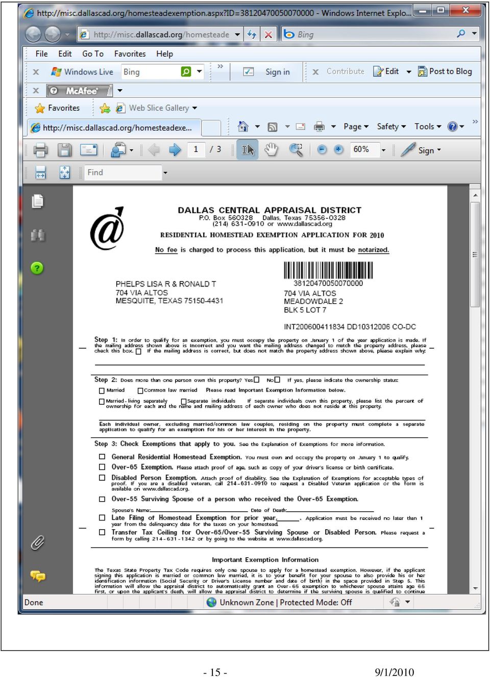
16 Note: To print the Homestead Exemption Form, click on the printer icon in the menu bar, or save the PDF to your local hard drive, and use Acrobat Reader to open the file, and print it. Find Property on Map This section of the manual will describe how to find the parcel information by using a map. This is the home page of the Dallas Central Appraisal District. In the Navigation Links box, select Find Property on Map. This will take you directly to DCADMap /1/2010

17 This is the main page of DCADMap. There are three basic parts to this display: Tool Selection Box, Information Display and the Display Area. Tool Selection Box DCADWeb Links Active Tool Display Area Information Display Active Tool Display Zoom Bar A few other important areas of this display page are: DCADWeb Links, Active Tool Display and Zoom Bar /1/2010

18 Explanation of the key areas from the main DCADMap page. Tool Selection Box: The Tool Selection Box lets you directly interact with the Display Area. The different tools available are: Zoom In, Zoom Out, Pan, Identify, Parcel Identify Current Year, Measure, and Clear Selection. NOTE: To activate a tool, it must first be selected in the Tool Selection Box Zoom In: There are two ways to zoom into the area of interest: 1) Move the mouse pointer on the screen to the center of the area of interest and single click the left mouse button. This will zoom in at 10 percent of the size of the displayed area and re-center the map; 2) Zoom Box: Click a spot that is a corner of the area you want to zoom in to, and holding down the left mouse button, drag the mouse over the area of interest and you will see a RED box appear. Move the mouse until the area of interest is inside the box. Then lift your finger off of the mouse button. Zoom Out: There are two ways to zoom out of an area: 1) Move the mouse pointer on the screen to the area you want to zoom out of and single click the left mouse button. This will zoom out at 10 percent of the display area and re-center the map; 2) Zoom out box. The percentage of zoom out depends on how large a box is drawn. The smaller the box the bigger the percentage of zoom out. The larger the box the smaller the percentage. To draw the box, select a spot on the display screen, hold down the left mouse button and drag mouse. You will see a RED box appear. Move the mouse until the desired size is reached. Then lift your finger off of the mouse button. NOTE: You can also Zoom In and Zoom Out by using the Zoom Bar located at the bottom right hand corner of the Display Area. Pan: This allows you to move around the map and keep the same map scale. To Pan in the map display area; move the mouse pointer on the screen to the area you want to see. Click and hold down the left mouse button, drag mouse in the opposite direction that you want to see. Then lift your finger off of the mouse button. Example: If you wanted to see a parcel that was a block or so north from your current location, select Pan from the Tool Selection Box, click the upper portion of the display screen and hold the left mouse button down. Drag the mouse towards the bottom of the screen, then lift your finger off of the mouse button. NOTE: You can also pan by using the blue arrows on the sides and corners of the Display area. Select the arrow that is pointing in the direction you want to pan /1/2010

19 Identify: Allows you to get information from an Active layer. There are ten possible active layers: Prior Year Parcels [each of the last 5 years], Neighborhoods, MAPSCO Grid, Dallas block, Abstracts, or Subdivisions. Some of these layers are scale dependent; they are visible only within certain scale limits. The identifiable Layers have a selectable radio button just to the left of the layer name. You can only identify one layer at a time, and it does not need to be visible. Select the Identify task in the Tool Selection Box. Click on the radio button for the desired layer in the Information Display box. Then click on the map over the area you are interested in. The Layers tab changes to display the results of the Identity search. To return the Layers to its normal display just click on the Layers tab again. A query on Prior Year Parcel information will only returned the DCAD account number for the parcel selected. No additional account information or appraisal details are available. Parcel Identify Current Year: This button is used to find information from the map for the most current appraisal year, including the last certified value and exemption information for DCAD accounts. Once a parcel has been located using the tools in the Tool Selection Box, select Parcel Identify Current Year and select the parcel in the Display area. A pop up window will appear displaying basic information including Account number, Location, Owner name and mailing address, and either certified or proposed account value totals. If more than one account is associated with the selected property this window will list the total number of accounts and provide a Next button to view the other account s information /1/2010

20 By selecting More Details at the bottom of the pop up window, another window will appear opening up all the publicly displayed appraisal information for that account. The ten headings above the detail information jump the display to that particular information for this account: /1/2010

21 A number of links are set up on the first page of the account details information: Click on: to go to the property location on the DCAD map. Click on: to go to photographs of improvements on the property. These are not available over the web on residential properties. Click on: to print a Homestead Exemption form for the property. The form will include the owners name and address, the legal description for the property and a bar code of the account number, thus easing the processing of the application when it is received at DCAD. There is no fee for processing this application. Click on: Yahoo maps. to go to Yahoo s web site and see the location of the property using /1/2010
22 Measure: Measure the distance from point A to point B and calculate the square feet and acres for an area that is selected on the screen. With the area of interest in the middle of the display area and Measure selected from the Tool Selection Box, place the + on the corner (point A) of the parcel and click the left mouse button. Move the mouse over to the next corner (point B) and click the left mouse button again. A B To get the square feet and acres, select the next corner, making sure the next selection point is following the parcel lines. As point C is selected, it creates a polygon and calculates the area as square feet and acres. It is not necessary to end the measurement by clicking on the start point. C D It can be a simple or complex polygon /1/2010
23 Clear Selection: Clears any highlighted selection from Search parcel and the lines from the Measure tool. Information Display: Information Display is used to change what is visible and not visible in the Display area, gives options in printing a map, and finding a location. Layers: The Layers tab lists the layers that can be displayed and made active at the current scale. The check mark in the box shows the layers that are being displayed and the circle shows the layers that can be activated to get information from (see: Identify tool in Tool Selection Box). To change the layers that are being displayed, move the mouse into the box across from the intended layer to be turned on or off. After the selection is made, the Refresh Map button must be pressed. The Refresh Map button is always at the bottom of the Layers tab. NOTE: As the scale is increased or decreased layers will automatically be turned on and off. There will be more options for active layers. These detail pictures of the Layers tab show the difference in the visible and active layers as you zoom in. Above is the default layer list when zoomed to max extent. To the left is the extended layer list when zoomed in to the parcel level. Legend: The legend tab displays the layers that are visible in the display area. As layers are turned on and off, the Legend list will change /1/2010
24 Printing DCADMap Print: The Print tab will print what is in the Display Area. There are two options for printing. The Paper Size and Page Orientation. The paper is either, Letter 8.5 x 11, or Tabloid 11 x 17. The page orientation options are Portrait or Landscape. After the paper size and page orientation have been selected, click on Create Print Page. This will open a new browser window with the map image that is displayed in the display area. Also a Title Block will appear with a North Arrow, Scale Bar, Disclaimer, DCAD Name and DCAD Logo. To print this image on your printer, click the mouse on the Page Set Up tab in your internet browser s Print icon. Make sure the paper size and page orientation are the same as were selected on the Print tab. Then select Print. NOTE: You will not have to set the Page Setup every time you print. Only when you change the paper size or page orientation /1/2010
25 Find: The Find tab allows a search for known information on the following layers: Neighborhood, Map Grid, Dallas Block, Abstract and Subdivision. NOTE: To select the layers, click the left mouse button in the pull-down menu. Then select the layer to be searched. The Find tool will find all occurrences of the text entered. Enter as much of the name/number as you know to limit the search results. You do not have to enter all the letters/numbers to start the search. All the layers in this list can be searched for a text string or number. In this example the text string would be the Abstract name or the Abstract number. By typing in the number 123, the program will return a list showing all the occurrences of 123. Use the left mouse button to select the correct record (Blue underlined number). Once this is selected, the program will find that abstract and zoom the screen to that area with the selected abstract highlighted /1/2010
26 DCAD Map links: These links allow users to jump to the Home page, the Search pages, and the help page. Home: Links you back to the DCAD home page. Search: Links you to the Search Appraisals page (See instructions page 5) /1/2010
27 On-Line Help: This is a link back to the start of this document /1/2010
Web GIS User Guide MainStreetGIS, LLC
 Web GIS User Guide MainStreetGIS, LLC www.mainstreetgis.com Navigation There are two ways to navigate the map interface: 1. Activate one of the map tools a. Zoom In Tool Activate the tool, then click on
3D-GIS in the Cloud USER MANUAL. August, 2014
 3D-GIS in the Cloud USER MANUAL August, 2014 3D GIS in the Cloud User Manual August, 2014 Table of Contents 1. Quick Reference: Navigating and Exploring in the 3D GIS in the Cloud... 2 1.1 Using the Mouse...
Map Navigation Controls. An Interactive, Locally Based Knowledge Resource LivingstonLive.org/maps OR gisapps/livingstonviewerinternal
 Livingston County s Internet Mapping Portal User Guide An Interactive, Locally Based Knowledge Resource LivingstonLive.org/maps OR gisapps/livingstonviewerinternal A vast majority of County government
Internet Explorer 7. Getting Started The Internet Explorer Window. Tabs NEW! Working with the Tab Row. Microsoft QUICK Source
 Microsoft QUICK Source Internet Explorer 7 Getting Started The Internet Explorer Window u v w x y { Using the Command Bar The Command Bar contains shortcut buttons for Internet Explorer tools. To expand
LYON COUNTY GEOMOOSE 2 HELP DOCUMENT
 LYON COUNTY GEOMOOSE 2 HELP DOCUMENT TABLE OF CONTENTS Lyon County Geomoose 2 Help Document... 1 Introduction... 3 Quick Reference Chart... 4 The Interface... 4 The Table of Contents... 5 Quick Reference
Ingham County Equalization/Tax Mapping Viewer Tutorial
 MAP LAYERS (RIGHT SIDE) All data layers listed here can be displayed on the map. To display a layer, make sure that the box is checked (by default parcel and city layers are displayed, uncheck to turn
Help Document for WWW.SAGIS.ORG. Step by step, how-to instructions for navigating and using the Savannah Area GIS viewer.
 Help Document for WWW.SAGIS.ORG Step by step, how-to instructions for navigating and using the Savannah Area GIS viewer. 1 SAGIS Savannah Area GIS is focused on providing access to Geospatial data in a
ONPOINT Internet Training Manual
 The Internet version of ONPOINT is for use by the general public and can be accessed from a computer that is on the Internet by using the following URL: (http://gis.arlingtonva.us/acmap ). OnPoint is fully
Doña Ana County, NM Interactive Zoning Map
 Doña Ana County, NM Interactive Zoning Map Users Guide Basic Map Navigation Zoom Control The most efficient way of zooming, or changing the scale of the map is with the use of a mouse with a scroll wheel.
Creating and Using Links and Bookmarks in PDF Documents
 Creating and Using Links and Bookmarks in PDF Documents After making a document into a PDF, there may be times when you will need to make links or bookmarks within that PDF to aid navigation through the
Petrel TIPS&TRICKS from SCM
 Petrel TIPS&TRICKS from SCM Knowledge Worth Sharing Building Montages in Petrel Most Petrel projects require display maps to be made for presentations; either for partners or peers. This TIPS&TRICKS provides
Geocortex HTML 5 Viewer Manual
 1 FAQ Nothing Happens When I Print? How Do I Search? How Do I Find Feature Information? How Do I Print? How can I Email A Map? How Do I See the Legend? How Do I Find the Coordinates of a Location? How
Guide To Creating Academic Posters Using Microsoft PowerPoint 2010
 Guide To Creating Academic Posters Using Microsoft PowerPoint 2010 INFORMATION SERVICES Version 3.0 July 2011 Table of Contents Section 1 - Introduction... 1 Section 2 - Initial Preparation... 2 2.1 Overall
OnPoint 7.0 Tools and Functionality
 P a g e 1 OnPoint 7.0 Tools and Functionality The new version of the OnPoint website has the same functionality as the old site, but the look and feel of the page has changed. This document will compare
Employee Appointment Books. User s Manual
 Employee Appointment Books User s Manual Employee Appointment Books Health District Information System HDIS (Windows Ver. 4.0 ) Copyright 1998 by CHC Software, Inc All Rights Reserved CHC Software, Inc.
In this example, Mrs. Smith is looking to create graphs that represent the ethnic diversity of the 24 students in her 4 th grade class.
 Creating a Pie Graph Step-by-step directions In this example, Mrs. Smith is looking to create graphs that represent the ethnic diversity of the 24 students in her 4 th grade class. 1. Enter Data A. Open
Adobe Digital Signatures in Adobe Acrobat X Pro
 Adobe Digital Signatures in Adobe Acrobat X Pro Setting up a digital signature with Adobe Acrobat X Pro: 1. Open the PDF file you wish to sign digitally. 2. Click on the Tools menu in the upper right corner.
Data Visualization. Prepared by Francisco Olivera, Ph.D., Srikanth Koka Department of Civil Engineering Texas A&M University February 2004
 Data Visualization Prepared by Francisco Olivera, Ph.D., Srikanth Koka Department of Civil Engineering Texas A&M University February 2004 Contents Brief Overview of ArcMap Goals of the Exercise Computer
Database Program Instructions
 Database Program Instructions 1) Start your Comparative Rating software by double-clicking the icon on your desktop. 2) Click on the button on the Comparative Rating Software Main Menu. 3) A message Loading
Kodiak Island Borough GIS Online Tools
 Kodiak Island Borough GIS Online Tools The Kodiak Island Borough website is located at http://www.kodiakak.us/ You can access the GIS resources by clicking on the MAP CENTER icon in the middle of the page,
IDOT Getting Around Illinois Interactive Map Quick Reference Guide
 IDOT Getting Around Illinois Interactive Map Quick Reference Guide 1 2 3 4 5 6 7 8 9 10 1) Navigation Tools The Navigation tools are used to reposition the visible area on the map display. Zoom In Clicking
Realist A Quick Start Guide for New Users
 Realist A Quick Start Guide for New Users Realist is a service from: First American Real Estate Solutions 4 First American Way Santa Ana, CA 92707 Contents 1. Welcome to Realist... 2 2. How to Access Realist...
Microsoft Word 2010 Prepared by Computing Services at the Eastman School of Music July 2010
 Microsoft Word 2010 Prepared by Computing Services at the Eastman School of Music July 2010 Contents Microsoft Office Interface... 4 File Ribbon Tab... 5 Microsoft Office Quick Access Toolbar... 6 Appearance
Adobe Acrobat 6.0 Professional
 Adobe Acrobat 6.0 Professional Manual Adobe Acrobat 6.0 Professional Manual Purpose The will teach you to create, edit, save, and print PDF files. You will also learn some of Adobe s collaborative functions,
Task Card #2 SMART Board: Notebook
 Task Card #2 SMART Board: Notebook Objectives: Participants will learn how to utilize the SMART Notebook. Table of Contents: Launching The SMART Notebook Page 1 Entering Text Page 1 Top Toolbar Page 2
How to create pop-up menus
 How to create pop-up menus Pop-up menus are menus that are displayed in a browser when a site visitor moves the pointer over or clicks a trigger image. Items in a pop-up menu can have URL links attached
AODA Mouse Pointer Visibility
 AODA Mouse Pointer Visibility Mouse Pointer Visibility Helpful if you have trouble viewing the mouse pointer. Microsoft Windows based computers. Windows XP Find the pointer 1. Click the Start button or
Crown Field Support Engineering
 Crown Field Support Engineering Issue Date: 17 January 2014 Ref. No: GEN Go Online #0002 Subject: Basic Go Online w/ Audio Architect (Network Based Product) Applicability: The following step by step instructions
CATIA Basic Concepts TABLE OF CONTENTS
 TABLE OF CONTENTS Introduction...1 Manual Format...2 Log on/off procedures for Windows...3 To log on...3 To logoff...7 Assembly Design Screen...8 Part Design Screen...9 Pull-down Menus...10 Start...10
Learning Services IT Guide. Access 2013
 Learning Services IT Guide Access 2013 Microsoft Access is a programme which allows you to store a lot of information easily in the form of a database. For example you could create a database which stored
Extracting Aerial Images From GIS Based Ortho Photos Using ArcMap 9
 Extracting Aerial Images From GIS Based Ortho Photos Using ArcMap 9 Tutorial Updated August 2006 CP-208 Plan Preparation Studio - Prof. Elizabeth Macdonald 2 In this tutorial we will learn to extract aerial
How to create PDF maps, pdf layer maps and pdf maps with attributes using ArcGIS. Lynne W Fielding, GISP Town of Westwood
 How to create PDF maps, pdf layer maps and pdf maps with attributes using ArcGIS Lynne W Fielding, GISP Town of Westwood PDF maps are a very handy way to share your information with the public as well
Converting an AutoCAD Drawing into PDF File
 Tutorial Created by Brijesh Bhatha, 2004. Updated 2006 by Corinne Stewart ([email protected]) CP-208 Plan Preparation Studio - Prof. Elizabeth Macdonald 2 In this tutorial we will learn to create
How to use PGS: Basic Services Provision Map App
 How to use PGS: Basic Services Provision Map App The PGS: Basic Services Provision Map App The main features of the PGP Basic Services web application includes: Navigation Tools Map Tools Main Map Links
MAC OS X 10.5 Mail Setup
 MAC OS X 10.5 Mail Setup Automatically Configuring Mail Manually Configuring Mail Changing Mail Settings Automatically Configuring Mail Mail in Mac OS X 10.5 includes the automatically set up account option.
How To Print To Scale With Easy Blue Print
 Exporting and Printing Floor Plans From day one, your end goal has been to eventually get some floor plans (in some format) out of Easy Blue Print, which you can then use someplace else. Sure, Easy Blue
Creating Forms With Adobe LiveCycle Designer 8.2
 Creating Forms With Adobe LiveCycle Designer 8.2 Instructional Media Center HCC Version 2 Modified Date 1/20/10 Learning Objectives: At the end of this training session the student will be able to use
Adobe Acrobat Professional DC Tutorial
 Adobe Acrobat Professional DC Tutorial ADOBE ACROBAT Adobe Acrobat is a software program used to create forms, manuals, online book pages, maps and drafted images, that can be uploaded to a website, and
OUTLOOK WEB APP (OWA): MAIL
: MAIL") Office 365 Navigation Pane: Navigating in Office 365 Click the App Launcher and then choose the application (i.e. Outlook, Calendar, People, etc.). To modify your personal account settings, click the Logon
Office 365 Navigation Pane: Navigating in Office 365 Click the App Launcher and then choose the application (i.e. Outlook, Calendar, People, etc.). To modify your personal account settings, click the Logon
LinQ Mobile Software User s Guide
 LinQ Mobile Software User s Guide Trademarks SMART Board, LinQ and the SMART logo are either registered trademarks or trademarks of SMART Technologies Inc. Windows is either a registered trademark or a
Education Solutions Development, Inc. APECS Navigation: Business Systems Getting Started Reference Guide
 Education Solutions Development, Inc. APECS Navigation: Business Systems Getting Started Reference Guide March 2013 Education Solutions Development, Inc. What s Inside The information in this reference
Create a Poster Using Publisher
 Contents 1. Introduction 1. Starting Publisher 2. Create a Poster Template 5. Aligning your images and text 7. Apply a background 12. Add text to your poster 14. Add pictures to your poster 17. Add graphs
Word basics. Before you begin. What you'll learn. Requirements. Estimated time to complete:
 Word basics Word is a powerful word processing and layout application, but to use it most effectively, you first have to understand the basics. This tutorial introduces some of the tasks and features that
In this session, we will explain some of the basics of word processing. 1. Start Microsoft Word 11. Edit the Document cut & move
 WORD PROCESSING In this session, we will explain some of the basics of word processing. The following are the outlines: 1. Start Microsoft Word 11. Edit the Document cut & move 2. Describe the Word Screen
QQConnect Overview Guide
 QQConnect Overview Guide Last Updated: 3/20/2015 About QQConnect QQConnect is an add-on utility for QQCatalyst that makes it easy to transfer documents and e- mails from your Windows desktop or desktop
City of Corpus Christi. Mobile GIS Viewer. For ipad
 City of Corpus Christi Mobile GIS Viewer For ipad MIS - GIS 3/9/2012 P a g e 1 Contents Requirements... 2 Installation... 2 Using the ArcGIS Mobile App... 4 Connect to the Corpus Christi Mobile GIS Map
PennDOT s Internet Traffic Monitoring System (itms) Users Manual Version 003.001
 Users Manual Version 003.001") PennDOT s Internet Traffic Monitoring System (itms) Users Manual Version 003.001 The online itms for PennDOT s Internet site provides users with general traffic information data as well as a direct link
PennDOT s Internet Traffic Monitoring System (itms) Users Manual Version 003.001 The online itms for PennDOT s Internet site provides users with general traffic information data as well as a direct link
Creating a PowerPoint Poster using Windows
 Creating a PowerPoint Poster using Windows Copyright 2001 Michael Dougherty ([email protected]) Purpose The purpose of this tutorial is to illustrate how to create a 3 x 4 ft. poster using PowerPoint. This
Getting Land Survey Vertical & Horizontal Control via the Internet
 Getting Land Survey Vertical & Horizontal Control via the Internet https://www.auroragov.org aka: City of Aurora home page ROLL OVER City Hall Dropdown will appear 1 PICK Maps In the Info List 2 PICK Mapping
Microsoft Word 2013 Tutorial
 Microsoft Word 2013 Tutorial GETTING STARTED Microsoft Word is one of the most popular word processing programs supported by both Mac and PC platforms. Microsoft Word can be used to create documents, brochures,
National Register of Historic Places: GIS Webinar Cultural Resource GIS Facility National Park Service June 2012
 National Register of Historic Places: GIS Webinar Cultural Resource GIS Facility National Park Service June 2012 In February and March 2012 the National Register of Historic Places held webinars in conjunction
9 CREATING REPORTS WITH REPORT WIZARD AND REPORT DESIGNER
 9 CREATING REPORTS WITH REPORT WIZARD AND REPORT DESIGNER 9.1 INTRODUCTION Till now you have learned about creating Table, Query and Form using the respective Wizard and Designer mode. Every application
Decreases the magnification of your chart. Changes the magnification of the displayed chart.
 OrgPlus Guide 1) Logging In 2) Icon Key 3) Views a. Org Chart b. Salary Org Chart c. Head Count/Span of Control 4) Viewing Profile/Explore/Bookmarks Panels a. Creating Bookmarks 5) Searching a. From the
HOW TO ORGANIZE PICTURES
 Get started When you upload your pictures to Shutterfly, you can do much more than view them. Our workspace offers tools that let you quickly and easily organize your photos as well. We re going to show
Once you have obtained a username and password you must open one of the compatible web browsers and go to the following address to begin:
 CONTENT MANAGER GUIDELINES Content Manager is a web-based application created by Scala that allows users to have the media they upload be sent out to individual players in many locations. It includes many
Microsoft Office. Mail Merge in Microsoft Word
 Microsoft Office Mail Merge in Microsoft Word TABLE OF CONTENTS Microsoft Office... 1 Mail Merge in Microsoft Word... 1 CREATE THE SMS DATAFILE FOR EXPORT... 3 Add A Label Row To The Excel File... 3 Backup
Introduction to Word 2007
 Introduction to Word 2007 You will notice some obvious changes immediately after starting Word 2007. For starters, the top bar has a completely new look, consisting of new features, buttons and naming
Scientific Graphing in Excel 2010
 Scientific Graphing in Excel 2010 When you start Excel, you will see the screen below. Various parts of the display are labelled in red, with arrows, to define the terms used in the remainder of this overview.
Internet Explorer An Introduction
 Centre for Learning and Academic Development IT Training Internet Explorer An Introduction Version 1.0 www.skills.bham.ac.uk Author: Phil Smith and Linda Clark Version: 1.0, September 2011. The University
Keyboard Shortcuts Instead of the Mouse NOTES
 Keyboard Shortcuts Instead of the Mouse Tape 1--4:00 RADAR is a windows based product. As such, it is designed to operate with a mouse. However, you can also use the keyboard to activate the commands in
Excel 2007 Basic knowledge
 Ribbon menu The Ribbon menu system with tabs for various Excel commands. This Ribbon system replaces the traditional menus used with Excel 2003. Above the Ribbon in the upper-left corner is the Microsoft
Mitigation Planning Portal MPP Reporting System
 Mitigation Planning Portal MPP Reporting System Updated: 7/13/2015 Introduction Access the MPP Reporting System by clicking on the Reports tab and clicking the Launch button. Within the system, you can
LEARNING RESOURCE CENTRE. Guide to Microsoft Office Online and One Drive
 LEARNING RESOURCE CENTRE Guide to Microsoft Office Online and One Drive LEARNING RESOURCE CENTRE JULY 2015 Table of Contents Microsoft Office Online... 3 How to create folders... 6 How to change the document
Customize tab; click the Accounts category; drag the satellite dish icon to your toolbar.
 The Tech/Media Department will install and configure GroupWise for you on your classroom Mac OS X or PC computer. If GroupWise is not currently installed and you would like to begin using it, please submit
Quick Start Guide for Outlook Mac 2011
 Outlook 2011 for Mac is the email client for Microsoft Exchange. It is a comprehensive collaboration tool for organizing all your email, calendars, contacts and appointments. 1 6 2 3 4 7 5 The Outlook
Quest Web Parts for SharePoint
 Quest Web Parts for SharePoint Quest Web Parts for SharePoint enables you to build line-of-business applications on the SharePoint Platform while overcoming the limitations of SharePoint forms, lists,
HOW TO GET A SOIL MAP FROM THE WEB SOIL SURVEY
 Cooperative Extension of Ocean County Extension Center 1623 Whitesville Road Toms River, NJ 08755-1199 njaes.rutgers.edu/extension 732-349-1227 4-H 732-349-1246 Agriculture 732-349-1247 FCHS 732-349-1247
7 Mini Tablet User Guide
 7 Mini Tablet User Guide MODEL NUMBER: Powered by SYTABBL7 Wireless Mobile Internet Tablet Getting to Know Your New Tablet: Front View: Back View: Side Angle View: MENU MENU Power Key ON/OFF, Back Button
KB COPY CENTRE. RM 2300 JCMB The King s Buildings West Mains Road Edinburgh EH9 3JZ. Telephone: 0131 6505001
 KB COPY CENTRE RM 2300 JCMB The King s Buildings West Mains Road Edinburgh EH9 3JZ Telephone: 0131 6505001 Email: [email protected] [email protected] [email protected] Step 1. Set up page orientation
PowerPoint 2007 Lesson 1: Getting Started
 PowerPoint 2007 Lesson 1: Getting Started Anyone who is in a professional position will make presentations at one time or another. With the advent of fairly cheap and mobile LCD projectors, presentations
Creating a New Search
 Getting Started The information search feature in AVImark allows the user to create and save queries to find specific information in the program. The Information Search in version 2010.4 and later now
Hamline University Administrative Computing Page 1
 User Guide Banner Handout: BUSINESS OBJECTS ENTERPRISE (InfoView) Document: boxi31sp3-infoview.docx Created: 5/11/2011 1:24 PM by Chris Berry; Last Modified: 8/31/2011 1:53 PM Purpose:... 2 Introduction:...
Managing Your Desktop with Exposé, Spaces, and Other Tools
 CHAPTER Managing Your Desktop with Exposé, Spaces, and Other Tools In this chapter Taking Control of Your Desktop 266 Managing Open Windows with Exposé 266 Creating, Using, and Managing Spaces 269 Mac
Chapter 4: Website Basics
 1 Chapter 4: In its most basic form, a website is a group of files stored in folders on a hard drive that is connected directly to the internet. These files include all of the items that you see on your
Steps to Create a Database
 Steps to Create a Database Design the Database In order for a database to be effective some time should be spent on the layout of the table. Additionally, time should be spent on what the purpose of the
Ohio University Computer Services Center August, 2002 Crystal Reports Introduction Quick Reference Guide
 Open Crystal Reports From the Windows Start menu choose Programs and then Crystal Reports. Creating a Blank Report Ohio University Computer Services Center August, 2002 Crystal Reports Introduction Quick
Inside Blackboard Collaborate for Moderators
 Inside Blackboard Collaborate for Moderators Entering a Blackboard Collaborate Web Conference 1. The first time you click on the name of the web conference you wish to enter, you will need to download
CREATING A 3D VISUALISATION OF YOUR PLANS IN PLANSXPRESS AND CORTONA VRML CLIENT
 CREATING A 3D VISUALISATION OF YOUR PLANS IN PLANSXPRESS AND CORTONA VRML CLIENT 20-25 Minutes This topic is for users of PlansXpress Total Toolkit Edition. To upgrade to PlansXpress Total Toolkit, call
Realist 2.0 MLS Support (512) 454-7636 Monday thru Friday 9:00 am 5:00 pm
 454-7636 Monday thru Friday 9:00 am 5:00 pm") Realist 2.0 MLS Support (512) 454-7636 Monday thru Friday 9:00 am 5:00 pm 0 Understanding Realist On Realist s main page you ll find a full set of searching and mapping tools, all contained within one,
Realist 2.0 MLS Support (512) 454-7636 Monday thru Friday 9:00 am 5:00 pm 0 Understanding Realist On Realist s main page you ll find a full set of searching and mapping tools, all contained within one,
All V7 registers support barcode printing, except the Sharp 410/420 1A ROM and that limitation is based upon the register.
 Tools Section Barcode Printing These are basic instructions for Version 7 Polling barcode printing. Users will need to have a PLU/UPC file containing either UPC-A, UPC-E, EAN 13 or EAN 8 numbers, label
Everything You Need to Know to Use Your Personal Digital Certificate at the Health Science Center. Word
 Everything You Need to Know to Use Your Personal Digital Certificate at the Health Science Center Word When properly used, personal digital certificates allow the user to be definitively identified as
Maximizing Microsoft Office Communicator
 Maximizing Microsoft Office Communicator Microsoft Office Communicator is an instant messaging tool on the standard image for CG workstations. This Tech Tip contains basic instructions on how to use the
How to make a line graph using Excel 2007
 How to make a line graph using Excel 2007 Format your data sheet Make sure you have a title and each column of data has a title. If you are entering data by hand, use time or the independent variable in
Tips & Tricks for ArcGIS. Presented by: Jim Mallard, Crime Analysis Supervisor Arlington, Texas. 2007 IACA Conference Pasadena, Ca
 Tips & Tricks for ArcGIS Presented by: Jim Mallard, Crime Analysis Supervisor Arlington, Texas 2007 IACA Conference Pasadena, Ca Table of Contents Lock & Load Labels for Maximum Speed!...2 Choose your
Blackboard Collaborate Ultra
 Blackboard Collaborate Ultra These instructions are accurate as of 10/21/2015. The Collaborate Ultra program has not been rolled out to the campus community as of yet. To use Ultra with any of your classes
RFID Logger Software User Manual Rev 1.0
 RFID Logger Software User Manual Rev 1.0 Table of Contents 1. System Overview... 2 2. Installation... 2 3. USB RFID Interface Box... 3 4. Operation... 4 4.1. Start Up... 4 4.2. Menu overview... 4 4.2.1.
Sharing Files and Whiteboards
 Your user role in a meeting determines your level of file sharing. The type of files you can share include documents, presentations, and videos. About Sharing Files, page 1 Changing Views in a File or
BIGPOND ONLINE STORAGE USER GUIDE Issue 1.1.0-18 August 2005
 BIGPOND ONLINE STORAGE USER GUIDE Issue 1.1.0-18 August 2005 PLEASE NOTE: The contents of this publication, and any associated documentation provided to you, must not be disclosed to any third party without
How To Use Tigo Energy
 System Owner s Manual Tigo Energy Maximizer System Applies to the following: Tigo Energy Module Maximizer (MM-ES) Tigo Energy Dual Maximizer (MM-2ES) Tigo Energy Maximizer Management Unit (MMU) Model numbers:
Creating Fill-able Forms using Acrobat 8.0: Part 1
 Creating Fill-able Forms using Acrobat 8.0: Part 1 The first step in creating a fill-able form in Adobe Acrobat is to generate the form with all its formatting in a program such as Microsoft Word. Then
PowerWorld Simulator
 PowerWorld Simulator Quick Start Guide 2001 South First Street Champaign, Illinois 61820 +1 (217) 384.6330 [email protected] http://www.powerworld.com Purpose This quick start guide is intended to
Basic AutoSketch Manual
 Basic AutoSketch Manual Instruction for students Skf-Manual.doc of 3 Contents BASIC AUTOSKETCH MANUAL... INSTRUCTION FOR STUDENTS... BASIC AUTOSKETCH INSTRUCTION... 3 SCREEN LAYOUT... 3 MENU BAR... 3 FILE
Frequently Asked Questions for the USA TODAY e-newspaper
 Frequently Asked Questions for the USA TODAY e-newspaper Navigating the USA TODAY e-newspaper A look at the toolbar Toolbar Functions, Buttons, and Descriptions The tab marked Contents will take the e-reader
WORDPAD TUTORIAL WINDOWS 7
 WORDPAD TUTORIAL WINDOWS 7 Quick Access bar Home Tab Triangles = More Commands Groups on the Home tab Right paragraph margin Left paragraph Margin & Indent Paragraphs Ruler Hover the mouse pointer over
Chapter 14: Links. Types of Links. 1 Chapter 14: Links
 1 Unlike a word processor, the pages that you create for a website do not really have any order. You can create as many pages as you like, in any order that you like. The way your website is arranged and
Table of Contents. Event Management System Online Event Management System
 Online Event Management System Table of Contents Introduction... 2 Who uses this system... 2 What you can do using this system... 2 Accessing the Online Event Management system... 2 Finding Helpful Information...