SaaS & DaaS To Manage geospatial knowledge
|
|
|
- Francine Wright
- 8 years ago
- Views:
Transcription


1 SaaS & DaaS To Manage geospatial knowledge Piattaforma Italiana Internet del Futuro Roma 14 April 2011 Dimitri Dello Buono dimitri@dellobuono.eu Italian National Council of Research

2 Was born from Prime Minister s Office - Civil Protection Dept Network of Functional Centers and Competence Centers Defence DGIWG (Defence Geospatial Information Working Group) Agricolture To Manage the European Found in Agricolture geosdi was born to allow the interoperability of geospatial data and informations in the real real time activities

3 overview GeoSDI is the name of the five-years research programme ( ) carried on by a group of Researcher of the Italian National Council of Researches (CNR - IMAA) on behalf of the Prime Minister Office - Civil Protection Dept. The aim ofthe programme is to implement Open Software solutions for the Spatial Data Infrastructures Management.

4 Our goal : To Manage geospatial Data Cicle

5 SaaS Software as a Services Software as a Service or SaaS is an innovative software model that revolutionized the way in which software applications are consumed and are delivered. Specifically, SaaS, is accessed through a subscription and it operates through a web browser

6 Software DeskTop Vs. SaaS Features Desktop Apps Software as a Services Installation Necessary Immediate Persistency Adv Base Video Graphic Adv Base Versioning New Installation Immediate MultiPlatform New Installation Immediate Remote to Remote No Yes.....


7 Earth Observation Domain Data and Information

8 geospatial Solution on Web Results Static Maps

9 geospatial Solution on Web Results Interactive Maps

10 Federate Maps Gis on Web Results

11 geospatial Solution on Web Results Static Scenario

12 geospatial Solution on Web Results Dinamic Scenario

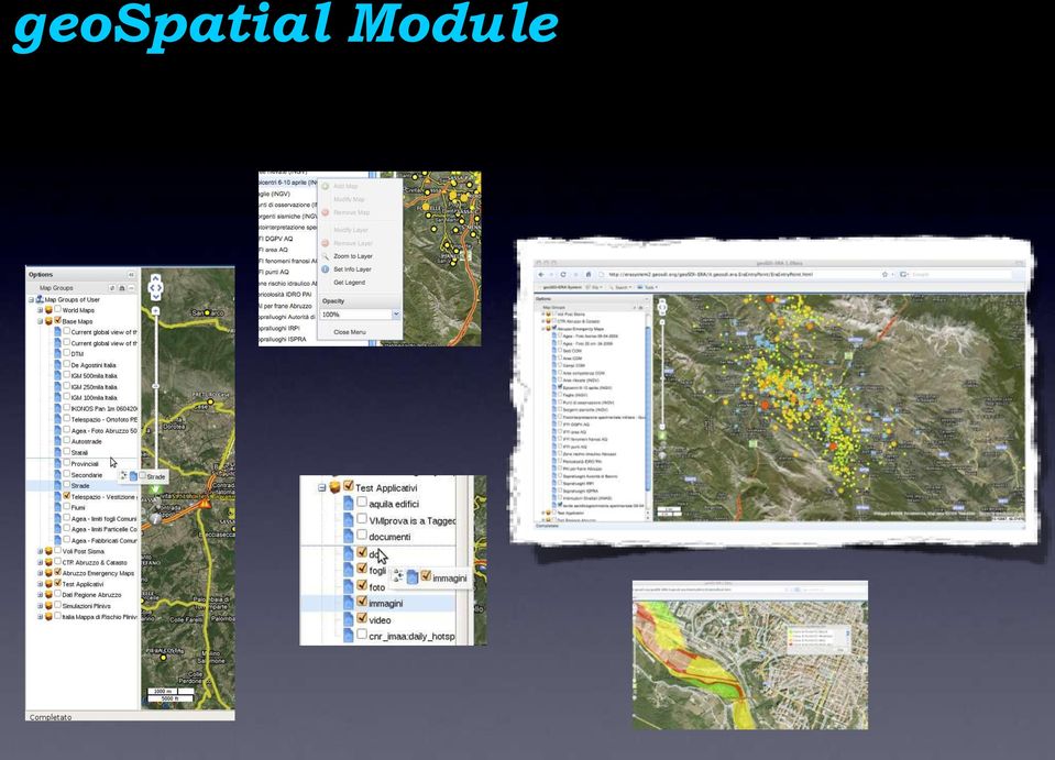
13 geospatial Module
14 Analisys of evidence The Cooperation and Interoperability Role No Cooperation No Interoperability.. Some Problems

15 geospatial Data Solution National and European Standard Some Solution but. No standard

16 geospatial Data Solution : Civil Protection Solution Civil Protection is.. Cooperation and interoperability

17 geospatial Solution on Web Involved People Citizen Generic Users Professional Users Digital Mapping and geomatics Specialist GIS Specialist Information System Manager Webmaster

18 GeoSpatial Data Interoperability

19 GeoSpatial Data Interoperability

20 GeoSpatial solution Goals Domain SDI Spatial Data Infrastructure Data and Informations Principal Goals To Find To Share To Manage


21 To Find


22 To Share GeoBatch


23 To Cooperate Geo-Platform Geo-Widget

24 To Use SLD-EDITOR WFS-EDITOR WPS
25 Requirement Platform Indipendent
26 Requirement Browser Indipendent
27 Requirement Data Indexing EptaDimensional DataBase Structure
28 Component of SDI Data Software User & Admin

29 geospatial Solution Is. Software as a Services


30 geospatial Solution has Modules and WidGet Styler WEB WPS Geocod CORE WFS-T Routing Plugin Engine XMPP
31 Component of SDI : Working Area Data : Server OWS DaaS Data as a Service Work Area : Web Software: Client SaaS Software as a Service Work Area : Web User & Admin Work Area : Web
32 Italian Group for NSDI Italian Civil and Military institutions used geospatial Solution to share geospatial services concerning the G Summit Area
33 Real Application screenshot Abruzzo Earthquake area of interest and Civil Protection structures
34 Real Application screenshot Orthophoto post-earthquake (look at the tends!!) and regional technical Map
35 Real Application screenshot Data from seismic sensors
36 Real Application screenshot Data from seismic sensors (WFS related info request)
37 Real Application screenshot Data from seismic sensors (WFS related info request)
38 Real Application screenshot Landslide phenomena
39 Real Application screenshot Damaged Buildings
40 Real Application screenshot Seismic sensor and terrain deformation from satellite image processing
41 Real Application screenshot Map of the Hydrogeological risk in the G8 Area
42 Real Application screenshot Haiti ERA Mosaic of Rapid Map : ONU NGA NASA Eros - GMosaic
43 Real Application screenshot Chile ERA Mosaic of Rapid Map : ONU NGA NASA Eros
44 Real Application screenshot Maierato ERA Mosaic of Rapid Map : IRPI Eros B Map


45 Real case : GeoSpatial Support for the G8 Italian National Spatial Infrastructure
46 Italian National Spatial Infrastructure
47 Metadata Catalogue of Catalogue Over Layer Inside

48 Login : user - Password : user
49 geosdi... and Europe INSPIRE - Monitor & Reporting Drafting Team
50 geosdi... and Europe Euromed PPRD Gis & EO Team
51 geosdi. and Defence Staff Defence Geospatial Information Working Group
52 geosdi. and United Nations

53 Arrivederci Dimitri Dello Buono
Geo-Platform Introduction
 Geo-Platform Introduction Dimitri Dello Buono @ geosdi 16 Sept 2013 CNR IRPI Perugia Questo lavoro è concesso in uso secondo i termini di una licenza Creative Commons (vedi ultima pagina) geosdi CNR IMAA
Mapping Mashup/Data Integration Development Resources Teaching with Google Earth and Google Ocean Stone Lab August 13, 2010
 Mapping Mashup/Data Integration Development Resources Teaching with Google Earth and Google Ocean Stone Lab August 13, 2010 David Hart GIS Specialist University of Wisconsin Sea Grant Institute Virtual
Green Move Web Viewer: critical issues and implementation
 GIT Geology and Information Technology 8a Riunione del Gruppo di Geologia informatica Sezione della Società Geologica Italiana Chiavenna, 17-19 giugno 2013 Polo Territoriale di Como Laboratorio di Geomatica
Cloud-based Infrastructures. Serving INSPIRE needs
 Cloud-based Infrastructures Serving INSPIRE needs INSPIRE Conference 2014 Workshop Sessions Benoit BAURENS, AKKA Technologies (F) Claudio LUCCHESE, CNR (I) June 16th, 2014 This content by the InGeoCloudS
What s new in Carmenta Server 4.2
 What s new in Carmenta Server 4.2 A complete solution for cost-effective visualisation and distribution of GIS data through web services Carmenta Server provides cost-effective technology for building
CubeWerx USA. Role-based Access Control. Best Practices for Geospatial SOA. 2008 NSDI CAP Project. 2007, CubeWerx USA
 Role-based Access Control Best Practices for Geospatial SOA 2008 NSDI CAP Project Key Points Participants, Scope and Objectives Project Design Best Practices Use Case Examples Participants U.S. Army Corps
Technology Trends In Geoinformation
 Technology Trends In Geoinformation Dato Prof. Sr Dr. Abdul Kadir Bin Taib Department of Survey and Mapping Malaysia (JUPEM) Email: drkadir@jupem.gov.my www.jupem.gov.my NGIS 2008 3 rd. National GIS Conference
Cloud computing application for water resources based on open source software and open standards a prototype
 Cloud computing application for water resources based on open source software and open standards a prototype Blagoj Delipetrev 1, Dimitri Solomatine 2 1 University Goce Delcev, Krste Misirkov bb, 2000
Mapping Mashup/Data Integration Development Resources
 Mapping Mashup/Data Integration Development Resources David Hart GIS Specialist University of Wisconsin Sea Grant Institute October 6, 2008 Virtual Globes A virtual globe is a 3D software model or representation
Design Requirements for an AJAX and Web-Service Based Generic Internet GIS Client
 11th AGILE International Conference on Geographic Information Science 2008 Page 1 of 6 Design Requirements for an AJAX and Web-Service Based Generic Internet GIS Client Edward Nash 1, Peter Korduan 1,
Smart Cities require Geospatial Data Providing services to citizens, enterprises, visitors...
 Cloud-based Spatial Data Infrastructures for Smart Cities Geospatial World Forum 2015 Hans Viehmann Product Manager EMEA ORACLE Corporation Smart Cities require Geospatial Data Providing services to citizens,
ArcGIS Framework Plug-In: Extending the ArcGIS Desktop for ANSI Standard Framework Data to Support Government Decision Making
 ArcGIS Framework Plug-In: Extending the ArcGIS Desktop for ANSI Standard Framework Data to Support Government Decision Making Final Project Report October 28, 2008 Agreement Number Organization Project
Introduction to Geospatial Web Services
 Geospatial Web Services Introduction to Geospatial Web Services An introduction and inventory of geospatial web services and their importance to interoperability in the geospatial domain. vers. 20100604
Francesco Tortorelli
 Francesco Tortorelli Joint CEN/TC 287 and OGC Workshop Bringing GI Standards-making bodies together Frascati (Rome), 30 September 2013 (AgID) AgID (previously CNIPA and DigitPA) is a government agency
Web-based spatio-temporal visualization and analysis of the Siberian Earth System Science Cluster (SIB-ESS-C)
") Web-based spatio-temporal visualization and analysis of the Siberian Earth System Science Cluster (SIB-ESS-C) Roman Gerlach Supervisor: Prof. C. Schmullius (Dept. of Geography, Friedrich-Schiller-University
Web-based spatio-temporal visualization and analysis of the Siberian Earth System Science Cluster (SIB-ESS-C) Roman Gerlach Supervisor: Prof. C. Schmullius (Dept. of Geography, Friedrich-Schiller-University
OPEN STANDARD WEB SERVICES FOR VISUALISATION OF TIME SERIES DATA OF FLOOD MODELS
 OPEN STANDARD WEB SERVICES FOR VISUALISATION OF TIME SERIES DATA OF FLOOD MODELS Barend Köbben FRMRC RPA 7 Workshop visualisations and flow simulations as flood risk communication tools
GeoMedia Product Update. Title of Presentation. Lorilie Barteski October 15, 2008 Edmonton, AB
 Product Update Title of Presentation Lorilie Barteski Edmonton, AB Know the audience poll Existing /Pro users Version 6.1 Version 6.0 Version 5.2 or earlier Existing WebMap users Version 6.1 Version 6.0
Developing Fleet and Asset Tracking Solutions with Web Maps
 Developing Fleet and Asset Tracking Solutions with Web Maps Introduction Many organizations have mobile field staff that perform business processes away from the office which include sales, service, maintenance,
gvsig: Open Source for handling Geospatial Information
 gvsig: Open Source for handling Geospatial Information Mario Carrera Rodríguez carrera_marrod@gva.es Generalitat Valenciana (GV) is the government of the Valencian Community (Castellón, Valencia, Alicante)
Spatial Data Infrastructures - trends and impacts on society. Max Craglia Joint Research Centre Digital Earth and Reference Data Unit
 Spatial Data Infrastructures - trends and impacts on society Max Craglia Joint Research Centre Digital Earth and Reference Data Unit Outline Where we were 20 years ago Where we are now Where we are going
Task AR-09-01a Progress and Contributions
 Doug Nebert, POC U.S. Geological Survey ddnebert@usgs.gov March 2010 Task AR-09-01a Progress and Contributions Background and scope for AR-09-01a This Task defines the minimum, common technical capabilities
PDOK Kaart, the Dutch Mapping API
 PDOK Kaart, the Dutch Mapping API Haico van der Vegt*, Leo van der Sluijs* * Cadastre, Land Registry and Mapping Agency of the Netherlands Abstract. PDOK (public services on the map) is a partnership of
Data interchange between Web client based task controllers and management information systems using ISO and OGC standards
 Data interchange between Web client based task controllers and management information systems using ISO and OGC standards Michael Nørremark 1*, Ole Jørgensen 1, Jens Bligaard 2 and Claus G. Sørensen 1
Authors: Maggie Ortiz Earthquake Engineering Research Institute. Oakland, CA 94612 Tel: 510-451-0905 Fax: 510-451-5411 maggie@eeri.
 USGS Award Numbers: G14AP00021 & G14AP00022 Start Date: 1/1/2014 End Date: 12/31/2014 Continued Enhancement of California Earthquake Clearinghouse Operations through Improved Data Collection, Sharing,
Primavera Project Management System at WVDOT. Presented by Marshall Burgess, WVDOT Stephen Cole, Stephen Cole Consulting Jervetta Bruce, CDP, Inc.
 : Integrating GIS With Primavera Project Management System at WVDOT Presented by Marshall Burgess, WVDOT Stephen Cole, Stephen Cole Consulting Jervetta Bruce, CDP, Inc. WVDOT Geographic Information System
Systèmes de mesures OGC compliant pour le monitoring des infrastructures dans le Projet ISTIMES
 Integrated System for Transport Infrastructures surveillance and Monitoring by Electromagnetic Sensing Systèmes de mesures OGC compliant pour le monitoring des infrastructures dans le Projet ISTIMES 3
GetLOD - Linked Open Data and Spatial Data Infrastructures
 GetLOD - Linked Open Data and Spatial Data Infrastructures W3C Linked Open Data LOD2014 Roma, 20-21 February 2014 Stefano Pezzi, Massimo Zotti, Giovanni Ciardi, Massimo Fustini Agenda Context Geoportal
GEOCOM PROJECT INTEGRATING DATA & TECHONOLOGIES
 GEOCOM PROJECT INTEGRATING DATA & TECHONOLOGIES Lucio Colaiacomo Chief Technology Officer l.colaiacomo@eusc.europa.eu Rationale for the project Providing support through our domain background & tech. expertise
Web-based Participatory GIS with data collection on the field: a prototype architecture in two and three dimensions
 8 Convegno Nazionale del Gruppo di Geologia Informatica Sezione della Società Geologica Italiana Chiavenna (SO), 17-19 giugno 2013 Ex Convento dei Cappuccini, Via Molinanca DICA Laboratorio di Geomatica
Web Mapping technologies for the valorization of slow tourism: the Via Regina project
 Web Mapping technologies for the valorization of slow tourism: the Via Regina project Maria Antonia Brovelli, Candan Eylul Kilsedar, Marco Minghini, Giorgio Zamboni Politecnico di Milano (DICA) Laboratorio
GeoNetwork, The Open Source Solution for the interoperable management of geospatial metadata
 GeoNetwork, The Open Source Solution for the interoperable management of geospatial metadata Ing. Emanuele Tajariol, GeoSolutions Ing. Simone Giannecchini, GeoSolutions GeoSolutions GeoSolutions GeoNetwork
Emerging Trends in SDI.
 Emerging Trends in SDI. Jeanne Foust ESRI gsdi 1 Spatial Data Infrastructure TRENDS GIS use continues to rapidly grow. Recognition Of GIS As Critical Infrastructure growing. Alignment of SDI and National
INTEROPERABLE IMAGE DATA ACCESS THROUGH ARCGIS SERVER
 INTEROPERABLE IMAGE DATA ACCESS THROUGH ARCGIS SERVER Qian Liu Environmental Systems Research Institute 380 New York Street Redlands, CA92373, U.S.A - qliu@esri.com KEY WORDS: OGC, Standard, Interoperability,
How To Use Arcgis For Free On A Gdb 2.2.2 (For A Gis Server) For A Small Business
 For A Small Business") Esri Middle East and Africa User Conference December 10 12 Abu Dhabi, UAE Understanding ArcGIS in Virtualization and Cloud Environments Marwa Mabrouk Powerful GIS capabilities Delivered as Web services
Esri Middle East and Africa User Conference December 10 12 Abu Dhabi, UAE Understanding ArcGIS in Virtualization and Cloud Environments Marwa Mabrouk Powerful GIS capabilities Delivered as Web services
AN INTEGRATED FRAMEWORK FOR SPATIO-TEMPORAL DATA MANAGEMENT: THE PROJECT BRISEIDE BRIDGING SERVICES INFORMATION AND DATA FOR EUROPE
 AN INTEGRATED FRAMEWORK FOR SPATIO-TEMPORAL DATA MANAGEMENT: THE PROJECT BRISEIDE BRIDGING SERVICES INFORMATION AND DATA FOR EUROPE Raffaele de Amicis, Giuseppe Conti, Federico Prandi* Fondazione Graphitech,
GIS Data Conversion. GIS maps are digital not analog. Getting the Map into the Computer
 Getting the Map into the Computer Getting the Map into the Computer Getting Started with Geographic Information Systems Chapter 4 4.1 Analog-to-Digital Maps 4.2 Finding Existing Map Data 4.3 Digitizing
Geospatially Enabling the World: The Convergence of Geospatial and Architectural and Engineering Design
 Geospatially Enabling the World: The Convergence of Geospatial and Architectural and Engineering Design Geoff Zeiss Director of Technology Autodesk Map Middle East Dubai 2007 1 Overview Geospatial inflection
G-MOSAIC. Project introduction Luboš Kučera Gisat. Project managed by Sergio Proietti Telespazio S.p.A.
 GMES services for Management of Operations, Situation Awareness and Intelligence for regional Crises Project introduction Luboš Kučera Gisat Project managed by Sergio Proietti Telespazio S.p.A. G-MOSAIC
GIS and Mapping Solutions for Developers. ESRI Developer Network (EDN SM)
") GIS and Mapping Solutions for Developers ESRI Developer Network (EDN SM) GIS and Mapping Solutions for Developers If you are a software developer looking for an effective way to bring geographic and mapping
GIS and Mapping Solutions for Developers ESRI Developer Network (EDN SM) GIS and Mapping Solutions for Developers If you are a software developer looking for an effective way to bring geographic and mapping
From Geoportal to Spatial Data Service Platform. Jani Kylmäaho National Land Survey of Finland Development Centre
 From Geoportal to Spatial Data Service Platform Jani Kylmäaho National Land Survey of Finland Development Centre 29.6.2012 Introduction National Land Survey of Finland - 1900 employees Development Centre
EXPLORING AND SHARING GEOSPATIAL INFORMATION THROUGH MYGDI EXPLORER
 EXPLORING AND SHARING GEOSPATIAL INFORMATION THROUGH MYGDI EXPLORER Subashini Panchanathan Malaysian Centre For Geospatial Data Infrastructure ( MaCGDI ) Ministry of National Resources and Environment
the Cloud Dean McCormick Regional Sales Manager Geospatial MEA Region
 Powering Big Data: From Creation to the Cloud Dean McCormick Regional Sales Manager Geospatial MEA Region The only constant is change, continuing change, inevitable change, that is the dominant factor
 Development tools to create Web-GIS applications DbMAP ASJ the best solution to easily publish GIS data from existing spatial databases and distributed GIS data sources Easily designs, produces, and publishes
Institute of Natural Resources Departament of General Geology and Land use planning Work with a MAPS
 Institute of Natural Resources Departament of General Geology and Land use planning Work with a MAPS Lecturers: Berchuk V.Y. Gutareva N.Y. Contents: 1. Qgis; 2. General information; 3. Qgis desktop; 4.
Geospatial exploitation Products. GXP WebView. Powered by the GXP Platform
 Geospatial exploitation Products GXP WebView Powered by the GXP Platform Exploitation Capabilities GXP WebView Powered by the GXP Platform Detailed annotation (text, points, lines, and polygons) Distance,
About As. In a team with the best. ESRI Bulgaria is the exclusive distributor of Esri Inc. for Bulgaria. Esri Inc.
 About As ESRI Bulgaria is an IT company, leader in the field of Geographic Information Systems (GIS) on the Bulgarian market. Offering the most advanced high-tech products, solutions and services, ESRI
INPE Spatial Data Infrastructure for Big Spatiotemporal Data Sets. Karine Reis Ferreira (INPE-Brazil)
") INPE Spatial Data Infrastructure for Big Spatiotemporal Data Sets Karine Reis Ferreira (INPE-Brazil) INPE (Brazil) and Big Data I work at INPE (Brazilian National Institute for Space Research). Main gate
INPE Spatial Data Infrastructure for Big Spatiotemporal Data Sets Karine Reis Ferreira (INPE-Brazil) INPE (Brazil) and Big Data I work at INPE (Brazilian National Institute for Space Research). Main gate
The Spatial Data Infrastructure of Spain as an example of success in Europe *
 UNITED NATIONS E/CONF.99/IP.16 ECONOMIC AND SOCIAL COUNCIL Ninth United Nations Regional Cartographic Conference for the Americas New York, 10-14 August 2009 Item 7(b) of the provisional agenda Best Practices
THE SPATIAL DATA INFRASTRUCTURE OF SPAIN AS AN EXAMPLE OF SUCCESS IN EUROPE
 THE SPATIAL DATA INFRASTRUCTURE OF SPAIN AS AN EXAMPLE OF SUCCESS IN EUROPE Julio Mezcua-Rodríguez (jmezcua@fomento.es) Instituto Geográfico Nacional (National Geographic Institute). General Ibañez Ibero,
2009 CAP Grant Kickoff USGS, Reston, VA May 21, 2009
 Leveraging GOS Map and Data Services for Search and Rescue Operations using NASA WorldWind Open Source 3D Visualization Platform Nadine Alameh, Ph.D. MobiLaps LLC 2009 CAP Grant Kickoff USGS, Reston, VA
INSPIRE in practice: Experiences with INSPIRE data and services
 INSPIRE in practice: Experiences with INSPIRE data and services Peter Parslow Principal Geographic Information Architect June 2014: ISO TC211 Standards in Practice workshop What s INSPIRE? European Commission
Portal for ArcGIS. Satish Sankaran Robert Kircher
 Portal for ArcGIS Satish Sankaran Robert Kircher ArcGIS A Complete GIS Data Management Planning & Analysis Field Mobility Operational Awareness Constituent Engagement End to End Integration Collect, Organize,
The use of Semantic Web Technologies in Spatial Decision Support Systems
 The use of Semantic Web Technologies in Spatial Decision Support Systems Adam Iwaniak Jaromar Łukowicz Iwona Kaczmarek Marek Strzelecki The INSPIRE Conference 2013, 23-27 June Wroclaw University of Environmental
Configuration Guide. How to Configure SSL VPN Features in DSR Series. Overview
 Configuration Guide How to Configure SSL VPN Features in DSR Series Overview This document describes how to configure D-Link DSR-500N to enable SSL VPN feature. An SSL VPN is a form of VPN that can be
Installation Guide. Research Computing Team V1.9 RESTRICTED
 Installation Guide Research Computing Team V1.9 RESTRICTED Document History This document relates to the BEAR DataShare service which is based on the product Power Folder, version 10.3.232 ( some screenshots
How To Test For Anspire
 Network for testing GI services Anders Östman GIS Institute, University of Gävle, Nobelvägen 2, SE 80176, Gävle, Sweden Anders.Ostman@hig.se Abstract. The use of standards is essential when building a
Agenda. What is GIS? GIS and SAP Real Examples
 Agenda What is GIS? GIS and SAP Real Examples Life Without GIS My Stuff My Paper Maps Features Three Elements of a GIS Attributes What parcels are adjacent to Main Street? Behavior Display Query Analysis
Introduction to the Mapbender OWS Security Proxy
 Introduction to the Mapbender OWS Security Proxy Arnulf Christl, WhereGroup GmbH & Co. KG, Bonn, Germany 1/16 Agenda 1 Introduction to the Architecture OWS from Bottom Up with the OSGeo SDI Software Stack
Databases for 3D Data Management: From Point Cloud to City Model
 Databases for 3D Data Management: From Point Cloud to City Model Xavier Lopez, Ph.D. Senior Director, Spatial and Graph Technologies Oracle Program Agenda Approach: Spatially-enable the Enterprise Oracle
ISO 19119 and OGC Service Architecture
 George PERCIVALL, USA Keywords: Geographic Information, Standards, Architecture, Services. ABSTRACT ISO 19119, "Geographic Information - Services," has been developed jointly with the Services Architecture
Enabling embedded maps
 Enabling embedded maps Case: National geoportal of Finland Antti Rainio National Land Survey of Finland Trends: Web Services, Mapping Mashup, Open Source, Open Data Decentralised data s Service interfaces
A DISTRIBUTED CATALOG AND DATA SERVICES SYSTEM FOR REMOTE SENSING DATA
 A DISTRIBUTED CATALOG AND DATA SERVICES SYSTEM FOR REMOTE SENSING DATA Ramachandran Suresh *, Liping Di *, Kenneth McDonald ** * NASA/RITSS 4500 Forbes Blvd, Lanham, MD 20706, USA suresh@rattler.gsfc.nasa.gov
GNSS Scenario. By Dr Ashok Kaushal. GNSS scenario in India in India. 05/08/2007 Slide No.: 1
 GNSS Scenario in India By Dr Ashok Kaushal ASL 1 Advanced Systems Pvt. Aerospace Ltd., Systems Bangalore Pvt. Ltd. Slide No.: 1 Content Introduction Significance of Location Trends G 3 perspective Location
Vision. South Pacific GIS/RS Conference 2015 11/17/2015. Applying Geography Everywhere. Applying Geography Everywhere
 South Pacific GIS/RS Conference 2015 Applying Geography Everywhere Jithen (J) Singh Eagle Technology Group Ltd (Esri New Zealand) Suva, Fiji Vision Applying Geography Everywhere 1 GIS Is Evolving A Whole
Cloud Computing and Government Services August 2013 Serdar Yümlü SAMPAŞ Information & Communication Systems
 eenviper White Paper #4 Cloud Computing and Government Services August 2013 Serdar Yümlü SAMPAŞ Information & Communication Systems 1 Executive Summary Cloud computing could revolutionise public services
HRG Performance Series DVR DDNS Support Application Note (hrgddns)
") HRG Performance Series DVR DDNS Support Application Note (hrgddns) This document describes how to enable and configure Dynamic DNS (DDNS) functionality on the HRG Performance Series digital video recorder
HRG Performance Series DVR DDNS Support Application Note (hrgddns) This document describes how to enable and configure Dynamic DNS (DDNS) functionality on the HRG Performance Series digital video recorder
THE STATUS OF DISASTER EDUCATION IN THE UNIVERSITIES OF SRI LANKA. Rekha Nianthi Department of Geograohy University of Peradeniya Sri Lanka
 THE STATUS OF DISASTER EDUCATION IN THE UNIVERSITIES OF SRI LANKA Rekha Nianthi Department of Geograohy University of Peradeniya Sri Lanka Disaster management related national/public education and awareness
_ LUCIADRIA PRODUCT DATA SHEET
 _ LUCIADRIA PRODUCT DATA SHEET V2015.1 LuciadRIA offers browser-based geospatial situational awareness with the fluidity and speed of a desktop application. The software components of LuciadRIA have been
The Framework of GIS in North Dakota. Approved by the GISTC: January 28, 2009
 The Framework of GIS in North Dakota Approved by the GISTC: January 28, 2009 Purpose This document provides a definition and scope of GIS in North Dakota at the state government level. Scope Role of the
How to Setup and Manage Spatial Assets with ArcGIS Online for a Mobile Workforce
 How to Setup and Manage Spatial Assets with ArcGIS Online for a Mobile Workforce W A U R I S A 2 0 1 4 Presented By Engineer Technician II Pierce County Public Works and Utilities Road Operations Division
Enterprise GIS Solutions to GIS Data Dissemination
 Enterprise GIS Solutions to GIS Data Dissemination ESRI International User Conference July 13 17, 2009 Wendy M. Turner Senior GIS Engineer & Program Manager Freedom Consulting Group, LLC Building the Enterprise
Gram Panchayat & Ward Boundary Delineation and Assets mapping
 Gram Panchayat & Ward Boundary Delineation and Assets mapping For Rural Development Department & State Election Commission, Govt. of Maharashtra MAHARASHTRA REMOTE SENSING APPLICATIONS CENTRE Autonomous
How to remotely access your Virtual Desktop from outside the college using VMware View Client. How to guide
 How to remotely access your Virtual Desktop from outside the college using VMware View Client How to guide Author: ICT Services Version: 1.0 Date: November 2015 Contents What is the VMware View Client?...
EUDATA WCS. Leap to Next Generation Customer Care
 EUDATA WCS Leap to Next Generation Customer Care What We Do We Develop products that enhance WEB customer care performance We are Experts in integrating these products into complex customer platforms We
GMES in Poland: Achievements and Challanges. Marek Banaszkiewicz Space Research Centre of the Polish Academy of Sciences
 GMES in Poland: Achievements and Challanges Marek Banaszkiewicz Space Research Centre of the Polish Academy of Sciences GMES in Poland 2 Responsible Ministry: Higher Education and Science Cooperating Ministries:
Bhuvan. Indian Earth Observation Visualization. Indian Space Research Organisation. http://bhuvan.nrsc.gov.in. Multi Resolution. Societal Applications
 Multi Resolution Bhuvan Societal Applications Indian Earth Observation Visualization http://bhuvan.nrsc.gov.in 3D Geographic Models Seamless Fly Through Indian Space Research Organisation Thematic Vectors
WP 7: Build prototype software
 Systemic Seismic Vulnerability and Risk Analysis for Buildings, Lifeline Networks and Infrastructures Safety Gain WP 7: Build prototype software D. Schäfer, VCE A. Bosi, VCE T. Gruber, VCE H. Wenzel, VCE
Leveraging Geospatial Information Across the Enterprise: Bentley s Flexible Geospatial Approach
 Leveraging Geospatial Information Across the Enterprise: Bentley s Flexible Geospatial Approach A Bentley White Paper Gijsbert Noordam Senior Consultant, Geospatial Center of Excellence www.bentley.com
DISMAR: Data Integration System for Marine Pollution and Water Quality
 DISMAR: Data Integration System for Marine Pollution and Water Quality T. Hamre a,, S. Sandven a, É. Ó Tuama b a Nansen Environmental and Remote Sensing Center, Thormøhlensgate 47, N-5006 Bergen, Norway
Deploying a Geospatial Cloud
 Deploying a Geospatial Cloud Traditional Public Sector Computing Environment Traditional Computing Infrastructure Silos of dedicated hardware and software Single application per silo Expensive to size
Quick Set Up Guide for Users: Salesforce Authentication & Email Importing
 Quick Set Up Guide for Users: Salesforce Authentication & Email Importing Once a Match My Email (MME) account has been set up for a company by the Cloud Admin, additional users that have been added under
How To Use Gis
 Welcome Understanding Purpose Creating Relationships You A Global Community of GIS Professionals Changing the World Together Applying Geography Everywhere Your WORK Showcasing Your Web Apps Vision Applying
DreamFactory on Microsoft SQL Azure
 DreamFactory on Microsoft SQL Azure Account Setup and Installation Guide For general information about the Azure platform, go to http://www.microsoft.com/windowsazure/. For general information about the
The paths of Via Regina geomatics for sustainable mobility
 FOSS4G Europe Bremen 15-17 July 2014 The paths of Via Regina geomatics for sustainable mobility Maria Antonia Brovelli (*), Massimiliano Cannata (**), Alba Lucchese (*), Marco Minghini (*), Marco Negretti
Establishment of Spatial Data Infrastructure within the Environmental Sector in Slovak Republic
 EnviroInfo 2005 (Brno) Informatics for Environmental Protection - Networking Environmental Information Establishment of Spatial Data Infrastructure within the Environmental Sector in Slovak Republic Martin
ATLAS CARTOGRAPHIC TECHNOLOGIES LTD. (ATLASCT) Dedicated Geo-Server. Business Proposal
 Dedicated Geo-Server. Business Proposal") ATLAS CARTOGRAPHIC TECHNOLOGIES LTD. (ATLASCT) Dedicated Geo-Server Business Proposal Contents Introduction... 3 Dedicated Geo-Server Solution... 4 Functionality... 5 Usage examples... 6 Included products
ATLAS CARTOGRAPHIC TECHNOLOGIES LTD. (ATLASCT) Dedicated Geo-Server Business Proposal Contents Introduction... 3 Dedicated Geo-Server Solution... 4 Functionality... 5 Usage examples... 6 Included products
Oklahoma s Open Source Spatial Data Clearinghouse: OKMaps
 Oklahoma s Open Source Spatial Data Clearinghouse: OKMaps Presented by: Mike Sharp State Geographic Information Coordinator Oklahoma Office of Geographic Information MAGIC 2014 Symposium April 28-May1,
A Hybrid Architecture for Mobile Geographical Data Acquisition and Validation Systems
 A Hybrid Architecture for Mobile Geographical Data Acquisition and Validation Systems Claudio Henrique Bogossian 1, Karine Reis Ferreira 1, Antônio Miguel Vieira Monteiro 1, Lúbia Vinhas 1 1 DPI Instituto
Using Remote Web Workplace Version 1.01
 Using Remote Web Workplace Version 1.01 Remote web workplace allows you to access your Windows XP desktop through Small Business Server 2003 from a web browser. 1. Connect to the Internet in your remote
Leveraging Geospatial Information Across the Enterprise: Bentley s Flexible Geospatial Approach
 Leveraging Geospatial Information Across the Enterprise: Bentley s Flexible Geospatial Approach A Bentley White Paper Gijsbert Noordam Product Manager Nicolas Loubier Senior Product Manager July 2012 www.bentley.com
Intergraph Roadway Information Management Solution. Title Title. Title Title. A White Paper
 Intergraph Roadway Information Management Solution A White Paper Security, Government & Infrastructure, a division of Intergraph Title Title Title Title Table of Contents 1. Introduction... 1 2. Intergraph
GeoNetwork, The Open Source Solution for the interoperable management of geospatial metadata
 GeoNetwork, The Open Source Solution for the interoperable management of geospatial metadata Ing. Simone Giannecchini, GeoSolutions Ing. Emanuele Tajariol, GeoSolutions Outline GeoNetwork Introduction
Integrated Risk Management System Components in the GEO Architecture Implementation Pilot Phase 2 (AIP-2)
") Meraka Institute ICT for Earth Observation PO Box 395 Pretoria 0001, Gauteng, South Africa Telephone: +27 12 841 3028 Facsimile: +27 12 841 4720 University of KwaZulu- Natal School of Computer Science
Meraka Institute ICT for Earth Observation PO Box 395 Pretoria 0001, Gauteng, South Africa Telephone: +27 12 841 3028 Facsimile: +27 12 841 4720 University of KwaZulu- Natal School of Computer Science
13 th EC GI & GIS Workshop WIN: A new OGC compliant SOA. for risk management. GMV, 2007 Property of GMV All rights reserved
 13 th EC GI & GIS Workshop WIN: A new OGC compliant SOA for risk management GMV, 2007 Property of GMV All rights reserved Content 1. Introduction 2. Objectives 3. Architecture and Model 4. Technical aspects
Centre for EcologicalNoosphere Studies NAS RA CENS
 SCOPES 2009-2012 Scientific Co-operation between Eastern Europe and Switzerland Accessing Armenian Environmental data through CENS Spatial Data Infrastructure Centre for EcologicalNoosphere Studies NAS
Esri GIS Mobile Solutions. John Sharrard jsharrard@esri.com
 Esri GIS Mobile Solutions John Sharrard jsharrard@esri.com If I had asked people what they wanted, they would have said faster horses. Henry Ford Trend: Increase demand for location services Pew Research
Managing Social Media in a Disaster. Jeff Baranyi Public Safety Tech Lead and Esri Disaster Response Team
 Managing Social Media in a Disaster Jeff Baranyi Public Safety Tech Lead and Esri Disaster Response Team Esri Disaster Response Program www.esri.com/disaster Support our users, our partners and Esri personnel
High-Performance Visualization of Geographic Data
 High-Performance Visualization of Geographic Data Presented by Budhendra Bhaduri Alexandre Sorokine Geographic Information Science and Technology Computational Sciences and Engineering Managed by UT-Battelle
OSGeo Web Mapping Typification: GeoMajas, Mapbender, MapFish and OpenLayers. Christoph Baudson Arnulf Christl FOSS4G 2010 Barcelona
 OSGeo Web Mapping Typification: GeoMajas, Mapbender, MapFish and OpenLayers Christoph Baudson Arnulf Christl FOSS4G 2010 Barcelona Disclaimer All information contained in this presentation has been compiled
Google Enterprise Geospatial. Andrea Aymerich Head of Geo Enterprise Italy
 Google Enterprise Geospatial Andrea Aymerich Head of Geo Enterprise Italy Google Confidential 2011 Google Internet Traffic Growth Location is anywhere Worldwide smartphone and tablet shipment exceed PC