Catalogue of Hydrographic Publications
|
|
|
- Sherilyn Fletcher
- 10 years ago
- Views:
Transcription
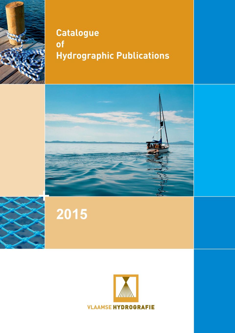
1 Catalogue of Hydrographic Publications 2015

2 InDEX 1. CHARTS Chart 1 - INT Paper Charts Charts Chart sets Overview charts 1.3. Electronic Navigational Charts - ENCs 1.4. Inland Electronic Navigational Charts IENCs 1.5. Chart indexes Nautical Paper Charts Chart index P1 - Nautical charts Chart index P2 - Chart sets Chart index P3 - Overview Charts 1.6. Chart indexes Electronic Nautical Charts Chart index E1 - ENCs Chart index E2 - IENCs 1.7. Product Specifications HYDROGRAPHIC PUBLICATIONS Notices to Mariners Tide tables IALA Maritime Buoyage System 2.4. List of Lights and Fogsignals 2.5. Tidal Streams Atlas 2.6. List of Hydrographical Publications SALE At the Flemish Hydrography Bookstores hydrographic products REVISION OF PUBLICATIONS 19 Compiled by: Coastal Division - Flemish Hydrography Administratief Centrum (1 st Floor) Vrijhavenstraat Oostende, Belgium Published by: Agency for Maritime and Coastal Services Brussels 2015 Flemish Government Design:

3 1. CHARTS 1.1. Chart 1 - InT 1 The INT 1 gives an overview of international signs, abbreviations and terms used on nautical charts. It is regularly published in Dutch by the Flemish Hydrography Paper Charts Covered area: Belgian and adjacent Dutch and French coasts Western Scheldt and Sea Scheldt up to Wintam Charts Nautical paper charts are national and international separate large charts. Several member states of the International Hydrographic Organisation (IHO) publish INTernational nautical paper charts. These charts can be incorporated in the other members national series, thanks to the standardisation of the presentation. Apart from a worldwide INT-charts series on a scale of 1:3.5 million to 1:10 million, the number of middle and large scale INT-charts available is steadily growing. Some of the Belgian paper charts are part of this INT-charts series. These charts do not only get an international number, printed in magenta and preceded by INT, but also a Belgian chart number. These paper charts are mentioned in this catalogue. The symbols and their meaning used on these charts are clarified in the INT 1 publication. Each newly published chart features the BaZ number up to which the chart has been corrected and revised (see also 4. Revision of Publications on page 19 in this catalogue). An overview of the nautical charts is given below in Chart index P1 on page 6 and in 1.7. Product Specifications Nautical Charts on page 11. 3
 publish INTernational nautical paper charts.")
4 Chart sets Covered area: Western Scheldt and Sea Scheldt up to Wintam Gent-Terneuzen Canal Chart-sets consist of several loose overlapping charts, collected in a folder. Each set of charts contains a legend, explaining most of the used symbols. These symbols are generally analogous to the INT 1, described above (1.1.). Each newly published chart features the BaZ number up to which the chart has been corrected and revised (see also 4. Revision of Publications on page 19 in this catalogue). An overview of the paper chart-sets is given below in Chart index P2 on page 7 and in 1.7. Product Specifications Nautical Charts on page Overview charts Covered area: Western Scheldt (Vlissingen up to Antwerp) Belgian North Sea These charts cover a large area and can be used as overview charts. They are printed on single large map sheets. The charted symbols and their explanation can be found in the publication INT 1 (see above). The nautical information is updated till the date which is mentioned in the lower, left corner of the mapsheet. These charts are unsuitable for navigation as they are not updated by the Notices to Mariners. An overview of the paper chart-sets is given below in Chart index P3 on page 8 and in 1.7. Product Specifications Nautical Charts on page 11. 4

5 1.3. Electronic Navigational Charts - ENCs Covered area: Belgian Continental Shelf, Belgian Territorial Sea and channels to and from the Belgian seaports Sea Scheldt up to Wintam and channel to the Antwerp port docks Gent-Terneuzen Canal on Belgian territory and channel to the Gent port docks These official international electronic charts can be used in an ECDIS system. The ENCs are distributed on request to chart agencies by Value Added Resellers (VARs). For more information, see An overview of the ENCs is given below in Chart index E1 on page 9 and in 1.7. Product Specifications Nautical Charts on page Inland Electronic Navigational Charts - IENCs Covered area: Harbour Zeebrugge and the 5-miles zone for estuarian navigation between Zeebrugge and de Belgian-Dutch border Canal Boudewijn between Zeebrugge and Brugge Sea Scheldt up to Wintam and channel to the Antwerp port docks Gent-Terneuzen Canal on Belgian territory and channel to the Gent port docks These official electronic navigational charts can be used in an ECDIS system. The IENCs can be downloaded for free from An overview of the IENCs is given below in Chart index E2 on page 10 and in 1.7. Product Specifications on page 11. 5

6 1.5. Chart indexes - Nautical Paper Charts Chart index P1 - Nautical charts 6

7 Chart index P2 - Chart sets 7

8 Chart index P3 - Overview charts

9 1.6 Chart indexes - Electronic nautical charts Chart index E1 - ENCs 9

10 Chart index E2 - IENCs

11 1.7. Product Specifications Nautical Charts Paper Charts- see Chart index P1 - page 6 Depositing Code number Title of chart Scale 1/ First edition Last edition nat. Int. TA Chart 1 - INT 1 - Symbols, abbreviations, terms used on charts (booklet) Nov KD11 D11 - North Sea - Flemish Banks 100, Oct From Gravelines to Oostkapelle With map: Zeebrugge 20,000 Nieuwpoort 20,000 Oostende 15,000 Blankenberge 15,000 1 chart 110 x 79 cm K North Sea, Belgian-Dutch Coast 60, Oct From Oostende to Westkapelle With map Zeebrugge 20,000 Vlissingen 25,000 Brugge 15,000 1 chart 115 x 84 cm K North Sea, French-Belgian Coast 60, Oct From Duinkerke to Oostende Nieuwpoort 20,000 Oostende 15,000 1 chart 115 x 84 cm K Western Scheldt-Sea Scheldt 1998 Jan Baalhoek to Wintam Part A: Baalhoek to Antwerpen Part B: Antwerpen to Hoboken Part C: Hoboken to Wintam 30,000 15,000 1 chart 119 x 81 cm 11

12 Paper Chart sets - see also Chart index P2 - page 7 Depositing code Number Title of chart Scale 1/ Nat. Int. K Western Scheldt-Sea Scheldt Western Scheldt mouth till Rupel mouth from 15,000 - till 50,000 First edition Last edition 1936 Aug Contains 10 charts 104/01: Monding Rupel - Hemiksem 104/02: Hemiksem - Hoboken 104/03: Antwerpen 104/04: Doel - Boerenschans 104/05: Saeftinge - Doel 104/06: Valkenisse - Saeftinge 104/07: Walsoorden - Valkenisse 104/08: Hansweert 104/09: Terneuzen - Hansweert 104/10: Wielingen - Vlissingen 25.5 x 35.5 cm / 51.0 x 35.5 cm 15,000 15,000 25,000 30,000 25,000 25,000 25,000 25,000 50,000 50,000 K Gent-Terneuzen Canal 1991 Apr Contains 11 charts 105/01: Gent 105/02: Gent Zeehaven 105/03: Desteldonk 105/04: Terdonk 105/05: Rieme 105/06: Zelzate 105/07: Sas van Gent 105/08: Sas van Gent - Sluiskil 105/09: Sluiskil 105/10: Sluiskil-Terneuzen 105/11: Terneuzen 25.5 x 35.5 cm / 51.0 x 35.5 cm Depositing code Overview charts- see Chart index P3 - page 8 Number Title of chart Scale 1/ nat. Int. First edition Last edition K Western Scheldt 50, Jan Vlissingen to Antwerpen 122 x 60 cm KBNZ BNZ - Belgian North Sea 100, Jun Printed on white paper 90gr 98 x 85 cm KSED 1866 Special edition Reproduction facsimile "Carte Générale des Banc de Flandres" 100, x 70 cm 12

13 Electronic Charts (ENCs) - see also Chart index E1 - page 9 Cell number Cell name Scale 1/ Usage-band BE3VLBNK Flemish Banks 90, Coastal BE4VBLNK Approach to Zeebrugge and Oostende 45, Approach BE5ZEEBR Zeebrugge 4, Harbour BE5OOSTE Oostende 4, Harbour BE5ANTWN Antwerpen-Noord 22, Harbour BE5ANTWZ River Scheldt (Antwerpen to Wintam) 12, Harbour BE5KGETE Gent-Terneuzen Canal (ENC) 12, Harbour For an overview of the covering worldwide see Electronic navigational charts for inland navigation (IENCs) - see 1.9. Chart index E2 page 10 Cell number Cell name Scale 1/ Usage-band BE7GT017 Kanaal Gent-Terneuzen 7 - River BE7BZ001 Antwerpen Noord (BE-NL grens tot Tavernierkaai) 7 - River BE7BZ002 Antwerpen Zuid (Schelde Antwerpen tot Wintam) 7 - River BE7EV001 Zeebrugge Estuaire Vaart (Zeebrugge tot BE-NL grens) 7 - River BE7BK001 Boudewijnkanaal (Zeebrugge Achterhaven-Brugge) 7 - River The IENCs can be downloaded for free on 13
 - see 1.9.")
14 2. HYDROGRAPHIC PUBLICATIOnS 2.1. notices to Mariners The publication Notices to Mariners (Berichten aan Zeevarenden - BaZ) is published every fortnight. The fi rst yearly edition of this publication, NtM issue 1, gives a general overview of all the messages with a permanent character. The publication features recent information of importance to the navigation sector, plus supplements and corrections to the nautical charts. The extremely varied type of information includes the dates and times of army shooting exercises, new buoys placed in the sea and recent wrecks and obstacles. The bulk of the information can be applied straightaway to update nautical charts. These updates ensure seafarers that their nautical charts always show the most recent information, thus offering them a reliable instrument during their sea trips. From 2010 on the Notices to Mariners will be published in English as well Tide booklet and tide tables Knowing high and low water times is of vital importance for seafarers, who have to reckon with shoals and sandbanks. The Flemish Hydrography determines the water level at the tide measuring stations located in Nieuwpoort, Oostende and Zeebrugge. Longterm measurements form a basis for computing the tide forecasts. The forecasts are included in a touristic booklet and in professional tide tables that are published every year. The tide tables contain all high and low water times in Nieuwpoort, Oostende, Blankenberge, Zeebrugge, Vlissingen, Prosperpolder, Anwerpen and Wintam for the current year. The tidal data for Vlissingen are provided by Rijkswaterstaat, the Netherlands. The tidal data for Prosperpolder, Antwerpen and Wintam are provided by the Hydrological Institute (Waterbouwkundig Laboratorium) in Borgerhout. The calculation of the tidal data for Blankenberge is based upon extrapolation IALA Maritime Buoyage System Buoyage is an aid to navigators and a means to complete nautical charts. It gives additional direction to seafarers, thus ensuring safe navigation. Until the 60s, every country bordering the sea had its own buoyage system which often led to confusion and even accidents. The International Association of Lighthouse Authorities (IALA), located in France, therefore founded an international, worldwide used Maritime Buoyage System. All buoys and beacons used throughout the world are described in our publication Maritime Buoyage System List of Lights and Fogsignals The List of Lights and Fogsignals (Lichtenlijst) has been published every 3 to 4 years starting in It describes all lights and fogsignals at sea, on the River Scheldt and on the Gent-Terneuzen Canal. Corrections and supplements to this list are published in the Notices to Mariners (BaZ). When you buy a List of Lights and Fogsignals, a list of all corrections and supplements is added to the book. 14

15 2.5. Tidal Streams Atlas The Tidal Streams Atlas for the Flemish Banks - North Sea (Stroomatlas voor de Vlaamse Banken - Noordzee) indicates the tidal streams for spring- and neap-tide from 6 hours, 5 hours, etc. before, to 6 hours after high water at Zeebrugge List of hydrographical publications Depositing code Title First edition New edition or periodicity Per number For a year subscription - Tide booklet for Nieuwpoort, Oostende, Blankenberge and Zeebrugge (1) (water relative to TAW) 2009 yearly free - GTJJ (2) Tide tables for Nieuwpoort, Oostende, Blankenberge, Zeebrugge, Vlissingen, Prosperpolder, Antwerpen and Wintam (water relative to TAW and LAT) 1932 yearly BAZJJ (2) Notices to Mariners (in English from 2010 on) 1951 fortnightly BAZJJ/1 (2) BAZJJ/1/ENG (2) Notices to Mariners n 1 English or Dutch 1951 yearly LI2013 List of Lights and Fogsignals for Belgium and adjacent waters SAVB1992 Atlas of tidal streams for Belgium SAZB2011 Atlas of tidal streams Zeebrugge: Pas van het Zand and central part of the new outer harbour SAO2013 Atlas of tidal streams at the port of Oostende MBS2015 Maritime Buoyage System Catalogue of Hydrographic Publications electronically on website - Overview of tidal data at the Belgian coast - period for Nieuwpoort, Oostende and Zeebrugge (1) Only obtainable at the municipalities and tourist offices (2) Please change JJ to indicate the desired edition e.g. order tide tables 2014 = GT14 15

16 3. SALE 3.1. At the offices of the Flemish Hydrography After depositing the proper price (see and 2.6.) on the following bank account, indicating the code (see also an 2.6.), the number of copies and F and your VAT-number in case you want an invoice for your order, your publications will be sent to you by mail. Should you prefer to pick up your order at the Flemish Hydrography s offices, please make an appointment on +32(0)59/ first or at [email protected]. Bank account EVFH at Borgerhout: IBAN: BE BIC: GKCCBEBB Flemish Government Agency for Maritime and Coastal Services Coastal Division Flemish Hydrography Administrative Centre Vrijhavenstraat Oostende Tel.: +32(0)59/ Mail: [email protected] 3.2. At specialised bookstores Address KD11 K101 K102 K104 GT Other Antwerpen Bogerd-Martin N.V. Oude Leeuwenrui Antwerpen tel. 03/ Landtmeters Naval Stores NV/SA Godefriduskaai Antwerpen tel. 03/ UVO Napoleonskaai 3 tot Antwerpen tel. 03/ Tresco Engineering bvba Kribbestraat Antwerpen tel. 03/ ENC ENC Blankenberge North Sea Boating Oude Wenduinse Steenweg Blankenberge tel. 050/
59/55 42 52 first or at hydrowinkel@mow.vlaanderen.be.")
17 Address KD11 K101 K102 K104 GT Other Brussel Plaisance Metsysstraat Brussel tel. 02/ Nieuwpoort Boat-House Watersportlaan 7 S 8620 Nieuwpoort tel. 058/ Euro-Boat Watersportlaan Nieuwpoort tel. 058/ Ship Chandler Collart Watersportlaan 7 S Nieuwpoort Tel. 0475/ Ship-Shop Watersportlaan Nieuwpoort tel. 058/ The Nauticstore Watersportlaan Nieuwpoort Tel. 058/ [email protected] West-Diep Louisweg Nieuwpoort tel. 058/ Oostende Compas Hendrik Baelskaai Oostende tel. 059/ Cortois Hendrik Baelskaai Oostende tel. 059/ of 0495/ TA08 KSED1866 on demand: SAZB2011 Le Galion Visserskaai Oostende tel. 059/ KSED1866 Visé Comptoir Technique de la Plaisance Mr. J.M. Raes Promenade d Aiguillon Visé (Devant-le-Pont) tel. 04/

18 Address KD11 K101 K102 K104 GT Other Zeebrugge ASTRON Kapitein Joris Praet Kustlaan Zeebrugge tel. 050/ Marinetechnics Werfkaai Zeebrugge tel. 050/ KSED1866 Scheepswerven Vandamme Werfkaai Zeebrugge tel. 050/ SAZB2011 V.V.C. Equipment Kotterstraat Zeebrugge Tel. 050/ Nederland Datema Prins Hendrikkade 176/ TC Amsterdam Nederland on demand ENCs are distributed by Value Added Resellers (VARs) to chart agencies. For more information, please see : Abbreviations : KD11 D11 - North Sea Flemish Banks K /INT North Sea Belgian-Dutch Coast - Western Scheldt mouth - from Oostende to Westkapelle K /INT North Sea French-Belgian Coast - from Duinkerke to Oostende K Western Scheldt - Sea Scheldt (11 charts set) KSED1866 Special edition - reproduction facsimile Carte Générale des Bancs de Flandres 1866 GT Tide table TA08 Chart 1 - INT 1 - Symbols, abbreviations SAZB2011 Atlas of tidal streams Zeebrugge: Pas van het Zand and central part of the new outer harbour ENC Electronic Navigational Chart 18

19 4. REVISION OF PUBLICATIONS The ENCs are updated by the Flemish Hydrography Services and afterwards offered to the users through the IC-ENC (1) VARS (Value Added Resellers). The paper sea charts and hydrographic publications are updated on the basis of the Notices to Mariners (NtM). These are biweekly published in book form by the Flemish Hydrography Services and are downloadable on the website (click on BaZ - download list ). In addition to the Notices of Mariners (NtM), the Maritime Rescue and Coordination Centre (MRCC) also issues NAVAREA messages. These Navigational Warnings contain information needed by mariners for safe navigation. More information about the content of the NAVAREA Messages can be found in the Manual on Safety Information on the website The Navigational Warnings are broadcasted until the situation is restored or until the messages are published in the Notices to Mariners. The Navigational Warnings are broadcasted by Radio Ostend at regular intervals on Navtex, VHF and MF radio telephone channels (see BAZ No. 1 Art. 1/4). The IENCs are updated by the Flemish Hydrography Services on a continuous basis. Once they are finalized they are distributed for free on (1) IC-ENC: The International Centre for ENCS an association of national hydrographic organizations working together in order to harmonize the production and distribution of electronic navigational charts. 19
, the Maritime Rescue and Coordination Centre (MRCC) also issues NAVAREA messages.")
20

Catalogue of Hydrographic Publications
 Catalogue of Hydrographic Publications 2014 InDEX 1. CHARTS 03 1.1. Chart 1 - INT 1 03 1.2. Paper Charts 03 1.3. Paper Chart-sets 03 1.4. Electronic Navigational Charts - ENCs 04 1.5. Inland Electronic
Notices to Mariners NR. 18
 Notices to Mariners + OSTEND august 30th 2012 NR. 18 1 FRANCE >18/259 APPROACH NNW ZUYDCOOTE - RESTRICTED AREA - CHART CORRECTION Delete the coordinates of the restricted area between: (a) (b) (c) (d)
NEW ZEALAND CHARTING AND NOTICES TO MARINERS
 General Information 1. In accordance with agreements between New Zealand (NZ), Australia (AU) and the British Admiralty (BA) for reducing duplication in charting activities, New Zealand has a defined Charting
Admiralty ECDIS Service. Electronic charts you can trust
 Admiralty ECDIS Service Electronic charts you can trust Accurate Simplicity in a complex world Imagine a global system of navigation that is safe, accurate and easy to manage. The Admiralty ECDIS Service
NATIONAL REPORT TO THE MEDITERRANEAN AND BLACK SEAS HYDROGRAPHIC COMMISSION (MBSHC) (Tunisia Tunisie)
 (Tunisia Tunisie)") NATIONAL REPORT TO THE MEDITERRANEAN AND BLACK SEAS HYDROGRAPHIC COMMISSION (MBSHC) (Tunisia Tunisie) 1. Hydrographic Office / Service: The Tunisian Hydrographic and Oceanographic Service has changed its
NATIONAL REPORT TO THE MEDITERRANEAN AND BLACK SEAS HYDROGRAPHIC COMMISSION (MBSHC) (Tunisia Tunisie) 1. Hydrographic Office / Service: The Tunisian Hydrographic and Oceanographic Service has changed its
MEDITERRANEAN AND BLACK SEAS HYDROGRAPHIC COMMISSION XVIII CONFERENCE
 MEDITERRANEAN AND BLACK SEAS HYDROGRAPHIC COMMISSION XVIII CONFERENCE CONTRIBUTION BY MONTENEGRO INSTITUTE OF HYDROMETEOROLOGY AND SEISMOLOGY SECTOR FOR HYDROGRAPHY AND OCEANOGRAPHY TURKEY, Istanbul 25-27
Passenger Terminal Amsterdam
 Fact sheet large cruise ships to Passenger Terminal Amsterdam Port of Amsterdam Amsterdam-IJmond Pilot Organization 2009 Version: November 6 th 2009 This fact sheet provides information on the passage
Towards a Universal Hydrographic Data Model
 http://www.transnav.eu the International Journal on Marine Navigation and Safety of Sea Transportation Volume 7 Number 4 December 2013 DOI: 10.12716/1001.07.04.12 Towards a Universal Hydrographic Data
IHO Commission on the Promulgation of Radio Navigational Warning (CPRNW) International Hydrographic Bureau, Monaco
 International Hydrographic Bureau, Monaco") IHO Commission on the Promulgation of Radio Navigational Warning (CPRNW) CPRNW9-3.2.1-V International Hydrographic Bureau, Monaco Origin: Brazil MSI Self Assessment - NAVAREA V Submitted by: Brazil 1.
IHO Commission on the Promulgation of Radio Navigational Warning (CPRNW) CPRNW9-3.2.1-V International Hydrographic Bureau, Monaco Origin: Brazil MSI Self Assessment - NAVAREA V Submitted by: Brazil 1.
GUIDELINES AND CRITERIA FOR VESSEL TRAFFIC SERVICES ON INLAND WATERWAYS (VTS Guidelines 2006)
") GUIDELINES AND CRITERIA FOR VESSEL TRAFFIC SERVICES ON INLAND WATERWAYS (VTS Guidelines 2006) 1. INTRODUCTION 1.1 These Guidelines are compatible with SOLAS regulation V/8-2 and IMO Assembly Resolution
GUIDELINES AND CRITERIA FOR VESSEL TRAFFIC SERVICES ON INLAND WATERWAYS (VTS Guidelines 2006) 1. INTRODUCTION 1.1 These Guidelines are compatible with SOLAS regulation V/8-2 and IMO Assembly Resolution
WWNWS3/3/2-XV Meeting 3 29 August 2011 Agenda Item 3.2. MSI Self Assessment NAVAREA XV. Submitted by Chile SUMMARY
 WWNWS WWNWS3/3/2-XV Meeting 3 29 August 2011 Agenda Item 3.2 MSI Self Assessment NAVAREA XV Submitted by Chile SUMMARY Executive Summary: NAVAREA XV provides the paper of MSI self assessment for WWNWS3
THESE INSTRUCTIONS ARE INTENDED FOR MARINERS CARRYING OUT THE IHO ENC/ECDIS DATA PRESENTATION AND PERFORMANCE CHECKS
 THESE INSTRUCTIONS ARE INTENDED FOR MARINERS CARRYING OUT THE IHO ENC/ECDIS DATA PRESENTATION AND PERFORMANCE CHECKS The checks and the accompanying dataset are not intended for, and are not suitable to
ANNEX I TO EAtHC WEST AFRICA ACTION TEAM REPORT DECEMBER 2002 COUNTRY REPORT : GUINEA
 ANNEX I TO EAtHC WEST AFRICA ACTION TEAM REPORT DECEMBER 2002 COUNTRY REPORT : GUINEA INTRODUCTION. 1. International. Guinea is not a member of IHO, but is an associate member of the EAtHC. Guinea is a
Jeppesen is a Boeing company
 Smart guide to ENCs Jeppesen is a Boeing company Boeing is the world s largest aerospace company and leading manufacturer of commercial jetliners and defense, space and security systems. Backed by Boeing
SEFEC. With Open Coast Defence of Steel and Concrete built Barrier towards Total Energy Transition 2050 by Combining Water-, Wind- and Sun-Power
 1. Description Multifunctional Flood Barrier SEFEC With Open Coast Defence of Steel and Concrete built Barrier towards Total Energy Transition 2050 by Combining Water-, Wind- and Sun-Power Description
WATERWAYS in Finland
 WATERWAYS in Finland The efficient and economical running of Finland s vital international transport demands a comprehensive and safe network of fairways. The mission of the Finnish Maritime Administration
The only navigation information management system you need now and for the future
 The only navigation information management system you need now and for the future Intuitive and easy to use Unique 100% BA Chart update service Enables you to view the important Admiralty Information Overlay
27. SEA CHARTS EXERCISES ADMIRALTY GUIDE TO ELECTRONIC CHARTING
 27. SEA CHARTS EXERCISES ADMIRALTY GUIDE TO ELECTRONIC CHARTING 1. Supply the correct multi-word term from those in the brackets: (Electronic Navigational Charts, marine survey data, route planning, positioning
WWNWS2/3/2-XV Meeting 2 15 July 2010 Agenda Item 3.2. MSI Self Assessment NAVAREA XV. Submitted by CHILE SUMMARY
 WWNWS WWNWS2/3/2-XV Meeting 2 15 July 2010 Agenda Item 3.2 MSI Self Assessment NAVAREA XV Submitted by CHILE SUMMARY Executive Summary: NAVAREA XV provides the paper of MSI self assessment for WWNWS2 Action
Production Plan for 2005/2006/2007
 PUBLIC CONSULTATION ON FISHING VESSEL SAFETY Canadian Hydrographic Service Products at your service RIMOUSKI FEBRUARY 2006 Introduction The Canadian Hydrographic Service CHS activities Production Plan
Price list 2012 ver.1 Valid from 1 st January 2012
 Price list 2012 ver.1 Valid from 1 st January 2012 US$ Contents Page 1 C-MAP Professional / C-MAP Professional+ 3 2 ENC (Official Electronic Navigational Charts) 4 3 Jeppesen PRIMAR ECDIS Service 5 4 C-MAP
1.1 The primary function of the ECDIS is to contribute to safe navigation.
 IMO RESOLUTION A.817 (19) PERFORMANCE STANDARDS FOR ELECTRONIC CHART DISPLAY AND INFORMATION SYSTEMS (ECDIS) Note: The IMO Performance Standards for ECDIS are reproduced in this publication for convenience,
How To Make A Report On The Hydrographic Activities Of The Republic Of Cuba
 Report on the activities of the Hydrographic and Geodetic Service of the Republic of Cuba National Hydrography and Geodetic Office 2011 I. INTRODUCTION: As part of the accomplishment of actions derived
IHB File No S3/8152 CIRCULAR LETTER 05/2012 24 January 2012 OPERATIONAL DESCRIPTIONS OF IC-ENC AND PRIMAR RENCS
 IHB File No S3/8152 CIRCULAR LETTER 05/2012 24 January 2012 OPERATIONAL DESCRIPTIONS OF IC-ENC AND PRIMAR RENCS Dear Hydrographer, 1 The IHO Member States have adopted the concept of a Worldwide Electronic
Law on Coast Guard. Art 1 Purpose. The purpose of this law is to reestablish a Coast Guard for Somalia. Art 2 Definitions
 Law No------/2015 Law on Coast Guard Art 1 Purpose The purpose of this law is to reestablish a Coast Guard for Somalia. For the purpose of this Law:. means. Art 2 Definitions Art 3 Applicability of Somali
AVCS Folio for - ADMIRALTY Chart Agent PAYS Services
 AVCS Folio for - ADMIRALTY Chart Agent PAYS Services Version 1.1 AVCS User Folio Guide for ADMIRALTY V1.0 Chart Agent PAYS Services - Guide V1.1 2 Quick Start Guide 1 Contents 2 1. What is the Folio? 3
A century of sea fisheries in Belgium
 A century of sea fisheries in Belgium A CENTURY OF SEA FISHERIES IN BELGIUM Manual for standardization and geographical delineation of historical fishing grounds in Belgian sea fisheries statistics 1929
ECDIS Display, Safety Settings and Alarm Management
 ECDIS Display, Safety Settings and Alarm Management Captain Zakirul Bhuiyan, MSc, PGCE, AFRIN, AFNI Senior Lecturer, Ship Simulation Warsash Maritime Academy Southampton Solent University Newtown Road,
CHART TRACK MANAGING ALL YOUR DATA
 CHART TRACK MANAGING ALL YOUR DATA MANAGING ALL YOUR DATA Let Chart Track do the work As a pioneer in digital updating services, Chart Track has always been at the forefront of providing accurate, reliable
Version 3.0 January 2012. Admiralty e-navigator Service. Fleet Manager Shipping Company User Guide 1. Fleet Manager User Guide
 January 2012 Admiralty e-navigator Service Fleet Manager Shipping Company User Guide 1 Fleet Manager User Guide Table of Contents Contents Introduction... 5 Purpose of the User Guide...5 Admiralty e-navigator
ITU Service Publications (maritime) & the online information system. MARS (Maritime mobile Access and Retrieval System)
 & the online information system. MARS (Maritime mobile Access and Retrieval System)") ITU Service Publications (maritime) & the online information system MARS (Maritime mobile Access and Retrieval System) 1 Article 20 of the Radio Regulations (RR) ITU Service Publications (maritime) and
ITU Service Publications (maritime) & the online information system MARS (Maritime mobile Access and Retrieval System) 1 Article 20 of the Radio Regulations (RR) ITU Service Publications (maritime) and
Correctielijst op HP 1 - Editie 2013 The Netherlands Coast Pilot
 Correctielijst op HP 1 - Editie 2013 The Netherlands Coast Pilot Bijgewerkt op: 10-09-2015 BaZ-nummer Hoofdstuk 480/13 15.4.4.4 508/13 11.4.1.5, 11.4.1.6, 11.4.4, 11.4.4.4, 11.4.4.6, 11.5.3, 11.6.1, 11.6.2.1,
DEMOCRATIC REPUBLIC OF TIMOR-LESTE NATIONAL PARLIAMENT. Law No. 7/2002. Of 20 September MARITIME BOUNDARIES OF THE TERRITORY OF THE DEMOCRATIC
 DEMOCRATIC REPUBLIC OF TIMOR-LESTE NATIONAL PARLIAMENT Law No. 7/2002 Of 20 September MARITIME BOUNDARIES OF THE TERRITORY OF THE DEMOCRATIC REPUBLIC OF TIMOR-LESTE The Constitution of the Democratic Republic
GUIDELINES ON THE DESIGN AND USE OF PORTABLE PILOT UNITS
 IMPA 2009 1 GUIDELINES ON THE DESIGN AND USE OF PORTABLE PILOT UNITS Prepared by IMPA With Technical Input from CIRM IMPA 2009 2 GUIDELINES ON THE DESIGN AND USE OF PORTABLE PILOT UNITS FOREWORD With the
BookletChart. San Francisco Bay Southern Part NOAA Chart 18651. A reduced-scale NOAA nautical chart for small boaters
 BookletChart San Francisco Bay Southern Part NOAA Chart 18651 A reduced-scale NOAA nautical chart for small boaters When possible, use the full-size NOAA chart for navigation. Included Area Published by
Swedish Law as an Example The Nairobi Convention Summary. Wreck Removal. Jhonnie Kern University of Gothenburg
 Wreck Removal Jhonnie Kern University of Gothenburg 13 October 2015 WRECK REMOVAL Swedish Law as an Example The Nairobi Convention Purposes of the Convention Scope of the Convention Definitions of Ship
IHB File No. S3/3100. CIRCULAR LETTER 60/2003 12 September 2003 THE WORLD VTS GUIDE. Dear Hydrographer,
 IHB File No. S3/3100 CIRCULAR LETTER 60/2003 12 September 2003 THE WORLD VTS GUIDE Dear Hydrographer, The World VTS Guide is a publication jointly issued by the International Association of Marine Aids
Telecom in Belgium. Commercial Office
 Telecom in Belgium 1 Table of content Fixed Phone Lines 3 Cell Phone Operators...4 A.Proximus 4 B.Mobistar.5 C.BASE..5 Internet......6 Television...7 Radio..8 Communications in Belgium are well developed
Real-time Risk Assessment for Aids to Navigation Using Fuzzy-FSA on Three-Dimensional Simulation System
 http://www.transnav.eu the International Journal on Marine Navigation and Safety of Sea Transportation Volume 8 Number 2 June 2014 DOI: 10.12716/1001.08.02.04 Real-time Risk Assessment for Aids to Navigation
Masters of Safety & Security. EUCISE2020 Industry Day Brussels September 23, 2015 SIGNALIS Presentation
 Masters of Safety & Security EUCISE2020 Industry Day Brussels September 23, 2015 SIGNALIS Presentation Ability to offer an end-to-end solution C2 Software & System Integration Electronics RADARS Sonars
Congratulations and Welcome USCG Flotilla 4 76, 5NR
 Congratulations and Welcome USCG Flotilla 4 76, 5NR The United States Coast Guard Auxiliary The civilian volunteer arm of the United States Coast Guard Penn s Landing Philadelphia Safe Boating Education
IDNM Nr.18 Nr. 217 228 / 2015 April 24 th 2015 SECTION I
 SECTION I EXPLANATORY NOTES. NOTICE TO MARINERS GUIDANCE 1. Indonesian Notices to Mariners using dual languages Indonesian and English. 2. Asterisk (*) Indicates that Notices to Mariners are based on original
The Nationwide Automatic Identification System Newsletter Issue #1 3 rd Quarter FY 2007
 June 2007 Issue 1 The Nationwide Automatic Identification System Newsletter Issue #1 3 rd Quarter FY 2007 W elcome to the first issue of The Guardian, a quarterly newsletter issued by the Nationwide Automatic
Version 4.0 November 2011. Admiralty e-navigator Service. Fleet Manager User Guide 1
 November 2011 Admiralty e-navigator Service Fleet Manager User Guide 1 Fleet Manager User Guide Table of Contents Introduction... 5 Purpose of the User Guide...5 Admiralty e-navigator Service Overview...5
The Integration of Hydrographic and Oceanographic Data in a Marine Geographic Information System U.S. Hydro 2015
 The Integration of Hydrographic and Oceanographic Data in a Marine Geographic Information System U.S. Hydro 2015 Karen Hart CARIS USA Oceanography and Hydrography Defined Oceanography: The branch of Earth
Guidance on vessel traffic services (VTS) in Danish waters
 in Danish waters") Translation. Only the Danish document has legal validity. Guidance no. 9680 of 16 December 2010 issued by the Danish Maritime Authority Guidance on vessel traffic services (VTS) in Danish waters Purpose
Translation. Only the Danish document has legal validity. Guidance no. 9680 of 16 December 2010 issued by the Danish Maritime Authority Guidance on vessel traffic services (VTS) in Danish waters Purpose
The Hong Kong Polytechnic University. Subject Description Form
 The Hong Kong Polytechnic University Subject Description Form Subject Code Subject Title LSGI3350A Hydrographic Surveying Credit Value 3 Level 3 Pre-requisite / Co-requisite/ Exclusion Objectives Nil This
HYDROGRAPHIC DEPARTMENT MARITIME AND PORT AUTHORITY OF SINGAPORE (MPA) (Version: July 2015)
 (Version: July 2015)") HYDROGRAPHIC DEPARTMENT MARITIME AND PORT AUTHORITY OF SINGAPORE (MPA) (Version: July 2015) GENERAL SPECIFICATIONS FOR THE CONDUCT OF HYDROGRAPHIC SURVEYS 1 Engagement of Commercial Hydrographic Surveyor
HYDROGRAPHIC DEPARTMENT MARITIME AND PORT AUTHORITY OF SINGAPORE (MPA) (Version: July 2015) GENERAL SPECIFICATIONS FOR THE CONDUCT OF HYDROGRAPHIC SURVEYS 1 Engagement of Commercial Hydrographic Surveyor
Beacon to Beacon Northern & Southern Maps
 Beacon to Beacon Northern & Southern Maps Disclaimer: When using the Beacon to Beacon Guide booklets and/or the maps contained therein for commercial or non-commercial purposes, the Department of Transport
International Maritime Pilots Assoication Association Internationale des Pilotes Maritimes Asociascisn Internacional de Practicos Maritime-portuarios
 International Maritime Pilots Assoication Association Internationale des Pilotes Maritimes Asociascisn Internacional de Practicos Maritime-portuarios INTERNATIONAL MARITIME ORGANIZATION ORGANISATION MARITIME
New Technologies and Airborne LiDAR Bathymetry survey Techniques in European Environmental Coastal Mapping Projects
 New Technologies and Airborne LiDAR Bathymetry survey Techniques in European Environmental Coastal Mapping Projects Nigel Townsend, Fugro LADS Corporation SSSI, Spatial Information Day 03 August 2012 Adelaide,
GEN 3.6 SEARCH AND RESCUE
 GEN 3.6-1 3 APR 14 GEN 3.6 SEARCH AND RESCUE 1. RESPONSIBLE SERVICE (S) 1.1 The search and rescue service in Singapore is provided by the Civil Aviation Authority of Singapore, in collaboration with the
World Vessel Traffic Services Guide - Australia - Melbourne
 World Vessel Traffic Services Guide - Australia - Melbourne VHF Procedures Port of Melbourne VTS Area is divided into two Sectors. Sector 1: Lonsdale VTS (LVTS) Located at: POINT LONSDALE SIGNAL STATION
Removal of Wrecks Directive 2015
 Removal of Wrecks Directive 2015 Directive 01-2015 The Director of the Department of Marine Services and Merchant Shipping (ADOMS), in exercise of the powers conferred by Section 7, sub-section (3) of
PLAN OF ACTION MARITIME TRANSPORT
 AFRICAN UNION UNION AFRICAINE UNIÃO AFRICANA SECOND AFRICAN UNION CONFERENCE OF MINISTERS RESPONSIBLE FOR MARITIME TRANSPORT 12-16 OCTOBER 2009 DURBAN, SOUTH AFRICA AU/MT/MIN/DRAFT/Pl.Ac. (II) PLAN OF
Stroomatlas sluis van Wintam
 departement Mobiliteit en Openbare Werken Stroomatlas sluis van Wintam Deelrapport 1 NUMERIEK 2D MODEL 119 121 122 123 124 128 122 125 130 12_101 WL Rapporten Vlaamse overheid Stroomatlas sluis van Wintam
POSITION DESCRIPTION 1 PURPOSE OF POSITION
 POSITION DESCRIPTION Position Title: Senior Hydrographic Surveyor Division: Operations Section: Survey Position Title of Supervisor: Executive Manager Operations 1 PURPOSE OF POSITION Responsible for the
IDNM Nr.17 Nr. 203 216 / 2015 April 17 th 2015 SECTION I
 SECTION I EXPLANATORY NOTES. NOTICE TO MARINERS GUIDANCE 1. Indonesian Notices to Mariners using dual languages Indonesian and English. 2. Asterisk (*) Indicates that Notices to Mariners are based on original
How To Navigate The Ocean In The Pacific Coastline
 BookletChart El Segundo and Approaches NOAA Chart 18748 A reduced-scale NOAA nautical chart for small boaters When possible, use the full-size NOAA chart for navigation. Published by the National Oceanic
PIANC BELGIË AIPCN - BELGIQUE «Navigation, ports, waterways» «Navigation, ports, voies navigables»
 NATIONAL ACTIVITIES 2010 PIANC-Belgium started the year 2010 on January 13 with the traditional culinary walk, this time in the city of Ghent, organised by the Belgian Youngsters. 18 gourmands participated
Transport Infographics
 Connect to Compete! Generating growth Transport Infographics Creating jobs Innovating to compete Connecting people Transport Generating growth Transport is the lifeblood of the EU economy There are over
International Certificate for Operators of Pleasure Craft
 ECONOMIC COMMISSION FOR EUROPE INLAND TRANSPORT COMMITTEE Working Party on Inland Water Transport International Certificate for Operators of Pleasure Craft Resolution. 40 Revision 1 UNITED NATIONS New
Electronic Chart Systems the portable approach
 Http://www.pcmaritime.co.uk Electronic Chart Systems the portable approach Paper given at the Safety at Sea ECDIS Conference by Kay Faulkner of PC Maritime Rotterdam, September 2001 http://www.pcmaritime.co.uk
DAMEN BRESKENS SAILING WEEKEND 2016
 DAMEN BRESKENS SAILING WEEKEND 2016 (25 th ), 26 th, 27 th and 28 th of August 24 th and 25 th of August Measurements Open Dutch Championships IRC 1 and 2 Open Class Championship IRC 3 ONE TON CUP revival
Australian Hydrographic Service Charting the Australian waters near and far
 Australian Hydrographic Service Charting the Australian waters near and far L Pietrini Australian Hydrographic Service, Wollongong, NSW Abstract The Australian Hydrographic Service (AHS) collects, manages
Using the ADMIRALTY Vector Chart Service with PC Maritime ECDIS. This guide is based on the PC Maritime NAVMASTER ECDIS Version 7.1.0.
 Using the ADMIRALTY Vector Chart Service with PC Maritime ECDIS This guide is based on the PC Maritime NAVMASTER ECDIS Version 7.1.0.16 User Guide V1.1 2 1 Introduction 3 2 Data Management 4 3 The User
MSDI: Workflows, Software and Related Data Standards
 MSDI: Workflows, Software and Related Data Standards By Andy Hoggarth October 2009 Introduction Leveraging SDI principles for hydrographic operational efficiency French INFRAGEOS example (SHOM - Service
National Reports to Regional Hydrographic Commissions
 National Reports to Regional Hydrographic Commissions 1. Hydrographic Office/Service 1.1 Direction Adjunct General Oceanography, Hydrography and Meteorology The Hydrography, belonging to the General Office
World Vessel Traffic Services Guide - United Kingdom - Port of London
 World Vessel Traffic Services Guide - United Kingdom - Port of London Approaches The Port of London is normally approached using one of three channels. The main Deep Water route is from the North East
THE BRIEF FOR THE PROVISION OF SWATH BATHYMETRY TO IHO ORDER 1A
 THE BRIEF FOR THE PROVISION OF SWATH BATHYMETRY TO IHO ORDER 1A Scheme Title Employer s Address Nominated Employer s Representative Survey Title Purpose of Survey Specification Northeast Regional Coastal
 Enclosure (1) to NVIC 01-16 Use of official electronic charts, electronic charting systems and electronic publications This guidance applies to vessels subject to U.S. chart (or map) and publication carriage
CMEMS user requirements and user uptake strategy
 CMEMS Service Evolution & User Uptake Workshop CMEMS user requirements and user uptake strategy Dominique Obaton Mercator Océan CMEMS Service Evolution & User Uptake Workshop The Copernicus Marine service
Curriculum for the Degree of. Bachelor of Science. Nautical Science
 Curriculum for the Degree of Bachelor of Science In Nautical Science 1 1.Name :Bachelor of Science ( Nautical Science ) Abbreviation : B.Sc.( Nautical Science ) 2.Program of Study The Bachelor of Nautical
Marine Order 21 (Safety of navigation and emergency procedures) 2012
 2012") Marine Order 21 (Safety of navigation and emergency procedures) 2012 (AISR modification compilation) in effect under the Navigation Act 2012 This is a compilation of Marine Order 21 (Safety of navigation
Marine Order 21 (Safety of navigation and emergency procedures) 2012 (AISR modification compilation) in effect under the Navigation Act 2012 This is a compilation of Marine Order 21 (Safety of navigation
Maritime Integrated PNT System
 Maritime Integrated PNT System Core element for safe ship navigation Evelin Engler und Thoralf Noack DLR Institut für Kommunikation und Navigation Folie 1 Maritime Integrated PNT System = overlay of satellite
An exactearth Technical White Paper April 2015. Satellite AIS
 An exactearth Technical White Paper April 2015 Satellite AIS Executive Summary exactearth Ltd (www.exactearth.com) is a private data services company delivering global locationbased maritime vessel tracking
01 e-navigation News. What is e-navigation? Dublin Bay Digital Diamond. Issue. Febuary 2014 www.cil.ie +353 1 2715500
 CO R P OR ATE SECU RI T Y T E AM W ORK E V E N TS 01 e-navigation News Issue What is e-navigation? Dublin Bay Digital Diamond Febuary 2014 www.cil.ie +353 1 2715500 2 e-navigation e-navigation is the harmonised
The Icelandic Coast Guard. Always Prepared
 The Icelandic Coast Guard Always Prepared The Icelandic Coast Guard The Icelandic Coast Guard (ICG) has recently undergone considerable changes and renewals. As a result of extensive strategic work, the
A Short Course on Nautical Charts and Basic Plotting for the Recreational Boater
 A Short Course on Nautical Charts and Basic Plotting for the Recreational Boater Gary C. Kessler [email protected] http://www.garykessler.net/scuba Version 3.2 (1/1/2015) Gary C. Kessler, 2015 Table
London Array. Operations and Maintenance
 London Array londonarray.com London Array Operations & Maintenance Base Port of Ramsgate Military Road Ramsgate CT11 9LG Registered in England and Wales No 04344423 Operations and Maintenance 1 2 Operations
DRAFT PROGRAMME FOR THE 5TH FEEDER FISHING WORLD CHAMPIONSHIP 2015 IN TERNEUZEN
 DRAFT PROGRAMME FOR THE 5TH FEEDER FISHING WORLD CHAMPIONSHIP 2015 IN TERNEUZEN Dear angling friends, Sportvisserij Nederland is delighted to invite you to participate in the 5th Feeder Fishing World Championship,
PORT TARIFF SZCZECIN AND ŚWINOUJŚCIE SEAPORTS AUTHORITY 2010
 PORT TARIFF SZCZECIN AND ŚWINOUJŚCIE SEAPORTS AUTHORITY 2010 Approved by the Board of Directors Resolution No. 5 of 23 rd August, 2010 Szczecin and Świnoujście Seaports Authority In case of any doubt the
Law of Ukraine on the exclusive (marine) economic zone of 16 May 1995
 economic zone of 16 May 1995") Page 1 Law of Ukraine on the exclusive (marine) economic zone of 16 May 1995 Taking into consideration the relevant provisions of the 1982 United Nations Convention on the Law of the Sea, Ukraine hereby
Page 1 Law of Ukraine on the exclusive (marine) economic zone of 16 May 1995 Taking into consideration the relevant provisions of the 1982 United Nations Convention on the Law of the Sea, Ukraine hereby
RECOMMENDATION ITU-R M.585-4 * Assignment and use of maritime mobile service identities
 Rec. ITU-R M.585-4 1 RECOMMENDATION ITU-R M.585-4 * Assignment and use of maritime mobile service identities (1982-1986-1990-2003-2007) Scope This Recommendation provides guidance to administrations for
IMO. RESOLUTION A.817(19) adopted on 23 November 1995 PERFORMANCE STANDARDS FOR ELECTRONIC CHART DISPLAY AND INFORMATION SYSTEMS (ECDIS)
 adopted on 23 November 1995 PERFORMANCE STANDARDS FOR ELECTRONIC CHART DISPLAY AND INFORMATION SYSTEMS (ECDIS)") INTERNATIONAL MARITIME ORGANIZATION E IMO A 19/Res.817 15 December 1996 Original: ENGLISH ASSEMBLY 19th session Agenda item 10 RESOLUTION A.817(19) adopted on 23 November 1995 PERFORMANCE STANDARDS FOR
INTERNATIONAL MARITIME ORGANIZATION E IMO A 19/Res.817 15 December 1996 Original: ENGLISH ASSEMBLY 19th session Agenda item 10 RESOLUTION A.817(19) adopted on 23 November 1995 PERFORMANCE STANDARDS FOR
Marine Guide for Ship Masters Contents
 Marine Guide for Ship Masters Contents Marine Guide for Ship Masters... 1 Port Operating Company... 2 Harbour Authority... 2 Location... 2 Pilotage... 2 Pilot Boat... 3 Pilot Ladder... 3 Pilots and Tugs
2020 The Vision. Marine Aids to Navigation Strategy. General Lighthouse Authorities The United Kingdom and Republic of Ireland
 2020 The Vision Marine Aids to Navigation Strategy General Lighthouse Authorities The United Kingdom and Republic of Ireland Glossary of Terms AIS AtoN CIL DfT DGNSS DGPS ECDIS EGNOS GLA GLONASS GNSS
KOTKA VTS MASTER'S GUIDE
 1 (5) KOTKA VTS MASTER'S GUIDE Vessel Traffic Services The provisions on vessel traffic services are laid down in the Vessel Traffic Service Act 623/2005 and in the Government Decree on Vessel Traffic
United States Coast Guard Auxiliary Telecommunications Workshop. USCG Auxillary Communications 1
 United States Coast Guard Auxiliary Telecommunications Workshop USCG Auxillary Communications 1 United States Coast Guard The lead military agency of the Department of Homeland Security (not DOD) A multi-mission
A Mariner s Guide to Marine Weather Services Great Lakes
 A Mariner s Guide to Marine Weather Services Great Lakes U.S. DEPARTMENT OF COMMERCE National Oceanic and Atmospheric Administration National Weather Service NOAA PA 98053 Introduction Few people are affected