BIOCORRIDOR MARTIN SAGRADO REDD+ PROJECT
|
|
|
- Mervin Hudson
- 8 years ago
- Views:
Transcription
1 BIOCORRIDOR MARTIN SAGRADO REDD+ PROJECT Project Design Document Reduced Emissions from Deforestation and Forest Degradation San Martin Department, Peru A Community Forestry Initiative for Carbon and Biodiversity Conservation and Poverty Reduction Version 3.0 January 2012 PROJECT DEVELOPER TECHNICAL PARTNER FOR IMPLEMENTATION AMAZONIA VERDE 1

2 PROJECT DESIGN DOCUMENT FOR REDUCING EMISSIONS FROM DEFORESTATION AND FOREST DEGRADATION (REDD) Table of Contents I. GENERAL INFORMATION II. EXECUTIVE SUMMARY III. GENERAL SECTION G1. Original Conditions at the Project Site G2. Baseline Projections G3. Project Design and Goals G4. Management Capacity G5. Land Tenure and legal status G6. Adaptive Management for Sustainability G7. Knowledge Dissemination IV. CLIMATE SECTION CL1. Net Positive Climate Impacts CL2. Offsite Climate Impacts ( Leakage ) CL3. Climate Impact Monitoring CL4. Adapting to Climate Change and Climate Variability CL5. Carbon Benefits Withheld from Regulatory Markets V. COMMUNITY SECTION CM1. Net Positive Community Impacts CM2. Offsite Community Impacts CM3. Community Impact Monitoring CM4. Capacity Building CM5. Best Practices in Community Involvement VI. BIODIVERSITY SECTION B1. Net Positive Impacts B2. Offsite Biodiversity Impacts B3. Biodiversity Impact Monitoring B4. Use of Native Species B5. Water and Soil Resource Enhancement VII. GOLD LEVEL SECTION GL1. Climate Change Adaption Benefits GL2. Exceptional Community Benefits GL3. Exceptional Biodiversity Benefits 2

3 I. GENERAL INFORMATION Location of the project Country: Department: Nearest City: Peru San Martin Juan Jui, Provinces of Mariscal Caceres and Huallaga Precise location of project activities: Located in the western part of San Martín Region of Peru, in the basin of Huayabamba river, the project area extends over hectares, constituded by three land concessions with conservation purposes: Martin Sagrado, El Breo, Monte Cristo. It is next to the Rio Abiseo National Park and Abiseo Pajaten area. Project Developer Project Identification, Design, Monitoring, and Commercialization PUR PROJET (The Pure Project) Name of contact person: Pierric Jammes Title: General Manager Adress: 20 passage de la bonne graine, Paris, France Pur Projet is the project developer, at the initiative of the REDD+ project. Pur Projet has been present in San Martin region and in the project zone since 2008, starting with the development of community reforestation programs. Pur Projet started the REDD+ project in Local Implementing Organization FUNDACION AMAZONIA VIVA Name of contact person: Roldan Rojas Paredes Title: General Manager Adress: Juanjui San Martin, Peru Telephone number: roldan2063@hotmail.com The Fundacion Amazonia Viva, created at Pur Projet s initiative, and constituted by the different community associations involved in the project, is responsible for the local project coordination and technical coordination of field activities. (Note: The Fundacion Amazonia Viva was first created as San Martin Verde, both names can still be found on communication material) Other Implementing Partners Cooperativa Agraria Cacaotera Acopagro (ACOPAGRO) Name of contact person: Gonzalo Rios Nunez Title: General Manager Adress: Jiron Arica # 284, Juanjui San Martin Departamento, Peru Telephone number: Fax: acopagro@acopagro.com.pe Website: 3
 Name of contact person: Pierric Jammes Title: General Manager Adress: 20 passage de")
4 Association de Proteccion de bosques Comunales Dos de Mayo (EL BREO) Name of contact person: Sr. Tiberio López Vásquez Title: President of the association Adress: Dos De Mayo, San Martin Departamento, Peru Asociacion de Productores Agropecuarios de Huicungo (APAHUI) Name of contact person: Essari Alejandro Plasencia Culqui Title: General Manager Adress: Huicungo San Martin Departamento, Peru Telephone number: essari77@hotmail.com Reforesta Peru (REFORESTA) Name of contact person: Ing. Enrique Toledo Title: Founder and General Manager Adress: Tarapoto, Peru Website: Technical Partners ONF International (ONFI) Name of contact person: Marie Calmel Title: REDD+ Project Officer Address: 2 avenue de Saint-Mandé Paris, France Telephone Number: Fax: marie.calmel@onf.fr Website: 4
 Name of contact person: Ing. Enrique Toledo Title: Founder and General Manager Adress: Tarapoto, Peru Website: http:// www.reforestaperu.com.pe Technical Partners ONF")
5 II. EXECUTIVE SUMMARY Historical Context Peru has the third largest extent of tropical rainforests in the world, after Brazil and the Democratic Republic of Congo. These forests are some of the richest in the world, both in terms of biological diversity and natural resources (timber, energy, mineral resources). Peruvian forests are under great pressure. About half of Peru is forested. Of this, more than 80 percent is classified as primary forest, the most biodiverse and carbon-dense form of forest. The FAO estimates that the country loses around hectares of forest per year, giving it an annual deforestation rate of 0.4 percent ( ). An estimated 3.1% of its forest cover or around 2,164,000 ha has already been lost between 1990 and In contrast, during this same period the Department of San Martin, in the Amazon part, lost about 28% of its forested area (GRSM & IIAP, 2005). The actual rate of deforestation in the region is 40 ha per day. Most of this deforestation is the result of subsistence agriculture, which can largely be attributed to the migration of farmers from the highlands taking advantage of Peru's land-tenure law which allows people to own land by occupying it for five years. Deforestation and degradation are also increasingly the result of development activities, especially logging, commercial agriculture, mining, gas and oil operations, and infrastructure construction. A growing number of organizations in the department have been trying to protect the remaining natural forests as community forestry areas, but they all lack of financial means. Project sites include large tracts of healthy closed-canopy forests, as well as degraded forests suitable for restoration and assisted natural management. TABLE 01: Peru Forest Figures Forest area Total forest area, ,215,000 ha % of land area 50.9% Area per capita 2.6 ha Forest plantations ha Forest cover change, Annual change in forest cover Annual rate of change -0.4% ha Forest types, volumes and biomass Forest types (% of country s forest area) Wood volume in forests Wood biomass in forests Tropical 100% 158 m3 / ha, i.e million m3 in total 245 tonnes / ha, i.e million tonnes in total 5
. An estimated 3.")
6 Number of tree species in IUCN Red list Number of native tree species 2,500 Critically endangered 33 Endangered 14 Vulnerable 54 International Conventions and Ratification as of 1 December 2004 Agreements CBD, UNFCCC, Kyoto Protocol, CCD, CITES, Ramsar Convention, World Heritage Convention Source: State of the World s Forests, FAO, 2005 The Biocorridor Martin Sagrado REDD+ Project The Biocorridor Martin Sagrado Project for Reducing Greenhouse Gas Emissions from Deforestation ( Biocorridor Martin Sagrado REDD+ Project) aims to address deforestation and its resulting emission of greenhouse gases (GHG) in an area of the Department of San Martin, which is under great land use pressure. Its implementation is consistent with the ZEE strategy (Zonificacion Economica Ecologica) planned and initiated by the Regional Government of San Martin to halt deforestation and promote sustainable development in San Martin, based on giving value to the environmental services provided by its standing forests (CDC_UNALM 2002,2003). The local legislation provides the entire legal framework necessary to implement REDD projects in the San Martin department. The objectives of creating the Biocorridor Martin Sagrado project area were to protect forests with high conservation value while also improving the quality of life of the communities that live in these areas. The project seeks to maintain and increase carbon stocks in the area, preserve the hydrological cycle, as well as conserve biodiversity and endangered species. The project area completes a major role in the connectivity between the Abiseo River National Park and the Bosque de Proteccion Alto Mayo, part of the Conservation Corridor for Abiseo - Condor - Kutukú, considered as high priority for conservation and nucleus of one of the centers of high diversity ("Biodiversity hotspots") in the Tropical Andes. The creation and effective implementation of the project result from PUR PROJET, ACOPAGRO, and Fundacion Amazonia Viva initiatives, with the objective to leverage a financial mechanism generating a financial compensation for activities reducing emissions from deforestation (REDD+). The project started in January 2010, as a complementary strategy to the Alto Huayabamba reforestation project, in which PUR PROJET and ACOPAGRO are committed since 2008, with a plan to replant more than 2,000,000 trees by This Biocorridor Martin Sagrado project supports sustainable forest management, agro-forestry, non timber activities and livelihood development in the reserve by providing financing through carbon credits generated from forest protection and regeneration. The project will also create a 80-year income stream that will directly enhance household livelihoods and natural resource management capacity. Carbon financing will be used to support rural communities to develop a range of livelihood activities including non-timber forest products (NTMP), improved agro-forestry activities and productivity intensification, community-based ecotourism infrastructure, micro- 6
 in an area of the Department of San Martin, which is under great land use pressure.")
7 credit and communication walkways development as well as other economic, social, cultural and environmental activities. The additional resources raised from the sale of these credits will alow the communities to implement all of the measures necessary to control and monitor deforestation within the project site, enforce the law, and improve the welfare of local communities From the start of the project, mobilization of the community to protect forests has demonstrated effectiveness in halting deforestation and degradation in community forestry areas. ACOPAGRO and APAHUI members, and communities in the Huayabamba river basin have expressed strong interests in developing activities to better preserve their land and avoid deforestation. All of them have been consulted with regards to project design and objectives, and have been included in decision process. They have listed the projected activities they are wishing to develop with the support of Pur Projet. These activities have been prioritized and discussed with Fundacion Amazonia Viva and Pur Projet during the visits of the area. The project was designed through a transparent process involving participatory workshops and exterior consultations in order to guarantee the involvement and commitment of all the local stakeholders. The project implementers will provide investors and donors with a guarantee that the execution and completion of the project will be done in a manner that complies with all of the relevant legal, governmental and regulatory structures. The Amazonia Viva Foundation The Amazonia Viva Foundation is a Peruvian non-profit foundation created at Pur Projet s initiative. It is constituted by the associations and cooperatives involved in reforestation and forest conservation projects in San Martin region. It is operated by an assembly of representatives from each member organization, and works with a management team responsible for planification of activities, daily coordination of activities, and management of funds. Bringing together organizations and projects dedicated to the community preservation of forest in San Martin Region in Peru, the foundation has been created to support and coordinate the efforts of each organization, to reach a higher level of effectiveness and recognition. The San Martin Foundation is a way of increasing support from local, national and international authorities, and larger public or private funds to finance community activities for the preservation of the environment. Within the scope of REDD+ project, the San Martin Foundation coordinates project activities with member organizations, implements a global scheme for project management and a prioritization of activities, and manages the allocation of funds. The Amazonia Viva Foundation is in charge of implicating every community in the project zone, through visits to communities with collection of data, feedback and suggestions, and organizations of regular general assemblies for all communities involved in the REDD+ project Main objectives - Preserve and protect the fragile ecosystems of the Peruvian Yungas in San Martin, on the watersheds and river basins, procurement sources for the local population and San Martin - Protect wildlife, particularly vulnerable or endangered species - Protect scenic or landscape heritage to promote economic activities, recreation and environmental education - Preserve and ensure the continuous flow of environmental goods and services especially fixing greenhouse gases and water regulation Secondary objectives - Democratic participation of communities to the carbon credits sales, managing their community forests and creating conservation areas. - Promote political cooperation at all levels of management: national government, regional and local to ensure adequate legal framework and the sustainability of long-term projects with economic results that encourage conservation and reforestation of the areas 7

8 Project activities The project aims to prevent the deforestation through the implementation of the following categories of activities: 1. Legal: Formalization of project area will be conducted through the attribution, registration, and maintenance of concessions for conservation at regional government level, as well as registration at higher international level. In combination, financing of legal actions will help to fight illegal intrusions, encroachment and logging in the area. The project will also help developing forest management plans in a collaborative fashion. The project will support the communities in developing land and water resource development plans in a participatory and democratic manner by making improvements in the existing monitoring system managed by the local communities and by making large investments in the work of the environmental protection infrastructure and staff and the land titling agencies. 2. Control & Surveillance: Construction and maintenance of control points, demarcation of area boundaries, improvement of walkways, and patrolling/forest guarding are essential elements to effectively prevent uncontrolled deforestation. Also, increasing legitimacy of patrol groups and strengthening relationships with the local Forestry Administration will help creating a unified group of stakeholders that can prevent further forest encroachment, illegal logging, uncontrolled migration and other threats to forest integrity. 3. Sensibilization and Communication: Sensibilization of communities on conservation stakes will be done through local promoters, communication material, and implication of communities in the activities. Visits of the area will be conducted to raise awareness on forest s richness and environmental services. Education centres will be constructed to train and transmit scientific information to local communities in conservation efforts as well as to provide opportunities for the training of professionals specializing in biology, forest management, environmental education, etc. 4. Non timber forest valuation: community organization and training will be combined to improve the local capacity in forest management and forest product extraction such as seeds or medicinal plants. Research and development of new technologies will allow for innovation in the quality and types of products local communities produce. Furthermore, market development activities such as eco-tourism will be undertaken to improve market access. This combination should also enhance the production of forest products from the local communities involved in the project. 5. Scientific and Inventory: Inventories of biodiversity and carbon stocks will be conducted to improve knowledge on high conservation values species, on environmental services rendred by the forest in the whole region. Inventories will also contribute to monitoring of deforestation and conservation impacts on species conservation. Alongside, other scientific studies will investigate onsite the relationships between forest and water, food resources and food sovereignty, living conditions, wellbeing. 6. Renewable Energy: Even minor contributor, the development of renewable energy and equipment to lower fuelwood is a key component to make people aware of the need to develop alternative sources of energy. 7. Reforestation: Development in the buffer zone of the project area, where community lives, of agroforestry programs to plant native timber trees in the farmers parcels. This reforestation activity aims at lowering the pressure of agriculture on surrounding forest (yield increase), provide alternative source of fuelwood an timber to the communities, as well as raising communities awareness on forests. The project will build upon Pur Projet s experience in reforestation programs in the region. The project will also conduct Assisted Natural Regeneration within the project area to re-enrich degraded areas with native species. 8. Expansion, training and empowerement of communities: Empowerement of the communities on conservation, sustainable agriculture, resources management, and coordination with other neighbouring communities is very important to secure the sustainability of the project and limit leakage and risks from outside of the project area. It will help also promote the project in the whole region of San Martin. 8

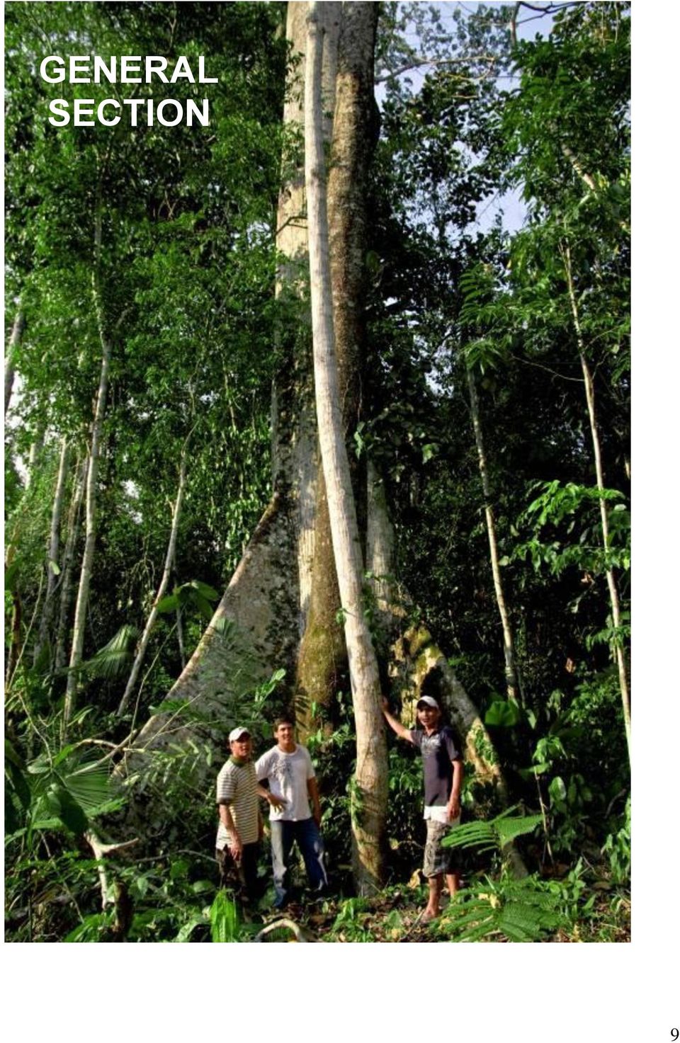
9 GENERAL SECTION 9
10 III. GENERAL SECTION G1. Original Conditions at the Project Site G1.1. Location of the Project and Basic Physical Parameters G1.1.1 Location of the project General location The project is located in Northern Peru, in the western part of the San Martin province. The province of San Martin is located in the Amazonean Andes, tropical region of Peru at the transition between the high Andes and the lower Amazon basin. The Martin Sagrado project zone can be reached by boat the town of Juanjui (3 hours). Figure 1 : General location of the project Project zone The project zone is constituted by the river basin of the Huayabamba River, delimited on the Western and Northern side by the Andes and the frontier with Amazonas and La Libertad provinces, to the East by the hills chain between Huayabamba and Saposoa valleys, on the South East by the Huallaga river. The project zone is relatively homogeneous in terms of climate, soils, vegetation, and socio-economic conditions. 10

11 Figure 2 : Location of the project zone Project zone Project area Project area: The project area encompasses hectares, and is constituded by three concessions with conservation purposes: Martin Sagrado, El Breo, and Monte Cristo. It is constituted by primary forest at more than 97%; only 3 small communities live inside the project area. 11

12 Figure 3: Location of the project area G1.1.2 Climate The proposed REDD project activity takes place in the Tropical Rainforest area (GPG LULUCF 2006, IPCC). According to the Koppen Classification System, the climate of the region is of the type AM, that is to say tropical warm, season humid, characterized by presenting abundant rainfall and a short dry season, which has no significant influence on the development of the vegetation due to the abundance of rainfall during the rest of the year. According to the climatic classification proposed by Dr. W. Thornthwhite it has been determined that the climate in the area is humid and warm. In general terms, it can be concluded that the climate in the studied area allows the development of agricultural activities and cattle raising without major limitations. On the other hand, the forestry sector is limited during the rainy season with respect to wood supply, which leaves a maximum of 5 months appropriate for the efficient use of this resource. According to the Economic Ecological Zoning San Martín Region, the proposed area has the following types of weather: Climate AB'4 Type: Corresponds to a super-humid climate (A) and semi-warm (B'4). It is located above 1200 to approximately 2000 m, especially on mountain slopes. It is estimated that every month excess moisture is present. It covers an area of approximately 15.67% of the proposed area. 12

13 Climate B1rA'a type: corresponds to a slightly damp climate (B1) and Warm (A'), with no water deficit (r) and low heat concentration in the summer (a '). It is estimated that every month excess moisture is present. It covers an approximate area of 0.01% of the proposed area. Climate B4B'2 Type: Corresponds to a very humid climate (B4) and cool temperate (B'2), which corresponds to the jungle, which is located above 3000 m, especially on the hillsides. It is estimated that every month excess moisture is present. It covers an approximate area representing 2.64% of the proposed area. Climate B4B'3 Type: Corresponds to a very humid climate (B4) and warm temperate (B `3). It is located at altitude levels ranging between 1800 and 2800 meters. It is estimated that every month excess moisture is present. It covers an area representing approximately 50.74% of the proposed area. Climate B4B'4 Type: Corresponds to a very humid climate (B4) and semi-warm (B'4). It is located below 1200 m, especially on the slopes of mountains. It covers an area representing approximately 30.94% of the proposed area. Figure 4: Climate map of the project zone Project zone Project area 13

14 G1.1.3 Geology The geological units that form part of the Concession are as follows (see Map No. 05: Geological Survey) Intrusive San Martín (Ps-gr/gd): Its composition is represented mainly by granite and granodiorite whitish color (leucocratic). This unit is considered an intrusive complex, as it shelters different types of igneous rocks ranging from granites, granodiorites and subvolcanic bodies as quartz latite. It occupies an approximate area equivalent to 0.11% of the proposed area. Yarahuango Formation (Py): Corresponds to a set of red lithology continental layers, which begins the continental sedimentation with minor interruptions of marine transgressions. It occupies an rea approximately equivalent to 0.19% of the proposed area. Chonta Formation (Km-ch): Formed by limestone sequences as micritic limestones, bituminous marl, shale levels, pelitic as silty clays, gray-green. Silty clay presents gray-green laminar sequences, housing among drywall layers that are exposed in cross and parallel manner, and rectangular lenses of sandstone. Occupies approximately an area equivalent to 0.38% of the proposed area. East Group (Ki-o): Includes white sandstone outcrops of medium-grained quartz. East Group sediments have undergone depositional stages, ranging from those made in an epicontinental shallow sea, which ranged between stages of transgression and regression; to sediments deposited in a tidal environment (deep sea). It occupies an area approximately equivalent to 3.91% of the proposed area. Ipururo Formation (Nm-i): Formed by reddish calcareous claystones grading to siltstone, sandstone interspersed with thin gray to greenish calcareous beds. Includes gray marl, reddish sandstone fine to medium grained, calcareous red claystones and volcanic sediments. It covers an area approximately equivalent to 7.09% of the proposed area. Pucara Group (TsJi-p): Training Chambar, carbonate sequence consists of dark gray limestone interbedded with bituminous limestone and dolomitic limestone. As seen in the area where it floats Huicungo Huayabamba-gray limestone sequences, which occurs in thin to medium layers. It encompasses an area approximately equivalent to 26.18% of proposed area. Mitu Group (Ps-m): Composed of a purely detrital molasse sequence alternating with volcanic material. These molasses are composed of conglomerates and sandstones interbedded with coarse-grained thin red shale levels. The clusters have the nature of shale, quartzite and granite, forming a sequence whose key feature is red. This group covers an area approximately equivalent to 29.01% of the proposed area. Marañon Complex (PE-m): The representative lithology consists of greenish shales, gray gneiss, quartzite, slate, and metavolcanic. It occupies an area approximately equivalent to 33.13% of the proposed area. 14

15 Figure 5: Geology map of the project zone Project zone Project area G1.1.4 Hydrology From the mountain are going down numerous highly torrential streams, carrying products of erosion (sediments), flowing into the tributaries of the Huallaga River. In general terms, the area is characterized by the presence of abundant rainfall during most part of the year, being able to differentiate a long season denominated winter from October to May and a short dry season denominated summer from June to August. This pattern does have a significant influence on the development of the vegetation in the area. Based on the information obtained from the Assis and Brasileia meteorological stations in Brazil between 1980 and 1989, the total medium annual rainfall is 2000 mm. This same data amounts to 1837 mm in Martin Sagrado. It can be appreciated that rainfall has less intensity during the months of May to September, where 20 to 25% of the total annual rainfall occurs. However, the dry season is not so dry, and there s no severe drought in the region. 15

16 During the most rainy period, from October to April, 75 to 80% of the total annual rainfall occurs. Medium rainfall in the area shall be evaluated to approximately 1800 mm annually. Figure 6: Hydrology diagram in Juanjui ( ) Source: (RAJAUD, 2008) 1 G1.1.5 Hydrography Taking as a reference to Maco, J. (2005), rivers and streams that make up the hydrographic network of the project zone are of the "clear water", which is characterized by the presence of crystalline water, allowing full transparency and clear observation of the channel bottom. This feature is that these water bodies are born and walk among the hills that present fairly consolidated geologic material. Many of them have moderate electrolyte content is reflected in the moderate electrical conductivity values. It is characteristic observed in these bodies of water turbidity after the fall of rain in the area of its basin, a process that lasts a very short time, and the presence of rapids in the rivers certain sections due to steep slopes of the channel into sections very short. These sections are usually partially blocked by rocks or stones that obstruct water, gaining power faster. 1 RAJAUD A, Analyse-diagnostic d une petite région agricole située dans l aire d influence de la coopérative cacaoyère Acopagro, région de San Martín, Pérou - Mémoire de DAA Développement Agricole AgroParisTech. 16

17 In the concession EL Breo, there are two watersheds: the watershed of Condorcillo 70, ha (61.71%). And the watershed of Rio Breo, comprising 43, hectares that represents 38.29% of the area. These rivers are major tributaries Huayabamba, born in the foothills of the Cordillera Oriental (see Map No. 08 Basin). Below the confluence of Jelache to the confluence of Abiseo, there are no major tributaries of the river Huayabamba, but only a series of short gorges (4-6km) on its right bank. In its lower reaches, the Huayabamba receives input from the Abiseo. Figure 7: Hydrography map of the project zone Project zone Project area 17
")
18 G1.1.6 Physiography Physiographic units that make up the surface area for project zone are described below: Physiographic Province: Andean Cordillera The Andes is generally characterized by presenting a varied topographical configuration from alluvial valleys and terraces to form hills and mountains, with very uneven relief. The project area has two units physiographic province weather: cold Land and Land perhumid warm to temperate. G1.1.6 A) Unit warm to temperate climate Land: Covers much of the project area. It covers an area approximately equivalent to 97% of the proposed area. With temperatures ranging from 14.5 º C - 25 º C, with annual rainfall of 500 to 4,000 mm and altitude from 500 to 3,500 meters. In the proposed area, this unit has two major climatic landscapes: mountainous (eastern range), mountainous terrain and hills (mountains subandina). - Great mountainous landscape (Cordillera Oriental): It is characterized by rugged topography with slopes ranging from 25 to 75%. It features a single landscape: High Mountain Landscape. It is formed by the elevations of land which have an altitude above 800 m. These categories are: High mountains of steep slopes:. Dissected relief Presents Protection Association of Communal Forest Dos de Mayo - Alto Huayabamba Technical Proposal that supports the creation of the Conservation concession for "The Breo '30 with slopes ranging from 25-50%, soils are very shallow due to contact lithology. High mountains of steep slopes:. Presents strongly dissected relief with slopes ranging from 50 to 75%. The soils are very shallow. High mountains extremely steep hillside: Presents strongly dissected relief with slopes greater than 75%. The soils are very shallow líctico by contact. - Great Landscape mountainous terrain and hills (Sub-Andean Cordillera) Exhibits from flat topography with slopes (0-4%) located in the valleys to very rough relief with slopes greater than 75%. It consists of a landscape that is described below: High Mountain Landscape. It consists of ground elevations have an altitude of over 800m. They have identified two sub landscapes according to its slope: High mountains steep slopes: Presents relief with slopes ranging from 25 to 50%. The soils are shallow. High mountains of steep slopes: Presents strongly dissected relief with slopes ranging from 50 to 75%. The soils are shallow to very shallow G1.1.6 B) Unit Climate: Cold Lands perhumid It covers an approximate area of 3% of the project area. With temperatures ranging from 3 º to 6 º C, with average annual rainfall of 1,750 to 1,800 mm and to m altitude. This unit features a large landscape climate, mountainous relief (Cordillera Oriental), described below: Great Landscape: Mountainous Terrain (Cordillera Oriental), is characterized by rugged topography with slopes ranging from 18

19 25 to 75%. It features a single landscape: High Mountain Landscape. It is formed by the elevations of land which have an altitude of over eight hundred feet high. These categories are: High mountains steep slopes: Raised dissected with slopes ranging from 25 to 50%, soils are shallow to moderately deep, moist depressions in areas dominated soil organic in nature. High mountains of steep slopes: located in the western part of the San Martin region, have strongly dissected relief with slopes ranging from 50 to 75%, the soils are shallow to very shallow. Figure 8: Physiography map of the project zone Project zone Project area 19

20 G1.1.7 Soils Generally soils are poor in nutrients, due to the nature of the lithology below, the strong chemical meteorization (caused by high temperatures and high humidity) and the washing of nutrients due to heavy rain during great part of the year. In these natural conditions, the fertility of the soil is linked to the organic cycle. Due to the abundant vegetative cover of the tropical forest there is a constant supply of organic matter, mainly as litter that afterwards is transformed into humus. Due to climatic conditions and the action of microorganisms, the decomposition of the organic matter is so fast that it only leaves a thin layer of humus relatively rich in nutrients. It is observed that most of the roots of the plants are found in this superficial layer to absorb the nutrients. In the high plains, soils are generally well drained. Only in these not very dissected units, soils are poor and moderately drained. Soils in the high plains have low fertility and could develop toxic levels of aluminum for the plants. Soils in low plains vary from poor to moderately well drained, depending on the grade of dissection. They have low to very low fertility and the aluminum saturation is very high. In the highly dissected hills and in lower proportion, soils present a franca texture in the superficial layer and an accumulation of clay in the subsoil, consequently they are very susceptible to erosion. There are 5 soil series in the project zone, according to the Zonificacion Ecologica Economica 2004, made by the regional government of San Martin, following the US Soil Taxonomy (1990): Calera Series I (Lithic Udorthents): Equivalent to 78% of the proposed area. Made up of soils derived from calcareous residual materials (shales and limestones). The soil is very superficial, with a weakly developed A horizon, thin layered (less than 40 cm), well drained, variable texture, granular structure and friable consistency. These soils have a neutral reaction (ph ), high organic matter content (8.48%). Due to some limitations of slope and depth, these soils are targeted for protection purposes only. Nippon Series I (Lithic Udorthents): Equivalent to 20% of the proposed area. Made up of soils derived from acidic waste materials (quartz sandstones). Located in areas of steep slopes of high hills and mountains. They are very shallow, well drained, coarse-textured, friable mass. When there is still a C horizon of limited thickness and gravel mixed with smaller gravel of different degrees of decomposition. Extremely acidic reaction (ph 4.5), high aluminum saturation and base saturation. Due to some limitations of slope and depth, the vocation of these soils is geared for protection purposes only. In very small proportions, on the banks of Huaybamba river close to Dos de Mayo, Santa Rosa communities, there are 3 more soil types: Belavista Palido (Typic Hapladalts), Copara I (Typic Eatradepts), and Moparo I (Typic Dystradepts). 20

21 Figure 9: Soil map of the project zone Project zone Project area G1.1.8 Soils Use capacity The project zone includes lands that have no ecological or soil conditions required for the operation of crops, pasture or forest production and other lands, although they have natural forest vegetation. Its use is not economical and should be managed for watershed protection, wildlife, scenic values, recreational and other involving collective benefit or social interest. Within this group we have: 21
22 Simple: Xes: Includes an approximate area of 85%, includes surface soils, in areas of steep slopes, with evidence of erosion. The limitations of use are related to soil and topographic factors, soil erosion. Associated: Xes-F2es: Includes an approximate area of 15 %: association of soils for land protection with limitations concerning relief which is very steep, and land suitable for forest production, but with limitations concerning terrain, poor fertility and depth the ground. At very small scale, on the banks of the Huayabamba river near the communities of Dos de Mayo and Santa Rosa, the project zone includes areas of land for permanent cultivation of average quality with limitations due to slopes and erosion, and land for forestry of average qulity with limitations due to slopes and erosion. Figure 10: Soil use capacity map of the project zone Project zone Project area 22
23 G1.2. Types and condition of vegetation within the project area G1.2.1 Ecosystems The project area completes a major role in the connectivity between the Abiseo River National Park and the Bosque de Proteccion Alto Mayo, part of the Conservation Corridor for Abiseo - Condor - Kutukú, considered as high priority for conservation and nucleus of one of the centers of high diversity ("Biodiversity hotspots") in the Tropical Andes. Part of the project area also has the status of being a buffer zone for the Abiseo River National Park. Due to its hydrographic position and its topographic variations, the project area includes the following ecological floors: Tropical Wet Forest (bh T) and Subtropical Wet Forest (bh S/T) (in transition to a subtropical very wet forest). Terrestrial Ecological Systems SETs The Data Center for Conservation - UNALM & TNC (2006), using biophysical models from different inputs and different methods, identifies and describes the terrestrial ecological systems (SET) of the Peruvian Yungas. Applying the digital map material produced by superimposing the reference and the proposed area coverage using the program Arc View 3.3, it was determined 09 types of SETs for the project zone, which are detailed below: Pluviseasonal Andean shrub and high mountain grasslands: They have a brush or grass-type cover, and xeric tropical or tropical pluviseasonal bioclimate. It is located in high mountain areas. Altitude 2900 m from the potential to over 3600msl. High Mountain Rainforests: Yunga hyper humid rain forest system, dominated and characterized by several species of evergreen trees and shrubs, and leaves lauroides sub-escleromorfas. Among species present in this well-preserved forests, the genera Podocarpus, Weinmannia, Oreopanax, Hesperomeles and Ilex. The forests are of low or medium height, canopy between 10 and 20 meters, featuring several levels or layers of undergrowth, large biomass of epiphytic non-vascular. It is located on high mountain slopes and ridges of mountains with frequent fog. Frequent Chusquea spp. and Ericaceae in the understory. Potential Altitude msl to 3700 msl. High Mountain Pluviseasonal forest: Yunga forests in areas with humid pluviseasonal bioclimate. Existence of an period with marked decrease in annual rainfall. Crop conditions and human uses are also different from those in High Mountain rainforests, with a significant incidence of fire as an element or factor anthropic landscape transformation. It is located on high mountain slopes, soil deep, well drained. Potential Altitude m to msl. Medium Mountain Rainforests: Set of associations of evergreen forests, of medium or high height, multi-layered and quite diverse. They have abundant epiphytes and common ferns. They thrive in areas with hyperhumid tropical bioclimate, on deep soils and well drained humus. Forests well preserved are generally dominated by species Podocarpus, Weinmannia Prumnopitys. It is located on mountain slopes with well drained soils and frequent fog. Potential Altitude m to meters. 23
24 Medium Mountain Pluviseasonal forest: Ecological system similar as the Medium Mountain Rainforests, but in areas of pluviseasonal tropical bioclimate, particularly in mountain areas with less steep slopes or in valleys with partial effect of orographic rain shadow. Associations of seasonal evergreen forests, developed in humid pluviseasonal areas. And, as in the previous case, well preserved rain forests are dominated by Podocarpaceae species or genera as Weinmannia, Clethra, Hesperomeles and Ilex. It is located on mountain slopes with well drained soils. Potential Altitude m to msl. Lower Mountain Evergreen forests: Ecological system of the thermotropical Yungas whose potential vegetation is evergreen high and middleheight forest (15-20 meters). Vegetation is quite diverse, but often has in common several species of Juglans Cinchonoideas (Cinchona, Ladenbergia). They thrive in moist soil very deep, well drained to excessively drained slopes of the sub-andean mountains. Potential Altitude msl. Lower Mountain rainforests and palm forest: Ecological system with dense multilevel forest vegetation, often with abundant palms Andes (Dictyocaryum), developed in the higher elevations of the lower mountains, above about 1200 to 1400 meters, where it is preferably higher slopes and ridges or mountain ridges of the sub-andean terrain well exposed to rain and fog. It develops on soils quite deep. The floristic composition is often characteristic of species of trees and shrubs Cinchonoideas (Ladenbergia, Cinchona). It is located on high mountain slopes and ridges dividing well-drained soils. Potential Altitude m to meters. Mountain forests and xeric shrublands of interandes valleys: Vegetation of semi-dry and dry valleys of the interandes floor of the Yungas, which shows a marked climatic effect of orographic rain shadow with dry xeric bioclimate. It is located on the mountain slopes of the montane well-drained soils to more or less degraded or eroded. Altitude m. Transitional Rainforest of the foothills: Forest is structurally high (20-30 meters), multi-layered, evergreen and with high floristic diversity, constituting one of the most complex ecological systems, diverse and less known. It is strongly threatened by recent human colonization, involving high annual rates of deforestation. Mountain slopes and foothills with well drained soils. 800 to 900 meters above sea level from 1700 to 2000 meters. G1.2.2 Vegetation Based on the interpretation of LANDSAT TMS satellite images, the Technical Unit in charge of the Ecologic Economic Zoning of the San Martin Provincecarried out a classification of vegetation types. 53 vegetal formations have been identified of which 39 correspond to forests, totaling 2.8 million hectares in San Martin (Source: ZEE, 2005). The presence of associations and subtypes of forests within the major identified vegetation types is caused by the heterogeneity that characterizes the tropical forests. Generally, the timber species are distributed within the whole area, varying in frequency and volume in each type of forest. The proposed project zone ecompasses 5 vegetation types : - Forests of higher Andean mountains with medium trees in associacion with matorrales (approximately 85% of th area) - Forests of lower Andean mountains with medium trees and dense matorrales (~5%) - Forests of higher Andean mountains with medium trees and dense sotobosque (~4%) - Combination in higher Andes of herbaceous with bushes and smaller trees and matorrales dispersed - Combination in lower Andes of medium and dispersed trees with dense matorrales This Amazon Andean foothill forest is characterised by the following species: Aspidosperma rigidum, Astorcaryum murumur, Attalea phalerata, Brosimum acutfolium, B. lactescens, Cariniana estrellensis, Cedrela odorata, Celtis schippi, Cetrolobium ochtryxylum, Clarisia biflora, 24
25 C.racemosa, Coussapoa ovalifoloa. C. villosa, Erythrina poeppigiana, Guarea macrophylla, Iriartea detoidea, Leonia glycicarpa, Porcelia steinbachii, P. ponderosa, Poulsenia armata, Pourouma cecropiifolia, Protium opacum, Pseudolmedia laevis, P. macrophylla, Ruizodendron ovale, Sloanea guianensis, Socratea exorhiza, Spaattosperma leucanthum, Swietenia macrophylla, Tabebuia serratifolia, Tapura acreana, Terminalia amazonica, T. oblonga, Trichilia pleeana, Thrihis caucana. (Navarra, ). Figure 11: Vegetation map of the project zone Project zone Project area 2 Navarro, 2002, Geografía Ecológica de Bolivia. Vegetación y Ambientes Acuáticos. Centro de Ecología Simón I. Patiño-Departament de Difusión. Cochabamba
26 G1.3. Boundaries of the project area and the project zone Project zone The project zone is constituted by the river basin of the Huayabamba River, delimited on the western and northern side by the Andes and the frontier with Amazonas and La Libertad provinces, to the east by the hills chain between Huayabamba and Saposo valleys, to the South by the southern limit of National Park Rio Abiseo, and to the South East by the Huallaga river. The xml file of project zone is available upon request. Figure 12 : Boundaries of the project zone Project zone Project area 26
27 Project area: The project area encompasses hectares, and is constituded by three concessions with conservation purposes: Martin Sagrado, El Breo, and Monte Cristo. It is constituted by primary forest at more than 99%; only 3 small communities live inside the project area. Boundaries are defined as follows: Northern limit Southern limit Eastern limit Western limit Frontier with the Amazonas region, Rio Verde river Frontier with National Park Rio Abiseo Huayabamba river Frontier with the concession Alto Huayabamba (Andes) - The Association de Proteccion de bosques Comunales Dos de Mayo (EL BREO) owns the concession title of the concession El Breo. - ACOPAGRO cooperative has solicited the concession Martin Sagrado, which is currently under attribution. - The Asociacion de Productores Agropecuarios de Huicungo (APAHUI) is in the process of sollicitating the concession Monte Cristo. The xml file of project area is available upon request. Figure 13 : Boundaries of the project area 27
28 G1.4. Current carbon stocks for each LULC class or forest stratum at project site As mentioned in G1.2.2, the project area is constituded at more then 95% by Humid Forest of Higher Mountains, and vegetation is quite homogeneous in the whole area Figure 14 : Pictures of forest type within the project area PHOTOS According to the table 3A.1.2 of the IPCC Good Practice Guidance for AFOLU, average biomass density in tropical mountain forest in America is 234 tdm/ha, and the average root to shoot ratio is 0,24 (table 3.A.1.8). Carbon stocks in living biomass above and below ground is therefore estimated at : 0,5 x (1+0,24) x 234 = 145 t C / ha, equivalent to 532 t CO2/ha. Assuming conservatively nil carbon stocks for the 5% of the project area constituted by Pajonal Altoandino (shrubs, dispersed bushes, herbaceous), The total carbon stock in living biomass of the project area is ha * 95% * 532 t CO2/ha = t CO2 G1.5. Community information In this chapter we develop the socioeconomic characteristics of the project zone (provinces of Mariscal Cáceres, Huallaga) through information collected by Amazonia Viva, by the INEI, the district municipality, the municipal delegate of Dos de Mayo, the Human Development Report of UNDP and obtained from surveys conducted in the field in a universe of 122 people (AMPA, 2008; Amazonia Viva, ). G1.5.1 Presentation of the participating communities Communities within the project area There are three communities living within the project area: La Morada, Canaan, and Anazco Pueblo. They mainly rely on livestock and coffee farming. As fuel they only use wood for cooking and mostly candles for light (70 to 95%) while solar energy is developing. 28
29 The three communities are typical examples of towns founded by a group of migrants, who originally came from the mountains to the jungle. The early years after establishment have been dedicated to the exploration of the environment, without interest for the protection of biodiversity. They slowly built up over 5 to 10 years some experience on the impact of mismanagement of resources. They are located in the Eastern Andes, in the department of San Martin, on the slopes of the mountains oriented northeast above the river Huabayacu. Howevern they depend politically on Chuquibamba in the department Amazonas. There are no roads to the villages, only paths from the district of Chuquibamba (2 to 3 days), and from the province of Bolivar (2 days). There is a proposal for the construction of a road by the Regional Government of Cajamarca, in order to facilitate the transport of forest products from Saposoa in the province of Huallaga, department of San Martin to Celendín department of Cajamarca. La Morada Gathering 80 families, there are 150 students in the village, a kindergarten, a primary and segundary school. La Morada activity is based on livestock with a herd of about 500 animals. Community health is ensured by a medical post, a nursery and medicinal plants. Canaan There is a kindergarten, a primary and a segundary school, 130 families and as many students in this village, 3 days walk away from the closest town. Their main income depends on livestock and coffee with 100 hectares of cocoa cultures and 400 animals. Both coffee and livestock products are sold outside of the village. Community health is also ensured by a medical post, a nursery and medicinal plants. Anazco Pueblo Smallest community of the area, Anazco Pueblo gathers 15 families, representing 70 people in total, 22 students and 1 professor. There is only a primary school. Also relying on cocoa cultures and livestock, their herd is smaller with 100 animals and 20 hectares for farming. Community health is ensured only by medicinal plants. Additional information on these 3 communities, collected during field trips to Chuquibamba, is available on request. Communities within the project zone, in the provinces of Mariscal Cáceres and Huallaga Major partners for REDD project: Dos de Mayo is the most populated village (898 inabitants). They are considred as a minor populated center and have a delegated mayor. 59% of the inahitants are men and 41% are women. 48% of the area (680 ha) are dedicated to cocoa production, with an average yearly production of 700kg/ha. The villagers also cultivate corn, plaintain, cotton and oranges and have around 100 cattle animals % of the villagers are illiterated, 48.28% have a primary eduction, 34.48% have a secondary education and 6.9% have a higher education. There is a medical center in the village. A technical study is under process to evaluate the opportunity to implement a drinking water system. The Association de Proteccion de bosques Comunales Dos de Mayo owns the concession El Breo and is strongly involved in the REDD project since the beginning Santa Rosa: on the bank of the Huayabamba river, Santa Rosa is constituted by ~40 cocoa farmers, majority of the area is dedicated to cocoa production, with average yields of 1200 kg/ha. As part of the REDD project, they are developing a botanical garden to value floral biodiversity, and want to develop a guesthouse for visitors to come and visit the conservation area. Strongly involved in the project since the beginning, Santa Rosa is now sollicitating a concession for conservation of ha. 29
30 Pucalpillo: located a little more downstream on the bank of Huayabamba river, 30% of the area (60 ha) are dedicated to cocoa production, with an average yearly production of 800kg/ha. The villagers also cultivate corn, plaintain, cotton and oranges and have around 40 cattle animals. 56% of the inhabitants have a primary education, 36% have a secondary education, 6% are illiterate and 2% have a higher eduction (no university). There is no medical center in the village. Strongly involved in the project since the beginning, the asociacion of productores agropecuarios de Pucalpillo (APAP) is now solicitating a concession for conservation of ha. Huicungo : located on the banks of the Huayabamba river, only 10km before the junction with Huallaga river, it is a major populated centers, with a municipality. Major incomes come from cocoa production, with some farmers members of ACOPAGRO cooperative, while others (~130 farmers) are joining the newly created Asociacion de Prodcutores Agropecuarios de Huicungo (APAHUI), whose aim is to develop as a complete cocoa cooperative. APAHUI is the organization sollicitating the concession for conservation Monte Cristo, part of the project area. Other communities of the project zone : Marisol is the last populated community upstream on the banks of the Huayabamba River, on the historical and natural path to the inner areas of the project area. They mostly rely on cocoa production. There is primary education in the village and use hydroelectrical (mainly) and solar power for electricity generation. Pizarro: 35% of the area (80 ha) are dedicated to cocoa production, with an average yearly production of 400kg/ha. The villagers also cultivate corn, plaintain, cotton and oranges and have around 60 cattle animals. 2% of the villagers are illiterated, 68% have a primary eduction, 24% have a secondary education and 6% have a higher education (no university). There is a medical center in the village. Mojarras: 32% of the area (70 ha) are dedicated to cocoa production, with an average yearly production of 400kg/ha. The villagers also cultivate corn, plaintain, cotton and oranges and have around 30 cattle animals. 84% of the villagers have a primary eduction (complete) and 16% have a higher education. There is no medical center in the village. Santa Ines: 29% of the area (70 ha) are dedicated to cocoa production, with an average yearly production of 400kg/ha. The villagers also cultivate corn, plaintain, cotton and oranges and have around 100 cattle animals. 2% of the villagers are illiterated, 76% have a primary eduction, 20% have a secondary education and 2% have a higher education. There is a medical center in the village. Gran pajaten: 25% of the area (10 ha) are dedicated to cocoa production, with an average yearly production of 400kg/ha. The villagers also cultivate corn, plaintain, and cotton and have around 20 cattle animals % of the villagers are illiterated, 48.27% have a primary eduction, 34.48% have a secondary education and 6.90% have a higher education. There is no medical center in the village. San Juan de Pajaten: 7% of the villagers have a higher education, 73.33% have a primary eduction, 13.34% have a secondary education and 6.33% of the villagers are illiterated. There is no medical center in the village. Nueva Esperanza: 25% of the area (25 ha) are dedicated to cocoa production, with an average yearly production of 400kg/ha. The villagers also cultivate corn, plaintain, cotton and organges and have around 30 cattle animals. 7% of the villagers are illiterated, 73% have a primary eduction, and 20% have a secondary education, 6.67% of the villagers are illiterated. There is a medical center in the village. 30
31 Primavera: 31% of the area (45 ha) are dedicated to cocoa production, with an average yearly production of 700kg/ha. The villagers also cultivate corn, plaintain, cotton and organges and have around 30 cattle animals. 4.08% of the villagers have a higher education, 81.64% have a primary eduction, and 14.28% have a secondary education. There is no medical center in the village. Luz del Oriente: located at the northern tip of Martin SAgrado concession, at the boarder with Amazonas region, Luz del Oriente is a community depending on Rodriguez de Mendoza in Amazonas region. It is accessible by dust road from Mendoza up to 10km from the community. Communities outside the project zone, though related to the project Chuquibamba, municipilaty located in Amazonas region, in the Andes, is the access point and political center for the 3 communities located within the Martin SAgrado project area (Canaan, La Morada, Anazco Pueblo). As such, it is implicated in the conservation project. It is accessible by dust road coming along the Maranon river bed. Comunidad Campesina de Leymebamba, located in Leymebamba, Amazonas region, in the Andes. Leymebamba is another access point to the 3 communities located within the Martin SAgrado project area (Canaan, La Morada, Anazco Pueblo). Also, the Community has sollicitated a concession for conservation in Amazonas region whose demarcation goes up to Martin SAgrado project area. As such, coordination with this community is interesting for the sake of both conservation projects. ACOPAGRO cooperative On top of local communities and community associations of local producers, the project is developed with a strong partner, owner of the Martin Sagrado concession within the project area: the ACOPAGRO cooperative ACOPAGRO cooperative was created in 1997, as part of a United Nations program to substitute coca plantations with cocoa and other alternative crops in the San Martin region. It now counts 2000 members, small-scale producers of cocoa and sugar cane having 5 hectares of land each, with an average 2.2 ha of cocoa fields. Most of the farmers were coca planters in the past. The organization is FLO and Organic certified (standards EU et NOP) and is very successful, both on its commercials activities (ACOPAGRO has become in ten years Peru s first cocoa exporter) as well as towards its compliance to fair trade principles. ACOPAGRO can be considered as a model organization and has been certified under Alter Eco Gold Standards in 2009 by SGS hectares of cocoa fields have already been planted and are harvested, the equivalent of 3 millions cocoa trees. Cocoa trees need 40 % shade to give their best potential, hence producers are willing to plant native trees in combination with their cocoa trees. As well, the small scale producers dispose of many areas of degraded land and pastures, because of the former coca plantations or food crop plantations, that they are willing to reforest with native trees for forestry activities. To help the farmers to achieve these objectives, ACOPAGRO and PUR PROJET set up a reforestation program in 2008 called Alto Huayabamba. The plantation started in April 2008 and the project is now fully operational with 1 million trees planted (Décember 2011) and was validated according to the VCS standard. The objective is to plant 2 million trees over 2300 hectares (depending on plantation of models between agro-forestry and forestry only plantations), of degraded land and cultivated land, practicing agroforestry combining native trees species with cocoa trees and forestry plantations. The project is funded via the sales of environmental services (trees certificates) and of ex-ante carbon credits (VCUS). 31
32 Carbon offset is very complimentary with Fair Trade and organic production, the Internal Control System is already in place for organic production, and producers very well trained on traceability. The climatic conditions are very favourable for vegetation growth, hence for carbon offset. ACOPAGRO has already proved its capacity to plant and secure a sustainable plantation. The need of the area is very large, both for coca producers, and much as for the damaged environment of the region. G1.5.2 Population This particular region has been quite recently populated, with a significant growth of the population dating back to the 1940 s. The participants in the project are the second or third generation, the majority of them discovered cacao farming recently. Their parents and grand-parents came in the region thanks to colonization programs. Consequently, the traditional love of the land that is obvious when it has been transmitted from generation to generation does not really exist. It explains why it has been easier for the producers to slash and burn the land as they did not have the culture of protecting the land and the species. This is changing with the co-operative thanks to the agricultural trainings. This is also changing with the reforestation program and the understanding that biodiversity is an essential process. The producer s pride to be members of ACOPAGRO or other association of producers, the cohesion and solidarity, the strong will to integrate more producers in the development process, the awareness and understanding of the deforestation issue strengthen the organization and improve the results in terms of sustainable development. Table 2 : Population distribution according to age group Community Age groups / Percentage Sample (hab) % % % 55 a + % Dos de Mayo Pucallpillo Santa Inés Pizarro Mojarras Gran Pajaten San Juan de Pajaten Primavera Nueva Esperanza San Juan del Abiseo Total Fuente: AMPA. Socioeconomic study


33 Figure 15 : Population distribution according to age group G1.5.3 Housing, sewage, energy, subsistence The majority of the families part of the Martin Sagrado project have houses and residences are generally made of wood with roofs made of palm thatch. None of the communities except Huicungo has a basic sanitation system, potable water service or trash collection. Organic trash is deposited naturally on the ground surrounding the residences or in the fields and is incorporated into the soil. The nonorganic trash is separated and burned. The population has access to potable water resources directly from water sources such as Huayabamba river, the river Jelache and the river Abiseo, as well as the various creeks and tributaries in the zone. As for sewage, this service is also inexistant so it is common to find latrines built by the villagers themselves. On the other hand, the Dos de Mayo Town Center has a technical file which was developed by USAID / PDA, to install a water system. Currently, this record is being complemented sewer service for submission to the District Municipality of Huicungo. Energy: Except for Huicungo, most of the communities along the Huayabamba river are not connected to the grid. The community of Dos de Mayo has established an alternative service using a generator that runs on gasoline. The municipality of this community provides this service to its population over 4 hours from 6pm. S/ is the monthly fee per family served. The community of Marisol relies on 33
34 hydroelectrical power. Some families in other communities are slowly testing small solar panels to charge batteries. Most of the need for lighting is covered with candles and kerosene lamps. On the other hand, almost all of the population uses firewood for cooking, as well as the kitchens are rustic stone or clay. All of the communities depend on subsistence agriculture (platanos and fruit production) and extractive activities, such as fruit collection, fishing and hunting to supplement their diets. Usually, subsistence practices are used when fishing and hunting, with fish providing the major source of protein in the communities. G1.5.4 Education and health It's the least supplied area, most of these people only have health promoters, with an incipient implementation. Only in Huicungo and in the communities of Dos de Mayo, Nueva Esperanza and Santa Inés are medical centers where residents come from other communities. However, the lack of resources and medical supplies to people forced to move to the city of Juanjui in emergencies and in the case of La Morada y Los Chilchos toward Bolívar or Leymebamba. In Alto Huayabamaba, going to school may be hard (20 minutes walk from Santa Rosa, but some producers are further away along the river) because of the isolation of the area and the access only by boat. The good point about schooling is that many of the producers interviewed succeeded to send their children to university thanks to the cocoa revenues. This shows a great progress in the standard of living of producers and their family. Students of different levels compose the school classes, what makes the teacher s work more difficult, since she must teach all the students at the same time in the same classroom. There is no organized system of health care provided by formally trained medics. Basic emergency assistance (first aid) is provided by community members and is based on traditional knowledge or training provided by the local municipality. The most common health problems and illnesses are malaria, diarrhea, verminosis, malnutrition, flu and hypertension. The treatment of more serious problems requires transportation to the hospital in the city of Novo Aripuanã in rabetas (wooden canoes with small outboard motors). TABLE 3: Educative infrastructures in participating communities 34
35 Table 4 : Population distribution according to educational level Community Instruction level Primary Secundary Superior No University Analphabet Dos de Mayo 48.28% 34.48% 6.90% 10.34% Santa Inés 76.00% 20.00% 2.00% 2.00% Pucallpillo 56.00% 36.00% 2.00% 6.00% Mojarras 84.00% 0.00% 16.00% 0.00% Nueva Esperanza 73.33% 20.00% 0.00% 6.67% Gran Pajaten 48.27% 34.48% 6.90% 10.35% Pizarro 68.00% 24.00% 6.00% 2.00% Primavera 81.64% 14.28% 4.08% 0.00% San Juan de Pajaten 73.33% 13.34% 7.00% 6.33% San Juan de Abiseo 66.50% 22.50% 5.00% 6.00% Source: AMPA. Socioeconomic study G1.5.5 Gender issues Majority of members are male but there are women as well. Women interviewed declared to be well accepted and felt like any other member. It is interesting to note that during all the meetings with producers, men requested women to participate, what they refuse to do most of the time, nevertheless requesting their participation is a start in the emancipation process. There are also many women employees at the coop level as well, with very good spirit apparently at the offices and at the producer level and good integration of women, in Peru which is traditionally quite male dominant TABLE 5: Homes, houses and population by gender Comunidad/Anexo Hogares Viviendas Varones Mujeres Total Dos de Mayo Arica Atun rumi Chilin Chorro Gran Pajaten La Quinta Llano Mojarras Monte Bravo Nueva Esperanza Oro Mina

, the revenues of the producers have increased steadily 36")
36 Pizarro Primavera Pucallpillo San Juan de Pajaten San Juan del Abiseo Santa Inés La Morada - Chilchos Total Source: District Municipality of Huicungo & AMPA Figure 16 : Distribution of population by gender G1.5.6 Economy and Income The participants are poor but their living conditions are acceptable, except regarding nutrition, education and health. People have access to drinkable water and food from their fields. They own 2 to 5 hectares of land, of which 0,5 to 3 are planted with cocoa trees. They earn an average 3000 to 5000 Euros a year of sales. As shown in the UNODC (United Nations Organization against Drug and Crime), the revenues of the producers have increased steadily 36
37 and the ACOPAGRO Fair Trade project can be considered successful. All producers interviewed declared they were really happy with the project since they started. They used to be coca growers but now earn as much with cocoa There is more land available to buy and convert from monoculture (coca, sugar cane,..) to consortium fields (cocoa + native forest). This gives producers the opportunity to develop their sales, the objective is to bring them from an average 1,5 hectares of cultivated cocoa trees to a minimum of 5 hectares, for them to reach a decent revenue and be in capacity to develop even more their farm. The area is quite isolated, especially for Alto Huayabamba accessible only by boat, but on the other hand, there is land there to buy and to plant. The most important economic activities are the cultivatation and sale of cocoa and sugar cane. Most of the families raise chickens for domestic consumption and others raise cows on a small scale. According to the data provided by the Agricultural Cooperative Cocoa - ACOPAGRO, agricultural production is estimated by community, is as follows: Dos de Mayo: 38% (190ha) is cocoa, with an average production of 400kg/ha year and the sale price is S /. 6.4 kg. 20% (100ha) corresponds to a maize and banana cultures, respectively. The average maize production is 2000 kg / ha and the sale price is S/.0.70kg. The average production of banana is 10 MT / ha and the price is S/.0.50 kg. The 16% is cotton, is 80 ha, with an average production of 1200 kg / ha.year and the sale price is S/.1.20kg. The 6% corresponds to the orange crop, ie 30 ha with average yield of 40TM/ha. The sale price is S/.0.20kg. In the Commonwealth of Dos de Mayo, there are approximately 100 head of cattle, being the selling price per head S/ Figure 17 : Estimated agricultural production - Dos de Mayo Community Pucallpillo: 30% (60 ha) is cocoa, with an average production of 400 kg / ha year and selling price per kilogram of S / % (45 ha) is corn. The average production is 2000 kg / ha and the sale price is S/.0.70kg. 20% (40 ha) is made of cotton and banana crops. The average production is 1200 kg / ha and the price is S/.1.20kg. The average production of banana is 10 MT / ha and the sale price is S/.0.50 kg. 7.5% (15 h) corresponds to the orange crop, with production and 40TM/ha average selling price per kilogram of S/ Also, there are approximately 40 head of cattle. The selling price per head is S/
38 Figure 18 : Estimated agricultural production - Pucallpillo Community Gran Pajaten: In this community, each culture is represented by 25% each, ie 10 ha are used for the production of cocoa, 10 ha for maize, 10 ha to 10 ha for cotton and bananas. The sales prices per kg are: Cocoa S / 6.4; S/0.70 Corn, Cotton and Banana S/.1.2 S/0.50. The production amounts to 4TM cocoa 20TM corn, 12 tons of cotton and banana 100TM. Also in this community there are approximately 20 head of cattle. The selling price per head is S/ Mojarras: The 31.82% is cocoa (70ha), with an average production of 400 kg / ha year and the sale price is S /. 6.4 kg. The 22.73% is maize (50 ha), with an average production of 2000 kg / ha. The sale price of corn is S/.0.70kg. The 18.18% (40 ha) is made of cotton and banana crops, respectively. The average production of cotton is 1200 kg / ha and the price is S/.1.20kg. The average production of banana is 10 MT / ha and the sale price is S/.0.50 kg. The 9.09% (20 ha) is orange crop, with production averaging 40TM/ha. The sale price is S/.0.20kg. Also, there are about 30 head of cattle. Nueva Esperanza: The 25% is cocoa and corn (25ha), respectively. The average production of cocoa is 400 kg / ha year and the sale price is S /. 6.4 kg. The average maize production is 2000 kg / ha and the sale price is S/.0.70kg. The 20% is cotton and banana (20 ha), respectively. The average production of cotton is 1200 kg / ha and the sale price is S/.1.20kg. The average production of banana is 10TM/ha and the sale price is S/.0.50 kg. 10% corresponds to the cultivation of orange (10 ha), which on average produce 40TM/ha. The sale price is S/.0.20kg. In this community there are approximately 30 head of cattle and selling price per head is S/ Pizarro: The 34.78% (80 ha) is cocoa, with an average production of 400 kg / ha year and selling price per kilogram of S / The 17.39% (40 ha) is maize and banana cultures, respectively. The average maize production is 2000 kg / ha and the sale price is S/.0.70kg. The average production of banana is 10 MT / ha and the sale price is S/.0.50 kg. The 21.74% (50 ha) is cotton. The average production is 1200 kg / ha and the price is S/.1.20kg. The 8.70% (20 ha) is orange crop, with production averaging 40TM/ha. The sale price is S/.0.20kg. Also, there are approximately 60 head of cattle, whose selling price per head is S/ Primavera: The 31.03% (45 ha) is cocoa, with an average production of 400 kg / ha year and selling price per kilogram of S / The 20.69% (30 ha) is corn and banana cultures, respectively. The average maize production is 2000 kg / ha and the sale price is S/.0.70kg. The average production of banana is 10 MT / ha and the sale price is S/.0.50 kg. The 17.24% (25 ha) is cotton. The average production is 1200 kg / ha 38
39 and the price is S/.1.20kg. The 10.34% (15 ha) is orange crop, with production averaging 40TM/ha. The sale price is S/.0.20kg. Also, there are approximately 30 head of cattle. San Juan de Pajaten: 25% (10 ha) is cocoa, corn, cotton and banana, respectively. The average production of cocoa is 400 kg / ha year and selling price per kilogram of S / The average maize production is 2000 kg / ha and the sale price is S/.0.70kg. The average production of banana is 10 MT / ha and the sale price is S/.0.50 kg. The orange is not a cash crop in this community. In San Juan del Abiseo, there are approximately 20 head of cattle. San Juan del Abiseo: 40% (80 ha) is cocoa, with an average production of 400 kg / ha year and selling price per kilogram of S / The 17.78% (40 ha) is growing corn, cotton and banana cultures, respectively. The average maize production is 2000 kg / ha and the sale price is S/.0.70kg. The average production of cotton is 1200 kg / ha and the price is S/.1.20kg. The average production of banana is 10 MT / ha and the sale price is S/.0.50 kg. The 6.67% (15 ha) is orange crop, with production averaging 40TM/ha. The sale price is S/.0.20kg. In this community there is no cattle. Santa Ines: The 29.17% (70 ha) is cocoa, with an average production of 400 kg / ha year and selling price per kilogram of S / The 20.83% (50 ha) is growing corn, cotton and banana cultures, respectively. The average maize production is 2000 kg / ha and the sale price is S/.0.70kg. The average production of cotton is 1200 kg / ha and the price is S/.1.20kg. The average production of banana is 10 MT / ha and the sale price is S/.0.50 kg. The 8.33% (20 ha) is orange crop, with production averaging 40TM/ha. The sale price is S/.0.20kg. Also, there are approximately 100 head of cattle. G1.5.7 Remoteness and accessibility Juanjui is 2 to 3 hours drive away from Tarapoto city and airport. Tarapoto is already in an isolated area of Peru, not easily accessible by road (20 to 30 hours drive from Lima). Alto Huayabamba producers are even more remote and only accessible by boat, 3 to 4 hours boat drive from Juanjui. This means transport has to be by boat to Juanjui. During heavy rain season, Alto Huayabamba area is hardly accessible by boat as rough waters make it hard to go upstream. Producers are widespread along the river, each quite isolated on his field and without any motorized boat. To reach Juanjui, producers wait for the taxi-boats to take them and their cocoa. Producers bring their goods and cocoa to the Juanjui market by taxi-boat 39
40 The taxi-boat cost 20 soles from Juanjui to Santa Rosa (when the minimum wage in the region is approximately 500 soles per month), it stops at every village three times a day. The more isolated producers have to reach those meeting points first. To go downstream, the common use is to take rafts or rubber rings. It takes nine hours in raft to go from Santa Rosa to Juanjui where the main office of the cooperative and services are located. This is a regular trip for the communities representatives. G1.6. Description of the current land use, property rights G General land use and property rights conditions in project zone For centuries the San Martin Province was a lightly populated, densely forested region with small patches of subsistence rain-fed agriculture and forest hunting and gathering. The province became a coca production stronghold from the 1980s through the mid-1990s due to its isolation, leading to migrants invasions and massive deforestation. A vast part of the land in San Martin Province has never been titled nor have boundaries been welldemarcated. Ownership has remained unclear, though this situation is changing as stakeholders struggle to claim the provinces forests. Under the Forestry Law, the vast majority of land in Peru is considered part of the National Forest Estate and under the management of the Forestry Administration. Forest Estate Demarcation, while a national priority, has only recently been undertaken. Over the past 15 years, part of the forests have been cleared by coca producers, poorly managed forest concessions, oil exploitation companies, economic land concessions (ELCs), migrant settlers, and local communities working for land speculators. ELCs are a component of the government development strategy to attract private investment for the development of underutilized state public lands. In San Martin Province, ELCs are currently being mechanically cleared for rice, corn, papaya and sugarcane production. Local interviews indicated that Oil concessions and ELCs are often managed by a partnership of foreign and Peruvian businessmen. In the last years, the regional government of San Martin has undertaken a program of progressive land titling for the farmers who do not own any legal land title (~50% in the case of ACOPAGRO members). Pur Projet helped ACOPAGRO to sign a contract with the regional government authority in charge of land titling to prioritize titling of producers involved in both reforestation and REDD projects in the Huayabamba river basin. The goal is to have all ACOPAGRO member legally titled by end of In 2011, the regional governement also decided to suspend all attributions of oil and mining concessions in the region, switching to a more environmental philosophy of land dedication to conservation purposes. G Land tenure in the project area The project area is constituted by 3 concessions for conservation (Martin Sagrado, El Breo, Monte Cristo), sollicitated respectively by ACOPAGRO, Asociacion Dos De Mayo, and APAHUI. These are concessions given upon solicitation by the regional government for a period of 40 years (renewable), with the sole purpose of conservation. The concessionaires must sollicitate the concession first, building a technical file describing the area, the conservation stakes, and are given the concession after a public comment period of 3 months where communities can contest the concession. Once obtained, the concessionaires must submit within 3 years a detailed management plan for the concession, and the conservation activities will be monitored every 5 years by the government, which can reclaim back the concession in case of non-respect of the conditions. 40
41 The Asociacion Dos de Mayo already has the concession El Breo, and is in currently building the management plan for complete attribution of the concession. ACOPAGRO has sollicitated the concession Martin Sagrado. The public comment period has just fisihed (December 2011), and ACOPAGRO will receive the concession title. APAHUI is in the process of sollicitating the Monte Cristo concession, and is currently (December 2011) building the technical file for solicitation. It is part of the REDD project activities (even the first priorities) to help the communities and organizations in the process of securing land tenure over the project area. Once the concessions have been attributed, there are no longer possibilities for disputes within the San Martin Region G1.7. Biodiversity information G1.7.1 Terrestrial Ecological Systems SETs The Data Center for Conservation - UNALM & TNC (2006), using biophysical models from different inputs and different methods, identifies and describes the terrestrial ecological systems (SET) of the Peruvian Yungas. At coarse filter level (ecosystem level), within the Peruvian Yungas Ecoregion, the CDC-UNALM identified 18 SETs as conservation targets (CDC-UNALM and TNC, 2006). The SETs are defined as "groups of plant communities that tend to co-occur in the landscape due to its relationship with common factors and determinants and ecological processes, substrates and / or environmental gradients" (Josse et al., 2007:11). The use of SETs to evaluate the effectiveness of conservation has many advantages because it combines in one system: ecological, dominant vegetation and landforms. Applying the digital map material produced by superimposing the reference and the proposed area coverage using the program Arc View 3.3, 09 types of SETs have been identified as priority conservation targets for the project area, which are detailed in the General information G1.2 The types and condition of vegetation within the project area. These units synergistically complement those already included in the Abiseo River National Park and the Concession for Conservation "Alto Huayabamba," forming a more robust and resilient block to global climate changes to come. G1.7.2 Flora inventory in the reference project area Table 6 : List of species of flora listed in the inventory FLORA Angiospermae Families Species DYCOTYLED- ONEAE PROTEACEAE OLACACEAE Oreocallis grandiflora (Lam.) R. Brown saltaperico, cucharilla Heisteria acuminata (H.B.K.) Engler chuchuhuasi D 41
42 D Y C O T Y L E D O N E A E SANTALACEAE Y Cervantesia tomentosa R. & P. Muehlenbeckia S volcanica (Benth.) Endlicher mullaca OM. tamnifolia (H.B.K.) Meiss bejuco N Polygonum aviculare L. pica pica E P. hydropiperoides Michaux pica pica A POLYGONACEAE Rumex acetocella L. lengua de vaca R. crispus L. lengua de vaca R. conglomeratus Murray lengua de vaca R. obtusifolius L. lengua de vaca Triplaris peruviana Fisch. & Meyer ex C.A. Meyer Chenopodium ambrosioides L. paico C. murale L. hierba gallinazo CHENOPODIACEAE C. pallidicaule Aellen cañigua C. quinoa Willd. quinua Alternanthera elongata (Willd. ex Roem. & Schultes) Schinz hierba A. macbridei Standley blanca yahuar milckay AMARANTHACEAE A. porrigens (Jacq.) Kuntze moradilla Amaranthus caudatus L. kiwicha Guilleminea densa (Willd.) Moq. Iresine difusa H.B.K. ex Willd. ANNONACEAE Unonopsis guatterioirdes (A.DC.) R.E. Fries Siparuna pyricarpa (R. & P.) Perkins MONIMIACEAE S. weberbaueri Perkins limoncillo Endlicheria bracteata Mez canela moena Nectandra cissiflora Nees muina LAURACEAE Ocotea balanocarpa Mez. muena Persea caerulea (R. & P.) Mez. Pleurothyrium cuneifolium Nees canela muena Peperomia ferreyrae Yuncker peperomia P. galioides H.B.K. peperomia P. hilli Trelease peperomia PIPERACEAE P. obtusifolia (L.) A. Dietrich peperomia Piper aduncum L. matico P. corpunya R & P. matico P. moho moho C. DC. matico Y otras especies de Piper y Peperomia probablemente nuevas para la Bocconia ciencia integrifolia H & B. pincullo PAPAVERACEAE Bocconia pearcei Hutchison pincullo BRASSICACEAE Rorippa nasturtium-aquaticum (L.) Hayek berro Rubus roseus Poir zarzamoras ROSACEAE R. acanthophyllus Focke fresas 42
43 FABACEAE GERANIACEAE ERYTHROXYLACEAE EUPHORBIACEAE MELIACEAE MALVACEAE BOMBACACEAE PASSIFLORACEAE CARICACEAE Amburana cearensis (Allem & Atilde) A.S. Smith ishpingo Astragalus garbancillo Cav. garbancillo Cedrelinga cateniformis Ducke tornillo Caesalpinia sepiaria Roxb caesalpinia Dalea cilíndrica Hook. dalea Desmodium limense Hook pie de perro Erythrina peruviana Krukoff pajuro Indigofera tephrosioides Kunth añil Medicago lupulina L. alfalfilla M. polymorpha L. alfalfilla Melilotus indica (L.) All. alfalfilla Otholobium glandulosum (L.) J.W. culén O. mexicanum Grimes culén Senna birostris (Dombey ex J. Vogel) Irwin & Barneby Trifolium amabile Kunth chijape, trébol Vicia andicola Kunth alberjilla Erodium cicutarium (L.) L Herit ex Aiton alfiler E. malacoides (L.) L Herit & Eacute alfiler E. moschatum (L.) L Herit & Eacute ex Aiton alfiler Geranium sessiliflorum Cav. ojotilla Erythroxylum coca Lam. coca Chriropetalum ruizianus (muell. Arg.) Pax & Hoffm. Croton alnifolius Lam. crotón C. lechlerii Muell. Arg. sangre de grado C. palanostigma Klotzsch sangre de grado C. ruizianus Muell. Arg cabra cabra Dalechampia aristolochiaefolia Kunth Euphorbia huachanhana (Klotzsch & Grarcke) Boiss Hura crepitans L. habilla Sebastiania obtusifolia (H.B.K.) Pax & Hoffm. Cedrela odorata L. cedro Swietenia macrophylla caoba Malva parviflora L. malva Sida rhombifolia L. sida Urocarpidum macrocerpum Krap. malva Ceiba insignis (Kunth) Gibas & Semir barrigón Passiflora huamachucoensis L.K. Escobar P. ligularis Juss. granadilla D P. peduncularis Cav. cholgame Y C P. tripartita var. mollisima (Kunth) Hola. Nielse & O Jorgense poro poro T Vasconcellea candicans (Gray) A. DC. papaya Y V. heterophylla (Gray) DC. papaya 43
44 D Y C O T Y L E D O N E A E Begonia hirtella Link begonias L B. acerifolia Kunth begonias E BEGONIACEAE B. octopetala L Herit. D begonias Y probables especies Onuevas para la ciencia. Existen varias especies N por determinar, posiblemente MELASTOMATACEAE nuevas para la ciencia. E Arcytophyllum tymifolium A (R. & P.) Standl. Cinchona pubescens M. E Vahl. cascarilla C. micrantha R. & P. cascarilla Galium aparine L. Manettia peruviana Standl. RUBIACEAE Palicourea macrobotrys (R. & P.) Roem & Schult (otras especies más) Psychotria caerulea R. & P. (otras especies más) Randia obovata R & P. R. killippi Standl. Aloysia tripilla ( L Herit) Britton cedrón Cytharexylum flexuosum R. & P.) D. Don Duranta membranacea Lantana armata Schauer lantana L. camara L. lantana VERBENACEAE L. reptans Hayek lantana Stachytarpheta cayennensis (Rich) M. Vahl Verbena cuneifolia R. & P. verbena V. litorales Kunth verbena V. fasciculata Benth verbena Acnistus arborescens (L.) Schltdl. chimulala A. umbellatus Browalia americana L. flor de mayo Brugmansia arborea (L.) Lagerth floripondio blanco B. sanguinea (R.&P.) D.Don puca campanilla, floripondio rojo SOLANACEAE Cestrum auriculatum L Herit hierba santa C. strigilatum R. & P. hierba hedionda Cyphomandra betacea (Cav.) Sendtn berengena Dunalia spinosa (Mey.) Dammer espino D. umbellata (Dunal) J.F. Macbr. Iochroma calycinum I. grandiflorum Benth campanilla I. umbellatum (R.&P.) Hunziker ex D Arcy shirac SOLANACEAE Jaltomata biflora (R.& P.) Benitez, y otras especies más Larnax género con varias especies 44
45 D Y C O T Y L E D O N E A E PLANTAGINACEAE CAPRIFOLIACEAE VALERIANACEAE ASTERACEAE BROMELIACEAE BROMELIACEAE BROMELIACEAE Nicandra physalodes (L.) Gaertn capulí cimarrón Nicotiana glauca Graham tabaco silvestre N. glutinosa L. tabaco silvestre N. paniculata L. tabaco cimarrón Physalis peruviana L. tomate silvestre, aguaymantu Salpichroa ramosissima Miers. cuytulumbo S. tristris Miers. Solanum abitaguense S. Knapp papa de zorro S. bukasovii Rybin papa de zorro S. jalcae Ochoa papa de zorro S. trinitense Ochoa papa de zorro S. sesile R. & P. papa de zorro Streptosolem jamesonii (Benth) Miers. Plantago lanceolata L. llantén P. limensis Pers llantén P.rigida Kunth llantén Sambucus peruviana Kunth saúco Viburnum ayavacense H.B.K. V. triphyllum Benth Phyllactis rigida (R. & P.) Pers. valeriana estrella Valeriana candolleana Gardner valeriana V. clematitis H.B.K. valeriana V. decussata R. & P. polo polo V. mirophylla Kunth valeriana V. pinnatifida.r. & P. alberjilla Achyrocline alata (H.B.K.) DC. espingo de oro, huira huira Ageratina azangaroensis (Schultz-Bip ex Wedd.) King & H. Rob. huarmi huarmi Bidens andicola H.B.K. amor seco B. pilosa L. amor seco Aechmea mertensii (Mey) Schult. f Bromelia varias especies Guzmania strobilanthes (R. & P.) Mez G. monostachia (L.) Rugby ex Mez Greigia macbrideana L.B.Sm. Pitcairnia ferreyrae L.B. Sm. P. paniculata (R. & P.) R & P. Puya fulgens L. B. Sm. Y varias especies más Tillandsia capillaris R. & P. T. latifolia Mey T. sagasteguii L.B. Sm. T. seemannii (Baker) Mez 45
46 ARECACEAE CYCLANTHACEAE ARACEAE MUSACEAE ORCHIDACEAE T. tectorum E. Rorren Y otras especies más. Ceroxylon crispus Burret Wettinia augusta Poepp & Endl. Prestoea acuminata (Willd.) Moore Carludovica palmata R. & P. bombonaje, Cyclanthus bipartitus Poit. sangapilla Anthurium soukupii (con varias especies más) Colocasia esculenta (L.)Schott pituca Phylodendron con varias especies más Heliconia con varias especies más Muchos géneros y especies (algunos muy novedosos) Details on tree species Peru is the third largest extent of tropical forest in the World, after Brazil and the Republic of Congo. It counts 2500 species of native tree species of which 33 are critically endangered, 14 endangered and 54 vulnerable. (Source: Mongabay.com, 2010) Hereunder, a brief description of the most important timber species present in the area, and their characteristics from plantation to maturity (source : Universidad La Molina, Peru) a) Swietenia macrophylla - Mahogany Habitat: sites with high rates and persistent rainfall; despite being intolerant to long term droughts, it also happens in areas with a remarkable dry season. Specie usually developed in light, loamy to sandy soils with good fertility conditions, well drained and medium stoned. Fructification: usually near to the end of the year. Seed dispersion: by means of the wind; medium distances of 32 to 36m and a maximum of 95 up to 100m. Germination: 54 to 95% of germination for fresh seeds on average environmental conditions. Said rate is reduced to 30% within 60 days on average environmental conditions. Growing conditions: seedlings are planted every 3m (3m x 3m) up to 7m x 4m. The recommended rotation is of years. In wellfertilized alluvial soils, very fast growths were reported, reaching at the age of 3 years diameters of 15-20cm. Growing/Mortality rate: 1.8m of height is reached by the trees since their plantation up to their first year; diameters of 6-27cm in 6-12 years respectively and 15-20m of height in 7-12 years respectively. 46
47 b) Cedrela odorata Cedar Habitat: sites with high rates and persistent rainfall but also in areas with a remarkable dry season. Specie usually developed in clayey to sandy soils with normal fertility conditions, well drained and sometimes highly stoned. Fructification: near to the end of the dry season, but also during the whole year. Seed dispersion: by means of the wind. Germination: 60-70% of germination for fresh seeds on average environmental conditions. Seeds should be sowed directly in nursery beds with a mixed substrate of sand and soil, at half shadow. Growing conditions: seedlings with their substrate are transplanted to the field, considering a 4m distance between one plant and the other. Plantation areas are of alluvial soils, loam-sandy to clayey, flat or with low slopes. Growing/Mortality rate: 2-4cm/year is the average growing rate; reaching 4-5m of height in 7-11 years respectively. This specie has showed a good survival rate in the in-field tests carried out by the concessions (70%). c) Manilkara bidentata Quinilla Habitat: sites with high rates and persistent rainfall. Specie usually developed in clayey to slimy soils, mainly acid, well drained and medium stoned. Fructification: since the end of the dry season up to the start of the rainy one, between September and January. Seed dispersion: by means of fauna species: monkeys and bats. Some rodents also disperse seeds of fallen fruits. Germination: on the one hand this specie has a good germination rate, but on the other hand it germination power is low, reaching only a 20% and loosing it in 1 or 2 months. Growing conditions: seedlings with their substrate are transplanted to the field. The area of plantation is a high terrace with alluvial soils, loam-sandy and mainly flat. Growing/Mortality rate: the average annual diametric growth is of 6-10 at the 7-10th years of plantation respectively and the average height reached in the same period of time is of 6-7m. The survival rate is high, 70-90% without any maintenance activities. A thinning-out was tested in the 7th year of plantation with good results on the faster diametric increase of the individuals. 47
48 d) Dipteryx spp. Shihuahuaco Habitat: sites with high rates and persistent rainfall, but also in areas with a remarkable dry season. Specie usually developed in clayey to slimy soils, well drained, with good fertility conditions and medium stoned. Fructification: at the end of the dry season. Seed dispersion: mainly by means of bat species (Artibeus jamaicensis, Artibeus lituratus and Carollia spp.), which get and then take the fruits to safe places to eat them quietly. Some monkey species (Ateles spp.) and large rodents (Dasyprocta spp. and Myoprocta spp.) could also act eventually as seed spreaders. Germination: getting 79-80% of germination power. Growing conditions: good initial growth in alluvial, well-drained soils. Growing/Mortality rate: an average annual increase of 1m of height in a 3 year plantation was registered, on alluvial and well-drained soils. On the other hand, average annual increases of 0.57m of height in an 8 year plantation were registered in a Forest Reserve in Ducke, Manaus, Brazil. e) Amburana cearensis Ishpingo Habitat: sites with high rates and persistent rainfall, but also in areas with a remarkable dry season. Specie usually developed in clayey to slimy soils, well drained and medium stoned. Fructification: during the dry season, between July and August. Germination: good rate. Growing/Mortality rate: despite the growing rate is apparently slow, in a 3 year plantation established in the Pucallpa height growths of m were registered. f) Eschweilera coriacea Misa Habitat: sites with high rates and persistent rainfall. Specie usually developed in clayey soils, mainly acid, well drained, sometimes with poor fertility conditions and low stoned. Fructification: during the rainy season, between January and March. Germination: good rate. Growing conditions: not tested yet. Plantation should be made with bare root and also by no till plantation. Growing/Mortality rate: slow growing rate; volumetric increases of about 1000m3/ha/year. g) Apuleia leiocarpa Ana caspi Habitat: sites with high rates and persistent rainfall, but also in areas with a remarkable dry season. Specie highly adaptable to different textures and fertility conditions of soils, well-drained and medium stoned. Fructification: during the rainy season, between November and March. Germination: good rate in seeds with a pre-germination treatment, reaching 90% of germination power. In fresh seeds without treatment the percentage is lower, around 20%. 48
49 h) Aspidosperma parvifolium Quillobordón Habitat: sites with high rates and persistent rainfall. Specie usually developed in clayey to slimy soils, well drained and medium stoned. Fructification: at the start of the rainy season, between November and December. Seed dispersion: by means of the wind, winged seeds. Germination: seed propagation is successful. Growing conditions: the area of plantation is a high terrace with alluvial, loam-sandy soils, flat or with a light slope. Growing/Mortality rate: the average annual diametric increase is of 8-11cm in plantations of years respectively. The average height reached at the age of 14 is 10m. The survival rate is low, around 20%. i) Brosimum lactescens Manchinga Habitat: sites with high rates and persistent rainfall. Specie usually developed in clayey to slimy soils, slightly acid, well drained and medium stoned. Fructification: at the end of the dry season, in October. Seed dispersion: by means of bird and mammal species, which eat the fallen fruits. Among them, it should be highlighted Mozama Americana (Venado), Tayassu spp. (Pecaríes) and some rodents. Germination: reaching 98% of germination power for fresh seeds, but only 25% for seeds that had been collected 15 days before. Growing conditions: seedlings with their substrate are transplanted to the field, with 2m distance between one plant and the other (2mx2m). The areas of plantation are high terrace, mostly flat and of loam-sandy to loam-silty soils. Growing/Mortality rate: the survival rate is medium, around 52% in-field and 55-73% under shadow. j) Ruagea insignis Requia Habitat: sites with high rates and persistent rainfall but also in areas with a remarkable dry season. Specie highly adapted to a varied range of soils in terms of texture, acidity and fertility conditions; sometimes temporarily flooded areas and also next to the rivers. Fructification: there are flowers and fruits during the whole year, but it seems to be more fructification at the end of the rainy season, between March and April. Seed dispersion: by means of bird species, which are attracted by the intense red color of the seeds. Also some monkey specie and maquisapas (Ateles spp.) eat said fruits and therefore participate in the seed dispersion. Germination: reaching 40-58% of germination power in fresh seeds. k) Terminalia oblonga Yacushapana Habitat: sites with high rates and persistent rainfall but also in areas with a remarkable dry season. Specie usually developed in loam to loam-sandy soils, neutral to acid, well drained and sometimes highly stoned. Fructification: during the dry season up to the start of the rainy one, between May and December. Seed dispersion: by means of the wind. Germination: reaching 80% of germination power in fresh seeds. Growing conditions: seedlings with their substrate are transplanted to the field after 8-12 months of plantation. Root pruning and the removal of some foliage is recommended before the in-field planting. Growing/Mortality rate: Costa Rica registers state a diametric increase of 13cm and a height increase of 12m in a 14 year plantation of Yacushapana. 49
50 l) Copaifera reticulate Copaiba Habitat: sites with high rates and persistent rainfall. Specie usually developed in clayey to slimy soils with good fertility conditions, well drained and medium stoned. Fructification: since the end of the dry season up to the start of the rainy one, between September to January. Germination: reaching 31-78% of germination power in fresh seeds. Growing/Mortality rate: registers made in Brazil for a congenus specie Copaifera langsdorfii show slow growth rates, with diameters of 9-11cm in average reached in years and heights of 9-12m in the same period. The survival rate is very high, around 90%. m) Myroxylon balsamum Estoraque Habitat: sites with high rates and persistent rainfall but also in areas with a remarkable dry season. Specie developed in primary forests, on clayey to slimy soils with good fertility conditions, well drained and variably stoned. Fructification: next to the end of the dry season, but also during the whole year. Seed dispersion: by means of the wind; fruits are samaras. Additionally, some parrot species could also participate in the seed dispersion. Germination: reaching 60-75% of germination power in fresh seeds. Growing conditions: characteristic specie in primary forests, mainly on high terrace or low hills zones and on rich and well-drained soils. Growing/Mortality rate: registers made in Brazil for a congenus specie Myroxylon peruiferum show slow growth rates, with diameters of 6-7cm in 14 years and heights of 6-7m in the same period. The survival rate is very high, around 90%. G Fauna within the project zone Diverse species of mammals, birds, reptiles and amphibians are observed, as well as numerous species of invertebrates. Within the project zone over 160 mammal species, 324 bird species, 26 butterfly species, 106 reptile species, 123 amphibian species exist, as well as many other species of invertebrates have been identified Among the most representative species present in the surroundings the following should be highlighted: Sachavaca (Tapirus terrestres), venado colorado (Mazama americana), majaz (Agouti paca), añuje (Dasyprocta variegata), conejo silvestre (Sylvilagus brasilensis), oso hormiguero (Myrmecophaga tridactyla), armadillo gigante (Priodontes maximus), carachupa (Dasypus novemcinctus), puma (Felis concolor), otorongo (Pantera onca), mancos (Eira barbara), perro de monte (Atelocynus microtis), mono leoncito (Cebuella pygmaea), pichico de barriga naranjada (Saguinus labiatus), musmuqui (Aotus nancymaae), maquisapa (Ateles paniscus), as well as dangerous reptiles as shushupe (Lachesis muta), naca naca (Micrurus sp), mantona (Boa constrictor) and quelónidos as the motelo (Geochelone denticulada), taricaya (Podonemis sp), birds as the harpia (Harpia harpia), Cóndor de la selva (Sarcoramphus papa), Guacamayo (Ara macao), Paujil (Mitu tuberosa), Tucan (Ramphastos cuvieri), Paguana (Crypturellus undulatus), pucacunga (Penelope jacquacu) and manacaraco (Ortalis guttata). 50
51 G1.8. High Conservation Values (HCVs) and description of the qualifying attributes The World Wild Fund for Nature has delineated three yungas ecoregions along the eastern side of the Andes. San Martin Region is located in the northernmost one (Peruvian Yungas). These yungas ecoregions are transitional zones between the Andean highlands and the eastern forests. The yungas forests are extremely diverse, ranging from moist lowland forest to evergreen montane forest and cloud forests. The terrain is extremely rugged and varied, contributing to the ecological diversity and richness. A complex mosaic of habitats occurs with changing latitude as well as elevation. There are high levels of biodiversity and species endemism throughout the yungas regions. Many of the forests are evergreen, and the South Andean Yungas contains what may be the last evergreen forests resulting from Quaternary glaciations. Within the different forest types listed above there are areas of High Conservation Value (HCV), divided into areas of biological and cultural significance. Biological HCV areas include the primary forest of the project area, composed primarily of evergreen forest. Due to the presence of several IUCN listed threatened species in the project area (see previous section), the project area can be designated as a biological HCV area. Hereunder, a summary of the existent biodiversity conditions within Martin Sagrado project area at the starting date of the REDD Project, as well as the conditions in its immediate surroundings defined by the leakage belt determined in the present REDD Project. It is based on the results of a series of studies related to the biophysical and biodiversity conditions of the area as well as communities observations and feed-back. Said documents represent a joint effort made by the communities and their partners with the aim to achieve the sustainable management of their forests, using the accumulated knowledge of the biodiversity component of the project. G Globally, regionally or nationally significant concentrations of biodiversity values G1.8.1 a. Protected areas The National Park Rio Abiseo is the major protected area in the project zone. It encompasses hectares of rainforest. The National Park was established in 1983; UNESCO pronounced it as Natural and Cultural Heritage of Humanity (World Heritage Site) in The park is home to a large number of species of flora and fauna, as well as the location of over 30 pre-columbian archaeological sites. Since 1986, the park has not been open to tourism due to the fragile nature of both the natural and archaeological environment. Other conservation areas include the Concession for Conservation Alto Huayabamba, attributed to the NGO AMPA in Located on the most western part of San Martin Region, in the highest part of the Andes, it encompasses hectares of mostly high Andean ecosystems. Just outside the project zone, to the north of San Martin region, across the boarder with Amazonas region is the Bosque de protection Alto Mayo, a forest conservation area created in 1987, encompassing hectares of forest. The project area completes a major role in the connectivity between the Abiseo River National Park and the Bosque de Proteccion Alto Mayo, and as part of the more global Conservation Corridor for Abiseo - Condor - Kutukú, considered as high priority for conservation and nucleus of one of the centers of high diversity ("Biodiversity hotspots") in the Tropical Andes 51
52 Figure 19 : Map of protected areas and conservation corridor Bosque de protecion Alto Mayo Project zone Concession for conservation Alto Huayabamba Project area National Park Rio Abiseo G1.8.1 b. Threatened species Based on current legislation and lists of endangered species worldwide (IUCN)) the following species have been registered and have a high probability of occurrence in the project area (CDC-UNALM and TNC, 2006, Angulo et al. 2008; AMPA, 2009). They are displayed here according to their threat level according to INRENA, IUCN and CITES. 52
53 TABLE 7 : Endangered species in the proposed project zone ESPECIES GRADO DE AMENAZA PERU UICN CITES FLORA Cyathea spp. helecho arbóreo II Podocarpus oleifolius saucecillo CR LC -- Ceroxylon crispum palma de cera VU Cedrela odorata cedro VU VU III Cedrela montana cedro VU Cedrela lilloi atoc cedro EN EN -- Swietenia macrophylla caoba VU VU II Polylepis multijuga quinoa EN VU -- Juglans neotropica nogal NT EN -- FAUNA Aves Aulacorhynchus huallagae tucancito semiamarillo EN EN -- Aburria aburri "pava negra" NT NT -- Hemispingus rufosuperciliaris hemispingo VU VU -- cejirufo Leptosittaca branickii loro de mejillas doradas VU VU II Thripophaga berlepschi rabiblando bermejo EN VU -- Mamíferos Oreonax flavicauda mono choro de cola amarilla EN CR I Aotus miconax mono nocturno EN VU II Callicebus oenanthe mono tocon andino VU EN II Pudu mephistophiles sachacabra EN VU II Tremarctos ornatus oso de anteojos EN VU I Panthera onca otorongo - VU I Tapirus terrestris sachavaca - - II Elaborated by AMPA. Source. UICN 2008, CITES, PERU 2004 y The International Union for Conservation of Nature (UICN 2008), brings together a diverse panel of experts who evaluated and ranked based on species extinction. The categories used are: Extinct (EX), Extinct in the Wild (EW), Critically Endangered (CR), Endangered (EN), Vulnerable (VU), Near Threatened (NT), Least Concern (LR), Data Deficient (DD) and Not Evaluated (NE). The species listed in categories CR, EN and VU are considered threatened. Consistent with the model used by the IUCN, nationally, equivalent categories are used to this international system. Thus, the categorization for threatened fauna in Peru is under the aegis of Supreme Decree N º AG, which defines threat categories as follows: Critically Endangered (CR), Endangered (EN), Vulnerable (VU), Near Threatened (NT). In the case of plants, the categorization comes under Supreme Decree No AG, which employs categories equal to the categories of animals indicated above. The CITES (Convention on International Trade in Endangered Species) includes 53
54 in its appendices to those species that have undergone some drastic changes or decrease in abundance due to excessive hunting or trade of their products, such as skins, teeth and bones. CITES Appendix considers three categories: Appendix I includes all species of animals and plants who bear an increased risk of extinction, CITES generally prohibits the international trade in specimens of these species. However, trade may be permitted in exceptional circumstances the same, eg for scientific research. Appendix II includes species not necessarily threatened with extinction but could become, unless strictly controlled trade, international trade in specimens of these species may be authorized to grant an export permit or re-export certificate, not must have an import permit. Appendix III includes species included at the request of a country that already regulates trade in the species and requires the cooperation of other countries to prevent unsustainable or illegal exploitation of the same, including species regulated for conservation purposes by individual countries. In the project area, we have a list of 21 species found in any of the lists of threatened species nationally and internationally, or are listed in the Appendices to CITES. Undoubtedly, this list highlights the endemic monkeys Oreonax flavicauda (yellow-tailed woolly monkey) and miconax Aotus (night monkey), and endemic birds Aulacorhynchus huallagae (Toucanet semiamarillo) Thripophaga berlepschi (rabiblando vermilion) and Hemispingus rufosuperciliaris (hemispingo cejirufo). On the other hand, in terms of flora highlight what we believe are the populations of mahogany mountains and the rare saucecillo (Podocarpus oleifolius). Although, these species have some level of protection in places like the Rio Abiseo National Park, has always been calling for the extension of the protection zones of these endemic species (CDC-UNALM and TNC, 2006). We believe the project addresses this need for expansion of habitat for these species are endemic. G1.8.1 c. Distribution and occurrence of endemic species Diverse species of mammals, birds, reptiles and amphibians are observed, as well as numerous species of invertebrates. Within Martin Sagrado reserve over 160 mammal species, 324 bird species, 26 butterfly species, 106 reptile species, 123 amphibian species exist, as well as many other species of invertebrates. As mentioned earlier in the fauna inventory (section G.1.7.3) more than 700 species have been identified (amphibians, reptiles, birds and mammals) whose unique characteristics (endemism, continuous distribution and conservation status) makes them worthy of being viewed as objects of conservation for the entire Peruvian Yungas ecoregion. In the area of the concession El Breo, the theoretical spatial distribution of these species (fundamental niche) has been projected onto hexagons (10 ha approx.) which indicate the total number of species they contain. The map obtained shows the areas with the greatest concentration of species, and the maximum record of occurrence obtained for a polygon within the Peruvian Yungas is 52 species. Map information based on that we have developed a distribution map of these sites for the requested area. There we can see that our proposal includes a high concentration of sites with high richness of species, including an hexagon with an occurrence of 51 species. 54
55 Figure 20 : Spatial distribution of species considered as objects of conservation Elaborated by AMPA. Source: CDC-UNALM y TNC, 2006 Similarly, around this hexagon occurs exceptional concentration of sites with high species richness (> 40 species per hexagon) to the west side of the area. A distribution histogram of the number of species per polygon reveals a bias toward hexagons with high wealth. About 60% of these sites display more than 31 species unique to the Peruvian Yungas. 55
56 Figure 21 : Distribution of hexagons / Richness of species for the conservation of the Yungas Elaborated by AMPA. Source: CDC-UNALM y TNC, 2006 G Threatened or rare ecosystems G a. Area with vulnerable soils According to the Economic Ecological Zoning of St. Martin, the proposed project area is within the protection zonesfor soil and slope conditions, with a smaller area corresponding to an association of slope protection zones and soils associated with timber potential forest production fair to poor. Thus, we are facing very fragile areas unsuitable for agriculture. It is recommended to their protection from migration trends that lead to disordered occupation of the territory of the basin, it does not take into account the natural ability of soils. This classification as protected areas comprises those lands that have no ecological or soil conditions required for the operation of crops, pasture or forest production and other lands that have natural vegetation forest but its use is not economical and should be handled with for watershed protection, wildlife, scenic values, recreational and other benefits involving collective or social interest. G b. Rare ecosystems with conservation objectives The Data Center for Conservation - UNALM & TNC (2006), using biophysical models from different inputs and different methods, identifies and describes the terrestrial ecological systems (SET) of the Peruvian Yungas. At coarse filter level (ecosystem level), within the Peruvian Yungas Ecoregion, the CDC-UNALM identified 18 SETs as conservation targets (CDC-UNALM and TNC, 2006). The SETs are defined as "groups of plant communities that tend to co-occur in the landscape due to its relationship with common factors and determinants and ecological processes, substrates and / or environmental gradients" (Josse et al., 2007:11). The use of SETs to evaluate the effectiveness of conservation has many advantages because it combines in one system: ecological, dominant vegetation and landforms. 09 types of SETs have been 56
57 identified as priority conservation targets for the project area, which are detailed in the General information G1.2 The types and condition of vegetation within the project area. These units synergistically complement those already included in the Abiseo River National Park and the Concession for Conservation "Alto Huayabamba," forming a more robust and resilient block to global climate changes to come. G c. Conservation targets The Data Center for Conservation (DCC-UNALM ) and The Nature Conservancy (TNC) has identified two major Peruvian Yungas blocks that are of high priority because they encompass a large number of species and key ecosystems and still maintain a high level of integrity (low human intervention, high connectivity). One of these blocks is the San Martín Yunga - that stretches from Huánuco northern Monsoon Valley to the headwaters of Alto Mayo (CDC-UNALM, 2003, DCC-UNALM and TNC, 2006). The following conservation targets (species level) have been selected by the organizations mentioned above: Mammals Birds 1. Mono choro de cola amarilla - Oreonax flavicauda 2. Oso de Anteojos - Tremarctos ornatus 3. Gallito de las rocas - Rupicola peruviana 4. Loro mejillas doradas - Leptosittaca branickii Quina o Cascarilla Tree 5. Cinchona officinalis y Cinchona pubescens Also, based on information about range, habitat preference and distribution of forest types, we project that would be found within the area as well: the night monkey (Aotus miconax), the Andean stump monkey (Callicebus oenanthe) and three palm trees Andean (Ceroxylon crispum, and Prestoea maynensis Wettinia acuminata). All these elements have also been selected as conservation targets of the Yungas de San Martin and NorthEast Huanuco. Mamíferos 6. Mono nocturno - Aotus miconax 7. Mono tocón andino - Callicebus oenanthe Palmeras Andinas 8. Ceroxylon crispum, Wettinia maynensis y Prestoea acuminata The identification of species conservation objectives was done by incorporating the criteria used by the DCC-UNALM, which are: a) Species known to society, especially local communities (cock of the rock, spectacled bear, the cinchona tree). b) Species of great scientific and endemic (endemic primates such as yellowtail woolly monkey, monkey Andean night monkey Andean stump, rare birds such as parrots and golden cheeks spectacled bear). c) Species of scientific and social importance (Andean palms). d) Endangered species (primates, spectacled bear, parrot golden cheeks) Furthermore, the prioritization of species as conservation targets are made taking into account the sensitivity of these to changes in the environment (eg primates, spectacled bear, parrot golden cheeks). 57
.")
.")
58 The same shall take into account the availability of scientific information on the species (habitat requirements and conservation status). Below is the most outstanding characteristics (description) of the species listed as conservation targets in the project area, indicating its importance (CDC-UNALM & TNC, 2006). Figure 22 : Description of species considered as conservation targets 58

59 59

60 60

61 61

62 G d. Other rare and valuable species The forest in the project area is very important in terms of biodiversity conservation since it is conformed by important populations of the specie Swietenia macrophyla (mahogany), and Cedrela odorata (cedar), which have been incorporated respectively to the Appendix II and III of CITES for being considered endangered and vulnerable species. G1.8.4 Areas that provide critical ecosystem services G a. Regulation and water supply The concession El Breo itself covers approximately 9% of the Huayabamba River subwatershed, including the middle and lower basins of the Breo and Cordoncillo rivers and complements the Conservation concession for Alto Huayabamba in the regulation of water sources that descend abruptly from the meters to 600 meters in just 60 km horizontal projection. Thus, the role of forest cover is essential to prevent erosion and regulating base flow that would otherwise be discharged as a stream in a short period of the year. This is based on the hydrological study of the San Martin region by Maco, J. (2005), which indicates that during the dry season river flow exceeds Huayabamba Huallaga river at the point of intersection. In this sense we can say that water environmental services provided by the concession area for Conservation El Breo have a regional scope, directly benefiting the population living in the middle and lower sub Huayabamba river as well as indirectly to that established in the middle basin of the Huallaga River, which now represents the valley's most populous and largest development and production of the San Martin. Protect and preserve vegetation and waterways in the area will allow the maintenance of water environmental services associated with it, thus contributing to the regulation of water flows as well as storage and water retention that makes it possible the efficient supply (in terms of quality and quantity) of 62
63 this vital resource in the watershed, reservoirs and aquifers, allowing fresh drain into the populations in its area of influence, both for human consumption for drinking and for use in agriculture, aquaculture, industry and transportation. It is important to note that the contribution of CC water regulation contributes to a certain extent with the maintenance of the hydroelectric potential of the basins of Huayabamba and Huallaga Central, which is related to the strong flows and waterfalls that are normally therein, which may be exploited for the installation of small hydro power plants which supply power to the local populations, thus contributing to the use of renewable energy do not depend on fossil fuels, apart from being expensive, pollute the environment. G b. Erosion control and sediment retention The project area soils are shallow and located in areas of steep slopes. This indicates that the associated vegetation is extremely fragile to changes of use. Deforestation can lead to irreversible processes of soil loss due to erosion by wind and rain would be faster than the soil formation processes. Therefore, the presence of vegetation in that area increases soil retention within the ecosystem, controlling the accumulation of sediment in lakes and wetlands downstream. G c. Carbon sequestration and regulation of the microclimate At this point in the negotiations for the mechanism of the Kyoto Protocol is undoubtedly the role of deforestation in the contribution of greenhouse gases. Keep the primary forests of the lease has an undeniable advantage over other forms of land use due to high carbon stored. Thus, this project is an opportunity to add to inventory forests that Peru can offer as permanent stocks of forests (avoided deforestation). In addition to the benefits of carbon sequestration, forest area contributes to the regulation of local and regional temperature because in this area are the building blocks of cold air, having high density, lower to medium and low areas of the basins, mixing with the hot air produced in these zones and thus regulating temperature. Also, this air flow contributes to the regulation of rainfall and other climatic processes biologically mediated locally and regionally. G d. Habitat for fish reproduction The lower parts of the requested area is located on the river Huayabamba are recognized by local people and sites that contain a high concentration of hydro-biological resources, among them outstanding tarpon (Brycon cephalus) and boquichico (Prochilodus nigricans). The observations conducted by the evaluation team and the stories of the people to infer that the riparian forests in the lower area are temporary refuge habitats during the rainy season or spawning areas. There is a local consensus that commercial fishing in these areas should be prohibited, especially in the Martin Sagrado and El Breo waterfall sites. These are sites that are depending on subsistence fisheries and trade conducted along the lower reaches of Huayabamba. G e. Pollination and dispersal of species of commercial value The CC El Breo is adjacent to the Zone 2 Permanent Production Forest (BPP) of San Martín ( RM-AG). Healthy populations of pollinators and dispersers within the concession emerge as an important safeguard to maintain the processes of natural regeneration of commercial species within Zone 2 of the BPP. Thus, logging units located in southwestern sector have an important source of seeds and pollinators DC The Breo. Similarly, the CC would favor Breo commercial plantations carried out in the vicinity, including local production of cocoa, bananas and citrus. CC Forests Breo source would be acting as pollinators, dispersers and core or a barrier for biological pest control. 63
64 G Areas that are fundamental for meeting the basic needs of local communities (e.g., for essential food, fuel, fodder, medicines or building materials without readily available alternatives) G a. Food provisions gathered by hunting The population located inside the zone and on the outskirts is benefiting from hunting wildlife migrating from the surrounding forests.. Large mammals and birds have almost disappeared from grocery nuclei populated in the lower basin of Huayabamba. However, in nearby towns, it is still possible to access game animals that ensure to maintain healthy populations and eventually migrate from the high forests of the requested area (source). Thus, the forest of the area requested has been contributing steadily to the local diet. This environmental service be maintained only if it maintains the integrity of the forest and implement measures to regulate the rational use of this fauna. G b. Unique landscapes with opportunities for recreation The area also features ecotourism attractions as the Falls of El Breo, Velo de Novia and Chambirillo Falls, Cajañahui canyon, among others; in addition to forests in good condition and riparian landscapes of crystal clear waters inhabited by fish tame that invite contemplation and appreciation of nature in its pristine form. Because of its location in a transition zone between the lowlands and Andean highlands, the area allows the expression of many types of landscapes that differ from the familiar Amazon floodplain. The landscapes in the area of the region have always intrigued locals and travelers, we believe that these attractive landscapes should be protected to be shared with future generations. G1.8.6 Areas that are critical for the traditional cultural identity of communities (e.g., areas of cultural, ecological, economic or religious significance identified in collaboration with the communities). The projet zone is an area of great archaeological wealth of pre-hispanic ancestors. There is no research before our first archaeological field work (Schjellerup 1997). There are remains of the Chachapoyas culture ( ), in the form of rounded structures of stone and many funeral homes are built on the slopes of the rocks with red paint and architectural ornaments symbol. The symbols were significant ethnic and social value, the use of symbols offered a demonstration of potential for local identity, which was maintained through the Inca period. East of the Cordillera Oriental are many Inca sites ( ), such as buildings in drywall or along the banks of Huabayacu (Schjellerup 1997). An Inca trail comes from Bolívar and unites with another way Hornopampa, where the Inca trail follows the river Huabayacu, crossing a mountain range and Continual north to the province Rodríguez de Mendoza. Near La Morada are the remains of a fortress and rectangular structures (Rangrapata and Hornopampa) and a site with masonry style Inca Cuzco. The farms currently in the Morada and surrounding area is the remains of stone terraces, which is being destroyed by the settlers. 64
65 G2. Baseline Projections G2.1. Most Likely Land-use Scenario in Absence of Project G Context and history of deforestation One of the worst problems about global warming is that mankind in the last 500 years has destroyed 50 percent of forests on the planet and that is a very serious problem indeed, Antonio Brack, Environment Minister of Peru, (Rhett A. Butler, mongabay.com, August 03, 2009). Up to now development has consisted of the woodland practice of slash and burn to clear land for crops and livestock, but that has given mediocre results because of the 10 million hectares where that has been done, 8 million hectares are unproductive. It s shameful and we can t keep doing it." he said, adding that programs aims to save these forests and at the same time see how we can give a basic income to these communities for the woodland they preserve. Peru can contribute enormously to the world in preserving biodiversity, native cultures and forest management, and we re laying down a big challenge to protect those forests, create wealth from them and not destroy them." Antonio Brack, Environment Minister of Peru, August 03, 2009 Peru has historically had one of the lowest annual deforestation rates in the Amazon basin, but forest loss has been increasing in recent years due to illegal logging, mining, agriculture, and expansion of road networks, including the paving of motorways that provides access to a remote and biologically-rich regions. 65
66 In 2005 the most recent year for which data is available at least 150,000 hectares of forest was lost, while a similar area was degraded through logging and other activities. Conflict between developers and native communities has been escalating over the past year. In June 2010 more than 30 were killed in a clash between indigenous protesters and federal police over the government's plan to promote energy development in the Amazon rainforest. More than 70 percent of the Peruvian Amazon is now under foreign concession. Deforestation and land use change accounts for roughly 70 percent of Peru's greenhouse gas emissions, according to the Carbon Dioxide Information Analysis Center (CDIAC). Spanning a variety of ecosystems, including the dry coastal region, the tropical Amazon, and the high Andes, the country is particularly vulnerable to climate change. The Peruvian government estimates that the country's glaciers have shrunk by more than 20% in the past 30 years and expects them all to disappear by The loss of glaciers, which are the source for as much as 50 percent of the water in the upper Amazon, could have a significant impact on agriculture and urban water supplies as well as the Amazon rainforest. Indigenous communities are believed to be especially at risk from climate shifts. (Source: Rhett A. Butler, mongabay.com, August 03, 2009). Figure 23 : Forest Damage in Peru, Historical deforestation activities of San Martin From 1940 to 1960, the San Martin region was mostly covered with forests and with a deforestation rate of less than 8000 ha / year (Source: APECO, 1995). From 1960 to 1975, the deforested area went from ha to ha, equivalent to ha / year, a multiplication by 6 of the annual deforestation rate. This was linked with the main motorway constructions of the region. From 1975 to 1979, same deforestation rate continues with ha deforested. From 1980 to 1983, the region looses again ha of forests, reaching a total of ha. From 1983 to 1989, the total yearly deforested area accounts for ha / year. This period sees very large increase of the coca production in the region, leading to massive pollution of soils and rivers due to heavy use of agro-chemicals and kerosene for cocaine production. Until 1993, the deforestation rate slightly decreases, to reach again levels of ha / year of deforestation since that date. In 2002, deforestation area in San Martin accounts for ha. The average yearly deforestation area is at ha / year. (Source : INRENA). 66
67 According to the Regional Government of San Martin, about 26% of the Region San Martin was deforested in , and the annual deforestation rate was about 1.17%, which represents hectares per year (Source : IIAP 2004). Latest non public figures (preliminary results) from the San Martin regional roundtable on REDD Mesa REDD San Martin indicate that deforestation rate could have been reduced in the last years from 2006 to 2010, lowering to an average annual rate of 0.50%. FIGURE 24: Deforestation map in San Martín Region (2006; and 2006 projection for 2009) Source: Regional Government of San Martín (Red area is deforested area) In absence of the project, it is likely that deforestation in the province will continue, and a conservative annual rate of deforestation of 0.50% can be used for baseline projections (This rate will be refined upon completion of the baseline scenario of the Mesa REDD San Martin in 2012) 3 F. REATEGUI REATEGUI, P. MARTINEZ DAVILA.Gobierno Regional de la Region San Martin. Zonificacion Ecologica Economica de le Region San Martin. Informe Tematico Forestal. Dec
68 G Drivers and agents of deforestation Project assessments, interviews and participatory rural appraisals indicate that at least nine drivers of deforestation and six agents of deforestation have been and continue to be active in the San Martin Province. Note that the identified active drivers of deforestation are not, by any means, an exhaustive or complete representation of the deforestation threat in Peru or even within the San Martin Province. These drivers represent the most prevalent drivers that have been active in the past and will continue ti be active in the future. TABLE 8 : Drivers and agents of deforestation Agents of deforestation Drivers - deforestation and degradation practices / Land-Use Local communiti es Migrants Mine/Oil dealers Illegal dealers Loggers Governme nt Total 1. Conversion to croplands, pastures and housing 17% 28% 25% 70% 2. Conversion to settlements / infrastructure (Roads, water and electricity) 5% 7% 3% 15% 3. Selective logging of high-value species for commercial sales 1% 1% 8% 10% 4. Timber harvesting for local use (housing and infrastructures) 0,5% 0,5% 1% 5. Fuelwood gathering 0,5% 0,5% 1% 6. Uncontrolled fires 1% 1% 2% 7. Intentional fires (Paths opening and fires for hunting) 0,5% 0,5% 1% 8. Mining and Hydrocarbon activities encroachment 0% 0% 0% 9. Economic land concession (timber and agriculture) 0% 0% Total 25,5% 38,5% 0,0% 25,0% 8,0% 3,0% 100% 68
69 1. Forest clearing for conversion to croplands and pastures The population of San Martin is estimated at people (San martin Region, 2005), which represents 2.6 % of Peru and 20 % of the population living in the Amazon rainforest in Peru. Majority of population is urban (65.3 %). Density is at people / km2 but if considering only potential productive lands, it is at 60 people / km2. Forest clearing for land sales and conversion to croplands is mainly driven by local population, migrants, and illegal dealers. Migrants San Martin is caracterized by many waves of migrants coming into the region (for crops and coca production) since It went from 7.7 % of migrants installed in that year, up to 31.7 % of total population ( people) in 1993 (Source: GORESAM and IIAP: Instituto de Investigaciones de la Amazonia Peruana, 2005). This has lead to an increasing pressure on deforestation for agricultural activities. While migrants may participate in forest clearing for future land sales, land speculation is often driven by business-people, officials, and local villagers who seek to claim and clear forest land for sale in San Martin. According to reports, power men hire migrants or local villagers to fell and burn off forest cover for $50 to $100 per hectare. Small huts are constructed to indicate residence, although these are frequently not occupied. This pattern reflects attempts to grab available public forest land and hold it until it can be resold at a higher price. While these actions are usually illegal, letters from local officials are used to create an appearance of legitimacy. Once one plot is opened it appears to encourage other migrants to open forests in neighboring areas. In some cases, poor migrants may sit on the plot for one to two years waiting for land values to rise. These plots are then sold to a consolidator or businessman who buys a number of them to form a larger plot. The province has no budget to protect, rehabilitate or develop these lands and so they often are either leased as large Economic Land Concession or reclaimed by migrants. Local population The rural population average increase rate is at 5 % for San Martin. (Source: GORESAM and IIAP, Instituto de Investigaciones de la Amazonia Peruana, 2005). With the rural population expanding at a rate of 5 % per year ( more people each year), demand for farmland will require an additional to hectares annually based on 2 to 5 hectares for each household. In addition, the Provincial Governor has proposed the development of new settlements for migrants. Aside from migrant pressures on forest clearing, local communities are experiencing overpopulation and also require an increasing amount of farmland as children marry and establish independent farms. In the past, village elders were responsible for identifying forest areas that are suitable for rain fed corm and paddy fields. Young families or migrants requiring land approach the elders to request a farmland allocation. Usually a 2 to 5 hectares plot with good soil moisture is selected within the forest. Many committees are accepting these plots on the basis that the owner agrees not to expand the existing fields. Causes leading to deforestation Population density increase (demography + immigration), Good revenues from agriculture, development of cocoa industry in San Martin Region, Soil fertility, Historical use of cattle as patrimony. Improved accessibility through the opening of roads, paths is a major cause leading to migration and increased deforestation. 69
70 Road construction is one of the most important underlying threat for the area sustainability, as road construction will damage the forest and open the zone to easier illegal invasions. Past road projects show how damaging such constructions may be. In particular, the road project Salaverry JuanJui connecting La Libertad to San Martin region, would cross straight through the project area, along Jelache River. Another road project Chuquibamba - La Morada Saposoa connecting Amazonas region (Chuquibamba) to San Martin region across the mountains would also cross straight through the project area Figure 25 : Salaverry Juanjui road plan Source: Plan vial departamental participativo La libertad, 2004-expediente tecnico CC el Breo Figure 26 : Map of the potential road projects crossing project area Source: Plan vial departamental participativos La libertad y Amazonas 70
71 Underlying Causes Lack of economic activities in the mountains, population pressure, lack of clear land property and titles, country infrastructure development. We consider this major driver at 70 % of potential contribution to deforestation. 2. Conversion to settlements / infrastructure (Roads, water, electricity, buildings) Throughout the project zone settlements have been expanding rapidly over the past decade (at a comparable rate as population increase at 5 % per year). Settlement growth occurs through the expansion of village boundaries as forests are cleared for roads, houses, shops, and other buildings in the region. In addition, newly created communities are also established by migrants or local families interested in creating new villages. New villages are approved by local government officials but some install their homes without legal authorization (ex: Puerto Mojaras Case, Acopagro visit, 2010 and Alto Shamboyaco Case, 2010). The area likely reflects population growth trends in general. This driver is assessed at 15% in terms of contribution to deforestation in San Martin, though this may be further accelerated by private and public sector investment. Causes Demographic growth implies the need for new and more infrastructures (schools, roads, electricity, football fields, cocoa modules, etc.) Underlying causes Population pressure on environment, lack of clear land tenure, development of the country s infrastructures, lack of education on environmental stakes, a lack of financial means and/or alternatives. 3. Selective logging of high-value species for commercial sales The Timber sector in the San Martin region accounts for 8 % of the Peruvian national official production of wood. There are officially 216 Timber companies and an estimated 350 additional ones not legally formalized. There is very little data about actual wood production and a large part may be exploited without legal record, being illegal logging for most of it. Local communities and migrants are as well, at a smaller scale, agent of this forest degradation within the reference project zone and outside. Illegal logging contributes significantly to forest degradation but is particularly hard to monitor in terms of area. High-value luxury wood is selectively felled. Illegal timber smuggling is widespread, often organized by private sector operators who obtain support from local military and police. Armed soldiers are often involved in these activities presenting control problems for weaker Community Forestry Management Committees. Illegal loggers also benefit from the lack of transparency and information on land title and land tenure rights. There are zones designated as Forests of Permanent Production (FPP, BPP in Spanish: Bosques de Produccion Permanente) in the San Martin Region for a total of ha (RM N AG, 2002). Of which ha are in areas of protection, ha in areas of protection associated with timber production and ha in areas of recuperation. Of these FPPs, divided in 120 parcels, 75 have been already contracted as forest concessions by 28 forestry companies for a total of ha. (Source: CIF 2006 & Mediante RM N ). Logging concessions are situated on the left bank 71
72 of rio Huayabamba (East). There are possibilities of encroachments, on-site wood cutting, close to the rivers (difficult extraction, lack of accessibility and material) and the river can be crossed easily. Hence, there is an additional risk of deforestation leading to partial or total deforestation, giving the very limited control capacity from local authorities on that aspect. Some additional timber concessions could be distributed in the future and the areas extended, hence we consider the driver at 10 % of potential contribution to deforestation. Underlying causes There is no economic alternative to date more profitable than timber sales of high value species. 4. Timber harvesting for local use (housing and infrastructures) Housing in rural settlements is classified as semi-permanent (roofs and walls constructed of temporary materials like bamboo, thatch, grass, reeds, etc.) and permanent (constructed with more durable materials like wood, concrete, etc.). Permanent housing requires the felling of straight timbers to construct residences, businesses, and shops. Semi-permanent housing also requires the harvesting of timber, and their temporary nature often means they are abandoned and their inhabitants move on to other areas, increasing degradation on forestlands and requiring the use of additional forest resources. Causes: The demographic growth due to natural population increase and immigration leads to timber harvesting by local stakeholders, conducted to accumulate building materials for construction of lodging and basic infrastructure in settlements. Considering the limited number of families in the area and their very large forests, this driver is marginal, but could increase with the years if population increases and if neighboring communities or additional migrants settle in the area. Due to the very low density of population within the project area, timber harvesting for local use is estimated at 1 % of total deforestation drivers. Underlying causes: Population pressure and high prices of other construction materials. 5. Fuelwood gathering Communities participating in the project are mostly dependent upon fuel-wood for their energy needs (although some of them are testing solar or hydroelectrical energy), most of them being too isolated to bring any source of external energy. The growth of urban centers (e.g. Tarapoto, Juanjui...) and small industry, where charcoal is the fuel source of choice, are stimulating expansion of the charcoal industry. Without the introduction of fuelefficient stoves as recommended in the project, it is likely that fuel-wood consumption would continue to rise, rather than stabilize. According to CIEF, fuelwood consumption in the Region of San Martin is evaluated at 1.3 m3 / person / year for people living in rural areas of the San Martin Region ( people in 2007), accounting for m3 / year. 72
73 A typical household might consume between 1 to 2 MT of fuel wood annually, reflecting a 55 to 110 MT of fuel-wood used in the project area each year, which is quite marginal, but still has to be followed up, since it can gain critical level with population increase of the community or of neighboring communities gathering fuelwood from the Martin Sagrado territory. Underlying causes: Demographic pressure, and lack of efficient alternative to fuelwood for cooking This is a driver with a contribution assessed at less than 1 % to deforestation on the project area. 6. Uncontrolled fires due to slash and burn practices Spontaneous fires in the region have been observed following spread of slash and burn practices, which are carried out when planting a parcel, or after replanting, after a period of 3 to 5 years of cultivation, followed by a period during which the farmer will not use the parcel anymore, for 5 to 10 or up to 20 years. These slash and burn practices are performed by farmers which are not members of ACOPAGRO (this practice is not accepted for organic certification and not practiced by Acopagro members). Spread of fires from neighboring parcels to the preojct area is very limited since slashed and burned parcels are usually closely monitored by the farmers, and fires cannot easily migrate from a slashed parcel to a forest area because of humidity of forested areas. It can happen however on a fairly rare basis during dry summers. Children and careless smokers may also start these fires. This is a driver with a contribution estimated to be of 2%. 7. Intentional fires (Paths opening and fires for hunting) Forest fires are frequent occurrences in many areas and there are few resources available for local communities or government agencies to control the damage to woodlands or the resulting carbon emissions. In the absence of project, it is likely that ground fires will continue to degrade forests and suppress natural regeneration. The frequency of fires is increasing regularly and they often grow beyond their intended size and spread to other forest lands leading to significant degradation of forests and deforestation. As a result, biomass is lost and regrowth is slowed, at the same time fuel wood and timber is extracted leading to a gradual erosion of vegetative material and forest health. Causes: Concerning hunters, forest fires are occasionally started to flush out wild game (wild pigs, turtles, monitor lizards etc.) from heavily forested areas and concentrate the game into smaller parcels, where they are easier to catch. The burning of bunches of leaves and small branches is also practiced with the purpose of producing smoke to drive bees away from their hives to facilitate the collection of honey. Occasionally, this practice is the source of forest fire. Moreover, in the mountain communities, a local belief according to which provoking fires would lead to increased rainfalls may encourage this practice, although it is very limited. Underlying causes: Game animals are typically hunted for subsistence. Increased urbanization, and demand for exotic meat may increase pressures on hunting lands and stimulate the use of hunter-induced forest fires to concentrate animal populations. The project will allow for the protection of forest lands from hunting fires by social fencing, patrolling, and fire-prevention activities. Within the project area, hunters induced forest fires is considered very limited and is not used by the local community, this is more a practice outside of 73
74 the project area. However it is important to consider it as a danger to the forest as it would be hard to prevent a fire to spread to the project area. Migrants may also induce this practice where they settle. Due to the very low density of population, annual forest fires are estimated at 1 % of total deforestation drivers within the project area. 8. Mining and Hydrocarbon activities The attribution of oil and mining concessions has been suspended in 2011 in the San Martin Region, following the establishment of a regional law forbidding the expansion of oil and mining activities in the region. Considering this law, oil and mining concessions cannot be considered as a future active deforestation driver for the project area. However, it is important to keep this threat included in the analisis, bearing in mind the high potential risks it would generate in case the public policy on that matter was to change in the future. In fact, mining potential has already been identified in the project zone, with 10 mining concession that had already been solicited by the mining companies to the regional government. TABLE 9 : Information on the mine sites identified and concessions solicited to the government in the Martin Sagrado project zone Mining activities would not only imply encroachment in the project area but would also contribute to strong pollution of the tributaries of the Huayabamba river, therefore impacting all depending communities downstream. 74
75 Hydrocarbon potential in the project zone is also strong: Figure 27 : Map of the leased block for hydrocarbon exploration and exploitation The above map shows the current and potential future status of land lease to oil companies in Peru. One can see that the project area is directly threatened by oil exploration since the land next to the project zone has been already leased for this activity. A Decree of January 15 th 2000 (Mediante Decreto Supremo EM) was signed with the Perupetro and Advantage Resources, Selva LLC (Burlington) for the exploration of the Lot n 87. Martin Sagrado project area is located in the lot n 153, and although not leased yet, there is a risk in case of chage of public policy that future participatory or authoritary decisions will allow agains this activity to develop. Hence, the risk is high, both for deforestation but as well pollution of the rivers of the area, the Huayabamba River, among others. Causes: In case of oil exploitation, we can envision a driver of 33 % for deforestation and degradation potential of the area, with the complimentary development of such activities (blasts for additional sismic studies road and settlement constructions, additional migration of population, etc...). Former cases have proven heavy direct and indirect impacts on the environment after installing such activities. The very rapid expansion of 75
76 oil concessions: multiplied by 6 since 2003, up to 41 % of forest area in Peru in 2009 and bound to reach 70 % of forest areas in Peru, justifies this Driver as being the main one. Underlying causes : Large economical stakes for the Peruvian government, on a national and international scale. In that sector, lobbying is extremely strong, as well as direct or indirect international pressures, which could lead to a change in the government s policy. Given the current position of the government on the attribution of new oil and mining concessions in the San Martin province, this driver is considered to have a nil impact on baseline deforestation. However, this is a threat that needs to be monitored and included again in case of policy changes. 9. Economic Land Concession (timber and agriculture) Over ha (14.90 % of the Area) have been designated as production areas by the San martin government (Source: ZEE, Gobierno Regional San Martin / IIAP, 2005). These concessions are currently being cleared of forest for rice, papaya, corn and other commercial crops cultivation. Similarly as for oil and mining concessions, position of regional government is not to attribute new ELCs in the Huayabamba river basin, considered by the regional government as an area for protection. However, lobby and strong underlying drivers may render ELCs again more attractive in the future and this threat shoud be kept in the analysis. Underlying causes: It is important to understand the economic and political dynamics driving the issuance of concessions. Some government planners maintain that underutilized lands need to be developed to generate revenues for the state however critics argue that past timber and other leases have produced minimal income for the country. Large ELCs are being criticized, for a failure to follow through on their commitment to implement management plans. There is some speculation that some business interests seek ELCs simply to harvest high value luxury wood, with no intention or financial capacity to invest in the development of their land. Considering the current position of the government on the attribution of ELCs, this driver is considered to have a nil impact on baseline deforestation. However, this is a threat that needs to be monitored and included again in case of policy changes. Hereafter is the summary of all drivers, agents, and underlying causes, with the individual contributions to deforestation 76
77 TABLE 10 : Summary of drivers of deforestation and relative significance Local Migrants Mine/Oil Illegal Loggers Governme Drivers - deforestation and communiti dealers dealers nt degradation practices / Land-Use es 1. Conversion to croplands, pastures and housing Agents of deforestation causes - Drivers of deforestation Total 17% 28% 25% 70% Non spatial Spatial - Population density increase (demography + immigration) - Good revenues from agriculture; development of cocoa industry in San Martin Region - Soil fertility - Historical use of cattle as patrimony - Further exploration of rivers upstream - Projects of roads construction (South) (see details) 2. Conversion to settlements / infrastructure (Roads, water and electricity) 3. Selective logging of high-value species for commercial sales 5% 7% 3% 15% 1% 1% 8% 10% - Population density increase (demography + immigration) - Cocoa fermenting / drying facilities - Schools - Football fields - "Hostel" - Some species with high value (timber/ medicinal) : e.g., tornillos, caoba - Development of economic activities in the vicinity (mining, oil exploration) - Further exploration of rivers upstream - Projects of roads construction (South) (see details) - Logging concessions on left bank of rio Huayabamba (East). Possible encroachments/ crossing of river is easy - On-site wood cutting, close to rivers (difficult extraction, lack of accessibility and material) 4. Timber harvesting for local use (housing and infrastructures) 0,5% 0,5% 1% - Population density increase (demography + immigration) - Wood used for construction, fencing 5. Fuelwood gathering 0,5% 0,5% 1% - Population density increase (demography + immigration) - Wood used for cooking 6. Uncontrolled fires 1% 1% 2% - Forest clearing (Slash and burns practices) 7. Intentional fires (Paths opening and fires for hunting) 0,5% 0,5% 1% - Population density increase (demography + immigration) - Hunting practice - Provoque rainfall (Local belief) 8. Mining and Hydrocarbon activities encroachment 0% 0% 0% POTENTIAL RISKS - Mining potential identified / Metal and Oil rich soil 9. Economic land concession (timber and agriculture) 0% 0% Total 25,5% 38,5% 0,0% 25,0% 8,0% 3,0% 100% Underlying causes of deforestation - Lack of economic activities in the mountains - Population pressure - Lack of clear land property / titles - Country infrastructure development - Lack of economic activities in the mountains - Population pressure - Lack of clear land property / titles - Country infrastructure development - No economic alternative to date more profitable than timber sales - Population pressure - Other construction materials too expensive - Population pressure - No alternative for cooking - Population pressure - Cultural habits and belief - Large economic stakes for Peru - No immediate risks due to law forbidding oil and mining activities in the region - Large economic stakes for Peru - No immediate risks due to governement position on ELCS 77
78 Without project intervention it is likely that forests throughout the province, including those targeted for inclusion in the proposed project, will lose forest cover at a rate of at least 0,50 % per year. Without a REDD project in place, it is unlikely that the Martin Sagrado Project will have the financial, technical, or political support required to ensure the conservation of the area targeted for the project. The following table summarizes indicators that will be used to monitor the threat of each of the drivers of deforestation during the project s crediting period. TABLE 11: Drivers of deforestation and Risk indicators Drivers - deforestation and degradation practices / Land-Use Indicators 1. Conversion to croplands, pastures and housing Areas are deforested to establish a claim on land that is later sold, or resold as land prices increase. Growing pressure on forest land for agricultural expansion 2. Conversion to settlements / infrastructure (Roads, water and electricity) Increase in magrand forest clearing along the roads and existing cities, and causes social conflicts 3. Selective logging of high-value species for commercial sales Further forest degradation, removing larger, high value hard woods, while undermining community control. 4. Timber harvesting for local use (housing and infrastructures) Reduced quantity of phenotypically superior and large trees 5. Fuelwood gathering Growth of community-base commercial fuel-wood collection; existence or growth of charcoal industry 6. Uncontrolled fires Suppressed natural regenation of degraded forests. Cabon emissions from forest destruction 7. Intentional fires (Paths opening and fires for hunting) Suppressed natural regenation of degraded forests. Cabon emissions from forest destruction 8. Mining and Hydrocarbon activities encroachment Forest clearing 9. Economic land concession (timber and agriculture) Reduced forest resources. This creates presusre on neighboring forests, and causes social conflicts G2.2. Documentation that project benefits would not happen in absence of project The key barrier to implementation of the project is financial. Project activities would not be possible without revenues from the sale of carbon credits. Farmers have have a maximum total net disposable income of a maximum of Euros / year per family (for ACOPAGRO members) to cover basic needs but with this small amount, they surely cannot fund the project activities. Without carbon revenues, areas protected by the project would be subject to deforestation and degradation. Funds will enable to provide 78

79 training, workshops, technological assets and funding to support the ongoing monitoring of carbon stocks to ensure project activities are continued for the planned duration of the project. There are no laws in place in Peru that require the project area to be protected. The project has contributed significantly to community awareness and ability to protect their lands. The project will also facilitate the development of government capacity to support and implement carbon projects, which prior to project intervention did not exist. In addition, the project has clarified land tenure and demarcated boundaries with signs between various community land-holdings. Both are key requirements in the development of carbon projects and distribution of carbon-related benefits. G2.3. Calculation of estimated carbon stock changes in absence of project G Historical rates of deforestation Tables 15 and 16 show the progressive deforestation from 2000 to 2006 within the reference region. These are the most accurate data we have for the province of San Martin. Table 12 : Deforestation figures in San Martin Region in 2000 TABLE 13 : Deforestation figures in San Martin Region in 2006 CUADRO DE DEFORESTACIÓN PROVINCIAL DEPARTAMENTO DE SAN MARTIN PROVINCIA SUPERFIFICE TOTAL SUPERFICIE DEFORESTADA (HAS:) % DEFORESTA CIÓN UBICACIÓN DE PROVINCIAS CON MAYOR DEFORESTACIÓN EL DORADO , ,00 92,18 1º PICOTA , ,00 84,59 2º RIOJA , ,00 43,70 3º MOYOBAMBA , ,00 43,14 4º LAMAS , ,00 40,58 5º BELLAVISTA , ,00 31,61 6º MARISCAL CACERES , ,00 29,00 7º TOCACHE , ,00 25,25 8º SAN MARTIN , ,00 22,83 9º HUALLAGA , ,00 19,38 10º TOTAL DPTO , ,00 33,69 Fuente: GRSM Proyecto GRRNNGMA Implementación de Sistema Remoto de Control y Monitoreo de la Deforestación y Estado de Conservación para la Gestión Ambiental Regional", Junio
80 Over these 6 years, the deforestation rate was ha / year average equivalent to 1.29 % / year of deforestation over the whole Province of San Martin. G Baseline deforestation rate Although it would be reasonable to extrapolate the baseline deforestation rates in the project area from the historical deforestation rates in the reference region, latest non public figures (preliminary results) from the San Martin regional roundtable on REDD Mesa REDD San Martin indicate that deforestation rate could have been reduced in the last years from 2006 to 2010, lowering to an average annual rate of 0.50%. Conservatively, we will use this annual deforestation rate as a basis for future deforestation. Baseline scenario will be refined with the latest results from the Mesa REDD San Martin when they will be published (June 2012) Moreover, it is well documented that deforestation rates decrease when forest areas are gradually disappearing. This is called the forest transition theory (Mather and Needle, CL (1998). This scarcity factor was calibrated in a conservative way by using a land-use change model. Vast forest areas which are initially characterized by rapid deforestation rates, stabilize their forest area after some time. To incorporate a decrease in deforestation rate upon a gradual depletion of forest resources, these initial deforestation rates were multiplied with a forest scarcity factor, which is initially 1, but gradually decreases as the proportion of remaining forest decreases (Table 17). Deforestation will start to decrease when around 50% of the current forest area in is deforested, and almost completely stops when around 80% of the forest area has disappeared. A very similar pattern was reported by Meyfroidt and Lambin (2008, Forest transition in Vietnam and its environmental impacts. Global Change Biology, 14 (6), ) 15 in Vietnam. Deforestation rates started decreasing when 50% of forest cover remained, and halted in at around 25% forest cover. Figure 28 : Relative Deforestation Rate as a Function of Proportion of Initial Forest Area that is Deforested Source : Meyfroidt P, Lambin EF (2008), Forest Transition in Vietnam and its environmental impacts. Global Change Biology, 14(6),
81 In our case, at start, the whole area (Province of San Martin) is deforested at % (2006 figure). We keep a rate of 0,50 % until we reach 50 % of the region as deforested, then the relative deforestation rate applies, until we reach 80 to 90 % of deforested area for the region of San Martin, where the actual deforestation rate becomes close to none. TABLE 14: Projected deforestation under baseline scenario Deforestation rates BASELINE SCENARIO San Martin Region Biocorridor Martin Sagrado project area Year Annual deforestatio nrate used as basis (%) Projected deforestated area (%) Relative Deforestation Rate (%) Yearly deforestation rate adjusted with relative factor Deforested area per year (ha / year) Cumulative deforested area (ha) Deforested area per year (ha / year) Cumulative deforested area (ha) ,50% 33,7 100% 0,50% ,50% 34,2 100% 0,50% ,50% 34,7 100% 0,50% ,50% 35,2 100% 0,50% ,50% 35,7 100% 0,50% ,50% 36,2 100% 0,50% ,50% 36,7 100% 0,50% ,50% 37,2 100% 0,50% ,50% 37,7 100% 0,50% ,50% 38,2 100% 0,50% ,50% 38,7 100% 0,50% ,50% 39,2 100% 0,50% ,50% 39,7 100% 0,50% ,50% 40,2 100% 0,50% ,50% 40,7 100% 0,50% ,50% 41,2 100% 0,50% ,50% 41,7 100% 0,50% ,50% 42,2 100% 0,50% ,50% 42,7 100% 0,50% ,50% 43,2 100% 0,50% ,50% 43,7 100% 0,50% ,50% 44,2 100% 0,50% ,50% 44,7 100% 0,50% ,50% 45,2 100% 0,50% ,50% 45,7 100% 0,50% ,50% 46,2 100% 0,50% ,50% 46,7 100% 0,50% ,50% 47,2 100% 0,50% ,50% 47,7 100% 0,50% ,50% 48,2 100% 0,50% ,50% 48,7 100% 0,50% ,50% 49,2 100% 0,50% ,50% 49,7 100% 0,50% ,50% 50,2 99,8% 0,50% ,50% 50,7 99,5% 0,50% ,50% 51,2 99,2% 0,50% ,50% 51,7 98,5% 0,49% ,50% 52,2 98,0% 0,49% ,50% 52,7 97,4% 0,49% ,50% 53,2 96,8% 0,48% ,50% 53,6 96,2% 0,48% ,50% 54,1 95,5% 0,48% ,50% 54,6 94,8% 0,47% ,50% 55,1 94,0% 0,47% ,50% 55,5 93,0% 0,47% Actual Deforestation at project end : 55,5% 20,3% 81
82 It is predicted that 20,3 % of the forest in the project area may disappear under the baseline scenario in the project area within the 40 years, after applying relative deforestation rates. FIGURE 29: Remaining forest area (in ha) in the project area under baseline conditions as a function of time G Impact on carbon stock changes We have seen (see section G.1.4) that carbon stocks in living biomass in project area at the start of the project is 532 t CO2/ha.(IPCC value for tropical humid mountain forests in America) When applying the relative deforestation rate for the baseline scenario, we get in terms of carbon stock change for the project area: 82
83 TABLE 15: Projected carbon changes in the project area under baseline scenario BASELINE SCENARIO Biocorridor Martin Sagrado project area Year Deforested area per year (ha / year) Cumulative deforested area (ha) Net change in Cumultive net carbon stock per change in year ( T CO2 e / carbon stock (T year) CO2 e )
84 Note: This does not include leakage. See climate section for that impact and the total net carbon credits available for distribution. Non-CO2 emissions are fully included in the project s calculations when significant. The test of whether a non-co2 emission source is significant is described in the Climate section. This section also contains an overview of all emissions sources from non-co2 emissions and fuel related emissions from project activities. G2.4. Description of How the Without Project Scenario Would Affect Communities Without the project it is likely that the communities of the area will increasingly lose control over the forest. These communities depend on the forest for a wide range of products including foods, house construction, fuel-wood, timber, medicinal plants and seeds. Loss of access to these resources will create economic hardships for local communities and undermine the achievements of the Millennium Development Goals. Encroachment of these forests by private corporations and migrants will also likely generate social conflicts in the area. Not only will forest cover be lost and environmental services weakened (including biodiversity and hydrological functions, especially for crops), local communities will experience diminishing access to forest resources. This will lead to social and economic marginalization and possible displacement of these rural families, and potentially create conflict between concessionaires, migrants, and local populations. An additional component of the non-project scenario is the deterioration of hydrological services essential to the lives of rural families. They depend on water for domestic supplies and their agriculture is rain fed, the forest ensures good levels of rainfalls and water stocking. The clearing of forests will adversely impact water resources, including possible change to micro-climate. Since agriculture is almost exclusively rainfed, declining rainfall and soil moisture will likely cause declines in family farm productivity. Without revenues from carbon sales, including agricultural intensification, water resource development, or NTFP processing, activities geared to enhance community livelihood will not take place. The province has experienced severe erosion as forest cover has been removed. Erosion problems have accelerated over the past decade. This region experiences an extended dry season and often torrential wet season. Forest conservation is a key element in any strategy to preserve Peru s complex hydrological systems and avoid further loss of soil through erosion. During the extended dry season, many rural areas in San martin Province experience chronic water shortages. Forest loss exacerbates these drought conditions by creating a hotter microclimate and accelerating water run-off rates. Without the project, land degradation will be more extensive; there will be greater soil erosion and reduced water infiltration and aquifer recharge. G2.5. Description of How the Without Project Scenario Would Affect Biodiversity In the absence of the project it is likely that forest habitat in the project area will be reduced by 15% in the next 40 years through land clearing, illegal logging and slash and burn practices. In addition, forest degradation will reduce the density of the understory vegetation and disrupt the natural age distribution of trees, leading to a substantial loss of habitat. The reduction of key habitat will place pressure on already-stressed flora and fauna. Without the project, community efforts to control poaching and regulate hunting will not be implemented. High market prices and growing demands for luxury hardwoods (often originating from endangered and slowly growing tree species) in Peru have placed growing pressures on forests, with much of this valuable timber harvested illegally. Logging bans and the decline of natural forest resources in Brazil have increased the pressure on 84
85 Peru s forests. Many of the species with the highest value are already listed on the IUCN threatened species list. As these trees and forests are depleted, so too are important indigenous sources of seed, reducing the potential for regeneration. In addition, hunting and poaching are common, resulting in an increasing number of endangered fauna species. Finally, the clearing of forest for commercial agriculture is rapidly reducing the habitat for many flora and fauna species, and reducing biodiversity. The rampant deforestation will almost certainly lead to the extinction of the last feline population in Peru (pantera onca in particular). 85
86 G3. Project Design and Goals G3.1. Summary of Project s Major Climate, Community, and Biodiversity Objectives Climate Objectives The project is designed to mobilize the communities in the project zone, to avoid further deforestation and degradation, as well as facilitate the natural regeneration of Martin Sagrado and neighbouring forests. This will lead to an avoided emission net impact of Tons of CO2 eq (before leakage), over the 40 year project (see Climate chapter).the project will develop and demonstrate a carbon finance mechanism to reduce greenhouse gas emissions, contribute to economic and social development, and conserve biodiversity over the next 40 years. Principle project strategies include building the capacity of local communities, and of ACOPAGRO and APAHUI managers, field workers to conserve community forests, as the primary managers of REDD project forests, creating a strong coalition of stakeholders who are committed to achieving the project goals including supporting villagers to improve the quality of forests, maximizing benefits flows to local communities participating in the project, and studying and developing additional REDD projects. Operationally, the success of the project depends on strengthening community capacity to protect local forests through legal recognition and technical and financial support. The institutional, logistical, and political support of the Amazonia Viva Foundation and local government may as well enhance the effectiveness of community efforts to protect forests. Community managed assisted natural regeneration, enrichment planting activities and agro-forestry following agro-ecological practices are planned to enhance carbon sequestration in degraded forests and reduce soil erosion, while improving forest livelihoods and local employment opportunities. The emphasis on community involvement will maximize the longevity of the sequestered carbon, and minimize the risk of losing the carbon assets. In addition, by increasing biodiversity in these forests, especially the number of birds, reptiles, and amphibians, the risks of farm pests will be reduced. Through supporting and documenting the role communities play in forest carbon conservation and sustainable management, Amazonia Viva and Pur Projet seek to provide proof of concept to the Government of Peru and to the donor community that will encourage the replication of this strategy as a national program. The long-term goals of this project are to sequester carbon, contribute to the devolution of forest management rights to poor, and demonstrate the viability of utilizing carbon offset credits to finance the national forest management program. Community Objectives The project seeks to ensure the security of families in the project community and to assist them by increasing employment opportunities and livelihood on a sustainable basis from their natural resources. The project will strengthen community leadership, organizational and financial capabilities, improve relationships with local government, help resolve resource conflicts, and educate farmers and 86
87 neighbouring communities on forest management and biodiversity. Community bookkeeping and project management skills will be developed as a major goal of the project, while project funds will be used to build capital reserves. In addition, new micro-finance groups will be created to help manage non-timber forest product enterprises. Training, technical support, and funding for forest-based livelihood activities (such as the sustainable extraction of non-timber forest products) and the extension and adoption of more productive and sustainable agricultural practices will also be provided by the project (namely agro-forestry). Community eco-tourism activities will be encouraged too and economic development via micro-credit activities. Biodiversity Objectives This project will contribute to the protection and conservation of Peru endangered flora and fauna in tropical rainforests by supporting the engagement of rural communities as resident managers. Forest regeneration will be facilitated with enrichment planting of endangered species to increase the quantity and quality of available habitat. Project staff will facilitate community dialogues and provide technical guidance regarding effective practices for conserving flora and fauna. Project communities will also conduct regular monitoring of biodiversity with support from the project staff. High Conservation Value areas mentioned before will not be negatively affected. Though the project area consists only of the three concessions Martin Sagrado, El Breo, and Monte Cristo, the surrounding area and neighbouring communities will be positively affected by project implementation. G3.2. Description of Each Project Activity The project will undertake eight main different categories of activities to achieve reduced degradation and deforestation. Each of these activities targets one or more of the below identified deforestation drivers (table 16). Formalizing and reinforcing legal land-tenure of the area directly affects migrant encroachment and the concession-type deforestation drivers. It is clear from previous analysis that community respect and acceptance of legal status and laws is absolutely essential in the success of the project. Other project activities may be highly inefficient if the communities involved do not have enforced legal rights and ownership feeling to the land. To optimize the efficiency of the project activities, these activities are incrementally implemented, with reinforcement of land-tenure status being the first project activity. Because of this incremental implementation, the total benefits accrued from the project of the project activities will increase gradually over time. This is explicitly taken into account into the carbon calculations. 87
88 TABLE 16 : Summary of Project Activities Categories and their effectiveness on each driver Drivers of deforestation / Activities Contribution DF (d) Relative importance of driver to total deforestation (%) Legal Control & Surveillance Sensibilizatio n & communicatio n Effectiveness (a,d) : Relative reduction in the impact of driver due to activities (%) Non Timber forest valuation Scientific & Inventory Renewable Energy Reforestation in agroforestry models Coordination, Expansion & Transmission Total 1. Conversion to croplands, pastures and housing 2. Conversion to settlements / infrastructure (Roads, water and electricity) 3. Selective logging of highvalue species for commercial sales 4. Timber harvesting for local use (housing and infrastructures) 70% 10% 20% 15% 15% 5% 10% 75% 15% 15% 25% 20% 5% 5% 15% 85% 10% 30% 20% 15% 5% 5% 75% 1% 50% 10% 10% 20% 90% 5. Fuelwood gathering 1% 20% 30% 10% 10% 70% 6. Uncontrolled fires 2% 30% 40% 20% 90% 7. Intentional fires (Paths opening and fires for hunting) 8. Mining and Hydrocarbon activities encroachment 1% 30% 15% 30% 5% 20% 100% 0% 40% 40% 20% 100% 9. Economic land concession (timber and 0% 50% 50% 100% agriculture) Effectiveness of activity on total deforestation 9,3% 21,7% 17,2% 12,3% 4,8% 1,2% 7,7% 3,2% 77,2% This section contains a description on how each of these activities affects each of the drivers. It is also described how the effectiveness of each of these activities changes throughout the project s lifetime due to gained experience, or differences in funding. The relative effectiveness refers to the effectiveness relative to what is maximally achievable given the project s conditions, but may be different from this maximum due to timing of funding or lack of experience. In other words, the relative effectiveness will always be 100% at some point during the crediting period, regardless of the absolute effectiveness of the activity in reducing deforestation. 88
89 Figure 30 : Overview of project activities and estimated budget Activity category Activity Budget ( ) Budget ( ) TOTAL Legal Elaboration of maps Martin Sagrado Registration of Martin Sagrado concession Demarcation and registration of Monte Cristo concession Delimitation and elaboration of maps concessions Pucalpillo & Santa Rosa Registration of Pucalpillo and Santa Rosa Concession Elaboration and revision of Management plans ("Plan de manejo") to maintain concession rights Legal assistance (lawyers) to get court decision on migrants invasion in conservation area Control & Surveillance Activation and Monitoring of unique registers of associations Construction and maintenance of 6 control checkpoints at entry points of the project area Land demarcation and landmarks construction, maintenance, and replacement Sub-Landmarks construction, maintenance, and replacement Forest guarding. 12 forest guards Boat and equipments for patrolling (Purchase, maintenance, replacement) Sensibilization & Communication Paiting of 15 boats to the colors of conservation and Fundacion San Martin Verde T-shirts Fundacion San Martin Verde for all communities involved and surrounding communities ( 2000 T-shirts) Installation, improvement, extension, and maintenance of Community radios Radio host and programmation for Radios Local promotional and education material Educational field visits for schools in conservation area Local external communication especially via local transport companies and agencies Compensations for local promoters and trainers of the program HEM Non timber forest valuation Design, creation, and management of Botanical Garden to value flora biodiversity present in the forest and sell plants extracts locally Medicinal plants: seeds extraction and tre nursery activities to sell Seeds extraction activity and elaboration of tree nurseries Construction, expansion, and maintenance of base centers in neighbouring communities (Santa Rosa, Huicungo, La Morada, etc.) to facilitate access to the concession and develop activities : eco-tourism, scientific and press trips, showroom of the concession activities Ecoturism activities: tours to discover landscape, fauna and flora inside the concessions Equipment and developpement of conservation area for ecoturism : paths, miradors, etc
90 5 - Scientific & Inventory Elaboration of the technical study (Expediente tecnico) for all concessions area Inventory management : monitoring of biodiversity Specific scientific studies: link with water, food security and sovereignty, cocoa yields, etc Reporting to regional, national and international authorities and institutions, research publications Renewable Energy Implementation of distribution channel for solar panels and solar lamps and coordination Implementation of improved cookstoves in communities Reforestation in agroforestry models Plantation of timber trees in agroforestry systems in surrounding communities Local Project management and coordination. Expansion, training, and empowerement of communities Supervision of conservation activities, management of San Martin Verde Fundation, and coordination with government Coordination of all legal and administrative processes. Expansion and empowerment of communities Training and assistance of farmers and community members in conservation activities Management of conservation activities by forestry engineers Construction, Expansion and maintenance of offices buildings in concessionaires communities Empowerement of Asociacions members of San Martin Verde and contractualization of procedures Coordination with local authorities Implication and participation in Mesa REDD San Martin Meeting and coordination with regional governement (ARA) for formalization of concessions Field visit of Regional Governement's representants Project certification External forestry expertise and technical assistance in monitoring (ONFI) Certification costs CCBA Certification costs VCS External partners and network for project strengthening, distribution and promotion Field visit of partners, prospective clients; base camp installation in the concession for welcoming the partners Project presentation and promotion (European and US network), PPA (Pure Planet Alliance), and Consortium. Lobbying, Media, advertising, partnership and conferences International promotion and recognition (UNEP, IUCN, UNESCO, Bio Fund) Other unplanned activities Other unplanned activities to fight new deforestation threats Provisions for local risks (activities) Provisions for miscellaneous risks (equipment breakdowns, landmarks destructions, fires, flooding, etc.). This provision is allocated to future project expenses of the first crediting period and released in case of damages on project activities or materials or unexpected exceptional expenses Provisions for future project local expenses (activities) Project long term future expenses (crediting periods ). Provision made to cover future verifications at each crediting period end, and minimum monitoring requirements for the project follow-up until project end Provisions for taxes Provision for payment of government taxes on sales of environment services Insurance Insurance policy Project Management Pur Projet Project implementation and management Pur Projet on site. Preparation for validation, monitoring, technical assistance
91 G Legal Land tenure formalization : Land is the single most important asset for most Peruvians, as economic and social lives are inexorably tied to the use of natural resources. Transparently assuring land-tenure rights structures is of upmost importance both to the livelihoods of local populations and the prevention of unregulated and unsustainable land use. Project area: The land-tenure status is clear but it has not been formally demarcated. First legal priority is to formalize the legal tenure of the project area, through the finalization of attribution and registration of the three concessions for conservation. This includes elaboration of maps and technical files for the attribution process, accompany the communities in the formal process of concession solicitation, elaboration of the management plan for the concession. The Asociacion Dos De Mayo already has the concession El Breo attributed. The concession Martin Sagrado is being (Dec 2011) attributed to ACOPAGRO. APAHUI has solicited the concession Monte Cristo to the government. Project zone: Also, conventional land tenure for forest areas does not always extend to tenure over housing and agricultural lands, and a lack of protection for agricultural lands can lead to families moving deeper into forest areas to clear new patches. In the project zone, all of the farmers have clear land use rights as they have been there and cultivating their land for more than 5 years. However, only half of the farmers legally own the land on which they settle and use for agriculture. As part of the project, Amazonia Viva foundation will work with the regional government to prioritize land titling for tthe participating farmers who don t own a legal land title yet. A cadastral plan has to be developed too, to manage the land use between agricultural land and forest preservation areas. By establishing legally-binding forest management agreements, this will help secure the community forest.this action provides exclusive management rights and responsibilities to the communities over the project area, greatly enhancing their ability to protect and conserve these resources. Legal einforcement: Without legal einforcement, maintaining tenure over land against migrants or concessionaries is extremely difficult. The establishment of these agreements often requires financial resources to implement, which can be generated by sales of carbon credits from the project. These financial resources can also be used for forest monitoring and patrolling programs, as well as forest boundary demarcation to ensure that migrant populations do not encroach on forest lands part of the Martin Sagrado reserve. Maintaining formal land-tenure rights is also important in ensuring that agriculture lands are not granted to large corporations as ELCs or as timber concessions to harvest luxury woods. The creation and reinforcement of land tenure rights can effectively accomplish this by granting land rights to communities and ensuring this land is not taken through ELC or exploited by in-migration. The Amazonia Viva Foundation will also be responsible for meeting with new migrant communities and leaders, as well as the local government to clarify boundaries of the project area, resolve any existing conflicts, and emphasize the intention of the AMAZONIA VIVA foundation to secure the area. Forest management plan: While the local village leaders are consulted in land allocation activities, there are currently no land-use plans for the project areas. However, developing forest management plans in a collaborative fashion is a key element in sustainable resource management. The project will support the communities in developing 91
92 land and water resource development plans in a participatory and democratic manner. The plans contain guidelines on the amount of timber each person can harvest, based on current and future timber needs, and how much land within the project sites can be converted in the future for expansion of settlements and cropland. The forest management plans also identify areas for assisted natural regeneration and enrichment planning. Areas of high biodiversity, hydrological value and High Conservation Areas are identified for special management. The forest management plans increase the efficiency of the current land-use, and take into account the increased need for land for settlements and agriculture in the future. By planning the future conversion and avoiding the random conversion of forest patches, forest degradation along settlement and cropland edges is reduced. The development of forest management plans requires community-wide discussion on how to best manage natural resources, emphasizing the inclusion of all stakeholders. This policy of inclusion cultivates a feeling of resource ownership, motivating sustainable land use practices. The project guides communities in identifying appropriate areas for future settlement and agricultural expansion while clarifying and demarcating areas for permanent forest conservation. Often the need for new settlement or agricultural space leads to the degradation of forest lands. The involvement of knowledgeable local stakeholders and outside experts allows for the realization of technical and sustainable methods of expansion. During the stakeholder meetings, there are also discussions on how the forest should be managed with respect to the use of fire to clean the land. For this, the technical support of the ACOPAGRO and APAHUI cooperatives and Amazonia Viva s technicians is key. Additionally, participatory land-use planning can also provide guidance and rules in case of disputes or conflict over land or resources. Land-use planning procedures include the preparation of large scale maps (1:25,000) of the project area with zoning information that is posted in the community meeting room. The resource management plan maps are used for resource related discussions, annual work-plan development, fire management, and other spatial monitoring needs. Data from maps are transferred into the project GIS data base on an annual basis. The potential of the proposed REDD+ project to generate carbon revenues for forest management has been instrumental in generating an action plan to resolve tenure conflicts in the project area through meetings, workshops, site visits, as well as higher level policy discussions. Legal formalization and einforcement are a key backbone of the project to secure the forest areas. It is estimated to contribute to an overall 9.3 % of the protection of the forest against the different drivers of deforestation. It is particularly effective against oil exploration, large economic land concessions and timber concessions as it commits the communities to conservation and prevents the community or members of the community to sign a contract with these economic players. TABLE 17 : Legal: effectiveness on reducing deforestation for each driver 92
93 Drivers of deforestation / Activities 1. Conversion to croplands, pastures and housing 2. Conversion to settlements / infrastructure (Roads, water and electricity) 3. Selective logging of highvalue species for commercial sales 4. Timber harvesting for local use (housing and infrastructures) Contribution DF (d) Relative importance of driver to total deforestation (%) Legal 70% 10% 15% 15% 10% 1% Relative reduction in the impact of driver due to activities (%) 5. Fuelwood gathering 1% 6. Uncontrolled fires 2% 7. Intentional fires (Paths opening and fires for hunting) 8. Mining and Hydrocarbon activities encroachment 1% 0% 40% 9. Economic land concession (timber and 0% 50% agriculture) Effectiveness of activity on total 9,3% G Control and Surveillance This strategy involves supporting the community members as they improve the pathways, demarcate forest boundaries, construct and maintain walkways, and patrol/protect forest areas. Project support provides training in management planning, uniforms, communication equipment, patrol huts, boundary markers and signage, and employment. These actions increase the legitimacy of patrol groups in the eyes of outsiders and enhance status of AMAZONIA VIVA Foundation members in their local communities. In addition, the project seeks to strengthen cooperative relationships between the local Amazonia Viva staff, police, and military effort in order to create a unified group of stakeholders that can prevent further forest encroachment, illegal logging, forest fires set by humans and poaching. Similarly, forest protection activities prevent the unsustainable harvesting of fuel-wood and timber for local use. The project will provide financial support to local staff to develop a quick-response mobile unit to react to illegal forest activities in cooperation with local government, police, and military. Illegal logging risks will be mitigated through a number of measures including demarcating boundaries and posting signage, blocking tractor access through trenching and other methods, regular patrolling, development of a network of patrol huts and fire roads to facilitate rapid movement, rapid response and confiscation of chainsaws and other equipment, and improve communications through the use of mobile phones. 93
94 Migrant encroachers for illegal loging or to slash and burn require a minimum amount of time, at least one week, to clear the forest to establish a settlement on encroached land. Routine weekly forest patrols and increased monitoring activity will ensure migrant encroachers are unable to settle, or are removed quickly. In addition, a case tracking system would be set up so that the prosecution of major offenders can be followed through. The project would support the Amazonia Viva Foundation, ACOPAGRO and APAHUI cooperatives, local authorities, NGOs, and other partners to create a cell-phone network to act as an early warning system to control illegal forest activities. Cell phone communications provides a low-cost way to strengthen coordination among the interorganizational enforcement team. Text messages sent to all participating communities are a rapid way to inform communities of fire or other threats. Workshops and meetings would be held to build team relationships, ACOPAGRO and APAHUI cooperatives are key to that aspect. Previous work with the communities has already increased their awareness and sensitivity to their land rights. Overall, the control and surveillance activities will contribute to an estimated 22% of avoided deforestation and degradation. TABLE 18 : Control and surveillance: effectiveness on reducing deforestation for each driver Drivers of deforestation / Activities Contribution DF (d) Relative importance of driver to total deforestation (%) Relative reduction in the impact of driver due to activities (%) Control & Surveillance 1. Conversion to croplands, pastures and housing 2. Conversion to settlements / infrastructure (Roads, water and electricity) 3. Selective logging of highvalue species for commercial sales 4. Timber harvesting for local use (housing and infrastructures) 70% 20% 15% 25% 10% 30% 1% 5. Fuelwood gathering 1% 6. Uncontrolled fires 2% 30% 7. Intentional fires (Paths opening and fires for hunting) 8. Mining and Hydrocarbon activities encroachment 1% 30% 0% 9. Economic land concession (timber and 0% agriculture) Effectiveness of activity on total 21,7% 94
95 G Sensibilization & Communication Sensibilization of the communities, the local stakeholders, and the government is critical in raising the awareness of the necessity of conservation. Local stakeholders must understand the importance and the benefits of preserving for them of for the region. Also we have observed that this ambitious program for avoided deforestation adn conservation must gain a great momentum to become effective and efficient. A way of gathering people, communities, other stakeholders around this conservation subject is to develop important communication on the project existence, the development of project activities. This can be done through the distribution of T-shirts branded to the conservation project, painting of the boats which are the common way of going around, leaflets, exhibitions, as well as of course regular visits to all communities. It is also critical to make the communities feel directly implicated and part of the success of the project. In this sense, development of communication tools such as community radios, exhibitions, participation in concurses is key for the communities involved to be able to share their experience, communicate on their actions, their difficulties and their successes, and also to increase proudness of the communities in the project Since the beginning of the projectin 2010, a large part of the budget has been spent in communication and sensibilization activities, which allowed to create an important momentum on the region for conservation, to get onboard the project new communities adn new organizations ( APAHUI, Pucalpillo, etc.), and to also get the full support of the regional government. Also, it is to be noted that this intense communication may have contributed to the the recent increased focus of the regional government on conservation and environmental stakes, the suppression of concessions attribution to oil and mining companies. Also, the number of solliciations for concessions for conservation has increased dramatically in the last year, likely due to the huge momentum created by the communication around the reforestation adn conservation projects, the creation of Amazonia Viva Foundation. Overall, sensibilization and communication is estimated to have an impact of 17% on overall avoided deforestation and degradation. 95
96 TABLE 19 : Sensibilization & Communication: effectiveness on reducing deforestation for each driver Contribution DF (d) Effectiveness (a,d) : Relative reduction in the impact of driver due to activities (%) Drivers of deforestation / Activities Relative importance of driver to total deforestation (%) Sensibilization & communication 1. Conversion to croplands, pastures and housing 2. Conversion to settlements / infrastructure (Roads, water and electricity) 3. Selective logging of highvalue species for commercial sales 4. Timber harvesting for local use (housing and infrastructures) 70% 15% 15% 20% 10% 20% 1% 50% 5. Fuelwood gathering 1% 20% 6. Uncontrolled fires 2% 40% 7. Intentional fires (Paths opening and fires for hunting) 8. Mining and Hydrocarbon activities encroachment 1% 15% 0% 9. Economic land concession (timber and 0% agriculture) Effectiveness of activity on total deforestation 17,2% G Non timber forest valuation The project plans several livelihood enhancement activities to boost the incomes of project participants and in neighbouring communities. These include seeds extraction and tree nurseries, enhancing production, processing, and marketing of non-timber forest products including cocoa, essential oils, traditional medicinal plants, eco-tourism, and other income generating activities, and productivity increase. Cultural activities generating income are part of this too. A micro-credit fund is made available for communities members to start non timber activities. The sale of non-timber products will help to increase rural income, shifting the burden from the sale of agricultural and timber products, and reducing the need for cropland. The project will also assist communities in establishing micro-finance accounts that can receive small grants from carbon income, allowing capital formation to be used for revolving loans for education, health, and small enterprise development. Small grants will be awarded to farmer-innovators who wish to perform trials of new sustainable farming system techniques. 96
97 The project will develop similar activities in the leakage area and with all the neighboring activities. A detailed plan and monitoring will be included and appended to this PDD, following the discussions with the neighbouring communities. Non-timber forest product development activities are supported during the full timespan of the project. Similar as to agricultural intensification measures, a period of 5 to 10 years is assumed before these will be fully effective because marketing networks must be developed, etc. A final adoption rate of 50% is assumed after terminating the project s support for these activities. Together with legal contracting they are the main backbone of the project success. TABLE 20 : Non-timber forest valuation: effectiveness on reducing deforestation for each driver Drivers of deforestation / Activities Contribution DF (d) Effectiveness (a,d) : Relative reduction in the impact of driver due to activities (%) Relative importance of Non Timber forest driver to total valuation deforestation (%) 1. Conversion to croplands, pastures and housing 2. Conversion to settlements / infrastructure (Roads, water and electricity) 3. Selective logging of highvalue species for commercial sales 4. Timber harvesting for local use (housing and infrastructures) 70% 15% 15% 10% 15% 1% 5. Fuelwood gathering 1% 6. Uncontrolled fires 2% 7. Intentional fires (Paths opening and fires for hunting) 8. Mining and Hydrocarbon activities encroachment 1% 30% 0% 40% 9. Economic land concession (timber and 0% 50% agriculture) Effectiveness of activity on total deforestation 12,3% G Scientific & Inventory The project will realize scientific studies and inventories in the project area and in the project zone, in order to understand and publicize better the biodiversity richness of thhe project zone, as well as the environmental services brought by the forest. Such scientific studies will include inventories of biodiversity (fauna and flora), inventory of biomass, and studies about link between forest and water cycle preservation, forest and food sovereignty, forest and climate, etc. 97
98 This improved knowledge and the results of the studies will help defend better the goals of conservation against potential future alternative for local communities (cropland extension) or for the local governemnet (oil, mining concessions or ELCs) These studies are laso critical to target better which activities to develop and and in which areas specifically in order to best preserve biodiversity, ecosystemic services, and natural resources. Alltogehter, it is estimated that scientific & Inventory activities will contribute to 4.8% of avoided deforestation and degradation. Table 21 : Scientific & Inventory : effectiveness on reducing deforestation for each driver Contribution DF (d) Effectiveness (a,d) : Relative reduction in the impact of driver due to activities (%) Drivers of deforestation / Activities Relative importance of Scientific & Inventory driver to total deforestation (%) 1. Conversion to croplands, pastures and housing 2. Conversion to settlements / infrastructure (Roads, water and electricity) 3. Selective logging of highvalue species for commercial sales 4. Timber harvesting for local use (housing and infrastructures) 70% 5% 15% 5% 10% 5% 1% 5. Fuelwood gathering 1% 6. Uncontrolled fires 2% 7. Intentional fires (Paths opening and fires for hunting) 8. Mining and Hydrocarbon activities encroachment 1% 5% 0% 9. Economic land concession (timber and 0% agriculture) Effectiveness of activity on total deforestation 4,8% G Renewable Energy Even minor contributor, the development of renewable energy or more efficient energy-saving techniques to lower fuelwood consumption, is a key component to make people aware of the need to develop alternative sources of energy. During the various meetings, many farmers pointed as well this as a priority to them. In July 2010, a first batch of 150 solar panel lamps (of 2 different kinds), were handed over to the Pucalpillo community by Pur Projet, as a start. In some communities, farmers have been helped to upgrade their stoves to improved cooking stoves in order to reduce fuelwood consumption and to limitate smoke in the kitchen. Also, the development of alternative sources of energy (solar, hydroelectric) could avoid the construction of electricity lines that would degrade or deforest the area. For example, an electric line has been planned 98
99 along the Huayabamba river up to upstream communities, and it wil be necessary to remove some forest to build this line in a forested landscape. Were the communities to be self-sufficient in electricity with other sources, this line would not necessarly be necessary. TABLE 22: Renewable energy: effectiveness on reducing deforestation for each driver Contribution DF (d) Effectiveness (a,d) : Relative reduction in the impact of driver due to activities (%) Drivers of deforestation / Activities Relative importance of driver to total deforestation (%) Renewable Energy 1. Conversion to croplands, pastures and housing 2. Conversion to settlements / infrastructure (Roads, water and electricity) 3. Selective logging of highvalue species for commercial sales 4. Timber harvesting for local use (housing and infrastructures) 70% 15% 5% 10% 1% 10% 5. Fuelwood gathering 1% 30% 6. Uncontrolled fires 2% 7. Intentional fires (Paths opening and fires for hunting) 8. Mining and Hydrocarbon activities encroachment 1% 0% 9. Economic land concession (timber and 0% agriculture) Effectiveness of activity on total deforestation 1,2% G Reforestation Agroforestry in the projet zone (buffer zone of the project area): Development in the buffer zone of the project area, where community lives, of agroforestry programs to plant native timber trees in the farmers parcels. This reforestation activity aims at lowering the pressure of agriculture on surrounding forest (coco yield increase in agroforestry, limiting the need to expand cultivated areas), provide alternative source of fuelwood an timber to the communities (pruning and thinning products of reforested parcels), as well as raising communities awareness on forests. On top of that, the sales of trees at maturity (according to a sustainable management plan) will provide additional revenues for the farmes, diversifying their incomes, and decreasing their need for other sources of revenues they could get from deforestation of the project area The project will build upon Pur Projet s experience in reforestation programs developed with ACOPAGRO since 2008 in the same region. Assisted Natural Regeneration : 99
100 In the project area itself, plantation in degraded areas of removed or missing species in order to recreate natural complete ecosystems and regenerate the biodiversity, carbon stocks of these high conservation value areas. In particular, in areas where illegal loggers have come to cut selectively high value tree species such as Tornillos, Cedars, the Assisted Natural Regeneration will replant these tree species to help recreate original conditions. TABLE 23: Renewable energy: effectiveness on reducing deforestation for each driver Drivers of deforestation / Activities Contribution DF (d) Relative importance of driver to total deforestation (%) Effectiveness (a,d) : Relative reduction in the impact of driver due to activities (%) Reforestation 1. Conversion to croplands, pastures and housing 2. Conversion to settlements / infrastructure (Roads, water and electricity) 3. Selective logging of highvalue species for commercial sales 4. Timber harvesting for local use (housing and infrastructures) 70% 10% 15% 10% 5% 1% 10% 5. Fuelwood gathering 1% 10% 6. Uncontrolled fires 2% 7. Intentional fires (Paths opening and fires for hunting) 8. Mining and Hydrocarbon activities encroachment 1% 0% 9. Economic land concession (timber and 0% agriculture) Effectiveness of activity on total deforestation 7,7% G Expansion, training and empowerement of communities Training and empowerement of the communities on conservation,sustainable agriculture and resources management are a key issue for project s sustainability and will be mainly adressed by Amazonia Viva s, Pur Projet s, ACOPAGRO s and APAHUI s staff as well as the promoters in the communities. Training will be very wide and on multiple subjects, with in-field trainings and technical trainings, both on agro-forestry, forest management and the development of non-timber activities. The communities need to feel onboard the project, implicated, and learning from the project. This only will ensure permanency and sustainability of the action. Coordination and development with other neighbouring communities as well transmission to future generations is also very important to secure the sustainability of the project and limit leakage and risks from outside of the project area. It will help promote the project in the whole region of San Martin too. 100
101 Table 24: Expansion, Training, and Empowerement: effectiveness on reducing deforestation for each driver Contribution DF (d) Effectiveness (a,d) : Relative reduction in the impact of driver due to activities (%) Drivers of deforestation / Activities Relative importance of Coordination, Expansion driver to total & Transmission deforestation (%) 1. Conversion to croplands, pastures and housing 2. Conversion to settlements / infrastructure (Roads, water and electricity) 3. Selective logging of highvalue species for commercial sales 4. Timber harvesting for local use (housing and infrastructures) 70% 15% 15% 10% 1% 20% 5. Fuelwood gathering 1% 10% 6. Uncontrolled fires 2% 20% 7. Intentional fires (Paths opening and fires for hunting) 8. Mining and Hydrocarbon activities encroachment 1% 20% 0% 20% 9. Economic land concession (timber and 0% agriculture) Effectiveness of activity on total deforestation 3,2% G3.3. Map Identifying Location of Project Areas, Activities and Leakage Areas Project area: See map in Section G.1 Area of activities: Activities of the categories Scientific and Inventory, Control and Surveillance, Assisted Natural Regeneration will take place directly inside the project area. Activities of the categories Non-timber Forest Valuation, Reforestation in agroforestry, Training and Empowerement, Sensibilization and Communicaiton, Renewable energy will be conducted in all communities of the project zone. Mainly with the communities along the Huayabamba river, downstreal of the project area, and natural acces to the project areas, but also with the communities to the North and North West, inside the Martin Sagrado concession (Canaan, Anazco Pueblo, La Morada) or outside of hte project are in the Andes (Chuquibamba, Leymebamba, Luz del Oriente, etc.). 101
102 Legal activities, coordination with local government, and Sensibilization adn Communication will expand outside the project zone, in Juan Jui (headquarters of Amazonia Viva Foundation and ACOPAGRO cooperative, and closest city to the project area), in Tarapoto and Moyobamba, where the offices of the regional governement are. Figure 31: Map of project zone with area of main activities (In bright yellow, the main areas of activities development) Leakage area: Leakage is expected to be low because of the presence around the project area of other protected areas or areas dedicated to conservation : to the South, the National Park Rio Abiseo, to the West, the concession for conservation Alto Huayabamba, to the North West, the conservation area of Leymebamba. On top of that, accessibility is difficult in the region and it is hard for deforestation agents to move from one place to another (no roads, no paths, accidented relief, etc.). 102
103 To the North (Province of Leymebamba, Mendoza area), communities are already settled and have deforested extensively in the past. It is therefore likely that additional deforestation will be low and not directly attributed to the project. To the East (left bank of Huayabamba), most of the area is already leased as forestry concessions. Commercial loggers are therefore already present in the area and additional deforestation is likely not to be attributed to the project activities but part of the baseline scenario really. Still, to the North, and to the East, the leakage area was selected sufficiently large to encompass all accessible forests around the project areas that could be under pressure during the project s lifetime. The location was selected by taking into account the cost that local agents of deforestation need to incur to move their activities as well as accessibility. Figure 32: Map of leakage area (In bright blue, the leakage belt) 103
104 G3.4. Definition of Project Lifetime and GHG Accounting Period Project Lifetime The project s lifetime is 80 years, including the 12 months project preparation period (2010 : Year 1) that involves stakeholder consultations, PRAs, mapping, boundary demarcation, community training and initial livelihood activities, and negotiations with brokers, and buyers. The first 3 years of the project (i.e. Years 1-3) represent the project establishment period. The goal of this period includes: stabilizing project boundaries; controlling drivers of deforestation and degradation in the project areas; developing community project management institutions; building REDD and A/R project development and management capacity; regenerating degraded forest lands within the project boundaries; Instituting monitoring and measurement systems for carbon accounting, biodiversity, and livelihood generation. During Years 4-80, the project will move into the maintenance period during which the management will be supported by the project communities, the Amazonia Viva Foundation and local NGOs. The project lifetime was designed to allow sufficient time to: stabilize threatened forest cover; restore degraded forests; Build enduring community forest management institutions. These encourage livelihoods activities that support the long term conservation of the area. GHG Accounting Period The GHG Crediting Period is 40 years ( ) during which net revenues from carbon payments during this period will be used to benefit local communities by enhancing livelihoods and improving the quality of the forest. The project started on January 1 st, 2010 and will end on December 31, The Crediting Period was chosen to be shorter than the project s lifetime periodto match the duration of the lease of concessions for conservation. Although the concessions for conservation can be renewed for another 40 year after the first period, since future position of local government cannot be predicted ni 40 years time, and since proof of title is mandatory for carbon credits emissions, the project chose conservatilvely 40 years as the GHG crediting period. Though the planned life of the project is 80 years, the benefits and the returns from the project will last far beyond the project timeline. Trees are a long-lived species and the forest will endure beyond the 80 years provided management and protection schemes remain in place. Reforestation that takes place within the project timeline will create habitat corridors and refugia needed for threatened and endangered species. If these species are protected within the project timeframe they can be expected to live on past the life of the project. Lastly social bonds, education and lessons learnt will be gained forever in the hearts and minds of the local communities. 104
105 G3.5. Identification of Natural and Human-Induced Risks and Mitigation Strategies Potential risks at the community level include the following: 1. Communities lack of effectiveness to control the Conservation Forest area The project seeks to sustain the authority of the Amazonia Viva Foundation over the project forests by facilitating its legal status and the formalization of agreements as a condition for project implementation. The project will also bring together a provincial level working group, via the ACOPAGRO and ORO VERDE Cooperatives, APAHUI association and Local Government officials to monitor project implementation. The project seeks to provide special support to local public agencies and governments to build their capacity to partner with project communities in forest protection. The main stakeholders among the public sector institutions, especially at the provincial and district level, lack the logistic means and human capacity needed to meet the challenges of sustainable natural resource management. The project hopes that, by addressing these weaknesses, a coalition of public institutions and community groups can develop and implement longer term natural resource management plans and strategies. 2. Community members experience loss of confidence in the Amazonia Viva Foundation (AMAZONIA VIVA) The project provides for institutional strengthening of the AMAZONIA VIVA foundation and activities to engage the project communities such as Assisted Natural Regeneration (ANR) and forest protection. Uniforms, identification cards, equipment and financial support for the AMAZONIA VIVA foundation will help formalize forest protection activities and enhance the status of AMAZONIA VIVA foundation members in their communities. These actions will also increase their legitimacy in the eyes of outsiders. There is a risk that increasing status and dominance of the AMAZONIA VIVA foundation members leads to conflicts within the communities due to jealousy or feelings of being left out and not getting direct access to benefits. Regular meetings of the AMAZONIA VIVA foundation and community members are scheduled to discuss management issues and project priorities. Finally, the project monitors benefits flowing to community members every 3 years to ensure equity in access to employment and development activities. The local Forestry Authorities officers and particularly the ACOPAGRO technicians and agronomists are also involved in providing training and capacity building to community members. They are engaged in monitoring community performance and motivational levels on an ongoing basis throughout the life of the project. The AMAZONIA VIVA foundation is knowledgeable regarding the linkage between carbon revenues and the project activities and grant programs that they fund, as well as the ability of AMAZONIA VIVA foundation to protect and restore forests. As a consequence, a direct financial incentive will be maintained to encourage and motivate participating members and communities to succeed in forest conservation and regeneration efforts. 3. Population growth forces agricultural expansion in project area It is estimated that the population density will increase from 17 people per square km in 2006 to 28 per square km in 2021 in the San Martin Province. While this is still low, it represents a 60% increase in population over a 15 year period and an annual growth rate of 2.74%. This value may double or triple depending on immigration rates, however as available forest lands decrease it is anticipated that migration into the province will slow. The project will work with the participating communities to assist them in developing long term resource management plans for their community forests areas as well as other natural resources in the leakage belt under their control. The key is to involve the entire community in a land-use planning process that clearly demarcates conservation 105
106 forests, as well as anticipating future agricultural land resource needs based on community priorities. This includes ensuring that forest and land resource management regulations are formulated by the community and sanctions are put in place. The project will guide communities in identifying appropriate areas for future settlement and agricultural expansion while clarifying and demarcating areas for permanent forest conservation. The project will also actively promote and support agricultural intensification via agro-forestry and agroecological practices, rather than further forest clearing. For this, agronomists will be key to provide appropriate training to participants and neighboring community members. Most families have sufficient land in terms of their labor availability, and consequently the amount of arable land is less of a constraint than the availability of farm inputs and agro-ecological techniques. As a result, increasing yields is likely the best way to enhance food security and farm income. The project, via the Amazonia Viva Foundation, will also provide communities with extension information on sustainably productive farming systems and provide small grants to innovative local farmers willing to conduct innovative cropping trials. 4. Loss of carbon stocks through fire, illegal felling, and land clearing This project proposes to reduce risk of carbon leakage from land clearing, illegal felling and fire by building strong partnerships between the Amazonia Viva Foundation, the communities members, the cooperatives and local NGOs at the field and provincial level. Pur Projet will seek as well the support of national and international organizations to fund and lobby for the promotion of the project. Illegal logging risks will be mitigated through a number of measures including demarcating boundaries and posting signage, blocking of tractor access through trenching and other methods, regular patrolling, development of a network of patrol huts and fire roads to facilitate rapid movement, rapid response and confiscation of chainsaws and other equipment, and improved communications with FA through two-way radios and cell phones. Land encroachment will be addressed in three ways. First the AMAZONIA VIVA Foundation will take responsibility for meeting with new migrant and neighbouring communities and leaders, as well as local government to clarify the boundaries of the project area, resolve any existing conflicts, and emphasize the intention of the AMAZONIA VIVA Foundation to secure the area. Communities will be encouraged to inform prospective migrants that the forests are protected and that there are no opportunities for new migrants to the area. Second, the AMAZONIA VIVA Foundation will demarcate boundaries with pillars and signage, maintain regular patrols, and call in the support of the local FA, police and military as needed. These actions will be coordinated with commune chiefs and district governors. Third, villagers who established in-holdings within the CF areas prior to the project will be asked to sign contractual agreements with the AMAZONIA VIVA Foundation that will allow them to continue farming provided that they do not expand further into the forest area. They will also be forbidden to sell their in-holdings to any outside person. 5. Insufficient Funding or Inappropriate Use of the Revenues Project planning and implementation costs are funded through Pur Projet own s funds end sales of environmental services initially, and the on-going carbon sales income then. These costs have been estimated and budgeted for the life of the project (at 26.7 million Euros, without distribution costs) and in the initial years the ability for carbon to pay for project costs is based on estimates of potential net carbon income. Depending on the price of carbon and payment schedule for carbon payments, this cash flow 106
107 may need to be augmented with additional grants in the early years of the project. Once the project is validated, any potential funding gap can be identified and additional funding sources can be secured. The project is developing a mechanism for the allocation of income from the sale of carbon credits, after project costs and management costs for the project are covered, that will be acceptable to participating communities, the Amazonia Viva Foundation, the provincial government and to Pur Projet. The goal of allocation will be to direct income from carbon credits to benefit participating communities, restore the health of forests and develop new REDD projects in Peru after project development and management costs are covered. It is proposed that the carbon revenues be managed by Pur Projet and AMAZONIA VIVA foundation for operations management and expenses reporting, with allocations made annually for project implementation costs based on the approved annual work plans. Any net revenues generated after project costs and management costs for the project are covered would be placed initially in a project grant fund administered by the AMAZONIA VIVA foundation. Net carbon revenues may be then channelled into the AMAZONIA VIVA foundation account that will support livelihood activities for project communities, as well as finance the development of new REDD and A/R projects. The allocation plan will also assess how community carbon payment funds are managed in terms of technical support, institutional capacity building, reinvestment in forest restoration and economically productive forest enterprises, etc. Annual audits on project funds will be competed at the end of each year. It is estimated that from the total budget of 26.7 million euros of the project (without distribution costs), at least 17 to 18 million will be directly invested or spent via the AMAZONIA VIVA foundation to the participating communities, equivalent to 63 % to 67 % of total budget directly invested in project activities for the beneficiaries. 107
108 G3.6. Measures to Ensure the Maintenance or Enhancement of High Conservation Values consistent with precautionary principle Inventories of biodiversity have been conducted in the past at different level, the San Martin province level, but as well more in detail in the project area, for the concession El Breo (see section G1). It means there is good knowledge of biodvisersity and high conservation value in the project area, with already identified conservation ragets, distribution patterns, and activities ot prserve this value. Still, inventory is not 100% complete yet and extended to the whole project area. However, in accordance with the precautionary principle, this lack of complete scientific data is not postponing the implementation of activities to preserve the area. As it can be seen in the overall chronogram, all types of conservation activities (see section G3.2) will be started and implemented, alongside the completion of more detailed inventories and studies of the biodiversity. For the assisted natural regeneration of forest resources, priority will be given to areas that are natural habitats for rare or threatened species. Enrichment planting will occur with unique endemic species. For the monitoring of biodiversity, unique habitat areas and species of exceptional importance for conservation will be identified so that project activities can focus on them. The project seeks to ensure the maintenance of the cultural High Conservation Values (HCV) areas by supporting traditionally forest-dependent lifestyles through (1) clarifying the land-tenure and stewardship of the local communities over the forest they have been living in for centuries, and (2) by supporting the community s livelihoods through the various measures that are being financed from the carbon credits. G3.7. Description of Measures that Will Be Taken to Maintain and Enhance Benefits beyond Project Lifetime The project plans several activities to permanently enhance and support the incomes of project households. Example of such activities include supporting the sustainable harvesting, production and marketing of non-timber forest products including seeds, medicinal plants, Through the micro-finance mechanisms and small grants supported by the project, small enterprises can be developed and farmers can enhance their production and yields without the on-going need for funding. The education, training, empowerement of the commmunities provided within the project is a key investment in the social capability of the communities to pursue the activities beyond project lifetime. The success of the project on the long run will be driven in a large part by the appropriation of the project by the communities. A proportion of the funds will be used to develop other carbon projects within the neighbouring communities and to a larger extent, in the San Martin Province. As a consequence, this project can serve as a catalyst for other forest conservation and poverty reduction projects. 108
109 G3.8. Involvement of Communities in Project Design and Provisions for Stakeholder Consultation During Project Implementation Identification and Organization of Stakeholders and Communities Affected by the Project The main stakeholders are the owner of the concessions constituting the project area: ACOPAGRO cooperative, Asociacion Dos De Mayo, and APAHUI association, as well as two other main communities (Santa Rosa and Pucalpillo), also willing to ask for large concessions for conservation in the same zone, and heavily involved in the project since the beginning. These 5 main stakeholder were selected due to the concessions they had or they wanted to ask on large forest areas in the Huayabamba river, in the biological corridor between National Park Rio Abiseo and Bosque de Proteccion Alto Mayo, because of their commitment to for protection of the forests and their awareness about environemental issues, and their capacity to form an organization towering the project (Amazonia Viva). They has also been involved (ACOPAGRO in the first place) in the development and success of a reforestation program started in 2008 in the same region. The Amazonia Viva Foundation was founded by these 5 stakeholders (plus the cooperative ORO VERDE, involved in another reforestation program in San Martin province), in order to coordinate actions for conservation and reforestation in the province, and more specifically to coordinate locally the Biocorridor Martin Sagrado REDD project. The Foundation is today constituted by the 6 members, with elected representatives at the board, and managed by a General Manager and a team of engineers and technicians. The members of the foundation will meet at least quarterly to review progress and take decisions. The other stakeholders are all the forest dependent communities in the project zone (Huayabamba river basin). These communities have expressed their desire to support and comply with the carbon project management plans in return for technical and financial support to build their stewardship capacity and local economy. The communities along the Huayabamba river have been involved in the previous reforestation program developed by Pur Projet and ACOPAGRO and have been identified and consuted through this channel on the REDD project. Communities in the northern part of the project zone have been identified by Amazonia Viva Foundation a bit later on, and consulted and included in project design through various onsite visits to the communities (Chuquibamba, Leymebamba) Other stakeholders in the REDD project include the provincial and district governments, commune chiefs and councils, NGOs and civil society groups, and the national and local Forestry Administration. All of them have been consulted by Pur Projet and Amazonia Viva Foundation, and implicated to a lesser extent in the feasibility and design of the project. Pur Projet has a long history of presence in the province and zone, through the development of reforestation projects, and has build strong relationships with all stakeholders in the area. Involvement of Communities in Project Design A series of meetings was organized to involve the identified stakeholders in the project design process. This series of meetings coincided with field sampling and social appraisals. The meetings had high levels of community participation to the Amazonia Viva Foundation activities, and therefore helped to ensure that decision making is done transparently and through the consensus of group members. Given high levels of illiteracy in project communities and the complexities 109
110 of carbon project modalities, the project development team communicated and shared project concepts with communities through a series of village meetings. In July 2010, contracts were signed between ACOPAGRO Cooperative and Pur Projet to start the operational activities, organize additional meetings with all project neighbouring communities, to discuss the procedures and modalities of the REDD project including introducing the concept, benefits and risks, as well as exploring the current situation and existing problems that communities are facing. This information has been used to formulate contractual agreements with local communities covering project participation, as well as in designing the annual work plans for technical and financial assistance. The following sections contain a summary of the input of each of the stakeholder a) Specific Inputs from Participating Communities (including Dos de Mayo) The project developers and AMAZONIA VIVA Foundation members met with communities to ask their opinion and get input on the project design, key problems, and other development priorities. For the most part, the problems and needs mentioned by the different communities were very similar, as were their requests for support. A number of communities wanted to improve walkways and build more patrol posts. Communities also requested employment opportunities to be built into the project design, and that the majority of funds actually go to them. Communities have requested legal support to address encroachment by more powerful stakeholders and economic land concessionaires. The AMAZONIA VIVA Foundation shall organize a series of meetings in 2011 and 2012 to inform other stakeholders of the project s goals and request that they respect the boundaries of the project area. The communities also mentionned they would like to restore their forests and would like to regenerate native and medicinal species. Most of these species have multiple uses and are endangered or threatened species. In addition, villagers would like to enrich plant species that are valuable, including frutal species. Some leaders reported that while initially community members were reluctant to confront migrant encroachers, as they have become better organized they are actively confronting individuals engaged in illegal forest activities. The community members have requested more of the following to strengthen protection: budget to better the walkways, patrol posts, legal recognition from the Forestry Administration for sites that are not yet approved, boundary posts, walking paths around boundary, two-way radios, some salary subsidies for patrols, and uniforms. In addition, the communities would like to receive some livelihood development support including training on cocoa and coffee cultivation, seeds collection and other non timber revenues. The villages also expressed a need for improved access to schools. These communities inputs have been key in the design of the project to support activities which will directly build their capacity to protect forests, while generating employment and income to local communities. Special initiatives funded under the project will reflect community priorities including walkways improvement and development, livelihood training and micro-financing, agricultural intensification, and related needs. 110
111 b) Specific Inputs from ACOPAGRO Cooperative. Another main stakeholder is the organic and fair trade cooperative ACOPAGRO. The Cooperative is key to the project, as it was implicated since the beginning in the design of the project. Moreover, it has been developing since 2008 with Pur Projet a reforestation program in the same region with the same communities, and has therefore a strong legitimity among farmers on environmental programs. On top of that, it is a famous cocoa cooperative in the whole province of San Martin and even outside the province, with a strong legitimacy and image. It is therefore helpful as primary member of Amazonia Viva foundation, to make the link and ensure smooth communication between Pur Projet and the participating communities. On a technical point of view, ACOPAGRO s extensive experience in the development of agro-forestry organic agriculture and natural productivity intensification will be key as well to give training to the communities. Moreover, the Cooperative will be in capacity to setup and manage the supply chains and ensure distribution of non-timber products like seeds, medicinal plants extracts, honey, etc... ACOPAGRO will also be in charge as well of developing micro-credit activities. ACOPAGRO will provide training to the communities on: improved agro-forestry practices, agro-ecological practices, forest protection, boundary demarcation, patrolling support including uniforms, huts, and communication equipment; Assisted Natural Regeneration activities; Small enterprise training and micro-finance development. c) Specific Inputs from APAHUI organization. APAHUI is a strong organization of cocoa producers created recently before the project start with 80 farmers, but with a strong motivation and goal to become a complete cooperative with higher volumes of production. They decided to join the REDD project in 2011, whith the goal of joining their Municipal Area for Conservation Huicungo to the 2 others concessions for conservation, and foramlize the land tenure of this area by asking for a concession for conservation for an area of has from this municipal conservation area. The project expanded from has to has at their initiative. d) Specific Inputs from Local Government. At the origination of the project, Local Government representatives mentionned that they have no funding to dedicate to meetings to discuss community forestry management issues at the provincial, district, or municipality level. They even requested funding from the project to allow provincial and district officials to travel to community forests areas, as well to meetings with stakeholders to resolve forest conflicts. Local Forest Administration (INRENA) staff comment that they have limited resources with which to provide extension and custodial support to the community forests groups. They have requested project support to cover travel expenses to the forest areas including, transportation, gas and maintenance, and per diem for accommodation and food. The stakeholder meetings with Forestry Administration, Local Government, and civil society organizations generated a range of comments that were discussed, explored and integrated into the project strategy and work plan. Community comments, as well as those of other stakeholders provide the basis for formulating activities. 111
112 This includes: improved forest protection through walkways improvement, boundary demarcation, patrolling support including uniforms, huts, and communication equipment; employment for Assisted Natural Regeneration activities; small grants for agro-forestry development; enhanced livelihoods through small enterprise training and micro-finance institution development. Later after projet initiation, local government developed the Mesa REDD San Martin, workgroup and exchange platform dedicated to the elaboration of the baseline scenario for REDD readiness of San Martin region in Peru. The roundtable involves technical consultants, representatives from regional and national government, representatives from the differnet conservation initiatives in the region, representatives of native communities, etc. Pur Projet and Amazonia Viva are part of the roundtable. So far the roundtable has been a platform to exchange on drivers and agents of deforestation, historical deforestation rates, future threats, etc. These elements were integrated to the project design. Provisions for On-going Stakeholder Consultation during Project Implementation The project ensures regular community feedback through discussions between the AMAZONIA VIVA Foundation and the implementing communities, and Pur Projet. The Amazonia Viva Foundation will meet quarterly to review experience and best practices to identify innovations for extension. These practices will receive special attention for inclusion in the coming year s work plan. AMAZONIA VIVA Foundation will also organize quarterly broader assemblies where all community members will be able to participate to give their feedbacl on the project. Given the lack of accessibility of some communities, AMAZONIA VIVA Foundation staff will also conduct regular field visits to all communities involved to collect heir feedback. The AMAZONIA VIVA Foundation will play an active role in distributing key project documents to affected community members and key stakeholders as well as publicizing community events/meetings. In addition, monitoring of socio-economic and environmental impacts will be conducted on a continuous basis, through the use of surveys (see questionnaire in appendix). A sample of farmers in the participating communities will be surveyed every 2 years to monitor the impact of conservation activities and collect their feedback on the project. Periodic focus group discussions will be used to document how key activities are progressing and identify problems and issues. Case studies will be written by project staff and consultants to ensure lessons are captured. Quarterly meetings of the provincial working group and the AMAZONIA VIVA Foundation will be used to inform local government representatives regarding project achievements and experiences. Project documents and biodiversity and community monitoring data will be collected and processed by Pur Projet, and put at disposal of the communities and the cooperatives. Annual work plans and budgets are developed each year based on feedback from the previous year s operations. The goal of this annual review by the AMAZONIA VIVA Foundation is to enhance the impact of project resources on carbon storage and sequestration, as well as livelihood and biodiversity goals. While an overall budget and strategic plan is provided in the Project Development Document (PDD) and related documents, the AMAZONIA VIVA Foundation together with project implementing organizations and community participants will have the flexibility to modify their annual strategies and budgets based on experiences from the previous years and emerging development priorities. 112
113 G3.9. Procedure to publicize Public Comment Period Parallel to the publishing of the English-version of the PDD on CCBA website, a simplified spanish-version of the document will also posted on ACOPAGRO and Pur Projet s websites for the 30-day public comment period. A printed version of the document will be distributed in the participating communities for free consultation. In addition, Amazonia Viva will also organize a series of community sessions to present the document. All Spanish comments will be centralized by one person within the AMAZONIA VIVA Foundation, and translated into English, and sent to Pur Projet before the end of the public comment period. Pur Projet will then submit the comments from local communities and other stakeholders to the annex of this PDD. G3.10. Process for Handling Unresolved Conflicts The project relies on existing and emerging institutions to mediate any conflict arising from project related activities. The AMAZONIA VIVA Foundation, ACOPAGRO, and APAHUI are the focal point in the community for preparing annual work plans and ensuring a transparent and participatory process among members. Since the AMAZONIA VIVA Foundation has close interaction with the ACOPAGRO staff, and receives support from them, this process allows a consensus plan to emerge that minimizes the chance for conflict. Leading up to the start of project implementation, the project team will meet with all AMAZONIA VIVA Foundation members to receive their input into the first year work plan. Conflicts that may arise during the course of project implementation will be presented and solved at quarterly AMAZONIA VIVA meetings. Conflicts that cannot be solved at the level of the AMAZONIA VIVA Foundation groups will be mediated by a mutually agreed upon, neutral third party. ACOPAGRO in the first place, then local NGOs and the Forestry Administration will attempt to resolve conflicts raised based on the Forestry Laws, and the Community Forestry Agreements, and will provide a written response to grievances by the next monthly meeting. Project conflicts and their associated responses will be documented. G3.11. Demonstration that Financial Mechanisms are Adequate for Project Implementation Up-front project funding for the project has been provided through the investment of Pur Projet s own funds in the first place. In the first years, sales of environmental services (certificates of hectares preserved) and in smaller proportions of ex-ante carbon credits permitted to cover all start-up costs as well as the cost of validation of methodology and Project Documents for the CCBA. Such funding will continue throughout the project lifetime. However, most funding will come from the sales of VCUs generated by the project after VCS validation and verification of the project (2013). Estimated net carbon revenues (net of commercilaization costs) from the project, totaling up to 50 million euros over 40 years, is expected to exceed all project-related costs (evaluated today at 26 million euros) as well as all on-going carbon monitoring costs. Detailed 80-year financial projections have been developed for the project, and will be made available to the Validator upon request. Main categories of expenses are presented in the section G.3.2 of the present PDD. 113
114 G4. Management Capacity and Best Practices G4.1. Identification and Roles of Project Proponents The specific roles of each of the project partners are outlined in table 38. TABLE 38 Role of each of the project partners Pur Projet Pur Projet is the project developer, at the initiative of the REDD+ project. Pur Projet has been present in San Martin region and in the project zone since 2008, starting with the development of community reforestation programs. Pur Projet designed and started the REDD+ project in 2010, is responsible for the general coordination of the project, and in charge of the commercialization of the carbon credits issued by the project. Fundación Amazonia Viva Other participating communities (in project area and in project zone) The Amazonia Viva Foundation is the main local implementing organization Foundation created at Pur Projet s initiative, in order to coordinate and support reforestation and conservation activities in the San Martin region. The foundation gathers ACOPAGRO and ORO VERDE cooperatives, and 4 local community associations: APAHUI, Asociacion de Proteccion de Bosques Comunales Dos de Mayo, APAP (Asociaccion de Productores Agroforestales Pucallpillo), APAPMASAR (Asociacion de Productores Agropecuarios y Protectores del Medio Ambiante Santa Rosa). The foundation members have been implicated in Project design and implementation since the beginning. The constitution and formalization of the foundation came up in 2011 after the beginning of the first project activities, in order to facilitate and optimize local management of the project. Within the scope of REDD+ project, the foundation assists Pur Projet with coordination of project actions, including implementation, management and monitoring of the project. Participates in project design. Facilitation between various stakeholders, ensuring accountability, transparency in use of revenues, and good governance. Support with training of local communities, stakeholder consultation and integration. Designing and conducting social appraisals, and support with conducting forest inventories. Support forest protection and enforcement, capacity building for local communities, stakeholder consultation and conducting forest inventories. Daily administration of all project activities. List of communities in section G.1.5. All participating communities were included in the project design and the decision process and the choice of activities. The communities are responsible for the implementation and monitoring of project activities in the field. The project includes empowerement of these communities. ONFI Technical partner assisting in carbon calculations, development of Project Design Documents, creation of management system to gather monitoring data, design of forest stocks inventory plan. 114
115 Reforesta Peru Project partner for forestry expertise and seedlings sourcing for reforestation activities. Growth of seedlings monitored by agronomists and engineers dedicated to reforestation and agroforestry as part of project activities. Trainings on forestry aspects and forests management. Each year the implementing organization will prepare an annual project report to be approved by the communities and Pur Projet. Every six months meetings will be held to allow project managers to report to the ACOPAGRO management regarding progress, needs, and achievements. At the field level, the implementing organization will oversee the daily administration and monitoring of the REDD project activities in cooperation with the implementing partners allowing coordination with local government and technical agencies. G4.2. Identification of key skills and Experience of Management Team Members of the Amazonia Viva Foundation, as the implementing organizations and the implementing partners have extensive experience in designing and implementing community development projects in rural areas, as well as practical and technical field knowledge. The foundation is managed by Roldan Rojas Paredes, who ran a few times the municipals and was a counselor of Acopagro in cooperativism. He has a large experience and knowledge of the region, its communities and the various stakeholders. The Amazonia Viva Foundation management team also includes a agronomist engineer with previous extensive experience in community reforestation project, an economist with strong experience of relationship with local authorities, legal issues, and community management. Acopagro cooperative also has experienced agronomists, forestry and community specialist, as well as many filed tecnicians who have a strong knowledge of the communities. In addition, the project will be supported by the local Forestry Administration staff that will provide technical and custodial support to local Amazonia Viva Foundation. Pur Projet, a private organization based in Paris, France, and specializing in the development and marketing of community forest carbon credits has supported the development of all carbon market preparatory work and will ensure that buyer-seller negotiations are conducted in an efficient manner and that carbon measurement and submission to registries are successfully completed. Pur Projet will complete the project design document and facilitate negotiations between the communities and the foundation to ensure a smooth transition as field activities are initiated. Pur Projet has a portfolio of 8 other afforestation/ reforestation projects in tropical countries (Indonesia, Ghana, Thailand (4), Honduras, Peru) developing agroforestry and afforestation with small-scale farmers (cocoa, rice, coffee), 3 REDD+ projects (Peru, Brasil) with native communities, and 5 additional plantation projects (Philippines, Morocco, South Africa, Brasil). Pur Projet is at the initiative of the creation of Amazonia Viva consortium. 12 years experience of Pur Projet's founders (Tristan Lecomte, Alexis Kryceve, Mathieu Senard, Edouard Rollet, Ilse Keijzer) in grass roots development projects through their experience at Alter Eco (they cofounded Alter Eco in 1998, leading Fair Trade company in France). They developed long term partnerships and development projects (combining Fair Trade and Organic) with over 60 cooperatives of small-scale farmers in more than 40 countries. More references available at validators request. 115
116 Reforesta Peru is a Peruvian tree nursery company with heavy expertise in forestry and combination of forestry with agriculture (forestry and agronomists experienced engineers). Reforesta Peru has been involved in reforestation projects with the same communities with Acopagro for the last 4 years, and has extensive knowledge on the local forest characterisitcs, tree species, combination with agricultural systems, markets for timber, etc. G4.3. Plan to Provide Orientation and Training to the Project s Employees A substantial amount of training will be provided to the project s employees and participants. Depending on the needs for the project, these will include training in forest inventories, biodiversity assessments, silvicultural management for risks in mitigation, or silvicultural management for assisting natural regeneration. The training for these jobs will be organized by the Amazonia Viva Foundation, Pur Projet, and other requested organizations, such as the organization who will conduct the biodiversity monitoring. In addition, a key component of the project is to have local community members teaching and learning from each other. Groups that have worked with the local communities in the past will select local community members to be trained. Special attention will be given to gather a wide range of people from within the communities and especially from underrepresented groups. G4.4. Equal Opportunity of Local Community Members for Employment We believe strongly that local employment is a key component in the project. Local community members are more knowledgeable about the local flora, fauna, conditions, geography, weather and culture than most experienced outsiders. In addition, employing local community members not only will create significant direct and indirect job opportunities over a 40 year period, but facilitates a stronger connection to the land and forest resources. The training and employment directly offered and created by the project will support the creation of a lifestyle that emphasizes sustainable forest protection and forest stock enhancement. Jobs related to project implementation range from improving the walkways, conducting forest inventories, developing and managing non-timber forest activities (botanical garden, seeds extraction, ecoturism ), forest patrolling, to managing microfinance, and thus require a range of skill-sets. Though all community members are given an equal opportunity to apply for employment, the ultimate decision is up to the local groups mentioned above based on the abilities of the individual. As local community members train each other, become more self-sufficient, and knowledgeable of their trade they will move into upper management. The project proponents will investigate if specific community groups are underrepresented. Project proponent will organize training sessions targeting underrepresented community groups to ensure the inclusion of such groups into employment activities. Special attention will go to gender equality and the participation of women in capacity building and employment activities. G4.4. Compliance with Regulations Covering Worker Rights and Plan to Communicate Regulations The project will meet or exceed all applicable national labor laws and regulations covering worker rights. Compliance will be achieved by the explicit approval of the annual work plans designed by the Amazonia Viva Foundation and Pur Projet. This will ensure that actions are consistent with the national legal framework. The project managers will inform workers of their employment rights during community 116
117 meetings. Documents explaining national rules on worker s rights and the obligations of both contracting parties will be made available in local languages when relevant. G4.5. Assessment of Risk to Worker s Safety and Plan to Communicate and Minimize Risks In the field work, the main risks for the safety of workers include falling trees in thinning operations, accidents using cutting tools, and snake bites. Falling trees are less of a problem as most of the thinning operations involve very small diameter shoots. Safety guidelines will be formulated to address risks that endanger worker health. The Amazonia Viva foundation workgroups involved with thinning will be trained in safety techniques. The Project Implementation team will review worker risks and mitigation strategies annually to ensure risks are minimized. Often disadvantaged groups become associated with jobs of greater health risk. Special attention will be given to make sure that AMAZONIA VIVA foundation workgroups will be from diverse backgrounds and that knowledge of any risk associated with project employment is understood by all means possible. G4.6. Financial Health of Implementing Organization The project is being jointly implemented by Pur Projet and the Amazonia Viva Foundation, whose main members are Acopagro and Oro Verde cooperatives. Pur Projet is a private organization, based in Paris and attracts donor funding and carbon finance funds. Currently, Pur Projet implements over 10 carbon offset and community forestry projects in 8 countries, with offices in France and the US, using multi-dimensional approaches to enhance the capacity of individuals, organizations, networks, and communities to deliver environmental services and fair trade and organic products, and increase learning in four key sectors: fight against climate change, communitybased natural resource management; improving livelihoods; civil society awareness on sustainability. These programs generally entail institutional strengthening, technical assistance and training for national and grassroots organizations, as well as management of grant funds on behalf of donors and the private sector. As of December 2010, Pur Projet had a million euros in cash as treasury, activity is cash flow positive, clients paying in advance for the services rendered, so the financial situation of the company is very strong in terms of cash flow and Pure Project has all callable funds to cover projects needs until breakeven point and beyond. Pur Projet is fully self funded since its start, by a large portfolio of clients (more than 70), among others multinationals like Nestle, Procter and Gamble, Unilever, Vinci, Chanel, Clarins, Carrefour,.. These clients are committed for 2 to 3 years commitment plans, which give good visibility on expected sales for the coming years and secure projects and activities. Pur Projet has already more than euros of future expected revenues for 2012 by these clients. Pur Projet is a fast growing and profitable company with provisions and financial reserves built up precisely to be able to meet an eventual default in the project. Fixed costs are very limited, and the direct approach to the projects allows getting good margin levels. Pur Projet develops projects directly sold to clients, and this absence of intermediaries allows a good strategic positioning on the market, with competitive prices for clients, significant returns for farmers and good margin levels for Pure Project. Pur Projet has no debt and is fully self-funded by carbon sales. 117
118 Since its start in 2008, Pur Projet has been profitable and its turnover grew by 100 % between 2009 and 2010, from 500 K Euros in 2009 to 1 million euros in 2010 In 2011, sales growth follows same pattern, with an expected 1.5 million euros turnover. Pur Projet is profitable since its start, and is recording a sharp increase in its profitability, raising from 8 Keuros in 2009, to 140 Keuros in 2010 and an expected 250 Keuros net result in With volumes of sales of carbon credits growing, the company can only gain in profitability, economies of scale permitting to lower fixed costs (like project framework development cots, validation, follow-up). Moreover, Pur Projet has a strict policy in provision making for future risks. As financial accounts show, the company had already provisioned more than 250 Keuros in provisions for risks as of end of 2010, and will record a total of 450 Keuros by the of end of On the whole, the Pur Projet has a very cautious financial management policy and reinvests 100 % of net result in reserves as a company policy. Objective is to grow the financial reserves of the company, to secure partnerships and projects and leverage with other external financial partners to build up projects and duplicate them. ACOPAGRO is an agricultural cooperative with over 10 years experience in the export of cocoa and 2000 active members. The organization is FLO and Organic certified (standards EU et NOP) and is very successful, both on its commercials activities (ACOPAGRO has become in ten years Peru s first cocoa exporter) as well as towards its compliance to fair trade principles. ACOPAGRO can be considered as a model organization and has been certified under Alter Eco Gold Standards in 2009 by SGS. Its mission is to build empowered communities that give people an opportunity for a better life. ACOPAGRO does this by strengthening the capacity of farmers to be good products providers. ACOPAGRO represents its stakeholders, network with others for learning and knowledge sharing, and advocate for social, economic and environmental justice. Interdependence, responsible stewardship, inclusion of vulnerable groups, and respect for local ownership and knowledge are core values across all of the programs both of Pur Projet and ACOPAGRO. 118
119 G5. Legal Status and Property Rights G5.1. List of Relevant Laws and Assurance of Compliance The proposed project activities are all within the existing legal framework of the Government of Peru. Project forest management activities will be approved by the Forestry Administration (INRENA) on an annual basis, ensuring that actions are consistent with the national legal framework. The project complies with all national and local laws and regulations and international treaties and agreements. The project proponents hereby assure that the project has and will comply with all the regulations. The extensive stakeholder consultation process will ensure that compliance is achieved. G5.2. Document that the project has approval from the appropriate authorities, including the established formal and/or traditional authorities customarily required by the communities. Pur Projet and the Amazonia Viva Foundation are members of the regional Mesa Redd San Martin, as REDD project developer in the San Martin Region recognized by the regional government. Pur Projet has been active for 4 years in San Martin Region with reforestation programs, and has the support and approval of the regional government for the Reforestation and REDD programs developed in the region. G5.3. Demonstrate that the project will not encroach uninvited on private property, community property, or government property The project will not encroach uninvited on private property, community property, or any other government property, as the project area was before an unused area owned by the government. The cooperative ACOPAGRO, the Dos de Mayo and APAHUI Associations have or are in the process of obtaining consessions for conservation purproses from regional government, for the Project area of hectares. Although they don t legally have any rights on the land, the communities living inside the project area (Canaan, La Morada, Anazco Pueblo) were consulted and gave their free prior informed consent for the project (documents available on demand). G5.4. Demonstrate that the project does not require the involuntary relocation of people or of the activities important for the livelihoods and culture of the communities The project activities will not involve the resettlement of any communities or households, since project goals include stopping settlements before they happen. Resettlement is not a component of the project design nor would it be acceptable, their participation in land-use planning is essential. None of the project activities requires any relocation, voluntary or involuntary. However, due to the high pressure from migration into the San Martin Province, the project must be ready to respond to pressure from future migrants to encroach in the area. The project team is already conducting diagnostic studies to better understand in-migration patterns and drivers in the project area. The project team will organize a regular dialogue between the project communities and migrant communities in each area to develop natural resource management plans, as well as guidelines and regulations covering land-use allocation. Project benefits will also target local migrant communities where feasible, to ensure incentives are in place to stabilize and guide land-use and land-use change in the project area and leakage belt. The formulation of clear land use plans with large format maps posted in public places will clarify tenure status for land in the project area. This will enable to explain new land and forest policies to migrants 119
120 visiting the area. As the tenure situation is publicly and transparently clarified, word-of-mouth communications will inform prospective migrants and slow migration rates into the area. G5.4. Identification and Mitigation of Illegal Activities This project is designed to combat all illegal activities within the project boundary. The most common illegal activities are illegal logging, fires, and agricultural encroachment. Cooperation between local communities, police, and Forestry Administration staff and the distribution of equipment to aid in patrols should be able to reduce 90% of deforestation associated with illegal logging. Frequent patrols will eventually dissuade illegal loggers from continuing their operations in the project area. Intentional fires are used to clean the land and are often started by hunters to attract game to new shoots to feed. The clearing of land by fire severely harms the forest ecosystem and often is the first step toward agriculture encroachment. Intensified agriculture will help mitigate agriculture encroachment in forested areas. Local farmers will be trained to improve efficiency and give priority to permanent cultures (like coffee and cocoa) instead of moving to new land. G5.6. Demonstration of Land Tenure Status and Title to Carbon Rights The Asociacion Dos de Mayo, ACOPAGRO, and APAHUI possess or are in the process of getting the legal concessions for conservation attributed by the government, which ensure the explicit and uncontested legal tenure to the local communities as well as the land management and carbon rights. An agreement signed between concessionaires (Asociacion Dos de Mayo, ACOPAGRO, APAHUI), Amazonia Viva Foundation and Pur Projet stipulates that the concessionaires, owner of the carbon rights, transfer the carbon credits to Pur Projet for distribution along the project development. G6. Adaptive Management for Sustainability G6.1. Design of management actions and monitoring programs The project will use different sources to periodically collect reliable information as a technical support tool for decision making, to facilitate the adaptive management of the project. The ACOPAGRO cooperative provides its own social monitoring. The efforts in the social area will be controlled through annual surveys, that will be directly conducted with the communities, in order to have continuous feedback evaluation. The monitoring program will be performed by comparing the data raised periodically and the initial conditions of the Martin Sagrado project, which will be mapped and identified in the annual project report, through satellite images and field studies. The land use area monitoring will be done with remote sensing methods, using images of medium resolution, generated in partnership with Planete Action. Associated with this, the monitoring program aims to involve the communities in mapping the threatened areas, identifying the risks and threats to which these areas are subjected. The large scale monitoring will be done through satellite images made available by Spot Image. There is also a special monitoring report in order to ensure that the efforts of biodiversity conservation and sustainable use of the natural resources are being effective. The information is collected with a form that 120
121 covers different key themes for evaluation, and completed by technicians connected directly (local team) or indirectly (institutional managers and co-managers) to the Martin Sagrado project implementation. All of this reliable data that is collected and documented will be used as a technical support tool for decision making in order to improve project outcomes, and to adapt the project according to the actual needs and reality. These decisions will be made during the annual CFMC meeting to review the Activity Plan. On these occasions, the design of the monitoring plan will be analyzed according to its efficiency in generating reliable feedback and all the necessary inormation. Plan or management actions are identified, a corrective action will be designed and, if needed, discussed with the CFMC. G6.2. Management plan for documenting decisions, actions and outcomes and for sharing this information with others within the project team In order to avoid the loss of information, ACOPAGRO and Pur Projet will adopt a project implementation process in which annual reports will be prepared by every monitoring program and any corrective actions (i.e., to resolve conflicts or apply suggestions) taken by the team will be documented immediately following the execution. Every member of the project will be aware of how to document the actions taken in the project and how to forward it to the project coordinator, who will keep track of this information and use it when necessary. All these documents can be consulted at any time by anyone, if necessary. The most relevant information will be released to everyone involved in the project implementation during the project meetings or by mail. G6.3. Flexibility of the project design to accommodate potential changes The project adopts an adaptive management approach that is a structured and interactive process for decision making in the face of uncertainty. The objective is to reduce uncertainty over time through systematic monitoring. This system is useful in the definition of the operational objectives that serve to measure the project success, the effectiveness of the extension work and the project s contribution to positive change. The system allows lessons learned to be integrated into the project and into the manner in which the management team operates. The improvement in the quality of the project will be obtained using an adaptive management approach. ACOPAGRO s experience in implementing a System of Monitoring Information for Fair Trade, Organic and reforestation activities will be very useful. G6.4. Early commitment to the long-term sustainability of project benefits once initial project funding expires Through a mechanism of payments for environmental services, the project seeks to provide value for forest conservation. Considering that the project aims at preventing emissions of at least 20 million tons of CO2 into the atmosphere over 40 years, and more than 6,8 million tons of CO2 over the first 10 years, there is a considerable potential for long-term project sustainability. Based on the current contract signed by ACOPAGRO and Pur Projet, Pur Projet will purchase the REDD credits generated by the Martin Sagrado Project at a price not less than US$ 1 per ton of CO2. Therefore, considering only the minimum price of US$ 1, the Martin Sagrado project is expected to generate more than US$ 6,8 million in the first 10 years; and more than US$ 20 million by 2050 through the sale of REDD carbon credits generated in the crediting areas. The base price for the initial carbon credits will be negotiated, to guarantee the financial sustainability that the project requires to achieve its environmental and social objectives. 121
122 It is worth noting that the expected resources from the REDD financial mechanism have not yet been generated; the investor partners involved in the implementation of the Martin Sagrado project, through partnerships with Pur Projet, will guarantee the financial support necessary for the effective implementation of the project s planned activities related to forest conservation and sustainable development. The initial invested fund will be partiality used for community capacity building to generate income through sustainable business. Ecological activities already performed by community members will be amplified and improved in quality and efficiency, allowing the generation of income. Community organization and business training will be combined to improve the local capacity in forest management and forest product extraction. Research and development of new technologies will allow for innovation in the quality and types of products local communities produce. Furthermore, market development activities will be undertaken to improve market access. This combination should enhance the production of forest products from the local communities involved in the project. 122
123 G7. Knowledge Dissemination G7.1. How the relevant or applicable lessons learned will be documented. All the activities developed by Martin Sagrado Project participants related to the protected areas in the are documented through written reports, including activities such as awareness raising, expeditions for inventories, community meetings, training workshops, zoning workshops, management planning workshops and land use mapping workshops. This documentation method will also be applied to all the activities to be implemented within the scope of the Martin Sagrado project. All of these reports will be made available on the Internet on Pur Projet website. G7.2. How this information will be disseminated in order to encourage replication of successful practices Examples include undertaking and disseminating research that has wide- reaching applications, holding training workshops for community members from other locations, promoting farmer to farmer knowledgetransfer activities, linking to regional databases and working with interested academic, corporate, governmental or non-governmental organizations to replicate successful project activities. The dissemination of general information provided by the project will be achieved through the participation of team members in scientific and general events, both nationally and internationally, related to environmental conservation, climate, and sustainable development. Furthermore, the project will develop a series of pamphlets, brochures and reports to document and disseminate the lessons learned by the project inside and outside the project boundaries. Other dissemination activities include making presentations at schools, universities and promotional events. The team will also be involved in exchange programs in which communities and local stakeholders participate, allowing the successful replication of project activities elsewhere. The Martin Sagrado project will promote internal workshops to exchange technical information and experiences among the communities within the project area and also among communities in other protected areas. The documentation and reporting of the project activities and lessons learned through prior experience in other protected areas in the San Martin region will be the basis for the continual improvement of the processes and methods that will be applied in the management of this project and others that will be created in the future. The exchange of experiences with similar initiatives will also be important for improving the concepts, processes and methods used. The project s knowledge dissemination to the community has already begun, with activities such as workshops for introducing the project and discussing climate change issues. 123
124 CLIMATE SECTION 124
125 IV. CLIMATE SECTION CL1. Net Positive Climate Impacts CL1.1. Net Change in Carbon Stocks due to Project Activities Net Change in Carbon Stocks due to a Decrease in Deforestation Rate The carbon calculations are based on the VCS VM0006 methodologyfor REDD. A basic outline of this methodology is provided here. Every project activity is designed to reduce one or more deforestation drivers to some extent. The net change in deforestation rates under the project scenario are calculated by multiplying the relative reduction in deforestation due to project activities with the absolute deforestation rates under the baseline scenario. The relative reduction in deforestation due to project activities is calculated based on the effectiveness of each project activity to reduce every driver of deforestation and the relative contribution of each driver to the total deforestation. Mathematically, the relative impact of a project on the deforestation rate is calculated as: 125
126 Following table : Table 25 : Relative Reduction in the Impact of Each Deforestation Driver due to the Different Project Activities (Effectiveness of activity a on driver d) Contribution DF (d) Effectiveness (a,d) : Relative reduction in the impact of driver due to activities (%) Drivers of deforestation / Activities Relative importance of driver to total deforestation (%) Legal Control & Surveillance Sensibilization Non Timber & forest valuation communication Scientific & Inventory Renewable Energy Reforestation in agroforestry models Coordination, Expansion & Transmission Total 1. Conversion to croplands, pastures and housing 2. Conversion to settlements / infrastructure (Roads, water and electricity) 3. Selective logging of high-value species for commercial sales 4. Timber harvesting for local use (housing and infrastructures) 70% 15% 20% 20% 20% 5% 10% 90% 15% 15% 25% 20% 5% 5% 15% 85% 10% 30% 20% 15% 5% 5% 75% 1% 50% 10% 10% 20% 90% 5. Fuelwood gathering 1% 20% 30% 10% 10% 70% 6. Uncontrolled fires 2% 30% 40% 20% 90% 7. Intentional fires (Paths opening and fires for hunting) 8. Mining and Hydrocarbon activities encroachment 1% 30% 15% 30% 5% 20% 100% 0% 40% 40% 20% 100% 9. Economic land concession 0% 50% 50% 100% (timber and agriculture) Effectiveness of activity on total deforestation 12,8% 21,7% 20,7% 15,8% 4,8% 1,2% 7,7% 3,2% 87,7% 126
127 Table 26 : Adoption rates of activities during the project period Adoption rate of activity : rate(a,t) Project Year Calendar Year Legal Control & Surveillance Sensibilizati on & communicati on Non Timber forest valuation Scientific & Inventory Renewable Energy Reforestation in agroforestry models Coordination, Expansion & Transmission % 0% 30% 10% 20% 0% 30% 30% % 20% 50% 30% 40% 20% 50% 50% % 40% 70% 60% 60% 40% 70% 70% % 80% 100% 100% 80% 60% 100% 100% % 100% 100% 100% 90% 80% 100% 100% % 100% 100% 100% 100% 100% 100% 100% % 100% 100% 100% 100% 100% 100% 100% % 100% 100% 100% 100% 100% 100% 100% % 100% 100% 100% 100% 100% 100% 100% % 100% 100% 100% 100% 100% 100% 100% % 100% 100% 100% 100% 100% 100% 100% % 100% 100% 100% 100% 100% 100% 100% % 100% 100% 100% 100% 100% 100% 100% % 100% 100% 100% 100% 100% 100% 100% % 100% 100% 100% 100% 100% 100% 100% % 100% 100% 100% 100% 100% 100% 100% % 100% 100% 100% 100% 100% 100% 100% % 100% 100% 100% 100% 100% 100% 100% % 100% 100% 100% 100% 100% 100% 100% % 100% 100% 100% 100% 100% 100% 100% % 100% 100% 100% 100% 100% 100% 100% % 100% 100% 100% 100% 100% 100% 100% % 100% 100% 100% 100% 100% 100% 100% % 100% 100% 100% 100% 100% 100% 100% % 100% 100% 100% 100% 100% 100% 100% % 100% 100% 100% 100% 100% 100% 100% % 100% 100% 100% 100% 100% 100% 100% % 100% 100% 100% 100% 100% 100% 100% % 100% 100% 100% 100% 100% 100% 100% % 100% 100% 100% 100% 100% 100% 100% % 100% 100% 100% 100% 100% 100% 100% % 100% 100% 100% 100% 100% 100% 100% % 100% 100% 100% 100% 100% 100% 100% % 100% 100% 100% 100% 100% 100% 100% % 100% 100% 100% 100% 100% 100% 100% % 100% 100% 100% 100% 100% 100% 100% % 100% 100% 100% 100% 100% 100% 100% % 100% 100% 100% 100% 100% 100% 100% % 100% 100% 100% 100% 100% 100% 100% % 100% 100% 100% 100% 100% 100% 100% % 100% 100% 100% 100% 100% 100% 100% 127
128 Table 27 : Relative impact of activities on project deforestation over time Relative impact of activity on deforestation : Relative Activity ImpactDF (a,t) Calendar Year Legal Control & Surveillance Sensibilization Non Timber Scientific & & forest valuation Inventory communication Renewable Energy Reforestation in agroforestry models Coordination, Expansion & Transmission Relative impact of project on deforestation (%) ,3% 0,0% 6,2% 1,6% 1,0% 0,0% 2,3% 0,9% 13,3% ,8% 4,3% 10,3% 4,7% 1,9% 0,2% 3,9% 1,6% 30,8% ,7% 8,7% 14,5% 9,5% 2,9% 0,5% 5,4% 2,2% 51,2% ,8% 17,3% 20,7% 15,8% 3,8% 0,7% 7,7% 3,2% 81,9% ,8% 21,7% 20,7% 15,8% 4,3% 0,9% 7,7% 3,2% 86,9% ,8% 21,7% 20,7% 15,8% 4,8% 1,2% 7,7% 3,2% 87,7% ,8% 21,7% 20,7% 15,8% 4,8% 1,2% 7,7% 3,2% 87,7% ,8% 21,7% 20,7% 15,8% 4,8% 1,2% 7,7% 3,2% 87,7% ,8% 21,7% 20,7% 15,8% 4,8% 1,2% 7,7% 3,2% 87,7% ,8% 21,7% 20,7% 15,8% 4,8% 1,2% 7,7% 3,2% 87,7% ,8% 21,7% 20,7% 15,8% 4,8% 1,2% 7,7% 3,2% 87,7% ,8% 21,7% 20,7% 15,8% 4,8% 1,2% 7,7% 3,2% 87,7% ,8% 21,7% 20,7% 15,8% 4,8% 1,2% 7,7% 3,2% 87,7% ,8% 21,7% 20,7% 15,8% 4,8% 1,2% 7,7% 3,2% 87,7% ,8% 21,7% 20,7% 15,8% 4,8% 1,2% 7,7% 3,2% 87,7% ,8% 21,7% 20,7% 15,8% 4,8% 1,2% 7,7% 3,2% 87,7% ,8% 21,7% 20,7% 15,8% 4,8% 1,2% 7,7% 3,2% 87,7% ,8% 21,7% 20,7% 15,8% 4,8% 1,2% 7,7% 3,2% 87,7% ,8% 21,7% 20,7% 15,8% 4,8% 1,2% 7,7% 3,2% 87,7% ,8% 21,7% 20,7% 15,8% 4,8% 1,2% 7,7% 3,2% 87,7% ,8% 21,7% 20,7% 15,8% 4,8% 1,2% 7,7% 3,2% 87,7% ,8% 21,7% 20,7% 15,8% 4,8% 1,2% 7,7% 3,2% 87,7% ,8% 21,7% 20,7% 15,8% 4,8% 1,2% 7,7% 3,2% 87,7% ,8% 21,7% 20,7% 15,8% 4,8% 1,2% 7,7% 3,2% 87,7% ,8% 21,7% 20,7% 15,8% 4,8% 1,2% 7,7% 3,2% 87,7% ,8% 21,7% 20,7% 15,8% 4,8% 1,2% 7,7% 3,2% 87,7% ,8% 21,7% 20,7% 15,8% 4,8% 1,2% 7,7% 3,2% 87,7% ,8% 21,7% 20,7% 15,8% 4,8% 1,2% 7,7% 3,2% 87,7% ,8% 21,7% 20,7% 15,8% 4,8% 1,2% 7,7% 3,2% 87,7% ,8% 21,7% 20,7% 15,8% 4,8% 1,2% 7,7% 3,2% 87,7% ,8% 21,7% 20,7% 15,8% 4,8% 1,2% 7,7% 3,2% 87,7% ,8% 21,7% 20,7% 15,8% 4,8% 1,2% 7,7% 3,2% 87,7% ,8% 21,7% 20,7% 15,8% 4,8% 1,2% 7,7% 3,2% 87,7% ,8% 21,7% 20,7% 15,8% 4,8% 1,2% 7,7% 3,2% 87,7% ,8% 21,7% 20,7% 15,8% 4,8% 1,2% 7,7% 3,2% 87,7% ,8% 21,7% 20,7% 15,8% 4,8% 1,2% 7,7% 3,2% 87,7% ,8% 21,7% 20,7% 15,8% 4,8% 1,2% 7,7% 3,2% 87,7% ,8% 21,7% 20,7% 15,8% 4,8% 1,2% 7,7% 3,2% 87,7% ,8% 21,7% 20,7% 15,8% 4,8% 1,2% 7,7% 3,2% 87,7% ,8% 21,7% 20,7% 15,8% 4,8% 1,2% 7,7% 3,2% 87,7% ,8% 21,7% 20,7% 15,8% 4,8% 1,2% 7,7% 3,2% 87,7% 128
129 The full impact of the REDD project is reached after 5 years, after which it is estimated that the deforestation rate is about 12 % of the deforestation rate under baseline conditions. According to the reduction in the deforestation rate achieved by the project activities, the project will avoid the emission of 28,3 million tons of CO2 over the project period (table xx). This net impact is before taking into account the leakage and the VCS buffer withholdings. Table 28 : Change in carbon stock after applying relative impact of project Baseline scenario Project scenario Calendar Year Net change in carbon stock (baseline) (TCO2e/year) Net change in Relative impact carbon stock of project on (project) deforestation (%) (TCO2e/year) Net impact of project in carbon stock (T CO2e/year) ,3% ,8% ,2% ,9% ,9% ,7% ,7% ,7% ,7% ,7% ,7% ,7% ,7% ,7% ,7% ,7% ,7% ,7% ,7% ,7% ,7% ,7% ,7% ,7% ,7% ,7% ,7% ,7% ,7% ,7% ,7% ,7% ,7% ,7% ,7% ,7% ,7% ,7% ,7% ,7% ,7% Total
130 CL1.2. Net Change in Emissions of Non-CO2 Gases The decrease in N2O and CH4 emissions due to reduced occurrence of fire in the project area are conservatively omitted. These are unlikely to account for more than 5% of the project s emission reductions. There is no other impact on the net changes in emissions of non-co2 gases from the project. There is no use whatsoever of any kind of chemical, pesticide or fertilizer, no methane emissions, or of any other GHG. CL1.3. Other GHG Emissions from Project Activities No roads in the project boundary and no transport appart from project participants, which are included in Pur Projet carbon footprint evaluation and offset program. CL1.4. Net Climate Impact of the Project The project has a positive net climate impact of about 28,3 million TCO2e that are generated during its 40 year duration before considering Leakage and Buffer (see table xx). CL1.5. Specification How Double Counting is Avoided The carbon credits generated from the project will be registered under the Verified Carbon Standard and sold under that mechanism. Credits from the project will not be registered or sold under any current regulatory scheme, as these schemes currently don t allow REDD credits to be sold. If and when the credits become eligible under a regulatory scheme, the proper procedures will be taken to ensure that credits are not sold twice. 130
131 CL2. Offsite Climate Impacts ( Leakage ) CL2.1. Determination of Leakage Type and Extent Determination of Leakage Type Leakage has been cited as being a major obstacle for the development of avoided deforestation projects (e.g., Schlamadinger et al., 2005; Miles and Kapos, 2008). If the project is successfully able to reduce deforestation in the project areas, solely to be transferred to areas outside the project boundaries, this would not achieve the desired environmental benefits of the project. However, the mere potential for leakage does not necessarily negate the environmental integrity of an avoided deforestation project. Only in cases where potential leakage cannot be identified and quantified does leakage pose an insurmountable barrier. In addition, the leakage risk can be mitigated by incorporating leakage prevention activities into the project activities. Activities adopted to minimize leakage, and make communities less dependent on deforestation include agroforestry, introduction of fuel-efficient cookstove, solar panels, and non-timber forest activities (ecoturism, seeds extraction, botanical garden, etc). This project recognizes three different leakage types: (1) activity-shifting leakage within the leakage belt, immediately adjacent to the project sites (2) activity-shifting leakage outside of the leakage belt, and (3) market leakage. Activity-shifting leakage versus market leakage. Activity-shifting leakage refers to the increased deforestation outside of the project area due to the projectrelated displacement of agents of deforestation from the project area. Market-effect leakage occurs when prices and market forces are affected by project activities, influencing the economic attractiveness of deforestation. This may occur, for example, by reducing the rate of illegal logging for commercial on-scale. The reduction in illegal logging can increase the price of illegally logged wood in the area, which will make illegal logging in other areas more attractive. A more in-depth review of leakage can be found in Aukland et al., The conservative quantification of market leakage is based on coefficients set by the VCS AFOLU guidance. 1 Aukland, L., P.M. Costa, and S. Brown A conceptual framework and its application for addressing leakage; the case of avoided deforestation. Climate Policy 3:
132 Activity-shifting leakage within the leakage belt vs. activity-shifting leakage outside of the leakage belt. Some drivers are acting at a local level and are geographically constrained and will shift pressure from the project area to right outside of the project area, in an area that is referred to as the leakage belt. However, other drivers are geographically unconstrained and might shift pressures to areas far away outside of the project area. Examples of geographical constrained drivers are fuel-wood collection or collection of timber for local use. The range of action local agents of deforestation is constrained by the time it takes to move from a dwelling to the place of deforestation. Examples of geographical unconstrained drivers are oil exploration and migrant encroachment. Only activity shifting leakage within the leakage belt can be monitored. Activity-shifting leakage outside of the project area cannot be monitored as it can happen in completely different areas. As a consequence, loss of carbon credits from activity shifting leakage within the leakage belt can be estimated ex-ante but monitored and integrated ex-post for the calculation of the actual carbon credits. Activity shifting leakage outside of the leakage belt can only be conservatively estimated ex-ante using a factor approach and used in ex-post calculations. The assumptions made while assigning these factors must be monitored during the crediting period. Factors will be updated upon a validation of the baseline. A typology of the leakage caused by every identified driver of deforestation is included in table xx. Determination of Leakage Extent The relative impact of leakage is quantified by ex-ante leakage cancellation factors, which express the driver-specific relative amount of leakage for the amount of deforestation that is avoided. For example, a leakage cancellation factor of 20% translates into a loss of 20 tons of credits through leakage from a project activity with a greenhouse gas benefit of 100 tons within the project area. In other words, the net greenhouse gas benefit would be 80 tons in this example. The methodology to quantify losses in carbon credits from leakage is included in the next section. This quantity describes the proportion of the (expected) gross emission reductions inside the project area that are lost again due to leakage outside of the project area. Only changes that are directly attributed to project activities should be included in the cancellation rate. For example, if preventing illegal encroachment within the project area by patrolling saves 500 ha of forest per year, but directly leads to an increased deforestation outside of the project area of 300 ha, the cancellation rate of illegal encroachment prevention is 60%. The following section contains a justification of the selected leakage cancellation rate for every identified driver. Extent of leakage belt and leakage intensity The project area is located directly next to the National Park Rio Abiseo to the South, to the concession for conservation Alto Huayabamba to the West, the Municipal Conservation area of Leymembamba community to the North West, to municipal conservation areas of Santa Rosa and Pucalpillo and deforested areas to the South East. In all these areas, leakage is impossible as they are already area dedicated to conservation, or already deforested areas. Therefore, the area where leakage can happen in the project zone is limited to the forests to the North and the East of the project zone. On these sides, accessibility is low (mountain ranges), limiting the potential displacements of deforestation agents, and limiting the extent of the leakage belt 132
133 Finally, to the East (left bank of Huayabamba), alrea is already attributed as timber concessions, with concessionaires owning the rights on this land. It is therefore likely that they will also fight any encroachment, migration, deforestation threats on their land. Figure 33: Map of leakage belt (In bright blue, the leakage belt) 133
134 TABLE 29 : Summary of Leakage cancellation rate per driver and total leakage amount under project scenario Drivers of deforestation 1. Conversion to croplands, pastures and housing 2. Conversion to settlements / infrastructure (Roads, water and electricity) 3. Selective logging of high-value species for commercial sales 4. Timber harvesting for local use (housing and infrastructures) Leakage cancellation rates Total amount Total leakage cancellation rate leakage (T CO2e of loss) 15% % % % Fuelwood gathering 20% Uncontrolled fires 0% 0 7. Intentional fires (Paths opening and fires for hunting) 8. Mining and Hydrocarbon activities encroachment 9. Economic land concession (timber and agriculture) Total 10% % 0 30% Conversion to Croplands The availability of arable land is typically less of a constraint than the availability of farm inputs or water. Agroforestry and improvements in agricultural efficiency will improve crop yields from existing agricultural land, preventing the need for further deforestation to create new land to grow crops. Also, development of non-timber forest activities bringing additional revenues will prevent the local populations to increase their agriculture activities for income purposes. Also, project participants will have approved binding forestry agreements preventing the expansion of croplands within the project areas. Still, it is expected that about 15% of the impacts of reducing the conversion to cropland within the project area will be annulled in the leakage area. 2. Conversion to Settlements Project participants will have approved binding forestry agreements that prevent the clearing of forestland for the creation of new settlements. In addition participatory land use plans will reduce the accelerated deforestation from random conversion to settlements. Furthermore, improvements in infrastructure subsidized including water distribution and purification in existing settlements will reduce the need for settlement expansion. With these measures, it is estimated that 15% of the benefits from reducing the forest area for conversion to settlements will be cancelled due to increased conversion in the leakage area. 3. Selective logging for commercial sales Illegal loggers denied access to the project areas by forest patrols will also shift the location of their logging operations to alternate locations outside of the project area. Most of the land is already dedicated to commercial logging, so activity shifting leakage will be low. On the contrary, market leakage can be expected as the project will increase the rarity of high value species and will likely trigger some logging in 134
135 other places. This will result in an estimated a 30% leakage cancellation rate, mainly due to market leakage outside of the leakage belt. 4. Timber Harvesting for Local Use The need for timber on a local level will not decrease as a result of project implementation. However, some timber can be harvested from areas undergoing reforestation (agroforesty or assisted natural regeneration) and by controlling the timber harvesting, the adverse effects of timber harvesting will be controlled. Therefore, a moderate 30% leakage cancellation rate is assumed. Since the timber is harvested for local use, leakage from this driver will be confined to the leakage belt. 5. Fuel-wood Gathering Because of very limited population within the project boundary compared to the total area, even in the neighboring communities, there should not be significant leakage. Moreover, the project will help the communities switch to more fuel-efficient cookstoves and solar energy, reducing the need for fuelwood. However, to remain conservative, we estimate a 20% leakage cancellation rate within the leakage area. 6. Uncontrolled fires Uncontrolled fires are triggered by slash and burn practices in agriculture parcels outside of the project area. The project will not displace the effect of this fire (in the leakage belt, fires are also already occurring), but will target the source of the fires, trying to reduce the occurrence. There is no leakage for this driver. 7. Intentional Fires Hunters denied access to the project areas by forest patrols will shift the location of their hunting grounds to alternate locations. The use of forest fires to concentrate and drive animals from forest cover will shift to the leakage belt, however it is not very much developed in the area, and there are very few hunters. This results in a 10% leakage cancellation rate. Since hunters are usually not living within the project area, but roaming around, the leakage is not confined to the leakage belt. 8. Mining and Hydrocarbon activities encroachment It is likely that oil and mining companies that are not able to explore and extract in the project area due to the legal registration of the project and its protection like via forest patrolling will serach for other concessions elsewhere (mot likely outside the San Martin region). In addition, oil and mining companies are not geographically constrained as they operate at national or international level and can open new exploration fronts in any other region. However, not all exporation activities will be conducted in forested areas. Therefores, an expected leakage of 30% is estimated. 9. Economic Land Concessions Economic Land Concessions granted by the MAFF will not be allowed within the project areas. However, a number of large ELCs will continue to be granted at the national level. Since the project design will have affected national policies to a certain extent, the effective cancelling rate is envisioned to be around 30% outside of the project area. 135
136 TABLE 30 : Leakage cancellation rate for every driver divided into the three leakage types Drivers of deforestation 1. Conversion to croplands, pastures and housing 2. Conversion to settlements / infrastructure (Roads, water and electricity) 3. Selective logging of high-value species for commercial sales 4. Timber harvesting for local use (housing and infrastructures) Activity shifting inside leakage belt Leakage cancellation rates Activity shifting outside leakage belt Market leakage Total leakage cancellation rate 5% 10% 15% 5% 10% 15% 30% 30% 30% 30% 5. Fuelwood gathering 20% 20% 6. Uncontrolled fires 0% 7. Intentional fires (Paths opening and fires for hunting) 8. Mining and Hydrocarbon activities encroachment 9. Economic land concession (timber and agriculture) 10% 10% 30% 30% 30% 30% CL2.2. Documentation and Quantification of How Leakage will be Mitigated Leakage is mitigated by implementing specific project activities that either increase livelihoods or reduce the need for land, or sales of timber related activities. Project activities provide new livelihoods and will therefore reduce the need for local communities to deforest land for subsistence agriculture. Such project activities include participatory measurement and monitoring, forest patrolling, construction of walkways, assisted natural regeneration and enrichment planting and technical and financial assistance to develop agro-forestry and agro-ecological practices. Project activities will increase the efficiency of already-deforested land for producing crops or providing settlement area by organizing stakeholder-driven Participatory Land Use Plans, and agricultural organic intensification. Project activities will decrease the use of wood from the forest by increasing the efficiency of wood-stoves and solar panel within the renewable energy plan. CL2.3. Subtracting Project related Leakage from Carbon Benefits Similar to the calculations above, the exact methodology for quantifying leakage is based on a VCS methodology that is currently undergoing validation. The procedure to quantify losses from activity-shifting or market leakage is summarized below. Briefly, the effect of leakage can be quantified by multiplying the expected leakage cancellation rates with the rates by which the influence of each driver is reduced and the net decreases in deforestation due to project actions. This can be done separately for activity-shifting 136
137 leakage within the leakage belt, activity-shifting leakage outside of the leakage belt, and market leakage. The following formula can be used: The relative impact of leakage is quantified by ex-ante leakage cancellation factors, which express the driver-specific relative amount of leakage for the amount of deforestation that is avoided. This quantity describes the proportion of the (expected) gross emission reductions inside the project area that are lost again due to leakage outside of the project area. Only changes that are directly attributed to project activities should be included in the cancellation rate. For example, if preventing illegal encroachment within the project area by patrolling saves 500 ha of forest per year, but directly leads to an increased deforestation outside of the project area of 300 ha, the cancellation rate of illegal encroachment prevention is 60%. Once the leakage cancellation rates are fixed for every driver d, the can be calculated as following: About 16,3% of the climate benefits from the REDD project within the project area is annulled by increased emissions outside of the project area due to activity-shifting or market leakage. Most of the leakage is due to activity shifting leakage outside of the leakage belt, followed by activity shifting leakage inside of the leakage belt, and market leakage. 137
138 Table 31 : Losses of Carbon Credits through Leakage and Final Carbon benefits from project including Losses from Leakage and buffer Calendar Year Baseline scenario Net change in Net change in carbon stock carbon stock (baseline) (project) (TCO2e/year) (TCO2e/year) Net impact of project in carbon stock (T CO2e/year) Project scenario Leakage Buffer (20 %) (T CO2e/year) (T CO2/year) Net Impact of project including Leakage and Buffer (T CO2e/year) Total CL2.4. Inclusion of Non-CO2 Gases in Calculations Non-CO2 emissions would be included if significant but there is no non-co2 emissions generated by project activities. No fertilizer or pesticides are used, no methane emissions. These emissions are considered as nil. 138

139 CL3. Climate Impact Monitoring CL3.1. Plan for Selecting and Monitoring Carbon Pools The following table contains a justification for which carbon pools were selected. Non-CO2 GHG were not included in monitoring because they are expected to be less than 5% of the total CO2 equivalent benefits generated by the project. Table 32 : Carbon Pools Selected in this Project CL3.2. Development of a Full Monitoring Plan Pur Projet will develop a full monitoring plan within 12 months of validation of the project. A monitoring plan that is consistent with the VCS methodology will be finalized upon validation of the project under VCS standard.the monitoring plan will be adjusted to be compatible with a potential future National Carbon Accounting System; this adjustment will be done in collaboration with the regional roundtable Mesa REDD San Martin. The results of monitoring will be made publically available and communicated to local. 139
Madagascar: Makira REDD+
 project focus Madagascar: Makira REDD+ Madagascar is considered to be one of the top five biodiversity hotspots in the world due to more than 75% of all animal and plant species being endemic while less
DEPARTMENT OF FORESTRY DRAFT REVISED NATIONAL FOREST POLICY OF MALAWI
 DEPARTMENT OF FORESTRY DRAFT REVISED NATIONAL FOREST POLICY OF MALAWI July, 2013 1. Foreword 2. Preface 3. Introduction 4. Policy linkages 5. Broad Policy Direction 6. Policy Priority Areas Provides the
FOREST RESTORATION MONITORING TOOL
 FOREST RESTORATION MONITORING TOOL Draft version for field test INTRODUCTION FAO upon recommendation of its members identified the need to initiate a comprehensive analysis, evaluation and documentation
WEATHERING, EROSION, AND DEPOSITION PRACTICE TEST. Which graph best shows the relative stream velocities across the stream from A to B?
 NAME DATE WEATHERING, EROSION, AND DEPOSITION PRACTICE TEST 1. The diagram below shows a meandering stream. Measurements of stream velocity were taken along straight line AB. Which graph best shows the
Technology For Adaptation. Forestry Conservation Management. Dr. Javier Aliaga Lordemann
 Technology For Adaptation. Forestry Conservation Management Dr. Javier Aliaga Lordemann Forests has more carbon store than the currently carbon free atmosphere. By contrast, are important sources of emissions
Threats to tropical forests
 Threats to tropical forests and what we can do about it Ryszard Laskowski Institute of Environmental Sciences Jagiellonian University www.eko.uj.edu.pl/laskowski 1/22 Human activities: dangers and hopes
WILLOCHRA BASIN GROUNDWATER STATUS REPORT 2009-10
 WILLOCHRA BASIN GROUNDWATER STATUS REPORT 2009-10 SUMMARY 2009-10 The Willochra Basin is situated in the southern Flinders Ranges in the Mid-North of South Australia, approximately 50 km east of Port Augusta
Create Your Own Soil Profile Ac5vity
 Create Your Own Soil Profile Ac5vity Middle School: 5-8 Task Overview: Soil profile refers to layers of soil. A typical soil profile takes nearly 1,000 to 100,000 years to form. The formation of the soil
Ecological Restoration Strategies for Cattle Ranching Landscapes of the Azuero
 COURSE REPORT Ecological Restoration Strategies for Cattle Ranching Landscapes of the Azuero District of Pedasi, Province of Los Santos July 27-31, 2015 A field course organized by: The Environmental Leadership
Additional Criteria and Indicators for Cocoa Production
 Additional Criteria and Indicators for Cocoa Production November 2005 (SAN): Conservación y Desarrollo (CyD), Ecuador Fundación Interamericana de Investigación Tropical (FIIT), Guatemala Fundación Natura,
INDONESIA - LAW ON WATER RESOURCES,
 Environment and Development Journal Law LEAD INDONESIA - LAW ON WATER RESOURCES, 2004 VOLUME 2/1 LEAD Journal (Law, Environment and Development Journal) is a peer-reviewed academic publication based in
INTEGRATED NATIONAL ADAPTATION PILOT República de Colombia INAP
 INTEGRATED NATIONAL ADAPTATION PILOT INAP Ecosystem Based Adaptation High Mountain Ecosystems Angela Andrade Technical Coordinator INAP Klaus Schutze Páez Coordinator Comp B CLIMATE CHANGE IN COLOMBIA
Communities, Biomes, and Ecosystems
 Communities, Biomes, and Ecosystems Before You Read Before you read the chapter, respond to these statements. 1. Write an A if you agree with the statement. 2. Write a D if you disagree with the statement.
Climate Change: A Local Focus on a Global Issue Newfoundland and Labrador Curriculum Links 2010-2011
 Climate Change: A Local Focus on a Global Issue Newfoundland and Labrador Curriculum Links 2010-2011 HEALTH Kindergarten: Grade 1: Grade 2: Know that litter can spoil the environment. Grade 3: Grade 4:
Water from the Air: Cloud Forests
 Water from the Air: Cloud Forests Alden Wicker Water from the Air: Cloud Forests In the Americas, Asia, and Africa, there s a special kind of forest. It s rare, beautiful, and incredibly important to the
Ranger Report About Deforestation of the Rainforest
 Ranger Report About Deforestation of the Rainforest About deforestation Forests are cut down for many reasons, but most of them are related to money or to people s need to provide for their families. The
THE ECOSYSTEM - Biomes
 Biomes The Ecosystem - Biomes Side 2 THE ECOSYSTEM - Biomes By the end of this topic you should be able to:- SYLLABUS STATEMENT ASSESSMENT STATEMENT CHECK NOTES 2.4 BIOMES 2.4.1 Define the term biome.
Status of the World s Soil Resources
 5 December 2015 Status of the World s Soil Resources The Intergovernmental Technical Panel on Soils (ITPS), the main scientific advisory body to the Global Soil Partnership (GSP) hosted by the Food and
Sedimentary Rocks, Depositional Environments and Stratigraphy
 Sedimentary Rocks, Depositional Environments and Stratigraphy The Nature of Sedimentary Rocks Sedimentary rocks are composed of: Fragments of other rocks (detrital or clastic) Chemical precipitates Organic
INTENDED NATIONALLY DETERMINED CONTRIBUTIONS (INDCs)
") UNITED REPUBLIC OF TANZANIA INTENDED NATIONALLY DETERMINED CONTRIBUTIONS (INDCs) 1. Introduction The United Republic of Tanzania, which comprises of Tanzania Mainland and Zanzibar, brings forth her Intended
UNITED REPUBLIC OF TANZANIA INTENDED NATIONALLY DETERMINED CONTRIBUTIONS (INDCs) 1. Introduction The United Republic of Tanzania, which comprises of Tanzania Mainland and Zanzibar, brings forth her Intended
Chapter 3 Communities, Biomes, and Ecosystems
 Communities, Biomes, and Ecosystems Section 1: Community Ecology Section 2: Terrestrial Biomes Section 3: Aquatic Ecosystems Click on a lesson name to select. 3.1 Community Ecology Communities A biological
1.7.0 Floodplain Modification Criteria
 1.7.0 Floodplain Modification Criteria 1.7.1 Introduction These guidelines set out standards for evaluating and processing proposed modifications of the 100- year floodplain with the following objectives:
Revising the Nantahala and Pisgah Land Management Plan Preliminary Need to Change the Existing Land Management Plan
 Revising the Nantahala and Pisgah Land Management Plan Preliminary Need to Change the Existing Land Management Plan Throughout the Plan 1. There is a fundamental need for the revised plan to address how
SUPPORTING FACTSHEET
 SUPPORTING FACTSHEET 13 August 2015 Progress towards delivering Asia Pulp & Paper Group s peatland commitments OVERVIEW... 2 APP CONSERVATION MILESTONES... 2 CONTEXT... 2 Indonesia scommitment to greenhouse
Norwegian Forests. Policy and Resources
 Norwegian Forests Policy and Resources 21 Forestry in Norway Norway has long traditions in forestry and forest management, and for using wood in construction and as a source of energy. Sawn wood and round
Intended Nationally Determined Contribution (INDC) of the Federal Democratic Republic of Ethiopia
 of the Federal Democratic Republic of Ethiopia") Intended Nationally Determined Contribution (INDC) of the Federal Democratic Republic of Ethiopia Ethiopia intends to limit its net greenhouse gas (GHG) emissions in 2030 to 145 Mt CO2e or lower. This
Intended Nationally Determined Contribution (INDC) of the Federal Democratic Republic of Ethiopia Ethiopia intends to limit its net greenhouse gas (GHG) emissions in 2030 to 145 Mt CO2e or lower. This
Rocks & Minerals. 10. Which rock type is most likely to be monomineralic? 1) rock salt 3) basalt 2) rhyolite 4) conglomerate
 rock salt 3) basalt 2) rhyolite 4) conglomerate") 1. Of the Earth's more than 2,000 identified minerals, only a small number are commonly found in rocks. This fact indicates that most 1) minerals weather before they can be identified 2) minerals have
1. Of the Earth's more than 2,000 identified minerals, only a small number are commonly found in rocks. This fact indicates that most 1) minerals weather before they can be identified 2) minerals have
Physiography, Geography and Climate of Latin America (Lecture 3)
") Physiography, Geography and Climate of Latin America (Lecture 3) Natural Landmarks in Latin America World's longest and second highest mountain range, and the world's highest active volcanoes. Biggest
Physiography, Geography and Climate of Latin America (Lecture 3) Natural Landmarks in Latin America World's longest and second highest mountain range, and the world's highest active volcanoes. Biggest
Need for up-to-date data to support inventory compilers in implementing IPCC methodologies to estimate emissions and removals for AFOLU Sector
 Task Force on National Greenhouse Gas Inventories Need for up-to-date data to support inventory compilers in implementing IPCC methodologies to estimate emissions and removals for AFOLU Sector Joint FAO-IPCC-IFAD
REPORT TO REGIONAL WATER SUPPLY COMMISSION MEETING OF WEDNESDAY, SEPTEMBER 4, 2013 LEECH WATER SUPPLY AREA RESTORATION UPDATE
 Making a difference... together Agenda Item #9 REPORT #RWSC 2013-17 REPORT TO REGIONAL WATER SUPPLY COMMISSION MEETING OF WEDNESDAY, SEPTEMBER 4, 2013 SUBJECT LEECH WATER SUPPLY AREA RESTORATION UPDATE
The Terms of reference (ToR) for conducting Rapid EIA study for the proposed project is described below:
 for conducting Rapid EIA study for the proposed project is described below:") Proposed Terms of Reference for EIA Study Objective: In order to identify the environmental impacts due to construction and operation of the proposed project and associated facilities, a study will be
Proposed Terms of Reference for EIA Study Objective: In order to identify the environmental impacts due to construction and operation of the proposed project and associated facilities, a study will be
Proposed Terms of Reference for EIA studies
 1 Proposed Terms of Reference for EIA studies Base line data collection will be collected for the Post-Monsoon season 2016 (September to November 2016) in study area and 10 kms radius from project site.
SFM FINANCING facts and challenges
 SFM FINANCING facts and challenges Republic of Indonesia By: YETTI RUSLI Senior Adviser to the Minister of Forestry 1 st Ad hoc Expert Group of The UNFF on Forest Financing, Nairobi 13-17 September 2010
In this lesson, students will identify a local plant community and make a variety of
 MAKING COMMUNITY MEASUREMENTS: ABIOTIC FACTORS Grades 3 6 I. Introduction In this lesson, students will identify a local plant community and make a variety of measurements, preferably during two different
Application of Invest`s Sedimentation Retention model for restoration benefits forecast at Cantareira Water Supply System
 Application of Invest`s Sedimentation Retention model for restoration benefits forecast at Cantareira Water Supply System Introduction Healthy forests regulate water flows, protect watercourses and maintain
Ch6&7 Test. Multiple Choice Identify the choice that best completes the statement or answers the question.
 Ch6&7 Test Multiple Choice Identify the choice that best completes the statement or answers the question. 1. Which of the following does NOT change the form of existing rock? a. tremendous pressure c.
Multi-scale upscaling approaches of soil properties from soil monitoring data
 local scale landscape scale forest stand/ site level (management unit) Multi-scale upscaling approaches of soil properties from soil monitoring data sampling plot level Motivation: The Need for Regionalization
Angora Fire Restoration Activities June 24, 2007. Presented by: Judy Clot Forest Health Enhancement Program
 Angora Fire Restoration Activities June 24, 2007 Presented by: Judy Clot Forest Health Enhancement Program California Tahoe Conservancy Independent California State Agency within the Resources Agency Governed
Healthy Forests Resilient Water Supply Vibrant Economy. Ecological Restoration Institute
 Healthy Forests Resilient Water Supply Vibrant Economy Ecological Restoration Institute How Water Gets to Your Home MOST OF THE VALLEY S WATER SUPPLY comes from winter precipitation and runoff from Arizona
Doing Business, Small & Medium Enterprise Support and Information Access
 Doing Business, Small & Medium Enterprise Support and Information Access Vietnam, a nation of 92 million people, aspires to be more fully integrated into the global economy and community and an industrialized
Goldman Sachs Environmental Policy Framework
 Goldman Sachs Environmental Policy Framework Goldman Sachs believes that a healthy environment is necessary for the well-being of society, our people and our business, and is the foundation for a sustainable
Source: Colombian Biennial Update Report, IDEAM 2015
 Pursuant to decisions 1/CP.19 and 1/CP.20 of the United Nations Framework Convention on Climate Change (UNFCCC), the Republic of Colombia is pleased to present its Intended Nationally Determined Contribution
Research to improve the use and conservation of agricultural biodiversity for smallholder farmers
 Research to improve the use and conservation of agricultural biodiversity for smallholder farmers Agricultural biodiversity the variability of crops and their wild relatives, trees, animals, arthropods,
Projects that promote the conservation and/or sustainable use of endemic species. 3
 OPERATIONAL PROGRAM NUMBER 4 MOUNTAIN ECOSYSTEMS 4.1 Mountain ecosystem are among the world s most vulnerable biogeographical domain. From the Andes to the Himalayas, mountain ecosystems are very distinct
Universal Soil Erosion Equation
 Author: Laura Swantek Time: 50 minute class period Grade Level: 9-12 Background: Soil is created by the weathering of rock and the decomposition of organic materials. Soils are classified according to
Environment Situation in Timor-Leste
 Environment Situation in Timor-Leste Historically; 1. East-Timor or Timor-Leste, the Portuguese name of the country. 2. It was colonialised by Portuguese 450 years and Occupied by Indonesian 24 years.
Keywords: soil and water conservation, yield increase, cost-benefit, watershed management, food security.
 20 years of watershed management in Niger: approaches, impacts and economic aspects of large scale soil and water conservation measures Nill, D.; Ackermann, K; Schöning, A.; Trux, A.; van den Akker, E.;
Phosphorus. Phosphorus Lake Whatcom Cooperative Management. www.ecy.wa.gov/programs/wq/nonpoint/phosphorus/phosphorusban.html
 Phosphorus Phosphorus Brochure Lake Whatcom Cooperative Management Reducing Phosphorus Website Washington State Department of Ecology www.ecy.wa.gov/programs/wq/nonpoint/phosphorus/phosphorusban.html Nutrients
Jeongho SEO, Kyeonghak LEE, Raehyun KIM Korea Forest Research Institute. 6~8. Sept. 2007 Kuala Lumpur, Malaysia
 5 th Workshop on GHG Inventory in Asia Jeongho SEO, Kyeonghak LEE, Raehyun KIM Korea Forest Research Institute 6~8. Sept. 2007 Kuala Lumpur, Malaysia Contents 1/ 32 Background 2/ 32 Land Use and Forestry
4.2 Buena Vista Creek Watershed
 Buena Vista Creek Watershed 4.2 Buena Vista Creek Watershed Watershed Overview The Buena Vista Creek Watershed is the fourth-largest system within the Carlsbad Hydrologic Unit. The watershed extends approximately
AP ENVIRONMENTAL SCIENCE 2012 SCORING GUIDELINES
 AP ENVIRONMENTAL SCIENCE 2012 SCORING GUIDELINES Question 2 The Fremont School District uses oil to heat school buildings. Go Green! is a new project the district will implement. The superintendent has
understanding Sustainable Landscaping & Tree Preservation Standards
 understanding Sustainable Landscaping & Tree Preservation Standards Purpose To promote landscaping around development that is compatible with the existing environment, and which reduces greenhouse gas
TARAPOTO PROCESS ON THE AMAZON FOREST S SUSTAINABILITY CRITERIA AND INDICATORS
 TARAPOTO PROCESS ON THE AMAZON FOREST S SUSTAINABILITY CRITERIA AND INDICATORS INTERNATIONAL EXPERT MEETING ON MONITORING, ASSESSMENT AND REPORTING ON THE PROGRESS TOWARD SUSTAINABLE FOREST MANAGEMENT
A Guide to Woodland Carbon for Business
 A Guide to Woodland Carbon for Business Contents: 1. Investing in Woodland Carbon: an overview 2. Why Woodland Carbon? 3. How much does it cost? 4. Woodland Carbon Code 5. Woodland Carbon compliance 6.
GLOSSARY OF TERMS CHAPTER 11 WORD DEFINITION SOURCE. Leopold
 CHAPTER 11 GLOSSARY OF TERMS Active Channel The channel that contains the discharge Leopold where channel maintenance is most effective, sediment are actively transported and deposited, and that are capable
CLIMATE CHANGE & FORESTS; STATUS OF SCIENCE, POLICY & RESEARCH. Prof. Ravindranath Indian Institute of Science Bangalore
 CLIMATE CHANGE & FORESTS; STATUS OF SCIENCE, POLICY & RESEARCH Prof. Ravindranath Indian Institute of Science Bangalore Forests and climate change 1. Deforestation and land use change contribute to CO
How To Be Sustainable With Tourism
 QUÉBEC DECLARATION ON ECOTOURISM In the framework of the UN International Year of Ecotourism, 2002, under the aegis of the United Nations Environment Programme (UNEP) and the World Tourism Organization
Global Environment Facility GEF OPERATIONAL PROGRAM #13 ON CONSERVATION AND SUSTAINABLE USE OF BIOLOGICAL DIVERSITY IMPORTANT TO AGRICULTURE
 Global Environment Facility GEF OPERATIONAL PROGRAM #13 ON CONSERVATION AND SUSTAINABLE USE OF BIOLOGICAL DIVERSITY IMPORTANT TO AGRICULTURE CONTENTS Introduction..1 Convention Guidance... 2 Agricultural
1) Stakeholder participation in ER-PIN planning and ERP design
 Stakeholder participation in ER-PIN planning and ERP design") Grading for ER-PIN Assessments: Color Qualification Analysis Green The indicator is clearly addressed and supported by country stakeholders and other sources of evidence; Yellow The indicator is partially
Grading for ER-PIN Assessments: Color Qualification Analysis Green The indicator is clearly addressed and supported by country stakeholders and other sources of evidence; Yellow The indicator is partially
Chesapeake Bay Governor School for Marine and Environmental Science
 Choose the best answer and write on the answer sheet provided. 1. Which of the following is LEAST likely to be an effect of global warming? (a) Loss of fertile delta regions for agriculture (b) Change
COMPREHENSIVE PLAN SECTION B, ELEMENT 4 WATER RESOURCES. April 20, 2010 EXHIBIT 1
 COMPREHENSIVE PLAN SECTION B, ELEMENT 4 WATER RESOURCES April 20, 2010 EXHIBIT 1 ELEMENT 4 WATER RESOURCES TABLE OF CONTENTS 4.1 INTRODUCTION 4.2 GOALS AND POLICIES 4.2.A General Goals and Policies 1 4.2.B
DSM Position on Sustainable Biomass
 Corporate Public Affairs Het Overloon 1, 6411 TE Heerlen, the Netherlands www.dsm.com April 2012 DSM Position on Sustainable Biomass Key messages DSM is a leading Life Sciences and Materials Sciences company
TURKMENISTAN. Akmurat t muradov
 TURKMENISTAN Akmurat t muradov General observations The independent and neutral State of Turkmenistan is situated in the western part of Central Asia, bordered by Kazakhstan, Uzbekistan, the Islamic Republic
PRESENTATION 2 MAJOR ENVIRONMENTAL PROBLEMS
 UNEP GLOBAL JUDGES PROGRAMME APPLICATION OF ENVIRONMENTAL LAW BY NATIONAL COURTS AND TRIBUNALS PRESENTATION 2 MAJOR ENVIRONMENTAL PROBLEMS OUTLINE OF PRESENTATION A) Major environmental issues B) Responses
Climate Change on the Prairie:
 Climate Change on the Prairie: A Basic Guide to Climate Change in the High Plains Region - UPDATE Global Climate Change Why does the climate change? The Earth s climate has changed throughout history and
SLOW ONSET EVENTS. climate change impacts on BIODIVERSITY
 Regional Gateway for Technology Transfer and Climate Change Action in Latin America and the Caribbean (ROLAC UNEP) Characterizing and addressing SLOW ONSET EVENTS climate change impacts on BIODIVERSITY
Chapter 18 Introduction to. A f r i c a
 Chapter 18 Introduction to A f r i c a Ch. 18:1 Landforms & Resources 1. Africa s shape & landforms are the result of its location in the southern part of the ancient supercontinent of. Pangaea Over thousands
2 CHAPTER 1 Introduction
 Introduction 1 Tropical tree seed handling continuously develops. Scientific research and less advanced, yet persistent practical progress bring about new knowledge and experience on tropical species.
4. Priority Areas of Conservation
 4. Priority Areas of Conservation A. SIGNIFICANT RESOURCE AREAS This Open Space and Farmland Plan identifies the key issues facing open space and agricultural resources in the Town, highlights the location
Weathering, Erosion, and Soils. Weathering and Erosion. Weathering and Erosion
 Weathering, Erosion, and Soils 1 The Grand Canyon, a landscape shaped by weathering and erosion 2 Weathering vs. erosion Types of weathering Physical Chemical Rates of weathering and erosion Climate Rock
THE NATURAL RESOURCES AND ENVIRONMENT ORDINANCE (CAP. 84 - LAWS OF SARAWAK, 1958 Ed.)
") THE NATURAL RESOURCES AND ENVIRONMENT ORDINANCE (CAP. 84 - LAWS OF SARAWAK, 1958 Ed.) THE NATURAL RESOURCES AND ENVIRONMENT (PRESCRIBED ACTIVITIES) ORDER, 1994 (Made under section 11A(1)) (Incorporating
THE NATURAL RESOURCES AND ENVIRONMENT ORDINANCE (CAP. 84 - LAWS OF SARAWAK, 1958 Ed.) THE NATURAL RESOURCES AND ENVIRONMENT (PRESCRIBED ACTIVITIES) ORDER, 1994 (Made under section 11A(1)) (Incorporating
APPLICATION OF GEOSPATIAL TECHNOLOGIES FOR SUSTAINABLE ENVIRONMENTAL MANAGEMENT
 APPLICATION OF GEOSPATIAL TECHNOLOGIES FOR SUSTAINABLE NATURAL RESOURCES AND ENVIRONMENTAL MANAGEMENT IN MALAYSIA By James Dawos Mamit, Ph.D. Deputy Minister Ministry of Natural Resources and Environment,
Plants, like all other living organisms have basic needs: a source of nutrition (food),
,") LEARNING FROM LEAVES: A LOOK AT LEAF SIZE Grades 3 6 I. Introduction Plants, like all other living organisms have basic needs: a source of nutrition (food), water, space in which to live, air, and optimal
LEARNING FROM LEAVES: A LOOK AT LEAF SIZE Grades 3 6 I. Introduction Plants, like all other living organisms have basic needs: a source of nutrition (food), water, space in which to live, air, and optimal
The Role of Spatial Data in EU Agricultural Policy Analysis
 The Role of Spatial Data in EU Agricultural Policy Analysis Wolfgang Britz Institute for Food and Resource Economics, University Bonn Geospatial Open Source Hosting of Agriculture, Resource and Environmental
Harvesting energy with fertilizers
 Harvesting energy with fertilizers Sustainable agriculture in Europe 1 Harvesting energy with fertilizers The reason for agriculture s existence is to supply energy to mankind. Agriculture converts solar
Work Report for Sino-Italian Cooperation Project (2005-2007) Application of Vallerani System Technology in Demonstration Forestation in Inner Mongolia
 Application of Vallerani System Technology in Demonstration Forestation in Inner Mongolia") Work Report for Sino-Italian Cooperation Project (2005-) Application of Vallerani System Technology in Demonstration Forestation in Inner Mongolia Key Technology for Mechanized Rain Collection and Vegetation
Work Report for Sino-Italian Cooperation Project (2005-) Application of Vallerani System Technology in Demonstration Forestation in Inner Mongolia Key Technology for Mechanized Rain Collection and Vegetation
Tracking Tool for SFM/REDD- Plus Projects. Guidance Note v0.2
 Tracking Tool for SFM/REDD- Plus Projects Guidance Note v0.2 Introduction The SFM/REDD- plus tracking tool (TT) aims to measure progress in achieving the impacts and outcomes established at the portfolio
Mud in the Water. www.agclassroom.org/ok. Oklahoma Academic Standards. Objective. Background. Resources Needed. Activities
 Mud in the Water Objective Students will learn about soil erosion and water pollution by building a demonstration model from pop bottles and observing the movement of pollutants from soil into water. Background
Management of Water and Fisheries Resources to Improve Community Livelihoods in Battambang
 GEF Small Grants Programme Community-Based Adaptation in Small Island Developing States - SIDS CBA Management of Water and Fisheries Resources to Improve Community Livelihoods in Battambang Project No:
Territorial Approach to Climate Change State of Mexico. Alma Abreu Aguirre State of Mexico, October 25, 2010
 Territorial Approach to Climate Change State of Mexico Alma Abreu Aguirre State of Mexico, October 25, 2010 2 STATE OF MEXICO: MAIN STATISTICS Source: INEGI STATE OF MEXICO: MAIN STATISTICS Source: INEGI
Natural Resources and Landscape Survey
 Landscape Info Property Name Address Information Contact Person Relationship to Landscape Email address Phone / Fax Website Address Landscape Type (private/muni/resort, etc.) Former Land Use (if known)
Agricultural Production and Research in Heilongjiang Province, China. Jiang Enchen. Professor, Department of Agricultural Engineering, Northeast
 1 Agricultural Production and Research in Heilongjiang Province, China Jiang Enchen Professor, Department of Agricultural Engineering, Northeast Agricultural University, Harbin, China. Post code: 150030
2x800 MW Thermal Power Project Near Village Paraspani, Tehsil Pathargama, Godda- District By Adani Power (Jharkhand) Limited
 Limited") (IV) Proposed Terms of Reference for EIA Studies Project Category Project Proponent Location Paraspani Thermal Power Plant (2x800 MW) Coal based Thermal Power Project A [1(d) Thermal Power Plant 500 MW]
(IV) Proposed Terms of Reference for EIA Studies Project Category Project Proponent Location Paraspani Thermal Power Plant (2x800 MW) Coal based Thermal Power Project A [1(d) Thermal Power Plant 500 MW]
Post-Wildfire Clean-Up and Response in Houston Toad Habitat Best Management Practices
 Post-Wildfire Clean-Up and Response in Houston Toad Habitat Best Management Practices Purpose The purpose of this document is to provide guidance and recommendations for minimizing potential impacts to
NAPA COUNTY WATERSHED SYMPOSIUM
 Planning, Building, and Environmental Services NAPA VALLEY GROWTH NAPA COUNTY WATERSHED SYMPOSIUM Plunging Forward May 15, 2015 1 YOU CAN T CROSS THE SEA MERELY BY STANDING AND STARING AT THE WATER. Rabindranath
Tropical Rainforest. Abiotic Factors Amount of Water, Sunlight, Soil, Precipitation
 World Biomes A biome is an area of land that shares similar temperatures and precipitation. The observation of the temperature and precipitation over a period time make up a biome s climate. Each biome
What is Soil Survey?
 What is Soil Survey? Soil Survey is a systematic examination, description, classification, and mapping of the soils in a given area. Brady and Weil. 1996 Who Produces Soil Survey Cooperative effort between
Climate, Vegetation, and Landforms
 Climate, Vegetation, and Landforms Definitions Climate is the average weather of a place over many years Geographers discuss five broad types of climates Moderate, dry, tropical, continental, polar Vegetation:
IS Desertification A Reality or Myth? What is desertification?
 IS Desertification A Reality or Myth? What is desertification? Desertification is a process of fertile land transforming into a desert typically as a result of deforestation, drought or improper/inappropriate
Amherst County Public Schools. AP Environmental Science Curriculum Pacing Guide. College Board AP Environmental Science Site
 Amherst County Public Schools AP Environmental Science Curriculum Pacing Guide College Board AP Environmental Science Site REV: 8/12 1 st 9 weeks AP Objectives Energy Resources and Consumption A. Energy
Status and National Priorities of Soil Resources in Sri Lanka
 Status and National Priorities of Soil Resources in Sri Lanka R S Dharmakeerthi President, Soil Science Society of Sri Lanka and W D Wicramasinghe Director, NRMC &Country Focal Point-FAO 1. Introduction:
Rainforest Concern Module 2 Why do we need rainforests?
 Rainforest Concern Module 2 Why do we need rainforests? Rainforest Concern Module 2: Why do we need Rainforest? Before we go any further, there are some words you may not understand, and these words and
Chapter D9. Irrigation scheduling
 Chapter D9. Irrigation scheduling PURPOSE OF THIS CHAPTER To explain how to plan and schedule your irrigation program CHAPTER CONTENTS factors affecting irrigation intervals influence of soil water using
FRONT RANGE WATERSHED PROTECTION DATA REFINEMENT WORK GROUP
 FRON RANGE WAERSHED PROECION DAA REFINEMEN WORK GROUP PROECING CRIICAL WAERSHEDS IN COLORADO FROM WILDFIRE: A ECHNICAL APPROACH O WAERSHED ASSESSMEN AND PRIORIIZAION EXECUIVE SUMMARY FEBRUARY 2009 PROECING
The Water, Energy, Food Nexus: Lebanese Policy and Institutional Analysis
 The Water, Energy, Food Nexus: Lebanese Policy and Institutional Analysis Nadim Farajalla, Patricia Haydamous, Charbel Rizk, Silva Kerkezian and Rana El Hajj-Mitri Climate Change and the Environment in
FLOOD PROTECTION AND ECOSYSTEM SERVICES IN THE CHEHALIS RIVER BASIN. May 2010. Prepared by. for the. 2010 by Earth Economics
 FLOOD PROTECTION AND ECOSYSTEM SERVICES IN THE CHEHALIS RIVER BASIN May 2010 Prepared by for the Execubve Summary The Chehalis Basin experienced catastrophic flooding in 2007 and 2009. In response, the
ACCOUNTING FOR ASIA S NATURAL CAPITAL
 ACCOUNTING FOR S NATURAL CAPITAL DRIVING THE TRANSITION TO A RESOURCE-EFFICIENT GREEN ECONOMY Asia s rapid economic growth during recent decades has been accompanied by serious depletion of the region
PRACTICAL STRATEGIES FOR IMMEDIATE PROGRESS ON CLIMATE CHANGE BUILDING BLOCKS FOR A GLOBAL AGREEMENT
 PRACTICAL STRATEGIES FOR IMMEDIATE PROGRESS ON CLIMATE CHANGE BUILDING BLOCKS FOR A GLOBAL AGREEMENT Forging an effective response to climate change is one of the international community s highest priorities.
Greater Nanticoke Area School District Science/Technology Standards 5 th Grade
 Greater Nanticoke Area School District Science/Technology Standards 5 th Grade Standard 3.1 Unifying Themes CS 3.1.7A Explain the parts of a simple system and their relationship to each other 1. Describe
Physical Environment. There are economic reasons for countries to cut down their rainforests.
 Tropical Rainforests Reasons for their Destruction Tropical Rainforests are found in the Amazon Basin of South America, (e.g. Brazil) Central Africa (e.g. Congo) and South East Asia (e.g. Indonesia). There