Córdoba Ground Station CONAE - Argentina
|
|
|
- Maximillian Hampton
- 8 years ago
- Views:
Transcription
1 Córdoba Ground Station CONAE - Argentina Marcelo Colazo Estación Terrena Córdoba CONAE mcolazo@conae.gov.ar

2 CONAE Ground Station Overview of facilities and operations AVHRR Data Ingestion and Production

3 The installation of Cordoba Ground Station started in September It became operational in March 1997, with the reception of satellite data from Landsat 5, ERS 1/2, and SPOT 1/2. At present the Station adquires data from 16 satellites and deliveries an average of 1000 highlevel products a month. With the recently installed new processing system, in the short term it will be possible to produce around 3000 products.

4 ETC Due to the Station excellent localization, it is possible to regularly acquire satellite data from Argentina, Chile, Bolivia, Paraguay and Uruguay, together with important part of Peru and Brazil.

5 Ant. 7.3 Ant. 13

6 SAC-C Mission Control Center and Data Adquisition and Processing Area

7 SAC-C cameras SAC-C, launched in 2000 is member of the morning constellation for Earth observation joinly with : Landsat 7, EO-1 y Terra MMRS: Multispectral Medium Resolution Scanner Resolution: 175m Observed Swath: 360km HRTC: High Resolution Pancromatic Camera Resolution: 35m Observed Swath: 90km HSTC: High Sensibility Technical Camera Resolution: 300m Observed Swath: 700km 2 modes of adquisition: Real Time and Storage Mode

8 Comisión Nacional de Actividades Espaciales MISION Landsat 5 TM Origen Landsat 7 +ETM USA Instrumento TM Spot 1 Spot 2 ERS 2 EUROPA USA FRANCIA FRANCIA ETM HRV HRV XS Pan HRV HRV Pan XS NOAA SeaStar USA EROS A SAC C USA ARGENTINA AMI SAR HRPT SeaWIFS 824 Km 705 Km MMRS HRTC ISRAEL CCD Altitud 706 Km 705 Km 823 Km 823 Km 786 Km Revisit a Ancho de 16 Días 16 Días 26 Días 26 Días 32 Días 185 Km 185 Km 60 Km 60 Km 99 Km 3000 Km 2800 Km 360 Km 90 Km 12Km 26 mts 1100 mts 1130 mts 175 mts 35 mts 2 mts Cobertura Resolución 30 mts Espacial Cant. de Bandas 30 mts. mts. (V.IR) 10 mts 30 mts 10 mts 30 mts 15 mts. mts. (Pan) 8 Resolución Espectral A 4 POR día 1 1 Día Km 480 Km 2 a 9 Días 2 a 4 Días 5 ALI Terra USA USA HYP ATC 16 Días 16 Días 30 Km 8 Km 185 Km 30 mts. mts. (V.IR) 10 mts. mts. (Pan) 220 MODIS 705 Km 705 Km 10 1 EO Km IRS RadarSat 1 INDI A LISS CANADA SAR PAN WIFS 817 Km 793 a 821 km 6 Días 5 a 24 Días 148 Km 70 Km 744 Km 45 a 500 Km Banda 1 a mts. mts. Banda 3 a mts. mts. 23 mts 6 mts 188 mts 8 a 100 mts Banda 8 a mts. mts B 1 B8 B5 B6 B6 B7 B4 B20 a B36 B7 B2 a B6 B3 B7 B5 B5 B5 B3 B6 B4 B4 B2 B3 B8 B2 B3 B2 B3 1 B2 B2 B3 B4 a B219 B5 B3 B4 B2 a B6 PAN B5 a B2 Miami, Dec 7th 2004
 10 mts 30 mts 10 mts 30 mts 15 mts. mts. (Pan) 8 Resolución Espectral 7 1 3 1 3 2 A 4 POR día 1 1 Día 5 8 707 Km 480 Km 2 a 9 Días 2 a 4 Días 5 ALI Terra USA USA HYP ATC 16 Días 16 Días 30 Km 8 Km 185 Km 30 mts.")
9 2 4-feet antennas For NOAA HRPT and Seawifs Data Ingestion

10 Cordoba Ground Station HRPT Ingestion system Quorum system running on a PC Intel 486 under DOS. Ingestion can be done on local disk or network disk and then processed on an Origin 3000 Server.

11 AVHRR Level 1B Generation Level 1B is produced using SeaView running on a SGI Origin SST Product is also generated. Mean time for a pass to be processed: 3 minutes. The products are compressed and sent to the CONAE Headquarters in Buenos Aires via FTP using a 14 Mbps link. Metadata and Quicklook are generated for the catalogue.

12 CONAE Home Page,

13 Catalogues of data adquired at Cordoba Ground Station

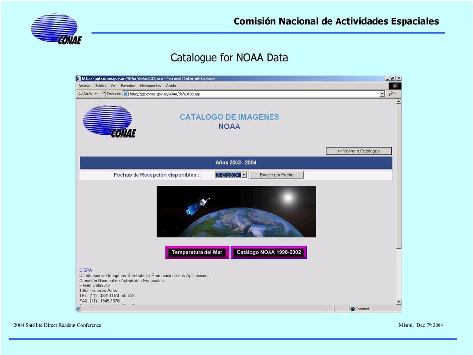
14 Catalogue for NOAA Data
15 Catalogue for NOAA Data

16 Catalogue for NOAA Data

17 Archive HRPT data received since 1998 HRPT and 1B files are stored in CDs Around 4000 CDs are the archive of NOAA data. Data can be requested by users via DISPA office at Headquarters in Buenos Aires and delivered via FTP or CD. SAC-C data also kept on CD, the other data on DLT

18 Applications Development of Level 2 applicaction to integrate with MODIS and SAC-C products Automatization of the products generation. Near Real Time delivery to users.

19 DATOS AUXILIARES OTROS DATOS EJEMPLO BASADO EN FOCOS CALIENTES OTROS SAT/ SENSORES.?? TBD TERRA AQUA NOAA SAC-C MODIS Calibr. Georref Masc.nub. Focos Perf. Atm. NDVI Subset AIRS AVHRR ATOVS HSTC MMRS Calibr. Georref Masc.nub. SST Indices Focos Perfiles Calibr. Georref Masc.nub. Indices Focos Subset OTROS PRODS.?? TBD discriminados WEB FTP ARCHIVO

20 Thank you!

Comisión Nacional de Actividades Espaciales Servicio Meteorológico Nacional
 Direct Readout and Relay of Satellite Data (DRARS) South America/South DRARS - Argentina Spatial Agency (CONAE) - National Meteorological Service (SMN) Status Report on South America RARS Argentina (Regional
Earth remote sensing systems of middle and low resolution
 Earth remote sensing systems of middle and low resolution Serial on-line remote sensing satellites delivering data available on the world market V.I. Gershenzon (ScanEx R&D Center) In 1980, graduated from
SPOT Satellite Earth Observation System Presentation to the JACIE Civil Commercial Imagery Evaluation Workshop March 2007
 SPOT Satellite Earth Observation System Presentation to the JACIE Civil Commercial Imagery Evaluation Workshop March 2007 Topics Presented Quick summary of system characteristics Formosat-2 Satellite Archive
Remote Sensing Satellite Information Sheets Geophysical Institute University of Alaska Fairbanks
 Remote Sensing Satellite Information Sheets Geophysical Institute University of Alaska Fairbanks ASTER Advanced Spaceborne Thermal Emission and Reflection Radiometer AVHRR Advanced Very High Resolution
SAC-C MISSION 2.0 CONAE INSTRUMENTS DESCRIPTION 2.1 MMRS
 SAC-C MISSION Carlos Alonso Carlos Hofmann SAC-C Program Manager SAC-C System Engineer CONAE (Comisión Nacional de Actividades Espaciales), Paseo Colón 751 (1063) Buenos Aires Argentina 1 Abstract. SAC-C
LANDSAT 7 - GROUND SEGMENT ACTIVITIES AT THE GERMAN REMOTE SENSING DATA CENTER. Deutsches Fernerkundungsdatenzentrum (DFD) DLR (*)
 DLR (*)") LANDSAT 7 - GROUND SEGMENT ACTIVITIES AT THE GERMAN REMOTE SENSING DATA CENTER Günter Strunz (*), Hans-Dietrich Bettac (**), Jörg Gredel (*), Klaus-Dieter Reiniger (*) & Gunter Schreier (*) Deutsches Fernerkundungsdatenzentrum
LANDSAT 7 - GROUND SEGMENT ACTIVITIES AT THE GERMAN REMOTE SENSING DATA CENTER Günter Strunz (*), Hans-Dietrich Bettac (**), Jörg Gredel (*), Klaus-Dieter Reiniger (*) & Gunter Schreier (*) Deutsches Fernerkundungsdatenzentrum
High Resolution Information from Seven Years of ASTER Data
 High Resolution Information from Seven Years of ASTER Data Anna Colvin Michigan Technological University Department of Geological and Mining Engineering and Sciences Outline Part I ASTER mission Terra
The National Strategy, Current Activities for Space Technology Development and Application
 14-18 November 2011, Putrajaya, Malaysia The National Strategy, Current Activities for Space Technology Development and Application Lai Anh Khoi Space Technology Institute, VAST, Vietnam Bief History Space
AN OPENGIS WEB MAP SERVER FOR THE ESA MULTI-MISSION CATALOGUE
 AN OPENGIS WEB MAP SERVER FOR THE ESA MULTI-MISSION CATALOGUE T. Westin a, *, C. Caspar b, L. Edgardh a, L. Schylberg c a Spacemetric AB, Tingsv 19, 19161 Sollentuna, Sweden - tw@spacemetric.se b ESA Esrin,
CBERS Program Update Jacie 2011. Frederico dos Santos Liporace AMS Kepler liporace@amskepler.com
 CBERS Program Update Jacie 2011 Frederico dos Santos Liporace AMS Kepler liporace@amskepler.com Overview CBERS 3 and 4 characteristics Differences from previous CBERS satellites (CBERS 1/2/2B) Geometric
Proba-V: Earthwatch Mission as part of ESA s Earth Observation Programmes
 Proba-V: Earthwatch Mission as part of ESA s Earth Observation Programmes Antwerp 05.07.2013 Bianca Hoersch Proba-V Mission Manager Third Party Mission & Sentinel-2 Mission Manager Earth Observation Directorate,
Long Term Preservation of Earth Observation Data
 Long Term Preservation of Earth Observation Data QA4EO Workshop RAL, October 18-20 th 2011 Mirko Albani and Bojan Bojkov* (ESA/ESRIN) Page 1 Outline Earth Observation data preservation: the need and the
Satellite Snow Monitoring Activities Project CRYOLAND
 Satellite Snow Monitoring Activities Project CRYOLAND Background material for participants to the Workshop on European Snow Monitoring Perspectives, Darmstadt, 4-5 December 2012. CryoLand provides Snow,
The DLR Multi Mission EO Ground Segment
 The DLR Multi Mission EO Ground Segment Payload Ground Segment Erhard Diedrich Remote Sensing Workshop Mexico 22-24 April 2008 DLR Ground Segment for Earth Observation: Servicing GMES, national and commercial
IV WORKSHOP RNP2 (WRNP2)
") IV WORKSHOP RNP2 (WRNP2) Hotel Pirâmide, Natal, RN, 19-20 de Maio de 2003 Advanced Network Engineering and Applications from Space Missions - AUTHORS - Eduardo W. Bergamini Serviços Aplicativos em Missões
IV WORKSHOP RNP2 (WRNP2) Hotel Pirâmide, Natal, RN, 19-20 de Maio de 2003 Advanced Network Engineering and Applications from Space Missions - AUTHORS - Eduardo W. Bergamini Serviços Aplicativos em Missões
The use of Earth Observation technology to support the implementation of the Ramsar Convention
 Wetlands: water, life, and culture 8th Meeting of the Conference of the Contracting Parties to the Convention on Wetlands (Ramsar, Iran, 1971) Valencia, Spain, 18-26 November 2002 COP8 DOC. 35 Information
AUTOMATED IMAGE RECEPTION, PROCESSING AND DISTRIBUTION SYSTEM FOR HIGH RESOLUTION REMOTE SENSING SATELLITES
 AUTOMATED IMAGE RECEPTION, PROCESSING AND DISTRIBUTION SYSTEM FOR HIGH RESOLUTION REMOTE SENSING SATELLITES Moon-Gyu Kim, Taejung Kim, Sung-Og Park, Dongseok Shin*, Min Nyo Hong*, Sunghee Kwak*, Wookhyun
China Earth Observation
 China High-resolution Earth Observation China Earth Observation System (CHEOS) and its Lastest Development The Earth Observation System and Data Center, CNSA 2014-2 Outlines 1 Introduction 2 The composition
Big data in Environmental Remote Sensing Challenges and Chances
 Big data in Environmental Remote Sensing Challenges and Chances Th. Udelhoven University of Trier Environmental and Geoinformatics Department 19/12/2013-1 UniGR Workshop: Big Data challenges and opportunities
Universidad Nacional de Rosario Facultad de Ciencias Exactas, Ingeniería y Agrimensura Centro de Sensores Remotos CONICET CONAE NASA
 Monitoring Urban Night-Time Lights Related to Economic Activity (Gross Domestic Product), Urban Heat Island (UHI) and Fires detection in the Paraná Flooding Valley - Argentina using the Observatory SAC-
The Multimission National Center of the Italian Space Agency
 The Multimission National Center of the Italian Space Agency L. Garramone - ASI GSCB Workshop, ESA/ESRIN Frascati Table of contents Multimission National Center (CNM): status of the activities; Main functions
Istanbul Technical University-Center for Satellite Communications and Remote Sensing (ITU-CSCRS)
") Istanbul Technical University-Center for Satellite Communications and Remote Sensing (ITU-CSCRS) Istanbul Technical University, Center for Satellite Communications and Remote Sensing (ITU-CSCRS) was originally
Istanbul Technical University-Center for Satellite Communications and Remote Sensing (ITU-CSCRS) Istanbul Technical University, Center for Satellite Communications and Remote Sensing (ITU-CSCRS) was originally
A global Network of Regional ATOVS Retransmission Services (RARS)
") A global Network of Regional ATOVS Retransmission Services (RARS) Marie Dumont (WMO Space Programme) Anders Soerensen (EUMETSAT) Jérôme Lafeuille (WMO Space Programme) Outline Definition and historical
A global Network of Regional ATOVS Retransmission Services (RARS) Marie Dumont (WMO Space Programme) Anders Soerensen (EUMETSAT) Jérôme Lafeuille (WMO Space Programme) Outline Definition and historical
NOAA Direct Broadcast Real-Time Network: Current Status and Plans for Delivering Sounder Data to DRARS
 NOAA Direct Broadcast Real-Time Network: Current Status and Plans for Delivering Sounder Data to DRARS Liam Gumley (NOAA DB Demonstration Technical Manager), Bruce Flynn, Heath Skarlupka, David Santek,
The RapidEye optical satellite family for high resolution imagery
 'Photogrammetric Week 01' D. Fritsch & R. Spiller, Eds. Wichmann Verlag, Heidelberg 2001. Scherer, Krischke 139 The RapidEye optical satellite family for high resolution imagery STEFAN SCHERER and MANFRED
Innovation and new land monitoring services for climate change, forests and agroforestry
 Innovation and new land monitoring services for climate change, forests and agroforestry Martin Herold Wageningen University Center for Geoinformation Current distribution of aboveground biomass Terrestrial
IMAGING SATELLITE PROGRAMS
 FOREIGN LAND IMAGING SATELLITE PROGRAMS PRESENTATION TO NOAA S ADVISORY COMMITTEE FOR COMMERCIAL REMOTE SENSING 11/14/03 W. STONEY MITRETEK SYSTEMS FRANCE Current SPOT-4, 10 meter Pan, 20 meter MS
earthnet online The ESA Earth Observation Multi-Mission User Information Services
 r bulletin 93 february 1998 earthnet online The ESA Earth Observation Multi-Mission User Information Services G. Landgraf & L. Fusco Remote Sensing Exploitation Department, ESA Directorate of Application
European Space Agency EO Missions. Ola Gråbak ESA Earth Observation Programmes Tromsø, 17 October 2012
 European Space Agency EO Missions Ola Gråbak ESA Earth Observation Programmes Tromsø, 17 October 2012 Europe and Space, A POLICY Article 189 of the Lisbon Treaty (2009) gives the European Union an explicit
Sentinel-1 Mission Overview
 Sentinel-1 Mission Overview Pierre Potin Sentinel-1 Mission Manager, ESA Advanced Course on Radar Polarimetry ESRIN, Frascati, 19 January 2011 Global Monitoring for Environment and Security GMES is established
Monitoring Soil Moisture from Space. Dr. Heather McNairn Science and Technology Branch Agriculture and Agri-Food Canada heather.mcnairn@agr.gc.
 Monitoring Soil Moisture from Space Dr. Heather McNairn Science and Technology Branch Agriculture and Agri-Food Canada heather.mcnairn@agr.gc.ca What is Remote Sensing? Scientists turn the raw data collected
PETROBRAS Orbital Sea Surface Monitoring
 PETROBRAS Orbital Sea Surface Monitoring Performed by : Contingency Control - Exploration & Production Area Technical support: R&D Center Cristina Bentz PETROBRAS R&D Center Environment Assessment and
Argentine Data Collection System Features and Applications
 Features and Applications Adrián Carlotto 1, José Juárez 1, Gerardo Sager 1, Gustavo Mercado 2 1 Facultad de Ingeniería, UNLP 2 CONAE April 11-13, 2012 Buenos Aires, ARGENTINA DCS Main Features DCS (Data
CHILE EARTHQUAKE AND TSUNAMI ON 27 FEBRUARY 2010
 CHILE EARTHQUAKE AND TSUNAMI ON 27 FEBRUARY 2010 Fourth United Nations International UN-SPIDER Bonn Workshop on Disaster Management and Space Technology 12 14 October 2010 1 Multi-Sectoral Working Group
ESA Earth Observation and the need for high speed networking
 ESA Earth Observation and the need for high speed networking Pisa, 11 th May 25 11 th May 25 GARR Conference 5 1 ESA Earth Observation 11 th May 25 GARR Conference 5 2 The European Space Agency The European
The MODIS online archive and on-demand processing
 The MODIS online archive and on-demand processing Edward Masuoka NASA Goddard Space Flight Center, Greenbelt, MD, USA Production Driven by Science Over the Terra and Aqua mission lifetimes, better calibration
NASA Earth System Science: Structure and data centers
 SUPPLEMENT MATERIALS NASA Earth System Science: Structure and data centers NASA http://nasa.gov/ NASA Mission Directorates Aeronautics Research Exploration Systems Science http://nasascience.nasa.gov/
Obtaining and Processing MODIS Data
 Obtaining and Processing MODIS Data MODIS is an extensive program using sensors on two satellites that each provide complete daily coverage of the earth. The data have a variety of resolutions; spectral,
Operational Space- Based Crop Mapping Protocols at AAFC A. Davidson, H. McNairn and T. Fisette.
 Operational Space- Based Crop Mapping Protocols at AAFC A. Davidson, H. McNairn and T. Fisette. Science & Technology Branch. Agriculture and Agri-Food Canada. 1. Introduction Space-Based Crop Mapping at
Internal Calibration Software Requirements
 REQUIREMENT SPECIFICATION Internal Calibration Software Requirements This document is stored electronically. Printed version might not be the latest. SAOCOM PROJECT COMISION NACIONAL DE ACTIVIDADES ESPACIALES
Using Remote Sensing to Monitor Soil Carbon Sequestration
 Using Remote Sensing to Monitor Soil Carbon Sequestration E. Raymond Hunt, Jr. USDA-ARS Hydrology and Remote Sensing Beltsville Agricultural Research Center Beltsville, Maryland Introduction and Overview
Spanish Earth Observation Programme
 Spanish Earth Observation Mónica LópezL Head of SEOSAT / Ingenio ESA s Department - Directorate of Aerospace s CDTI Centre for the Development of Industrial Technology 1 AGENDA 1. Spanish Earth Observation
The New ImageDB Server Direct Access to Selected ERS SAR Data Products
 the new imagedb server The New ImageDB Server Direct Access to Selected ERS SAR Data Products S. D Elia Earth Remote Sensing Exploitation Division, ESA Directorate of Application Programmes, ESRIN, Frascati,
Satellite SST Product Development Proposal
 Call for Proposals under the IMOS (EIF) Five Year Strategy: Enhancement or extension of IMOS July 2009 to June 2013 Satellite SST Products Sub-Facility Plan Overview: Proposed Infrastructure Investment:
ScanEx Ground Stations Network: Network of ground stations receiving data from artificial Earth remote sensing satellites
 ScanEx Ground Stations Network: Network of ground stations receiving data from artificial Earth remote sensing satellites 1 Contents Network general characteristics:... 3 1. General information about ScanEx
25 Years of Indian Remote Sensing Satellite (IRS) Series
 Series") 25 Years of Indian Remote Sensing Satellite (IRS) Series Vinay K Dadhwal Director National Remote Sensing Centre (NRSC), ISRO Hyderabad, INDIA 50 th Session of Scientific & Technical Subcommittee of COPUOS,
25 Years of Indian Remote Sensing Satellite (IRS) Series Vinay K Dadhwal Director National Remote Sensing Centre (NRSC), ISRO Hyderabad, INDIA 50 th Session of Scientific & Technical Subcommittee of COPUOS,
See Lab 8, Natural Resource Canada RS Tutorial web pages Tues 3/24 Supervised land cover classification See Lab 9, NR Canada RS Tutorial web pages
 SFR 406 Remote Sensing, Image Interpretation and Forest Mapping EXAM # 2 (23 April 2015) REVIEW SHEET www.umaine.edu/mial/courses/sfr406/index.htm (Lecture powerpoint & notes) TOPICS COVERED ON 2 nd EXAM:
Nigerian Satellite Systems, and her Remote Sensing Data
 Nigerian Satellite Systems, and her Remote Sensing Data S. O. Mohammed, PhD (Director-General/Chief Executive) National Space Research & Development Agency (NASRDA) A Presentation at the 2010 International
Ocean Colour experience SeaWiFS / MODIS / VIIRS
 Ocean Colour experience SeaWiFS / MODIS / VIIRS Bryan Franz and the NASA Ocean Biology Processing Group presented by Ewa Kwiatkowska, EUMETSAT Sentinel-3 Cal/Val Meeting 20-22 March 2012 Goal Provide a
Real Time Services for Space Applications Holger Maass, Susanne Lehner
 Real Time Services for Space Applications Holger Maass, Susanne Lehner Holger.Maass@dlr.de German Remote Sensing Data Center ( DFD ) with 2 locations in Germany Neustrelitz in Mecklenburg-Vorpommern Oberpfaffenhofen
ARGOS REAL TIME ANTENNA UPGRADE PROJECT. Bill Woodward, CLS America Michel Guigue, CLS Toulouse Yann Bernard, CLS Toulouse
 ARGOS REAL TIME ANTENNA UPGRADE PROJECT Bill Woodward, CLS America Michel Guigue, CLS Toulouse Yann Bernard, CLS Toulouse TODAY S PRESENTATION WHY UPGRADE THE CURRENT NETWORK? THE UPGRADE OBJECTIVE & APPROACH
REGIONAL CLIMATE CENTRE SOUTH EAST SOUTH AMERICA
 REGIONAL CLIMATE CENTRE SOUTH EAST SOUTH AMERICA Julián Báez Benítez President of Regional Association III of WMO (South America) Director of Direction of Meteorology and Hydrology of Paraguay WMO RA-III
The NASA NEESPI Data Portal to Support Studies of Climate and Environmental Changes in Non-boreal Europe
 The NASA NEESPI Data Portal to Support Studies of Climate and Environmental Changes in Non-boreal Europe Suhung Shen NASA Goddard Space Flight Center/George Mason University Gregory Leptoukh, Tatiana Loboda,
DESCW: PC Software Supporting Remote Sensing Data
 r bulletin 97 march 1999 DESCW: PC Software Supporting Remote Sensing Data S. D Elia Earth Remote Sensing Exploitation Division, ESA Directorate for Application Programmes, ESRIN, Frascati, Italy R. Biasutti
The USGS Landsat Big Data Challenge
 The USGS Landsat Big Data Challenge Brian Sauer Engineering and Development USGS EROS bsauer@usgs.gov U.S. Department of the Interior U.S. Geological Survey USGS EROS and Landsat 2 Data Utility and Exploitation
INTERNAL AND EXTERNAL AUDITS
 PROCEDURE INTERNAL AND EXTERNAL AUDITS This document is stored electronically. Printed version might not be the latest. SAOCOM PROJECT COMISION NACIONAL DE ACTIVIDADES ESPACIALES BUENOS AIRES ARGENTINA
CEOS contribution to the GEO Geohazard Supersite and Natural Laboratories Initiative Data access and license conditions
 CEOS contribution to the GEO Geohazard Supersite and Natural Laboratories Initiative Data access and license conditions Ecuadorian Volcanoes Permanent Supersite December 8, 2014 1. Purpose and Scope This
EROS RECORDS MANAGEMENT PLAN. Geologist Ed Harp estimates rock-fall susceptibility in American Fork Canyon, UT. 10/7/2004.
 EROS RECORDS MANAGEMENT PLAN Geologist Ed Harp estimates rock-fall susceptibility in American Fork Canyon, UT. 10/7/2004. John Faundeen Version 3.5 August 2009 CONTENTS Page Number A. Definitions 3 B.
Set-up of a digital image archive for MOMS-2P(PRIRODA) data
 data") 'Photogrammetric Week '97' D. Fritsch D. Hobbie, Eds., Wichmann Verlag, Heidelberg, 1997. Mißling et al. 223 Set-up of a digital image archive for MOMS-2P(PRIRODA) data HOLGER MAASS, KLAUS- DIETER MISSLING
'Photogrammetric Week '97' D. Fritsch D. Hobbie, Eds., Wichmann Verlag, Heidelberg, 1997. Mißling et al. 223 Set-up of a digital image archive for MOMS-2P(PRIRODA) data HOLGER MAASS, KLAUS- DIETER MISSLING
Resolutions of Remote Sensing
 Resolutions of Remote Sensing 1. Spatial (what area and how detailed) 2. Spectral (what colors bands) 3. Temporal (time of day/season/year) 4. Radiometric (color depth) Spatial Resolution describes how
Methods for Monitoring Forest and Land Cover Changes and Unchanged Areas from Long Time Series
 Methods for Monitoring Forest and Land Cover Changes and Unchanged Areas from Long Time Series Project using historical satellite data from SACCESS (Swedish National Satellite Data Archive) for developing
A remote sensing instrument collects information about an object or phenomenon within the
 Satellite Remote Sensing GE 4150- Natural Hazards Some slides taken from Ann Maclean: Introduction to Digital Image Processing Remote Sensing the art, science, and technology of obtaining reliable information
Review for Introduction to Remote Sensing: Science Concepts and Technology
 Review for Introduction to Remote Sensing: Science Concepts and Technology Ann Johnson Associate Director ann@baremt.com Funded by National Science Foundation Advanced Technological Education program [DUE
ACCESS TO ERS AND ENVISAT DATA. CGMS is informed about the ESA Earth Observation data policy and data access, in particular in Near Real Time.
 Prepared by ESA Agenda Item: III.3 Discussed in WG3 ACCESS TO ERS AND ENVISAT DATA CGMS is informed about the ESA Earth Observation data policy and data access, in particular in Near Real Time. ACCESS
Raster Data Structures
 Raster Data Structures Tessellation of Geographical Space Geographical space can be tessellated into sets of connected discrete units, which completely cover a flat surface. The units can be in any reasonable
INTA AIRBORNE REMOTE SENSING FACILITY from the Hasselblad s cameras to the SensyTech-AHS sensor
 INTA AIRBORNE REMOTE SENSING FACILITY from the Hasselblad s cameras to the SensyTech-AHS sensor José-Antonio Gómez-Sánchez gomezsj@inta.es Remote Sensing Laboratory INSTITUTO NACIONAL DE TÉCNICA AEROESPACIAL
Research on Soil Moisture and Evapotranspiration using Remote Sensing
 Research on Soil Moisture and Evapotranspiration using Remote Sensing Prof. dr. hab Katarzyna Dabrowska Zielinska Remote Sensing Center Institute of Geodesy and Cartography 00-950 Warszawa Jasna 2/4 Field
Present Status of Coastal Environmental Monitoring in Korean Waters. Using Remote Sensing Data
 Present Status of Coastal Environmental Monitoring in Korean Waters Using Remote Sensing Data Sang-Woo Kim, Young-Sang Suh National Fisheries Research & Development Institute #408-1, Shirang-ri, Gijang-up,
NIGERIA EARTH OBSERVATION SATELLITE PROJECT
 NIGERIA EARTH OBSERVATION SATELLITE PROJECT By SIEDU ONAILO MOHAMMED, Ph.D. Director General National Space Research and Development Agency Presentation at the DMC and NovaSAR International Conference
Ocean Level-3 Standard Mapped Image Products June 4, 2010
 Ocean Level-3 Standard Mapped Image Products June 4, 2010 1.0 Introduction This document describes the specifications of Ocean Level-3 standard mapped archive products that are produced and distributed
Remote Sensing for Geographical Analysis
 Remote Sensing for Geographical Analysis Geography 651, Fall 2008 Department of Geography Texas A&M University (3 credit hours) Instructor: Dr. Hongxing Liu Office hours: Tue & Thur 10:00AM-12:00AM, O&M
Price List. January 1 st, 2016. 1 of 40. PRICE LIST January 1 st, 2016 SLS-COM-16-001
 Price List January 1 st, 2016 1 of 40 INDEX INDEX... 2 COSMO-SKYMED... 4 IKONOS... 10 QUICKBIRD... 10 GEOEYE-1... 10 WORLDVIEW-1/2/3... 10 RADARSAT-1... 20 RADARSAT-2... 20 ASTER... 26 IRS P6... 28 IRS
an insight into systems from acquisition to dissemination
 an insight into systems from acquisition to dissemination P Shasidhar Reddy Manager Computer Systems National Remote Sensing Centre Satellite data acquisition planning, reception, processing and dissemination
Aquarius-SACD DOCUMENT DRAFT
 COMISION NACIONAL DE ACTIVIDADES ESPACIALES PROJECT Aquarius-SACD DOCUMENT PAGES :23 Nº: AQ-336-0522 DATE: July 28, 2009 TITLE DRAFT Aquarius Ground System Aquarius Instrument Team ICD AQ-336-0522 Summary
MODIS direct broadcast data for enhanced forecasting and real-time environmental decision making. The role of Remote Sensing in Wildfire Management
 MODIS direct broadcast data for enhanced forecasting and real-time environmental decision making The role of Remote Sensing in Wildfire Management Natural Disasters Natural disasters are continuously increasing
Overview on Namibian Flood SensorWeb Pilot Project stuart.frye@nasa.gov October 22, 2009
 Overview on Namibian Flood SensorWeb Pilot Project stuart.frye@nasa.gov October 22, 2009 1 Goal is to visualize available satellite data and possible future satellite data in an area of interest and a
Monitoring a Changing Environment with Synthetic Aperture Radar. Alaska Satellite Facility National Park Service Don Atwood
 Monitoring a Changing Environment with Synthetic Aperture Radar Don Atwood Alaska Satellite Facility 1 Entering the SAR Age 2 SAR Satellites RADARSAT-1 Launched 1995 by CSA 5.6 cm (C-Band) HH Polarization
NASA Goddard Space Flight Center Ocean Data Processing System Operations, Project Data and Software Management Plan August 2012
 NASA Goddard Space Flight Center Ocean Data Processing System Operations, Project Data and Software Management Plan August 2012 1.0 INTRODUCTION This document describes the Operations and Project Data
McIDAS-V Tutorial Displaying Polar Satellite Imagery updated September 2015 (software version 1.5)
") McIDAS-V Tutorial Displaying Polar Satellite Imagery updated September 2015 (software version 1.5) McIDAS-V is a free, open source, visualization and data analysis software package that is the next generation
McIDAS-V Tutorial Displaying Polar Satellite Imagery updated September 2015 (software version 1.5) McIDAS-V is a free, open source, visualization and data analysis software package that is the next generation
Suomi / NPP Mission Applications Workshop Meeting Summary
 Suomi / NPP Mission Applications Workshop Meeting Summary Westin City Center, Washington, DC June 21-22, 2012 Draft Report (updated March 12, 2013) I. Background The Suomi National Polar- orbiting Partnership
TIME AND FREQUENCY METROLOGY WORKING GROUP Working to support time and frequency metrology throughout the Americas
 J. Mauricio Lopez R. a, Michael A. Lombardi b, Andrew N. Novick b, Jean-Simon Boulanger c, Raymond Pelletier c, Carlos Donado M. d, and Ricardo Carvalho e a Centro Nacional de Metrología (CENAM), Querétaro,
How To Use Data From Copernicus And Big Data To Help The Environment
 Copernicus and Big Data: Challenges and Opportunities Alessandro Annoni European Commission Joint Research Centre www.jrc.ec.europa.eu Serving society Stimulating innovation Supporting legislation Big
Antenna Chetumal: Use of remote sensing data for environmental and civil security applications in Mexico. 22 nd to 24 th of April, 2008
 Antenna Chetumal: Use of remote sensing data for environmental and civil security applications in Mexico 22 nd to 24 th of April, 2008 Location: International Conference Center (ICC). Ciudad de México
University of Wisconsin SSEC Data Center. May 7, 2012
 University of Wisconsin SSEC Data Center May 7, 2012 SSEC Data Center SSEC Data Center - Activities Assist Satellite Operations Control Center and other agencies in satellite checkout and troubleshooting
Technical Support Services Contract Solicitation G14PS00053 Questions and Responses from EROS Site Visits December 2, 2014
 Technical Support Services Contract Solicitation G14PS00053 Questions and Responses from EROS Site Visits December 2, 2014 1. Question: Can you provide more information on how/what Landsat 7 and 8 data
The European Space Agency s Synthetic Aperture Radar Programme From Experiment to Service Provision
 The European Space Agency s Synthetic Aperture Radar Programme From Experiment to Service Provision Evert Attema ESA, Directorate of Earth Observation Programme! The idea of an independent European space
Remote Sensing Applications in Support of Sustainable Development and Disaster Management by DLR Current Activities
 Remote Sensing Applications in Support of Sustainable Development and Disaster Management by DLR Current Activities Dr. Günter Strunz German Aerospace Center (DLR) German Remote Sensing Data Center 43rd
Design of a High Resolution Multispectral Scanner for Developing Vegetation Indexes
 Design of a High Resolution Multispectral Scanner for Developing Vegetation Indexes Rishitosh kumar sinha*, Roushan kumar mishra, Sam jeba kumar, Gunasekar. S Dept. of Instrumentation & Control Engg. S.R.M
Contributions of the geospatial fields to monitoring sustainability of urban environments John Trinder. School of Civil and Environmental Engineering
 Contributions of the geospatial fields to monitoring sustainability of urban environments John Trinder School of Civil and Environmental Engineering 2 IMPACT OF HUMAN DEVELOPMENT Humans are modifying the
Astrium GEO UK Multi-Mission PDGS Facilities and Services
 Astrium GEO UK Multi-Mission PDGS Facilities and Services Introduction UK-MM-PAC ERS-1/2 UK-MM-PAC ENVISAT Data Hosting Activities Future Activities Infoterra Archives LTDP Preparation Collaborative Activities
Developments toward a European Land Monitoring Framework. Geoff Smith. Seminar 2 nd December, 2015 Department of Geography, University of Cambridge
 Developments toward a European Land Monitoring Framework Geoff Smith Specto Natura Limited Enable clients to deliver useful, accurate and reliable environmental information from EO. Positioned at the interface
Preface. Ko Ko Lwin Division of Spatial Information Science University of Tsukuba 2008
 1 Preface Remote Sensing data is one of the primary data sources in GIS analysis. The objective of this material is to provide fundamentals of Remote Sensing technology and its applications in Geographical
A DISTRIBUTED CATALOG AND DATA SERVICES SYSTEM FOR REMOTE SENSING DATA
 A DISTRIBUTED CATALOG AND DATA SERVICES SYSTEM FOR REMOTE SENSING DATA Ramachandran Suresh *, Liping Di *, Kenneth McDonald ** * NASA/RITSS 4500 Forbes Blvd, Lanham, MD 20706, USA suresh@rattler.gsfc.nasa.gov
National Snow and Ice Data Center A brief overview and data management projects
 Cooperative Institute for Research in Environmental Sciences University of Colorado National Snow and Ice Data Center A brief overview and data management projects Walt Meier, Mark Parsons, and Mark Serreze
Welcome to NASA Applied Remote Sensing Training (ARSET) Webinar Series
 Webinar Series") Welcome to NASA Applied Remote Sensing Training (ARSET) Webinar Series Introduction to Remote Sensing Data for Water Resources Management Course Dates: October 17, 24, 31 November 7, 14 Time: 8-9 a.m.
Welcome to NASA Applied Remote Sensing Training (ARSET) Webinar Series Introduction to Remote Sensing Data for Water Resources Management Course Dates: October 17, 24, 31 November 7, 14 Time: 8-9 a.m.
COORDINATION GROUP ON SATELLITE DATA REQUIREMENTS FOR RA III AND RA IV. Summary
 COORDINATION GROUP ON SATELLITE DATA REQUIREMENTS FOR RA III AND RA IV 5 th Teleconference, 26 February 2014, 15.00 UTC Participants: Summary Estela Collini, SNM, Argentina (estela.collini@gmail.com) Luiz
NASA's Earth Observing Data and Information System (EOSDIS)
") NASA's Earth Observing Data and Information System (EOSDIS) Copernicus Big Data Workshop 13 March 2014 Brussels, Belgium Kevin Murphy EOSDIS System Architect NASA Goddard Space Flight Center Topics to
NASA's Earth Observing Data and Information System (EOSDIS) Copernicus Big Data Workshop 13 March 2014 Brussels, Belgium Kevin Murphy EOSDIS System Architect NASA Goddard Space Flight Center Topics to
Data Management Framework for the North American Carbon Program
 Data Management Framework for the North American Carbon Program Bob Cook, Peter Thornton, and the Steering Committee Image courtesy of NASA/GSFC NACP Data Management Planning Workshop New Orleans, LA January
University of Wisconsin SSEC Datacenter
 University of Wisconsin SSEC Datacenter 2015 McIDAS Users Group Meeting June 8, 2015 SSEC Data Center Mission Statement The SSEC Data Center mission is to create and maintain the facilities, human expertise
Matsu: An Elastic Cloud Connected to a SensorWeb for Disaster. (Session 12F Working Group: Cloud Computing for Spacecraft Operations)
") Matsu: An Elastic Cloud Connected to a SensorWeb for Disaster Response (Session 12F Working Group: Cloud Computing for Spacecraft Operations) Daniel Mandl - NASA/GSFC 3/2/11 1 SensorWeb High Level Architecture
Matsu: An Elastic Cloud Connected to a SensorWeb for Disaster Response (Session 12F Working Group: Cloud Computing for Spacecraft Operations) Daniel Mandl - NASA/GSFC 3/2/11 1 SensorWeb High Level Architecture