ARchaeological Consultants CALIFORNIA 94110
|
|
|
- Jacob Harrell
- 10 years ago
- Views:
Transcription
1 bolrnoida550ciate5 ARchaeological Consultants "SINCE THE BEGINNING" 361S FOLSOM ST. CALIFORNIA SAN FRANCISCO, 41S/SSQ-7.2B(') Judy Shanley David J. Powers & Associates 1885 The Alameda San Jose, CA November 20 th, 2008 NOV L a,'\it.;. y",<:\.:" :~~~f: ;{- J'.2;,.-;'..:'rlTG.;';, ii~c. Dear Ms. Shanley RE: LOS ALTOS COMMUNITY CENTER MASTER PLAN CULTURAL RESOURCES STUDY, LOS ALTOS, SANTA CLARA COUNTY, CALIFORNIA On October 2 nd, 2008 I completed an archaeological field inspection ofthe above referenced project area located in Los Altos. No evidence ofprehistoric or historic archaeological resources was found either during the archaeological literature review or the field inspection. This report contains a summary ofinformation gained to date. PROJECT DESCRIPTION The proposed project area consists ofan under 20 acre irregularly shaped parcel ofland containing the Los Altos City Hall, Library, youth Center, Police station and other facilities including the History House and History Museum. Located on the Mountain View U.S.G.S. map, the borders ofthe property are San Antonio Road on the west, Housing on the north, the Recreation Center and housing on the east, and Hawthorne Way on the south. The building complexes are located in a setting which includes open fields and orchards. At the time ofthe field visit all ofthe open ground and the orchard ground had been disced to remove any weed covenng. ARCHIVAL RESEARCH An archaeological literature review was undertaken by this author in person at the Northwest Information Center (NWIC) located in Rohnert Park (File no ). The inventory has no historic or prehistoric sites located within the borders ofthe parcel or within a quarter mile of it. There also have been no formal archaeological field inspections ofthe project area, and none within a quarter mile radius.

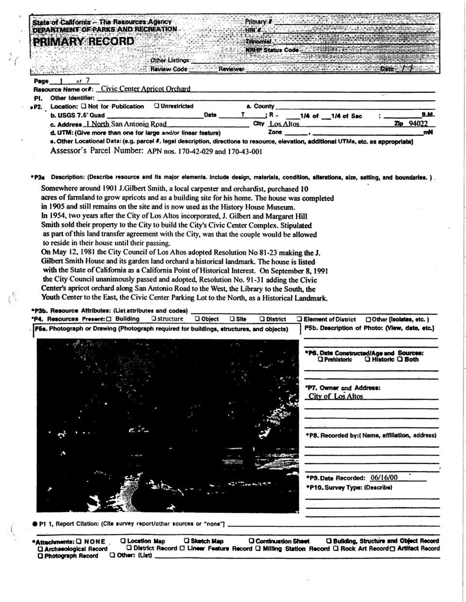
2 The property does contain one recorded historic resource, the existing History House. A plaque near the stairs ofthe house explained that the house was built by Gilbert Smith, who bought the land in 1901, at which time he planted apricots. In 1931 he expanded the farm to 10 acres, which was bought by the City oflos Altos in Smith stayed on until his death in 1966; his wife Margaret died in In 1977 the house became the History Museum. The House and the original 5 acres of Apricots became an official Los Altos Historical Landmark in 1987, designated at "California Point ofhistorical Interest ScI-058). Currently the house stands alone next to the newly constructed history museum. DESCRIPTION OF FIELD INSPECTION A visual inspection ofall open ground inside the project area was undertaken by this author on October 2 nd, The open fields in front ofand behind City Hall and surrounding the police station and bordering the soccer field were inspected by walking 20 foot transects over all the open areas. Soils throughout the area consist ofa reddish brown clay loam with scant naturally occurring gravels ofbasalt and siltstone. The soils, disced to a consistency ofpowder, were inspected for any indicators ofaboriginal use typical to this part ofsanta Clara County: darker than surrounding soils containing stone, bone or fresh water shellfish, evidence offire (ash, charcoal, fire affected rock or soils), artifacts ofthese materials and any indications ofburials, either human or animal. The surface was also inspected for any evidence ofhistoric trash deposits which may have been created by the Smith family in the early 20 th century. Historic archaeological deposits can be found in the form offilled in wells and/or privy pits or in excavated trash pits. FINDINGS/RECOMMENDATIONS No evidence ofeither historic or prehistoric archaeological resources was found during the field inspection. Conditions for a field inspection were ideal-the ground inside the open spaces around the city buildings (partly covered with orchard) had been disced to remove all weed covering. It is evident from the uniformity ofthe soils viewed that this area has not been altered historically, and that ifany archaeological materials (prehistoric or historic) existed in the area, the history ofdiscing and plowing there would have brought examples ofthem to the surface. It is the opinion ofthis author that the project area is located in a zone oflow to moderate archaeological sensitivity; the nearest riparian zone (a favored Native American habitation area) is located approximately a mile to the east where Hale and Permanente Creeks merge and flow north to the bay. Adobe Creek, which runs along the foothills to the west approximately a half mile away, supported Native American habitation as it exited the hills to form the modem border 2

3 between Palo Alto and Los Altos, over two miles from the Community Center project area. Future development ofopen areas inside the project borders should have no effect on either historic or prehistoric cultural resources. This report does not recommend mechanical subsurface presence/absence testing to search for buried resources, and does not recommend archaeological monitoring of future construction related earthmoving activities. In the unlikely event that any ofthe cultural materials described in this report are uncovered, work should be halted within 50 feet ofthe discovery until a qualified archaeologist has been retained to inspect the discovery. Ifit is determined that additional earthmoving will affect a resource eligible for inclusion on the California Register ofhistoric Resources (CRHR), a plan for its evaluation should be submitted to the Los Altos Planning Department for approval. Evaluation is normally done through a limited program ofhand excavation to sample the archaeological deposit for significant materials and/or information. In the event that evaluative testing does demonstrate that the area contains a CRHR eligible resource, a plan for mitigation of impacts to it should be submitted to the Planning Department for approval before construction work is allowed to recommence in the zone designated as archaeologically sensitive. Mitigation can include additional data recovery through hand excavation coupled with archaeological monitoring inside the archaeological zone to insure that all significant archaeological information and material is retrieved for analysis. Monitoring also helps in the timely identification ofhuman burials, limiting damage to them. All human remains encountered must, by law, be carefully removed from impact areas and reburied at a location agreed to between the City and the designated Most Likely Descendant along with any associated grave goods. Sincerely, ~~~ Miley Paul Holman Holman & Associates 3

4 LOSALTOSCO~TYCENTERMASTERPLAN 1 SOUTH SAN ANTONIO ROAD ASSESSOR PARCEL AND LOS ALTOS, SANTA CLARA COUNTY, CALIFORNIA MOUNTAIN VIEW U.S.G.S MAP Produced by the United States Geological Survey Topography compiled PlanlmelJy derived &omlmagery taken 1991 and othersourcea. PhotolllJlpected using Imagery laken 1997; no major culture or drainage changes observed PLSS and BUrvey control cunent as of Boundaries other than corporate, verified 1999 North American Datum of 1927 (NAn 27). ProJec:tlon IUld IOOO meter grid: Unlveulll Transverse Mercator, zone OOO foot Ucks: CIlJifornla CAlordlnate System of1927 :zone3) :IIorth American Dlltum of 1983 (NAD 83) Is.hown by dashed :omer tick., The valun or the.hllt bablieen NAD 27 and NAD 83, " ~. '* *'......!'tjn GN / 0'35'! 10MILS 1SlP 276 MILS 1...
.")
5

6
7

8

9
10

11

12

13
14
15

16
17

18

19

20

21
22
23
IV. Environmental Impact Analysis I.2. Cultural Resources Archaeological Resources
 IV. Environmental Impact Analysis I.2. Cultural Resources Archaeological Resources 1. Introduction The following section addresses the potential for the Proposed Project to affect archaeological resources
Scene Detection and Processing
 Scientific Working Group for Forensic Anthropology (SWGANTH) Scene Detection and Processing Issue Date: 01/23/2013 Revision: 0 Scene Detection and Processing 1.0 Principle, Spirit, and Intent A scene is
PLAN AND PROCEDURES FOR THE UNANTICIPATED DISCOVERY OF CULTURAL RESOURCES AND HUMAN SKELETAL REMAINS PROJECT, COUNTY WASHINGTON
 PLAN AND PROCEDURES FOR THE UNANTICIPATED DISCOVERY OF CULTURAL RESOURCES AND HUMAN SKELETAL REMAINS PROJECT, COUNTY WASHINGTON 1. INTRODUCTION The Washington State Department of Transportation (WSDOT)
Unit 5 - The Discovery of Human Remains: Best Practices
 Unit 5 - The Discovery of Human Remains: Best Practices This document is a best practices guideline describing the procedures for the treatment of human skeletal remains discovered outside a licensed cemetery.
BEAR DEN PHASE 2 PROJECT. Plan of Development. APPENDIX I Plan for Unanticipated Discovery of Cultural Resources or Human Remains During Construction
 BEAR DEN PHASE 2 PROJECT Plan of Development APPENDIX I Plan for Unanticipated Discovery of Cultural Resources or Human Remains During Construction BEAR DEN PHASE 2 PROJECT Plan of Development Plan for
Phase III: Data Recovery and Mitigation
 Phase III: Data Recovery and Mitigation Introduction... 51 Developing a Data Recovery Plan... 51 Methods and Techniques for Data Recovery... 53 Reporting the Results of Data Recovery Projects... 55 Interested
NOTICE OF PREPARATION
 PLANNING DIVISION CITY OF SUNNYVALE P.O. BOX 3707 SUNNYVALE, CA 94088-3707 NOTICE OF PREPARATION TO: Responsible, Trustee, and Other Interested Public Agencies FROM: Sunnyvale Community Development 456
Hopewell Archeology: The Newsletter of Hopewell Archeology in the Ohio River Valley Volume 6, Number 1, September 2004
 Hopewell Archeology: The Newsletter of Hopewell Archeology in the Ohio River Valley Volume 6, Number 1, September 2004 5. New Discoveries Right in Our Own Front Yard: Preliminary Results of Recent Research
Public Land Survey System - Definition
 Public Land Survey System - Definition The Public Land Survey System (PLSS) is a method used in the United States to locate and identify land, particularly for titles and deeds of farm or rural land. The
Data Sharing System (DSS) Data Entry Instruction for Archaeological Survey
 Data Entry Instruction for Archaeological Survey") Data Sharing System (DSS) Data Entry Instruction for Archaeological Survey Introduction The following data entry guidelines are to be followed for new Data Sharing System (DSS) entries. When updating previously
Data Sharing System (DSS) Data Entry Instruction for Archaeological Survey Introduction The following data entry guidelines are to be followed for new Data Sharing System (DSS) entries. When updating previously
If you require assistance in obtaining access to the presentations or have questions regarding the. 6300 or Glenn Young at (916) 341 6696.
 341 6696.") These materials were developed by CalRecycle staff to address specific technical training areas and are posted as reference documents for the local l government and CalRecycle staff who work on closed,
These materials were developed by CalRecycle staff to address specific technical training areas and are posted as reference documents for the local l government and CalRecycle staff who work on closed,
~ J~2~~ FROM: Stephen M. Haase. RE_COMMENI)~ no~ TO: HONORABLE MAYOR AND CITY COUNCIL. SUBJECT: EVERGREEN COMMUNITY COLLEGE SURPLUS PROPERn
~ no~ TO: HONORABLE MAYOR AND CITY COUNCIL. SUBJECT: EVERGREEN COMMUNITY COLLEGE SURPLUS PROPERn") COUNCIL AGENDA: 8-03-04 ITEM: 2.7 ~ J~2~~ CAPrrALOF~VA1J.EY TO: HONORABLE MAYOR AND CITY COUNCIL SUBJECT: EVERGREEN COMMUNITY COLLEGE SURPLUS PROPERn FROM: Stephen M. Haase DATE July 27, 2004 COUNCIL DISTRICT:
COUNCIL AGENDA: 8-03-04 ITEM: 2.7 ~ J~2~~ CAPrrALOF~VA1J.EY TO: HONORABLE MAYOR AND CITY COUNCIL SUBJECT: EVERGREEN COMMUNITY COLLEGE SURPLUS PROPERn FROM: Stephen M. Haase DATE July 27, 2004 COUNCIL DISTRICT:
SPECIAL USE PERMIT 22-01. JCSA Groundwater Treatment Facility Staff Report for the November 5, 2001, Planning Commission Public Hearing
 SPECIAL USE PERMIT 22-01. JCSA Groundwater Treatment Facility Staff Report for the November 5, 2001, Planning Commission Public Hearing This report is prepared by the James City County Planning Division
APPROVED. PXP 2009 Tank Leak Detection and Containment at Inglewood Oil Field. Baldwin Hills CSD Conditions L.18. and E.29.e.
 PXP 2009 Tank Leak Detection and Containment at Inglewood Oil Field Baldwin Hills CSD Conditions L.18. and E.29.e. WORKING DRAFT SUBJECT TO CHANGE BASED ON COUNTY REVIEW AND ACCEPTANCE Prepared for: May
March 2008. Prepared by: Irvine Ranch Water District. 15600 Sand Canyon Avenue. Irvine, CA 92618. Contact: Natalie Likens (949) 453-5633
 453-5633") ADDENDUM TO THE MICHELSON WATER RECLAMATION PLANT PHASE 2 & 3 CAPACITY EXPANSION PROJECT FEBRUARY 2006 FINAL ENVIRONMENTAL IMPACT REPORT AND THE SAN JOAQUIN FRESHWATER MARSH ENHANCEMENT PLAN REVISED SEPTEMBER
ADDENDUM TO THE MICHELSON WATER RECLAMATION PLANT PHASE 2 & 3 CAPACITY EXPANSION PROJECT FEBRUARY 2006 FINAL ENVIRONMENTAL IMPACT REPORT AND THE SAN JOAQUIN FRESHWATER MARSH ENHANCEMENT PLAN REVISED SEPTEMBER
Utah State General Records Retention Schedule SCHEDULE 1 GEOSPATIAL DATA SETS
 Utah State General Records Retention Schedule SCHEDULE 1 BIOTA RECORDS (Item 1-26) These are geospatial records that depict wildlife use areas in the state of Utah as determined by wildlife biologists
Ground Penetrating Radar Survey of a Portion of the Riverside Cemetery, Hopkinsville, Kentucky
 Ground Penetrating Radar Survey of a Portion of the Riverside Cemetery, Hopkinsville, Kentucky October 2012 Report prepared by Anthony L. Ortmann, Ph.D. Assistant Professor Department of Geosciences Murray
Trinomial NRHP Status Code 3CS Other Listings Review Code Reviewer Date Page 1 of 6 *Resource Name or #: (Assigned by recorder) 1101 Sutter Street
 1101 Sutter Street") HRI # PRIMARY RECORD Trinomial NRHP Status Code 3CS Other Listings Review Code Reviewer Date Page 1 of 6 *Resource Name or #: (Assigned by recorder) 1101 Sutter Street P1. Historic name of building (if
HRI # PRIMARY RECORD Trinomial NRHP Status Code 3CS Other Listings Review Code Reviewer Date Page 1 of 6 *Resource Name or #: (Assigned by recorder) 1101 Sutter Street P1. Historic name of building (if
Michael & Christina Harland (PLN020078)
") LYNNE MOUNDAY ZONING ADMINISTRATOR COUNTY OF MONTEREY STATE OF CALIFORNIA RESOLUTION NO. 020078 A. P. # 009-451-011-000 In the matter of the application of Michael & Christina Harland (PLN020078) FINDINGS
LYNNE MOUNDAY ZONING ADMINISTRATOR COUNTY OF MONTEREY STATE OF CALIFORNIA RESOLUTION NO. 020078 A. P. # 009-451-011-000 In the matter of the application of Michael & Christina Harland (PLN020078) FINDINGS
An Archaeological Settlement Analysis of Goshono Site
 An Archaeological Settlement Analysis of Goshono Site TAKADA Kazunori YAMADA Masahisa 1. The Planar Distribution of Remains Goshono is a late-middle Jomon settlement site in Iwate Prefecture, Ninohe County,
CHAPTER 4 LEGAL DESCRIPTION OF LAND DESCRIBING LAND METHODS OF DESCRIBING REAL ESTATE
 r CHAPTER 4 LEGAL DESCRIPTION OF LAND DESCRIBING LAND A legal description is a detailed way of describing a parcel of land for documents such as deeds and mortgages that will be accepted in a court of
APPENDIX E CULTURAL RESOURCE MANAGEMENT REPORT (CRM, 2013) Environmental Assessment Registration Document for Irish Cove Quarry Expansion
 Environmental Assessment Registration Document for Irish Cove Quarry Expansion") APPENDIX E CULTURAL RESOURCE MANAGEMENT REPORT (CRM, 2013) Environmental Assessment Registration Document for Irish Cove Quarry Expansion DEXTER CONSTRUCTION COMPANY LIMITED IRISH COVE QUARRY EXPANSION
APPENDIX E CULTURAL RESOURCE MANAGEMENT REPORT (CRM, 2013) Environmental Assessment Registration Document for Irish Cove Quarry Expansion DEXTER CONSTRUCTION COMPANY LIMITED IRISH COVE QUARRY EXPANSION
Storm Drain System Operation and Maintenance
 Santa Clara Valley Urban Runoff Pollution Prevention Program PUBLIC AGENCY ACTIVITIES Performance Standard and Supporting Documents for Storm Drain System Operation and Maintenance December 19, 1996 March
About Fact Sheets Contact Us Partners Products Site Map FAQ Help
 About Fact Sheets Contact Us Partners Products Site Map FAQ Help Home Articles PLSS Article The Public Land Survey System (PLSS) What is the PLSS? History Commonly Used Terms Related Links What is the
GEOGRAPHIC INFORMATION SYSTEMS Lecture 11: Land Division Systems
 GEOGRAPHIC INFORMATION SYSTEMS Lecture 11: Land Division Systems Land Division Systems - in many applications of GIS, land ownership is an important data layer and it is important for GIS users to be familiar
Drop off Locations for Used/Unused/Expired Medications:
 Drop off Locations for Used/Unused/Expired Medications: Cupertino Santa Clara County Sheriff West Valley Patrol Division 1601 S. De Anza Blvd., Cupertino, CA 95014 (Cross street Duckett Way) (408) 868
Rural Residential Buildable Lands Inventory
 The Dalles Periodic Review, May 2013 Rural Residential Lands Inventory Contents Introduction and Summary... 1 Concerns related to the 2007 Analysis... 2 Rural Residential Capacity Summary... 2 Methodology...
Reference: Escondido Ballpark Cultural Resources Survey (Affinis Job No. 2394)
") 847 Jamacha Road, El Cajon, California 92019-3206 tel: (619) 441-0144 fax: (619) 441-6421 October 13, 2010 Ms. Kim Baranek HELIX Environmental Planning 7578 El Cajon Boulevard, Suite 200 La Mesa, California
847 Jamacha Road, El Cajon, California 92019-3206 tel: (619) 441-0144 fax: (619) 441-6421 October 13, 2010 Ms. Kim Baranek HELIX Environmental Planning 7578 El Cajon Boulevard, Suite 200 La Mesa, California
Re: Preliminary Permit Application for the Rose Creek Pumped Storage Project
 September 12, 2013 Kimberly D. Bose, Secretary Federal Energy Regulatory Commission 888 First Street, N.E. Washington, D.C. 20426 Re: Preliminary Permit Application for the Dear Ms. Bose, Please find attached
Seminole Geography. Using GIS as a Tool for. Tribal Historic Preservation Office
 Seminole Geography Using GIS as a Tool for Tribal Historic Preservation Offices Presentation at the 2008 ESRI International User Conference San Diego, California Juan J. Cancel, B.A. & Paul N. Backhouse
SPECIAL DISTRICTS AND LAFCO OVERVIEW
 2005-2006 SANTA CLARA COUNTY CIVIL GRAND JURY REPORT Introduction SPECIAL DISTRICTS AND LAFCO OVERVIEW The 2005-2006 Santa Clara County Civil Grand Jury (Grand Jury) reviewed ten special districts, covering
MINIMUM STANDARDS FOR ACCEPTANCE OF AQUATIC RESOURCES DELINEATION REPORTS
 MINIMUM STANDARDS FOR ACCEPTANCE OF AQUATIC RESOURCES DELINEATION REPORTS U.S. ARMY CORPS OF ENGINEERS BUILDING STRONG January 2016 The U.S Army Corps of Engineers, through its Regulatory Program, regulates
ANTIQUITIES PERMIT APPLICATION FORM ARCHEOLOGY
 TEXAS HISTORICAL COMMISSION ANTIQUITIES PERMIT APPLICATION FORM ARCHEOLOGY GENERAL INFORMATION I. PROPERTY TYPE AND LOCATION Project Name (and/or Site Trinomial) _C=o"-'u=n""'ty'-'R:...:.;o=a=d--'--=-..:...
APPENDIX E Cultural Resource Management Report (CRM, 2013) Environmental Assessment Registration Document for James River Quarry Expansion
 Environmental Assessment Registration Document for James River Quarry Expansion") APPENDIX E Cultural Resource Management Report (CRM, 2013) Environmental Assessment Registration Document for James River Quarry Expansion DEXTER CONSTRUCTION COMPANY LIMITED JAMES RIVER QUARRY EXPANSION
APPENDIX E Cultural Resource Management Report (CRM, 2013) Environmental Assessment Registration Document for James River Quarry Expansion DEXTER CONSTRUCTION COMPANY LIMITED JAMES RIVER QUARRY EXPANSION
TABLE OF CONTENTS LIST OF TABLES. Table 4.14-1: Schools within Two Miles... 4.14-4
 TABLE OF CONTENTS 4.14 PUBLIC SERVICES... 4.14-1 4.14.0 Introduction... 4.14-1 4.14.1 Methodology... 4.14-1 4.14.2 Existing Conditions... 4.14-2 4.14.3 Impacts... 4.14-5 4.14.4 Applicant-Proposed Measures...
Food Service Facilities
 Food Service Facilities Selecting and installing a grease removal device Regional Water Quality Control Plant Operated by the City of Palo Alto for the East Palo Alto Sanitary District, Los Altos, Los
Study for Kgale Quarries Operation
 Archaeological Impact Assessment Study for Kgale Quarries Operation Area Extension Prepared for: Kgale Quarries P. O. Box 1301 Gaborone AIA STUDY FOR KGALE QUARRIES OPERATION AREA EXTENSION May 2013 Ecosurv
Guidelines for Preparing Cultural Resources Management Archaeological Reports
 Guidelines for Preparing Cultural Resources Management Archaeological Reports Submitted to the Historic Preservation Office July 2000 Reports must be submitted as individual documents for accessioning
Phoenix Biological Consulting Providing proactive biological solutions throughout southern California
 Phoenix Biological Consulting Providing proactive biological solutions throughout southern California PO Box 720949, Pinon Hills, CA 92372-0949; (949) 887 0859 cell (760) 249-5463 fax July 30, 2012 Mr.
Appendix A: Affordable Housing Site Inventory
 Appendix A: Affordable Housing Site Inventory Following is a brief summary of the various sites considered for the Affordable Housing Project. Each site is provided with a photo when available and a concise
Summary of Pre- and Post-Project Vegetation Survey Results
 3921 East Bayshore Road Palo Alto CA 94303-4326 tel 650.962.9876 fax 650.962.8234 www.acterra.org [email protected] Introduction Summary of Pre- and Post-Project Vegetation Survey Results Acterra Stewardship
CONTENTS ABSTRACT. KEYWORDS:. Forest ownership, forest conversion.
 CONTENTS INTRODUCTION... Page PHYSICAL CHANGES IN COMMERCIAL FOREST AREA... 4 Nearly 1 million acres have been lost since 1945... 4 Road construction was leading cause of forest loss in the two states...
K A N S A S DEPARTMENT OF HEALTH AND ENVIRONMENT PERMIT APPLICATION FOR A RECLAMATION FACILITY. 1. Applicant's Name
 K A N S A S DEPARTMENT OF HEALTH AND ENVIRONMENT PERMIT APPLICATION FOR A RECLAMATION FACILITY 1. Applicant's Name Address (Street or Rural Route) (City & State) (Zip) Person to contact Title Phone Fax
OFFERING MEMORANDUM. Walgreens Drug Store 3315 South H Street Bakersfield, CA 93304
 Photos on cover not of actual site OFFERING MEMORANDUM Walgreens Drug Store 3315 South H Street 93304 For More Information: Vince Roche Lic. 01155079 661.633.3817 [email protected] 5060 California
Tutorial on the Public Land Survey System Descriptions
 Tutorial on the Public Land Survey System Descriptions From the Wisconsin Department of Natural Resources (http://www.dnr.state.wi.us/org/land/forestry/private/plsstut/plsstut1.htm) When the land was first
SLOPE AND TOPOGRAPHY
 SLOPE AND TOPOGRAPHY What are Slope and Topography? Slope and topography describe the shape and relief of the land. Topography is a measurement of elevation, and slope is the percent change in that elevation
STRATFORD CAMPUS, UNIVERSITY OF EAST LONDON ARCHAEOLOGICAL DESKTOP STUDY
 STRATFORD CAMPUS, UNIVERSITY OF EAST LONDON ARCHAEOLOGICAL DESKTOP STUDY TQ3945 8475 By Jo Udall Project Manager, Mark Turner 1/6/96 CONTENTS 1. INTRODUCTION 2. HISTORICAL AND ARCHAEOLOGICAL BACKGROUND
BOARD AGENDA MEMO. Meeting Date: 05/12/15 Agenda Item: Unclassified Manager: N. Camacho Extension: 2084 Director(s): SUBJECT:
: SUBJECT:") FC 1025 (09-20-13) Meeting Date: 05/12/15 Agenda Item: Unclassified Manager: N. Camacho Extension: 2084 Director(s): All BOARD AGENDA MEMO SUBJECT: Public Hearing Annual Report Recommending Flood Control
FC 1025 (09-20-13) Meeting Date: 05/12/15 Agenda Item: Unclassified Manager: N. Camacho Extension: 2084 Director(s): All BOARD AGENDA MEMO SUBJECT: Public Hearing Annual Report Recommending Flood Control
APPLICATION PROCESS FOR LAND DISTURBING PERMIT
 PREFACE: APPLICATION PROCESS FOR LAND DISTURBING PERMIT The property owner, developer and designated planners and engineers shall review the general development plans and detailed plans of the Local Issuing
Stacey Harrington, M.S, R.E.H.S. Napa County Environmental Management Coordinator
 Stacey Harrington, M.S, R.E.H.S. Napa County Environmental Management Coordinator How many people view the Napa County regions: How groundwater management folks see Napa County Brief History During the
UTM Zones for the US UTM UTM. Uniform strips Scalable coordinates
 UTM UTM Uniform strips Scalable coordinates Globally consistent, most popular projection/coordinate system for regional to global scale geospatial data (i.e. satellite images global scale datasets USGS/EDC)
Historical Resources Guidelines. San Diego Municipal Code Land Development Code
 San Diego Municipal Code Land Development Code Historical Resources Guidelines Adopted September 28, 1999 Amended June 6, 2000 by Resolution No. R-293254-3 Amended April 30, 2001 by City Manager Document
RESPONSE TO WORKING GROUP AND P UBLIC COMMENTS ON THE S ITE C CLEAN ENERGY P ROJECT ENVIRONMENTAL IMP ACT S TATEMENT
 RESPONSE TO WORKING GROUP AND P UBLIC COMMENTS ON THE S ITE C CLEAN ENERGY P ROJECT ENVIRONMENTAL IMP ACT S TATEMENT Technical Memo ARCHAEOLOGY MAY 8, 2013 Subject: Archaeology Purpose This technical memo
Lesson 2: The Nature of Real Property. Real Property. Real Property. Real Estate Principles of Georgia. vs. Personal Property.
 Real Estate Principles of Georgia Lesson 2: The Nature of Real Property 1 of 53 23 Real Property vs. Personal Property Two types of property: Real property, ( realty ), real estate Personal property (
First Annual Centennial Strategy for. Yucca House National Monument
 First Annual Centennial Strategy for Yucca House National Monument August 2007 Year: 2007 Vision Statement Yucca House National Monument was set aside in 1919 to preserve an unexcavated Ancestral Puebloan
GLOSSARY OF TERMS CHAPTER 11 WORD DEFINITION SOURCE. Leopold
 CHAPTER 11 GLOSSARY OF TERMS Active Channel The channel that contains the discharge Leopold where channel maintenance is most effective, sediment are actively transported and deposited, and that are capable
APPENDIX G. California Coastal Commission & Conservancy Accessibility Standards
 APPENDIX G California Coastal Commission & Conservancy Accessibility Standards STANDARDS AND RECOMMENDATIONS FOR ACCESSWAY LOCATION AND DEVELOPMENT These standards provide guidelines for the location,
MAPPING THE ST. FRANCIS DAM OUTBURST FLOOD WITH GEOGRAPHIC INFORMATION SYSTEMS
 MAPPING THE ST. FRANCIS DAM OUTBURST FLOOD WITH GEOGRAPHIC INFORMATION SYSTEMS J. David Rogers Kevin James Department of Geological Engineering University of Missouri-Rolla St. Francis Dam was a 200-ft
Internship Opportunities Compiled by: Michelle Rippy May 2015
 Internship Opportunities Compiled by: Michelle Rippy May 2015 Federal Level Internships Bureau of Alcohol, Tobacco, Firearms and Explosives Internship o Pathways Internship Program: http://www.atf.gov/content/careers/careers-at-
PLANNING COMMISSION COUNTY OF MONTEREY, STATE OF CALIFORNIA
 PLANNING COMMISSION COUNTY OF MONTEREY, STATE OF CALIFORNIA In the matter of the application of Pebble Beach Company (PLN020290) RESOLUTION NO. 02074 A.P. # 008-411-018-000-M FINDINGS AND DECISION for
BASIN MANAGEMENT OBJECTIVES CHEROKEE SUBINVENTORY UNIT
 BASIN MANAGEMENT OBJECTIVES CHEROKEE SUBINVENTORY UNIT Butte County Water Advisory Committee Member John Scott Contact Information Phone Number: (530) 533-8394 Email Address: [email protected] Description
Name & Contact Information Notes Store Hours Campbell Campbell Ace Hardware 148 North San Tomas Aquino Rd. Campbell, CA 95008 (408) 866-5980.
 866-5980.") Campbell Campbell Ace Hardware 148 North San Tomas Aquino Rd. Campbell, CA 95008 (408) 866-5980 Ace Hardware of Gilroy 1260 1st St. Gilroy, CA 95020 (408) 847-5890 Los Altos Hardware 441 1st St. Los Altos,
Campbell Campbell Ace Hardware 148 North San Tomas Aquino Rd. Campbell, CA 95008 (408) 866-5980 Ace Hardware of Gilroy 1260 1st St. Gilroy, CA 95020 (408) 847-5890 Los Altos Hardware 441 1st St. Los Altos,
720 Contour Grading. General. References. Resources. Definitions
 720 Contour Grading General Contour grading directs water to a desired point, prevents erosion, provides noise deflection, provides visual fit of the facility into the landscape, and protects desirable
EAST BAY REGIONAL SEWER PROGRAM
 EAST BAY REGIONAL PRIVATE SEWER LATERAL PROGRAM The East Bay Regional Private Sewer Lateral Program is a joint effort to protect San Francisco Bay. This guidebook explains the program and provides guidelines
Guide for the Management of Archaeological Resources. National Capital Commission February 2008
 Guide for the Management of Archaeological Resources National Capital Commission February 2008 1 Ce document est aussi disponible en français. National Capital Commission 202 40 Elgin Street Ottawa, Canada
Geophysical Survey at MIMA, The Bull Tavern Site Lexington, MA 2010. Draft
 Geophysical Survey at MIMA, The Bull Tavern Site Lexington, MA 2010. Draft By William A. Griswold, Ph.D., RPA Archeologist, National Park Service Northeast Region Archeology Program Heritage Preservation,
APPENDIX B ARCHAEOLOGICAL LITERATURE SEARCH. Prepared by: HOLMAN & ASSOCIATES
 APPENDIX B ARCHAEOLOGICAL LITERATURE SEARCH Prepared by: HOLMAN & ASSOCIATES APRIL 2014 22 April 2014 Kristy Weis Project Manager David J. Powers & Assoc., Inc. 1871 The Alameda, Suite 200 San José, CA
AERIAL PHOTOGRAPHS. For a map of this information, in paper or digital format, contact the Tompkins County Planning Department.
 AERIAL PHOTOGRAPHS What are Aerial Photographs? Aerial photographs are images of the land taken from an airplane and printed on 9 x9 photographic paper. Why are Aerial Photographs Important? Aerial photographs
FINAL PLAN OF REMEDIAL ACTION
 FINAL PLAN OF REMEDIAL ACTION 1000 FRENCH STREET SITE Wilmington, Delaware DE 1115 June 1999 Department of Natural Resources and Environmental Control Division of Air and Waste Management Site Investigation
Land Disturbance, Erosion Control and Stormwater Management Checklist. Walworth County Land Conservation Department
 Land Disturbance, Erosion Control and Stormwater Management Checklist Walworth County Land Conservation Department The following checklist is designed to assist the applicant in complying with the Walworth
GIS MAPPING FOR IRRIGATION DISTRICT RAPID APPRAISALS Daniel J. Howes 1, Charles M. Burt 2, Stuart W. Styles 3 ABSTRACT
 GIS MAPPING FOR IRRIGATION DISTRICT RAPID APPRAISALS Daniel J. Howes 1, Charles M. Burt 2, Stuart W. Styles 3 ABSTRACT Geographic information system (GIS) mapping is slowly becoming commonplace in irrigation
Floodplain Development Land Use Review
 COMMUNITY DEVELOPMENT DEPARTMENT Planning Division P.O. Box 490 333 Broadalbin Street SW Albany, OR 97321 Phone 541-917-7550 Fax 541-791-0150 www.cityofalbany.net Floodplain Development Land Use Review
I. INTRODUCTION B. A. PURPOSE
 System Plan Introduction A. The Mission of the San Antonio Parks and Recreation Department is to develop and maintain a balanced, safe, and easily accessible system of exceptional parks, recreational facilities
Risk Analysis, GIS and Arc Schematics: California Delta Levees
 Page 1 of 7 Author: David T. Hansen Risk Analysis, GIS and Arc Schematics: California Delta Levees Presented by David T. Hansen at the ESRI User Conference, 2008, San Diego California, August 6, 2008 Abstract
Santa Clara: Reinvented and on the rise.
 MARKETPLACE Santa Clara: Reinvented and on the rise. Located in the center of Silicon Valley, the city of Santa Clara is perfectly positioned to be the next big Bay Area city. Between the CalTrain, Amtrak,
CITY OF SANTA ROSA DEPARTMENT OF COMMUNITY DEVELOPMENT STAFF REPORT FOR PLANNING COMMISSION SEPTEMBER 13, 2012 APPLICANT FILE NUMBER CUP12-042
 ITEM NO. 10 CITY OF SANTA ROSA DEPARTMENT OF COMMUNITY DEVELOPMENT STAFF REPORT FOR PLANNING COMMISSION SEPTEMBER 13, 2012 PROJECT TITLE Turning Point Residential Treatment Center ADDRESS/LOCATION 440
Sustainable solu&ons to wastewater systems in the face of sea level rise Chris&an Nilsen, PE Stanford University Research and Industrial Liaison
 Re- inven'ng the Na'on s Urban Water Infrastructure [ReNUWIt] Sustainable solu&ons to wastewater systems in the face of sea level rise Chris&an Nilsen, PE Stanford University Research and Industrial Liaison
CHAPTER I: INTRODUCTION. Background
 CHAPTER I: INTRODUCTION Background California State Law requires each county to adopt a General Plan for the physical development of the county and any land outside its boundaries which bears relation