Mapping Your Land: An Overview for Landowners
|
|
|
- Edgar Freeman
- 8 years ago
- Views:
Transcription
1
2

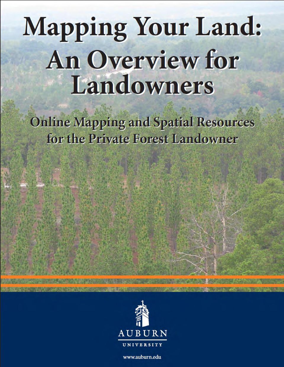
3 Mapping Your Land: An Overview for Landowners Online Mapping and Spatial Resources for the Private Forest Landowner Tutorials by John C. Gilbert 1 and John S. Kush 1 Design and Layout by Elizabeth P. Bowersock 2 Gilbert, J.C. and Kush, J.S Mapping Your Land: An Overview for Landowners. Online Mapping and Spatial Resources for the Private Landowner. Longleaf Pine Stand Dynamics Laboratory. 14 pages. 1 Longleaf Pine Stand Dynamics Laboratory, School of Forestry and Wildlife Sciences, Auburn University, Alabama 2 School of Forestry and Wildlife Sciences, Auburn University, Alabama

4

5 How to Use This Book The purpose of this book is to introduce private forest landowners and conservation professionals to online mapping and spatial resources that can be used to accomplish a variety of objectives. The tutorials provide instructions and examples to help users get started using these applications and programs to make maps, acquire data, and store information about areas of interest. All examples were created using Microsoft Windows XP and Internet Explorer 8. Users can choose to duplicate the examples or focus on other areas of interest. To help users choose which applications best fit the desired objectives, this book is divided into 5 sections highlighting websites and programs with examples and tutorials. Each section contains keywords, homepage links, tutorial information, examples, and screenshots. Screenshots are highlighted with red ovals and lines to help the users find the buttons, tools, etc. described in the tutorials. Each section can be used individually or in combination to achieve the desired objectives. Since websites are constantly changing and being updated, links and screenshots may not match exactly as these updates are completed. Keywords lists were added to help users find online applications and programs using a search engine (e.g. Google, Bing, Yahoo, etc.) if links change. Below is an outline with titles and key points for each section. 1. USDA/NRCS Web Soil Survey... 3 Online application Locate a piece of property or an area of interest Create a boundary for the area of interest Display soil information with aerial photographs and/or topographic layers as backgrounds Create maps Create basic or detailed soil reports 2. Google Earth... 7 Requires downloading a program Locate a piece of property or area of interest Store location and description information Create placemarks or points (gates, deer stands, start of a path, etc.) Create paths or lines for roads, streams, etc. Create boundaries for timber stands, fields, etc. Create maps Get directions 3. Alabama Historic Aerial Photo Archive Online application View historical aerial photographs Order digital copies 4. USDA Natural Resources Conservation Service (NRCS) Geospatial Data Gateway Online application to search for data Requires a GIS viewer For more advanced users Search for data (examples include aerial imagery, topographic maps, elevation information, soils, land use land cover, geology, climate data, etc. 5. USDA National Agroforestry Center (NAC) CanVis Requires downloading a program or requesting a CD or DVD Create visual simulations of potential management options using digital photographs 1

6 2

7 1. USDA/NRCS Web Soil Survey The USDA/NRCS Web Soil Survey (WSS) can be used to create a soils map as well as explore other online soil surveys. To get started with your own soil survey, follow the directions outlined below. Keywords: web soil survey, NRCS Starting the USDA/NRCS WSS: In your web browser, go to: usda.gov/app/homepage.htm To Create a Soils Map: 1. Click the green button to START WSS. (See right.) 2. A screen with a map of the United States will appear. (See right.) The default tab is Area of Interest (AOI). 3. Under Quick Navigation, a. Choose an option that best represents how you would like to navigate to the area of interest (i.e. where you want to create a soils map). You can also use the tool bar above the map to navigate or in conjunction with one of the other navigation options. (See sample toolbar at the bottom of this page.) Toolbar Buttons, From Left to Right (See Below): 1. Zoom In used to zoom in toward a specific point by clicking a specific place on the map or by clicking and dragging to create a box for an area of interest 2. Zoom Out used to zoom out from a specific point by clicking a specific place on the map or by clicking and dragging to create a box for an area of interest 3. Pan used to move the map in any direction by clicking and dragging a point on the map 4. Zoom to Extent used to zoom the map out to show the entire United States 5. Zoom to AOI (Area of Interest) used to zoom the map to the AOI that has been identified 6. Zoom History Back used to zoom the map back to the previous view 7. Zoom History Forward used to zoom the map forward after using the Zoom History Back tool 8. Identify provides information about selected features on the maps. Follow directions that appear when selected. 9. Measure Distance used to measure line segments. Click and drag a point on the map and move the pointer to another point and click. Double-click to end the measurement, and it provides total segment length. Note that the units feet/miles change as you zoom in. The units can also be changed to meters/ kilometers by clicking the Use Meters/Kilometers button. 10. Data Available used to show the available data with the date by clicking on an area 11. Define AOI by Rectangle used to identify the area for the soils maps by clicking and dragging to create a box around the area 12. Define AOI by Polygon used to identify the area for the soils maps by clicking points around the area 13. Normal Map Layout (L) & Full Width Map Layout (R) used to change the way the map layout looks 14. Help provides a help menu for the WSS (L) 13(R)
.")
8 The example tract that will be used for the purpose of this tutorial is called the Donahue Tract. The Donahue Tract is located west of the intersection of Donahue Drive and Woodfield Drive on the Auburn University campus. 1. Under State and County, choose Alabama and Lee County. 2. Click View when the selection is made. 3. Use the Zoom In and Pan tools to find the location. The newly defined area will be highlighted with a diagonal hatching pattern. Clipping soil layer to AOI extent will appear. (If it doesn t, double-click the tract again.) See image below. Creating the Soils Map: 1. Click the Soil Map tab to create the soils map for the tract. **If the message Warning: Soil Map may not be valid at this scale appears, zoom out. A Map Unit Legend box appears and the soil divisions are shown on the tract. Notice the Map Unit Name, Acres in AOI, and the Percent AOI. Set the Area of Interest (AOI): To create a soils map, the AOI needs to be defined. 1. Click the Define AOI by Polygon tool. 2. Using this tool, click points to trace around the boundary of the tract. (See screen shot below for guidance.) If you make a mistake, click Clear AOI or Esc and start over. 3. Double-click to complete the polygon. Create a Printable Version of the Map(s): **There might be a need to alter your browser s pop-up settings before completeing these steps. 1. Click Printable Version. 2. At subtitle, add Donahue Tract. 3. Under Options, make the desired selections then click View. The WSS will then generate a printable version. A soils map, map legend, and map unit legend page (one of each) are created in a new window. (See page 5.) 4. Click File, then Print to open the printer options window and to print the document. 4
 See image below. Creating the Soils Map: 1. Click the Soil Map tab to create the soils map for the tract.")
9 Creating a Custom Report: The Custom Report provides more detailed information about the soil survey, map unit descriptions, and soil descriptions. A custom report can be created for free by following these steps: 1. Click Add to Shopping Cart. 2. Type in the subtitle Donahue Tract and click OK. 3. Click the Shopping Cart (Free) tab to choose options for the report. 4. Choose any of the options. (For this example, the Default Settings were used.) 5. Click Check Out. 6. Click OK to choose the default Get Now delivery method. The custom report can be printed, saved, or ed by following the same directions as outlined in Create a Printable Version. Save the Map as a.pdf: 1. Click File, then Save As. Make sure the Save as type: is Adobe PDF Files (.pdf). **If Adobe Reader is not loaded on your machine, visit com/reader/ to download a free version of the program. 2. In the Save As window, navigate to the file directory where you want to save the document. 3. Type in the name for the document under File name: 4. Click Save. 5

10 **Note that you can Download Later, which requires an address where a link will be sent to download the report within 10 days. 2. Change the background to Topographic Map. Exploring Soils Information: To explore more soil data associated with the Soil Survey for the area, click Soil Data Explorer. This tab allows you to explore a wide variety of soil properties under the Suitabilities and Limitation Ratings menu. Tips and Troubleshooting: 1. If WSS is not working, check the system requirements to run the program. See usda.gov/app/help/requirements.htm. 2. Want and Help menus are located on the right side of the WSS homepage. 3. For more instructions see nrcs.usda.gov/app/help/wss_homepage_howto. pdf 4. It may be necessary to turn off the Pop-up blocker/ allow Pop-ups from the WSS website. 5. Some processes may take a little time to complete; be patient. 6. The session can also timeout if there is a long period of inactivity, which will require starting over. Adjusting Map Legend: The map legend can be adjusted to change display options for the AOI, political features, federal land, water features, transportation, and background. 1. Click the Legend tab on the side of the map to access the options. Citation: Soil Survey Staff, Natural Resources Conservation Service, United States Department of Agriculture. Web Soil Survey. Available online at [05/24/2011]. 6

11 2. Google Earth Use and Tutorial Information Google Earth provides aerial photography as a background for map making. It can be used to: Locate property or areas of interest Store location and description information Create placemarks or points for areas of interest Create paths or lines for roads, streams, etc. Create boundaries for timber stands Get directions Opening Google Earth: 1. After downloading and installing Google Earth, open the program using the Desktop Icon or by locating the program in your Programs menu. 2. Click Start and then All Programs to find the list. Below is the default view for Google Earth. The software is free, but must be downloaded and installed; it also requires an internet connection. Main Website: Keywords: Google Earth System Requirements: Google Earth can be used on PCs, Macs, and Linux systems. Basic system needs are as follows: 512 MB of RAM 400 MB of free space on hard drive DirectX9 and 3D capable with 64/256MB of VRAM For more detailed information and recommended system requirements by operating system, see Google Earth Help and Tutorials: 1. Help: 2. Tutorials: The example tract that will be used for the purpose of this tutorial is called the Donahue Tract. The Donahue Tract is located west of the intersection of Donahue Drive and Woodfield Drive on the Auburn University campus MapLink/Tele Atlas, 2011 Europa Technologies, US Dept of State Geographer, Navigation: Use the toolbar (see right) to: Turn the map different directions Move the view Zoom in and out Other options include: Using the mouse, click (left mouse button) the screen and drag Using the scroll button on the mouse (if applicable) Using the arrow keys and Ctrl on the keyboard Explore the toolbar and practice clicking the various tools. 7

12 Layers: Turn on basic layers for navigation by clicking the box next to the layer. 1. Borders and Labels Shows state and county boundaries Cities 2. Roads Explore other layers for additional information. 1. Type the name of a place or location using search options: City Address Coordinates (default is latitude and longitude; can get from GPS unit) 2. Click the magnifying glass to zoom to the location. Navigation tools can also be used with searches. Additional options can be found under the Find Businesses tab as well as the Directions tab. Image 2011 GeoEye To Change Coordinates and Units: 1. Click Tools, then Options. Make changes and click Apply, then OK. Search and Locate: When searching for an area of interest (e.g. a piece of property or a timber stand), use the navigation toolbar (see page 7); it may be faster to use the Search tool and the Fly To tab. After locating an area of interest, use the tools from the toolbar to complete a variety of tasks. Tools (From Left to Right): Hide sidebar Add placemark Add polygon Add path Add overlay image Record a tour Show historical imagery Show sunlight across the landscape Switch between Earth, Sky, and other planets Show a ruler Print View in Google Maps 8

13 To Add a Placemark or Point (e.g. gate, deer stand, trailhead, etc.): 1. Locate the area of interest. 2. Click the Add Placemark button. 3. Click the Icon (a flashing yellow pushpin) and drag it to the area of interest. 4. Type a Name for the placemark in the blank provided. 5. Add a Description to store more information about the location. 6. Click the Style, Color tab to change the label, icon style, and color. 7. Write down the coordinates for future use. 8. Click OK. 3. A.kmz extension is the default, but you can also choose.kml (user preference). To Create a Path or Line: 1. Locate the area of interest. 2. Click the Add Path button. The pointer will turn into a white square. 3. Move the pointer over the area of interest and trace the line (a trail or stream) by clicking points to create a line. 4. Right click to delete points. 5. Hover over points and the pointer will turn into a hand so you can click points and move them. 6. Use the same procedures from creating a placemark to: Add a Description Change Style, Color, and Icon Edit the Path Save and the path file To Edit and Save a Placemark: 1. Right click the Icon or name under Places and click Properties. 2. Under the same menu, click Save Place As to save the placemark in a convenient location. 9
. To Create a Path or Line: 1. Locate the area of interest. 2. Click the Add Path button.")
14 To Create a Polygon: 1. Locate the area of interest. 2. Click the Add Polygon button. The pointer will turn into a white square. 3. Move pointer over the area of interest and trace around the area (timber stand, field, etc.) by clicking points to create a polygon. 4. Use the aerial photo, roads, trails, and known boundaries to help you trace the area. 5. Right click to delete points. 6. Hover over points; the pointer will turn into a hand so you can click points and move them. 7. It may be helpful to change the Area to Outlined. (See below.) This can be useful when tracing complex shapes. Filled and Outlined was used for the example below. 8. Click OK when the polygon is completed. 9. Use the same procedures from creating a placemark or a path to complete the polygon. Measuring a Distance: 1. Click Show Ruler. 2. Choose a Line or a Path. 3. Choose the desired units. 4. Click 2 or more places on the map to measure a distance. To Print a Map: 1. Click File and Print. 2. Choose Graphic of 3D View and the desired quality. To Save an Image of a Map: 1. Click File, Save, and choose Save Image. 2. Name the file. 3. The default file type is a Jpeg image (.jpg). This will allow the file to be opened and used like a picture. 10

15 Opening a Saved File: 1. Click File and Open, then double-click on the file name. View in Google Maps: 1. Click File and View in Google Maps. Calculating Areas: Areas can be calculated in Google Earth using the ruler if the area of interest is square or rectangular. Google Earth Pro has an area feature tool, but it requires purchasing a license. Website: earthmaps/earth_pro.html GE-Path (Freeware) To see the full list of features, download from Save files with the.klm extension. Topographic Map: 1. Visit 2. Keywords: Google Earth, topographic map, overlay. 3. Click Download with Google Earth. 4. Save the.kml file, and then open it in Google Earth. 5. Topographic maps can be viewed at difference scales as you zoom in. Adding GPS Data: 1. Click Tools then GPS to insert or add real-time data. Google Earth. Version
 To see the full list of features, download from http://www.sgrillo.net/googleearth/gepath.htm Save files with the.klm extension. Topographic Map: 1. Visit http://www.gelib.")
16 3. Alabama Historic Aerial Photos The Alabama Historic Aerial Photos Archive is an online application that allows you to view historical aerial photographs and order digital copies. Keywords: Alabama, historic, aerial photographs Aerial Photography Index (main website): Aerial Photography Archive: Help is available at: Choose the County and Location of Interest: 1. Scroll over the county with the mouse to see a historical mosaic for the county. 2. Either click the county on the map or the name in the list on the right to see the list of locations. 3. Find the location nearest to your area of interest and click the date of interest. Tools (see bottom left): Use the tools at the bottom of the aerial photograph window or click and drag to view a particular place in the photograph. From left to right: Zoom in Zoom out Arrows to move each direction Recenter the photo Digital Copies: To purchase digital copies, download a quote request. 1. Fill out the required information on the Alabama Maps Aerial Photo Order Form. (See below.) 2. Follow the directions for purchasing digital copies of the aerial photographs. 3. If you are unable to find an area of interest, send an to alabama.maps@ua.edu with a location description and coordinates requesting if historical aerial photographs are available and what years are available. You can get coordinates from your GPS unit or using the tutorial information from Google Earth. 12

17 4. USDA Natural Resources Conservation Service (NRCS) Geospatial Data Gateway For more advanced users that have a GIS software package or viewer, the NRCS Geospatial Data Gateway provides a wide variety of data options. Keywords: NRCS, Geospatial, Data, Gateway Homepage: Frequently Asked Questions: usda.gov/gdghome_faq.aspx For more information and help: nrcs.usda.gov/gateway_5_tutorial_14may2010.pdf NRCS Geospatial Data Gateway: Requires a GIS viewer. Data will vary by state and county. Example data types include: Ortho Imagery or Aerial imagery Topographic maps Elevation maps Land Use Land Cover Geology Soils Climate Precipitation Climate Temperature Get Data: 1. Click the green button labeled Get Data. 2. Next, select the state and county of interest. You can choose all of the counties in a state. 3. Click Submit Selected Counties. Data Options: 1. Scroll through the list of data options. If you selected numerous counties or the whole state, then some options may not be available. If this happens, try selecting individual counties. 2. Click the box to next to the data layers of interest. (See below.) 3. Click Continue. 13

18 Projection and Delivery Method: 1. Choose a projection. If you have other existing GIS or GPS data you want to overlay with your choice, choose a projection that matches your existing data. 2. Choose a delivery method. The FTP option allows you to download the data online. (Depending on your connection speed and size of data request, this could take some time to download.) CD and DVD options cost extra and will be mailed to you. 5. USDA National Agroforestry Center (NAC) CanVis For users with an interest in creating visual simulations of potential management options using digital photographs, CanVis provides a variety of options. CanVis is a free program that requires either downloading the program or ordering a CD or DVD. Keywords: simulation National, Agroforestry, CanVis, visual CanVis (main website): Download: Order: Other Help, Training, and Publications: or FTP Option: 1. Choosing the FTP option requires you to complete the form. 2. After the information is filled out, click Continue and Place Order. Information will be provided about the status of your order. A picture can really make a difference when making decisions and planning management options. With CanVis, users can: Edit digital photographs. Add or remove trees, shrubs, grasses and groundcover, etc. Use a series of photographs to show a simulation before and after a potential management option like planting trees, planting shrubs, thinning a stand, adding a fence, etc. (See example below.) Example simulations can be found at vs. Images created using CanVis
 CanVis For users with an interest in creating visual simulations of potential management options using digital photographs, CanVis provides a variety of")
19

20

Introduction to Google Earth
 Center for Teaching, Research & Learning Social Science Research Lab American University, Washington, D.C. http://www.american.edu/provost/ctrl/ 202-885-3862 Introduction to Google Earth This tutorial
WFP Liberia Country Office
 1 Oscar Gobbato oscar.gobbato@wfp.org oscar.gobbato@libero.it WFP Liberia Country Office GIS training - Summary Objectives 1 To introduce to participants the basic concepts and techniques in using Geographic
Instructions to view & create.kmz/.kml files from Google Earth
 Page 1 of 6 Instructions to view & create.kmz/.kml files from Google Earth Make sure you have Google Earth downloaded on your computer. If you don t, please visit this link to download Google Earth http://www.google.com/earth/download/ge.
White Mountain Guide Online User Guide
 White Mountain Guide Online User Guide 1.1 Minimum System Requirements page 2 1.2 Account Set-up page 2 2.0 Community Side Features page 4 2.1 View or Post a Trip Report page 4 2.2 View or Post a Trail
Help Document for WWW.SAGIS.ORG. Step by step, how-to instructions for navigating and using the Savannah Area GIS viewer.
 Help Document for WWW.SAGIS.ORG Step by step, how-to instructions for navigating and using the Savannah Area GIS viewer. 1 SAGIS Savannah Area GIS is focused on providing access to Geospatial data in a
HOW TO GET A SOIL MAP FROM THE WEB SOIL SURVEY
 Cooperative Extension of Ocean County Extension Center 1623 Whitesville Road Toms River, NJ 08755-1199 njaes.rutgers.edu/extension 732-349-1227 4-H 732-349-1246 Agriculture 732-349-1247 FCHS 732-349-1247
APPENDICES. Appendix 1 Autodesk MapGuide Viewer R6 Help http://www.mapguide.com/help/ver6/viewer/en/index.htm
 APPENDICES Appendix 1 Autodesk MapGuide Viewer R6 Help http://www.mapguide.com/help/ver6/viewer/en/index.htm Appendix 2 The MapPlace Toolbar and Popup Menu http://www.em.gov.bc.ca/mining/geolsurv/mapplace/menudesc.htm
Texas Wildfire Risk Assessment Portal (TxWRAP) User Manual. Texas A&M Forest Service
 User Manual. Texas A&M Forest Service") Texas Wildfire Risk Assessment Portal (TxWRAP) User Manual Texas A&M Forest Service October 2012 Table of Contents 1 ABOUT TXWRAP... 7 1.1 ACCESSING TXWRAP... 7 1.2 GETTING SUPPORT... 8 Documentation...
Texas Wildfire Risk Assessment Portal (TxWRAP) User Manual Texas A&M Forest Service October 2012 Table of Contents 1 ABOUT TXWRAP... 7 1.1 ACCESSING TXWRAP... 7 1.2 GETTING SUPPORT... 8 Documentation...
Contents. The OWRB Floodplain Viewer. Creating Maps... 8. Helpful Tips... 10
 Contents QUICK START GUIDE... 2-5 Add layers...9 Search for Layers...9 COMPREHENSIVE GUIDE... 6 Navigate the map...6 Locate specific places...6 Add layer from file...9 Add layer from web...9 Display pop-up
Using Google Earth for Environmental Science Research
 Using Google Earth for Environmental Science Research This document is up-to-date as of August 2013. If you have any questions or additions to this material please email dan.friess@nus.edu.sg. Note: this
TUTORIAL - Locations & Mapping. Using the ESdat Environmental Database System. For use with ESDAT version 5
 TUTORIAL - Locations & Mapping Using the ESdat Environmental Database System For use with ESDAT version 5 (version 5 software updates available from ) Function Tutorial - Locations and Mapping Table of
Sharing Files and Whiteboards
 Your user role in a meeting determines your level of file sharing. The type of files you can share include documents, presentations, and videos. About Sharing Files, page 1 Changing Views in a File or
ArcGIS online Introduction... 2. Module 1: How to create a basic map on ArcGIS online... 3. Creating a public account with ArcGIS online...
 Table of Contents ArcGIS online Introduction... 2 Module 1: How to create a basic map on ArcGIS online... 3 Creating a public account with ArcGIS online... 3 Opening a Map, Adding a Basemap and then Saving
LYON COUNTY GEOMOOSE 2 HELP DOCUMENT
 LYON COUNTY GEOMOOSE 2 HELP DOCUMENT TABLE OF CONTENTS Lyon County Geomoose 2 Help Document... 1 Introduction... 3 Quick Reference Chart... 4 The Interface... 4 The Table of Contents... 5 Quick Reference
Creating a Guided Tour with Google Earth
 Creating a Guided Tour with Google Earth Before creating a tour, first orient yourself to basic Google Earth functions. To start, download Google Earth to your desktop. This is free through earth.google.com.
INTRODUCTION to ESRI ARCGIS For Visualization, CPSC 178
 INTRODUCTION to ESRI ARCGIS For Visualization, CPSC 178 1) Navigate to the C:/temp folder 2) Make a directory using your initials. 3) Use your web browser to navigate to www.library.yale.edu/mapcoll/ and
Microsoft PowerPoint 2008
 Microsoft PowerPoint 2008 Starting PowerPoint... 2 Creating Slides in Your Presentation... 3 Beginning with the Title Slide... 3 Inserting a New Slide... 3 Slide Layouts... 3 Adding an Image to a Slide...
Watershed Ecosystem & Restoration Services (WERS Mapping Application) User s Guide
 User s Guide") Watershed Ecosystem & Restoration Services (WERS Mapping Application) User s Guide CONTACT Site Administrators: David Gillum, GISP, AACO, OIT Rick Fisher, AACO, WERS ITGILL00@aacounty.org rfisher@aacounty.org
Watershed Ecosystem & Restoration Services (WERS Mapping Application) User s Guide CONTACT Site Administrators: David Gillum, GISP, AACO, OIT Rick Fisher, AACO, WERS ITGILL00@aacounty.org rfisher@aacounty.org
Using the Kendall County GIS Basic GIS Viewer
 Using the Kendall County GIS Basic GIS Viewer Link to Viewer Gallery: http://gis.co.kendall.il.us/gisviewer_gallery.aspx Help and About Initial View Introduction Navigation Identify Tool Search Tool Search
Introduction to GIS software
 Introduction to GIS software There are a wide variety of GIS software packages available. Some of these software packages are freely available for you to download and could be used in your classroom. ArcGIS
Microsoft Publisher 2010 What s New!
 Microsoft Publisher 2010 What s New! INTRODUCTION Microsoft Publisher 2010 is a desktop publishing program used to create professional looking publications and communication materials for print. A new
Introduction to Microsoft Publisher : Tools You May Need
 Introduction to Microsoft Publisher : Tools You May Need 1. Why use Publisher instead of Word for creating fact sheets, brochures, posters, newsletters, etc.? While both Word and Publisher can create documents
Web GIS User Guide MainStreetGIS, LLC
 Web GIS User Guide MainStreetGIS, LLC www.mainstreetgis.com Navigation There are two ways to navigate the map interface: 1. Activate one of the map tools a. Zoom In Tool Activate the tool, then click on
Activity: Using ArcGIS Explorer
 Activity: Using ArcGIS Explorer Requirements You must have ArcGIS Explorer for this activity. Preparation: Download ArcGIS Explorer. The link below will bring you to the ESRI ArcGIS Explorer download page.
Data Visualization. Brief Overview of ArcMap
 Data Visualization Prepared by Francisco Olivera, Ph.D., P.E., Srikanth Koka and Lauren Walker Department of Civil Engineering September 13, 2006 Contents: Brief Overview of ArcMap Goals of the Exercise
DCAD Website Instruction Manual
 DCAD Website Instruction Manual - 1-9/1/2010 INDEX PAGE Search Appraisal ---------------------------- 3-4 Owner Name ------------------------------ 5-6 Account Number ------------------------------ 7 Street
Doña Ana County, NM Map Help
 Doña Ana County, NM Map Help Map Features Introduction 1. Toolbar 2. Zoom Control Buttons 3. Map/Legend Tabs 4. Layer Control 5. Parcel Search Tools 6. Selected Feature Attributes Toolbar The map toolbar
Finding GIS Data and Preparing it for Use
 Finding_Data_Tutorial.Doc Page 1 of 19 Getting Ready for the Tutorial Sign Up for the GIS-L Listserv Finding GIS Data and Preparing it for Use The Yale University GIS-L Listserv is an internal University
Microsoft Word 2010. Quick Reference Guide. Union Institute & University
 Microsoft Word 2010 Quick Reference Guide Union Institute & University Contents Using Word Help (F1)... 4 Window Contents:... 4 File tab... 4 Quick Access Toolbar... 5 Backstage View... 5 The Ribbon...
Adobe Illustrator CS5 Part 1: Introduction to Illustrator
 CALIFORNIA STATE UNIVERSITY, LOS ANGELES INFORMATION TECHNOLOGY SERVICES Adobe Illustrator CS5 Part 1: Introduction to Illustrator Summer 2011, Version 1.0 Table of Contents Introduction...2 Downloading
Adobe Acrobat Professional DC Tutorial
 Adobe Acrobat Professional DC Tutorial ADOBE ACROBAT Adobe Acrobat is a software program used to create forms, manuals, online book pages, maps and drafted images, that can be uploaded to a website, and
Guide to Viewing Maps in Google Earth
 Guide to Viewing Maps in Google Earth The BCT made the decision to provide the GIS (Geographic Information System) resources for Bat Groups in the form of Google Earth maps because they do not require
Microsoft PowerPoint 2010
 Microsoft PowerPoint 2010 Starting PowerPoint... 2 PowerPoint Window Properties... 2 The Ribbon... 3 Default Tabs... 3 Contextual Tabs... 3 Minimizing and Restoring the Ribbon... 4 The Backstage View...
Extracting Aerial Images From GIS Based Ortho Photos Using ArcMap 9
 Extracting Aerial Images From GIS Based Ortho Photos Using ArcMap 9 Tutorial Updated August 2006 CP-208 Plan Preparation Studio - Prof. Elizabeth Macdonald 2 In this tutorial we will learn to extract aerial
How to use PGS: Basic Services Provision Map App
 How to use PGS: Basic Services Provision Map App The PGS: Basic Services Provision Map App The main features of the PGP Basic Services web application includes: Navigation Tools Map Tools Main Map Links
Introduction to Google SketchUp (Mac Version)
") Introduction to Google SketchUp (Mac Version) This guide is handy to read if you need some basic knowledge to get started using SketchUp. You will see how to download and install Sketchup, and learn how
Introduction to Google SketchUp (Mac Version) This guide is handy to read if you need some basic knowledge to get started using SketchUp. You will see how to download and install Sketchup, and learn how
Expert Review and Questionnaire (PART I)
") NASA ARC Project 1-9-2001 Web-based Geospatial Information Services and Analytic Tools for Habitat Conservation and Management Expert Review and Questionnaire (PART I) Thank you for participating in this
NASA ARC Project 1-9-2001 Web-based Geospatial Information Services and Analytic Tools for Habitat Conservation and Management Expert Review and Questionnaire (PART I) Thank you for participating in this
National Register of Historic Places: GIS Webinar Cultural Resource GIS Facility National Park Service June 2012
 National Register of Historic Places: GIS Webinar Cultural Resource GIS Facility National Park Service June 2012 In February and March 2012 the National Register of Historic Places held webinars in conjunction
SMART Ink 1.5. Windows operating systems. Scan the following QR code to view the SMART Ink Help on your smart phone or other mobile device.
 SMART Ink 1.5 Windows operating systems User s guide Scan the following QR code to view the SMART Ink Help on your smart phone or other mobile device. Trademark notice SMART Ink, SMART Notebook, SMART
PDF MAPS FOR SMARTPHONES AND TABLETS
 INTRODUCTION Incident mapping often utilizes PDF documents of maps to be created for printing, archiving, and now for the ability to use these products in the field. With the release of Adobe Acrobat 9
Completing Baseline s Site Survey Request Form
 Completing Baseline s Site Survey Request Form The first step in successfully implementing a radio network for your irrigation controllers is to identify the proposed locations for each radio. These radios
Ortelia Space Builder User Manual
 Ortelia Space Builder User Manual http://ortelia.com 1 Table of Contents Introducing Ortelia Space Builder... 2 System Requirements... 3 1. Operating system:... 3 2. Hardware:... 3 Minimum Graphics card
From GPS Data Collection to GIS Data Display A Walk-Through Example
 From GPS Data Collection to GIS Data Display A Walk-Through Example The Global Positioning System (GPS) is a satellite based navigation system consisting of 24 satellites, a worldwide network of tracking
What s New in QuarkXPress 8
 What s New in QuarkXPress 8 LEGAL NOTICES 2008 Quark Inc. as to the content and arrangement of this material. All rights reserved. 1986 2008 Quark Inc. and its licensors as to the technology. All rights
Creating Figure Ground Maps in ArcMap 10.x: Basic procedures to download, open, manipulate and print spatial data
 Creating Figure Ground Maps in ArcMap 10.x: Basic procedures to download, open, manipulate and print spatial data These procedures outline: A. Retrieving Property Data B. Uncompressing the Downloaded Files
Studying Topography, Orographic Rainfall, and Ecosystems (STORE)
") Studying Topography, Orographic Rainfall, and Ecosystems (STORE) Basic Lesson 3: Using Microsoft Excel to Analyze Weather Data: Topography and Temperature Introduction This lesson uses NCDC data to compare
Studying Topography, Orographic Rainfall, and Ecosystems (STORE) Basic Lesson 3: Using Microsoft Excel to Analyze Weather Data: Topography and Temperature Introduction This lesson uses NCDC data to compare
Data Visualization. Prepared by Francisco Olivera, Ph.D., Srikanth Koka Department of Civil Engineering Texas A&M University February 2004
 Data Visualization Prepared by Francisco Olivera, Ph.D., Srikanth Koka Department of Civil Engineering Texas A&M University February 2004 Contents Brief Overview of ArcMap Goals of the Exercise Computer
Sharing a Screen, Documents or Whiteboard in Cisco Unified MeetingPlace
 Sharing a Screen, Documents or Whiteboard in Cisco Unified MeetingPlace Release: 7.0 Revision Date: December 9, 2009 1:29 pm This section describes how to use the features in the Cisco Unified MeetingPlace
User s Guide to ArcView 3.3 for Land Use Planners in Puttalam District
 User s Guide to ArcView 3.3 for Land Use Planners in Puttalam District Dilhari Weragodatenna IUCN Sri Lanka, Country Office Table of Content Page No Introduction...... 1 1. Getting started..... 2 2. Geo-referencing...
Task Card #2 SMART Board: Notebook
 Task Card #2 SMART Board: Notebook Objectives: Participants will learn how to utilize the SMART Notebook. Table of Contents: Launching The SMART Notebook Page 1 Entering Text Page 1 Top Toolbar Page 2
HELCOM Data and Map Service. User Manual
 HELCOM Data and Map Service User Manual Version 2.2 - February 2015 1 Table of contents 1. General Information... 3 1.1 Background... 3 1.2 Technical requirements... 3 1.3 Contact... 3 2. Accessing HELCOM
Creating Custom Crystal Reports Tutorial
 Creating Custom Crystal Reports Tutorial 020812 2012 Blackbaud, Inc. This publication, or any part thereof, may not be reproduced or transmitted in any form or by any means, electronic, or mechanical,
Introduction to Microsoft Word 2003
 Introduction to Microsoft Word 2003 Sabeera Kulkarni Information Technology Lab School of Information University of Texas at Austin Fall 2004 1. Objective This tutorial is designed for users who are new
CreativeConferencing passionate about communication
 simplicity personified CreativeGlance Managing a Glance Web Conference Creative s Glance Web Conference is a powerful yet simple data tool that allows you to show your computer screen and any application
Quickstart Tutorial. Bradford Technologies, Inc. 302 Piercy Road, San Jose, California 95138 800-622-8727 fax 408-360-8529 www.bradfordsoftware.
 Quickstart Tutorial A ClickFORMS Tutorial Page 2 Bradford Technologies. All Rights Reserved. No part of this document may be reproduced in any form or by any means without the written permission of Bradford
Microsoft PowerPoint 2011
 Microsoft PowerPoint 2011 Starting PowerPoint... 2 Creating Slides in Your Presentation... 3 Beginning with the Title Slide... 3 Inserting a New Slide... 3 Adding an Image to a Slide... 4 Downloading Images
Creating Forms with Acrobat 10
 Creating Forms with Acrobat 10 Copyright 2013, Software Application Training, West Chester University. A member of the Pennsylvania State Systems of Higher Education. No portion of this document may be
Banner Document Management Suite (BDMS) Web Access Help
 Web Access Help") May 10 th, 2011 Banner Document Management Suite (BDMS) Web Access Help Division of Information Technology AppXtender Web Access Help: For questions regarding AppXtender Web Access, please contact the
May 10 th, 2011 Banner Document Management Suite (BDMS) Web Access Help Division of Information Technology AppXtender Web Access Help: For questions regarding AppXtender Web Access, please contact the
How to georectify an image in ArcMap 10
 How to georectify an image in ArcMap 10 The University Library has a large collection of historical aerial photos for some North Carolina Counties ( http://www.lib.unc.edu/reference/gis/usda/index.html
Sharing Presentations, Documents, and Whiteboards
 Chapter 19 19 Sharing Presentations, Documents, and Whiteboards Your user role in an event determines your level of sharing. Whichever role you take, the following table describes the basic tasks associated
Creating Fill-able Forms using Acrobat 8.0: Part 1
 Creating Fill-able Forms using Acrobat 8.0: Part 1 The first step in creating a fill-able form in Adobe Acrobat is to generate the form with all its formatting in a program such as Microsoft Word. Then
Flash MX Image Animation
 Flash MX Image Animation Introduction (Preparing the Stage) Movie Property Definitions: Go to the Properties panel at the bottom of the window to choose the frame rate, width, height, and background color
Design document Goal Technology Description
 Design document Goal OpenOrienteering Mapper is a program to draw orienteering maps. It helps both in the surveying and the following final drawing task. Support for course setting is not a priority because
JOOMLA 2.5 MANUAL WEBSITEDESIGN.CO.ZA
 JOOMLA 2.5 MANUAL WEBSITEDESIGN.CO.ZA All information presented in the document has been acquired from http://docs.joomla.org to assist you with your website 1 JOOMLA 2.5 MANUAL WEBSITEDESIGN.CO.ZA BACK
Getting Started With DraftSight A Guide For AEC Users
 Getting Started With DraftSight A Guide For AEC Users DraftSight.com Facebook.com/DraftSight Welcome to DraftSight a valuable tool for any AEC professional! DraftSight is more than a free, professional-grade
Using Microsoft Word. Working With Objects
 Using Microsoft Word Many Word documents will require elements that were created in programs other than Word, such as the picture to the right. Nontext elements in a document are referred to as Objects
Using Adobe Dreamweaver CS4 (10.0)
") Getting Started Before you begin create a folder on your desktop called DreamweaverTraining This is where you will save your pages. Inside of the DreamweaverTraining folder, create another folder called
Getting Started Before you begin create a folder on your desktop called DreamweaverTraining This is where you will save your pages. Inside of the DreamweaverTraining folder, create another folder called
Texas Department of Transportation PLANS ONLINE
 Texas Department of Transportation PLANS ONLINE Plan Information Website User Guide Providing Project Plans and More! http://www.dot.state.tx.us/business/planinfo.htm Table of Contents Plan Information...
MetroBoston DataCommon Training
 MetroBoston DataCommon Training Whether you are a data novice or an expert researcher, the MetroBoston DataCommon can help you get the information you need to learn more about your community, understand
SMART Board Training Outline Trainer: Basel Badran
 Sharjah Higher Colleges of Technology SMART Board Training Outline Trainer: Basel Badran What is a SMART Board? o Concept & Technology SMART Board Components: o Smart Tools Start Center Recorder Keyboard
How to create pop-up menus
 How to create pop-up menus Pop-up menus are menus that are displayed in a browser when a site visitor moves the pointer over or clicks a trigger image. Items in a pop-up menu can have URL links attached
Contents. Introduction... 4
 Copyright 2014 Idea Spectrum, Inc. All Rights Reserved. Realtime Landscaping Architect, the Realtime Landscaping Architect logo, Idea Spectrum, and the Idea Spectrum logo are all trademarks of Idea Spectrum,
Chapter 6: Data Acquisition Methods, Procedures, and Issues
 Chapter 6: Data Acquisition Methods, Procedures, and Issues In this Exercise: Data Acquisition Downloading Geographic Data Accessing Data Via Web Map Service Using Data from a Text File or Spreadsheet
www.lpi.nsw.gov.au SCIMS Online Support Guide
 www.lpi.nsw.gov.au SCIMS Online Support Guide November 2012 Document Status Revision Version 1.7 Version date 01/11/2012 Author Owner John Kelaher and Cheryl Wheeler Land and Property Information Surveying
6. If you want to enter specific formats, click the Format Tab to auto format the information that is entered into the field.
 Adobe Acrobat Professional X Part 3 - Creating Fillable Forms Preparing the Form Create the form in Word, including underlines, images and any other text you would like showing on the form. Convert the
Click on various options: Publications by Wizard Publications by Design Blank Publication
 Click on various options: Publications by Wizard Publications by Design Blank Publication Select the Blank Publications Tab: Choose a blank full page Click on Create New Page Insert > Page Select the number
(These instructions are only meant to get you started. They do not include advanced features.)
") FrontPage XP/2003 HOW DO I GET STARTED CREATING A WEB PAGE? Previously, the process of creating a page on the World Wide Web was complicated. Hypertext Markup Language (HTML) is a relatively simple computer
FrontPage XP/2003 HOW DO I GET STARTED CREATING A WEB PAGE? Previously, the process of creating a page on the World Wide Web was complicated. Hypertext Markup Language (HTML) is a relatively simple computer
Using FileMaker Pro with Microsoft Office
 Hands-on Guide Using FileMaker Pro with Microsoft Office Making FileMaker Pro Your Office Companion page 1 Table of Contents Introduction... 3 Before You Get Started... 4 Sharing Data between FileMaker
FastTrack Schedule 10. Tutorials Manual. Copyright 2010, AEC Software, Inc. All rights reserved.
 FastTrack Schedule 10 Tutorials Manual FastTrack Schedule Documentation Version 10.0.0 by Carol S. Williamson AEC Software, Inc. With FastTrack Schedule 10, the new version of the award-winning project
Microsoft Word 2010 Prepared by Computing Services at the Eastman School of Music July 2010
 Microsoft Word 2010 Prepared by Computing Services at the Eastman School of Music July 2010 Contents Microsoft Office Interface... 4 File Ribbon Tab... 5 Microsoft Office Quick Access Toolbar... 6 Appearance
Logbook Entry Creator Program
 Aircraft Maintenance Logbook Entries Made Easy Logbook Entry Creator Program Instruction Manual www.ronsaviationsoftware.com Rons Aviation Software V1.2 The log book entry creator program is designed to
Introduction to Windows XP
 Introduction to Windows XP Academic Computing Support Information Technology Services Tennessee Technological University January 2003 1. What s new in XP New colorful interface. More stable than 9x/Me
Range Management Databases on the Web: Two Examples
 Range Management Databases on the Web: Two Examples George Ruyle, Chair, Rangeland & Forest Research Program, School of Renewable Natural Resources, Biological Sciences East 302, University of Arizona,
Introduction to Google Earth May 24, 2011. TJ Keiran Senior Planner / GIS Specialist Cowlitz-Wahkiakum Council of Governments
 Introduction to Google Earth May 24, 2011 TJ Keiran Senior Planner / GIS Specialist Cowlitz-Wahkiakum Council of Governments Purpose of this class Introduce free version of Google Earth Demonstrate common
Chapter 14: Links. Types of Links. 1 Chapter 14: Links
 1 Unlike a word processor, the pages that you create for a website do not really have any order. You can create as many pages as you like, in any order that you like. The way your website is arranged and
Trace.Net OTDR Test Management Software User s guide
 Trace.Net OTDR Test Management Software User s guide 2007-2009, AFL Telecommunications, all rights reserved. TRAC-01-1000 Revision B, 2009-06-10 Specifications are subject to change without notice. I Contents
Creating and Using Links and Bookmarks in PDF Documents
 Creating and Using Links and Bookmarks in PDF Documents After making a document into a PDF, there may be times when you will need to make links or bookmarks within that PDF to aid navigation through the
Introduction to Word 2007
 Introduction to Word 2007 You will notice some obvious changes immediately after starting Word 2007. For starters, the top bar has a completely new look, consisting of new features, buttons and naming
User s Guide TABLE OF CONTENTS. Getting Started... 1. Features... 2 Signing In... 2 Exploring the Find Web Page... 3 Getting Help...
 User s Guide For quick access to the information contained in this online guide, click on any topic in the Table of Contents below to be taken directly to the information. When finished, click on the closest
User Guide. DYMO Label TM v.8
 User Guide DYMO Label TM v.8 Copyright 2009 Sanford, L.P. All rights reserved. Revised 6/12/09. No part of this document or the software may be reproduced or transmitted in any form or by any means or
Geocortex HTML 5 Viewer Manual
 1 FAQ Nothing Happens When I Print? How Do I Search? How Do I Find Feature Information? How Do I Print? How can I Email A Map? How Do I See the Legend? How Do I Find the Coordinates of a Location? How
Getting Started Guide. Chapter 11 Graphics, the Gallery, and Fontwork
 Getting Started Guide Chapter 11 Graphics, the Gallery, and Fontwork Copyright This document is Copyright 2010 2014 by the LibreOffice Documentation Team. Contributors are listed below. You may distribute
Guide To Creating Academic Posters Using Microsoft PowerPoint 2010
 Guide To Creating Academic Posters Using Microsoft PowerPoint 2010 INFORMATION SERVICES Version 3.0 July 2011 Table of Contents Section 1 - Introduction... 1 Section 2 - Initial Preparation... 2 2.1 Overall
Manual. OIRE Escuela de Profesiones de la Salud. Power Point 2007
 Power Point 2007 Manual OIRE Escuela de Profesiones de la Salud Power Point 2007 2008 The New Power Point Interface PowerPoint is currently the most common software used for making visual aids for presentations.
GEM global earthquake model. User guide: Android mobile tool for field data collection. Rosser, J., J.G. Morley, A. Vicini. Data capture tools
 User guide: Android mobile tool for field data collection GEM Technical Report 2014-03 V1.0.0 Rosser, J., J.G. Morley, A. Vicini Data capture tools GEM global earthquake model i User guide: Android mobile
Importing Terrain and Imagery into STK
 Importing Terrain and Imagery into STK CONTENTS OVERVIEW... 2 IMPORTING TERRAIN DATA TO A SCENARIO... 3 USING THE IMAGERY AND TERRAIN CONVERTER... 3 Creating a 3D Image Inlay... 3 Displaying Your Image
TASKSTREAM FAQs. 2. I have downloaded a lesson attachment, but I cannot open it. What is wrong?
 TASKSTREAM FAQs Why do I not receive emails from TaskStream? It could be that your email program is interpreting incoming TaskStream mail as spam, which is a term for junk mail Spam is not typically stored
How To Use Senior Systems Cloud Services
 Senior Systems Cloud Services In this guide... Senior Systems Cloud Services 1 Cloud Services User Guide 2 Working In Your Cloud Environment 3 Cloud Profile Management Tool 6 How To Save Files 8 How To
Florence School District #1
 Florence School District #1 Module 2: SMART Board Basics and Beyond 1 SMART Board Software and Beyond In SMART Notebook software, you can create or open SMART Notebook software (.notebook) files. After
Publisher 2007: Part 2 Advanced Features. Grouped Objects in Publisher:
 Publisher 2007: Part 2 Advanced Features Grouped Objects in Publisher: Most pre-designed publications in MS Publisher come with objects grouped together. Objects can be either multiple text boxes or an