NOMAD and the exploration of habitability on Mars
|
|
|
- Osborn Butler
- 7 years ago
- Views:
Transcription
1 NOMAD and the exploration of habitability on Mars KONINKLIJK BELGISCH INSTITUUT VOOR RUIMTE-AERONOMIE INSTITUT ROYAL D AERONOMIE SPATIALE DE BELGIQUE ROYAL BELGIAN INSTITUTE OF SPACE AERONOMY KONINKLIJK BELGISCH INSTITUUT VOOR RUIMTE-AERONOMIE INSTITUT ROYAL D AERONOMIE SPATIALE DE BELGIQUE ROYAL BELGIAN INSTITUTE OF SPACE AERONOMY KONINKLIJ A.C. Vandaele, S. Robert, I.R. Thomas, E. Neefs, B. Ristic, F. Daerden (1), M. Patel, J. Mason (2), J.-J. Lopez-Moreno (3), G. Bellucci (4), and the NOMAD Team (1) Royal Belgian Institute for Space Aeronomy, Belgium (2) Open University, Milton Keynes, UK (3) IAA, Granada, Spain (4) INAF-IAPS, Rome, Italy KONINKLIJK BELGISCH INSTITUUT VOOR RUIMTE-AERONOMIE INSTITUT ROYAL D AERONOMIE SPATIALE DE BELGIQUE ROYAL BELGIAN INSTITUTE OF SPACE AERONOMY KONINKLIJK BELGISCH INSTITUUT VOOR RUIMTE-AERONOMIE INSTITUT ROYAL D AERONOMIE SPATIALE DE BELGIQUE ROYAL BELGIAN INSTITUTE OF SPACE AERONOMY KONINKLIJ
, and the NOMAD Team (1) Royal Belgian Institute for Space Aeronomy, Belgium (2) Open University, Milton Keynes, UK (3) IAA, Granada, Spain (4) INAF-IAPS, Rome, Italy KONINKLIJK BELGISCH")
2 ESA-Roscosmos Configuration NOMAD High resolution occultation and nadir spectrometers Atmospheric composition (CH 4,O 3, trace species, isotopes) dust, clouds, P&T profiles UVIS ( µm) λ/ λ ~ 250 SO Limb Nadir IR ( µm) λ/ λ ~ 10,000 SO Limb Nadir IR ( µm) λ/ λ ~ 20,000 SO CaSSIS High-resolution camera Mapping of sources; landing site selection ACS Suite of 3 high-resolution spectrometers Near IR ( µm) λ/ λ ~ 20,000 Atmospheric chemistry, aerosols, surface T, structure IR (Fourier, 2 25 µm) λ/ λ ~ 4000 (SO)/500 (N) Mid IR ( µm) λ/ λ ~ 50,000 SO Limb Nadir SO Nadir SO FREND Collimated neutron detector Mapping of subsurface water All Power Resolution λ/ λ calculated at mid-range
 λ/ λ ~ 20,000 Atmospheric chemistry, aerosols, surface T, structure IR (Fourier, 2 25 µm) λ/ λ ~ 4000 (SO)/500 (N) Mid IR (2.2 4.")
3 NOMAD science objectives The chemical composition of the Martian atmosphere Mars climatology and seasonal cycles Sources and sinks in the Martian atmosphere

4 NOMAD : Science Objectives

5 NOMAD NOMAD High resolution occultation and nadir spectrometers UVIS ( µm) λ/ λ ~ 250 IR ( µm) λ/ λ ~ 10,000 IR ( µm) λ/ λ ~ 20,000 Atmospheric composition (CH 4,O 3, trace species, isotopes) dust, clouds, P&T profiles SO SO Limb Limb Nadir Nadir SO SO SOIR/ Venus Express o Solar Occultation o IR : µm o Resolution ~ 0.15 cm -1 o Resolving power = LNO o Nadir, Limb, Solar Occultation o IR : µm o Resolution ~ 0.3 cm -1 o Resolving power = UVIS Humbolt/ExoMars o Nadir, Limb, Solar Occultation o UV-vis : nm o Resolution ~ 1-2 nm

6 Science implementation (1) IR channels : heritage from SOIR/VEx CO 2 on Venus Venus Express (VEx) - ESA Launch in Baikonur in 2006 End in Dec SOIR spectrometer Channel of SPICAV/SOIR on VEx Echelle grating + AOTF 2200 cm -1 to 4400 cm -1 (2.2 µm to 4.4 µm) Divided in 94 diffracting orders Order width: 20 to 37 cm -1 Spectral resolution: 0.1 to 0.25 cm -1 Measures 4 orders per second during an occultation CO on Venus 1 Order Order Transmitance Transmitance Wavenumber [cm-1] Order Wavenumber [cm-1] Order Transmitance Transmitance Wavenumber [cm-1] Wavenumber [cm-1]

7 Science implementation (2) UVIS Channel: heritage from UVIS on Humbolt/ExoMars Science based on SPICAM/MEX LED Spectrometer 1 2 Wide FOV probe Narrow FOV probe Optical selector

8 UVIS Science heritage Climatologies of O3, dust OD, surface albedo / Clouds O3 CLOUDS Comparison with OMEGA

9 Science implementation (3) Improvements/modifications o SO 6 orders (instead of 4), 1 can be Dark Slit perpendicular to limb better vertical resolution 2 series of settings for high & low altitudes Top of atmosphere 30 km o LNO Solar occultation possible, but Optimized for Nadir (& Limb) increase of SNR : Larger & higher slit; larger optics; radiator MAR S o UVIS Extended spectral coverage ( nm) 2 telescopes for solar occultation & nadir
 2 telescopes for")
10 Observations modes Fields of view Nadir Solar Occultation Channel 400 km Channel At limb LNO km SO km LNO km SO 4-6 (binned) km UVIS km SO 1 (1 pixel) 0.5 km 15s motion 50.4 km UVIS km 1/6s motion ~0.4 km 1 day coverage One orbit every ~2 hours -74 to +74 degrees latitude

11 Observations (1) Solar Occultation

12 Observations (2) With dust At 20 km tangent height

13 Observations (3) Nadir

14 CO 2 and CO isotopologues CO CO 2

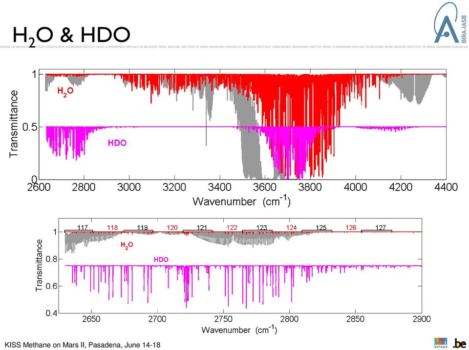
15 H 2 O & HDO
16 Search for trace gases: CH 4, C 2 H 4, C 2 H 6 ν cm -1

17 Signal-to Noise ratio determination Radiometric models of the three channels. Based on: 1. Computation of the detected signal, considering the incoming radiation and the attenuation due to the different optical components ; 2. Estimation of the noise on the detector. From these quantities signal to noise ratios (SNR) can be calculated and used further to investigate the sensitivity of the instrument. SO Vandaele et al b; Thomas et al LNO - Nadir
 can be calculated and used further to investigate the")
18 Detections limits: (1) methodology 1. Simulate a series of spectra with known abundances of the target species ; With different abundances covering a large possible interval 2. Add noise corresponding to the SNR just obtained ; 200 noisy spectra per abundance Considering SNR Socc Nadir Robert et al. 2016; Vandaele et al, 2015a SO LNO UVIS Apply a retrieval method to fit the abundances ; 4. Compare with the input values. The arrows indicate the detection limit values i.e. the lowest abundance for which the mean error is still lower than the 1-σ standard deviation. CH 4 DOFS for order 134: DL = ppb cm -1

19 Detections limits: (2) results CH4 nadir C 2 H 4 Order ppb C 2 H 6 Order ppb Q-branch and R(0) line R-branch (3 J 5) CH 4 Order ppb
 CH 4 Order ppb 134 11 135 19")
20 Detections limits: (2) results Nadir and solar occultations SO LNO Solar Occultation Solar Occultation Nadir CH ppb a 25 ppt 20 ppt 11 ppb H 2 O ~ 300 ppm (variable with season) b 0.2 ppb 0.15 ppb 31 ppb (a) Formisano et al., 2004; Krasnopolsky et al., 2004; Mumma et al., 2009b ; (b) Fedorova et al., 2008; Smith, 2004; Smith et al., 2009b ; (c) Krasnopolsky et al., 1997; Lodders and Fegley, 1997; Owen et al., 1977 ; (d) Mahaffy et al., 2013 ; (e) Krasnopolsky, 1997 ; (f) Hartogh et al., 2010 ; (g) Villanueva et al., 2013; (h) Maguire, 1977; (i) Lefevre et al., 2004 ; (j) Perrier et al., HDO D/H =5.6 SMOW c 0.7 ppb 0.7 ppb 0.8 ppm CO ~ 557 ppm d 5 ppb 4 ppb 1.5 ppm C 2 H 2 < 2 ppb g 0.03 ppb 0.03 ppb 20 ppb C 2 H 4 < 4 ppb g 0.2 ppb 0.15 ppb 70 ppb C 2 H 6 < 0.2 ppb e < 0.7 ppb g 0.03 ppb 0.02 ppb 11 ppb 0.03 ppb ppb 31 ppb < 3 ppb e HCl < 0.2 ppb f < 0.6 ppb g HCN < 5 ppb g 0.03 ppb 0.03 ppb 15 ppb HO ppb i < 200 ppb g 1 ppb 1 ppb 0.5 ppm H 2 S < 200 ppm h 4 ppb 3 ppb 1.6 ppm N 2 O < 100 ppb h < 90 ppb g 0.2 ppb 0.2 ppb 83 ppb NO 2 < 10 ppb h 0.14 ppb 0.1 ppb 50 ppb OCS < 10 ppb h 0.3 ppb 0.3 ppb 122 ppb O 3 ~ ppmv (variable with season) j 2.5 ppb 1.5 ppb 0.8 ppm H 2 CO < 4.5 ppb e < 3.9 ppb g 0.04 ppb 0.03 ppb 16 ppb
 Perrier et al., 2006. HDO D/H =5.6 SMOW c 0.7 ppb 0.7 ppb 0.8 ppm CO ~ 557 ppm d 5 ppb 4 ppb 1.5 ppm C 2 H 2 < 2 ppb g 0.03 ppb 0.03 ppb 20 ppb C 2 H 4 < 4 ppb g 0.2 ppb 0.")
21 NOMAD Science Publications Publications o NOMAD instrument with focus on IR channels, Neefs et al., Applied Optics 54 (28), ( (2015). o NOMAD instrument with focus on UVIS, Patel et al., Applied Optics, in prep o NOMAD Science Objectives, Vandaele et al., PSS, 119, (2015) o Optical & SNR models Part I: UVIS, Vandaele et al., Optics Express Vol. 23, Issue 23, pp (2015) o Optical & SNR models Part II: SO & LNO, Thomas et al., Optics Express 24(4), pp (2016) o Expected performances of the NOMAD/ExoMars instrument. Robert et al., PSS 124, pp (2016) o Two test-cases for synergistic detections in the Martian atmosphere: carbon monoxide and methane, Robert et al., JQSRT (under revision).
22 NOMAD Ops Working Groups Definition of WG for Operation Strategy definition Other space instruments/missions Mars Express: M. Giuranna CRISM: Mike Smith MAVEN: Nick Schneider, A. Stiepen EXM ACS: A. Trokhimovskiy, M. Lopez- Valverde, M. Patel, V. Wilquet, JC Gérard EXM EDM: M. Patel, O. Karatekin EXM 2018 : O. Karatekin /V. Dehant (LARA) InSight: O. Karatekin JWST: G. Villanueva Others? All welcome
23 NOMAD: status On-ground calibration o A terrific number of observations, still being analysed NEC o Boresight o Mini and full Sun scans o Dark sky observations MCC - Mid-cruise checkout - NOW o Refine boresight o Additional mini-scans and full-scans (SO/LNO) o Straylight with larger grid size o Dark sky integration time stepping (LNO/UVIS) o Mars observation (UVIS only) Next: MCO
24 Ground Calibration Done: o Performance checks E.g. detector smile Pixel non-linearity vs. radiance Bad pixel mapping o Spectral calibration AOTF frequency vs. diffraction order (SO/LNO) Pixel vs. wavenumber (SO/LNO) Pixel vs. wavelength (UVIS) o Integration time vs. instrument temperature SO and LNO dark current measurements UVIS
25 Near Earth Commissioning Most time-critical data already analysed: o Boresight direction o Detector pixel illumination o Sun saturation integration time o SO SNR estimate Fed into mid-cruise checkout plan Earth-pointing was removed from the plan (forbidden to point CaSSIS within 60 of the Sun) AOTF/spectral data not yet compared with ground calibration results Jupiter data not yet analysed Geometric straylight not yet analysed o 15,000 frames of data broke the conversion script
26 Boresight Direction Dedicated NOMAD raster scans o Large grid, to ensure that we see the sun Also joint NOMAD-ACS raster scans o Smaller grid size o More useful to derive boresight offset
27 Sun Detector Saturation SO 7.5 ms
28 SO and LNO Miniscan Results SO LNO
29 MCC first results! LNO and SO still seeing the Sun
30 The NOMAD Science Team Vandaele, Ann Carine; Lopez Moreno, Jose Juan; Bellucci, Giancarlo; Patel, Manish; Allen, Mark; Altieri, Francesca; Aoki, Shohei; Bolsée, David; Clancy, Todd; Cloutis, Edward; Daerden, Frank; Depiesse, Cédric; Fedorova, Anna; Formisano, Vittorio; Funke, Bernd; Fussen, Didier; Garcia- Comas, Maya; Geminale, Anna; Gérard, Jean- Claude; Gillotay, Didier; Giuranna, Marco; Gonzalez-Galindo, Francisco; Ignatiev, Nicolai; Kaminski, Jacek; Karatekin, Ozgur; Kasaba, Yasumasa; Lefèvre, Franck; Lewis, Stephen; López-Puertas, Manuel; López-Valverde, Miguel; Mahieux, Arnaud; Mason, Jon; Mumma, Mike; Neary, Lori; Neefs, Eddy; Novak, R.; Renotte, Etienne; Robert, Séverine; Sindoni, Giuseppe; Smith, Mike; Stiepen, Arnaud; Thomas, Ian; Trokhimovskiy, Alexander; Vander Auwera, Jean; Villanueva, Geronimo; Viscardy, Sébastien; Whiteway, Jim; Willame, Yannick; Wilquet, Valerie; Wolff, Michael The NOMAD Tech Team Alonso-Rodrigo, Gustavo; Aparicio del Moral, Beatriz; Barzin, Pascal; BenMoussa, Ali; Berkenbosch, Sophie; Biondi, David; Bonnewijn, Sabrina; Candini, Gian Paolo; Clairquin, Roland; Cubas, Javier; Delanoye, Sofie; Giordanengo, Boris; Gissot, Samuel; Gomez, Alejandro; Jeronimo Zafra, Jose; Leese, Mark; Maes, Jeroen;Mazy, Emmanuel; Mazzoli, Alexandra; Meseguer, Jose; Morales, Rafael; Orban, Anne; Pastor-Morales, M; Perez-grande, Isabel; Ristic, Bojan; Rodriguez Gomez, Julio; Saggin, Bortolino; Samain, Valérie; Sanz Andres, Angel; Sanz, Rosario; Simar, Juan-Felipe; Thibert, Tanguy
SOIR and NOMAD: Characterization of planetary atmospheres
 SOIR and NOMAD: Characterization of planetary atmospheres S. Robert*, S. Chamberlain*, A. Mahieux*, R. Drummond*, I. Thomas*, V. Wilquet*, A.C. Vandaele* and J.-L. Bertaux * BIRA-IASB, Belgian Institute
Application of satellite observation for air quality modelling and assessments
 Application of satellite observation for air quality modelling and assessments Collaboration with the European Space Agency Jacek W. Kamiński Fundacja EkoPrognoza Centre for Research in Earth and Space
Congresso della SAIT Museo della Scienza e della Tecnologia di Milano 15 Maggio 2014
 Congresso della SAIT Museo della Scienza e della Tecnologia di Milano 15 Maggio 2014 Francesca Esposito INAF Osservatorio Astronomico di Capodimonte (Napoli) ExoMars Mission The ExoMars Program is carried
Densities and temperatures in the Venus mesosphere and lower thermosphere retrieved from SOIR on board Venus Express:
 JOURNAL OF GEOPHYSICAL RESEARCH, VOL. 115,, doi:10.1029/2010je003589, 2010 Densities and temperatures in the Venus mesosphere and lower thermosphere retrieved from SOIR on board Venus Express: Retrieval
The Sentinel-4/UVN instrument on-board MTG-S
 The Sentinel-4/UVN instrument on-board MTG-S Grégory Bazalgette Courrèges-Lacoste; Berit Ahlers; Benedikt Guldimann; Alex Short; Ben Veihelmann, Hendrik Stark ESA ESTEC European Space Technology & Research
16 th IOCCG Committee annual meeting. Plymouth, UK 15 17 February 2011. mission: Present status and near future
 16 th IOCCG Committee annual meeting Plymouth, UK 15 17 February 2011 The Meteor 3M Mt satellite mission: Present status and near future plans MISSION AIMS Satellites of the series METEOR M M are purposed
Passive Remote Sensing of Clouds from Airborne Platforms
 Passive Remote Sensing of Clouds from Airborne Platforms Why airborne measurements? My instrument: the Solar Spectral Flux Radiometer (SSFR) Some spectrometry/radiometry basics How can we infer cloud properties
An Airborne A-Band Spectrometer for Remote Sensing Of Aerosol and Cloud Optical Properties
 An Airborne A-Band Spectrometer for Remote Sensing Of Aerosol and Cloud Optical Properties Michael Pitts, Chris Hostetler, Lamont Poole, Carl Holden, and Didier Rault NASA Langley Research Center, MS 435,
An Introduction to the MTG-IRS Mission
 An Introduction to the MTG-IRS Mission Stefano Gigli, EUMETSAT IRS-NWC Workshop, Eumetsat HQ, 25-0713 Summary 1. Products and Performance 2. Design Overview 3. L1 Data Organisation 2 Part 1 1. Products
Cloud detection and clearing for the MOPITT instrument
 Cloud detection and clearing for the MOPITT instrument Juying Warner, John Gille, David P. Edwards and Paul Bailey National Center for Atmospheric Research, Boulder, Colorado ABSTRACT The Measurement Of
BIRA-IASB, an (inter)nationally renowned partner in atmospheric research
nationally renowned partner in atmospheric research") Belgian Institute for Space Aeronomy (BIRA-IASB) Institut d Aéronomie Spatiale de Belgique (IASB) Belgisch Instituut voor Ruimte-Aeronomie (BIRA) BIRA-IASB, an (inter)nationally renowned partner in atmospheric
Belgian Institute for Space Aeronomy (BIRA-IASB) Institut d Aéronomie Spatiale de Belgique (IASB) Belgisch Instituut voor Ruimte-Aeronomie (BIRA) BIRA-IASB, an (inter)nationally renowned partner in atmospheric
Labs in Bologna & Potenza Menzel. Lab 3 Interrogating AIRS Data and Exploring Spectral Properties of Clouds and Moisture
 Labs in Bologna & Potenza Menzel Lab 3 Interrogating AIRS Data and Exploring Spectral Properties of Clouds and Moisture Figure 1: High resolution atmospheric absorption spectrum and comparative blackbody
Remote Sensing of Clouds from Polarization
 Remote Sensing of Clouds from Polarization What polarization can tell us about clouds... and what not? J. Riedi Laboratoire d'optique Atmosphérique University of Science and Technology Lille / CNRS FRANCE
Electromagnetic Radiation (EMR) and Remote Sensing
 and Remote Sensing") Electromagnetic Radiation (EMR) and Remote Sensing 1 Atmosphere Anything missing in between? Electromagnetic Radiation (EMR) is radiated by atomic particles at the source (the Sun), propagates through
Electromagnetic Radiation (EMR) and Remote Sensing 1 Atmosphere Anything missing in between? Electromagnetic Radiation (EMR) is radiated by atomic particles at the source (the Sun), propagates through
Validating MOPITT Cloud Detection Techniques with MAS Images
 Validating MOPITT Cloud Detection Techniques with MAS Images Daniel Ziskin, Juying Warner, Paul Bailey, John Gille National Center for Atmospheric Research, P.O. Box 3000, Boulder, CO 80307 ABSTRACT The
How To Measure Solar Spectral Irradiance
 Accurate Determination of the TOA Solar Spectral NIR Irradiance Using a Primary Standard Source and the Bouguer-Langley Technique. D. Bolsée, N. Pereira, W. Decuyper, D. Gillotay, H. Yu Belgian Institute
CALIBRATION OF SCIAMACHY IN-FLIGHT MEASURED IRRADIANCES AND RADIANCES FIRST RESULTS OF LEVEL 1 VALIDATION (CASIMIR, ENVISAT AOID 406)
") CALIBRATION OF SCIAMACHY IN-FLIGHT MEASURED IRRADIANCES AND RADIANCES FIRST RESULTS OF LEVEL 1 VALIDATION (CASIMIR, ENVISAT AOID 406) J. Skupin, S. Noël, M. W. Wuttke, H. Bovensmann and J. P. Burrows Institute
CALIBRATION OF SCIAMACHY IN-FLIGHT MEASURED IRRADIANCES AND RADIANCES FIRST RESULTS OF LEVEL 1 VALIDATION (CASIMIR, ENVISAT AOID 406) J. Skupin, S. Noël, M. W. Wuttke, H. Bovensmann and J. P. Burrows Institute
SOLSPEC MEASUREMENT OF THE SOLAR ABSOLUTE SPECTRAL IRRADIANCE FROM 165 to 2900 nm ON BOARD THE INTERNATIONAL SPACE STATION
 SOLSPEC MEASUREMENT OF THE SOLAR ABSOLUTE SPECTRAL IRRADIANCE FROM 165 to 2900 nm ON BOARD THE INTERNATIONAL SPACE STATION G. Thuillier1, D. Bolsee2 1 LATMOS-CNRS, France 2 Institut d Aéronomie Spatiale
ARM SWS to study cloud drop size within the clear-cloud transition zone
 ARM SWS to study cloud drop size within the clear-cloud transition zone (GSFC) Yuri Knyazikhin Boston University Christine Chiu University of Reading Warren Wiscombe GSFC Thanks to Peter Pilewskie (UC)
Hyperspectral Satellite Imaging Planning a Mission
 Hyperspectral Satellite Imaging Planning a Mission Victor Gardner University of Maryland 2007 AIAA Region 1 Mid-Atlantic Student Conference National Institute of Aerospace, Langley, VA Outline Objective
Titan: The Solar System s Abiotic Petroleum Factory
 Titan: The Solar System s Abiotic Petroleum Factory J. Hunter Waite, Ph.D. Institute Scientist Space Science & Engineering Division Southwest Research Institute Titan: The Solar System s Abiotic Petroleum
Multiangle cloud remote sensing from
 Multiangle cloud remote sensing from POLDER3/PARASOL Cloud phase, optical thickness and albedo F. Parol, J. Riedi, S. Zeng, C. Vanbauce, N. Ferlay, F. Thieuleux, L.C. Labonnote and C. Cornet Laboratoire
NASA s Dawn Mission Journey to the Asteroid Frontier
 NASA s Dawn Mission Journey to the Asteroid Frontier Dawn Lucy McFadden, Co-Investigator University of Maryland College Park, MD January 12, 2009 SBAG update 9 th Discovery Mission Dawn Explores the Earliest
Solar System science with the IRAM interferometer. Recent Solar System science with the IRAM Plateau de Bure interferometer
 Recent Solar System science with the IRAM Plateau de Bure interferometer J. Boissier (Institut de radioastronomie millimétrique) Contact: boissier@iram.fr Outline Planet moons Io Titan Planets Mars Comets
Introduction to teledection
 Introduction to teledection Formation Sébastien Clerc, ACRI-ST sebastien.clerc@acri-st.fr ACRI-ST Earth Observation Actors and Markets 2 Earth Observation economic importance Earth Observation is one of
Overview of the IR channels and their applications
 Ján Kaňák Slovak Hydrometeorological Institute Jan.kanak@shmu.sk Overview of the IR channels and their applications EUMeTrain, 14 June 2011 Ján Kaňák, SHMÚ 1 Basics in satellite Infrared image interpretation
Authors: Thierry Phulpin, CNES Lydie Lavanant, Meteo France Claude Camy-Peyret, LPMAA/CNRS. Date: 15 June 2005
 Comments on the number of cloud free observations per day and location- LEO constellation vs. GEO - Annex in the final Technical Note on geostationary mission concepts Authors: Thierry Phulpin, CNES Lydie
Dawn - Overview, Science Objectives, Mission Progress. Hap McSween For PI Chris Russell
 Dawn - Overview, Science Objectives, Mission Progress Hap McSween For PI Chris Russell Presentation to Decadal Survey Primitive Bodies Panel, Washington, DC, Sep 2009 Spacecraft configuration, assembly
Mars Atmosphere and Volatile EvolutioN (MAVEN) Mission
 Mission") Mars Atmosphere and Volatile EvolutioN (MAVEN) Mission MAVEN Science Community Workshop December 2, 2012 Particles and Fields Package Solar Energetic Particle Instrument (SEP) Davin Larson and the SEP
Mars Atmosphere and Volatile EvolutioN (MAVEN) Mission MAVEN Science Community Workshop December 2, 2012 Particles and Fields Package Solar Energetic Particle Instrument (SEP) Davin Larson and the SEP
The 2013 MAVEN Mission To Mars. Bruce Jakosky MAVEN Principal Investigator University of Colorado
 The 2013 MAVEN Mission To Mars Bruce Jakosky MAVEN Principal Investigator University of Colorado Summary of MAVEN Status We ve been developing MAVEN since 2003; now under 3 months to launch! All science
Corso di Fisica Te T cnica Ambientale Solar Radiation
 Solar Radiation Solar radiation i The Sun The Sun is the primary natural energy source for our planet. It has a diameter D = 1.39x10 6 km and a mass M = 1.989x10 30 kg and it is constituted by 1/3 of He
WAVELENGTH OF LIGHT - DIFFRACTION GRATING
 PURPOSE In this experiment we will use the diffraction grating and the spectrometer to measure wavelengths in the mercury spectrum. THEORY A diffraction grating is essentially a series of parallel equidistant
Cloud Climatology for New Zealand and Implications for Radiation Fields
 Cloud Climatology for New Zealand and Implications for Radiation Fields G. Pfister, R.L. McKenzie, J.B. Liley, A. Thomas National Institute of Water and Atmospheric Research, Lauder, New Zealand M.J. Uddstrom
SATELLITE IMAGES IN ENVIRONMENTAL DATA PROCESSING
 SATELLITE IMAGES IN ENVIRONMENTAL DATA PROCESSING Magdaléna Kolínová Aleš Procházka Martin Slavík Prague Institute of Chemical Technology Department of Computing and Control Engineering Technická 95, 66
Assessing Cloud Spatial and Vertical Distribution with Infrared Cloud Analyzer
 Assessing Cloud Spatial and Vertical Distribution with Infrared Cloud Analyzer I. Genkova and C. N. Long Pacific Northwest National Laboratory Richland, Washington T. Besnard ATMOS SARL Le Mans, France
Data processing (3) Cloud and Aerosol Imager (CAI)
 Cloud and Aerosol Imager (CAI)") Data processing (3) Cloud and Aerosol Imager (CAI) 1) Nobuyuki Kikuchi, 2) Haruma Ishida, 2) Takashi Nakajima, 3) Satoru Fukuda, 3) Nick Schutgens, 3) Teruyuki Nakajima 1) National Institute for Environmental
Data processing (3) Cloud and Aerosol Imager (CAI) 1) Nobuyuki Kikuchi, 2) Haruma Ishida, 2) Takashi Nakajima, 3) Satoru Fukuda, 3) Nick Schutgens, 3) Teruyuki Nakajima 1) National Institute for Environmental
Retrieval of vertical cloud properties of deepconvective clouds by spectral radiance measurements
 Faculty of Physics and Earth Sciences Retrieval of vertical cloud properties of deepconvective clouds by spectral radiance measurements Tobias Zinner Evi Jäkel, Sandra Kanter, Florian Ewald, Tobias Kölling
Evaluations of the CALIPSO Cloud Optical Depth Algorithm Through Comparisons with a GOES Derived Cloud Analysis
 Generated using V3.0 of the official AMS LATEX template Evaluations of the CALIPSO Cloud Optical Depth Algorithm Through Comparisons with a GOES Derived Cloud Analysis Katie Carbonari, Heather Kiley, and
SSO Transmission Grating Spectrograph (TGS) User s Guide
 User s Guide") SSO Transmission Grating Spectrograph (TGS) User s Guide The Rigel TGS User s Guide available online explains how a transmission grating spectrograph (TGS) works and how efficient they are. Please refer
SSO Transmission Grating Spectrograph (TGS) User s Guide The Rigel TGS User s Guide available online explains how a transmission grating spectrograph (TGS) works and how efficient they are. Please refer
2. Molecular stucture/basic
 2. Molecular stucture/basic spectroscopy The electromagnetic spectrum Spectral region for atomic and molecular spectroscopy E. Hecht (2nd Ed.) Optics, Addison-Wesley Publishing Company,1987 Spectral regions
Fig.1. The DAWN spacecraft
 Introduction Optical calibration of the DAWN framing cameras G. Abraham,G. Kovacs, B. Nagy Department of Mechatronics, Optics and Engineering Informatics Budapest University of Technology and Economics
FTIR Instrumentation
 FTIR Instrumentation Adopted from the FTIR lab instruction by H.-N. Hsieh, New Jersey Institute of Technology: http://www-ec.njit.edu/~hsieh/ene669/ftir.html 1. IR Instrumentation Two types of instrumentation
Climatology and Monitoring of Dust and Sand Storms in the Arabian Peninsula
 Climatology and Monitoring of Dust and Sand Storms in the Arabian Peninsula Mansour Almazroui Center of Excellence for Climate Change Research (CECCR) King Abdulaziz University, Jeddah, Saudi Arabia E-mail:
Module 13 : Measurements on Fiber Optic Systems
 Module 13 : Measurements on Fiber Optic Systems Lecture : Measurements on Fiber Optic Systems Objectives In this lecture you will learn the following Measurements on Fiber Optic Systems Attenuation (Loss)
High Resolution Planetary Imaging Workflow
 High Resolution Planetary Imaging Workflow Fighting the Atmosphere Getting out of the Atmosphere Adaptive Optics Lucky Imaging Lucky Imaging is the process of capturing planets using a CCD video camera.
Development of the Extreme Ultraviolet Spectrometer: EXCEED
 Development of the Extreme Ultraviolet Spectrometer: EXCEED Go Murakami*, Kazuo Yoshioka, Atsushi Yamazaki, Tomoki Kimura Institute of Space and Astronautical Science, Japan Aerospace Exploration Agency
8.1 Radio Emission from Solar System objects
 8.1 Radio Emission from Solar System objects 8.1.1 Moon and Terrestrial planets At visible wavelengths all the emission seen from these objects is due to light reflected from the sun. However at radio
Overview. What is EMR? Electromagnetic Radiation (EMR) LA502 Special Studies Remote Sensing
 LA502 Special Studies Remote Sensing") LA502 Special Studies Remote Sensing Electromagnetic Radiation (EMR) Dr. Ragab Khalil Department of Landscape Architecture Faculty of Environmental Design King AbdulAziz University Room 103 Overview What
LA502 Special Studies Remote Sensing Electromagnetic Radiation (EMR) Dr. Ragab Khalil Department of Landscape Architecture Faculty of Environmental Design King AbdulAziz University Room 103 Overview What
The Fundamentals of Infrared Spectroscopy. Joe Van Gompel, PhD
 TN-100 The Fundamentals of Infrared Spectroscopy The Principles of Infrared Spectroscopy Joe Van Gompel, PhD Spectroscopy is the study of the interaction of electromagnetic radiation with matter. The electromagnetic
Solar Energy. Outline. Solar radiation. What is light?-- Electromagnetic Radiation. Light - Electromagnetic wave spectrum. Electromagnetic Radiation
 Outline MAE 493R/593V- Renewable Energy Devices Solar Energy Electromagnetic wave Solar spectrum Solar global radiation Solar thermal energy Solar thermal collectors Solar thermal power plants Photovoltaics
ADM-Aeolus pre-launch campaigns with an airborne instrument demonstrator
 ADM-Aeolus pre-launch campaigns with an airborne instrument demonstrator Oliver Reitebuch Institut für Physik der Atmosphäre Background The ADM-Aeolus instrument ALADIN uses several novel techniques, like
Methane and Deuterium in Titan s Atmosphere
 Methane and Deuterium in Titan s Atmosphere Jeremy Bailey School of Physics, University of New South Wales, NSW, 2052, Australia Summary: Observations of the near-infrared spectrum of Titan have been obtained
Exoplanet and Solar System Synergy with Future Missions
 Exoplanet and Solar System Synergy with Future Missions Britney Schmidt Georgia Tech OPAG Steering Committee Steve Vance, Jet Propulsion Lab Kunio Sayanagi, Hampton University Solar System Targets for
The Earth s Atmosphere
 THE SUN-EARTH SYSTEM III The Earth s Atmosphere Composition and Distribution of the Atmosphere The composition of the atmosphere and the way its gases interact with electromagnetic radiation determine
CBERS Program Update Jacie 2011. Frederico dos Santos Liporace AMS Kepler liporace@amskepler.com
 CBERS Program Update Jacie 2011 Frederico dos Santos Liporace AMS Kepler liporace@amskepler.com Overview CBERS 3 and 4 characteristics Differences from previous CBERS satellites (CBERS 1/2/2B) Geometric
Remote sensing of precipitable water vapour and cloud cover for site selection of the European Extremely Large Telescope (E-ELT) using MERIS
 using MERIS") Remote sensing of precipitable water vapour and cloud cover for site selection of the European Extremely Large Telescope (E-ELT) using MERIS H. Kurlandczyk 1 M.Sarazin 1 1 European Organisation for Astronomical
Remote sensing of precipitable water vapour and cloud cover for site selection of the European Extremely Large Telescope (E-ELT) using MERIS H. Kurlandczyk 1 M.Sarazin 1 1 European Organisation for Astronomical
Clouds and the Energy Cycle
 August 1999 NF-207 The Earth Science Enterprise Series These articles discuss Earth's many dynamic processes and their interactions Clouds and the Energy Cycle he study of clouds, where they occur, and
Laser Ranging to Nano-Satellites
 13-0222 Laser Ranging to Nano-Satellites G. Kirchner (1), Ludwig Grunwaldt (2), Reinhard Neubert (2), Franz Koidl (1), Merlin Barschke (3), Zizung Yoon (3), Hauke Fiedler (4), Christine Hollenstein (5)
Solar system studies with the SMA. Arielle MOULLET, Mark GURWELL and the SMA team
 Solar system studies with the SMA Arielle MOULLET, Mark GURWELL and the SMA team The solar system at mm wavelengths Thermal continuum emission from surfaces on bodies with little/no atmosphere : Mars,
The Optical Design of the High Resolution Imaging Channel for the SIMBIO-SYS experiment on the BepiColombo Mission to Mercury
 Mem. S.A.It. Suppl. Vol. 12, 77 c SAIt 2008 Memorie della Supplementi The Optical Design of the High Resolution Imaging Channel for the SIMBIO-SYS experiment on the BepiColombo Mission to Mercury G. Marra
COOKBOOK. for. Aristarchos Transient Spectrometer (ATS)
") NATIONAL OBSERVATORY OF ATHENS Institute for Astronomy, Astrophysics, Space Applications and Remote Sensing HELMOS OBSERVATORY COOKBOOK for Aristarchos Transient Spectrometer (ATS) P. Boumis, J. Meaburn,
NATIONAL OBSERVATORY OF ATHENS Institute for Astronomy, Astrophysics, Space Applications and Remote Sensing HELMOS OBSERVATORY COOKBOOK for Aristarchos Transient Spectrometer (ATS) P. Boumis, J. Meaburn,
V6 AIRS Spectral Calibra2on
 V6 AIRS Spectral Calibra2on Evan Manning Bob Deen Yibo Jiang George Aumann Denis EllioA Jet Propulsion Laboratory California Ins2tute of Technology 5/4/09 1 Spectral Calibra2on Primer AIRS measures radiance
Evaluation of the Effect of Upper-Level Cirrus Clouds on Satellite Retrievals of Low-Level Cloud Droplet Effective Radius
 Evaluation of the Effect of Upper-Level Cirrus Clouds on Satellite Retrievals of Low-Level Cloud Droplet Effective Radius F.-L. Chang and Z. Li Earth System Science Interdisciplinary Center University
ESCI 107/109 The Atmosphere Lesson 2 Solar and Terrestrial Radiation
 ESCI 107/109 The Atmosphere Lesson 2 Solar and Terrestrial Radiation Reading: Meteorology Today, Chapters 2 and 3 EARTH-SUN GEOMETRY The Earth has an elliptical orbit around the sun The average Earth-Sun
Proba-V: Earthwatch Mission as part of ESA s Earth Observation Programmes
 Proba-V: Earthwatch Mission as part of ESA s Earth Observation Programmes Antwerp 05.07.2013 Bianca Hoersch Proba-V Mission Manager Third Party Mission & Sentinel-2 Mission Manager Earth Observation Directorate,
The atmospheres of different planets
 The atmospheres of different planets Thomas Baron October 13, 2006 1 Contents 1 Introduction 3 2 The atmosphere of the Earth 3 2.1 Description and Composition.................... 3 2.2 Discussion...............................
FRESCO. Product Specification Document FRESCO. Authors : P. Wang, R.J. van der A (KNMI) REF : TEM/PSD2/003 ISSUE : 3.0 DATE : 30.05.
 REF : TEM/PSD2/003 ISSUE : 3.0 DATE : 30.05.") PAGE : 1/11 TITLE: Product Specification Authors : P. Wang, R.J. van der A (KNMI) PAGE : 2/11 DOCUMENT STATUS SHEET Issue Date Modified Items / Reason for Change 0.9 19.01.06 First Version 1.0 22.01.06
PAGE : 1/11 TITLE: Product Specification Authors : P. Wang, R.J. van der A (KNMI) PAGE : 2/11 DOCUMENT STATUS SHEET Issue Date Modified Items / Reason for Change 0.9 19.01.06 First Version 1.0 22.01.06
Energy Pathways in Earth s Atmosphere
 BRSP - 10 Page 1 Solar radiation reaching Earth s atmosphere includes a wide spectrum of wavelengths. In addition to visible light there is radiation of higher energy and shorter wavelength called ultraviolet
RESULTS FROM A SIMPLE INFRARED CLOUD DETECTOR
 RESULTS FROM A SIMPLE INFRARED CLOUD DETECTOR A. Maghrabi 1 and R. Clay 2 1 Institute of Astronomical and Geophysical Research, King Abdulaziz City For Science and Technology, P.O. Box 6086 Riyadh 11442,
Cloud Remote Sensing during VOCALS- REx: Selected U.S. Efforts
 Cloud Remote Sensing during VOCALS- REx: Selected U.S. Efforts Paquita Zuidema, U of Miami Qabs ~ 4xI{(m 2-1)/(m 2 +2)} Qscat ~ 8/3 x 4 (m 2-1)/(m 2 +2) 2 x=2 r/ VOCALS Educational Talk 10/31/08 1. Satellite
Lectures Remote Sensing
 Lectures Remote Sensing ATMOSPHERIC CORRECTION dr.ir. Jan Clevers Centre of Geo-Information Environmental Sciences Wageningen UR Atmospheric Correction of Optical RS Data Background When needed? Model
CALCULATION OF CLOUD MOTION WIND WITH GMS-5 IMAGES IN CHINA. Satellite Meteorological Center Beijing 100081, China ABSTRACT
 CALCULATION OF CLOUD MOTION WIND WITH GMS-5 IMAGES IN CHINA Xu Jianmin Zhang Qisong Satellite Meteorological Center Beijing 100081, China ABSTRACT With GMS-5 images, cloud motion wind was calculated. For
Sky Monitoring Techniques using Thermal Infrared Sensors. sabino piazzolla Optical Communications Group JPL
 Sky Monitoring Techniques using Thermal Infrared Sensors sabino piazzolla Optical Communications Group JPL Atmospheric Monitoring The atmospheric channel has a great impact on the channel capacity at optical
Calibration of the MASS time constant by simulation
 Calibration of the MASS time constant by simulation A. Tokovinin Version 1.1. July 29, 2009 file: prj/atm/mass/theory/doc/timeconstnew.tex 1 Introduction The adaptive optics atmospheric time constant τ
Blackbody radiation. Main Laws. Brightness temperature. 1. Concepts of a blackbody and thermodynamical equilibrium.
 Lecture 4 lackbody radiation. Main Laws. rightness temperature. Objectives: 1. Concepts of a blackbody, thermodynamical equilibrium, and local thermodynamical equilibrium.. Main laws: lackbody emission:
A remote sensing instrument collects information about an object or phenomenon within the
 Satellite Remote Sensing GE 4150- Natural Hazards Some slides taken from Ann Maclean: Introduction to Digital Image Processing Remote Sensing the art, science, and technology of obtaining reliable information
ENERGY & ENVIRONMENT
 Greenhouse molecules, their spectra and function in the atmosphere by Jack Barrett Reprinted from ENERGY & ENVIRNMENT VLUME 16 No. 6 2005 MULTI-SCIENCE PUBLISING C. LTD. 5 Wates Way, Brentwood, Essex CM15
Evaluation of VIIRS cloud top property climate data records and their potential improvement with CrIS
 Evaluation of VIIRS cloud top property climate data records and their potential improvement with CrIS Dr. Bryan A. Baum (PI) Space Science and Engineering Center University of Wisconsin-Madison Madison,
IRS Level 2 Processing Concept Status
 IRS Level 2 Processing Concept Status Stephen Tjemkes, Jochen Grandell and Xavier Calbet 6th MTG Mission Team Meeting 17 18 June 2008, Estec, Noordwijk Page 1 Content Introduction Level 2 Processing Concept
How To Understand Light And Color
 PRACTICE EXAM IV P202 SPRING 2004 1. In two separate double slit experiments, an interference pattern is observed on a screen. In the first experiment, violet light (λ = 754 nm) is used and a second-order
The potential of cloud slicing to derive profile information from Nadir looking instruments
 The potential of cloud slicing to derive profile information from Nadir looking instruments Thomas Wagner, Steffen Beirle, Cheng Liu MPI for Chemistry, Mainz, Germany Pioneering studies (trop. O 3 from
TUTORIAL Extraction of Geospatial Information from High Spatial Resolution Optical Satellite Sensors
 TUTORIAL Extraction of Geospatial Information from High Spatial Resolution Optical Satellite Sensors E. Baltsavias 1,L. Zhang 2, D. Holland 3, P.K. Srivastava 4, B. Gopala Krishna 4, T.P. Srinivasan 4
Satellite Remote Sensing of Volcanic Ash
 Marco Fulle www.stromboli.net Satellite Remote Sensing of Volcanic Ash Michael Pavolonis NOAA/NESDIS/STAR SCOPE Nowcasting 1 Meeting November 19 22, 2013 1 Outline Getty Images Volcanic ash satellite remote
PTYS/ASTR 206 Section 2 Spring 2007 Homework #2 (Page 1/5) NAME: KEY
 NAME: KEY") PTYS/ASTR 206 Section 2 Spring 2007 Homework #2 (Page 1/5) NAME: KEY Due Date: start of class 2/6/2007 5 pts extra credit if turned in before 9:00AM (early!) (To get the extra credit, the assignment must
PTYS/ASTR 206 Section 2 Spring 2007 Homework #2 (Page 1/5) NAME: KEY Due Date: start of class 2/6/2007 5 pts extra credit if turned in before 9:00AM (early!) (To get the extra credit, the assignment must
Treasure Hunt. Lecture 2 How does Light Interact with the Environment? EMR Principles and Properties. EMR and Remote Sensing
 Lecture 2 How does Light Interact with the Environment? Treasure Hunt Find and scan all 11 QR codes Choose one to watch / read in detail Post the key points as a reaction to http://www.scoop.it/t/env202-502-w2
LANDSAT 8 Level 1 Product Performance
 Réf: IDEAS-TN-10-QualityReport LANDSAT 8 Level 1 Product Performance Quality Report Month/Year: January 2016 Date: 26/01/2016 Issue/Rev:1/9 1. Scope of this document On May 30, 2013, data from the Landsat
Robotic Pre-Cursor Contribution to Human NEA Mission. H. Kuninaka JSPEC/JAXA
 Robotic Pre-Cursor Contribution to Human NEA Mission H. Kuninaka JSPEC/JAXA Asteroid Explorer Hayabusa Dimensions 1.0m x 1.6m x 1.1m Weight : 380kg(Dry) Chemical Fuel 70kg Xe Propellant 60kg Total 510kg
LiDAR for vegetation applications
 LiDAR for vegetation applications UoL MSc Remote Sensing Dr Lewis plewis@geog.ucl.ac.uk Introduction Introduction to LiDAR RS for vegetation Review instruments and observational concepts Discuss applications
High Resolution Spatial Electroluminescence Imaging of Photovoltaic Modules
 High Resolution Spatial Electroluminescence Imaging of Photovoltaic Modules Abstract J.L. Crozier, E.E. van Dyk, F.J. Vorster Nelson Mandela Metropolitan University Electroluminescence (EL) is a useful
SGS: Das Scanning Grating Spektrometer Ein kleines, günstiges Spektrometermodul auf Basis eines dispersiven Mikrosystems
 the leading supplier of Micro Scanning Devices Your Micro Optical Solution IPHT-Workshop 11.-12.03.08 We move the light for you! SGS: Das Scanning Grating Spektrometer Ein kleines, günstiges Spektrometermodul
Image classification of night time images detected from the International Space Station
 Image classification of night time images detected from the International Space Station Alejandro Sánchez de Miguel, José Gómez Castaño and Jaime Zamorano Calvo. Universidad Complutense de Madrid. Image
A review of cloud top height and optical depth histograms from MISR, ISCCP, and MODIS
 JOURNAL OF GEOPHYSICAL RESEARCH, VOL. 115,, doi:10.1029/2009jd013422, 2010 A review of cloud top height and optical depth histograms from MISR, ISCCP, and MODIS Roger Marchand, 1 Thomas Ackerman, 1 Mike
High resolution images obtained with Solar Optical Telescope on Hinode. SOLAR-B Project Office National Astronomical Observatory of Japan (NAOJ)
") High resolution images obtained with Solar Optical Telescope on Hinode SOLAR-B Project Office National Astronomical Observatory of Japan (NAOJ) Temperature stratification of solar atmosphere G-band Ca
High resolution images obtained with Solar Optical Telescope on Hinode SOLAR-B Project Office National Astronomical Observatory of Japan (NAOJ) Temperature stratification of solar atmosphere G-band Ca
Yukikatsu Terada (Saitama Univ, Japan), on behalf of the Astro-H Software Calibration board
, on behalf of the Astro-H Software Calibration board") Yukikatsu Terada (Saitama Univ, Japan), on behalf of the Astro-H Software Calibration board SKIP (Rob Introduction) The sixth series of the Japanese X-ray satellite. Collaboration with JAXA, NASA, and
Yukikatsu Terada (Saitama Univ, Japan), on behalf of the Astro-H Software Calibration board SKIP (Rob Introduction) The sixth series of the Japanese X-ray satellite. Collaboration with JAXA, NASA, and
Passive Millimeter-Wave Imaging and Potential Applications in Homeland Security and Aeronautics
 Passive Millimeter-Wave Imaging and Potential Applications in Homeland Security and Aeronautics Magdy Attia, Ph.D. James B. Duke Distinguished Professor Chair, Computer Science & Engineering Department
Light as a Wave. The Nature of Light. EM Radiation Spectrum. EM Radiation Spectrum. Electromagnetic Radiation
 The Nature of Light Light and other forms of radiation carry information to us from distance astronomical objects Visible light is a subset of a huge spectrum of electromagnetic radiation Maxwell pioneered
Total radiative heating/cooling rates.
 Lecture. Total radiative heating/cooling rates. Objectives:. Solar heating rates.. Total radiative heating/cooling rates in a cloudy atmosphere.. Total radiative heating/cooling rates in different aerosol-laden
On the use of Synthetic Satellite Imagery to Evaluate Numerically Simulated Clouds
 On the use of Synthetic Satellite Imagery to Evaluate Numerically Simulated Clouds Lewis D. Grasso (1) Cooperative Institute for Research in the Atmosphere, Fort Collins, Colorado Don Hillger NOAA/NESDIS/STAR/RAMMB,
2.3 Spatial Resolution, Pixel Size, and Scale
 Section 2.3 Spatial Resolution, Pixel Size, and Scale Page 39 2.3 Spatial Resolution, Pixel Size, and Scale For some remote sensing instruments, the distance between the target being imaged and the platform,
Chang e-3 s Progress and Achievement 2/2014
 Chang e-3 s Progress and Achievement 2/2014 Main content 1. Chinese Lunar Exploration Program 2. Chang e-3 s Progress 3. Chang e-3 s Achievement Chinese Lunar Exploration Program Phase I Orbital missions