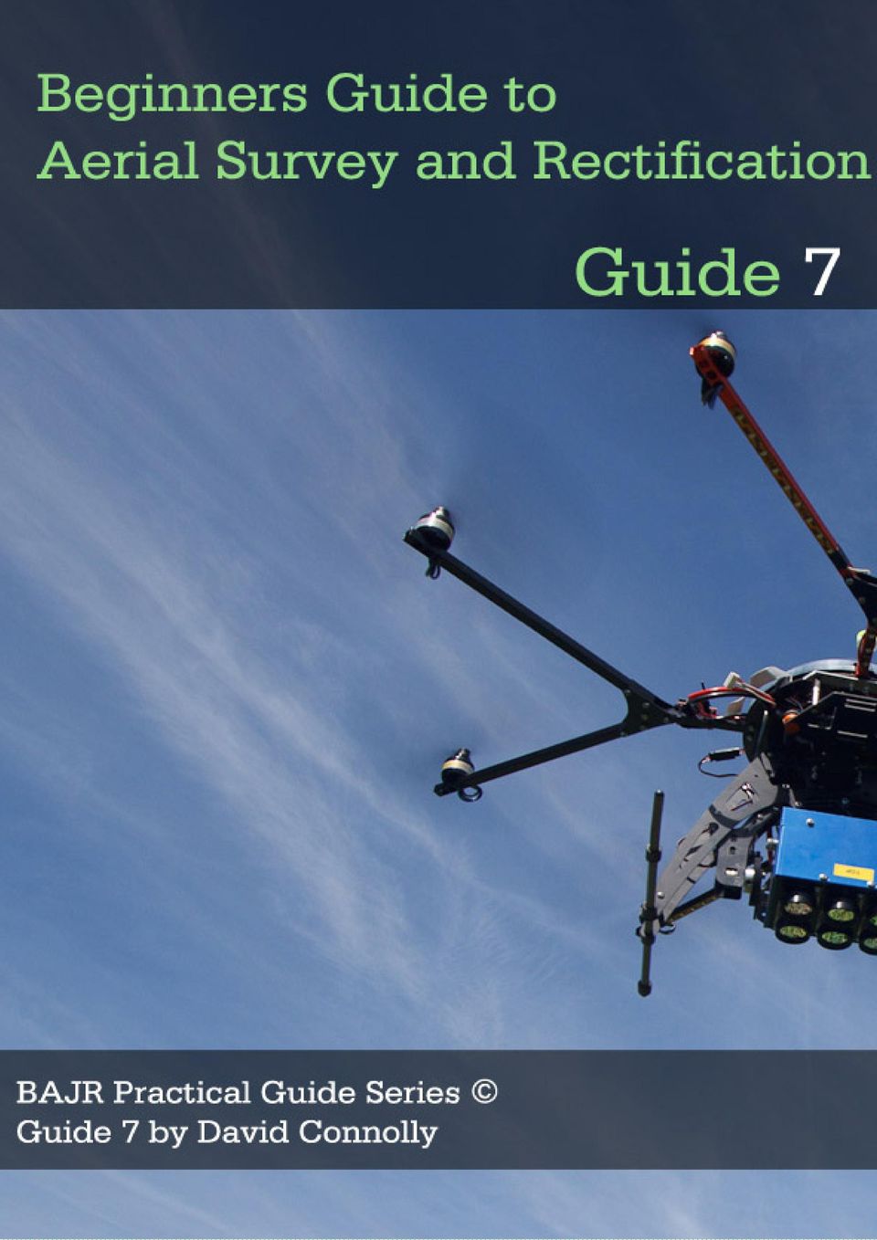
What is Aerial Survey?
|
|
|
- Olivia Kennedy
- 9 years ago
- Views:
Transcription
1
2 What is Aerial Survey? Aerial photography has been an invaluable source of non invasive and large scale survey of the UK for nearly a century. The large number of photographs taken during and immediately after the Second World War are a valuable resource in themselves and since then, we have had the flying archaeologists in light aircraft, helicopters and now remote drones and camera platforms. They have flown both in search of new monuments and cropmarks, as well as recording the landscape as a whole, putting monuments into a spatial relationship with the topography and other monuments. The times and seasons of flying would depend on the type of feature that was to be prospected or recorded; cropmarks show during certain times during the growth of a crop, parch marks only show in hot dry weather, while light dustings of snow, or low sun in winter may show up low profile sites. Upstanding structures or landscapes would require conditions that favoured their particular photography (for example, exotic coniferous planting in designed landscapes would show up easier in winter when the rest of the trees were bare). Soilmark sites will only show up in recently ploughed areas, where the ground is turned over. It is a common misconception that once an area has been flown, it requires no further flights. A cropmark or parch mark may only appear in one season and be invisible the next 10 years depending on the specific conditions that are present during that particular flight in that season, on that day at that time with that crop. Aerial images are used and collected around the world from jungle to desert and from urban architectural recording to survey methods that include Infra Red, LiDAR (Light Detection And Ranging) or thermal imaging. Jerash, Jordan Photo: David Connolly 1

3 Vertical These are often taken from a fixed camera mounted on an aerial survey plane. The aircraft will fly at a fixed height and produce a near plan view for production of a photograph at a certain scale (often 1:10,000 or 1:25,000). There are often two photographs taken and these are used as a stereoscopic pair, which can be viewed through a stereoscope produce the impression of a 3D image. This form of photography is often concerned with recording the present landscape, or in the case of the WWII photographs, searching for military targets. They do however often capture sites as well, and can be very useful in locating sites. Vertical photography does allow the large-scale mapping of landscapes (including areas of past human activity) which is as useful as the site centred photography that characterises oblique photography. It can also be carried out by remote operated drones and aerial platforms at lower levels. Vertical trench photograph. Image: Adam Stanford, Aerial Cam Oblique These are the most common form of monument photograph, where a handheld camera is used to record a site that is being flown over. This results in an angled shot of the site, though it is usually taken at a lower altitude and targeted directly on the site from various directions, thus providing more detail than vertical photographs. Many photographs can even be achieved from elevated locations such as hills, or the tops of buildings or low level aerial platforms such as vehicle mounted masts. The National Heritage organisations also have teams that deal with aerial photography on a national scale, both commissioning new flights and collating and rectifying existing resources. It is a shame that this useful resource is under funded, but in this period of time where the rural landscape is being developed at an ever-increasing rate, it is essential that this form of large-scale prospecting be given the importance it deserves. Other cheaper forms of Aerial photography that have been established and found to be of great use are Kite Flown Cameras, Remote Controlled model aircraft and of course Microlights. 2

4 Oblique site photograph. Image: Adam Stanford, Aerial Cam These cheaper methods all allow a greater number of flights and/or coverage, as well as allowing amateurs and local groups to get involved. To do this however, the following concepts and aims should appreciated in addition to a reasonable understadning of phtography. This guide is intended as a quick start to understanding and using aerial photographs and methods for transcribing features located on photographs onto orthographic plans. The links at the end will lead you to more detailed and specialist resources, should you wish to take this further. 3

5 Cropmark and Parch mark Sites The definition of a cropmark site is just as it sounds visible signs of buried features within a sown crop in a field. The sub surface archaeology causes variation in the growth of the overlying crop. Variations in the moisture retention of the buried ditch fills or walls cause observable difference in the growth and or colour of the vegetation, which is best observed in large homogenous crop areas, such as fields of arable crops. Prehistoric funerary at Grezac in France by J. Dassié via Wikimendia Commons Above ditches or humic rich areas, the crops will grow quicker and higher than the surrounding plant, due to the additional water and nutrients (positive cropmark), while walls, roads and features that are more compact will not retain the moisture as well, resulting in the crops growing slower or shorter (negative cropmark). The period when cropmarks are visible is short, as it depends on the growing crop, usually in the high summer of July or August. Ditches with more water content allow greater drop growth, harder features such as walls, stunt growth 4

6 As the name suggests parch marks appear during periods of extended heat and little or no rain. It is the underlying archaeology that determines the degree of parching, with the first areas exhibiting drought being directly over features such as walls, roads or cobbled areas, that have retained the least amount of moisture. It is possible to see these marks clearly on grass as well as crops, though the window of opportunity to view and identify these sites is only during a period of particularly hot weather. (1976 was a good year for cropmarks, a bad year for farmers!). It may be geological or recent works rather than ancient human activity that is evident in the cropmark, so interpretation is essential. Ancient streambeds, geological cracks in the bedrock or modern pipelines will show up as linear features. People have been fooled by the circles formed by animals feeding from a bale of hay for example. Time and experience will aid interpretation, but if in doubt, say so. Soilmark Sites Another form of feature visible from the air is the soilmark site. This type of site is the actual features themselves, rather than the ghostly depiction in the overlying vegetation. When an area is deep ploughed, or has been stripped of topsoil, the underlying features are exposed and differences in the colour of these in relation to the natural subsoil. Often, areas of human activity produce a large amount of dark soils so that you may be able to make out dark areas in fields that may represent sub surface activity. Building rubble, dark ditch fills or even ploughed out barrows will all show up, though only for the shortest of periods when the topsoil is freshly turned. The best time to spot these is during the winter when the farmer has freshly ploughed the fields. In some cases the effect can even be seen from any elevated position. It is also sadly evidence that the underlying archaeology is being damaged by continual agricultural activity. Remembered that you may be looking at geological rather than archaeological elements in the landscape A site must be interpreted correctly or it should be recorded as a possible rather than definite site. Classic soil mark site - Spott Enclosure, East Lothian 5

7 Low profile Sites A low profile site is actually still visible on the ground, though it may be imperceptible, with low bumps and humps being the only sign of buried features. They will usually only survive in areas that have not been subject to arable ploughing and levelling, so upland sites are the most common to view in this way, or deserted village sites that have been given over to pasture for centuries. These sites are also startling to view vertical aerial photos under a stereoscope, where the exaggerated vertical scale makes the earthwork leap out of the photograph. Good clear light is required to see these monuments best and the low raking sunlight in the mornings and evenings of the winter is perfect as it provides a marked contrast between the highlights and shadows. For larger earthworks, it is also possible to see the banks and hollows after a light dusting of snow, though once again, all the conditions must be just right to capture these images. Banked Enclosures, Deserted Medieval Villages, Rig and Furrow, relic field system boundaries are all examples of monuments that become clearer after this form of photographic recording. Rig and furrow field systems in the Lammermuirs, East Lothian 6

8 Rectification? After you have flown, photographed and identified your sites, whether cropmark or monument, it is important to know where exactly they are, or they are just photographs with only half the information that could be taken from them. Location, shape and size can be extracted from the photograph, as long as enough recognisable features are present. The features could be corners of fences, buildings, road junctions, or any recognisable element that also appears on a map. There are two simple methods of rectification which requires no digital manipulation, where you take the raw data of the photograph and translate it to a scaled map, from which much more information can be taken. This guide does not describe other methods, such as softcopy photogrammetry, parallax or stereo pair elevation mapping or image rectification within a GIS package but concentrates on those that are readily accessible to all. 7

9 Paper Strip Method of rectification This method is best for linear features and requires a minimum of three recognisable points on the oblique photograph, though it is better if you have a minimum of four. Mark each point with a number (1,2,3,4..etc) and mark the same points on the map (1:10,000 as a maximum scale). With lines drawn from point 1 to the others (see below) draw further lines to the end points and corner of the linear feature. Now place the paper strip on the image, as shown and mark the points where the lines intersect the paper, remembering to mark which line is which. Now move to the map, lay the strip on the same radial pattern and move the paper until the known point marks match up. You can then mark the unknown points onto the plan and draw faint lines (red dotted lines above), from the origin through the marks to create a radial pattern for the unknown points. 8

10 Repeat the previous step with the other radial series. (see above) You could of course repeat this process three or four times if you mark more radial origins. In this case, we are only using two point origins. You can now project lines from the radial origins and through the new points you have now marked and where they intersect is the rectified point. It really is that simple, though this method cannot deal with complex or curved features and for that, we will have to use a modified version of the Mobius Network. In this example we will locate the enclosed farm in the centre of this aerial photograph. 9

11 Mobius Network This method of rectification is much better for complicated cropmarks and curved features. It is slightly more time consuming, but the results are worth it, especially if you are out in the field, away from any form of technological rectification. You will need a photograph that has visible and recognisable points (4 in total, which surround the feature you wish to rectify, and a plan that shows the same features as the photograph. As before, mark the points 1, 2, 3 & 4. (For this version of mobius rectification, they must form a rough square.) Draw lines to between each point, measure the length and then divide by 10, now mark these points along the line. Repeat on each line and then join the dots to form a grid pattern. Repeat the entire procedure on the map of the area and you are ready to begin. This method does suit near vertical photographs better as to use obliques you will have to consider perspective. The more oblique the more distortion from perspective, this is good for a field rectification, and should be accurate to +- 2m if you take care. 10

12 Once you have the two images with the grids superimposed, it is a simple case of tracing/copying the photo image across to the map, just like the children s drawing books where one picture is traced across to a blank grid. A reference to another form of Mobius network rectification can be found in Evans, B.M. and Malta, L., Acquisition of 35 mm. oblique photographs for stereoscopic analysis and measurement, Photogrammetric Engineering and Remote Sensing 50, , (1984). This guide is to help you rectify aerial photographs using the minimum of technology, there are several commercial software programmes that can complete complex rectification calculations (check the links to see some examples). It should be remembered that rectifying an image is one thing, but recognising features, interpreting them and utilising the rectified images takes practice and training. 11

13 Digital software and Rectification Today, aerial survey is often recognized as a synonym for aerophotogrammetry, part of photogrammetry where the camera is placed in the air. Measurements on aerial images are provided by photogrammetric technologies and methods. To accurately georeference and orthographicly correct an aerial image you must accurately know the coordinate system, and have a suitable series of points (either collected manually in the field using a Total Station or sub metre GPS OR by using a digital or scanned map of suitable high scale. In a further guide, GIS : Guide for Archaeologists using QGIS will explain the process of georeferencing and assigning real-world coordinates to each pixel of the raster and how to obtain coordinates from scanned map images and systems such as Bing or Googlemaps itself. Useful Web Resources Aerial Archaeology Research Group (AARG) Archaeological Prospection Resources Department of Archaeological Sciences Bonn Archaeological Software Package (BASP) with Air Photo Aerial Archaeology - Beginners Book list TerraServer-USA A site to show what is possible with Aerial Photos Aerial Archaeology in Wales - RCAHMW Aerial Survey - English Heritage Aerial Archaeology French site with definitions and explanations AHDS - Archiving Aerial Photography and Remote Sensing Data: A Guide to Good Practice Baker Aerial Archaeology BBC History explain Aerial Archaeology by Dave MacLeod 12

Education in Aerial Remote Sensing for Archaeology
 ISSN 2040-526X Education in Aerial Remote Sensing for Archaeology Edited by Dave Cowley & Rog Palmer Collected papers and report of the AARG/EAC Working Party on Aerial Archaeology Occasional Publication
AERIAL PHOTOGRAPHS. For a map of this information, in paper or digital format, contact the Tompkins County Planning Department.
 AERIAL PHOTOGRAPHS What are Aerial Photographs? Aerial photographs are images of the land taken from an airplane and printed on 9 x9 photographic paper. Why are Aerial Photographs Important? Aerial photographs
Image Analysis CHAPTER 16 16.1 ANALYSIS PROCEDURES
 CHAPTER 16 Image Analysis 16.1 ANALYSIS PROCEDURES Studies for various disciplines require different technical approaches, but there is a generalized pattern for geology, soils, range, wetlands, archeology,
Remote sensing is the collection of data without directly measuring the object it relies on the
 Chapter 8 Remote Sensing Chapter Overview Remote sensing is the collection of data without directly measuring the object it relies on the reflectance of natural or emitted electromagnetic radiation (EMR).
Freehand Sketching. Sections
 3 Freehand Sketching Sections 3.1 Why Freehand Sketches? 3.2 Freehand Sketching Fundamentals 3.3 Basic Freehand Sketching 3.4 Advanced Freehand Sketching Key Terms Objectives Explain why freehand sketching
DETECTION OF RING SHAPED STRUCTURES IN AGRICULTURAL LAND USING HIGH RESOLUTION SATELLITE IMAGES
 DETECTION OF RING SHAPED STRUCTURES IN AGRICULTURAL LAND USING HIGH RESOLUTION SATELLITE IMAGES S. Ø. Larsen a, *, Ø. D. Trier a, R. Solberg a a Norwegian Computing Center, P.O. Box 114 Blindern, NO-0314
2. Using a Visible Light Blocking Filter on a standard Digital Camera
 Black and White Infra-Red - Many years ago I shot some images with black and white Infrared film, but I never had the success with it that I would have liked. I put that down to the fact that infra-red
Taking pictures of your farm
 Taking pictures of your farm Taking pictures of your farm Good photos are becoming increasingly important for businesses, especially farms, where they re a wonderful proxy for a public who can t always
MAPPING THE PREHISTORIC STATUE ROADS ON RAPA NUI USING REMOTE SENSING SATELLITE IMAGERY
 MAPPING THE PREHISTORIC STATUE ROADS ON RAPA NUI USING REMOTE SENSING SATELLITE IMAGERY Gabe Wofford Global Environmental Science University of Hawai i at Manoa ABSTRACT In an extension of the work of
WHAT IS GIS - AN INRODUCTION
 WHAT IS GIS - AN INRODUCTION GIS DEFINITION GIS is an acronym for: Geographic Information Systems Geographic This term is used because GIS tend to deal primarily with geographic or spatial features. Information
Chapter 5: Working with contours
 Introduction Contoured topographic maps contain a vast amount of information about the three-dimensional geometry of the land surface and the purpose of this chapter is to consider some of the ways in
A Resource for Free-standing Mathematics Qualifications
 To find a maximum or minimum: Find an expression for the quantity you are trying to maximise/minimise (y say) in terms of one other variable (x). dy Find an expression for and put it equal to 0. Solve
How To Make An Orthophoto
 ISSUE 2 SEPTEMBER 2014 TSA Endorsed by: CLIENT GUIDE TO DIGITAL ORTHO- PHOTOGRAPHY The Survey Association s Client Guides are primarily aimed at other professionals such as engineers, architects, planners
3D Drawing. Single Point Perspective with Diminishing Spaces
 3D Drawing Single Point Perspective with Diminishing Spaces The following document helps describe the basic process for generating a 3D representation of a simple 2D plan. For this exercise we will be
SESSION 8: GEOGRAPHIC INFORMATION SYSTEMS AND MAP PROJECTIONS
 SESSION 8: GEOGRAPHIC INFORMATION SYSTEMS AND MAP PROJECTIONS KEY CONCEPTS: In this session we will look at: Geographic information systems and Map projections. Content that needs to be covered for examination
Photogrammetric Point Clouds
 Photogrammetric Point Clouds Origins of digital point clouds: Basics have been around since the 1980s. Images had to be referenced to one another. The user had to specify either where the camera was in
Chapter 8: Aerial photograph interpretation
 Introduction Almost all modern topographic maps and many other types such as those depicting geology, natural vegetation, and landuse, are based on information obtained from aerial photography. In this
Mapping Earth from Space Remote sensing and satellite images. Remote sensing developments from war
 Mapping Earth from Space Remote sensing and satellite images Geomatics includes all the following spatial technologies: a. Cartography "The art, science and technology of making maps" b. Geographic Information
Geographical Information Systems (GIS) and Economics 1
 and Economics 1") Geographical Information Systems (GIS) and Economics 1 Henry G. Overman (London School of Economics) 5 th January 2006 Abstract: Geographical Information Systems (GIS) are used for inputting, storing,
Geographical Information Systems (GIS) and Economics 1 Henry G. Overman (London School of Economics) 5 th January 2006 Abstract: Geographical Information Systems (GIS) are used for inputting, storing,
Chapter 5 Topographic Maps Bengt Rystedt, Sweden
 Chapter 5 Topographic Maps Bengt Rystedt, Sweden 5.1 Introduction A topographic map describes a place (topos is Greek for place). For a long time, they have been used for military purposes but are now
Description of Simandou Archaeological Potential Model. 13A.1 Overview
 13A Description of Simandou Archaeological Potential Model 13A.1 Overview The most accurate and reliable way of establishing archaeological baseline conditions in an area is by conventional methods of
3D Drawing. Single Point Perspective with Diminishing Spaces
 3D Drawing Single Point Perspective with Diminishing Spaces The following document helps describe the basic process for generating a 3D representation of a simple 2D plan. For this exercise we will be
6 th Grade Vocabulary-ALL CAMPUSES
 6 th Grade Vocabulary-ALL CAMPUSES 6.1 History. The student understands that historical events influence contemporary events. (B) analyze the historical background of the United States to evaluate relationships
CIESIN Columbia University
 Conference on Climate Change and Official Statistics Oslo, Norway, 14-16 April 2008 The Role of Spatial Data Infrastructure in Integrating Climate Change Information with a Focus on Monitoring Observed
What Is Holistic Planned Grazing?
 What Is Holistic Planned Grazing? Holistic Planned Grazing is a planning process for dealing simply with the great complexity livestock managers face daily in integrating livestock production with crop,
High Resolution Digital Surface Models and Orthoimages for Telecom Network Planning
 Renouard, Lehmann 241 High Resolution Digital Surface Models and Orthoimages for Telecom Network Planning LAURENT RENOUARD, S ophia Antipolis FRANK LEHMANN, Berlin ABSTRACT DLR of Germany and ISTAR of
Opportunities for the generation of high resolution digital elevation models based on small format aerial photography
 Opportunities for the generation of high resolution digital elevation models based on small format aerial photography Boudewijn van Leeuwen 1, József Szatmári 1, Zalán Tobak 1, Csaba Németh 1, Gábor Hauberger
Description of field acquisition of LIDAR point clouds and photos. CyberMapping Lab UT-Dallas
 Description of field acquisition of LIDAR point clouds and photos CyberMapping Lab UT-Dallas Description of field acquisition of LIDAR point clouds and photos Objective: Introduce the basic steps that
building on success Trees and Basements Partial Review of the Core Strategy February 2014
 building on success Trees and Basements Partial Review of the Core Strategy February 2014 Regulation 19, Town and Country Planning (Local Planning) (England) Regulations 2012. 2 Contents 1. Introduction...
Introduction to GIS (Basics, Data, Analysis) & Case Studies. 13 th May 2004. Content. What is GIS?
 & Case Studies. 13 th May 2004. Content. What is GIS?") Introduction to GIS (Basics, Data, Analysis) & Case Studies 13 th May 2004 Content Introduction to GIS Data concepts Data input Analysis Applications selected examples What is GIS? Geographic Information
Introduction to GIS (Basics, Data, Analysis) & Case Studies 13 th May 2004 Content Introduction to GIS Data concepts Data input Analysis Applications selected examples What is GIS? Geographic Information
Who is responsible for the destruction of the Amazon rainforest?
 The dictionary defines deforestation as the removal of a forest where the land is then used for a non-forest use. In recent years, deforestation has become a significant issue with the loss of large areas
The Role of SPOT Satellite Images in Mapping Air Pollution Caused by Cement Factories
 The Role of SPOT Satellite Images in Mapping Air Pollution Caused by Cement Factories Dr. Farrag Ali FARRAG Assistant Prof. at Civil Engineering Dept. Faculty of Engineering Assiut University Assiut, Egypt.
7tipsforsofter. lookinglight. Beginners Digital Photography - Tutorial 03. Making Photography Easier. www. DIGITAL Beginners.com
 7tipsforsofter lookinglight Beginners Digital Photography - Tutorial 03 Tel: 00353 1 620 5156 Email: [email protected] www.digitalbeginners.com All text, photographs and illustrations David McKane
Filters for Black & White Photography
 Filters for Black & White Photography Panchromatic Film How it works. Panchromatic film records all colors of light in the same tones of grey. Light Intensity (the number of photons per square inch) is
GIS and Remote Sensing in Diachronic Study of Agriculture in Greece
 GIS and Remote Sensing in Diachronic Study of Agriculture in Greece Maria Androulidaki a, Michail Salampasis b, Vagis Samathrakis c, Christos Batzios d a Alexander Technology Educational Institute of Thessaloniki,
PLOTTING SURVEYING DATA IN GOOGLE EARTH
 PLOTTING SURVEYING DATA IN GOOGLE EARTH D M STILLMAN Abstract Detail surveys measured with a total station use local coordinate systems. To make the data obtained from such surveys compatible with Google
Digital Communications
 National Assembly for Wales Election Manifesto 2016 Digital Communications Digital growth is key to driving the Welsh economy forward, which is why innovative policies are needed to meet the increasing
Remote Sensing and GIS Application In Change Detection Study In Urban Zone Using Multi Temporal Satellite
 Remote Sensing and GIS Application In Change Detection Study In Urban Zone Using Multi Temporal Satellite R.Manonmani, G.Mary Divya Suganya Institute of Remote Sensing, Anna University, Chennai 600 025
HIGH AND LOW RESOLUTION TEXTURED MODELS OF COMPLEX ARCHITECTURAL SURFACES
 HIGH AND LOW RESOLUTION TEXTURED MODELS OF COMPLEX ARCHITECTURAL SURFACES E. K. Stathopoulou a, A. Valanis a, J. L. Lerma b, A. Georgopoulos a a Laboratory of Photogrammetry, National Technical University
Earth Coordinates & Grid Coordinate Systems
 Earth Coordinates & Grid Coordinate Systems How do we model the earth? Datums Datums mathematically describe the surface of the Earth. Accounts for mean sea level, topography, and gravity models. Projections
How To Fuse A Point Cloud With A Laser And Image Data From A Pointcloud
 REAL TIME 3D FUSION OF IMAGERY AND MOBILE LIDAR Paul Mrstik, Vice President Technology Kresimir Kusevic, R&D Engineer Terrapoint Inc. 140-1 Antares Dr. Ottawa, Ontario K2E 8C4 Canada [email protected]
Anamorphic Projection Photographic Techniques for setting up 3D Chalk Paintings
 Anamorphic Projection Photographic Techniques for setting up 3D Chalk Paintings By Wayne and Cheryl Renshaw. Although it is centuries old, the art of street painting has been going through a resurgence.
Field Techniques Manual: GIS, GPS and Remote Sensing
 Field Techniques Manual: GIS, GPS and Remote Sensing Section A: Introduction Chapter 1: GIS, GPS, Remote Sensing and Fieldwork 1 GIS, GPS, Remote Sensing and Fieldwork The widespread use of computers
Small Scale Poultry Housing
 Small Scale Poultry Housing Phillip J. Clauer, Poultry Extension Specialist, Animal and Poultry Sciences Small scale poultry coops seem to be built in almost every possible shape and size. Those building
Mobile Network Base Station Design Guide User Manual
 Mobile Network Base Station Design Guide User Manual Prepared for the Mobile Carriers Forum and the Design and Innovation Programme Taskforce February 2008 Consultant Contact: Nicole Halsey, Director Urban
List 10 different words to describe the weather in the box, below.
 Weather and Climate Lesson 1 Web Quest: What is the Weather? List 10 different words to describe the weather in the box, below. How do we measure the weather? Use this web link to help you: http://www.bbc.co.uk/weather/weatherwise/activities/weatherstation/
LIFE SCIENCE. Hoop House Construction for New Mexico: 12-ft. x 40-ft. Hoop House BRINGING TO YOUR HOME ECONOMICS COLLEGE OF AGRICULTURE AND
 Hoop House Construction for New Mexico: 12-ft. x 40-ft. Hoop House COLLEGE OF AGRICULTURE AND HOME ECONOMICS BRINGING SCIENCE TO YOUR LIFE Hoop House Construction for New Mexico: 12-ft. x 40-ft. Hoop House
Rainforest Concern Module 2 Why do we need rainforests?
 Rainforest Concern Module 2 Why do we need rainforests? Rainforest Concern Module 2: Why do we need Rainforest? Before we go any further, there are some words you may not understand, and these words and
"Description of the urban and architectural development conceptual design of the historical city centre of Gorzow Wlkp. R3DC4T
 "Description of the urban and architectural development conceptual design of the historical city centre of Gorzow Wlkp. R3DC4T Gorzów Wielkopolski Gorzów Wielkopolski is an important regional city centre
A technical overview of the Fuel3D system.
 A technical overview of the Fuel3D system. Contents Introduction 3 How does Fuel3D actually work? 4 Photometric imaging for high-resolution surface detail 4 Optical localization to track movement during
environment briefing02
 PRODUCED BY THE SAFETY, HEALTH & ENVIRONMENT GROUP OF THE ENERGY NETWORKS ASSOCIATION - JULY 2006 environment briefing02 transporting electricity Overhead Lines or Underground Cables? Introduction The
Digital Photography Composition. Kent Messamore 9/8/2013
 Digital Photography Composition Kent Messamore 9/8/2013 Photography Equipment versus Art Last week we focused on our Cameras Hopefully we have mastered the buttons and dials by now If not, it will come
Walsall Council Validation Guide for submitting a Householder Planning Application
 Walsall Council Validation Guide for submitting a Householder Planning Application Householder Planning Application Guide Introduction This guide offers help to people who are submitting a Householder
CREATING SCENERY WITH THE PHOENIX RC CREATOR PROGRAM
 TUTORIAL 1 CREATING SCENERY WITH THE PHOENIX RC CREATOR PROGRAM This document is copyrighted to the author and may only be reproduced or copied with the author s consent. It is free for distribution on
PUSD High Frequency Word List
 PUSD High Frequency Word List For Reading and Spelling Grades K-5 High Frequency or instant words are important because: 1. You can t read a sentence or a paragraph without knowing at least the most common.
Overview. Suggested Lesson Please see the Greenlinks Module description.
 Overview Plants interact with their environment in many ways that we cannot see. Children often enjoy learning about these hidden secrets of plant life. In this lesson, children will learn about role of
Guidance on Householder permitted development rights
 FORWARD CONTENTS CLOSE Guidance on Householder permitted development rights Circular 1/2012 CONTENTS BACK FORWARD CLOSE 1. INTRODUCTION 04 2. BEFORE STARTING 05 3. MAIN CONCEPTS 07 Principal elevation
Stage 4. Geography. Blackline Masters. By Karen Devine
 1 Devine Educational Consultancy Services Stage 4 Geography Blackline Masters By Karen Devine Updated January 2010 2 This book is intended for the exclusive use in NSW Secondary Schools. It is meant to
Digital Orthophoto Production In the Desktop Environment 1
 Digital Orthophoto Production In the Desktop Environment 1 By Dr. Roy A. Welch and Thomas R. Jordan Digital orthophotos are proving suitable for a variety of mapping, GIS and environmental monitoring tasks.
Shaping Space DRAWING GUIDELINES
 DRAWING GUIDELINES Types of drawin Freehand drawings, paintings or sketches These are good for recording the general visual effect of a building or for making personal statements about how you feel about
Impact of water harvesting dam on the Wadi s morphology using digital elevation model Study case: Wadi Al-kanger, Sudan
 Impact of water harvesting dam on the Wadi s morphology using digital elevation model Study case: Wadi Al-kanger, Sudan H. S. M. Hilmi 1, M.Y. Mohamed 2, E. S. Ganawa 3 1 Faculty of agriculture, Alzaiem
Bedwyn Brail, Wiltshire: Geophysical and Earthworks Survey
 Bedwyn Brail, Wiltshire: Geophysical and Earthworks Survey Report no. 167.0306 & 167.0506 Authors L. Amadio MSc & B. Clarke MSc Date October 2012 Acknowledgement Wiltshire Archaeological and Natural History
DESIGNING YOUR LANDSCAPE
 DESIGNING YOUR LANDSCAPE SITE AND NEEDS ASSESSMENT Examine all existing features of your site that could affect your landscape design and then identify the functions you want your landscape to serve. Site
METHODS OF GEOREFERENCING OLD MAPS ON THE EXAMPLE OF CZECH EARLY MAPS
 CO-314 METHODS OF GEOREFERENCING OLD MAPS ON THE EXAMPLE OF CZECH EARLY MAPS CAJTHAML J. Czech Technical University in Prague, PRAGUE 6, CZECH REPUBLIC BACKGROUND AND OBJECTIVES Old maps are unique source
Participants to develop their business without making great efforts; to use modern machinery to be implemented over the years in agriculture.
 TITLE: MODERN MACHINES IN AGRICULTURE INTRODUCTION: Modern agriculture depends heavily on engineering, technology and the biological and physical sciences. Irrigation, drainage, conservation and channelling
REGISTRATION OF LASER SCANNING POINT CLOUDS AND AERIAL IMAGES USING EITHER ARTIFICIAL OR NATURAL TIE FEATURES
 REGISTRATION OF LASER SCANNING POINT CLOUDS AND AERIAL IMAGES USING EITHER ARTIFICIAL OR NATURAL TIE FEATURES P. Rönnholm a, *, H. Haggrén a a Aalto University School of Engineering, Department of Real
Higher Geography Biosphere Vegetation Succession: Sand Dunes
 Higher Geography Biosphere Vegetation Succession: Sand Dunes A PowerPoint resource to accompany the posters available at: http://www.macaulay.ac.uk/soilposters/education_vegetation_6v2.pdf http://www.macaulay.ac.uk/soilposters/education_vegetation_7v2.pdf
CATIA V5 Surface Design
 CATIA V5 Training Foils CATIA V5 Surface Design Version 5 Release 19 August 2008 EDU_CAT_EN_V5S_FI_V5R19 1 Lesson 1: Introduction to Generative Shape Design About this Course Introduction CATIA is a robust
How to georectify an image in ArcMap 10
 How to georectify an image in ArcMap 10 The University Library has a large collection of historical aerial photos for some North Carolina Counties ( http://www.lib.unc.edu/reference/gis/usda/index.html
Advice can also be sought from specific specialist officers in the Council.
 Canterbury City Council Validation of Planning Applications Guidance note 2010: Introduction Up to date advice on the validation of planning applications is contained in the CLG Guidance on information
Shadows, Angles, and the Seasons
 Shadows, Angles, and the Seasons If it's cold in winter, why is Earth closer to the Sun? This activity shows the relationship between Earth-Sun positions and the seasons. From The WSU Fairmount Center
Imagery. 1:50,000 Basemap Generation From Satellite. 1 Introduction. 2 Input Data
 1:50,000 Basemap Generation From Satellite Imagery Lisbeth Heuse, Product Engineer, Image Applications Dave Hawkins, Product Manager, Image Applications MacDonald Dettwiler, 3751 Shell Road, Richmond B.C.
Rural Settlement Patterns
 Rural Settlement Patterns A summary with pictures. Courtesy of Crescent School There are three types of rural settlement patterns that occurred where large numbers of people settled: the long lots of
November 2006. General Notes. Tree Protection. Tree Protection and New Development Guidance Note
 Tree Protection and New Development Guidance Note November 2006 General Notes The retention and planting of trees within a development can add to the character and aesthetic value of a site whilst maintaining
REGIONAL SEDIMENT MANAGEMENT: A GIS APPROACH TO SPATIAL DATA ANALYSIS. Lynn Copeland Hardegree, Jennifer M. Wozencraft 1, Rose Dopsovic 2 INTRODUCTION
 REGIONAL SEDIMENT MANAGEMENT: A GIS APPROACH TO SPATIAL DATA ANALYSIS Lynn Copeland Hardegree, Jennifer M. Wozencraft 1, Rose Dopsovic 2 ABSTRACT: Regional sediment management (RSM) requires the capability
Land Use/Land Cover Map of the Central Facility of ARM in the Southern Great Plains Site Using DOE s Multi-Spectral Thermal Imager Satellite Images
 Land Use/Land Cover Map of the Central Facility of ARM in the Southern Great Plains Site Using DOE s Multi-Spectral Thermal Imager Satellite Images S. E. Báez Cazull Pre-Service Teacher Program University
Using an Abney Level to Measure Relative Heights
 1) Introduction Using an Abney Level to Measure Relative Heights An Abney level is a small surveying instrument that consists of a sighting tube and a spirit level linked to a protractor and this allows
WEATHERING, EROSION, AND DEPOSITION PRACTICE TEST. Which graph best shows the relative stream velocities across the stream from A to B?
 NAME DATE WEATHERING, EROSION, AND DEPOSITION PRACTICE TEST 1. The diagram below shows a meandering stream. Measurements of stream velocity were taken along straight line AB. Which graph best shows the
GEOENGINE MSc in Geomatics Engineering (Master Thesis) Anamelechi, Falasy Ebere
 Anamelechi, Falasy Ebere") Master s Thesis: ANAMELECHI, FALASY EBERE Analysis of a Raster DEM Creation for a Farm Management Information System based on GNSS and Total Station Coordinates Duration of the Thesis: 6 Months Completion
Master s Thesis: ANAMELECHI, FALASY EBERE Analysis of a Raster DEM Creation for a Farm Management Information System based on GNSS and Total Station Coordinates Duration of the Thesis: 6 Months Completion
Image Draping & navigation within Virtual GIS
 Image Draping & navigation within Virtual GIS Draping of Geo Corrected data such as aerial imagery or map data enables virtual 3D field tours to be conducted in an area of interest. This document covers
MULTIPURPOSE USE OF ORTHOPHOTO MAPS FORMING BASIS TO DIGITAL CADASTRE DATA AND THE VISION OF THE GENERAL DIRECTORATE OF LAND REGISTRY AND CADASTRE
 MULTIPURPOSE USE OF ORTHOPHOTO MAPS FORMING BASIS TO DIGITAL CADASTRE DATA AND THE VISION OF THE GENERAL DIRECTORATE OF LAND REGISTRY AND CADASTRE E.ÖZER, H.TUNA, F.Ç.ACAR, B.ERKEK, S.BAKICI General Directorate
New development of automation for agricultural machinery
 New development of automation for agricultural machinery a versitale technology in automation of agriculture machinery VDI-Expertenforum 2011-04-06 1 Mechanisation & Automation Bigger and bigger Jaguar
3D Capabilities of SPOT 6
 3D Capabilities of SPOT 6 P. Nonin, D. Decluseau, L. Gabet, M. Bernard* ASTRIUM GEO-Information Services, France Abstract. On September 9th, 2012 a new optical satellite, SPOT 6, was successfully launched
The YellowScan system: A test on the oppida of Nages/Roque de Viou (Languedoc, France) Tristan Allouis, PhD Research and Development, L'Avion Jaune
 Tristan Allouis, PhD Research and Development, L'Avion Jaune") The YellowScan system: A test on the oppida of Nages/Roque de Viou (Languedoc, France) Tristan Allouis, PhD Research and Development, L'Avion Jaune L'Avion Jaune : Earth observation data provider UAVs
The YellowScan system: A test on the oppida of Nages/Roque de Viou (Languedoc, France) Tristan Allouis, PhD Research and Development, L'Avion Jaune L'Avion Jaune : Earth observation data provider UAVs
LiDAR for vegetation applications
 LiDAR for vegetation applications UoL MSc Remote Sensing Dr Lewis [email protected] Introduction Introduction to LiDAR RS for vegetation Review instruments and observational concepts Discuss applications
Maybe you know about the Energy House.
 Plans and experiments for the Energy House can be found at Design Coalition s website at www.designcoalition.org Maybe you know about the Energy House. Here are some more ideas for leaning about the sun
REGIONAL CENTRE FOR TRAINING IN AEROSPACE SURVEYS (RECTAS) MASTER IN GEOINFORMATION PRODUCTION AND MANAGEMENT
 MASTER IN GEOINFORMATION PRODUCTION AND MANAGEMENT") REGIONAL CENTRE FOR TRAINING IN AEROSPACE SURVEYS (RECTAS) MASTER IN GEOINFORMATION PRODUCTION AND MANAGEMENT PROGRAMME DESCRIPTION October 2014 1. The programme The academic programme shall be referred
REGIONAL CENTRE FOR TRAINING IN AEROSPACE SURVEYS (RECTAS) MASTER IN GEOINFORMATION PRODUCTION AND MANAGEMENT PROGRAMME DESCRIPTION October 2014 1. The programme The academic programme shall be referred
BASIC EXPOSURE APERTURES, SHUTTER SPEEDS AND PHOTO TERMINOLOGY
 BASIC EXPOSURE APERTURES, SHUTTER SPEEDS AND PHOTO TERMINOLOGY EXPOSURE Exposure is the response of a photographic emulsion to light. The emulsion is made of a material (silver) that is sensitive to light.
Rotherham Metropolitan Borough Council. Appendix A. Street Lighting. Sustainable Energy Action Plan
 Rotherham Metropolitan Borough Council Appendix A Street Lighting Sustainable Energy Action Plan October 2010 Streetpride Service Summary Modern street lighting provides many benefits to the community
Graphical Integration Exercises Part Four: Reverse Graphical Integration
 D-4603 1 Graphical Integration Exercises Part Four: Reverse Graphical Integration Prepared for the MIT System Dynamics in Education Project Under the Supervision of Dr. Jay W. Forrester by Laughton Stanley
NATURAL REGIONS OF KENTUCKY
 NATURAL WONDERS As you travel around Kentucky taking pictures, you are excited by what you see. Kentucky offers diverse and amazing sights. The Six Regions In the West, you see the Mississippi River, the
THE FUTURE OF DRONES IN THE COMMERCIAL WORLD. February 2015
 THE FUTURE OF DRONES IN THE COMMERCIAL WORLD February 2015 Written by: Sophie Lyall, Project Manager Jacob Fries, Business Analyst Emma Davidson, Business Analyst Gareth Blades, Business Analyst INTRODUCTION:
Thermal Imaging Test Target THERMAKIN Manufacture and Test Standard
 Thermal Imaging Test Target THERMAKIN Manufacture and Test Standard June 2014 This document has been produced by CPNI as the standard for the physical design, manufacture and method of use of the Thermal
Measuring Your Latitude from the Angle of the Sun at Noon
 Measuring Your Latitude from the Angle of the Sun at Noon Background: You can measure your latitude in earth's northern hemisphere by finding out the altitude of the celestial equator from the southern