DEWNR Technical report 2015/07
|
|
|
- Claire Ball
- 10 years ago
- Views:
Transcription

1 Hydrological investigations to inform surface water use limits and generalised environmental water requirements for key ecological assets on Kangaroo Island DEWNR Technical report 2015/07

2


3 Hydrological investigations to inform surface water use limits and generalised environmental water requirements for key ecological assets on Kangaroo Island Julian Whiting, Douglas Green Department of Environment, Water and Natural Resources February, 2015 DEWNR Technical Report 2015/07

4 Department of Environment, Water and Natural Resources GPO Box 1047, Adelaide SA 5001 Telephone National (08) International Fax National (08) International Website Disclaimer The Department of Environment, Water and Natural Resources and its employees do not warrant or make any representation regarding the use, or results of the use, of the information contained herein as regards to its correctness, accuracy, reliability, currency or otherwise. The Department of Environment, Water and Natural Resources and its employees expressly disclaims all liability or responsibility to any person using the information or advice. Information contained in this document is correct at the time of writing. This work is licensed under the Creative Commons Attribution 4.0 International License. To view a copy of this license, visit Crown in right of the State of South Australia, through the Department of Environment, Water and Natural Resources 2015 ISBN Preferred way to cite this publication Whiting J. and Green D. 2015, Hydrological investigations to inform surface water use limits and generalised environmental water requirements for key ecological assets on Kangaroo Island, DEWNR Technical Report 2015/07, Government of South Australia, through the Department of Environment, Water and Natural Resources, Adelaide Download this document at: DEWNR Technical Report 2015/07 i

5 Foreword The Department of Environment, Water and Natural Resources (DEWNR) is responsible for the management of the State s natural resources, ranging from policy leadership to on-ground delivery in consultation with government, industry and communities. High-quality science and effective monitoring provides the foundation for the successful management of our environment and natural resources. This is achieved through undertaking appropriate research, investigations, assessments, monitoring and evaluation. DEWNR s strong partnerships with educational and research institutions, industries, government agencies, Natural Resources Management Boards and the community ensures that there is continual capacity building across the sector, and that the best skills and expertise are used to inform decision making. Sandy Pitcher CHIEF EXECUTIVE DEPARTMENT OF ENVIRONMENT, WATER AND NATURAL RESOURCES DEWNR Technical Report 2015/07 ii

6 Acknowledgements The authors wish to acknowledge the following: The Kangaroo Island Natural Resources Management Board and Kangaroo Island Water Resources Taskforce for providing funding assistance for this project, and reviewing this report. Natural Resources Kangaroo Island regional staff: Jo Sullivan who provided operational spreadsheets and data, and valuable field knowledge Bill Haddrill and Martine Kinloch for providing feedback throughout the project Department of Environment, Water and Natural Resources staff: Kumar Savadamuthu, Simon Sherriff and Jason Vanlaarhoven for their invaluable knowledge and assistance with the methodology, and for comments provided in reviewing this report Lieke van Roosmalen for providing project management and support Gabrielle Eckert and David Thompson for spatial analysis assistance External peer reviews of this report were provided by: Dr Jai Vaze, Research Team Leader Catchment Hydrology, CSIRO Land & Water Peter Goonan, Principal Scientific Officer (Aquatic Biology), South Australian Environment Protection Agency (SA EPA) The financial support of the Commonwealth Government (under the Climate Change Adaptation Program Stream 1) for this project is also gratefully acknowledged. DEWNR Technical Report 2015/07 iii

7 Contents Foreword Acknowledgements ii iii Summary 1 PART 1 Hydrological investigations to inform surface water use limits 5 1 Introduction Overview Background of water use limits on KI Background of this project Project approach 7 2 Hydrological data analysis Background Previous hydrological analysis Catchment characteristics Rainfall data Annual streamflow data 20 3 Annual rainfall-runoff relationships Background Two-year analysis Longer-term analysis KI-specific relationships Average KI relationships Temporal variability in Rocky River relationship Influence of individual years on average relationships 34 4 Catchment yield calculations Generalised KI relationships Cygnet River catchment Timber Creek catchment Highly-developed catchments Less-developed catchments Regionalisation for catchment analysis WUL calculation procedure Methodology used for Zone B in the 2009 Plan Assumptions in the 2009 Plan methodology for calculating SLs Impact of applying Method B to former Zone A catchments 45 5 Daily rainfall-runoff relationships Background Daily streamflow data 47 DEWNR Technical Report 2015/07 iv

8 5.3 Flow duration curve variation Flow volumes UTFR-rainfall relationships 53 6 Flow measurement uncertainty 55 7 Conclusions 61 PART 2 Generalised environmental water requirements for key ecological assets 65 1 Introduction 65 2 Summary of assets Fish Summary of avaliable data Assessment of data quality Summary of ecological community Gaps and knowledge deficiencies Future investment opportunities Macroinvertebrates Summary of avaliable data Assessment of data quality Summary of ecological community Gaps and knowledge deficiencies Future investment opportunities Aquatic and riparian vegetation Summary of avaliable data Assessment of data quality Summary of ecological community Gaps and knowledge deficiencies Future investment opportunities Water quality Summary of avaliable data Assessment of data quality Historical water quality Gaps and knowledge deficiencies Future investment opportunities 78 3 Generalised environmental water requirements (EWRs) Fish Macroinvertebrates Aquatic and Riparian Vegetation 84 4 Community ecological survey Methods Survey results 88 5 Summary 93 DEWNR Technical Report 2015/07 v

9 PART 3 Future steps 95 References 97 Appendix 99 A. Community survey 99 DEWNR Technical Report 2015/07 vi

10 List of figures Figure 1 Locations of water resource catchments, streamflow gauging stations and rainfall gauging stations 10 Figure 2 Land use proportions for the five KI streamflow gauging station catchments and Middle River catchment12 Figure 3 Distribution of land use types 13 Figure 4 Annual rainfall for SILO station Parndana (Allandale) 14 Figure 5 Annual rainfall for SILO station Kingscote Airport 15 Figure 6 Annual catchment-averaged rainfall associated with the Rocky River and Timber Creek streamflow gauging stations from SILO gridded data ( ) 16 Figure 7 Average annual rainfall for subcatchments calculated from SILO gridded data ( ) 17 Figure 8 Catchment-averaged rainfall for the Timber Creek gauging station from SILO gridded data alongside a linear model of these data from SILO point rainfall 18 Figure 9 Annual catchment-averaged rainfall totals corresponding to the five KI streamflow gauging stations from SILO gridded data ( ), with 2013 values estimated from linear models 19 Figure 10 Monthly streamflow data availability for the five KI streamflow gauging stations 20 Figure 11 Comparison of annual streamflow at the Koala Lodge gauging station on the Cygnet River with annual catchment rainfall for the upstream catchment 22 Figure 12 Rainfall-runoff curves for Middle River Reservoir inflow and MLR catchment runoff using TanH functions (McMurray, 2007) 24 Figure 13 Locations of water resource catchments, and selected streamflow gauging stations in the MLR 26 Figure 14 Rainfall-runoff relationships for five KI streamflow gauges and 19 streamflow MLR gauges for Figure 15 Rainfall-runoff relationships for five KI gauges and 19 MLR gauges for the period 30 Figure 16 Land use proportions for the catchments of the five KI streamflow gauging stations and 19 selected MLR streamflow gauging stations 31 Figure 17 Annual rainfall-runoff relationships for KI streamflow gauges 32 Figure 18 Rainfall-runoff curves for Rocky River, with TanH functions fitted to pre-1993 and post-1993 data 34 Figure 19 Time series of daily flows for the Cygnet River (Koala Lodge) gauge for 2011, 2012 and Figure 20 Daily SILO rainfall for BoM observation station (Kingscote Aero) for Figure 21 Proposed generalised-extended KI rainfall-runoff curve, compared with Middle River rainfall-runoff curve used for the 2009 Plan 38 Figure 22 Annual rainfall-runoff relationships for the two Cygnet River gauges, showing a TanH function that was derived from combining these two data series 39 Figure 23 Annual rainfall-runoff relationships for two Cygnet River gauges and the Timber Creek gauge, showing a potential highly-developed area rainfall-runoff curve that was derived from combining these three data series 41 Figure 24 Annual rainfall-runoff relationships for Stunsail Boom River gauge, showing comparison between measured runoff for the total catchment area and the calculated runoff from the cleared portion of the catchment43 Figure 25 Daily flow duration curves for selected calendar years (non-missing data) at each KI streamflow gauge 48 Figure 26 Flow duration curves for 2012 for KI gauges (solid lines) and selected MLR gauges (dashed lines) 49 Figure 27 Flow duration curves for 2013 for KI gauges (solid lines) and selected MLR gauges (dashed lines) 50 Figure 28 Daily flows for 2012 for Cygnet River (Koala Lodge) gauge, with flows above the 10 th percentile POE flow rate for 2012 shaded 51 Figure 29 Daily flows for 2013 for Cygnet River (Koala Lodge) gauge, with flows above the 10 th percentile POE flow rate for 2013 shaded 52 Figure 30 Unit threshold flow rates for individual years for the five KI streamflow gauges 54 DEWNR Technical Report 2015/07 vii
 17 Figure 8 Catchment-averaged rainfall for the Timber Creek gauging station from SILO gridded data alongside a")
11 Figure 31 Rating table (with confidence limits) used to describe flows passing the Timber Creek streamflow gauge (site A ) as at May 2014, with individual gaugings shown 56 Figure 32 Daily streamflow recorded in 2013 at the Timber Creek gauge, with portion of record during which stage height exceeded the highest spot gauged stage height 57 Figure 33 Variation in confidence interval around theoretical rating curve for the Timber Creek streamflow gauge 58 Figure 34 Annual rainfall-runoff relationships for the Timber Creek gauge, showing rainfall-runoff curves fitted to flow rates calculated from the theoretical rating curve, and at upper and lower confidence bounds around the theoretical curve 59 Figure 35 Previous fish and macroinvertebrate survey sites 70 Figure 36 Daily mean corrected EC for Stunsail Boom River (A ) for Figure 37 Daily mean corrected EC for the Koala Lodge streamflow gauging station on Cygnet River (A ) for Figure 38 Daily mean corrected EC for the Timber Creek streamflow gauging station (A ) for Figure 39 Common environmental water requirement processes linked to flow magnitudes (after Favier et al., 2004)79 Figure 40 Subcatchments where survey responses with useful information were received 89 Figure 41 Subcatchments with survey responses that identified macroinvertebrates 90 Figure 42 Subcatchments with survey responses that identified fish 91 Figure 43 KI subcatchments with survey responses that identified permanent pools 92 Figure 44 Description of the interaction between EWRs, EWPs and SELs (after Savadamuthu et al., 2011) 96 List of tables Table 1 Land use for the five KI streamflow gauging station catchments and the Middle River catchment 11 Table 2 Summary statistics for spatially averaged gridded rainfall and linear combinations of point rainfall series for the five KI gauging station catchments ( ) 19 Table 3 Summary information for KI streamflow gauging stations 20 Table 4 Summary of annual streamflow data for calendar years having non-missing data 21 Table 5 Summary of rainfall-runoff relationships for calendar year having non-missing data 21 Table 6 Summary of the impact of period of analysis on rainfall-runoff relationships in Cygnet River 21 Table 7 Summary of annual streamflow and rainfall for for the KI and selected MLR gauges 25 Table 8 Comparison of catchment yields that are calculated using different rainfall runoff curves 33 Table 9 Runoff coefficients for individual calendar years 34 Table 10 Summary of Generalised KI rainfall-runoff function and a proposed Generalised-extended KI rainfallrunoff function representing a 10% yield reduction at annual rainfall of 600 mm 37 Table 11 Summary of annual rainfall-runoff curves for Cygnet River 40 Table 12 Summary of annual rainfall-runoff curves for Timber Creek 40 Table 13 Comparison of highly-developed area rainfall-runoff curve with other potential curves 41 Table 14 Summary of potential annual rainfall-runoff curves for Stunsail Boom River 42 Table 15 Summary of daily streamflows for KI gauging sites for selected calendar years (with non-missing data) 47 Table 16 Summary of historical daily flows (ML) for the five KI gauges for selected calendar years 48 Table 17 Summary of annual 10 th percentile POE flows (ML/day) for the five KI streamflow gauges 50 Table 18 Volume available (in ML) for extraction (above 10 th percentile POE flow rates) and percentages of total annual flows for each calendar year for the five KI streamflow gauges 53 Table 19 Uncertainties in flows rates estimated from streamflow rating tables 56 Table 20 Summary of options for the calculation of WULs and TFRs on KI 63 DEWNR Technical Report 2015/07 viii

12 Table 21 Summary of the major ecological assessments that were analysed for this report 65 Table 22 Native fish species recorded from rivers and estuaries 68 Table 23 Previous macroinvertebrate sampling sites 73 Table 24 Generalised EWRs for diadromous migratory fish species 80 Table 25 Generalised EWRs for wetland specialised fish species 81 Table 26 Generalised EWRs for exotic fish species 81 Table 27 Generalised EWRs for flowing water (cascade) macroinvertebrate species 82 Table 28 Generalised EWRs for flowing water (riffle) macroinvertebrate species 82 Table 29 Generalised EWRs for macroinvertebrates specialised for still water, persistent ponds and pools 83 Table 30 Generalised EWRs for macroinvertebrates specialised for still water and lowland streams 83 Table 31 Generalised EWRs for macroinvertebrates specialised for still water and temporary pools 83 Table 32 Generalised EWRs for macroinvertebrate species specialised for still water floodplain wetlands 84 Table 33 Generalised EWRs for terrestrial dry/damp vegetation species 84 Table 34 Generalised EWRs for amphibious fluctuation tolerator (low growing) vegetation species 84 Table 35 Generalised EWRs for amphibious fluctuation tolerator (emergent) vegetation species 85 Table 36 Generalised EWRs for amphibious fluctuation tolerator (Large Woody) vegetation species 85 Table 37 Generalised EWRs for amphibious fluctuation responder (plastic) vegetation species 85 Table 38 Generalised EWRs for amphibious fluctuation responder (emergent) vegetation species 85 DEWNR Technical Report 2015/07 ix

13 Summary This technical study was undertaken by the Science, Monitoring and Knowledge (SMK) Branch of the Department of Environment, Water and Natural Resources (DEWNR) in response to a request from the Kangaroo Island (KI) Natural Resources Management (NRM) Board ( the Board ) to deliver a validated calculation methodology for helping to define Surface Water Use Limits (WULs) for KI NRM region. This report seeks to provide a suite of options to calculate revised WULs for KI at a subcatchment scale, but does not seek to recommend a particular approach to calculate WULs in any revised KI NRM Plan. It is acknowledged that any decision to alter WUL aspects of the KI NRM Plan is at the discretion of the Board. The WULs discussed in this report are limits for consumptive water use purposes only, and do not include the needs of water-dependent ecosystems, as encapsulated in environmental water requirements (EWRs). EWRs need to be defined and calculated for further determination of sustainable extraction limits (SELs) for KI. The calculation of WULs requires the underlying rainfall and runoff generation processes on KI to be well understood, and for the meaning of average catchment yield to be clearly defined. This report reviews water resource information, and specifically gauged streamflow and gridded rainfall data, to characterise the hydrological processes of major catchments on KI in order to propose new WULs. The Kangaroo Island Natural Resources Management Plan 2009 ( the 2009 Plan ) defines limits on farm dams and watercourse extractions (which were termed Sustainable Limits, SLs) at a subcatchment scale for all water resource catchments outside National Park, Conservation Park and Wilderness Protection Areas. For this project, the Board has acknowledged the potential lack of clarity, in terms of the management of the water-dependent ecosystems of KI, presented with the phrase Sustainable Limits, and has sought to use the term Water Use Limits (WULs) instead to describe limits on farm dams and watercourse extractions in the non-prescribed KI NRM region. These limits currently apply to all new surface water use, including surface water capture and use from farm dams, watercourse diversions and extractions, and plantation forestry use, for which wateraffecting activity permits are required. In the absence of long-term, high quality hydrological observations from KI, SLs in the 2009 Plan were derived from a rainfall-runoff relationship developed from a single series of reconstructed inflows to Middle River Reservoir (as a surrogate measure of streamflow) for There are currently five series of daily streamflow records for KI, located in four distinct surface water catchments (Rocky River, Cygnet River, Timber Creek and Stunsail Boom River). The Stunsail Boom River gauging station was installed by DEWNR in February 2010 following the completion of the 2009 Plan. This report identifies spatial variability in both annual rainfall and streamflow response across KI, with data from Cygnet River and Timber Creek indicating much higher catchment yields than either Rocky River or Stunsail Boom River. In addition, this report identifies temporal variability in rainfall-runoff relationships in both the Rocky River catchment on KI and various Mount Lofty Ranges (MLR) catchments, with the period since 1992 revealing lower catchment yields than for the period that was used in the specification of SLs in the 2009 Plan. This report provides estimates of catchment yields for KI using rainfall-runoff relationships developed in this study and average catchment rainfall, using all available hydrological data from KI. Streamflow data for the Cygnet River and Timber Creek catchments (for which streamflow records are available since 2003 and 2004, respectively) suggest that distinct rainfall-runoff curves can be developed for these catchments to estimate average annual yield, as distinct from the generalised KI-wide rainfall-runoff curve adopted for the 2009 Plan. Rainfall-runoff relationships are developed for current conditions on KI, with no adjustment made to gauged catchment yields to account for farm dam extractions. This approach was consistent with approach used to develop SLs in the 2009 Plan, and acknowledges that the hydrological modelling required to assess the impact of farm dams on KI, and to produce time series of adjusted catchment yields, was beyond the scope of this project. Similar rainfall-flow relationships were developed at a daily scale, which is critical for the determination of conditions under which watercourse diversions may not occur. Distinct relationships between annual catchment rainfall and Unit Threshold Flow DEWNR Technical Report 2015/07 1

14 Rates (UTFRs) 1 are provided as an option for Timber Creek and Cygnet River, as opposed to generalised KI-wide relationships that are used currently to implement the 2009 Plan. Uncertainties inherent in short data sets, together with streamflow gauging uncertainty, make the provision of a confident validation of underlying rainfall-runoff relationships in KI watercourses difficult at this stage. With a continued commitment to hydrological monitoring and evaluation on KI that is guided by a robust risk management framework, this level of confidence in the underlying rainfall-runoff relationships should improve with time. This report seeks to support a stepping stone approach by the Board towards water sharing policies that utilise KI-specific hydrological and ecological knowledge, to achieve a sustainable balance between the needs of the KI environment and the people who use the surface water of KI to make a living. As such, using the time and resources available, this project has taken the first step by using available KI hydrological and climate data to validate a standard hydrological methodology for estimating catchment yields. To further support this first step, this project has also delivered a preliminary review of existing ecological data records. A survey was sent to landholders to obtain additional site-specific information regarding waterdependent flora and fauna. These tasks represent initial steps in the process of reviewing and potentially deriving new environmental water requirements for KI, after which Sustainable Extraction Limits (SELs) can be established. This project provides the Board with the latest hydrological knowledge available which, when considered in parallel with the potential impacts of future climate scenarios, supports informed risk-based decision making in terms of formulating a revised NRM Plan for KI that is climate ready. This report presents four options for the Board s consideration in the context of WUL and related policies that seek to consider the variability in streamflow responses across KI, as demonstrated through this project s analysis of hydrological data. A1 Option Abolish Zone A and await longer local data sets WUL calculation basis and data sources Ex-Zone B WULs are unchanged Zone A replaced with Method B WULs with same basis as ex-zone B, i.e. rainfall-runoff curve derived from Middle River Reservoir water balance inflows, with similarity to pre-1992 MLR hydrological relationships TFR calculation basis and data sources Regionalised MLR UTFR-rainfall curve (from 2009 Plan) retained for all zones Potential ecohydrological advantages Consistent calculation procedure for all KI catchments Potential ecohydrological disadvantages No ecohydrological basis for yield calculations No reference to KI streamflow gaugings No consideration of changes in recent rainfall on hydrology since 1992 A2 Abolish Zone A and include latest rainfall data for Zone B Generalised-extended rainfallrunoff function used for all catchments, i.e. extend TanH function used in 2009 Plan to include latest rainfall data Regionalised MLR UTFR-rainfall curve (from 2009 Plan) retained for all zones Consistent calculation procedure for all KI catchments Impacts of rainfall recorded since 1992 are included in yield estimation No ecohydrological basis for yield calculations No reference to KI streamflow gaugings 1 UTFRs are defined as the rate of flow per unit catchment area (expressed as L/s/km 2 ), below which water must not be diverted or collected in farm dams. The 2009 Plan sets UTFRs as the rate of daily flow that would be exceeded or equalled for 10% of the time, divided by the area of the contributing catchment. DEWNR Technical Report 2015/07 2

15 B Option Abolish Zone A and use local data from most gauged catchments WUL calculation basis and data sources All available data from Cygnet River and Timber Creek gauges combined to derive a single highly-developed area rainfallrunoff function for Cygnet and Timber catchments Generalised-extended rainfallrunoff function used for all other catchments, i.e. extend TanH function used in 2009 Plan to include latest rainfall data Stunsail Boom River gauge data not used yet, due to insufficient data Rocky River gauge data not used, as this is outside the Policy Area TFR calculation basis and data sources 10 th percentile POE flows retained as UTFR Highly-developed area UTFR-rainfall curve adopted for Cygnet River and Timber Creek catchments Regionalised MLR UTFR-rainfall curve (from 2009 Plan) retained for other catchments Potential ecohydrological advantages Climatic impacts on hydrology since 1992 are included in yield and UTFR estimation KI streamflow records included in yield and UTFR estimation Some highlydeveloped but ungauged catchments may have yields and UTFRs underestimated Potential ecohydrological disadvantages Some lessdeveloped but ungauged catchments may have yields and UTFRs overestimated (i.e. WULs will be greater than 25% of yield) C Abolish Zone A and utilise local data across KI on a land use basis All available data from Cygnet River and Timber Creek gauges combined to derive a single rainfall-runoff function for all highly-developed catchments Generalised-extended rainfallrunoff function used for all lessdeveloped catchments (i.e. catchments with high proportions of uncleared land) 10 th percentile POE flows retained as UTFR Highly-developed area UTFR-rainfall curve adopted for all highly-developed catchments Regionalised MLR UTFR-rainfall curve (from 2009 Plan) retained for all lessdeveloped catchments Climatic impacts on hydrology since 1992 are included in yield and UTFR estimation Yields and UTFRs of highly developed ungauged catchments consider increased runoff from cleared areas Some lessdeveloped but ungauged catchments may have yields and UTFRs overestimated (i.e. WULs will be greater than 25% of yield) DEWNR Technical Report 2015/07 3

16 Page left blank intentionally DEWNR Technical Report 2015/07 4

17 PART 1 Hydrological investigations to inform surface water use limits 1 Introduction 1.1 Overview This technical study was undertaken by the Science, Monitoring and Knowledge (SMK) Branch of the Department of Environment, Water and Natural Resources (DEWNR) in response to a request from the Kangaroo Island (KI) Natural Resources Management (NRM) Board ( the Board ) to deliver a validated calculation methodology to define Surface Water Use Limits (WULs). This report seeks to provide a suite of options to calculate revised WULs at a subcatchment scale, but does not seek to recommend a particular approach to calculate WULs in any revised KI NRM Plan. It is acknowledged that any decision to alter WUL aspects of the KI NRM Plan is at the discretion of the Board. The WULs discussed in this report are limits for consumptive water use purposes only, and do not include the needs of the water-dependent ecosystems, as encapsulated in environmental water requirements (EWRs). EWRs need to be defined and calculated for further determination of sustainable extraction limits (SELs) for KI. 1.2 Background of water use limits on KI The 2009 Plan defines limits on farm dams and watercourse extractions (termed Sustainable Limits, SLs) at a subcatchment scale for all water resource catchments outside National Park, Conservation Park and Wilderness Protection Areas. The 2009 Plan separates KI into two hydrological zones ( A and B ) on the basis of average annual rainfall, and presents separate methodologies ( Method A and Method B respectively) to calculate SLs in these zones. The 2009 Plan postulated catchments on the lateritic plateau landform of KI with average annual rainfall of 600 mm or more as the basis for separating these zones. For this project, the Board has acknowledged the potential lack of clarity, in terms of the management of the water-dependent ecosystems of KI, presented with the phrase Sustainable Limits, and has sought to use the term Water Use Limits (WULs) to describe limits on farm dams and watercourse extractions in the non-prescribed KI region. The term Sustainable Limits is analogous to the term Sustainable Use Limits (or SULs) that has been used by the Board in recent years when describing the implementation of surface water management policies, and is consistent with strategic policy documents from the Government of South Australia, including the State NRM Plan 2006 (DWLBC, 2006). It should however be noted that these surface water extraction limits do not necessarily represent ecologically or economically sustainable extraction volumes and/or flow regimes. Rather, their definition enables the equitable sharing of surface water resources for consumptive (stock, domestic and irrigation) purposes. In its guidelines on water allocation and management, the State NRM Plan 2006 (DWLBC, 2006) Appendix 2 states the following: Outside prescribed areas, and until there is additional information, 25% of median annual adjusted catchment yield should be used as an indicator of the sustainable limit of the catchment surface water and watercourse water use. Adjusted is defined as the annual catchment discharge with the impact of dam storage removed. This 25% rule, to which it has been subsequently referred, was applied to the calculation of SLs in Zone B in the 2009 Plan (and termed Method B ). This rule evolved from earlier policies in South Australia that required half the average runoff from any property to be permitted to pass to downstream users. As outlined in the Department of Water, Land and Biodiversity Conservation (DWLBC) Fact Sheet 81: Sustainable limits of surface water use in South Australia (DWLBC, n.d.): DEWNR Technical Report 2015/07 5

18 The State NRM Plan s 25% rule evolved from the State Water Plan % rule. To ensure that all surface water was equitably shared, the 50% rule required that half the average runoff from any property should pass to downstream users, leaving a maximum of 50% to be captured for use. Due to the lack of inflow during dry years, unharvestable spills occurring in large events and wet years, evaporation and seepage, experience has shown that only half of this volume can be reliably accessed from farm dams every year, giving rise to the 25% rule. The 2009 Plan outlines the practical implementation of these surface water limits, noting the following provision: Once a catchment s Sustainable Limit is reached the activity will become on-merit, and no further (water affecting activity) permits will be issued (in the specific catchment). Both dams and commercial forestry must fall within the Sustainable Limit. In the 2009 Plan, Method A was predicated on an assumption that the yield characteristics of the gauged Rocky River catchment, an almost completely uncleared (native) catchment, represented the desired natural state runoff in neighbouring catchments (collectively Zone A ) that have varying degrees of land clearing for agricultural production. Streamflows in Rocky River catchment were therefore assumed to be the minimum flow that must be protected from water resource development (KINRMB, 2009) across Zone A. With a dearth of local hydrological data, the average yields of ungauged catchments in Zone B were calculated (for the purpose of the 2009 Plan) through a relationship that, while using KI rainfall data, relied heavily on hydrological information from gauged catchments in the Mt Lofty Ranges (MLR) to estimate catchment yields. Across both Zone A and Zone B, surface water volumes available for additional development were calculated as the difference between the catchment s SL and prior commitments, which include extractions for both farm dams and plantation forestry. The calculation of SLs therefore required a calculation of farm dam storage volumes, current extractions for plantation forestry and the calculation of median annual adjusted catchment yields across KI. This calculation was facilitated by spatial information regarding land-use changes (i.e. changes to forestry use) and farm dam volumes, and the use of rainfall-runoff relationships from gauged MLR watersheds to estimate median annual adjusted catchment yield. These MLR relationships were used as a result of a shortage of long-term streamflow data from KI. To manage the risk of excessive watercourse diversion in dry years, the 2009 Plan also includes provisions to limit the rates of extraction, and stipulated threshold flow rates (TFRs) that would provide for low-flows to maintain aquatic and riparian ecosystems. At the time of preparing the 2009 Plan, longer-term daily streamflow records from MLR catchments (including the Fleurieu Peninsula) were used to calculate these TFRs. Hydrological information from the MLR has been adopted in other regions in South Australia where detailed Environmental Water Requirement (EWR) assessments had yet to be undertaken, in order to develop localised relationships between rainfall and streamflows. 1.3 Background of this project The Board is currently reviewing the 2009 Plan in preparation for an imminent update. In 2013, the Board approached SMK of DEWNR to undertake scientific investigations into a revised method for determining WULs that would utilise hydrological data that was available from KI. In finalising the 2009 Plan, a Water Resources Taskforce (WRTF) was established to, inter alia, review surface water policy set out in the 2009 Plan and the scientific basis of the policy. In May 2010, at the recommendation of the WRTF, the Board contracted CSIRO to conduct an independent scientific review of surface water resources management policies contained in the 2009 Plan. Through this review, Aryal (2011) concluded that (inter alia) there was little justification for the ongoing use of Method A (and its associated approach to SL calculation). The WRTF subsequently reviewed the CSIRO Report (Aryal, 2011), and made a suite of recommendations to the Board on how to proceed with water resources management policy on KI. These recommendations were released by the Board as a Public Communiqué in March 2012 titled KI Water Resources Management Update (KINRMB, 2012). In response to the recommendations presented in this public communiqué, SMK presented an internal draft discussion paper to the WRTF in October 2012 that outlined a spectrum of eight options that could be used to determine WULs in future DEWNR Technical Report 2015/07 6

19 revisions of the 2009 Plan. The discussion paper and the associated presentation from SMK did not seek to advocate for one option or another, rather, it sought to inform discussion around the potential pros and cons of each option. At the conclusion of the October 2012 meeting with SMK, the WRTF requested SMK to...develop a project plan for the delivery of Option 5 Validated/refined Method B and Option 6 Regionalisation using available data, for the Board to consider. The basis for Option 5 was described in the draft discussion paper in the following manner: Option 5: Validated/ refined Method B Validate/revise Method B (25% rule) and associated policies (e.g. maintenance of low flows) for different KI catchments using data that has become available since Method B was originally implemented for KI. This option would use all available data from KI, with the potential to use appropriate data from similar non-ki catchments also. Formal EWRs are yet to be developed across KI, and therefore a clear description of KI s water dependent ecosystems (WDEs) and the flow regimes required for maintaining the health of these ecosystems remains quantitatively limited. Option 6 in the draft discussion paper was designed to address this through a complete review of the methodology for determining WULs based on KI-specific rainfall-streamflow relationships and new EWR data: Option 6: Regionalisation using currently available non-ki and KI data Regionalise from available local rainfall & stream flow and catchment characteristics data (e.g. Middle River) to formulate new (water sharing) rules. Catchments/sub-catchments can be grouped into similar hydrological categories based on catchment characteristics prior to application of any methodology. Hydrological and ecological studies have occurred in similar environments to KI. It may be possible to extend findings from these areas to KI if regionalisation is possible. Using KI data where possible to validate hypotheses will increase confidence in findings. The Board subsequently requested SMK to undertake all work required to deliver Option 5 from the draft discussion paper, taking into account the Board s commitment to complete Option 6 at a later date. It was proposed that a revised/validated WUL methodology determined through Option 5 would be applied to the whole of KI (outside national park, conservation park and wilderness protection areas), without the separation into hydrological Zones A and B. This report represents SMK s response to the Board s request and provides a suite of options to calculate revised WULs at a subcatchment scale, and seeks to outline some progress towards Option 6 and priorities for further works. 1.4 Project approach The key objective of this project was to validate WULs across KI through the use of local hydrological information. To maintain consistency with State policy, the 25% rule (as described in Section 1.2) was utilised to calculate WULs for both gauged and ungauged catchments. The use of this rule requires estimates for median adjusted annual catchment yields, and to be consistent with the methodology used for Zone B in the 2009 Plan (Method B ), relationships between average catchment yield and average annual catchment rainfall were defined using the standard hydrological TanH function (Grayson et al., 1996). In the 2009 Plan, the parameters of the TanH function adopted for all Zone B catchments were estimated from a time series of reconstructed inflows to Middle River Reservoir, for the period As a consequence, existing WULs for KI were calculated under a range of modelling assumptions, including the relevance of the historical period used, the applicability of these data to represent yield in other catchments, and a purported close relationship to hydrological behaviours in MLR catchments. Since the completion of the 2009 Plan, additional hydrological information has been obtained across KI through the installation of a streamflow gauging station on Stunsail Boom River, and ongoing operation of streamflow gauging stations on Cygnet River and Timber Creek. Although the gauging stations on these latter two watercourses pre-dated the 2009 Plan, the period of data available from these stations has now increased to a level that warranted investigations. The initial phase of this project involved analysis of hydrological data from KI and from selected MLR catchments, with a view to assessing the relevance of the assumptions made in the 2009 Plan. Recent streamflow records from KI were analysed against estimates of catchmentaveraged rainfall (using gridded daily rainfall data from the SILO climate database to characterise rainfall-runoff relationships at both an annual scale and a daily scale. SILO is an enhanced climate data bank hosted by the Science Delivery Division of the Queensland Government Department of Science, Information Technology, Innovation and the Arts (DSITIA). DEWNR Technical Report 2015/07 7

20 A range of options to calculate WULs in the various KI catchments using these rainfall-runoff relationships were then developed. In addition, rainfall-runoff relationships at a daily scale were explored in order to characterise threshold flow rates (TFRs), which can be used to manage surface water extractions on KI. DEWNR Technical Report 2015/07 8
, which can be used to manage surface water")
21 2 Hydrological data analysis 2.1 Background Kangaroo Island has an area of 4370 km 2, measuring approximately 155 km east west, and approximately 55 km north south at its widest point. KI has 53 water resource catchments, and most watercourses are ephemeral providing flows mainly through the winter period. The majority of the watercourses drain the higher Gosse Ritchie plateau in the north-west of KI towards the coastline. As with much of Southern Australia, KI has a temperate climate with dry warm summers and cool wet winters, with higher rainfall recorded in the western region of the island. Although a large proportion of KI has been cleared for agricultural production, significant areas of native vegetation remain. Plantation forestry expanded considerably in the early part of this century, and now covers around 230 km 2. The presence of plantation forestry plays an important role when defining the hydrological characteristics. The Rocky River catchment is located in the Flinders Chase National Park in the south-west of KI, and is one of few catchments in South Australia still predominantly covered by native vegetation and not subject to land clearing (Banks 2010). The hydrological importance of a fully-vegetated natural catchment is recognised, with Rocky River having the longest operating streamflow-monitoring gauge on KI (installed in 1970). Although catchment yield from cleared agricultural land will be higher than from natural (uncleared) catchments, a shortage in streamflow monitoring stations across KI has prevented a thorough analysis in the past. There are currently five main streamflow gauging stations operating across KI, with locations of these stations shown in Figure 1. Two gauging stations located on the Cygnet River (which is the largest catchment on KI) and single gauging stations in the Timber Creek and Stunsail Boom River catchments have been established in the past 10 years, to complement the Rocky River gauge. 2.2 Previous hydrological analysis The 2009 NRM Plan contains a suite of surface water management policies, including definitions of Sustainable Limits (SLs refer to Part1, Section 1.2 for background) and actions for their implementation. Prior to the preparation of the 2009 Plan, a range of background studies had been completed to gain a better understanding of the quality and quantity of water resources of KI, and the management required to sustain natural ecosystems, primary industries, and human consumption needs, together with other urban and domestic uses (McMurray, 2007). Nilsen (2006) prepared a comprehensive report for the Board, as part of the Rivers of Life project that involved extensive on-ground investigations, which were a response to community concerns over deteriorating conditions of water resources. The report sought to provide a baseline technical background on the condition of surface water and groundwater resources, by focussing on seven main catchments. As part of the same multi-agency study into the natural resources, McMurray (2007) developed a risk assessment approach to quantify the impact of farm dams on runoff and the potential threats to aquatic ecosystems through the use of a GIS-based model that incorporated simulated mean-annual runoff captured by farm dams. A rainfall-runoff equation based on the standard hydrological TanH equation was used for this assessment, the parameters of which were derived from annual rainfall and a yield analysis for the Middle River Reservoir catchment. As previously indicated, the 2009 Plan specified SLs at a subcatchment scale. These SLs were derived from estimates of average catchment yields, which in turn were estimated (for ungauged catchments) from the rainfall-runoff relationship developed by McMurray (2007), derived from a time series of annual reconstructed inflows to Middle River Reservoir, the only major water supply storage on KI. Although SA Water developed a WaterCress water balance model (AWE, 2009) to assist the management of reservoir operations, this did not supply any additional information regarding streamflow responses in Middle River. DEWNR Technical Report 2015/07 9
22 2.3 Catchment characteristics Land use plays a key role in catchment yield, with the clearing of native vegetation increasing yields and the development of plantation forestry significantly reducing yields. Greenwood and Cresswell (2007) indicated that the long-term reduction in runoff from forested catchments in the MLR approached 85% of pre-forest runoff. The assumption of plantation forestry having an 85% reduction in pre-forest runoff is now South Australian policy (Government of South Australia, 2009). To further explore the hydrological characteristics of KI, land use in catchments upstream of each gauging station were analysed using GIS tools. The Australian Land Use Management (ALUM) Classification system (BRS, 2006) groups land uses under three classes, primary, secondary and tertiary, with each tertiary class being a sub class of a secondary class and each secondary class being a sub class of a primary class. Table 1 summarises the land use (under the primary land use classes (1 to 6) of the ALUM Classification) for the catchment areas upstream (u/s) of the gauging stations for the five gauged catchments and the entire area of the Middle River catchment. The data indicate that the primary land uses across KI are under the Conservation and Natural Environments class (Class 1) (which includes national parks, conservation parks, wilderness areas, and privately owned land that has not been cleared as sub-classes) and the Production and Dryland Agriculture and Plantations class (Class 3) (representing land cleared for agricultural and plantations). Plantation forestry is reported as a sub-class (Class 3.1) of Class 3, and since the area covered by this land use is significant across some of the catchments, values for this secondary class are also included in Table 1 and Figure 2. Rocky River catchment is predominantly an uncleared area, with significant portions of uncleared land also present in the Stunsail Boom River catchment. In contrast, Timber Creek has a very high proportion of cleared land. Uncleared land appears to be distributed in a uniform manner through the Cygnet River catchment, with the area upstream of the Huxtable Forest gauge having a similar proportion to the larger catchment that is upstream of the Koala Lodge gauge. Plantation forestry in the Cygnet River catchment however is concentrated in the upstream end. Table 1 Land use for the five KI streamflow gauging station catchments and the Middle River catchment Australian Land Use Management (ALUM) Classification Class 1 Conservation and Natural Environments 2 Production from Relatively Natural Environments 3 Production from Dryland Agriculture and Plantations Rocky u/s Gorge Falls (98.2%) 0.00 (0.0%) 0.60 (0.32%) 3.1 Plantation forestry 0.49 (0.26%) 4 Production from Irrigated Agriculture 0.00 (0.0%) 5 Intensive Uses 1.21 (0.6%) 6 Water 1.56 (0.8%) Total catchment area (km 2 ) Cygnet Huxtable Forest (21.8%) 0.00 (0.0%) (74.5%) (18.0%) 0.84 (0.4%) 6.45 (3.0%) 0.68 (0.3%) Timber South Coast Road (18.7%) 0.00 (0.0%) (78.2%) 5.43 (4.3%) 0.56 (0.4%) 2.88 (2.3%) 0.52 (0.4%) Stunsail Boom South Coast Road Bridge (63.7%) 0.00 (0.0%) (34.1%) (15.3%) 0.32 (0.1%) 3.54 (1.3%) 2.14 (0.8%) Cygnet u/s Koala Lodge (21.2%) 0.00 (0.0%) (76.0%) (9.8%) 1.19 (0.2%) (2.3%) 1.32 (1.3%) Middle River (36.4%) 0.00 (0.0%) (59.8%) (17.9%) 0.00 (0.0%) 3.83 (1.3%) 1.69 (0.8%) DEWNR Technical Report 2015/07 11
23 Figure 2 illustrates these land use areas in terms of proportions of total catchment area. Note that Plantation Forestry (Class 3.1) is sub-class of the Production from Dryland Agriculture and Plantation class (Class 3). These land use characteristics are explored later in this report in the analysis of rainfall-runoff relationships for KI. The distribution of land use types across the whole of KI are illustrated in Figure 3. Figure 2 Land use proportions for the five KI streamflow gauging station catchments and Middle River catchment DEWNR Technical Report 2015/07 12
.")
24 2.4 Rainfall data The spatial and temporal variability in historic rainfall across KI (and selected MLR catchment areas) was characterised from the SILO rainfall dataset in a GIS framework. These climate datasets, which include daily rainfall, are based on historical climate data provided by the Bureau of Meteorology (BoM). The SILO Patched Point Dataset is a collection of daily climate data sets for BoM observation stations that extends original BoM measurements back to 1889 with interpolated values (Jeffrey et al., 2001). The annual rainfall records for two of these SILO stations (located in the upper catchment of Middle River on the Gosse Ritchie plateau) and (located at the downstream end of the Cygnet River catchment near the eastern coastline) are shown in Figure 4 and Figure 5 respectively. These two figures demonstrate the large spatial variability in rainfall across KI, with the former site having long-term mean annual rainfall of 799 mm (for ) and the latter 474 mm. The mean annual rainfall for each series was subtracted from each annual total to produce a series of annual rainfall departure values. These annual departures were then accumulated, with the resulting time series shown in Figure 4 and Figure 5 as the cumulative departure from long-term mean. An extended period of negative cumulative departure values indicated an extended period of below-average rainfall. These cumulative departures highlight significant differences in the distribution of rainfall between these two stations. For example, was a period of consistently above-average rainfall at the inland station, but also a period of below-average rainfall at the coastal station. These observations indicate that the spatial variability in rainfall may have considerable impact upon hydrological responses across KI Average annual rainfall Annual rainfall (mm) Cumulative departure from long-term mean Cumulative departure from mean (mm) Year Figure 4 Annual rainfall for SILO station Parndana (Allandale) DEWNR Technical Report 2015/07 14

25 Cumulative departure from long-term mean Annual rainfall (mm) Average annual rainfall Cumulative departure from mean (mm) Year -600 Figure 5 Annual rainfall for SILO station Kingscote Airport The SILO Patched Point Dataset also includes daily records for a number of climate variables that have been interpolated between observation stations (through the use of splining and kriging techniques), and provided on a 0.05 degree grid (approximately every five kilometres) across Australia. These gridded data were available for the period , and although they are derived from measured data at discrete locations, they are entirely synthetic. The SILO gridded rainfall data provided the most useful measurement of rainfall variability across KI, and were analysed via GIS to determine average daily rainfall across subcatchments. With many of these subcatchments being smaller than the 25 km 2 resolution provided in the original SILO gridded data, these data were resampled at a grid spacing of degrees (approximately 0.5 km, realising a resolution of 0.25 km 2 ). Note that all degree grids within a 0.05 degree grid have the same rainfall as that of the parent 0.05 degree grid. The resampled daily rainfall grids were aggregated from daily to annual totals, and were then analysed via GIS to calculate spatially averaged rainfall totals for areas including catchments upstream of gauging stations, and ungauged catchments at a subcatchment scale. Figure 6 shows spatially-averaged annual rainfall totals for catchments upstream of the Rocky River and Timber Creek gauging stations for the period These time series again highlight the variability in rainfall across KI, with the annual average rainfall across this period ranging from 705 mm for the Rocky River catchment to 540 mm for Timber Creek. The spatial variability in annual rainfall across KI is illustrated in Figure 7 with annual spatially-averaged rainfall calculated from SILO gridded data ( ) shown for each subcatchment area. DEWNR Technical Report 2015/07 15
26 Annual catchment-averaged rainfall (mm) TIMBER South Coast Road - average annual rainfall ROCKY u/s Gorge Falls - average annual rainfall TIMBER South Coast Road ROCKY u/s Gorge Falls Year Figure 6 Annual catchment-averaged rainfall associated with the Rocky River and Timber Creek streamflow gauging stations from SILO gridded data ( ) DEWNR Technical Report 2015/07 16
27 At the time of preparing this report, SILO gridded data sets were not available for 2013, although daily rainfall at SILO stations (which are BoM observations stations) were available to 31 Dec Therefore to determine estimates of catchment-averaged rainfall for 2013, linear combinations of annual rainfalls at SILO stations located in (or adjacent to) the gauging station catchments were fitted to the spatially averaged series for For each spatially averaged rainfall series, various combinations of point rainfall predictors were investigated with parameters fitted through minimising the residual sum of squares, and a parsimonious model structure chosen. The locations of the 21 SILO stations on KI are shown in Figure 1. The linear model ( ) chosen to describe average rainfall for the upstream catchment of the Timber Creek gauge was a combination of annual rainfall at sites (Parndana East Research Station) and (Murray Lagoon Hawks Nest), i.e.: = The linear model for Timber Creek rainfall is shown alongside the spatially averaged gridded rainfall in Figure Linear model 800 Catchment-averaged rainfall 700 Annual rainfall (mm) Year Figure 8 Catchment-averaged rainfall for the Timber Creek gauging station from SILO gridded data alongside a linear model of these data from SILO point rainfall This model-fitting process was repeated for the catchment-averaged rainfall for each KI gauging station. Summary statistics for for the linear combinations of point rainfall series are summarised in Table 2 alongside statistics for the catchmentaveraged rainfall series. The five linear combinations shown in Table 2 were then used to generate catchment-averaged rainfall associated with the five gauging stations for 2013, to enable analysis of the rainfall-runoff relationships for these streamflow gauges for The estimates for 2013 are shown in Figure 9 alongside the gridded rainfall totals for the period These values were assumed to be the best estimates for catchment-wide rainfall in the absence of the SILO gridded daily rainfall data. DEWNR Technical Report 2015/07 18
28 Table 2 Summary statistics for spatially averaged gridded rainfall and linear combinations of point rainfall series for the five KI gauging station catchments ( ) Streamflow gauging station catchment Rocky River Cygnet (Huxtable) Cygnet (Koala) Timber Creek Stunsail Boom Linear model Annual average rainfall (mm) Standard deviation (mm) Annual maximum (mm) Annual minimum (mm) Linear correlation n/a n/a x x n/a n/a x x x n/a n/a x x x n/a n/a x x n/a n/a x x STUN'SAIL-BOOM South Coast Road Bridge Annual catchment-averaged rainfall (mm) ROCKY u/s Gorge Falls CYGNET Huxtable Forest CYGNET u/s Koala Lodge TIMBER South Coast Road Year Figure 9 Annual catchment-averaged rainfall totals corresponding to the five KI streamflow gauging stations from SILO gridded data ( ), with 2013 values estimated from linear models DEWNR Technical Report 2015/07 19
29 2.5 Annual streamflow data The five KI streamflow gauging stations that were used for this analysis (and the five stations currently operating on KI) are described in Table 3. The Rocky River gauging station was established in 1970, and has a mostly complete record of daily flows from 1974 onwards. However, there are long periods of missing flow data in the other four flow records, as shown in Figure 10 in terms of monthly record completion, with the percentage of days with non-missing data shown for each month from Jan 2003 Dec Table 3 Summary information for KI streamflow gauging stations Gauging station name Station number Area (km 2 ) Start of flow record Calendar years analysed Rocky u/s Gorge Falls A /08/ , (39 years) Cygnet Huxtable Forest A /04/ , (4 years) Cygnet u/s Koala Lodge A /01/ , (10 years) Timber South Coast Road A /06/ (5 years) Stunsail Boom South Coast Rd Bridge A /02/ (2 years) 100% 50% 0% 100% STUNSAIL BOOM South Coast Road 50% TIMBER South Coast Road 0% 100% 50% CYGNET u/s Koala Lodge 0% 100% 50% CYGNET Huxtable 0% 100% 50% 0% ROCKY u/s Gorge Year Figure 10 Monthly streamflow data availability for the five KI streamflow gauging stations DEWNR Technical Report 2015/07 20
30 As a consequence of the periods of missing data across these daily streamflow records, the analysis of flow data (and hence catchment yield) for these KI gauges was undertaken only for the calendar years with non-missing flow data (or where missing data only occurred in low flow or likely zero-flow periods), as shown in Table 3. Annual flows recorded in these selected years are summarised in Table 4. Average rainfall-runoff relationships for these selected calendar years are described in Table 5. Table 4 Summary of annual streamflow data for calendar years having non-missing data Gauging station name Mean annual flow (and std. dev.) for selected years (ML) Maximum annual flow for selected years (ML) Minimum annual flow for selected years (ML) Rocky u/s Gorge Falls 13,643 (9,400) 44,724 1,920 Cygnet Huxtable Forest 28,977 (13,480) 42,096 14,389 Cygnet u/s Koala Lodge 46,637 (38,389) 131,376 2,457 Timber South Coast Road 19,342 (12,845) 41,978 11,179 Stunsail Boom South Coast Rd Bridge 22,172 (10,529) 29,617 14,726 Table 5 Summary of rainfall-runoff relationships for calendar year having non-missing data Gauging station name Mean annual flow (ML) Mean annual runoff (mm) Mean annual rainfall (mm) Runoff coefficient Rocky u/s Gorge Falls 13, % Cygnet Huxtable Forest 28, % Cygnet u/s Koala Lodge 46, % Timber South Coast Road 19, % Stunsail Boom South Coast Rd Bridge 22, % It is interesting to note in Table 5 that the runoff coefficient for the Huxtable Forest catchment of the Cygnet River was higher than for the downstream Koala Lodge gauge, where Figure 2 showed that the latter had a higher proportion of cleared land. However for short records, the period of analysis can have a large impact on deriving average annual characteristics. With the Huxtable Forest record being shorter (4 years) than the Koala Lodge record (10 years), it is necessary to also observe the average characteristics of the latter across the same period that is available for the former. Table 6 provides a comparison between rainfall-runoff relationships across this shorter 4 year sequence, showing that in these same years the downstream gauge has a much higher runoff coefficient. The rainfall-runoff relationship for the Cygnet River catchment (as measured at the Koala Lodge gauge) is further analysed in Figure 11, with successively drier years (e.g ) shown to have a cumulative impact of large reductions in streamflow. Table 6 Summary of the impact of period of analysis on rainfall-runoff relationships in Cygnet River Gauging station name Period of analysis Mean annual flow (ML) Mean annual runoff (mm) Mean annual rainfall (mm) Runoff coefficient Cygnet Huxtable Forest 2009/10/12/13 28, % Cygnet u/s Koala Lodge , , % Cygnet u/s Koala Lodge 2009/10/12/13 68, % DEWNR Technical Report 2015/07 21
31 150, , Annual streamflow (ML) 90,000 60,000 Rainfall Annual catchment rainfall (mm) 30,000 missing data Year 2 Figure 11 Comparison of annual streamflow at the Koala Lodge gauging station on the Cygnet River with annual catchment rainfall for the upstream catchment 2 The green bar in Figure 11 does not represent the extent of missing data. DEWNR Technical Report 2015/07 22
32 3 Annual rainfall-runoff relationships The calculation of WULs for KI catchments with the 25% rule requires a method to determine median annual adjusted catchment yield, as described in Part 1, Section 0. This is an important component of the WUL calculation process, both for gauged and ungauged catchments. As outlined in Part 1, Section 2.5, the Rocky River gauge is the only daily streamflow gauge on KI to provide long-term data. As a result, it was necessary to determine whether the hydrological data available from KI is sufficient to determine average catchment yields across both gauged and ungauged catchments. As a means to validate WULs, it was necessary to first investigate the validity of key assumptions made to calculate WULs in the 2009 Plan, namely whether a single rainfall-runoff relationship is appropriate for the whole of KI, whether such a relationship(s) is consistent with hydrological relationships across the MLR, and whether the use of hydrological data for a period preceding 1993 is still appropriate. Streamflow gauges that have been installed on KI since 1993 now provide some recent local hydrological data that enable such an investigation, with the five gauging records (although short in length) providing some insight to geographical influence on the hydrological characteristics of KI. If KI data were to reveal close hydrological relationships to MLR data, then the opportunity to utilise the longer MLR gauged records to better define rainfall-runoff relationships may be justified. The rainfall-runoff relationship that was used to calculate WULs across KI for the 2009 Plan is a relationship between catchment rainfall and average catchment yield. No adjustment was made to these yields for farm dam extractions. To maintain consistency with the 2009 derivation of WULs, and to acknowledge that the hydrological modelling required to assess the impact of farm dams was beyond the scope of this project, this report followed the same approach. It should be acknowledged that this approach will result in lower estimates of average catchment yield than the 25% rule requires. 3.1 Background The TanH hyperbolic relationship (Grayson et al., 1996) is a standard model for relating annual rainfall to annual catchment yield, and is generally used for infilling annual runoff based on measured rainfall. This relationship estimates flow (Q) in terms of rainfall (P) and two parameters (L, F) in the following manner: ( ) =( ) tanh McMurray (2007) sought to define an annual rainfall-runoff relationship for KI. The only suitable runoff data at the time of the 2007 study was a series of modelled inflows to Middle River reservoir for the period This inflow series was derived from an annual water balance of Middle River Reservoir by Tomlinson (1996). As a consequence, these inflows were based on assumptions regarding the stage height to storage volume relationship of the Reservoir, and losses from storage due to evaporation and seepage and volumetric measurement of extractions. As a result, these data were unrepresentative of streamflows determined from a gauging station, and may have considerable uncertainty due to the many assumptions upon which they were based. McMurray (2007) noted that the TanH function (with L=140 and F=730) that was fitted through these Middle River data (when plotted against annual rainfall estimates for the Middle River catchment) plotted close to a rainfall-runoff curve (TanH function with L=200, F=650) that was derived from MLR flow data, in an unpublished DWLBC study for the period ending As noted by McMurray (2007), the similarities (between the MLR and Middle River curves) provided a degree of confidence in the relevance of the equation derived from the Middle River. These two rainfall-runoff curves are shown in Figure 12. Streamflow gauging stations on KI have provided the local hydrological information from which KI catchment-specific rainfall-runoff relationships presented in this report can be derived. DEWNR Technical Report 2015/07 23
33 Middle River TanH used for 2009 Plan (L=140, F=730) Annual catchment yield (mm) MLR TanH used for 2009 Plan (L=200, F=650) Annual rainfall (mm) Figure 12 Rainfall-runoff curves for Middle River Reservoir inflow and MLR catchment runoff using TanH functions (McMurray, 2007) 3.2 Two-year analysis The first aspect of this study was the investigation of rainfall-runoff relationships in KI across a common period for the five streamflow gauging stations. As noted in Part 1, Section 2.5, missing data in these five series presented some difficulties in establishing a continuous period at an annual scale with all five streamflow records available. The two-year period ending 31 Dec 2013 has only short periods of missing data in one gauge; a total of 6 missing days in the Stunsail Boom record across the months of June 2013 (1 day), July 2013 (3 days) and August 2013 (2 days), so while not ideal, this was seen as satisfactory. This 2-year period had the benefit of including both a close-to-average rainfall year (2012, as shown in Figure 6) and a wetter than average year (2013), with different hydrological responses expected in each year. Daily streamflows at the five KI gauges were compared across this common 2-year period (1 Jan Dec 2013), with rainfall-runoff relationships evaluated using catchment-wide rainfall averages. Gridded rainfall data from the SILO climate database were re-sampled at 0.5 km x 0.5 km grids, and aggregated from a daily scale to annual totals across the catchment areas upstream of each gauging station. To investigate hydrological relationships between KI and across the MLR, as inferred by McMurray (2007), the rainfall-runoff relationships for these 5 gauges were compared to those for 19 gauged MLR catchments that each had continuous daily flow records for this two-year period. The various data series for used for this investigation are summarised in Table 7, and show that these MLR gauges cover a range of hydrological conditions, with varying rainfall conditions. The locations of these selected MLR streamflow gauges are shown in Figure 13. It should be noted that the streamflows in two of these watercourses, Dawesley Creek and the Onkaparinga River at Houlgraves, may be confounded by releases from the Bird-in-Hand Wastewater Treatment Plant (WWTP) and River Murray transfers through the Murray Bridge to Onkaparinga pipeline, respectively. DEWNR Technical Report 2015/07 24
34 Table 7 Summary of annual streamflow and rainfall for for the KI and selected MLR gauges Streamflow gauge ROCKY u/s Gorge Falls CYGNET Huxtable Forest CYGNET u/s Koala Lodge TIMBER South Coast Rd STUNSAIL South Coast Rd KI/ MLR Station number Area above gauge (km 2 ) Mean annual flow (ML) Mean annual runoff (mm) Mean annual catchment rainfall (mm) Runoff coeff. KI A , % KI A , % KI A , % KI A , % KI A , % DAWESLEY Dawesley MLR A , % MOUNT BARKER d/s Mt Barker MLR A , % BREMER near Hartley MLR A , % CURRENCY near Higgins FINNISS 4km East of Yundi INMAN u/s Victor Harbour STW MYPONGA u/s Dam and Road Bridge ALDGATE Aldgate Railway Station MLR A , % MLR A , % MLR A , % MLR A , % MLR A , % SCOTT Scott Bottom MLR A , % BAKER 4.5km WNW Kangarilla BROWNHILL Scotch College MLR A , % MLR A , % TORRENS Mt Pleasant MLR A , % TANUNDA Bethany MLR A , % ONKAPARINGA Houlgraves MLR A , % NORTH PARA Yaldara MLR A , % YANKALILLA d/s Blackfellows ONKAPARINGA u/s Hahndorf Dis. MLR A , % MLR A , % LITTLE PARA Fault MLR A , % HINDMARSH Hind. Valley Resv. t/o Weir MLR A , % DEWNR Technical Report 2015/07 25
35 The average annual catchment yield (for ) for each MLR gauge was plotted against its corresponding average annual catchment rainfall as shown in Figure 14, with a rainfall-runoff curve fitted to these data. The two parameters for the TanH function were fitted by minimising the residual sum of squares. The use of a short time frame for comparative analyses such as Figure 14 provides the opportunity for short-term climatic events to mask the identification of any underlying hydroclimatic features. The Hindmarsh River gauge showed much higher runoff over the period than nearby MLR catchments (e.g. Myponga River and Yankalilla River) that have similar rainfall conditions. Longer period analysis together with catchment characterisation would be required to further clarify rainfall-runoff relationships in the Hindmarsh River catchment. The inclusion of this gauge in the suite of MLR data has the effect of increasing the slope of the rainfall-runoff curve shown in Figure 14. Although the runoff coefficient of the Hindmarsh River gauge (which approaches 50% for the period) is clearly higher than ratios for the other 18 MLR gauges over this period, additional information would be required to determine whether this gauge should be excluded from a comparison between the hydrological relationships across KI and MLR catchments. Figure 14 illustrates large variability in rainfall-runoff relationships across these MLR gauges for the period, and shows some differences between the corresponding rainfall-runoff curve and the original rainfall-runoff curves presented by McMurray (2007) for reconstructed Middle River Reservoir inflows and MLR flows for The model-fitting process identified a zero value for the L parameter of the TanH function, which had the effect of giving this relationship a longer tail, and hence higher catchment yields under lower rainfall conditions. It should also be noted that it is uncertain whether the TanH relationships in McMurray (2007) were fitted through a process of minimising residual sum of squares, as undertaken for this report, or whether the L parameter (termed initial loss by Grayson et al., 1996) was fixed. This represents additional uncertainty regarding the use of this TanH function to derive average catchment yields in the Zone B catchments in the 2009 Plan. In addition, these curves also suggest significant differences in rainfall-runoff relationships between the five KI gauges. For the period, Cygnet River and Timber Creek show higher runoff than many MLR gauges with similar rainfall, whereas Stunsail Boom River and Rocky River demonstrate lower runoff than was observed in many MLR gauges. These results are consistent with the land use differences shown in Figure 2, such that catchments with a higher proportion of cleared land recorded higher catchment yields, and conversely the Stunsail Boom River catchment, with a higher proportion of native vegetation, revealed much lower runoff. From reviewing this two-year analysis, it was apparent that two of the gauged catchments on KI (Rocky River and Stunsail Boom River) had hydrological behaviours during this period that were quite different than the Cygnet River and Timber Creek catchments. Although the Rocky River catchment is outside the water policy zone for WULs, the Stunsail Boom River is within the zone, and therefore the use of a single rainfall-runoff relationship to calculate yield in these four catchments could lack precision. In addition, the TanH function fitted to the MLR data revealed differences from the original rainfall-runoff relationship of McMurray (2007), although it should be noted that the MLR gauges chosen for this analysis were different from the selection of gauges made by McMurray (2007) for this earlier assessment. Some of the records analysed by McMurray (2007) did not continue to 2013, and therefore could not be used in direct comparison with KI data. DEWNR Technical Report 2015/07 27
36 Average annual catchment yield ( ) (mm) MLR gauges MLR gauges, TanH function (L=0, F=1010) Original MLR TanH function (L=200, F=650) Original Middle River TanH function (L=140, F=730) KI gauges BREMER near Hartley TIMBER South Coast Road BAKER 4.5km WNW Kangarilla CYGNET u/s Koala Lodge ONKAPARINGA Houlgraves CYGNET Huxtable MOUNT BARKER d/s Mt Barker SCOTT Scott Bottom FINNISS RIVER 4km East of Yundi BROWNHILL Scotch College CURRENCY near Higgins ALDGATE Aldgate Railway Station MYPONGA u/s Dam and Road Bridge MOUNT BARKER d/s Mt Barker YANKALILLA d/s Blackfellows ONKAPARINGA u/s Hahndorf Dissipater INMAN u/s Victor Harbour STW TANUNDA Bethany STUNSAIL South Coast Rd ROCKY u/s Gorge Falls DAWESLEY Dawesley HINDMARSH Hindmarsh Valley Resv. t/o Weir NORTH PARA Yaldara LITTLE PARA u/s Fault Average annual catchment rainfall ( ) (mm) Figure 14 Rainfall-runoff relationships for five KI streamflow gauges and 19 streamflow MLR gauges for DEWNR Technical Report 2015/07 28
37 3.3 Longer-term analysis While the two-year analysis of rainfall-runoff relationships in KI and selected MLR catchments shown in Figure 14 provided an opportunity for comparison between the five KI gauged records and a range of MLR data, this short timeframe also had the potential to be dominated by single climatic events. This analysis was then repeated using additional hydrological data to help identify longer-term characteristics across KI, and hydrological relationships with MLR data, and whether the pre-1993 data are representative of recent hydrological conditions. It should be noted that for this investigation, it was not possible to use the same reconstructed Middle River Reservoir inflow series from McMurray (2007) for the period after 1992 to establish the impacts of post-1992 climate on KI hydrology, as the calculation process for the original series (Tomlinson, 1996) was unknown. Therefore, it was necessary to infer such effects through observing both the change in the hydrological responses of longer-term MLR records around 1992, and the relationship between these MLR data and KI data. Average annual catchment yield for was determined for each of the 19 MLR gauges assessed in Part 1, Section 3.2 (or shorter periods if streamflow records didn t extend to 1970) and plotted against the average annual catchment rainfall for the same years. A TanH function was fitted to these points (with parameter values L=0, F=1030), and is shown in Figure 15 to plot slightly closer to the original rainfall-runoff curve of McMurray (2007) than was apparent with the data. This suggests that these selected MLR gauges are capturing a similar hydrological relationship to that previously identified. This procedure was then replicated using average annual catchment rainfall and runoff associated with each gauge for The rainfall-runoff relationship for this latter period (with parameter values L=0, F=1150) showed lower overall catchment yield for the MLR data than for the period that was used to calculate SLs in the 2009 Plan. Indeed, for annual rainfall in the range mm (which corresponds to the range of average conditions across much of KI), these TanH functions suggests a reduction of approximately 18% in average annual yield when compared to the period. Analysis of data for the overall period identified a TanH function (with parameter values L=0, F=1124) that plots between the two shorter-period curves, which was an expected result. However with only some of these MLR records extending back to 1970, information from dominated the rainfall-runoff relationships for the longer period, with the overall rainfall-runoff curve plotting much closer to the curve. When the extended period ( ) is compared against the earlier period ( ), an average yield reduction of approximately 14% is observed. In addition to these MLR records, the average rainfall-runoff data for the five KI gauges are shown on Figure 15. Although flows for the Rocky River gauge are available from 1974 onwards, the period was chosen for this analysis as it corresponds to the record of the Koala Lodge gauge on the Cygnet River, the next longest KI record. This analysis of rainfall-runoff data from the KI gauged catchments for the period (or a shorter period where data does not extend back to 1970) indicated higher annual catchment yields for the Cygnet River and Timber Creek gauges in comparison to catchments in the MLR with similar rainfall and for the same period. In contrast, the Stunsail Boom River and Rocky River gauges showed lower yields than the generalised MLR relationship. These results are consistent with the general observations from the two-year analysis, and suggest a need to define different catchment yield relationships across KI, at a time when data availability facilitates an acceptable level of uncertainty. DEWNR Technical Report 2015/07 29
 200 150 100 50 KI gauges Middle River TanH used for 2009 Plan (1970-1992) ONKAPARINGA RIVER @ Houlgraves MLR TanH used for 2009 Plan (1970-1992) TIMBER CREEK @ South Coast Road")
38 300 MLR gauges ( ) ALDGATE Aldgate Railway Station MLR gauges ( ), TanH function MLR gauges ( ), TanH function 250 MLR gauges ( ), TanH function Average annual catchment yield (mm) KI gauges Middle River TanH used for 2009 Plan ( ) ONKAPARINGA Houlgraves MLR TanH used for 2009 Plan ( ) TIMBER South Coast Road HINDMARSH Hindmarsh Valley Resv. CYGNET Huxtable SCOTT Scott Bottom FINNISS 4km E of Yundi BROWNHILL Scotch College MYPONGA u/s Dam and Road Bridge CYGNET u/s Koala Lodge CURRENCY near Higgins BAKER 4.5km WNW Kangarilla TANUNDA Bethany STUNSAIL BOOM South Coast TORRENS Mt Pleasant Road ONKAPARINGA u/s Hahndorf MOUNT BARKER d/s Mt Barker Dissipater YANKALILLA d/s Blackfellows ROCKY u/s Gorge Falls DAWESLEY Dawesley INMAN u/s Victor Harbour STW NORTH PARA Yaldara BREMER near Hartley LITTLE PARA u/s Fault Average annual catchment rainfall (mm) Figure 15 Rainfall-runoff relationships for five KI gauges and 19 MLR gauges for the period DEWNR Technical Report 2015/07 30
39 Figure 16 summarises the land use proportions of the catchments for the 19 selected MLR streamflow gauges. These characteristics demonstrate that there is no plantation forestry in these 19 MLR catchments, and that there is generally a high proportion of cleared agricultural land. Three catchments (Tanunda Creek, Scott Creek and Brownhill Creek) have natural (uncleared) land in over 40% of their area however, interestingly, these three gauges do not plot as low (in comparison to the other MLR gauges) in Figure 15 as the Stunsail Boom River and Rocky River do in comparison with the other KI gauges. Figure 16 Land use proportions for the catchments of the five KI streamflow gauging stations and 19 selected MLR streamflow gauging stations 3.4 KI-specific relationships Average KI relationships Figure 17 explores further the variability in KI rainfall-runoff relationships, with catchment yields for the five KI gauges for the individual years (with no missing daily flow data) that were used to generate the average values in Figure 15 plotted against their corresponding annual catchment-averaged rainfall. 39 values are included for the Rocky River gauge, 10 for the Cygnet (Koala Lodge) gauge, 5 for Timber Creek, 4 for Cygnet (Huxtable Forest) and 2 data points shown for Stunsail Boom River. DEWNR Technical Report 2015/07 31
40 TanH functions were then fitted to the series of annual rainfall-runoff values for the four longer records, and compared with the 2009 Plan Middle River TanH curve from McMurray (2007). These TanH functions are shown in Figure 17. A TanH function was not fitted to the Stunsail Boom data, as there were only two years of non-missing flow data (2012, 2013) from which rainfall-runoff information could be obtained. These data were insufficient information from which a rainfall-runoff relationship could be developed. Figure 17 further suggests that although gauged data from KI is limited, there appears to be some difference in the rainfallrunoff relationships for the Cygnet River and Timber Creek catchments when compared to those that calculated SLs for the 2009 Plan. Annual catchment yield (mm) 400 Cygnet u/s Koala Lodge, measured runoff Cygnet u/s Koala Lodge, TanH (L=295, F=240) 350 Timber Creek, measured runoff 2013 Timber Creek, TanH (L=143, F=389) Cygnet Huxtable Forest, measured runoff 300 Cygnet Huxtable, TanH (L=0, F=798) 2013 Middle River TanH used for 2009 Plan (L=140, F=730) 250 Rocky River, measured runoff Rocky River, TanH (L=180, F=831) Stunsail Boom River, measured runoff Annual catchment rainfall (mm) Figure 17 Annual rainfall-runoff relationships for KI streamflow gauges Table 8 summarises the impact of these rainfall-runoff relationships on the generation of catchment yield. At an average annual catchment rainfall of 600 mm, the Middle River TanH relationship (used for the 2009 Plan) suggests catchment yield of 53 mm, whereas the rainfall-runoff curves associated with the Cygnet (Koala Lodge) and Timber Creek gauges produce yields of 99 mm and 136 mm, respectively. The use of rainfall-yield relationships such as these could clearly have the effect of increasing the WUL for Cygnet River and Timber Creek from the values that are currently presented in the 2009 Plan. It is important to reiterate however that the TanH relationships for the Timber Creek, Huxtable and Koala gauges shown here are generated from only 5, 4 and 10 data points respectively. So although these flow records suggest higher yields in the Timber Creek and Cygnet River catchments from yields calculated using the Middle River rainfall-runoff relationship (from the 2009 Plan), there is significant uncertainty regarding the form of rainfall-runoff relationships for these areas. DEWNR Technical Report 2015/07 32
41 Table 8 Comparison of catchment yields that are calculated using different rainfall runoff curves TanH function TanH L parameter TanH F parameter Yield at 500 mm rainfall Yield at 600 mm rainfall Yield at 700 mm rainfall Timber Creek mm 136 mm 211 mm Cygnet u/s Koala Lodge catchment Cygnet Huxtable Forest catchment Middle River TanH function used for 2009 Plan mm 99 mm 180 mm mm 92 mm 137 mm mm 53 mm 89 mm Rocky River mm 32 mm 59 mm Temporal variability in Rocky River relationship Figure 15 showed clear separation between the average rainfall-runoff relationships that corresponded to selected MLR gauge records for the periods and From the available KI streamflow information, the Rocky River gauge provides the only source of continuous flow data for the period preceding 1993, and consequently it was possible to analyse differences in rainfall-runoff relationships either side of a 1993 breakpoint. This year was only chosen to correspond to the WUL calculation process in the 2009 NRM Plan, and there was no investigation undertaken into the most appropriate year for breakpoint analysis undertaken. TanH functions were fitted to annual rainfall-runoff pairs for the Rocky River gauge the periods and , and shown in Figure 18. The latter period showed annual yield reduction of 17.5% at rainfall of 600 mm, 26.8% at 700 mm and 32.0% at 800 mm from the curve representing flows. A comparison between an extended period ( ) rainfallrunoff curve and the earlier period curve suggests a reduction in average annual catchment yield of between 17% at 600mm rainfall to 10% at 900 mm rainfall. As a consequence, these rainfall-runoff curves suggest a reduction in Rocky River catchment yield since This result supports the generalised MLR observations that were shows in Figure 15, where average annual yield reduced by approximately 18% after 1992, and provides further support to the suggestion that pre-1993 data may not be the most appropriate description of recent hydrological responses in KI. As previously noted, the 2009 Plan includes subcatchment SLs that are based on modelled hydrological data for the period Figure 15 and Figure 18 suggest that the use of relationships based on this earlier period may over-estimate catchment runoff in the period since DEWNR Technical Report 2015/07 33
42 300 Rocky River measured runoff ( ) 250 Rocky River measured runoff ( ) Rocky River TanH (L=157, F=815) Annual catchment yield (mm) Rocky River TanH (L=0, F=1447) Rocky River TanH (L=180, F=831) Middle River TanH used for 2009 Plan (L=140, F=730) Annual catchment rainfall (mm) Figure 18 Rainfall-runoff curves for Rocky River, with TanH functions fitted to pre-1993 and post-1993 data Influence of individual years on average relationships The analysis of short-term hydrological information at an annual scale, such as the streamflow records from KI, reduces the number of data points from which generalised relationships can be derived. The consequence of this is that such relationships can be influenced by low-frequency observations that occur in the period of record. For both the Timber Creek and Cygnet River (Koala Lodge) gauges, data points corresponding to 2011 observations plot significantly below the rainfall-runoff curves that were developed from all available data (including these 2011 values). Figure 17 shows that 2009 and 2003 provided similar rainfall conditions to 2011 for the Cygnet River (Koala Lodge) catchment, however the streamflow gauge showed much higher catchment yields in these years. Similarly for the Timber Creek gauge, the annual catchment rainfall for 2009, 2010 and 2012 were all lower than for 2011, yet annual runoff in these years were significantly higher. The Cygnet River (Huxtable Forest) gauge had a large amount of missing daily flow data in Table 9 shows the runoff coefficients for individual years for the Timber Creek and Cygnet River gauges, and highlights that hydrological conditions in 2011 were different from the years either side. Table 9 Runoff coefficients for individual calendar years Streamflow gauge Timber Creek 23.7% 19.6% 14.2% 20.3% 40.5% Cygnet u/s Koala Lodge 21.3% 16.6% 6.4% 13.8% 35.3% Cygnet Huxtable Forest 25.2% 15.4% N/A 11.9% 23.2% DEWNR Technical Report 2015/07 34

43 To further illustrate the variation in streamflow response in the Cygnet River across the period of flow record, Figure 19 provides a comparison between daily flows at the Cygnet River (Koala Lodge) gauge for the three-year period This flow series shows the first major flow event of 2011 occurred on 22 March 2011 (approx ML/day), much earlier than break-of-season flows that were observed during late June in 2013 and late August in The significance of this March 2011 flow event is further illustrated by the fact that it represented a significant proportion (close to 20%) of the total annual flow for Daily flow (ML) Jan Feb Mar Apr May Jun Jul Aug Sep Oct Nov Dec Figure 19 Time series of daily flows for the Cygnet River (Koala Lodge) gauge for 2011, 2012 and 2013 In terms of catchment hydrology, streamflow response is influenced by both the timing and magnitude of rainfall events. A clearer picture of the impact of the 22 March 2011 flow event, in terms of the overall rainfall-runoff relationship for 2011, is obtained through analysis of daily rainfall records. Figure 20 shows the daily SILO rainfall record for the three years recorded at the Kingscote Aero station (22841), which is close to the Cygnet River (Koala Lodge) streamflow gauge. This time series shows that the large flow event on 22 March 2011 followed a large rainfall event (110 mm) on the preceding day, although two large rainfall events (75 mm on 19 February 2011 and 46 mm on 8 March 2011) would have wetted the catchment in order for the 21 March rainfall event to produce high runoff volumes. Rainfall recorded at this station during February/ March 2011 were historically significant. For , the SILO PPD series for station has an average March rainfall of 17.8 mm, 3.8% of the annual average rainfall of 474 mm for this period. In March 2011, 161 mm rainfall was recorded at this station, approximately 29% of the 559 mm total for Therefore, the wet month of March 2011 had a very low probability of exceedance. The spatial variability of rainfall across KI can be illustrated by the daily PPD series for station (location shown in Figure 1) upstream of the Cygnet River (Huxtable Forest) gauge, which showed that rainfall in March 2011 was less extreme than at site 22841, with a total March 2011 rainfall represented only 11.9% of the annual total. DEWNR Technical Report 2015/07 35
44 Daily rainfall (mm) Jan Feb Mar Apr May Jun Jul Aug Sep Oct Nov Dec Figure 20 Daily SILO rainfall for BoM observation station (Kingscote Aero) for The important role of catchment soil moisture levels on surface runoff is also illustrated in the flow series from The first major flow event in 2013, which peaked at approximately 3000 ML/day in late June, was produced from a rainfall event of 25 mm on 22 June 2013, and a number of other preceding rainfall events (including 40 mm on 12 June 2013). The effect of a wet catchment in generating higher runoff volumes is then observed in flow record from the following month. A sequence of wet days in July 2013, which included 31 mm of rainfall on 22 July 2013, produced a flow event that peaked at approximately 8000 ML/day, much larger than flows in June The temporal distribution of rainfall events in 2011, with high rainfall depths occurring over a short period in February and March at a time of high temperatures and dry catchments (resulting in high losses through seepage), produced different hydrological outcomes (i.e. lower runoff volumes) than would occur if a similar volume of rain fell on wetter catchments during Winter months. The lower runoff coefficients for 2011 causes slopes of the rainfall-runoff curves for the Cygnet River (Koala Lodge) and Timber Creek gauges (as shown in Figure 17) to be lower, representing lower catchment yield for a certain annual rainfall, than if these data were absent. However, the inclusion of the 2011 data highlights risks involved in deriving long-term relationships from short records, and demonstrates the high impact that localised low-frequency climate events can have on such records. DEWNR Technical Report 2015/07 36
45 4 Catchment yield calculations The various rainfall-runoff relationships described in Part 1, Section 3 present a range of potential approaches to calculate catchment yields for KI, and consequently a range of options from which to calculate WULs. The rainfall-runoff comparisons in Part 1, Section 3.4 showed that separate relationships between catchment yield and catchment rainfall (described by TanH functions) can be developed for the Timber Creek and Cygnet River catchments, rather than a single relationship being described for all KI catchments. 4.1 Generalised KI relationships The impetus for this study was the recognition that the SL/ WUL calculation process for KI in the 2009 Plan was contingent upon a times series of reconstructed inflows to Middle River (and informed by hydrological observations from the MLR), and was not informed by local hydrological observations. In the period since the completion of the 2009 Plan, a number of streamflow gauging stations have been installed from which data have been used to observe rainfall-runoff interaction across KI, and potentially to inform revision to the WUL calculation process. With 40 water resource catchments in the project area (excluding the 13 catchments of high conservation value), there are still 37 of these without gauged streamflow data. As a result, the estimation of WULs across KI requires a mechanism (such as a generalised KI rainfall-runoff relationship) to calculate WULs in these ungauged catchments. In the 2009 Plan, the original Middle River rainfall-runoff curve (representing the period ) was used as a generalised rainfall-runoff relationship for Zone B. The validation of the WUL calculation process with local hydrological data encompasses a review of the form of this generalised KI rainfall-runoff relationship. The existing generalised KI TanH function (in the 2009 Plan) does not account for rainfall recorded in the period The rainfall-runoff analysis in Part 1, Section 3 showed that selected streamflow gauges have shown variable rainfall-runoff relationships in the period following Figure 15 suggested an average yield reduction of 18% across the 19 selected MLR gauges for the period after 1992 and Figure 18 showed even higher yield reductions in Rocky River flows. However a possible interpretation of the rainfall-runoff analysis presented in Part 1, Section 3 may conclude that at this point there are insufficient data to propose a new form of the generalised KI rainfall-runoff relationship, and that this existing rainfall-runoff relationship is still appropriate as a method to calculate WULs. On the other hand, the rainfall-runoff analysis in Part 1, Section 3 could also be interpreted to suggest a modified form of the generalised KI relationship (a generalised-extended KI TanH function) is appropriate to account for an extended period of analysis to This latter interpretation of Figure 15 and Figure 18 could include proposing a generalised-extended KI rainfall-runoff curve that reduces average yield by approximately 10% compared with yield calculated via the Middle River rainfall-runoff curve from the 2009 Plan. To this end, a TanH function corresponding to a 10% reduction in the TanH function from the 2009 Plan was fitted to ensure both an average reduction in yield of 10% across a 400 mm-800 mm range of annual rainfall, and a 10% reduction at annual rainfall of 600 mm. Table 10 summarises the variation in yield reduction for this new TanH function (defined by parameters L=142, F=770), compared to the function used for the 2009 Plan. Figure 21 illustrates this proposed generalised-extended rainfall-runoff relationship, which is a potential alternative to the Middle River rainfall-runoff curve (2009 Plan) to calculate average catchment (and subcatchment) yield. The application of this generalised-extended rainfallrunoff curve would reduce WULs from values calculated using the existing generalised KI function (2009 Plan). Table 10 Summary of Generalised KI rainfall-runoff function and a proposed Generalised-extended KI rainfall-runoff function representing a 10% yield reduction at annual rainfall of 600 mm TanH function TanH L parameter TanH F parameter Yield at 400 mm rainfall Yield at 600 mm rainfall Yield at 800 mm rainfall Generalised KI (2009 Plan) mm 52.6 mm mm Generalised-extended KI mm 47.3 mm mm Yield reduction 11.7 % 10.0 % 8.5 % DEWNR Technical Report 2015/07 37
46 Middle River TanH used for 2009 Plan (L=140, F=730) Extended ( ) KI TanH function (L=142, F=770) Annual catchment yield (mm) Annual rainfall (mm) Figure 21 Proposed generalised-extended KI rainfall-runoff curve, compared with Middle River rainfall-runoff curve used for the 2009 Plan 4.2 Cygnet River catchment The annual rainfall-runoff relationships described in Figure 17 suggested that rainfall-runoff relationships for the Huxtable Forest and Koala Lodge gauges on the Cygnet River could be described by different rainfall-runoff relationships, although these curves were identified through only small datasets. The rainfall-runoff curve for the upstream catchment was fitted through four data points, with the downstream catchment TanH function using 10 points. These small datasets likely contribute to the results of these two rainfall-runoff curves having quite different shapes, with the Koala Lodge dataset including one dry year (2006) that is absent from the Huxtable Forest record. The two rainfall-runoff curves cross at rainfall of approximately 577 mm, with the Koala Lodge rainfall-runoff curve producing higher yield than the Huxtable Forest curve for rainfall exceeding 577 mm, and catchment rainfalls lower than this producing the opposite effect. Above an annual rainfall of 444 mm, the Koala Lodge relationship will produce higher catchment yield than the Middle River rainfall-runoff curve used for the 2009 Plan, whereas the Huxtable Forest curve produces higher yields than the Middle River rainfall-runoff curve for all rainfalls. The analysis of rainfall-runoff relationships for the two Cygnet River gauges reveals a number of options for calculating yields (and hence WULs) of the Cygnet River subcatchments. One approach would be to use the Huxtable Forest rainfall-runoff curve and the Koala Lodge rainfall-runoff curve as detailed in Figure 17, with the former defining yield for all subcatchments draining upstream of the Huxtable Forest gauge, and the latter for all other Cygnet River subcatchments. Whilst this approach utilises all available Cygnet River observations, it would create a situation where subcatchments that drain to the Huxtable gauge, yet border subcatchments that drain downstream of this gauge, have their annual yield calculated via an approach that differs from these adjacent subcatchments. Hence the WULs calculated via these differing approaches might be quite different, even though average rainfall may be similar. Also, with the Huxtable Forest record having fewer data points than the Koala Lodge record, there will be less confidence in the definition of the rainfall-yield relationship for the former. DEWNR Technical Report 2015/07 38
47 An alternative approach would be to define a new Combined Cygnet rainfall-runoff curve using all 14 data points from the Huxtable Forest and Koala Lodge gauges. By using both the 10 data points from the Koala Lodge record and the 4 data points from the Huxtable Forest record, a new rainfall-runoff curve is shown in Figure 22. This new curve fits between the two other Cygnet River curves, and may represent a more appropriate description of catchment-wide rainfall-yield relationships for all subcatchments of the Cygnet River. 350 Cygnet Huxtable, measured runoff 300 Cygnet u/s Koala lodge, measured runoff Annual catchment yield (mm) Cygnet Huxtable TanH (L=0, F=798) Cygnet u/s Koala Lodge TanH (L=295, F=240) 'Combined Cygnet' TanH (L=158, F=477) Middle River TanH used for 2009 Plan (L=140, F=730) Annual catchment rainfall (mm) Figure 22 Annual rainfall-runoff relationships for the two Cygnet River gauges, showing a TanH function that was derived from combining these two data series Even though the combined Cygnet rainfall-runoff curve shown in Figure 22 may represent a more appropriate catchmentwide description of rainfall-runoff interaction, it is still based on only 14 data points. As such it could be argued that this is an insufficient number of data points, and that the ongoing use of a generalised KI rainfall-runoff curve for the entire Cygnet River catchment remains suitable, until such time as sufficient data to represent the temporal variability in rainfall has been collected. Analysis of the rainfall records from existing long term rainfall stations in the different catchments in KI would provide data that represent average, wetter than average and drier than average rainfall periods. These data sets could then be used to develop a representation of the temporal variability of rainfall. The three potential Cygnet River data-derived rainfall-runoff relationships are compared against the generalised KI and generalised-extended KI curves in Table 11. These relationships indicate that for annual rainfalls across the range mm, each Cygnet River data-derived curve calculates higher catchment yields than the Middle River rainfall-runoff curve (2009 Plan). As a result, the adoption of any of these three relationships would produce WULs that are higher (for a given estimate of average rainfall) than the existing SLs (in the 2009 Plan). DEWNR Technical Report 2015/07 39
48 Table 11 Summary of annual rainfall-runoff curves for Cygnet River TanH function Cygnet Huxtable Forest catchment Cygnet u/s Koala Lodge catchment TanH L parameter TanH F parameter Yield at 500 mm rainfall Yield at 600 mm rainfall Yield at 700 mm rainfall mm 92 mm 137 mm mm 99 mm 180 mm Combined Cygnet River mm 94 mm 154 mm Generalised KI (2009 Plan) Generalised-extended KI (refer Part 1, Section 4.1) mm 53 mm 89 mm mm 47 mm 81 mm 4.3 Timber Creek catchment The rainfall-runoff curve shown in Figure 17 for the Timber Creek gauge was generated from five data points, and shows higher catchment yields than the Cygnet River (Koala Lodge) curve for a given annual rainfall. If this relationship was adopted for calculating average annual yields in the Timber Creek subcatchments, higher yields (hence higher WULs) than the values presented in the 2009 Plan will be calculated for given annual rainfall. An alternative to the adoption of a new Timber Creek data-derived rainfall-runoff relationship would be the conclusion that five data points are insufficient information from which to define a long-term rainfall-yield relationship in the Timber Creek catchment, and a generalised KI curve should continue to be used until additional gauged yield data is obtained. Alternatively, the option of combining Timber Creek data with that from the other largely-cleared catchments should be explored (see Part 1, Section 4.4). The Timber Creek data-derived TanH function is compared with the generalised KI and generalised-extended KI rainfallrunoff curves in Table 12. Table 12 Summary of annual rainfall-runoff curves for Timber Creek TanH function TanH L parameter TanH F parameter Yield at 500 mm rainfall Yield at 600 mm rainfall Yield at 700 mm rainfall Timber Creek mm 132 mm 211 mm Generalised KI (2009 Plan) mm 53 mm 89 mm Generalised-extended KI (refer Part 1, Section 4.1) mm 47 mm 81 mm 4.4 Highly-developed catchments A further alternative to defining separate rainfall-runoff curves to calculate yield in the Cygnet River and Timber Creek catchments is to firstly acknowledge the impact of land use on catchment yield in these two areas of high agricultural development, and generate a single highly-developed area TanH function through combining observations at all three gauges. The calibration of a single rainfall-runoff curve (TanH function with parameters L=162, F=438) to these 19 data points produces a new rainfall-runoff relationships that is still significantly different from the Middle River ( generalised KI) rainfallrunoff relationship used for the 2009 Plan. The annual yield estimated from this developed area rainfall-runoff curve is compared in Table 13 to the other functions that have been previously introduced. This new rainfall-runoff curve is shown in Figure 23 alongside the parameters of the TanH function used for the 2009 Plan. DEWNR Technical Report 2015/07 40
49 Table 13 Comparison of highly-developed area rainfall-runoff curve with other potential curves TanH function TanH L parameter TanH F parameter Yield at 500 mm rainfall Yield at 600 mm rainfall Yield at 700 mm rainfall Timber Creek mm 132 mm 211 mm Cygnet u/s Koala Lodge catchment Cygnet Huxtable Forest catchment mm 99 mm 180 mm mm 92 mm 137 mm Highly-developed area mm 105 mm 170 mm Generalised KI (2009 Plan) Generalised-extended KI (refer Part 1, Section 4.1) mm 53 mm 89 mm mm 47 mm 81 mm 400 Cygnet River & Timber Creek measured runoff 350 Potential 'highly-developed area' TanH (L=162, F=438) Middle River TanH used for 2009 Plan (L=140, F=730) 300 Annual catchment yield (mm) Annual catchment rainfall (mm) Figure 23 Annual rainfall-runoff relationships for two Cygnet River gauges and the Timber Creek gauge, showing a potential highly-developed area rainfall-runoff curve that was derived from combining these three data series DEWNR Technical Report 2015/07 41
50 4.5 Less-developed catchments It was shown previously that the Stunsail Boom River streamflow gauge provides only two years of flow data from which rainfall-yield relationship could be developed. Although this is insufficient to reliably define a long-term rainfall-runoff curve, Figure 17 shows that flows in these two years plot below the Middle River TanH curve used for the 2009 Plan, and close to the rainfall-runoff curve associated with the Rocky River catchment for the period As a result, one approach to calculate WULs for the Stunsail Boom River catchment could be to use the rainfall-runoff relationship defined for the Rocky River catchment (parameters L=12, F=1267), even though the Rocky River catchment remains outside the policy zone for WULs. This approach would highlight the role played by the significant areas of natural vegetation in the Stunsail Boom catchment (approximately 64% of the total catchment area) upon the rainfall-runoff processes, and would result in lower catchment yield estimates relative to a generalised KI rainfall-runoff curve (refer Table 14). Table 14 Summary of potential annual rainfall-runoff curves for Stunsail Boom River TanH function Less-developed area / Rocky River Generalised KI (2009 Plan) Generalised-extended KI (refer Part 1, Section 4.1) TanH L parameter TanH F parameter Yield at 500 mm rainfall Yield at 600 mm rainfall Yield at 700 mm rainfall mm 32 mm 59 mm mm 53 mm 89 mm mm 47 mm 81 mm An alternative approach to estimating catchment yield in less-developed catchments (for the purpose of defining WULs) could be to focus only upon the area of the catchment that has been cleared for agricultural production or plantation forestry, and the contribution these areas provide to overall catchment runoff. The existing calculation methodology for WULs (described in Part 1, Section 4.7) relies upon an assumption that plantation forestry represents an average reduction in catchment runoff of 85% from cleared land (Government of South Australia, 2009), and that the runoff from natural vegetation was 45% of the runoff from cleared land. The Stunsail Boom River gauge recorded total annual flows of 14,726 ML in 2012 and 29,617 ML in 2013, corresponding to average runoff values of 54.5 mm and mm from the catchment upstream of the gauging point. By analysing the catchment areas corresponding to different land use types (Table 1) and these afore-mentioned assumptions regarding runoff from each land type, the runoff from the cleared portion of the Stunsail Boom catchment is calculated as approximately 105 mm in 2012 and 211 mm in 2013 for respective annual rainfall of 704 mm and 975 mm. By comparing these annual values in Figure 24, it is possible that the cleared parts of the Stunsail Boom River catchment could have runoff characteristics more closely aligned to other cleared catchments, and that the uncleared parts of the catchment could have runoff characteristics more closely aligned to the uncleared Rocky River catchment. As a result, there is a greater degree of uncertainty with the overall runoff characteristics of the Stunsail Boom River catchment, and a precautionary approach should be adopted to this catchment. Until additional hydrological observations are obtained for less-developed catchments (such as the Stunsail Boom River catchment), WULs could continue to be calculated from a generalised KI rainfallrunoff relationship. DEWNR Technical Report 2015/07 42
51 300 Middle River TanH used for 2009 Plan (L=140, F=730) Annual catchment yield (mm) Rocky River, measured runoff Rocky River, TanH (L=180, F=831) Stunsail Boom River, total area runoff (measured) Stunsail Boom River, cleared area runoff (calculated) Annual catchment rainfall (mm) Figure 24 Annual rainfall-runoff relationships for Stunsail Boom River gauge, showing comparison between measured runoff for the total catchment area and the calculated runoff from the cleared portion of the catchment 4.6 Regionalisation for catchment analysis As noted in Part 1, Section 1.3, this report represents SMK s response to the Board s request to deliver Option 5, as a stepping stone towards the completion of Option 6 at a later date. This Option 6, as defined in Part 1, Section 1.3, involves the regionalisation of non-ki and KI data to formulate new water sharing rules in ungauged catchments. One approach to determining rainfall-runoff relationships in ungauged catchments on KI would be to first use all gauged data from KI to produce a regionally-applicable rainfall-runoff model, although this model-averaging approach is only suitable if the ungauged catchments were hydrologically similar to the gauged catchments. Additionally, if this approach was followed, rainfall-runoff relationships would need to adequately account for the entire flow regimes of ungauged catchments, not only total annual runoff with components such as threshold flow rates important for the implementation of water sharing rules. Alternatively, this regionalisation could involve the grouping of KI catchments/ subcatchments into categories on the basis of catchment characteristics. More specifically, it would be based on a selection of gauged catchments that have a degree of similarity to specific ungauged catchments. Whilst being outside the scope of this project, some initial investigations have been undertaken into defining appropriate regionalisation approaches for KI. The generalised KI and generalised-extended KI rainfall-runoff relationships (refer Part 1, Section 4.1) provide default methods for calculating catchment yield in ungauged catchments in KI in terms of the catchment-averaged annual rainfall. However in the absence of recorded streamflow data, catchment descriptors can be used to identify similarities between gauged and ungauged catchments, with optimised flowrelated parameters then applied across catchments with similar characteristics. There are at least four categories of catchment descriptors that can be analysed for this purpose: climatic descriptors (including mean and seasonal distributions of rainfall and evaporation), catchment morphology descriptors (including slope and altitude DEWNR Technical Report 2015/07 43
52 range among others), landscape descriptors and land cover descriptors. Land Use type was previously introduced (see Part 1, Section 2.3) as a land cover attribute that affects the rainfall-runoff process. Potential landscape attributes that could be used to identify hydrological similarity of catchments include surface waterholding capacity (a spatial measure of surface soil depth and texture), surface soil texture (a spatial measure of clay content in surface soil), depth to groundwater and susceptibility to waterlogging, which is a series of landscape map classes that describe the degree of surface and sub-surface drainage, among others. These four descriptors are all examples of landscape features that impact the rainfall-runoff processes, and therefore surface water yields, at a catchment scale. An initial classification of gauged catchments on KI and in the MLR, on the basis of these landscape-based characteristics, was undertaken via GIS during this study. These catchment classifications were then related to streamflow records to investigate the strongest predictors of flow. A more rigorous approach to the identification of hydrological similarity of catchments on KI and surrounding areas (e.g. MLR) may involve the use of multivariate statistical techniques such as cluster analysis to relate a large number of catchment descriptors to gauged streamflow records. There have been a large number of studies into the development of regionalisation approaches for ungauged catchments (e.g. Merz & Bloschl, 2004), and it is envisaged that Option 6 will include a detailed assessment of the most appropriate technique for KI. 4.7 WUL calculation procedure Methodology used for Zone B in the 2009 Plan The Sustainable Limits described in the 2009 NRM plan were calculated at a subcatchment scale in a spreadsheet format (J Sullivan [DEWNR] 2014, pers comm, 10 February). The methodology that was used to calculate annual limits for subcatchments in Zone B can be described in the following manner: a) Calculate the total subcatchment area (A T ) b) For the subcatchment of interest, calculate the area of natural vegetation (A N ) and the area of plantation forestry (A F ) c) The area of cleared land (A C ) calculated as A C =(A T -A N -A F ) d) Calculate average annual rainfall for subcatchment (P) e) Using the Middle River rainfall-runoff relationship from the 2009 Plan (TanH function with parameters L=140, F=730), calculate average annual runoff for the subcatchment (R A ) f) Calculate runoff from the cleared area of subcatchment, R C =1.2 x R A (i.e. a 20% increase from average yield is assumed, to account for greater runoff from cleared land) g) Calculate runoff from natural area, R N =0.45 x R C h) Calculate total subcatchment yield, Y T = (A C R C + A N R N ) and WUL = 0.25 x Y T i) Determine farm dam capacity (FDC) in subcatchment j) Calculate losses through farm dam use and plantation forestry interception, i.e. L T = 0.5 x FDC + (0.85 x R C ) k) Volume available for additional development, V AD = WUL L T l) If V AD < 0, then the WUL is exceeded, and activity will become on-merit, with additional water affecting activity permits may not be issued. DEWNR Technical Report 2015/07 44
53 4.7.2 Assumptions in the 2009 Plan methodology for calculating SLs The methodology outlined in Part 1, Section includes a number of assumptions: a) Firstly, the methodology assumes that the subcatchment portions with different land use are each exposed to the same rainfall conditions. An alternative (but more time consuming) approach would be to aggregate gridded rainfall across the cleared and uncleared areas of the subcatchments separately. b) The methodology also assumes that runoff from natural areas is a constant 45% of the runoff generated from cleared land. No reference to this assumption can be found in documentation relating to the 2009 Plan. The suitability of this assumption has not been analysed as part of this study, as the adoption of rainfall-runoff curves derived from gauged data from KI (as introduced in this report) would not require the separate calculation of runoff from natural areas. However it should be noted that the locations within catchments of both native vegetation and plantation forestry will play a major role in their impact on surface water runoff. Plantations close to the catchment outlet can tap much higher volumes of water, and will therefore show much larger reduction in runoff at the outlet compared with plantations in upper reaches of the catchment. c) The losses from plantation forests were assumed to be a constant 85% of the runoff from cleared land (i.e. runoff from plantation forests assumed to be 15% of runoff from cleared land). This assumption was consistent with South Australian state policy (Government of South Australia, 2009), and therefore the suitability of this assumption was not investigated. d) On average, 50% of the total volume of farm dams was assumed to meet the total annual extractions and losses from watercourses, which is consistent with the Sustainable Limit policy on KI (2009 Plan). The total farm dam volume was estimated from GIS information, using surface area-volume relationships calculated from MLR investigation, and no review of these numbers was undertaken as part of this study. e) The operational spreadsheets that were provided for this study (J Sullivan [DEWNR] 2014, pers comm, 10 February) contain no reference to the observation period or calculation approach used to generate average annual rainfall totals for each KI subcatchment. When compared to average annual totals calculated using the SILO gridded data ( ) in this study, there are some marked differences between the assumed average rainfall totals that underpin the calculation of current WULs in certain subcatchments, and the average rainfall estimated in this study. As noted previously, the period of historical record from which average rainfall is calculated will impact the estimation of average catchment yield, and therefore the calculation of average WULs Impact of applying Method B to former Zone A catchments As previously noted, the 2009 Plan outlined an alternative Method A for calculating SLs in the higher-rainfall Zone A catchments. The subsequent CSIRO review of the 2009 Plan (Aryal, 2011) raised questions about the basis for this Method A, and its ongoing use. Under Method A, the flow conditions in Rocky River were assumed to represent the desired natural state runoff (KI NRMB, 2009c) for the catchments of Zone A, and therefore became the minimum flow that must be protected from water resource development. The calculation methodology for Zone A catchments (J Sullivan [DEWNR] 2014, pers comm, 10 February) firstly calculates average yield in each subcatchment using the original Middle River rainfall-runoff curve (treating cleared and natural parts separately, as per the 2009 Plan s application of Method B ), then subtracts from this yield the corresponding yield from a Rocky River rainfall-runoff curve, to produce an annual volume available for use. The effect of this is that the WUL produced is generally higher than the volume that would be calculated using Method B (i.e. taking 25% of the total yield). The application of Method B (the 25% rule) to calculate WULs in all ex- Zone A catchments (should this approach be adopted by the Board) would result in a reduction in WULs from values listed in the 2009 Plan, even before post-2009 changes in average rainfall, farm dam volumes and land use types are factored in. DEWNR Technical Report 2015/07 45
54 Page left blank intentionally DEWNR Technical Report 2015/07 46
55 5 Daily rainfall-runoff relationships 5.1 Background The characterisation of WULs on KI requires the specification of annual rainfall-runoff relationships for both gauged and ungauged catchments. In addition, the current Plan (2009) seeks to manage the timing and conditions of extraction from watercourses via the definition of daily threshold flow rates (TFRs). The implementation of these TFRs seeks to maintain flows to downstream users, and to protect surface water dependent ecosystems during drier periods. As such, TFRs represent a surrogate measure for low flows, in the absence of detailed environmental water requirements (EWRs) across KI. The Unit Threshold Flow Rate (UTFR) is defined as the rate of flow per unit catchment area (expressed as L/s/km 2 ), below which water must not be diverted or collected in farm dams. The 2009 Plan defines location-specific TFRs (or low flow bypass rates) as the product of the UTFR and the catchment area draining to (a) the point of capture (for farm dams) or (b) the point of diversion. The 2009 Plan sets the UTFR as the rate of daily flow that would be exceeded or equalled for 10% of the time, divided by the catchment area. During the preparation of the 2009 Plan, there was very limited daily flow information for KI watercourses from which to calculate these flow rates, and therefore UTFRs were informed by hydrological observations from other gauges in South Australia, via the adoption of a regionalised curve (relating UTFR to average annual rainfall) from MLR gauges. With streamflow observations now available for gauging stations on KI, it is possible to analyse whether daily flows can inform the specification of UTFRs that better reflect local conditions. 5.2 Daily streamflow data The daily streamflow observations for the selected calendar years having non-missing data (as presented in Part 1, Section 2.5) are summarised in Table 15. Table 15 Summary of daily streamflows for KI gauging sites for selected calendar years (with nonmissing data) Gauging station name Max. daily flow (ML) Mean daily flow (Std Dev) (ML) Median daily flow (ML) Total no. days % days missing % days zero flow Rocky u/s Gorge Falls 2, (96.5) ,245 <0.1% 20.2% Cygnet Huxtable Forest 4, (305.4) 2.8 1, % 30.5% Cygnet u/s Koala Lodge 10, (570.0) 4.0 3, % 37.2% Timber South Coast Road 2, (201.1) 3.5 1, % 6.9% Stunsail Boom South Coast Rd Bridge 1, (158.7) % 27.9% The daily streamflow data for the five KI gauges for the selected calendar years (with non-missing data) are compared through flow duration curves in Figure 25. These curves are cumulative frequency curves showing the percent of time during which daily flows were equalled or exceeded during the select years. The shape of flow duration curves provide a cumulative impact of the various factors that influence runoff, such as climate, topography, land use and soil condition. As such, a comparison of the shapes of these five curves provides some insight into the hydrological characteristics of these catchments. The two flow durations curves for the Cygnet River plot close together, which is expected, as the contributing catchment of the Koala Lodge station incorporates the Huxtable Forest gauge catchment. The flatter slope at the lower end of the Timber Creek duration curve suggests a greater amount of perennial storage in that catchment, indicating a higher baseflow persistence in comparison to the other catchments. DEWNR Technical Report 2015/07 47
56 The flatter slope throughout the Rocky River curve indicates that it has a less variable flow pattern than the other streams, with its flow equalised to a greater degree, possibly due to surface or groundwater storage. This curve is also the smoothest curve, as it represents the longest streamflow time series from KI ROCKY u/s Gorge Falls CYGNET Huxtable Forest 1000 CYGNET u/s Koala Lodge TIMBER South Coast Road 100 STUNSAIL BOOM South Coast Road Daily flow (ML) % 10% 20% 30% 40% 50% 60% 70% 80% 90% 100% Percentage of time that flows are exceeded Figure 25 Daily flow duration curves for selected calendar years (non-missing data) at each KI streamflow gauge The daily flow rates for the five KI gauges having various probabilities of exceedance (POE), as shown in the historical flow duration curves of Figure 25, are summarised in Table 16. Table 16 Summary of historical daily flows (ML) for the five KI gauges for selected calendar years Percentage of time flow exceeded ROCKY u/s Gorge Falls CYGNET Huxtable Forest CYGNET u/s Koala Lodge TIMBER South Coast Road STUNSAIL BOOM South Coast Road 10 th %ile POE flow th %ile POE flow th %ile POE flow th %ile POE flow th %ile POE flow th %ile POE flow th %ile POE flow th %ile POE flow th %ile POE flow DEWNR Technical Report 2015/07 48
57 5.3 Flow duration curve variation Figure 25 illustrated flow duration curves for the five KI gauges, using all available data from calendar years selected for analysis of rainfall-runoff relationships. To analyse the inter-annual variability in the daily flow records of these gauges, flow duration curves for 2012 and 2013 are presented in Figure 26 and Figure 27 respectively, alongside flow duration curves from a selection of gauges in the MLR. This comparison with MLR data seeks to explore the validity of applying a UTFR-rainfall relationship from MLR gauges to KI catchments. Through comparing Figure 26 with Figure 27, it appears that drier conditions in 2012 revealed a higher proportion of zero flows in the KI catchments (apart from Timber Creek), and flow duration curves having steeper slopes, which suggest more variable flow conditions. The magnitude of medium-size flows (nominally between 10% and 50% exceedance) in 2013 are consistently higher than in 2012 for the KI gauges. The characteristics of the flow-duration curves for selected MLR gauges appear significantly different from the KI gauges; firstly the MLR gauges show considerably more baseflow than the KI gauges, with a flatter slope at the lower end of these curves for both years indicating more perennial storage, and secondly even though total flows during 2013 were slightly higher than 2012 for each of the four MLR gauges shown, the medium-sized flows were generally smaller during These characteristics further suggest that the hydrological processes in these MLR catchments are slightly different from those underlying the KI catchments. This is an important observation when viewed against the existing use of a general UTFR-rainfall relationship from the MLR to manage watercourse extractions on KI. Daily flow (ML) ROCKY u/s Gorge Falls CYGNET Huxtable Forest CYGNET u/s Koala Lodge TIMBER South Coast Road STUNSAIL BOOM South Coast Road YANKALILLA d/s Blackfellows FINNISS RIVER 4km East of Yundi INMAN u/s Victor Harbour STW MYPONGA u/s Dam and Road Bridge Percentage of time that flows are exceeded Figure 26 Flow duration curves for 2012 for KI gauges (solid lines) and selected MLR gauges (dashed lines) DEWNR Technical Report 2015/07 49
58 Daily flow (ML) ROCKY u/s Gorge Falls CYGNET Huxtable Forest CYGNET u/s Koala Lodge TIMBER South Coast Road STUNSAIL BOOM South Coast Road YANKALILLA d/s Blackfellows FINNISS RIVER 4km East of Yundi INMAN u/s Victor Harbour STW MYPONGA u/s Dam and Road Bridge Percentage of time that flows are exceeded Figure 27 Flow duration curves for 2013 for KI gauges (solid lines) and selected MLR gauges (dashed lines) This inter-annual variability in the daily flow records is explored further in Table 17, with the 10 th percentile POE flow rates shown for each calendar year that was used in the annual rainfall-runoff analysis. These annual flows show that the flow volumes preserved for downstream use will vary dramatically between years. Table 17 Summary of annual 10 th percentile POE flows (ML/day) for the five KI streamflow gauges Year ROCKY u/s Gorge Falls CYGNET Huxtable Forest CYGNET u/s Koala Lodge TIMBER South Coast Road STUNSAIL BOOM South Coast Road n/a n/a n/a n/a n/a n/a n/a n/a n/a n/a 17.6 n/a n/a n/a 79.8 n/a n/a n/a n/a n/a n/a n/a n/a n/a n/a DEWNR Technical Report 2015/07 50
59 5.4 Flow volumes Figure 28 and Figure 29 show daily streamflows recorded at the Koala Lodge gauge on the Cygnet River during 2012 and 2013 respectively. In addition, these plots also show the 10 th percentile POE flow rate for each year, and highlight the portion of the hydrograph passing the Koala Lodge gauging point that exceed the 10 th percentile POE flow rate. These time series indicate large inter-annual variability in both catchment yield and the total volume of water that could be available for extraction in these two years, assuming that the 10 th percentile POE daily flow rate is maintained. For information, the 20 th percentile POE non-zero flow rates for 2012 and 2013 are also included in Figure 28 and Figure 29 respectively. The 20 th percentile non-zero flow rate was identified as a suitable UTFR descriptor through Water Allocation Plan modelling for the Eastern MLR Prescribed Water Resources Area (PWRA) (Alcorn, 2011), and Western MLR PWRA (VanLaarhoven, 2012). Figure 28 shows that this latter flow rate is very similar to the 10 th percentile POE flow rate for 2012, although Figure 29 shows that this is significantly lower for CYGNET u/s Koala Lodge 3000 CYGNET u/s Koala Lodge, 10th percentile POE flow rate CYGNET u/s Koala Lodge, 20th percentile POE non-zero flow rate 2500 Flow (ML/day) Jan Feb Mar Apr May Jun Jul Aug Sep Oct Nov Dec Figure 28 Daily flows for 2012 for Cygnet River (Koala Lodge) gauge, with flows above the 10 th percentile POE flow rate for 2012 shaded DEWNR Technical Report 2015/07 51
60 8000 CYGNET u/s Koala Lodge CYGNET u/s Koala Lodge, 10th percentile POE flow rate CYGNET u/s Koala Lodge, 20th percentile POE non-zero flow rate CYGNET u/s Koala Lodge, Maximum daily flow for 2012 Flow (ML/day) Jan Feb Mar Apr May Jun Jul Aug Sep Oct Nov Dec Figure 29 Daily flows for 2013 for Cygnet River (Koala Lodge) gauge, with flows above the 10 th percentile POE flow rate for 2013 shaded Table 18 summarises the variability in the total volumes of flows above the 10 th percentile POE rate that would potentially be available for extraction, in terms of both the total annual volumes that occur above this threshold flow rate, and the proportion of the total annual flow recorded at each gauge. These results indicate that the Stunsail Boom River and Rocky River gauges have a higher proportion of their total flows being above the 10 th percentile POE rate, highlighting the increased surface interception by the natural vegetation in the catchments. DEWNR Technical Report 2015/07 52
61 Table 18 Volume available (in ML) for extraction (above 10 th percentile POE flow rates) and percentages of total annual flows for each calendar year for the five KI streamflow gauges ROCKY u/s Gorge Falls CYGNET Huxtable Forest CYGNET u/s Koala Lodge TIMBER South Coast Road STUNSAIL BOOM South Coast Road ,452 (48.9%) n/a 54,479 (70.5%) n/a n/a ,618 (61.4%) n/a 45,342 (79.1%) n/a n/a ,540 (52.0%) n/a 13,699 (57.8%) n/a n/a ,152 (63.7%) n/a 1,551 (63.1%) n/a n/a ,219 (52.2%) n/a 6,240 (57.6%) n/a n/a ,527 (59.3%) n/a n/a n/a n/a ,049 (57.9%) 29,208 (75.6%) 51,429 (78.5%) 14,760 (85.7%) n/a ,606 (68.9%) 17,344 (83.4%) 41,465 (92.2%) 11,919 (89.0%) n/a ,291 (49.7%) n/a 13,391 (68.6%) 8,716 (78.0%) n/a ,529 (47.4%) 9,829 (68.3%) 25,449 (76.1%) 10,315 (79.7%) 9,648 (65.5%) ,769 (57.3%) 30,551 (72.6%) 107,604 (81.9%) 33,590 (80.0%) 19,476 (65.8%) 5.5 UTFR-rainfall relationships As previously indicated, UTFRs are currently defined for KI catchments in the 2009 Plan by a relationship between UTFR and annual catchment rainfall, which was developed from MLR records, and defined by a TanH function with parameters L=250 and F=2750. This relationship is applied to all catchments on KI to determine the relative UTFR, and hence the TFR at each watercourse diversion or on-stream dam capture location. Using the daily flow observations from five KI streamflow gauges, separate TanH functions describing rainfall-utfr relationships can be generated. This reflects the annual rainfall runoff relationships described in Part 1, Section 3.3. The 10 th percentile POE flow rates for each KI gauge were divided by the gauging catchment area to produce annual UTFRs (in L/s/km 2 ), and these were plotted against the corresponding annual catchmentaveraged rainfall in Figure 30. Rainfall-runoff curves were then fitted to each series by minimising the residual sum of squares. In a similar outcome to annual rainfall-runoff relationship in Figure 17, the rainfall-runoff curves corresponding to the Timber Creek gauge and the two Cygnet River gauges plot separately from the existing MLR TanH function. These results suggest higher threshold flow rates for these three KI catchments in comparison to MLR catchments with similar rainfall, further suggesting that a relationship between UTFR and catchment rainfall for Cygnet River and Timber Creek (represented by a TanH curve) may differ from the relationship currently adopted by the 2009 Plan. A TanH function developed as a combined Cygnet River relationship, using data from both Cygnet River gauges, plots very close to the rainfall-runoff curve of the shorter Cygnet River (Huxtable Forest) gauge, but still significantly higher than the existing MLR curve. A potential highly-developed area rainfall-runoff curve was also fitted to the combined set of observations from the two Cygnet River gauges and the Timber Creek gauge. With only two years of flow data, there is insufficient data to develop a UTFR-rainfall relationship for the Stunsail Boom River catchment. However as these two data points plot either side of the existing MLR curve, there is also insufficient evidence to suggest that the existing MLR-derived rainfall-runoff curve is inappropriate for this catchment. These results suggest that although there may be higher annual yield in the Cygnet River and Timber Creek catchments than suggested using the existing generalised KI rainfall-runoff relationship (2009 Plan), higher daily flows would need to remain in-stream, when compared with the values published in the 2009 Plan. DEWNR Technical Report 2015/07 53
62 40 Cygnet u/s Koala Lodge, measured TFR Annual UTFR, 10th percentile exceedance (L/s/km 2 ) Cygnet River (Koala Lodge) TanH (L=192, F=1886) Cygnet Huxtable Forest, measured TFR Cygnet River (Huxtable Forest) TanH (L=0, F=3171) Combined Cygnet River TanH (L=18, F=3046) Timber Creek, measured TFR Timber Creek TanH (L=79, F=2179) Potential "Highly-developed area" TanH (L=63, F=2584) Rocky River, measured TFR Rocky River TanH (L=3, F=4255) Stunsail Boom River, measured TFR MLR TanH used for 2009 Plan (L=250, F=2750) Annual Catchment-Averaged Rainfall (mm) Figure 30 Unit threshold flow rates for individual years for the five KI streamflow gauges DEWNR Technical Report 2015/07 54
63 6 Flow measurement uncertainty The estimation of flow rates at streamflow gauges is a source of uncertainty in the characterisation of rainfall-runoff relationships in all hydrological studies such as this, not only KI. The degree of uncertainty here is determined by a number of factors, as explored below in the context of this KI project. Estimates of flow rate at a gauging station are interpreted from stage height (water level) measurements through the use of rating tables. At low flows the relationships between water depth (stage) and flow rate are generally very accurate, due to the well-defined weir structures at the gauges, across which the behaviour of streamflows are understood with high certainty. When flows overtop these structures, stage-flow relationships need to be estimated from theoretical rating curves, the form of which are influenced by site characteristics such as topography and surface roughness. When streamflow gauges are established in South Australia, an estimate of confidence in the theoretical stage-flow relationship (above the gauging structure) is made by hydrographic staff. Spot gaugings, involving the in-situ measurement of stage heights and flows, then seek to refine the rating curve, and reduce the uncertainty around the estimates of higher flow rates. The five KI streamflow gauges analysed in this study are managed by DEWNR, whose hydrographic staff are generally based in Adelaide. Given the generally swift rainfall-runoff response times for higher flows in KI streams, the travel time between Adelaide and KI (for hydrographic staff) makes spot gauging the less frequent, over-weir structure flows a challenging proposition, which is further compounded by budget limitations. As such, the rating curves for some of the KI streams have only a few gaugings above the height of the weir structures. Figure 31 shows the rating curve (accessed through South Australia s Hydstra surface water database) that is currently used to estimate flows at the Timber Creek streamflow gauge, together with the confidence bounds around the theoretical relationship. The highest gauging at this site (shown as 23/08/2005 ) was at a stage height of m, whereas the highest recorded daily flow across the period was m. DEWNR Technical Report 2015/07 55
64 Current confidence limits for highest recorded water level at gauge: Discharge 24.6 m 3 /s ± 8 m 3 /s Figure 31 Rating table (with confidence limits) used to describe flows passing the Timber Creek streamflow gauge (site A ) as at May 2014, with individual gaugings shown While the Timber Creek streamflow gauge shows a large proportion of the potential flow range above the stage height that has been gauged by DEWNR staff, Rocky River has a well-defined gauging station that has had over 90 flow gaugings made, primarily due to the fact that the Rocky River gauge has been in place 30 years longer than Timber Creek. Table 19 shows the proportion of time in each flow sequence in which the mean daily recorded stage height exceeds the highest recorded gauging. Additionally, the proportion of total flow volume which flows on these days is shown, indicating that the days in which flows are above the highest gauging correspond to periods of high flow, and represent significant proportions of the total annual flow. It is evident that uncertainties with measuring these high flows needs to be considered when using data from these gauging stations to derive rainfall-runoff relationships, especially at an annual time scale. Table 19 Uncertainties in flows rates estimated from streamflow rating tables Gauging station name % of days with stream heights exceeding highest recorded gauging % of total flow volume Rocky u/s Gorge Falls < 0.1% < 1% Cygnet Huxtable Forest 11% 77% Timber South Coast Road 10% 85% Stunsail Boom South Coast Rd Bridge 5% 54% Cygnet u/s Koala Lodge 1% 45% To further illustrate the impact of uncertainty in gauging these high flows, Figure 32 shows the daily hydrograph for Timber Creek in The solid line represents the theoretical flow rate at the highest recorded gauging height (1.401 m, discharge 57 ML/d), and the area shaded represents the total flow volume passing the gauge on days with stage heights higher than this. DEWNR Technical Report 2015/07 56
65 2500 TIMBER Coast Road, daily flows TIMBER South Coast Road, highest spot gauging 2000 Flow (ML/day) Jan Feb Mar Apr May Jun Jul Aug Sep Oct Nov Dec Figure 32 Daily streamflow recorded in 2013 at the Timber Creek gauge, with portion of record during which stage height exceeded the highest spot gauged stage height The confidence intervals around the theoretical rating curve in Figure 31 were estimated at the installation of the gauging station. For the Timber Creek gauge, these confidence bounds range from approximately 18.6% at the highest recorded gauging (1.401 m) to 33% at a stage height of 3 m, as shown in Figure 33. DEWNR Technical Report 2015/07 57

66 3.2 3 Stage height at streamflow gauge (m) % 20% 22% 24% 26% 28% 30% 32% 34% Confidence interval around theoretical rating curve Figure 33 Variation in confidence interval around theoretical rating curve for the Timber Creek streamflow gauge The impact of uncertainties in stage-flow relationships for Timber Creek were explored further, with the time series of daily flow heights for the five-year period modified using the confidence intervals around the theoretical flow estimates (taken from the middle line on the rating curve). For each day with mean stage height greater than m, the confidence interval in flow estimate at that height was interpolated from the relationship in Figure 33. Flow estimates were then modified to produce an upper and lower daily flow estimate (i.e. theoretical flow rate ± confidence interval). These daily sequences were then aggregated to annual totals, and these upper and lower annual totals then related to annual rainfall values as in Part 1, Section 3. Rainfall-runoff curves were then fitted to the three sequences of five annual rainfall-runoff pairs, as shown in Figure 34, with the middle curve representing the Timber Creek curve that was originally shown in Figure 17, and the upper and lower curves representing the cumulative impact of the uncertainty interval around flow estimates. This result demonstrates that the uncertainty in flow data that is inherent with the estimation of high flows, a feature that is not unique to KI, will impact the derivation of annual runoff characteristics particularly for short sequences. However it should be noted that the lower TanH curve in Figure 34, which corresponds to a reduction in estimated catchment yield of up to 25% from the theoretical TanH curve, still estimates yields that are up to twice the yields estimated from the Middle River TanH function (2009 Plan). This further highlights that, even in light of uncertainties involved in measuring flows in Timber Creek, there is a strong indication that there are significantly higher yields in the Timber Creek catchment (for a given annual rainfall) than estimated from the generalised KI approach of the 2009 Plan. DEWNR Technical Report 2015/07 58
67 600 TanH curve for flows at theoretical rating curve (L=143, F=389) 500 TanH curve for flows at upper confidence bound (L=216, F=226) TanH curve for flows at lower confidence bound (L=50, F=648) Annual catchment yield (mm) Middle River TanH used for 2009 Plan (L=140, F=730) Annual catchment rainfall (mm) Figure 34 Annual rainfall-runoff relationships for the Timber Creek gauge, showing rainfall-runoff curves fitted to flow rates calculated from the theoretical rating curve, and at upper and lower confidence bounds around the theoretical curve DEWNR Technical Report 2015/07 59

68 Page left blank intentionally DEWNR Technical Report 2015/07 60
69 7 Conclusions This report has characterised catchment yield relationships across KI using streamflow gauging records at five locations across four catchments for the period up to While ostensibly being a validation of WULs using local hydrological data, this study has offered an exploration of the underlying rainfall-runoff relationships that are used to estimate catchment yield in the 2009 Plan. To this end, the report has focused on the question of whether the local hydrological data are sufficient to refine existing hydrological relationships that calculate both average annual yield, and hence annual WULs at a subcatchment scale. For the imminent review of the KI NRM Plan, the intention of the KI NRM Board is to define WULs across KI using a locallyvalidated 25% rule, a statewide policy position that aims to equitably share surface water resources in areas with only limited hydrological data, and consistent with Method B that was defined in the 2009 Plan. The application of this method requires a mechanism to calculate average yield in ungauged catchments, with the existing 2009 Plan using a single rainfall-runoff relationship (termed a generalised KI relationship) to estimate average subcatchment yield across KI. In the absence of longterm streamflow data from developed areas of KI, this relationship was derived from a time series of estimated annual inflows to Middle River Reservoir for The analysis of recent streamflow gauge observations suggest that catchment yield in two of the more developed catchments on KI, Timber Creek and Cygnet River, may be considerably higher than is suggested by the generalised KI relationship that underpins the WULs in the 2009 Plan. Higher catchment yields would then equate to higher annual WULs, for given rainfall conditions. These two catchments are highly developed, with large proportions of land (over 70% of the Timber Creek catchment) being cleared since European settlement for dryland agriculture. Conversely, the analysis of the streamflow gauge observations in the Stunsail Boom River and Rocky River, two catchments with high proportions of natural (uncleared) land, suggest a tendency for yield to be lower than would be estimated using the 2009 Plan generalised KI rainfall-runoff relationship. This variability in relationships between catchment yield and spatiallyaveraged rainfall across five streamflow gauges raises questions as to the appropriateness of using only a single rainfall-runoff relationship to calculate catchment yield across KI, and suggests a key role of land use type in determining total catchment yield. The Rocky River streamflow gauge is the only long-term gauge on KI, with an almost complete record of daily flows available from 1974 onwards (almost 40 years of record). The next longest record of streamflow observations is from the Koala Lodge gauge at the downstream end of the Cygnet River, with a little over 10 years of flow data available since The Rocky River daily flow record was analysed alongside the flow records of 19 streamflow gauges in the Mt Lofty Ranges (some of which were longer than the Rocky River gauge) to determine the temporal variability in their catchment-specific rainfall-runoff relationships. With the 2009 Plan WULs having been calculated with reservoir inflow estimates for the period , the impact of rainfall-runoff relationships for the period commencing 1993 was evaluated. This analysis showed that both the Rocky River and MLR records reflected a tendency towards lower yields in the period than for periods ending An estimation of Rocky River rainfall-runoff relationships over the period showed average annual yields were at least 10% lower, for given rainfall, than yields estimated for the period Generalised relationships for the MLR showed average yield reductions of approximately 14% when the period of analysis was extended from 1992 to 2013, although it should be noted that not all these flow records have the same record period. It should be acknowledged that the most recent 20-year period has revealed generally lower catchment yields in both the Rocky River catchment in western KI and in streamflow catchments across the MLR. If WULs were re-calculated using a single generalised rainfall-runoff relationship for the period (rather than as in the 2009 Plan), it is likely that lower WULs would be calculated across KI than values shown in the 2009 Plan. Data validation is a process that considers some key characteristics of data series including fitness, accuracy and consistency. Although this study had the objective to validate WULs with local hydrological data, the short records of streamflow gauge observations from KI proves to be a limiting factor in confidently validating the rainfall-runoff relationships that calculate catchment yields at a subcatchment scale. It is clearly a benefit to hydrological analyses on KI for local streamflow data to be available for demonstrating the variability in streamflow generation processes. However the 4 years of good data at the Huxtable Forest gauge in the Cygnet River, and five years of record at the Timber Creek, are likely to be not long enough to sufficiently capture the expected variability in climatic influences on catchment yields. Flow records collected for a period that DEWNR Technical Report 2015/07 61
70 sufficiently represent the observed rainfall variability i.e. average, drier than average and wetter than average rainfall is required to adequately represent the climate influenced variability of catchment yields. The short record of flows in the Timber Creek gauge do suggest much higher yields than would be estimated from rainfallrunoff relationships derived from the 2009 Plan Middle River Reservoir inflow sequence. However the derivation of a validated rainfall-runoff relationship for this catchment is difficult to provide with confidence, when using only 5 years of data. In an attempt to reduce the uncertainty in such relationships that are produced from short records, the rainfall-runoff observations at the two Cygnet River gauges were pooled with the Timber Creek observations to develop a combined relationship from which average catchment yield in these developed areas of KI could be calculated. This relationship was estimated from 19 data points, rather than the five available for Timber Creek alone, and suggested yields that were approximately twice the yield that would be calculated from the 2009 Plan generalised KI relationship. In this context, the use of the existing generalised KI relationship to calculate WULs in these catchments would be a conservative decision, as it may be defining less than 25% of the average yield in these catchments for watercourse extraction, although this would allow for uncertainties in the exact form of the rainfall-runoff relationship for these areas. Another major area of uncertainty in the estimation of average yield in the gauged catchments on KI are those related to flow measurement. The refinement of stage-height relationships for streamflow gauges can only happen over a period of time, and for the Cygnet River and Timber Creek gauges, there is a real need for additional gaugings at medium-high flow rates to increase confidence in the estimates of flow rates. This is particularly relevant when attempting to define rainfall-runoff relationships for the calculation of average catchment yield and WULs. However in light of this, it should be noted that even if the theoretical rating curve for Timber Creek was over-estimating flow rates by 30%, the resulting yield estimates for this catchment would still be significantly higher than yields calculated from the existing generalised KI relationship. In summary, this project presents the following options (Table 20) for the Board s consideration in the context of WULs and TFR policies in an imminent review of the KI NRM Plan. The resultant zone-by-zone WUL/TFR tables for potential inclusion in a revised NRM Plan can be developed when preferred options are clear. It should be emphasised here that other variations on the options presented below are also available, and can be explored in more detail at the Board s request. DEWNR Technical Report 2015/07 62
71 Table 20 Summary of options for the calculation of WULs and TFRs on KI A Option Abolish Zone A and await longer local data sets A2 Abolish Zone A and include latest rainfall data for Zone B B Abolish Zone A and use local data from most gauged catchments C Abolish Zone A and utilise local data across KI on a land use basis WUL calculation basis and data sources Ex-Zone B WULs are unchanged Zone A replaced with Method B WULs with same basis as ex-zone B, i.e. rainfall-runoff curve derived from Middle River Reservoir water balance inflows, with similarity to pre-1992 MLR hydrological relationships Generalised-extended rainfallrunoff function used for all catchments, i.e. extend TanH function used in 2009 Plan to include latest rainfall data All available data from Cygnet River and Timber Creek gauges combined to derive a single highly-developed area rainfallrunoff function for Cygnet and Timber catchments Generalised-extended rainfallrunoff function used for all other catchments, i.e. extend TanH function used in 2009 Plan to include latest rainfall data Stunsail Boom River gauge data not used yet, due to insufficient data Rocky River gauge data not used, as this is outside the Policy Area All available data from Cygnet River and Timber Creek gauges combined to derive a single rainfall-runoff function for all highly-developed catchments Generalised-extended rainfallrunoff function used for all lessdeveloped catchments (i.e. catchments with high proportions of uncleared land) TFR calculation basis and data sources Regionalised MLR UTFR-rainfall curve (from 2009 Plan) retained for all zones Regionalised MLR UTFR-rainfall curve (from 2009 Plan) retained for all zones 10 th percentile POE flows retained as UTFR Highly-developed area UTFR-rainfall curve adopted for Cygnet River and Timber Creek catchments Regionalised MLR UTFR-rainfall curve (from 2009 Plan) retained for other catchments 10 th percentile POE flows retained as UTFR Highly-developed area UTFR-rainfall curve adopted for all highly-developed catchments Regionalised MLR UTFR-rainfall curve (from 2009 Plan) retained for all lessdeveloped catchments Potential ecohydrological advantages Consistent calculation procedure for all KI catchments Consistent calculation procedure for all KI catchments Impacts of rainfall recorded since 1992 are included in yield estimation Impacts of rainfall recorded since 1992 are included in yield and UTFR estimation KI streamflow records included in yield and UTFR estimation Some highlydeveloped but ungauged catchments will have yields and UTFRs under-estimated Impacts of rainfall recorded since 1992 are included in yield and UTFR estimation Yields and UTFRs of highly developed ungauged catchments consider increased runoff from cleared areas Potential ecohydrological disadvantages No ecohydrological basis for yield calculations No reference to KI streamflow gaugings No consideration of changes in recent rainfall on hydrology since 1992 No ecohydrological basis for yield calculations No reference to KI streamflow gaugings Some lessdeveloped but ungauged catchments may have yields and UTFRs overestimated (i.e. WULs may be greater than 25% of yield) Some lessdeveloped but ungauged catchments may have yields and UTFRs overestimated (i.e. WULs will be greater than 25% of yield) DEWNR Technical Report 2015/07 63
72 Page left blank intentionally DEWNR Technical Report 2015/07 64
73 PART 2 Generalised environmental water requirements for key ecological assets 1 Introduction A number of investigations of the aquatic ecology of KI have been undertaken previously, including macroinvertebrate monitoring, fish sampling and vegetation surveys. The objective of Part 2 of this report was to summarise the current knowledge of inland aquatic ecosystems of Kangaroo Island, and to provide qualitative environmental water requirements (EWRs) for the major functional biotic groups that are present. A number of databases were examined, including records from the South Australian Museum (SAM), South Australian Environment Protection Agency (EPA), and the South Australian Research and Development Institute (SARDI), amongst others (Table 21). Table 21 Summary of the major ecological assessments that were analysed for this report Study Date Author(s) Organisation Data collected Data location Fish Action Plan 2009 Middle River fish survey M. Hammer, S. Wedderburn, J. van Weenen Aquasave/ DEH (incorporating SAM records) 2009 D. McNeil, S. Fredburg SARDI Rivers of Life 2006 T. Nilsen KI NRM Board, DEH, DWLBC AusRivAS P. Goonan EPA Wetland Inventory Kangaroo Island Aquatic Ecosystem Condition Community Ecological Survey 2002 R. Seaman DEH 2008,2013 P. Goonan EPA 2014 D. Green DEWNR Fish presence Fish Presence/Length Data Aerial Videography and Photography Macroinvertebrate presence and abundance/ Water Quality and Habitat Data Wetland Information including Zooplankton and Fish Macroinvertebrate presence and ranked abundance/water Quality and Habitat data Presence of ecological assets Stored on DEWNR servers SARDI Database Stored on DEWNR servers EPA Unknown EPA servers DEWNR/ Natural Resources KI The largest datasets analysed as part of this study were those housed in the EPA macroinvertebrate sampling database and the Fish Action Plan s collection of fish data from SARDI, Aquasave and SAM records. Additional data sets were obtained from the DEWNR Fauna supertables of the Biological Databases of South Australia. These datasets were combined with results from a questionnaire sent to KI landholders as part of this project in April 2014, which sought site-specific information from landholders on KI regarding the identification and location of aquatic ecological assets. In addition, previously acquired aerial DEWNR Technical Report 2015/07 65
74 videography and aerial photography (Nilsen. 2006) were reviewed to identify areas of permanent water in some of the catchments. All data sets analysed in this study were consolidated into a single geodatabase and a series of layer files for spatial analysis of the ecological assets of KI. Environmental water requirements (EWRs) may be described as the water regime needed to sustain the ecological values of ecosystems, including their processes and biological diversity, at a low level of risk (DWLBC, 2006). The functional output of this definition is generally a threshold attached to a hydrological metric for a given species or functional group. EWRs have been developed for a range of areas across South Australia by relevant experts who hypothesised critical hydrological thresholds beyond which the ecosystem would probably experience degradation. While area- and fauna-specific EWRs are desired for risk assessment purposes, generalised functional group EWRs from across South Australia provide a starting point for examining risks from water extractions and allocations to the aquatic ecological assets of KI. DEWNR Technical Report 2015/07 66
75 2 Summary of assets This section provides a general summary of the aquatic vegetation, fish and macroinvertebrates that have previously been identified. In addition to these assets, KI also supports other water dependent fauna, including six species of frog that occur in catchments with low to moderate salinity levels (Nilsen, 2006). There is also a self-sustaining population of Platypus (Ornithorhynchus anatinus) that were introduced from Tasmania in the past and are found in the western rivers of the island, most notably in Rocky River (Nilsen, 2006). 2.1 Fish Summary of avaliable data There are two major sources of information about inland fish. The Fish Action Plan (Hammer et al., 2009) provides a summary of all fish data collected from KI up to the mid-2000s, including SAM records and data from surveys undertaken by Aquasave and by M. Hammer with community groups. In addition, fish data from a 2009 survey of the Middle River Catchment undertaken by SARDI was reviewed Assessment of data quality Previous fish surveys have provided wide spatial coverage of KI, with each of the major catchments being surveyed on multiple occasions (Figure 35). Data collected for the Fish Action Plan (Hammer et al., 2009) is limited to species presence only, with no information about numbers or size of fish caught. These data are very spatially representative, with species considered to have been identified accurately, with the exception of some of SAM records (e.g. the presence of Mountain Galaxias and River Blackfish have been questioned by the author [M. Hammer, pers. comm.]). The trapping methods employed for these surveys were not recorded, although these were assumed to be a combination of seine netting, bait trapping and electro-fishing. This means that fish presence is the only information that can be used from these survey data. The 2009 SARDI survey was limited to the Middle River catchment, however this survey provided more detailed information that included accurate species identification, fish count and length data. This additional information is useful for species population analyses and fish community health assessments. The sampling methods employed for this survey were standard comprehensive SARDI methods that included the use of fyke nets set over 24-hour periods. Survey questionnaires sent to the public as part of this project provided some high-level information that was generally limited to the presence of fish, with some responses including species identification that often cited common names (e.g. Muddies, which were assumed to be Climbing Galaxias). Several records of alien species (e.g. Rainbow Trout) were also provided that are probably accurate but require further field verification to confirm their presence in various subcatchments Summary of ecological community A total of 15 species of fish have been recorded from rivers and estuaries of KI (Table 22). Historical fish data identified two dominant species, the Common Galaxias (Galaxias maculatus) and Climbing Galaxias (Galaxias brevipinnis), with both found in all major surface water catchments on the island with the exception of Timber Creek (SARDI Data, Hammer et al., 1999). Both fish species are diadromous (migratory between fresh and salt water) and therefore their absence from Timber Creek, which drains into Murray Lagoon, is probably due to its lack of connection to the ocean (McNeil and Hammer, 2007). The widespread distribution of these species indicates that there are limited barriers to upstream dispersal, with the Climbing Galaxias being able to reach the plateau on the western side of KI. The Common Galaxias has inferior climbing ability and is limited to higher order watercourses below the plateau. The Climbing Galaxias population in Middle River shows that this species can persist in some locations without a seaward connection, presumably using the Middle River Reservoir as a surrogate for the ocean (McNeil and Fredberd, 2010). DEWNR Technical Report 2015/07 67
76 The Western Blue Spot Goby (Pseudogobius olorum) is another freshwater species that is relatively widespread across KI. This species is generally restricted to the areas near river mouths (McNeil and Hammer, 2007) but can be found further upstream in high numbers. On KI, it is restricted to the higher order streams closer to estuarine environments with the exception of the more saline Cygnet and Wilson Rivers where it is found further upstream. Smaller numbers of other fish species are present across the estuaries of KI. These estuaries harbour some of the most diverse fish communities in South Australia, in contrast with other estuarine areas of the State that are affected by habitat degradation and reduced water level fluctuations, characteristics that McNeil and Hammer (2007) suggested were important for supporting estuarine fish. Species of fish previously found in estuaries of KI include the Lagoon Goby (Tasmanogobius lasti), Smallmouth Hardyhead (Atherinosoma microstoma), Southern Black Bream (Acanthopagrus butcheri), Tamar Goby (Afuragobius tamarensis), Bridled Goby (Arenigobius bifrenatus), Australian Herring (Arripis georgianus) and juvenile Mullet (Family: Mugilidae). Baker (2004) identified several marine species in the estuaries and lagoons of KI, including Eel Blenny (Peronedys anguillaris) and King George Whiting (Sillagnodes punctata). The Short Finned Eel (Anguilla australis) has also been found in limited numbers, mostly around the coast and in the lower reaches of the larger rivers, most recently captured in the Lower South West River and Stunsail Boom River (data supporting Hammer et al., 2009). The South Australian Museum has records of Pouched Lamprey (Geotria australis) and Mountain Galaxias (Galaxias olidus) on KI. It is probable that Pouched Lamprey could use KI watercourses for the freshwater portion of their life cycle, however this species is currently very rare in South Australia and has not been captured in any recent sampling on KI in the past few decades. The Mountain Galaxias is a relatively robust species that lives its entire lifecycle in headwater streams (McNeil and Hammer, 2007). Although there are habitats on KI that may be suitable to support Mountain Galaxias, a lack of records or confirmed observations in recent years, indicates that this South Australian Museum record was probably a misidentified Climbing Galaxias. There are only limited number of records of introduced fish species on KI; all were records of Rainbow Trout (Oncorhynchus mykiss) that appears to be limited to the Middle River catchment. Community survey responses suggested that Rainbow Trout have also been introduced to De Mole and possibly the Cygnet River catchments. Rainbow Trout are known to predate heavily on Galaxias species (Lintermans, 2000) so ongoing monitoring and management of Rainbow Trout populations should be carried out to minimise the impact of this species upon native fish populations on KI. Table 22 Native fish species recorded from rivers and estuaries Record Common name Species Functional group Source Recent Climbing Galaxias Galaxias brevipinnis Diadromous SARDI, Hammer et al Common Galaxias Galaxias maculatus Diadromous SARDI, Hammer et al Smallmouth Hardyhead Atherinosoma microstoma Estuarine SARDI, Hammer et al Southern Black Bream Acanthopagrus butcheri Estuarine SARDI, Hammer et al Lagoon Goby Tasmanogobius lasti Estuarine SARDI, Hammer et al Tamar Goby Afuragobius tamarensis Estuarine SARDI, Hammer et al Bridled Goby Arenigobius bifrenatus Estuarine SARDI, Hammer et al Western Blue Spot Goby Pseudogobius olorum Wetland specialised/ SARDI, Hammer et al Estuarine Australian Herring Arripis georgianus Estuarine SARDI, Hammer et al Juvenile Mullet Family: Mugilidae Estuarine SARDI, Hammer et al Ellblenny Peronedys anguillaris Marine Baker 2004 King George Whiting Sillagnodes punctata Marine Baker 2004 Short Finned Eel Anguilla australis Diadromous SA Museum Historic Pouched Lamprey Geotria australis Diadromous SA Museum Mountain Galaxias* Galaxias olidus Stream specialised SA Museum *Suspect record of this species on the island DEWNR Technical Report 2015/07 68
77 2.1.4 Gaps and knowledge deficiencies There are knowledge gaps associated with three types of fish information for KI. The first of these concerns data acquisition, including both count and length data, as provided in the SARDI survey for the Middle River catchment. This data provides a clearer picture of the community health (e.g. recruitment levels and trophic interactions) than presence-only data but is currently limited to the Middle River catchment. The second knowledge gap concerns a lack of quantitative fish data in proximity to streamflow gauging and water quality monitoring stations. Current trends in EWR development involves a move away from setting expert-derived thresholds towards developing empirical response models, however, this requires fish, streamflow and water quality data collected from the same general location on targeted streams. The third main knowledge gap concerns establishing relationships between flow regimes and the ecology of the estuarine areas of KI. These areas are known to maintain a high diversity of fish (14 species of fish have been documented), however, the potential impacts on estuarine communities of changes to the flow regimes of KI watercourses area is currently unknown. A better understanding of the relationship between ecological communities and flow regimes of estuaries is consequently required. Finally, the presence, distribution and population structure of some of the rarer fish species on KI are currently unknown. For example, Pouched Lamprey, Short finned Eel and River Blackfish have all been recorded on KI, either anecdotally or as part of a sampling program. Knowledge gaps relating to the presence of these fish presents a risk to water management on KI Future investment opportunities In order to address knowledge gaps with respect to fish species on KI, it is proposed that the first priority for any future fish monitoring on mainland KI would be the development of a time series dataset linked to flow records at key locations, for the purpose of assessing temporal variability in populations in response to flow changes. These data are absent across much of South Australia and are vital for linking the response behaviour of fish to the hydrological environment. The second priority would be to investigate the distribution of some of the rarer fish species on KI such as the Short Finned Eel and the Pouched Lamprey. This would involve targeted sampling during a specific time of the year in order to catch fish migrating upstream, rather than opportunistic catching in the inland area of KI. Targeted sampling to establish the presence and distribution of these rarer fish should enable a better understanding of the risk profile of these fish communities. Finally, an investigation into the ecology of the KI estuaries, and their responses to changes in flow regimes would inform the quantification of risks to these systems. DEWNR Technical Report 2015/07 69
78 2.2 Macroinvertebrates Summary of avaliable data There are three main sources of macroinvertebrate data relating to KI. The first source of data is the AusRivAS sampling that was undertaken as part of the statewide AusRivAS program from A selection of sites were made across the island from , and again from 1997 to 2007; samples were generally taken in autumn and spring of just the one year sampled, although several sites were sampled repeatedly. Following the completion of the AusRivAS program, the EPA s aquatic ecosystem monitoring program has twice included KI (2008 and 2013). In addition to these data, a separate study of KI wetlands was undertaken in 2002 (Seaman, 2002), focusing on 14 lagoons and wetlands near the Timber Creek Catchment. All previous macroinvertebrate sampling sites are shown in Figure 35 (excluding wetland and lagoon sites as these were not these locations were not recorded) and summarised in Table Assessment of data quality Both the AusRivAS and aquatic ecosystem monitoring data include species identification wherever possible and either laboratory estimated counts in the earlier work and ranked abundance estimates from the most recent field based assessments at all survey sites. The species identification is considered to be accurate, and although the count data include subsampled and categorical estimates, these are also considered to be adequate. Seaman (2002) provides only limited information with regards to sampling methodology, or identification of samples taken during the 2002 survey of KI wetlands, although specimens were identified to either genus or species, where applicable. This study suggested the use of a condition rating system that was based on number of families present and trophic levels. This proposed rating system differs from other commonly-used macroinvertebrate rating systems and likely overestimate the health of these systems, although many rating systems are designed for rivers rather than wetlands Summary of ecological community Macroinvertebrate surveys of watercourses have identified tolerant, generalist species from nutrient enriched streams and rare and sensitive species from more natural streams from the western end of the island. Surveys undertaken since 2007 have used the EPA s aquatic ecosystem condition reporting methods ( EPA, 2014). A diverse range of macroinvertebrate species have been sampled with the most abundant being chironomids (Chironomidae), Water Scud (Austrochiltonia), and water beetles. There are also records of several sensitive and/or rare species, including scorpionfly larvae (Nannochorista), stoneflies (Newmanoperla thoreyi, Austrocerca tasmanica, Illiesoperla mayi, Riekoperla naso), mayflies (Centroptilum elongatum, Atalophlebia, Thraulophlebia inconspicua, Nousia fuscula), caddisflies (Apsilochorema gisbum, Tasimia, Orthotrichia bishopi, Oxyethira columba, Lingora, Atriplectides dubius), uncommon chironomids (Stempellina and Podonomopsis) and riffle beetle larvae (Kingolus). Sampling of six watercourses in 2008 identified high nutrient levels at each location, an expected result for catchments with agricultural development, but not expected for Breakneck River, which lies entirely within Flinders Chase National Park. Elevated nutrient levels at this site were thought to have resulted from a recent bushfire that occurred in the catchment. The western part of KI has higher rainfall and is less affected by surface water salinity, and as noted above, supports a more diverse suite of macroinvertebrate species. Many rivers on the eastern side of KI were assigned poor ratings in the EPA s aquatic ecosystem condition reports due to increased nutrient levels and higher salinity. Sampling results from 2013 were similar to those from 2008, with many sites showing high nutrient levels and higher than expected salinity. The 2013 survey included 31 sites on KI that were visited in both autumn and spring. A majority of these sites had been previously sampled for macroinvertebrates, and only one site was dry in both seasons. The EPA results show that most sites have maintained a generally fair or poor rating, which is unsurprising given the ecological condition of a majority of KI rivers has remained unchanged. Only a few streams (20% of sites) from the well vegetated western end of the island were assigned very good or good ratings. DEWNR Technical Report 2015/07 71
79 Recent sampling results have shown a continuing prevalence of introduced macroinvertebrates. The introduced Marron (Cherax tenuimanus) has colonised all major catchments across KI apart from the more saline streams such as Timber Creek (Nielsen, 2006). The interactions of Marron with the native macroinvertebrate and aquatic plant food web are not well understood, therefore the implications of its ongoing presence on the island are unknown. Marron are thought to compete with other large crustaceans such as the native Yabby (Cherax destructor), and have high fecundity and can reach very high densities under ideal conditions (Beatty, 2006). The New Zealand Pond Snail (Potamopyrgus antipodarum) is another introduced species that has been found across KI. This small bodied snail also has the ability to reproduce quickly and reach large numbers, particularly in flowing brackish and saline habitats, but it is unclear whether it competes with other native snails. Wetlands on KI include freshwater and saline swamp and lake habitats (Seaman 2002), and each supports distinctive communities of zooplankton and macroinvertebrates. The species that were identified in the 2002 survey were all relatively common species on the island and southern parts of the State (c.f. appendix in Seaman (2002)) Gaps and knowledge deficiencies Previous macroinvertebrate sampling at benchmark locations revealed little change in the abundance and presence of macroinvertebrates over time, although there is only limited understanding about the macroinvertebrate health outside these sites. The EPA has recently revised their sampling approach to focus on different sites every five years as a means to increase the spatial distribution of ecological condition assessments on the island. The EPA also plans to continue to sample a small number of fixed sites and incorporate randomly selected sites in order to be able to extrapolate the results throughout the island in the future Future investment opportunities Where possible, future macroinvertebrate data should be paired with additional data, particularly flow observations to assist the process of characterising EWRs across KI. The EPA sampling currently includes water quality and another approximately 250 habitat, vegetation and sediment metrics, and estimated flow metrics with each survey carried out providing time and site specific information. For the development of response models, links to longer term flow and water quality data are required. The characterisation of thresholds in flow, water quality (salinity in particular) and other abiotic factors is probably going to be the most effective means to identify key management actions for the maintenance and protection of significant macroinvertebrate communities and the ecological processes that support them. To assist this process, investigations could be targeted at specific groups of taxa (e.g. flow dependent mayflies, stoneflies, caddisflies and some dipterans) and involve more regular sampling programs and testing specific hypotheses about key taxa. DEWNR Technical Report 2015/07 72
80 Table 23 Previous macroinvertebrate sampling sites Sampling site ID Location Sampling year Agency West Bay Rd Breakneck River 2008 EPA 11.5 km NW from NPWS Hdqters Breakneck River 2013 EPA E from 'Woodleigh' Chapman River 2013 EPA U/s estuary Chapman River 2013 EPA SW from Lashmar Lagoon Chapman River 2013 EPA Bhutt Creek Rd Cygnet River EPA Streaky Bay Rd Cygnet River EPA W from Parndana Cygnet River 2013 EPA Koala Lodge Flow Gauging Station Cygnet River 2013 EPA Huxtable Forest GS Cygnet River 2013 EPA U/s estuary in lower catchment De Mole River 2013 EPA South Coast Rd Eleanor River 2008 EPA U/s estuary in lower catchment Emu Bay Creek 2013 EPA E-W Hwy Harriet River 2008 EPA W from 'Vivonne Heights' Harriet River 2013 EPA NE from Mount Taylor Harriet River 2013 EPA Ncoast Rd King George Creek 2008 EPA N from Murray Lagoon Little Timber Creek 2013 EPA Playford Hwy Middle River EPA U/s Lagoon Flat Middle River 2013 EPA NNW from Gosse Middle River 2013 EPA N from 'Bangor' Middle River 2013 EPA U/s from Middle River Dam Middle River 2013 EPA N from Karatta North West River 2013 EPA S from Cape Borda Ravine des Casoars 2013 EPA Snake Lagoon Trk Rocky River EPA 3km west from NPWS Hdqters Rocky River 2013 EPA E branch, Flinders Chase Rocky River 2013 EPA SW from Smith Beach Smith Creek 2013 EPA U/s estuary in lower catchment Snug Cove Creek 2013 EPA W from Kelly Lodge South West River 2013 EPA SW from Stokes Bay Springy Water Creek 2013 EPA South Coast Rd Stunsail Boom River 2008 EPA Stunsail Boom GS Stunsail Boom River 2013 EPA South Coast Rd Timber Creek 2008 EPA Timber Creek GS Timber Creek 2013 EPA SE from Parndana Timber Creek 2013 EPA NE Pardarna Consv Park Tributary of Cygnet River 2013 EPA N from 'Bangor' Tributary of Middle River 2013 EPA U/s estuary Western River 2013 EPA W from 'Woodleigh' Wilson River 2013 EPA WilsonR Rd Wilson River EPA Wetland Breakneck River 2002 DEH Lagoon Discovery Lagoon 2002 DEH Lagoon Six Mile Lagoon 2002 DEH Lagoon Six Mile Lagoon DEH Lagoon Salt Lagoon 2002 DEH DEWNR Technical Report 2015/07 73
81 Sampling site ID Location Sampling year Agency Lagoon Rush Lagoon 2002 DEH Lagoon Grassdale Lagoon 2002 DEH Lagoon Duck Lagoon 2002 DEH Lagoon Cygnet River Lagoon 2002 DEH Lagoon Big While Salt Lagoon 2002 DEH Lagoon Greenfields Lagoon 2002 DEH Swamp Emanual Swamp 2002 DEH Lagoon Lashmar Lagoon 2002 DEH Lake Salt Lake 2002 DEH Lagoon White Lagoon DEH Lagoon Nepean Bay Lagoon 2002 DEH Lake Milky s Lake 2002 DEH Swamp Destree Swamp 2002 DEH Lagoon Wangara Lagoon 2002 DEH Lake Salt Lake DEH Lagoon Murrays Lagoon 2002 DEH Lagoon White Lagoon 2002 DEH Lagoon White Lagoon 2002 DEH Swamp Halls Road Swamp 2002 DEH Lagoon Birchmore Lagoon 2002 DEH 2.3 Aquatic and riparian vegetation Summary of avaliable data The most comprehensive survey of riparian vegetation on KI was undertaken as part of the Rivers of Life project (Nilsen, 2006). This report used aerial videography and photography taken in 2005 and 2006 to examine the extent and condition of the riparian vegetation across six of the major catchments on KI: Rocky River, Cygnet River, Middle River, Harriet River, Timber Creek and Wilson River. These data were also used to characterise flow regimes and in-stream structures, with vegetation species identified through site visits. Site specific data from the EPA Condition Assessments (EPA 2014) also provide information on major species present as well as the presence of any weeds Assessment of data quality Vegetation data provided in Nilsen (2006) is extensive, covering most 3 rd - and higher-order rivers on KI, however there is only limited information provided on flow regimes and in-stream structures, predominantly due to shading provided by the vegetation overstorey. Although Nilsen (2006) did not identify vegetation species, it is assumed that most of the wider section of riparian vegetation included relatively intact remnant vegetation. The EPA condition assessments provide site specific information for sites used in their condition assessments. These reports detail major plant groups present (percentage cover) and the presence of weeds. While not specifically intended as vegetation surveys, they allow for limited interpretation of the vegetation community Summary of ecological community Vegetation surveys for the Rivers of Life project (Nilsen, 2006) assessed riparian vegetation as being in relatively good condition, with at least half the surveyed watercourse length having more than 15 m width of riparian vegetation and less than DEWNR Technical Report 2015/07 74

82 10% of the watercourse length being totally bare banked. The survey attempted to document the presence of in-stream vegetation and sedges, however this was hampered by large trees obscuring the understory vegetation. A majority of remnant riparian vegetation are woodland trees dominated by large eucalypts, including River Red Gums (Eucalyptus camaldulensis) and Sugar Gums (Eucalyptus cladocalyx). There are also sections of watercourse, particularly in the western and southern parts of KI that pass through Mallee. Understory vegetation varies considerably across KI with both rainfall and topography; watercourses on the eastern side of KI generally have sedges (Cyperus sp.), rushes (Juncus sp.) and reeds (Typha sp.), with pockets of ferns generally found in the higher rainfall areas, while the riparian understory of the western catchments is more commonly dominated by ferns, with sedges, rushes and reeds less common. Coral fern (Gleichenia sp.) and Bracken (Pteridium sp.) often form dense stands, particularly in the higher rainfall areas. In-stream vegetation is typically dominated by Water Ribbon (Triglochin sp.) with limited growths of other species. The exception is the Cygnet River, in which no submerged aquatic vegetation was observed during the last survey. Historical survey data suggest a distinct change in the level of remnant vegetation (particularly riparian vegetation) between the east and west sides of KI (Nilsen, 2006), which corresponds to patterns in macroinvertebrate and water quality data collected by the EPA (EPA, 2014). In addition, historical survey data does not suggest a presence of weeds of national significance or species of conservation concern across KI, though these ratings are subject to review Gaps and knowledge deficiencies The extent of the riparian vegetation is well understood across the major surface water catchments on KI, and this level of understanding compares well to other areas of South Australia. Outside the major catchments, however, there is only a limited understanding of both the health and structural diversity of riparian vegetation, and the distribution of introduced plant species, which represents a significant knowledge gap. This information is routinely collected by the EPA in the condition assessments; however, the spatial scale of this collection is very limited Future investment opportunities The development of vegetation response models, and ultimately the characterisation of environmental water requirements (EWRs) on KI would be assisted through additional vegetation surveys undertaken at selected sites across KI. Future surveys should target information including relationships between vegetation functional group/species and water depth, periods of inundation and cease-to-flow points in KI watercourses. In addition, this information would enable an assessment of the movement of plant communities in response to changes in flow regime. Auble et al. (1994) describe a method using inundation periods and functional groups to model vegetation responses that is suitable for developing response models, and is therefore applicable to KI. Targeted investigations are also required to develop an improved conceptual understanding of the drivers of poor water quality, in order to define the role of riparian vegetation buffer zones, which are present across many catchments (Nilsen, 2006), to improve surface water quality. 2.4 Water quality Summary of avaliable data Water quality data for KI is provided through a number of different sources. The primary source of this information is streamflow monitoring data (that includes salinity) from five streamflow monitoring sites across KI (the Timber Creek, Stunsail Boom River, Cygnet River-Koala Lodge and Cygnet River-Huxtable Forest gauging stations, and Harriet River). The second source of water quality data is the EPA s aquatic ecosystem monitoring database, with point samples of water quality taken alongside macroinvertebrate samples. Water quality measurements from individual projects (e.g. Nilsen, 2006 and Seaman, 2002) are also available for analysis. DEWNR Technical Report 2015/07 75
83 2.4.2 Assessment of data quality In-stream salinity measurements at streamflow gauging stations across KI are considered to be good quality, and suitable for understanding trends in salinity over time. The time series of daily mean corrected EC (see Figure 36, Figure 37 and Figure 38) have significant periods of missing data, many of which correspond to periods of low or zero flow in these watercourses. The EPA point sampling data is considered a reliable indicator of trends in watercourse salinity and water quality, though care needs to be taken that localised, site specific readings are reflecting overall trends to ensure validity of data Historical water quality Water quality measurements show the monitored watercourses on KI are more saline than many watercourses in the Mt Lofty Ranges, and also demonstrate a pattern of salinity increasing from West to East across KI. Figure 36 shows a time series of corrected EC for Stunsail Boom River (A ) for the period , which shows a distinct seasonal pattern in salinity that reduces in the high-flow periods, with average corrected EC (for non-missing data) of 2,654 µs/cm. Water quality data recorded at the Koala Lodge gauge (A ) on the Cygnet River also reveals a seasonal pattern of salinity (Figure 37), however the average corrected EC value for this period (for non-missing data) is considerably higher (6,701 µs/cm) than Stunsail Boom River. There is less missing data in the Koala Lodge record, which may indicate that the measuring equipment at this gauge has been more reliable than at the Stunsail Boom River gauge. Figure 38 shows a time series of mean daily corrected EC for Timber Creek, which although shows a similar seasonal pattern, also shows the highest average daily salinity for these streams (13,470 µs/cm). While there is no daily corrected EC data for Rocky River, the EPA s point sample records suggests that this has some of the freshest surface water on KI with EC levels recorded around 500 µs/cm. Watercourse salinity levels shown in Figure 36, Figure 37 and Figure 38 are high enough to preclude many freshwater species, and may explain an absence of obligate freshwater fish from surveys on KI Corrected EC (us/cm) Jan-10 Jul-10 Jan-11 Jul-11 Jan-12 Jul-12 Jan-13 Jul-13 Date Figure 36 Daily mean corrected EC for Stunsail Boom River (A ) for DEWNR Technical Report 2015/07 76
84 20,000 18,000 16,000 14,000 Corrected EC (us/cm) 12,000 10,000 8,000 6,000 4,000 2,000 0 Jan-03 Jan-04 Jan-05 Jan-06 Jan-07 Jan-08 Jan-09 Jan-10 Jan-11 Jan-12 Jan-13 Date Figure 37 Daily mean corrected EC for the Koala Lodge streamflow gauging station on Cygnet River (A ) for ,000 30,000 25,000 Corrected EC (us/cm) 20,000 15,000 10,000 5,000 0 Jan-05 Jan-06 Jan-07 Jan-08 Jan-09 Jan-10 Jan-11 Jan-12 Jan-13 Date Figure 38 Daily mean corrected EC for the Timber Creek streamflow gauging station (A ) for DEWNR Technical Report 2015/07 77
85 2.4.4 Gaps and knowledge deficiencies There is only limited understanding about the historical salinity levels of KI watercourses, with Nilsen (2006) noting that natural surface water salinity may have been exacerbated by land clearing since European settlement. Although water quality monitoring at streamflow gauging stations have provided good records of daily changes in surface water salinities of these monitored watercourses, there is very little information regarding salinity levels of other KI watercourses. It is very difficult to interpolate salinity and water quality levels across catchments. While there may be sufficient data to develop preliminary relationships between ecological response and water quality, there is little to compare these relationships to in many cases Future investment opportunities Water quality data from DEWNR streamflow monitoring stations, together with EPA reporting has provided a useful description of in-stream salinity across KI. However the acquisition of salinty data for additional watercourses on KI would further assist the process of relating the health and diversity of water-dependent ecosystems to changes in salinity. As noted in Part 2, Section 2.3.5, additional salinity data is also vital to determine the role of riparian vegetation buffer zones in improving salinity, and overall water quality. DEWNR Technical Report 2015/07 78
86 3 Generalised environmental water requirements (EWRs) Environmental water requirements (EWRs) are defined as the water regime needed to sustain the ecological values of ecosystems, including their processes and biological diversity, at a low level of risk (DWLBC, 2006). The functional output of this definition is generally a threshold that is attached to a flow band (water depth) for a given species or functional group. Figure 39 (after Favier et al., 2004) provides a schematic representation of the key flow bands and typical functions in relation to a cross-section of a watercourse. An investigation in 2010 into the EWRs for fish in Middle River (McNeil and Fredberd, 2010) is the only study into EWRs of native fauna on KI. The outcomes of this 2010 report were used in conjunction with EWR reports from other South Australian regions to hypothesise some broad EWRs that may be relevant for vegetation, fish and macroinvertebrates that occur on KI. The application of site-specific EWRs to a particular catchment, sub-catchment or management zone will ultimately be dictated by the presence of specific functional groups (for fish and vegetation), or the presence of specific habitat types (for macroinvertebrates) in that area. EWRs for frogs and platypus have yet to be documented (including in Tasmania), however EWRs for vegetation, fish and macroinvertebrate functional groups may also cover the EWRs for frogs and platypus. However given that platypus is an introduced species to KI, with a range that is limited to National Park areas, EWRs for this species may not be applicable. Figure 39 Common environmental water requirement processes linked to flow magnitudes (after Favier et al., 2004) The EWRs presented in this section are generalised EWRs that have been developed through previous investigations, and not specific to KI. These EWRs are generally based on expert opinion and are not validated to KI conditions, although targeted site investigations can reduce the inherent uncertainty through the development of ecological response models. These EWRs are designed around thresholds that deliver a pass/fail result, rather than reflecting a changing risk profile for ecological systems DEWNR Technical Report 2015/07 79
87 in response to changes in water regimes that is provided by ecological response models. Although some thresholds do exist in ecology, they are not generally identified and described using a pass/fail assessment (e.g. Groffman et al., 2006). The generalised EWRs presented in this section mostly relate to a particular flow regime during a particular season for a given time. These metrics are a simple representation of a complex interaction between flow and ecology, but do not cover all aspects of maintaining a viable ecological community. As such, these generalised EWRs should be viewed as a first step towards a more in-depth assessment of water dependent ecosystem requirements. It should be noted that the generalised EWRs are presented for fish, macroinvertebrates and vegetation separately, and therefore there may be conflicting results across biotic groups. 3.1 Fish There are three functional groups of fish on KI; diadromous migratory species (Climbing Galaxias, Common Galaxias, Short Finned Eel and Pouched Lamprey), wetland specialised species (Western Blue Spot Goby) and obligate freshwater species (exotic Rainbow Trout). Diadromous species need to migrate from the ocean to riverine environments for reproduction, wetland specialised species require fluctuating water levels and flow for migration and stream specialised species require variable flow regimes for reproduction and dispersal. Table 24, Table 25 and Table 26 summarise generalised EWRs for these three functional groups that have been previously documented in southern Australia through over 20 separate EWR investigations. Several of these reports are detailed from investigations undertaken on KI and represent the highest confidence for EWRs, particularly those for the diadromous fish. These EWRs from outside KI will need to be verified, and possibly adjusted, for their application to KI, through the use of local knowledge and expert opinion. There are also a number of estuarine species present on KI for which EWRs have yet to be documented. It should be noted that the EWRs for the exotic Rainbow Trout relate to their exclusion, not for their preservation. Table 24 Generalised EWRs for diadromous migratory fish species Flow season Minimum permanent depth Depth required during flows Flow requirements Timing of flow events Duration of flow events Low flow season Transition 1 High flow season 20 cm depth for smaller fish, 30 cm for larger fish cm across 25% of the wetted channel for smaller fish Fresh flows to maintain pool water quality Flows to flush spawning sites (fresh to bankfull depending on substrate) Connecting flows to mouth Over mid-flows to inundate eggs Flushing flows leading into spring 1 in 2-5 years for connecting flows Extended flows between June and December Zero flows for no more than 100 days At least one fresh per month Flushing flows for about 2 days July-November for connecting flows for 1-12 weeks DEWNR Technical Report 2015/07 80
88 Table 25 Generalised EWRs for wetland specialised fish species Flow Season Minimum Permanent Depth Depth Required During Flows Flow Requirements Timing of Flow Events Duration of Flow Events Low Flow Season Transition 1 High Flow Season 20 cm depth for smaller fish Low flows Low flow season fresh cm across 25% of the wetted channel for smaller fish Fresh flows to maintain pool water quality Flows to flush spawning sites (fresh to bankfull depending on substrate) Inundation of macrophyte beds for spawning Overbank flows for migration Flushing flows leading into spring Annual for connecting and mid flows Overbank flows 1 in 1-3 years Zero flows for no more that 100 days At least one fresh per month Flushing flows for about 2 days Connecting flow for 3 months Mid flows for 1-3 weeks minimum for breeding events Table 26 Generalised EWRs for exotic fish species Flow Season Minimum Permanent Depth Depth Required During Flows Flow Requirements Timing of Flow Events Duration of Flow Events Low Flow Season *This is an EWR designed to select against Trout. No Flows* If no flows occur naturally 1 in 1 No longer than 100 days 3.2 Macroinvertebrates Hydrologically-defined habitats present across KI include flowing water (riffle), still water (persistent ponds and pools), still water (lowland streams), still water (temporary pools) and still water (floodplain wetlands). These represent all of the habitats for which EWRs have been described. It was hypothesised during previous workshops that EWRs for fish will probably cover the EWRs for most macroinvertebrates that are present in the same areas. DEWNR Technical Report 2015/07 81
89 Table 27 Generalised EWRs for flowing water (cascade) macroinvertebrate species Flow Season Low Flow Season Transition 1 High Flow Season Transition 2 Minimum Permanent Depth Larvae not well adapted to dry, can survive brief periods at cease to flow 0.1 m depth Depth Required During Flows 10 cm, 75% of the low flow Channel Inundated 0.1m depth 10 cm, 75% of the low flow Channel Inundated 10 cm, 75% of the low flow Channel Inundated Flow Requirements Flows through Reed beds to Overbank flows for large recruitment events Timing of Flow Events Year Round Break in season no later than April Mid flow to overbank flow 1 in 1-2 years, 1 in 2-3 years sustaining 1-3 weeks optimal, 1 week sustaining Duration of Flow Events Table 28 Generalised EWRs for flowing water (riffle) macroinvertebrate species Flow Season Minimum Permanent Depth Depth Required During Flows Flow Requirements Timing of Flow Events Duration of Flow Events Low Flow Season Larvae not well adapted to dry, can survive brief periods at cease to flow 0.1 m depth 10 cm, 75% of the low flow Channel Inundated 0.1 m depth Year round Transition 1 High Flow Season Transition 2 10 cm, 75% of the low flow Channel Inundated 10 cm, 75% of the low flow Channel Inundated Flows through Reed beds to Overbank flows for large recruitment events Break in season no later than April Mid flow to overbank flows 1 in 1-2 years, 1 in 2-3 years sustaining Min. 30 days (Middle River EWRs) 1-3 weeks, sustaining 1 week (Broughton EWRs) Stoneflies Require water for 5-6 months DEWNR Technical Report 2015/07 82
90 Table 29 Generalised EWRs for macroinvertebrates specialised for still water, persistent ponds and pools Flow Season Low Flow Season Transition 1 High Flow Season Minimum Permanent Depth Depth Required During Flows 0.1 m depth 0.1 m depth Flow Requirements Fresh (>2 time median nonzero flow) Mid flows to overbank flows Timing of Flow Events Fresh >1 per month Break of season no later than April Mid flow to overbank flows 1 in 1-2 years, 1 in 2-3 years sustaining Note: Hypothesised that fish parameters will provide for Macroinvertebrates as well (Middle River EWRs) Duration of Flow Events Zero flows for no more than 100 days 1-3 weeks, sustaining 1 week (Broughton EWRs) Stoneflies Require water for 5-6 months Table 30 Generalised EWRs for macroinvertebrates specialised for still water and lowland streams Flow Season Low Flow Season High Flow Season Minimum Permanent Depth 0.1 m depth Depth Required During Flows Fresh (>2 times median non-zero flow) 0.1m Pool Depth Flow Requirements LFS 80th percent exceedence flow to maintain pool condition Flows through Reed banks to overbank flows Timing of Flow Events Fresh > 1 per month Mid flow to overbank flows 1 in 2 years, 1 in 2-3 years sustaining Note: Hypothesised that fish parameters will provide for Macroinvertebrates as well (Middle River EWRs) Duration of Flow Events Zero flows for no longer than 100 days 1-3 weeks, 1 week sustaining Stoneflies require water from 5-6 months Table 31 Generalised EWRs for macroinvertebrates specialised for still water and temporary pools Flow Season Minimum Permanent Depth Depth Required During Flows Flow Requirements Timing of Flow Events Duration of Flow Events High Flow Season (or when created) 0.1 m depth Flows through reed beds to overbank flows to create habitat Time to complete lifecycle DEWNR Technical Report 2015/07 83

91 Table 32 Generalised EWRs for macroinvertebrate species specialised for still water floodplain wetlands Flow Season Low Flow Season High Flow Season Minimum Permanent Depth Depth Required During Flows Flow Requirements Timing of Flow Events Duration of Flow Events 0.1 m depth 0.1 m depth Permanent Flows through reed beds to overbank Mid flow to overbank flows 1 in 2 years, 1 in 2-3 years sustaining Time to complete lifecycle Min 1-3 weeks, sustaining 1 week 3.3 Aquatic and Riparian Vegetation The vegetation functional groups on KI include emergent, terrestrial dry/damp, amphibious fluctuation tolerator (low growing), amphibious fluctuation tolerator (emergent), amphibious fluctuation tolerator (large woody) and amphibious fluctuation tolerator (plastic) (Cassanova, 2011). For many vegetation groups with requirements for permanent water it was assumed that EWRs for fish will be sufficient, however this assumption needs to be considered when managing sites with no fish but with vegetation that requires permanent water. Table 33 Generalised EWRs for terrestrial dry/damp vegetation species Flow Season Minimum Permanent Depth Depth Required During Flows Flow Requirements Timing of Flow Events Duration of Flow Events High Flow Season Note: Flows not needed to sustain Bank full flows to prevent encroachment Table 34 Generalised EWRs for amphibious fluctuation tolerator (low growing) vegetation species Flow Season Minimum Permanent Depth Depth Required During Flows Flow Requirements Timing of Flow Events Duration of Flow Events Low Flow Season High Flow Season Damp Soils Needs to be exposed for reproduction Shallow flooding Bank full flows to move propagules Damp soils through growing period (Sept/Oct through April/May) Shallow flooding in spring 3 months DEWNR Technical Report 2015/07 84
92 Table 35 Generalised EWRs for amphibious fluctuation tolerator (emergent) vegetation species Flow Season Minimum Permanent Depth Depth Required During Flows Flow Requirements Timing of Flow Events Duration of Flow Events Low Flow Season High Flow Season Damp to water logged soils Lower bank sections inundated to prevent encroachment In channel benches inundated Bank full flows to move propagules HFS freshes Through growing period (Sept/Oct through April/May) Lower banks inundated every 1 in 2 years Dry time during autumn Lower banks inundated for 2-8 months Inundated 8-10 months Table 36 Generalised EWRs for amphibious fluctuation tolerator (Large Woody) vegetation species Flow Season High Flow Season Minimum Permanent Depth Depth Required During Flows Mid to high flows Flow Requirements Note: Large variations in flow requirements and durations from different EWR reports. Timing of Flow Events Mid to high flows June December Overbank flows Spring summer Duration of Flow Events Mid to high flows 1 in years + successive Over bank flows 1 in 1-20 years for 1-6 weeks* Table 37 Generalised EWRs for amphibious fluctuation responder (plastic) vegetation species Flow Season Minimum Permanent Depth Depth Required During Flows Flow Requirements Timing of Flow Events Duration of Flow Events Low Flow Season Standing water Permanent High Flow Season Shallow inundation of benches and low banks Bank full flows for propagules movement Low flows needed 1 in 2 years provided permanent pools available in the interim 6-12 months Table 38 Generalised EWRs for amphibious fluctuation responder (emergent) vegetation species Flow Season Low Flow Season High Flow Season Transition 2 Minimum Permanent Depth Constant water up to 50 cm Depth Required During Flows Note: It is assumed that criteria for fish will cover for submerged plants Flow Requirements Lowest bars and banks inundated Low flows required for recruitment Flows to prevent choking Bank full flows for movement of propagules Low flows Timing of Flow Events Low flows Permanent Pools Duration of Flow Events 9-12 months for low flows Year round presence of permanent water DEWNR Technical Report 2015/07 85
93 Page left blank intentionally DEWNR Technical Report 2015/07 86
94 4 Community ecological survey 4.1 Methods To assist the identification of aquatic ecosystem assets on KI outside previously surveyed areas, the project team communicated directly with landholders to obtain site-specific information regarding aquatic flora and fauna assets on their properties. A community survey was considered the most efficient mode of communication given the large number of landholders on KI with watercourses on their properties. This survey, presented in Appendix A, was sent in April 2014 to each landholder with a property size of at least 50 hectares which intersected a 2 nd order or higher stream. As a result, the community survey was sent to 470 landholders, and covered almost all subcatchments of the project area outside National Park, Wilderness and Conservation Areas. The survey comprised of two sections, the first identified assets on their land, and the second asked for the landholder s thoughts about water management on KI, and solicited their values regarding the aquatic environments of KI. This latter section was not specific to the particular project, but was opportunistically collected at the Board s request to further inform broader water management considerations by the Board. As such, this latter survey section is not reported here, other than the provision of a general summary. Each landholder was sent a copy of a map with their property outlined on an aerial photograph, which they were asked to mark-up with locations of any known water dependent flora or fauna. They were also asked to identify the flow regime of the rivers on their properties, wherever possible. Ecological information gathered from this survey was collated in a spatial database, and aggregated at a subcatchment scale. Information was recorded as presence only information of: aquatic macroinvertebrates fish submerged vegetation aquatic vegetation permanent pools (not including dams) The survey also asked if the landholder was able to be more specific about the ecological assets present. They were asked about the presence of: non-native fish native fish yabbies marron riparian trees aquatic sedges frogs This information was combined with the data collected from previous survey work to provide a more complete description of the presence of aquatic assets on KI. DEWNR Technical Report 2015/07 87
95 4.2 Survey results A total of 122 surveys were returned from 81 individual landholders spanning 93 subcatchments. The spatial distributions of these responses are shown in Figure 40. All major surface water catchments were represented by at least one survey response, although there are large sections of some catchments that were not represented. For example, the North East River (the eastern branch of Stunsail Boom River) had no survey coverage, and there were large gaps on the northern subcatchments of the Cygnet River and in the headwaters of Middle River. Smaller catchments that flow north were also poorly represented. A majority of survey responses (78%) identified healthy riparian vegetation along watercourses, which corresponds with results of the Rivers of Life Project (Nilsen, 2006). There was also a significant proportion of responses (58%) that indicated the presence of aquatic macroinvertebrates, (Figure 41), while only 28% of responses indicated the presence of fish (Figure 42). A more detailed examination of responses to the ecological questions in the survey suggests that Yabbies are more common than Marron, where they were believed to occur in 38 and 24 subcatchments, respectively. There were 19 subcatchments where both Marron and Yabbies were identified together. The survey responses showed no apparent patterns in the spatial distribution of macroinvertebrates. Native fish were recorded in 16 subcatchments and included mainly Climbing Galaxias, which are often referred to as Muddies or Mud Fish, or simply Galaxias KI. Five subcatchments had non-native trout and White Lagoon had translocated Silver Perch in a farm dam). This represents an expansion of the range of trout from that identified in the formal fish survey results presented in Part 2, Section 2.1. One survey response identified River Blackfish (Gadopsis marmoratus); this is a relatively rare species that is present in isolated areas of both the Eastern and Western Mt Lofty Ranges (McNeil and Hammer, 2007), and has only been identified once on KI (SAM record) though there are limited details about its origin. The habitats of KI are suitable for River Blackfish, however it is also possible that this was a misidentification of a large specimen of Climbing Galaxias. The survey responses indicated a variable distribution of the presence of permanent water across KI (Figure 43). The presence of permanent pools was correlated with the presence of fish, with most subcatchments with permanent water also having at least one species of fish present, although nine subcatchments with fish did not have any clearly identify permanent pools present. Permanent flow was identified in five of these nine subcatchments, with the remaining four subcatchments being most likely representative of the movement of migratory fish during times of high flow. Given that both species of native fish found in high abundances on KI are diadromous, observations of migration events are likely to be conspicuous when they occur (e.g. McNeil and Hammer, 2007). DEWNR Technical Report 2015/07 88
96 5 Summary Previous ecological surveys have provided insight into the current state of aquatic ecological assets across much of KI, with most of the major surface water catchments having aerial videography and photography surveys to identify the extent of riparian vegetation, which complements the existing data from on-ground surveys of fish and macroinvertebrates. Historical fish surveys show only limited populations of native fish in the inland areas of KI, with two species of diadromous fish dominating the inland rivers. Estuarine areas of KI show much higher diversity, with multiple fish species being sampled, including diadromous species, estuarine species and marine species. Macroinvertebrate communities that have been collected across KI are generally in very good to poor condition based on the EPA s assessment protocols. The most recent macroinvertebrate sampling included a number of sites that had not been sampled in the last 10 years, which greatly improved the spatial coverage of macroinvertebrate knowledge. The condition of riparian vegetation is not well understood, although its presence and width from the watercourse is well documented across major surface water catchments. The environmental implications of water management decisions would be better understood by establishing a connection between biological sampling and surface water flow observations. Current trends in the development of EWRs include a preference towards response modelling, at the expense of hydrologically metric-driven approaches. The collection of KIspecific data should enable surface water management decisions to be driven by KI-specific conditions. These data should both validate existing ecological response models and ultimately enable KI-specific response models to be developed. Additional streamflow gauges on currently ungauged watercourses would not only assist the understanding of catchment yields, but also provide additional data for ecological response modelling and empirically-derived EWRs in these catchments. The lagoon areas on the eastern side of KI are areas with only limited understanding of ecological assets, and investigations into the communities that are present in these systems should assist in the development of targeted management strategies. The estuarine areas of KI support a diverse range of fish species, and further sampling of these areas will expand current understanding of the role of freshwater inflows to these areas, which in turn has implications on management strategies of the surface water resources on KI. The community survey sent as part of this project successfully obtained some high-level ecological data from many different areas of KI, and these survey responses have complemented existing sampling data to characterise ecological assets. This sitespecific information will greatly enhance the development of surface water management strategies to meet ecological objectives. DEWNR Technical Report 2015/07 93
97 Page left blank intentionally DEWNR Technical Report 2015/07 94
98 PART 3 Future steps This study was undertaken with a primary objective of validating surface water use limits across KI with local hydrological data. This report therefore represents a stepping stone to the characterisation and provision of an environmentally sustainable water regime in KI that supports social and economic needs for water. The KI NRM Board has committed to undertaking Option 6 (as described in Part 1, Section 1.3 of this report), which will involve the development of new water sharing rules for KI, at a later date. The timing of the Board undertaking this future work, and the form that it will take, will depend on funding and personnel availability. The 2009 NRM Plan defines limits on surface water use in a manner to ensure water supplies for downstream users, and the environment, in the absence of additional information regarding eco-hydrological relationships. The path towards defining new water sharing rules to replace existing WULs will ideally lead to the characterisation of sustainable extraction limits (SELs) for KI, and the definition of new rules around the taking of water from KI watercourses. SELs represent a collective response to the varying environmental, social and economic demands on surface water resources. It is clear that in order to specify these, additional monitoring and site investigations of the surface water resources across KI will be required. It is acknowledged however that the process to obtain the necessary local knowledge (of KI s hydrology, ecology and geomorphology) will require significant expenditure, and the input of experienced staff members. As such, the Board has not committed to a set timeframe for the completion of Option 6. The development of SELs across KI requires a continued expansion of the level of understanding of eco-hydrological relationships. The development of Environmental Water Requirements (EWRs) in areas of South Australia that have been prescribed under the state s Natural Resources Management Act (2004) represents a goal in this context towards which the Board can work. For prescribed areas, the Act requires the development of Water Allocation Plans, which are to include an assessment of the quantity and quality of water required by water dependent ecosystems. The prescription of KI s surface water resources may not be a necessary step in order for the Board to develop and implement water-sharing rules, however much of the learning from the EWR process in areas of South Australia that have been prescribed (including the Eastern and Western Mt Lofty Ranges) could be applied to KI, if time and budget permit. The ultimate definition of SELs across KI will require a greater understanding of KI s total resource capacity (representing the total water available across KI). This current study has shown progress in this regard, and has highlighted the importance of local gauged streamflow records for accurately estimating catchment yields. Additional monitoring sites in the southern parts of KI that have significant agricultural development, including the Eleanor and Harriet Rivers, together with longer records at existing sites to capture the impacts of climatic variability will greatly assist the definition of the resource capacity. In addition, the collection of fish and biotic data at the same locations as flow monitoring is undertaken will greatly benefit the development of ecosystem response models. Associated with this would be an emphasis on additional spot gaugings at existing streamflow gauges wherever possible, in order to reduce the uncertainties associated with medium-high flow estimation. In addition to the definition of total resource capacity on KI, the characterisation of SELs requires the specification of KI-specific environmental water requirements (EWRs), which represent the water regimes required to maintain (at a low level of risk) the ecological values of water dependent ecosystems. Environmental Water Provisions (EWPs) represent those parts of the EWRs that can be met at any given time. These are determined by identifying a water regime that maintains the environment at an acceptable level of risk, and therefore represent modifications to EWRs in response to social and economic demands on surface water resources. They require an assessment of the risk level that society is willing to place on the ongoing health of KI ecosystems. The interaction between EWRs, EWPs and SELs is represented in Figure 44. The determination of EWRs for water-dependent fauna and flora on KI should be guided by local knowledge, and as shown in Part 2 of this report, there are still many gaps in the spatial distribution of ecological observations for KI. EWRs are generally described in terms of measureable hydrologic metrics that correspond to key, ecologically relevant parts of the flow regime including flow season, frequency, duration and magnitude (Savadamuthu et al., 2011), although recent trends in EWR development have shown a move toward ecological response models. A firm understanding of local hydrology, ecology and geomorphology is therefore required to understand the impact of varying flow conditions on aquatic ecosystems. With only a DEWNR Technical Report 2015/07 95
99 small number of surface water flow monitoring gauges currently installed across KI, in the first instance eco-hydrological modelling to inform EWRs will need to be directed towards monitored zones. Figure 44 Description of the interaction between EWRs, EWPs and SELs (after Savadamuthu et al., 2011) A coordinated ongoing monitoring programme that builds upon the historical ecological datasets (as described in Part 2) will be vital for the Board to continue to move towards a deeper understanding of the ecological assets of KI. The community survey has benefited this process with a large number of responses complementing historical monitoring results and providing the Board (and DEWNR) with additional information regarding ecological assets. An initial follow-up to these responses will be advantageous, in order to ground truth observations captured in the survey responses such as the presence of permanent pools, and aquatic vegetation. With KI covering such a large area, it will be imperative for ongoing field investigations of KI catchment areas to be prioritised. This prioritisation will be a matter for the Board to consider, which may involve a pragmatic approach guided by risk management and knowledge gaps. The description of Option 6, as provided in Part 1, Section 1.3 of this report, emphasised the role of regionalisation using currently available non-ki and KI data to inform the development of new water sharing rules. In this manner, it is proposed that by grouping catchment/ subcatchments into similar categories, hydrological and ecological knowledge in areas of similarity outside of KI can be extended to KI. Therefore the lack of detailed eco-hydrological knowledge in parts of KI could be alleviated somewhat. A detailed process of regionalisation was beyond the scope of this current study, although the classification of land use types in each KI gauged catchment (and the selected MLR catchments) gave some insight into this approach (refer Part 1, Sections 2.3 and 3.3). A rigorous regionalisation process, using characteristics such as those described in Part 1, Section 4.6 of this report could identify a group of reference catchments in the MLR and other locations that have more extensive ecological and hydrological information than their corresponding KI catchments. Given ongoing limitations in funding and resources, such scientifically defensible transfers of existing eco-hydrological knowledge could provide the Board with options to ultimately define eco-hydrological relationships for KI, sooner than would otherwise be the case. In the short term, this report has tabled a number of WUL and TFR calculation options for the Board s consideration in revising the 2009 KI NRM Plan. In addition, this report has characterised a range of assumptions used in the calculation of WULs in the 2009 Plan that could be reviewed as an outcome of this project. At a subcatchment scale, surface yield was calculated separately for the cleared and uncleared components of the ungauged catchments. This approach, along with the assumption that runoff from uncleared components is 45% of runoff from cleared areas, and assumptions regarding the calculation of average annual rainfall at a subcatchment scale, may need to be reviewed. Moreover, it should be noted that the application of the 25% rule (as Method B ) in the 2009 Plan did not attempt to adjust median annual catchment yields for farm dam extractions. The development of catchment scale rainfall-runoff models, together with the associated data collection, that would be required to calculate the hydrological impacts of farm dams on KI will require significant resources. The Board may need to consider whether this is a necessary action for the ongoing use of the 25% rule across KI. As such, it is now envisaged that the Board, via the KI WRTF, will partner with DEWNR to inform decision-making on the water management policies to be adopted in the imminent revised KI NRM Plan. DEWNR Technical Report 2015/07 96
100 References Alcorn, MR 2011, Hydrological Modelling of the Eastern Mount Lofty Ranges: Demand and Low Flow Bypass scenarios, DFW Technical Note 2011/02, Government of South Australia, through Department for Water, Adelaide Aryal, SK 2011, Independent scientific review of the Kangaroo Island Natural Resources Management Plan Water Resources Management Policy - A report to the Kangaroo Island Natural Resources Management Board, CSIRO: Water for a Healthy Country National Research Flagship, Australia Auble, GT, Friedman, JM and Scott, ML 1994, Relating riparian vegetation to present and future streamflows, in Ecological Applications, 4, pp AWE 2009, Middle River Hydrological Assessment: Stage 1 - Data Review, A report for the South Australian Water Corporation, Adelaide, South Australia Baker, JL 2004, Towards a system of ecologically representative marine protected areas in South Australian marine bioregions - Technical Report. Prepared for the Coast and Marine Conservation Branch, Department for Environment and Heritage, South Australia. Beatty, SJ 2006, The diet and trophic positions of translocated, sympatic populations of Cherax destructor in the Hutt River, Western Australia: evidence of resource overlap, in Marine and Freshwater Research, 57, pp BRS 2006, Guidelines for land use mapping in Australia: principles, procedures and definitions, A technical handbook supporting the Australian Collaborative Land Use Mapping Programme Edition 3, Australian Government, through Bureau of Rural Sciences, Australia Cassanova, MT 2011, Using water plant functional groups to investigate environmental requirements, in Freshwater Biology, 56, pp DEWNR 2013, Non-prescribed Surface Water Resources Assessment Kangaroo Island Natural Resources Management Region, Government of South Australia, through Department of Environment, Water and Natural Resources, Adelaide DWLBC 2006, State Natural Resources Management Plan, Government of South Australia, through Department of Water, Land, Biodiversity and Conservation, Adelaide DWLBC (n.d.), Fact Sheet 81: Sustainable limits of surface water use in South Australia, Government of South Australia, through Department of Water, Land, Biodiversity and Conservation, Adelaide EPA 2014, Aquatic Ecosystem Condition Reports. South Australian Environmental Protection Agency, Adelaide, Australia. Available online: Favier, D, Scholz, G, Vanlaarhoven, J & Bradley, J A River Management Plan for the Broughton Catchment, Government of South Australia, through Department of Water, Land, Biodiversity and Conservation, Adelaide Government of South Australia 2009, Managing the water resource impacts of plantation forests A Statewide Policy Framework, Government of South Australia Grayson, RB, Argent, RM, Nathan, RJ, McMahon, TA & Mein, RG 1996, Hydrological recipes: estimation techniques in Australian hydrology, Cooperative Research Centre for Catchment Hydrology, Victoria, Australia Groffmann, PM, Baron, JS, Blett, T, Gold, AJ, Goodman, I, Gunderson, LH, Levinson, BM, Palmer, MA, Peaerl, HW & Peterson, GD 2006, Ecological Thresholds: The Key to Successful Environmental Management or an Important Concept with No Practical Application?, in Ecosystems, 9, pp 1-13 Hammer, M, Wedderburn, S & van Weenen, J 1999, Action Plan for South Australian Freshwater Fishes, Native Fish Australia (SA) Inc., Adelaide, Australia DEWNR Technical Report 2015/07 97
. Using spatial interpolation to construct a comprehensive archive of Australian climate data External link icon, Environmental Modelling and Software, Vol 16/4, pp 309-330.")
101 Hammer, M, Wedderburn, S & van Weenen, J 2009, Action Plan for South Australian Freshwater Fishes, Native Fish Australia (SA) Inc., Adelaide, Australia Jeffrey, S.J., Carter, J.O., Moodie, K.B. and Beswick, A.R. (2001). Using spatial interpolation to construct a comprehensive archive of Australian climate data External link icon, Environmental Modelling and Software, Vol 16/4, pp Kangaroo Island Natural Resources Management Board (KINRMB) 2009, Kangaroo Island Natural Resources Management Plan 2009, Volume 3: Implementation A: Regulatory and Operational Policy, Government of South Australia, through KINRMB, Kangaroo Island, South Australia Kangaroo Island Natural Resources Management Board (KINRMB) 2012, Kangaroo Island Water Resources Management Update, Government of South Australia, through KINRMB, Kangaroo Island, South Australia Lintermans, M 2000, Recolonization by the mountain galaxias Galaxias olidus of a montane stream after the eradication of rainbow trout Oncorhynchus mykiss, in Marine and Freshwater Research, 51, pp McMurray, D 2007, A risk assessment of the impact of farm dams on streamflow in catchments on Kangaroo Island, DWLBC Technical Note 2007/16, Government of South Australia, through Department of Water, Land and Biodiversity Conservation, Adelaide McNeil, DG & Fredberd, J 2010, Environmental water requirements of native fishes in the Middle River Catchment, Kangaroo Island, South Australia, Government of South Australia, through South Australian Research and Development Institute, Adelaide McNeil, DG & Hammer, M 2007, Biological review of the freshwater fishes of the Mount Lofty Ranges, South Australia, South Australian Research and Development Institute (Aquatic Sciences), Adelaide, F2006/ Merz, R & Bloschl, G 2004, Regionalisation of catchment model parameters, in Journal of Hydrology, 287, pp Nilsen, T 2006, Technical Background to Water Management Planning on Kangaroo Island, South Australia. Technical report produced for the Kangaroo Island Natural Resources Management Board, Kangaroo Island, South Australia Savadamuthu, K, van der Wielen, M, Alcorn, MR & Vanlaarhoven, J 2011, Hydro-ecological modelling to establish sustainable extraction limits in unregulated catchments, in Proceedings of the 19 th International Congress on Modelling and Simulation (MODSIM 2011), pp Schmarr, DW, Mathwin, R & Cheshire, DL 2013, Western Mount Lofty Ranges Fish Condition Report : incorporating the Barossa Valley Prescribed Water Resources Area fish community study, the verification of water allocation science project (VWASP) and the Western Mount Lofty Ranges fish community monitoring project, South Australian Research and Development Institute (Aquatic Sciences), Government of South Australia Seaman, RL 2002, Wetland Inventory of Kangaroo Island, South Australia, Government of South Australia, through Department of Environment and Heritage, Adelaide VanLaarhoven, J 2012, Assessment of the needs of water dependent ecosystems for the Western Mount Lofty Ranges Prescribed Water Resources Area, DFW Technical Report 2012/09, Government of South Australia, through Department for Water, Adelaide DEWNR Technical Report 2015/07 98

102 Appendix A. Community survey DEWNR Technical Report 2015/07 99
103 Page left blank intentionally DEWNR Technical Report 2015/07 100
104 Community Survey Kangaroo Island Surface Water Use Limits Policy Revision The Kangaroo Island Natural Resources Management (KI NRM) Board is currently undertaking a project in collaboration with the Department of Environment, Water and Natural Resources (DEWNR) to review water resource policies on KI. This project is gathering information to give the Board a better understanding of the Island s water resources at a catchment scale. A key source of information for this project is the KI community, so this short questionnaire seeks to capture your knowledge of local water resources and obtain a better understanding of the value you place on them. All landholders who complete and return the survey will be in the running to win a two-night accommodation package at one of KI s heritage cottages. 3 Please take a few minutes to answer the questions about the sections of creeks, rivers or wetlands on your property. In particular, we want to identify areas that have permanent water in them, either flowing or pooled, and find out how often and for how long the rivers and creeks on your property flow. We are also interested in knowing if there is any aquatic life inhabiting the creeks, rivers and wetlands on your property, including fish, invertebrates (e.g. marron) and vegetation. Information gathered from this survey will be published only in an aggregated form. Individual people and properties will not be identified, unless specific written permission is obtained. We have provided a map of your property to help your response, together with an example map to illustrate how your property map can be used to respond to questions 1 5. Please return your marked-up map and this form in the enclosed prepaid envelope no later than Thursday, 10 April Please direct any enquiries to: Joseph Sullivan NRM Officer Water, Natural Resources Kangaroo Island [email protected] (08) Landowners who are members of the KI NRM Board or employees of Natural Resources Kangaroo Island are encouraged to complete the survey but are excluded from entering the draw for the accommodation prize DEWNR Technical Report 2015/07 101
105 The following questions concern the creeks, rivers and wetlands on your property: 1. On the map provided, please identify the locations of: a. permanently flowing creeks and rivers b. creeks and rivers that flow during winter/spring c. creeks and rivers that flow only after moderate/large rainfall events d. permanent pools located in creeks and rivers e. wetlands. 2. Have you ever seen or caught fish on your property? YES / NO (circle one) If yes, please mark locations on map and record which species of fish (if known). 3. Do you know if there are any frogs or yabbies/marron or other large aquatic invertebrates present? YES / NO (circle one) If yes, please mark locations on map and record which species (if known). (Invertebrates such as yabbies and marron can indicate the quality of water present.) 4. Is there any submerged vegetation in the creeks, rivers or wetlands on your property? YES / NO (circle one) If yes, please mark locations on map. 5. Is there any larger vegetation (trees/shrubs/sedges) around the creeks, rivers or wetlands? YES / NO (circle one) If yes, please mark locations on map and record approximate width of vegetation, and note whether larger vegetation is native or non-native. We would also appreciate your general thoughts about water resources on KI. Feel free to provide any information in response to the following questions: 6. What do you value about rivers, creeks and wetlands on KI? DEWNR Technical Report 2015/07 102
106 7. What concerns do you have about water use on KI? 8. Do you have any suggestions about how to improve the management of water on KI? 9. How do you think climate change will affect water and its use on KI? DEWNR Technical Report 2015/07 103
107 10. Is there any other information that you think would assist this project? The Board thanks you for taking the time to share this information and for working with us to improve water resource management on KI for the sake of future generations. If you are happy for the KI NRM Board to contact you to follow-up your responses if required, please provide your details below Phone:... DEWNR Technical Report 2015/07 104
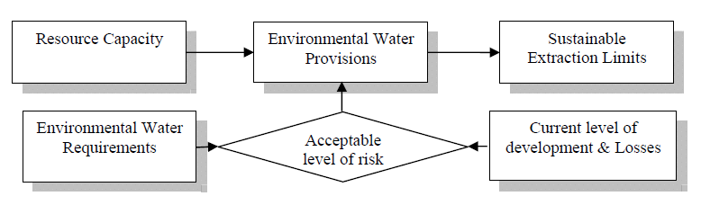
108
109
Macro water sharing plans the approach for unregulated rivers
 Macro water sharing plans the approach for unregulated rivers Access and trading rules for pools Leading policy and reform in sustainable water management Publisher NSW Office of Water Level 18, 227 Elizabeth
WILLOCHRA BASIN GROUNDWATER STATUS REPORT 2009-10
 WILLOCHRA BASIN GROUNDWATER STATUS REPORT 2009-10 SUMMARY 2009-10 The Willochra Basin is situated in the southern Flinders Ranges in the Mid-North of South Australia, approximately 50 km east of Port Augusta
New challenges of water resources management: Title the future role of CHy
 New challenges of water resources management: Title the future role of CHy by Bruce Stewart* Karl Hofius in his article in this issue of the Bulletin entitled Evolving role of WMO in hydrology and water
1 in 30 year 1 in 75 year 1 in 100 year 1 in 100 year plus climate change (+30%) 1 in 200 year
 1 in 200 year") Appendix C1 Surface Water Modelling 1 Overview 1.1 The Drain London modelling was designed to analyse the impact of heavy rainfall events across each London borough by assessing flow paths, velocities
Appendix C1 Surface Water Modelling 1 Overview 1.1 The Drain London modelling was designed to analyse the impact of heavy rainfall events across each London borough by assessing flow paths, velocities
A Conceptual Software System for Water Allocation, Planning and Catchment Management
 A Conceptual Software System for Water Allocation, Planning and Catchment Management R.M. Argent a, P.J.A. Gijsbers b, J-M. Perraud c and G.M. Podger c a Department of Civil and Environmental Engineering
Water Forever: South West Margaret River Forum
 Questions from the MRREC 1. How much water is currently being taken from each well/bore and region in the South West? This is a question for the water regulator the Department of Water. Please note information
Water Extraction Permitting Policy
 Water Extraction Policy 1 Water Extraction Permitting Policy Department of Environment, Labour & Justice January 2013 Water Extraction Policy 2 EXECUTIVE SUMMARY This document establishes a new policy
Estimating Potential Reduction Flood Benefits of Restored Wetlands
 Estimating Potential Reduction Flood Benefits of Restored Wetlands Kenneth W. Potter University of Wisconsin Introduction Throughout the summer of 1993 a recurring question was the impact of wetland drainage
Appendix C - Risk Assessment: Technical Details. Appendix C - Risk Assessment: Technical Details
 Appendix C - Risk Assessment: Technical Details Page C1 C1 Surface Water Modelling 1. Introduction 1.1 BACKGROUND URS Scott Wilson has constructed 13 TUFLOW hydraulic models across the London Boroughs
Government of South Australia OUR PLACE OUR FUTURE. State Natural Resources Management Plan South Australia 2012 2017. Leunig
 Government of South Australia OUR PLACE OUR FUTURE State Natural Resources Management Plan South Australia 2012 2017 Leunig ABORIGINAL ACKNOWLEDGEMENT The State NRM Plan acknowledges the important and
ADDING VALUE TO BOM FLOOD PREDICTIONS (WITHOUT MESSING AROUND WITH MODELS)
") ADDING VALUE TO BOM FLOOD PREDICTIONS (WITHOUT MESSING AROUND WITH MODELS) Mark Babister Steve Opper Peter Cinque Matthew Chadwick Belinda Davies Director, Webb McKeown & Associates Director, Emergency
ADDING VALUE TO BOM FLOOD PREDICTIONS (WITHOUT MESSING AROUND WITH MODELS) Mark Babister Steve Opper Peter Cinque Matthew Chadwick Belinda Davies Director, Webb McKeown & Associates Director, Emergency
Adoption of an Interim 602(a) Storage Guideline. Final Environmental Assessment
 Storage Guideline. Final Environmental Assessment") Adoption of an Interim 602(a) Storage Guideline Final Environmental Assessment U.S. Department of the Interior Bureau of Reclamation March 2004 The mission of the Department of the Interior is to protect
Adoption of an Interim 602(a) Storage Guideline Final Environmental Assessment U.S. Department of the Interior Bureau of Reclamation March 2004 The mission of the Department of the Interior is to protect
EU China River Basin Management Programme
 Ministry of Water Resources Ministry of Environmental Protection EU China River Basin Management Programme Technical Report 075 Water Resource Supply Security Strategy Analysis Ben Piper, Zhang Wang and
Objective 4: Enhanced community education, flood awareness and preparedness
 Objective 4: Enhanced community education, flood awareness and preparedness Understanding the extent and full impacts of flooding is essential for planning for potential future pressures on the drainage
Environment Agency 2014 All rights reserved. This document may be reproduced with prior permission of the Environment Agency.
 Flood and coastal erosion risk management Long-term investment scenarios (LTIS) 2014 We are the Environment Agency. We protect and improve the environment and make it a better place for people and wildlife.
Flood Risk Management
 Flood Risk Management Value of Flood Risk Management Every year floods sweep through communities across the United States taking lives, destroying property, shutting down businesses, harming the environment
Flood Risk Management
 Flood Risk Management Value of Flood Risk Management Value to Individuals and Communities Every year floods sweep through communities across the United States taking lives, destroying property, shutting
1.7.0 Floodplain Modification Criteria
 1.7.0 Floodplain Modification Criteria 1.7.1 Introduction These guidelines set out standards for evaluating and processing proposed modifications of the 100- year floodplain with the following objectives:
Integrated Restoration Prioritization
 Integrated Restoration Prioritization Habitat Restoration and Environmental Monitoring Projects Section Restoration Services Division Definition Restoration Prioritization is a process of combining various
Abaya-Chamo Lakes Physical and Water Resources Characteristics, including Scenarios and Impacts
 LARS 2007 Catchment and Lake Research Abaya-Chamo Lakes Physical and Water Resources Characteristics, including Scenarios and Impacts Seleshi Bekele Awulachew International Water Management Institute Introduction
THE NATURAL RESOURCES AND ENVIRONMENT ORDINANCE (CAP. 84 - LAWS OF SARAWAK, 1958 Ed.)
") THE NATURAL RESOURCES AND ENVIRONMENT ORDINANCE (CAP. 84 - LAWS OF SARAWAK, 1958 Ed.) THE NATURAL RESOURCES AND ENVIRONMENT (PRESCRIBED ACTIVITIES) ORDER, 1994 (Made under section 11A(1)) (Incorporating
THE NATURAL RESOURCES AND ENVIRONMENT ORDINANCE (CAP. 84 - LAWS OF SARAWAK, 1958 Ed.) THE NATURAL RESOURCES AND ENVIRONMENT (PRESCRIBED ACTIVITIES) ORDER, 1994 (Made under section 11A(1)) (Incorporating
11.4 Voluntary Purchase. 11.5 House Raising and Flood Proofing
 11.4 Voluntary Purchase As mentioned in Section 10 in certain high hazard areas of the floodplain, it may be impractical or uneconomic to mitigate flood hazard to existing properties at risk, or flood
LYNDE CREEK WATERSHED EXISTING CONDITIONS REPORT CHAPTER 12 - STORMWATER MANAGEMENT
 Whitby CLOCA Whitby CLOCA LYNDE CREEK WATERSHED EXISTING CONDITIONS REPORT CHAPTER 12 - STORMWATER MANAGEMENT June 2008 TABLE OF CONTENTS 1.0 INTRODUCTION... 3 2.0 STUDY AREA AND SCOPE... 4 3.0 METHODOLOGY...
Restoration Planning and Development of a Restoration Bank
 Restoration Planning and Development of a Restoration Bank Black Creek Pioneer Village, South Theatre 8:30 a.m. to 3:30 p.m. Habitat Restoration and Environmental Monitoring Projects Section Restoration
City of London Climate Change Adaptation Strategy Dealing with Extreme Rainfall Events
 City of London Climate Change Adaptation Strategy Dealing with Extreme Rainfall Events May 29, 2014 Presented by: Berta Krichker M.Eng., FEC, P.Eng. Manager of Stormwater Unit Environmental and Engineering
5.5 QUALITY ASSURANCE AND QUALITY CONTROL
 0 0 0. QUALITY ASSURANCE AND QUALITY CONTROL.. Introduction The IPCC Good Practice Guidance and Uncertainty Management (GPG000, IPCC, 000), Chapter, Quality Assurance and Quality Control, defines quality
06 - NATIONAL PLUVIAL FLOOD MAPPING FOR ALL IRELAND THE MODELLING APPROACH
 06 - NATIONAL PLUVIAL FLOOD MAPPING FOR ALL IRELAND THE MODELLING APPROACH Richard Kellagher 1, Mike Panzeri 1, Julien L Homme 1, Yannick Cesses 1, Ben Gouldby 1 John Martin 2, Oliver Nicholson 2, Mark
Payments for Ecosystem Services: towards improved biodiversity conservation and water security in South Africa, a semi-arid, developing country
 Payments for Ecosystem Services: towards improved biodiversity conservation and water security in South Africa, a semi-arid, developing country Jane Turpie & James Blignaut Introduction Ecosystems largely
Rural Flooding: The Potential Role of Forestry
 Rural Flooding: The Potential Role of Forestry Nadeem Shah, Tom Nisbet, & Huw Thomas Centre for Forestry and Climate Change Structure Background Woodland and Flood Alleviation The Theory. Studies on Woodland
Expert Panel Assessment. Snowy Precipitation Enhancement Trial (SPET) Executive Summary
 Executive Summary") Expert Panel Assessment Snowy Precipitation Enhancement Trial (SPET) Executive Summary In Summary Snowy Hydro Ltd proposes to undertake a six year cloud seeding trial in the Snowy Mountains region of New
Expert Panel Assessment Snowy Precipitation Enhancement Trial (SPET) Executive Summary In Summary Snowy Hydro Ltd proposes to undertake a six year cloud seeding trial in the Snowy Mountains region of New
Green Infrastructure Case Study Template
 Green Infrastructure Case Study Template The aim of the exercise is to provide information on how the elements of the Green Infrastructure Strategy are implemented at national level and to provide case
Recovery of full cost and pricing of water in the Water Framework Directive
 Abstract Recovery of full cost and pricing of water in the Water Framework Directive D. Assimacopoulos Professor, Department of Chemical Engineering, NTUA The Water Framework Directive (EC 2000/60) introduces
AZ EGER-PATAK HIDROLÓGIAI VIZSGÁLATA, A FELSZÍNI VÍZKÉSZLETEK VÁRHATÓ VÁLTOZÁSÁBÓL ADÓDÓ MÓDOSULÁSOK AZ ÉGHAJLATVÁLTOZÁS HATÁSÁRA
 AZ EGER-PATAK HIDROLÓGIAI VIZSGÁLATA, A FELSZÍNI VÍZKÉSZLETEK VÁRHATÓ VÁLTOZÁSÁBÓL ADÓDÓ MÓDOSULÁSOK AZ ÉGHAJLATVÁLTOZÁS HATÁSÁRA GÁBOR KEVE 1, GÉZA HAJNAL 2, KATALIN BENE 3, PÉTER TORMA 4 EXTRAPOLATING
Ramsar COP8 DOC. 20 Information paper English only
 "Wetlands: water, life, and culture" 8th Meeting of the Conference of the Contracting Parties to the Convention on Wetlands (Ramsar, Iran, 1971) Valencia, Spain, 18-26 November 2002 Ramsar COP8 DOC. 20
Optimizing Water Resources Allocation System and Improving Water Resources Supply Capacity
 Optimizing Water Resources Allocation System and Improving Water Resources Supply Capacity Zhang Shiwei Department of Planning and Programming Ministry of Water Resources, P.R.China May. 2015 Contents
CSO Modelling Considering Moving Storms and Tipping Bucket Gauge Failures M. Hochedlinger 1 *, W. Sprung 2,3, H. Kainz 3 and K.
 CSO Modelling Considering Moving Storms and Tipping Bucket Gauge Failures M. Hochedlinger 1 *, W. Sprung,, H. Kainz and K. König 1 Linz AG Wastewater, Wiener Straße 151, A-41 Linz, Austria Municipality
BLACK/HARMONY/FAREWELL CREEK WATERSHED EXISTING CONDITIONS REPORT CHAPTER 12 - STORMWATER MANAGEMENT
 Harmony Creek subwatershed Harmony Creek subwatershed BLACK/HARMONY/FAREWELL CREEK WATERSHED EXISTING CONDITIONS REPORT CHAPTER 12 - STORMWATER MANAGEMENT April 2011 TABLE OF CONTENTS 1.0 INTRODUCTION...
The River Ribble is one of the longest rivers in the North West of England
 River Ribble The River Ribble is one of the longest rivers in the North West of England Did you know? The tidal limit of the Ribble is 11 miles inland (above Preston); The River Ribble is home to a variety
HCP Team Meeting. November 18, 2015. icfi.com
 HCP Team Meeting November 18, 2015 icfi.com 1 Welcome and Introductions Where are we in the HCP process Hydrology modeling update Native fish survey Fish translocation Finalize covered activities Next
 Developing a Representative System of Marine Protected Areas in NSW 1 Developing a Representative System of Marine Protected Areas in NSW an Overview N O V E M B E R 2 0 0 1 New South Wales Developing
Purpose of the water security outlook
 Water Security Outlook December 2015 Purpose of the water security outlook The Water Security Outlook (WSO) is an annual update to Barwon Water s Water Supply Demand Strategy (WSDS), published in 2012.
Note on Draft Progress Report Template
 Note on Draft Progress Report Template The Draft Progress Report template is provided as a guide to applicants on possible reporting requirements for the Biodiversity Fund. This actual report will be provided
Initial Assessment of Potential Flood Mitigation for Communities Downstream of Googong Dam
 Initial Assessment of Potential Flood Mitigation for Communities Downstream of Googong Dam ICON WATER AND QUEANBEYAN CITY COUNCIL Summary Report 8006314 25 June 2015 Initial Asssessment of Potential Flood
IUCN Guidelines to Avoid Impacts of Water Resources Projects on Dams and Other Water Infrastructure
 IUCN Guidelines to Avoid Impacts of Water Resources Projects on Dams and Other Water Infrastructure (December 2013) IUCN does not engage in projects which involve the design, construction or rehabilitation
Impact of water harvesting dam on the Wadi s morphology using digital elevation model Study case: Wadi Al-kanger, Sudan
 Impact of water harvesting dam on the Wadi s morphology using digital elevation model Study case: Wadi Al-kanger, Sudan H. S. M. Hilmi 1, M.Y. Mohamed 2, E. S. Ganawa 3 1 Faculty of agriculture, Alzaiem
Management of flooding downstream of dams
 Management of flooding downstream of dams Attachment to Victoria State Flood Emergency Plan Version 1.0 (6 February 2013) This plan is produced by the Victoria State Emergency Service and Department of
Climate Change Adaptation Good Practice - Case Study. Climate Futures for Tasmania
 Climate Change Adaptation Good Practice - Case Study Climate Futures for Tasmania About Adaptation Good Practice Adapting to climate change is a relatively new concept to many. It is important to learn
COMPREHENSIVE PLAN SECTION B, ELEMENT 4 WATER RESOURCES. April 20, 2010 EXHIBIT 1
 COMPREHENSIVE PLAN SECTION B, ELEMENT 4 WATER RESOURCES April 20, 2010 EXHIBIT 1 ELEMENT 4 WATER RESOURCES TABLE OF CONTENTS 4.1 INTRODUCTION 4.2 GOALS AND POLICIES 4.2.A General Goals and Policies 1 4.2.B
River Wensum Restoration Strategy Swanton Morley Restoration Scheme Reach 14a
 River Wensum Restoration Strategy Swanton Morley Restoration Scheme Reach 14a At a glance River restoration benefits: Improved planform, channel cross-section, flow variation and sediment process. Improved
Origins and causes of river basin sediment degradation and available remediation and mitigation options. Feedback from the Riskbase workshop
 Origins and causes of river basin sediment degradation and available remediation and mitigation options Feedback from the Riskbase workshop Corinne Merly 1, Olivier Cerdan 1, Laurence Gourcy 1 Emmanuelle
A framework for integrated wetland inventory, assessment and monitoring
 "Wetlands: water, life, and culture" 8th Meeting of the Conference of the Contracting Parties to the Convention on Wetlands (Ramsar, Iran, 1971) Valencia, Spain, 18-26 November 2002 Background Ramsar COP8
Standardized Runoff Index (SRI)
") Standardized Runoff Index (SRI) Adolfo Mérida Abril Javier Gras Treviño Contents 1. About the SRI SRI in the world Methodology 2. Comments made in Athens on SRI factsheet 3. Last modifications of the factsheet
Standardized Runoff Index (SRI) Adolfo Mérida Abril Javier Gras Treviño Contents 1. About the SRI SRI in the world Methodology 2. Comments made in Athens on SRI factsheet 3. Last modifications of the factsheet
Aquatic Biomes, Continued
 Aquatic Biomes, Continued Introduction Extent of Marine biomes Issues & challenges Factors influencing distribution Dynamics in time & space Depth Tour of marine biomes Issues (by biome) Freshwater biomes
Australian Government Response to the Senate Committee on Finance and Public Administration
 Australian Government Response to the Senate Committee on Finance and Public Administration Australian Government Response to the Senate Committee on Finance and Public Administration Native Vegetation
1 Introduction. 1.1 Key objective. 1.2 Why the South Esk
 1 Introduction 1.1 Key objective The aim of this study is to identify and assess possible options for improving the quality of the river channel and habitats in the River South Esk catchment whilst helping
Havnepromenade 9, DK-9000 Aalborg, Denmark. Denmark. Sohngaardsholmsvej 57, DK-9000 Aalborg, Denmark
 Urban run-off volumes dependency on rainfall measurement method - Scaling properties of precipitation within a 2x2 km radar pixel L. Pedersen 1 *, N. E. Jensen 2, M. R. Rasmussen 3 and M. G. Nicolajsen
Chapter 9: Water, Hydrology and Drainage Land West of Uttoxeter
 Chapter 9: Water, Hydrology and Drainage Land West of Uttoxeter ENVIRONMENTAL STATEMENT: VOLUME 1 9.1 INTRODUCTION 9.1.1 This Chapter considers the effects of the Project on surface water and groundwater
2 ND SEPTEMBER 2014. Report of the Bi-Borough Executive Director for Transport and Technical Services
 London Borough of Hammersmith & Fulham COMMUNITY SAFETY, ENVIRONMENT & RESIDENTS SERVICES POLICY & ACCOUNTABILITY COMMITTEE 2 ND SEPTEMBER 2014 SURFACE WATER MANAGEMENT PLAN (SWMP) Report of the Bi-Borough
Applying MIKE SHE to define the influence of rewetting on floods in Flanders
 Applying MIKE SHE to define the influence of rewetting on floods in Flanders MARK HENRY RUBARENZYA 1, PATRICK WILLEMS 2, JEAN BERLAMONT 3, & JAN FEYEN 4 1,2,3 Hydraulics Laboratory, Department of Civil
4.2 Buena Vista Creek Watershed
 Buena Vista Creek Watershed 4.2 Buena Vista Creek Watershed Watershed Overview The Buena Vista Creek Watershed is the fourth-largest system within the Carlsbad Hydrologic Unit. The watershed extends approximately
CHAPTER 24: ENVIRONMENTAL MANAGEMENT
 Central Eyre Iron Project Environmental Impact Statement CHAPTER 24: ENVIRONMENTAL MANAGEMENT CHAPTER 24 ENVIRONMENTAL MANAGEMENT COPYRIGHT Copyright Iron Road Limited, 2015 All rights reserved This document
DISTRICT VALUES STATEMENTS, GOALS, ACTION ITEMS, AND ONGOING TASKS FOR 2015 Adopted by the Board of Directors December 10, 2014. Values Statements.
 DISTRICT VALUES STATEMENTS, GOALS, ACTION ITEMS, AND ONGOING TASKS FOR 2015 Adopted by the Board of Directors December 10, 2014 Values Statements. The Board opposes any new transfers of water from the
Australian water markets: trends and drivers 2007 08 to 2009 10
 Australian water markets: trends and drivers 2007 08 to 2009 10 National Water Commission Australian water markets: trends and drivers 2007 08 to 2009 10 1 Commonwealth of Australia 2011 This work is copyright.
WARNING: You cannot rely on a printed version of this document to be current. Always check the DECCW intranet to ensure you have the latest version.
 New South Wales Natural Resources Monitoring, Evaluation and Reporting Strategy 2010 2015 New South Wales Natural Resources Monitoring, Evaluation and Reporting Strategy 2010 2015 WARNING: You cannot
QUESTIONS AND ANSWERS WATERS OF THE U.S. PROPOSAL
 QUESTIONS AND ANSWERS WATERS OF THE U.S. PROPOSAL Key Background Congress enacted the modern Clean Water Act in 1972 to address pollution entering the nation s waters to complement statutes such as the
Integrated Local Flood Management and Drainage Strategy OVERVIEW
 Integrated Local Flood Management and Drainage Strategy OVERVIEW Flooding is a natural phenomenon. In urban areas where drainage relies on pipe networks, open channels and creeks, flooding can cause infrastructure
Melbourne Water s Submission. Draft Victorian Floodplain Management Strategy
 Melbourne Water s Submission Draft Victorian Floodplain Management Strategy Waterways, drainage and floodplains are essential to life and liveability. The rivers, creeks, estuaries, wetlands and floodplains
Belmont Forum Collaborative Research Action on Mountains as Sentinels of Change
 Belmont Forum Collaborative Research Action on Mountains as Sentinels of Change 1. Background and rationale Mountains exist in many regions of the world and are home to a significant fraction of the world
APPLICATION OF GEOSPATIAL TECHNOLOGIES FOR SUSTAINABLE ENVIRONMENTAL MANAGEMENT
 APPLICATION OF GEOSPATIAL TECHNOLOGIES FOR SUSTAINABLE NATURAL RESOURCES AND ENVIRONMENTAL MANAGEMENT IN MALAYSIA By James Dawos Mamit, Ph.D. Deputy Minister Ministry of Natural Resources and Environment,
4. Environmental Impacts Assessment and Remediation Targets
 4. Environmental Impacts Assessment and Remediation Targets 4.1 Environmental Impacts Significant additional development in the Alder Creek watershed is not anticipated at this time; however, there are
Risk and vulnerability assessment of the build environment in a dynamic changing society
 Risk and vulnerability assessment of the build environment in a dynamic changing society Limnei Nie SINTEF Building and infrastructure, P.O.Box 124 Blindern, NO-0314 Oslo, Norway. [email protected]
Report for 2003PA14B: Spruce Creek Watershed Keystone Project
 Report for 2003PA14B: Spruce Creek Watershed Keystone Project There are no reported publications resulting from this project. Report Follows Abstract: This proposal seeks support for a graduate assistant
WATER AND DEVELOPMENT Vol. II - Types Of Environmental Models - R. A. Letcher and A. J. Jakeman
 TYPES OF ENVIRONMENTAL MODELS R. A. Letcher and A. J. Jakeman Centre for Resource and Environmental Studies, The Australian National University, Australia Keywords: environmental models, environmental
Code of practice for wastewater overflow management
 Code of practice for wastewater overflow management For further information please contact: Information Officer Environment Protection Authority GPO Box 2607 Adelaide SA 5001 Telephone: (08) 8204 2004
Recommendations for future developments
 C Recommendations for future developments C.1 Reducing flood risk through site layout and design C.1.1 C.1.2 Flood risk should be considered at an early stage in deciding the layout and design of a site
How To Manage Water Resources
 NB: Unofficial translation; legally binding texts are those in Finnish and Swedish Ministry of the Environment, Finland Government Decree on Water Resources Management (1040/2006) Given in Helsinki on
Stream Rehabilitation Concepts, Guidelines and Examples. Objectives. Pierre Y. Julien. Three Laws of Stream Restoration
 Stream Rehabilitation Concepts, Guidelines and Examples Pierre Y. Julien Wuhan 2005 Objectives Part I - Stream restoration and rehabilitation: 1. Present and discuss important concepts, laws, criteria
Sustainability Brief: Water Quality and Watershed Integrity
 Sustainability Brief: and Watershed Integrity New Jersey depends on water resources for the health of our people, the strength of our economy, and the vitality of our ecosystems. The quality of our water
The Terms of reference (ToR) for conducting Rapid EIA study for the proposed project is described below:
 for conducting Rapid EIA study for the proposed project is described below:") Proposed Terms of Reference for EIA Study Objective: In order to identify the environmental impacts due to construction and operation of the proposed project and associated facilities, a study will be
Proposed Terms of Reference for EIA Study Objective: In order to identify the environmental impacts due to construction and operation of the proposed project and associated facilities, a study will be
Climate Change and Sri Lanka. Ajith Silva Director/ Policy and Planning Ministry of Environment and Natural Resources Sri Lanka
 Climate Change and Sri Lanka Ajith Silva Director/ Policy and Planning Ministry of Environment and Natural Resources Sri Lanka Asia Total Area: 65610 Km Land Area : 62705 Km Inland water : 2905 Km 2 Coastal
SECTION 3.2 CLIMATE AND PRECIPITATION
 SECTION 3.2 CLIMATE AND PRECIPITATION Ulster County Climate Data A preliminary analysis of the Preserve s weather data shows that the average temperature has risen about two degrees over the past 114 years.
How To Improve The Health Of The Zambezi River
 Environmental Flows and Restoration of the Zambezi Delta, Mozambique Dr. Richard Beilfuss International Crane Foundation Zambeze Delta 18 000 km² 230 km coastal frontage 124 km apex to coast Hydropower
Introduction to protection goals, ecosystem services and roles of risk management and risk assessment. Lorraine Maltby
 Introduction to protection goals, ecosystem services and roles of risk management and risk assessment. Lorraine Maltby Problem formulation Risk assessment Risk management Robust and efficient environmental
Monitoring at Credit Valley Conservation. Presented by Jackie Thomas and Luke Harvey
 Monitoring at Credit Valley Conservation Presented by Jackie Thomas and Luke Harvey Where are we? WHAT IS MONITORING? Long-term sampling of the same point or reach to track changes over time/space Short
Accounting for Nature
 Accounting for Nature Fenner Conference on the Environment Environmental Decision Making 10 12 March, 2009 The Shine Dome, Canberra Peter Cosier Wentworth Group of Concerned Scientists When speaking about
Measurement of Banks Exposure to Interest Rate Risk and Principles for the Management of Interest Rate Risk respectively.
 INTEREST RATE RISK IN THE BANKING BOOK Over the past decade the Basel Committee on Banking Supervision (the Basel Committee) has released a number of consultative documents discussing the management and
3. The submittal shall include a proposed scope of work to confirm the provided project description;
 QIN Shoreline Master Program Project Summary The Shoreline Master Program (SMP) development process for the Quinault Indian Nation (QIN) includes the completion of inventory and analysis report with corresponding
4 Water supply description
 4 Water supply description A description of the drinking-water system is equally applicable to large utilities with piped distribution systems, piped and non-piped community supplies, including handpumps
1. Purpose and scope. 2. SEPA's role in hydropower and planning
 Page no: 1 of 10 1. Purpose and scope 1.1 The purpose of this note is to provide guidance on the approach that we will take when dealing with hydropower development management consultations. We welcome