CONNECTING THE DOTS REGIONAL GREEN INFRASTRUCTURE NETWORK RESOURCE GUIDE
|
|
|
- Valentine Cain
- 9 years ago
- Views:
Transcription
1 5.3 Attachment REGIONAL GREEN INFRASTRUCTURE NETWORK RESOURCE GUIDE

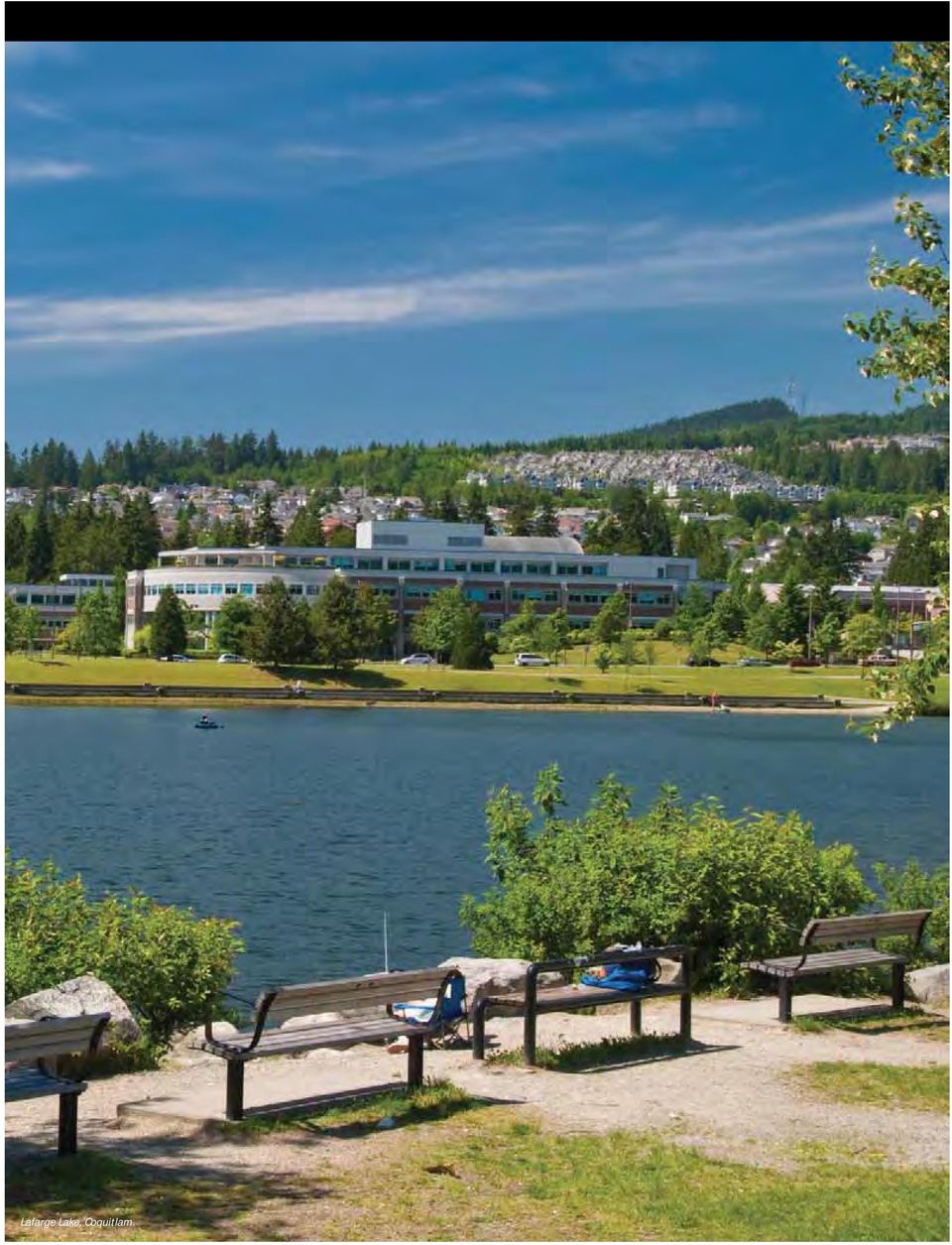
2 Lafarge Lake, Coquitlam.
3 Table of Contents Introduction: A regional green infrastructure network... 5 A primer on green infrastructure... 6 What is green infrastructure?... 6 What is a green infrastructure network?... 9 How do we benefit from green infrastructure?...10 Can we afford to build a green infrastructure network? Moving towards a regional green infrastructure network...14 Developing our regional green infrastructure network...16 The regional green infrastructure network today Essential concepts of connectivity...18 Exploring regional opportunities for green infrastructure Green infrastructure on the ground: case studies...22 Appendix Types of green infrastructure Acknowledgements Content provided by: s DIAMOND HEAD CONSULTING LTD s ECOPLAN INTERNATIONAL s CALYPSO DESIGN 3

4

5 Introduction: A regional green infrastructure network 7KH RFHDQ PRXQWDLQV IRUHVWV DQG ULYHUV RI 0HWUR 9DQFRXYHU SURYLGH D VSHFWDFXODU QDWXUDO VHWWLQJ IRU WKH UHJLRQpV QHLJKERXUKRRGV XUEDQ FHQWUHV SDUNV DJULFXOWXUDO DQG LQGXVWULDO ODQGV &ROOHFWLYHO\ WKLV HQYLURQPHQW VXSSRUWV RYHU PLOOLRQ UHVLGHQWV LQ DGGLWLRQ WR WKH GLYHUVLW\ RI SODQWV DQG DQLPDOV WKDW FDOO LW KRPH 7KH UHJLRQpV SURVSHULW\ LV WLHG WR RXU QDWXUDO HQYLURQPHQW 7KH GLYHUVH ODQGVFDSH DQG SOHQWLIXO QDWXUDO UHVRXUFHV VXSSRUWHG )LUVW 1DWLRQV IRU WKRXVDQGV RI \HDUV DQG ODWHU DWWUDFWHG QHZ LPPLJUDQWV IURP HDVWHUQ &DQDGD (XURSH DQG DURXQG WKH ZRUOG 3RSXODWLRQ JURZWK DQG KXPDQ GHYHORSPHQW KDV UHVXOWHG LQ VLJQLî FDQW FKDQJHV WR WKH ODQGVFDSH GLPLQLVKLQJ WKH KHDOWK DQG DEXQGDQFH RI PDQ\ QDWXUDO IHDWXUHV +RZHYHU LQ UHFHQW \HDUV RXU DSSUHFLDWLRQ RI WKH YDOXH RI QDWXUH DQG WKH PDQ\ VHUYLFHV LW SURYLGHV KDV JURZQ DQG LV UHï HFWHG LQ RXU UHJLRQDO DQG PXQLFLSDO SODQV DQG SROLFLHV DV ZHOO DV WKH PDQDJHPHQW RI RXU SURSHUWLHV IDFLOLWLHV DQG JUHHQVSDFHV 7KH &RQQHFWLQJ WKH 'RWV 5HVRXUFH *XLGH VXSSRUWV WKH GHYHORSLQJ 5HJLRQDO *UHHQ,QIUDVWUXFWXUH 1HWZRUN 6WUDWHJ\ RI 0HWUR 9DQFRXYHU 7KLV GRFXPHQW GHVFULEHV GLIIHUHQW IRUPV RI JUHHQ LQIUDVWUXFWXUH DQG KRZ LW SURYLGHV LQWHJUDWHG EHQHî WV DFURVV WKH UHJLRQDO ODQGVFDSH,W VXSSRUWV WKH GHYHORSPHQW RI D UHJLRQDO JUHHQ LQIUDVWUXFWXUH QHWZRUN WKDW ZLOO LQFUHDVH WKH UHVLOLHQF\ RI RXU QDWXUDO V\VWHPV DQG SURYLGH HFRORJLFDO HQYLURQPHQWDO DQG VRFLR HFRQRPLF EHQHî WV WR RXU FRPPXQLWLHV DEFINITION Green infrastructure is the natural vegetation, soils, water and bioengineered solutions that collectively provide society with a EURDG DUUD\ RI SURGXFWV DQG VHUYLFHV IRU KHDOWK\ OLYLQJ 1DWXUDO DUHDV VXFK DV IRUHVWV ZHWODQGV DQG ï RRGSODLQV DQG HQJLQHHUHG systems like bioswales and rain gardens conserve natural resources DQG PLWLJDWH QHJDWLYH HQYLURQPHQWDO HIIHFWV EHQHî WLQJ ERWK SHR SOH DQG ZLOGOLIH :KHQ JUHHQ LQIUDVWUXFWXUH LV FRQQHFWHG DV SDUW RI D ODUJHU IUDPHZRUN D JUHHQ LQIUDVWUXFWXUH QHWZRUN LV FUHDWHG Environmental change, whether human-caused or natural, has the SRWHQWLDO WR VLJQLî FDQWO\ DIIHFW WKH OLYDELOLW\ RI RXU UHJLRQ LQ WKH IXWXUH 0HWUR 9DQFRXYHU LV H[SHFWLQJ ZDUPHU GULHU VXPPHUV DQG PLOGHU ZHWWHU ZLQWHUV DV D UHVXOW RI FOLPDWH FKDQJH,PSDFWV H[SHFWHG WR DIIHFW WKH UHJLRQ LQFOXGH ULVLQJ VHD OHYHOV VSULQJ ï RRGLQJ VXPPHU drought, air quality degradation, impacts to ground water and more IUHTXHQW DQG VHYHUH ZHDWKHU HYHQWV (FRV\VWHP FKDQJHV PD\ DOVR happen more quickly than most native plants and animals can adapt, ZKLOH DGDSWDEOH LQYDVLYH VSHFLHV PD\ ï RXULVK 7KHVH SRWHQWLDO LPSDFWV FRXOG KDYH VHULRXV UHSHUFXVVLRQV IRU KXPDQ KHDOWK FRPPXQLWLHV LQIUDVWUXFWXUH HFRV\VWHPV DQG OLIHVW\OHV 5

6 Naturalized path at UniverCity at Simon Fraser University, Burnaby, BC. A primer on green infrastructure *UHHQ LQIUDVWUXFWXUH LV D UHODWLYHO\ QHZ WHUP DQG WKHUH LV VRPH YDULDELOLW\ LQ KRZ LW LV XVHG 7KLV VHFWLRQ GHVFULEHV VRPH RI WKH EDVLF FRQFHSWV RI JUHHQ LQIUDVWUXFWXUH DQG LWV SRWHQWLDO DSSOLFDWLRQV LQ 0HWUR 9DQFRXYHU DQG PHPEHU PXQLFLSDOLWLHV What is green infrasstructure? *UHHQ LQIUDVWUXFWXUH LV D EURDG WHUP WKDW GHVFULEHV WKH LQWHJUDWLRQ RI QDWXUDO DQG VHPL QDWXUDO FRPSRQHQWV LQ ODQG XVH SODQQLQJ HQJLQHHULQJ DQG urban GHVLJQ 7KHVH FRPSRQHQWV YDU\ LQ VL]H DQG VFRSH EXW ZRUN FROOHFWLYHO\ WR LPSURYH WKH FRQGLWLRQ RI RXU XUEDQ HQYLURQPHQW DQG VXSSRUW KHDOWKLHU PRUH OLYDEOH DQG VXVWDLQDEOH FRPPXQLWLHV *UHHQ LQIUDVWUXFWXUH JHQHUDOO\ VKDUHV WKH IROORZLQJ FKDUDFWHULVWLFV s s s 6 MULTI-FUNCTIONAL. *UHHQ LQIUDVWUXFWXUH SURYLGHV D YDULHW\ RI EHQHîWV DQG qiuhhr HFRV\VWHP VHUYLFHV WR SHRSOH DQG ZLOGOLIH ADAPTIVE. *UHHQ LQIUDVWUXFWXUH KDV PDQ\ IRUPV ERWK QDWXUDO DQG FRQVWUXFWHG DQG can be LPSOHPHQWHG DW GLIIHUHQW VFDOHV DQG VXUIDFHV KDUGVFDSH WR VRIWVFDSH SUSTAINABLE. *UHHQ LQIUDVWUXFWXUH VXSSRUWV broad-based community sustainability goals, including social well-being, community health, and ecological and environmental VXVWDLQDELOLW\,W FDQ DOVR SURYLGH HFRQRPLF EHQHîWV E\ UHGXFLQJ FDSLWDO PDLQWHQDQFH DQG UHSODFHPHQW FRVWV RI VRPH FRQYHQWLRQDO JUH\ LQIUDVWUXFWXUH GREEN INFRASTRUCTURE Natural Grasslands Riparian areas Forests Fields Wetlands INTERCONNECTED NATURAL SYSTEMS AND ECOLOGICAL PROCESSES Human-made Street trees Rain gardens Green roofs Porous pavement Bioswales Clean water, clean air, wildlife habitat and higher quality of life

7 DEFINITION Ecosystem Services 7KH DVSHFWV RI HFRV\VWHPV XVHG DFWLYHO\ RU SDVVLYHO\ WR FRQWULEXWH WR KXPDQ ZHOOEHLQJ 7KH\ LQFOXGH WKH SURYLVLRQ RI FOHDQ ZDWHU DQG DLU SROOLQDWLRQ RI FURSV PLWLJDWLRQ RI HQYLURQPHQWDO KD]DUGV H J IORRGLQJ SHVW DQG GLVHDVH FRQWURO DQG FDUERQ VHTXHVWUDWLRQ *UHHQ LQIUDVWUXFWXUH FDQ EH LPSOHPHQWHG DFURVV D UDQJH RI ODQGVFDSHV IURP XUEDQ FHQWUHV WR UXUDO DQG DJULFXOWXUDO DUHDV 2QH RI WKH GLVWLQFWLRQV WKDW VHSDUDWH WKHVH ODQGVFDSHV LV WKH DPRXQW RI KDUG RU LPSHUPHDEOH VXUIDFHV RU KDUGVFDSH *HQHUDOO\ WKH PRUH GHYHORSHG D ODQGVFDSH LV WKH PRUH KDUGVFDSH H[LVWV *UHHQ LQIUDVWUXFWXUH FDQ VRPHWLPHV UHSODFH KDUGVFDSH ZLWK PRUH SHUPHDEOH VXUIDFHV FUHDWH additional greenspace, and demonstrate greater value in conserving QDWXUDO DUHDV 7KH DPRXQW DQG W\SH RI KDUGVFDSH WKDW H[LVWV FDQ LQï XHQFH WKH NLQG RI JUHHQ LQIUDVWUXFWXUH WKDW FDQ EH LPSOHPHQWHG *UHHQ LQIUDVWUXFWXUH SURMHFWV FDQ UDQJH LQ VL]H IURP VPDOO VWUHHW RU ORW OHYHO LQWHUYHQWLRQV WR D QHLJKERXUKRRG ZLGH VFDOH 'HWHUPLQ LQJ ZKLFK W\SH RI JUHHQ LQIUDVWUXFWXUH LV DSSURSULDWH GHSHQGV RQ D SURMHFWpV REMHFWLYHV RSSRUWXQLWLHV DQG FRQVWUDLQWV H J FRVW ODQG XVH UHJXODWLRQV 5HIHU WR $SSHQGL[ $ IRU D PRUH GHWDLOHG GHVFULSWLRQ RI WKH W\SHV RI JUHHQ LQIUDVWUXFWXUH ZŽŽŌ ŽƉ ŚĞƌď ŐĂƌĚĞŶ Natural Open Spaces Greenways Urban Tree Canopy Green Streets Stormwater Detention Daylighted Streams LARGE SCALE Hedgerows Permeable Paving Wildlife Overpasses Green Roofs Pollinator Gardens Bioswales MEDIUM SCALE Natural Community Landscaping Gardens SMALL SCALE HARDSCAPE SOFTSCAPE 'ƌğğŷ ŝŷĩƌăɛƚƌƶđƚƶƌğ ŽƉƉŽƌƚƵŶŝƟ ĞƐ ĂĐƌŽƐƐ ƚśğ ƵƌďĂŶ ůăŷěɛđăɖğ 7

8 Riparian setback LARGE SCALE Greenways Large forested park MEDIUM SCALE Agricultural hedgerow Permeable paving Green street Detention pond Community gardens SMALL SCALE Green roofs Bioswale REGIONAL GREEN INFRASTRUCTURE NETWORK ŽŵƉŽŶĞŶƚƐ ŽĨ ŐƌĞĞŶ ŝŷĩăɛƚƌƶđƚƶƌğ ůŝŷŭ ƚžőğƚśğƌ ƚž ĨŽƌŵ Ă ĨƵŶĐƟŽŶĂů ŶĞƚǁŽƌŬ 8 Backyard gardens Small urban park

9 What is a green infrrastructure e network k? :KHQ GLIIHUHQW JUHHQ LQIUDVWUXFWXUH FRPSRQHQWV DUH FRQQHFWHG WKH UHVXOWLQJ IUDPHZRUN LV UHIHUUHG WR DV D green infrastructure network. $ JUHHQ LQIUDVWUXFWXUH QHWZRUN LV W\SLFDOO\ FRPSRVHG RI FRUH JUHHQVSDFHV FDOOHG KXEV DQG FRUULGRUV WKDW OLQN WKHP WRJHWKHU Hubs IRUP WKH KHDUW RI WKH QHWZRUN DQG SURYLGH VLJQLîFDQW EHQHîWV DQG HFRV\VWHP VHUYLFHV IRU SHRSOH )RU H[DPSOH ZDWHUVKHGV DUH SURWHFWHG WR HQVXUH ZDWHU TXDOLW\ DJULFXOWXUDO ODQG VXSSOLHV IRRG IRUHVW VWDQGV LPSURYH DLU TXDOLW\ îowhu ZDWHU DQG VWRUH FDUERQ DQG ODUJH qqdwxudor SDUNV SURYLGH UHFUHDWLRQDO DPHQLWLHV DQG KHDOWK EHQHîWV 7KHVH DUHDV DOVR SURYLGH KDELWDW IRU D ZLGH YDULHW\ RI SODQWV DQG DQLPDOV Corridors tie the network together and make it bigger than the sum RI LWV LQGLYLGXDO SDUWV,PSURYHG FRQQHFWLYLW\ DPRQJ KXEV VXSSRUWV PRYHPHQW RI SHRSOH H J JUHHQZD\V SODQWV DQG ZLOGOLIH H J ULSDULDQ FRUULGRUV 7KH Matrix UHIHUV WR WKH ODQGVFDSH RXWVLGH RI WKH KXEV DQG FRUULGRUV,W LQFOXGHV D PXOWLWXGH RI VPDOOHU QDWXUDO IHDWXUHV WKDW DUH QRW FRQQHFWHG WR RQH DQRWKHU EXW WRJHWKHU SURYLGH LPSRUWDQW EHQHîWV &RQVHUYDWLRQ UHVWRUDWLRQ DQG LQIUDVWUXFWXUH LQWHUYHQWLRQV LQ WKH PDWUL[ VXSSRUW HFRV\VWHP IXQFWLRQV VXFK DV VWRUPZDWHU LQîOWUDWLRQ SROOLQDWRU PRELOLW\ DQG VHHG GLVSHUVDO IRU SODQWV 7KH\ FDQ DOVR DFW WR EXIIHU DQG RU FRPSOHPHQW DGMDFHQW HFRV\VWHPV RU IHDWXUHV LQ D JUHHQ LQIUDVWUXFWXUH QHWZRUN 2SSRUWXQLWLHV WR SUHVHUYH DQG HQKDQFH QDWXUDO FRUULGRUV LQ OHVV XUEDQL]HG HQYLURQPHQWV DUH RIWHQ VXSSRUWHG E\ WKH DYDLODELOLW\ RI RSHQ VSDFH DQG LQ VRPH LQVWDQFHV IHZHU GHYHORSPHQW SUHVVXUHV 0DQ\ UHJXODWRU\ SURWHFWLRQV DOVR H[LVW WR SUHVHUYH VHQVLWLYH DUHDV LQFOXGLQJ ULSDULDQ FRUULGRUV YHJHWDWHG DUHDV WKDW EXIIHU ZDWHUFRXUVHV But what happens in dense, urban environments that are largely built RYHU DQG DUH RIWHQ VXEMHFW WR VLJQLîFDQW GHYHORSPHQW SUHVVXUH",Q WKHVH DUHDV JUHHQ LQIUDVWUXFWXUH FDQ EH SLHFHG WRJHWKHU DW WKH VLWH OHYHO WR IRUP OLQNDJHV 5H GHYHORSPHQW UHWURîWWLQJ DQG PXQLFLSDO LQFHQWLYHV SURYLGH RSSRUWXQLWLHV WR LPSURYH FRQQHFWLYLW\ PIECING GREEN INFRASTRUCTURE TOGETHER 7KH &LW\ RI :LOVRQYLOOH VRXWK RI 3RUWODQG 2UHJRQ KDV LPSOHPHQWHG D YDULHW\ RI QDWXUDO UHVRXUFH SURWHFWLRQ SROLFLHV WR HQFRXUDJH GHYHORSPHQW RI JUHHQ LQIUDVWUXFWXUH 6WRUPZDWHU PDQDJHPHQW REMHFWLYHV LQFOXGH SURWHFWLQJ QDWXUDO ZDWHUFRXUVHV restoring and daylighting streams; encouraging developers to use open drainage V\VWHPV LPSOHPHQWLQJ /RZ,PSDFW 'HYHORSPHQW /,' VWUDWHJLHV DQG SURWHFWLQJ H[LVWLQJ YHJHWDWLRQ 'HYHORSPHQW FKDUJHV DQG VWRUPZDWHU XVHU IHHV SD\ IRU WKHVH FDSLWDO LQYHVWPHQWV DAYLIGHTING URBAN STREAMS AND STORMWATER MANAGEMENT $FFODLPHG E\ )LVKHULHV DQG 2FHDQV &DQDGD ')2 DV WKH ODUJHVW FUHHN SURMHFW RI LWV NLQG LQ %& WKH GD\OLJKWLQJ RI 7KDLQ &UHHN LQ 1RUWK 9DQFRXYHU LQ LQYROYHG WKH UHPRYDO DQG UHSODFHPHQW RI D PHWUH ORQJ FXOYHUW ZLWK D îvk IULHQGO\ RSHQ FKDQQHO DQG HQDEOHG WKH UHVWRUDWLRQ RI D VHFWLRQ RI WKH FUHHN WR QHDU QDWXUDO FRQGLWLRQV 7KH SURMHFW ZKLFK FRVW PLOOLRQ DQG ZRQ D &RQVXOWLQJ (QJLQHHUV RI %& $ZDUG RI 0HULW KDV FUHDWHG DQ DWWUDFWLYH FUHHN FRUULGRU DQG FRQWULEXWHG WR WKH SUHVHUYDWLRQ RI HQGDQJHUHG VDOPRQ VWRFNV DOO ZKLOH RIIHULQJ LPSURYHG ïrrg SURWHFWLRQ LQ WKH DUHD 9

10 How do we benefit from gree en infrastrructure? *UHHQ LQIUDVWUXFWXUH LQ ERWK LWV QDWXUDO IRUP H J IRUHVWV ULSDULDQ DUHDV ZHWODQGV HWF DQG LWV KXPDQ PDGH IRUP H J ELRVZDOHV VWUHHW WUHHV JUHHQ URRIV HWF SURYLGHV qiuhhr HFRV\VWHP VHUYLFHV WKDW VXSSRUW VXVWDLQDEOH GHYHORSPHQW DQG OLYDEOH FRPPXQLWLHV (FRV\VWHP VHU YLFHV WKDW EHQHî W WKH UHJLRQ LQFOXGH FOHDQ DLU DQG ZDWHU SROOLQDWLRQ RI FURSV DQG FDUERQ VHTXHVWUDWLRQ %\ LQYHVWLQJ LQ JUHHQ LQIUDVWUXFWXUH ZH ZLOO FRQWLQXH WR UHFHLYH WKH HQYLURQPHQWDO HFRQRPLF DQG VRFLDO EHQHî WV QDWXUH SURYLGHV SOCIAL YDOXLQJ WKH EHQHî WV IURP QDWXUH 3DFLî F 3DUNODQGV )RXQGDWLRQ DQG WKH 'DYLG 6X]XNL )RXQGDWLRQ %XLOGLQJ FRQQHFWLYLW\ DFURVV WKH UHJLRQ VXSSRUWV DQG N M EN TA L HQKDQFHV WKLV QDWXUDO FDSLWDO ĞŶĞĮ ƚɛ ŽĨ 'ƌğğŷ /ŶĨĂƐƚƌƵĐƚƵƌĞ 10 EC O MI O $ O LQ %&pv /RZHU 0DLQODQG LV ELOOLRQ 1DWXUDO &DSLWDO LQ %&pv /RZHU 0DLQODQG IR YDOXH RI WKH VHUYLFHV SURYLGHG E\ WKH IRUHVWV ZHWODQGV JUDVVODQGV DQG FURSODQGV ENV $ UHSRUW HVWLPDWHG WKDW D FRQVHUYDWLYH HVWLPDWH RI WKH DQQXDO HFRQRPLF C THE ECONOMIC VALUE OF NATURE N
RXQGDWLRQ DQG WKH 'DYLG 6X]XNL")
11 QUALITY OF LIFE. *UHHQVSDFHV LPSURYH OLYDELOLW\ HQKDQFH ORFDO FKDUDFWHU DQG SURYLGH DFFHVV WR QDWXUH HUMAN HEALTH.,QWHUDFWLRQ ZLWK QDWXUH LV HVVHQWLDO WR KXPDQ KHDOWK $ ODUJH DQG JURZLQJ ERG\ RI UHVHDUFK LQ &DQDGD DQG abroad clearly demonstrates that physical, social and psychological ZHOO EHLQJ DUH SRVLWLYHO\ LQïXHQFHG E\ RXU YLHZV RI DQG DFFHVV WR QDWXUH RECREATION. &RQQHFWHG DQG H[SDQGHG JUHHQ QHWZRUNV LQFUHDVH ERWK SDVVLYH H J ZDONLQJ ELUG ZDWFKLQJ DQG DFWLYH H J MRJJLQJ F\FOLQJ UHFUHDWLRQ RSSRUWXQLWLHV FOOD PRODUCTION. *UHHQ LQIUDVWUXFWXUH VXSSRUWV D GLYHUVLW\ RI LQVHFWV SODQWV DQLPDOV DQG RWKHU RUJDQLVPV PDQ\ RI ZKLFK DUH EHQHîFLDO WR ORFDO IRRG SURGXFWLRQ &RPPXQLW\ DQG EDFN\DUG JDUGHQV FRQWULEXWH WR OLYDELOLW\ DQG SURYLGH DQ DIIRUGDEOH ORFDO IRRG VRXUFH ENVIRONMENTAL EDUCATION. Urban greenspace creates more RSSRUWXQLWLHV IRU SHRSOH WR H[SHULHQFH HQJDJH ZLWK DQG OHDUQ DERXW QDWXUH DQG HFRV\VWHP VHUYLFHV FINANCIAL. *UHHQHU HQYLURQPHQWV FDQ DWWUDFW EXVLQHVVHV DQG HPSOR\HHV DQG SURYLGH MREV LQ WRXULVP DJULFXOWXUH DQG RWKHU VHFWRUV *UHHQ LQIUDVWUXFWXUH FDQ DOVR PLQLPL]H FDSLWDO requirements and reduce long-term maintenance and replacement FRVWV DVVRFLDWHG ZLWK WUDGLWLRQDO LQIUDVWUXFWXUH STORMWATER MANAGEMENT. *UHHQ LQIUDVWUXFWXUH FDQ PLPLF DQG UHSODFH FRQYHQWLRQDO JUH\ LQIUDVWUXFWXUH VXFK DV VWRUPZDWHU pipes and tanks resulting in reduced capital and maintenance FRVWV 7UHHV DQG YHJHWDWLRQ GHFUHDVH WKH DPRXQW RI KDUG VXUIDFHV DQG LQFUHDVH UDLQZDWHU LQWHUFHSWLRQ DQG LQîOWUDWLRQ UHGXFLQJ WKH ULVN RI VWRUP VHZDJH RYHUïRZV DQG ïrrglqj GREEN CORRIDORS AND THE NECTAR TRAIL PROJECT 7KH 1HFWDU 7UDLO LV D QHZ 9DQFRXYHU EDVHG FRPPXQLW\ LQLWLDWLYH WKDW ZLOO FRQQHFW H[LVWLQJ SROOLQDWRU IULHQGO\ KDELWDWV LQ WKH XUEDQ HQYLURQPHQW E\ EXLOGLQJ FRUULGRUV RI QDWLYH ïrzhu JDUGHQV EHWZHHQ WKHP 7KLV SURJUDP LV RUJDQL]HG DQG PDLQWDLQHG E\ WKH (QYLURQPHQWDO <RXWK $OOLDQFH WKH &LW\ RI 9DQFRXYHU WKH 9DQFRXYHU 3DUN %RDUG DQG ORFDO UHVLGHQWV 7KHVH JUHHQZD\V will encourage pollinator travel, which in turn supports nature and local IRRG SURGXFWLRQ ZKLOH RIIHULQJ RSSRUWXQLWLHV IRU HQYLURQPHQWDO HGXFDWLRQ DQG LPSURYHG OLYDELOLW\ LQ WKH VXUURXQGLQJ FRPPXQLW\ 7KH îuvw 1HFWDU 7UDLO SURMHFW ZLOO OLQN 4XHHQ (OL]DEHWK 3DUN WR WKH 9DQ 'XVHQ *DUGHQV DORQJ WKH 5LGJHZD\ *UHHQZD\ ENERGY EFFICIENCY. 7UHHV DQG YHJHWDWLRQ VKDGH DQG FRRO EXLOGLQJV LQ WKH VXPPHU DQG KHOS LQVXODWH EXLOGLQJV LQ WKH ZLQWHU AIR QUALITY. 7UHHV KHOS FRRO WKH DWPRVSKHUH UHGXFLQJ WKH SURGXFWLRQ RI KDUPIXO SROOXWDQWV 7UHHV DQG YHJHWDWLRQ DOVR DEVRUE DQG VWRUH FDUERQ GLR[LGH DQG UHOHDVH R[\JHQ LQWR WKH DWPRVSKHUH WATER QUALITY. 9HJHWDWLRQ DQG KHDOWK\ VRLOV FOHDQ XUEDQ UXQRII and allow water to be absorbed into the ground, recharging VWUHDPV DQG JURXQGZDWHU HAZARD REDUCTION. 9HJHWDWHG ODQGVFDSHV DEVRUE ZDWHU DQG VWDELOL]H VORSHV KHOSLQJ WR SURWHFW WKH EXLOW HQYLURQPHQW DJDLQVW KD]DUGV OLNH ïrrglqj DQG ODQGVOLGHV BIODIVERSITY. 5HVWRUHG QDWXUDO YHJHWDWLRQ VWUHDPV ODNHV DQG ZHWODQGV SURYLGH KDELWDW LQFOXGLQJ IRRG DQG VKHOWHU IRU D GLYHUVLW\ RI VSHFLHV 1DWXUDO FRUULGRUV DOORZ SODQWV DQG DQLPDOV WR PRYH EHWZHHQ ODUJHU KDELWDW DUHDV RYHUFRPLQJ WKH HIIHFWV RI KDELWDW IUDJPHQWDWLRQ DQG KHOSLQJ WR GLYHUVLI\ WKH JHQH SRRO THE GREEN EFFECT 9LHZV RI QDWXUH H J WUHHV DQG JUHHQHU\ IURP RIîFHV DQG VFKRROV UHGXFH VWUHVV LQFUHDVH SURGXFWLYLW\ DQG VXSSRUW KLJKHU UHVXOWV LQ FRJQLWLYH WHVWV 6HQLRUV WHQG WR OLYH ORQJHU ZKHQ OLYLQJ QH[W WR DQG UHFUHDWLQJ LQ JUHHQVSDFH ZKLOH QHJDWLYH VRFLDO EHKDYLRXU H J LOOHJDO DFWLYLW\ DJJUHVVLRQ OLWWHULQJ LV ORZHU LQ XUEDQ DUHDV ZLWK PRUH WUHHV DQG JUHHQVSDFH 11

12 Can we afford to bu uild a Gree en Infrastrructure Network k? 7KH FRVWV DVVRFLDWHG ZLWK EXLOGLQJ WKH 5HJLRQDO *UHHQ,QIDVWUXFWXUH 1HWZRUN ODUJHO\ VWHP IURP VHFXULQJ ODQG WKURXJK SXUFKDVLQJ RU FRYHQDQWV DQG UHVWRULQJ VLWHV LQ PRUH PRGLîHG HQYLURQPHQWV 7KHVH FRVWV FDQ EH VLJQLîFDQW HVSHFLDOO\ ZLWK WKH KLJK ODQG SULFHV LQ 0HWUR 9DQFRXYHU DIRECT COST SAVINGS: %XLOGLQJ DQG PDLQWHQDQFH FRVWV IRU JUHHQ LQIUDVWUXFWXUH FDQ EH OHVV WKDQ FRQYHQWLRQDO JUH\ LQIUDVWUXFWXUH 0XQLFLSDOLWLHV DQG GHYHORSHUV FDQ DOVR VDYH PRQH\ WKURXJK UHGXFHG FDSLWDO DQG ODQG DFTXLVLWLRQ FRVWV )RU H[DPSOH JUHHQ LQIUDVWUXFWXUH LV RIWHQ GHVLJQHG WR PDQDJH VWRUPZDWHU UXQRII DW LWV VRXUFH DQG LV RIWHQ LQWHJUDWHG LQWR H[LVWLQJ ODQGVFDSLQJ RU EXLOGLQJV 7UDGLWLRQDO JUH\ LQIUDVWUXFWXUH UHTXLUHV D PXFK ODUJHU IRRWSULQW WR FROOHFW GLUHFW VWRUH DQG SRWHQWLDOO\ WUHDW VWRUPZDWHU RII VLWH *UHHQ LQIUDVWUXFWXUH DOVR W\SLFDOO\ KDV D ORQJHU OLIHVSDQ WKDQ FRQYHQWLRQDO V\VWHPV UHGXFLQJ UHSODFHPHQW FRVWV INDIRECT COST SAVINGS: 7KH XS IURQW FRVWV RI JUHHQ LQIUDVWUXFWXUH DUH SDLG EDFN RYHU WLPH WKURXJK WKH EHQHîWV DQG VHUYLFHV WKH\ SURYLGH )RU H[DPSOH JUHHQ URRIV DQG WUHHV FDQ VDYH PRQH\ E\ UHGXFLQJ HQHUJ\ FRVWV $ 8 6 VWXG\ RI JUHHQ LQIUDVWUXFWXUH VWRUPZDWHU PDQDJHPHQW SURMHFWV IRXQG WKDW DOO EXW WZR SURMHFWV KDG LQWHUQDO UDWHV RI UHWXUQ RI JUHDWHU WKDQ,Q PDQ\ PXQLFLSDOLWLHV SHUPHDEOH SDYHPHQW LV EHLQJ XVHG WR UHSODFH DJLQJ KDUG VXUIDFHV $OWKRXJK LQLWLDO installation costs can be higher than conventional paving, these costs are recouped over time through savings in maintenance and stormwater PDQDJHPHQW MULTIPLE BENEFITS: 7KH HFRQRPLF YDOXH RI JUHHQ LQIUDVWUXFWXUH SURMHFWV LV FRPSRXQGHG JLYHQ WKH PXOWLSOH IXQFWLRQV WKH\ SHUIRUP $V DQ H[DPSOH JUHHQ LQIUDVWUXFWXUH VWRUPZDWHU PDQDJHPHQW SURMHFWV RIWHQ SURYLGH FRQFXUUHQW UHFUHDWLRQ SDVVLYH DQG DFWLYH HFRORJLFDO WUDQVSRUWDWLRQ H J ELNH DQG SHGHVWULDQ SDWKV KHDOWK DQG XUEDQ GHVLJQ DQG EHDXWLîFDWLRQ EHQHîWV The benefits of green infrastructure Estimates based on the 2010 NYC Green Infrastructure Plan THE BENEFIT OF GREEN INFRASTRUCTURE estimates based on the 2010 NYC Green Infrastructure Plan PROJECTED COSTS ANNUAL SAVINGS to achieve 20-year stormwater objectives per one hectare of GI ONE HECTARE of fully vegetated green infrastructure $21,049 $3.9B in reduced energy demand $2.4B $410 in reduced CO2 emissions $2,579 in improved air quality $11,671 in increased property value GREEN INFRASTRUCTURE 12 GREY INFRASTRUCTURE
RU H[DPSOH JUHHQ LQIUDVWUXFWXUH LV RIWHQ GHVLJQHG WR PDQDJH VWRUPZDWHU UXQRII DW")
13 Cost comparison of green street infastructure vs grey infastructure GREEN ROOFS According to Portland s Green Roof Program, green roofs can cost one and a half times more than conventional roofs to install. However, a green roof will last twice as long before needing to be replaced, and will reduce annual stormwater volumes by over 50%. TREES Economic benefits related to stormwater management, improved air quality, reduced energy consumption, carbon sequestration, and better aesthetics can be $ $3.00 per tree for every $1 invested in planting/maintenance. WETLANDS AND DETENTION PONDS Building a wastewater treatment system using constructed wetlands costs about $5 per gallon of capacity compared to roughly $10 per gallon of capacity for a conventional advanced treatment facility. BIO-SWALES The City of Portland found vegetated bio-swales reduced 25 year peak storm flows by 88% and total flow into local sewers by 85% compared to conventional infrastructure. PERMEABLE PAVING Permeable pavement in alleys can have a life expectancy of years and runoff reductions of 70 90%. GREEN VS. GREY CHICAGO CASE STUDY &KLFDJR $PHULFDpV WKLUG ODUJHVW FLW\ LV LPSOHPHQWLQJ QHZ JUHHQ LQIUDVWUXFWXUH SROLFLHV WR DGGUHVV LWV DJLQJ VWRUPZDWHU V\VWHP DQG YDVW DPRXQW RI LPSHUYLRXV VXUIDFH ZKLFK DFFRXQWV IRU RI LWV XUEDQ DUHD &KLFDJRpV *UHHQ $OOH\ 3URJUDP DLPV WR WUDQVIRUP WKH ZRUOGpV ORQJHVW QHWZRUN RI SDYHG DOOH\ZD\V XVLQJ JUHHQ WHFKQRORJ\ 3HUPHDEOH KLJK DOEHGR SDYHUV DUH LQVWDOOHG WR UHWURî W H[LVWLQJ DOOH\V &RVW LV FRPSDUDEOH WR WUDGLWLRQDO SDYHUV EXW FRPHV ZLWK DGGLWLRQDO EHQHî WV RI SHUPLWWLQJ LQFUHDVHG VWRUPZDWHU LQî OWUDWLRQ XS WR DQG UHGXFLQJ WKH XUEDQ KHDW LVODQG HIIHFW 7KLV DSSURDFK LV EHLQJ FKDPSLRQHG WR KHOS LQFUHDVH WKH &LW\pV WULSOH ERWWRP OLQH OLQNLQJ LPSURYHG HQYLURQ PHQWDO FRQGLWLRQV ZLWK UHGXFHG JRYHUQPHQW H[SHQGLWXUHV DQG EHWWHU TXDOLW\ RI OLIH Bell Street Park plan. SVR Design. GREEN VS. GREY SEATTLE CASE STUDY 7KH &LW\ RI 6HDWWOH LQFRUSRUDWHV JUHHQ LQIUDVWUXFWXUH DV SDUW RI LWV QDWLRQDOO\ DFFODLPHG 1DWXUDO 'UDLQDJH 6\VWHPV 1'6 SURMHFWV 7KHVH SURMHFWV XVH LQQRYDWLYH VWUHHW GHVLJQV WR PDQDJH VORZ DQG î OWHU VWRUPZDWHU DQG UHGXFH UXQRII LQWR QDWXUDO ZDWHUFRXUVHV %LRVZDOHV VPDOO ZHWODQGV QDWXUDO ODQGVFDSLQJ DQG SHUPHDEOH VXUIDFHV DUH LQWHJUDWHG LQWR VWUHHWVFDSHV &RVW DQDO\VHV KDYH SURYHQ WKDW 1'6 GHVLJQV FDQ EH VLJQLî FDQWO\ OHVV H[SHQVLYH WR LQVWDOO WKDQ WUDGLWLRQDO VWUHHWV WKDW XVH JUH\ LQIUD VWUXFWXUH 7KLV FDQ EH DWWULEXWHG WR UHGXFHG SDYLQJ UHTXLUHPHQWV DQG HQJLQHHUHG LQIUDVWUXFWXUH ORZHU LQVWDOODWLRQ FRVWV DQG UHGXFWLRQV LQ PDLQWHQDQFH 3HUKDSV PRVW LPSRUWDQWO\ WKHVH DOWHUQDWLYH VWRUPZDWHU VWUDWHJLHV KDYH EHHQ SURYHQ WR ZRUN H[FHS WLRQDOO\ ZHOO ZLWK SRVW FRQVWUXFWLRQ SURMHFW PRQLWRULQJ LQ 6HDWWOH GHPRQVWUDWLQJ XS WR D UHGXFWLRQ LQ VWRUPZDWHU YROXPHV 13

14 Moving towards a regional green infrastructure network 7KH H[LVWLQJ HOHPHQWV RI WKH UHJLRQDO JUHHQ LQIUDVWUXFWXUH QHWZRUN DUH WKH UHVXOW RI WKH FRPELQHG DQG RIWHQ FROODERUDWLYH HIIRUWV RI PXQLFLSDOLWLHV DQG 0HWUR 9DQFRXYHU 0DQ\ ORFDO SODQV VWUDWHJLHV DQG DFWLRQ KDYH SOD\HG D ODUJH UROH LQ FUHDWLQJ WKH ODQGVFDSH ZH YDOXH WRGD\ $W WKH UHJLRQDO VFDOH WKH EXLOGLQJ EORFNV RI D UHJLRQDO JUHHQ LQ IUDVWUXFWXUH QHWZRUN FDQ EH WUDFHG EDFN WR pv JURXQGEUHDNLQJ Livable Region Plan 7KLV SODQ HVWDEOLVKHG WKH SROLF\ IRXQGDWLRQ IRU FRQVHUYLQJ DQG FRQQHFWLQJ JUHHQVSDFH LQ WKH UHJLRQ 6XEVH TXHQW XSGDWHV WR WKLV SODQ KDYH IXUWKHU UHî QHG WKHVH SROLFLHV to address the new challenges emerging in our rapidly changing XUEDQ HQYLURQPHQW SUSTAINABLE REGION INITIATIVE...,Q WKH Livable Region Strategic Plan LGHQWLî HG D *UHHQ =RQH WR KHOS GHî QH WKH OLPLW WR XUEDQ H[SDQVLRQ $ 5HJLRQDO 3DUN DQG 2XWGRRU 5HFUHDWLRQ 6\VWHP ZDV SURSRVHG WR H[SDQG DQG LPSURYH PDMRU UHFUHDWLRQDO VLWHV DQG WKH OLQNDJHV EHWZHHQ WKHP WR qdoorz SHRSOH DQG ZLOGOLIH WR PRYH PRUH IUHHO\ DFURVV WKH UHJLRQ r TURNING IDEAS INTO ACTION SUSTAINABLE REGION INITIATIVE... TURNING IDEAS INTO ACTION Regional Growth Strategy Bylaw No.1136, 2010 REGIONAL GREEN INFRASTRUCTURE NETWORK RESOURCE GUIDE Metro Vancouver 2040 Shaping Our Future Metro Vancouver s Ecological Health Action Plan OCTOBER 2011 Adopted by the Greater Vancouver Regional District Board on July 29, Updated to July 26, KH PRVW UHFHQW UHJLRQDO JURZWK VWUDWHJ\ Metro Vancouver 2040 Shaping our Future ZDV DGRSWHG LQ 2QH RI LWV SROLF\ JRDOV ZDV WR q3urwhfw DQG HQKDQFH QDWXUDO IHDWXUHV DQG WKHLU FRQQHFWLYLW\ r 7KH VWUDWHJ\ ZDV IROORZHG E\ WKH UHOHDVH RI 0HWUR 9DQFRXYHUpV Ecological Health Action Plan ZKLFK SURSRVHG SURMHFWV WR maintain and enhance ecosystem services in the region and help UHDOL]H WKH FRPPLWPHQWV DUWLFXODWHG LQ WKH Sustainable Region Initiative 2QH RI WKH $FWLRQ 3ODQpV SURMHFWV LV DGYDQFLQJ D UH JLRQDO JUHHQ LQIUDVWUXFWXUH QHWZRUN 7KLV LV UHFRJQL]HG DV DQ DUHD RI RSSRUWXQLW\ ZKHUH 0HWUR 9DQFRXYHU FRXOG WDNH D OHDGHUVKLS UROH LQ LGHQWLI\LQJ DQG FRRUGLQDWLQJ LPSRUWDQW UHJLRQDO FRQQHFWLYLW\ 14 7KLV 5HVRXUFH *XLGH SURYLGHV LPSRUWDQW LQIRUPDWLRQ DERXW JUHHQ LQIUDVWUXFWXUH WKDW ZLOO VXSSRUW PXQLFLSDOLWLHV JRYHUQPHQW DJHQFLHV planners, developers, stewardship groups and the general public in LPSOHPHQWLQJ WKH UHJLRQDO JUHHQ LQIUDVWUXFWXUH QHWZRUN 2EMHFWLYHV RI WKLV JXLGH DUH WR s GHVFULEH WKH GLIIHUHQW W\SHV RI JUHHQ LQIUDVWUXFWXUH s FRPPXQLFDWH WKH EHQHî WV DQG YDOXHV RI JUHHQ LQIUDVWUXFWXUH s GHPRQVWUDWH KRZ PXQLFLSDOLWLHV DUH DOUHDG\ VXFFHVVIXOO\ implephqwlqj JUHHQ LQIUDVWUXFWXUH DFURVV GLIIHUHQW ODQG XVHV DQG at a YDULHW\ RI VFDOHV DQG s VXSSRUW SROLF\ GHYHORSPHQW WKDW SURPRWHV JUHHQ LQIUDVWUXFWXUH

15
16 ZŽŽŌŽƉ ŐĂƌĚĞŶƐ Developing our regional green infrastructure network 0HWUR 9DQFRXYHU LV ZRUNLQJ ZLWK UHJLRQDO SDUWQHUV WR UHFRJQL]H and enhance locally and regionally important linkages between RXU QDWXUDO DQG EXLOW HQYLURQPHQWV 5HDOL]LQJ WKH JRDO RI D UHJLRQDO QHWZRUN ZLOO UHTXLUH D YDULHW\ RI DSSURDFKHV,Q VRPH DUHDV RSSRUWXQLWLHV PD\ LQFOXGH H[SDQGLQJ H[LVWLQJ SURWHFWHG DUHDV VXFK DV UHJLRQDO SDUNV ZLOGOLIH PDQDJHPHQW RU FRQVHUYDQF\ DUHDV (OVHZKHUH QHZ ODQGVFDSLQJ VWUHHW WUHHV DQG ELRVZDOHV ZLOO EH WKH IRFXV ISLANDS OF NATURE,QLWLDOO\ VODWHG IRU LQGXVWULDO GHYHORSPHQW 6XUUH\ %HQG 5HJLRQDO 3DUN ZDV SUHVHUYHG WKURXJK D 0HWUR 9DQFRXYHU DQG &LW\ RI 6XUUH\ SDUWQHUVKLS WKDW EHJDQ ZLWK ODQG DFTXLVLWLRQ LQ DQG D VHULHV RI MRLQW PHHWLQJV FRPPHQFLQJ LQ 1RZ WKLV SDUN SURWHFWV RQH RI WKH IHZ UHPDLQLQJ XQ GLNHG VHFWLRQV RI WKH )UDVHU 5LYHU DQG SURYLGHV D FULWLFDO DQG GLYHUVH ZHWODQG KDELWDW DORQJ DQ RWKHUZLVH KLJKO\ LPSDFWHG VWUHWFK RI ZDWHUZD\,Q DGGLWLRQ WKH 7UDQVSRUWDWLRQ,QYHVWPHQW &RUSRUDWLRQ KDV XQGHUWDNHQ D +DELWDW (QKDQFHPHQW 3URMHFW ZLWKLQ WKH SDUN ZKLFK LQFOXGHV LPSURYHPHQWV WR SDUN LQIUDVWUXFWXUH WKDW ZLOO VXSSRUW DQG VXVWDLQ 7KH 5HJLRQDO *UHHQ,QIUDVWUXFWXUH 1HWZRUN SURYLGHV D FRQFHSWXDO IUDPHZRUN WR YLHZ JUHHQVSDFH 7KH 5*,1 LV WKH VSLQH RI D PXOWL IDFHWHG QHWZRUN PDGH XS RI KXEV FRUULGRUV DQG WKH PDWUL[,W VWUHQJWKHQV FROODERUDWLRQ DFURVV PXQLFLSDO ERXQGDULHV E\ IRFXVLQJ RQ OLQNLQJ DQG FRQVHUYLQJ ODUJH VHQVLWLYH HFRV\VWHPV H[SDQGLQJ KXPDQ PDGH JUHHQ LQIUDVWUXFWXUH DQG GHOLYHULQJ LPSRUWDQW HFRV\VWHP VHUYLFHV 7KLV UHJLRQDO QHWZRUN ZLOO VXSSRUW DQG FRQQHFW WR ORFDO JUHHQ LQIUDVWUXFWXUH SURJUDPV DQG GHPRQVWUDWH WKH EHQHîWV RI LPSOHPHQWLQJ GLIIHUHQW W\SHV RI JUHHQ LQIUDVWUXFWXUH RQ D YDULHW\ RI VFDOHV VDOPRQ DQG ZLOGOLIH KDELWDWV City of Surrey 16

17 The region nal grreen astructture netwo ork infra toda ay 8UEDQ GHYHORSPHQW KDV UHVXOWHG LQ VLJQLîFDQW FKDQJHV WR 0HWUR 9DQFRXYHUpV ODQGVFDSH RYHU WLPH +RZHYHU RXU UHJLRQ LV DOVR IRUWXQDWH WR KDYH UHWDLQHG DQ DEXQGDQFH RI QDWXUDO KXEV WKDW SURYLGH WUHPHQGRXV YDOXH DQG EHQHîWV )RUHVWHG ZDWHUVKHGV KDYH EHHQ SURWHFWHG WR HQVXUH FOHDQ GULQNLQJ ZDWHU 3URWHFWHG IRUHVKRUH LQWHUWLGDO ]RQHV and riparian areas provide important habitat and movement corridors IRU ZLOGOLIH $JULFXOWXUDO ODQGV RFFXS\ VLJQLîFDQW DUHDV RI ORZODQG ïrrgsodlqv WKDW FDQ DOVR SURYLGH LPSRUWDQW QDWXUDO KDELWDW 2XU ZHOO established parks support recreation and protect the many plants, DQLPDOV DQG KDELWDWV IRXQG LQ RXU UHJLRQ 7RJHWKHU WKHVH DUHDV IRUP WKH IRXQGDWLRQ RI WKH UHJLRQDO JUHHQ LQIUDVWUXFWXUH QHWZRUN RECOGNIZING THE ROLE OF OUR HISTORIC WATERWAYS ([SHULHQFH WKH )UDVHU (7) LV D XQLTXH YLVLRQ WR FRQQHFW FRPPXQLWLHV SDUNV QDWXUDO IHDWXUHV KLVWRULF DQG FXOWXUDO VLWHV DQG H[SHULHQFHV DORQJ WKH /RZHU )UDVHU 5LYHU 7KH &DQ\RQ WR &RDVW 7UDLO DQG 5HFUHDWLRQDO %OXHZD\ DUH WKH EDFNERQH RI WKH SURMHFW FRQQHFWLQJ +RSH WR WKH 6DOLVK 6HD E\ RYHU NP RI WUDLO DQG YLD WKH 7KH FKDOOHQJH LQ GHYHORSLQJ D 5HJLRQDO *UHHQ,QIUDVWUXFWXUH 1HWZRUN LV FUHDWLQJ IXQFWLRQDO FRQQHFWLRQV WKURXJK KLJKO\ XUEDQL]HG DQG PRVWO\ SULYDWHO\ RZQHG ODQGVFDSHV,QQRYDWLYH SODQQLQJ LV UHTXLUHG WR FDSLWDOL]H RQ RSSRUWXQLWLHV WR EULGJH WKHVH JDSV,Q PDQ\ FDVHV VXFFHVVIXO LPSOHPHQWDWLRQ ZLOO UHTXLUH D FROODERUDWLYH DSSURDFK DPRQJ PXOWLSOH SDUWQHUV :KLOH WKHUH ZLOO GRXEWOHVV EH PDQ\ FKDOOHQJHV WKH RSSRUWXQLWLHV WR EHWWHU OLQN H[SDQG DQG LPSURYH D UHJLRQDO QHWZRUN DUH H[FHSWLRQDO,Q DGGLWLRQ WR WKH EXLOGLQJ EORFNV L H WKH KXEV WKDW are already in place, much technical background work has been complethg H J 0HWUR 9DQFRXYHUpV Sensitive Ecosystem Inventory and Land &RYHU &ODVVLîFDWLRQ, and other complementary local level plans and VWUDWHJLHV H J WKH &LW\ RI 6XUUH\pV %LRGLYHUVLW\ &RQVHUYDWLRQ 6WUDWHJ\ 3HUKDSV PRVW LPSRUWDQWO\ WKH FRPPLWPHQW DQG FDSDFLW\ DPRQJVW regional partners and member municipalities is evident in the number RI JUHHQ LQIUDVWUXFWXUH SURMHFWV XQGHUZD\ RU FRPSOHWHG ULYHU LWVHOI %\ EULQJLQJ WRJHWKHU GHVWLQDWLRQV H[SHULHQFHV DQG DPHQLWLHV DORQJ WKH ULYHU (7) ZLOO DFW DV D FDWDO\VW WR DGG VWUHQJWK DQG G\QDPLVP WR ORFDO WRXULVP DQG HFRQRPLF GHYHORSPHQW LQLWLDWLYHV DFWLQJ DV D FDWDO\VW 7KH KRSH LV IRU DOO WR EH LQVSLUHG WR EHFRPH PRUH DFWLYH VWHZDUGV RQ EHKDOI RI WKH ULYHU DQG IRU WKH /RZHU )UDVHU 5LYHU WR EHFRPH RQH RI WKH ZRUOGpV JUHDW ULYHU GHVWLQDWLRQV Photo: EŝĐŚŽůĂƐ ^ĐĂƉŝůůĂƟ FIRST NATIONS AND GREEN INFRASTRUCTURE )LUVW 1DWLRQV DUH LPSRUWDQW SDUWQHUV LQ RXU JUHHQ LQIUDVWUXFWXUH HIIRUWV 7KHUH DUH )LUVW 1DWLRQV LQ WKH 0HWUR 9DQFRXYHU UHJLRQ 2I WKHVH 7VDZZDVVHQ )LUVW 1DWLRQ LV D 7UHDW\ )LUVW 1DWLRQ DQG LV D IXOO PHPEHU RI 0HWUR 9DQFRXYHU ZKLOH VHYHUDO RWKHUV DUH LQ DGYDQFHG WUHDW\ QHJRWLDWLRQV ZLWK WKH 3URYLQFH DQG &DQDGD &ROOHFWLYHO\ DQG LQGLYLGXDOO\ )LUVW 1DWLRQV DUH LPSRUWDQW SDUWQHUV DQG VWDNHKROGHUV LQ ERWK VXSSRUWLQJ DQG IDFLOLWDWLQJ WKH GHYHORSPHQW RI D UHJLRQDO JUHHQ LQIUDVWUXFWXUH QHWZRUN $V ODQGKROGHUV SROLWLFDO SDUWQHUV DQG UHVLGHQWV RI WKH UHJLRQ WKHLU HQJDJHPHQW DQG LQYROYHPHQW ZLOO DOVR KHOS HQVXUH WKDW WKH LPSRUWDQW FXOWXUDO YDOXHV DQG EHQHîWV RI JUHHQ LQIUDVWUXFWXUH DUH LQFOXGHG LQ DQ\ QHZ SURMHFWV 17

18 Essentia al concepts of connec ctivity $ IXQFWLRQLQJ DQG SURWHFWHG JUHHQ LQIUDVWUXFWXUH QHWZRUN LV DQ LQWHJUDO SDUW RI RXU UHJLRQpV IXWXUH,W ZLOO FRQQHFW WKH QDWXUDO ODQGVFDSH DQG SURYLGH D IUDPHZRUN IRU PRUH VXVWDLQDEOH ODQG GHYHORSPHQW DQG VWHZDUGVKLS LQ 0HWUR 9DQFRXYHU 7KH SURFHVV WR FRPSOHWH WKH network will not be immediate and will involve a phased DSSURDFK RYHU WLPH $GYDQFH SODQQLQJ LV QHFHVVDU\ WR HQVXUH WKDW JUHHQ LQIUDVWUXFWXUH LV LPSOHPHQWHG VWUDWHgically when opportunities arise and avoids unintended FRQVHTXHQFHV 7KLV UHTXLUHV D FRRUGLQDWHG LQWHJUDWHG approach involving local and regional politicians, planners, HQJLQHHUV HFRORJLVWV ELRORJLVWV DQG GHYHORSHUV When developing the Regional Green Infastructure Network, general principles of conservation biology should be observed. These will improve overall habitat quality, and can help prioritize and enhance sites for inclusion as part of the network. PREFERENCE LESS MORE CONNECTIVITY. *UHHQ LQIUDstructure should be connected ZKHUHYHU SRVVLEOH 0XOWL SDUWQHU coordination is required to overcome obstacles associated ZLWK MXULVGLFWLRQDO ERXQGDULHV 7KHUH DUH PDQ\ RSSRUWXQLWLHV DYDLODEOH IRU LPSOHPHQWLQJ JUHHQ LQIUDVWUXFWXUH ([SDQGLQJ DQG RU EXIIHULQJ H[LVWLQJ SURWHFWHG QDWXUDO DUHDV FDQ JUHDWO\ LQFUHDVH WKHLU HFRV\VWHP VHUYLFH YDOXH $JLQJ RU XQGHUSHUIRUPLQJ JUH\ LQIUDVWUXFWXUH VKRXOG EH UHSODFHG ZKHUHYHU SUDFWLFDO RU SRVVLEOH 8UEDQ UHQHZDO UHYLWDOL]DWLRQ DQG UHGHYHORSPHQW SURMHFWV SURYLGH H[FHOOHQW RSSRUWXQLWLHV WR UHSODFH RU HQKDQFH WUDGLWLRQDO LQIUDVWUXFWXUH ZLWK JUHHQ DOWHUQDWLYHV PROXIMITY. *UHHQ LQIUDVWUXFWXUH SURMHFWV ORFDWHG FORVH WR RQH DQRWKHU SURYLGH PRUH EHQHîWV WKDQ WKRVH WKDW DUH IDUWKHU DSDUW *UHHQ LQIUDVWUXFWXUH VKRXOG DOVR EH LQFRUSRUDWHG LQWR WKH SODQQLQJ DQG GHVLJQ RI DOO QHZ GHYHORSPHQW DW ERWK WKH EXLOGLQJ DQG VLWH OHYHO IURP WKH RXWVHW ZLWK WKH REMHFWLYH RI PLQLPL]LQJ JUH\ LQIUDVWUXFWXUH DQG KDUGVFDSH 2SSRUWXQLWLHV WR HQKDQFH ORFDO DQG UHJLRQDO JUHHQ LQIUDVWUXFWXUH FRQQHFWLRQV VKRXOG DOVR EH H[SORUHG,QWHJUDWLQJ JUHHQ LQIUDVWUXFWXUH ZLWK UHJLRQDO LQIUDVWUXFWXUH SURMHFWV DQG SODQQLQJ H J VHZHU ZDWHU WUDQVSRUWDWLRQ SURYLGHV IXUWKHU RSSRUWXQLW\ WR LPSURYH FRQQHFWLYLW\ 0DMRU QHWZRUN KXEV DUH PDQDJHG VRPHWLPHV FR RSHUDWLYHO\ E\ D YDULHW\ RI GLIIHUHQW SDUWQHUV DQG LQFOXGH municipal, regional and provincial parks, protected ZDWHUVKHGV DQG HFRORJLFDO UHVHUYHV 0XQLFLSDOLWLHV ZLOO play the primary role in determining where and when JUHHQ LQIUDVWUXFWXUH FDQ EH LPSOHPHQWHG WR FRQQHFW KXEV $ YDULHW\ RI SODQQLQJ WRROV DQG PHFKDQLVPV FDQ EH HPSOR\HG WR KHOS SURWHFW H[LVWLQJ KXEV DQG LPSOHPHQW JUHHQ LQIUDVWUXFWXUH SURMHFWV 18 SIZE. $OWKRXJK H[LVWLQJ ODQG XVH ZLOO GLFWDWH WKH W\SH RI JUHHQ LQIUDVWUXFWXUH WKDW FDQ EH LPplemented, generally speaking, ODUJHU SURMHFWV ZLOO SURYLGH PRUH EHQHîWV WKDQ VPDOOHU RQHV WƌŝŶĐŝƉůĞƐ ŽĨ ĐŽŶƐĞƌǀĂƟŽŶ ďŝžůžőlj

19

20 Explorin ng regional opportunities for green infrastru ucture 7KHUH DUH QXPHURXV RSSRUWXQLWLHV IRU LPSOHPHQWLQJ JUHHQ LQIUDVWUXFWXUH SURMHFWV DFURVV 0HWUR 9DQFRXYHU :KLOH ODQG XVH LV FDWHJRUL]HG WR D îqhu OHYHO RI GHWDLO DW WKH PXQLFLSDO OHYHO WKH VL[ ODQGVFDSH W\SHV GHSLFWHG EHORZ DUH WKH PRVW W\SLFDO RQHV UHSUHVHQWHG DFURVV WKH 0HWUR 9DQFRXYHU UHJLRQ 7KH XQLTXH FKDUDFWHULVWLFV RI HDFK ODQGVFDSH ZLOO LQïXHQFH WKH W\SHV RI JUHHQ LQIUDVWUXFWXUH RSSRUWXQLWLHV WKDW PD\ EH FRQVLGHUHG 0DQ\ RI WKH JUHDW GHVLJQ HOHPHQWV DQG LQQRYDWLYH WHFKQRORJLHV SUHVHQWHG LQ VRPH RI WKH FDVH VWXGLHV LQ WKLV JXLGH ZLOO EH EHWWHU VXLWHG WR FHUWDLQ ODQGVFDSH W\SHV WKDQ RWKHUV KRZHYHU WKHUH LV D SODFH IRU JUHHQ LQIUDVWUXFWXUH WKURXJKRXW WKH UHJLRQ,Q NHHSLQJ ZLWK WKH SROLF\ GLUHFWLRQ RI 0HWUR WKH PRVW LPSRUWDQW GHFLVLRQ WR VXSSRUW JUHHQ LQIUDVWUXFWXUH LV ORFDWLRQ,QGXVWULDO KLJK GHQVLW\ DQG PHGLXP GHQVLW\ GHYHORSPHQW VKRXOG DOO KDSSHQ ZLWKLQ H[LVWLQJ XUEDQ DUHDV H J ZLWKLQ WKH 8UEDQ &RQWDLQPHQW %RXQGDU\ 'LUHFWLQJ GHYHORSPHQW LQ WKLV PDQQHU VXSSRUWV UHWHQWLRQ RI H[LVWLQJ JUHHQ LQIUDVWUXFWXUH H J IRUHVWHG QDWXUDO DUHDV ZKLFK FDQ OHDG WR VXEVWDQWLDOO\ PRUH EHQHîWV WKDQ EXLOGLQJ QHZ JUHHQ LQIUDVWUXFWXUH DORQH INDUSTRIAL HIGH DENSITY MEDIUM DENSITY INDUSTRIAL. $UHDV VXSSRUWLQJ LQGXVWULDO DQG employment activity, including port lands, rail \DUGV EXVLQHVV SDUNV KHDY\ PDQXIDFWXULQJ IDFWRULHV DQG ZDUHKRXVLQJ HIGH DENSITY. Urban and town centres with RIîFH DQG UHVLGHQWLDO WRZHUV PL[HG XVH GHYHORSPHQWV DQG ODUJH FRPPHUFLDO FHQWUHV MEDIUM DENSITY. Urban neighbourhoods ZLWK UHVLGHQWLDO DQG FRPPHUFLDO GHYHORSPHQW Low rise buildings, townhouses, and more FRPSDFW VLQJOH IDPLO\ QHLJKERXUKRRGV RURAL AGRICULTURAL GREEN SPACE RURAL. Neighbourhoods and subdivisions IHDWXULQJ ORZ GHQVLW\ UHVLGHQWLDO GHYHORSPHQW 6LQJOH IDPLO\ KRPHV RQ ODUJHU UHVLGHQWLDO ORWV DQG DFUHDJHV LQ UXUDO DUHDV AGRICULTURAL. $UHDV RIWHQ GHVLJQDWHG IRU agricultural use or other resource management SXUSRVHV 6RPH UXUDO UHVLGHQWLDO DFUHDJHV ZLWK ODUJHU VLQJOH IDPLO\ KRPHV DORQJ ZLWK IDUPKRXVH KRPHV DQG DQFLOODU\ EXLOGLQJV EDUQV VWRUDJH DQG SURFHVVLQJ IDFLOLWLHV GREENSPACE. 0DQDJHG qqdwxudor DUHDV including protected watersheds, parks, and RWKHU RSHQ VSDFHV WKDW SURYLGH VLJQLîFDQW nature services, in addition to conservation and UHFUHDWLRQ SDVVLYH DQG DFWLYH YDOXHV Generalized Metro Vancouver landcape types. 20

21 7KH IROORZLQJ PDWUL[ VKRZV WKH W\SHV RI JUHHQ LQIUDVWUXFWXUH RSSRUWXQLWLHV WKDW DUH FRQVLGHUHG DSSURSULDWH IRU HDFK ODQGVFDSH 6SHFLîF W\SHV RI JUHHQ LQIUDVWUXFWXUH VKRXOG QRW EH FRQVLGHUHG H[FOXVLYH WR DQ\ RQH ODQGVFDSH LQGHHG WKHUH PD\ EH RSSRUWXQLWLHV WR LPSOHPHQW RQH RU DOO GHSHQGLQJ RQ VSHFLîF VLWH FRQGLWLRQV DQG SURMHFW REMHFWLYHV LANDSCAPE TYPE GREEN INFRASTRUCTURE OPPORTUNITY INDUSTRIAL HIGH DENSITY MEDIUM DENSITY RURAL AGRICULTURAL GREEN SPACE Hubs Small natural/open areas Riparian corridors Urban tree canopy Greenways Detention/Infiltration ponds Bioswales Rain gardens Permeable pavement Community gardens Green roofs/walls Natural landscaping Container gardens Green streets Daylighted streams Hedgerows Pollinator-friendly gardens more opportunities less opportunities 'ƌğğŷ ŝŷĩƌăɛƚƌƶđƚƶƌğ ŽƉƉŽƌƚƵŶŝƟĞƐ ďlj ůăŷěɛđăɖğ ƚljɖğ 21
22 GREEN INFRASTRUCTURE ON THE GROUND The following case studies highlight successful regional green infrastructure projects implemented in each of the six landscape categories. Each case study provides the following information: 22 PROJECT DESCRIPTION $Q RYHUYLHZ RI WKH SURMHFW DQG LWV REMHFWLYHV PROJECT PLANNING AND IMPLEMENTATION $Q RYHUYLHZ RI ZKDW SODQQLQJ WRROV DQG PHFKDQLVPV ZHUH XVHG WR LPSOHPHQW WKH SURMHFW PROJECT OUTCOMES AND LESSONS LEARNED $Q RYHUYLHZ DQG VXPPDU\ RI SURMHFW VXFFHVVHV FKDOOHQJHV DQG OHVVRQV OHDUQHG ENABLING FISCAL AND POLICY TOOLS $ OLVW RI WKH WRROV XVHG WR GHVLJQ SODQ IXQG DQG LPSOHPHQW WKH SURMHFWV
23 23
24 INDUSTRIAL CREEKWAY PARK STREAM RESTORATION PROJECT LOCATION North of Hastings Park (McGill Street), Vancouver, BC PROJECT DESCRIPTION Creekway Park is one of the City of Vancouver s newest parks. Located just north of busy McGill Street and next to the CN Rail corridor, it begins to build ecological and human connections between Hastings Park (PNE) and New Brighton Park on Burrard Inlet. The park is an initial phase of a project that will eventually restore an historical stream that once flowed through Hastings Park to Burrard Inlet. This park also improves east-west bikeway and pedestrian connections through east Vancouver. PLANNING AND IMPLEMENTATION Creekway Park was developed in an abandoned parking lot as part of the Hastings Park revitalization program. The project was designed by an interdisciplinary team that included landscape architects, water resources engineers, geotechnical engineers, biologists, and transportation planners. It also went through an extensive public engagement process including open houses and meetings with the Hastings Park Open Space Advisory Group. The water system consists of a series of vegetated wetlands connected with a cobble-lined channel. Stormwater from the immediate area is recirculated using a pump-based system. At a later stage, stormwater from the larger Hastings Park catchment will be redirected to ensure the stream and wetlands have year-round flow. Diverse herbaceous, wetland, and shrub communities provide the foundation for increasing biodiversity over time. Eventually, stormwater filtration through the constructed stream will help restore fish habitat in a tidal salt marsh in New Brighton Park. 24 Creekway Park is a novel ecosystem that emulates some of the forms and functions of native ecosystems, while blending them with urban landscape components. While the plant communities are generally native, they also include blue irises and other flowering plants that are not native to coastal BC. These were included to increase diversity and create bolder colours and textures to enhance the park experience. Many of the native plant species such as coastal strawberry, thimbleberry, and spiraea are important for native bees and other pollinators. PROJECT OUTCOMES AND LESSONS LEARNED Creekway Park was built in a narrow linear parcel at the intersection of a broad range of municipal infrastructure: roads, rail lines, storm drains, regional sanitary sewers, gas lines, and power lines. The design needed to respond to these infrastructure constraints by building above the existing ground plane to avoid sub-surface disturbance. This precluded the creation of deeper wetlands and streams enclosed in a shallow ravine. Trees could only be planted along the park s perimeter. Setting clear targets for habitat restoration projects ensures that expectations are met. Some members of the public felt that fish habitat should be an important component of Creekway Park. However, given the highly urbanized catchment, channel gradient issues, and small stream size, salmon and trout habitat was not considered an appropriate restoration target. Instead, the design promoted the goal of restoring a dynamic ecosystem that will benefit many urban species. ENABLING FISCAL AND POLICY TOOLS Greenest City Action Plan (Access to Nature target) Hastings Park/PNE Master Plan
25 INDUSTRIAL CAMPBELL HEIGHTS BUSINESS PARK PROJECT LOCATION Campbell Heights Business Park, Surrey, BC PROJECT DESCRIPTION Campbell Heights Business Park is a large (101 hectare) greenfield development located in south-east Surrey. The overall development concept envisions a high quality industrial business park that reflects the area s natural surroundings. Green infrastructure is integrated to manage stormwater on site, protect environmental features, and improve overall aesthetics. Over 2.4 million square feet of office, commercial and industrial space had been constructed between 2003 and PLANNING AND IMPLEMENTATION Campbell Heights is located on the Brookswood Aquifer, a highly productive groundwater resource. Water in the aquifer is used for drinking and irrigation and also provides base flows to valuable fish bearing creeks including the Little Campbell River. The area also has a large percentage of forested land and numerous watercourses. Design and servicing guidelines were created prior to development to protect these environmental values and encourage integration of green infrastructure to manage stormwater. PROJECT OUTCOMES AND LESSONS LEARNED Wildlife corridors have been maintained to provide connectivity between the habitats in Campbell Valley Regional Park, and those in the Nicomekl River and Serpentine River lowland areas. Riparian corridors and salmon-bearing watercourses are preserved, enhanced or reconstructed. There is coordinated development among buildings, landscaping and site features. A portion of the Campbell Heights area was a former quarry pit for sand and gravel. Stormwater servicing for areas previously mined consist of onsite bioswales, onsite oil-water interceptors, perforated City storm sewers, stormceptor devices at each piped outfall, a settling pool prior to stormwater entering the creek system and a community detention facility. Areas not previously mined have significant gravel deposits and better infiltration potential. Servicing for these areas consists of full infiltration (exfiltration) for both onsite and offsite runoff up to the 100 year return period that also serves to address water quality issues. Where soil conditions allow for effective groundwater recharge, the stormwater system is designed to release stormwater back into the ground. This mimics the way stormwater naturally moves in the area while also reducing the requirements for stormwater sewers and detention ponds. The purchase and development of lots has progressed at a steady rate within the Campbell Heights Business Park. The most significant lesson learned was the importance of having good design guidelines for the habitat compensation/restoration areas. The highly pervious sands and gravels posed unforeseen challenges and extra costs associated with establishing a healthy plant community. The reliance on exfiltration systems for stormwater servicing required that more prescriptive guidelines be provided to engineering and design consultants who were more familiar with conventional servicing systems. As development has progressed, this requirement has lessened. Erosion and sediment control (ESC) during construction has been a significant issue. Education is needed to ensure all onsite staff and contractors are aware of the consequences of poor ESC practices. ENABLING FISCAL AND POLICY TOOLS Cluster Development ( Eco-clusters ) Sustainable Design Guidelines Density Bonusing Conservation Habitat Covenants Local Area Bylaws for green infrastructure and parkette maintenance 25
26 INDUSTRIAL NEW CONCEPTS FOR ARTERIAL ROAD DESIGN PROJECT LOCATION New Dollarton Highway, North Vancouver (District), BC PROJECT DESCRIPTION This project included construction of collector, arterial and local roads through a newly developed commercial/industrial area, the largest on the North Shore. This innovative approach to road design was used to protect the ecological sensitivity of the Maplewood Flats foreshore along Burrard Inlet. The ecology of this conservation area is highly dependent on the quality of ground water and protection of natural vegetation, which provides important habitat for birds, mammals and fish. The drainage design for the new highway increases groundwater recharge and provides better control of stormwater runoff, while also incorporating large center and sidewalk boulevard plantings to improve aesthetic appeal and wildlife habitat. PLANNING AND IMPLEMENTATION This project was completed in accordance to the Metro Vancouver Integrated Stormwater Management Plan (ISWMP) guidelines. Goals of the drainage design for this project are to service the entire 40.6 hectare catchment area of the Maplewoods neighbourhood and to maintain the level and quality of ground water. Existing site conditions (high water table, flat terrain and gravelly soils) presented a challenge. Typical road standards were maintained. Lane widths were not reduced to accommodate the new boulevards. Underground piping was also retained due to presence of a large underground main. Runoff is exfiltrated via catch basins and a dispersal drain system that is incorporated in green strips located between the roadway and a meandering path on both sides of the highway. During ex26 treme rainfall events, the runoff overflow is piped via a storm sewer to an outfall structure. An oil and grit separator is incorporated in the outfall design; only low flow events are passed through the separator. Flow is diverted into the separator by means of concrete benching in the storm sewer that forms a small dam in the pipe invert. PROJECT OUTCOMES AND LESSONS LEARNED This project was completed over five phases from 1999 to 2003 at a total cost of $8 million, which is more expensive than a conventional design. Maintenance costs are also higher, but this was expected prior to construction. The drainage system is functioning as designed; however, an easier cleanout system would have been an improvement. As a result, the lifetime efficacy of the dispersal drain system is expected to be shorter than planned due to construction related sediment. Planted areas in the center and walkway boulevards are well established and are contributing positively to the wider community as greenways that are used predominantly by pedestrians. Neighbouring businesses generally favour the new street design and some have incorporated complementary green infrastructure features (e.g., rain gardens, pervious pavement in parking lots) into their sites. ENABLING FISCAL AND POLICY TOOLS North Vancouver District Official Community Plan (OCP) Integrated Stormwater Management Plans for the surrounding watercourses Metro Vancouver ISWMP Initiative Development Service Bylaw Maplewood and Lower Lynn Town Center Plan
27 HIGH DENSITY TOWN CENTRE GAMING FACILITY PROJECT LOCATION th Lougheed Highway and 227 Street, Maple Ridge, BC PROJECT DESCRIPTION A former brownfield site in the heart of Maple Ridge was turned into an innovative urban landscape supporting a mixed-use entertainment and community gaming facility. This project set out to create a new vibrant space in the Town Centre, with priorities to remediate contaminated soils and incorporate green infrastructure into the building and site design. Further work to enhance habitat and restore ecosystems on the Gaming Centre site and the municipal park conservation areas to the south add to the community and ecological health benefits of the project. degraded ravine area on site. New wetlands, bioswales, and bio-filtration ponds provide habitat for wildlife, including two species at risk (red-legged frog and Oregon forestsnail). These features also improve water quality for downstream fish habitat. A conservation area of 0.74 hectares was dedicated as Parkland on the south side of the property. Additional habitat improvements and restoration work was required on existing municipal Park Conservation lands southwest of the site. Enhancements on these lands included construction of ponds and wetland habitats, retention of mature forest, invasive plant species management, and design and construction of a nature trail. Native vegetation was extensively re-planted in areas that were disturbed or sparsely vegetated within the park or surrounding steep slopes. PROJECT OUTCOMES AND LESSONS LEARNED Integrating green infrastructure and landscaping into the design helped create a vibrant space and a more natural transition between the commercial corridor and residential lands. The innovative urban design and collaborative process were key elements leading to the success of this project. Careful coordination amongst consultants and stakeholders is necessary in a project that requires multidisciplinary integrated solutions. PLANNING AND IMPLEMENTATION The facility was designed to ease the transition between commercial lands along the Lougheed corridor and adjacent residential development. A variety of green infrastructure elements are part of the building and site design. The building design includes a 1,000 m2 green roof and a green wall. Rainwater is diverted from the roof and parking areas into rain gardens, bio-swales, and bio-filtration wetland areas, directing the water into the soil where silt and pollutants can be filtered out before the water slowly enters the municipal stormwater system. The heat island effect (caused when heat energy is absorbed by pavement and other surfaces) is minimized through the green roof and planting of 36 large canopy street trees along the streets and parking areas. Approximately 2,800 m2 of other tree and shrub plantings were also added to the site. Ecological enhancements were required as part of the environmental development permit. Ecological restoration works were completed and funded as part of a compensation package for in-fill of a smaller Green infrastructure, integrating ecological, engineering, and building solutions where landscape and natural processes help inform and guide development design can be cost effective in the long term because of the added services and benefits they provide. Green infrastructure can also be used effectively as a good marketing and public relations tool. Integration of park lands into the site design can be highly valuable. This is especially true if there are mutual benefits to the municipality, the natural environment and the developer from habitat enhancements, rainwater management, tiered stormwater source controls, improved aesthetics, and public access to greenways. ENABLING FISCAL AND POLICY TOOLS Parkland Dedication Streamside Protection Regulation guidelines Sustainable Design Guidelines Environmental Development Permit requiring ecological enhancement 27
28 HIGH DENSITY UNIVERCITY COMMUNITY PROJECT LOCATION UniverCity, Simon Fraser University (SFU), Burnaby, BC PROJECT DESCRIPTION UniverCity is a mixed-use community located at the top of Burnaby Mountain. When fully developed, the population is expected to be 10,000 residents. It is envisioned as a complete community integrating a variety of green infrastructure and natural ecosystems and features into its design. PLANNING AND IMPLEMENTATION Planning for UniverCity began in the early 1990s. Sustainability and environmental protection were key principles included in the 1996 SFU Official Community Plan. In 1997, the SFU Community Trust was created to plan and implement development in the community in partnership with the City. This collaboration resulted in development guidelines and requirements for green building performance, stormwater management and natural landscaping. The 2002 Stormwater Management Plan outlines specific approaches for reducing runoff, protecting water quality of downstream creeks, and enhancing watercourses on-site. Rainwater percolates into the soils via permeable pavement, infiltration 28 galleries and bioswales, and is detained in underground cisterns, before making its way into constructed streams, wetlands and downstream watercourses. This design means that no standard stormwater pipes are used within the community, with the exception of overflow facilities to safely convey extreme rain events. The features are designed to be attractive, fit into the urban landscape, and provide wildlife habitat. Each development site is required to infiltrate and detain rainwater to specified standards, and to monitor and report how the systems are functioning for at least two years. Systems must be approved by SFU Community Trust and the City through the development permit process. Covenants are registered over stormwater infrastructure on each property specifying these requirements. Monitoring of hydrology and water quality is overseen by an Adaptive Management Committee. SFU Community Trust and the City of Burnaby also allowed for nature to permeate throughout the community. By preserving individual and groups of large trees and incorporating them into pedestrian greenways, the site became a part of its surroundings, instead of an urban enclave surrounded by forest. On private property, significant trees identified for retention, greenways and riparian corridors are protected by covenants held by SFU Community Trust and/or the City of Burnaby. In some cases, guidelines for tree management, view management, and replanting criteria (in
29 case trees need to be removed for safety reasons) are attached to the covenants. More manicured areas such as boulevards and strata-managed landscaping also must comply with the Development Guidelines and Requirements, with specific types and percentages of native plants, depending on the location. PROJECT OUTCOMES AND LESSONS LEARNED Rainwater management at UniverCity has, so far, largely met the intent and goals of the Stormwater Management Plan, successfully minimizing runoff to replicate pre-development conditions, and protecting or improving water quality, while intensively developing the land for residential and mixed-use. The monitoring and adaptive management process allows for adjustments and application of new knowledge and innovations on-site, and elsewhere across the City and region. Meeting the original infiltration requirements has been challenging for some sites, as some soils were found to be less permeable than expected. In these cases designs had to be modified and innovative approaches used; having a structure for adaptive management has allowed this to occur. Covenants have proven to be effective mechanisms to ensure specific requirements are met. However, there have been some challenges in communicating the intent and requirements of these legal documents, particularly when responsibility for certain areas has changed hands. To address this, a user-friendly guide was developed to clearly describe the intent of the covenants, illustrate their locations, outline maintenance guidelines to ensure habitat values are maintained, and describe the roles and responsibilities of various parties for long-term maintenance of these areas (e.g., SFU Community Trust, City of Burnaby, building strata). Knitting rainwater management into the landscape and ecology adds value to the neighbourhood. For example, a stormwater treatment wetland is affectionately called the frog pond by residents. Choruses of frogs and birds can be heard echoing throughout the community not just in the natural forest nearby. Greenways and trees contribute to a walkable community and provide pleasant places to socialize with neighbours and for children to play safely. A sense of safety and comfort in the community has led to a large family-based demographic in this high density community. Whereas most high density communities in the Metro Vancouver region typically consist of 10-12% families, at UniverCity, families represent close to 40% of the population. ENABLING FISCAL AND POLICY TOOLS Development Guidelines for stormwater management, landscaping and green building performance Covenants with descriptive guidebooks
30 MEDIUM DENSITY PROJECT LOCATION STREET BUS BULGE RAIN GARDEN Lonsdale Avenue & 21st Street, North Vancouver (City), BC PROJECT DESCRIPTION The City of North Vancouver renovated a busy section of Lonsdale Avenue in North Vancouver, converting a 45m long section of conventional roadway with a longstanding bus stop into an attractive bus bulge and rain garden. PLANNING AND IMPLEMENTATION This rain garden was installed as part of a public transportation and park improvement project. The site fronts one of the City s busiest streets and is also located next to an urban pocket park. The rain garden provides an added park feature and improves the natural aesthetic of the street. Civil works were contributed following negotiations with a developer on an adjacent site. City staff seized the opportunity to integrate multiple objectives and increase functionality by managing stormwater on site. The rain garden captures run off from a six lane arterial road and bus route, thus becoming more than just a passive landscape element. A curb inlet at the upper end of the bulge channels the water into a pipe underneath the sidewalk, which then diverts the water into the rain garden. Water flowing through the rain garden is also channeled into a pipe where the seat walls and bus shelter are located. Soils, granular material and large aggregate were placed in the bottom of the channel to ensure as much water as possible was detained and encouraged to infiltrate into the substrate. During storm events or when the soils are saturated, water overflows into a grate at the southern end (bottom) of the rain garden. Plants are a mix of regionally adaptive ornamental perennials and native plants suited to rain gardens. Native soft rush (Juncus effusus) for example, has a striking spikey growth habit and evergreen foliage, is tolerant of full immersion in water and extensive drought periods, has minimal to no maintenance requirements, and is tolerant of pollution and siltation. Boulders and stones were included in the design, many of which were salvaged from the site. PROJECT OUTCOMES AND LESSONS LEARNED This project created a visually attractive and natural landscape feature that works simultaneously as an important piece of civil infrastructure. The City is still assessing the value of this investment to determine the change in quality and quantity of water leaving the site. There are plans to replicate this project elsewhere using civil works contributions adjacent to major projects, in addition to integrating this style of roadway design into regular updates to street infrastructure in areas of high stormater flow. ENABLING FISCAL AND POLICY TOOLS Sustainable design guidelines Official Community Plan (OCP) goals Urban wildlife habitat creation Civil works contribution
31 MEDIUM DENSITY COQUITLAM GREEN STREET PROJECT PROJECT LOCATION Upper Hyde Creek Neighbourhood, Burke Mountain, City of Coquitlam, BC PROJECT DESCRIPTION The West Watkins green street, in the Upper Hyde Creek Neighbourhood of Coquitlam, was initiated as the City s first green street pilot project in This green street connects homes with a neighbourhood park and the City s trail system, while also providing a public greenspace. The unpaved public road is used for pedestrian, cyclist and emergency vehicle access and is an integral part of the stormwater management plan. The street was designed to meet planning, environmental and engineering objectives. PLANNING AND IMPLEMENTATION The Upper Hyde Creek Neighbourhood Plan includes policies for green streets and the Hyde Creek Integrated Watershed Management Plan identifies the need for sustainable approaches to land development and protection of the watercourses and natural environment. towards pervious areas so that rain runoff is captured and infiltrated. The green street lawns and planted beds have additional topsoil to provide water detention and nutrient holding capacity, which maximizes stormwater infiltration. Swales or infiltration facilities can also be incorporated on one or both sides. PROJECT OUTCOMES AND LESSONS LEARNED Coquitlam s Strategic Plan (2012) includes policies which support the incorporation of additional green streets. The City continues to assess the value of these projects based on feedback from residents, traffic impacts, real estate values, cost, maintenance, and performance. Benefits can be optimized by situating green streets where they support or enhance a natural feature or public open space. For West Watkins, the development community was part of the neighbourhood planning process and supportive of the City s objectives. Information to date indicates that green streets are a marketable feature and also help developers meet rainwater management criteria for their sites. ENABLING FISCAL AND POLICY TOOLS The West Watkins green street was constructed by a developer in place of a traditional paved road as part of their development servicing requirements. This helped the project meet criteria established by the Engineering department for rainwater management. Sanitary, storm, water mains and other utilities are located under the green street as they would be for a typical road design. A primary access lane at the rear of the green street provides vehicular access to residences and additional on-street parking. Sidewalks are the only impervious surface on the green street and they are graded Official Community Plan direction for watershed planning Strategic Plan goals for sustainable design and infrastructure Integrated Watershed Management Plan (IWMP) Neighbourhood Plan policies reflecting watershed plan recommendations Rainwater Management Requirements for all watersheds with an IWMP Development servicing requirements 31
32
33 RURAL COUGAR CANYON ELEMENTARY SCHOOL RAIN GARDEN PROJECT LOCATION Lyon Road, Sunshine Hills Neighbourhood, Delta, BC PROJECT DESCRIPTION In 2006, the Corporation of Delta installed its first demonstration rain garden at Cougar Canyon Elementary School. The rain garden improves fish habitat in Delta s waterways by collecting rainwater from the paved parking lot and allowing it to infiltrate into the soil instead of flowing into storm sewers. Students learn how the rain garden connects to their local watershed and how everyday actions may impact nearby watercourses. By maintaining the garden, students also gain a direct appreciation of nature. PLANNING AND IMPLEMENTATION This project was supported by the Cougar Creek Streamkeepers, the Corporation of Delta, Delta School District, and Stream of Dreams, with a grant from the Pacific Salmon Foundation. In 2006, Delta Engineering decommissioned two storm drains in the school parking lot. The solid curb was replaced with wheel stops, and a sunken garden was excavated along the full length of the parking lot. Next, drain rock, highly absorbent soils and boulders, and a dozen larger trees were installed. Lastly, nearly all of Cougar Canyon s K-7 students and students from Seaquam Secondary s Volunteer Club came together to plant 600 rain garden shrubs and ground covers, under the supervision of the Streamkeepers. The rain garden program is also integrated into the school curriculum. Students and streamkeeper volunteers maintain the rain garden throughout the year. A Rain Gardeners education package for Grade 4 & 5 students is included. One class adopts the school rain garden each year, and teachers use the rain garden package to teach the curriculum outcomes using interactive lesson plans. Students make observations and conduct experiments in the garden to learn about science and the environment. employees design and construct rain gardens at schools and then coordinate a community planting day with local streamkeepers, students, and neighbourhood volunteers. Educational benefits of the school rain garden program are already evident. Students entering secondary school who have owned rain gardens at their old elementary schools continue to be involved in other rain garden activities in their local community. Each rain garden is designed to fit the school site and to collect as much rain water as possible from the surrounding paved areas. However, it can be challenging to communicate the purpose and function of rain gardens to construction crews who may be unfamiliar with the concept of infiltrating rain water into the ground. Therefore, it is critical for the project manager to oversee construction during the entire process to ensure the rain garden functions correctly. ENABLING FISCAL AND POLICY TOOLS PROJECT OUTCOMES AND LESSONS LEARNED In 2007, the Cougar Canyon school rain garden was honoured with an Environmental Stewardship award from the BC Landscape and Nursery Association. Delta has expanded its rain garden program to include most of the elementary schools in North Delta. City Annual inclusion in drainage budget Delta s Corporate Climate Change Initiative (Green Infrastructure section) Regional Rain Garden Design Guidelines Stewardship Partnerships 33
34 RURAL HAMPSTEAD ECO-CLUSTER DEVELOPMENT PROJECT LOCATION PLANNING AND IMPLEMENTATION Silver Valley, Maple Ridge, BC The Hampstead development is part of the Silver Valley Area Plan. Housing in this area is condensed into smaller pockets or eco-clusters which are surrounded by open space. Eco-clusters and ecological based designs are typically being used for low density, larger sized, greenfield sites with more complex or environmentally sensitive topography. PROJECT DESCRIPTION The Hampstead community at Silver Ridge is located on the forested hills of northeast Maple Ridge. The homes in the community are clustered to protect sensitive natural areas. Single unit and row homes are on gentle slopes to preserve views, trees, watercourses, and other natural open spaces. By preserving forests, wetlands, soils, and other environmental features, additional benefits such as clean air, water, and wildlife habitat are provided. Green infrastructure is also integrated into the site design to help manage stormwater and provide recreational opportunities. The District of Maple Ridge is working with developers to protect, manage, and restore ecosystem features such as forests and soils as they provide benefits like clean air and water to people and wildlife. 34 Innovative design guidelines help preserve trees and natural features. These include: establishing 30 metre streamside setbacks, placing buffers next to agricultural land, maintaining common use open space fronting homes, and clustering development on slopes less than 20% to minimize site grading. Corridors are retained to connect neighbourhoods and allow people and wildlife to easily move across the landscape. The development incorporates bioswales, rain gardens, detention and biofiltration
35 and restoration. For example, appropriate building and landscape materials are required to reduce wildfire risk. Secondary emergency access corridors are also needed. In Silver Valley, these double as service corridors and multi-use trails between Eco-clusters. Although there were increased up-front costs, many of these initial investments are expected to offset longer term costs that would otherwise be transferred to neighbouring properties, public taxpayers and to the District. The District now requires developers to evaluate how and where they plan on using ecological design principles and sustainable design practices to improve livability and protect the natural environment. ENABLING FISCAL AND POLICY TOOLS ponds, and permeable pavement to help manage stormwater from roads and other hard surfaces. On-lot underground detention pits are also used to retain water that is shed from roofs, which is then redirected to surrounding natural areas or ponds. Density bonusing is used as an incentive to preserve additional open space. The municipality also accommodates density requirements and affordability concerns in complex topographic environments, on condition that appropriate sustainable design and mitigation measures are used by developers. Conservation habitat covenants are sometimes used rather than full scale dedication of environmentally sensitive lands for park conservation. This permits a larger parcel size for development yield. In exchange, the developer sets aside or provides additional conservation protection in the form of habitat covenants for significant natural areas and/or features on site that are not regulated to ensure an overall net benefit to the natural environment. Some yearly maintenance costs for parkettes and green infrastructure are passed on to the property owners through a Local Area Bylaw. Cluster Development ( Eco-clusters ) Streamside Protection Regulation guidelines Sustainable Design guidelines Density Bonusing Conservation Habitat Covenants Local Area Bylaws for green infrastructure and parkette maintenance PROJECT OUTCOMES AND LESSONS LEARNED Silver Ridge has won numerous national, provincial, and regional awards. By preserving greenspace and using green infrastructure, livability has increased, but so have some of the costs. Increased costs are associated with design, servicing infrastructure, risk mitigation, 35
36 AGRICULTURE Photo: David Bradbeer GRASSLAND SET-ASIDE, WEST DELTA FARM PROJECT LOCATION Delta, BC PROJECT DESCRIPTION A West Delta farm had a field that was struggling with reduced yields due to salinity issues. The farmer was looking for ways to increase productivity and transition it to organic production. These challenges and desired objectives made the farm a perfect candidate for the Delta Farmland and Wildlife Trust (DF&WT) Grassland Set-aside Program. Farm fields in Delta and Richmond often integrate fallow grassland into their regular crop rotation. This rest period provides an opportunity for soil fertility to be improved by introducing tall grass that later becomes green manure. Additional benefits to farmers and the environment can be achieved by strategically planting and managing these spaces. PLANNING AND IMPLEMENTATION Through the Grassland Set-aside Program, the farmer of this 5.7 ha site planted a specific mix of grasses in the field, including orchardgrass, tall fescue, timothy and double cut red clover. Grasses were left to mature for four years. This Grassland Set-aside helped improve soil fertility by increasing soil porosity and allowing rain 36 water to percolate into newly installed tile drains and flush salt from the field. The Set-aside also increased soil organic matter content, which is important to maintain long-term productivity. Other benefits of maintaining grass during the fallow period include reducing soil erosion from wind and rain, suppressing weeds by increasing competition for light, soil, and water, and breaking pest cycles. The tall grass habitat also supports an array of grassland raptors, songbirds, small mammals, and native pollinators, some of which are listed as Species at Risk in Canada. The Grassland Set-aside Program was developed using DF&WT s Partners in Stewardship Model. The model explores challenges to farming and wildlife habitat requirements through scientific research. The results of studies (by DF&WT, often in partnership with post-secondary institutions) are presented to local farmers. If supported by the agricultural community, the Trust raises funds through grants and long-term partnerships to initiate a Stewardship Program. All Stewardship Programs operate as cost-shares. Farmers are compensated for providing ecosystem services, and reimbursed for a portion of their cost. Ongoing monitoring, evaluation and research are used to refine management practices, improve habitat elements and address farm challenges.
37 The Delta Farmland and Wildlife Trust was established in 1993 with a mission to promote the preservation of farmland and associated wildlife habitat in the Fraser delta through sustainable farming and land stewardship; the Grassland Set-aside Program is one of six stewardship programs run by the Trust. PROJECT OUTCOMES AND LESSONS LEARNED After the field that was set-aside was put back into agricultural production, the farmer experienced greatly improved vegetable yields. Says the farmer: The Grassland Set-aside Program has proven to be a valuable tool for improving problem soils. DF&WT s Grassland Setaside Program is unique in Canada and has been successful in providing green infrastructure on farmland for over 20 years. On average, there are 10 to 15 farmers who establish and maintain an average of 220 hectares of tall grass habitat for the benefit of agriculture and wildlife per year. To learn more about The Grassland Set-aside Program, visit ENABLING FISCAL AND POLICY TOOLS Stewardship Program (funding raised through grants and longterm partners) Cost-share program with stewardship partners Collaboration with local farmers Ongoing scientific research and evaluation Communication between local government, conservation non-profits, post-secondary institutions, farming community Promoting public awareness of agriculture and wildlife conservation Photos: (top) Hank Tseng, (middle) ^ŽĮ,ŝŶĚŵĂƌĐŚ ďžʃ Žŵ ĂǀŝĚ ƌăěďğğƌ
38 GREENSPACE SEMIAHMOO TRAIL PROJECT LOCATION South Surrey, Surrey, BC PROJECT DESCRIPTION The Semiahmoo Trail is a historic wagon road built in It originally crossed Surrey, extending from the Fraser River to the US border. Today, the only remaining sections of this Trail are between the Nicomekl River and 20th Avenue. These remnants form part of a popular linear park that is subject to heritage designation. Design Guidelines for the Semiahmoo Trail were established to ensure coordinated development of the public trail, and to provide guidelines for development abutting the Trail to protect the heritage value and character of this important public amenity. PLANNING AND IMPLEMENTATION The Semiahmoo Trail Design Guidelines are implemented and/ or financed by private development abutting the Trail. Design Guidelines for new single-family dwellings and development permits for multi-family developments along the Semiahmoo Trail require preservation of the unique natural and heritage character of the Trail. This includes a review of building heights and topographical considerations to ensure minimal building massing impact along the Trail. Additionally, direct vehicular access to the Semiahmoo Trail is not permitted to new developments fronting the Trail. Existing driveways must be removed and alternative access provided as part of the review and approval of development proposals, subdivision applications and building permit applications along the Semiahmoo Trail. Developers of properties abutting the Trail are required to dedicate additional lands to complete the Trail as necessary. Registration of a restrictive covenant is required to establish a 10 metre landscape buffer on private property fronting the Trail and to prohibit construction within the buffer. The landscaping plan for the buffer is established either on the building scheme for single-family residential lots, or as part of the development permit for multi-family projects. The Guidelines require that landscape buffer plantings emphasize native plants and flowering and fruiting shrub species that provide wildlife habitat and aesthetic appeal. New landscaping is required to complement existing Trail conditions. Prior to obtaining a building permit, applicants are required to complete landscaping and construction of split-rail fencing within the Trail s landscape buffer area. The Friends of the Semiahmoo Trail, a local community advocacy group, act as stewards of the Semiahmoo Trail and regularly organize work parties to remove invasive species and plant ecologically appropriate species. PROJECT OUTCOMES AND LESSONS LEARNED The Semiahmoo Trail Design Guidelines have been in place since Project outcomes include a minimum 20 metre wide park corridor, a 40 metre wide corridor for habitat & biodiversity, pedestrian connectivity, stormwater management, and preservation of a significant natural and cultural heritage site in a relatively urban area. Implementation of the Semiahmoo Trail Design Guidelines is a good example of collaboration between the City, the development community, and a local advocacy group. It is also a good example of what can be achieved with a plan that has a specific vision and the tools to make that vision a reality. ENABLING FISCAL AND POLICY TOOLS 38 Restrictive covenant Building scheme approvals Development permits Design guidelines
39 GREENSPACE ROBSON PARK REVITALIZATION PROJECT LOCATION Avenue, Surrey, BC schemes. The project successfully merged the need for stormwater management in an older neighbourhood with the need to revitalize a dated park facility. PROJECT DESCRIPTION Robson Ravine Park protects over 3.6 hectares of a uniquely sensitive ecosystem. The largest portions of the park date back to 1956 when the upper ravine was protected through neighbourhood subdivision. Decades later, portions of the lower ravine were added through additional land dedication and purchase. Robson Park represents the headwaters of Robson Creek. An older park with limited recreational opportunities and natural habitat values, Robson Park was in need of aesthetic and functional upgrades. The project was initiated based on requirements in the Manson Master Drainage Plan and commitments to Fisheries and Oceans Canada. The park revitalization project was aimed at providing stormwater management and ecosystem services, celebrating the positive attributes of the park, and inviting the citizens back into the space. Park enhancements included: re-establishing a natural watercourse through the site, providing detention facilities for erosion and water quality protection, the update and addition of recreation amenities and improved public safety using crime prevention through environmental design (CEPTED) techniques. Environmental enhancement works included: stream daylighting, the creation of in-line pond habitats, aeration of urban runoff, and restoration of streamside habitats with phased natural successional planting PLANNING AND IMPLEMENTATION Funding was challenging due to increasing construction costs in the province since With the City s drainage priorities focused on lowland flood mitigation, the project was delayed until Final construction costs amounted to $3.35 million dollars. All works were funded through the City s Drainage Utility (Engineering Department). PROJECT OUTCOMES AND LESSONS LEARNED Robson Park is a great example of Surrey s commitment to sustainability and infrastructure investments through the Build Surrey program. The community played a key role in park design and continues to be involved with participation by local organizations in planting, education and maintenance to help ensure the newly constructed facilities will be respected and cared for. ENABLING FISCAL AND POLICY TOOLS Land dedication and purchase during subdivision Master Drainage Plan Engineering Department helped identify an integrated green infrastructure approach as the preferred option. 39
40 GREENSPACE TERRA NOVA RURAL PARK PROJECT LOCATION Terra Nova Rural Park, Richmond, BC PROJECT DESCRIPTION The 63 acres of this park, together with the existing 35 acre natural area to the south, play a significant role in the ecology of the Metro Vancouver region as well as the Fraser River estuary ecosystem. It is part of the Pacific Flyway and a complex, interrelated network of marine, intertidal, and terrestrial ecosystems. It is located adjacent to the estuary and provides a combination of habitats including: open fields, ditches, treed areas, a daylighted historic slough, landscaped gardens and hedgerows. The land that has been farmed for approximately 125 years and left fallow in more recent years provides foraging and nesting sites for a large number of shorebirds, songbirds, waterfowl and wading birds. Field grasses that take up 70% of the land provide habitat for small mammals that are a food source for the raptors in the area, including: eagles, blue heron, hawks, and owls. unique rural character while providing a balance between agricultural heritage, wildlife conservation, and recreational uses.. Historic uses are being brought to life through community based agricultural programs run by non-profit groups. The site has become a venue for teaching about the local and global issues of food security and environmental stewardship. The fallow farm fields which are rapidly disappearing in urban areas are now managed to maintain a rich grass environment for raptors and other birds. Through diligent historic research, lost environmental features such as a buried slough were discovered and recreated. Adaptive re-uses have been implemented and others are being considered for the five heritage buildings and former residential buildings in the park. These uses include: two park caretaker units, a Farm Centre office and meeting space for the four non-profit groups, a barn that is a community learning kitchen and meeting space; and an 1892 former cannery store that is being restored to function as a shop/coffee store selling food that is grown in the park. The uniqueness of this park has inspired Kwantlen Polytechnic University to create a diploma program, called the Richmond Farm School which conducts many of its classes in Terra Nova. PROJECT OUTCOMES AND LESSONS LEARNED PLANNING AND IMPLEMENTATION In the 1970s, Richmond was undergoing a rapid change from rural to suburban. The slow erosion of the farmland base inspired the community to respond in 1986 to the imminent residential rezoning of a former farming area called Terra Nova. In 1996, the Save Richmond Farmland Society was formed to preserve this rural landscape. Tens of thousands of residents shared the vision of protecting the land. In 1996, voters approved the City borrowing $28.5 million to purchase 63 acres of land in Terra Nova for public use. An overall Park Plan was developed in 2005 based on bio-physical and cultural research studies and public input from three open houses. The public support was the highest that the City had ever received for a park plan with 98% of the people strongly supporting the planning principles, the key features, and the park vision: to preserve the 40 Community involvement, engagement and partnerships are the cornerstones to the success of this park. The Richmond Fruit Tree Project has been a partner in the park for several years and manages a community based one hectare Sharing Farm. Together with the Food Security Society and Kwantlen Polytechnic University, they offer programs, food festivals and harvest vegetables for the Food Bank. The Terra Nova Schoolyard Society started a gardening program in 2006 with one elementary class and, presently, 500 students are actively involved in gardening and cooking. These community groups create an environment that inspires a value for fresh food, healthy eating habits and personal and social responsibility and ecological stewardship that will last a lifetime. ENABLING FISCAL AND POLICY TOOLS Annual Parks Operations Budget Development Cost Charges (DCC) Capital Budget Program Additional funding for non-profit programming has been obtained by on-site non-profits through the Health Authority and VanCity Richmond Foundation Endowment Fund
41
42 GREENSPACE WAGG CREEK PARK STORMWATER ENHANCEMENT PROJECT PROJECT LOCATION Wagg Creek Park, North Vancouver (City), BC PROJECT DESCRIPTION Wagg Creek Park is a remnant piece of coastal western hemlock forest located only two blocks from the City s urban core. Despite being a green oasis in the City, the park faces many challenges. These include: invasive plant and animal species and degradation of aquatic habitat. The creek is fed by a series of stormwater outfalls that collect runoff from a quarter of the City. Silt acts as a magnet for hydrocarbons, metals and other pollutants from vehicles and roadways, which are then carried into the creek and settle in Wagg Pond. An aging, small-scale outlet structure retained water in the pond, but allowed some silt and contaminants to flow downstream into the important fish-bearing habitat of Mosquito Creek. In 2008, a number of stormwater source control features were constructed in the park to better manage these contaminants. PLANNING AND IMPLEMENTATION In 2008, the City initiated a Stormwater Enhancement with the 42 main goal of enhancing fish habitat downstream of Wagg Pond by improving water quality. Other goals included flood control, habitat restoration and enhanced programming for park visitors including education.
43 The pond was deepened and a larger, more flood-resistant outlet structure and fish ladder were built. Both measures increased the sediment-holding capacity of Wagg Pond which helps minimize total suspended solids and contaminants downstream. A storm pipe that had previously carried run-off water directly from an adjacent lane to the creek was day-lighted. A series of terraced rain gardens and a bioswale were also installed to detain and treat the water. This project provided an opportunity to restore and enhance riparian habitat and to rethink how park visitors interact with nature. The design goal was to balance functional demands of this stormwater feature with the experience of the park visitor. For example, a stepping stone path allows people to explore the terraced rain gardens while an adjacent interpretive sign illustrates the process. During peak storm events, water cascades over the weirs and it becomes an ephemeral water feature. PROJECT OUTCOMES AND LESSONS LEARNED Parks and remnant urban forests can provide valuable green infrastructure opportunities, especially stormwater management. Challenges can arise when habitat is created and incoming water is not clean. Spills of various types are also common in urban areas and can have a detrimental impact on wildlife. Public education combined with a comprehensive stormwater management strategy is needed to enhance the health of the creek and its riparian ecosystem over the long term. At Wagg Creek Park, sediment will need to be dredged from the pond approximately every four to five years. Although maintenance access was planned for, traditional dredging methods (i.e. excavator and dump trucks) are disruptive to habitat and park visitors alike. The City is exploring dredging options that are economically sustainable and will minimize impacts on the environment. ENABLING FISCAL AND POLICY TOOLS Funded through the City s Capital Plan City s Official Community Plan identifies and prioritizes ecological / environmental health Stream and Drainage System Protection Bylaw Integrated Stormwater Management Plan (in progress) 43
44 GREENSPACE EXPERIENCE THE FRASER DEMONSTRATION PROJECT PROJECT LOCATION Fort Langley (Township), BC PROJECT DESCRIPTION making and interpretation of ETF themes (agriculture, celebration, environment and nature, first nations, heritage and culture, industry and transportation, outdoor recreation, and riverfront communities). Key features include: on-site stormwater management, native plantings, environmental and agricultural education, new opportunities for healthy active living and non-motorized travel. Metro Vancouver partnered with the Township of Langley on this trail, blueway and park project to establish a key regional trail connection, provide new Fraser River focused recreational opportunities, and in doing so illustrate the potential of the Experience the Fraser project (ETF). Through this collaboration, a 12 km Canyon to Coast / Trans Canada Trail link from historic Fort Langley to the Golden Ears Bridge was established and 41 hectares of landbanked parkland was opened with new open space, river access, art and interpretive displays. PLANNING AND IMPLEMENTATION The project provides new experiences that connect people to the river and demonstrates creativity and best practices in agriculture-recreation interface planning, intergovernmental collaboration, archaeological resource management, place Site design and trail alignment was influenced by careful archaeological, agricultural and environmental analysis. An archeological overview assessment and monitoring during construction ensured 44 This project was co-managed by Metro Vancouver and the Township of Langley. First Nations, park neighbours and the broader community were engaged at the outset of the project. Funding was provided by municipal and regional government, a provincial ETF grant and the Trans Canada Trail Foundation.
45 archeological resources were protected. The trail was routed to avoid disturbing sensitive ecosystems and no large trees were removed during construction. Trail runoff is managed on site, and new seasonal wetland habitat areas and native species plantings were established. The project team prepared an Agricultural Strategy to minimize the project s impact on parkland leased for farming and neighbouring farm operations. This process involved engaging with neighbouring farmers, lease holders and the Agricultural Land Commission. Trail routing utilized existing farm roads and road right of ways and was aligned to keep actively farmed land intact and maintain access for farm equipment. Agricultural inspired art and interpretive features were incorporated to educate trail users. The trail route traverses varied landscapes and key points of interest. Interpretive displays along the trail celebrate ETF themes and the cultural landscape. Direct contact with the Fraser River is enhanced with a new picnic area, open space, shade trees, access to the park from the blueway and organized group camping facilities to support multi-day paddling excursions on the Fraser River. PROJECT OUTCOMES AND LESSONS LEARNED This project resulted in a major regional trail connection that provided new opportunities to experience the Fraser River, to connect with and learn about nature close to home, to experience an agricultural and working farm landscape, and to promote healthy, active living. This demonstration project illustrates creativity and best practice in collaborative trail and open space planning and design, agriculture recreation interface planning and design, archaeological resource management and community partnerships, as well as the potential for great results arising from intergovernmental collaboration. ENABLING FISCAL AND POLICY TOOLS Provincial grant funding of the Experience the Fraser project Metro Vancouver capital funding of park and trail projects Township of Langley capital funding of park and trail projects Non-government organization grant programs 45
46 BIOSWALES RAIN GARDENS DAYLIGHTED STREAMS GREEN ROOFS GREEN WALLS GREEN STREETS GREEN ALLEYS GREENWAYS HEDGEROWS APPENDIX A TYPES OF GREEN INFRASTRUCTURE BIOSWALES/RAIN GARDENS 9HJHWDWHG RSHQ FKDQQHOV DQG ODQGVFDSHG DUHDV GHVLJQHG WR PDQDJH VWRUPZDWHU UXQRII IURP KDUG VXUIDFHV VXFK DV URRIV URDGV DQG SDUNLQJ ORWV 7KHVH IHDWXUHV FDQ DOVR SURYLGH LPSRUWDQW ZLOGOLIH KDELWDW DAYLIGHTED STREAMS Uncovered streams that had previously been diverted into pipes and FXOYHUWV DQG EXULHG XQGHUJURXQG 7KHVH UHVWRUHG VWUHDPV SURYLGH YDOXDEOH XUEDQ JUHHQVSDFH VWRUPZDWHU PDQDJHPHQW EHQHîWV DQG KDELWDW IRU îvk DQG ZLOGOLIH 7KH\ FDQ DOVR SURYLGH LPSRUWDQW KDELWDW FRUULGRUV DQG OLQNV EHWZHHQ ODUJHU QDWXUDO DUHDV GREEN ROOFS/WALLS *UHHQ RU OLYLQJ URRIV DUH VSHFLDOO\ GHVLJQHG YHJHWDWHG EXLOGLQJ URRIV WKDW EHWWHU PDQDJH VWRUPZDWHU LPSURYH HQHUJ\ HIîFLHQF\ DQG SURYLGH ZLOGOLIH KDELWDW *UHHQ ZDOOV DUH HVVHQWLDOO\ YHUWLFDO JDUGHQV VRPH LQFOXGH VSHFLDOL]HG PRGXODU HOHPHQWV VHFXUHG WR EXLOGLQJ ZDOOV GREEN STREETS/GREEN ALLEYS *UHHQ VWUHHWV DQG DOOH\V LQFRUSRUDWH PLQLPL]HG LPSHUYLRXV DUHDV QDWXralL]HG VWRUPZDWHU PDQDJHPHQW IHDWXUHV H J ELRVZDOHV DQG QDWXUDO ODQGVFDSLQJ H J ERXOHYDUG WUHHV VKUXEV 7KH\ DUH W\SLFDOO\ GHVLJQHG IRU D YDULHW\ RI XVHUV YHKLFOHV ELF\FOHV SHGHVWULDQV GREENWAYS 0XOWL PRGDO SDWKZD\V IRU SHGHVWULDQV DQG F\FOLVWV WKDW SURYLGH conqhfwlrqv WR LPSRUWDQW GHVWLQDWLRQV 1DWXUDO ODQGVFDSLQJ RQ JUHHQZD\V DOVR FUHDWHV YDOXDEOH KDELWDW DQG IXQFWLRQV DV OLQHDU ZLOGOLIH FRUULGRUV HEDGEROWS 1DUURZ SODQWLQJ VWULSV RI WUHHV VKUXEV DQG RWKHU SODQWV WKDW JURZ DORQJ îhog ERUGHUV IHQFH OLQHV DQG ZDWHUZD\V,Q PRUH XUEDQ VHWWLQJV KHGJHURZV FDQ IXQFWLRQ DV OLYLQJ IHQFHV DFWLQJ DV DQ DHVWKHWLF EXIIHU ZKLOH DOVR SURYLGLQJ ZLOGOLIH KDELWDW
47 NATURAL LANDSCAPING PERMEABLE PAVEMENT PERMEABLE PAVEMENT $ W\SH RI KDUG VXUIDFLQJ WKDW DOORZV UDLQIDOO WR SHUFRODWH WKURXJK WR XQGHUO\LQJ VRLO VXEVWUDWH RU EH UHPRYHG E\ D VXEVXUIDFH GUDLQ 3HUPHDEOH SDYHPHQW FDQ UHSODFH FRQYHQWLRQDO DVSKDOW DQG FRQFUHWH IRU VLGHZDONV GULYHZD\V SDUNLQJ DUHDV DQG URDG VXUIDFHV STORMWATER DETENTION/INFILTRATION PONDS $UWLîFLDO EDVLQV GHVLJQHG WR FROOHFW îowhu FRQYH\ DQG GHWDLQ VWRUPZDWHU /DQGVFDSHG SRQGV SURYLGH KDELWDW IRU D YDULHW\ RI ZLOGOLIH WILDLIFE UNDERPASSES/OVERPASSES,QFUHDVLQJO\ FRPPRQ LQ PRUH XUEDQL]HG DUHDV WKHVH IHDWXUHV UDQJLQJ IURP VLPSOH FXOYHUWV WR SODQWHG RYHUSDVVHV IDFLOLWDWH WKH VDIH PRYHPHQW RI ZLOGOLIH RYHU DQG XQGHU URDGV DQG FDQ OLQN LPSRUWDQW KDELWDW DUHDV URBAN TREE CANOPY URBAN TREE CANOPY 7KH XUEDQ WUHH FDQRS\ LQFOXGHV GHQVH VWDQGV RI WUHHV LQ SDUNV VWUHHW WUHHV DQG WUHHV RQ SULYDWH SURSHUW\ &ROOHFWLYHO\ WKH XUEDQ WUHH FDQRS\ SURYLGHV QXPHURXV KHDOWK DQG HQYLURQPHQWDO EHQHîWV LQFOXGLQJ DLU îowudwlrq VKDGLQJ DQG FRROLQJ VWRUPZDWHU UHWHQWLRQ DQG GHWHQWLRQ FDUERQ VHTXHVWUDWLRQ ZLQG EUHDNV XUEDQ EHDXWLîFDWLRQ DQG KDELWDW IRU ELUGV DQLPDOV DQG LQVHFWV STORMWATER DETENTION INFILTRATION PONDS POLLINATOR-FRIENDLY GARDENS :LWK WKH DGGLWLRQ RI QDWLYH ïrzhulqj SODQWV SXEOLF DQG SULYDWH JDUGHQV DQG ODQGVFDSHV FDQ SURYLGH LPSURYHG KDELWDW IRU SROOLQDWRUV EHHV EXWWHUïLHV PRWKV EHHWOHV HWF ZKLFK DUH VR FULWLFDO WR RXU IRRG VHFXULW\ POLLINATOR-FRIENDLY GARDENS NATURAL LANDSCAPING 8VH RI QDWLYH SODQWV LQ JDUGHQ DUHDV SURYLGHV LPSRUWDQW ZLOGOLIH habitat, UHTXLUHV OHVV PDLQWHQDQFH LQFOXGLQJ ZDWHULQJ DQG SURYLGHV VWRUPZDWHU PDQDJHPHQW EHQHîWV WILDLIFE UNDERPASSES WILDLIFE OVERPASSES
48
,Q JHQHUDO WKH FKLHI UHDVRQV WR SXUFKDVH OLIH LQVXUDQFH DUH
 FCS 7025 Life Insurance 1 Nayda I. Torres and Vervil Mitchell 2 What Is Life Insurance? /LIH LQVXUDQFH LV D ULVNVKDULQJ SODQ WKDW SURYLGHV SURWHFWLRQ DJDLQVW ILQDQFLDO GLVDVWHU IRU HDFK PHPEHU RI D JURXS
DO INSIDER TRADING LAWS WORK?
 Yale ICF Working Paper No. 00-19 DO INSIDER TRADING LAWS WORK? Arturo Bris Yale University OCTOBER 2000 This paper can be downloaded without charge from the Social Science Research Network Electronic Paper
APPENDIX H. CONCEPT DEVELOPMENT
 APPENDIX H. CONCEPT DEVELOPMENT +,17(502'$/75$163257$7,21 &(17(5237,216 7KH,7& LOOXVWUDWHG LQ)LJXUHV+WKURXJK+ LV LQWHQGHG WR VHUYH DV WKH SUHPLHU VKRUWWHUPEXVLQHVV WUDYHOHU SDUNLQJ RSWLRQ IRUWKHDLUSRUW7KH,7&DOVRVHUYHVDVWKHDLUSRUW
hp 10BII financial calculator
 hp 10BII financial calculator user s guide Edition 1 HP part number F1902-90001 Notice REGISTER YOUR PRODUCT AT: www.register.hp.com THIS MANUAL AND ANY EXAMPLES CONTAINED HEREIN ARE PROVIDED AS IS AND
(WKHUQHW 3& &DUG 0RGHOV '(0993&7 '(09937 '(0993/7
 (WKHUQHW 3& &DUG 0RGHOV '(0993&7 '(09937 '(0993/7 8VHU V *XLGH Rev. 08w (October 2004) 9'(099301110136 3ULQWHG LQ 7DLZDQ 5(&
A Developer s Guide: Watershed-Wise Development
 A Developer s Guide: Watershed-Wise Development Environmental Protection What is a watershed? It does not matter how far away you build from a creek, lake, or the ocean, you are in a watershed. Another
in NORTH-EASTERN let s play golf
 in NORTH-EASTERN let s play golf Attractions in North-Eastern Poland Gdańsk Sopot Gdynia 7KUHH FLWLHV RQH GHVWLQDWLRQ $Q H[SORVLYH PL[ RI WUDGLWLRQ DQG LQQRYDWLRQ KDV VKDSHG WKH FRQWHPSRUDU\ LPDJH RI WKH
Interlocking Concrete Pavement Institute (ICPI) Model Stormwater Ordinance for Permeable Interlocking Concrete Pavements August 2010
 Model Stormwater Ordinance for Permeable Interlocking Concrete Pavements August 2010") Interlocking Concrete Pavement Institute (ICPI) Model Stormwater Ordinance for Permeable Interlocking Concrete Pavements August 2010 Background What are permeable interlocking concrete pavements (PICP)?
Interlocking Concrete Pavement Institute (ICPI) Model Stormwater Ordinance for Permeable Interlocking Concrete Pavements August 2010 Background What are permeable interlocking concrete pavements (PICP)?
%586+('$6,'( 329(57< $1' '(17$/ &$5(,1 9,&725,$
 %586+('$6,'( 329(57< $1' '(17$/ &$5(,1 9,&725,$ $ 5HSRUW IURP WKH 9DQFRXYHU,VODQG 3XEOLF,QWHUHVW 5HVHDUFK *URXS %\ %UXFH % :DOODFH 5HVHDUFK &RRUGLQDWRU Brushed Aside: Poverty and Dental Care in Victoria
How To Prepare For A Telemedicine Practice
 equipment telemedicine software lth equipment exam camera telemedicine software telemedicine technology global nology medical image automation software global uipment innovative telemedicine DICOM PACS
Storm Water Runoff. Managing. A Self-Assessment Guide for Wisconsin Businesses. Storm water runoff is coming. This guide provides businesses
 Managing Storm Water Runoff A Self-Assessment Guide for Wisconsin Businesses Storm water runoff is coming under increasing scrutiny as both a source of pollutants to our lakes and streams, and as a cause
PROCEEDINGS OF THE CIPA WG 6 INTERNATIONAL WORKSHOP ON SCANNING FOR CULTURAL HERITAGE RECORDING SEPTEMBER, 1-2, 2002 CORFU, GREECE
 The ICOMOS /ISPRS Committee for Documentation of Cultural Heritage Le comité ICOMOS /ISPRS pour la documentation du patrimoine culturel INTERNATIONAL SOCIETY FOR PHOTOGRAMMETRY AND REMOTE SENSING INTERNATIONALE
1.7.0 Floodplain Modification Criteria
 1.7.0 Floodplain Modification Criteria 1.7.1 Introduction These guidelines set out standards for evaluating and processing proposed modifications of the 100- year floodplain with the following objectives:
How To Plan A Buffer Zone
 Backyard Buffers Protecting Habitat and Water Quality What is a buffer? A buffer (also called a riparian buffer area or zone) is the strip of natural vegetation along the bank of a stream, lake or other
Philosophy Introduction to Philosophy: Student Activities (Intermediate 2 and Higher)
") Philosophy Introduction to Philosophy: Student Activities (Intermediate 2 and Higher) 7777 Summer 2000 HIGHER STILL Philosophy Introduction to Philosophy: Student Activities Intermediate 2 and Higher
Philosophy Introduction to Philosophy: Student Activities (Intermediate 2 and Higher) 7777 Summer 2000 HIGHER STILL Philosophy Introduction to Philosophy: Student Activities Intermediate 2 and Higher
STAFF REPORT TO COMMITTEE OF THE WHOLE
 STAFF REPORT TO COMMITTEE OF THE WHOLE DATE: November 7 2012 TO: FROM: SUBJECT: ATTACHMENT(S): COMMITTEE OF THE WHOLE GINA LAYTE-LISTON, SUPERVISOR, WASTEWATER Stormwater Management Funding Strategy None
Planning, Health and Environment Division
 18 Planning, Health and Environment Division A Planning Guide to Sustainable Drainage Systems Introduction Working in co-operation with the Environment Agency, Severn Trent Water Ltd., the Highway Authority
How To Amend A Stormwater Ordinance
 Regulatory Alternatives to Address Stormwater Management and Flooding in the Marlboro Street Study Area Alternative 1: Amend Existing Local Regulations This proposed alternative provides an incremental
NOTICE OF MEETING HEALTH & WELLBEING BOARD 30 JANUARY 2015
 Ian Wardle MANAGING DIRECTOR Civic Offices, Bridge Street, Reading RG1 2LU 0118 937 3787 To: All members of the Health & Wellbeing Board (Agenda Sheet to all Councillors) Our Ref: Your Ref: Direct: 0118
SUSTAINABLE URBAN DRAINAGE SYSTEMS
 overflow can lead into a permeable conveyance system to increase further the benefit and reduce the need for pipe systems. Pollutant removal rates have been shown to be high, with some pollutants being
Technical Report Documentation Page 2. Government Accession No. 3. Recipient s Catalog No.
 1. Report No. FHWA/TX-99/1747-1 Technical Report Documentation Page 2. Government Accession No. 3. Recipient s Catalog No. 4. Title and Subtitle REVIEW OF CURRENT GE OGRAPHIC INFORMATION SYSTEMS TECHNOLOGY
Stormwater management around the world Lessons from Novatech 2010 Dennis Corbett and Marion Urrutiaguer
 Stormwater management around the world Lessons from Novatech 2010 Dennis Corbett and Marion Urrutiaguer Novatech 2010, the 7th international conference on sustainable techniques and strategies in urban
GB MEDIA LAUNCH 2014
 MEDIA LAUNCH 2014 GB GB MEDIA LAUNCH 2014 far from a hollow marketing slogan, KTM s claim is an honest commitment constantly brought to new life at the company s headquarters in Mattighofen, Austria. And
City of Atlanta. Department of Watershed Management. Post-Development Stormwater Management Ordinance Summary of Revisions
 City of Atlanta Department of Watershed Management Post-Development Stormwater Management Ordinance Summary of Revisions Cory Rayburn, CPESC Environmental Program Manager [email protected] Stormwater
Using Green Infrastructure to Manage Combined Sewer Overflows and Flooding
 New York State Water Resources Institute Using Green Infrastructure to Manage Combined Sewer Overflows and Flooding Emily Vail Hudson River Estuary Program NYS Department of Environmental Conservation
Land Disturbance, Erosion Control and Stormwater Management Checklist. Walworth County Land Conservation Department
 Land Disturbance, Erosion Control and Stormwater Management Checklist Walworth County Land Conservation Department The following checklist is designed to assist the applicant in complying with the Walworth
Settlements Must Be Integrated with Nature
 Settlements Must Be Integrated with Nature Why it Matters Besides reducing the impact of new development on land and vegetation, BC communities must also become more integrated with the natural world.
APPENDIX F. RESIDENTIAL WATER QUALITY PLAN: ALLOWABLE BMP OPTIONS
 APPENDIX F. RESIDENTIAL WATER QUALITY PLAN: ALLOWABLE BMP OPTIONS The following section provides descriptions, advantages, limitations, and schematics of allowable best management practices (BMPs) for
COMPREHENSIVE PLAN SECTION B, ELEMENT 4 WATER RESOURCES. April 20, 2010 EXHIBIT 1
 COMPREHENSIVE PLAN SECTION B, ELEMENT 4 WATER RESOURCES April 20, 2010 EXHIBIT 1 ELEMENT 4 WATER RESOURCES TABLE OF CONTENTS 4.1 INTRODUCTION 4.2 GOALS AND POLICIES 4.2.A General Goals and Policies 1 4.2.B
Muddy River Restoration Project Project Description
 Muddy River Restoration Project Project Description Since the fall of 1996, the Muddy River has flooded three times, causing damage to residents, businesses institutions and the public transit system in
Detention Ponds. Detention Ponds. Detention Ponds. Detention Ponds. Detention Ponds. Detention Ponds. CIVL 1112 Detention Ponds - Part 1 1/12
 CIVL 1112 - Part 1 1/12 The water cycle, also known as the hydrologic cycle, describes the continuous movement of water on, above and below the surface of the Earth. The water cycle, also known as the
Toronto s Wet Weather Flow Master Plan
 Toronto s Wet Weather Flow Master Plan 1. The Master Plan 2. The Don And Waterfront Study 3. What the Individual Can Do Wet Weather Flow Management Master Plan 2000 Storm Presentation to Don Mouth Naturalization...
Community Workshop 5. Overarching Goals for Machado Lake Ecosystem and Wilmington Drain Multi-Use Projects
 City of Los Angeles Department of Public Works Bureau of Engineering Machado Lake Ecosystem Rehabilitation Project & Wilmington Drain Multi-Use Project Community Workshop 5 February 24, 2009 In association
Chagrin River Watershed Partners, Inc. Cost Analysis of Low Impact Development Best Management Practices
 Chagrin River Watershed Partners, Inc. Cost Analysis of Low Impact Development Best Management Practices Amy H. Brennan (440) 975-3870 www.crwp.org [email protected] Chagrin River Watershed Partners Formed
Chapter 3 SENSITIVE AREAS AND VEGETATED CORRIDORS
 Chapter 3 3.01 General Provisions 3.01.1 Introduction 3.01.2 Application and Interpretation of Chapter 3.01.3 Unbuildable Lots 3.01.4 Other Permits 3.01.5 Prohibited Activities 3.02 Service Provider Letter
Background research on the topic of urban forestry is intended to
 overview urban forestry Urban Forestry Background research on the topic of urban forestry is intended to help guide the task of integrating trees and urban forestry goals and aspirations into the Portland
BASSETT CREEK VALLEY MASTER PLAN OPEN HOUSE
 BASSETT CREEK VALLEY MASTER PLAN OPEN HOUSE February 23, 2006 PROJECT INTRODUCTION Project Area 230 acres $50 million estimated market value (approximately) 50 acres parkland 100 residences (estimated)
FLOOD PROTECTION AND ECOSYSTEM SERVICES IN THE CHEHALIS RIVER BASIN. May 2010. Prepared by. for the. 2010 by Earth Economics
 FLOOD PROTECTION AND ECOSYSTEM SERVICES IN THE CHEHALIS RIVER BASIN May 2010 Prepared by for the Execubve Summary The Chehalis Basin experienced catastrophic flooding in 2007 and 2009. In response, the
the instruments of other international organisations.
 2(&'35,1&,3/(62)&25325$7(*29(51$1&( '5$)75(9,6('7(;7 -$18$5< 1 2(&'3ULQFLSOHVRI&RUSRUDWH*RYHUQDQFH Since the OECD Principles of Corporate Governance were agreed in 1999, they have formed the basis for
ELMER AVENUE. Water Augmentation Study NEIGHBORHOOD RETROFIT DEMONSTRATION PROJECT
 ELMER AVENUE Water Augmentation Study NEIGHBORHOOD RETROFIT DEMONSTRATION PROJECT STAGG STREET ELMER AVENUE KESWICK STREET PASEO NOTE: Photo taken before retrofit WHAT IS THE NEIGHBORHOOD RETROFIT PROJECT?
CLACKAMAS COUNTY ZONING AND DEVELOPMENT ORDINANCE
 1008 STORM DRAINAGE (3/24/05) 1008.01 PURPOSE To minimize the amount of stormwater runoff resulting from development utilizing nonstructural controls where possible, maintain and improve water quality,
Corridor Goals and Objectives
 Corridor Goals and Objectives This chapter presents the goals and objectives, developed by the Corridor Study Committee, that serve as the purpose and intent of the Corridor Plan. This plan covers a twenty
CWSRF Project Descriptions and Examples for Green Project Reserve
 CWSRF Project Descriptions and Examples for Green Project Reserve I. Water Efficiency a. Water efficiency is the use of improved technologies and practices to deliver equal or better services with less
4. Environmental Impacts Assessment and Remediation Targets
 4. Environmental Impacts Assessment and Remediation Targets 4.1 Environmental Impacts Significant additional development in the Alder Creek watershed is not anticipated at this time; however, there are
Development proposals will require to demonstrate, according to scale, type and location, that they:-
 Appendix 2 : Relevant Development Plan Policies Angus Local Plan Review 2009 Policy S1 : Development Boundaries (a) Within development boundaries proposals for new development on sites not allocated on
DOÑA ANA COUNTY DESIGN STORM CRITERIA GUIDELINES FOR COMMERCIAL AND RESIDENTIAL SITES. Run-off Analysis Methods
 DOÑA ANA COUNTY DESIGN STORM CRITERIA GUIDELINES FOR COMMERCIAL AND RESIDENTIAL SITES Run-off Analysis Methods This document sets forth the minimum design, technical criteria and specifications for the
Pervious Pavement SYSTEMS THINKING. THE NEW DESIGN PROBLEM and the Role of the Civil Engineer. LOW IMPACT DEVELOPMENT Introduction
 Pervious Pavement Options and Design Guidelines (with LID example projects) SYSTEMS THINKING Need to think differently about the problem Whole System Design Site & Project Relationships Integrated Design
Post-Construction Stormwater Management Checklist* (5,000 SF or Greater)
") Applicability: Required for projects that create and/or replace 5,000 square feet or greater of impervious surface (i.e. asphalt roads, concrete structures, building area, sidewalks, etc.). Impervious
Applicability: Required for projects that create and/or replace 5,000 square feet or greater of impervious surface (i.e. asphalt roads, concrete structures, building area, sidewalks, etc.). Impervious
Clean Water Services. Ecosystems Services Case Study: Tualatin River, Washington
 Viewed broadly, the concept of ecosystem services describes the many resources and services provided by nature. Typically, traditional planning and development practices do not adequately represent the
Urban Waters and River Restoration. Pinja Kasvio, Finnish Environment Institute, SYKE RESTORE North Region Closing Seminar 14.8.
 Urban Waters and River Restoration Pinja Kasvio, Finnish Environment Institute, SYKE RESTORE North Region Closing Seminar 14.8.2013 Urban Waters Hålland, Gässlösa (Sweden) Characteristics of urban areas:
Guidance on the use of sustainable drainage systems (SUDS) and an overview of the adoption policy introduced by
 and an overview of the adoption policy introduced by") Guidance on the use of sustainable drainage systems (SUDS) and an overview of the adoption policy introduced by Easy guide to Sustainable drainage systems 02 Contents Page Introduction 05 Purpose of this
Guidance on the use of sustainable drainage systems (SUDS) and an overview of the adoption policy introduced by Easy guide to Sustainable drainage systems 02 Contents Page Introduction 05 Purpose of this
CITY UTILITIES DESIGN STANDARDS MANUAL
 CITY UTILITIES DESIGN STANDARDS MANUAL Book 2 (SW) SW9 June 2015 SW9.01 Purpose This Chapter provides information for the design of open channels for the conveyance of stormwater in the City of Fort Wayne.
Flood Plain Reclamation to Enhance Resiliency Conserving Land in Urban New Jersey
 Flood Plain Reclamation to Enhance Resiliency Conserving Land in Urban New Jersey Rutgers Cooperative Extension Water Resources Program Christopher C. Obropta, Ph.D., P.E. Email: [email protected]
HERE COMES THE RAIN AGAIN Stormwater Management in a Changing Climate at the City of Toronto
 HERE COMES THE RAIN AGAIN Stormwater Management in a Changing Climate at the City of Toronto Evergreen s Urban Watershed Forum 20 March 2015 Presented by Kurtis Elton Policy & Program Advisor, Toronto
understanding Sustainable Landscaping & Tree Preservation Standards
 understanding Sustainable Landscaping & Tree Preservation Standards Purpose To promote landscaping around development that is compatible with the existing environment, and which reduces greenhouse gas
2010 Salida Community Priorities Survey Summary Results
 SURVEY BACKGROUND The 2010 Salida Community Priorities Survey was distributed in September in an effort to obtain feedback about the level of support for various priorities identified in the draft Comprehensive
Pioneer Park Stormwater Management Rehabilitation Project Town of Richmond Hill Engineering and Public Works Department Design, Construction and
 Pioneer Park Stormwater Management Rehabilitation Project Town of Richmond Hill Engineering and Public Works Department Design, Construction and Water Resources Division Presentation Outline Background
DESCRIPTION OF STORMWATER STRUCTURAL CONTROLS IN MS4 PERMITS
 DESCRIPTION OF STORMWATER STRUCTURAL CONTROLS IN MS4 PERMITS Phase I MS4 permits require continuous updating of the stormwater system inventory owned and operated by the MS4. They also include inspection
Allen Bradley DF1 Protocol and Command Set Reference Manual
 Because of the variety of uses for the products described in this publication, those responsible for the application and use of this control equipment must satisfy themselves that all necessary steps have
Pervious Pavers. By: Rich Lahren. Hebron Brick & Block Supply
 Pervious Pavers By: Rich Lahren Hebron Brick & Block Supply Stormwater Management and Control Issues Past emphasis was on flood control Today s emphasis is also on pollution More impermeable areas are
Recommendations for future developments
 C Recommendations for future developments C.1 Reducing flood risk through site layout and design C.1.1 C.1.2 Flood risk should be considered at an early stage in deciding the layout and design of a site
Challenging Sustainable Goals for Landscape Architects
 Challenging Sustainable Goals for Landscape Architects By Barrett L. Kays 11, FASLA Sustainable goals need to challenge landscape architects, our clients, and the public to incrementally solve major environmental
Los Angeles Union Station, CA Sustainable Neighborhood Assessment. April 22-23, 2014
 Los Angeles Union Station, CA Sustainable Neighborhood Assessment April 22-23, 2014 Sustainable Neighborhood Assessment Through the Sustainable Neighborhood Assessment Tool developed by Global future development
PUBLIC WORKS DESIGN, SPECIFICATIONS & PROCEDURES MANUAL LINEAR INFRASTRUCTURE
 REGION OF PEEL PUBLIC WORKS DESIGN, SPECIFICATIONS & PROCEDURES MANUAL LINEAR INFRASTRUCTURE Storm Sewer Design Criteria REVISED July 2009 PUBLIC WORKS STORM SEWER DESIGN CRITERIA TABLE OF CONTENTS 1.0
Ecosystem Services in the Greater Houston Region. A case study analysis and recommendations for policy initiatives
 Ecosystem Services in the Greater Houston Region A case study analysis and recommendations for policy initiatives Ecosystem Services Ecosystems provide services through their natural processes that we
Toronto's New Soil and Tree-based Standards for Boulevards
 2013 ISA Annual Meeting Toronto, August 3-7, 2013 Toronto's New Soil and Tree-based Standards for Boulevards Extended Abstract May 16, 2013 Introduction In 2012, the city of Toronto embarked on a process
Guidelines for Control of Water Runoff on Small Lots. Revised 6/09
 Guidelines for Control of Water Runoff on Small Lots Revised 6/09 Table of Contents Introduction and Purpose 3 Administrative Procedures 3 Plan Submittal Requirements 3 General Design Criteria 4 Dry Wells
Appendix "B" - Development Checklist
 Appendix "B" - Development Checklist Page B INTRODUCTION The North Shore is a varied, compact and well-established combination of neighbourhoods. The diversity of services, residential accommodation and
THE APPRAISAL OF REAL ESTATE 3 RD CANADIAN EDITION BUSI 330
 THE APPRAISAL OF REAL ESTATE 3 RD CANADIAN EDITION BUSI 330 REVIEW NOTES by CHUCK DUNN CHAPTER 10 Copyright 2010 by the Real Estate Division and Chuck Dunn. All rights reserved ARE 3 rd EDITION REVIEW
Environmental Case Study Decatur, Georgia, DeKalb County A Suburban Creek Resists Channelization
 Introduction A visual examination of Doolittle Creek in a highly developed suburban county in Georgia yielded telltale signs of a creek whose original streambed had been altered. Examination of official
Individual Residential Property Credit
 NORTHEAST OHIO REGIONAL SEWER DISTRICT Stormwater Management Program Individual Residential Property Credit Revised 12/11/12 why stormwater management? flooding POLLUTION EROSION The inability to effectively
Issue: 2 Adopted by Council: 20/02/07. Directorate of Environment and Regeneration Planning Services
 Issue: 2 Adopted by Council: 20/02/07 Directorate of Environment and Regeneration Planning Services LOCAL PLANNIING GUIIDANCE NOTE NO..19:: SUSTAIINABLE DRAIINAGE SYSTEMS Background The provision of adequate
10/4/2012. 40 slide sample of Presentation. Key Principles to Current Stormwater Management
 40 slide sample of Presentation Please contact [email protected] if you would like the complete presentation Key Principles to Current Stormwater Management Distributed Control Measures Integrated
Low Impact Development
 Low Impact Development for Linear Transportation Projects Disclaimer This project was developed through an Assistance Agreement under the U.S. EPA Office of Water 104 b(3) Program. It is intended for use
LYNDE CREEK WATERSHED EXISTING CONDITIONS REPORT CHAPTER 12 - STORMWATER MANAGEMENT
 Whitby CLOCA Whitby CLOCA LYNDE CREEK WATERSHED EXISTING CONDITIONS REPORT CHAPTER 12 - STORMWATER MANAGEMENT June 2008 TABLE OF CONTENTS 1.0 INTRODUCTION... 3 2.0 STUDY AREA AND SCOPE... 4 3.0 METHODOLOGY...
PRIVATE TREATMENT CONTROL BMP OPERATION AND MAINTENANCE VERIFICATION FORM BIORETENTION FACILITIES, VEGETATED SWALES & HIGHER RATE BIOFILTERS
 BIORETENTION FACILITIES, VEGETATED SWALES & HIGHER RATE BIOFILTERS Check here for Address or phone number change the fiscal year (July 1 June 30), and date(s) maintenance was performed. Under Inspection,
Guidelines for. Permeable Pavement
 What is permeable pavement? Guidelines for Permeable Pavement When rainwater falls on conventional pavement, such as concrete, it accumulates and then flows across and off of this impervious surface as
CITY OF HIGHLAND PARK, ILLINOIS Stormwater Management Fact Sheet
 CITY OF HIGHLAND PARK, ILLINOIS Stormwater Management Fact Sheet WHAT IS STORMWATER MANAGEMENT? Stormwater management is the method for channeling rainfall through pipes and sewers away from property to
BLACK/HARMONY/FAREWELL CREEK WATERSHED EXISTING CONDITIONS REPORT CHAPTER 12 - STORMWATER MANAGEMENT
 Harmony Creek subwatershed Harmony Creek subwatershed BLACK/HARMONY/FAREWELL CREEK WATERSHED EXISTING CONDITIONS REPORT CHAPTER 12 - STORMWATER MANAGEMENT April 2011 TABLE OF CONTENTS 1.0 INTRODUCTION...
Outlet stabilization structure
 Overview of Sedimentation and Erosion Control Practices Practice no. 6.41 Outlet stabilization structure Erosion at the outlet of channels, culverts, and other structures is common, and can cause structural
Green Infrastructure in Action: Examples, Lessons Learned & Strategies for the Future December 2014
 Green Infrastructure in Action: Examples, Lessons Learned & Strategies for the Future December 2014 New York City s Green Infrastructure Plan: Compliance Through Adaptive Management Presentation Overview
28.0 Development Permit Area #2 (Neighbourhood District)
") 28.0 Development Permit Area #2 (Neighbourhood District) Goals and Objectives To provide a guide for infill and new development in the Neighbourhood District. To outline the nature, form and character
28.0 Development Permit Area #2 (Neighbourhood District) Goals and Objectives To provide a guide for infill and new development in the Neighbourhood District. To outline the nature, form and character
Corralling the evidence about the value of Green Infrastructure. Martin Moss. Senior Advisor Green Infrastructure Operations England.
 Corralling the evidence about the value of Green Infrastructure Martin Moss. Senior Advisor Green Infrastructure Operations England. Flow of discussion. Part 1 - What do we mean by GI? Part 2 - What are
Green Infrastructure in Arid and Semi-Arid Climates
 Green Reserve The American Recovery and Reinvestment Act (ARRA), Green Project Reserve of 2009, through the State Revolving Fund, provided funding for a wide variety of qualifying projects in the categories
State of Green Infrastructure in the Gauteng City-Region
 State of Green Infrastructure in the Gauteng City-Region Valuing Natural Capital Dialogue City of Johannesburg 26 th February 2014 Kerry Bobbins Researcher GCRO [email protected] Overview Structure
Sustainable Drainage Systems (SUDS) A guide for developers
 A guide for developers") Sustainable Drainage Systems (SUDS) A guide for developers We are the Environment Agency. It s our job to look after your environment and make it a better place for you, and for future generations. Your
Sustainable Drainage Systems (SUDS) A guide for developers We are the Environment Agency. It s our job to look after your environment and make it a better place for you, and for future generations. Your
Briefing note: Sustainable Stormwater Management prepared by the NTUA
 Briefing note: Sustainable Stormwater Management prepared by the NTUA Sustainable drainage systems are cost-effective easy-to-manage solutions, designed to manage runoff flow rates, reduce the impact of
Interim Technical Guidelines for the Development of Environmental Management Plans for Underground Infrastructure Revised - July 2013.
 Interim Technical Guidelines for the Development of Environmental Management Plans for Underground Infrastructure Revised - July 2013 Rationale Underground infrastructure may be at risk from valley, streambank