Land Management Database (LMDB) Framework with Dekho and Desktop
|
|
|
- Hilary Carr
- 10 years ago
- Views:
Transcription
")

1 Land Management Database (LMDB) Framework with Dekho and Desktop Nik Henry 7 Sep
2 Spatial Data for Standardised Reporting Background to LMDB OEH Investment Current LMDB Framework Desktop Demonstration Current LMDB Usage Murray CMA Use Tailored for NRM Agencies LMDB Next Steps Contacts 2
3 Background to LMDB LMDB Framework is currently supported by NSW Office of Environment Heritage, with software development, technical support, training and reporting. Born from a necessity for multi attribute mapping of Land Use, Saline Outbreak and Land Management Practice. An ArcGIS Desktop Plug-in (VB6 active X) toolbar was developed early on. Provides frontend/backend methods for recording multi-attribute descriptions against spatial features (points, lines and polygons). A standardised attribute list based on descriptions from multiattribute mapping needs discussed in this report: State Wide Needs and Uses for Land Management Practice Information (LMPI) by Nik Henry (2005) 3
4 Provided by BSR Solutions 4
5 Background cont.. Integrate with Other systems provide the ability to link compiled datasets with other important systems Based on agreed standards use agreed standards and descriptions for attribution Promote efficiency data can be used for multiple purposes, reducing data redundancy over time Community driven high-end users of the system form the technical working group which drives agreed updates and changes to the system. Network independence public can use the system with full client side functionality, but no government network functionality. 5
6 OEH Investment 7 years of incremental improvement, no huge one off system development costs. Development, management and support now provided by Program Performance MER (PPMER) Team. PPMER Team works under the NSW Monitoring, Evaluation & Reporting Strategy ( ), has three main priorities; Resource Condition state of the catchment reporting Program Performance reporting on investment Data Management - facilitate sharing of datasets Recently attracted funds over two financial years to demonstrate LMDB to standardise the reporting of NRM investment across NSW. 6
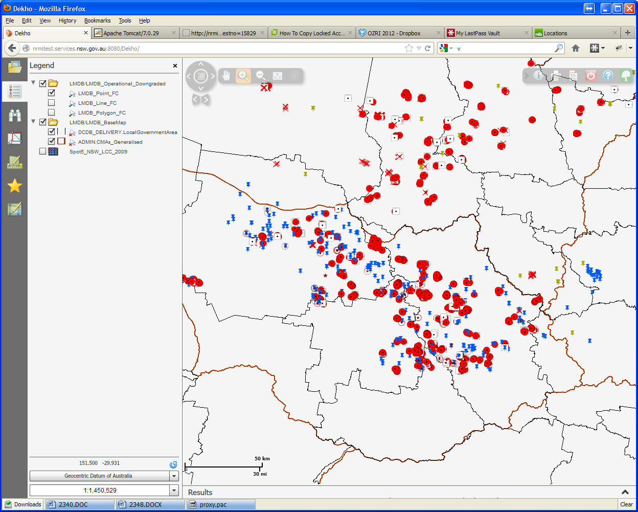
7 OEH Investment cont. ESRI Australia was contracted to migrate original VB6 project to VB.NET for ArcGIS 10 Desktop toolbar. Includes original VB6 functionality and business processes, provided by; Toolbar esriaddin providing main toolbar with menu and tools Dock-able window esriaddin displays attribution progress Forms esriaddin provides attribution forms and functions Core functions esriaddin preferences and system management ESRI Australia was also contracted to develop a proof of concept web mapping platform. Project uses Dekho 4 and includes some functionality from the desktop plug-in, with; LMDB Toolbar (Dekho Flex Component) using Dekho Vr4 API s for feature editing VB.NET Web Methods to service dropdown list. 7
8 Current LMDB Framework Network based infrastructure; Enterprise Database (EDBP - Oracle Spatial 10g) centralised repository for all compiled data. NRMI Virtual Server provides the LMDB Support Centre, Crystal Reports Server 2011, web methods for desktop plug-in and main web site (Joomla). NRMI Test Server sand box for testing, is currently used to evaluate Dekho Vr4 implementation. Client side components; LMDB Toolbar 4 esriaddin s provide a toolbar with menu and several select tools LMDB Reference MS ACCESS database with 40 relational tables LMDB Project DB (esri PGDB) core spatial and data tables for all attribution records with links to the reference. LMDB Preference DB (ACCESS) workgroup preferences for toolbar functionality and client side database management 8
9 Desktop Demonstration Copy and add feature layers to new PGDB Toolbox-Append used to copy features to EDBP SQL select statements used 9
10 Desktop Demonstration 10
11 Current LMDB Usage Uptake started in 2005, with; Over 500 users since inception and 237 discrete users this year Currently 14 workgroups, with 12 Catchment Management Authorities, Sydney Catchment Authority and Crown Lands using LMDB. Technical Working Group (TWG) comprises members from each workgroup, community that drives development, customisation and updates. Workgroups have agreed to fixed attribution pathways control how data is recorded, ensuring consistency and quality assurance. Functionality is configurable for each workgroup, controlling; - storage of client side PGDB s - availability of attributes for describing spatial features - certain functions that are available for users 11
12 Provided by BSR Solutions 12
13 Current Usage cont. Central data repository (EDBP) mirrors client side geo-database schema for easy compilation of state wide datasets, using the Append functionality. 22,067 client PGDB created, of which 11,627 compiled 125,973 spatial features (points lines and polygons) Totalling 133,639 km and 58,270,976 ha respectively 466,000 on-ground activities recorded 31,600 images uploaded to repository EDBP datasets are supplied back to the user as spatial views, currently over 30 layers supplied, including; Workgroup specific spatial data, integrated with textual data Performance specific data, showing range of investment 13
14 Provided by BSR Solutions 14
15 Murray CMA Use 15
16 ESRI Australia developed LMDB Dekho component using Flex Builder 4.5, based on VB.NET Desktop functionality Map Services created for use in Dekho platform, including; - Feature and Geometry Services - Feature Template service - State wide SPOT 5 image provided from Apollo Image Server. Web Methods created using VB.NET to provide application with textual data for drop-down menus. Proof of concept was released last week 28 August 2012 Dekho Implementation Currently testing LMDB Dekho component for all workgroups for evaluation 16

17 17

18 Next Steps 18
19 Questions? External website; FOR MORE INFORMATION LMDB System Management; - Nik Henry [email protected] LMDB Technical Support; - Zoie Hathway [email protected] 19
Standardised reporting for Natural Resource Management (NRM) Investment in NSW
 Investment in NSW") Standardised reporting for Natural Resource Management (NRM) Investment in NSW http://lmdb.nrmoptions.nsw.gov.au Nik Henry OEH, Newcastle Office 1 Presentation NRM Investment Background to LMDB System
Standardised reporting for Natural Resource Management (NRM) Investment in NSW http://lmdb.nrmoptions.nsw.gov.au Nik Henry OEH, Newcastle Office 1 Presentation NRM Investment Background to LMDB System
Chapter 1: Introduction to ArcGIS Server
 Chapter 1: Introduction to ArcGIS Server At a high level you can think of ArcGIS Server as software that helps you take your geographic information and make it available to others. This data can be distributed
ArcGIS Data Models Practical Templates for Implementing GIS Projects
 ArcGIS Data Models Practical Templates for Implementing GIS Projects GIS Database Design According to C.J. Date (1995), database design deals with the logical representation of data in a database. The
GIS Databases With focused on ArcSDE
 Linköpings universitet / IDA / Div. for human-centered systems GIS Databases With focused on ArcSDE Imad Abugessaisa [email protected] 20071004 1 GIS and SDBMS Geographical data is spatial data whose
What is GIS. What is GIS? University of Tsukuba. What do you image of GIS? Copyright(C) ESRI Japan Corporation. All rights reserved.
 ESRI Japan Corporation. All rights reserved.") What is GIS University of Tsukuba Graduate School of Life and Environmental Science April 21 st, 2011 What is GIS? What do you image of GIS? Gas Insulated Switch Groupe Interventional Speciale Geographic
What is GIS University of Tsukuba Graduate School of Life and Environmental Science April 21 st, 2011 What is GIS? What do you image of GIS? Gas Insulated Switch Groupe Interventional Speciale Geographic
Spatial Database Support
 Page 1 of 11 Spatial Database Support Global Mapper can import vector data from and export vector data to the following spatial databases: Esri ArcSDE Geodatabase Esri File Geodatabase Esri Personal Geodatabases
LocatorHub. Migrating LocatorHub to Version 5.2. The Transition from ArcObjects Based Plug-Ins to ArcGIS for Server Services
 LocatorHub Migrating LocatorHub to Version 5.2 The Transition from ArcObjects Based Plug-Ins to ArcGIS for Server Services November 2013 Confidentiality Statement This document contains information which
HELCOM Data and Map Service. User Manual
 HELCOM Data and Map Service User Manual Version 2.2 - February 2015 1 Table of contents 1. General Information... 3 1.1 Background... 3 1.2 Technical requirements... 3 1.3 Contact... 3 2. Accessing HELCOM
Spatial data models (types) Not taught yet
 Not taught yet") Spatial data models (types) Not taught yet A new data model in ArcGIS Geodatabase data model Use a relational database that stores geographic data A type of database in which the data is organized across
Spatial data models (types) Not taught yet A new data model in ArcGIS Geodatabase data model Use a relational database that stores geographic data A type of database in which the data is organized across
ArcGIS 10.1 Web Apps and APIs. John Hasthorpe & Kai Hübner
 ArcGIS 10.1 Web Apps and APIs John Hasthorpe & Kai Hübner Overview Options for leveraging ArcGIS Server using Esri s Web APIs Alternatives to the Web ADF application builder (Gone in 10.1) When and how
Geodatabase Programming with SQL
 DevSummit DC February 11, 2015 Washington, DC Geodatabase Programming with SQL Craig Gillgrass Assumptions Basic knowledge of SQL and relational databases Basic knowledge of the Geodatabase We ll hold
13/10/2011. Data Integration and Interoperability. Gordon Sumerling & Maree Wilson
 Data Integration and Interoperability Gordon Sumerling & Maree Wilson 1 Agenda Seamless integration between GIS and CAD CAD Support in ArcGIS Using GIS Data in CAD Editing GIS Data in CAD Introduction
EXPLORING AND SHARING GEOSPATIAL INFORMATION THROUGH MYGDI EXPLORER
 EXPLORING AND SHARING GEOSPATIAL INFORMATION THROUGH MYGDI EXPLORER Subashini Panchanathan Malaysian Centre For Geospatial Data Infrastructure ( MaCGDI ) Ministry of National Resources and Environment
Cookbook 23 September 2013 GIS Analysis Part 1 - A GIS is NOT a Map!
 Cookbook 23 September 2013 GIS Analysis Part 1 - A GIS is NOT a Map! Overview 1. A GIS is NOT a Map! 2. How does a GIS handle its data? Data Formats! GARP 0344 (Fall 2013) Page 1 Dr. Carsten Braun 1) A
Data Integration for ArcGIS Users Data Interoperability. Charmel Menzel, ESRI Don Murray, Safe Software
 Data Integration for ArcGIS Users Data Interoperability Charmel Menzel, ESRI Don Murray, Safe Software Product overview Extension to ArcGIS (optional) Jointly developed with Safe Software Based on Feature
REACCH PNA Data Management Plan
 REACCH PNA Data Management Plan Regional Approaches to Climate Change (REACCH) For Pacific Northwest Agriculture 875 Perimeter Drive MS 2339 Moscow, ID 83844-2339 http://www.reacchpna.org [email protected]
GEOGRAPHIC INFORMATION SYSTEMS Lecture 20: Adding and Creating Data
 Adding Existing Data Into ArcGIS - there are many different ways to get data into ArcGIS GEOGRAPHIC INFORMATION SYSTEMS Lecture 20: Adding and Creating Data Add Data - normally we use the Add Data button
Getting your app together with Web AppBuilder for ArcGIS
 Getting your app together with Web AppBuilder for ArcGIS Walter Simonazzi Walter Simonazzi Session path What is Web AppBuilder for ArcGIS? Web AppBuilder for ArcGIS tour What s new? July 2015 Demos Community
ArcGIS 10.1 Geodatabase Administration. Gordon Sumerling & Christopher Brown
 ArcGIS 10.1 Geodatabase Administration Gordon Sumerling & Christopher Brown Key Improvements at ArcGIS 10.1 1. Easier Administration through Graphic Interfaces 2. Greater Seamless integration with Open
Lecture 8. Online GIS
 Lecture 8 Online GIS Lecture 8: Outline I. Online GIS 1. Google Earth 2. MSN Live Maps II. Open Source GIS III. ArcGIS Server and the ESRI suite of online software utility options IV. Advanced Data Mining
Supported DBMS platforms DB2. Informix. Enterprise ArcSDE Technology. Oracle. GIS data. GIS clients DB2. SQL Server. Enterprise Geodatabase 9.
 ArcSDE Administration for PostgreSQL Ale Raza, Brijesh Shrivastav, Derek Law ESRI - Redlands UC2008 Technical Workshop 1 Outline Introduce ArcSDE technology for PostgreSQL Implementation PostgreSQL performance
Incident Reporting & Management
 Rivo Software Solution Layer allows you to report and manage incidents such as injuries, accidents and theft. With powerful capabilities including analytical trending you can make better decisions to reduce
ESRI Technical Certification Overview. Amy Daniels Instructor, Greenville Tech
 ESRI Technical Certification Overview Amy Daniels Instructor, Greenville Tech Why have certification by ESRI? It communicates your proficiency in ESRI software Similar to Microsoft Certification, it can
Prepare your data in ArcGIS for Desktop
 Collector for ArcGIS (ios) Tutorials Prepare your data in ArcGIS for Desktop Create and share a map for data collection Track where collectors went Additional help FAQs Supported data Configure map capabilities
White Paper. Freeance Mobile for Cityworks
 White Paper Freeance Mobile for Cityworks Version 1.1 May 2012 Freeance Mobile for Cityworks Freeance Mobile for Cityworks 2012.1 is a mobile application for the following smartphones and tablets: iphone
ArcGIS Online School Locator
 ArcGIS Online School Locator G-Cloud Services RM 1557vi Service Definition Esri UK G-Cloud 6 Lot 3 SaaS Services Crown Commercial Service Acknowledgement Esri and ArcGIS are trademarks, registered trademarks,
NatureServe s Environmental Review Tool
 NatureServe s Environmental Review Tool A Repeatable Online Software Solution for Agencies For More Information, Contact: Lori Scott Rob Solomon [email protected] [email protected] 703-908-1877
Paul Zenden Sioux Technische Software Ontwikkeling Science Park Eindhoven 5709 5692 EP Son Tel: +31 (0) 40 26 77 100 E-mail: paul.zenden@sioux.
 40 26 77 100 E-mail: paul.zenden@sioux.") Paul Zenden Sioux Technische Software Ontwikkeling Science Park Eindhoven 5709 5692 EP Son Tel: +31 (0) 40 26 77 100 E-mail: [email protected] Experiences with Enterprise Architect UML Modeling & Design
Paul Zenden Sioux Technische Software Ontwikkeling Science Park Eindhoven 5709 5692 EP Son Tel: +31 (0) 40 26 77 100 E-mail: [email protected] Experiences with Enterprise Architect UML Modeling & Design
Using CAD Data in ArcGIS
 Esri International User Conference San Diego, California Technical Workshops July 27, 2012 Using CAD Data in ArcGIS Jeff Reinhart & Phil Sanchez Agenda Overview of ArcGIS CAD Support Using CAD Datasets
ArcGIS Web Mapping. Sam Berg, esri [email protected]
 ArcGIS Web Mapping Sam Berg, esri [email protected] Agenda ArcGIS and WebMaps The APIs ArcGIS for Flex Viewer ArcGIS for Silverlight Builder ArcGIS for Sharepoint ArcGIS Application Templates ArcGIS Runtime
Agile Business Suite: a 4GL environment for.net developers DEVELOPMENT, MAINTENANCE AND DEPLOYMENT OF LARGE, COMPLEX BACK-OFFICE APPLICATIONS
 Agile Business Suite: a 4GL environment for.net developers DEVELOPMENT, MAINTENANCE AND DEPLOYMENT OF LARGE, COMPLEX BACK-OFFICE APPLICATIONS In order to ease the burden of application lifecycle management,
Harvard Data Visualization Project
 Esri User Conference, July 12-15, San Diego California Harvard Data Visualization Project Spatio-Temporal Visualization of Global Phenomena: 1850 to the Present Harvard Business School Geoffrey Jones Walter
ArcGIS. Server. A Complete and Integrated Server GIS
 ArcGIS Server A Complete and Integrated Server GIS ArcGIS Server A Complete and Integrated Server GIS ArcGIS Server enables you to distribute maps, models, and tools to others within your organization
ArcSDE Spatial Data Management Roles and Responsibilities
 ArcSDE Spatial Data Management Roles and The following discussion outlines the major roles and responsibilities involved in deploying your spatial data and geographic information system (GIS) applications
University of Arkansas Libraries ArcGIS Desktop Tutorial. Section 4: Preparing Data for Analysis
 : Preparing Data for Analysis When a user acquires a particular data set of interest, it is rarely in the exact form that is needed during analysis. This tutorial describes how to change the data to make
Enterprise GIS Solutions to GIS Data Dissemination
 Enterprise GIS Solutions to GIS Data Dissemination ESRI International User Conference July 13 17, 2009 Wendy M. Turner Senior GIS Engineer & Program Manager Freedom Consulting Group, LLC Building the Enterprise
Victorian Mapping and Address Service. System Overview. And. Trial Access Definition & Request Form
 Victorian Mapping and Address Service Incorporating the spatial smart tag system System Overview And Trial Access Definition & Request Form Victorian Government Oct 2007 VMAS Overview Page 1 1. INTRODUCTION
Editing Common Polygon Boundary in ArcGIS Desktop 9.x
 Editing Common Polygon Boundary in ArcGIS Desktop 9.x Article ID : 100018 Software : ArcGIS ArcView 9.3, ArcGIS ArcEditor 9.3, ArcGIS ArcInfo 9.3 (or higher versions) Platform : Windows XP, Windows Vista
Portal. from the trenches!
 from the trenches! Deployment Patterns Scaling and High Availability Reference Implementations Common Challenges Extending Engagement patterns Esri UC 2014 Technical Workshop for ArcGIS Technology Transfer
ArcGIS Viewer for Silverlight An Introduction
 Esri International User Conference San Diego, California Technical Workshops July 26, 2012 ArcGIS Viewer for Silverlight An Introduction Rich Zwaap Agenda Background Product overview Getting started and
GIS Architecture and Data Management Practices Boone County GIS Created and Maintained by the Boone County Planning Commission GIS Services Division
 GIS Architecture and Data Management Practices Boone County GIS Created and Maintained by the Boone County Planning Commission June 2008 Background Boone County s GIS program has been in existence for
Addendum 1 RFP #154D-16F CityWorks System Cloud Hosting
 Addendum 1 CityWorks System Cloud Hosting This addendum is issued to answer questions submitted via email and to make the following revisions to this solicitation. All information provided herein is hereby
UPDATED GIS DATABASE DESIGN: Geodatabase Model
 CITY OF SUFFOLK, VIRGINIA UPDATED GIS DATABASE DESIGN: Geodatabase Model Prepared by: Michael Baker Jr., Inc. Virginia Beach, Virginia TABLE OF CONTENTS A. GEODATABASE OVERVIEW...2 B. TYPES OF GEODATABASES...3
GIS Data Models for INSPIRE and ELF
 GIS Data Models for INSPIRE and ELF Paul Hardy Roberto Lucchi EuroSDR/ELF Copenhagen Data Modelling and Model Driven Implementation of Data Distribution 28 Jan 2015 ArcGIS for INSPIRE Extends ArcGIS for
Implementing ArcGIS for SharePoint Habitat for Humanity of Omaha April, 2013
 Ingenuity Innovation Integrity Implementing ArcGIS for SharePoint Habitat for Humanity of Omaha April, 2013 1851 Alexander Bell Drive Suite 350 Reston, VA 20191 703.463.2059 800.483.2434 www.vistronix.com
Kingdom Of Bahrain Ministry of Works. Enterprise Asset Management System A Geocentric Approach. Presented By Hisham Y.
 Kingdom Of Bahrain Ministry of Works Enterprise Asset Management System A Geocentric Approach Presented By Hisham Y. Sater April 2012 Ministry Of Works Bahrain MOW The construction arm of the Kingdom of
Developing Apps with the ArcGIS Runtime SDK for Android. Ben Ramseth Esri Inc. Instructor Technical Lead
 Developing Apps with the ArcGIS Runtime SDK for Android Ben Ramseth Esri Inc. Instructor Technical Lead Ben Ramseth Instructor Technical Lead Esri Inc USA, Charlotte, NC [email protected] @EsriMapNinja
ArcGIS Server in Practice Series: Best Practices for Creating an ArcGIS Server Web Mapping Application for Municipal/Local Government
 An Esri White Paper August 2009 ArcGIS Server in Practice Series: Esri, 380 New York St., Redlands, CA 92373-8100 USA TEL 909-793-2853 FAX 909-793-5953 E-MAIL [email protected] WEB www.esri.com Copyright 2009
GIS Cloud Computing Solutions
 GIS Cloud Computing Solutions Who We Are IT and GIS professionals with lineage managed services for enterprise-class customers Cloud in 80+ data centers worldwide with access to thousands of servers Operators
Cloud Nine: Developing an Entirely Cloud Based GIS, Asset Management and Work Order System
 Cloud Nine: Developing an Entirely Cloud Based GIS, Asset Management and Work Order System Corrie Bondar 1*, Mark Valentino 2 1 Freese and Nichols, Inc., Raleigh, North Carolina 2 Freese and Nichols, Inc.,
Challenges and Success of Migrating to an Enterprise Database in York County, PA
 Challenges and Success of Migrating to an Enterprise Database in York County, PA PA GIS Conference June 16, 2015 Wade Gobrecht York County Planning Commission Andrew Ross GeographIT Source: Can You Draw
Customer and Data Services (CDS) Hazus Release 3.0. User Release Notes
 Hazus Release 3.0. User Release Notes") Customer and Data Services (CDS) Hazus Release 3.0 User Release Notes Version 0.4 November 13, 2015 Document Management History Revision History Version Number Date Summary of Changes Team/Author 0.1 10/05/15
Customer and Data Services (CDS) Hazus Release 3.0 User Release Notes Version 0.4 November 13, 2015 Document Management History Revision History Version Number Date Summary of Changes Team/Author 0.1 10/05/15
Leveraging Cloud-Based Mapping Solutions
 Leveraging Cloud-Based Mapping Solutions GeoAlberta October 28, 2014 Laura Kerssens Safe Software Agenda To the Cloud Using Basic Services Cloud Applications Web Services Cloud-Hosted Databases Real-time
Workflow improvement with FME in Skedsmo municipality
 Workflow improvement with FME in Skedsmo municipality Anders Hveem Malum (Geodata AS) and Turid Brox Nilsen (Skedsmo municipality) 16.05.2014 Skedsmo Kommune, Teknisk sektor 1 Skedsmo municipality Situated
Converting GIS Datasets into CAD Format
 Ball State University Libraries GIS Research and Map Collection Converting GIS Datasets into CAD Format Author: Angela Gibson, 6/13/2014 Overview: One of the most common requests from students is for GIS
An Esri White Paper February 2011 Best Practices for Storing the ArcGIS Data Reviewer Workspace in an Enterprise Geodatabase for Oracle
 An Esri White Paper February 2011 Best Practices for Storing the ArcGIS Data Reviewer Workspace in an Enterprise Geodatabase for Oracle Esri, 380 New York St., Redlands, CA 92373-8100 USA TEL 909-793-2853
WILLAMALANE PARK AND RECREATION DISTRICT. Springfield, Oregon GIS ASSET MANAGEMENT IN A PARK AND RECREATION DISTRICT ESRI USER CONFERENCE JULY 2014
 WILLAMALANE PARK AND RECREATION DISTRICT Springfield, Oregon GIS ASSET MANAGEMENT IN A PARK AND RECREATION DISTRICT ESRI USER CONFERENCE JULY 2014 SESSION GOALS Share our process of implementing and developing
Oracle Application Express MS Access on Steroids
 Oracle Application Express MS Access on Steroids Jules Lane Principal Consultant Tactical Database Development options Spreadsheets Encourage data duplication and inconsistency, clog
HydroDesktop Overview
 HydroDesktop Overview 1. Initial Objectives HydroDesktop (formerly referred to as HIS Desktop) is a new component of the HIS project intended to address the problem of how to obtain, organize and manage
TELECOM FIBER EDITING TOOLS REFERENCE GUIDE Version 1.2
 TELECOM FIBER EDITING TOOLS REFERENCE GUIDE Version 1.2 Prepared by: Esri 380 New York Street Redlands, California 92373-8100 Phone: (909) 793-2853 Table of Contents 1. Overview and Getting Started...
Introduction to Web AppBuilder for ArcGIS: JavaScript Apps Made Easy
 Introduction to Web AppBuilder for ArcGIS: JavaScript Apps Made Easy OKSCAUG Pamela Kersh September 22, 2015 The ArcGIS Platform enables Web GIS Enabling GIS Everywhere Desktop Web Device Simple Integrated
Database Servers Tutorial
 Copyright 1995-2010 Esri All rights reserved. Table of Contents A quick tour of the database servers tutorial........................ 3 Exercise 1: Add a database server to the Catalog tree and create
ishare in the Cloud Service Definition v5.0
 Service Definition v5.0 An overview of ishare in the Cloud ishare is an end to end Enterprise GIS for public sector comprising a spatial data warehouse, rich functionality browser based GIS including editing
Data Modeling Basics. John Auel GIS Technician II United Services Group
 Data Modeling Basics John Auel GIS Technician II United Services Group Background Bachelor of Science at University of Wisconsin, Steven s Point Area of Emphasis -- Cartography Been at United Services
Web Editing Tutorial. Copyright 1995-2010 Esri All rights reserved.
 Copyright 1995-2010 Esri All rights reserved. Table of Contents Tutorial: Creating a Web editing application........................ 3 Copyright 1995-2010 Esri. All rights reserved. 2 Tutorial: Creating
GIS Support RFP Questions and Answers
 GIS Support RFP Questions and Answers 4.6 Vendor Support/Training reference to standard support offerings, which is more appropriate for a software vendor than for a services provider ANSWER: This is a
Spatial RDBMS: A Key to Increased ROI WHITE PAPER. Ash Vadujkar Asia Pacific Product Manager, Pitney Bowes MapInfo Corporation
 Spatial RDBMS: A Key to Increased ROI WHITE PAPER Ash Vadujkar Asia Pacific Product Manager, Pitney Bowes MapInfo Corporation WHITE PAPER Spatial RDBMS: A Key to Increased ROI 2 ABSTRACT MAPINFO SPATIALWARE
Digital Document Processing
 Digital Document Processing Digital Document Processing A well-planned, centralised and efficient system for managing physical and electronic documents can significantly speed up business processes, enhance
How To Use Arcgis For Free On A Gdb 2.2.2 (For A Gis Server) For A Small Business
 For A Small Business") Esri Middle East and Africa User Conference December 10 12 Abu Dhabi, UAE Understanding ArcGIS in Virtualization and Cloud Environments Marwa Mabrouk Powerful GIS capabilities Delivered as Web services
Esri Middle East and Africa User Conference December 10 12 Abu Dhabi, UAE Understanding ArcGIS in Virtualization and Cloud Environments Marwa Mabrouk Powerful GIS capabilities Delivered as Web services
CRMS Website Training
 CRMS Website Training March 2013 http://www.lacoast.gov/crms Coastwide Reference Monitoring System - Wetlands CWPPRA Restoration Projects Congressionally funded in 1990 Multiple restoration techniques
Consolidate by Migrating Your Databases to Oracle Database 11g. Fred Louis Enterprise Architect
 Consolidate by Migrating Your Databases to Oracle Database 11g Fred Louis Enterprise Architect Agenda Why migrate to Oracle What is migration? What can you migrate to Oracle? SQL Developer Migration Workbench
Quick start. A project with SpagoBI 3.x
 Quick start. A project with SpagoBI 3.x Summary: 1 SPAGOBI...2 2 SOFTWARE DOWNLOAD...4 3 SOFTWARE INSTALLATION AND CONFIGURATION...5 3.1 Installing SpagoBI Server...5 3.2Installing SpagoBI Studio and Meta...6
(Geo)database and Data Management
database and Data Management") (Geo)database and Data Management An introduction to the possibilities of a centralized (spatial) data storing and access as well as its data management constraints (GLOWA Volta Project) GLOWA Volta Project
(Geo)database and Data Management An introduction to the possibilities of a centralized (spatial) data storing and access as well as its data management constraints (GLOWA Volta Project) GLOWA Volta Project
GIS and Mapping Solutions for Developers. ESRI Developer Network (EDN SM)
") GIS and Mapping Solutions for Developers ESRI Developer Network (EDN SM) GIS and Mapping Solutions for Developers If you are a software developer looking for an effective way to bring geographic and mapping
GIS and Mapping Solutions for Developers ESRI Developer Network (EDN SM) GIS and Mapping Solutions for Developers If you are a software developer looking for an effective way to bring geographic and mapping
Introduce Web3D Development and Visualization. Moxie Zhang Esri R&D Center Beijing
 Introduce Web3D Development and Visualization Moxie Zhang Esri R&D Center Beijing Web Scene Desktop Web Device New in ArcGIS Online and Portal Web Scene Mash-up of 3D / 2D layers Web Scene Viewer and
FME Server Tutorial. FME 2014 Edition
 FME Server Tutorial FME 2014 Edition Document and Copyright Information Safe Software Inc. makes no warranty either expressed or implied, including, but not limited to, any implied warranties of merchantability
LEVERAGE VBLOCK SYSTEMS FOR Esri s ArcGIS SYSTEM
 Leverage Vblock Systems for Esri's ArcGIS System Table of Contents www.vce.com LEVERAGE VBLOCK SYSTEMS FOR Esri s ArcGIS SYSTEM August 2012 1 Contents Executive summary...3 The challenge...3 The solution...3
Embracing ArcGIS for Local Government. Robert Parsons Delaware County, Ohio Auditor s Office Steve Koenig Bruce Harris & Associates
 Embracing ArcGIS for Local Government Robert Parsons Delaware County, Ohio Auditor s Office Steve Koenig Bruce Harris & Associates Background Project began in April 2013 At that time ArcIMS 9.2 was the
A Workflow for Creating and Sharing Maps
 A Workflow for Creating and Sharing Maps By Keith Mann, Esri What You Will Need Item Source ArcGIS Online for Organizations subscription ArcGIS 10.1 for Desktop (Any license level) ArcGIS Spatial Analyst
Spatial Analyst Tutorial
 Copyright 1995-2010 Esri All rights reserved. Table of Contents About the ArcGIS Spatial Analyst Tutorial......................... 3 Exercise 1: Preparing for analysis............................ 5 Exercise
Australian Hydrological Geospatial Fabric (Geofabric) Tutorial. Access Water Storage information
 Tutorial. Access Water Storage information") Australian Hydrological Geospatial Fabric (Geofabric) Tutorial Access Water Storage Version 2.1 November 2012 Contact details Geospatial Data Unit Bureau of Meteorology GPO Box 2334 CANBERRA ACT 2601
Australian Hydrological Geospatial Fabric (Geofabric) Tutorial Access Water Storage Version 2.1 November 2012 Contact details Geospatial Data Unit Bureau of Meteorology GPO Box 2334 CANBERRA ACT 2601
An Esri White Paper August 2009 ArcGIS Server in Practice Series High-Capacity Map Services: A Use Case with CORINE Land-Cover Data
 An Esri White Paper August 2009 ArcGIS Server in Practice Series High-Capacity Map Services: A Use Case with CORINE Land-Cover Data Esri, 380 New York St., Redlands, CA 92373-8100 USA TEL 909-793-2853
ArcGIS Pro. James Tedrick, Esri
 ArcGIS Pro James Tedrick, Esri What you already know Why ArcGIS PRO? Vision The next generation ArcGIS desktop application for the GIS community who need a clean and comprehensive user experience which
Using Oracle9i SCM for Software Configuration Management. An Oracle Technical White Paper July 2002
 Using Oracle9i SCM for Software Configuration Management An Oracle Technical White Paper July 2002 INTRODUCTION As organizations strive to build larger, more complex, fully integrated software applications
Publishing Hosted 3D Feature Layers. An Esri White Paper September 2015
 An Esri White Paper September 2015 Copyright 2015 Esri All rights reserved. Printed in the United States of America. The information contained in this document is the exclusive property of Esri. This work
Data Validation Online References
 Data Validation Online References Submitted To: Program Manager GeoConnections Victoria, BC, Canada Submitted By: Jody Garnett Brent Owens Refractions Research Inc. Suite 400, 1207 Douglas Street Victoria,
How to Use PIPS Access to/from SQL Database Utility Program. By PIPSUS Support Team Dr. Chouikha ([email protected])
") How to Use PIPS Access to/from SQL Database Utility Program By PIPSUS Support Team Dr. Chouikha ([email protected]) 1. Introduction PIPS (Price Index Processor Software) data transfer utility program
How to Use PIPS Access to/from SQL Database Utility Program By PIPSUS Support Team Dr. Chouikha ([email protected]) 1. Introduction PIPS (Price Index Processor Software) data transfer utility program
SMARTEAM - Editor Administrator Guide
 SMARTEAM - Editor Administrator Guide SmarTeam Corporation Ltd. Web: www.smarteam.com Tel: +972-9-7644000 5 Hagavish St., P.O.B 7020 Email: [email protected] Fax: +972-9-7644001 Kfar Saba, Israel 44641
RESPONSE TO GIS SERVICES RFP. 1. What version of ArcGIS software are you using? If it is not the latest, is there a plan to upgrade?
 RESPONSE TO GIS SERVICES RFP 1. What version of ArcGIS software are you using? If it is not the latest, is there a plan to upgrade? We are currently using ArcGIS 10.x as follows: ArcGIS for Desktop - Mixed
The Spatial Data Standards for Facilities, Infrastructure, and Environment Online (SDSFIE Online) Web Site. http://www.sdsfieonline.
 Web Site. http://www.sdsfieonline.") The Spatial Data Standards for Facilities, Infrastructure, and Environment Online (SDSFIE Online) Web Site http://www.sdsfieonline.org Mr. Kurt Buehler DISDI Program Support Image Matters LLC July 22,
The Spatial Data Standards for Facilities, Infrastructure, and Environment Online (SDSFIE Online) Web Site http://www.sdsfieonline.org Mr. Kurt Buehler DISDI Program Support Image Matters LLC July 22,
 Advanced ArcSDE Administration for SQL Server Shannon Shields Tony Wakim Workshop Format Three topics What's New In-depth Database Administration Trouble-shooting / Performance Selection varies year to
Administering Your Microsoft SQL Server Geodatabase
 Administering Your Microsoft SQL Server Geodatabase Shannon Shields Chet Dobbins Esri UC 2014 Technical Workshop Agenda News since the last UC How do I - Configure SQL Server to support geodatabases? -
Portal for ArcGIS. Satish Sankaran Robert Kircher
 Portal for ArcGIS Satish Sankaran Robert Kircher ArcGIS A Complete GIS Data Management Planning & Analysis Field Mobility Operational Awareness Constituent Engagement End to End Integration Collect, Organize,
Build an ArcGIS Online Application
 Build an ArcGIS Online Application Sign into ArcGIS Online for Maryland 1. Open a web browser 2. Go to URL http://maryland.maps.arcgis.com/ 3. Click Sign In in the upper right corner of the web page 4.