ArcGIS 10.1 Web Apps and APIs. John Hasthorpe & Kai Hübner
|
|
|
- Joleen Ross
- 9 years ago
- Views:
Transcription

1 ArcGIS 10.1 Web Apps and APIs John Hasthorpe & Kai Hübner


2 Overview Options for leveraging ArcGIS Server using Esri s Web APIs Alternatives to the Web ADF application builder (Gone in 10.1) When and how to start developing

3 GIS Services Your web apps are going to need to utilise one or more services Do the heavy lifting Sources: Esri sample services ArcGIS Online ArcGIS Online for Organisations ArcGIS Server (can be cloud based)

4 Esri Web APIs (Introduced at ArcGIS 9.3) Non Developer ArcGIS Online Applications Both Configurable Viewer Applications Developer Custom Applications Flex JavaScript Silverlight All applications access GIS services via REST based Web services

5 Web ADF
6 Esri Hosted Applications Fastest way to create interactive web maps is to use the ArcGIS online viewers: ArcGIS.COM Map Viewer / ArcGIS Explorer Online Configure: Content: Extents, basemaps, layers, pop-ups, symbology, text Appearance: Templates available for Map Viewer Functionality: Print, measure, geocode, bookmarks, editing, time Great ArcGIS online integration and sharing

7 Which one should I use? ArcGIS.COM Map Viewer Extras Application templates (some configurable) Built on JavaScript API (tablet friendly) User based editing and filtering Secure services
 User based editing and")
8 Which one should I use? ArcGIS Explorer Online Extras Map dashboards (gauges and graphs) Attribute queries Presentations / annotated tours

9 Locally Hosted Applications Why host your self? Security (want to keep everything internal) Want more control of application: Customisation Functionality What do you need? Your own web server (e.g. IIS, Tomcat) A configurable web application or viewer

10 ArcGIS Viewer for Flex / Silverlight Follow the following principle: Download Configure Deploy Configure using config files or an application builder Extend using: add ins and widgets Replacement for the application builder in ArcGIS Server Manager

11 Non Developer ArcGIS Viewer for Silverlight (App Builder)

12 Developer Options

13 Why extend or develop your own apps? Utilise new server capabilities, not yet available in the viewers Meet design and layout requirements (corporate design) Take an application from generic to specific (custom workflows) Want to use app on a mobile device
")
14 New functionality Server 10.1 Dynamic renderer Dynamic change layer order Improved print functionality Editor tracking Geometry service (Geodetic Buffer) Generate statistics Gauge widgets
 Generate")


15 Your programming options

16 HTML 5 Includes JavaScript + CSS3 New functions: Geolocation Storage on client side Working offline File access Drag and drop Canvas & SVG Most functions are supported by latest browsers caniuse.com

17 Where to start? Existing Widgets and Add-ins (API code galleries) Templates Silverlight: ArcGIS Extensibility kit for Silverlight Flex: Un-compiled Flex Viewer JavaScript: Templates from ArcGIS.com Developer Samples (API Resource centres)

18 Novice Developer Web app for a desktop browser

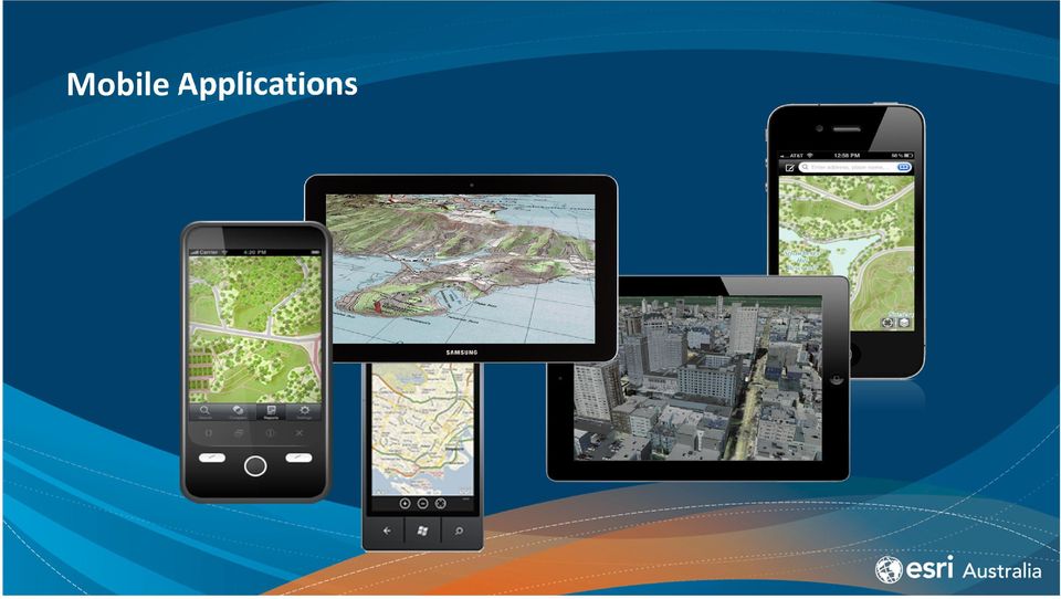
19 Mobile Applications
20 Mobile web apps vs. Native apps

21 Advanced Developer Web app for a mobile browser
22 Developer Road Map Novice Experienced ArcGIS Online Applications Viewer Applications Web APIs Generic Specific
23 Summary Different options to leverage the Web APIs (Development skills vs requirement for custom functionality) Application builders provide an interactive way to createand deploy apps A defined road map exist for developers
24 Training Courses Esri Australia Instructor training esriaustralia.com.au/training-gis-courses-server-intermediate Building Web Applications using: ArcGIS API for JavaScript ArcGIS API for Flex ArcGIS API for Microsoft Silverlight/WPF Creating Effective Web Applications Using ArcGIS Server Free Esri Inc. training Using HTML5 with ArcGIS training.esri.com/gateway/index.cfm?fa=catalog.webcoursedetail&courseid=2437
25 Additional Resources Esrihelp for web API s Esri viewers links.esri.com/flexviewer links.esri.com/silverlightviewer Esri videos video.arcgis.com/channel/9/arcgis-apis


26 Thank you Questions?
27
ArcGIS Web Mapping. Sam Berg, esri [email protected]
 ArcGIS Web Mapping Sam Berg, esri [email protected] Agenda ArcGIS and WebMaps The APIs ArcGIS for Flex Viewer ArcGIS for Silverlight Builder ArcGIS for Sharepoint ArcGIS Application Templates ArcGIS Runtime
Intro to Web App Builder. Mark Scott, Solutions Engineer, Esri County Government Team [email protected]
 Intro to Web App Builder Mark Scott, Solutions Engineer, Esri County Government Team [email protected] The ArcGIS Platform enables Web GIS Enabling GIS Everywhere Desktop Web Device Simple Integrated Open
ArcGIS Viewer for Silverlight An Introduction
 Esri International User Conference San Diego, California Technical Workshops July 26, 2012 ArcGIS Viewer for Silverlight An Introduction Rich Zwaap Agenda Background Product overview Getting started and
Petroleum Web Applications to Support your Business. David Jacob & Vanessa Ramirez Esri Natural Resources Team
 Petroleum Web Applications to Support your Business David Jacob & Vanessa Ramirez Esri Natural Resources Team Agenda Petroleum Web Apps to Support your Business The ArcGIS Location Platform Introduction
Introduction to Web AppBuilder for ArcGIS: JavaScript Apps Made Easy
 Introduction to Web AppBuilder for ArcGIS: JavaScript Apps Made Easy OKSCAUG Pamela Kersh September 22, 2015 The ArcGIS Platform enables Web GIS Enabling GIS Everywhere Desktop Web Device Simple Integrated
Mobile Solutions in ArcGIS. Justin Fan
 Mobile Solutions in ArcGIS Justin Fan Agenda Introducing Mobile GIS Esri Mobile GIS solutions Selecting the right Mobile GIS solution Resources Q&A Introducing Mobile GIS What is Mobile GIS? Extends the
Scott Moore, Esri April 4, 2016 2016 Intermountain, Great Falls, MT
 Create Great Web Apps No Coding Required Scott Moore, Esri April 4, 2016 2016 Intermountain, Great Falls, MT Agenda Product overview Web AppBuilder for ArcGIS tour What s New November 2015 ArcGIS Online
Best practices building multi-platform apps. John Hasthorpe & Josh Venman
 Best practices building multi-platform apps John Hasthorpe & Josh Venman It s good to have options Android 4.3 10 Tablet Windows 7 14 Laptop Windows 7 15 Laptop Mac OSX 15 Laptop ios 6 4.6 Phone Android
Building and Deploying Web Applications
 Building and Deploying Web Applications Dal Hunter and Jeff Shaner Friday, Nov 6 10:30-12:00 Agenda Product overview Web AppBuilder for ArcGIS tour What s New July 2015 ArcGIS Online update Customization
Portal for ArcGIS. Satish Sankaran Robert Kircher
 Portal for ArcGIS Satish Sankaran Robert Kircher ArcGIS A Complete GIS Data Management Planning & Analysis Field Mobility Operational Awareness Constituent Engagement End to End Integration Collect, Organize,
ArcGIS Web App Builder (AWAB) In BETA. John Bocan MES/DoIT [email protected]
 In BETA. John Bocan MES/DoIT john.bocan@maryland.gov") ArcGIS Web App Builder (AWAB) In BETA John Bocan MES/DoIT [email protected] Some Facts (1 slide) The Pros (5 slides) The Cons (2 slides) Some Bugs/Issues (1 slide) What s to Come (1 slide) What This
ArcGIS Web App Builder (AWAB) In BETA John Bocan MES/DoIT [email protected] Some Facts (1 slide) The Pros (5 slides) The Cons (2 slides) Some Bugs/Issues (1 slide) What s to Come (1 slide) What This
Configuring and Extending ArcGIS Solutions Web Applications
 Esri Developer Summit March 8 11, 2016 Palm Springs, CA Configuring and Extending ArcGIS Solutions Web Applications Allison Muise & Mike Tschudi ArcGIS Solutions? ArcGIS as a Platform Simple, Open, and
Chapter 1: Introduction to ArcGIS Server
 Chapter 1: Introduction to ArcGIS Server At a high level you can think of ArcGIS Server as software that helps you take your geographic information and make it available to others. This data can be distributed
Esri GIS Mobile Solutions. John Sharrard [email protected]
 Esri GIS Mobile Solutions John Sharrard [email protected] If I had asked people what they wanted, they would have said faster horses. Henry Ford Trend: Increase demand for location services Pew Research
Introduce Web3D Development and Visualization. Moxie Zhang Esri R&D Center Beijing
 Introduce Web3D Development and Visualization Moxie Zhang Esri R&D Center Beijing Web Scene Desktop Web Device New in ArcGIS Online and Portal Web Scene Mash-up of 3D / 2D layers Web Scene Viewer and
ArcGIS Platform. An Integrated System. Portal
 Platform An Integrated System Portal An Integrated Web GIS Platform Knowledge Workers Executive Access Public Engagement Work Anywhere Enterprise Integration Providing Mapping, Analysis, Data Management,
Portal. from the trenches!
 from the trenches! Deployment Patterns Scaling and High Availability Reference Implementations Common Challenges Extending Engagement patterns Esri UC 2014 Technical Workshop for ArcGIS Technology Transfer
Implementing ArcGIS for SharePoint Habitat for Humanity of Omaha April, 2013
 Ingenuity Innovation Integrity Implementing ArcGIS for SharePoint Habitat for Humanity of Omaha April, 2013 1851 Alexander Bell Drive Suite 350 Reston, VA 20191 703.463.2059 800.483.2434 www.vistronix.com
Portal for ArcGIS: An Introduction
 2013 Esri Mid-Atlantic User Conference December 10-11 Baltimore, MD Portal for ArcGIS: An Introduction Derek Law Esri, Redlands Agenda Web GIS Deployment patterns Portal for ArcGIS overview Security Integration
Getting your app together with Web AppBuilder for ArcGIS
 Getting your app together with Web AppBuilder for ArcGIS Walter Simonazzi Walter Simonazzi Session path What is Web AppBuilder for ArcGIS? Web AppBuilder for ArcGIS tour What s new? July 2015 Demos Community
Developing Apps with the ArcGIS Runtime SDK for Android. Ben Ramseth Esri Inc. Instructor Technical Lead
 Developing Apps with the ArcGIS Runtime SDK for Android Ben Ramseth Esri Inc. Instructor Technical Lead Ben Ramseth Instructor Technical Lead Esri Inc USA, Charlotte, NC [email protected] @EsriMapNinja
Off The Shelf Approach to ArcGIS Server & The Dashboard Approach to Gaining Insight to ArcGIS Server
 Off The Shelf Approach to ArcGIS Server & The Dashboard Approach to Gaining Insight to ArcGIS Server Robert Lenarcic Latitude Geographics [email protected] AGENDA Out of the box ArcGIS Server web-mapping
Prepare Data ArcMap Open Trees.mpk Chrome ArcGIS Online New Map Chrome Esri Blogs Chrome Local Government Resources Reflector Phone Connected
 Prepare Data ArcMap Open Trees.mpk Chrome ArcGIS Online New Map Chrome Esri Blogs Chrome Local Government Resources Reflector Phone Connected Kate Firefox http://doc.arcgis.com/en/operations dashboard/
Conservation Workshop ArcGIS Explorer
 Conservation Workshop ArcGIS Explorer Bern Szukalski [email protected] Topics for this session Introduction Overview of features Using ArcGIS Explorer effectively New features & capabilities Customization
What is ArcGIS Comprised Of?
 ArcGIS Server 9.1 What is ArcGIS Comprised Of? ArcGIS Desktop Integrated suite of GIS applications ArcGIS Engine Embeddable developer components Server GIS ArcSDE, ArcIMS, ArcGIS Server Mobile GIS ArcPad
Essential Mapping Apps
 Essential Mapping Apps 74% of adults use their smartphone to look at maps or other information based on their current location (of the 58% that own a smart phone) Pew Research Center Maps for Directions
MetroGIS Project Proposal Template Version 1.0
 MetroGIS Project Proposal Template Version 1.0 1 MetroGIS provides an on-going opportunity for collaborative projects among its stakeholders. Crucial to the success of collaborative projects are the identification
Use ArcGIS Online to Manage
 Use ArcGIS Online to Manage Your Own Custom Map Gallery By Keith Mann, Esri Start customizing the template by changing the graphics and the web page title. Wouldn t it be great if you could create a dynamic
ArcGIS Server 9.3.1 mashups
 Welcome to ArcGIS Server 9.3.1: Creating Fast Web Mapping Applications With JavaScript Scott Moore ESRI Olympia, WA [email protected] Seminar agenda ArcGIS API for JavaScript: An Overview ArcGIS Server Resource
Online Data Services. Security Guidelines. Online Data Services by Esri UK. Security Best Practice
 Online Data Services Security Guidelines Online Data Services by Esri UK Security Best Practice 28 November 2014 Contents Contents... 1 1. Introduction... 2 2. Data Service Accounts, Security and Fair
ArcGIS Pro. James Tedrick, Esri
 ArcGIS Pro James Tedrick, Esri What you already know Why ArcGIS PRO? Vision The next generation ArcGIS desktop application for the GIS community who need a clean and comprehensive user experience which
Microsoft SQL Server 2012 - Review
 Microsoft Cert Kit Catalogue 1 Microsoft Cert Kit Page 3 Windows Page 4 Server 2012 and 2008 Page 5 SQL Server 2012 Page 6 Page 7 Page 8 Page 9 Page 10 Page 11 Page 12 Cloud Messaging Communication SharePoint
A Workflow for Creating and Sharing Maps
 A Workflow for Creating and Sharing Maps By Keith Mann, Esri What You Will Need Item Source ArcGIS Online for Organizations subscription ArcGIS 10.1 for Desktop (Any license level) ArcGIS Spatial Analyst
Cross Platform Mobile Gis System For Data Collection Based On Gps And Emerging Gis Technologies
 International Conference of Advance Research and Innovation (-2014) Cross Platform Mobile Gis System For Data Collection Based On Gps And Emerging Gis Technologies Mohammad Nasim a,*, Prashant Kumar b
How to Setup and Manage Spatial Assets with ArcGIS Online for a Mobile Workforce
 How to Setup and Manage Spatial Assets with ArcGIS Online for a Mobile Workforce W A U R I S A 2 0 1 4 Presented By Engineer Technician II Pierce County Public Works and Utilities Road Operations Division
ESRI Mobile GIS Solutions Overview. Shane Clarke ESRI
 ESRI Mobile GIS Solutions Overview Shane Clarke ESRI Agenda Overview of mobile GIS ESRI mobile GIS Solutions Selecting a mobile GIS solution Q & A 2 Mobile GIS Overview 3 What is mobile GIS? Extension
County of Los Angeles. Chief Information Office Preferred Technologies for Geographic Information Systems (GIS) September 2014
 September 2014") County of Los Angeles Chief Information Office Preferred Technologies for Geographic Information Systems (GIS) September 2014 CIO Preferred Technologies for GIS This document lists the preferred Geographic
County of Los Angeles Chief Information Office Preferred Technologies for Geographic Information Systems (GIS) September 2014 CIO Preferred Technologies for GIS This document lists the preferred Geographic
Network Analysis with ArcGIS Online
 Federal GIS Conference February 9 10, 2015 Washington, DC Network Analysis with ArcGIS Online Matt Kennedy Topics Online versus on-premise network analysis services How to access online services How to
Esri Maps for Office, SharePoint & Dynamics CRM. Tony Howser Sentha Sivabalan Scott Ball
 Esri Maps for Office, SharePoint & Dynamics CRM Tony Howser Sentha Sivabalan Scott Ball Agenda Location Analytics Esri Maps for - SharePoint - Office - Dynamics CRM Pricing Road Map Q & A Evolving the
Copyright 2012, Oracle and/or its affiliates. All rights reserved.
 1 Oracle WebCenter Strategy and Vision Rob Schootman Principal Sales Consultant Oracle Fusion Middleware 2 Insert Information Protection Policy Classification from Slide 13 Let s introduce myself... 3
Operations Dashboard for ArcGIS: Extending the Functionality
 Operations Dashboard for ArcGIS: Extending the Functionality Jay Chen Kylie Donia Tif Pun Esri UC 2014 Technical Workshop Esri UC 2014 Technical Workshop Agenda Operations Dashboard In 45 seconds Esri
13/10/2011. Data Integration and Interoperability. Gordon Sumerling & Maree Wilson
 Data Integration and Interoperability Gordon Sumerling & Maree Wilson 1 Agenda Seamless integration between GIS and CAD CAD Support in ArcGIS Using GIS Data in CAD Editing GIS Data in CAD Introduction
GIS IN THE CLOUD THE ESRI EXAMPLE DAVID CHAPPELL SEPTEMBER 2010 SPONSORED BY ESRI
 GIS IN THE CLOUD THE ESRI EXAMPLE DAVID CHAPPELL SEPTEMBER 2010 SPONSORED BY ESRI CONTENTS Contents... 2 Cloud Computing Basics... 3 Cloud Applications and Cloud Platforms... 3 An Example Cloud Platform:
Enterpise Mobility Lexicon & Terminology
 1 Enterpise Mobility Lexicon & Terminology www.openratio.com By Rabih Kanaan 1 Amazon SNS Amazon Simple Notification Service (SNS) is a push messaging service that makes it simple & cost-effective to push
Quick Start Guide to. ArcGISSM. Online
 Quick Start Guide to ArcGISSM Online ArcGIS Online Quick Start Guide ArcGIS SM Online is a cloud-based mapping platform for organizations. Users get access to dynamic, authoritative content to create,
SAP BusinessObjects Design Studio Deep Dive. Ian Mayor and David Stocker SAP Session 0112
 SAP BusinessObjects Design Studio Deep Dive Ian Mayor and David Stocker SAP Session 0112 Legal Disclaimer 2013 SAP AG. All rights reserved. 2 SAP BusinessObjects Client Tools Build Custom Experiences Dashboards
MAY 18, 2015 ARCGIS 10.3.1 FOR SERVER FUNCTIONALITY MATRIX
 MAY 18, 2015 ARCGIS 10.3.1 FOR SERVER FUNCTIONALITY MATRIX Copyright 2015 Esri All rights reserved. Printed in the United States of America. The information contained in this document is the exclusive
Five Steps to Better Performance
 Effective Web maps have a specific focus and are designed so users can interact with them to accomplish meaningful tasks. Five Steps to Better Performance Sample methodology for creating a great Web map
Storytelling with Maps: Workflows and Best Practices
 Storytelling with Maps: Workflows and Best Practices Introduction What is a story map? Story maps are interactive maps combined with text and other content to tell a story about the world. Typically story
MOC 55072 Visualizing Data with SharePoint 2013, Report Builder, PowerPivot & PowerView with NO CODE
 To register or for more information call our office (208) 898-9036 or email [email protected] MOC 55072 Visualizing Data with SharePoint 2013, Report Builder, PowerPivot & PowerView with NO
NatureServe s Environmental Review Tool
 NatureServe s Environmental Review Tool A Repeatable Online Software Solution for Agencies For More Information, Contact: Lori Scott Rob Solomon [email protected] [email protected] 703-908-1877
Mobile GIS Guide. About The Author. Getting your mobile GIS project off the ground
 About The Author Matt Sheehan is a mobile GIS pioneer. He and his staff at WebMapSolutions have been providing clients with mobile GIS solutions since the earliest days of smartphones and tablets. We live
ArcGIS for. Intelligence
 ArcGIS for ArcGIS for solutions.arcgis.com/intelligence Copyright 2015 Esri. All rights reserved. 146660 DUAL3M7/15rk Briefing Book ArcGIS for Briefing Book ArcGIS Web Application ArcGIS for Create and
Quick Start Guide Mobile Entrée 4
 Table of Contents Table of Contents... 1 Installation... 2 Obtaining the Installer... 2 Installation Using the Installer... 2 Site Configuration... 2 Feature Activation... 2 Definition of a Mobile Application
Enterprise GIS Architecture Deployment Options. Andrew Sakowicz
 Enterprise GIS Architecture Deployment Options Andrew Sakowicz Audience Audience - Architects - Developers - Administrators - Project Managers Level: - Beginner / Intermediate Introduction Andrew Sakowicz
Step 1 Preparation and Planning
 Its daunting starting any GIS Web or Mobile project. Where does one begin? This 3 step guide should help you get past your project inertia and start things moving rapidly forward. Step 1 Preparation and
Welcome to Esri's Software Export Control Classification Number (ECCN) Matrix
 Matrix") Welcome to Esri's Software Export Control Classification Number (ECCN) Matrix Updated September 30, 2015 This portion of the Esri web site is to provide information regarding the export control classification
Welcome to Esri's Software Export Control Classification Number (ECCN) Matrix Updated September 30, 2015 This portion of the Esri web site is to provide information regarding the export control classification
Publishing geospatial data to the web using the EEA infrastructure
 Publishing geospatial data to the web using the EEA infrastructure *Note: Map Services should be published using the EEA Map Services Tick Sheet for guidance. Contact Sebastien Petit ([email protected])
Storytelling with Esri Story Maps
 Storytelling with Esri Story Maps Exercise 1: Exploring Story Maps Estimated time: 10 minutes Exercise 2: Creating a Web Map and a Story Map Web Application Estimated time: 20 minutes Exercise 3: Creating
Supporting High-Quality Printing in Web Applications with ArcGIS for Server
 2013 Esri International User Conference July 8 12, 2013 San Diego, California Technical Workshop Supporting High-Quality Printing in Web Applications with ArcGIS for Server Craig Williams Tanu Hoque Esri
Note: Hands On workshops are Bring Your Own Laptop (BYOL), unless otherwise noted. Some workshops are Bring Your Own Mobile Device(BYOD).
, unless otherwise noted. Some workshops are Bring Your Own Mobile Device(BYOD).") 2015 MN GIS/LIS Consortium Pre Conference Workshops The Minnesota GIS/LIS Consortium is pleased to offer a diverse list of workshops on Wednesday, October 7th, 2015 at the DECC, Duluth, Minnesota Charting
2015 MN GIS/LIS Consortium Pre Conference Workshops The Minnesota GIS/LIS Consortium is pleased to offer a diverse list of workshops on Wednesday, October 7th, 2015 at the DECC, Duluth, Minnesota Charting
Building Applications with the ArcGIS Runtime SDK for Windows Mobile
 Esri International User Conference San Diego, California Technical Workshops July 25th Building Applications with the ArcGIS Runtime SDK for Windows Mobile Jay Chen Justin Colville What we will cover today
Firefox for Android. Reviewer s Guide. Contact us: [email protected]
 Reviewer s Guide Contact us: [email protected] Table of Contents About Mozilla Firefox 1 Move at the Speed of the Web 2 Get Started 3 Mobile Browsing Upgrade 4 Get Up and Go 6 Customize On the Go 7 Privacy
Please contact Cyber and Technology Training at (410)777-1333/[email protected] for registration and pricing information.
777-1333/technologytraining@aacc.edu for registration and pricing information.") Course Name Start Date End Date Start Time End Time Active Directory Services with Windows Server 8/31/2015 9/4/2015 9:00 AM 5:00 PM Active Directory Services with Windows Server 9/28/2015 10/2/2015 9:00
Course Name Start Date End Date Start Time End Time Active Directory Services with Windows Server 8/31/2015 9/4/2015 9:00 AM 5:00 PM Active Directory Services with Windows Server 9/28/2015 10/2/2015 9:00
Izenda & SQL Server Reporting Services
 Izenda & SQL Server Reporting Services Comparing an IT-Centric Reporting Tool and a Self-Service Embedded BI Platform vv Izenda & SQL Server Reporting Services The reporting tools that come with the relational
HTML5 the new. standard for Interactive Web
 WHITE PAPER HTML the new standard for Interactive Web by Gokul Seenivasan, Aspire Systems HTML is everywhere these days. Whether desktop or mobile, windows or Mac, or just about any other modern form factor
Vector Web Mapping Past, Present and Future. Jing Wang MRF Geosystems Corporation
 Vector Web Mapping Past, Present and Future Jing Wang MRF Geosystems Corporation Oct 27, 2014 Terms Raster and Vector [1] Cells and Pixel Geometrical primitives 2 Early 2000s From static to interactive
How to start with 3DHOP
 How to start with 3DHOP Package content, local setup, online deployment http://3dhop.net 30/6/2015 The 3DHOP distribution Where to find it, what s inside The 3DHOP distribution package From the page http://3dhop.net/download.php
ArcGISSM. Online. The Mapping Platform for Your Organization
 ArcGISSM Online The Mapping Platform for Your Organization ArcGIS Online is a cloud-based platform for making and sharing maps, apps, and other geographic data and content. Knowledge Workers Policy Makers
Embracing ArcGIS for Local Government. Robert Parsons Delaware County, Ohio Auditor s Office Steve Koenig Bruce Harris & Associates
 Embracing ArcGIS for Local Government Robert Parsons Delaware County, Ohio Auditor s Office Steve Koenig Bruce Harris & Associates Background Project began in April 2013 At that time ArcIMS 9.2 was the
Republic Polytechnic School of Infocomm C308 Web Framework. Module Curriculum
 Republic Polytechnic School of Infocomm C308 Web Framework Module Curriculum This document addresses the content related abilities, with reference to the module. Abilities of thinking, learning, problem
Making Your Mobile Workforce More Efficient
 ArcGIS for Mobile Making Your Mobile Workforce More Efficient What Is Mobile GIS? Mobile geographic information system (GIS) technology extends GIS beyond the office and allows organizations to make accurate,
Contents. The OWRB Floodplain Viewer. Creating Maps... 8. Helpful Tips... 10
 Contents QUICK START GUIDE... 2-5 Add layers...9 Search for Layers...9 COMPREHENSIVE GUIDE... 6 Navigate the map...6 Locate specific places...6 Add layer from file...9 Add layer from web...9 Display pop-up
Developing Exceptional Mobile and Multi-Channel Applications using IBM Web Experience Factory
 Developing Exceptional Mobile and Multi-Channel Applications using IBM Web Experience Factory IBM Corporation 2011 Web Experience Factory formerly known as WebSphere Portlet Factory Note we are currently
AV-18 Introduction of the GIS Integration
 Slide 1 AV-18 Introduction of the GIS Integration Authors Victor Lough Dan Marsillo Geoff Tarcha social.invensys.com @InvensysOpsMgmt / #SoftwareRevolution /InvensysVideos /InvensysOpsMgmt /company/invensys
Quick Start Guide to. ArcGISSM. Online. for Insurance
 Quick Start Guide to ArcGISSM Online for Insurance Historic tracks from tropical storms and hurricanes are overlaid on a map displaying population growth. Quick Start Guide to ArcGIS Online ArcGIS SM Online
ANDROID APP DEVELOPMENT: AN INTRODUCTION CSCI 5115-9/19/14 HANNAH MILLER
 ANDROID APP DEVELOPMENT: AN INTRODUCTION CSCI 5115-9/19/14 HANNAH MILLER DISCLAIMER: Main focus should be on USER INTERFACE DESIGN Development and implementation: Weeks 8-11 Begin thinking about targeted
GIS: Transforming the Business. Presented by: Catherine Fitzgerald Manager, Information Services Municipality of Chatham-Kent
 GIS: Transforming the Business Presented by: Catherine Fitzgerald Manager, Information Services Municipality of Chatham-Kent Organization Overview Municipality of Chatham-Kent Single Tier Local Government
Mobile Solutions for Data Collection. Sarah Croft and Laura Pierik
 Mobile Solutions for Data Collection Sarah Croft and Laura Pierik Presentation Overview Project Overview Benefits of using Mobile Technology Mobile Solutions- two different approaches Results and Recommendations
Mobile Access to Production Information Automation University 2015 AUD 21
 Mobile Access to Production Information Automation University 2015 AUD 21 Kai Bergemann Product Manager Software EMEA Region PUBLIC INFORMATION Rev 5058-CO900E Question What is Mobility? The term refers
SUMMER SCHOOL ON ADVANCES IN GIS
 SUMMER SCHOOL ON ADVANCES IN GIS Six Workshops Overview The workshop sequence at the UMD Center for Geospatial Information Science is designed to provide a comprehensive overview of current state-of-the-art
SAP BusinessObjects Design Studio Overview. Jie Deng, Product Management Analysis Clients November 2012
 SAP BusinessObjects Design Studio Overview Jie Deng, Product Management Analysis Clients November 2012 Legal Disclaimer 2 SAP BusinessObjects Dashboarding Strategy Self Service Dashboarding Professional
SYST35300 Hybrid Mobile Application Development
 SYST35300 Hybrid Mobile Application Development Native, Web and Hybrid applications Hybrid Applications: Frameworks Native, Web and Hybrid Applications Mobile application development is the process by
City of Corpus Christi. Mobile GIS Viewer. For ipad
 City of Corpus Christi Mobile GIS Viewer For ipad MIS - GIS 3/9/2012 P a g e 1 Contents Requirements... 2 Installation... 2 Using the ArcGIS Mobile App... 4 Connect to the Corpus Christi Mobile GIS Map
Ease of Use No programming, no system administration. Make maps fast with this productivity tool.
 Online Mapping Tools Esri s ArcGIS Online A mapping tool for interactive digital maps Access to map data basemaps and your own data Ease of Use No programming, no system administration. Make maps fast
This course provides students with the knowledge and skills to develop ASP.NET MVC 4 web applications.
 20486B: Developing ASP.NET MVC 4 Web Applications Course Overview This course provides students with the knowledge and skills to develop ASP.NET MVC 4 web applications. Course Introduction Course Introduction
EA104 World Premiere of SAP BusinessObjects Design Studio. Eric Schemer, Senior Director Product Management, BI Clients, SAP AG October, 2013
 EA104 World Premiere of SAP BusinessObjects Design Studio Eric Schemer, Senior Director Product Management, BI Clients, SAP AG October, 2013 Disclaimer This presentation outlines our general product direction
SharePoint 2013. A Ten-Point Review of SharePoint 2013 vs. 2010 NICOLAS LAGROTTA NICOLAS LAGROTTA
 SharePoint 2013 A Ten-Point Review of SharePoint 2013 vs. 2010 NICOLAS LAGROTTA NICOLAS LAGROTTA Contents Introduction... 1 1. Development-Related Changes... 1 2. Licensing... 2 3. Site/Library Template
Operations Dashboard for ArcGIS
 Federal GIS Conference 2014 February 10 11, 2014 Washington DC Operations Dashboard for ArcGIS Joe Bayles Agenda Esri Strategy toward mobility ios Extend the reach of Web GIS Platform agnostic Native apps/web
GIS and Mapping Solutions for Developers. ESRI Developer Network (EDN SM)
") GIS and Mapping Solutions for Developers ESRI Developer Network (EDN SM) GIS and Mapping Solutions for Developers If you are a software developer looking for an effective way to bring geographic and mapping
GIS and Mapping Solutions for Developers ESRI Developer Network (EDN SM) GIS and Mapping Solutions for Developers If you are a software developer looking for an effective way to bring geographic and mapping
Day 1 - Technology Introduction & Digital Asset Management
 SharePoint Developers Academy 2010 Course Syllabus Introduction Day 1 - Technology Introduction & Digital Asset Management 1. Kick Start a. Participant Introductions b. Course Overview c. Training Goals
An ESRI White Paper October 2009 ESRI Geoportal Technology
 An ESRI White Paper October 2009 ESRI Geoportal Technology ESRI 380 New York St., Redlands, CA 92373-8100 USA TEL 909-793-2853 FAX 909-793-5953 E-MAIL [email protected] WEB www.esri.com Copyright 2009 ESRI
Sharperlight Web Interface
 Sharperlight Web Interface www.sharperlight.com [email protected] Sharperlight Web Interface Published by philight Software International Pty Ltd All other copyrights and trademarks are the property
getting started with box 1. What is box? 2. Creating an account 3. box functions
 getting started with box 1. What is box? 2. Creating an account 3. box functions What is box? A hard drive in the cloud where you can store your files (pictures, word documents, excel files, PDF files,