Development, deployment and validation of an oceanographic virtual laboratory based on Grid computing
|
|
|
- Mark Shelton
- 10 years ago
- Views:
Transcription
1 Development, deployment and validation of an oceanographic virtual laboratory based on Grid computing David Mera Pérez Santiago de Compostela, Feb. 15 th 2013

2 Index 1 Context and Motivation 2 Objectives 3 Virtual laboratory development 4 Virtual laboratory validation 5 Results and conclusions

3 Index 1 Context and Motivation 2 Objectives 3 Virtual laboratory development 4 Virtual laboratory validation 5 Results and conclusions

4 Context and Motivation Satellite missions for Earth observation increase every year. The study of the ocean requires multidisciplinary teams Distributed computing paradigm. 1/27

5 Index 1 Context and Motivation 2 Objectives 3 Virtual laboratory development 4 Virtual laboratory validation 5 Results and conclusions

6 Objectives 1. To develop a user-friendly distributed computational environment based on Grid computing. 2. To develop an oceanographic application to test the Grid environment. - An oil spill automatic detection system based on the analysis of satellite Synthetic Aperture Radar imaging. 2/27

7 Index 1 Context and Motivation 2 Objectives 3 Virtual laboratory development 4 Virtual laboratory validation 5 Results and conclusions

8 Retelab User access and registration The access to most of the Grids is not intuitive. - Command line interface. - Digital certicates. - The computer knowledge is mandatory. - The users management is based on les. 3/27

9 Retelab User access and registration Retelab approach 4/27

10 Retelab Distributed storage system Based on Metadata - ISO Integration of visualization tools. - Live Access Server. - Integrated Data Viewer. 5/27

11 Retelab Job submission and monitoring system Previous job submission systems: - They need interaction with the users. - The interaction decreases simplicity and transparency. Retelab approach: - Grid metascheduler. > To make decisions on behalf of users. > To facilitate the optimal utilization of the Grid resources. > It undertakes the tasks for resource discovery, job scheduling, executing, monitoring and output retrieval. - It was mainly developed by a CESGA researcher. 6/27

12 Retelab Integration 7/27
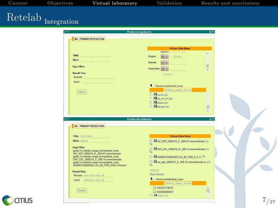
13 Retelab Integration 8/27

14 Index 1 Context and Motivation 2 Objectives 3 Virtual laboratory development 4 Virtual laboratory validation 5 Results and conclusions

15 Sentinazos Introduction The international trade is mainly supported by maritime transport. The intensive trac sails along the Exclusive Economic Zones (EEZ) of the countries and generates important pollution problems. Only the 7 % of oil spills come from catastrophes like tanker and oil platform accidents. Sentinazos 35% 45% Accidentes 13% 7% Emanaciones naturales Ríos 9/27

16 Sentinazos Introduction Synthetic Aperture Radar (a) (b) (c) Vientos de baja intensidad <3 m/s Vientos moderados Vientos fuertes > 15 m/s 10/27


17 Sentinazos Introduction Synthetic Aperture Radar - Examples 10 30'W 10 W 9 30'W 9 W 8 30'W 44 N Millas náuticas 43 30'N 43 N 42 30'N 42 N 11/27

18 Sentinazos Introduction Synthetic Aperture Radar - Oil Spills Total number of spills=1.638 (Mediterraneam sea, 1999) Amorphous Old Spills Angular spills Less fresh spills Very fresh spills Figura: Classication of detected spills in terms of their shapes. 12/27

19 Sentinazos Goals Hypothesis 1. Is possible to use wind information to segment oil candidates from SAR images? 2. Is the shape analysis relevant to classify the oil candidates? Goal To develop an oil spill automatic detection system focused on the galician coast and based on SAR images. 13/27

20 Sentinazos Methodology Dataset: a collection of 47 SAR images from the Envisat. - Galician coast. Finisterre Trac Separation Scheme ( ) - Wide Swath Mode - Polarization: vertical-vertical - Coverage: 400 km x 400 km 14/27

21 Methodology Sentinazos Oil Spill detection system architecture Image calibration SAR images Reprojection Land mask Noise filter Preprocesing Wind data Segmentation Characterization Classification Detection system 15/27

22 Sentinazos Methodology Segmentation - Establishing the Adaptive Threshold. 16/27
23 Sentinazos Methodology Segmentation - Applying the Adaptive Threshold Pixel data > 3m/s <=Threshold Wind Speed? Selecting AT Applying AT Intensity? Labeling as oil < 3m/s Labeling as water >Threshold Generating Binary Image SAR images: x pixels. Incidence Angle Wind Speed Intensity Deleting Blobs <50 pixels (0.3km 2 ) Blob Area? Extracting Blobs Pixel >50 pixels 17/27
24 Sentinazos Methodology Characterization - The segmented areas are analyzed to get a characteristic vector: > 17 shape characteristics (Ratio area perimeter, 7 Hu moments, Thickness, etc) PCA 5 main components. > 2 physical characteristics related with the pixel intensity values. > 2 contextual characteristics related with the wind speed and the incidence angle. 18/27
25 Sentinazos Methodology Classication - Clustering of oil spills and look alikes. - Evaluation of the characteristics vector. - Machine learning classiers. > Articial Neural Network > Decision Tree 19/27

26 Sentinazos Methodology Classication Ratio intensidad < 2,04183 Sí No PCA3 < 9,49121 Sentinazo Sí No Sentinazo Look-alike 20/27
27 Index 1 Context and Motivation 2 Objectives 3 Virtual laboratory development 4 Virtual laboratory validation 5 Results and conclusions
28 Results and conclusions Base de datos de candidatos 155 Look-alikes 80 Sentinazos 85% 15% Datos para el entrenamiento Test 70% 15% Entrenamiento Validación Validation set Test set Sentinazos Look-alikes Sentinazos Look-alikes ANN 85,7 % 85,2 % 92,9 % 96,3 % Pruned decision tree 92,9 % 85,2 % 92,9 % 92,6 % 21/27
29 Results and conclusions A 10 W 9 W 43 N B C Millas Náuticas A 10 W a 9 W A 10 W b 9 W 43 N B 43 N B C C Millas Náuticas Millas Náuticas c d 22/27
30 Context Objectives Virtual laboratory Validation Results and conclusions Results and conclusions 10 40'W 10 30'W 43 40'N A 0 0, 'W 10 20'W 'W 3 Millas Náuticas 10 W 9 50'W 43 N 42 50'N 42 40'N B 0 10 W 'W Millas Náuticas 9 40'W 42 10'N C 0 42 N Millas Náuticas 23/27
31 Results and conclusions 24/27

32 Results and conclusions 25/27
33 Results and conclusions Conclusions - Processing time. - The AT could be improved using other wind models. - The oil spills inside of low wind areas are not discovered. - Is the shape relevant? Ongoing work - New wind speed models. - New satellites (Sentinel). - New classiers. - Add contextual data (ships, FTSS, etc). 26/27
34 Collaborations Retelab - Marine and Food Technological Centre (AZTI Tecnalia) - The Centre of Supercomputing of Galicia (CESGA) - Canarian Institute of Marine Sciences (ICCM) Sentinazos - University of Coruña - Median Engeniering Group (GIM), University of Extremadura - MacDonald Image Lab, Department of Earth, Ocean and Atmospheric Sciences, Florida State University - Spanish Maritime Safety Agency (SASEMAR) 27/27
35 Thank you!!
Satellite monitoring of oil spills in the Mediterranean Sea for 1999-2004
 Satellite monitoring of oil spills in the Mediterranean Sea for 1999-2004 Konstantinos Topouzelis, O. Muellenhoff, G. Ferraro, B. Bulgarelli E.C. Joint Research Centre Institute for the Protection and
The Application of Synthetic Aperture Radar (SAR) to Natural Resource Damage Assessment
 to Natural Resource Damage Assessment") The Application of Synthetic Aperture Radar (SAR) to Natural Resource Damage Assessment George Graettinger NOAA s Ocean Service, Office of Response & Restoration Oil Observing Tools Training & Workshop
The Application of Synthetic Aperture Radar (SAR) to Natural Resource Damage Assessment George Graettinger NOAA s Ocean Service, Office of Response & Restoration Oil Observing Tools Training & Workshop
The distribution of marine OpenData via distributed data networks and Web APIs. The example of ERDDAP, the message broker and data mediator from NOAA
 The distribution of marine OpenData via distributed data networks and Web APIs. The example of ERDDAP, the message broker and data mediator from NOAA Dr. Conor Delaney 9 April 2014 GeoMaritime, London
TerraSAR-X Applications Guide
 TerraSAR-X Applications Guide Extract: Maritime Monitoring: Oil Spill Detection April 2015 Airbus Defence and Space Geo-Intelligence Programme Line Maritime Monitoring: Oil Spill Detection Issue As the
Space radar technologies for oil spills management, detection of illegal fishing and logging activities
 Space radar technologies for oil spills management, detection of illegal fishing and logging activities VIGISAT The French satellite ground receiving station VIGISAT 2009 know today, live better tomorrow
The use of Satellite Remote Sensing for Offshore Environmental Benchmarking
 The use of Satellite Remote Sensing for Offshore Environmental Benchmarking Michael King Fugro NPA Limited Fugro NPA (Formerly Nigel Press Associates) World leading Satellite Remote Sensing & Geoscience
The European Space Agency s Synthetic Aperture Radar Programme From Experiment to Service Provision
 The European Space Agency s Synthetic Aperture Radar Programme From Experiment to Service Provision Evert Attema ESA, Directorate of Earth Observation Programme! The idea of an independent European space
16 th IOCCG Committee annual meeting. Plymouth, UK 15 17 February 2011. mission: Present status and near future
 16 th IOCCG Committee annual meeting Plymouth, UK 15 17 February 2011 The Meteor 3M Mt satellite mission: Present status and near future plans MISSION AIMS Satellites of the series METEOR M M are purposed
Sentinel-1 Mission Overview
 Sentinel-1 Mission Overview Pierre Potin Sentinel-1 Mission Manager, ESA Advanced Course on Radar Polarimetry ESRIN, Frascati, 19 January 2011 Global Monitoring for Environment and Security GMES is established
Operational Space- Based Crop Mapping Protocols at AAFC A. Davidson, H. McNairn and T. Fisette.
 Operational Space- Based Crop Mapping Protocols at AAFC A. Davidson, H. McNairn and T. Fisette. Science & Technology Branch. Agriculture and Agri-Food Canada. 1. Introduction Space-Based Crop Mapping at
THEMIS: MARINE RESOURCES MANAGEMENT SOFTWARE SUITE
 THEMIS: MARINE RESOURCES MANAGEMENT SOFTWARE SUITE THEMIS*, A COMPREHENSIVE FISHERIES MANAGEMENT SUITE THEMIS is a comprehensive data integration interface and a crucial tool for maintaining 24-hour fishing
How To Find Natural Oil Seepage In The Dreki Area Using An Envisat Image
 rn ORKUSTOFNUN National Energy Authority Searching for natural oil seepage in the Dreki area using ENVISAT radar images. Ingibjorg J6nsd6ttir and Arni Freyr Valdimarsson, Faculty of Earth Sciences School
Maritime accidents and safety investigations. Executive Director Dr. Veli-Pekka Nurmi
 Maritime accidents and safety investigations Executive Director Background for marine accident investigations Historically the maritime safety has improved through learning by experience. The practises
Monitoring of Arctic Conditions from a Virtual Constellation of Synthetic Aperture Radar Satellites
 DISTRIBUTION STATEMENT A. Approved for public release; distribution is unlimited. Monitoring of Arctic Conditions from a Virtual Constellation of Synthetic Aperture Radar Satellites Hans C. Graber RSMAS
Analecta Vol. 8, No. 2 ISSN 2064-7964
 EXPERIMENTAL APPLICATIONS OF ARTIFICIAL NEURAL NETWORKS IN ENGINEERING PROCESSING SYSTEM S. Dadvandipour Institute of Information Engineering, University of Miskolc, Egyetemváros, 3515, Miskolc, Hungary,
Azure Machine Learning, SQL Data Mining and R
 Azure Machine Learning, SQL Data Mining and R Day-by-day Agenda Prerequisites No formal prerequisites. Basic knowledge of SQL Server Data Tools, Excel and any analytical experience helps. Best of all:
Norwegian Satellite Earth Observation Database for Marine and Polar Research http://normap.nersc.no USE CASES
 Norwegian Satellite Earth Observation Database for Marine and Polar Research http://normap.nersc.no USE CASES The NORMAP Project team has prepared this document to present functionality of the NORMAP portal.
Galaxy Morphological Classification
 Galaxy Morphological Classification Jordan Duprey and James Kolano Abstract To solve the issue of galaxy morphological classification according to a classification scheme modelled off of the Hubble Sequence,
METIER Course No. 6: Remote Sensing & Hydrosphere Helsinki 6 November 2008 Kati Tahvonen Finnish Environment Institute
 The Use of Remote Sensing, Drifting Forecasts and GIS Data in Oil Response and Pollution Monitoring METIER Course No. 6: Remote Sensing & Hydrosphere Helsinki 6 November 2008 Kati Tahvonen Finnish Environment
EMSA s Integrated Maritime Environment. Justino de Sousa. October 2012. - a tool for improved Maritime Domain Awareness
 EMSA s Integrated Maritime Environment - a tool for improved Maritime Domain Awareness October 2012 1 Justino de Sousa European Maritime Safety Agency C.3.1 Integrated Maritime Data Introduction : the
Applications of Deep Learning to the GEOINT mission. June 2015
 Applications of Deep Learning to the GEOINT mission June 2015 Overview Motivation Deep Learning Recap GEOINT applications: Imagery exploitation OSINT exploitation Geospatial and activity based analytics
Synthetic Aperture Radar: Principles and Applications of AI in Automatic Target Recognition
 Synthetic Aperture Radar: Principles and Applications of AI in Automatic Target Recognition Paulo Marques 1 Instituto Superior de Engenharia de Lisboa / Instituto de Telecomunicações R. Conselheiro Emídio
Development of an Integrated Data Product for Hawaii Climate
 Development of an Integrated Data Product for Hawaii Climate Jan Hafner, Shang-Ping Xie (PI)(IPRC/SOEST U. of Hawaii) Yi-Leng Chen (Co-I) (Meteorology Dept. Univ. of Hawaii) contribution Georgette Holmes
Practical Data Science with Azure Machine Learning, SQL Data Mining, and R
 Practical Data Science with Azure Machine Learning, SQL Data Mining, and R Overview This 4-day class is the first of the two data science courses taught by Rafal Lukawiecki. Some of the topics will be
Brett Gaines Senior Consultant, CGI Federal Geospatial and Data Analytics Lead Developer
 Air Quality Data Analytics using Spark and Esri s GIS Tools for Hadoop Esri International User Conference July 22, 2015 Session: Discovery and Analysis of Big Data using GIS Brett Gaines Senior Consultant,
NASA Earth System Science: Structure and data centers
 SUPPLEMENT MATERIALS NASA Earth System Science: Structure and data centers NASA http://nasa.gov/ NASA Mission Directorates Aeronautics Research Exploration Systems Science http://nasascience.nasa.gov/
Use of OGC Sensor Web Enablement Standards in the Meteorology Domain. in partnership with
 Use of OGC Sensor Web Enablement Standards in the Meteorology Domain in partnership with Outline Introduction to OGC Sensor Web Enablement Standards Web services Metadata encodings SWE as front end of
Big Data Analytics. for the Exploitation of the CERN Accelerator Complex. Antonio Romero Marín
 Big Data Analytics for the Exploitation of the CERN Accelerator Complex Antonio Romero Marín Milan 11/03/2015 Oracle Big Data and Analytics @ Work 1 What is CERN CERN - European Laboratory for Particle
Modelling, Extraction and Description of Intrinsic Cues of High Resolution Satellite Images: Independent Component Analysis based approaches
 Modelling, Extraction and Description of Intrinsic Cues of High Resolution Satellite Images: Independent Component Analysis based approaches PhD Thesis by Payam Birjandi Director: Prof. Mihai Datcu Problematic
Levee Assessment via Remote Sensing Levee Assessment Tool Prototype Design & Implementation
 Levee Assessment via Remote Sensing Levee Assessment Tool Prototype Design & Implementation User-Friendly Map Viewer Novel Tab-GIS Interface Extensible GIS Framework Pluggable Tools & Classifiers December,
Methods for Monitoring Forest and Land Cover Changes and Unchanged Areas from Long Time Series
 Methods for Monitoring Forest and Land Cover Changes and Unchanged Areas from Long Time Series Project using historical satellite data from SACCESS (Swedish National Satellite Data Archive) for developing
Введение в спутниковую радиолокацию: Радиолокаторы с синтезированной апертурой (РСА) Introduction to satellite radars: Synthetic Aperture Radars (SAR)
 Introduction to satellite radars: Synthetic Aperture Radars (SAR)") Введение в спутниковую радиолокацию: Радиолокаторы с синтезированной апертурой (РСА) Introduction to satellite radars: Synthetic Aperture Radars (SAR) проф. Бертран Шапрон IFREMER / ЛСО РГГМУ Prof. Bertrand
Введение в спутниковую радиолокацию: Радиолокаторы с синтезированной апертурой (РСА) Introduction to satellite radars: Synthetic Aperture Radars (SAR) проф. Бертран Шапрон IFREMER / ЛСО РГГМУ Prof. Bertrand
How To Monitor Sea Level With Satellite Radar
 Satellite Altimetry Wolfgang Bosch Deutsches Geodätisches Forschungsinstitut (DGFI), München email: [email protected] Objectives You shall recognize satellite altimetry as an operational remote sensing
New Space Capabilities for Maritime Surveillance
 www.dlr.de ESA Blue Growth Marititime College, Cork, Ireland 17.4..2013 New Space Capabilities for Maritime Surveillance Susanne Lehner German Aerospace Center DLR Remote Sensing Technology Institute DLR
Supervised Classification workflow in ENVI 4.8 using WorldView-2 imagery
 Supervised Classification workflow in ENVI 4.8 using WorldView-2 imagery WorldView-2 is the first commercial high-resolution satellite to provide eight spectral sensors in the visible to near-infrared
Pentaho Data Mining Last Modified on January 22, 2007
 Pentaho Data Mining Copyright 2007 Pentaho Corporation. Redistribution permitted. All trademarks are the property of their respective owners. For the latest information, please visit our web site at www.pentaho.org
COMPARISON OF OBJECT BASED AND PIXEL BASED CLASSIFICATION OF HIGH RESOLUTION SATELLITE IMAGES USING ARTIFICIAL NEURAL NETWORKS
 COMPARISON OF OBJECT BASED AND PIXEL BASED CLASSIFICATION OF HIGH RESOLUTION SATELLITE IMAGES USING ARTIFICIAL NEURAL NETWORKS B.K. Mohan and S. N. Ladha Centre for Studies in Resources Engineering IIT
DISMAR: Data Integration System for Marine Pollution and Water Quality
 DISMAR: Data Integration System for Marine Pollution and Water Quality T. Hamre a,, S. Sandven a, É. Ó Tuama b a Nansen Environmental and Remote Sensing Center, Thormøhlensgate 47, N-5006 Bergen, Norway
Maritime Domain Management System
 Maritime Domain Management System A member of the SRT plc group www.srt-marinesystems.com 1 Who is SRT Marine System Solutions? The global leaders in maritime domain VTS, VMS technologies, products and
COASTAL WIND ANALYSIS BASED ON ACTIVE RADAR IN QINGDAO FOR OLYMPIC SAILING EVENT
 COASTAL WIND ANALYSIS BASED ON ACTIVE RADAR IN QINGDAO FOR OLYMPIC SAILING EVENT XIAOMING LI a, b, * a Remote Sensing Technology Institute, German Aerospace Center (DLR), Oberpfaffenhofen, 82234, Germany
Rosaly Lopes, Jet Propulsion Laboratory, California Institute of Technology
 Saturn s Moon Titan: Cassini-Huygens Reveals a New World Rosaly Lopes, Jet Propulsion Laboratory, California Institute of Technology The year 2005 will be remembered in the history of space exploration
SIGNATURE VERIFICATION
 SIGNATURE VERIFICATION Dr. H.B.Kekre, Dr. Dhirendra Mishra, Ms. Shilpa Buddhadev, Ms. Bhagyashree Mall, Mr. Gaurav Jangid, Ms. Nikita Lakhotia Computer engineering Department, MPSTME, NMIMS University
Multisensor Data Fusion and Applications
 Multisensor Data Fusion and Applications Pramod K. Varshney Department of Electrical Engineering and Computer Science Syracuse University 121 Link Hall Syracuse, New York 13244 USA E-mail: [email protected]
Review for Introduction to Remote Sensing: Science Concepts and Technology
 Review for Introduction to Remote Sensing: Science Concepts and Technology Ann Johnson Associate Director [email protected] Funded by National Science Foundation Advanced Technological Education program [DUE
Received in revised form 24 March 2004; accepted 30 March 2004
 Remote Sensing of Environment 91 (2004) 237 242 www.elsevier.com/locate/rse Cloud detection in Landsat imagery of ice sheets using shadow matching technique and automatic normalized difference snow index
How To Use Data From Copernicus And Big Data To Help The Environment
 Copernicus and Big Data: Challenges and Opportunities Alessandro Annoni European Commission Joint Research Centre www.jrc.ec.europa.eu Serving society Stimulating innovation Supporting legislation Big
Morphological analysis on structural MRI for the early diagnosis of neurodegenerative diseases. Marco Aiello On behalf of MAGIC-5 collaboration
 Morphological analysis on structural MRI for the early diagnosis of neurodegenerative diseases Marco Aiello On behalf of MAGIC-5 collaboration Index Motivations of morphological analysis Segmentation of
How To Write A Call To Action For Terrasar-X
 Doc.: TX-PGS-PL-4127 TerraSAR-X Announcement of Opportunity: Utilization of the TerraSAR-X Archive 1 Page: 2 of 11 TABLE OF CONTENTS TERRASAR-X... 1 ANNOUNCEMENT OF OPPORTUNITY: UTILIZATION OF THE TERRASAR-X
INTEGRANDO DATOS MARINOS Y MODELOS AL SERVICIO DE LA OPERATIVA PORTUARIA: EL SISTEMA SAMPA DEL PUERTO DE ALGECIRAS
 INTEGRANDO DATOS MARINOS Y MODELOS AL SERVICIO DE LA OPERATIVA PORTUARIA: EL SISTEMA SAMPA DEL PUERTO DE ALGECIRAS Operational Oceanography on the Strait of Gibraltar SAMPA and TRADE Teams Physical environment
Comparison of K-means and Backpropagation Data Mining Algorithms
 Comparison of K-means and Backpropagation Data Mining Algorithms Nitu Mathuriya, Dr. Ashish Bansal Abstract Data mining has got more and more mature as a field of basic research in computer science and
Tactical Oil Spill Management TOSM APTOMAR.COM
 Tactical Oil Spill Management TOSM APTOMAR.COM TCMS AIRBORNE OFFSHORE NEAR SHORE ONSHORE Operations Room Oil Rig Oil Rig Standby Vesel SECurus Radar Surveillance Aircraft TACTICAL OIL SPILL MANAGEMENT
MyOcean Copernicus Marine Service Architecture and data access Experience
 MyOcean Copernicus Marine Service Architecture and data access Experience Sophie Besnard CLS, Toulouse, France February 2015 MyOcean Story MyOcean Challenge & Success MyOcean Service MyOcean System MyOcean
Ksat Infrastructure and architecture for Multi-Mission Applications. dr. Kris Nackaerts dr. Martin Krynitz dr. Jan Petter Pedersen
 Ksat Infrastructure and architecture for Multi-Mission Applications dr. Kris Nackaerts dr. Martin Krynitz dr. Jan Petter Pedersen Riyadh, 2016 Tromsø Capital of space activities in the North Tromsø Capital
An Introduction to Data Mining. Big Data World. Related Fields and Disciplines. What is Data Mining? 2/12/2015
 An Introduction to Data Mining for Wind Power Management Spring 2015 Big Data World Every minute: Google receives over 4 million search queries Facebook users share almost 2.5 million pieces of content
Workload Characterization and Analysis of Storage and Bandwidth Needs of LEAD Workspace
 Workload Characterization and Analysis of Storage and Bandwidth Needs of LEAD Workspace Beth Plale Indiana University [email protected] LEAD TR 001, V3.0 V3.0 dated January 24, 2007 V2.0 dated August
NCDC's Application of Climate Data to Tourism Business Decision-Making
 NCDC's Application of Climate Data to Tourism Business Decision-Making Climate, Weather, and Tourism Workshop November 14-15, 2008 East Carolina University Greenville, NC Neal Lott NOAA s National Climatic
A KNOWLEDGE-BASED APPROACH FOR REDUCING CLOUD AND SHADOW ABSTRACT
 A KNOWLEDGE-BASED APPROACH FOR REDUCING CLOUD AND SHADOW Mingjun Song, Graduate Research Assistant Daniel L. Civco, Director Laboratory for Earth Resources Information Systems Department of Natural Resources
National Snow and Ice Data Center
 National Snow and Ice Data Center This data set (NSIDC-0484), part of the NASA Making Earth System Data Records for Use in Research Environments (MEaSUREs) Program, provides the first comprehensive, high-resolution,
Tutorial 8 Raster Data Analysis
 Objectives Tutorial 8 Raster Data Analysis This tutorial is designed to introduce you to a basic set of raster-based analyses including: 1. Displaying Digital Elevation Model (DEM) 2. Slope calculations
Scientific Data Management and Dissemination
 Federal GIS Conference February 9 10, 2015 Washington, DC Scientific Data Management and Dissemination John Fry Solution Engineer, Esri [email protected] Agenda Background of Scientific Data Management through
The Arctic Observing Network and its Data Management Challenges Florence Fetterer (NSIDC/CIRES/CU), James A. Moore (NCAR/EOL), and the CADIS team
, James A. Moore (NCAR/EOL), and the CADIS team") The Arctic Observing Network and its Data Management Challenges Florence Fetterer (NSIDC/CIRES/CU), James A. Moore (NCAR/EOL), and the CADIS team Photo courtesy Andrew Mahoney NSF Vision What is AON? a
The Arctic Observing Network and its Data Management Challenges Florence Fetterer (NSIDC/CIRES/CU), James A. Moore (NCAR/EOL), and the CADIS team Photo courtesy Andrew Mahoney NSF Vision What is AON? a
Marine route optimization. Jens Olaf Pepke Pedersen Polar DTU / DTU Space www.polar.dtu.dk www.space.dtu.dk
 Marine route optimization Jens Olaf Pepke Pedersen Polar DTU / DTU Space www.polar.dtu.dk www.space.dtu.dk Early attempt at route optimization Jens Munk (1579-1628) Tries to find a way to India through
Dr. Gary S. E. Lagerloef Earth and Space Research, 1910 Fairview Ave E
 Establishing a NOAA Operational Data Center for Surface Currents Derived from Satellite Altimeters and Scatterometers; Pilot Study for the Tropical Pacific Including the Hawaiian Islands and US Territorial
The Matsu Wheel: A Cloud-based Scanning Framework for Analyzing Large Volumes of Hyperspectral Data
 The Matsu Wheel: A Cloud-based Scanning Framework for Analyzing Large Volumes of Hyperspectral Data Maria Patterson, PhD Open Science Data Cloud Center for Data Intensive Science (CDIS) University of Chicago
Fingerprinting the datacenter: automated classification of performance crises
 Fingerprinting the datacenter: automated classification of performance crises Peter Bodík 1,3, Moises Goldszmidt 3, Armando Fox 1, Dawn Woodard 4, Hans Andersen 2 1 RAD Lab, UC Berkeley 2 Microsoft 3 Research
WebFOCUS RStat. RStat. Predict the Future and Make Effective Decisions Today. WebFOCUS RStat
 Information Builders enables agile information solutions with business intelligence (BI) and integration technologies. WebFOCUS the most widely utilized business intelligence platform connects to any enterprise
Satellite Altimetry Missions
 Satellite Altimetry Missions SINGAPORE SPACE SYMPOSIUM 30 TH SEPTEMBER 2015 AUTHORS: LUCA SIMONINI/ ERICK LANSARD/ JOSE M GONZALEZ www.thalesgroup.com Table of Content General Principles and Applications
Digital image processing
 746A27 Remote Sensing and GIS Lecture 4 Digital image processing Chandan Roy Guest Lecturer Department of Computer and Information Science Linköping University Digital Image Processing Most of the common
Plagiarism detection using software tools: a study in a Computer Science degree
 Plagiarism detection using software tools: a study in a Computer Science degree A. Bugarín, M. Carreira, M. Lama, X.M. Pardo Department of Electronics and Computer Science, School of Engineering, University
Security Systems EMERGENCY MANAGEMENT. In security you cannot choose the second best option. indracompany.com
 Security Systems EMERGENCY MANAGEMENT In security you cannot choose the second best option indracompany.com EMERGENCY MANAGEMENT EMERGENCY MANAGEMENT EMERGENCY C4i CENTRE Crisis management and preparednesss
Introduction. A. Bellaachia Page: 1
 Introduction 1. Objectives... 3 2. What is Data Mining?... 4 3. Knowledge Discovery Process... 5 4. KD Process Example... 7 5. Typical Data Mining Architecture... 8 6. Database vs. Data Mining... 9 7.
Is a Data Scientist the New Quant? Stuart Kozola MathWorks
 Is a Data Scientist the New Quant? Stuart Kozola MathWorks 2015 The MathWorks, Inc. 1 Facts or information used usually to calculate, analyze, or plan something Information that is produced or stored by
De la Business Intelligence aux Big Data. Marie- Aude AUFAURE Head of the Business Intelligence team Ecole Centrale Paris. 22/01/14 Séminaire Big Data
 De la Business Intelligence aux Big Data Marie- Aude AUFAURE Head of the Business Intelligence team Ecole Centrale Paris 22/01/14 Séminaire Big Data 1 Agenda EvoluHon of Business Intelligence SemanHc Technologies
131-1. Adding New Level in KDD to Make the Web Usage Mining More Efficient. Abstract. 1. Introduction [1]. 1/10
![131-1. Adding New Level in KDD to Make the Web Usage Mining More Efficient. Abstract. 1. Introduction [1]. 1/10](/thumbs/25/4963058.jpg "131-1. Adding New Level in KDD to Make the Web Usage Mining More Efficient. Abstract. 1. Introduction [1]. 1/10") 1/10 131-1 Adding New Level in KDD to Make the Web Usage Mining More Efficient Mohammad Ala a AL_Hamami PHD Student, Lecturer m_ah_1@yahoocom Soukaena Hassan Hashem PHD Student, Lecturer soukaena_hassan@yahoocom
1/10 131-1 Adding New Level in KDD to Make the Web Usage Mining More Efficient Mohammad Ala a AL_Hamami PHD Student, Lecturer m_ah_1@yahoocom Soukaena Hassan Hashem PHD Student, Lecturer soukaena_hassan@yahoocom
An Overview of Knowledge Discovery Database and Data mining Techniques
 An Overview of Knowledge Discovery Database and Data mining Techniques Priyadharsini.C 1, Dr. Antony Selvadoss Thanamani 2 M.Phil, Department of Computer Science, NGM College, Pollachi, Coimbatore, Tamilnadu,
Video Analytics A New Standard
 Benefits The system offers the following overall benefits: Tracker High quality tracking engine UDP s embedded intelligent Video Analytics software is fast becoming the standard for all surveillance and
Windows Azure Data Services (basics) 55093A; 3 Days
 55093A; 3 Days") Lincoln Land Community College Capital City Training Center 130 West Mason Springfield, IL 62702 217-782-7436 www.llcc.edu/cctc Windows Azure Data Services (basics) 55093A; 3 Days Course Description This
Lincoln Land Community College Capital City Training Center 130 West Mason Springfield, IL 62702 217-782-7436 www.llcc.edu/cctc Windows Azure Data Services (basics) 55093A; 3 Days Course Description This
How To Understand The History Of Navigation In French Marine Science
 E-navigation, from sensors to ship behaviour analysis Laurent ETIENNE, Loïc SALMON French Naval Academy Research Institute Geographic Information Systems Group [email protected] [email protected]
Machine Learning with MATLAB David Willingham Application Engineer
 Machine Learning with MATLAB David Willingham Application Engineer 2014 The MathWorks, Inc. 1 Goals Overview of machine learning Machine learning models & techniques available in MATLAB Streamlining the