MyOcean Copernicus Marine Service Architecture and data access Experience
|
|
|
- Neal Long
- 10 years ago
- Views:
Transcription
1 MyOcean Copernicus Marine Service Architecture and data access Experience Sophie Besnard CLS, Toulouse, France February 2015

2 MyOcean Story MyOcean Challenge & Success MyOcean Service MyOcean System MyOcean Engineering MyOcean towards CMS

3 MyOcean Story MyOcean1 integration of a System of systems - Strong engineering part to structure and manage the project - Requirements coming from EU stakeholder mainly. MyOcean2 Service part takes the lead - More user oriented with integration of users feedbacks in the continuous improvement process. Strong improvements in terms of process and operationality. MyOcean-FO Consolidation of the System and the Service - Continuity of MyOcean 2 to reach full operationality. CMS Copernicus Marine environment monitoring Service Operational service with its user community and strong integration in the Oceanographic and industrial world.

4 MyOcean Story MyOcean Challenge & Success MyOcean Service MyOcean System MyOcean Engineering MyOcean towards CMS

5 MyOcean: Initial postulat Provide a unified marine data access service (interoperable, INSPIRE) with lots of (heterogeneous) data providers who want keep hold on their data and their production system at home (flexible, federative)

6 MyOcean : Five objectives Today MyOcean delivers: 1. A core service (easy access, reliable and sustainable) 2. An integrated capacity for production & service 3. A user-driven service 4. A pan-european organization 5. A methodology for development and operations The initial postulat is reached successfully

7 MyOcean key success points A unique access point service (unique centralized Portal & Service Desk) Not only a system but a user-driven service relying on a distributed scalable organization Addressing both registered / regular Users (Met Offices, Navies, ) and occasional Users (Researchers, EU Citizen, ) Addressing sectoral activities Discovery, visualization and download services through an online interactive catalogue covering all products Open & Free Access (EU data policy) A common set of information, documentation, content and formats All data served through standard interfaces Mainly compliant with the INSPIRE directive (and on track to be fully) Monitoring and reporting capabilities (product, system, users) for better service provision User feedbacks management and technological watch for continuous improvement Configuration and change management Continuous increase & improvement of the services and products and their quality level
 Monitoring and reporting capabilities (product, system, users) for better service provision User feedbacks management")
 Met/oceano. Centres + Business Cies.")
8 Users and Service End of 2014: Number of registered users: more than % New users rate: > 110 new users/ month 13% Users depending operationally on MyOcean : % Downstream providers: 1076 (31%) Met/oceano. Centres + Business Cies. 3% Business/Company 17% 51% University, Educational, Research National Meteorological and / or Oceanographic Service (public sector) Other International Organisation Unaffiliated Other

9 MyOcean Story MyOcean Challenge & Success MyOcean Service MyOcean System MyOcean Engineering MyOcean towards CMS

10 A comprehensive and consistent description of the ocean All areas In Situ observations Satellite Observations Assimilative Models Real-time Reanalyses Sectoral Users

11 MyOcean Web Portal


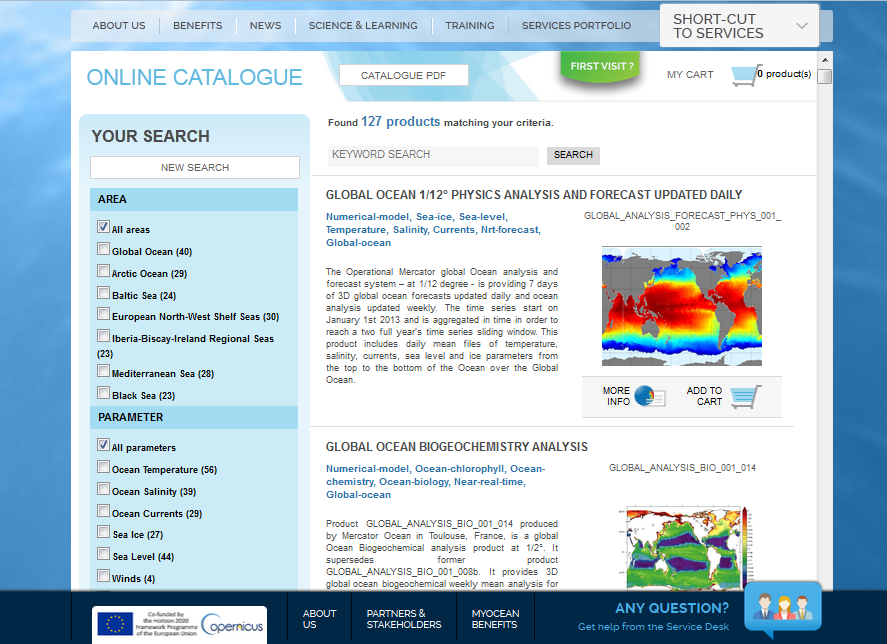
12 MyOcean Web Portal

13 MyOcean Viewing


14 MyOcean Viewing

15 Service desk to support and help End Users and Data Providers. A Central service desk is supported by a distributed organization of local service desks Quality control on product and service (online and through reports) Service continuity and transition management User Workshop Online documentation on the product MyOcean additional services Measure Dec Jan % Availability of MIS based on 7 days 100% 100% x 24 hours requirement % Availability of MIS Catalogue 99,88% 100% Browser Service based on 7 days x 24 hours requirement. Number of times the outage was more 0/1 0/0 than 2 days (x) over number of individual outages (y) % Availability of Authorisation Interface 100% 100% Service based on 7 days x 24 hours requirement

16 MyOcean Story MyOcean Challenge & Success MyOcean Service MyOcean System MyOcean Engineering MyOcean towards CMS

 -")

17 From data production to downstream applications through standard web services 1 Web portal - Centralized system - Offer a single entry to all services - Users have a unique login and password to access all MyOcean services Login View Discove r Downloa d 24 Dissemination units 1 Information system - Centralized system - Provide a catalogue build on OGC and ISO standards (INSPIRE directive) - Provide administration functionalities - Provide a centralized authentication system - Distributed systems over Europe - Provide machine to machine interfaces to download and view data - All DUs are connected to the centralized authentication system - Authorization can be configured in the DU: a user profile can access certain datasets and not others - All DUs are monitored centrally: system monitoring and transaction accounting Catalogue Metadata (ISO) Authentication/Authorization Subsetter View FTP Subsetter View FTP Subsetter View FTP Subsetter View FTP Subsetter View FTP Download View FTP Storage netcdf CF


18 A pan-european system organization to produce marine information 24 DU 52 PU 59 partners 127 products / 561 datasets 94To delivered to the user in 2014


 - Monitoring Dashboard - Static metadata - User Administration View Catalogue User")
19 Functional Overview Download SL TAC OC TAC OSI TAC In Situ TAC Production Centres Global MFC Arctic MFC Baltic MFC NWS MFC IBI MFC MED MFC Black Sea MFC Monitoring User Transaction Production System Monitoring Central Information System (CIS) MyOcean Information System (MIS) User Interface System (UIS) - Monitoring Dashboard - Static metadata - User Administration View Catalogue User registration
 - Monitoring Dashboard - Static metadata - User Administration View Catalogue User")


20 Client side Server side Download Service: technical overview NetCDF M-FTP NetCDF THREDDS NetCDF FILE or FTP Gridded data: TDS or File + Motu In situ data MyOcean FTP (authenticated) MOTU Metadata (XML) Data(NetCDF files) HTML, Javascript Script downloading Python Command line MyOcean Web Portal Download interface

21 Client side Server side View Service: technical overview NetCDF THREDDS WMS NetCDF THREDDS WMS NetCDF THREDDS WMS Gridded data: THREDDS + ncwms In situ data Oceanotron + WMS frontdesk Metadata (XML) Images (PNG) Background Maps MyOcean Web Portal Dynamic View HTML, Javascript Third-party WMS clients. e.g. EEA Eye On Earth)
22 MyOcean Story MyOcean Challenge & Success MyOcean Service MyOcean System MyOcean Engineering MyOcean towards CMS
23 Engineering Success : visible part From good scientific algorithms good system prototype (operate by experts only) FTP services To Service with strong availability, timeliness, robustness SLA to allow End Users to rely on us to create downstream services Only one point of contact for user : one main service desk, one catalogue, one Graphic user interface for download or View Complexity of 54 Production units, 24 Dissemination units hidden Still Good scientific algorithms, ie the best products One major release by year (big step) Quaterly small releases for the flexibility, dynamism Taking into account the user needs and feedbacks
24 Engineering Success : hidden part Mastering of standards and strong experiences in system engineering and service engineering Good rhythm : Continuous adaptation of project methodology according to partners feelings (Implies partners communication) Lot of Sensitization and Training (and we should have done even more to get better result or at least with less suffering!) Lot of communication during integration and testing phases (IVV). Change management and release management : Good rhythm between dynamism (user point of view), flexibility (partners point of view), and number of IVV phases by years (cost and stress).
25 MyOcean Story MyOcean Challenge & Success MyOcean Service MyOcean System MyOcean Engineering MyOcean towards CMS
26 MyOcean: Next Steps Transition to Copernicus Marine Environment Monitoring Service (May 1 st, 2015) Service Continuity Insure System Operations without disruption from May 2015 Adaptation to new context, new partners, new interfaces, new products Support for transition Technical support on new-comers Continuous technical support to users Put Marine Copernicus on track Consolidate current System Analyze feedbacks from MyOcean experience
27 END
SeaDataNet pan-european infrastructure for ocean and marine data management. Dick M.A. Schaap MARIS
 SeaDataNet pan-european infrastructure for ocean and marine data management By Dick M.A. Schaap MARIS SeaDataNet II Technical Coordinator Co-authors: Michele Fichaut (Ifremer) and Giuseppe Manzella (ENEA)
SeaDataNet pan-european infrastructure for ocean and marine data management and its relation to EMODNet and GEOSS
 SeaDataNet pan-european infrastructure for ocean and marine data management and its relation to EMODNet and GEOSS By Dick M.A. Schaap MARIS SeaDataNet Technical Coordinator Madrid Spain, 26 January 2012,
CMEMS user requirements and user uptake strategy
 CMEMS Service Evolution & User Uptake Workshop CMEMS user requirements and user uptake strategy Dominique Obaton Mercator Océan CMEMS Service Evolution & User Uptake Workshop The Copernicus Marine service
The distribution of marine OpenData via distributed data networks and Web APIs. The example of ERDDAP, the message broker and data mediator from NOAA
 The distribution of marine OpenData via distributed data networks and Web APIs. The example of ERDDAP, the message broker and data mediator from NOAA Dr. Conor Delaney 9 April 2014 GeoMaritime, London
Copernicus Space Component ESA Data Access Overview J. Martin (ESA), R. Knowelden (Airbus D&S)
, R. Knowelden (Airbus D&S)") Copernicus Space Component ESA Data Access Overview J. Martin (ESA), R. Knowelden (Airbus D&S) Introduction and Context Operational Scenarios Translation into interfaces Translation into services Current
Copernicus Space Component ESA Data Access Overview J. Martin (ESA), R. Knowelden (Airbus D&S) Introduction and Context Operational Scenarios Translation into interfaces Translation into services Current
CDI/THREDDS Interoperability: the SeaDataNet developments. P. Mazzetti 1,2, S. Nativi 1,2, 1. CNR-IMAA; 2. PIN-UNIFI
 CDI/THREDDS Interoperability: the SeaDataNet developments P. Mazzetti 1,2, S. Nativi 1,2, 1. CNR-IMAA; 2. PIN-UNIFI Outline Interoperability Issues in SeaDataNet A broker solution for CDI/THREDDS interoperability
Pan-European infrastructure for management of marine and ocean geological and geophysical data
 Pan-European infrastructure for management of marine and ocean geological and geophysical data By Dick M.A. Schaap Geo-Seas Technical Coordinator March 2010 Supported by the European Commission FP7 - Research
Norwegian Satellite Earth Observation Database for Marine and Polar Research http://normap.nersc.no USE CASES
 Norwegian Satellite Earth Observation Database for Marine and Polar Research http://normap.nersc.no USE CASES The NORMAP Project team has prepared this document to present functionality of the NORMAP portal.
Sentinels Operations Konzept und Prinzipien des Datenzugangs - Copernicus Space Component Data Access Overview
 Sentinels Operations Konzept und Prinzipien des Datenzugangs - Copernicus Space Component Data Overview B. Hoersch Ground Segment and Mission Operations Department, Earth Observation Programmes Directorate,
INSPIRE Dashboard. Technical scenario
 INSPIRE Dashboard Technical scenario Technical scenarios #1 : GeoNetwork catalogue (include CSW harvester) + custom dashboard #2 : SOLR + Banana dashboard + CSW harvester #3 : EU GeoPortal +? #4 :? + EEA
The ORIENTGATE data platform
 Seminar on Proposed and Revised set of indicators June 4-5, 2014 - Belgrade (Serbia) The ORIENTGATE data platform WP2, Action 2.4 Alessandra Nuzzo, Sandro Fiore, Giovanni Aloisio Scientific Computing and
DATA ACCESS AT EUMETSAT
 1 EUM/OPS/VWG/15/793789 v1a DATA ACCESS AT EUMETSAT Copernicus Climate Data Store Workshop ECMWF 3-6 March 2015 Harald Rothfuss Overview of Presentation 1. Introduction to EUMETSAT 2. EUMETSAT Data Access
 Integrated Data Viewer (IDV) a visualization framework Yuan Ho Unidata Program Center Boulder, CO Presentation Outline Integrated Data Viewer (IDV) overview The IDV features IDV examples and customized
SRS BIO OPTICAL WORKFLOW
 SRS BIO OPTICAL WORKFLOW Version 2.0 22 nd March 2013 Data Workflows emii, the data management facility for IMOS, has developed workflows for each IMOS sub facility to describe the flow of IMOS data from
13.2 THE INTEGRATED DATA VIEWER A WEB-ENABLED APPLICATION FOR SCIENTIFIC ANALYSIS AND VISUALIZATION
 13.2 THE INTEGRATED DATA VIEWER A WEB-ENABLED APPLICATION FOR SCIENTIFIC ANALYSIS AND VISUALIZATION Don Murray*, Jeff McWhirter, Stuart Wier, Steve Emmerson Unidata Program Center, Boulder, Colorado 1.
Cloud-based Infrastructures. Serving INSPIRE needs
 Cloud-based Infrastructures Serving INSPIRE needs INSPIRE Conference 2014 Workshop Sessions Benoit BAURENS, AKKA Technologies (F) Claudio LUCCHESE, CNR (I) June 16th, 2014 This content by the InGeoCloudS
Environment Canada Data Management Program. Paul Paciorek Corporate Services Branch May 7, 2014
 Environment Canada Data Management Program Paul Paciorek Corporate Services Branch May 7, 2014 EC Data Management Program (ECDMP) consists of 5 foundational, incremental projects which will implement
Copernicus Climate Change Service C3S. Jean-Noël Thépaut. [email protected]. Funded by the European Union.
 Copernicus Climate Change Service C3S Jean-Noël Thépaut [email protected] Funded by the European Union Implemented by C3S: State of play of play From the Copernicus regulation (EU) 377/2014:
DISMAR: Data Integration System for Marine Pollution and Water Quality
 DISMAR: Data Integration System for Marine Pollution and Water Quality T. Hamre a,, S. Sandven a, É. Ó Tuama b a Nansen Environmental and Remote Sensing Center, Thormøhlensgate 47, N-5006 Bergen, Norway
GeoNetwork, The Open Source Solution for the interoperable management of geospatial metadata
 GeoNetwork, The Open Source Solution for the interoperable management of geospatial metadata Ing. Emanuele Tajariol, GeoSolutions Ing. Simone Giannecchini, GeoSolutions GeoSolutions GeoSolutions GeoNetwork
Building a SDI for small countries the Portuguese example
 Building a SDI for small countries the Portuguese example Rui Pedro Julião Instituto Geográfico Português Deputy Director-General [email protected] Abstract Portugal was one of the SDI pioneers in the beginning
Metadata for Data Discovery: The NERC Data Catalogue Service. Steve Donegan
 Metadata for Data Discovery: The NERC Data Catalogue Service Steve Donegan Introduction NERC, Science and Data Centres NERC Discovery Metadata The Data Catalogue Service NERC Data Services Case study:
GOSIC NEXRAD NIDIS NOMADS
 NOAA National Climatic Data Center GOSIC NEXRAD NIDIS NOMADS Christina Lief NOAA/NESDIS/NCDC GOSIC Program Manager NOAA/NESDIS/NCDC Asheville, NC 28801 GEOSS AIP Phase 2 Workshop September 25-26, 2008
The Arctic Observing Network and its Data Management Challenges Florence Fetterer (NSIDC/CIRES/CU), James A. Moore (NCAR/EOL), and the CADIS team
, James A. Moore (NCAR/EOL), and the CADIS team") The Arctic Observing Network and its Data Management Challenges Florence Fetterer (NSIDC/CIRES/CU), James A. Moore (NCAR/EOL), and the CADIS team Photo courtesy Andrew Mahoney NSF Vision What is AON? a
The Arctic Observing Network and its Data Management Challenges Florence Fetterer (NSIDC/CIRES/CU), James A. Moore (NCAR/EOL), and the CADIS team Photo courtesy Andrew Mahoney NSF Vision What is AON? a
The Copernicus Marine Environment and Monitoring Service
 The Copernicus Marine Environment and Monitoring Service Pierre Bahurel, Mercator Ocean Marine data and information powering Blue Growth European Maritime Day, Athens, 28-29 May 2015 Search & Rescue in
The NERC DataGrid (NDG)
") The NERC DataGrid (NDG) Roy Lowry on behalf of the NDG, BADC and BODC. Ray Cramer, Marta Gutierrez, Kerstin Kleese Van Dam, Venkatasiva Kondapalli, Susan Latham, Bryan Lawrence, Kevin O Neill, Ag Stephens,
The NERC DataGrid (NDG) Roy Lowry on behalf of the NDG, BADC and BODC. Ray Cramer, Marta Gutierrez, Kerstin Kleese Van Dam, Venkatasiva Kondapalli, Susan Latham, Bryan Lawrence, Kevin O Neill, Ag Stephens,
The Copernicus Marine Enviroment Monitoring Service
 The Copernicus Marine Enviroment Monitoring Service P.Y. Le Traon 7&8 Sep 2015 - CMEMS SE & UU Workshop, Brussels 1 CMEMS : The Copernicus Marine Environment Monitoring Service SATELLITES (S1, S3, Jason-CS)
Interoperable Solutions in Web-based Mapping
 ISPRS SIPT IGU UCI CIG ACSG Table of contents Table des matières Authors index Index des auteurs Search Recherches Exit Sortir Interoperable Solutions in Web-based Mapping Marta Wojnarowska and Bridget
Spatial Data Infrastructure. A Collaborative Network
 Spatial Data Infrastructure A Collaborative Network Solving Challenges Takes Collaboration Social challenges, environmental issues, and economic downturns all take cooperation to solve. Working together
CA Service Desk Manager
 DATA SHEET CA Service Desk Manager CA Service Desk Manager (CA SDM), on-premise or on-demand, is designed to help you prevent service disruptions, better manage change risks, and provides a 360-degree
2311A: Advanced Web Application Development using Microsoft ASP.NET Course 2311A Three days Instructor-led
 2311A: Advanced Web Application Development using Microsoft ASP.NET Course 2311A Three days Instructor-led Introduction This three-day, instructor-led course provides students with the knowledge and skills
OGC at KNMI: Current use and plans Available products
 OGC at KNMI: Current use and plans Available products Maarten Plieger KNMI R&D Ernst de Vreede, John van de Vegte, Wim Som de Cerff, Ian van der Neut, Raymond Sluiter, Jan Willem Noteboom Contents 1. ADAGUC
What s new in Carmenta Server 4.2
 What s new in Carmenta Server 4.2 A complete solution for cost-effective visualisation and distribution of GIS data through web services Carmenta Server provides cost-effective technology for building
CLOUD BASED N-DIMENSIONAL WEATHER FORECAST VISUALIZATION TOOL WITH IMAGE ANALYSIS CAPABILITIES
 CLOUD BASED N-DIMENSIONAL WEATHER FORECAST VISUALIZATION TOOL WITH IMAGE ANALYSIS CAPABILITIES M. Laka-Iñurrategi a, I. Alberdi a, K. Alonso b, M. Quartulli a a Vicomteh-IK4, Mikeletegi pasealekua 57,
PDOK Kaart, the Dutch Mapping API
 PDOK Kaart, the Dutch Mapping API Haico van der Vegt*, Leo van der Sluijs* * Cadastre, Land Registry and Mapping Agency of the Netherlands Abstract. PDOK (public services on the map) is a partnership of
Enabling embedded maps
 Enabling embedded maps Case: National geoportal of Finland Antti Rainio National Land Survey of Finland Trends: Web Services, Mapping Mashup, Open Source, Open Data Decentralised data s Service interfaces
FreeGIS.net, INSPIRE, Open Source Software and OGC standards
 FreeGIS.net, INSPIRE, Open Source Software and OGC standards Workshop: How Open Source / Free Software and Open Standards complement each other in an SDI environment SFScon 13 Free Software Conference
Your Location Instant NOC using Kaseya. Administrator at Remote Location Secure access to Management Console from anywhere using only a browser
 Kaseya Product Brief The Kaseya Platform Making your systems more secure, your staff more productive, your services more reliable and your results easier to validate. No matter what part of Kaseya s integrated
UK Location Programme
 Location Information Interoperability Board Data Publisher How To Guide Understand the background to establishing an INSPIRE View Service using GeoServer DOCUMENT CONTROL Change Summary Version Date Author/Editor
RDS Building Centralized Monitoring and Control
 RDS Building Centralized Monitoring and Control 1. Overview This document explains the concept and differing options for the monitoring and control of RDS replication over your network. The very basic
NCDC Strategic Vision
 NOAA s National Climatic Data Center World s Largest Archive of Climate and Weather Data Presented to: Coastal Environmental Disasters Data Management Workshop September 16, 2014 Stephen Del Greco Deputy
TARGETPROCESS HELP DESK PORTAL
 TARGETPROCESS HELP DESK PORTAL v.2.17 User Guide This document describes TargetProcess Help Desk Portal functionality and provides information about TargetProcess Help Desk Portal usage. 1 HELP DESK PORTAL...2
ITU Service - Content Management System (CMS) - 2012
 - 2012") ITU Service - Content Management System (CMS) - 2012 Table of Contents 1 Purpose and General Overview... 2 2 Service Description: Content Management System... 2 2.1 How to Request Service... 3 2.2 Service
ITU Service - Content Management System (CMS) - 2012 Table of Contents 1 Purpose and General Overview... 2 2 Service Description: Content Management System... 2 2.1 How to Request Service... 3 2.2 Service
DISMAR implementing an OpenGIS compliant Marine Information Management System
 DISMAR implementing an OpenGIS compliant Marine Information Management System Éamonn Ó T uama, Coastal & Marine Resources Centre, ERI, University College Cork. DISMAR DISMAR (Data Integration System for
The ORIENTGATE data platform
 Research Papers Issue RP0195 December 2013 The ORIENTGATE data platform SCO Scientific Computing and Operations Division By Alessandra Nuzzo University of Salento and Scientific Computing and Operations
Sextant. Spatial Data Infrastructure for Marine Environment. C. Satra Le Bris, E. Quimbert, M. Treguer
 Sextant On-Line information system for marine geographical information E. Quimbert, M. Bellouis, F. Lecuy, M. Treguer Centre de Bretagne BP 70, Plouzané 29280 France E-mail: [email protected] Sextant
European Soil Data Centre (ESDAC) Marc Van Liedekerke Land Management and Natural Harzards Unit
 Marc Van Liedekerke Land Management and Natural Harzards Unit") European Soil Data Centre (ESDAC) Marc Van Liedekerke Land Management and Natural Harzards Unit 1 Outline 1. What is ESDAC? 2. Requirements 3. Information providers; Inventory 4. ESDAC Repository 5. Implementation
European Soil Data Centre (ESDAC) Marc Van Liedekerke Land Management and Natural Harzards Unit 1 Outline 1. What is ESDAC? 2. Requirements 3. Information providers; Inventory 4. ESDAC Repository 5. Implementation
EUMETSAT EO Portal. End User Image Access using OGC WMS/WCS services. EUM/OPS/VWG/10/0095 Issue <1> <14/01/2010> Slide: 1
 EUMETSAT EO Portal End User Image Access using OGC WMS/WCS services Slide: 1 Overview Introduction: status of data access and visualization EUMETSAT datasets Architecture Web Map Service implementation
Baudouin Raoult, Iryna Rozum, Dick Dee
 ECMWF contribution to the EU funded CHARME Project: A Significant Event Viewer tool Matthew Manoussakis Baudouin Raoult, Iryna Rozum, Dick Dee 5th Workshop on the use of GIS/OGC standards in meteorology
Portal for ArcGIS. Satish Sankaran Robert Kircher
 Portal for ArcGIS Satish Sankaran Robert Kircher ArcGIS A Complete GIS Data Management Planning & Analysis Field Mobility Operational Awareness Constituent Engagement End to End Integration Collect, Organize,
The Time has come for A Single View of IT. Sridhar Iyengar March 2011
 The Time has come for A Single View of IT Sridhar Iyengar March 2011 ManageEngine Portfolio Network Servers & Applications Desktop ServiceDesk Windows Infrastructure Event Log & Compliance Security Network
THE OPEN UNIVERSITY OF TANZANIA
 THE OPEN UNIVERSITY OF TANZANIA Institute of Educational and Management Technologies COURSE OUTLINES FOR DIPLOMA IN COMPUTER SCIENCE 2 nd YEAR (NTA LEVEL 6) SEMESTER I 06101: Advanced Website Design Gather
Data Sheet Netrounds Control Center
 Data Sheet Netrounds Control Center The core component of Netrounds is a unifying cloud-based Control Center, which provides a consolidated GUI for operations staff as well as a cloud API for external
ICE Futures Europe. AFTS Technical Guide for Large Position Reporting V1.0
 ICE Futures Europe AFTS Technical Guide for Large Position Reporting V1.0 ICE FUTURES EUROPE Page 1 of 7 Contents 1. Introduction... 3 2. Online access to Clearing Systems... 4 3. Uploading Data... 5 4.
A standards-based open source processing chain for ocean modeling in the GEOSS Architecture Implementation Pilot Phase 8 (AIP-8)
") NATO Science & Technology Organization Centre for Maritime Research and Experimentation (STO-CMRE) Viale San Bartolomeo, 400 19126 La Spezia, Italy A standards-based open source processing chain for ocean
NATO Science & Technology Organization Centre for Maritime Research and Experimentation (STO-CMRE) Viale San Bartolomeo, 400 19126 La Spezia, Italy A standards-based open source processing chain for ocean
DataTube: web services voor data
 DataTube: web services voor data Gerben de Boer Onno van de Akker Gerrit Hendriksen Deltares, Matroos Deltares, FEWS Deltares, NHI FEWS & Matroos: database > viewers VIEWER client 3 rd party viewer Matroos
How To Use The Alabama Data Portal
 113 The Alabama Metadata Portal: http://portal.gsa.state.al.us By Philip T. Patterson Geological Survey of Alabama 420 Hackberry Lane P.O. Box 869999 Tuscaloosa, AL 35468-6999 Telephone: (205) 247-3611
An Esri White Paper June 2011 ArcGIS for INSPIRE
 An Esri White Paper June 2011 ArcGIS for INSPIRE Esri, 380 New York St., Redlands, CA 92373-8100 USA TEL 909-793-2853 FAX 909-793-5953 E-MAIL [email protected] WEB esri.com Copyright 2011 Esri All rights reserved.
HYCOM Meeting. Tallahassee, FL
 HYCOM Data Service An overview of the current status and new developments in Data management, software and hardware Ashwanth Srinivasan & Jon Callahan COAPS FSU & PMEL HYCOM Meeting Nov 7-9, 7 2006 Tallahassee,
Product Navigator User Guide
 Product Navigator User Guide Table of Contents Contents About the Product Navigator... 1 Browser support and settings... 2 Searching in detail... 3 Simple Search... 3 Extended Search... 4 Browse By Theme...
Network device management solution
 iw Management Console Network device management solution iw MANAGEMENT CONSOLE Scalability. Reliability. Real-time communications. Productivity. Network efficiency. You demand it from your ERP systems
OpenDAP configuration course
 July 8, 2009(revision 646) 1 Introduction 2 Overview 3 Architecture 4 Components 5 Hyrax Backend server Backend configuration Run 6 Frontend 7 NetCDF 8 Extra Time schedule 13:00-13:30 Project overview
TERMS OF REFERENCE. Revamping of GSS Website. GSS Information Technology Directorate Application and Database Section
 TERMS OF REFERENCE Revamping of GSS Website GSS Information Technology Directorate Application and Database Section Tel: Accra 0302 682656 Cables: GHANASTATS In case of reply the number and date of this
SiteCelerate white paper
 SiteCelerate white paper Arahe Solutions SITECELERATE OVERVIEW As enterprises increases their investment in Web applications, Portal and websites and as usage of these applications increase, performance
The European Soil Data Center 欧 洲 土 壤 数 据 中 心
 The European Soil Data Center 欧 洲 土 壤 数 据 中 心 Gergely Tóth, Panos Panagos, Marc van Liedekerke,, Luca Montanarella EUROPEAN COMMISSION JOINT RESEARCH CENTRE Institute for Environment and Sustainability
EXPLORING AND SHARING GEOSPATIAL INFORMATION THROUGH MYGDI EXPLORER
 EXPLORING AND SHARING GEOSPATIAL INFORMATION THROUGH MYGDI EXPLORER Subashini Panchanathan Malaysian Centre For Geospatial Data Infrastructure ( MaCGDI ) Ministry of National Resources and Environment
Open Source Visualisation with ADAGUC Web Map Services
 Open Source Visualisation with ADAGUC Web Map Services Maarten Plieger Ernst de Vreede John van de Vegte, Wim Som de Cerff, Raymond Sluiter, Ian van der Neut, Jan Willem Noteboom 1 ADAGUC project Cooperative
The THREDDS Data Repository: for Long Term Data Storage and Access
 8B.7 The THREDDS Data Repository: for Long Term Data Storage and Access Anne Wilson, Thomas Baltzer, John Caron Unidata Program Center, UCAR, Boulder, CO 1 INTRODUCTION In order to better manage ever increasing