Photogrammetry. Lecture 5-b September 25, 2007
|
|
|
- Marsha Randall
- 7 years ago
- Views:
Transcription
1 Photogrammetry Lecture 5-b September 25, 2007
2 What is Photogrammetry Photogrammetry is the art and science of making accurate measurements by means of aerial photography: Analog photogrammetry (using films: hard-copy photos) Digital photogrammetry (digital images) Aerial photographs were the first form of remote sensing imagery. Differences between photogrammetry and Remote Sensing are that photographs are: Black and white (1 band) or color (blue, green, red, and IR) Wavelength range of µm Use cameras One type of remote sensing imagery
3 Types of vantage points to acquire photographs Vertical vantage points Low-oblique vantage points High-oblique vantage points


 90 Jensen, Jensen, 2000 2000 Most are vertical")
4 Vertical Aerial Photography Camera film plane Vertical Aerial Photograph Over Level Terrain Altitude above-groundlevel (AGL) field of view Gooseneck s s of of the the San San Juan Juan River River in in Utah Utah Optical axis Principal point (PP) 90 Jensen, Jensen, Most are vertical aerial photography

5 Low-oblique oblique Aerial Photography Low-Oblique Aerial Photograph Over Flat Terrain field of view 90 Optical axis Horizon is not shown in photograph Jensen, Jensen, Low-oblique oblique photograph of of a a bridge bridge on on the the Congaree River River near near Columbia, SC. SC.


6 High-oblique Aerial Photography High-Oblique Aerial Photograph Over Flat Terrain High-oblique photograph of of the the grand grand Coulee Coulee Dam Dam in in Washington in in field of view Optical axis Horizon is shown in the photograph 90 Jensen, Jensen,
: Yellow, Magenta, and Cyan Filters (subtract or absorb some colors before the")
 Haze filter (absorbs UV)")
7 Color Science additive Additive primary colors : Blue, Green, and Red Subtractive primary colors (or complementary colors): Yellow, Magenta, and Cyan Filters (subtract or absorb some colors before the light reaches the camera): Red filter (absorbs green and blue, you can red) Yellow (or minus-blue) filter (absorbs blue, allows green and red to be transmitted, which is yellow) Haze filter (absorbs UV) Subtractive
8 Types of photographs Black and white photographs Panchromatic (minus-blue filter used to eliminate UV and blue wavelengths) IR (IR-sensitive film and IR only filter used to acquire photographs at µm) UV (at µm, low contrast and poor spatial resolution due to serious atmospheric scattering) Color photographs Normal color (Haze filter used to absorb UV and create true color µm, or blue, green, red) IR color (Yellow filter used to eliminate blue and create IR color (or false-color infrared) of µm, or green, red, IR) 4 bands (blue, green, red, and IR)


9 Normal color False-color infrared


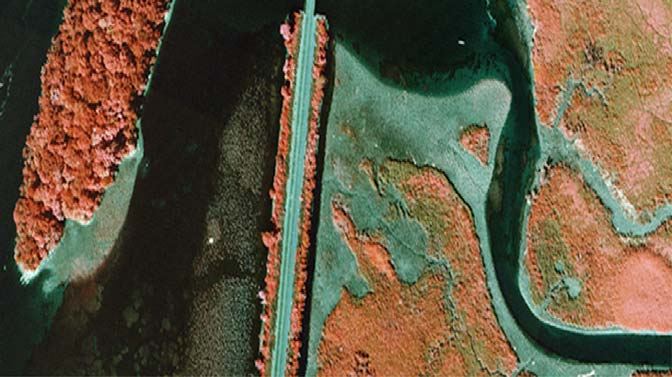
10 Normal color False-color infrared
11 Scale of photographs Image size/ real world size : S = ab/ab Focal length/ altitude above ground: Positive print Exposure Station, L a Optical axis o b Focal length, f Image space Camera lens Altitude above ground level, H S = f / H Principal Point A P Real-world object space B

12 Scale (2) Exposure station, L Camera lens Focal length f In real world e c a b o d g D Image space Object space G Altitude above sea level H In the image E C A Lowest elevation above sea level, h min B P Highest elevation above sea level, h Average elevation max above sea level, h Sea level 1 = 12 S = 0.012/ (6 x 12) = 1/6000 S = f / (H-h) Max scale, minimum scale, and average or nominal scale
 detectors.")

13 Digital Cameras Use an area array of solidstate charge-coupleddevice (CCD) detectors. The detectors are arranged in a matrix format with m columns and n rows. Analog (continuous) signals (voltage) are converted into (discrete) digital brightness value (DN)
14 Orthophotographs and digital orthoimagery An aerial photograph that has all the distortions due to camera tilt, scale, and surface relief. Photograph after corrected by ground control points (x, y, z) or digital elevation model (DEM) called orthophotograph, orthophoto, or digital orthoimagery. Not as photographs, they have different scales in different terrain relief, orthophotos have only one scale, no distortion, and have true distance, angle, and area. Orthophotos can be directly input into GIS as basemap or for interpretation.

15 Orthorectification

16

17 Extraction of of Building Infrastructure based on on orthophotographs

18 Orthophotograph draped over a DEM
19 Satellite photographs Extensive collections of photographs have been acquired from manned and unmanned Earth or Mars-orbiting satellites. Beginning in 1962, USA acquired photographs of moon for Apollo mission 1995, USA declassified intelligence satellites photographs of Sino- Soviet acquired at 2-8 m resolution. 2000, Russia launched satellites acquired photographs of 2 meter resolution 1999, Mars Orbiter Camera (MOC) onboard the Mars Global Surveyor (MGS) of NASA acquires Mars photographs with m resolution 2003, High Resolution Stereo Camera (HRSC) on board the ESA Mars Express acquires Mars photographs with 10 m resolution, selected areas will be imaged at 2 meters resolution.
Opportunities for the generation of high resolution digital elevation models based on small format aerial photography
 Opportunities for the generation of high resolution digital elevation models based on small format aerial photography Boudewijn van Leeuwen 1, József Szatmári 1, Zalán Tobak 1, Csaba Németh 1, Gábor Hauberger
Spectral Response for DigitalGlobe Earth Imaging Instruments
 Spectral Response for DigitalGlobe Earth Imaging Instruments IKONOS The IKONOS satellite carries a high resolution panchromatic band covering most of the silicon response and four lower resolution spectral
How Landsat Images are Made
 How Landsat Images are Made Presentation by: NASA s Landsat Education and Public Outreach team June 2006 1 More than just a pretty picture Landsat makes pretty weird looking maps, and it isn t always easy
MULTIPURPOSE USE OF ORTHOPHOTO MAPS FORMING BASIS TO DIGITAL CADASTRE DATA AND THE VISION OF THE GENERAL DIRECTORATE OF LAND REGISTRY AND CADASTRE
 MULTIPURPOSE USE OF ORTHOPHOTO MAPS FORMING BASIS TO DIGITAL CADASTRE DATA AND THE VISION OF THE GENERAL DIRECTORATE OF LAND REGISTRY AND CADASTRE E.ÖZER, H.TUNA, F.Ç.ACAR, B.ERKEK, S.BAKICI General Directorate
How To Make An Orthophoto
 ISSUE 2 SEPTEMBER 2014 TSA Endorsed by: CLIENT GUIDE TO DIGITAL ORTHO- PHOTOGRAPHY The Survey Association s Client Guides are primarily aimed at other professionals such as engineers, architects, planners
SAMPLE MIDTERM QUESTIONS
 Geography 309 Sample MidTerm Questions Page 1 SAMPLE MIDTERM QUESTIONS Textbook Questions Chapter 1 Questions 4, 5, 6, Chapter 2 Questions 4, 7, 10 Chapter 4 Questions 8, 9 Chapter 10 Questions 1, 4, 7
Remote sensing is the collection of data without directly measuring the object it relies on the
 Chapter 8 Remote Sensing Chapter Overview Remote sensing is the collection of data without directly measuring the object it relies on the reflectance of natural or emitted electromagnetic radiation (EMR).
Selecting the appropriate band combination for an RGB image using Landsat imagery
 Selecting the appropriate band combination for an RGB image using Landsat imagery Ned Horning Version: 1.0 Creation Date: 2004-01-01 Revision Date: 2004-01-01 License: This document is licensed under a
High Resolution Digital Surface Models and Orthoimages for Telecom Network Planning
 Renouard, Lehmann 241 High Resolution Digital Surface Models and Orthoimages for Telecom Network Planning LAURENT RENOUARD, S ophia Antipolis FRANK LEHMANN, Berlin ABSTRACT DLR of Germany and ISTAR of
Active and Passive Microwave Remote Sensing
 Active and Passive Microwave Remote Sensing Passive remote sensing system record EMR that was reflected (e.g., blue, green, red, and near IR) or emitted (e.g., thermal IR) from the surface of the Earth.
16 th IOCCG Committee annual meeting. Plymouth, UK 15 17 February 2011. mission: Present status and near future
 16 th IOCCG Committee annual meeting Plymouth, UK 15 17 February 2011 The Meteor 3M Mt satellite mission: Present status and near future plans MISSION AIMS Satellites of the series METEOR M M are purposed
Mapping Earth from Space Remote sensing and satellite images. Remote sensing developments from war
 Mapping Earth from Space Remote sensing and satellite images Geomatics includes all the following spatial technologies: a. Cartography "The art, science and technology of making maps" b. Geographic Information
Digital Remote Sensing Data Processing Digital Remote Sensing Data Processing and Analysis: An Introduction and Analysis: An Introduction
 Digital Remote Sensing Data Processing Digital Remote Sensing Data Processing and Analysis: An Introduction and Analysis: An Introduction Content Remote sensing data Spatial, spectral, radiometric and
A remote sensing instrument collects information about an object or phenomenon within the
 Satellite Remote Sensing GE 4150- Natural Hazards Some slides taken from Ann Maclean: Introduction to Digital Image Processing Remote Sensing the art, science, and technology of obtaining reliable information
The RapidEye optical satellite family for high resolution imagery
 'Photogrammetric Week 01' D. Fritsch & R. Spiller, Eds. Wichmann Verlag, Heidelberg 2001. Scherer, Krischke 139 The RapidEye optical satellite family for high resolution imagery STEFAN SCHERER and MANFRED
Chapter 6 Telescopes: Portals of Discovery. How does your eye form an image? Refraction. Example: Refraction at Sunset.
 Chapter 6 Telescopes: Portals of Discovery 6.1 Eyes and Cameras: Everyday Light Sensors Our goals for learning:! How does your eye form an image?! How do we record images? How does your eye form an image?
White paper. CCD and CMOS sensor technology Technical white paper
 White paper CCD and CMOS sensor technology Technical white paper Table of contents 1. Introduction to image sensors 3 2. CCD technology 4 3. CMOS technology 5 4. HDTV and megapixel sensors 6 5. Main differences
SPOT Satellite Earth Observation System Presentation to the JACIE Civil Commercial Imagery Evaluation Workshop March 2007
 SPOT Satellite Earth Observation System Presentation to the JACIE Civil Commercial Imagery Evaluation Workshop March 2007 Topics Presented Quick summary of system characteristics Formosat-2 Satellite Archive
Geography 403 Lecture 7 Scanners, Thermal, and Microwave
 Geography 403 Lecture 7 Scanners, Thermal, and Microwave Needs: Lect_403_7.ppt A. Basics of Passive Electric Sensors 1. Sensors absorb EMR and produce some sort of response, such as voltages differences
Review for Introduction to Remote Sensing: Science Concepts and Technology
 Review for Introduction to Remote Sensing: Science Concepts and Technology Ann Johnson Associate Director ann@baremt.com Funded by National Science Foundation Advanced Technological Education program [DUE
Name Class Date. spectrum. White is not a color, but is a combination of all colors. Black is not a color; it is the absence of all light.
 Exercises 28.1 The Spectrum (pages 555 556) 1. Isaac Newton was the first person to do a systematic study of color. 2. Circle the letter of each statement that is true about Newton s study of color. a.
Examination Space Missions and Applications I (AE2103) Faculty of Aerospace Engineering Delft University of Technology SAMPLE EXAM
 Faculty of Aerospace Engineering Delft University of Technology SAMPLE EXAM") Examination Space Missions and Applications I AE2103 Faculty of Aerospace Engineering Delft University of Technology SAMPLE EXAM Please read these instructions first: This are a series of multiple-choice
Examination Space Missions and Applications I AE2103 Faculty of Aerospace Engineering Delft University of Technology SAMPLE EXAM Please read these instructions first: This are a series of multiple-choice
'Developments and benefits of hydrographic surveying using multispectral imagery in the coastal zone
 Abstract With the recent launch of enhanced high-resolution commercial satellites, available imagery has improved from four-bands to eight-band multispectral. Simultaneously developments in remote sensing
2.3 Spatial Resolution, Pixel Size, and Scale
 Section 2.3 Spatial Resolution, Pixel Size, and Scale Page 39 2.3 Spatial Resolution, Pixel Size, and Scale For some remote sensing instruments, the distance between the target being imaged and the platform,
CBERS Program Update Jacie 2011. Frederico dos Santos Liporace AMS Kepler liporace@amskepler.com
 CBERS Program Update Jacie 2011 Frederico dos Santos Liporace AMS Kepler liporace@amskepler.com Overview CBERS 3 and 4 characteristics Differences from previous CBERS satellites (CBERS 1/2/2B) Geometric
Fig.1. The DAWN spacecraft
 Introduction Optical calibration of the DAWN framing cameras G. Abraham,G. Kovacs, B. Nagy Department of Mechatronics, Optics and Engineering Informatics Budapest University of Technology and Economics
THE NATURE OF LIGHT AND COLOR
 THE NATURE OF LIGHT AND COLOR THE PHYSICS OF LIGHT Electromagnetic radiation travels through space as electric energy and magnetic energy. At times the energy acts like a wave and at other times it acts
Image Draping & navigation within Virtual GIS
 Image Draping & navigation within Virtual GIS Draping of Geo Corrected data such as aerial imagery or map data enables virtual 3D field tours to be conducted in an area of interest. This document covers
RESOLUTION MERGE OF 1:35.000 SCALE AERIAL PHOTOGRAPHS WITH LANDSAT 7 ETM IMAGERY
 RESOLUTION MERGE OF 1:35.000 SCALE AERIAL PHOTOGRAPHS WITH LANDSAT 7 ETM IMAGERY M. Erdogan, H.H. Maras, A. Yilmaz, Ö.T. Özerbil General Command of Mapping 06100 Dikimevi, Ankara, TURKEY - (mustafa.erdogan;
3D Capabilities of SPOT 6
 3D Capabilities of SPOT 6 P. Nonin, D. Decluseau, L. Gabet, M. Bernard* ASTRIUM GEO-Information Services, France Abstract. On September 9th, 2012 a new optical satellite, SPOT 6, was successfully launched
Rodenstock Photo Optics
 Rogonar Rogonar-S Rodagon Apo-Rodagon N Rodagon-WA Apo-Rodagon-D Accessories: Modular-Focus Lenses for Enlarging, CCD Photos and Video To reproduce analog photographs as pictures on paper requires two
Understanding Raster Data
 Introduction The following document is intended to provide a basic understanding of raster data. Raster data layers (commonly referred to as grids) are the essential data layers used in all tools developed
Green = 0,255,0 (Target Color for E.L. Gray Construction) CIELAB RGB Simulation Result for E.L. Gray Match (43,215,35) Equal Luminance Gray for Green
 CIELAB RGB Simulation Result for E.L. Gray Match (43,215,35) Equal Luminance Gray for Green") Red = 255,0,0 (Target Color for E.L. Gray Construction) CIELAB RGB Simulation Result for E.L. Gray Match (184,27,26) Equal Luminance Gray for Red = 255,0,0 (147,147,147) Mean of Observer Matches to Red=255
Red = 255,0,0 (Target Color for E.L. Gray Construction) CIELAB RGB Simulation Result for E.L. Gray Match (184,27,26) Equal Luminance Gray for Red = 255,0,0 (147,147,147) Mean of Observer Matches to Red=255
Integrating the Solar Spectrum
 Integrating the Solar Spectrum PHYS 4400, Principles and Varieties of Solar Energy Instructor: Randy J. Ellingson The University of Toledo January 24, 203 Pop Quiz Note: quiz does not count toward grade
1. Introduction to image processing
 1 1. Introduction to image processing 1.1 What is an image? An image is an array, or a matrix, of square pixels (picture elements) arranged in columns and rows. Figure 1: An image an array or a matrix
Design of a High Resolution Multispectral Scanner for Developing Vegetation Indexes
 Design of a High Resolution Multispectral Scanner for Developing Vegetation Indexes Rishitosh kumar sinha*, Roushan kumar mishra, Sam jeba kumar, Gunasekar. S Dept. of Instrumentation & Control Engg. S.R.M
Filters for Digital Photography
 Filters for Digital Photography LICHTFILTER Whether for analog or Digital Photography: The best results are achieved by using correction filters - not by digitally enhancing in a software program as once
Introduction to Remote Sensing and Image Processing
 Introduction to Remote Sensing and Image Processing Of all the various data sources used in GIS, one of the most important is undoubtedly that provided by remote sensing. Through the use of satellites,
Information Contents of High Resolution Satellite Images
 Information Contents of High Resolution Satellite Images H. Topan, G. Büyüksalih Zonguldak Karelmas University K. Jacobsen University of Hannover, Germany Keywords: satellite images, mapping, resolution,
Files Used in this Tutorial
 Generate Point Clouds Tutorial This tutorial shows how to generate point clouds from IKONOS satellite stereo imagery. You will view the point clouds in the ENVI LiDAR Viewer. The estimated time to complete
3D VISUALIZATION OF GEOTHERMAL WELLS DIRECTIONAL SURVEYS AND INTEGRATION WITH DIGITAL ELEVATION MODEL (DEM)
") Presented at Short Course VII on Exploration for Geothermal Resources, organized by UNU-GTP, GDC and KenGen, at Lake Bogoria and Lake Naivasha, Kenya, Oct. 27 Nov. 18, 2012. GEOTHERMAL TRAINING PROGRAMME
Presented at Short Course VII on Exploration for Geothermal Resources, organized by UNU-GTP, GDC and KenGen, at Lake Bogoria and Lake Naivasha, Kenya, Oct. 27 Nov. 18, 2012. GEOTHERMAL TRAINING PROGRAMME
AERIAL PHOTOGRAPHS. For a map of this information, in paper or digital format, contact the Tompkins County Planning Department.
 AERIAL PHOTOGRAPHS What are Aerial Photographs? Aerial photographs are images of the land taken from an airplane and printed on 9 x9 photographic paper. Why are Aerial Photographs Important? Aerial photographs
Chapter 8: Aerial photograph interpretation
 Introduction Almost all modern topographic maps and many other types such as those depicting geology, natural vegetation, and landuse, are based on information obtained from aerial photography. In this
Theremino System Theremino Spectrometer Technology
 Theremino System Theremino Spectrometer Technology theremino System - Theremino Spectrometer Technology - August 15, 2014 - Page 1 Operation principles By placing a digital camera with a diffraction grating
Satellite Imaging System
 atellite Imaging ystem AA omaie Management Information ystems University of Business and Technology UBT, Jeddah, KA aasomaia@cba.edu.sa Abstract The aim of this paper is to present the essential elements
ESCI 107/109 The Atmosphere Lesson 2 Solar and Terrestrial Radiation
 ESCI 107/109 The Atmosphere Lesson 2 Solar and Terrestrial Radiation Reading: Meteorology Today, Chapters 2 and 3 EARTH-SUN GEOMETRY The Earth has an elliptical orbit around the sun The average Earth-Sun
Recent advances in Satellite Imagery for Oil and Gas Exploration and Production. DESK AND DERRICK APRIL 2016 PRESENTED BY GARY CREWS---RETIRED
 Recent advances in Satellite Imagery for Oil and Gas Exploration and Production. DESK AND DERRICK APRIL 2016 PRESENTED BY GARY CREWS---RETIRED Agenda Brief review of state of the applications in 2010 Basics
WATER BODY EXTRACTION FROM MULTI SPECTRAL IMAGE BY SPECTRAL PATTERN ANALYSIS
 WATER BODY EXTRACTION FROM MULTI SPECTRAL IMAGE BY SPECTRAL PATTERN ANALYSIS Nguyen Dinh Duong Department of Environmental Information Study and Analysis, Institute of Geography, 18 Hoang Quoc Viet Rd.,
Automatic and Objective Measurement of Residual Stress and Cord in Glass
 Automatic and Objective Measurement of Residual Stress and Cord in Glass GlassTrend - ICG TC15/21 Seminar SENSORS AND PROCESS CONTROL 13-14 October 2015, Eindhoven Henning Katte, ilis gmbh copyright ilis
Digital image processing
 746A27 Remote Sensing and GIS Lecture 4 Digital image processing Chandan Roy Guest Lecturer Department of Computer and Information Science Linköping University Digital Image Processing Most of the common
Saturn V Straw Rocket
 Saturn V Straw Rocket Saturn V Rocket Activity Background Information As part of our NASA Tram Tour, you have the opportunity to view a Saturn V Rocket at our Rocket Park. This particular rocket was slated
STAAR Science Tutorial 30 TEK 8.8C: Electromagnetic Waves
 Name: Teacher: Pd. Date: STAAR Science Tutorial 30 TEK 8.8C: Electromagnetic Waves TEK 8.8C: Explore how different wavelengths of the electromagnetic spectrum such as light and radio waves are used to
Description of field acquisition of LIDAR point clouds and photos. CyberMapping Lab UT-Dallas
 Description of field acquisition of LIDAR point clouds and photos CyberMapping Lab UT-Dallas Description of field acquisition of LIDAR point clouds and photos Objective: Introduce the basic steps that
Study Guide for Exam on Light
 Name: Class: Date: Study Guide for Exam on Light Multiple Choice Identify the choice that best completes the statement or answers the question. 1. Which portion of the electromagnetic spectrum is used
Digital Image Basics. Introduction. Pixels and Bitmaps. Written by Jonathan Sachs Copyright 1996-1999 Digital Light & Color
 Written by Jonathan Sachs Copyright 1996-1999 Digital Light & Color Introduction When using digital equipment to capture, store, modify and view photographic images, they must first be converted to a set
VISIONMAP A3 - SUPER WIDE ANGLE MAPPING SYSTEM BASIC PRINCIPLES AND WORKFLOW
 VISIONMAP A3 - SUPER WIDE ANGLE MAPPING SYSTEM BASIC PRINCIPLES AND WORKFLOW Michael Pechatnikov, Erez Shor, Yuri Raizman VisionMap Ltd., www.visionmap.com 13 Mozes St., Tel-Aviv, 67442, Israel michael@visionmap.com,
A.P. Cracknell Department of Electronic Engineering and Physics, University of Dundee, U.K.
 SATELLITE REMOTE SENSING A.P. Cracknell Department of Electronic Engineering and Physics, University of Dundee, U.K. Keywords: Satellites, satellite programs, applications, future systems Contents 1. Introduction
Filters for Black & White Photography
 Filters for Black & White Photography Panchromatic Film How it works. Panchromatic film records all colors of light in the same tones of grey. Light Intensity (the number of photons per square inch) is
STATE OF NEVADA Department of Administration Division of Human Resource Management CLASS SPECIFICATION
 STATE OF NEVADA Department of Administration Division of Human Resource Management CLASS SPECIFICATION TITLE PHOTOGRAMMETRIST/CARTOGRAPHER V 39 6.102 PHOTOGRAMMETRIST/CARTOGRAPHER II 33 6.110 PHOTOGRAMMETRIST/CARTOGRAPHER
Digital Orthophoto Production In the Desktop Environment 1
 Digital Orthophoto Production In the Desktop Environment 1 By Dr. Roy A. Welch and Thomas R. Jordan Digital orthophotos are proving suitable for a variety of mapping, GIS and environmental monitoring tasks.
From Pixel to Info-Cloud News at Leica Geosystems JACIE Denver, 31 March 2011 Ruedi Wagner Hexagon Geosystems, Geospatial Solutions Division.
 From Pixel to Info-Cloud News at Leica Geosystems JACIE Denver, 31 March 2011 Ruedi Wagner Hexagon Geosystems, Geospatial Solutions Division What else can I do with my sensor/data? Earth to Image Image
Digital Image Fundamentals. Selim Aksoy Department of Computer Engineering Bilkent University saksoy@cs.bilkent.edu.tr
 Digital Image Fundamentals Selim Aksoy Department of Computer Engineering Bilkent University saksoy@cs.bilkent.edu.tr Imaging process Light reaches surfaces in 3D. Surfaces reflect. Sensor element receives
Raster Data Structures
 Raster Data Structures Tessellation of Geographical Space Geographical space can be tessellated into sets of connected discrete units, which completely cover a flat surface. The units can be in any reasonable
EVIDENCE PHOTOGRAPHY TEST SPECIFICATIONS MODULE 1: CAMERA SYSTEMS & LIGHT THEORY (37)
") EVIDENCE PHOTOGRAPHY TEST SPECIFICATIONS The exam will cover evidence photography involving crime scenes, fire scenes, accident scenes, aircraft incident scenes, surveillances and hazardous materials scenes.
EVIDENCE PHOTOGRAPHY TEST SPECIFICATIONS The exam will cover evidence photography involving crime scenes, fire scenes, accident scenes, aircraft incident scenes, surveillances and hazardous materials scenes.
Institute of Natural Resources Departament of General Geology and Land use planning Work with a MAPS
 Institute of Natural Resources Departament of General Geology and Land use planning Work with a MAPS Lecturers: Berchuk V.Y. Gutareva N.Y. Contents: 1. Qgis; 2. General information; 3. Qgis desktop; 4.
Possibilities of applying CORONA archive satellite images in forest cover change detection example of the Fruška Gora mountain
 ISSN 0354-8724 (hard copy) ISSN 1820-7138 (online) Possibilities of applying CORONA archive satellite images in forest cover change detection example of the Fruška Gora mountain Minucsér Mészáros A *,
GIS and Remote Sensing in Diachronic Study of Agriculture in Greece
 GIS and Remote Sensing in Diachronic Study of Agriculture in Greece Maria Androulidaki a, Michail Salampasis b, Vagis Samathrakis c, Christos Batzios d a Alexander Technology Educational Institute of Thessaloniki,
AP Physics B Ch. 23 and Ch. 24 Geometric Optics and Wave Nature of Light
 AP Physics B Ch. 23 and Ch. 24 Geometric Optics and Wave Nature of Light Name: Period: Date: MULTIPLE CHOICE. Choose the one alternative that best completes the statement or answers the question. 1) Reflection,
VIIRS-CrIS mapping. NWP SAF AAPP VIIRS-CrIS Mapping
 NWP SAF AAPP VIIRS-CrIS Mapping This documentation was developed within the context of the EUMETSAT Satellite Application Facility on Numerical Weather Prediction (NWP SAF), under the Cooperation Agreement
Hyperspectral Satellite Imaging Planning a Mission
 Hyperspectral Satellite Imaging Planning a Mission Victor Gardner University of Maryland 2007 AIAA Region 1 Mid-Atlantic Student Conference National Institute of Aerospace, Langley, VA Outline Objective
- the. or may. scales on. Butterfly wing. magnified about 75 times.
 Lecture Notes (Applications of Diffraction) Intro: - the iridescent colors seen in many beetles is due to diffraction of light rays hitting the small groovess of its exoskeleton - these ridges are only
River Flood Damage Assessment using IKONOS images, Segmentation Algorithms & Flood Simulation Models
 River Flood Damage Assessment using IKONOS images, Segmentation Algorithms & Flood Simulation Models Steven M. de Jong & Raymond Sluiter Utrecht University Corné van der Sande Netherlands Earth Observation
Science In Action 8 Unit C - Light and Optical Systems. 1.1 The Challenge of light
 1.1 The Challenge of light 1. Pythagoras' thoughts about light were proven wrong because it was impossible to see A. the light beams B. dark objects C. in the dark D. shiny objects 2. Sir Isaac Newton
Introduction to Imagery and Raster Data in ArcGIS
 Esri International User Conference San Diego, California Technical Workshops July 25, 2012 Introduction to Imagery and Raster Data in ArcGIS Simon Woo slides Cody Benkelman - demos Overview of Presentation
LBS-300 Beam Sampler for C-mount Cameras. YAG Focal Spot Analysis Adapter. User Notes
 LBS-300 Beam Sampler for C-mount Cameras P/N SP90183, SP90184, SP90185 and SP90186 YAG Focal Spot Analysis Adapter P/N SP90187, SP90188, SP90189, SP90190, SP90191 User Notes Ophir-Spiricon Inc. 60 West
Digital Photogrammetric System. Version 6.0.2 USER MANUAL. Block adjustment
 Digital Photogrammetric System Version 6.0.2 USER MANUAL Table of Contents 1. Purpose of the document... 4 2. General information... 4 3. The toolbar... 5 4. Adjustment batch mode... 6 5. Objects displaying
Imagery. 1:50,000 Basemap Generation From Satellite. 1 Introduction. 2 Input Data
 1:50,000 Basemap Generation From Satellite Imagery Lisbeth Heuse, Product Engineer, Image Applications Dave Hawkins, Product Manager, Image Applications MacDonald Dettwiler, 3751 Shell Road, Richmond B.C.
Choosing a digital camera for your microscope John C. Russ, Materials Science and Engineering Dept., North Carolina State Univ.
 Choosing a digital camera for your microscope John C. Russ, Materials Science and Engineering Dept., North Carolina State Univ., Raleigh, NC One vital step is to choose a transfer lens matched to your
Introduction to CCDs and CCD Data Calibration
 Introduction to CCDs and CCD Data Calibration Dr. William Welsh San Diego State University CCD: charge coupled devices integrated circuit silicon chips that can record optical (and X-ray) light pixel =
Generation of Cloud-free Imagery Using Landsat-8
 Generation of Cloud-free Imagery Using Landsat-8 Byeonghee Kim 1, Youkyung Han 2, Yonghyun Kim 3, Yongil Kim 4 Department of Civil and Environmental Engineering, Seoul National University (SNU), Seoul,
TS-E24mm f/3.5l TS-E45mm f/2.8 TS-E90mm f/2.8 Instructions
 TS-E24mm f/3.5l TS-E45mm f/2.8 TS-E90mm f/2.8 ENG Instructions Thank you for purchasing a Canon product. Canon s TS-E lenses are tilt-shift lenses designed for EOS cameras. The tilt-shift mechanism enables
Waves Sound and Light
 Waves Sound and Light r2 c:\files\courses\1710\spr12\wavetrans.doc Ron Robertson The Nature of Waves Waves are a type of energy transmission that results from a periodic disturbance (vibration). They are
LANDSAT 8 Level 1 Product Performance
 Réf: IDEAS-TN-10-QualityReport LANDSAT 8 Level 1 Product Performance Quality Report Month/Year: January 2016 Date: 26/01/2016 Issue/Rev:1/9 1. Scope of this document On May 30, 2013, data from the Landsat
Scanners and How to Use Them
 Written by Jonathan Sachs Copyright 1996-1999 Digital Light & Color Introduction A scanner is a device that converts images to a digital file you can use with your computer. There are many different types
A long time ago, people looked
 Supercool Space Tools! By Linda Hermans-Killam A long time ago, people looked into the dark night sky and wondered about the stars, meteors, comets and planets they saw. The only tools they had to study
The Sentinel-4/UVN instrument on-board MTG-S
 The Sentinel-4/UVN instrument on-board MTG-S Grégory Bazalgette Courrèges-Lacoste; Berit Ahlers; Benedikt Guldimann; Alex Short; Ben Veihelmann, Hendrik Stark ESA ESTEC European Space Technology & Research
Sunlight and its Properties. EE 495/695 Y. Baghzouz
 Sunlight and its Properties EE 495/695 Y. Baghzouz The sun is a hot sphere of gas whose internal temperatures reach over 20 million deg. K. Nuclear fusion reaction at the sun's core converts hydrogen to
A PHOTOGRAMMETRIC APPRAOCH FOR AUTOMATIC TRAFFIC ASSESSMENT USING CONVENTIONAL CCTV CAMERA
 A PHOTOGRAMMETRIC APPRAOCH FOR AUTOMATIC TRAFFIC ASSESSMENT USING CONVENTIONAL CCTV CAMERA N. Zarrinpanjeh a, F. Dadrassjavan b, H. Fattahi c * a Islamic Azad University of Qazvin - nzarrin@qiau.ac.ir
Light Waves and Matter
 Name: Light Waves and Matter Read from Lesson 2 of the Light Waves and Color chapter at The Physics Classroom: http://www.physicsclassroom.com/class/light/u12l2a.html MOP Connection: Light and Color: sublevel
MAPPING DETAILED DISTRIBUTION OF TREE CANOPIES BY HIGH-RESOLUTION SATELLITE IMAGES INTRODUCTION
 MAPPING DETAILED DISTRIBUTION OF TREE CANOPIES BY HIGH-RESOLUTION SATELLITE IMAGES Hideki Hashiba, Assistant Professor Nihon Univ., College of Sci. and Tech., Department of Civil. Engrg. Chiyoda-ku Tokyo
KINECT PROJECT EITAN BABCOCK REPORT TO RECEIVE FINAL EE CREDIT FALL 2013
 KINECT PROJECT EITAN BABCOCK REPORT TO RECEIVE FINAL EE CREDIT FALL 2013 CONTENTS Introduction... 1 Objective... 1 Procedure... 2 Converting Distance Array to 3D Array... 2 Transformation Matrices... 4
SPACE EXPLORATION BYU Merit Badge PowWow Official Merit Badge Worksheet
 SPACE EXPLORATION BYU Merit Badge PowWow Official Merit Badge Worksheet Scout's Name Instructor's Name Scout's Address City State Zip Instructions 1) The Scout is to review the merit badge book before
Treasure Hunt. Lecture 2 How does Light Interact with the Environment? EMR Principles and Properties. EMR and Remote Sensing
 Lecture 2 How does Light Interact with the Environment? Treasure Hunt Find and scan all 11 QR codes Choose one to watch / read in detail Post the key points as a reaction to http://www.scoop.it/t/env202-502-w2
WHITE PAPER. Are More Pixels Better? www.basler-ipcam.com. Resolution Does it Really Matter?
 WHITE PAPER www.basler-ipcam.com Are More Pixels Better? The most frequently asked question when buying a new digital security camera is, What resolution does the camera provide? The resolution is indeed
Development of Automatic shooting and telemetry system for UAV photogrammetry INTRODUCTION
 Development of Automatic shooting and telemetry system for UAV photogrammetry Jinwoo PARK 1, Minseok KIM 1, Khin Mar Yee 1, Chuluong CHOI 1 1 Department of Spatial Information Engineering, Pukyong National
G492-GIS for Earth Sciences Raster Data Structure
 G492-GIS for Earth Sciences Raster Data Structure I. Introduction A. Basis - grid cell structure 1. representing map elements as dimensional pixels that are attached to cell attributes 2. Raster Data -
OBLIQUE AERIAL PHOTOGRAPHY TOOL FOR BUILDING INSPECTION AND DAMAGE ASSESSMENT
 OBLIQUE AERIAL PHOTOGRAPHY TOOL FOR BUILDING INSPECTION AND DAMAGE ASSESSMENT A. Murtiyoso 1, F. Remondino 2, E. Rupnik 2, F. Nex 2, P. Grussenmeyer 1 1 INSA Strasbourg / ICube Laboratory, France Email:
2003 INTERNATIONAL CONFERENCE AIRPORTS: PLANNING, INFRASTRUCTURE & ENVIRONMENT
 AIRPORTS: PLANNING, INFRASTRUCTURE & ENVIRONMENT AIRBORNE AND SPACEBORNE REMOTE SENSING TERRAIN MAPPING FOR PLANNING AND DESIGN OF TRANSPORTATION INFRASTRUCTURE ASSETS Waheed Uddin Associate Professor
Adaptation of High Resolution Ikonos Images to Googleearth for Zonguldak Test Field
 Adaptation of High Resolution Ikonos Images to Googleearth for Zonguldak Test Field Umut G. SEFERCIK, Murat ORUC and Mehmet ALKAN, Turkey Key words: Image Processing, Information Content, Image Understanding,
Lectures Remote Sensing
 Lectures Remote Sensing ATMOSPHERIC CORRECTION dr.ir. Jan Clevers Centre of Geo-Information Environmental Sciences Wageningen UR Atmospheric Correction of Optical RS Data Background When needed? Model