Publishing Data and Maps and Developing Applications with ArcGIS Server
|
|
|
- Aldous Campbell
- 7 years ago
- Views:
Transcription

1 Publishing Data and Maps and Developing Applications with ArcGIS Server GIS Sam Berg ESRI 1
2 Agenda ArcGIS Server Overview GIS Services Author, Serve, Use Map Caching Web Mapping Applications GIS Tasks Service Capabilities Webservice access Web ADF Introduction Further Resources Questions and Comments 2
3 Agenda ArcGIS Server Overview GIS Services Author, Serve, Use Map Caching Web Mapping Applications GIS Tasks Service Capabilities Webservice access Web ADF Introduction Further Resources Questions and Comments 3
4 What is ArcGIS Server? You may already have geographic resources/documents For example... Maps ArcMap documents Globes ArcGlobe documents etc. ArcGIS Server enables you to share these resources The resource runs on a server Service = resource running on a server Users connect to the service to use it 4
5 ArcGIS Server 9.2 Complete & Integrated server-based GIS Out-of-the-box applications and services Tremendous developer opportunities Spatial Data Management ArcGIS Desktop ArcGIS Explorer Visualization (Mapping) Java.NET ArcGIS Server Spatial Analysis Web Mapping Applications ArcGIS Mobile 5
6 What are services? Service = GIS resource running on a server vs. GIS application on your local computer Almost any GIS operation that you can do locally may also be run using a service 6
7 GIS Services can be used to Display Data 7

8 GIS Services can Answer Questions 8
9 What types of services can ArcGIS Server offer? Map View or query a 2D map on the server Globe View or query a 3D globe on the server Geocode Perform address matching on the server Geodata Perform data replication, extraction, or query over the intranet or Internet Geoprocessing Run a tool or model on the server and get the results back 9
10 What do I need to prepare? Service type Map Globe Geocode Published using Map document (.mxd or.pmf. pmf) Globe document (.3dd) Locator (.loc file or geodatabase) Geodata Geoprocessing Geodatabase or Map document with geodatabase layer Toolbox (.tbx tbx) ) or Map document (.mxd mxd) ) with tool layer 10
11 Clients Users may connect with Browser based Web Application Desktop client (ArcMap, ArcGIS Engine application, ArcGIS Explorer) Mobile client (ArcGIS Mobile application, smart phone application) Custom applications calling GIS Web services 11
12 Agenda ArcGIS Server Overview GIS Services Author, Serve, Use Map Caching Web Mapping Applications GIS Tasks Service Capabilities Webservice access Web ADF Introduction Further Resources Questions and Comments 12
13 Author, Serve, Use 1. Author GIS content ArcGIS Desktop applications 2. Serve GIS services ArcGIS Server Manager 3. Use GIS services Web-mapping applications ArcGIS Explorer ArcGIS Desktop ArcGIS Mobile WMS, KML/KMZ, SOAP REST (at 9.3) 13
14 How do I publish a service? You publish a document or set of data Need to prepare the data/document Author the map (.MXD), globe (.3DD), etc. Think about types and number of users, security, permissions Publish in Manager or ArcCatalog 14
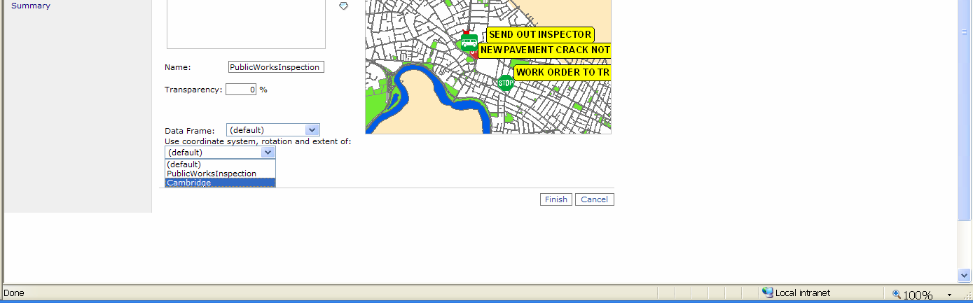
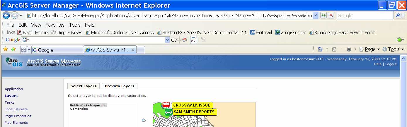
15 Demo: Authoring, serving, and using a Map Service ArcMap authoring Publishing GIS resources via ArcCatalog or Manager Viewing map service in ArcGIS 15
16 16
17 17
18 18
19 19
20 20
21 21
22 Agenda ArcGIS Server Overview GIS Services Author, Serve, Use Map Caching Web Mapping Applications GIS Tasks Service Capabilities Webservice access Web ADF Introduction Further Resources Questions and Comments 22
23 Caching The fastest way to serve your maps Pre-creates map/globe images as tiles at multiple scale levels Choose scale levels of detail and tile size Users retrieve files from server rather than dynamically creating g maps 23
24 What is a Web mapping application? ArcGIS Server 9.2 has an out-of of-the-box way to create GIS Web applications Web Mapping Application A web application (website) that uses GIS services Multi-service architecture Map can display multiple services From ArcGIS Servers on the Internet ArcIMS, WMS, ArcWeb Services, etc. 24
25 How do I create a Web mapping application? ArcGIS Server Manager Non-programmer Menu and wizard approach Can customize the web application with developer tools Developer environment For programmers Use an integrated development environment (IDE).NET: Visual Studio 2005, Visual Web Developer Express (free from m Microsoft) or other developer tools (Dreamweaver( Dreamweaver,, etc.) Java: Eclipse, Sun Java Studio Creator, etc. Use Web Mapping Application template or add Web controls to a new w or existing web application 25
26 What can I add to a Web mapping application? Toolbar Map Tasks Query Search Find address Editing Overview Map More 26
27 Agenda ArcGIS Server Overview GIS Services Author, Serve, Use Map Caching Web Mapping Applications GIS Tasks Service Capabilities Webservice access Web ADF Introduction Further Resources Questions and Comments 27


28 Adding functionality through tasks Tasks are used to Ask questions Display answers Out-of of-the-box tasks Editing Find Address Find Place Geoprocessing Query Attributes Search Attributes Custom tasks with Task Framework 28
29 Web Tasks Editor The Editor task provides a suite of tools for Web-based based editing of features in a versioned geodatabase. 29
30 Web Tasks Find Address The Find Address task prompts the user for an address, then displays the resulting address on the map Find Place allows a user to type in the name of the place to search for on the map Geoprocessing Executing GP Services on the Web 30
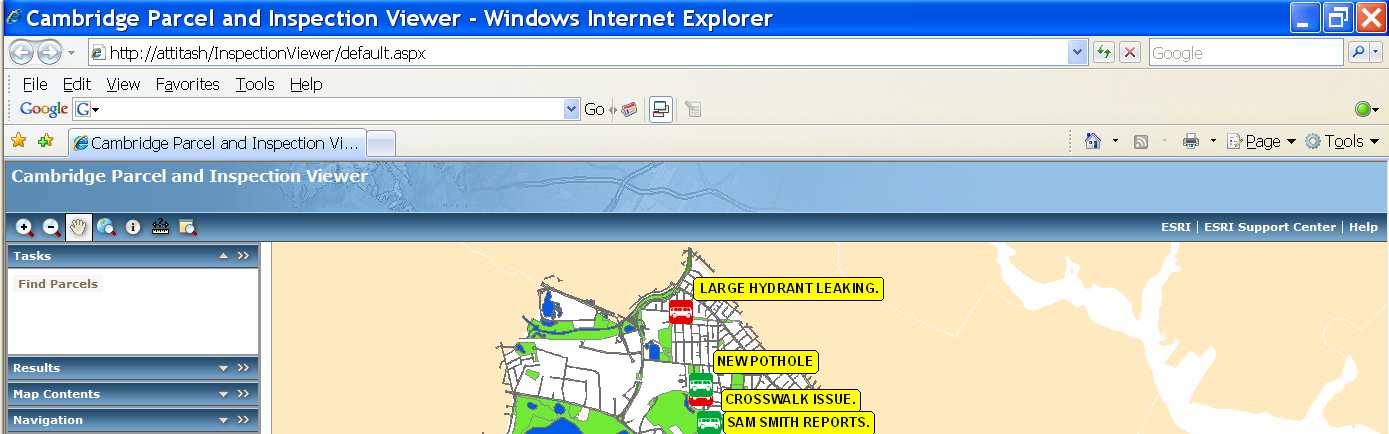
31 Demo: Web Mapping Application Publishing and caching map resource Walkthrough of Manager s s Web Application Creation w/multiple data sources Adding out of the box tasks 31
32 32
33 33
34 34
35 35
36 36
37 37
38 38
39 39
40 Agenda ArcGIS Server Overview GIS Services Author, Serve, Use Map Caching Web Mapping Applications GIS Tasks Service Capabilities Webservice access Web ADF Introduction Further Resources Questions and Comments 40

41 Service Capabilities 41
42 Agenda ArcGIS Server Overview GIS Services Author, Serve, Use Map Caching Web Mapping Applications GIS Tasks Service Capabilities Webservice access Web ADF Introduction Further Resources Questions and Comments 42
43 43
44 44
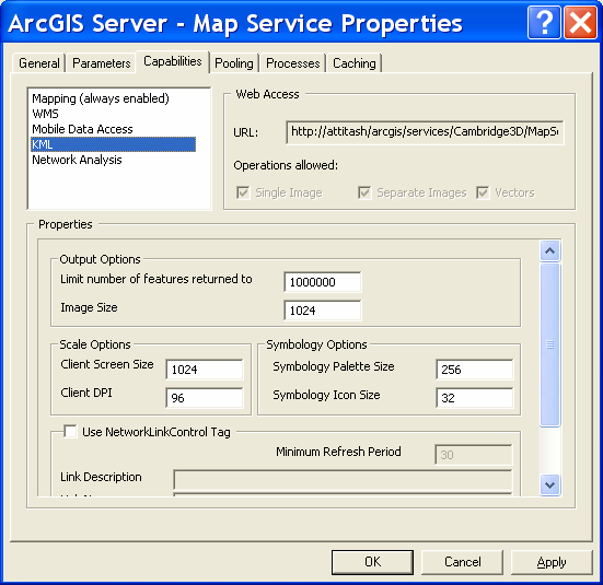
45 Demo: KML Services from ArcGIS Server 45
46 46
47 47
48 Agenda ArcGIS Server Overview GIS Services Author, Serve, Use Map Caching Web Mapping Applications GIS Tasks Service Capabilities Webservice access Web ADF Introduction Further Resources Questions and Comments 48
49 Web Enabled GIS Services Allows any SOAP Webservice client to call published GIS resources directly client does not need ArcGIS or ArcObjects Endpoints generated by ArcGIS Server automatically Alternatively custom web services can be built out of ArcObjects 49
50 Example: What can you do with a Map Service? Map requests Queries Coordinate Calculation Retrieve Service information 50

51 Demo: Accessing GIS Web Services 51
52 52
53 Agenda ArcGIS Server Overview GIS Services Author, Serve, Use Map Caching Web Mapping Applications GIS Tasks Service Capabilities Webservice access Web ADF Introduction Further Resources Questions and Comments 53
54 What is an Application Developer Framework (ADF)? 1. A set of components for creating applications Controls, templates, classes 2. Software developer kit (SDK) Documentation, walk-throughs throughs,, samples 54
55 ArcGIS Server 9.2: Software Development Kit Build and deploy web & enterprise geospatial applications and services Productivity boost with out-of of-the-box IDE integration Software Development Kit (SDK) includes :.NET components Web ADF Mobile ADF Java components Web ADF Enterprise ADF Web map Applications ArcGIS Mobile Business Applications Integration Environment Plus the ArcGIS Explorer SDK for custom tasks Web.NET Mobile Web Enterprise Java Software Development Kit (SDK) 55
56 Architecutural Components of ArcGIS Server Applications ArcGIS Desktop Application Developers Framework ArcGIS Explorer Web Services ArcGIS WebMap Applications ArcGIS Mobile Applications Composite Applications Web Controls Back Office Server Software Components Coarse-grained ArcObjects Fine-grained ArcObjects GIS Resources 2D Mapping 3D Globe Geodatabase Locator Spatial Analysis 56
57 Developing Web Applications Choices on how to get started developing Beginner: : Edit the web application created in the Website Manager Intermediate: : Start from a template integrated into the development environment Advanced: : Start from web controls or Types Use Environment like Visual Studio (.NET) Comprehensive Software Developer Kit 57
58 Edit the Application Created by Manager Easy transition from Website Manager to a development environment 58

59 Start with Web Mapping Application Template ESRI Web Mapping Application Template gets installed into the development environment 59
60 Develop Using the ESRI Web Controls ESRI Web Controls get installed into the development environment 60
61 Web ADF Web Controls 21+ Web Controls & Tasks All AJAX Enabled Support for ADF Datasources Enhanced for performance 61
62 FloatingPanel Control CompositeControl Container for one or more Web controls Rendered as a CSS in a browser 62
63 Web ADF Graphics Layer Extends System.Data.Dataset Collection of DataTables: ElementGraphicsLayer Store geometry and symbol together, per row Multiple geometry type in the same layer FeatureGraphicsLayer Store geometry and attributes Geometry should be the same type Use feature renderer to apply symbolization 63
64 Agenda ArcGIS Server Overview GIS Services Author, Serve, Use Map Caching Web Mapping Applications GIS Tasks Service Capabilities Webservice access Web ADF Introduction Further Resources Questions and Comments 64
65 Demo: Custom Task: GeoRSS Reader 65
66 Demo: Custom Application- Director s s Viewer for Inspection Requests 66
67 Editions and Levels of ArcGIS Server Capacity Level Edition Edition includes Workgroup Enterprise Functionality Basic Standard ArcSDE Geodata services for replication Basic features plus Map, globe, geocoding, geoprocessing (ArcView( tools) Web ADF SQL Server Express 10 users Any supported database Unlimited users Advanced Standard features plus Advanced geoprocessing Web editing Mobile ADF (Enterprise level) 67
68 Resources In the box ArcGIS Server Help Developer Help (SDK) Online Web Help Online version of Server Help Updated frequently ESRI Developer Network All SDK documentation and samples - updated User forums User-submitted submitted samples (ArcScripts) ArcGIS Server Blog Support.esri.com White papers, bug database, etc. Training 68
69 Questions and Comments? 69
ArcGIS Server Best Practices and Guidelines
 ArcGIS Server Best Practices and Guidelines NEARC 2007 ESRI Technical Session ESRI, Boston Agenda Components and Deployment OS User Groups and Directory Configuration Service Architectures GIS Security
Chapter 1: Introduction to ArcGIS Server
 Chapter 1: Introduction to ArcGIS Server At a high level you can think of ArcGIS Server as software that helps you take your geographic information and make it available to others. This data can be distributed
GIS and Mapping Solutions for Developers. ESRI Developer Network (EDN SM)
") GIS and Mapping Solutions for Developers ESRI Developer Network (EDN SM) GIS and Mapping Solutions for Developers If you are a software developer looking for an effective way to bring geographic and mapping
GIS and Mapping Solutions for Developers ESRI Developer Network (EDN SM) GIS and Mapping Solutions for Developers If you are a software developer looking for an effective way to bring geographic and mapping
ArcGIS Web Mapping. Sam Berg, esri sberg@esri.com
 ArcGIS Web Mapping Sam Berg, esri sberg@esri.com Agenda ArcGIS and WebMaps The APIs ArcGIS for Flex Viewer ArcGIS for Silverlight Builder ArcGIS for Sharepoint ArcGIS Application Templates ArcGIS Runtime
What is ArcGIS Comprised Of?
 ArcGIS Server 9.1 What is ArcGIS Comprised Of? ArcGIS Desktop Integrated suite of GIS applications ArcGIS Engine Embeddable developer components Server GIS ArcSDE, ArcIMS, ArcGIS Server Mobile GIS ArcPad
Extending ArcGIS Server capabilities through customization - A technology perspective
 Extending ArcGIS Server capabilities through customization - A technology perspective Abstract: Ramesh Babu R 1, G K Viswanathan 2, Tina Mary Francis 3 1 Delivery Manager, NeST Information Technologies
Developing Apps with the ArcGIS Runtime SDK for Android. Ben Ramseth Esri Inc. Instructor Technical Lead
 Developing Apps with the ArcGIS Runtime SDK for Android Ben Ramseth Esri Inc. Instructor Technical Lead Ben Ramseth Instructor Technical Lead Esri Inc USA, Charlotte, NC bramseth@esri.com @EsriMapNinja
Developing Web Apps with ArcGIS API for JavaScript TM. Student Edition
 Developing Web Apps with ArcGIS API for JavaScript TM Student Edition Copyright 2014 Esri All rights reserved. Course version 1.1. Version release date December 2014. Printed in the United States of America.
How To Build Gis Applications With An Arcgis Engine
 Delivering Custom GIS Applications With ArcGIS Engine An ESRI White Paper February 2004 ESRI 380 New York St., Redlands, CA 92373-8100, USA TEL 909-793-2853 FAX 909-793-5953 E-MAIL info@esri.com WEB www.esri.com
ArcGIS. Server. A Complete and Integrated Server GIS
 ArcGIS Server A Complete and Integrated Server GIS ArcGIS Server A Complete and Integrated Server GIS ArcGIS Server enables you to distribute maps, models, and tools to others within your organization
GIS Databases With focused on ArcSDE
 Linköpings universitet / IDA / Div. for human-centered systems GIS Databases With focused on ArcSDE Imad Abugessaisa g-imaab@ida.liu.se 20071004 1 GIS and SDBMS Geographical data is spatial data whose
ArcGIS Viewer for Silverlight An Introduction
 Esri International User Conference San Diego, California Technical Workshops July 26, 2012 ArcGIS Viewer for Silverlight An Introduction Rich Zwaap Agenda Background Product overview Getting started and
Mapping Mashup/Data Integration Development Resources
 Mapping Mashup/Data Integration Development Resources David Hart GIS Specialist University of Wisconsin Sea Grant Institute October 6, 2008 Virtual Globes A virtual globe is a 3D software model or representation
Five Steps to Better Performance
 Effective Web maps have a specific focus and are designed so users can interact with them to accomplish meaningful tasks. Five Steps to Better Performance Sample methodology for creating a great Web map
ESRI Mobile GIS Solutions Overview. Shane Clarke ESRI
 ESRI Mobile GIS Solutions Overview Shane Clarke ESRI Agenda Overview of mobile GIS ESRI mobile GIS Solutions Selecting a mobile GIS solution Q & A 2 Mobile GIS Overview 3 What is mobile GIS? Extension
ArcGIS 10.1 Geodatabase Administration. Gordon Sumerling & Christopher Brown
 ArcGIS 10.1 Geodatabase Administration Gordon Sumerling & Christopher Brown Key Improvements at ArcGIS 10.1 1. Easier Administration through Graphic Interfaces 2. Greater Seamless integration with Open
The Courses. Covering complete breadth of GIS technology from ESRI including ArcGIS, ArcGIS Server and ArcGIS Engine.
 ESRI India: Corporate profile ESRI India A profile India s Premier GIS Company Strategic alliance between ESRI Inc. and NIIT Technologies Adjudged as India s Best GIS Solutions Company - Map India 2001
SuperGIS Server 3.2 Standard Edition Specification
 SuperGIS Server 3.2 Standard Edition Specification 20140826 Specification 1. All of the services support SOAP (Simple Object Access Protocol). 2. Use map file created by SuperGIS Desktop as map services
A GP Service for Enterprise Printing. Kevin Shows, Anadarko Petroleum Kirk Kuykendall, Idea Integration 04/20/2011
 Kevin Shows, Anadarko Petroleum Kirk Kuykendall, Idea Integration 04/20/2011 History Implemented ArcGIS Server / browser mapping in 2008 Web ADF December, 2008 WPF April, 2010 Internally branded imaps
An Esri White Paper June 2010 Tracking Server 10
 An Esri White Paper June 2010 Tracking Server 10 Esri 380 New York St., Redlands, CA 92373-8100 USA TEL 909-793-2853 FAX 909-793-5953 E-MAIL info@esri.com WEB www.esri.com Copyright 2010 Esri All rights
Off The Shelf Approach to ArcGIS Server & The Dashboard Approach to Gaining Insight to ArcGIS Server
 Off The Shelf Approach to ArcGIS Server & The Dashboard Approach to Gaining Insight to ArcGIS Server Robert Lenarcic Latitude Geographics rlenarcic@latitudegeo.co AGENDA Out of the box ArcGIS Server web-mapping
Data Integration for ArcGIS Users Data Interoperability. Charmel Menzel, ESRI Don Murray, Safe Software
 Data Integration for ArcGIS Users Data Interoperability Charmel Menzel, ESRI Don Murray, Safe Software Product overview Extension to ArcGIS (optional) Jointly developed with Safe Software Based on Feature
The ArcGIS Server architecture
 2 The ArcGIS Server architecture ArcGIS Server is an object server for ArcObjects. The ArcGIS Server software system is distributed across multiple machines. Each aspect of ArcGIS Server plays a role in
Choosing the right GIS framework for an informed Enterprise Web GIS Solution
 13 ANNUAL INTERNATIONAL CONFERENCE AND EXHIBITION ON GEOSPATIAL INFORMATION TECHNOLOGY AND APPLICATIONS Epicentre; Gurgaon, India; 19-21 January, 2010 Choosing the right GIS framework for an informed Enterprise
http://www.esri.com/bia
 ArcGIS for Tribal Transportation Management David Gadsden Federal Account Manager dgadsden@esri.com d d 1 David Gadsden GIS Background UW Geography (1995) Peace Corps Tanzania Environmental Social Science
Mobile Solutions in ArcGIS. Justin Fan
 Mobile Solutions in ArcGIS Justin Fan Agenda Introducing Mobile GIS Esri Mobile GIS solutions Selecting the right Mobile GIS solution Resources Q&A Introducing Mobile GIS What is Mobile GIS? Extends the
ArcGIS 1: Introduction to GIS. Student Edition
 ArcGIS 1: Introduction to GIS Student Edition Copyright 2016 Esri All rights reserved. Course version 4.0. Version release date March 2016. Printed in the United States of America. The information contained
Geodatabase Archiving: Introduction to Concepts and Capabilities
 Geodatabase Archiving: Introduction to Concepts and Capabilities Transcript Copyright 2006 ESRI All rights reserved. The information contained in this document is the exclusive property of ESRI. This work
Esri ArcGIS Server 10 for VMware Infrastructure
 Esri ArcGIS Server 10 for VMware Infrastructure October 2011 DEPLOYMENT AND TECHNICAL CONSIDERATIONS GUIDE Table of Contents Introduction... 3 Esri ArcGIS Server 10 Overview.... 3 VMware Infrastructure
ArcGIS Desktop I: Getting Started with GIS
 ArcGIS Desktop I: Getting Started with GIS All rights reserved. Course version 1.0. Revised May 2008. Printed in the United States of America. The information contained in this document is the exclusive
Mapping Mashup/Data Integration Development Resources Teaching with Google Earth and Google Ocean Stone Lab August 13, 2010
 Mapping Mashup/Data Integration Development Resources Teaching with Google Earth and Google Ocean Stone Lab August 13, 2010 David Hart GIS Specialist University of Wisconsin Sea Grant Institute Virtual
ArcGIS Server 9.3.1 mashups
 Welcome to ArcGIS Server 9.3.1: Creating Fast Web Mapping Applications With JavaScript Scott Moore ESRI Olympia, WA smoore@esri.com Seminar agenda ArcGIS API for JavaScript: An Overview ArcGIS Server Resource
Web Editing Tutorial. Copyright 1995-2010 Esri All rights reserved.
 Copyright 1995-2010 Esri All rights reserved. Table of Contents Tutorial: Creating a Web editing application........................ 3 Copyright 1995-2010 Esri. All rights reserved. 2 Tutorial: Creating
INTEROPERABLE IMAGE DATA ACCESS THROUGH ARCGIS SERVER
 INTEROPERABLE IMAGE DATA ACCESS THROUGH ARCGIS SERVER Qian Liu Environmental Systems Research Institute 380 New York Street Redlands, CA92373, U.S.A - qliu@esri.com KEY WORDS: OGC, Standard, Interoperability,
MAY 18, 2015 ARCGIS 10.3.1 FOR SERVER FUNCTIONALITY MATRIX
 MAY 18, 2015 ARCGIS 10.3.1 FOR SERVER FUNCTIONALITY MATRIX Copyright 2015 Esri All rights reserved. Printed in the United States of America. The information contained in this document is the exclusive
GIS Beyond the Basics: Web Maps and File Sharing Services
 GIS Beyond the Basics: Web Maps and File Sharing Services by Julie Coco, PE I. INTRODUCING WEB-BASED GIS SERVICES A GIS service, or Geoservice, provides a way to retrieve maps, images, or geoprocessing
ArcGIS for Server Performance and Scalability-Testing and Monitoring Tools. Amr Wahba awahba@esri.com
 ArcGIS for Server Performance and Scalability-Testing and Monitoring Tools Amr Wahba awahba@esri.com Introductions Who are we? - ESRI Dubai Office Target audience - GIS administrators - DBAs - Architects
ArcGIS 10.1 Web Apps and APIs. John Hasthorpe & Kai Hübner
 ArcGIS 10.1 Web Apps and APIs John Hasthorpe & Kai Hübner Overview Options for leveraging ArcGIS Server using Esri s Web APIs Alternatives to the Web ADF application builder (Gone in 10.1) When and how
ArcGIS Server in Practice Series: Best Practices for Creating an ArcGIS Server Web Mapping Application for Municipal/Local Government
 An Esri White Paper August 2009 ArcGIS Server in Practice Series: Esri, 380 New York St., Redlands, CA 92373-8100 USA TEL 909-793-2853 FAX 909-793-5953 E-MAIL info@esri.com WEB www.esri.com Copyright 2009
2 Working with a Desktop GeoDatabase
 2 Working with a Desktop GeoDatabase Introduction... 3 1 Installation of an ESRI Desktop GeoDatabase... 3 1.1 Installation of Microsoft SL Server Express instance... 5 1.2 Installation of the ArcSDE libraries
Working with the Geodatabase Using SQL
 An ESRI Technical Paper February 2004 This technical paper is aimed primarily at GIS managers and data administrators who are responsible for the installation, design, and day-to-day management of a geodatabase.
Working with ArcGIS Network Analyst
 Working with ArcGIS Network Analyst All rights reserved. Course version 2.0. Revised January 2007. Printed in the United States of America. The information contained in this document is the exclusive property
ESRI Technical Certification Overview. Amy Daniels Instructor, Greenville Tech
 ESRI Technical Certification Overview Amy Daniels Instructor, Greenville Tech Why have certification by ESRI? It communicates your proficiency in ESRI software Similar to Microsoft Certification, it can
An ESRI White Paper December 2007 Enterprise GIS for Local Government
 An ESRI White Paper December 2007 Enterprise GIS for Local Government ESRI 380 New York St., Redlands, CA 92373-8100 USA TEL 909-793-2853 FAX 909-793-5953 E-MAIL info@esri.com WEB www.esri.com Copyright
Network Analysis with ArcGIS Online
 Federal GIS Conference February 9 10, 2015 Washington, DC Network Analysis with ArcGIS Online Matt Kennedy Topics Online versus on-premise network analysis services How to access online services How to
Customizing ArcPad solutions
 Esri International User Conference San Diego, California Technical Workshops 25 July 2012 Customizing ArcPad solutions Marika Vertzonis, Gareth Walters, Stephen Quan Session Outline What can be customized?
Lecture 8. Online GIS
 Lecture 8 Online GIS Lecture 8: Outline I. Online GIS 1. Google Earth 2. MSN Live Maps II. Open Source GIS III. ArcGIS Server and the ESRI suite of online software utility options IV. Advanced Data Mining
Geographic Information Systems for Java
 An ESRI White Paper April 2002 ESRI 380 New York St., Redlands, CA 92373-8100, USA TEL 909-793-2853 FAX 909-793-5953 E-MAIL info@esri.com WEB www.esri.com Copyright 2002 ESRI All rights reserved. Printed
ArcGIS Pro. James Tedrick, Esri
 ArcGIS Pro James Tedrick, Esri What you already know Why ArcGIS PRO? Vision The next generation ArcGIS desktop application for the GIS community who need a clean and comprehensive user experience which
An ESRI White Paper October 2009 ESRI Geoportal Technology
 An ESRI White Paper October 2009 ESRI Geoportal Technology ESRI 380 New York St., Redlands, CA 92373-8100 USA TEL 909-793-2853 FAX 909-793-5953 E-MAIL info@esri.com WEB www.esri.com Copyright 2009 ESRI
Developer Tutorial Version 1. 0 February 2015
 Developer Tutorial Version 1. 0 Contents Introduction... 3 What is the Mapzania SDK?... 3 Features of Mapzania SDK... 4 Mapzania Applications... 5 Architecture... 6 Front-end application components...
Improving Access to GIS Data With Targeted Web Apps. Joyce Green, City of Norman John McIntosh, City of Norman
 Improving Access to GIS Data With Targeted Web Apps Joyce Green, City of Norman John McIntosh, City of Norman Improving Access to GIS Data with Targeted Web Apps Background Objective Development Environment
Editing Strategies for Enterprise Geodatabase
 Federal GIS Conference February 9 10, 2015 Washington, DC Editing Strategies for Enterprise Geodatabase Ty Fabling Esri Solution Engineer A Complete Platform Enabling GIS Everywhere Desktop Web Device
Conservation Workshop ArcGIS Explorer
 Conservation Workshop ArcGIS Explorer Bern Szukalski bszukalski@esri.com Topics for this session Introduction Overview of features Using ArcGIS Explorer effectively New features & capabilities Customization
GeoManitoba Spatial Data Infrastructure Update. Presented by: Jim Aberdeen Shawn Cruise
 GeoManitoba Spatial Data Infrastructure Update Presented by: Jim Aberdeen Shawn Cruise Organization Overview Manitoba Innovation Energy and Mines Business Transformation and Technology (BTT) Application
LocatorHub. Migrating LocatorHub to Version 5.2. The Transition from ArcObjects Based Plug-Ins to ArcGIS for Server Services
 LocatorHub Migrating LocatorHub to Version 5.2 The Transition from ArcObjects Based Plug-Ins to ArcGIS for Server Services November 2013 Confidentiality Statement This document contains information which
Five Best Practices for Maintaining an Enterprise Geodatabase
 Five Best Practices for Maintaining an Enterprise Geodatabase Transcript Copyright 2007 ESRI All rights reserved. The information contained in this document is the exclusive property of ESRI. This work
Introduction to ArcGIS Network Analyst. Presenter: Matt Crowder ESRI Redlands, California
 Introduction to ArcGIS Network Analyst Presenter: Matt Crowder ESRI Redlands, California Seminar overview Topics What is Network Analyst? What is Network Analyst used for? What is the network dataset?
Database Servers Tutorial
 Copyright 1995-2010 Esri All rights reserved. Table of Contents A quick tour of the database servers tutorial........................ 3 Exercise 1: Add a database server to the Catalog tree and create
Network Analysis with ArcGIS for Server
 Esri International User Conference San Diego, California Technical Workshops July 24, 2012 Network Analysis with ArcGIS for Server Deelesh Mandloi Dmitry Kudinov Introduction Who are we? - Network Analyst
ArcGIS 9. Installation Guide: Workgroup for Microsoft SQL Server Express
 ArcGIS 9 Installation Guide: Workgroup for Microsoft SQL Server Express Copyright 2006 ESRI All Rights Reserved. Printed in the United States of America. The information contained in this document is the
Administering Your Microsoft SQL Server Geodatabase
 Administering Your Microsoft SQL Server Geodatabase Shannon Shields Chet Dobbins Esri UC 2014 Technical Workshop Agenda News since the last UC How do I - Configure SQL Server to support geodatabases? -
An Esri White Paper June 2011 ArcGIS for INSPIRE
 An Esri White Paper June 2011 ArcGIS for INSPIRE Esri, 380 New York St., Redlands, CA 92373-8100 USA TEL 909-793-2853 FAX 909-793-5953 E-MAIL info@esri.com WEB esri.com Copyright 2011 Esri All rights reserved.
Portal for ArcGIS. Satish Sankaran Robert Kircher
 Portal for ArcGIS Satish Sankaran Robert Kircher ArcGIS A Complete GIS Data Management Planning & Analysis Field Mobility Operational Awareness Constituent Engagement End to End Integration Collect, Organize,
Developing Mapping Applications with ArcGIS Runtime SDK for Windows Mobile. Jay Chen Justin Colville
 Developing Mapping Applications with ArcGIS Runtime SDK for Windows Mobile Jay Chen Justin Colville Agenda What is ArcGIS Runtime for Windows Mobile Software Development Kit Application SDK - Introduction
Implementing ArcGIS for SharePoint Habitat for Humanity of Omaha April, 2013
 Ingenuity Innovation Integrity Implementing ArcGIS for SharePoint Habitat for Humanity of Omaha April, 2013 1851 Alexander Bell Drive Suite 350 Reston, VA 20191 703.463.2059 800.483.2434 www.vistronix.com
Data Interoperability Extension Tutorial
 Data Interoperability Extension Tutorial Copyright 1995-2010 Esri All rights reserved. Table of Contents About the Data Interoperability extension tutorial...................... 3 Exercise 1: Using direct-read
How To Use Arcgis For Free On A Gdb 2.2.2 (For A Gis Server) For A Small Business
 For A Small Business") Esri Middle East and Africa User Conference December 10 12 Abu Dhabi, UAE Understanding ArcGIS in Virtualization and Cloud Environments Marwa Mabrouk Powerful GIS capabilities Delivered as Web services
Esri Middle East and Africa User Conference December 10 12 Abu Dhabi, UAE Understanding ArcGIS in Virtualization and Cloud Environments Marwa Mabrouk Powerful GIS capabilities Delivered as Web services
A Brief Explanation of Basic Web Services
 A Brief Explanation of Basic Web Services What is REST? REpresentational State Transfer (REST) is a way for software to work when distributed across a network. For example, if I want to view the Iowa Dept
Choosing the right GIS framework for an informed Enterprise Web GIS Solution
 Choosing the right GIS framework for an informed Enterprise Web GIS Solution Written By Sneha Rao (srao@ciesin.columbia.edu) and Sri Vinay (sri@ciesin.columbia.edu) CIESIN, Columbia University & NASA New
Introduction to the ArcGIS Data Model and Application Structure
 Introduction to the ArcGIS Data Model and Application Structure RNR/GEOG 417/517 Lab 6 Presentation Overview The georelational data model Structure of ArcGIS software Structure of an ArcGIS workspace Demonstrations/previews
EXPLORING AND SHARING GEOSPATIAL INFORMATION THROUGH MYGDI EXPLORER
 EXPLORING AND SHARING GEOSPATIAL INFORMATION THROUGH MYGDI EXPLORER Subashini Panchanathan Malaysian Centre For Geospatial Data Infrastructure ( MaCGDI ) Ministry of National Resources and Environment
Building Applications with the ArcGIS Runtime SDK for Windows Mobile
 Esri International User Conference San Diego, California Technical Workshops July 25th Building Applications with the ArcGIS Runtime SDK for Windows Mobile Jay Chen Justin Colville What we will cover today
University of Arkansas Libraries ArcGIS Desktop Tutorial. Section 4: Preparing Data for Analysis
 : Preparing Data for Analysis When a user acquires a particular data set of interest, it is rarely in the exact form that is needed during analysis. This tutorial describes how to change the data to make
DESIGN AND DEVELOPMENT OF EMERGENCY RESPONSE GEOGRAPHIC INFORMATION PLATFORM BASED ON WEB SERVICE
 DESIGN AND DEVELOPMENT OF EMERGENCY RESPONSE GEOGRAPHIC INFORMATION PLATFORM BASED ON WEB SERVICE Hongjun TIAN a,b *, Zhengjun LIU a, Jixian ZHANG a, Chengfeng LUO a, Bin LIU c a Key Laboratory of Mapping
Getting your app together with Web AppBuilder for ArcGIS
 Getting your app together with Web AppBuilder for ArcGIS Walter Simonazzi Walter Simonazzi Session path What is Web AppBuilder for ArcGIS? Web AppBuilder for ArcGIS tour What s new? July 2015 Demos Community
An Esri White Paper August 2009 ArcGIS Server in Practice Series High-Capacity Map Services: A Use Case with CORINE Land-Cover Data
 An Esri White Paper August 2009 ArcGIS Server in Practice Series High-Capacity Map Services: A Use Case with CORINE Land-Cover Data Esri, 380 New York St., Redlands, CA 92373-8100 USA TEL 909-793-2853
ES341 Overview of key file formats and file extensions in ArcGIS
 ES341 Overview of key file formats and file extensions in ArcGIS Commonly Encountered File Types/Extensions in ArcGIS.mxd A file containing a map, its layers, display information, and other elements used
Linear Referencing Tutorial
 Copyright 1995-2010 Esri All rights reserved. Table of Contents An overview of the linear referencing tutorial........................ 3 Exercise 1: Organizing your linear referencing data in ArcCatalog...............
Syllabus AGET 782. GIS for Agricultural and Natural Resources Management
 Syllabus AGET 782 Course Title: GIS for Agricultural and Natural Resources Management Course Abbreviation: AGET 782 Course Credits: Instructor: Course Description: Required Text: 3 hours Timothy N. Burcham,
Cookbook 23 September 2013 GIS Analysis Part 1 - A GIS is NOT a Map!
 Cookbook 23 September 2013 GIS Analysis Part 1 - A GIS is NOT a Map! Overview 1. A GIS is NOT a Map! 2. How does a GIS handle its data? Data Formats! GARP 0344 (Fall 2013) Page 1 Dr. Carsten Braun 1) A
Web and Mobile GIS Applications Development
 Web and Mobile GIS Applications Development Presented by : Aamir Ali Manager Section Head (GIS Software Customization) Pakistan Space and Upper Atmosphere Research Commission (SUPARCO) Geographical Information
SkylineGlobe - Products Overview
 SkylineGlobe - Products Overview Skyline Software Systems, Inc. is a leading provider of 3D earth visualization software and services. The company offers a comprehensive platform of applications, tools
GEOGRAPHIC INFORMATION SYSTEMS Lecture 20: Adding and Creating Data
 Adding Existing Data Into ArcGIS - there are many different ways to get data into ArcGIS GEOGRAPHIC INFORMATION SYSTEMS Lecture 20: Adding and Creating Data Add Data - normally we use the Add Data button
System Design Strategies 26th Edition
 26th Edition An ESRI Technical Reference Document August 2009 Prepared by: Dave Peters Systems Integration Environmental Systems Research Institute, Inc. 380 New York Street Redlands, California 92373-8100
Publishing Geoprocessing Services Tutorial
 Publishing Geoprocessing Services Tutorial Copyright 1995-2010 Esri All rights reserved. Table of Contents Tutorial: Publishing a geoprocessing service........................ 3 Copyright 1995-2010 ESRI,
ArcGIS 9. Installation Guide: ArcSDE for SQL Server Express licensed through ArcGIS Server Workgroup
 ArcGIS 9 Installation Guide: ArcSDE for SQL Server Express licensed through ArcGIS Server Workgroup Copyright 2006-2008 ESRI All Rights Reserved. Printed in the United States of America. The information
INCOG Transportation Planning Division Spatial Data Management Workflow GIS-T 2008
 INCOG Transportation Planning Division Spatial Data Management Workflow GIS-T 2008 Kevin Tartar, GISP Transportation Geodatabase Coordinator 201 West 5th Street, Suite 600 Tulsa, Oklahoma 74103 Phone:
Prepare your data in ArcGIS for Desktop
 Collector for ArcGIS (ios) Tutorials Prepare your data in ArcGIS for Desktop Create and share a map for data collection Track where collectors went Additional help FAQs Supported data Configure map capabilities
Publishing KML Services Tutorial
 Publishing KML Services Tutorial Copyright 1995-2010 Esri All rights reserved. Table of Contents Tutorial: Publishing a KML service............................ 3 Copyright 1995-2010 ESRI, Inc. All rights
Introduction. Why (GIS) Programming? Streamline routine/repetitive procedures Implement new algorithms Customize user applications
 Programming? Streamline routine/repetitive procedures Implement new algorithms Customize user applications") Introduction Why (GIS) Programming? Streamline routine/repetitive procedures Implement new algorithms Customize user applications 1 Computer Software Architecture Application macros and scripting - AML,
Introduction Why (GIS) Programming? Streamline routine/repetitive procedures Implement new algorithms Customize user applications 1 Computer Software Architecture Application macros and scripting - AML,
 Mesa Community College Geographic Information Systems Technician Certificate (GISTC) Karen Blevins Faculty / GIS Program Coordinator Overview Program in brief Program development Original Program Current
ArcGIS 9. Installing ArcIMS 9 on Red Hat Linux
 ArcGIS 9 Installing ArcIMS 9 on Red Hat Linux Table Of Contents Introduction...1 Introduction...1 Overview...2 What s included with ArcIMS 9.0?...2 ArcIMS components...2 Five steps to get ArcIMS up and
ArcGIS 3: Performing Analysis. Student Edition
 ArcGIS 3: Performing Analysis Student Edition Copyright 2016 Esri All rights reserved. Course version 4.0. Version release date March 2016. Printed in the United States of America. The information contained
Workflow improvement with FME in Skedsmo municipality
 Workflow improvement with FME in Skedsmo municipality Anders Hveem Malum (Geodata AS) and Turid Brox Nilsen (Skedsmo municipality) 16.05.2014 Skedsmo Kommune, Teknisk sektor 1 Skedsmo municipality Situated
Implementing a Mobile GIS. Tom Brenneman Esri
 Implementing a Mobile GIS Tom Brenneman Esri Agenda Mobile GIS Overview ESRI Mobile GIS Solutions - ArcPad - ArcGIS Mobile - ArcGIS for ios Select a Mobile GIS Solution Q&A Mobile GIS Overview ArcGIS 10
13/10/2011. Data Integration and Interoperability. Gordon Sumerling & Maree Wilson
 Data Integration and Interoperability Gordon Sumerling & Maree Wilson 1 Agenda Seamless integration between GIS and CAD CAD Support in ArcGIS Using GIS Data in CAD Editing GIS Data in CAD Introduction
AV-18 Introduction of the GIS Integration
 Slide 1 AV-18 Introduction of the GIS Integration Authors Victor Lough Dan Marsillo Geoff Tarcha social.invensys.com @InvensysOpsMgmt / #SoftwareRevolution /InvensysVideos /InvensysOpsMgmt /company/invensys
GIS Support RFP Questions and Answers
 GIS Support RFP Questions and Answers 4.6 Vendor Support/Training reference to standard support offerings, which is more appropriate for a software vendor than for a services provider ANSWER: This is a
ArcGIS 10.3 Enterprise Deployment. An Esri Technical Paper December 2014
 ArcGIS 10.3 Enterprise Deployment An Esri Technical Paper December 2014 Copyright 2014 Esri All rights reserved. Printed in the United States of America. The information contained in this document is the