The Newfoundland and Labrador Geoscience Atlas (GEOATLAS.GOV.NL.CA)
|
|
|
- Edwin Fox
- 7 years ago
- Views:
Transcription
 Pauline Honarvar Project Geologist (GIS) NL Geological Survey")
1 The Newfoundland and Labrador Geoscience Atlas (GEOATLAS.GOV.NL.CA) Pauline Honarvar Project Geologist (GIS) NL Geological Survey November 25, 2015
2 Presentation Outline: 1) Geological Survey and History of the Atlas 2) Geoscience Online and the Geoscience Atlas 3) Layers of Data and Base Maps 4) Standard Tools and Custom Tools 5) Links 6) Help Files 7) Future Directions
3 Department of Natural Resources Geological Survey Division Mandate: map the provincial geology and explain it s evolution and the origin of the mineral resources such as gold, copper and nickel deposits Geology Regional Aeromagnetics Image of Gold in Lake Sediments
4 The Geoscience Atlas From Field to Atlas Geologists capture data in the field using ArcPad customized with VB scripts that provide a standardized input using drop-down lists. Field data is uploaded as point, line and polygon shape files to field laptops every evening. Back in St. John s, rocks and sediments are analyzed for gold, copper etc. and provided to the geologist in spreadsheets. Maps are compiled and prepared by cartographers using the geologists field data. Reports are written and, along with the maps and geochemical data, are made available through the online Geofiles, as pdf and csv files. The reports, maps, and geochemical data are compiled in the Atlas and made available to the public.
5 The Geoscience Atlas - History NL Geological Survey was an early user of digital databases (mid-1980 s) and started providing our data on CD s in Esri s shape file format in the mid-1990 s Provided data on the internet, using ArcIMS, in the late 1990 s and moved to the ArcGIS server platform in April 2014 with the help of Tamarack Geographic Technologies Ltd. The Atlas is a portal to provide Newfoundland and Labrador geoscience databases to a worldwide audience including governments, mining and exploration companies, educational institutions, environmental companies and the public
6 Geoscience Online GIS.GEOSURV.GOV.NL.CA Click to enter The Atlas Keep an eye on announcements Check out What s New Contact Us Links to Other Information and Forms

7 Scale Slider (1:9 million to 1:9,000) GEOATLAS.GOV.NL.CA Map Service/ Group Layers Map Viewer Window Blue-underlined text linked to help file for that layer or group Overview Window Cursor Coordinates (NAD27) Close Overview
8 The Geoscience Atlas Data Layers Over 160 data layers and over 270 sublayers (e.g., geochemistry dot plots, contours and images of gold, lead, zinc etc.)
9 The Geoscience Atlas Base Maps - detail increases as scale is increased Topographic Outline Topo Scanned Topo Grey Topo Grey Topo DEM
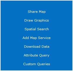
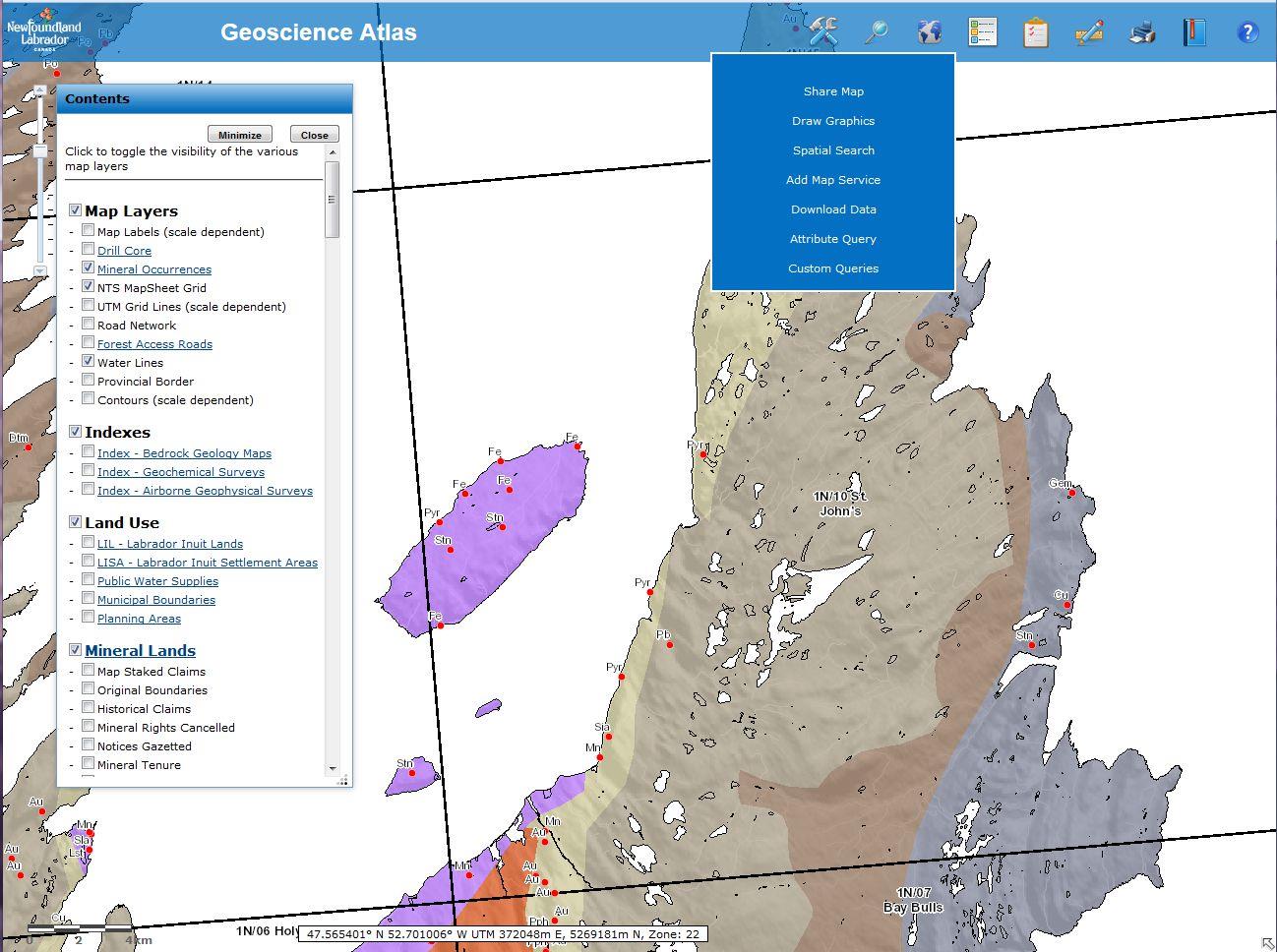
10 The Geoscience Atlas Tools Menu

11 The Geoscience Atlas Custom Queries -what claims were staked since November 1 st?

12 The Geoscience Atlas Printing Print as is Save as png Save as pdf (no title, NA or scalebar)
13 The Geoscience Atlas Search and Links Links to further information

14 The Geoscience Atlas Links to Oracle Links to pdf reports
15 The Geoscience Atlas Links to MS Access Links to Digital Data
16 The Geoscience Atlas Help Files Layer Help accessed through the Contents panel, blue underlined layer name -provides an overview of the layer, data collection and analysis procedures, a description of each attribute field, links to symbology files, references, disclaimer, citation and the person or group who is responsible for that layer Atlas Help provides descriptions of the tools, links to the Atlas Tutorial, Frequently Asked Questions (FAQ), List of Layers (description of all layers), and a Search and Query help file.
17 The Geoscience Atlas WMS Examples of Sites that use maps from the Geoscience Atlas: MIRIAD on-line Claim Staking System for Newfoundland and Labrador -uses many of the geoscience layers to provide a relative framework for exploration companies to digitally stake claims on-line COINAtlantic Coastal and Ocean Information Network Atlantic -provides access to the Atlantic Coastal Zone and Ocean Information from our Newfoundland Coastal Monitoring layers OneGeology a dynamic digital geological map of the world, provided by local geological surveys WMS links will be provided in the layer help files in the future.

18 Summary The Geoscience Atlas enables the NL Geological Survey to provide provincial geoscience data to a worldwide audience, increasing research and investment in our mining and exploration industries Side benefits include the use of ancillary layers, such as Land Use layers, to research parks and recreation, water usage, home and cottage lots, and geochemistry related to health issues
19 Future Plans new tools to extract data links to field photographs UAV video s (coastal erosion) provide WMS links
Census Data: Access, Mapping and Visualization
 Census Data: Access, Mapping and Visualization Trent University is a member of the Data Liberation Initiative (DLI), an agreement that provides academic institutions with access to otherwise restricted
COURSE OUTLINE GEOL 204 MINING COMPUTING 45 HOURS 1.5 CREDITS
 APPLIED SCIENCE AND MANAGEMENT DIVISION School of Science Fall, 2014 COURSE OUTLINE GEOL 204 MINING COMPUTING 45 HOURS 1.5 CREDITS PREPARED BY: Joel Cubley, Instructor DATE: APPROVED BY: Margaret Dumkee,
Quick Start Guide to. ArcGISSM. Online
 Quick Start Guide to ArcGISSM Online ArcGIS Online Quick Start Guide ArcGIS SM Online is a cloud-based mapping platform for organizations. Users get access to dynamic, authoritative content to create,
Earthquakes, volcanoes and plate tectonics in ArcGIS Online
 Earthquakes, volcanoes and plate tectonics in ArcGIS Online For non-commercial use only by schools and universities Copyright Esri UK GIS Esri for School UK Ltd Programme 2014 www.esriuk.com/schools Earthquakes,
Tutorial 3 - Map Symbology in ArcGIS
 Tutorial 3 - Map Symbology in ArcGIS Introduction ArcGIS provides many ways to display and analyze map features. Although not specifically a map-making or cartographic program, ArcGIS does feature a wide
Kodiak Island Borough GIS Online Tools
 Kodiak Island Borough GIS Online Tools The Kodiak Island Borough website is located at http://www.kodiakak.us/ You can access the GIS resources by clicking on the MAP CENTER icon in the middle of the page,
ArcGIS online Introduction... 2. Module 1: How to create a basic map on ArcGIS online... 3. Creating a public account with ArcGIS online...
 Table of Contents ArcGIS online Introduction... 2 Module 1: How to create a basic map on ArcGIS online... 3 Creating a public account with ArcGIS online... 3 Opening a Map, Adding a Basemap and then Saving
Mapping Mashup/Data Integration Development Resources
 Mapping Mashup/Data Integration Development Resources David Hart GIS Specialist University of Wisconsin Sea Grant Institute October 6, 2008 Virtual Globes A virtual globe is a 3D software model or representation
Geocortex HTML 5 Viewer Manual
 1 FAQ Nothing Happens When I Print? How Do I Search? How Do I Find Feature Information? How Do I Print? How can I Email A Map? How Do I See the Legend? How Do I Find the Coordinates of a Location? How
Mineral Exploration Using GIS and Processed Aster Images
 Mineral Exploration Using GIS and Processed Aster Images Carlos A. Torres Advance GIS EES 6513 (Spring 2007) University of Texas at San Antonio Abstract The risks of developing mineral resources need to
ArcGIS Web App Builder (AWAB) In BETA. John Bocan MES/DoIT john.bocan@maryland.gov
 In BETA. John Bocan MES/DoIT john.bocan@maryland.gov") ArcGIS Web App Builder (AWAB) In BETA John Bocan MES/DoIT john.bocan@maryland.gov Some Facts (1 slide) The Pros (5 slides) The Cons (2 slides) Some Bugs/Issues (1 slide) What s to Come (1 slide) What This
ArcGIS Web App Builder (AWAB) In BETA John Bocan MES/DoIT john.bocan@maryland.gov Some Facts (1 slide) The Pros (5 slides) The Cons (2 slides) Some Bugs/Issues (1 slide) What s to Come (1 slide) What This
GEOGRAPHIC INFORMATION GATEWAY New York Department of State (NYDOS) data acceptance & metadata standards
 data acceptance & metadata standards") GEOGRAPHIC INFORMATION GATEWAY New York Department of State (NYDOS) data acceptance & metadata standards 1. DATA ACCEPTANCE STANDARDS The following describes the data acceptance standards for data included
GEOGRAPHIC INFORMATION GATEWAY New York Department of State (NYDOS) data acceptance & metadata standards 1. DATA ACCEPTANCE STANDARDS The following describes the data acceptance standards for data included
Applications & Operations - Resource Stewardship & Major Projects
 Temporary GIS Technician (12 Months) BC Oil & Gas Commission, Fort St John Grid 18 - $55,294.14 - $62,886.67* * Posted salary includes a JFMM Allowance of 10% & a Location Allowance of 3% Applications
http://www.esri.com/bia
 ArcGIS for Tribal Transportation Management David Gadsden Federal Account Manager dgadsden@esri.com d d 1 David Gadsden GIS Background UW Geography (1995) Peace Corps Tanzania Environmental Social Science
Inlets Online: A Tutorial for Evaluating Inlet/Beach Processes Using Aerial Photography
 Inlets Online: A Tutorial for Evaluating Inlet/Beach Processes Using Aerial Photography by Mark R. Byrnes, Feng Li, and Julie D. Rosati PURPOSE: This Coastal and Hydraulics Engineering Technical Note (CHETN)
PEBBLE PROJECT ENVIRONMENTAL BASELINE DOCUMENT 2004 through 2008 APPENDIX C. DATA MANAGEMENT AND GEOGRAPHIC INFORMATION SYSTEM
 PEBBLE PROJECT ENVIRONMENTAL BASELINE DOCUMENT 2004 through 2008 APPENDIX C. DATA MANAGEMENT AND GEOGRAPHIC INFORMATION SYSTEM PREPARED BY: RESOURCE DATA, INC. TABLE OF CONTENTS TABLE OF CONTENTS... C-i
Quick Start Guide to. ArcGISSM. Online. for Public Accounts
 Quick Start Guide to ArcGISSM Online for Public Accounts Using ArcGIS Online with a Public Account ArcGIS SM Online is a cloud-based mapping platform that allows you to easily and quickly make maps, collaborate,
Geotechnical Data Sharing and Electronic Data Exchange at Minnesota DOT. Derrick D. Dasenbrock 1, M. ASCE, P.E.
 Geotechnical Data Sharing and Electronic Data Exchange at Minnesota DOT Derrick D. Dasenbrock 1, M. ASCE, P.E. 1 Minnesota Department of Transportation, 1400 Gervais Ave, Maplewood, MN, 55109 USA PH (651)
Getting Land Survey Vertical & Horizontal Control via the Internet
 Getting Land Survey Vertical & Horizontal Control via the Internet https://www.auroragov.org aka: City of Aurora home page ROLL OVER City Hall Dropdown will appear 1 PICK Maps In the Info List 2 PICK Mapping
INTRODUCTION to ESRI ARCGIS For Visualization, CPSC 178
 INTRODUCTION to ESRI ARCGIS For Visualization, CPSC 178 1) Navigate to the C:/temp folder 2) Make a directory using your initials. 3) Use your web browser to navigate to www.library.yale.edu/mapcoll/ and
The Advantages of Geographic Information Systems (GIS)
") The Benefits of Web-Based Map Deployment in Environmental Consulting Project Work I. INTRODUCTION Geographic Information System (GIS) software is a powerful tool for displaying and analyzing geographic
The Benefits of Web-Based Map Deployment in Environmental Consulting Project Work I. INTRODUCTION Geographic Information System (GIS) software is a powerful tool for displaying and analyzing geographic
Creating the US Topo
 Creating the US Topo A Process Discussion National Geospatial Program Office National Geospatial Technical Operations Center Helmut Lestinsky Graphics Product Specialist MOD Project Manager U.S. Department
Data Mining and Analysis in ArcGIS Online Joseph Kerski Education Manager Esri jkerski@esri.com Twitter @josephkerski 303-449-7779 x 18237
 Data Mining and Analysis in ArcGIS Online Joseph Kerski Education Manager Esri jkerski@esri.com Twitter @josephkerski 303-449-7779 x 18237 Joseph Kerski Webinar 1 Goals for this workshop 1. Understanding
Quick Start Guide to. ArcGISSM. Online. for Insurance
 Quick Start Guide to ArcGISSM Online for Insurance Historic tracks from tropical storms and hurricanes are overlaid on a map displaying population growth. Quick Start Guide to ArcGIS Online ArcGIS SM Online
Introduction to GIS software
 Introduction to GIS software There are a wide variety of GIS software packages available. Some of these software packages are freely available for you to download and could be used in your classroom. ArcGIS
WHAT IS GIS - AN INRODUCTION
 WHAT IS GIS - AN INRODUCTION GIS DEFINITION GIS is an acronym for: Geographic Information Systems Geographic This term is used because GIS tend to deal primarily with geographic or spatial features. Information
Oracle Data Miner (Extension of SQL Developer 4.0)
") An Oracle White Paper September 2013 Oracle Data Miner (Extension of SQL Developer 4.0) Integrate Oracle R Enterprise Mining Algorithms into a workflow using the SQL Query node Denny Wong Oracle Data Mining
An Oracle White Paper September 2013 Oracle Data Miner (Extension of SQL Developer 4.0) Integrate Oracle R Enterprise Mining Algorithms into a workflow using the SQL Query node Denny Wong Oracle Data Mining
Activites in Survey Department. Data Development Progress
 Introduction Activites in Survey Department Data Development Progress Conclusion Data Development in Brunei Darussalam Presented by : Hj Mohd Jamil bin Hj Mohd Ali Hj Jali bin Hj Nudin Survey Department
HELCOM Data and Map Service. User Manual
 HELCOM Data and Map Service User Manual Version 2.2 - February 2015 1 Table of contents 1. General Information... 3 1.1 Background... 3 1.2 Technical requirements... 3 1.3 Contact... 3 2. Accessing HELCOM
How to use PGS: Basic Services Provision Map App
 How to use PGS: Basic Services Provision Map App The PGS: Basic Services Provision Map App The main features of the PGP Basic Services web application includes: Navigation Tools Map Tools Main Map Links
GeoMap.WA. user guide
 GeoMap.WA user guide Version 1.1 March 2011 Preface: The information provided is interpretive. The information is made available in good faith and derived from sources believed to be reliable and accurate
REGIONAL SEDIMENT MANAGEMENT: A GIS APPROACH TO SPATIAL DATA ANALYSIS. Lynn Copeland Hardegree, Jennifer M. Wozencraft 1, Rose Dopsovic 2 INTRODUCTION
 REGIONAL SEDIMENT MANAGEMENT: A GIS APPROACH TO SPATIAL DATA ANALYSIS Lynn Copeland Hardegree, Jennifer M. Wozencraft 1, Rose Dopsovic 2 ABSTRACT: Regional sediment management (RSM) requires the capability
The International Hydrogeological Map of Europe ( IHME ) at the scale of 1:1.5 Million
 at the scale of 1:1.5 Million") The International Hydrogeological Map of Europe ( IHME ) at the scale of 1:1.5 Million - A coherent hydrogeological map for greater Europe and a model for the Rest of the World Historical Background State
The International Hydrogeological Map of Europe ( IHME ) at the scale of 1:1.5 Million - A coherent hydrogeological map for greater Europe and a model for the Rest of the World Historical Background State
Publishing Geoprocessing Services Tutorial
 Publishing Geoprocessing Services Tutorial Copyright 1995-2010 Esri All rights reserved. Table of Contents Tutorial: Publishing a geoprocessing service........................ 3 Copyright 1995-2010 ESRI,
Maps A Primer for Content & Production of Topographic Base Maps For Design Presented by SurvBase, LLC
 Maps A Primer for Content & Production of Topographic Base Maps For Design Presented by Definition and Purpose of, Map: a representation of the whole or a part of an area. Maps serve a wide range of purposes.
Expert Review and Questionnaire (PART I)
") NASA ARC Project 1-9-2001 Web-based Geospatial Information Services and Analytic Tools for Habitat Conservation and Management Expert Review and Questionnaire (PART I) Thank you for participating in this
NASA ARC Project 1-9-2001 Web-based Geospatial Information Services and Analytic Tools for Habitat Conservation and Management Expert Review and Questionnaire (PART I) Thank you for participating in this
What do I do first in ArcView 8.x? When the program starts Select from the Dialog box: A new empty map
 www.library.carleton.ca/find/gis Introduction Introduction to Georeferenced Images using ArcGIS Georeferenced images such as aerial photographs or satellite images can be used in many ways in both GIS
Vehicle Tracking Using ArcIMS and Geocortex IMF: A Winning Combination. Combination
 Vehicle Tracking Using ArcIMS and Geocortex IMF: A Winning Combination Combination Jason Close Internet Geographer Latitude Geographics Group Ltd. jclose@latitudegeo.com The City of Garland, Texas, population
www.lpi.nsw.gov.au SCIMS Online Support Guide
 www.lpi.nsw.gov.au SCIMS Online Support Guide November 2012 Document Status Revision Version 1.7 Version date 01/11/2012 Author Owner John Kelaher and Cheryl Wheeler Land and Property Information Surveying
Land Management Database (LMDB) Framework with Dekho and Desktop
 Framework with Dekho and Desktop") Land Management Database (LMDB) Framework with Dekho and Desktop Nik Henry 7 Sep 2012 1 Spatial Data for Standardised Reporting Background to LMDB OEH Investment Current LMDB Framework Desktop Demonstration
Land Management Database (LMDB) Framework with Dekho and Desktop Nik Henry 7 Sep 2012 1 Spatial Data for Standardised Reporting Background to LMDB OEH Investment Current LMDB Framework Desktop Demonstration
Mapping Mashup/Data Integration Development Resources Teaching with Google Earth and Google Ocean Stone Lab August 13, 2010
 Mapping Mashup/Data Integration Development Resources Teaching with Google Earth and Google Ocean Stone Lab August 13, 2010 David Hart GIS Specialist University of Wisconsin Sea Grant Institute Virtual
REGULATIONS FOR THE POSTGRADUATE DIPLOMA IN EARTH SCIENCES (PGDES)
") REGULATIONS FOR THE POSTGRADUATE DIPLOMA IN EARTH SCIENCES (PGDES) (See also General Regulations) The Postgraduate Diploma in Earth Sciences is a postgraduate diploma awarded for the satisfactory completion
REGULATIONS FOR THE POSTGRADUATE DIPLOMA IN EARTH SCIENCES (PGDES) (See also General Regulations) The Postgraduate Diploma in Earth Sciences is a postgraduate diploma awarded for the satisfactory completion
Using the Kendall County GIS Basic GIS Viewer
 Using the Kendall County GIS Basic GIS Viewer Link to Viewer Gallery: http://gis.co.kendall.il.us/gisviewer_gallery.aspx Help and About Initial View Introduction Navigation Identify Tool Search Tool Search
MicroStrategy Desktop
 MicroStrategy Desktop Quick Start Guide MicroStrategy Desktop is designed to enable business professionals like you to explore data, simply and without needing direct support from IT. 1 Import data from
Geographic Information System Tools for Management of US DOE Sites 14125
 Geographic Information System Tools for Management of US DOE Sites 14125 John Montgomery*, Cliff Carpenter*, Leonard Turton**, Steve Pawel** *US DOE, Office of Legacy Management **S.M. Stoller Corporation
Minnesota Department of Natural Resources \mn_dnr \mn_dnr\spatial \mn_dnr\tabular \mn_dnr\metadata
 INDEX OF GIS SPATIAL DATA, TABULAR DATA, AND METADATA ASSOCIATED WITH REPORT 380, AGGREGATE RESOURCE POTENTIAL PARTS OF NORTHERN ST. LOUIS AND LAKE COUNTIES, MN. Project of the Minnesota Department of
Studying Topography, Orographic Rainfall, and Ecosystems (STORE)
") Studying Topography, Orographic Rainfall, and Ecosystems (STORE) Introduction Basic Lesson 2: Using ArcGIS Explorer to Analyze the Connection between Topography and Rainfall This lesson introduces Geographical
Studying Topography, Orographic Rainfall, and Ecosystems (STORE) Introduction Basic Lesson 2: Using ArcGIS Explorer to Analyze the Connection between Topography and Rainfall This lesson introduces Geographical
Publishing Hosted 3D Feature Layers. An Esri White Paper September 2015
 An Esri White Paper September 2015 Copyright 2015 Esri All rights reserved. Printed in the United States of America. The information contained in this document is the exclusive property of Esri. This work
3D-GIS in the Cloud USER MANUAL. August, 2014
 3D-GIS in the Cloud USER MANUAL August, 2014 3D GIS in the Cloud User Manual August, 2014 Table of Contents 1. Quick Reference: Navigating and Exploring in the 3D GIS in the Cloud... 2 1.1 Using the Mouse...
Tutorial Overview Quick Tips on Using the ONRR Statistical Information Website
 Tutorial Overview Quick Tips on Using the ONRR Statistical Information Website We have added several upgrades to the ONRR Statistical Information Website. The new interactive map on the home page allows
Welcome to the Shortlist story map application template
 Welcome to the Shortlist story map application template Introduction for existing Shortlist authors... 2 Introduction for new Shortlist authors... 4 1. Create the ArcGIS web map for your Shortlist application...
Climate Change: A Local Focus on a Global Issue Newfoundland and Labrador Curriculum Links 2010-2011
 Climate Change: A Local Focus on a Global Issue Newfoundland and Labrador Curriculum Links 2010-2011 HEALTH Kindergarten: Grade 1: Grade 2: Know that litter can spoil the environment. Grade 3: Grade 4:
Step by Step Guide for GIS Cloud Applications
 Step by Step Guide for GIS Cloud Applications All in one manual for: Map Editor Map Viewer Asset Data Collection and Management Fleet Management Roadwork Management and Coordination Mobile Data Collection
Frequently Asked Questions: Wetlands Mapper
 Frequently Asked Questions: Wetlands Mapper December 2015 Mapper Content and Display How does the public access the new Mapper? The Wetlands Mapper can be found at: http://www.fws.gov/wetlands/ Does the
The Production of Orienteering Maps in Austria
 The Production of Orienteering Maps in Austria Ditz Robert Institute for Military Geography, Federal Ministry of Defence and Sports, Austria Abstract. Due to changing technologies in collecting data, the
Data Collection and Reporting Tool Training Presentation
 Data Collection and Reporting Tool Training Presentation 1 Table of Contents Introduction to the tool: Slides 3-9 How to use the tool General Information: Slides 11-14 Country Coordinator: Slides 15-35
Effects of Florida Under a 10 Meter Sea Level Rise
 Effects of Florida Under a 10 Meter Sea Level Rise Chance B. Murray Dec. 7 2009 I. Goal Assess the effects a 10 meter sea level rise would have on Florida. Mission: Determine the length of Florida s coastline
Creating Web and Mobile Maps Using ArcGIS Online. SCO Technical Paper
 Creating Web and Mobile Maps Using ArcGIS Online SCO Technical Paper Version History Version Date Notes Author/Contact 1.0 February, 2012 Initial document created. John J Czaplewski Copyright 2012 The
Australian Hydrological Geospatial Fabric (Geofabric) Tutorial. Access Water Storage information
 Tutorial. Access Water Storage information") Australian Hydrological Geospatial Fabric (Geofabric) Tutorial Access Water Storage Version 2.1 November 2012 Contact details Geospatial Data Unit Bureau of Meteorology GPO Box 2334 CANBERRA ACT 2601
Australian Hydrological Geospatial Fabric (Geofabric) Tutorial Access Water Storage Version 2.1 November 2012 Contact details Geospatial Data Unit Bureau of Meteorology GPO Box 2334 CANBERRA ACT 2601
Finding GIS Data and Preparing it for Use
 Finding_Data_Tutorial.Doc Page 1 of 19 Getting Ready for the Tutorial Sign Up for the GIS-L Listserv Finding GIS Data and Preparing it for Use The Yale University GIS-L Listserv is an internal University
Finding Drag Coefficient using Solidworks Flow Simulation
 Finding Drag Coefficient using Solidworks Flow Simulation Using solidworks to find the drag coefficient of shapes is a very useful way to cut down on the design time of a project, as it can remove tests.
THE CAGIS CONSORTIUM DATA SERVICES PRICING POLICY
 THE CAGIS CONSORTIUM DATA SERVICES PRICING POLICY AMENDED BY THE CAGIS POLICY BOARD ON June 6 th, 2014 Effective date: July 1st 2014 PART A Preamble PART B REGARDING SALE OF DATA SERVICE PRODUCTS TABLE
Software: AutoCAD Civil 3D 2014, NRCS C3D 2014 template, ESRI ArcMap. Notation:Button to Press Displayed Text Icon Action {Text to Enter} Menu Item
 Overview: Use the following processes for exchanging georeferenced data between AutoCAD Civil 3D 2014 and ArcMap. The work must be based in any real world coordinate system. (This example uses NAD 83 UTM
Importing Data from Excel Spreadsheets
 Importing Data from Excel Spreadsheets Dos, don ts, and updated procedures for ArcGIS 10 By Mike Price, Entrada/San Juan, Inc. This exercise models data from a well-known gold and base metals mining area
URISA Salary Survey for IT/GIS Professionals
 URISA Salary Survey for IT/GIS Professionals November 2011 Published by: The Urban and Regional Information Systems Association 701 Lee Street, Suite 680 Des Plaines, IL 60016 Phone: 847/824-6300, Fax:
User s Guide to ArcView 3.3 for Land Use Planners in Puttalam District
 User s Guide to ArcView 3.3 for Land Use Planners in Puttalam District Dilhari Weragodatenna IUCN Sri Lanka, Country Office Table of Content Page No Introduction...... 1 1. Getting started..... 2 2. Geo-referencing...
Help Document for WWW.SAGIS.ORG. Step by step, how-to instructions for navigating and using the Savannah Area GIS viewer.
 Help Document for WWW.SAGIS.ORG Step by step, how-to instructions for navigating and using the Savannah Area GIS viewer. 1 SAGIS Savannah Area GIS is focused on providing access to Geospatial data in a
SAFARI An outcrop analogue database for reservoir modelling
 SAFARI An outcrop analogue database for reservoir modelling Nicole Richter 1 John Howell 1,3, Kevin Keogh 2, Simon Buckley 1 and Kjell-Sigve Lervik 4 1 Centre for Integrated Petroleum Research (CIPR),
Storytelling with Maps: Workflows and Best Practices
 Storytelling with Maps: Workflows and Best Practices Introduction What is a story map? Story maps are interactive maps combined with text and other content to tell a story about the world. Typically story
Gunnison County Web Map
 Gunnison County Web Map Find Data - Find data - Navigate tools - Mouse over tooltip Make Maps - Layers - Legend - Drawing tools - Printing Analysis - Measurement - Selecting - Queries Spatial SQL - Basic
City of Corpus Christi. Mobile GIS Viewer. For ipad
 City of Corpus Christi Mobile GIS Viewer For ipad MIS - GIS 3/9/2012 P a g e 1 Contents Requirements... 2 Installation... 2 Using the ArcGIS Mobile App... 4 Connect to the Corpus Christi Mobile GIS Map
Missouri Regions Shaped by Land Forms and Geology
 Missouri Regions Shaped by Land Forms and Geology Lesson Abstract Summary: MO GLE: Subject Areas: The students will use various resources to compare and contrast the geology of each Missouri region to
Publishing KML Services Tutorial
 Publishing KML Services Tutorial Copyright 1995-2010 Esri All rights reserved. Table of Contents Tutorial: Publishing a KML service............................ 3 Copyright 1995-2010 ESRI, Inc. All rights
Web Based GIS Consulting Portal with Crop-Land Suitability
 Web Based GIS Consulting Portal with Crop-Land Suitability P.K.S.C. Jayasinghe a, Takemi Machida b a Ibaraki University, Ibaraki prefecture, Japan, subashjp@yahoo.com, b Ibaraki University, Ibaraki prefecture,
ART 170: Web Design 1
 Banner Design Project Overview & Objectives Everyone will design a banner for a veterinary clinic. Objective Summary of the Project General objectives for the project in its entirety are: Design a banner
Edwin Analytics Getting Started Guide
 Edwin Analytics Getting Started Guide This guide provides assistance for accessing and using Edwin Analytics, the Department of Elementary and Secondary Education s (ESE) online tool for expanding data
Reef Explorer User Guide
 Reef Explorer User Guide Contents USER INTERFACE...2 DATA CONTENT...3 BASEMAPS...4 ESRI BASEMAPS...4 National Geographic World Map...4 Light Gray Canvas Map...4 Ocean Basemap...4 World Terrain Base...4
WORK BREAKDOWN STRUCTURE FOR A TYPICAL MINE
 WORK BREAKDOWN STRUCTURE FOR A TYPICAL MINE LEGEND [GeoMine] = Technology Sites [Exploration-Geology-Reserves] = Edumine Courses [GEOCHEMISTRY] = State-of-the-Art Review (SOAR) 1 EXPLORATION [GEOMINE]
TOWN OF WESTON,CT REQUEST FOR PROPOSALS. For. Parcel Mapping & Web-Based GIS Application
 TOWN OF WESTON,CT I. INTRODUCTION REQUEST FOR PROPOSALS For Parcel Mapping & Web-Based GIS Application The Town of Weston, Connecticut (the "Town") seeks proposals from interested GIS consultants for the
CRMS Website Training
 CRMS Website Training March 2013 http://www.lacoast.gov/crms Coastwide Reference Monitoring System - Wetlands CWPPRA Restoration Projects Congressionally funded in 1990 Multiple restoration techniques
ArcGIS Pro. James Tedrick, Esri
 ArcGIS Pro James Tedrick, Esri What you already know Why ArcGIS PRO? Vision The next generation ArcGIS desktop application for the GIS community who need a clean and comprehensive user experience which
Using GIS to Track and Prioritize Your Assets
 Using GIS to Track and Prioritize Your Assets What is GIS?? Geographic Information System Geographic Location of an asset Information Characteristics of an asset System Software that allows connection
Ofgem Carbon Savings Community Obligation (CSCO) Eligibility System
 Eligibility System") Ofgem Carbon Savings Community Obligation (CSCO) Eligibility System User Guide 2015 Page 1 Table of Contents Carbon Savings Community Obligation... 3 Carbon Savings Community Obligation (CSCO) System...
Ofgem Carbon Savings Community Obligation (CSCO) Eligibility System User Guide 2015 Page 1 Table of Contents Carbon Savings Community Obligation... 3 Carbon Savings Community Obligation (CSCO) System...
Geosciences - Programme subject in programme for Specialization in General Studies
 Geosciences - Programme subject in programme for Specialization in General Studies Dette er en oversettelse av den fastsatte læreplanteksten. Læreplanen er fastsatt på Bokmål Laid down as a regulation
What is GIS? Geographic Information Systems. Introduction to ArcGIS. GIS Maps Contain Layers. What Can You Do With GIS? Layers Can Contain Features
 What is GIS? Geographic Information Systems Introduction to ArcGIS A database system in which the organizing principle is explicitly SPATIAL For CPSC 178 Visualization: Data, Pixels, and Ideas. What Can
How To Load Data Into An Org Database Cloud Service - Multitenant Edition
 An Oracle White Paper June 2014 Data Movement and the Oracle Database Cloud Service Multitenant Edition 1 Table of Contents Introduction to data loading... 3 Data loading options... 4 Application Express...
Global Air Navigation System Performance Based Air Navigation eanp Framework
 SIP/2009-WP/10 eanp Framework Global Air Navigation System Performance Based Air Navigation eanp Framework Jim Nagle, Chief CNS/AIRS International Civil Aviation Organization Workshop on the Development
Remote Sensing, GPS and GIS Technique to Produce a Bathymetric Map
 Remote Sensing, GPS and GIS Technique to Produce a Bathymetric Map Mark Schnur EES 5053 Remote Sensing Fall 2007 University of Texas at San Antonio, Department of Earth and Environmental Science, San Antonio,
Educational Level Guide. Pros
 GIS software summary This information is based on an evaluation carried out on behalf of the RGS-IBG (please see disclaimer). Category* Cost E- learnin g credits Educational Level Guide Pros Cons Summary
Implementation of a Web Portal for Managing and Sharing Environmental Data
 Implementation of a Web Portal for Managing and Sharing Environmental Data Prepared for: 2011 DoD Environmental Monitoring & Data Quality Workshop Presented by: Jason Samus EA Engineering, Science and
Texas Wildfire Risk Assessment Portal (TxWRAP) User Manual. Texas A&M Forest Service
 User Manual. Texas A&M Forest Service") Texas Wildfire Risk Assessment Portal (TxWRAP) User Manual Texas A&M Forest Service October 2012 Table of Contents 1 ABOUT TXWRAP... 7 1.1 ACCESSING TXWRAP... 7 1.2 GETTING SUPPORT... 8 Documentation...
Texas Wildfire Risk Assessment Portal (TxWRAP) User Manual Texas A&M Forest Service October 2012 Table of Contents 1 ABOUT TXWRAP... 7 1.1 ACCESSING TXWRAP... 7 1.2 GETTING SUPPORT... 8 Documentation...
Promoting Your Location Platform
 Promoting Your Location Platform A Change Management Kit www.esri.com/changekit Publication Date: November 23, 2015 Esri: Promoting Your Location Platform 1 What is the Change Management Kit? The launch
Step 2. Open ArcMap, set Projection to State Plane NAD 83 Feet Apply
 GIS III Exercise 01 Create a Database & Map Urban Land Use Jan 2010 Student Learning Outcomes: Import table data into an MS Access database; NOTE: DOS 8.3 naming is required for files being imported into
DRAFT ENVIRONMENTAL BASELINE STUDIES PROPOSED 2007 STUDY PLANS CHAPTER 19 DATA MANAGEMENT AND GEOGRAPHIC INFORMATION SYSTEM
 DRAFT ENVIRONMENTAL BASELINE STUDIES PROPOSED 2007 STUDY PLANS CHAPTER 19 DATA MANAGEMENT AND GEOGRAPHIC INFORMATION SYSTEM DRAFT SEPTEMBER 2007 DRAFT DATA MANAGEMENT AND GIS TABLE OF CONTENTS TABLE OF
Development of the Serbian Geological Resources Portal
 17 th Meeting of the Association of European Geological Societes Proceedings 61 65 BELGRADE, 14 18 September 2011 Development of the Serbian Geological Resources Portal RANKA STANKOVIĆ 1, JELENA PRODANOVIĆ
Guidelines on Information Deliverables for Research Projects in Grand Canyon National Park
 INTRODUCTION Science is playing an increasing role in guiding National Park Service (NPS) management activities. The NPS is charged with protecting and maintaining data and associated information that
Introduction to RStudio
 Introduction to RStudio (v 1.3) Oscar Torres-Reyna otorres@princeton.edu August 2013 http://dss.princeton.edu/training/ Introduction RStudio allows the user to run R in a more user-friendly environment.
EST Home Analytics v3 Basic User Guide
 EST Home Analytics v3 Basic User Guide Sept 2014 Page 1 of 32 Table of Contents Section 1: Introduction... 3 Background... 3 Section 2: Getting Started... 4 Logging In for the first time... 4 Navigating
United States Department of Agriculture US Forest Service Natural Resource Manager (NRM) Air v2.3 User Guide Chapter 1: Introduction
 Air v2.3 User Guide Chapter 1: Introduction") United States Department of Agriculture US Forest Service Natural Resource Manager (NRM) Air v2.3 User Guide Chapter 1: Introduction February 2015 TABLE OF CONTENTS Overview... 1-3 Why Do Water Chemistry
United States Department of Agriculture US Forest Service Natural Resource Manager (NRM) Air v2.3 User Guide Chapter 1: Introduction February 2015 TABLE OF CONTENTS Overview... 1-3 Why Do Water Chemistry
Mine Water Truck Tracking Rio Tinto Kennecott Copper TERESA COCKAYNE ENVIRONMENTAL, LAND, & WATER RTKC JULY 23, 2015
 Mine Water Truck Tracking Rio Tinto Kennecott Copper TERESA COCKAYNE ENVIRONMENTAL, LAND, & WATER RTKC JULY 23, 2015 Purpose Dust suppression is a key component for safety and air quality compliance within