SAFARI An outcrop analogue database for reservoir modelling
|
|
|
- Cecilia Neal
- 9 years ago
- Views:
Transcription
1 SAFARI An outcrop analogue database for reservoir modelling Nicole Richter 1 John Howell 1,3, Kevin Keogh 2, Simon Buckley 1 and Kjell-Sigve Lervik 4 1 Centre for Integrated Petroleum Research (CIPR), Uni Research AS, Bergen, Norway 2 Statoil ASA, Calgary, Canada 3 Also Rocksource ASA, Bergen, Norway 4 FORCE Sed/Strat, NPD, Stavanger, Norway Contact: [email protected] February 22-24, PUG conference, Houston

2 CIPR - Centre for Integrated Petroleum Research The Norwegian Centre of Excellence in Petroleum Technology Applied research into increased oil exploitation and secure CO 2 storage Specialty in integration of traditional research areas in cross discipline cooperation Research topics: Enhanced oil recovery (EOR) Geosciences Virtual Outcrop Geology (VOG) Reservoir simulation more than 100 researchers and PhDs from all over the world
 Reservoir simulation more than 100 researchers and PhDs from all")
3 Virtual outcrop geology group 3D spatial data collection for building and interrogating models of geological outcrops Laser scanning (LIDAR): ground-based + helicopter-based photorealistic models of outcrops Technique development maximizing the quantitative information extracted and used from VO data Sedimentological outcrop analogue modeling Interpretation of features Quantitative analysis accurate and high resolution input for reservoir modeling Visualization and data integration

4 Oblique Helicopter-based LIDAR scanning for outcrop mapping

5 Mediumfjellet (Svalbard) Fracture and fault analysis Simon Buckley

6 Statistical and dynamic analysis of virtual outcrops and geocellular models for shallow marine deltaic systems Mapping of clinoforms Building of surfaces Dynamically testing reservoir models (flow sim.) Water injector Producer Building of reservoir models Håvard Enge

7 Integration of hyperspectral imaging and lidar for geological mapping (1/2) dolomite Sensor with rotation stage limestone dolomite limestone spectral image Tobias Kurz

8 Result Classified point cloud (2/2) highly dolomitized moderate dolomitized limestone 1.1 % pixels 17.8 % pixels 24.1 % pixels Tobias Kurz

9 EUSA Empirical Understanding of Sedimentary Architecture Project goals: To collect large volumes of spatial geological outcrop data addressing the preserved stratigraphic architecture To setup a database with all the existing data and large volumes of new data funded by the Norwegian Research Council, NPD, 19+ oil companies through FORCE consortium project start was in June year

10 Sedimentary Architecture of Field Analogues for Reservoir Information Objectives A database for all outcrop data hard data = numerical information on sand body and barrier soft data = for improved conceptual understanding of depositional systems Common outcrop standard for nomenclature, data categories and domains Combines a large variety of different data sources SAFARI data Existing literature data Virtual outcrops 3D data from CIPR

11 Database requirements Storage and visualization of multiple data types e.g. geographical coordinates (GPS), numerical, vector, raster and 3D outcrop data, pictures Common standards for nomenclature, categories and domains XML exchange standards Search and query functionality Data analyses 2D statistical plots 3D virtual outcrop interpretation Channel belt thickness Width thickness plot by systems tract Channel belt width N=320 Numb. of datasets 27

12 Database implementation structure viewers ArcGIS Explorer Web mapping application ArcGIS Desktop ArcGIS mobile XML import/export server ArcGIS Server data Database (e.g. File GeoDB, SDE Oracle, ) SAFARI data 3D virtual outcrops published literature modern depositional systems proposed DB structure: flexible, easy to use fully accessible over the internet

13 data sets ArcExplorer demonstration

14 Data standardization

15 first draft just 3 weeks old! Data standardization
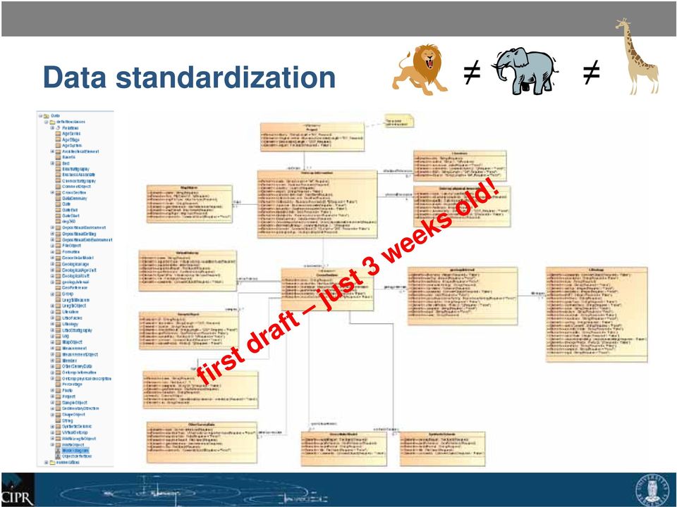
16 Standardization Depositional environment Sub-Environment Architectural element (AE) Lithofacies (LF) LF geometry AE geometry Project info Outcrop info SAFARI database Outcrop physical description and geometry Setting Stratigraphy Geological age Additional data Reference (Lit.) Georeference Cross sections Logs Pictures Samples Survey data (incl. 3D virtual outcrop data) Model data
 Georeference Cross sections Logs Pictures Samples Survey data (incl.")
17 Open discussion of outcrop standards and nomenclature! just started! Do you like to contribute to the standardization and nomenclature process or maybe your geologists? Contact me:

18 Conclusion and outlook Preliminary database structure Definition of standards and nomenclature Acquisition and standardization of new datasets 8 virtual outcrops 117 deep water outcrops data sets 32 rivers with 155 sections Setup of ArcGIS Server and clients Design of maps, tools and functionality

19 Sponsors Sed/Strat group through the PETROMAKS programme

20 More information? Want to be part? Get in contact! Thanks to ESRI and Geodata AS for technical support

21 Thank you for your attention!
GIS Databases With focused on ArcSDE
 Linköpings universitet / IDA / Div. for human-centered systems GIS Databases With focused on ArcSDE Imad Abugessaisa [email protected] 20071004 1 GIS and SDBMS Geographical data is spatial data whose
The following was presented at DMT 14 (June 1-4, 2014, Newark, DE).
.") DMT 2014 The following was presented at DMT 14 (June 1-4, 2014, Newark, DE). The contents are provisional and will be superseded by a paper in the DMT 14 Proceedings. See also presentations and Proceedings
DMT 2014 The following was presented at DMT 14 (June 1-4, 2014, Newark, DE). The contents are provisional and will be superseded by a paper in the DMT 14 Proceedings. See also presentations and Proceedings
Storing of CO 2 offshore Norway, Criteria for evaluation of safe storage sites
 Storing of CO 2 offshore Norway, Criteria for evaluation of safe storage sites Eva Halland Norwegian Petroleum Directorate Trondheim CCS Conference June 14-16, 2011 1 29.06.2011 Storing of CO 2 offshore
Data Mining and Exploratory Statistics to Visualize Fractures and Migration Paths in the WCBS*
 Data Mining and Exploratory Statistics to Visualize Fractures and Migration Paths in the WCBS* Jean-Yves Chatellier 1 and Michael Chatellier 2 Search and Discovery Article #41582 (2015) Posted February
RESERVOIR GEOSCIENCE AND ENGINEERING
 RESERVOIR GEOSCIENCE AND ENGINEERING APPLIED GRADUATE STUDIES at IFP School from September to December RGE01 Fundamentals of Geoscience I Introduction to Petroleum Geosciences, Sedimentology RGE02 Fundamentals
Nautilus Global Schedule 2016
 Geophysics N004a The Essentials of Rock Physics and Seismic Amplitude Interpretation 18-21 Apr Houston, US N049a Seismic Attributes for Exploration and Reservoir Characterisation 25-29 Apr Houston, US
3D Point Cloud Analytics for Updating 3D City Models
 3D Point Cloud Analytics for Updating 3D City Models Rico Richter 25 th May 2015 INSPIRE - Geospatial World Forum 2015 Background Hasso Plattner Institute (HPI): Computer Graphics Systems group of Prof.
Harmonizing Survey Deliverables Emerging Standards and Smart Data Exchange
 Harmonizing Survey Deliverables Emerging Standards and Smart Data Exchange Andy Hoggarth and Karen Cove, CARIS, Fredericton, Canada Introduction When a survey company plans a project the deliverables are
Workflow improvement with FME in Skedsmo municipality
 Workflow improvement with FME in Skedsmo municipality Anders Hveem Malum (Geodata AS) and Turid Brox Nilsen (Skedsmo municipality) 16.05.2014 Skedsmo Kommune, Teknisk sektor 1 Skedsmo municipality Situated
Integrated Information Management System, Development of Web Interface, a.k.a. Online Data Portal (ODP)
") Integrated Information Management System, Development of Web Interface, a.k.a. Online Data Portal (ODP) USBR Science and Technology Project ID 3625 Eric Peterson, May 2014. Duration: Fiscal Year 2010 through
Integrated Information Management System, Development of Web Interface, a.k.a. Online Data Portal (ODP) USBR Science and Technology Project ID 3625 Eric Peterson, May 2014. Duration: Fiscal Year 2010 through
ArcGIS 10.1 Geodatabase Administration. Gordon Sumerling & Christopher Brown
 ArcGIS 10.1 Geodatabase Administration Gordon Sumerling & Christopher Brown Key Improvements at ArcGIS 10.1 1. Easier Administration through Graphic Interfaces 2. Greater Seamless integration with Open
ESRI Technical Certification Overview. Amy Daniels Instructor, Greenville Tech
 ESRI Technical Certification Overview Amy Daniels Instructor, Greenville Tech Why have certification by ESRI? It communicates your proficiency in ESRI software Similar to Microsoft Certification, it can
Paradigm High Tech and Innovative Software Solutions for the Oil and Gas Industry
 Paradigm High Tech and Innovative Software Solutions for the Oil and Gas Industry EOST Strasbourg 17 Jan. 2012 Vision for Energy Matthieu Quinquet Outline General information Core activities and market
Broadband seismic to support hydrocarbon exploration on the UK Continental Shelf
 Broadband seismic to support hydrocarbon exploration on the UK Continental Shelf Gregor Duval 1 1 CGGVeritas Services UK Ltd, Crompton Way, Manor Royal Estate, Crawley, RH10 9QN, UK Variable-depth streamer
Geothermal. . To reduce the CO 2 emissions a lot of effort is put in the development of large scale application of sustainable energy.
 Geothermal Energy With increasing fossil fuel prices, geothermal energy is an attractive alternative energy source for district heating and industrial heating. In recent years the use of geothermal energy
Certificate Programs in. Program Requirements
 IHRDC Online Certificate Programs in OIL AND GAS MANAGEMENT Program Requirements IHRDC 535 Boylston Street Boston, MA 02116 Tel: 1-617-536-0202 Email: [email protected] Copyright International Human
Search and Discovery Article #40356 (2008) Posted October 24, 2008. Abstract
 Posted October 24, 2008. Abstract") Quantifying Heterogeneities and Their Impact from Fluid Flow in Fluvial-Deltaic Reservoirs: Lessons Learned from the Ferron Sandstone Outcrop Analogue* Peter E. Deveugle 1, Matthew D. Jackson 1, Gary J.
Quantifying Heterogeneities and Their Impact from Fluid Flow in Fluvial-Deltaic Reservoirs: Lessons Learned from the Ferron Sandstone Outcrop Analogue* Peter E. Deveugle 1, Matthew D. Jackson 1, Gary J.
EXPLORING AND SHARING GEOSPATIAL INFORMATION THROUGH MYGDI EXPLORER
 EXPLORING AND SHARING GEOSPATIAL INFORMATION THROUGH MYGDI EXPLORER Subashini Panchanathan Malaysian Centre For Geospatial Data Infrastructure ( MaCGDI ) Ministry of National Resources and Environment
MrSID Plug-in for 3D Analyst
 LizardTech MrSID Plug-in for 3D Analyst User Manual Copyrights Copyright 2009 2010 LizardTech. All rights reserved. Information in this document is subject to change without notice. The software described
Harmonizing Survey Deliverables Emerging Standards and Smart Data Exchange
 Harmonizing Survey Deliverables Emerging Standards and Smart Data Exchange Andy Hoggarth, CARIS 115 Waggoners Lane, Fredericton, New Brunswick, Canada [email protected] Karen Cove, CARIS 115 Waggoners
REGIONAL CENTRE FOR TRAINING IN AEROSPACE SURVEYS (RECTAS) MASTER IN GEOINFORMATION PRODUCTION AND MANAGEMENT
 MASTER IN GEOINFORMATION PRODUCTION AND MANAGEMENT") REGIONAL CENTRE FOR TRAINING IN AEROSPACE SURVEYS (RECTAS) MASTER IN GEOINFORMATION PRODUCTION AND MANAGEMENT PROGRAMME DESCRIPTION October 2014 1. The programme The academic programme shall be referred
REGIONAL CENTRE FOR TRAINING IN AEROSPACE SURVEYS (RECTAS) MASTER IN GEOINFORMATION PRODUCTION AND MANAGEMENT PROGRAMME DESCRIPTION October 2014 1. The programme The academic programme shall be referred
Digital Modernization of Oilfields Digital Oilfield to Intelligent Oilfield. Karamay Hongyou Software Co., Ltd.
 Digital Modernization of Oilfields Digital Oilfield to Intelligent Oilfield Karamay Hongyou Software Co., Ltd. Professional technologies and information technology enhance the development of the oil industry.
A Web services solution for Work Management Operations. Venu Kanaparthy Dr. Charles O Hara, Ph. D. Abstract
 A Web services solution for Work Management Operations Venu Kanaparthy Dr. Charles O Hara, Ph. D Abstract The GeoResources Institute at Mississippi State University is leveraging Spatial Technologies and
The Courses. Covering complete breadth of GIS technology from ESRI including ArcGIS, ArcGIS Server and ArcGIS Engine.
 ESRI India: Corporate profile ESRI India A profile India s Premier GIS Company Strategic alliance between ESRI Inc. and NIIT Technologies Adjudged as India s Best GIS Solutions Company - Map India 2001
Chapter Contents Page No
 Chapter Contents Page No Preface Acknowledgement 1 Basics of Remote Sensing 1 1.1. Introduction 1 1.2. Definition of Remote Sensing 1 1.3. Principles of Remote Sensing 1 1.4. Various Stages in Remote Sensing
Big Data in OpenTopography
 Big Data in OpenTopography Vishu Nandigam San Diego Supercomputer Center NSF Big Data in Educa
Collecting and Analyzing Big Data for O&G Exploration and Production Applications October 15, 2013 G&G Technology Seminar
 Eldad Weiss Founder and Chairman Collecting and Analyzing Big Data for O&G Exploration and Production Applications October 15, 2013 G&G Technology Seminar About Paradigm 700+ 26 700+ 29 7 15,000+ 15+ 200M+
Mineral Exploration Using GIS and Processed Aster Images
 Mineral Exploration Using GIS and Processed Aster Images Carlos A. Torres Advance GIS EES 6513 (Spring 2007) University of Texas at San Antonio Abstract The risks of developing mineral resources need to
Systems and control theory for increased oil recovery
 Systems and control theory for increased oil recovery Jan-Dirk Jansen, Delft University of Technology 1 Research & development drivers Increasing demand; reducing supply energy demand continues to grow
Experience the commitment. CGI Exploration2Revenue TM Business Suite. Optimize your upstream back office
 Experience the commitment CGI Exploration2Revenue TM Business Suite Optimize your upstream back office Delivering a competitive edge Today s oil and gas companies are challenged to lower the costs of running
Coming To An Airport Near You
 Airport GIS Data & ealp Coming To An Airport Near You Kevin Shirer, AAE Project Manager Association of California Airports; September 2009 Today s Presentation & Expectations Take away Basic knowledge
Applying GIS Analysis to Archaeological Research in Canada
 Applying GIS Analysis to Archaeological Research in Canada T A L K B Y D R. K I S H A S U P E R N A N T P R E S E N T E D A T G E O A L B E R T A 2 0 1 3 S E P T E M B E R 2 3, 2 0 1 3 Overview Review
Enterprise GIS Architecture Deployment Options. Andrew Sakowicz
 Enterprise GIS Architecture Deployment Options Andrew Sakowicz Audience Audience - Architects - Developers - Administrators - Project Managers Level: - Beginner / Intermediate Introduction Andrew Sakowicz
Appendix I: Module Descriptions
 Appendix I: Module Descriptions Learning Outcomes AGI Propedeutics and Electives 856M11 18 ECTS Students are adjusting to the requirements of the MSc AGI programme based on their different first degrees.
GEOGRAPHIC INFORMATION GATEWAY New York Department of State (NYDOS) data acceptance & metadata standards
 data acceptance & metadata standards") GEOGRAPHIC INFORMATION GATEWAY New York Department of State (NYDOS) data acceptance & metadata standards 1. DATA ACCEPTANCE STANDARDS The following describes the data acceptance standards for data included
GEOGRAPHIC INFORMATION GATEWAY New York Department of State (NYDOS) data acceptance & metadata standards 1. DATA ACCEPTANCE STANDARDS The following describes the data acceptance standards for data included
RiMONITOR. Monitoring Software. for RIEGL VZ-Line Laser Scanners. Ri Software. visit our website www.riegl.com. Preliminary Data Sheet
 Monitoring Software RiMONITOR for RIEGL VZ-Line Laser Scanners for stand-alone monitoring applications by autonomous operation of all RIEGL VZ-Line Laser Scanners adaptable configuration of data acquisition
Introduction to Imagery and Raster Data in ArcGIS
 Esri International User Conference San Diego, California Technical Workshops July 25, 2012 Introduction to Imagery and Raster Data in ArcGIS Simon Woo slides Cody Benkelman - demos Overview of Presentation
Interoperable Solutions in Web-based Mapping
 ISPRS SIPT IGU UCI CIG ACSG Table of contents Table des matières Authors index Index des auteurs Search Recherches Exit Sortir Interoperable Solutions in Web-based Mapping Marta Wojnarowska and Bridget
Editing Strategies for Enterprise Geodatabase
 Federal GIS Conference February 9 10, 2015 Washington, DC Editing Strategies for Enterprise Geodatabase Ty Fabling Esri Solution Engineer A Complete Platform Enabling GIS Everywhere Desktop Web Device
Integration of Geological, Geophysical, and Historical Production Data in Geostatistical Reservoir Modelling
 Integration of Geological, Geophysical, and Historical Production Data in Geostatistical Reservoir Modelling Clayton V. Deutsch (The University of Alberta) Department of Civil & Environmental Engineering
TEXAS A&M UNIVERSITY CORPUS CHRISTI COLLEGE OF SCIENCE AND TECHNOLOGY PROPOSAL FOR NEW COURSE/ELECTIVE. Credit Hours: 6 Semester: Summer Year: 2009
 TEXAS A&M UNIVERSITY CORPUS CHRISTI COLLEGE OF SCIENCE AND TECHNOLOGY PROPOSAL FOR NEW COURSE/ELECTIVE Course Number: GEOL 46xx Instructor: James R. Garrison, Jr. Credit Hours: 6 Semester: Summer Year:
INTEROPERABLE IMAGE DATA ACCESS THROUGH ARCGIS SERVER
 INTEROPERABLE IMAGE DATA ACCESS THROUGH ARCGIS SERVER Qian Liu Environmental Systems Research Institute 380 New York Street Redlands, CA92373, U.S.A - [email protected] KEY WORDS: OGC, Standard, Interoperability,
Deploying ArcGIS for Server Using Managed Services
 Deploying ArcGIS for Server Using Managed Services Andrew Sakowicz Erin Ross Sridhar Karra Agenda Introduction Program Overview - Overview - Methodology - Tools Customer Deployments - Architecture and
Exploiting Prestack Seismic from Data Store to Desktop
 Exploiting Prestack Seismic from Data Store to Desktop Solutions to maximize your assets. Landmark Software & Services Exploiting Prestack Seismic from Data Store to Desktop Author: Ciaran McCarry, Principal
Institute of Natural Resources Departament of General Geology and Land use planning Work with a MAPS
 Institute of Natural Resources Departament of General Geology and Land use planning Work with a MAPS Lecturers: Berchuk V.Y. Gutareva N.Y. Contents: 1. Qgis; 2. General information; 3. Qgis desktop; 4.
VCS REDD Methodology Module. Methods for monitoring forest cover changes in REDD project activities
 1 VCS REDD Methodology Module Methods for monitoring forest cover changes in REDD project activities Version 1.0 May 2009 I. SCOPE, APPLICABILITY, DATA REQUIREMENT AND OUTPUT PARAMETERS Scope This module
GIS: Geographic Information Systems A short introduction
 GIS: Geographic Information Systems A short introduction Outline The Center for Digital Scholarship What is GIS? Data types GIS software and analysis Campus GIS resources Center for Digital Scholarship
Relative Permeability Measurement in Rock Fractures
 Relative Permeability Measurement in Rock Fractures Siqi Cheng, Han Wang, Da Huo Abstract The petroleum industry always requires precise measurement of relative permeability. When it comes to the fractures,
GeoConvention 2013: Integration 1
 The Analysis and Annotation of 3D Photorealistic Geological Outcrop Models Miao Wang, The University of Texas at Dallas, 800 W. Campbell Rd, Richardson, TX, USA 750823 Michele Iris Rodriguez-Gomez, The
GIS Initiative: Developing an atmospheric data model for GIS. Olga Wilhelmi (ESIG), Jennifer Boehnert (RAP/ESIG) and Terri Betancourt (RAP)
, Jennifer Boehnert (RAP/ESIG) and Terri Betancourt (RAP)") GIS Initiative: Developing an atmospheric data model for GIS Olga Wilhelmi (ESIG), Jennifer Boehnert (RAP/ESIG) and Terri Betancourt (RAP) Unidata seminar August 30, 2004 Presentation Outline Overview
GIS Initiative: Developing an atmospheric data model for GIS Olga Wilhelmi (ESIG), Jennifer Boehnert (RAP/ESIG) and Terri Betancourt (RAP) Unidata seminar August 30, 2004 Presentation Outline Overview
3D Model of the City Using LiDAR and Visualization of Flood in Three-Dimension
 3D Model of the City Using LiDAR and Visualization of Flood in Three-Dimension R.Queen Suraajini, Department of Civil Engineering, College of Engineering Guindy, Anna University, India, [email protected]
Applications of Advanced Laser Scanning Technology in Geology
 Applications of Advanced Laser Scanning Technology in Geology A. Fowler, Riegl USA, Orlando, United States of America J. I. France, Riegl USA, Orlando, United States of America M. Truong, Riegl USA, Orlando,
Software. PowerExplorer. Information Management and Platform DATA SHEET
 DATA SHEET PowerExplorer Software Information Management and Platform KEY FEATURES Web-enabled Advanced, ad-hoc query capabilities Spatial E&P data presentation ZGF file import/export Spatializer Tabular
Carbonate Rock Formation
 Limestone, dolomite (or dolostone), and marble are often collectively referred to as carbonate rocks because the main mineral is calcite. The chemical name of calcite is calcium carbonate. Limestone, dolomite,
Databases for 3D Data Management: From Point Cloud to City Model
 Databases for 3D Data Management: From Point Cloud to City Model Xavier Lopez, Ph.D. Senior Director, Spatial and Graph Technologies Oracle Program Agenda Approach: Spatially-enable the Enterprise Oracle
WHAT IS GIS - AN INRODUCTION
 WHAT IS GIS - AN INRODUCTION GIS DEFINITION GIS is an acronym for: Geographic Information Systems Geographic This term is used because GIS tend to deal primarily with geographic or spatial features. Information
<Insert Picture Here> Data Management Innovations for Massive Point Cloud, DEM, and 3D Vector Databases
 Data Management Innovations for Massive Point Cloud, DEM, and 3D Vector Databases Xavier Lopez, Director, Product Management 3D Data Management Technology Drivers: Challenges & Benefits
SUMMER SCHOOL ON ADVANCES IN GIS
 SUMMER SCHOOL ON ADVANCES IN GIS Six Workshops Overview The workshop sequence at the UMD Center for Geospatial Information Science is designed to provide a comprehensive overview of current state-of-the-art
From 3D photogrammetric outcrop models to reservoir models: an integrated modelling workflow
 From 3D photogrammetric outcrop models to reservoir models: an integrated modelling workflow Julien Schmitz 1, Rémy Deschamps 1, Philippe Joseph 2, Olivier Lerat 2, Brigitte Doligez 1, Anne Jardin 2 1
Note: Hands On workshops are Bring Your Own Laptop (BYOL), unless otherwise noted. Some workshops are Bring Your Own Mobile Device(BYOD).
, unless otherwise noted. Some workshops are Bring Your Own Mobile Device(BYOD).") 2015 MN GIS/LIS Consortium Pre Conference Workshops The Minnesota GIS/LIS Consortium is pleased to offer a diverse list of workshops on Wednesday, October 7th, 2015 at the DECC, Duluth, Minnesota Charting
2015 MN GIS/LIS Consortium Pre Conference Workshops The Minnesota GIS/LIS Consortium is pleased to offer a diverse list of workshops on Wednesday, October 7th, 2015 at the DECC, Duluth, Minnesota Charting
Geosciences - Programme subject in programme for Specialization in General Studies
 Geosciences - Programme subject in programme for Specialization in General Studies Dette er en oversettelse av den fastsatte læreplanteksten. Læreplanen er fastsatt på Bokmål Laid down as a regulation
SCIENCE-BASED GIS SOLUTIONS. www.earthanalytic.com
 SCIENCE-BASED GIS SOLUTIONS www.earthanalytic.com Pipeline Routing, Site Selection, Cost Estimation and Risk Management Tools for Energy SmartFootprint is an extension to ArcGIS designed to assist planning,
What you can do:...3 Data Entry:...3 Drillhole Sample Data:...5 Cross Sections and Level Plans...8 3D Visualization...11
 What you can do:...3 Data Entry:...3 Drillhole Sample Data:...5 Cross Sections and Level Plans...8 3D Visualization...11 W elcome to North Face Software s software. With this software, you can accomplish
Geology 3120 - Structural Geology A capstone course
 Geology 3120 - Structural Geology A capstone course a culminating experience in which students synthesize subject-matter knowledge they have acquired, integrate cross-disciplinary knowledge, and connect
Point Clouds: Big Data, Simple Solutions. Mike Lane
 Point Clouds: Big Data, Simple Solutions Mike Lane Light Detection and Ranging Point Cloud is the Third Type of Data Vector Point Measurements and Contours Sparse, highly irregularly spaced X,Y,Z values
Search and Discovery Article #40256 (2007) Posted September 5, 2007. Abstract
 Posted September 5, 2007. Abstract") Evaluating Water-Flooding Incremental Oil Recovery Using Experimental Design, Middle Miocene to Paleocene Reservoirs, Deep-Water Gulf of Mexico* By Richard Dessenberger 1, Kenneth McMillen 2, and Joseph
Evaluating Water-Flooding Incremental Oil Recovery Using Experimental Design, Middle Miocene to Paleocene Reservoirs, Deep-Water Gulf of Mexico* By Richard Dessenberger 1, Kenneth McMillen 2, and Joseph
Introduction to GIS. http://libguides.mit.edu/gis
 Introduction to GIS http://libguides.mit.edu/gis 1 Overview What is GIS? Types of Data and Projections What can I do with GIS? Data Sources and Formats Software Data Management Tips 2 What is GIS? 3 Characteristics
Managing Lidar (and other point cloud) Data. Lindsay Weitz Cody Benkelman
 Data. Lindsay Weitz Cody Benkelman") (and other point cloud) Data Lindsay Weitz Cody Benkelman Presentation Context What is lidar, and how does it work? Not this presentation! What can you do with lidar in ArcGIS? What does Esri recommend
(and other point cloud) Data Lindsay Weitz Cody Benkelman Presentation Context What is lidar, and how does it work? Not this presentation! What can you do with lidar in ArcGIS? What does Esri recommend
Data Collection, Interpretation, and Geologic Modeling of Outcrop: Cerro La Molata, Cabo de Gata, Spain*
 Data Collection, Interpretation, and Geologic Modeling of Outcrop: Cerro La Molata, Cabo de Gata, Spain* Gregory S. Benson 1, Evan K. Franseen 2, Robert H. Goldstein 2, and Zhaoqi Li 2 Search and Discovery
ArcGIS. Server. A Complete and Integrated Server GIS
 ArcGIS Server A Complete and Integrated Server GIS ArcGIS Server A Complete and Integrated Server GIS ArcGIS Server enables you to distribute maps, models, and tools to others within your organization
AN INTEGRATED SOLUTION FOR MANAGING EXPLORATION DATA
 www.wipro.com AN INTEGRATED SOLUTION FOR MANAGING EXPLORATION DATA Sandipan Chakraborti, Senior Architect ENU Table of Contents 03... Introduction 04... Lack of Holistic View 06... Figure 1: Conceptual
Irresponsible of Statoil
 Irresponsible of Statoil Having reviewed all the available information, Bellona feels it is irresponsible of Statoil to resume production at Gullfaks C. All production from the Gullfaks C platform was
Spatial Database Support
 Page 1 of 11 Spatial Database Support Global Mapper can import vector data from and export vector data to the following spatial databases: Esri ArcSDE Geodatabase Esri File Geodatabase Esri Personal Geodatabases
Petroleum Technology - Bachelor's Degree Programme
 Studieprogram B-PETROL, ENGELSK, 2014 HØST, versjon 31-May-2015 23:46:35 Petroleum Technology - Bachelor's Degree Programme Credits: 180 credits Level: Bachelor's degree programme Offered by: Faculty of
Advanced Image Management using the Mosaic Dataset
 Esri International User Conference San Diego, California Technical Workshops July 25, 2012 Advanced Image Management using the Mosaic Dataset Vinay Viswambharan, Mike Muller Agenda ArcGIS Image Management
Geodatabase Programming with SQL
 DevSummit DC February 11, 2015 Washington, DC Geodatabase Programming with SQL Craig Gillgrass Assumptions Basic knowledge of SQL and relational databases Basic knowledge of the Geodatabase We ll hold
The ORIENTGATE data platform
 Seminar on Proposed and Revised set of indicators June 4-5, 2014 - Belgrade (Serbia) The ORIENTGATE data platform WP2, Action 2.4 Alessandra Nuzzo, Sandro Fiore, Giovanni Aloisio Scientific Computing and
Pennsylvania Geospatial Data Sharing Standards (PGDSS) V 2.5
 V 2.5") Submitted to: Pennsylvania Geospatial Data Sharing Standards (PGDSS) V 2.5 Spatial Data Migration Tools Report May 2, 2007 Table of Contents 1.0 Document Purpose...B-1 2.0 Overview of Spatial Data Migration
Submitted to: Pennsylvania Geospatial Data Sharing Standards (PGDSS) V 2.5 Spatial Data Migration Tools Report May 2, 2007 Table of Contents 1.0 Document Purpose...B-1 2.0 Overview of Spatial Data Migration
A GIS BASED GROUNDWATER MANAGEMENT TOOL FOR LONG TERM MINERAL PLANNING
 A GIS BASED GROUNDWATER MANAGEMENT TOOL FOR LONG TERM MINERAL PLANNING Mauro Prado, Hydrogeologist - SRK Consulting, Perth, Australia Richard Connelly, Principal Hydrogeologist - SRK UK Ltd, Cardiff, United
ENVI THE PREMIER SOFTWARE FOR EXTRACTING INFORMATION FROM GEOSPATIAL IMAGERY.
 ENVI THE PREMIER SOFTWARE FOR EXTRACTING INFORMATION FROM GEOSPATIAL IMAGERY. ENVI Imagery Becomes Knowledge ENVI software uses proven scientific methods and automated processes to help you turn geospatial
DecisionSpace Earth Modeling Software
 DATA SHEET DecisionSpace Earth Modeling Software overview DecisionSpace Geosciences Flow simulation-ready 3D grid construction with seamless link to dynamic simulator Comprehensive and intuitive geocellular
Geological Maps 1: Horizontal and Inclined Strata
 Geological Maps 1: Horizontal and Inclined Strata A well-rounded geologist must be familiar with the processes that shape the Earth as well as the rocks and minerals that comprise it. These processes cover
Sextant. Spatial Data Infrastructure for Marine Environment. C. Satra Le Bris, E. Quimbert, M. Treguer
 Sextant On-Line information system for marine geographical information E. Quimbert, M. Bellouis, F. Lecuy, M. Treguer Centre de Bretagne BP 70, Plouzané 29280 France E-mail: [email protected] Sextant
GIS Data in ArcGIS. Pay Attention to Data!!!
 GIS Data in ArcGIS Pay Attention to Data!!! 1 GIS Data Models Vector Points, lines, polygons, multi-part, multi-patch Composite & secondary features Regions, dynamic segmentation (routes) Raster Grids,
Geospatial Software Solutions for the Environment and Natural Resources
 Geospatial Software Solutions for the Environment and Natural Resources Manage and Preserve the Environment and its Natural Resources Our environment and the natural resources it provides play a growing
http://www.esri.com/bia
 ArcGIS for Tribal Transportation Management David Gadsden Federal Account Manager [email protected] d d 1 David Gadsden GIS Background UW Geography (1995) Peace Corps Tanzania Environmental Social Science
EarthStudy 360. Full-Azimuth Angle Domain Imaging and Analysis
 EarthStudy 360 Full-Azimuth Angle Domain Imaging and Analysis 1 EarthStudy 360 A New World of Information for Geoscientists Expanding the Frontiers of Subsurface Exploration Paradigm EarthStudy 360 is
Applications of Integrated Vessel-based LiDAR, Multibeam Bathymetry, and Geophysical Surveys for Geohazard Assessments and Site Characterization
 Applications of Integrated Vessel-based LiDAR, Multibeam Bathymetry, and Geophysical Surveys for Geohazard Assessments and Site Characterization James Fisher Engineering Geologist Todd Mitchell Survey
(Geo)database and Data Management
database and Data Management") (Geo)database and Data Management An introduction to the possibilities of a centralized (spatial) data storing and access as well as its data management constraints (GLOWA Volta Project) GLOWA Volta Project
(Geo)database and Data Management An introduction to the possibilities of a centralized (spatial) data storing and access as well as its data management constraints (GLOWA Volta Project) GLOWA Volta Project
ArcGIS Data Models Practical Templates for Implementing GIS Projects
 ArcGIS Data Models Practical Templates for Implementing GIS Projects GIS Database Design According to C.J. Date (1995), database design deals with the logical representation of data in a database. The
RESPONSE TO GIS SERVICES RFP. 1. What version of ArcGIS software are you using? If it is not the latest, is there a plan to upgrade?
 RESPONSE TO GIS SERVICES RFP 1. What version of ArcGIS software are you using? If it is not the latest, is there a plan to upgrade? We are currently using ArcGIS 10.x as follows: ArcGIS for Desktop - Mixed
MOBILE GEOGRAPHIC INFORMATION SYSTEMS: A CASE STUDY ON MANSOURA UNIVERSITY, EGYPT
 MOBILE GEOGRAPHIC INFORMATION SYSTEMS: A CASE STUDY ON MANSOURA UNIVERSITY, EGYPT Asmaa Ahmed Hussein 1, Elkhedr Hassan Eibrahim 2, Aziza Asem 1 1 Faculty of Computer Sciences and information systems,
Enhanced Oil Recovery (EOR) in Tight Oil: Lessons Learned from Pilot Tests in the Bakken
 in Tight Oil: Lessons Learned from Pilot Tests in the Bakken") Enhanced Oil Recovery (EOR) in Tight Oil: Lessons Learned from Pilot Tests in the Bakken Tight Oil Optimization Workshop Calgary, Alberta, Canada March 12, 215 James Sorensen John Hamling 215 University
Enhanced Oil Recovery (EOR) in Tight Oil: Lessons Learned from Pilot Tests in the Bakken Tight Oil Optimization Workshop Calgary, Alberta, Canada March 12, 215 James Sorensen John Hamling 215 University