A crash course to Coordinate Systems, Map Projections and Data Formats
|
|
|
- Kristin O’Connor’
- 9 years ago
- Views:
Transcription
1 A crash course to Coordinate Systems, Map Projections and Data Formats Ilkka Rinne Founder & CTO, Spatineo Oy GeoMashup CodeCamp 2011 University of Helsinki Department of Computer Science

2 About Us

3

4 Startup software company founded in 2011

5 Startup software company founded in 2011 Geospatial Data in the Web

6 Startup software company founded in 2011 Geospatial Data in the Web Software-as-a-Service (SaaS)

7

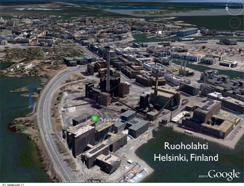
8 Ruoholahti Helsinki, Finland
9 Geo App Developer Data Providers Community

10 Empower Geo App Developer Data Providers Community Better access & powerful tools

11 Empower Encourage Geo App Developer Data Providers Community Better access & powerful tools Knowledge & Technical support

12 Empower Encourage Geo App Developer Better, more productive Data Providers Community communication Better access & powerful tools Knowledge & Technical support

13 In This Presentation Full material at the course web site:

14 In This Presentation Coordinates & Coordinate Systems Full material at the course web site:

15 In This Presentation Coordinates & Coordinate Systems (Map Projections) Full material at the course web site:

16 In This Presentation Coordinates & Coordinate Systems (Map Projections) Geospatial Data Formats in the Web Full material at the course web site:

17 In This Presentation Coordinates & Coordinate Systems (Map Projections) Geospatial Data Formats in the Web Open Standards for Web GeoData Access Full material at the course web site:

18 Coordinates My house is the center of the world, it s at (0,0)

19 Coordinates No, my house is the center of the world, it s at (0,0)

20 Coordinates (0,0) (0,0) Same coordinate pair, but in different Coordinate Systems

21 Coordinates (0,0) (-1,1) (1,1) Same Coordinate System, different coordinates for different places
22 Some Terminology Coordinate System (CS) Koordinaatisto in Finnish Set of mathematical rules for giving locations to places as set of coordinates. Number of axes defines the number of coordinates. Geodetic Coordinate System (GCS) Geodeettinen koordinaatisto Coordinate System, where the location is defined by geodetic longitude, geodetic latitude and height from an agreed height reference.
23 A Side Note: Latitude & Longitude Image from Wikimedia Commons, Originally by Djexplo, in public domain
24 More Terminology Geodetic Datum Datuumi in Finnish Set of parameters for relating a Geodetic Coordinate System to the Earth by setting it s origin, scale and orientation. Typically has a Reference Ellipsoid approximating the shape of the actual Earth s surface. (Geodetic) Coordinate Reference System (CRS) Koordinaattijärjestelmä A Geodetic Coordinate System fixed to the Earth using some Geodetic Datum.
25 Earth is not a sphere Image from Wikimedia Commons, Originally by NASA, in public domain
26 Earth is not a sphere Image from Wikimedia Commons, Originally by NASA, in public domain
27 Earth is not a sphere It s more like an ellipsoid Image from Wikimedia Commons, Originally by NASA, in public domain
28 Actually, it s not an ellipsoid either Image by NASA,
29 Actually, it s not an ellipsoid either Gravity anomalies make even the sea only shape of the Earth s surface slightly bumpy = Geoid Image by NASA,
30 Actually, it s not an ellipsoid either Gravity anomalies make even the sea only shape of the Earth s surface slightly bumpy = Geoid Choose and orient an ellipsoid wisely get a fit that s good enough Image by NASA,
31 Altitude Coordinates Ellipsoidal height Height from sea level (geoid) 8,848 m Surface of the Earth Geoid (mean sea level) Surface of the ellipsoid Geoid height Geoid: surface where the oceans would settle only based Earth s gravitational force. On continents, the fictional continuum of this mean sea level
32 Altitude Coordinates Ellipsoidal height Height from sea level (geoid) 8,848 m Surface of the Earth Geoid (mean sea level) Surface of the ellipsoid Geoid height Geoid: surface where the oceans would settle only based Earth s gravitational force. On continents, the fictional continuum of this mean sea level
33 Common Geodetic CRSs WGS84 (global, used by the GPS system) ETRS89 (For Europe, Eurasian plate is static) NAD83 (For US, Canada & Mexico, North American plate is static) All three use the same ellipsoid, but with a bit different parameters: more precise at the most important regions
34 CRS Realization
35 CRS Realization Coordinate Reference System + set of precisely measured positions on Earth. Makes it possible to define coordinates for new locations by measuring distances to the known reference positions.
36 CRS Realization Example: EUREF-FIN In Finland the practical realization of ETRS89 CRS is called EUREF-FIN. Precise locations of the reference points measured by the Finnish Geodetic Institute using satellite measurement networks and triangulation
37 Confusing Naming! CRS realization is also called a Coordinate System ( Koordinaatisto ). Datum can also mean CRS in English sometimes.
38 Limited Area CRS Coordinate Reference System may only be valid at certain parts of the world (where it s accurate enough)
39 Interpreting Coordinates <gml:boundedby> <gml:envelope srsname="epsg:4326"> <gml:lowercorner> </gml:lowercorner> <gml:uppercorner> </gml:upperCorner> </gml:envelope> </gml:boundedby>
40 Interpreting Coordinates Spatial Reference System <gml:boundedby> <gml:envelope srsname="epsg:4326"> <gml:lowercorner> </gml:lowercorner> <gml:uppercorner> </gml:upperCorner> Read: </gml:envelope> </gml:boundedby> CRS is WGS84 (2D), axis order: latitude, longitude
41 Interpreting Coordinates <gml:boundedby> <gml:envelope srsname="epsg:4326"> <gml:lowercorner> </gml:lowercorner> <gml:uppercorner> </gml:upperCorner> Read: </gml:envelope> </gml:boundedby> The EPSG:4326 is also known as urn:ogc:def:crs:epsg::4326 and Spatial Reference System CRS is WGS84 (2D), axis order: latitude, longitude
42 Interpreting Coordinates <gml:boundedby> <gml:envelope srsname="epsg:4326"> <gml:lowercorner> </gml:lowercorner> <gml:uppercorner> </gml:upperCorner> Read: </gml:envelope> </gml:boundedby> The EPSG:4326 is also known as urn:ogc:def:crs:epsg::4326 and Spatial Reference System CRS is WGS84 (2D), axis order: latitude, longitude When in doubt:
43 EPSG Codes European Petroleum Survey Group, currently part of the International Association of Oil & Gas Producers EPSG Geodetic Parameter Set: code names for a multitude of different CRSes, map projections, reference ellipsoids, datums etc., see EPSG Online Registry Some often needed EPSG Codes: 4326: WGS84 (2D) CRS, coordinates: lat, lon 4979.:WGS84 (3D) CRS, coordinates: lat, lon, ellipsoidal height 4258: ETRS89 (2D) CRS, coordinates: lat, lon 4258: ETRS89 (3D) CRS, coordinates: lat, lon, ellipsoidal height 5048: ETRS89-TM35FIN(N,E) CRS, coordinates: N, E 4123: KKJ (deprecated Finnish system), lat, lon 2393: YKJ (deprecated Finnish system), northing, easting 5717: N60 Vertical datum, mean sea level at Helsinki in : ETRS89-TM35FIN(N,E) + N60 vertical datum You need these for identifying in which CRS the given coordinates are, and when transforming coordinates (or points) from one CRS to another. Codes used widely in GIS software. More at:
44 Map Projections Coordinate transformation from geodetic coordinates to planar coordinates
45 Map Projections Coordinate transformation from geodetic coordinates to planar coordinates
46 Map Projections Polar stereographic Mercator projection
47 Map Projections
48 Map Projections All projections distort the surface somehow. Select the least harmful way for each mapping task.
49 Common Map Projections General Perspective Projection as seen from space Only one half of the globe can be seen Ok if you can change the center point (rotate) Google Earth
50 Common Map Projections Stereographic Shapes are preserved locally Can be used for maps over the poles
51 Common Map Projections Mercator Google, Bing Maps, Ovi (Nokia)? Good for areas near the Equator, not suitable for polar regions
52 Common Map Projections Transverse Mercator The cylinder is rotated 90º Accurate near the chosen central meridian
53 Common Map Projections Universal Transverse Mercator (UTM) Earth divided into 6º wide zones, separate Transverse Mercator projection defined for each. Images: Wikimedia Commons, Carlos Furuti,
54 Common Map Projections Universal Transverse Mercator (UTM) Earth divided into 6º wide zones, separate Transverse Mercator projection defined for each. Images: Wikimedia Commons, Carlos Furuti,
55 Finnish Map Projections (ETRS-)TM35FIN Ellipsoid Cylinder Projection zone Scale (Mk) = ºE Central meridian Surface of the cylinder Surface of the ellipsoid Central meridian Equator Projection zone Central meridian UTM based, the whole Finland in one, widened zone, central meridian is 27ºE Images: Maanmittauslaitos Equator (0,0 m) Make coordinates positive: move the origin (false easting). In TM35FIN the point where the Equator and the central meridian (27º) cross has coordinate N:0 E:
56 Some Geometry Types Point - a single position Line - two positions connected to each other LineString - multiple lines connected to each other Polygon - a closed LineString (can have holes!) MultiPolygon - multiple polygons in one (ex. the islands of a lake) (types slightly differ from data format to another)
57 Geospatial Data Formats: GML Geography Markup Language Extensive toolbox for building languages for geospatial data, or GML Application Profiles Standard by Open Geospatial Consortium (OGC). Geospatial objects and especially their geometries as XML structures. Very complex geometry types available.
58 Geospatial Data Formats: GML Geography Markup Language Extensive toolbox for building languages for geospatial data, or GML Application Profiles Standard by Open Geospatial Consortium (OGC). Geospatial objects and especially their geometries as XML structures. Very complex geometry types available.
59
60 GML Simple Features Profile Restricted set of GML geometry property types and simplified CRS handling: This profile defines a restricted but useful subset of XML-Schema and GML to lower the implementation bar of time and resources required for an organization to commit for developing software that supports GML. GML simple features profile, OGC r9, 05-July-2005 Powerful enough for most use cases, geometry types can be stored as geospatial objects in geoenabled databases, like PostGIS & Oracle Spatial
61 Geospatial Data Formats: GeoJSON Geo-enabled object encoded in JavaScript Object Notation (JSON) GML Simple Features for JSON Supports the following geometry types: Point, LineString, Polygon, MultiPoint, MultiLineString, MultiPolygon, and GeometryCollection
62 Geospatial Data Formats: GeoJSON Geo-enabled object encoded in JavaScript Object Notation (JSON) GML Simple Features for JSON Supports the following geometry types: Point, LineString, Polygon, MultiPoint, MultiLineString, MultiPolygon, and GeometryCollection
63
64 Geospatial Data Formats: KML Formerly Keyhole Markup Language Developed for Google Earth (was: Keyhole Earth Viewer) Standardized by Open Geospatial Consortium in 2008 In addition to defining geometries & their visualization, also offers some GUI and data linking features. WGS84 CRS only: latitude, longitude(, altitude).
65 Geospatial Data Formats: KML Formerly Keyhole Markup Language Developed for Google Earth (was: Keyhole Earth Viewer) Standardized by Open Geospatial Consortium in 2008 In addition to defining geometries & their visualization, also offers some GUI and data linking features. WGS84 CRS only: latitude, longitude(, altitude).
66
67 Default altitude: sea level (ellipsoidal height)
68 Geospatial Data Formats: (Geo)RSS Basic idea: location & geometry info embedded into an Atom or RSS feed entries. Two profiles, GeoRSS Simple and GeoRSS GML GeoRSS Simple is very straightforward: elements for point, line, polygon, box and circle. GeoRSS GML is a subset of GML geometry properties (a profile)
69 GeoRSS Simple in Atom
70 GeoRSS Simple in Atom
71 GeoRSS GML in Atom
72 GeoRSS GML in Atom
73 Open Standard Geo Web Services Standardized by the Open Geospatial Consortium (OGC): Web Map Service (WMS) Web Feature Service (WFS) HTTP-based to access spatial information as pre-rendered maps (WMS) or GML objects (WFS)
74 OGC Web Map Service (WMS) Retrieve pre-rendered images of selected map layers for the given geographic bounding box, in the wanted map projection, using standard HTTP requests. Offered layers & available options as an XML document (GetCapabilities).
75 OGC Web Feature Service (WFS) Retrieve objects with geospatial properties filtered by custom queries, encoded as GML Features (XML), using standard HTTP requests. Also advertises the service offerings and options using GetCapabilities documents.
76 WMS & WFS Adoption OGC & ISO Standards, wide support in both Commercial & Open Source software. Huge boost for adoption in Europe: EU INSPIRE Directive requires that public sector agencies open a lot of their geospatial databases as WMS & WFS services. Gradual implementation
77
78 Don t Go Anywhere Just Yet
79 Team Up Now Some of you probably like playing solo, but this is a teamwork course. Meet with your team before Monday to brainstorm about your app ideas and which data resources you re going to use. Come back here on Monday 24th at to announce your selection of data resources (minimum of two), and to learn about the Google Web Toolkit demo application.
Earth Coordinates & Grid Coordinate Systems
 Earth Coordinates & Grid Coordinate Systems How do we model the earth? Datums Datums mathematically describe the surface of the Earth. Accounts for mean sea level, topography, and gravity models. Projections
Lecture 2. Map Projections and GIS Coordinate Systems. Tomislav Sapic GIS Technologist Faculty of Natural Resources Management Lakehead University
 Lecture 2 Map Projections and GIS Coordinate Systems Tomislav Sapic GIS Technologist Faculty of Natural Resources Management Lakehead University Map Projections Map projections are mathematical formulas
EPSG. Coordinate Reference System Definition - Recommended Practice. Guidance Note Number 5
 European Petroleum Survey Group EPSG Guidance Note Number 5 Coordinate Reference System Definition - Recommended Practice Revision history: Version Date Amendments 1.0 April 1997 First release. 1.1 June
PLOTTING SURVEYING DATA IN GOOGLE EARTH
 PLOTTING SURVEYING DATA IN GOOGLE EARTH D M STILLMAN Abstract Detail surveys measured with a total station use local coordinate systems. To make the data obtained from such surveys compatible with Google
An Introduction to Coordinate Systems in South Africa
 An Introduction to Coordinate Systems in South Africa Centuries ago people believed that the earth was flat and notwithstanding that if this had been true it would have produced serious problems for mariners
The Map Grid of Australia 1994 A Simplified Computational Manual
 The Map Grid of Australia 1994 A Simplified Computational Manual The Map Grid of Australia 1994 A Simplified Computational Manual 'What's the good of Mercator's North Poles and Equators, Tropics, Zones
UTM Zones for the US UTM UTM. Uniform strips Scalable coordinates
 UTM UTM Uniform strips Scalable coordinates Globally consistent, most popular projection/coordinate system for regional to global scale geospatial data (i.e. satellite images global scale datasets USGS/EDC)
Pro Spatial with SQL Server 2012
 Pro Spatial with SQL Server 2012 Alastair Aitchison ULB Darmstadt Illllllill 17711989 Apress* Contents Contents at a Glance Foreword About the Author About the Technical Reviewer Acknowledgments Introduction
WHAT YOU NEED TO USE THE STATE PLANE COORDINATE SYSTEMS
 WHAT YOU NEED TO USE THE STATE PLANE COORDINATE SYSTEMS N & E State Plane Coordinates for Control Points AZIMUTHS - True, Geodetic, or Grid - Conversion from Astronomic to Geodetic (LaPlace Correction)
THE UNIVERSAL GRID SYSTEM
 NGA Office of GEOINT Sciences Coordinate Systems Analysis (CSAT) Phone: 314-676-9124 Unclassified Email: [email protected] March 2007 THE UNIVERSAL GRID SYSTEM Universal Transverse Mercator (UTM) Military
_ LUCIADRIA PRODUCT DATA SHEET
 _ LUCIADRIA PRODUCT DATA SHEET V2015.1 LuciadRIA offers browser-based geospatial situational awareness with the fluidity and speed of a desktop application. The software components of LuciadRIA have been
GEOGRAPHIC INFORMATION SYSTEMS CERTIFICATION
 GEOGRAPHIC INFORMATION SYSTEMS CERTIFICATION GIS Syllabus - Version 1.2 January 2007 Copyright AICA-CEPIS 2009 1 Version 1 January 2007 GIS Certification Programme 1. Target The GIS certification is aimed
Learning about GPS and GIS
 Learning about GPS and GIS Standards 4.4 Understand geographic information systems (G.I.S.). B12.1 Understand common surveying techniques used in agriculture (e.g., leveling, land measurement, building
2 GIS concepts. 2.1 General GIS principles
 2 GIS concepts To use GIS effectively, it is important to understand the basic GIS terminology and functionality. While each GIS software has slightly different naming conventions, there are certain principles
There are various ways to find data using the Hennepin County GIS Open Data site:
 Finding Data There are various ways to find data using the Hennepin County GIS Open Data site: Type in a subject or keyword in the search bar at the top of the page and press the Enter key or click the
Maintaining High Accuracy in Modern Geospatial Data
 Maintaining High Accuracy in Modern Geospatial Data Patrick Cunningham President [email protected] www.bluemarblegeo.com +1 (207) 582 6747 Copyright 2010 Blue Marble Geographics Concepts Geodesy -
UTM: Universal Transverse Mercator Coordinate System
 Practical Cartographer s Reference #01 UTM: Universal Transverse Mercator Coordinate System 180 174w 168w 162w 156w 150w 144w 138w 132w 126w 120w 114w 108w 102w 96w 90w 84w 78w 72w 66w 60w 54w 48w 42w
What are map projections?
 Page 1 of 155 What are map projections? ArcGIS 10 Within ArcGIS, every dataset has a coordinate system, which is used to integrate it with other geographic data layers within a common coordinate framework
_ LUCIADRIA PRODUCT DATA SHEET
 _ LUCIADRIA PRODUCT DATA SHEET V2016.0 LuciadRIA offers browser-based geospatial situational awareness with the fluidity and speed of a desktop application. The software components of LuciadRIA have been
Newton s Law of Gravity
 Gravitational Potential Energy On Earth, depends on: object s mass (m) strength of gravity (g) distance object could potentially fall Gravitational Potential Energy In space, an object or gas cloud has
WGS AGD GDA: Selecting the correct datum, coordinate system and projection for north Australian applications
 internal report WGS AGD GDA: Selecting the correct datum, coordinate system and projection for north Australian applications JBC Lowry Hydrological and Ecological Processes Program Environmental Research
Primitive type: GEOMETRY: matches SDO_GEOMETRY and GEOMETRY_COLUMN types.
 property sheets 27/01/2010 1/6 Introduction The Geographic Data was revised on the previous and design documents, the final goal was allow user to model geographic data into spatial databases like Oracle
Vector Web Mapping Past, Present and Future. Jing Wang MRF Geosystems Corporation
 Vector Web Mapping Past, Present and Future Jing Wang MRF Geosystems Corporation Oct 27, 2014 Terms Raster and Vector [1] Cells and Pixel Geometrical primitives 2 Early 2000s From static to interactive
Geomatics Guidance Note 3
 Geomatics Guidance Note 3 Contract area description Revision history Version Date Amendments 5.1 December 2014 Revised to improve clarity. Heading changed to Geomatics. 4 April 2006 References to EPSG
Measuring the Earth Using a GPS M. Scott Wilkerson & M. Beth Wilkerson, DePauw University, May 10, 2007
 Measuring the Earth Using a GPS M. Scott Wilkerson & M. Beth Wilkerson, DePauw University, May 10, 2007 Modified from: Kerski, J.J., 2007, Measuring the Earth s Circumference with GPS, Copyright ESRI,
THE FINNISH COORDINATE REFERENCE SYSTEMS
 THE FINNISH COORDINATE REFERENCE SYSTEMS Published by the Finnish Geodetic Institute and the National Land Survey of Finland Editors: Marko Ollikainen, National Land Survey of Finland Matti Ollikainen,
OSSIM Mapping ARchive OMAR Users Guide
 OSSIM Mapping ARchive OMAR Users Guide Version 1.8.16 March 25 2013 1 (U) Table of Contents Table of Contents (U) Table of Contents... 2 1.0 (U) Points of Contact... 6 2.0 (U) Overview... 7 2.1 (U) Feedback...
Enabling embedded maps
 Enabling embedded maps Case: National geoportal of Finland Antti Rainio National Land Survey of Finland Trends: Web Services, Mapping Mashup, Open Source, Open Data Decentralised data s Service interfaces
3.6A Calling Geodetic Location
 1 0 1 1 code 11 1 1 0 0 code 12 1 1 0 1 spare (no interpretation) 1 1 1 0 spare (no interpretation) 1 1 1 1 ST (Reserved) (no interpretation) The most ificant address al is sent first. Subsequent address
European Petroleum Survey Group EPSG. Guidance Note Number 10. April 2001. Geodetic Transformations Offshore Norway
 European Petroleum Survey Group EPSG Guidance Note Number 10 April 2001 Geodetic Transformations Offshore Norway Background 1. European Datum 1950 (ED50) is the de facto and de jure geographic coordinate
CURSO Inspire INSPIRE. SPEAKER: Pablo Echamendi Lorente. JEUDI 23/ THURSDAY 23 rd W S V : G E O S P A T I A L D A T A A C C E S S
 CURSO Inspire JEUDI 23/ THURSDAY 23 rd SPEAKER: Pablo Echamendi Lorente WS 5 SCHEDULE WMS OVERVIEW ACTIONS OGC SPECIFICATIONS OTHER SERVICES OVERVIEW proposal: Member States shall establish and operate
The Earth Really is Flat! The Globe and Coordinate Systems. Long History of Mapping. The Earth is Flat. Long History of Mapping
 The Earth Really is Flat! The Globe and Coordinate Systems Intro to Mapping & GIS The Earth is Flat Day to day, we live life in a flat world sun rises in east, sets in west sky is above, ground is below
Gravitational potential
 Gravitational potential Let s assume: A particle of unit mass moving freely A body of mass M The particle is attracted by M and moves toward it by a small quantity dr. This displacement is the result of
The Chief Directorate: National
 Surveying The South African Coordinate Reference System (Part 1) by Aslam Parker, Chief Directorate: National Geo-spatial Information This article will define the various elements of the South African
CityGML goes to Broadway
 CityGML goes to Broadway Thomas H. Kolbe, Barbara Burger, Berit Cantzler Chair of Geoinformatics [email protected] September 11, 2015 Photogrammetric Week 2015, Stuttgart The New York City Open Data
Introduction to GIS (Basics, Data, Analysis) & Case Studies. 13 th May 2004. Content. What is GIS?
 & Case Studies. 13 th May 2004. Content. What is GIS?") Introduction to GIS (Basics, Data, Analysis) & Case Studies 13 th May 2004 Content Introduction to GIS Data concepts Data input Analysis Applications selected examples What is GIS? Geographic Information
Introduction to GIS (Basics, Data, Analysis) & Case Studies 13 th May 2004 Content Introduction to GIS Data concepts Data input Analysis Applications selected examples What is GIS? Geographic Information
Free Google Tools for Creating Interactive Mapping Mashups
 Free Google Tools for Creating Interactive Mapping Mashups Cary Chadwick Emily Wilson Tuesday, May 10, 2011 2pm Welcome to the CLEAR Webinar Series! This is the fourth in the 2011 series Riparian Corridors,
WILD 3710 Lab 3: GIS Data Exploration Camp W.G. Williams
 WILD 3710 Lab 3: GIS Data Exploration Camp W.G. Williams -Laboratory- TAs and Lab Instructors: Chris McGinty [email protected] Office: JQL 146 Office Hours: W 2:30 3:30 or by appt. Alex Hernandez [email protected]
ADWR GIS Metadata Policy
 ADWR GIS Metadata Policy 1 PURPOSE OF POLICY.. 3 INTRODUCTION.... 4 What is metadata?... 4 Why is it important? 4 When to fill metadata...4 STANDARDS. 5 FGDC content standards for geospatial metadata...5
量 說 Explanatory Notes on Geodetic Datums in Hong Kong
 量 說 Explanatory Notes on Geodetic Datums in Hong Kong Survey & Mapping Office Lands Department 1995 All Right Reserved by Hong Kong Government 留 CONTENTS INTRODUCTION............... A1 HISTORICAL BACKGROUND............
GPS LOCATIONS FOR GIS: GETTING THEM RIGHT THE FIRST TIME
 GPS LOCATIONS FOR GIS: GETTING THEM RIGHT THE FIRST TIME Caroline Erickson and Pierre Héroux Geodetic Survey Division, Geomatics Canada Natural Resources Canada 615 Booth Street Ottawa, Ontario K1A 0E9
Celestial Observations
 Celestial Observations Earth experiences two basic motions: Rotation West-to-East spinning of Earth on its axis (v rot = 1770 km/hr) (v rot Revolution orbit of Earth around the Sun (v orb = 108,000 km/hr)
Google Web Toolkit. Introduction to GWT Development. Ilkka Rinne & Sampo Savolainen / Spatineo Oy
 Google Web Toolkit Introduction to GWT Development Ilkka Rinne & Sampo Savolainen / Spatineo Oy GeoMashup CodeCamp 2011 University of Helsinki Department of Computer Science Google Web Toolkit Google Web
EECS467: Autonomous Robotics Laboratory Prof. Edwin Olson. Map Projections and GPS
 EECS467: Autonomous Robotics Laboratory Prof. Edwin Olson Map Projections and GPS Cartography Several purposes of maps Geographic Information Systems (GIS) - Where is stuff? Measure distances, etc. Navigation
Surveying & Positioning Guidance note 10
 Surveying & Positioning Guidance note 10 Geodetic Transformations Offshore Norway Revision history Version Date Amendments 1.0 April 2001 First release 1 Background European Datum 1950 (ED50) is the de
DISMAR implementing an OpenGIS compliant Marine Information Management System
 DISMAR implementing an OpenGIS compliant Marine Information Management System Éamonn Ó T uama, Coastal & Marine Resources Centre, ERI, University College Cork. DISMAR DISMAR (Data Integration System for
GEOGRAPHY DATATYPES in SQL Server. by jared nielsen linkedin.com/nielsendata
 GEOGRAPHY DATATYPES in SQL Server by jared nielsen linkedin.com/nielsendata GEOGRAPHY vs GEOMETRY Geography Plots ellipsoidal Round Earth data using latitude, longitude and altitude* coordinates Geometry
Basic Coordinates & Seasons Student Guide
 Name: Basic Coordinates & Seasons Student Guide There are three main sections to this module: terrestrial coordinates, celestial equatorial coordinates, and understanding how the ecliptic is related to
Use of NASA World Wind Java SDK for Three-Dimensional Accessibility Visualization of Remote Areas in Lao P.D.R.
 Use of NASA World Wind Java SDK for Three-Dimensional Accessibility Visualization of Remote Areas in Lao P.D.R. Adrian Weber 1, Andreas Heinimann 2, Peter Messerli 2 1 Institute of Cartography, ETH Zurich,
Standardized data sharing through an open-source Spatial Data Infrastructure: the Afromaison project
 Standardized data sharing through an open-source Spatial Data Infrastructure: the Afromaison project Yaniss Guigoz - University of Geneva/GRID-Geneva 1 EcoARM2ERA and AFROMAISON Why Afromaison in this
Vertical Datums: An Introduction and Software Review
 Vertical Datums: An Introduction and Software Review Areas to Cover Theoretical Introduction Representation in EPSG Representation in OGC WKT Incorporation in PROJ.4 Incorporation in GDAL Future Work Introduction
A guide to coordinate systems in Great Britain
 A guide to coordinate systems in Great Britain An introduction to mapping coordinate systems and the use of GPS datasets with Ordnance Survey mapping D00659 v2.3 Mar 2015 Crown copyright Page 1 of 43 Contents
Calculation of Azimuth, Elevation and Polarization for non-horizontal aligned Antennas
 Calculation of Azimuth, Elevation and Polarization for non-horizontal aligned Antennas Algorithm Description Technical Document TD-1205-a Version 1.1 23.10.2012 In Co-operation with 1 Objective Many SatCom
Catalogue or Register? A Comparison of Standards for Managing Geospatial Metadata
 Catalogue or Register? A Comparison of Standards for Managing Geospatial Metadata Gerhard JOOS and Lydia GIETLER Abstract Publication of information items of any kind for discovery purposes is getting
ESTIMATION USABILITY OF THE FREE SOFTWARE FOR TRANSFORMATION OF GEODETIC COORDINATES BETWEEB LOCAL AND GLOBAL DATUMS-EXAMPLE OF THE ADRIATIC SEA
 ESTIMATION USABILITY OF THE FREE SOFTWARE FOR TRANSFORMATION OF GEODETIC COORDINATES BETWEEB LOCAL AND GLOBAL DATUMS-EXAMPLE OF THE ADRIATIC SEA Duplančić Leder, Tea; Faculty of Civil Engineering and Architecture,
_ LUCIADMOBILE V2015 PRODUCT DATA SHEET _ LUCIADMOBILE PRODUCT DATA SHEET
 _ LUCIADMOBILE PRODUCT DATA SHEET V2015 LuciadMobile enables the rapid development of geospatial situational awareness applications on mobile devices running Android, and is specifically designed for situational
Coordinate Conversions and Transformations including Formulas
 Geomatics Guidance Note Number 7, part 2 Coordinate Conversions and Transformations including Formulas Revised - April 2015 Page 1 of 145 Index Preface 4 Revision history 5 1 MAP PROJECTIONS AND THEIR
4 The Rhumb Line and the Great Circle in Navigation
 4 The Rhumb Line and the Great Circle in Navigation 4.1 Details on Great Circles In fig. GN 4.1 two Great Circle/Rhumb Line cases are shown, one in each hemisphere. In each case the shorter distance between
Step 2: Learn where the nearest divergent boundaries are located.
 What happens when plates diverge? Plates spread apart, or diverge, from each other at divergent boundaries. At these boundaries new ocean crust is added to the Earth s surface and ocean basins are created.
SESSION 8: GEOGRAPHIC INFORMATION SYSTEMS AND MAP PROJECTIONS
 SESSION 8: GEOGRAPHIC INFORMATION SYSTEMS AND MAP PROJECTIONS KEY CONCEPTS: In this session we will look at: Geographic information systems and Map projections. Content that needs to be covered for examination
TOWARDS AN AUTOMATED HEALING OF 3D URBAN MODELS
 TOWARDS AN AUTOMATED HEALING OF 3D URBAN MODELS J. Bogdahn a, V. Coors b a University of Strathclyde, Dept. of Electronic and Electrical Engineering, 16 Richmond Street, Glasgow G1 1XQ UK - [email protected]
LSD APC Part I Workshop Geographic Information System. Danny Yeung 14 November 2015
 LSD APC Part I Workshop Geographic Information System Danny Yeung 14 November 2015 Purposes To help LSD probationers to prepare for the LSD APC Part I Written Assessment to be held in December 2015. To
NGA GRID GUIDE HOW TO USE ArcGIS 8.x ANS 9.x TO GENERATE MGRS AND OTHER MAP GRIDS
 GEOSPATIAL SCIENCES DIVISION COORDINATE SYSTEMS ANALYSIS TEAM (CSAT) SEPTEMBER 2005 Minor Revisions March 2006 POC Kurt Schulz NGA GRID GUIDE HOW TO USE ArcGIS 8.x ANS 9.x TO GENERATE MGRS AND OTHER MAP
Chapter 6: Data Acquisition Methods, Procedures, and Issues
 Chapter 6: Data Acquisition Methods, Procedures, and Issues In this Exercise: Data Acquisition Downloading Geographic Data Accessing Data Via Web Map Service Using Data from a Text File or Spreadsheet
Earth-Sun Relationships. The Reasons for the Seasons
 Earth-Sun Relationships The Reasons for the Seasons Solar Radiation The earth intercepts less than one two-billionth of the energy given off by the sun. However, the radiation is sufficient to provide
BASICS OF PRECISION AGRICULTURE (PA)
") BASICS OF PRECISION AGRICULTURE (PA) specific production on particular place specific production, from foot to foot... Same sense: data collection and decision making for small pieces of the field. Particular
BASICS OF PRECISION AGRICULTURE (PA) specific production on particular place specific production, from foot to foot... Same sense: data collection and decision making for small pieces of the field. Particular
Web Map Service Architecture for Topographic Data in Finland
 Web Map Service Architecture for Topographic Data in Finland Teemu Sipilä National Land Survey of Finland Abstract. Since 2012 National Land Survey of Finland has been renewing its web map services and
SECOND GRADE 1 WEEK LESSON PLANS AND ACTIVITIES
 SECOND GRADE 1 WEEK LESSON PLANS AND ACTIVITIES UNIVERSE CYCLE OVERVIEW OF SECOND GRADE UNIVERSE WEEK 1. PRE: Discovering stars. LAB: Analyzing the geometric pattern of constellations. POST: Exploring
Metadata for Big River Watershed Geologic and Geomorphic Data
 Metadata for Big River Watershed Geologic and Geomorphic Data Metadata are descriptions and information regarding compiled data. This appendix contains the metadata that describes the compiled data used
ArcGIS Viewer for Silverlight An Introduction
 Esri International User Conference San Diego, California Technical Workshops July 26, 2012 ArcGIS Viewer for Silverlight An Introduction Rich Zwaap Agenda Background Product overview Getting started and
An HTML tool for exploiting geospatial web services
 An HTML tool for exploiting geospatial web services Theofilos Papadopoulos 1 and Konstantinos Evangelidis 2 1. Research Associate, [email protected] 2. Associate Professor, [email protected] Technological
*UDYLW\)LHOG7XWRULDO
LHOG7XWRULDO") % *UDYLW\)LHOG7XWRULDO The formulae and derivations in the following Chapters 1 to 3 are based on Heiskanen and Moritz (1967) and Lambeck (1990). ([SDQVLRQRIWKHJUDYLWDWLRQDOSRWHQWLDOLQWRVSKHULFDOKDUPRQLFV
% *UDYLW\)LHOG7XWRULDO The formulae and derivations in the following Chapters 1 to 3 are based on Heiskanen and Moritz (1967) and Lambeck (1990). ([SDQVLRQRIWKHJUDYLWDWLRQDOSRWHQWLDOLQWRVSKHULFDOKDUPRQLFV
UK Location Programme
 Location Information Interoperability Board Data Publisher How To Guide Understand the background to establishing an INSPIRE View Service using GeoServer DOCUMENT CONTROL Change Summary Version Date Author/Editor
Mapping Mashup/Data Integration Development Resources
 Mapping Mashup/Data Integration Development Resources David Hart GIS Specialist University of Wisconsin Sea Grant Institute October 6, 2008 Virtual Globes A virtual globe is a 3D software model or representation
EXPLORING AND SHARING GEOSPATIAL INFORMATION THROUGH MYGDI EXPLORER
 EXPLORING AND SHARING GEOSPATIAL INFORMATION THROUGH MYGDI EXPLORER Subashini Panchanathan Malaysian Centre For Geospatial Data Infrastructure ( MaCGDI ) Ministry of National Resources and Environment
DATA VISUALIZATION GABRIEL PARODI STUDY MATERIAL: PRINCIPLES OF GEOGRAPHIC INFORMATION SYSTEMS AN INTRODUCTORY TEXTBOOK CHAPTER 7
 DATA VISUALIZATION GABRIEL PARODI STUDY MATERIAL: PRINCIPLES OF GEOGRAPHIC INFORMATION SYSTEMS AN INTRODUCTORY TEXTBOOK CHAPTER 7 Contents GIS and maps The visualization process Visualization and strategies
Chapter 5 Spatial is not Special: Managing Tracking Data in a Spatial Database
 Chapter 5 Spatial is not Special: Managing Tracking Data in a Spatial Database Ferdinando Urbano and Mathieu Basille Abstract A wildlife tracking data management system must include the capability to explicitly
U.K. OFFSHORE OPERATORS ASSOCIATION (SURVEYING AND POSITIONING COMMITTEE) UKOOA DATA EXCHANGE FORMAT P6/98 DEFINITION OF 3D SEISMIC BINNING GRIDS
 UKOOA DATA EXCHANGE FORMAT P6/98 DEFINITION OF 3D SEISMIC BINNING GRIDS") U.K. OFFSHORE OPERATORS ASSOCIATION (SURVEYING AND POSITIONING COMMITTEE) UKOOA DATA EXCHANGE FORMAT P6/98 DEFINITION OF 3D SEISMIC BINNING GRIDS Revision 3.0 May 2000 SUMMARY The Guidelines For The Definition
U.K. OFFSHORE OPERATORS ASSOCIATION (SURVEYING AND POSITIONING COMMITTEE) UKOOA DATA EXCHANGE FORMAT P6/98 DEFINITION OF 3D SEISMIC BINNING GRIDS Revision 3.0 May 2000 SUMMARY The Guidelines For The Definition
A framework for a networkbased datastore for spatial and spatio-temporal geoscience data
 A framework for a networkbased datastore for spatial and spatio-temporal geoscience data Paul Gabriel, Jan Gietzel, Le Hai Ha, Helmut Schaeben Kommunikationsforum 3D 2011, Freiberg Mi, 23. März 2011 Outline
Interoperable Solutions in Web-based Mapping
 ISPRS SIPT IGU UCI CIG ACSG Table of contents Table des matières Authors index Index des auteurs Search Recherches Exit Sortir Interoperable Solutions in Web-based Mapping Marta Wojnarowska and Bridget
MrSID Plug-in for 3D Analyst
 LizardTech MrSID Plug-in for 3D Analyst User Manual Copyrights Copyright 2009 2010 LizardTech. All rights reserved. Information in this document is subject to change without notice. The software described
2. Orbits. FER-Zagreb, Satellite communication systems 2011/12
 2. Orbits Topics Orbit types Kepler and Newton laws Coverage area Influence of Earth 1 Orbit types According to inclination angle Equatorial Polar Inclinational orbit According to shape Circular orbit
Using Geocoded TIFF & JPEG Files in ER Mapper 6.3 with SP1. Eric Augenstein Earthstar Geographics Web: www.es-geo.com
 Using Geocoded TIFF & JPEG Files in ER Mapper 6.3 with SP1 Eric Augenstein Earthstar Geographics Web: www.es-geo.com 1 Table of Contents WHAT IS NEW IN 6.3 SP1 REGARDING WORLD FILES?...3 WHAT IS GEOTIFF
GIS WEB APPLICATIONS STANDARDS
 GIS WEB APPLICATIONS STANDARDS DRAFTED BY THE GIS WEB APPLICATIONS TASK TEAM UNDER THE PERVIEW OF THE ARCHITECTURE AND APPLICATIONS SUBCOMMITTEE OF THE ENTERPRISE GIS COMMITTEE TABLE OF CONTENTS Overview...
Visualization Method of Trajectory Data Based on GML, KML
 Visualization Method of Trajectory Data Based on GML, KML Junhuai Li, Jinqin Wang, Lei Yu, Rui Qi, and Jing Zhang School of Computer Science & Engineering, Xi'an University of Technology, Xi'an 710048,
Keywords: coordinate systems, latitude, longitude, georeferencing, global positioning system, GPS, geodetic datum, ellipsoid, geocoding, postal code
 Core Curriculum-Geographic Information Science (1997-2000) UCSB Peer Reviewed Title: Units 012-017 - Position on the Earth Book Title: Core Curriculum in Geographic Information Science Author: 012-017,
Spectrum Technology Platform. Version 9.0. Spectrum Spatial Developer Guide
 Spectrum Technology Platform Version 9.0 Spectrum Spatial Developer Guide Contents Chapter 1: Introduction...9 What Is Location Intelligence?...10 What Is the Location Intelligence Module?...10 Location
Assessment Tasks Pass theory exams at > 70%. Meet, or exceed, outcome criteria for projects and assignments.
 CENTRAL OREGON COMMUNITY COLLEGE: GEOGRAPHIC INFORMATION SYSTEM PROGRAM 1 CENTRAL OREGON COMMUNITY COLLEGE Associate Degree Geographic Information Systems Program Outcome Guide (POG) Program Outcome Guide
Pre-Algebra 2008. Academic Content Standards Grade Eight Ohio. Number, Number Sense and Operations Standard. Number and Number Systems
 Academic Content Standards Grade Eight Ohio Pre-Algebra 2008 STANDARDS Number, Number Sense and Operations Standard Number and Number Systems 1. Use scientific notation to express large numbers and small
APPLICATION OF OPEN SOURCE/FREE SOFTWARE (R + GOOGLE EARTH) IN DESIGNING 2D GEODETIC CONTROL NETWORK
 IN DESIGNING 2D GEODETIC CONTROL NETWORK") INTERNATIONAL SCIENTIFIC CONFERENCE AND XXIV MEETING OF SERBIAN SURVEYORS PROFESSIONAL PRACTICE AND EDUCATION IN GEODESY AND RELATED FIELDS 24-26, June 2011, Kladovo -,,Djerdap upon Danube, Serbia. APPLICATION
INTERNATIONAL SCIENTIFIC CONFERENCE AND XXIV MEETING OF SERBIAN SURVEYORS PROFESSIONAL PRACTICE AND EDUCATION IN GEODESY AND RELATED FIELDS 24-26, June 2011, Kladovo -,,Djerdap upon Danube, Serbia. APPLICATION
Math 215 Project (25 pts) : Using Linear Algebra to solve GPS problem
 : Using Linear Algebra to solve GPS problem") Due Thursday March 1, 2012 NAME(S): Math 215 Project (25 pts) : Using Linear Algebra to solve GPS problem 0.1 Introduction The age old question, Where in the world am I? can easily be solved nowadays by
Due Thursday March 1, 2012 NAME(S): Math 215 Project (25 pts) : Using Linear Algebra to solve GPS problem 0.1 Introduction The age old question, Where in the world am I? can easily be solved nowadays by
Comparison of Open Source Virtual Globes
 FOSS4G 2010 Comparison of Open Source Virtual Globes Mathias Walker Pirmin Kalberer Sourcepole AG, Bad Ragaz www.sourcepole.ch About Sourcepole GIS-Knoppix: first GIS live-cd QGIS Core developer QGIS Mapserver
<Insert Picture Here> Data Management Innovations for Massive Point Cloud, DEM, and 3D Vector Databases
 Data Management Innovations for Massive Point Cloud, DEM, and 3D Vector Databases Xavier Lopez, Director, Product Management 3D Data Management Technology Drivers: Challenges & Benefits
SQL SUPPORTED SPATIAL ANALYSIS FOR WEB-GIS INTRODUCTION
 SQL SUPPORTED SPATIAL ANALYSIS FOR WEB-GIS Jun Wang Jie Shan Geomatics Engineering School of Civil Engineering Purdue University 550 Stadium Mall Drive, West Lafayette, IN 47907 ABSTRACT Spatial analysis
From GPS Data Collection to GIS Data Display A Walk-Through Example
 From GPS Data Collection to GIS Data Display A Walk-Through Example The Global Positioning System (GPS) is a satellite based navigation system consisting of 24 satellites, a worldwide network of tracking
ADAGUC & PyTROLL. Maarten Plieger Ernst de Vreede. Application of polar orbiter products in weather forecasting Using open source tools and standards
 Application of polar orbiter products in weather forecasting Using open source tools and standards ADAGUC & PyTROLL Maarten Plieger Ernst de Vreede Royal Netherlands Meteorological Institute (KNMI) R&D