Open data. Noordzeedagen. Gerard van der Kolff
|
|
|
- Marylou Howard
- 9 years ago
- Views:
Transcription


1 Open data Noordzeedagen Gerard van der Kolff

2 Data growth and -storage, what s new?

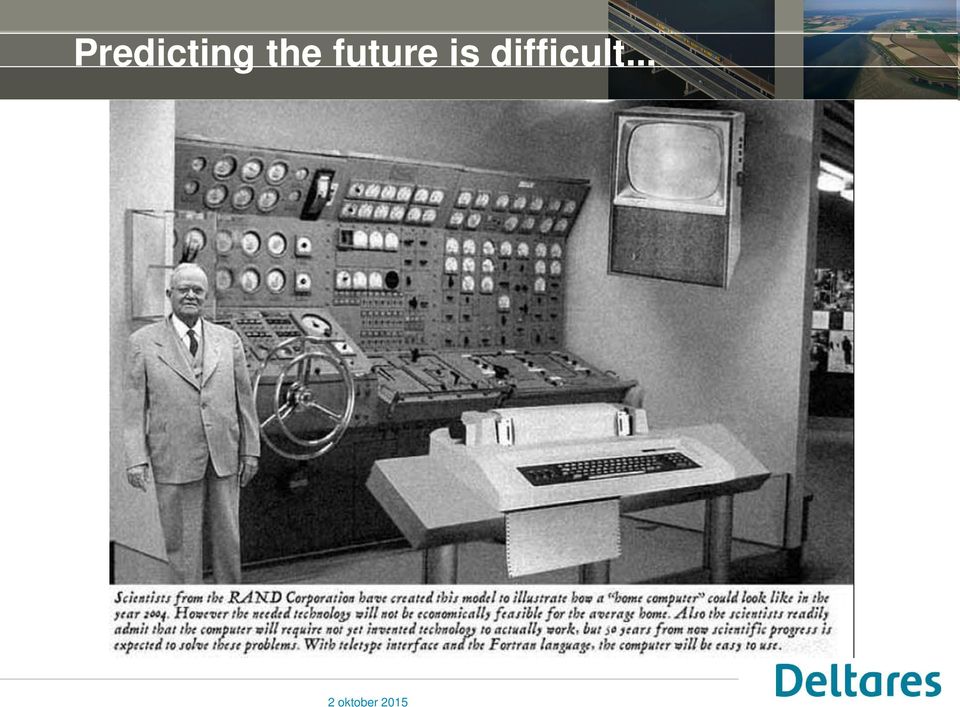
3 Predicting the future is difficult...
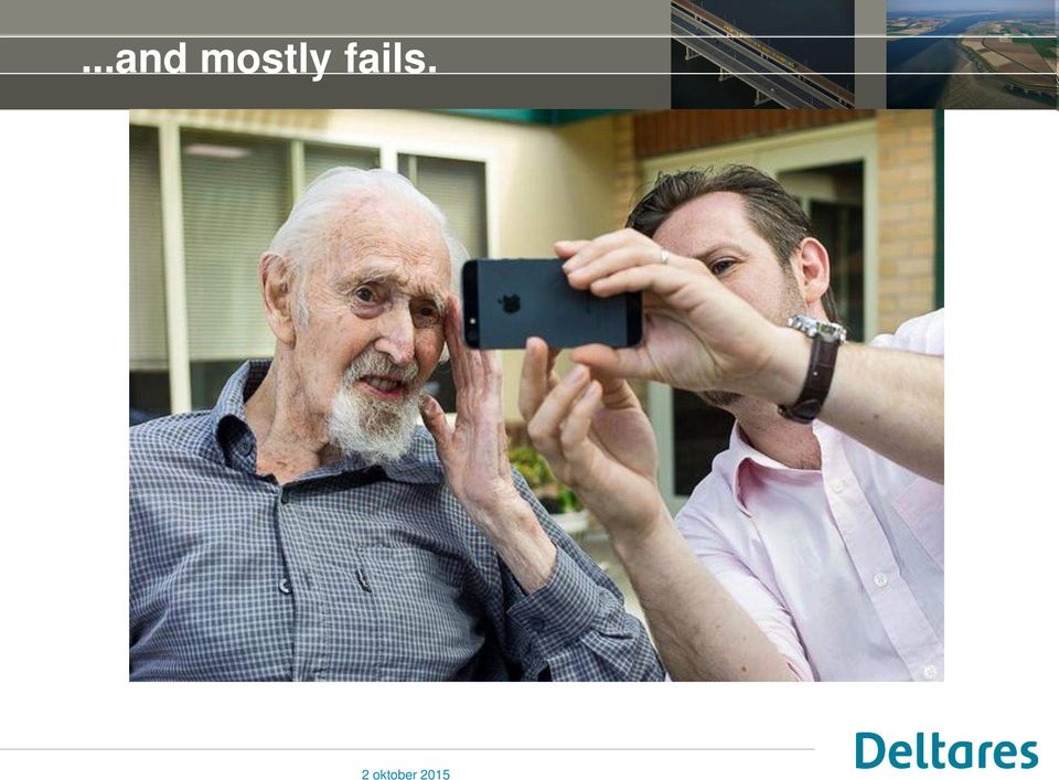
4 ...and mostly fails.
5 The Digital Disruption has already happened Worlds largest taxi company owns no taxis Uber Largest accommodation provider owns no real estates Airbnb Largest phone companies own no telco infra Skype, WeChat Worlds most valuable retailer has no inventory Alibaba Most popular media owner creates no content Facebook Worlds largest movie house owns no cinemas Largest software vendors don t write the apps Netflix Apple & Google

6 Goals fot the Short term and Middle term i. Reduce amount of active data ii. iii. iv. Start with data management (ICT, models and users) Teach and inform people about data management Investigate data reduction models v. Make the right tooling available vi. vii. Start with a Cloud strategy Start with grabbing chances and possibilities (Big) Data-analyses
")
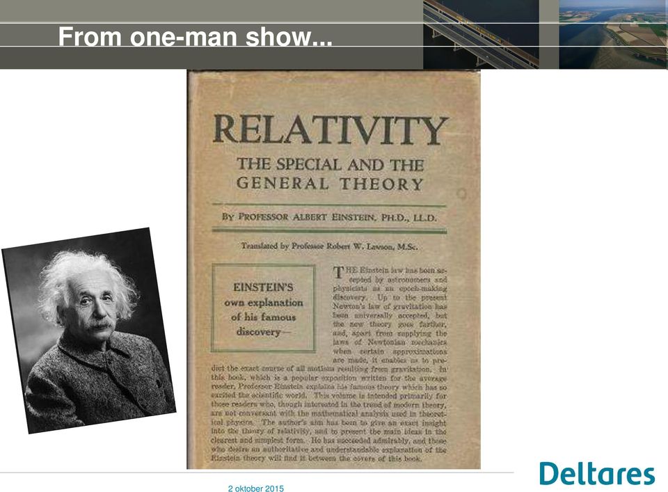
7 From one-man show...
8 ... to multi-party, multidisciplinary science

9 Long term international projects

10 Ocean currents by radar altimetry (SSA)

11 To communicate we need to understand eachother

12 OpenEarth vision! data providers = data users version central storage Cooperate check this out

13 Ecological effects in the Voordelta extension occurs in the Voordelta, a protected area (Natura 2000) European & national legislation require compensation of the significant effects on nature Loss of 2455 ha marine habitat ( Habitat type 1110 Sandbanks which are slightly covered by sea water all the time) Loss of foraging area for protected bird species (Common scoter, Common tern, Sandwich tern) Habitat 1110 Common scoter Marine protected area Voordelta Maasvlakte 2 Sandwich tern Common tern 16 March
 Habitat 1110 Common scoter Marine protected area Voordelta Maasvlakte 2 Sandwich tern Common tern 16")
14 Extensive monitoring programme Client: Rijkswaterstaat for PoR Deltares: Independent projectleader, integration of results, data management Consortium (led by IMARES): monitoring, data analysis Benthos (IMARES/NIOZ) Fish (IMARES) Birds (Waardenburg, INBO) Abiotic conditions (Arcadis/Alkyon) Human activities (CSO) Beam trawl fishery Sailing Kite surfing 16 March
 Human activities (CSO) Beam trawl fishery Sailing Kite surfing 16 March 2015")
15 Facilitate exchange


16 Data management marine monitoring projects Map Viewer Desktop GIS OpenEarth Software stack: éénmaal invoeren, overal ontsloten Google Earth EU-portal

17 Work on client or server? Invest first, profit later scientists professionals smart phone & tablet users work done on client raw data > SVN > GIT > http > ftp standard data > netcdf-cf- OPeNDAP > ISO SQL PostGIS tailored data > WCS > WFS > SOS > SOAP graphics of data > KML > WMS > WFS work done on server catalogue of data > CSW what where when who why how data URLs

18 Data growth and -storage, what s new?


19 Data management in steps... Raw data Organization Storage Documentation Access Data inspection Cleaning data ROMMELMARKT Quality control > SVN > GIT > http > ftp


20 Data management Raw data Organization Storage Documentation Access Standardization Naming conventions Directories, Folders, Files, Variables, parameters > netcdf-cf- OPeNDAP > ISO SQL PostGIS standard data net-cdf OpenDAP


21 Data management Raw data Organization Storage Documentation Access Version control Security Back-ups

")
22 Data management Raw data Organization Storage Documentation Access Meta data origin, purpose, time, geographic location, creator, access, and terms of use of the data Data manipulations from raw data Catalogues Geoserver (OGC WxS) Catalogue service

23 Data management Raw data Organization Storage Documentation Access User management Access control Privileges
24 The OpenEarth stack (recap)
25 OpenEarth stack some TechTalk
26 RWS domain architecture <> OpenEarth stack WFS Aquo
27 Demo: catalogue + viewer: show potential DL IHM-viewer Geonetwork catalogue (same system as nationaalgeoregister) Temporary viewer
28 Viewer: combine various information layers
29 Deltares Data Portal (Deltares public wiki: - projects)
30 NGR - Nationaal Georegister


31 KNMI Data Centre
32 Together with 3TU: OpenEarth DataLab
33 Data growth and -storage, what s new?
34 Extern Opslag Intern Four options to carry out projects Most conventional Deltares projects: Data storage and processing in house Intern Processing Extern
35 Extern Opslag Intern Four options to carry out projects Intern Processing Extern Fewer Deltares projects using in house processing of externally stored data
36 Extern Opslag Intern Four options to carry out projects Intern Processing Extern Deltares Cloud Scheduler (DCS) to manage processing and needed resources of the Amazon Elastic Compute Cloud (EC2). Thousands of computing hours of the WAQUA model for WTI 2017 have been carried this way.
37 Extern Opslag Intern Four options to carry out projects Intern Processing Extern Experimental projects making use of Google Earth Engine: External processing of external data commanded from your laptop
38 Data growth and -storage, what s new?
39 I have a dream...! (Digital Delta) Raymond Feron, RWS, september 2014
40 ... data centers on renewable energy...
41 As stated before...predicting the future is hard
42 Whahaha windmills to generate power!
DataTube: web services voor data
 DataTube: web services voor data Gerben de Boer Onno van de Akker Gerrit Hendriksen Deltares, Matroos Deltares, FEWS Deltares, NHI FEWS & Matroos: database > viewers VIEWER client 3 rd party viewer Matroos
Model examples Store and provide Challenges WCS and OPeNDAP Recommendations. WCS versus OPeNDAP. Making model results available through the internet.
 Making model results available through the internet. Fedor Baart, Gerben de Boer, Wim de Haas, Gennadiy Donchyts, Marc Philippart, Maarten Plieger September 14, 2011 Introduction Fedor Baart PhD thesis:
Open Source Visualisation with ADAGUC Web Map Services
 Open Source Visualisation with ADAGUC Web Map Services Maarten Plieger Ernst de Vreede John van de Vegte, Wim Som de Cerff, Raymond Sluiter, Ian van der Neut, Jan Willem Noteboom 1 ADAGUC project Cooperative
OGC at KNMI: Current use and plans Available products
 OGC at KNMI: Current use and plans Available products Maarten Plieger KNMI R&D Ernst de Vreede, John van de Vegte, Wim Som de Cerff, Ian van der Neut, Raymond Sluiter, Jan Willem Noteboom Contents 1. ADAGUC
Digital Transformation How to disrupt yourself without rocking the boat
 1 Digital Transformation How to disrupt yourself without rocking the boat Ken van Ierlant business value delivered www.meridiusmoore.com ALL COMMODITY BUSINESSES FACE THE CHALLENGE OF INCREASING C/I RATIOS
EUMETSAT EO Portal. End User Image Access using OGC WMS/WCS services. EUM/OPS/VWG/10/0095 Issue <1> <14/01/2010> Slide: 1
 EUMETSAT EO Portal End User Image Access using OGC WMS/WCS services Slide: 1 Overview Introduction: status of data access and visualization EUMETSAT datasets Architecture Web Map Service implementation
The ORIENTGATE data platform
 Seminar on Proposed and Revised set of indicators June 4-5, 2014 - Belgrade (Serbia) The ORIENTGATE data platform WP2, Action 2.4 Alessandra Nuzzo, Sandro Fiore, Giovanni Aloisio Scientific Computing and
Vision. South Pacific GIS/RS Conference 2015 11/17/2015. Applying Geography Everywhere. Applying Geography Everywhere
 South Pacific GIS/RS Conference 2015 Applying Geography Everywhere Jithen (J) Singh Eagle Technology Group Ltd (Esri New Zealand) Suva, Fiji Vision Applying Geography Everywhere 1 GIS Is Evolving A Whole
Standardized data sharing through an open-source Spatial Data Infrastructure: the Afromaison project
 Standardized data sharing through an open-source Spatial Data Infrastructure: the Afromaison project Yaniss Guigoz - University of Geneva/GRID-Geneva 1 EcoARM2ERA and AFROMAISON Why Afromaison in this
Introduction to the Mapbender OWS Security Proxy
 Introduction to the Mapbender OWS Security Proxy Arnulf Christl, WhereGroup GmbH & Co. KG, Bonn, Germany 1/16 Agenda 1 Introduction to the Architecture OWS from Bottom Up with the OSGeo SDI Software Stack
Build a Customer-Focused Digital Strategy
 Build a Customer-Focused Digital Strategy Featuring: Mike Rowland, Director of Digital Strategy, West Monroe Partners Brian Strojny, Co-Founder, Executive VP, Insite Moderated by: Thomas P. Gale, Publisher,
Cloud-based Infrastructures. Serving INSPIRE needs
 Cloud-based Infrastructures Serving INSPIRE needs INSPIRE Conference 2014 Workshop Sessions Benoit BAURENS, AKKA Technologies (F) Claudio LUCCHESE, CNR (I) June 16th, 2014 This content by the InGeoCloudS
GeoMedia Product Update. Title of Presentation. Lorilie Barteski October 15, 2008 Edmonton, AB
 Product Update Title of Presentation Lorilie Barteski Edmonton, AB Know the audience poll Existing /Pro users Version 6.1 Version 6.0 Version 5.2 or earlier Existing WebMap users Version 6.1 Version 6.0
The distribution of marine OpenData via distributed data networks and Web APIs. The example of ERDDAP, the message broker and data mediator from NOAA
 The distribution of marine OpenData via distributed data networks and Web APIs. The example of ERDDAP, the message broker and data mediator from NOAA Dr. Conor Delaney 9 April 2014 GeoMaritime, London
Sextant. Spatial Data Infrastructure for Marine Environment. C. Satra Le Bris, E. Quimbert, M. Treguer
 Sextant On-Line information system for marine geographical information E. Quimbert, M. Bellouis, F. Lecuy, M. Treguer Centre de Bretagne BP 70, Plouzané 29280 France E-mail: [email protected] Sextant
How To Use Gis
 Welcome Understanding Purpose Creating Relationships You A Global Community of GIS Professionals Changing the World Together Applying Geography Everywhere Your WORK Showcasing Your Web Apps Vision Applying
Enabling embedded maps
 Enabling embedded maps Case: National geoportal of Finland Antti Rainio National Land Survey of Finland Trends: Web Services, Mapping Mashup, Open Source, Open Data Decentralised data s Service interfaces
County of Los Angeles. Chief Information Office Preferred Technologies for Geographic Information Systems (GIS) September 2014
 September 2014") County of Los Angeles Chief Information Office Preferred Technologies for Geographic Information Systems (GIS) September 2014 CIO Preferred Technologies for GIS This document lists the preferred Geographic
County of Los Angeles Chief Information Office Preferred Technologies for Geographic Information Systems (GIS) September 2014 CIO Preferred Technologies for GIS This document lists the preferred Geographic
Open spatial data platform for visualization and analytics of geospatial data
 Open spatial data platform for visualization and analytics of geospatial data Bill Simpson-Young Director, Engineering and Technology Development, NICTA. Co-founder, Terria. Geospatial World Forum, 25
GeoNetwork, The Open Source Solution for the interoperable management of geospatial metadata
 GeoNetwork, The Open Source Solution for the interoperable management of geospatial metadata Ing. Emanuele Tajariol, GeoSolutions Ing. Simone Giannecchini, GeoSolutions GeoSolutions GeoSolutions GeoNetwork
Metadata for Data Discovery: The NERC Data Catalogue Service. Steve Donegan
 Metadata for Data Discovery: The NERC Data Catalogue Service Steve Donegan Introduction NERC, Science and Data Centres NERC Discovery Metadata The Data Catalogue Service NERC Data Services Case study:
Cloud Computing and Government Services August 2013 Serdar Yümlü SAMPAŞ Information & Communication Systems
 eenviper White Paper #4 Cloud Computing and Government Services August 2013 Serdar Yümlü SAMPAŞ Information & Communication Systems 1 Executive Summary Cloud computing could revolutionise public services
Secure your GIS. Protecting GIS applications suites. camptocamp / 9. septembre 2010 / www.camptocamp.com / [email protected]
 Secure your GIS Protecting GIS applications suites camptocamp / 9. septembre 2010 / www.camptocamp.com / [email protected] Outline - Camptocamp SA - Introduction Green field Heterogenous FOSS applications
Unidata s Vision for Transforming Geoscience by Moving Data Services and Software to the Cloud
 Unidata s Vision for Transforming Geoscience by Moving Data Services and Software to the Cloud The WWOSC 2014 17 August 2014 Montreal, CA Dr. Mohan Ramamurthy Unidata Program Center University Corporation
Oklahoma s Open Source Spatial Data Clearinghouse: OKMaps
 Oklahoma s Open Source Spatial Data Clearinghouse: OKMaps Presented by: Mike Sharp State Geographic Information Coordinator Oklahoma Office of Geographic Information MAGIC 2014 Symposium April 28-May1,
UK Location Programme
 Location Information Interoperability Board Data Publisher How To Guide Understand the background to establishing an INSPIRE View Service using GeoServer DOCUMENT CONTROL Change Summary Version Date Author/Editor
EXPLORING AND SHARING GEOSPATIAL INFORMATION THROUGH MYGDI EXPLORER
 EXPLORING AND SHARING GEOSPATIAL INFORMATION THROUGH MYGDI EXPLORER Subashini Panchanathan Malaysian Centre For Geospatial Data Infrastructure ( MaCGDI ) Ministry of National Resources and Environment
Cloud application for water resources modeling. Faculty of Computer Science, University Goce Delcev Shtip, Republic of Macedonia
 Cloud application for water resources modeling Assist. Prof. Dr. Blagoj Delipetrev 1, Assist. Prof. Dr. Marjan Delipetrev 2 1 Faculty of Computer Science, University Goce Delcev Shtip, Republic of Macedonia
Norwegian Satellite Earth Observation Database for Marine and Polar Research http://normap.nersc.no USE CASES
 Norwegian Satellite Earth Observation Database for Marine and Polar Research http://normap.nersc.no USE CASES The NORMAP Project team has prepared this document to present functionality of the NORMAP portal.
OpenDAP configuration course
 July 8, 2009(revision 646) 1 Introduction 2 Overview 3 Architecture 4 Components 5 Hyrax Backend server Backend configuration Run 6 Frontend 7 NetCDF 8 Extra Time schedule 13:00-13:30 Project overview
The Arctic Observing Network and its Data Management Challenges Florence Fetterer (NSIDC/CIRES/CU), James A. Moore (NCAR/EOL), and the CADIS team
, James A. Moore (NCAR/EOL), and the CADIS team") The Arctic Observing Network and its Data Management Challenges Florence Fetterer (NSIDC/CIRES/CU), James A. Moore (NCAR/EOL), and the CADIS team Photo courtesy Andrew Mahoney NSF Vision What is AON? a
The Arctic Observing Network and its Data Management Challenges Florence Fetterer (NSIDC/CIRES/CU), James A. Moore (NCAR/EOL), and the CADIS team Photo courtesy Andrew Mahoney NSF Vision What is AON? a
MSG Cloud Physical Properties retrieval and visualization
 MSG Cloud Physical Properties retrieval and visualization Jan Fokke Meirink Maarten Plieger John van de Vegte The MSG-CPP Project Goal: Provide an operational service for all products that are derived
From Geoportal to Spatial Data Service Platform. Jani Kylmäaho National Land Survey of Finland Development Centre
 From Geoportal to Spatial Data Service Platform Jani Kylmäaho National Land Survey of Finland Development Centre 29.6.2012 Introduction National Land Survey of Finland - 1900 employees Development Centre
A standards-based open source processing chain for ocean modeling in the GEOSS Architecture Implementation Pilot Phase 8 (AIP-8)
") NATO Science & Technology Organization Centre for Maritime Research and Experimentation (STO-CMRE) Viale San Bartolomeo, 400 19126 La Spezia, Italy A standards-based open source processing chain for ocean
NATO Science & Technology Organization Centre for Maritime Research and Experimentation (STO-CMRE) Viale San Bartolomeo, 400 19126 La Spezia, Italy A standards-based open source processing chain for ocean
Creating Service Definition file while disconnected from the server
 Service Definition File Creating Service Definition file while disconnected from the server When disconnected from the server you will configure your service definition with no available connection to
Introduction to Cloud Services
 Introduction to Cloud Services (brought to you by www.rmroberts.com) Cloud computing concept is not as new as you might think, and it has actually been around for many years, even before the term cloud
CDI/THREDDS Interoperability: the SeaDataNet developments. P. Mazzetti 1,2, S. Nativi 1,2, 1. CNR-IMAA; 2. PIN-UNIFI
 CDI/THREDDS Interoperability: the SeaDataNet developments P. Mazzetti 1,2, S. Nativi 1,2, 1. CNR-IMAA; 2. PIN-UNIFI Outline Interoperability Issues in SeaDataNet A broker solution for CDI/THREDDS interoperability
Publishing geospatial data to the web using the EEA infrastructure
 Publishing geospatial data to the web using the EEA infrastructure *Note: Map Services should be published using the EEA Map Services Tick Sheet for guidance. Contact Sebastien Petit ([email protected])
GeoMedia & Geostandaarden. Frank Langelaan
 GeoMedia & Geostandaarden Frank Langelaan Invloeden van standaarden 2 Industrie trends 3 Technolgie trends 4 5 Architectuur trends Keeping up with advances in hardware and operating systems Windows XP
DISMAR: Data Integration System for Marine Pollution and Water Quality
 DISMAR: Data Integration System for Marine Pollution and Water Quality T. Hamre a,, S. Sandven a, É. Ó Tuama b a Nansen Environmental and Remote Sensing Center, Thormøhlensgate 47, N-5006 Bergen, Norway
Web 3D Service (W3DS) in Geoserver
 in Geoserver") Jorge Gustavo Rocha [email protected] Nuno Carvalho Oliveira [email protected] VI Jornadas SIG Libre, Girona, March 23, 2012 1 Motivation and Introduction 2 3 4 5 Motivation Motivation and Introduction
Jorge Gustavo Rocha [email protected] Nuno Carvalho Oliveira [email protected] VI Jornadas SIG Libre, Girona, March 23, 2012 1 Motivation and Introduction 2 3 4 5 Motivation Motivation and Introduction
Step 1 Preparation and Planning
 Its daunting starting any GIS Web or Mobile project. Where does one begin? This 3 step guide should help you get past your project inertia and start things moving rapidly forward. Step 1 Preparation and
Design Requirements for an AJAX and Web-Service Based Generic Internet GIS Client
 11th AGILE International Conference on Geographic Information Science 2008 Page 1 of 6 Design Requirements for an AJAX and Web-Service Based Generic Internet GIS Client Edward Nash 1, Peter Korduan 1,
Data Visualization Using Web GIS Software
 Data Visualization Using Web GIS Software Tuomas Peltonen Radiation and Nuclear Safety Authority (STUK), Finland NKS NordDSS Workshop, Copenhagen, 1.-2.10.2009 RADIATION AND NUCLEAR SAFETY AUTHORITY Preface
Web and Mobile GIS Applications Development
 Web and Mobile GIS Applications Development Presented by : Aamir Ali Manager Section Head (GIS Software Customization) Pakistan Space and Upper Atmosphere Research Commission (SUPARCO) Geographical Information
Quality Assessment for Geographic Web Services. Pedro Medeiros (1)
") Quality Assessment for Geographic Web Services Pedro Medeiros (1) (1) IST / INESC-ID, Av. Prof. Dr. Aníbal Cavaco Silva, 2744-016 Porto Salvo, [email protected] Abstract Being able to assess the
Quality Assessment for Geographic Web Services Pedro Medeiros (1) (1) IST / INESC-ID, Av. Prof. Dr. Aníbal Cavaco Silva, 2744-016 Porto Salvo, [email protected] Abstract Being able to assess the
Interoperable Solutions in Web-based Mapping
 ISPRS SIPT IGU UCI CIG ACSG Table of contents Table des matières Authors index Index des auteurs Search Recherches Exit Sortir Interoperable Solutions in Web-based Mapping Marta Wojnarowska and Bridget
FreeGIS.net, INSPIRE, Open Source Software and OGC standards
 FreeGIS.net, INSPIRE, Open Source Software and OGC standards Workshop: How Open Source / Free Software and Open Standards complement each other in an SDI environment SFScon 13 Free Software Conference
ArcGIS Server Implementation HIGHS and lows
 ArcGIS Server Implementation HIGHS and lows GIS-T March 2011 Eric Abrams Iowa DOT [email protected] Agenda The Problem Timeline Future Discussion/Questions The Problem - 2006 How does Iowa DOT integrate
DISMAR implementing an OpenGIS compliant Marine Information Management System
 DISMAR implementing an OpenGIS compliant Marine Information Management System Éamonn Ó T uama, Coastal & Marine Resources Centre, ERI, University College Cork. DISMAR DISMAR (Data Integration System for
Environment Canada Data Management Program. Paul Paciorek Corporate Services Branch May 7, 2014
 Environment Canada Data Management Program Paul Paciorek Corporate Services Branch May 7, 2014 EC Data Management Program (ECDMP) consists of 5 foundational, incremental projects which will implement
smespire - Exercises for the Hands-on Training on INSPIRE Network Services April 2014 Jacxsens Paul SADL KU Leuven
 smespire - Exercises for the Hands-on Training on INSPIRE Network Services April 2014 Jacxsens Paul SADL KU Leuven These exercises aim at people who already have some basic knowledge of INSPIRE Network
ArcGIS Viewer for Silverlight An Introduction
 Esri International User Conference San Diego, California Technical Workshops July 26, 2012 ArcGIS Viewer for Silverlight An Introduction Rich Zwaap Agenda Background Product overview Getting started and
Smart Cities require Geospatial Data Providing services to citizens, enterprises, visitors...
 Cloud-based Spatial Data Infrastructures for Smart Cities Geospatial World Forum 2015 Hans Viehmann Product Manager EMEA ORACLE Corporation Smart Cities require Geospatial Data Providing services to citizens,
ArcGIS for Server in the Amazon Cloud. Michele Lundeen Esri
 ArcGIS for Server in the Amazon Cloud Michele Lundeen Esri What we will cover ArcGIS for Server in the Amazon Cloud Why How Extras Why do you need ArcGIS Server? Some examples Publish - Dynamic Map Services
Data and data product visualization in EMODNET Chemistry
 Data and data product visualization in EMODNET Chemistry Alexander Barth (1), Giorgio Santinelli (2), Gerrit Hendriksen (2), Jean-Marie Beckers (1) (1) University of Liège (Belgium), (2) Deltares (Netherlands)
PDOK Kaart, the Dutch Mapping API
 PDOK Kaart, the Dutch Mapping API Haico van der Vegt*, Leo van der Sluijs* * Cadastre, Land Registry and Mapping Agency of the Netherlands Abstract. PDOK (public services on the map) is a partnership of
Web-based spatio-temporal visualization and analysis of the Siberian Earth System Science Cluster (SIB-ESS-C)
") Web-based spatio-temporal visualization and analysis of the Siberian Earth System Science Cluster (SIB-ESS-C) Roman Gerlach Supervisor: Prof. C. Schmullius (Dept. of Geography, Friedrich-Schiller-University
Web-based spatio-temporal visualization and analysis of the Siberian Earth System Science Cluster (SIB-ESS-C) Roman Gerlach Supervisor: Prof. C. Schmullius (Dept. of Geography, Friedrich-Schiller-University
INTEROPERABLE IMAGE DATA ACCESS THROUGH ARCGIS SERVER
 INTEROPERABLE IMAGE DATA ACCESS THROUGH ARCGIS SERVER Qian Liu Environmental Systems Research Institute 380 New York Street Redlands, CA92373, U.S.A - [email protected] KEY WORDS: OGC, Standard, Interoperability,
Combining Drupal Content Management System with OGC Web Services
 Combining Drupal Content Management System with OGC Web Services By Terefe Hanchiso Sodango (Haramaya University, Ethiopia) Dr. U.D. (Ulanbek) Turdukulov & Drs. B.J. (Barend) Köbben(University of Twente,
Cloud Computing Technology
 Cloud Computing Technology The Architecture Overview Danairat T. Certified Java Programmer, TOGAF Silver [email protected], +66-81-559-1446 1 Agenda What is Cloud Computing? Case Study Service Model Architectures
Processing Biological Data in i-marine
 Processing Biological Data in i-marine Gianpaolo Coro ISTI-CNR i-marine Workshop 14 & 15 May 2013, Bruxelles, Belgium Facilities and Experience - Summary We will show results about: Ecological Niche Modeling
OPEN STANDARD WEB SERVICES FOR VISUALISATION OF TIME SERIES DATA OF FLOOD MODELS
 OPEN STANDARD WEB SERVICES FOR VISUALISATION OF TIME SERIES DATA OF FLOOD MODELS Barend Köbben FRMRC RPA 7 Workshop visualisations and flow simulations as flood risk communication tools
CURSO Inspire INSPIRE. SPEAKER: Pablo Echamendi Lorente. JEUDI 23/ THURSDAY 23 rd W S V : G E O S P A T I A L D A T A A C C E S S
 CURSO Inspire JEUDI 23/ THURSDAY 23 rd SPEAKER: Pablo Echamendi Lorente WS 5 SCHEDULE WMS OVERVIEW ACTIONS OGC SPECIFICATIONS OTHER SERVICES OVERVIEW proposal: Member States shall establish and operate
WP 3. Elaboration database Architecture Features (Software Architecture Document)
") Architecture Features (Software Architecture Document) o Best in class solution, using EC recommendations for IT in this field o Implementation based on free open source o Based on OGC standards, high
Architecture Features (Software Architecture Document) o Best in class solution, using EC recommendations for IT in this field o Implementation based on free open source o Based on OGC standards, high
The use of Semantic Web Technologies in Spatial Decision Support Systems
 The use of Semantic Web Technologies in Spatial Decision Support Systems Adam Iwaniak Jaromar Łukowicz Iwona Kaczmarek Marek Strzelecki The INSPIRE Conference 2013, 23-27 June Wroclaw University of Environmental
Amazon S3 Essentials
 Fr Amazon Simple Storage Service (Amazon S3), provides developers and IT teams with secure, durable, and highly scalable object storage. Amazon S3 is easy to use, with a simple web services interface to
Portal for ArcGIS. Satish Sankaran Robert Kircher
 Portal for ArcGIS Satish Sankaran Robert Kircher ArcGIS A Complete GIS Data Management Planning & Analysis Field Mobility Operational Awareness Constituent Engagement End to End Integration Collect, Organize,
D3.4.1: Data Fusion Tools
 COMPETITIVINESS AND INNOVATION FRAMEWORK PROGRAMME CIP-ICT-PSP-2013-7 Pilot Type B WP3 Service platform integration and deployment in cloud infrastructure D3.4.1: Data Fusion Tools Deliverable Lead: NETCAD
Evolving in the global digital scenario. Politecnico di Torino
 Evolving in the global digital scenario Claudio G. Demartini Claudio G. Demartini Politecnico di Torino Trends: Time Machine Before Now http://www.baekdal.com/analysis/market-of-information 29/10/2013
SDI at Grontmij. Ronald van Lanen
 SDI at Grontmij Ronald van Lanen Content 2 Introduction Grontmij overview Metadata in the Netherlands Pause Case I Roles of organizations Asset management and SDI Case II Best practice in projects Discussion
Distributed Computing. Mark Govett Global Systems Division
 Distributed Computing Mark Govett Global Systems Division Modeling Activities Prediction & Research Weather forecasts, climate prediction, earth system science Observing Systems Denial experiments Observing
Gladinet Cloud Access Solution Simple, Secure Access to Online Storage
 A Gladinet White Paper http://www.gladinet.com Gladinet Cloud Access Solution Simple, Secure Access to Online Storage October 12 Contents Introduction 2 Problem Statement 2 Previous Options Error! Bookmark
A Web Service based U.S. Cropland Visualization, Dissemination and Querying System
 A Web Service based U.S. Cropland Visualization, Dissemination and Querying System Rick Mueller, Zhengwei Yang, and Dave Johnson USDA/National Agricultural Statistics Service Weiguo Han and Liping Di GMU/Center
Standards based spatial data management, GIS and web mapping. Spatial data management, analysis & sharing the free & easy way!
 or Spatial data management, analysis & sharing the free & easy way! Premise: Traditional GIS is inherently flawed, especially when it comes to many fisheries/maritime datasets Premise: Traditional GIS
System Administration Training Guide. S100 Installation and Site Management
 System Administration Training Guide S100 Installation and Site Management Table of contents System Requirements for Acumatica ERP 4.2... 5 Learning Objects:... 5 Web Browser... 5 Server Software... 5
T H E E D U C A T I O N C L O U D. Freedom... a true Cloud based solution for education!
 T H E E D U C A T I O N C L O U D Freedom... a true Cloud based solution for education! Contents T H E E D U C A T I O N C L O U D What is Freedom? 04 Freedom... a Cloud based solution for education! High
Geographic Information Systems (GIS) @ GIS at UCSD. Here to help you explore our world
 @ GIS at UCSD. Here to help you explore our world") Geographic Information Systems (GIS) @ GIS at UCSD Here to help you explore our world GIS at UCSD what it is and what it means to you Tracey Hughes UCSD GIS Coordinator 2006 Image from Google Earth An
Geographic Information Systems (GIS) @ GIS at UCSD Here to help you explore our world GIS at UCSD what it is and what it means to you Tracey Hughes UCSD GIS Coordinator 2006 Image from Google Earth An
DEVELOPMENT OF REAL-TIME TRACKING & LOG MANAGEMENT SYSTEM USING FREE AND OPEN SOURCE SOFTWARE
 DEVELOPMENT OF REAL-TIME TRACKING & LOG MANAGEMENT SYSTEM USING FREE AND OPEN SOURCE SOFTWARE Daisuke Yoshida and Venkatesh Raghavan Graduate School for Creative Cities, Osaka City University 3-3-138 Sugimoto,