Data Recovery in the Middle-east Rainfall
|
|
|
- Ellen Morrison
- 9 years ago
- Views:
Transcription
1 MedCLIVAR-HyMeX Workshop, Barcelona, 7 th Sept 2009 Data Recovery in the Middle-east Rainfall Pinhas Alpert Tel-Aviv University, Israel

2 Some Rainfall Recovery Efforts in the GLOWA-Jordan River Middle-East Zahng et al, CDC, USA Yatagai etal., APHRODITE, JAPAN Halfon et al, 2008 Alpert- Rainfall from Cellular Data Conclusions

3 Development of a daily gridded precipitation data set for the Middle East A. Yatagai, P. Xie, and P. Alpert Yatagai, A., P. Xie and P. Alpert (2008): Development of a daily gridded precipitation data set for the Middle East, Adv.in Geosci., 12,

4

5 February Rain Climatology

6 Julian Day=306 Rain Climatology

7

8 Significance of high-resolution modeling for orographic rain Climate run Kitoh, Yatagai and Alpert, 2008: First super-high-resolution model projection that the ancient Fertile Crescent will disappear in this century. Hydrological Research Letters, p.1-4, 2008 A. Yatagai, P. Alpert and P. Xie, "Development of a daily gridded precipitation data set for the Middle East, Advance in Geosciences., 12, 1-6, F. Jin, J., A. Kitoh and P. Alpert, "Global warming projected water cycle changes over the Mediterranean, East and West: A comparison study of a super-high resolution global model with CMIP3".Phil. Trans. Roy. Soc. A., 368, 1-13, D terrain following rainfall model

9 Annual Precipitation- Middle East (mm/year) EMclim IPCC AR4 models CRU 20-km model
 EMclim")

10 Total seasonal (Oct-Apr) average precipitation for

11 Comparison of average total observed seasonal P The six stations are from south-to-north, Egypt---Cairo (Ca,); Israel---Beer-Sheva (Bs), Tel-Aviv (Ta), Haifa (Hf); Lebanon---Beirut (Be) and Turkey---Adana (Ad). Unit: mm/season. F. Jin, J., A. Kitoh and P. Alpert, "Global warming projected water cycle changes over the Mediterranean, East and West: A comparison study of a super-high resolution global model with CMIP3".Phil. Trans. Roy. Soc. A., 368, 1-13, 2010.


12 Unknown Rainfall Max P. Alpert and H. Shafir, Meso gamma scale distribution of orographic precipitation: numerical study and comparison with precipitation derived from radar measurements J. Appl. Meteor., 28, , 1989 P. Alpert and H. Shafir, A physical model to complement rainfall normals over complex terrain, J. Hydrol., 110, 51-62, 1989

13 New Method- Cellular Data Study of Precipitation by Cellular networks Prof. Pinhas Alpert Department of Geophysics & Planetary Sciences, Head Tel-Aviv University, Israel With: Asaf Reiysfeld, Artem Zinevich Prof. Hagit Messer-Yaron Oren Goldshtein, Amit Firsten, Noam David

14 Phase 2: Studying 2D Moisture Distribution over Israel At this stage the ability to reconstruct 2D moisture distribution maps of Israel will be examined. The microwave links available for use are depicted below (green): N. David, Alpert, P., and Messer, H, "Technical Note: Novel method for water vapour monitoring using wireless communication networks measurements", Atmos. Chem. Phys., 9, , 2009.


15 Rain Station (from Ilan Setter) Map of links (mainly Cellcom, Pelefone -s. of NATBAG

16 Improved global rainfall climatology Using commercial links Most problematic world regions are: 1. Developing countries, e.g. Africa (UN request, Ethipia student) 2. Inaccessible areas like steep topography; The Alps (PROCEMA virtual institute) 3. Urban areas- effects of anthropogenic activities on rainfall, moisture

 Akiyo Yatagai 1, Natsuko Yasutomi 1, Atsushi Hamada 1, Makoto Taniguchi 1,")
, Kyoto, Japan 2.")
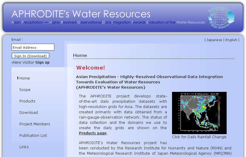
17 FY Asian Precipitation -- Highly Resolved Observational Data Integration Towards Evaluation of the Water Resources (APHRODITE s Water Resources) Akiyo Yatagai 1, Natsuko Yasutomi 1, Atsushi Hamada 1, Makoto Taniguchi 1, Tsugihiro Watanabe 1, Jumpei Kubota 1, Akio Kitoh 2, Kenji Kamiguchi 2, Osamu Arakawa 2, 1. Research Institute for Humanity and Nature (RIHN), Kyoto, Japan 2. Meteorological Research Institute (MRI), Japan Meteorological Agency (JMA), Tsukuba, Japan
, Kyoto, Japan 2.")
18 Background Regional impact of global warming is estimated by using high-resolution climate models. Model validation: High resolution Accuracy(Quantified) Statistical downscaling: Long-term data Climate impact on hydrological resources: Grid precipitation data Extreme events:high resolution Accuracy Long-term data Hydrological resources over mountains: grid precipitation data+snow accumulation+ temperature A collaboration study with Dr. Pingping XIE (CPC/NOAA) for RIHN s Yellow River project during FY (Xie et al., 2007)

19 Grid precipitation data used for model validation (5yrs ago) Data set Source Coverage Time Horizontal resolution resolution Period Legates and Willmott Rain gauge Global Land climatology 0.5 deg GPCP Merged (GTS, IR, CMAP MW) Global monthly GPCP_pen CMAP_pen Merged Global pentad GPCP1DD IR Global daily CRU GPCC Rain gauge Global Land monthly 0.5 PREC/L ver TRMM PR,TMI,VIRS 37N-37S Path 4.3km(PR) B42(Ver6) 50N-50S 3-hrly CMORPH MW+IR 60N-60S 30min GSMaP_TMI TRMM/TMI 40N-40S Daily GSMaP_MVK MW+IR 60N-60S hrly Regional East Asia 0.5 Precipita (1961- (Xie et al.2007) Rain gauge Regional daily 0.05(clim) APHRODITE tion APHRO 2003CHN) Asia analysis ver.1003 India Rain gauge Regional daily Reanalysis CPC unified ECMWF JRA NCEP Atmospheric observation+ 4DDA(model) Global 6-hrly 0.5~ , 0.25 deg

20 Can we use satellite-based daily precipitation data to study extreme events? Daily Precipitation for June to August, 2000 at Kagoshima (mm/day) Satellite-based observation underestimates heavy precipitation compared to rain-gauge-based observation (Radar-AMeDAS) Radar-AMeDAS GPCP-1DD TRMM3B42 Satellite-based rainfall estimation is not sufficient to validate extreme precipitation events simulated by high-resolution models

21
22 Current (most updated) APHRODITE precipitation data V1003 Products MA: Monsoon Asia ME: Middle East RU: Russia (Figure 1 shows the domains of V1003) V1005 JP Products JP: Japan Period MA/ME/RU: JP: Resolution Temporal: daily Horizontal:0.5º 0.5º / 0.25º 0.25º 0.05º 0.05º (JP_V1005) Free of Charge

23 Data used in V1003
24

25 Algorithm Flow
26 1. Define monthly precipitation climatology from daily and monthly observations at each station 2. Compute the ratio of (1) to the WORLDCLIM 3. Interpolate (2) onto a 0.05-degree grid using the new weighted mean method based on Spheremap (Willmott et al. 1985) 4. Define daily precipitation climatology by Fourier interpolation with the first six harmonics 5. Compute the ratio of the daily observation to the daily climatology (4) for the target day 6. Interpolate (5) onto a 0.05-degree grid using the same method used in (3) 7. Regrid 0.05-degree data (6) to and 0.5-degree products using the area-weighted mean

 Dataset A and B are 1/10 of our data.")
27 A QC tool with Google Earth A ( a global dataset) Example: Annual precipitation in 1995 at Kathmandu AP. Directly obtained from Department of Hydrometorology, Nepal B (GTS base real-time data) Dataset A and B are 1/10 of our data. Error in units-ofmeasurement are detected in widely used global datasets!
28 Definition of daily climatology
29 Daily precipitation I asked my colleague to send a slide which contains a movie. At Plinius conference, I did not use a movie but showed many consecutive slides. I will send them later.

30 precipitation analysis (Jan, 2000)
31 The followings are application samples. For satellite works, I will send later.
32 Post process of Numerical Weather Forecasts (NWF) as a teacher data Improving forecast (Krishnamurti et al. 2009) Observed Rain = a * (Model Rain) + b APHRO product Model rain GCM+statistical downscaling Forecasting precipitation variability Super-ensemble forecast
33 Validation of climate models/evaluation of the Hydrological budget caused by global warming APHRO_ME_0804 Annual precipitation global warming APHRO_ME_0804 年 降 水 MRI 20km model (present) Change in River Run-off Kitoh et al. (2008a) HRL Yatagai et al. (2008) ADGEO Kitoh et al. (2008b) HRL
Global Flood Alert System (GFAS)
") An Introduction of Global Flood Alert System (GFAS) Kazuo UMEDA Director of 2 nd Research Department, Infrastructure Development Institute-JAPAN Target: Reduction of Human Loss World s s natural disaster
An Introduction of Global Flood Alert System (GFAS) Kazuo UMEDA Director of 2 nd Research Department, Infrastructure Development Institute-JAPAN Target: Reduction of Human Loss World s s natural disaster
Application of global 1-degree data sets to simulate runoff from MOPEX experimental river basins
 18 Large Sample Basin Experiments for Hydrological Model Parameterization: Results of the Model Parameter Experiment. IAHS Publ. 37, 26. Application of global 1-degree data sets to simulate from experimental
II. Related Activities
 (1) Global Cloud Resolving Model Simulations toward Numerical Weather Forecasting in the Tropics (FY2005-2010) (2) Scale Interaction and Large-Scale Variation of the Ocean Circulation (FY2006-2011) (3)
Development of an Integrated Data Product for Hawaii Climate
 Development of an Integrated Data Product for Hawaii Climate Jan Hafner, Shang-Ping Xie (PI)(IPRC/SOEST U. of Hawaii) Yi-Leng Chen (Co-I) (Meteorology Dept. Univ. of Hawaii) contribution Georgette Holmes
Precipitation Remote Sensing
 Precipitation Remote Sensing Huade Guan Prepared for Remote Sensing class Earth & Environmental Science University of Texas at San Antonio November 14, 2005 Outline Background Remote sensing technique
High-resolution Regional Reanalyses for Europe and Germany
 High-resolution Regional Reanalyses for Europe and Germany Christian Ohlwein 1,2, Jan Keller 1,4, Petra Friederichs 2, Andreas Hense 2, Susanne Crewell 3, Sabrina Bentzien 1,2, Christoph Bollmeyer 1,2,
http://www.isac.cnr.it/~ipwg/
 The CGMS International Precipitation Working Group: Experience and Perspectives Vincenzo Levizzani CNR-ISAC, Bologna, Italy and Arnold Gruber NOAA/NESDIS & Univ. Maryland, College Park, MD, USA http://www.isac.cnr.it/~ipwg/
Present trends and climate change projections for the Mediterranean region
 Present trends and climate change projections for the Mediterranean region Prof. Piero Lionello, [email protected] Science of Materials Department, University of Salento, Italy Plan of the talk:
2.8 Objective Integration of Satellite, Rain Gauge, and Radar Precipitation Estimates in the Multisensor Precipitation Estimator Algorithm
 2.8 Objective Integration of Satellite, Rain Gauge, and Radar Precipitation Estimates in the Multisensor Precipitation Estimator Algorithm Chandra Kondragunta*, David Kitzmiller, Dong-Jun Seo and Kiran
Emergency Management Service. early warning FLOOD AND FIRE ALERTS. Space
 Emergency Management Service early warning FLOOD AND FIRE ALERTS Space 1 Copernicus at a Glance Copernicus is the European Union s Earth Observation programme: a user-driven space programme under civil
Flash Flood Guidance Systems
 Flash Flood Guidance Systems Introduction The Flash Flood Guidance System (FFGS) was designed and developed by the Hydrologic Research Center a non-profit public benefit corporation located in of San Diego,
Armenian State Hydrometeorological and Monitoring Service
 Armenian State Hydrometeorological and Monitoring Service Offenbach 1 Armenia: IN BRIEF Armenia is located in Southern Caucasus region, bordering with Iran, Azerbaijan, Georgia and Turkey. The total territory
Application of Numerical Weather Prediction Models for Drought Monitoring. Gregor Gregorič Jožef Roškar Environmental Agency of Slovenia
 Application of Numerical Weather Prediction Models for Drought Monitoring Gregor Gregorič Jožef Roškar Environmental Agency of Slovenia Contents 1. Introduction 2. Numerical Weather Prediction Models -
Analysis of Climatic and Environmental Changes Using CLEARS Web-GIS Information-Computational System: Siberia Case Study
 Analysis of Climatic and Environmental Changes Using CLEARS Web-GIS Information-Computational System: Siberia Case Study A G Titov 1,2, E P Gordov 1,2, I G Okladnikov 1,2, T M Shulgina 1 1 Institute of
Chapter 2 False Alarm in Satellite Precipitation Data
 Chapter 2 False Alarm in Satellite Precipitation Data Evaluation of satellite precipitation algorithms is essential for future algorithm development. This is why many previous studies are devoted to the
Fire Weather Index: from high resolution climatology to Climate Change impact study
 Fire Weather Index: from high resolution climatology to Climate Change impact study International Conference on current knowledge of Climate Change Impacts on Agriculture and Forestry in Europe COST-WMO
Titelmasterformat durch Klicken. bearbeiten
 Evaluation of a Fully Coupled Atmospheric Hydrological Modeling System for the Sissili Watershed in the West African Sudanian Savannah Titelmasterformat durch Klicken June, 11, 2014 1 st European Fully
Agricultural and Forest Meteorology
 Agricultural and Forest Meteorology 200 (2015) 233 248 Contents lists available at ScienceDirect Agricultural and Forest Meteorology j our na l ho me page: www.elsevier.com/locate/agrformet Climate forcing
TRMM and Other Global Precipitation Products and Data Services at NASA GES DISC. Zhong Liu George Mason University and NASA GES DISC
 TRMM and Other Global Precipitation Products and Data Services at NASA GES DISC Zhong Liu George Mason University and NASA GES DISC Outline Introduction of data and services at GES DISC TRMM and other
User Perspectives on Project Feasibility Data
 User Perspectives on Project Feasibility Data Marcel Šúri Tomáš Cebecauer GeoModel Solar s.r.o., Bratislava, Slovakia [email protected] http://geomodelsolar.eu http://solargis.info Solar Resources
Hong Kong Observatory Summer Placement Programme 2015
 Annex I Hong Kong Observatory Summer Placement Programme 2015 Training Programme : An Observatory mentor with relevant expertise will supervise the students. Training Period : 8 weeks, starting from 8
Development of a. Solar Generation Forecast System
 ALBANY BARCELONA BANGALORE 16 December 2011 Development of a Multiple Look ahead Time Scale Solar Generation Forecast System John Zack Glenn Van Knowe Marie Schnitzer Jeff Freedman AWS Truepower, LLC Albany,
BASIC APPROACH TO CLIMATE MONITORING PRODUCTS AND CLIMATE MONITORING PRODUCTS IN WMO RA VI
 BASIC APPROACH TO CLIMATE MONITORING PRODUCTS AND CLIMATE MONITORING PRODUCTS IN WMO RA VI Mesut DEMIRCAN Geodesy and Photogrametry Engineer Turkish State Meteorological Service Agrometeorology and Climatological
Comparative Evaluation of High Resolution Numerical Weather Prediction Models COSMO-WRF
 3 Working Group on Verification and Case Studies 56 Comparative Evaluation of High Resolution Numerical Weather Prediction Models COSMO-WRF Bogdan Alexandru MACO, Mihaela BOGDAN, Amalia IRIZA, Cosmin Dănuţ
Real-time monitoring and forecast of the West African monsoon intraseasonal variability: from 2011 to 2013
 Real-time monitoring and forecast of the West African monsoon intraseasonal variability: from 2011 to 2013 P.Peyrillé 1, R. Roehrig 1, F. Couvreux 1, E. Poan 1, J.-P. Lafore 1, N. Chapelon 4, O. Ndiaye
Developing Continuous SCM/CRM Forcing Using NWP Products Constrained by ARM Observations
 Developing Continuous SCM/CRM Forcing Using NWP Products Constrained by ARM Observations S. C. Xie, R. T. Cederwall, and J. J. Yio Lawrence Livermore National Laboratory Livermore, California M. H. Zhang
The IPCC Special Report on Managing the Risks of Extreme Events and Disasters to Advance Climate Change Adaptation
 The IPCC Special Report on Managing the Risks of Extreme Events and Disasters to Advance Climate Change Adaptation A changing climate leads to changes in extreme weather and climate events 2 How do changes
GCMs with Implicit and Explicit cloudrain processes for simulation of extreme precipitation frequency
 GCMs with Implicit and Explicit cloudrain processes for simulation of extreme precipitation frequency In Sik Kang Seoul National University Young Min Yang (UH) and Wei Kuo Tao (GSFC) Content 1. Conventional
DIURNAL CYCLE OF CLOUD SYSTEM MIGRATION OVER SUMATERA ISLAND
 DIURNAL CYCLE OF CLOUD SYSTEM MIGRATION OVER SUMATERA ISLAND NAMIKO SAKURAI 1, FUMIE MURATA 2, MANABU D. YAMANAKA 1,3, SHUICHI MORI 3, JUN-ICHI HAMADA 3, HIROYUKI HASHIGUCHI 4, YUDI IMAN TAUHID 5, TIEN
New challenges of water resources management: Title the future role of CHy
 New challenges of water resources management: Title the future role of CHy by Bruce Stewart* Karl Hofius in his article in this issue of the Bulletin entitled Evolving role of WMO in hydrology and water
Climate, water and renewable energy in the Nordic countries
 102 Regional Hydrological Impacts of Climatic Change Hydroclimatic Variability (Proceedings of symposium S6 held during the Seventh IAHS Scientific Assembly at Foz do Iguaçu, Brazil, April 2005). IAHS
 1 2 A very short description of the functional center network: regarding the Hydraulic and Hydrogeological risk, the national alert system is ensured by the National Civil Protection Department (DPCN),
[ Climate Data Collection and Forecasting Element ] An Advanced Monitoring Network In Support of the FloodER Program
![[ Climate Data Collection and Forecasting Element ] An Advanced Monitoring Network In Support of the FloodER Program](/thumbs/33/16326315.jpg "[ Climate Data Collection and Forecasting Element ] An Advanced Monitoring Network In Support of the FloodER Program") [ Climate Data Collection and Forecasting Element ] An Advanced Monitoring Network In Support of the FloodER Program December 2010 1 Introduction Extreme precipitation and the resulting flooding events
[ Climate Data Collection and Forecasting Element ] An Advanced Monitoring Network In Support of the FloodER Program December 2010 1 Introduction Extreme precipitation and the resulting flooding events
Climate Extremes Research: Recent Findings and New Direc8ons
 Climate Extremes Research: Recent Findings and New Direc8ons Kenneth Kunkel NOAA Cooperative Institute for Climate and Satellites North Carolina State University and National Climatic Data Center h#p://assessment.globalchange.gov
Real-time Global Flood Monitoring and Forecasting using an Enhanced Land Surface Model with Satellite and NWP model based Precipitation
 Real-time Global Flood Monitoring and Forecasting using an Enhanced Land Surface Model with Satellite and NWP model based Precipitation Huan Wu,2, Robert F. Adler, 2, Yudong Tian, 2, George J. Huffman
Guy Carpenter Asia-Pacific Climate Impact Centre, School of energy and Environment, City University of Hong Kong
 Diurnal and Semi-diurnal Variations of Rainfall in Southeast China Judy Huang and Johnny Chan Guy Carpenter Asia-Pacific Climate Impact Centre School of Energy and Environment City University of Hong Kong
Improving Hydrological Predictions
 Improving Hydrological Predictions Catherine Senior MOSAC, November 10th, 2011 How well do we simulate the water cycle? GPCP 10 years of Day 1 forecast Equatorial Variability on Synoptic scales (2-6 days)
Huai-Min Zhang & NOAAGlobalTemp Team
 Improving Global Observations for Climate Change Monitoring using Global Surface Temperature (& beyond) Huai-Min Zhang & NOAAGlobalTemp Team NOAA National Centers for Environmental Information (NCEI) [formerly:
ANALYSIS OF DATA EXCHANGE PROBLEMS IN GLOBAL ATMOSPHERIC AND HYDROLOGICAL NETWORKS SUMMARY REPORT 1. June 2004
 ANALYSIS OF DATA EXCHANGE PROBLEMS IN GLOBAL ATMOSPHERIC AND HYDROLOGICAL NETWORKS SUMMARY REPORT 1 June 2004 Global Climate Observing System (GCOS) Secretariat 1 This summary report is based on a study
NASA Earth Exchange Global Daily Downscaled Projections (NEX- GDDP)
") NASA Earth Exchange Global Daily Downscaled Projections (NEX-GDDP) 1. Intent of This Document and POC 1a) This document provides a brief overview of the NASA Earth Exchange (NEX) Global Daily Downscaled
NASA Earth Exchange Global Daily Downscaled Projections (NEX-GDDP) 1. Intent of This Document and POC 1a) This document provides a brief overview of the NASA Earth Exchange (NEX) Global Daily Downscaled
Baudouin Raoult, Iryna Rozum, Dick Dee
 ECMWF contribution to the EU funded CHARME Project: A Significant Event Viewer tool Matthew Manoussakis Baudouin Raoult, Iryna Rozum, Dick Dee 5th Workshop on the use of GIS/OGC standards in meteorology
Catastrophe Bond Risk Modelling
 Catastrophe Bond Risk Modelling Dr. Paul Rockett Manager, Risk Markets 6 th December 2007 Bringing Science to the Art of Underwriting Agenda Natural Catastrophe Modelling Index Linked Securities Parametric
Welcome to NASA Applied Remote Sensing Training (ARSET) Webinar Series
 Webinar Series") Welcome to NASA Applied Remote Sensing Training (ARSET) Webinar Series Introduction to Remote Sensing Data for Water Resources Management Course Dates: October 17, 24, 31 November 7, 14 Time: 8-9 a.m.
Welcome to NASA Applied Remote Sensing Training (ARSET) Webinar Series Introduction to Remote Sensing Data for Water Resources Management Course Dates: October 17, 24, 31 November 7, 14 Time: 8-9 a.m.
Meteorological Forecasting of DNI, clouds and aerosols
 Meteorological Forecasting of DNI, clouds and aerosols DNICast 1st End-User Workshop, Madrid, 2014-05-07 Heiner Körnich (SMHI), Jan Remund (Meteotest), Marion Schroedter-Homscheidt (DLR) Overview What
Impacts of a future city master plan on on thermal and wind environments in Vinh city, Vietnam
 Impacts of a future city master plan on on thermal and wind environments in Vinh city, Vietnam Satoru Iizuka, Nagoya University, Japan Tatsunori Ito, Nagoya University, Japan Masato Miyata, Mitsubishi
Parameterization of Cumulus Convective Cloud Systems in Mesoscale Forecast Models
 DISTRIBUTION STATEMENT A. Approved for public release; distribution is unlimited. Parameterization of Cumulus Convective Cloud Systems in Mesoscale Forecast Models Yefim L. Kogan Cooperative Institute
Flood risk assessment through a detailed 1D/2D coupled model
 CORFU Project Barcelona Case Study Final Workshop 19 th of May 2014 Flood risk assessment through a detailed 1D/2D coupled model Beniamino Russo Aqualogy Urban Drainage Direction Introduction and general
CLIMATE CHANGE RISK ASSESSMENT
 Additional Financing of Green Power Development Project (RRP BHU 37399) CLIMATE CHANGE RISK ASSESSMENT I. Background 1. With its mountainous terrain and abundant rivers, Bhutan has large potential for
Standardized Runoff Index (SRI)
") Standardized Runoff Index (SRI) Adolfo Mérida Abril Javier Gras Treviño Contents 1. About the SRI SRI in the world Methodology 2. Comments made in Athens on SRI factsheet 3. Last modifications of the factsheet
Standardized Runoff Index (SRI) Adolfo Mérida Abril Javier Gras Treviño Contents 1. About the SRI SRI in the world Methodology 2. Comments made in Athens on SRI factsheet 3. Last modifications of the factsheet
HAZARD RISK ASSESSMENT, MONITORING, MAINTENANCE AND MANAGEMENT SYSTEM (HAMMS) FOR LANDSLIDE AND FLOOD. Mohd. Nor Desa, Rohayu and Lariyah, UNITEN
 FOR LANDSLIDE AND FLOOD. Mohd. Nor Desa, Rohayu and Lariyah, UNITEN") HAZARD RISK ASSESSMENT, MONITORING, MAINTENANCE AND MANAGEMENT SYSTEM (HAMMS) FOR LANDSLIDE AND FLOOD Mohd. Nor Desa, Rohayu and Lariyah, UNITEN WHAT WE HAVE IN MIND AND FROM OUR PREVIOUS PROJECT CONTRIBUTION
HAZARD RISK ASSESSMENT, MONITORING, MAINTENANCE AND MANAGEMENT SYSTEM (HAMMS) FOR LANDSLIDE AND FLOOD Mohd. Nor Desa, Rohayu and Lariyah, UNITEN WHAT WE HAVE IN MIND AND FROM OUR PREVIOUS PROJECT CONTRIBUTION
Temporal variation in snow cover over sea ice in Antarctica using AMSR-E data product
 Temporal variation in snow cover over sea ice in Antarctica using AMSR-E data product Michael J. Lewis Ph.D. Student, Department of Earth and Environmental Science University of Texas at San Antonio ABSTRACT
Data Products via TRMM Online Visualization and Analysis System
 Accessing Global Precipitation Data Products via TRMM Online Visualization and Analysis System (TOVAS) Zhong Liu Center for Spatial Information Science and Systems (CSISS), George Mason University and
REGIONAL CLIMATE AND DOWNSCALING
 REGIONAL CLIMATE AND DOWNSCALING Regional Climate Modelling at the Hungarian Meteorological Service ANDRÁS HORÁNYI (horanyi( [email protected]@met.hu) Special thanks: : Gabriella Csima,, Péter Szabó, Gabriella
ARkStorm: California s Other Big One!
 ARkStorm: California s Other Big One! Understanding the Impacts of Massive Winter Storms Mark Jackson Meteorologist in Charge NOAA/National Weather Service Los Angeles/Oxnard What is ARkStorm? Emergency-preparedness
Nowcasting: analysis and up to 6 hours forecast
 Nowcasting: analysis and up to 6 hours forecast Very high resoultion in time and space Better than NWP Rapid update Application oriented NWP problems for 0 6 forecast: Incomplete physics Resolution space
GCOS science conference, 2 Mar. 2016, Amsterdam. Japan Meteorological Agency (JMA)
") GCOS science conference, 2 Mar. 2016, Amsterdam Status of Surface Radiation Budget Observation for Climate Nozomu Ohkawara Japan Meteorological Agency (JMA) Contents 1. Background 2. Status t of surface
GCOS science conference, 2 Mar. 2016, Amsterdam Status of Surface Radiation Budget Observation for Climate Nozomu Ohkawara Japan Meteorological Agency (JMA) Contents 1. Background 2. Status t of surface
Ⅱ. Related Activities
 (1) Global Cloud Resolving Model Simulations toward Numerical Weather Forecasting in the Tropics (FY2005-2010) (2) Scale Interaction and Large-Scale Variation of the Ocean Circulation (FY2006-2011) (3)
ANALYSIS OF THUNDERSTORM CLIMATOLOGY AND CONVECTIVE SYSTEMS, PERIODS WITH LARGE PRECIPITATION IN HUNGARY. Theses of the PhD dissertation
 ANALYSIS OF THUNDERSTORM CLIMATOLOGY AND CONVECTIVE SYSTEMS, PERIODS WITH LARGE PRECIPITATION IN HUNGARY Theses of the PhD dissertation ANDRÁS TAMÁS SERES EÖTVÖS LORÁND UNIVERSITY FACULTY OF SCIENCE PhD
Bridging the gap between climate science and development practice
 Bridging the gap between climate science and development practice FIC/IEH Methodology for analyzing climate change impacts on productive systems and value chains Climate model simulations are essential
meteonorm Global Meteorological Database
 meteonorm Global Meteorological Database Version 7 Software and Data for Engineers, Planners and Education The Meteorological Reference for Solar Energy Applications, Building Design, Heating & Cooling
David P. Ruth* Meteorological Development Laboratory Office of Science and Technology National Weather Service, NOAA Silver Spring, Maryland
 9.9 TRANSLATING ADVANCES IN NUMERICAL WEATHER PREDICTION INTO OFFICIAL NWS FORECASTS David P. Ruth* Meteorological Development Laboratory Office of Science and Technology National Weather Service, NOAA
APPLICATION OF GOOGLE EARTH FOR THE DEVELOPMENT OF BASE MAP IN THE CASE OF GISH ABBAY SEKELA, AMHARA STATE, ETHIOPIA
 APPLICATION OF GOOGLE EARTH FOR THE DEVELOPMENT OF BASE MAP IN THE CASE OF GISH ABBAY SEKELA, AMHARA STATE, ETHIOPIA Abineh Tilahun Department of Geography and environmental studies, Adigrat University,
Drought Monitoring and Forecasting in Sub-Saharan African. Justin Sheffield Princeton University
 Drought Monitoring and Forecasting in Sub-Saharan African Justin Sheffield Princeton University Outline Challenges for sub-saharan Africa (SSA) Current capabilities (national, regional, international) Princeton
Climate modelling. Dr. Heike Huebener Hessian Agency for Environment and Geology Hessian Centre on Climate Change
 Hessisches Landesamt für Umwelt und Geologie Climate modelling Dr. Heike Huebener Hessian Agency for Environment and Geology Hessian Centre on Climate Change Climate: Definition Weather: momentary state
RE: James vs. ABC Company Greentown, NJ D/A: February 20, 2011
 PO Box 7100 Hackettstown, NJ 07840 Phone: 1 800 427 3456 Fax: 908-850-8664 http://www.weatherworksinc.com June 16, 2012 Attn: John Doe Law Offices of John Doe 123 Fourth Street Smithtown, NJ 04506 RE:
Daily High-resolution Blended Analyses for Sea Surface Temperature
 Daily High-resolution Blended Analyses for Sea Surface Temperature by Richard W. Reynolds 1, Thomas M. Smith 2, Chunying Liu 1, Dudley B. Chelton 3, Kenneth S. Casey 4, and Michael G. Schlax 3 1 NOAA National
Data Management in support of Climate Services @ MeteoSwiss
 Eidgenössisches Departement des Innern EDI Bundesamt für Meteorologie und Klimatologie MeteoSchweiz Data Management in support of Climate Services @ MeteoSwiss Estelle Grueter, Heike Kunz (MeteoSwiss)
Visualizing of Berkeley Earth, NASA GISS, and Hadley CRU averaging techniques
 Visualizing of Berkeley Earth, NASA GISS, and Hadley CRU averaging techniques Robert Rohde Lead Scientist, Berkeley Earth Surface Temperature 1/15/2013 Abstract This document will provide a simple illustration
Solar Input Data for PV Energy Modeling
 June 2012 Solar Input Data for PV Energy Modeling Marie Schnitzer, Christopher Thuman, Peter Johnson Albany New York, USA Barcelona Spain Bangalore India Company Snapshot Established in 1983; nearly 30
USING SIMULATED WIND DATA FROM A MESOSCALE MODEL IN MCP. M. Taylor J. Freedman K. Waight M. Brower
 USING SIMULATED WIND DATA FROM A MESOSCALE MODEL IN MCP M. Taylor J. Freedman K. Waight M. Brower Page 2 ABSTRACT Since field measurement campaigns for proposed wind projects typically last no more than
UCAR Trustee Candidate Kenneth Bowman
 UCAR Trustee Candidate Kenneth Bowman The Member's Nominating Committee is pleased to present Dr. Kenneth Bowman from Texas A&M University as a candidate for the UCAR Board of Trustees. Dr. Bowman is currently
IMPACTS OF IN SITU AND ADDITIONAL SATELLITE DATA ON THE ACCURACY OF A SEA-SURFACE TEMPERATURE ANALYSIS FOR CLIMATE
 INTERNATIONAL JOURNAL OF CLIMATOLOGY Int. J. Climatol. 25: 857 864 (25) Published online in Wiley InterScience (www.interscience.wiley.com). DOI:.2/joc.68 IMPACTS OF IN SITU AND ADDITIONAL SATELLITE DATA
Climate and Global Dynamics e-mail: [email protected] National Center for Atmospheric Research phone: (303) 497-1761 Boulder, CO 80307
 497-1761 Boulder, CO 80307") Sean C. Swenson Climate and Global Dynamics P.O. Box 3000 [email protected] National Center for Atmospheric Research (303) 497-1761 Boulder, CO 80307 Education Ph.D. University of Colorado at Boulder,
Sean C. Swenson Climate and Global Dynamics P.O. Box 3000 [email protected] National Center for Atmospheric Research (303) 497-1761 Boulder, CO 80307 Education Ph.D. University of Colorado at Boulder,
Monsoon Variability and Extreme Weather Events
 Monsoon Variability and Extreme Weather Events M Rajeevan National Climate Centre India Meteorological Department Pune 411 005 [email protected] Outline of the presentation Monsoon rainfall Variability
THE STRATEGIC PLAN OF THE HYDROMETEOROLOGICAL PREDICTION CENTER
 THE STRATEGIC PLAN OF THE HYDROMETEOROLOGICAL PREDICTION CENTER FISCAL YEARS 2012 2016 INTRODUCTION Over the next ten years, the National Weather Service (NWS) of the National Oceanic and Atmospheric Administration
National Weather Service Flash Flood Modeling and Warning Services
 National Weather Service Flash Flood Modeling and Warning Services Seann Reed, Middle Atlantic River Forecast Center Peter Ahnert, Middle Atlantic River Forecast Center August 23, 2012 USACE Flood Risk
IBM Big Green Innovations Environmental R&D and Services
 IBM Big Green Innovations Environmental R&D and Services Smart Weather Modelling Local Area Precision Forecasting for Weather-Sensitive Business Operations (e.g. Smart Grids) Lloyd A. Treinish Project
Formulating Climate Change Scenarios to Inform Climate-Resilient Development Strategies
 United Nations Development Programme Formulating Climate Change Scenarios to Inform Climate-Resilient Development Strategies A Guidebook for Practitioners UNDP is the UN s global development network, advocating
 Mesoscale re-analysis of historical meteorological data over Europe Anna Jansson and Christer Persson, SMHI ERAMESAN A first attempt at SMHI for re-analyses of temperature, precipitation and wind over
NOAA Big Data Project. David Michaud Acting Director, Office of Central Processing Office Monday, August 3, 2015
 NOAA Big Data Project David Michaud Acting Director, Office of Central Processing Office Monday, August 3, 2015 Central Processing Portfolio Benefits and Scope Central Processing Portfolio Benefits Ensures
Real-time hazard impact modelling for surface water flooding: some UK developments
 Real-time hazard impact modelling for surface water flooding: some UK developments Steven Cole 1, Bob Moore 1, Timothy Aldridge 2, Andy Lane 3,4 and Stefan Laeger 4 International Conference on Flood Resilience,