Remote Sensing Lab: The Products Point Of View
|
|
|
- Abraham Tate
- 10 years ago
- Views:
Transcription
1 Remote Sensing Lab: The Products Point Of View Remote Sensing Lab performs processing of the images acquired with its equipment Different products are available to the users: Standard products On-Request products L0 / L1b / L2 / L3 INTA PROCESSING RESOURCES: HW: SUN WS, PCs... SW: IDL+ENVI, ERDAS, GEOMATICA, MIRAMON, PARGE, 6S, PCMODWIN, MATLAB... OTHER EQUIPMENT: GER1500, GPS receivers...

2 HARD DRIVE *.bin files backup on tape AHS DATA FLOW Quality check: Ahs_process.m Ingestion: AHSImportUtility Instrument Proc: AHSImportUtility Raw ENVI files ( 753 x L x 80) PARGE MODTRAN ENVI... Mandatory: Optional L1a / L2 /L3 products Dissemination on CD/DVD
 PARGE MODTRAN ENVI.")
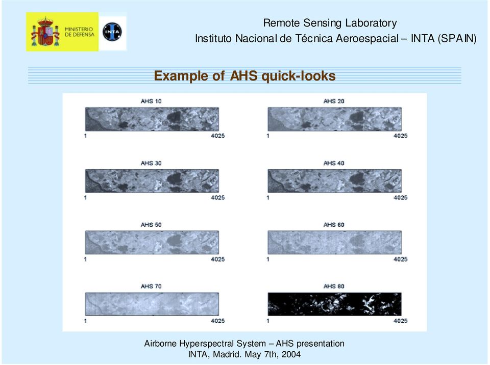
3 Example of AHS quick-looks
4 AHS STANDARD PRODUCTS identification radiometric correction geometric correction L0 / L1a raw data no process no process L1b at-sensor radiance L1c georeferenced at-sensor radiance L2a georeferenced reflectance apparent temper. & from ND to Ls using test bench + labsphere data for VIS-NIR-SWIR and sensor BlackBodies for TIR bands from ND to Ls using test bench + labsphere data for VIS-NIR-SWIR and sensor BlackBodies for TIR bands from Ls to ρ using MODTRAN no process direct georeferencing PARGE direct georeferencing PARGE using using

5 AHS PRODUCTS BACKUP PROCEDURES: Transformation from Ls to ρ using field spectroradiometry signatures and a suitable least squares fitting tool (as Empirical Line Method from ENVI) Transformation from Ls to ρ using 6S Use of GCPs and a suitable transformation (for example thin plate spline from Geomatica ) EXAMPLES OF AHS ON-REQUEST PRODUCTS S-Bend corrected images Surface brightness temperature via MODTRAN Level 3 data: thematic classifications, emissivity images... Formats: ERDAS-IMG, GEOMATICA-PCI...

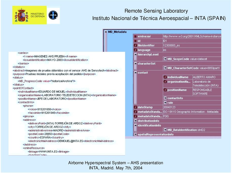
6 AHS PRODUCTS METADATA All image products will be delivered with a metadata file - there will be a different file per flight line 90% of the metadata elements derived from ISO19115:2003 "Geographic information: metadata" A few extra elements documented following the draft standards ISO19130 and ISO19115-part 2 File format: excel and XML files

7
8 AHS image (RGB 15/8/2) September 2003

9 Remote Sensing Lab capabilities: hyperspectral sensors Cáceres RGB combination of thermal images. Channels 77, 73, 71.

10 Remote Sensing Lab capabilities: hyperspectral sensors Temperature plot at different wavelengths. Natural vs artificial material behaviour

11 Doñana marshlands (RGB 15/8/3) 27 April 2004
 27")
 27 April")
12 Doñana marshlands (RGB 15/8/3) 27 April 2004
 27")
13 Doñana marshlands (RGB 77/75/72) 27 April 2004
")
 27 April")
14 Doñana marshlands (RGB 77/75/72) 27 April 2004
")
15

How to calculate reflectance and temperature using ASTER data
 How to calculate reflectance and temperature using ASTER data Prepared by Abduwasit Ghulam Center for Environmental Sciences at Saint Louis University September, 2009 This instructions walk you through
INTA AIRBORNE REMOTE SENSING FACILITY from the Hasselblad s cameras to the SensyTech-AHS sensor
 INTA AIRBORNE REMOTE SENSING FACILITY from the Hasselblad s cameras to the SensyTech-AHS sensor José-Antonio Gómez-Sánchez [email protected] Remote Sensing Laboratory INSTITUTO NACIONAL DE TÉCNICA AEROESPACIAL
ENVI Classic Tutorial: Atmospherically Correcting Hyperspectral Data using FLAASH 2
 ENVI Classic Tutorial: Atmospherically Correcting Hyperspectral Data Using FLAASH Atmospherically Correcting Hyperspectral Data using FLAASH 2 Files Used in This Tutorial 2 Opening the Uncorrected AVIRIS
INVESTIGA I+D+i 2013/2014
 INVESTIGA I+D+i 2013/2014 SPECIFIC GUIDELINES ON AEROSPACE OBSERVATION OF EARTH Text by D. Eduardo de Miguel October, 2013 Introducction Earth observation is the use of remote sensing techniques to better
Digital Remote Sensing Data Processing Digital Remote Sensing Data Processing and Analysis: An Introduction and Analysis: An Introduction
 Digital Remote Sensing Data Processing Digital Remote Sensing Data Processing and Analysis: An Introduction and Analysis: An Introduction Content Remote sensing data Spatial, spectral, radiometric and
Remote Sensing Method in Implementing REDD+
 Remote Sensing Method in Implementing REDD+ FRIM-FFPRI Research on Development of Carbon Monitoring Methodology for REDD+ in Malaysia Remote Sensing Component Mohd Azahari Faidi, Hamdan Omar, Khali Aziz
Lectures Remote Sensing
 Lectures Remote Sensing ATMOSPHERIC CORRECTION dr.ir. Jan Clevers Centre of Geo-Information Environmental Sciences Wageningen UR Atmospheric Correction of Optical RS Data Background When needed? Model
Advanced Image Management using the Mosaic Dataset
 Esri International User Conference San Diego, California Technical Workshops July 25, 2012 Advanced Image Management using the Mosaic Dataset Vinay Viswambharan, Mike Muller Agenda ArcGIS Image Management
Hyperspectral Satellite Imaging Planning a Mission
 Hyperspectral Satellite Imaging Planning a Mission Victor Gardner University of Maryland 2007 AIAA Region 1 Mid-Atlantic Student Conference National Institute of Aerospace, Langley, VA Outline Objective
Resolutions of Remote Sensing
 Resolutions of Remote Sensing 1. Spatial (what area and how detailed) 2. Spectral (what colors bands) 3. Temporal (time of day/season/year) 4. Radiometric (color depth) Spatial Resolution describes how
Preface. Ko Ko Lwin Division of Spatial Information Science University of Tsukuba 2008
 1 Preface Remote Sensing data is one of the primary data sources in GIS analysis. The objective of this material is to provide fundamentals of Remote Sensing technology and its applications in Geographical
High Resolution Information from Seven Years of ASTER Data
 High Resolution Information from Seven Years of ASTER Data Anna Colvin Michigan Technological University Department of Geological and Mining Engineering and Sciences Outline Part I ASTER mission Terra
Sky Monitoring Techniques using Thermal Infrared Sensors. sabino piazzolla Optical Communications Group JPL
 Sky Monitoring Techniques using Thermal Infrared Sensors sabino piazzolla Optical Communications Group JPL Atmospheric Monitoring The atmospheric channel has a great impact on the channel capacity at optical
Myths and misconceptions about remote sensing
 Myths and misconceptions about remote sensing Ned Horning (graphics support - Nicholas DuBroff) Version: 1.0 Creation Date: 2004-01-01 Revision Date: 2004-01-01 License: This document is licensed under
Chapter Contents Page No
 Chapter Contents Page No Preface Acknowledgement 1 Basics of Remote Sensing 1 1.1. Introduction 1 1.2. Definition of Remote Sensing 1 1.3. Principles of Remote Sensing 1 1.4. Various Stages in Remote Sensing
Work Package Radiometry
 Work Package Radiometry EuroSDR project Radiometric aspects of digital photogrammetric imagery Eija Honkavaara Department of Remote Sensing and Photogrammetry Finnish Geodetic Institute EuroDAC Core Team
Multiangle cloud remote sensing from
 Multiangle cloud remote sensing from POLDER3/PARASOL Cloud phase, optical thickness and albedo F. Parol, J. Riedi, S. Zeng, C. Vanbauce, N. Ferlay, F. Thieuleux, L.C. Labonnote and C. Cornet Laboratoire
SAMPLE MIDTERM QUESTIONS
 Geography 309 Sample MidTerm Questions Page 1 SAMPLE MIDTERM QUESTIONS Textbook Questions Chapter 1 Questions 4, 5, 6, Chapter 2 Questions 4, 7, 10 Chapter 4 Questions 8, 9 Chapter 10 Questions 1, 4, 7
The premier software for extracting information from geospatial imagery.
 Imagery Becomes Knowledge ENVI The premier software for extracting information from geospatial imagery. ENVI Imagery Becomes Knowledge Geospatial imagery is used more and more across industries because
Labs in Bologna & Potenza Menzel. Lab 3 Interrogating AIRS Data and Exploring Spectral Properties of Clouds and Moisture
 Labs in Bologna & Potenza Menzel Lab 3 Interrogating AIRS Data and Exploring Spectral Properties of Clouds and Moisture Figure 1: High resolution atmospheric absorption spectrum and comparative blackbody
Remote Sensing for Geographical Analysis
 Remote Sensing for Geographical Analysis Geography 651, Fall 2008 Department of Geography Texas A&M University (3 credit hours) Instructor: Dr. Hongxing Liu Office hours: Tue & Thur 10:00AM-12:00AM, O&M
2.3 Spatial Resolution, Pixel Size, and Scale
 Section 2.3 Spatial Resolution, Pixel Size, and Scale Page 39 2.3 Spatial Resolution, Pixel Size, and Scale For some remote sensing instruments, the distance between the target being imaged and the platform,
Towards agreed data quality layers for airborne hyperspectral imagery
 Towards agreed data quality layers for airborne hyperspectral imagery M. Bachmann, DLR M. Bachmann, DLR, S. Adar, TAU; E. Ben-Dor, TAU; J. Biesemans, VITO; X. Briottet, ONERA; M. Grant, PML; J. Hanus,
Digital image processing
 746A27 Remote Sensing and GIS Lecture 4 Digital image processing Chandan Roy Guest Lecturer Department of Computer and Information Science Linköping University Digital Image Processing Most of the common

D.S. Boyd School of Earth Sciences and Geography, Kingston University, U.K.
 PHYSICAL BASIS OF REMOTE SENSING D.S. Boyd School of Earth Sciences and Geography, Kingston University, U.K. Keywords: Remote sensing, electromagnetic radiation, wavelengths, target, atmosphere, sensor,
Treasure Hunt. Lecture 2 How does Light Interact with the Environment? EMR Principles and Properties. EMR and Remote Sensing
 Lecture 2 How does Light Interact with the Environment? Treasure Hunt Find and scan all 11 QR codes Choose one to watch / read in detail Post the key points as a reaction to http://www.scoop.it/t/env202-502-w2
APPLICATION OF GOOGLE EARTH FOR THE DEVELOPMENT OF BASE MAP IN THE CASE OF GISH ABBAY SEKELA, AMHARA STATE, ETHIOPIA
 APPLICATION OF GOOGLE EARTH FOR THE DEVELOPMENT OF BASE MAP IN THE CASE OF GISH ABBAY SEKELA, AMHARA STATE, ETHIOPIA Abineh Tilahun Department of Geography and environmental studies, Adigrat University,
Received in revised form 24 March 2004; accepted 30 March 2004
 Remote Sensing of Environment 91 (2004) 237 242 www.elsevier.com/locate/rse Cloud detection in Landsat imagery of ice sheets using shadow matching technique and automatic normalized difference snow index
ENVI THE PREMIER SOFTWARE FOR EXTRACTING INFORMATION FROM GEOSPATIAL IMAGERY.
 ENVI THE PREMIER SOFTWARE FOR EXTRACTING INFORMATION FROM GEOSPATIAL IMAGERY. ENVI Imagery Becomes Knowledge ENVI software uses proven scientific methods and automated processes to help you turn geospatial
3D VISUALIZATION OF GEOTHERMAL WELLS DIRECTIONAL SURVEYS AND INTEGRATION WITH DIGITAL ELEVATION MODEL (DEM)
") Presented at Short Course VII on Exploration for Geothermal Resources, organized by UNU-GTP, GDC and KenGen, at Lake Bogoria and Lake Naivasha, Kenya, Oct. 27 Nov. 18, 2012. GEOTHERMAL TRAINING PROGRAMME
Presented at Short Course VII on Exploration for Geothermal Resources, organized by UNU-GTP, GDC and KenGen, at Lake Bogoria and Lake Naivasha, Kenya, Oct. 27 Nov. 18, 2012. GEOTHERMAL TRAINING PROGRAMME
APPLICATION OF TERRA/ASTER DATA ON AGRICULTURE LAND MAPPING. Genya SAITO*, Naoki ISHITSUKA*, Yoneharu MATANO**, and Masatane KATO***
 APPLICATION OF TERRA/ASTER DATA ON AGRICULTURE LAND MAPPING Genya SAITO*, Naoki ISHITSUKA*, Yoneharu MATANO**, and Masatane KATO*** *National Institute for Agro-Environmental Sciences 3-1-3 Kannondai Tsukuba
Selecting the appropriate band combination for an RGB image using Landsat imagery
 Selecting the appropriate band combination for an RGB image using Landsat imagery Ned Horning Version: 1.0 Creation Date: 2004-01-01 Revision Date: 2004-01-01 License: This document is licensed under a
Landsat 7 Automatic Cloud Cover Assessment
 Landsat 7 Automatic Cloud Cover Assessment Richard R. Irish Science Systems and Applications, Inc. NASA s Goddard Space Flight Center, Greenbelt, Maryland ABSTRACT An automatic cloud cover assessment algorithm
Mineral Exploration Using GIS and Processed Aster Images
 Mineral Exploration Using GIS and Processed Aster Images Carlos A. Torres Advance GIS EES 6513 (Spring 2007) University of Texas at San Antonio Abstract The risks of developing mineral resources need to
From Pixel to Info-Cloud News at Leica Geosystems JACIE Denver, 31 March 2011 Ruedi Wagner Hexagon Geosystems, Geospatial Solutions Division.
 From Pixel to Info-Cloud News at Leica Geosystems JACIE Denver, 31 March 2011 Ruedi Wagner Hexagon Geosystems, Geospatial Solutions Division What else can I do with my sensor/data? Earth to Image Image
Land Use/Land Cover Map of the Central Facility of ARM in the Southern Great Plains Site Using DOE s Multi-Spectral Thermal Imager Satellite Images
 Land Use/Land Cover Map of the Central Facility of ARM in the Southern Great Plains Site Using DOE s Multi-Spectral Thermal Imager Satellite Images S. E. Báez Cazull Pre-Service Teacher Program University
Obtaining and Processing MODIS Data
 Obtaining and Processing MODIS Data MODIS is an extensive program using sensors on two satellites that each provide complete daily coverage of the earth. The data have a variety of resolutions; spectral,
GOES-R Advanced Baseline Imager (ABI) Algorithm Theoretical Basis Document For Low Cloud and Fog
 Algorithm Theoretical Basis Document For Low Cloud and Fog") NOAA NESDIS CENTER for SATELLITE APPLICATIONS and RESEARCH GOES-R Advanced Baseline Imager (ABI) Algorithm Theoretical Basis Document For Low Cloud and Fog Corey Calvert, UW/CIMSS Mike Pavolonis, NOAA/NESDIS/STAR
NOAA NESDIS CENTER for SATELLITE APPLICATIONS and RESEARCH GOES-R Advanced Baseline Imager (ABI) Algorithm Theoretical Basis Document For Low Cloud and Fog Corey Calvert, UW/CIMSS Mike Pavolonis, NOAA/NESDIS/STAR
The USGS Landsat Big Data Challenge
 The USGS Landsat Big Data Challenge Brian Sauer Engineering and Development USGS EROS [email protected] U.S. Department of the Interior U.S. Geological Survey USGS EROS and Landsat 2 Data Utility and Exploitation
Data Processing Developments at DFD/DLR. Stefanie Holzwarth Martin Bachmann, Rudolf Richter, Martin Habermeyer, Derek Rogge
 Data Processing Developments at DFD/DLR Stefanie Holzwarth Martin Bachmann, Rudolf Richter, Martin Habermeyer, Derek Rogge EUFAR Joint Expert Working Group Meeting Edinburgh, April 14th 2011 Conclusions
LANDSAT 8 Level 1 Product Performance
 Réf: IDEAS-TN-10-QualityReport LANDSAT 8 Level 1 Product Performance Quality Report Month/Year: January 2016 Date: 26/01/2016 Issue/Rev:1/9 1. Scope of this document On May 30, 2013, data from the Landsat
South East of Process Main Building / 1F. North East of Process Main Building / 1F. At 14:05 April 16, 2011. Sample not collected
 At 14:05 April 16, 2011 At 13:55 April 16, 2011 At 14:20 April 16, 2011 ND ND 3.6E-01 ND ND 3.6E-01 1.3E-01 9.1E-02 5.0E-01 ND 3.7E-02 4.5E-01 ND ND 2.2E-02 ND 3.3E-02 4.5E-01 At 11:37 April 17, 2011 At
VCS REDD Methodology Module. Methods for monitoring forest cover changes in REDD project activities
 1 VCS REDD Methodology Module Methods for monitoring forest cover changes in REDD project activities Version 1.0 May 2009 I. SCOPE, APPLICABILITY, DATA REQUIREMENT AND OUTPUT PARAMETERS Scope This module
Soil degradation monitoring by active and passive remote-sensing means: examples with two degradation processes
 Soil degradation monitoring by active and passive remote-sensing means: examples with two degradation processes Naftaly Goldshleger, *Eyal Ben-Dor,* *Ido Livne,* U. Basson***, and R.Ben-Binyamin*Vladimir
The empirical line method for the atmospheric correction of IKONOS imagery
 INT. J. REMOTE SENSING, 2003, VOL. 24, NO. 5, 1143 1150 The empirical line method for the atmospheric correction of IKONOS imagery E. KARPOUZLI* and T. MALTHUS Department of Geography, University of Edinburgh,
A remote sensing instrument collects information about an object or phenomenon within the
 Satellite Remote Sensing GE 4150- Natural Hazards Some slides taken from Ann Maclean: Introduction to Digital Image Processing Remote Sensing the art, science, and technology of obtaining reliable information
Overview of the IR channels and their applications
 Ján Kaňák Slovak Hydrometeorological Institute [email protected] Overview of the IR channels and their applications EUMeTrain, 14 June 2011 Ján Kaňák, SHMÚ 1 Basics in satellite Infrared image interpretation
Review for Introduction to Remote Sensing: Science Concepts and Technology
 Review for Introduction to Remote Sensing: Science Concepts and Technology Ann Johnson Associate Director [email protected] Funded by National Science Foundation Advanced Technological Education program [DUE
Temperature. LumaSense Technologies, Inc. supplies a unique selection of very precise calibration
 Temperature Calibration Sources Highly accurate calibration equipment for pyrometers, thermal imaging cameras, radiometers, heatflux and spectrographic measurement sytems. Calibration sources are infrared
Remote Sensing in Natural Resources Mapping
 Remote Sensing in Natural Resources Mapping NRS 516, Spring 2016 Overview of Remote Sensing in Natural Resources Mapping What is remote sensing? Why remote sensing? Examples of remote sensing in natural
Electromagnetic Radiation (EMR) and Remote Sensing
 and Remote Sensing") Electromagnetic Radiation (EMR) and Remote Sensing 1 Atmosphere Anything missing in between? Electromagnetic Radiation (EMR) is radiated by atomic particles at the source (the Sun), propagates through
Electromagnetic Radiation (EMR) and Remote Sensing 1 Atmosphere Anything missing in between? Electromagnetic Radiation (EMR) is radiated by atomic particles at the source (the Sun), propagates through
Comparison of Thermal Imaging Systems Used in Thermography as a Non Destructive Testing Method for Composite Parts
 ECNDT 26 - Tu.4.6.4 Comparison of Thermal Imaging Systems Used in Thermography as a Non Destructive Testing Method for Composite Parts Nathalie GERLACH, Haute Ecole Rennequin Sualem, Liège, Belgium Abstract:
GEOGRAPHICAL INFORMATION SYSTEM (GIS) AS A TOOL FOR CERTIFICATION OF BIOFUELS IN ARGENTINA
 AS A TOOL FOR CERTIFICATION OF BIOFUELS IN ARGENTINA") GEOGRAPHICAL INFORMATION SYSTEM (GIS) AS A TOOL FOR CERTIFICATION OF BIOFUELS IN ARGENTINA International Workshop CHALLENGES AND SOCIAL AND ENVIRONMENTAL IMPACTS OF THE BIOFUEL PRODUCTION IN AMERICA. Buenos
GEOGRAPHICAL INFORMATION SYSTEM (GIS) AS A TOOL FOR CERTIFICATION OF BIOFUELS IN ARGENTINA International Workshop CHALLENGES AND SOCIAL AND ENVIRONMENTAL IMPACTS OF THE BIOFUEL PRODUCTION IN AMERICA. Buenos
Big data and Earth observation New challenges in remote sensing images interpretation
 Big data and Earth observation New challenges in remote sensing images interpretation Pierre Gançarski ICube CNRS - Université de Strasbourg 2014 Pierre Gançarski Big data and Earth observation 1/58 1
DOMINANT. Opto Technologies Innovating Illumination. 150 InGaN Warm White : NAF-BSG DATA SHEET : Primax TM. Features: Applications:
 DATA SHEET : Primax TM 150 InGaN Warm White : NAF-BSG Primax TM Synonymous with function and performance, enter the Primax, the new era of high intensity illumination in LED. With its high flux output
Monitoring System Performance
 Monitoring System Performance Venue: PV Module Reliability Workshop Presenter: Keith Emery and Ryan Smith Date: February 16, 2011 NREL/PR-5200-50643 NREL is a national laboratory of the U.S. Department
VIIRS-CrIS mapping. NWP SAF AAPP VIIRS-CrIS Mapping
 NWP SAF AAPP VIIRS-CrIS Mapping This documentation was developed within the context of the EUMETSAT Satellite Application Facility on Numerical Weather Prediction (NWP SAF), under the Cooperation Agreement
SELECTIVE GLAZING FOR SUN CONTROL
 SUN CONTROL GLAZING SELECTIVE GLAZING FOR SUN CONTROL Sun Factor 1st level performance for direct solar energy Solar energy control Solar control coating Only if the glass is exposed to sun rays! 2nd level
Andrea Bondì, Irene D Urso, Matteo Ombrelli e Paolo Telaroli (Thetis S.p.A.) Luisa Sterponi e Cesar Urrutia (Spacedat S.r.l.) Water Calesso (Marco
 Luisa Sterponi e Cesar Urrutia (Spacedat S.r.l.) Water Calesso (Marco") Generation of a digital elevation model of the Wadi Lebda basin, Leptis Magna - Lybia Andrea Bondì, Irene D Urso, Matteo Ombrelli e Paolo Telaroli (Thetis S.p.A.) Luisa Sterponi e Cesar Urrutia (Spacedat
Generation of a digital elevation model of the Wadi Lebda basin, Leptis Magna - Lybia Andrea Bondì, Irene D Urso, Matteo Ombrelli e Paolo Telaroli (Thetis S.p.A.) Luisa Sterponi e Cesar Urrutia (Spacedat
CALIBRATION OF SCIAMACHY IN-FLIGHT MEASURED IRRADIANCES AND RADIANCES FIRST RESULTS OF LEVEL 1 VALIDATION (CASIMIR, ENVISAT AOID 406)
") CALIBRATION OF SCIAMACHY IN-FLIGHT MEASURED IRRADIANCES AND RADIANCES FIRST RESULTS OF LEVEL 1 VALIDATION (CASIMIR, ENVISAT AOID 406) J. Skupin, S. Noël, M. W. Wuttke, H. Bovensmann and J. P. Burrows Institute
CALIBRATION OF SCIAMACHY IN-FLIGHT MEASURED IRRADIANCES AND RADIANCES FIRST RESULTS OF LEVEL 1 VALIDATION (CASIMIR, ENVISAT AOID 406) J. Skupin, S. Noël, M. W. Wuttke, H. Bovensmann and J. P. Burrows Institute
Landsat Monitoring our Earth s Condition for over 40 years
 Landsat Monitoring our Earth s Condition for over 40 years Thomas Cecere Land Remote Sensing Program USGS ISPRS:Earth Observing Data and Tools for Health Studies Arlington, VA August 28, 2013 U.S. Department
CO2 Emissions. Indirect CO 2. Emissions Electricity and Heat Production 25 % Direct Emissions AFOLU 24 % Energy 1,4% Buildings 6,4 % Industry 11 %
 CO2 Emissions Direct Emissions AFOLU 24 % Buildings 6,4 % Transport 14 % 49 Gt CO2 eq (2010) Indirect CO 2 Emissions Electricity and Heat Production 25 % Energy 1,4% Industry 11 % Transport 0,3 % Industry
Reprojecting MODIS Images
 Reprojecting MODIS Images Why Reprojection? Reasons why reprojection is desirable: 1. Removes Bowtie Artifacts 2. Allows geographic overlays (e.g. coastline, city locations) 3. Makes pretty pictures for
Heat Transfer. Energy from the Sun. Introduction
 Introduction The sun rises in the east and sets in the west, but its exact path changes over the course of the year, which causes the seasons. In order to use the sun s energy in a building, we need to
Cafcam: Crisp And Fuzzy Classification Accuracy Measurement Software
 Cafcam: Crisp And Fuzzy Classification Accuracy Measurement Software Mohamed A. Shalan 1, Manoj K. Arora 2 and John Elgy 1 1 School of Engineering and Applied Sciences, Aston University, Birmingham, UK
A GIS helps you answer questions and solve problems by looking at your data in a way that is quickly understood and easily shared.
 A Geographic Information System (GIS) integrates hardware, software, and data for capturing, managing, analyzing, and displaying all forms of geographically referenced information. GIS allows us to view,
Geography 403 Lecture 7 Scanners, Thermal, and Microwave
 Geography 403 Lecture 7 Scanners, Thermal, and Microwave Needs: Lect_403_7.ppt A. Basics of Passive Electric Sensors 1. Sensors absorb EMR and produce some sort of response, such as voltages differences
LiDAR for vegetation applications
 LiDAR for vegetation applications UoL MSc Remote Sensing Dr Lewis [email protected] Introduction Introduction to LiDAR RS for vegetation Review instruments and observational concepts Discuss applications
THE OHIO STATE UNIVERSITY CIVIL, ENVIRONMENTAL & GEODETIC ENGINEERING
 THE OHIO STATE UNIVERSITY CIVIL, ENVIRONMENTAL & GEODETIC ENGINEERING Graduate Tracks GEOINFORMATION & GEODETIC ENGINEERING Geoinformation and Geodetic Engineering emerged from the scientific framework
Software requirements * :
 Title: Product Type: Developer: Target audience: Format: Software requirements * : Data: Estimated time to complete: Fire Mapping using ASTER Part I: The ASTER instrument and fire damage assessment Part
An Introduction to the MTG-IRS Mission
 An Introduction to the MTG-IRS Mission Stefano Gigli, EUMETSAT IRS-NWC Workshop, Eumetsat HQ, 25-0713 Summary 1. Products and Performance 2. Design Overview 3. L1 Data Organisation 2 Part 1 1. Products
Applied ERDAS Solutions
 V Konferencja naukowo-techniczna ZASTOSOWANIA TECHNIK OBSERWACJI ZIEMI X Konferencja użytkowników oprogramowania ERDAS Inc. Applied ERDAS Solutions Examples of different vertical market segments Irmi Runkel,
WATER BODY EXTRACTION FROM MULTI SPECTRAL IMAGE BY SPECTRAL PATTERN ANALYSIS
 WATER BODY EXTRACTION FROM MULTI SPECTRAL IMAGE BY SPECTRAL PATTERN ANALYSIS Nguyen Dinh Duong Department of Environmental Information Study and Analysis, Institute of Geography, 18 Hoang Quoc Viet Rd.,
Using PCI Geomatics Software with Oracle 10g Spatial and GeoRaster A PCI Geomatics Whitepaper
 Using PCI Geomatics Software with Oracle 10g Spatial and GeoRaster A PCI Geomatics Whitepaper November 2005 Table of Contents Table of Contents...1 1. Introduction...2 2. How Geomatica adds value to Oracle
Using Remotely Sensed Data From ASTER to Look Impact of Recent Earth Quakes in Gujarat, India.
 Using Remotely Sensed Data From ASTER to Look Impact of Recent Earth Quakes in Gujarat, India. A major earth quake occurred in Gujarat, India on January 26,2000. (Origin time 03:16 GMT, Location 23.399N
Retrieval of vertical cloud properties of deepconvective clouds by spectral radiance measurements
 Faculty of Physics and Earth Sciences Retrieval of vertical cloud properties of deepconvective clouds by spectral radiance measurements Tobias Zinner Evi Jäkel, Sandra Kanter, Florian Ewald, Tobias Kölling
Chapter 2: Solar Radiation and Seasons
 Chapter 2: Solar Radiation and Seasons Spectrum of Radiation Intensity and Peak Wavelength of Radiation Solar (shortwave) Radiation Terrestrial (longwave) Radiations How to Change Air Temperature? Add
Principle of Thermal Imaging
 Section 8 All materials, which are above 0 degrees Kelvin (-273 degrees C), emit infrared energy. The infrared energy emitted from the measured object is converted into an electrical signal by the imaging
Introduction to GIS (Basics, Data, Analysis) & Case Studies. 13 th May 2004. Content. What is GIS?
 & Case Studies. 13 th May 2004. Content. What is GIS?") Introduction to GIS (Basics, Data, Analysis) & Case Studies 13 th May 2004 Content Introduction to GIS Data concepts Data input Analysis Applications selected examples What is GIS? Geographic Information
Introduction to GIS (Basics, Data, Analysis) & Case Studies 13 th May 2004 Content Introduction to GIS Data concepts Data input Analysis Applications selected examples What is GIS? Geographic Information
V6 AIRS Spectral Calibra2on
 V6 AIRS Spectral Calibra2on Evan Manning Bob Deen Yibo Jiang George Aumann Denis EllioA Jet Propulsion Laboratory California Ins2tute of Technology 5/4/09 1 Spectral Calibra2on Primer AIRS measures radiance
Best practices for RGB compositing of multi-spectral imagery
 Best practices for RGB compositing of multi-spectral imagery User Service Division, EUMETSAT Introduction Until recently imagers on geostationary satellites were limited to 2-3 spectral channels, i.e.
ENVI Classic Tutorial: Atmospherically Correcting Multispectral Data Using FLAASH 2
 ENVI Classic Tutorial: Atmospherically Correcting Multispectral Data Using FLAASH Atmospherically Correcting Multispectral Data Using FLAASH 2 Files Used in this Tutorial 2 Opening the Raw Landsat Image
Remote Sensing. Vandaag. Voordelen Remote Sensing Wat is Remote Sensing? Vier elementen Remote Sensing systeem
 Remote Sensing 1 Vandaag Voordelen Remote Sensing Wat is Remote Sensing? Vier elementen Remote Sensing systeem 2 Nederland Vanaf 700 km hoogte Landsat TM mozaïek 3 Europa vanaf 36000 km hoogte 4 5 Mount
Remote sensing is the collection of data without directly measuring the object it relies on the
 Chapter 8 Remote Sensing Chapter Overview Remote sensing is the collection of data without directly measuring the object it relies on the reflectance of natural or emitted electromagnetic radiation (EMR).