Introduction to GIS.
|
|
|
- Charlene Chambers
- 7 years ago
- Views:
Transcription
1 Introduction to GIS 1
2 Overview What is GIS? Types of Data and Projections What can I do with GIS? Data Sources and Formats Software Data Management Tips 2
3 What is GIS? 3
4 Characteristics of GIS The data Spatial Tabular Methods Data input Data management Data analysis: answer questions that may not be explicitly stated in the data Data output: maps, new data Software and hardware 4
5 Characteristics of GIS: Data With GIS software, you can digitally represent geographic objects with a variety of shapes and layer those shapes on top of one another to create maps and perform analysis. Polygons Layers 5
6 Characteristics of GIS: Data With GIS software, you can digitally represent geographic objects with a variety of shapes and layer those shapes on top of one another to create maps and perform analysis. Polygons Lines Layers 6
7 Characteristics of GIS: Data With GIS software, you can digitally represent geographic objects with a variety of shapes and layer those shapes on top of one another to create maps and perform analysis. Polygons Lines Points Layers 7
8 Characteristics of GIS: Data With GIS software, you can digitally represent geographic objects with a variety of shapes and layer those shapes on top of one another to create maps and perform analysis. Layers Polygons Lines Points Raster images (pixels) 8
9 Data Types: Spatial Spatial or coordinate data represent features that have a known location on the earth. Vector: Points, lines, and polygons Raster: Row and column matrix Image by MIT OpenCourseWare. 9
10 Data Types: Vector Polygon and Points Lines 10
11 Data Types: Raster A model of the world as a surface that is divided into a regular grid of cells, arranged into rows and columns. All cells (or pixels) must be the same size. All cells have a value. Rast Raster Image Image by MIT OpenCourseWare. Image from: 11


12 Data Types: Raster Rasters include images, elevation models, and scanned maps. 12
13 Data Attribute Table Spatial data have a backend database called an attribute table. It can be used for querying and analysis. All attributes can be mapped. 13
14 Data Attribute Table Each state is represented with a different color. 14
15 Data Attribute Table Each state is color coded based on its population. 15
16 Data Types: Tabular Table (CSV, Excel) or database (Access, Oracle, PostgreSQL) Can be transformed into spatial data and mapped: Join with spatial data files by a common attribute (state name, unique ID, etc.) Map as points using coordinates such as longitude and latitude gathered from a GPS device Geocode: associate address fields with a street network 16
17 Map Projections There are many different map projections. All map projections distort at least some of the following: Shape Area Distance Direction 17
18 What can I do with GIS? 18
19 VIEW DATA AND CREATE MAPS 19
20 View Imagery 20 City of Cambridge Aerial Photograph, April 2010
21 Create 3D models 21
22 Create Maps 22
23 Create Maps 23
24 Create Maps Image in the public domain. From: 24
25 PERFORM ANALYSIS 25
26 Create Buffers Calculate what is Inside Outside Within a certain distance Buffers in ½-mile increments around Fenway Park 26
27 Clip Features All the water bodies in the US have been clipped using the Massachusetts state boundary. Now only the water in Massachusetts is visible. 27
28 Network Analysis 28

29 Spatial Statistics Courtesy of Tilden76 on Wikipedia at License CC BY
30 Analyze Raster Data Digital Elevation Model (DEM): A sampled array of elevations for a number of ground positions at regularly spaced intervals Use it to: Calculate rivers and watersheds, Create contour lines Determine viewsheds 30
31 and More! Calculate area and volume Join data based on a common attribute (ID, name, etc.) or its spatial location Find where data layers intersect Find the nearest features Perform surface analysis Contour Slope Hillshade Viewshed Hydrology 31
32 Where do I find GIS data? 32
33 Data Sources MIT sources GeoWeb: use any web browser (includes data downloads as well as DVDs and Maps in the library) Internet (Links to data sources) Create your own GPS, digitizing, etc. Not finding what you want? GIS data purchase requests? Contact GIS Help. 33

34 GeoWeb search layers of MIT hosted GIS data and data from other schools. 34
35 GIS Services links to data: libguides.mit.edu/gis 35
36 OpenStreetMap.org Open data! Anyone can contribute and download. 36
37 Data Formats ArcGIS can read many formats, including: Shapefile, personal geodatabase (Access), file geodatabase (ESRI) Image formats (JPG, TIF, GEOTIF, etc.) CAD (DXF and DWG) KML/KMZ files (from Google Earth) Data can be exported from ArcGIS to a variety of formats, including: KML CAD Adobe Illustrator TIF JPG 37
38 Create your own Data: Map Coordinates or Addresses Geocode Addresses: 77 Massachusetts Ave. Cambridge, MA Add XY data: W N 38
39 Create your own Data: Georeference maps and images 39
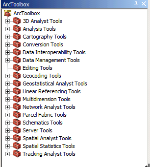
40 Collect Your Own Data Global positioning system (GPS) devices are available for checkout from the Rotch Library circulation desk. Courtesy of Nachoman-au on Wikipedia at _System#/media/File:Magellan_GPS_Blazer12.jpg. License CC BY
41 Data Sources Data from different sources, covering the same area, can look very different. Evaluate scale, accuracy, and file size when selecting data for a project. The yellow line is the coastline from the US Census state boundary file. Blue is the coastline from MassGIS. 41
42 Metadata Information about the data layer Read the metadata to determine who created the data, when it was created, what the codes in the table mean, if there are constraints on how it can be used, etc. You can find metadata: Downloaded with your data layers On the website where you got your data Sometimes you may need to contact the data provider to get metadata Metadata is most commonly in html/xml format, text files, or in a table format, such as excel or csv. 42
43 Metadata 43
44 Metadata 44
45 What software can I use? 45
46 ESRI ArcGIS: ArcMap Provides the most tools for processing data, analysis, and creating maps Comprehensive support through our academic license 46
47 ArcToolbox 47
48 ESRI ArcGIS: ArcCatalog Manage files and folders Create new shapefiles and geodatabases Preview files View metadata in format of choice Create metadata so your data can be understood and shared with others Save metadata files as XML, TXT, HTML, or SGML 48
49 Open Source Software The source code is made available under a license that allows the modification and redistribution of the software at will. For a more in-depth definition, visit the Open Source Initiative: opensource.org/docs/definition.php 49
50 QGIS 50
51 Data Management Tips 51
52 Data Management Tips GIS projects tend to generate many files, which are generally large in size. For file naming: Use file names that represent the file (default names like Export_Output are not helpful if you need to come back to your project later). Some software programs and tools may have file name constraints (e.g. an eight character limit without spaces). Watch out for this with ESRI ArcToolbox. Backup Your Data! 52
53 Data Management Tips Keep detailed notes about: Data sources Licensing constraints Data processing steps (ModelBuilder creates visuals of your procedure) What is stored where The GIS project maintains links to the individual data files (the data is not embedded in the map document itself) GIS formats, like shapefile (SHP), have many files that are linked together and must stay together in order to function Descriptions of the files you create and use (ArcCatalog has built-in tools for creating and editing metadata) 53
54 Exercise Overview Navigating the software interface Finding and adding data, including basemaps Accessing attribute information Symbolizing your data layers Selecting data by attribute and spatial location Creating new GIS data Designing a simple map 54
55 MIT OpenCourseWare RES.STR-001 Geographic Information System (GIS)Tutorial January IAP 2016 For information about citing these materials or our Terms of Use, visit:
Cookbook 23 September 2013 GIS Analysis Part 1 - A GIS is NOT a Map!
 Cookbook 23 September 2013 GIS Analysis Part 1 - A GIS is NOT a Map! Overview 1. A GIS is NOT a Map! 2. How does a GIS handle its data? Data Formats! GARP 0344 (Fall 2013) Page 1 Dr. Carsten Braun 1) A
INTRODUCTION TO ARCGIS SOFTWARE
 INTRODUCTION TO ARCGIS SOFTWARE I. History of Software Development a. Developer ESRI - Environmental Systems Research Institute, Inc., in 1969 as a privately held consulting firm that specialized in landuse
Introduction to GIS (Basics, Data, Analysis) & Case Studies. 13 th May 2004. Content. What is GIS?
 & Case Studies. 13 th May 2004. Content. What is GIS?") Introduction to GIS (Basics, Data, Analysis) & Case Studies 13 th May 2004 Content Introduction to GIS Data concepts Data input Analysis Applications selected examples What is GIS? Geographic Information
Introduction to GIS (Basics, Data, Analysis) & Case Studies 13 th May 2004 Content Introduction to GIS Data concepts Data input Analysis Applications selected examples What is GIS? Geographic Information
Institute of Natural Resources Departament of General Geology and Land use planning Work with a MAPS
 Institute of Natural Resources Departament of General Geology and Land use planning Work with a MAPS Lecturers: Berchuk V.Y. Gutareva N.Y. Contents: 1. Qgis; 2. General information; 3. Qgis desktop; 4.
GEOGRAPHIC INFORMATION SYSTEMS Lecture 20: Adding and Creating Data
 Adding Existing Data Into ArcGIS - there are many different ways to get data into ArcGIS GEOGRAPHIC INFORMATION SYSTEMS Lecture 20: Adding and Creating Data Add Data - normally we use the Add Data button
A GIS helps you answer questions and solve problems by looking at your data in a way that is quickly understood and easily shared.
 A Geographic Information System (GIS) integrates hardware, software, and data for capturing, managing, analyzing, and displaying all forms of geographically referenced information. GIS allows us to view,
ANALYSIS 3 - RASTER What kinds of analysis can we do with GIS?
 ANALYSIS 3 - RASTER What kinds of analysis can we do with GIS? 1. Measurements 2. Layer statistics 3. Queries 4. Buffering (vector); Proximity (raster) 5. Filtering (raster) 6. Map overlay (layer on layer
The Courses. Covering complete breadth of GIS technology from ESRI including ArcGIS, ArcGIS Server and ArcGIS Engine.
 ESRI India: Corporate profile ESRI India A profile India s Premier GIS Company Strategic alliance between ESRI Inc. and NIIT Technologies Adjudged as India s Best GIS Solutions Company - Map India 2001
WFP Liberia Country Office
 1 Oscar Gobbato oscar.gobbato@wfp.org oscar.gobbato@libero.it WFP Liberia Country Office GIS training - Summary Objectives 1 To introduce to participants the basic concepts and techniques in using Geographic
INSTRUCTIONS FOR MAKING 3D,.DWG CONTOUR LINES
 INSTRUCTIONS FOR MAKING 3D,.DWG CONTOUR LINES A TUTORIAL FROM SPATIAL AND NUMERIC DATA SERVICES NICOLE SCHOLTZ AND GEOFF IVERSON Overview... 2 A. Get a Digital Elevation Model (DEM)... 3 B. Open ArcMap,
Syllabus AGET 782. GIS for Agricultural and Natural Resources Management
 Syllabus AGET 782 Course Title: GIS for Agricultural and Natural Resources Management Course Abbreviation: AGET 782 Course Credits: Instructor: Course Description: Required Text: 3 hours Timothy N. Burcham,
A Method Using ArcMap to Create a Hydrologically conditioned Digital Elevation Model
 A Method Using ArcMap to Create a Hydrologically conditioned Digital Elevation Model High resolution topography derived from LiDAR data is becoming more readily available. This new data source of topography
Tutorial 8 Raster Data Analysis
 Objectives Tutorial 8 Raster Data Analysis This tutorial is designed to introduce you to a basic set of raster-based analyses including: 1. Displaying Digital Elevation Model (DEM) 2. Slope calculations
Raster: The Other GIS Data
 04-Raster_Tutorial_Arcgis_93.Doc Page 1 of 11 Raster: The Other GIS Data Objectives Understand the raster format and how it is used to model continuous geographic phenomena Understand how projections &
University of Arkansas Libraries ArcGIS Desktop Tutorial. Section 4: Preparing Data for Analysis
 : Preparing Data for Analysis When a user acquires a particular data set of interest, it is rarely in the exact form that is needed during analysis. This tutorial describes how to change the data to make
Oklahoma s Open Source Spatial Data Clearinghouse: OKMaps
 Oklahoma s Open Source Spatial Data Clearinghouse: OKMaps Presented by: Mike Sharp State Geographic Information Coordinator Oklahoma Office of Geographic Information MAGIC 2014 Symposium April 28-May1,
Online Digitizing and Editing of GIS Layers (On-Screen or Head s Up Digitizing)
") Online Digitizing and Editing of GIS Layers (On-Screen or Head s Up Digitizing) 2011 Charlie Schweik, Alexander Stepanov, Maria Fernandez, Lara Aniskoff Note: This work is licensed under the Creative Commons
Online Digitizing and Editing of GIS Layers (On-Screen or Head s Up Digitizing) 2011 Charlie Schweik, Alexander Stepanov, Maria Fernandez, Lara Aniskoff Note: This work is licensed under the Creative Commons
Chapter 6: Data Acquisition Methods, Procedures, and Issues
 Chapter 6: Data Acquisition Methods, Procedures, and Issues In this Exercise: Data Acquisition Downloading Geographic Data Accessing Data Via Web Map Service Using Data from a Text File or Spreadsheet
There are various ways to find data using the Hennepin County GIS Open Data site:
 Finding Data There are various ways to find data using the Hennepin County GIS Open Data site: Type in a subject or keyword in the search bar at the top of the page and press the Enter key or click the
Finding GIS Data and Preparing it for Use
 Finding_Data_Tutorial.Doc Page 1 of 19 Getting Ready for the Tutorial Sign Up for the GIS-L Listserv Finding GIS Data and Preparing it for Use The Yale University GIS-L Listserv is an internal University
Raster to Vector Conversion for Overlay Analysis
 Raster to Vector Conversion for Overlay Analysis In some cases, it may be necessary to perform vector-based analyses on a raster data set, or vice versa. The types of analyses that can be performed on
Understanding Raster Data
 Introduction The following document is intended to provide a basic understanding of raster data. Raster data layers (commonly referred to as grids) are the essential data layers used in all tools developed
Government 1009: Advanced Geographical Information Systems Workshop. LAB EXERCISE 3b: Network
 Government 1009: Advanced Geographical Information Systems Workshop LAB EXERCISE 3b: Network Objective: Using the Network Analyst in ArcGIS Implementing a network functionality as a model In this exercise,
Under GIS Data select Hydrography This will show all of the state-wide options for hydrography data. For this project, we want the seventh entry in
 Introductory Exercises for GIS Using ArcMap & ArcCatalog GIS Cyberinfrastructure Module EEB 5894, section 10 Please refer to the ESRI online GIS Dictionary for additional details on any of the terms in
How to georectify an image in ArcMap 10
 How to georectify an image in ArcMap 10 The University Library has a large collection of historical aerial photos for some North Carolina Counties ( http://www.lib.unc.edu/reference/gis/usda/index.html
Geographic Information Systems. ASM 215 Feb 2013 Larry Theller
 Geographic Information Systems ASM 215 Feb 2013 Larry Theller Schedule Wednesday GIS lecture Disc of homework Lab Thursday GPS Feb 28 Lab ABE 105 or 116 computer labs GIS Lecture today History Software
A Brief Explanation of Basic Web Services
 A Brief Explanation of Basic Web Services What is REST? REpresentational State Transfer (REST) is a way for software to work when distributed across a network. For example, if I want to view the Iowa Dept
Geography 3251: Mountain Geography Assignment III: Natural hazards A Case Study of the 1980s Mt. St. Helens Eruption
 Name: Geography 3251: Mountain Geography Assignment III: Natural hazards A Case Study of the 1980s Mt. St. Helens Eruption Learning Objectives: Assigned: May 30, 2012 Due: June 1, 2012 @ 9 AM 1. Learn
What do I do first in ArcView 8.x? When the program starts Select from the Dialog box: A new empty map
 www.library.carleton.ca/find/gis Introduction Introduction to Georeferenced Images using ArcGIS Georeferenced images such as aerial photographs or satellite images can be used in many ways in both GIS
Data source, type, and file naming convention
 Exercise 1: Basic visualization of LiDAR Digital Elevation Models using ArcGIS Introduction This exercise covers activities associated with basic visualization of LiDAR Digital Elevation Models using ArcGIS.
GIS: Geographic Information Systems A short introduction
 GIS: Geographic Information Systems A short introduction Outline The Center for Digital Scholarship What is GIS? Data types GIS software and analysis Campus GIS resources Center for Digital Scholarship
Converting GIS Datasets into CAD Format
 Ball State University Libraries GIS Research and Map Collection Converting GIS Datasets into CAD Format Author: Angela Gibson, 6/13/2014 Overview: One of the most common requests from students is for GIS
Spatial Adjustment Tools: The Tutorial
 Spatial Adjustment Tools: The Tutorial By Peter Kasianchuk, ESRI Educational Services In this exercise, you will perform some spatial adjustment and data management operations data to be used in analysis
Remote Sensing, GPS and GIS Technique to Produce a Bathymetric Map
 Remote Sensing, GPS and GIS Technique to Produce a Bathymetric Map Mark Schnur EES 5053 Remote Sensing Fall 2007 University of Texas at San Antonio, Department of Earth and Environmental Science, San Antonio,
GIS EXAM #2 QUERIES. Attribute queries only looks at the records in the attribute tables to some kind of
 GIS EXAM #2 QUERIES - Queries extracts particular records from a table or feature class for use; - Queries are an essential aspect of GIS analysis, and allows us to interrogate a dataset and look for patterns;
GIS 101 - Introduction to Geographic Information Systems Last Revision or Approval Date - 9/8/2011
 Page 1 of 10 GIS 101 - Introduction to Geographic Information Systems Last Revision or Approval Date - 9/8/2011 College of the Canyons SECTION A 1. Division: Mathematics and Science 2. Department: Earth,
GIS Data in ArcGIS. Pay Attention to Data!!!
 GIS Data in ArcGIS Pay Attention to Data!!! 1 GIS Data Models Vector Points, lines, polygons, multi-part, multi-patch Composite & secondary features Regions, dynamic segmentation (routes) Raster Grids,
What is GIS? Geographic Information Systems. Introduction to ArcGIS. GIS Maps Contain Layers. What Can You Do With GIS? Layers Can Contain Features
 What is GIS? Geographic Information Systems Introduction to ArcGIS A database system in which the organizing principle is explicitly SPATIAL For CPSC 178 Visualization: Data, Pixels, and Ideas. What Can
Introduction to the ArcGIS Data Model and Application Structure
 Introduction to the ArcGIS Data Model and Application Structure RNR/GEOG 417/517 Lab 6 Presentation Overview The georelational data model Structure of ArcGIS software Structure of an ArcGIS workspace Demonstrations/previews
Spatial Analyst Tutorial
 Copyright 1995-2010 Esri All rights reserved. Table of Contents About the ArcGIS Spatial Analyst Tutorial......................... 3 Exercise 1: Preparing for analysis............................ 5 Exercise
Quick and Easy Web Maps with Google Fusion Tables. SCO Technical Paper
 Quick and Easy Web Maps with Google Fusion Tables SCO Technical Paper Version History Version Date Notes Author/Contact 1.0 July, 2011 Initial document created. Howard Veregin 1.1 Dec., 2011 Updated to
WHAT IS GIS - AN INRODUCTION
 WHAT IS GIS - AN INRODUCTION GIS DEFINITION GIS is an acronym for: Geographic Information Systems Geographic This term is used because GIS tend to deal primarily with geographic or spatial features. Information
GEOGRAPHIC INFORMATION SYSTEMS CERTIFICATION
 GEOGRAPHIC INFORMATION SYSTEMS CERTIFICATION GIS Syllabus - Version 1.2 January 2007 Copyright AICA-CEPIS 2009 1 Version 1 January 2007 GIS Certification Programme 1. Target The GIS certification is aimed
Creating a File Geodatabase
 Creating a File Geodatabase Updated by Thomas Stieve January 06, 2012 This exercise demonstrates how to create a file geodatabase in ArcGIS 10; how to import existing data into the geodatabase, and how
Create a folder on your network drive called DEM. This is where data for the first part of this lesson will be stored.
 In this lesson you will create a Digital Elevation Model (DEM). A DEM is a gridded array of elevations. In its raw form it is an ASCII, or text, file. First, you will interpolate elevations on a topographic
ArcGIS online Introduction... 2. Module 1: How to create a basic map on ArcGIS online... 3. Creating a public account with ArcGIS online...
 Table of Contents ArcGIS online Introduction... 2 Module 1: How to create a basic map on ArcGIS online... 3 Creating a public account with ArcGIS online... 3 Opening a Map, Adding a Basemap and then Saving
ArcFuels Supplemental Material: GIS 9.x Tips and Tricks
 ArcFuels Supplemental Material: GIS 9.x Tips and Tricks Supplemental material: GIS Tips and Tricks... 1 Shapefiles: Points, Lines, and Polygons... 2 Creating a New Shapefile (point, line, or polygon)...
Lecture 3: Models of Spatial Information
 Lecture 3: Models of Spatial Information Introduction In the last lecture we discussed issues of cartography, particularly abstraction of real world objects into points, lines, and areas for use in maps.
Geocoding and Buffering Addresses in ArcGIS
 INTRODUCTION and Buffering Addresses in ArcGIS is the process of assigning location coordinates in a continuous, globlal reference system (Latitude and Longitude, for instance) to street addresses. While
Using GIS to Develop a Control Map and Database
 PENN STATE UNIVERSITY Using GIS to Develop a Control Map and Database SUR-351 Geodetic Models Brian E. Halchak & Rich Cebrick 12/2/2013 Table of Contents Abstract... 2 What is a GIS?... 2 Development of
Lecture 8. Online GIS
 Lecture 8 Online GIS Lecture 8: Outline I. Online GIS 1. Google Earth 2. MSN Live Maps II. Open Source GIS III. ArcGIS Server and the ESRI suite of online software utility options IV. Advanced Data Mining
Activity: Using ArcGIS Explorer
 Activity: Using ArcGIS Explorer Requirements You must have ArcGIS Explorer for this activity. Preparation: Download ArcGIS Explorer. The link below will bring you to the ESRI ArcGIS Explorer download page.
Government 1008: Introduction to Geographic Information Systems. LAB EXERCISE 4: Got Database?
 Government 1008: Introduction to Geographic Information Systems Objectives: Creating geodatabases Joining attribute tables Attribute and location based queries Spatial joins Creating spatial and attribute
GIS Architecture and Data Management Practices Boone County GIS Created and Maintained by the Boone County Planning Commission GIS Services Division
 GIS Architecture and Data Management Practices Boone County GIS Created and Maintained by the Boone County Planning Commission June 2008 Background Boone County s GIS program has been in existence for
Spatial Database Support
 Page 1 of 11 Spatial Database Support Global Mapper can import vector data from and export vector data to the following spatial databases: Esri ArcSDE Geodatabase Esri File Geodatabase Esri Personal Geodatabases
What is GIS. What is GIS? University of Tsukuba. What do you image of GIS? Copyright(C) ESRI Japan Corporation. All rights reserved.
 ESRI Japan Corporation. All rights reserved.") What is GIS University of Tsukuba Graduate School of Life and Environmental Science April 21 st, 2011 What is GIS? What do you image of GIS? Gas Insulated Switch Groupe Interventional Speciale Geographic
What is GIS University of Tsukuba Graduate School of Life and Environmental Science April 21 st, 2011 What is GIS? What do you image of GIS? Gas Insulated Switch Groupe Interventional Speciale Geographic
GIS I Business Exr02 (av 9-10) - Expand Market Share (v3b, Jul 2013)
 - Expand Market Share (v3b, Jul 2013)") GIS I Business Exr02 (av 9-10) - Expand Market Share (v3b, Jul 2013) Learning Objectives: Reinforce information literacy skills Reinforce database manipulation / querying skills Reinforce joining and mapping
GIS I Business Exr02 (av 9-10) - Expand Market Share (v3b, Jul 2013) Learning Objectives: Reinforce information literacy skills Reinforce database manipulation / querying skills Reinforce joining and mapping
Personal Geodatabase 101
 Personal Geodatabase 101 There are a variety of file formats that can be used within the ArcGIS software. Two file formats, the shape file and the personal geodatabase were designed to hold geographic
How to Download Census Data from American Factfinder and Display it in ArcMap
 How to Download Census Data from American Factfinder and Display it in ArcMap Factfinder provides census and ACS (American Community Survey) data that can be downloaded in a tabular format and joined with
ES341 Overview of key file formats and file extensions in ArcGIS
 ES341 Overview of key file formats and file extensions in ArcGIS Commonly Encountered File Types/Extensions in ArcGIS.mxd A file containing a map, its layers, display information, and other elements used
INTRODUCTION to ESRI ARCGIS For Visualization, CPSC 178
 INTRODUCTION to ESRI ARCGIS For Visualization, CPSC 178 1) Navigate to the C:/temp folder 2) Make a directory using your initials. 3) Use your web browser to navigate to www.library.yale.edu/mapcoll/ and
Data Integration for ArcGIS Users Data Interoperability. Charmel Menzel, ESRI Don Murray, Safe Software
 Data Integration for ArcGIS Users Data Interoperability Charmel Menzel, ESRI Don Murray, Safe Software Product overview Extension to ArcGIS (optional) Jointly developed with Safe Software Based on Feature
HELCOM Data and Map Service. User Manual
 HELCOM Data and Map Service User Manual Version 2.2 - February 2015 1 Table of contents 1. General Information... 3 1.1 Background... 3 1.2 Technical requirements... 3 1.3 Contact... 3 2. Accessing HELCOM
Groundwater Chemistry
 Mapping and Modeling Groundwater Chemistry By importing Excel spreadsheets into ArcGIS 9.2 By Mike Price, Entrada/San Juan, Inc. In ArcGIS 9.2, Microsoft Excel spreadsheet data can be imported and used
Effects of Florida Under a 10 Meter Sea Level Rise
 Effects of Florida Under a 10 Meter Sea Level Rise Chance B. Murray Dec. 7 2009 I. Goal Assess the effects a 10 meter sea level rise would have on Florida. Mission: Determine the length of Florida s coastline
Geographic Information Systems Training Module I through 4
 Geographic Information Systems Training Module I through 4 ARC GIS 10.x Geographic Information Systems and GPS Training Guide Developed by Stephen P. Menard Jr, USAID/Malawi Program Officer - Original
Quick Start Guide to. ArcGISSM. Online
 Quick Start Guide to ArcGISSM Online ArcGIS Online Quick Start Guide ArcGIS SM Online is a cloud-based mapping platform for organizations. Users get access to dynamic, authoritative content to create,
Guide to Viewing Maps in Google Earth
 Guide to Viewing Maps in Google Earth The BCT made the decision to provide the GIS (Geographic Information System) resources for Bat Groups in the form of Google Earth maps because they do not require
GIS Procedural Guide Geocoding / Address Matching in ArcGIS Created by Steve Zuppa, Map Library Assistant - Serge A. Sauer Map Library, 2008
 GIS Procedural Guide Geocoding / Address Matching in ArcGIS Created by Steve Zuppa, Map Library Assistant - Serge A. Sauer Map Library, 2008 Introduction In a traditional business database, street addresses
Practical, Easy-to-Use, Free GIS and Remote Sensing Tools for Resource Management
 Practical, Easy-to-Use, Free GIS and Remote Sensing Tools for Resource Management Andrew Lister Research Forester 11 Campus Blvd, Ste. 200 Newtown Square, PA 19073 alister@fs.fed.us Abstract: Geographic
How To Hydrologically Condition A Digital Dam
 Program: Funding: Conservation Applications of LiDAR Data http://tsp.umn.edu/lidar Environment and Natural Resources Trust Fund Module: Instructor: Hydrologic Applications Sean Vaughn, DNR GIS Hydrologist
1. Launch ArcCatalog, then navigate to the following location using the directory tree on the left side of the screen:
 Vector Data Analysis I: Buffering Today we will use ArcMap and ArcToolbox to manipulate vector-based geographic data. The results of these simple analyses will allow us to visualize complex spatial relationships.
GIS Spatial Data Standards
 GIS Spatial Data Standards Manatee County, FL GIS Section, Information Services Department TABLE OF CONTENTS I. Introduction 2 A. Purpose 2 B. Reference 2 II. Spatial Reference Information 2 A. Projection:
Community Health Maps Lab Series:
 Community Health Maps Lab Series: Lab 6 Data Visualization With CartoDB Objective: Understand How To Use CartoDB To Create an Online Visualization of Your Data Document Version: 2015-09-15 (V2) This course
Introduction to Imagery and Raster Data in ArcGIS
 Esri International User Conference San Diego, California Technical Workshops July 25, 2012 Introduction to Imagery and Raster Data in ArcGIS Simon Woo slides Cody Benkelman - demos Overview of Presentation
Insight for location-powered decision making.
 Location Intelligence Geographic Information Systems MapInfo Pro Insight for location-powered decision making. Data drives our decisions every day. Blend this data with geography and you can visualise
Using CAD Data in ArcGIS
 Esri International User Conference San Diego, California Technical Workshops July 27, 2012 Using CAD Data in ArcGIS Jeff Reinhart & Phil Sanchez Agenda Overview of ArcGIS CAD Support Using CAD Datasets
Step by Step Guide for GIS Cloud Applications
 Step by Step Guide for GIS Cloud Applications All in one manual for: Map Editor Map Viewer Asset Data Collection and Management Fleet Management Roadwork Management and Coordination Mobile Data Collection
Bentley ArcGIS. Connector
 Bentley ArcGIS Connector Introduction ESRI, as a GIS software products company, and Bentley Systems, Incorporated, as a developer of solutions for architecture/engineering/construction (AEC) professionals,
ArcGIS. Image Server tutorial
 ArcGIS 9 ArcGIS Image Server tutorial Copyright 2006, 2007, and 2008 Zanja Technologies, Inc. All rights reserved. The information contained in this work is the property of Zanja Technologies, Inc., under
Raster Data Structures
 Raster Data Structures Tessellation of Geographical Space Geographical space can be tessellated into sets of connected discrete units, which completely cover a flat surface. The units can be in any reasonable
GEOGRAPHIC INFORMATION GATEWAY New York Department of State (NYDOS) data acceptance & metadata standards
 data acceptance & metadata standards") GEOGRAPHIC INFORMATION GATEWAY New York Department of State (NYDOS) data acceptance & metadata standards 1. DATA ACCEPTANCE STANDARDS The following describes the data acceptance standards for data included
GEOGRAPHIC INFORMATION GATEWAY New York Department of State (NYDOS) data acceptance & metadata standards 1. DATA ACCEPTANCE STANDARDS The following describes the data acceptance standards for data included
Government 98dn Mapping Social and Environmental Space
 Government 98dn Mapping Social and Environmental Space LAB EXERCISE 5: The Analysis of Fields Objectives of this lab: Visualizing raster data Using Spatial Analyst functions to create new data Analysis
Geographic Information Systems (GIS) @ GIS at UCSD. Here to help you explore our world
 @ GIS at UCSD. Here to help you explore our world") Geographic Information Systems (GIS) @ GIS at UCSD Here to help you explore our world GIS at UCSD what it is and what it means to you Tracey Hughes UCSD GIS Coordinator 2006 Image from Google Earth An
Geographic Information Systems (GIS) @ GIS at UCSD Here to help you explore our world GIS at UCSD what it is and what it means to you Tracey Hughes UCSD GIS Coordinator 2006 Image from Google Earth An
GIS. Digital Humanities Boot Camp Series
 GIS Digital Humanities Boot Camp Series GIS Fundamentals GIS Fundamentals Definition of GIS A geographic information system (GIS) is used to describe and characterize spatial data for the purpose of visualizing
Kodiak Island Borough GIS Online Tools
 Kodiak Island Borough GIS Online Tools The Kodiak Island Borough website is located at http://www.kodiakak.us/ You can access the GIS resources by clicking on the MAP CENTER icon in the middle of the page,
Clinton County GIS Program
 Clinton County GIS Program The Clinton County GIS Program consists of several unique means of disseminating GIS and related data. Joe Merritt, County GIS Manager 1 Clinton County GIS Program 2 What? Google
Getting Started with ArcGIS
 Getting Started with ArcGIS Bob Booth and Andy Mitchell GIS by ESRI Copyright 1999 2001 ESRI. All rights reserved. Printed in the United States of America. The information contained in this document is
Publishing geospatial data to the web using the EEA infrastructure
 Publishing geospatial data to the web using the EEA infrastructure *Note: Map Services should be published using the EEA Map Services Tick Sheet for guidance. Contact Sebastien Petit (Sebastien.Petit@eea.europa.eu)
GIS Beyond the Basics: Web Maps and File Sharing Services
 GIS Beyond the Basics: Web Maps and File Sharing Services by Julie Coco, PE I. INTRODUCING WEB-BASED GIS SERVICES A GIS service, or Geoservice, provides a way to retrieve maps, images, or geoprocessing
Working with Digital Elevation Models and Digital Terrain Models in ArcMap 9
 Working with Digital Elevation Models and Digital Terrain Models in ArcMap 9 1 TABLE OF CONTENTS INTRODUCTION...3 WORKING WITH DIGITAL TERRAIN MODEL (DTM) DATA FROM NRVIS, CITY OF KITCHENER, AND CITY OF
Advanced Image Management using the Mosaic Dataset
 Esri International User Conference San Diego, California Technical Workshops July 25, 2012 Advanced Image Management using the Mosaic Dataset Vinay Viswambharan, Mike Muller Agenda ArcGIS Image Management
Files Used in this Tutorial
 Generate Point Clouds Tutorial This tutorial shows how to generate point clouds from IKONOS satellite stereo imagery. You will view the point clouds in the ENVI LiDAR Viewer. The estimated time to complete
MrSID Plug-in for 3D Analyst
 LizardTech MrSID Plug-in for 3D Analyst User Manual Copyrights Copyright 2009 2010 LizardTech. All rights reserved. Information in this document is subject to change without notice. The software described
Cookbook for Importing Point Information into a Polygon Shapefile using ArcGIS9
 Cookbook for Importing Point Information into a Polygon Shapefile using ArcGIS9 I. Create a Master polygon shapefile. In addition to the FID field this shapefile must have a field containing a unique ID
Implementing GIS in Optical Fiber. Communication
 KING FAHD UNIVERSITY OF PETROLEUM AND MINERALS COLLEGE OF ENVIRONMENTAL DESIGN CITY & RIGINAL PLANNING DEPARTMENT TERM ROJECT Implementing GIS in Optical Fiber Communication By Ahmed Saeed Bagazi ID# 201102590
WEB MAPPING TOOL DOCUMENTATION
 ENTERPRISE ZONES RE DESIGNATION WEB MAPPING TOOL DOCUMENTATION January 26, 2015 COVER PAGE TABLE OF CONTENTS INTRODUCTION 1 APPLICATION LAYOUT 2 WEB MAP NAVIGATION 3 LOCATION SEARCH 4 MAP LEGEND 5 BASEMAP
GEOGRAPHIC INFORMATION SOLUTIONS LTD. GPS Data Management & GIS Course
 GEOGRAPHIC INFORMATION SOLUTIONS LTD GPS Data Management & GIS Course 4th Floor-Outbox, Soliz House, Plot 23, Lumumba Avenue, Nakasero, Kampala Uganda. Mobile: +256 778 082 563/+256 712 593 775 Email:
Downloading SSURGO Soil Data from Internet
 Downloading SSURGO Soil Data from Internet Prepared by Venkatesh Merwade School of Civil Engineering, Purdue University vmerwade@purdue.edu September 2012 Purpose The purpose of this exercise to demonstrate
Earthquakes, volcanoes and plate tectonics in ArcGIS Online
 Earthquakes, volcanoes and plate tectonics in ArcGIS Online For non-commercial use only by schools and universities Copyright Esri UK GIS Esri for School UK Ltd Programme 2014 www.esriuk.com/schools Earthquakes,