TerraLib as an Open Source Platform for Public Health Applications. Karine Reis Ferreira
|
|
|
- Fay Gaines
- 8 years ago
- Views:
Transcription
1 TerraLib as an Open Source Platform for Public Health Applications Karine Reis Ferreira September 2008

2 INPE National Institute for Space Research Brazilian research institute Main campus is located in São José dos Campos in São Paulo state 1,600 employees 6 graduate courses

3 INPE National Institute for Space Research Some researches and services: CBERS China-Brazil Earth Resources Satellite Weather Forecast and Climate Studies PRODES: Monitoring of Amazon Deforestation PROARCO: Fire Monitoring Free geo softwares CBERS 2B

4 DPI Image Processing Division History developing geographical softwares Free GIS Geographical files and DBMS Desktop and Multiplatform Image Processing, Spatial Analysis, Edition, downloads Free and Open Source Geographical Software Library (TerraLib) and Geographical Application (TerraView) Spatial DBMS Client-Server and Multiplatform now
 and")

5 TerraLib Library to develop geographical applications C++ language Free and Open Source LGPL Extensive use DBMS MySQL, PostGIS Oracle, Oracle Spatial, SQLServer Spatial operations, image processing, spatial analysis,...

6 TerraLib web site (

7 TerraLib OGC Web Service support Environmental Modeling support

8 TerraView Geographical application built using TerraLib Is an example of: how to build a geographical application using TerraLib what you can do using this library Free and Open Source LGPL

9 TerraView Set of graphical interfaces (QT toolkit) that use the TerraLib functionalities.

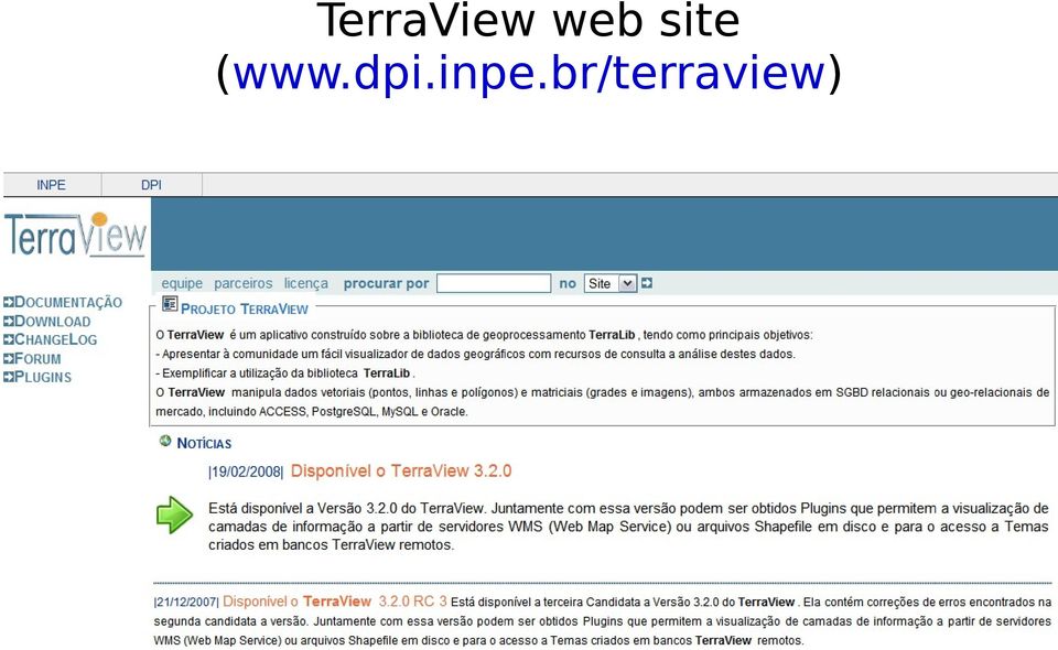
10 TerraView web site (
11 TerraView Plug-ins Add new graphical interfaces and functionalities to TerraView and customize it through plug-ins Plug-ins menu Ex.: Mosaic Images Plug-in

12 Brazilian Public Health Problems Aedes aegypti mosquito Endemic Diseases Dengue Fever Malaria Leptospirosis Anopheles mosquito Cases in Brazil Infected Died year Dengue Fever 559, Malaria 457, Leptospirosis 2, [Source: Ministry of Health, 2008]

13 Brazilian Public Health Problems Violence Total rate: 27 homicides per inhabitants per year 30 or 40 times higher than that of England, France, Austria and Japan [Source: Julio Jacobo Waiselfisz, 2007] Homicide rates 2002/2004

14 Applications for Public Health Software tools able to: detect epidemic outbreaks and spatio-temporal clusters model and identify risk and protection factors in endemic and epidemic moments integrate environmental information, risk factor detection, and warning methods

15 TerraLib Solutions for Public Health Projects networking health institutes, universities and government department: Join specialists from different areas Examples: SAUDAVEL and EUREQA Free and open source tools Built using TerraLib library Examples: TerraStat, TerraCrime, art and TerraCluster plug-ins

16 SAUDAVEL Project A Surveillance System to control, alert and intervene epidemic and endemic diseases, like Dengue Fever and Leptospirosis.

17 SAUDAVEL Project Central experiment: Monitoring Dengue Fever in Recife city, based on egg traps for Aedes aegypti and Aedes albopictus mosquito. 100 georeferenced egg traps in each site.

18 EUREQA Project Goal: Explore bacterial infections and resistance dynamics and their spatio-temporal correlations with antimicrobial usage density.

19 EUREQA Project Case study: community urinary tract infections (cutis) caused by Escherichia coli bacteria in São Paulo city.

20 TerraStat A library with spatial statistic functions: Moran Index, Local Mean,... Kernel Map and Kernel Ratio Map Skater Semivariogram Empirical Bayes Developed by LESTE and INPE Distributed with TerraLib

21 TerraCrime A surveillance system to control and alert crime occurrences. CRISP + LESTE + INPE
22 art = R-TerraLib API Interface between the statistic software R and the geographical library TerraLib. R: language and environment for graphics and statistical analysis ( Developed by Laboratory of Statistics and GeoInformation (LEG) at Federal University of Paraná. Available at
23 art data TerraLib R packages - spatial statistics - geostatistics - global and local spatial patterns - analysis of point patterns statistics Spatial DBMS - Handle raster and vector data - Store and retrieve them from spatial DBMS - Geoprocessing algorithms, such as neighborhood construction
24 art = R-TerraLib API R package for information exchange GRASS, RarcInfo and art art: R package that encapsulates TerraLib concepts
25 TerraCluster An ongoing collaborative project INPE (National Institute for Space Research) LESTE (Spatial Statistics Laboratory at Federal University of Minas Gerais) SVC (Secretary of Health Surveillance) 25 TerraView plug-ins for: Spatial temporal cluster detection Analyses of point patterns Rate estimation
26 TerraCluster: Grimson plug-in A method to detect if objects with high risk are randomly distributed in space Cases of meningitis in Belo Horizonte city.
27 TerraCluster: Spatial Scan plug-in A method to detect to detect spatial cluster Deaths caused by esophagus cancer in Parana state.
28 TerraCluster: Shiryayev-Roberts Surveillance System plug-in A method to detect and alert spatio-temporal clusters based on events Cases of meningitis in Belo Horizonte city.
29 TerraCluster Download plug-ins at: Some references about implemented methods: Grimson, R.C. (1989) Assessing patterns of epidemiological events in spacetime. In Proceedings of the 1989 Public Health Conference on Records and Statistics. Hyattsville, MD: National Center for Health Statistics. Assunção, R., Costa, M., Tavares, A. and Ferreira, S. (2006) Fast detection of arbitrarily shaped disease clusters. Statistics in Medicine, 25, Correa, T.R. and Assunção, R.M. (2007) Shiryayev-Roberts Method to Detect Space-Time Emerging Clusters. In: Davis, C.A Jr. and Monteiro, A.M.V. (eds.) Advances in GeoInformatics, Heidelberg: Springer,
30 Conclusion Projects networking researches from different areas + Open source tools for advanced spatio-temporal analyses, based on TerraLib Authors: Karine Reis Ferreira, Lúbia Vinhas, Antônio Miguel Vieira Monteiro, Gilberto Ribeiro Queiroz, Emiliano Ferreira Castejon, Juan Carlos Garrido, Lauro Tsutomu Hara, Pedro Ribeiro de Andrade Neto, Paulo Justiniano Ribeiro Junior and Renato Martins Assunção
31 Thank you! Karine Reis Ferreira home page:
TerraAmazon - The Amazon Deforestation Monitoring System - Karine Reis Ferreira
 TerraAmazon - The Amazon Deforestation Monitoring System - Karine Reis Ferreira GEOSS Users & Architecture Workshop XXIV: Water Security & Governance - Accra Ghana / October 2008 INPE National Institute
Geospatial Open Source Software As A Tool For Capacity Building. Lúbia Vinhas
 Geospatial Open Source Software As A Tool For Capacity Building Lúbia Vinhas Empowering people with geotechnology The white-box model: results = people + methods + software People Learning by doing x learning
A Hybrid Architecture for Mobile Geographical Data Acquisition and Validation Systems
 A Hybrid Architecture for Mobile Geographical Data Acquisition and Validation Systems Claudio Henrique Bogossian 1, Karine Reis Ferreira 1, Antônio Miguel Vieira Monteiro 1, Lúbia Vinhas 1 1 DPI Instituto
A Process and Environment for Embedding The R Software
 A Process and Environment for Embedding The R Software into TerraLib Pedro Ribeiro de Andrade Neto 1, Paulo Justiniano Ribeiro Junior 1 1 Laboratório de Estatística e Geoinformação (LEG) Statistics Department
INPE Spatial Data Infrastructure for Big Spatiotemporal Data Sets. Karine Reis Ferreira (INPE-Brazil)
") INPE Spatial Data Infrastructure for Big Spatiotemporal Data Sets Karine Reis Ferreira (INPE-Brazil) INPE (Brazil) and Big Data I work at INPE (Brazilian National Institute for Space Research). Main gate
INPE Spatial Data Infrastructure for Big Spatiotemporal Data Sets Karine Reis Ferreira (INPE-Brazil) INPE (Brazil) and Big Data I work at INPE (Brazilian National Institute for Space Research). Main gate
A RDF Vocabulary for Spatiotemporal Observation Data Sources
 A RDF Vocabulary for Spatiotemporal Observation Data Sources Karine Reis Ferreira 1, Diego Benincasa F. C. Almeida 1, Antônio Miguel Vieira Monteiro 1 1 DPI Instituto Nacional de Pesquisas Espaciais (INPE)
GEOPROCESSING TECHNOLOGIES AT DPI - INPE. SPRING TerraLib e Products Education Image Catalogs Conclusions
 GEOPROCESSING TECHNOLOGIES AT DPI - INPE SPRING TerraLib e Products Education Image Catalogs Conclusions SPRING Sistema de PRocessamento de INformações Georeferenciadas Introduction Image Processing Thematic
TerraLib: An Open Source GIS Library for Large-Scale Environmental and Socio-Economic Applications
 Chapter 12 TerraLib: An Open Source GIS Library for Large-Scale Environmental and Socio-Economic Applications Gilberto Câmara, Lúbia Vinhas, Karine Reis Ferreira, Gilberto Ribeiro de Queiroz, Ricardo Cartaxo
The Spatio-Temporal Database and Its Architecture
 The Architecture of a Flexible Querier for Spatio-Temporal Databases Karine Reis Ferreira, Lúbia Vinhas, Gilberto Ribeiro de Queiroz, Ricardo Cartaxo Modesto de Souza, Gilberto Câmara Divisão de Processamento
TerraLAB Using Free Software for Earth System Research and Free Software Development
 TerraLAB Using Free Software for Earth System Research and Free Software Development Tiago G. S. Carneiro 1, Tiago F. M. Lima 1,2, Sérgio D. Faria 3 1 TerraLAB Laboratório Associado INPE / UFOP para Modelagem
Integration of Statistics and Geographic Information Systems: the R/TerraLib case
 Integration of Statistics and Geographic Information Systems: the R/TerraLib case Pedro Ribeiro de Andrade Neto 1 Paulo Justiniano Ribeiro Junior 1 Karla Donato Fook 2,3 1 Laboratório de Estatística e
Big data analy+cs for global change monitoring and research in forestry and agriculture. Lubia Vinhas
 Big data analy+cs for global change monitoring and research in forestry and agriculture Lubia Vinhas Earth observa+on satellites and geosensor webs provide key informa+on about global change but that informa+on
VISUALIZING SPACE-TIME UNCERTAINTY OF DENGUE FEVER OUTBREAKS. Dr. Eric Delmelle Geography & Earth Sciences University of North Carolina at Charlotte
 VISUALIZING SPACE-TIME UNCERTAINTY OF DENGUE FEVER OUTBREAKS Dr. Eric Delmelle Geography & Earth Sciences University of North Carolina at Charlotte 2 Objectives Evaluate the impact of positional and temporal
CB OAT Implementation CB-09-05. Infrastructure Development and Technology Transfer for Information Access
 CB OAT Implementation CB-09-05 Infrastructure Development and Technology Transfer for Information Access Overarching Task Definition CB-09-05 Infrastructure Development and Technology Transfer for Information
Lesson 15 - Fill Cells Plugin
 15.1 Lesson 15 - Fill Cells Plugin This lesson presents the functionalities of the Fill Cells plugin. Fill Cells plugin allows the calculation of attribute values of tables associated with cell type layers.
What's new in gvsig Desktop 2.0
 What's new in gvsig Desktop 2.0 What are the novelties? 2.0 1.12 Migrating and building... Some examples... Please pardon our appearance during construction Pie and bar chart legends Table in layout 1.12
Jarbas Nunes Vidal Filho Curriculum Vitae
 Jarbas Nunes Vidal Filho Curriculum Vitae June/2014 Jarbas Nunes Vidal Filho Curriculum Vitae Personal data Name Gender Birth Jarbas Nunes Vidal Filho Masculine 31/07/1986 - Limoeiro Do Norte - Ceará -
Scientific Visualization of Occupation Data for Spatial Analysis of Animal Behavior Using OpenGL
 Scientific Visualization of Occupation Data for Spatial Analysis of Animal Behavior Using OpenGL ANDREI SANTOS andreisantoss@hotmail.com BERNARDO CORREA bernardocrfp@yahoo.com.br FELIPE FERREIRA faguimaraes@sga.pucminas.br
Analyzing temporal and spatial dynamics of deforestation in the Amazon: a case study in the Calha Norte region, State of Pará, Brazil
 Anais XV Simpósio Brasileiro de Sensoriamento Remoto - SBSR, Curitiba, PR, Brasil, 30 de abril a 05 de maio de 2011, INPE p.2756 Analyzing temporal and spatial dynamics of deforestation in the Amazon:
GIS Initiative: Developing an atmospheric data model for GIS. Olga Wilhelmi (ESIG), Jennifer Boehnert (RAP/ESIG) and Terri Betancourt (RAP)
, Jennifer Boehnert (RAP/ESIG) and Terri Betancourt (RAP)") GIS Initiative: Developing an atmospheric data model for GIS Olga Wilhelmi (ESIG), Jennifer Boehnert (RAP/ESIG) and Terri Betancourt (RAP) Unidata seminar August 30, 2004 Presentation Outline Overview
GIS Initiative: Developing an atmospheric data model for GIS Olga Wilhelmi (ESIG), Jennifer Boehnert (RAP/ESIG) and Terri Betancourt (RAP) Unidata seminar August 30, 2004 Presentation Outline Overview
Open-Source Geographic Information Systems Software: Myths and Realities
 30 Open-Source Geographic Information Systems Software: Myths and Realities Gilberto Câmara 1 and Harlan Onsrud 2 National Institute for Space Research, Brazil, and University of Maine, United States INTRODUCTION
DEVELOPMENT OF AN INTEGRATED IMAGE PROCESSING AND GIS SOFTWARE FOR THE REMOTE SENSING COMMUNITY. P.O. Box 515, São José dos Campos, Brazil.
 DEVELOPMENT OF AN INTEGRATED IMAGE PROCESSING AND GIS SOFTWARE FOR THE REMOTE SENSING COMMUNITY UBIRAJARA MOURA DE FREITAS 1, ANTÔNIO MIGUEL MONTEIRO 1, GILBERTO CÂMARA 1, RICARDO CARTAXO MODESTO SOUZA
Leveraging Cloud-Based Mapping Solutions
 Leveraging Cloud-Based Mapping Solutions GeoAlberta October 28, 2014 Laura Kerssens Safe Software Agenda To the Cloud Using Basic Services Cloud Applications Web Services Cloud-Hosted Databases Real-time
VISUALIZATION OF GEOSPATIAL DATA BY COMPONENT PLANES AND U-MATRIX
 VISUALIZATION OF GEOSPATIAL DATA BY COMPONENT PLANES AND U-MATRIX Marcos Aurélio Santos da Silva 1, Antônio Miguel Vieira Monteiro 2 and José Simeão Medeiros 2 1 Embrapa Tabuleiros Costeiros - Laboratory
Rail Brazil Tech Business Summit Location: Expo Center Norte November 5-7 2013 São Paulo
 Rail Brazil Tech Business Summit Location: Expo Center Norte November 5-7 2013 São Paulo Building a New Platform for Brazilian Rail Sector: Political Strategies, Technologies and Cost Reduction Solutions
3 rd COURSE: IMPLEMENTATION OF BIOLOGICAL CONTROL OF MOSQUITOES USING BACTERIAL BIOINSECTICIDES 22 25 September, 2003
 3 rd COURSE: IMPLEMENTATION OF BIOLOGICAL CONTROL OF MOSQUITOES USING BACTERIAL BIOINSECTICIDES 22 25 September, 2003 SATELLITE SYMPOSIUM: MOSQUITO VECTOR BORNE TROPICAL DISEASES AND BIOLOGICAL CONTROL
Date of Commencement: January, 2004 Duration: One Year Status: Ongoing. Objectives
 Development of a computer based Health Management Information System (HMIS) in Rajasthan using Geographical Information System- R. C. Sharma, Vinod Joshi and Manju Singhi Date of Commencement: January,
Continuous Interaction with TDK: Improving the User Experience in Terralib
 Continuous Interaction with TDK: Improving the User Experience in Terralib Marcelo Metello, Mário de Sá Vera, Melissa Lemos, Leone Pereira Masiero, Marcelo Tilio Monteiro de Carvalho Tecgraf Computer Graphics
NetSurv & Data Viewer
 NetSurv & Data Viewer Prototype space-time analysis and visualization software from TerraSeer Dunrie Greiling, TerraSeer Inc. TerraSeer Software sales BoundarySeer for boundary detection and analysis ClusterSeer
Institute of Natural Resources Departament of General Geology and Land use planning Work with a MAPS
 Institute of Natural Resources Departament of General Geology and Land use planning Work with a MAPS Lecturers: Berchuk V.Y. Gutareva N.Y. Contents: 1. Qgis; 2. General information; 3. Qgis desktop; 4.
APPLYING SATELLITE IMAGES CLASSIFICATION ALGORITHMS FOR SOIL COVER AND GEORESOURCES IDENTIFICATION IN NOVA LIMA, MINAS GERAIS - BRAZIL
 APPLYING SATELLITE IMAGES CLASSIFICATION ALGORITHMS FOR SOIL COVER AND GEORESOURCES IDENTIFICATION IN NOVA LIMA, MINAS GERAIS - BRAZIL Vladimir Diniz Vieira Ramos Universidade Federal de Minas Gerais Departamento
University of São Paulo School of Economics, Business Administration and Accounting at Ribeirão Preto
 University of São Paulo School of Economics, Business Administration and Accounting at Ribeirão Preto The University of São Paulo Praça do Relógio - Clock Square Established in January 25th, 1934; Public
Job description and selection criteria
 DEPARTMENT OF ZOOLOGY TINBERGEN BUILDING SOUTH PARKS ROAD OXFORD OX1 3PS Tel: 01865 271278 Job description and selection criteria Job title Division Department Location Grade and salary Hours Contract
THE EVOLUTION OF THE POPULATION- BASED CANCER REGISTRIES IN BRAZIL: A PERFORMANCE EVALUATION
 2nd International Cancer Control Congress November 25 to 28, 07 THE EVOLUTION OF THE POPULATION- BASED CANCER REGISTRIES IN BRAZIL: A PERFORMANCE EVALUATION Cláudio Pompeiano Noronha; Gulnar Azevedo Mendonça;
GIS: Geographic Information Systems A short introduction
 GIS: Geographic Information Systems A short introduction Outline The Center for Digital Scholarship What is GIS? Data types GIS software and analysis Campus GIS resources Center for Digital Scholarship
Ticket Categories available for 2014 FIFA World Cup
 1. Which Ticket Categories are offered by FIFA? There will be four price categories offered for the 2014 FIFA World Cup : - Category 1: This is the highest priced and located in prime areas within the
Spatial Data Analysis
 14 Spatial Data Analysis OVERVIEW This chapter is the first in a set of three dealing with geographic analysis and modeling methods. The chapter begins with a review of the relevant terms, and an outlines
Zika Virus. History of Zika virus
 Zika Virus Zika fever is caused by the Zika virus (ZIKV), an arthropod-borne virus (arbovirus). The Zika virus is a member of the Alphavirus genus in the family Togaviridae. It is related to dengue, yellow
A Web services solution for Work Management Operations. Venu Kanaparthy Dr. Charles O Hara, Ph. D. Abstract
 A Web services solution for Work Management Operations Venu Kanaparthy Dr. Charles O Hara, Ph. D Abstract The GeoResources Institute at Mississippi State University is leveraging Spatial Technologies and
Chapter Contents Page No
 Chapter Contents Page No Preface Acknowledgement 1 Basics of Remote Sensing 1 1.1. Introduction 1 1.2. Definition of Remote Sensing 1 1.3. Principles of Remote Sensing 1 1.4. Various Stages in Remote Sensing
Summary. Deforestation report for the Brazilian Amazon (February 2015) SAD
 SAD") Summary In February 2015, more than half (59%) of the forest area of the Brazilian Amazon was covered by clouds, a coverage lower than in February 2014 (69%). The States with the highest cloud cover were
Summary In February 2015, more than half (59%) of the forest area of the Brazilian Amazon was covered by clouds, a coverage lower than in February 2014 (69%). The States with the highest cloud cover were
An Introduction to Open Source Geospatial Tools
 An Introduction to Open Source Geospatial Tools by Tyler Mitchell, author of Web Mapping Illustrated GRSS would like to thank Mr. Mitchell for this tutorial. Geospatial technologies come in many forms,
Course Facebook Infectious Diseases Course
 Course Facebook Infectious Diseases Course Students from HSPH Adeline Boatin ABOATIN@hsph.harvard.edu Amelia Rock Master of Science Candidate, HSPH arock@hsph.harvard.edu Amie Shei Ph.D. Candidate, Health
School of Economics, Business Administration and Accounting at Ribeirão Preto. University of São Paulo
 School of Economics, Business Administration and Accounting at Ribeirão Preto University of São Paulo University of São Paulo Established in January 25th, 1934 Public University maintained by the State
Fields as a Generic Data Type for Big SpaLal Data
 Fields as a Generic Data Type for Big SpaLal Data Gilberto Camara, Max J. Egenhofer, Karine Ferreira, Pedro Andrade, Gilberto Queiroz, Alber Sanchez, Jim Jones, and Lubia Vinhas image: INPE mobile devices
Marco Follador ACADEMIC EXPERIENCE
 Marco Follador ACADEMIC EXPERIENCE 2005-2008, European PhD: - PhD in Georesources and Geotechnologies at Università di Bologna, Mining and Environmental Engineering, Bologna Italy. - PhD in Environmental
ICT Based Monitoring of Climate Change Related Deforestation: The Case of INPE in the Brazilian Amazon
 Authors: R. Climate Saravanan Change, Innovation & ICTs Project Centre for Development Informatics (CDI), University of Manchester, UK With the support of the International Development Research Centre
National Institute for Space Research (INPE) Earth Science System Center (CCST)
 Earth Science System Center (CCST)") National Institute for Space Research (INPE) Earth Science System Center (CCST) Lincoln Muniz Alves lincoln.alves@inpe.br Acknowledgment: Ana Paula Aguiar, Milton Kampel, Simone Costa, Nelson Ferreira,
National Institute for Space Research (INPE) Earth Science System Center (CCST) Lincoln Muniz Alves lincoln.alves@inpe.br Acknowledgment: Ana Paula Aguiar, Milton Kampel, Simone Costa, Nelson Ferreira,
Bioactive Essential Oils and Cancer
 Bioactive Essential Oils and Cancer Damião Pergentino de Sousa Editor Bioactive Essential Oils and Cancer 1 3 Editor Damião Pergentino de Sousa Federal University of Paraiba João Pessoa, Paraíba Brazil
 Development tools to create Web-GIS applications DbMAP ASJ the best solution to easily publish GIS data from existing spatial databases and distributed GIS data sources Easily designs, produces, and publishes
OPEN STANDARD WEB SERVICES FOR VISUALISATION OF TIME SERIES DATA OF FLOOD MODELS
 OPEN STANDARD WEB SERVICES FOR VISUALISATION OF TIME SERIES DATA OF FLOOD MODELS Barend Köbben FRMRC RPA 7 Workshop visualisations and flow simulations as flood risk communication tools
e-sensing: Big Earth observation data analytics for land use and land cover change information
 e-sensing: Big Earth observation data analytics for land use and land cover change information Thematic Project (48 months) November 2014 October 2018 Project leader: Prof. Dr. Gilberto Câmara (INPE Instituto
TRACKS INFECTIOUS DISEASE EPIDEMIOLOGY
 Dr. Shruti Mehta, Director The development of antibiotics, improved access to safe food, clean water, sewage disposal and vaccines has led to dramatic progress in controlling infectious diseases. Despite
USE OF GIOVANNI SYSTEM IN PUBLIC HEALTH APPLICATION
 USE OF GIOVANNI SYSTEM IN PUBLIC HEALTH APPLICATION 2 0 1 2 G R EG O RY G. L E P TO U K H O N L I N E G I OVA N N I WO R K S H O P SEPTEMBER 25, 2012 Radina P. Soebiyanto 1,2 Richard Kiang 2 1 G o d d
The changing view of the priority of dengue disease as seen by WHO and its regional office
 The changing view of the priority of dengue disease as seen by WHO and its regional office Organización Panamericana De la Salud Dr. José Luis San Martin Regional advisor of dengue program. OPS/OMS America
KEY WORDS: Geoinformatics, Geoinformation technique, Remote Sensing, Information technique, Curriculum, Surveyor.
 CURRICULUM OF GEOINFORMATICS INTEGRATION OF REMOTE SENSING AND GEOGRAPHICAL INFORMATION TECHNOLOGY Kirsi VIRRANTAUS*, Henrik HAGGRÉN** Helsinki University of Technology, Finland Department of Surveying
The Use of Geographic Information Systems in Risk Assessment
 The Use of Geographic Information Systems in Risk Assessment With Specific Focus on the RiVAMP Methodology Presented by Nadine Brown August 27, 2012 Climate Studies Group Mona Climate Change Workshop Presentation
Free and Open Source GIS: Will there ever be a Geo-Linux?
 In: Erwan Bocher (ed), Proceedings of Open Source Geospatial Research Conference (OGRS 2009). Lecture Notes in Geoinformation and Cartography (2010). Berlin, Springer, 2010. Free and Open Source GIS: Will
GIS. Digital Humanities Boot Camp Series
 GIS Digital Humanities Boot Camp Series GIS Fundamentals GIS Fundamentals Definition of GIS A geographic information system (GIS) is used to describe and characterize spatial data for the purpose of visualizing
Monitoring ESSENCE at Navy Military Medical Treatment Facilities (MTFs)
") Monitoring ESSENCE at Navy Military Medical Treatment Facilities (MTFs) 02 MARCH 2010 Navy and Marine Corp Public Health Center Preventive Medicine Department 620 John Paul Jones Circle, Suite 1100 Portsmouth,
Monitoring ESSENCE at Navy Military Medical Treatment Facilities (MTFs) 02 MARCH 2010 Navy and Marine Corp Public Health Center Preventive Medicine Department 620 John Paul Jones Circle, Suite 1100 Portsmouth,
Department of Epidemiological Surveillance and Intervention
 Department of Epidemiological Surveillance and Intervention EPIDEMIOLOGICAL DATA FOR MALARIA IN GREECE (MANDATORY NOTIFICATION SYSTEM) Key Points The notification rate of malaria in Greece shows an increasing
Managing a Geographic Database From Mobile Devices Through OGC Web Services
 Managing a Geographic Database From Mobile Devices Through OGC Web Services Nieves R. Brisaboa 1, Miguel R. Luaces 1, Jose R. Parama 1, and Jose R. Viqueira 2 1 Database Laboratory, University of A Coruña,
HIGH RESOLUTION REMOTE SENSING AND GIS FOR URBAN ANALYSIS: CASE STUDY BURITIS DISTRICT, BELO HORIZONTE, MINAS GERAIS
 HIGH RESOLUTION REMOTE SENSING AND GIS FOR URBAN ANALYSIS: CASE STUDY BURITIS DISTRICT, BELO HORIZONTE, MINAS GERAIS Hermann Johann Heinrich Kux Senior Researcher III INPE, Remote Sensing Division DAAD
Economic impact of dengue episode: multicenter study across four Brazilian regions
 Economic impact of dengue episode: multicenter study across four Brazilian regions First Regional Dengue Symposium Rio de Janeiro, November 2015 Celina Maria Turchi Martelli Visiting Researcher - CPqAM
A quick overview of geographic information systems (GIS) Uwe Deichmann, DECRG <udeichmann@worldbank.org>
 Uwe Deichmann, DECRG <udeichmann@worldbank.org>") A quick overview of geographic information systems (GIS) Uwe Deichmann, DECRG Why is GIS important? A very large share of all types of information has a spatial component ( 80
A quick overview of geographic information systems (GIS) Uwe Deichmann, DECRG Why is GIS important? A very large share of all types of information has a spatial component ( 80
INTRODUCTION TO ARCGIS SOFTWARE
 INTRODUCTION TO ARCGIS SOFTWARE I. History of Software Development a. Developer ESRI - Environmental Systems Research Institute, Inc., in 1969 as a privately held consulting firm that specialized in landuse
DataStorm: Large-Scale Data Management in Cloud Environments
 DataStorm: Large-Scale Data Management in Cloud Environments INESC-ID Data Management & Information Retrieval Group 1st DataStorm Workshop DataStorm W01: Outline Task H1 1 Task H1: Data Acquisition and
María G. Guzmán, DrCs
 Considerations for introduction of dengue vaccines in Cuba María G. Guzmán, DrCs August 23, 2011 Centro Colaborador OPS/OMS para el Estudio del Dengue y su Vector Epidemiological Cuban situation Does Cuban
Student Number Dissertation Seminar. 152111324 "Entrepreneurship and Development" with Susana Frazão Pinheiro
 Student Number Dissertation Seminar 152111324 "Entrepreneurship and Development" with Susana Frazão Pinheiro 152112101 "Healthcare Management" with Susana Frazão Pinheiro 152112353 "Public Private Partnerships"
GEOGRAPHIC INFORMATION SOLUTIONS LTD. GPS Data Management & GIS Course
 GEOGRAPHIC INFORMATION SOLUTIONS LTD GPS Data Management & GIS Course 4th Floor-Outbox, Soliz House, Plot 23, Lumumba Avenue, Nakasero, Kampala Uganda. Mobile: +256 778 082 563/+256 712 593 775 Email:
gvsig: A GIS desktop solution for an open SDI.
 gvsig: A GIS desktop solution for an open SDI. ALVARO ANGUIX1, LAURA DÍAZ1, MARIO CARRERA2 1 IVER Tecnologías de la Información. Valencia, Spain. Tel. +34 96 316 34 00; Fax. +34 96 316 34 00 Email: alvaro.anguix@iver.es
Geoinformatics and Environmental Modelling for Supporting Global Land Use Change Research
 CAPES CHAIR UNIVERSITY OF MÜNSTER June 2013 May 2015 Geoinformatics and Environmental Modelling for Supporting Global Land Use Change Research Final Report Gilberto Câmara (INPE - Instituto Nacional de
An Android based Quantum GIS prototype. Ramon Carrillo, Daniel Ochoa dochoa@espol.edu.ec
 An Android based Quantum GIS prototype Ramon Carrillo, Daniel Ochoa dochoa@espol.edu.ec Summary Background Past works Quantum GIS Mobile Quantum GIS Results Future works Background Robotic and computer
SUMMER SCHOOL ON ADVANCES IN GIS
 SUMMER SCHOOL ON ADVANCES IN GIS Six Workshops Overview The workshop sequence at the UMD Center for Geospatial Information Science is designed to provide a comprehensive overview of current state-of-the-art
Open Source tools for geospatial tasks
 Open Source tools for geospatial tasks Some alternatives to commercial software packages (ricardd@mathstat.dal.ca) Graduate Student Department of Biology Dalhousie University Workshop on Inshore Ecosystems
OPERATOR ALGEBRAS AND QUANTUM PHYSICS A Satellite Conference to the XVIII International Congress on Mathematical Physics.
 We hereby certify that Alan Garbarz, from CONICET / IFLP, Universidad de Buenos Aires, Argentina, participated in the Satellite Conference Operator Algebras and Quantum Physics, held at the We hereby certify
Health and Health Statistics in Brazil. Simon Schwartzman 1
 Health and Health Statistics in Brazil Simon Schwartzman 1 Prepared for the Joint Conference of the International Association of Survey Statisticians and the International Association of Official Statistics
Oracle Platform GIS & Location-Based Services. Fred Louis Solution Architect Ohio Valley
 Oracle Platform GIS & Location-Based Services Fred Louis Solution Architect Ohio Valley Overview Geospatial Technology Trends Oracle s Spatial Technologies Oracle10g Locator Spatial Oracle Application
Spatial Databases. Institute for Geoinformatics Winter Semester 2014. Malumbo Chipofya: room 109
 Spatial Databases Institute for Geoinformatics Winter Semester 2014 Malumbo Chipofya: room 109 Welcome to the Course! What is a Spatial Database? What is a Spatial Database? In a nutshell Welcome to the
NHPSS An Automated OTC Pharmaceutical Sales Surveillance System
 NHPSS An Automated OTC Pharmaceutical Sales Surveillance System Xiaohui Zhang, Ph.D., Reno Fiedler, and Michael Popovich Introduction Development of public health surveillance systems requires multiple
U.S. President s Malaria Initiative (PMI) Approach to Health Systems Strengthening
 Approach to Health Systems Strengthening") U.S. President s Malaria Initiative (PMI) Approach to Health Systems Strengthening What is Health System Strengthening? Strengthening health systems means supporting equitable and efficient delivery of
U.S. President s Malaria Initiative (PMI) Approach to Health Systems Strengthening What is Health System Strengthening? Strengthening health systems means supporting equitable and efficient delivery of
Analysis of Climatic and Environmental Changes Using CLEARS Web-GIS Information-Computational System: Siberia Case Study
 Analysis of Climatic and Environmental Changes Using CLEARS Web-GIS Information-Computational System: Siberia Case Study A G Titov 1,2, E P Gordov 1,2, I G Okladnikov 1,2, T M Shulgina 1 1 Institute of
Importance of Early Disease Outbreak Detection. Purely Temporal Methods. Prospective Disease Surveillance Data Sources. Three Important Issues
 A Space-Time Permutation Scan Statistic for the Early Detection of Disease Outbreaks Martin Kulldorff Harvard University Medical School and Harvard Pilgrim Health Care Institute S-GEM Workshop, Stockholm,
HEALTH ALERT DUE TO AN INCREASE OF DENGUE IN THE REGION
 Epidemiological Alert: Update on Dengue Outbreaks in the Americas HEALTH ALERT DUE TO AN INCREASE OF DENGUE IN THE REGION (8 September 2010) During the first semester of 2010, the epidemiological situation
Interview. Jeroen Ticheler (www.ticheler.net) Owner of GeoCat BV - Chair and founder of the GeoNetwork Opensource project.
 Owner of GeoCat BV - Chair and founder of the GeoNetwork Opensource project.") Interview By Felipe Costa Arquivo pessoal Jeroen Ticheler (www.ticheler.net) Owner of GeoCat BV - Chair and founder of the GeoNetwork Opensource project. FOSSGIS: How has your work at the Food and Agriculture
Interview By Felipe Costa Arquivo pessoal Jeroen Ticheler (www.ticheler.net) Owner of GeoCat BV - Chair and founder of the GeoNetwork Opensource project. FOSSGIS: How has your work at the Food and Agriculture
The Big Data Lab for Interdisciplinary SpatiallyEnabled Science (BLISS)
") The Big Data Lab for Interdisciplinary SpatiallyEnabled Science (BLISS) Goal Setting up a large database of time series of changes in land use for most of the agricultural areas of the planet Agenda The
The Big Data Lab for Interdisciplinary SpatiallyEnabled Science (BLISS) Goal Setting up a large database of time series of changes in land use for most of the agricultural areas of the planet Agenda The
Epidemics emergency: what role for research?
 Epidemics emergency: what role for research? Pr Jean François Delfraissy Dr Bernadette Murgue Institut of Microbiology & Infectious Diseases 1 The Heavy Burden of Infectious Diseases Infectious diseases
TerraML: a Language to Support Spatial Dynamic Modeling
 TerraML: a Language to Support Spatial Dynamic Modeling BIANCA PEDROSA GILBERTO CÂMARA FREDERICO FONSECA 2 TIAGO CARNEIRO RICARDO CARTAXO MODESTO DE SOUZA INPE National Institute for Space Research, Caixa
gvsig Mobile: gvsig goes Mobile Amelia del Rey Prodevelop gvsig Team adelrey@prodevelop.es
 gvsig Mobile: gvsig goes Mobile Amelia del Rey Prodevelop gvsig Team adelrey@prodevelop.es Agenda Introduction New functionalities Conclusion Demo Introduction Company profile Spanisn company (Valencia)
Disease surveillance and outbreak prevention and control
 CHAPTER 6 Disease surveillance and outbreak prevention and control Factors increasing the risk of DHF outbreaks The occurrence of DHF outbreaks is linked to a number of factors, including the density of
2013 Indiana Healthcare Provider and Hospital Administrator Multi-Drug Resistant Organism Survey
 2013 Indiana Healthcare Provider and Hospital Administrator Multi-Drug Resistant Organism Survey Antibiotic resistance is a global issue that has significant impact in the field of infectious diseases.
DEVELOPING WEB-BASED MAPPING SERVICES FOR PUBLIC HEALTH APPLICATIONS
 DEVELOPING WEB-BASED MAPPING SERVICES FOR PUBLIC HEALTH APPLICATIONS Amelia M. Budge a *, Karl K. Benedict a, and William Hudspeth a a EDAC, University of New Mexico, Albuquerque, NM 87131-0001, USA-(abudge,
ARCHITECTURE OF INTEGRATED GIS AND GPS FOR VEHICLE MONITORING
 1 st Logistics International Conference Belgrade, Serbia 28-30 November 2013 ARCHITECTURE OF INTEGRATED GIS AND GPS FOR VEHICLE MONITORING Adela B. Crnišanin * State University of Novi Pazar, Department
- Instituto Brasileiro de Política e Direito da Informática - IBDI
 Contact information 1. Organization's Name: - Instituto Brasileiro de Política e Direito da Informática - IBDI (Brazilian Institute of Policy and Cyberlaw, or Brazilian Institute of IT Law and Legal Policy)
Flávia da Fonseca Feitosa
 Flávia da Fonseca Feitosa Home: Sudetenstr. 69, WE 125 Bonn, Germany 53119 Email: flavia@uni-bonn.de University: Center for Development Research (ZEF) Walter-Flex-Str. 3 Bonn, Germany 53113 Tel.:+49 (0)228/73-4973
What Shots Do I Need? Stan Houston MD DTM&H FRCPC Department of Medicine & School of Public Health Consultant, Travellers Health Service
 What Shots Do I Need? Stan Houston MD DTM&H FRCPC Department of Medicine & School of Public Health Consultant, Travellers Health Service Faculty /Presenter Disclosure Faculty: Stan Houston Relationships
An Esri White Paper January 2011 HL7 and Spatial Interoperability Standards for Public Health and Health Care Delivery
 An Esri White Paper January 2011 HL7 and Spatial Interoperability Standards for Public Health and Health Care Delivery Esri, 380 New York St., Redlands, CA 92373-8100 USA TEL 909-793-2853 FAX 909-793-5953
ADVANCED GEOGRAPHIC INFORMATION SYSTEMS Vol. II - Using Ontologies for Geographic Information Intergration Frederico Torres Fonseca
 USING ONTOLOGIES FOR GEOGRAPHIC INFORMATION INTEGRATION Frederico Torres Fonseca The Pennsylvania State University, USA Keywords: ontologies, GIS, geographic information integration, interoperability Contents
Linking Sensor Web Enablement and Web Processing Technology for Health-Environment Studies
 Linking Sensor Web Enablement and Web Processing Technology for Health-Environment Studies Simon Jirka 1, Stefan Wiemann 2, Johannes Brauner 2, and Eike Hinderk Jürrens 1 1 52 North Initiative for Geospatial
GIS and. Public Health
 GIS and Public Health Geographic information systems (GISs) concentrate on combining computer mapping capabilities with database management and analysis tools. GIS systems include many applications, including