What's new in gvsig Desktop 2.0
|
|
|
- Annabel Shaw
- 10 years ago
- Views:
Transcription
1 What's new in gvsig Desktop 2.0

2 What are the novelties?

3 Migrating and building... Some examples... Please pardon our appearance during construction Pie and bar chart legends Table in layout X X Import/export symbols X Add-ons manager - CSV X X NETCDF X Multi-temporal data X Metadata management X Network analysis X WMTS X Raster tile cache X

4 The main novelty is in the area of development tools

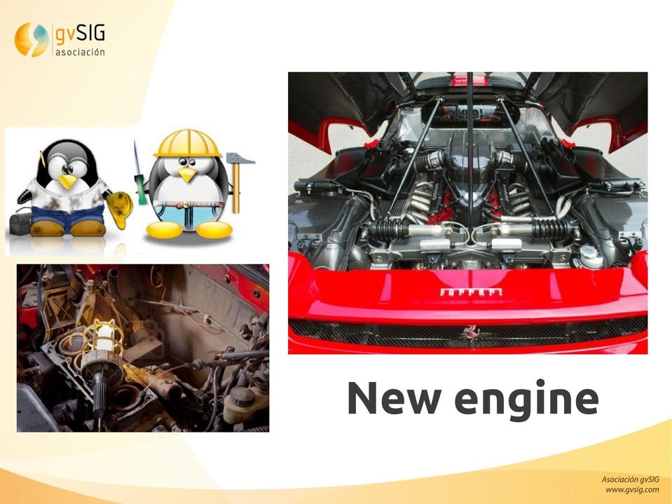
5 New engine
6 1.x Architecture Any change entails... complexity and impact

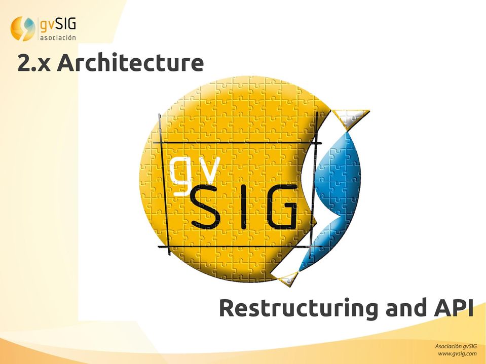
7 2.x Architecture Restructuring and API
8 less cost less developement time less impact new applications more frequent updates bug corrections 2.x Architecture: changes provide advantages


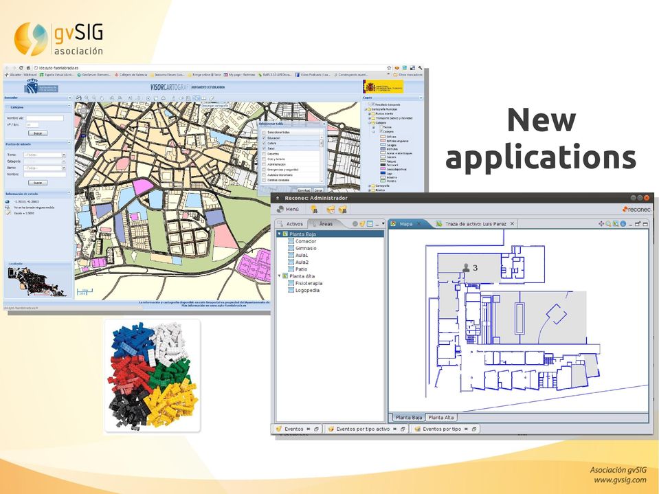
9 New applications


10 New installer New installer that supports typical and customized installation. Through a customized installation the user can control the add-ons that are installed. We can install a customized gvsig


11 Add-ons manager Not only new functionalities but also symbol libraries...


, like: - All supported data formats can be added without driver selection -")
12 Interface / usability Some changes in the interface of the data management tools like: - Importing/exporting files - Table operations - New layer Usability improvements (starting...), like: - All supported data formats can be added without driver selection - Screen refresh when zooming - Menus and sub-menu restructuring
, like: - All supported data formats can be added without driver selection -")
 support.")

13 Data display - Improvements in the layer performance: The user can now work on the application while a layer is loading. - WMTS (Web Map Tiled Service) support. The WMTS is a new OGC standard service that improves the popular WMS thanks to improved tile management. - Raster data cache. Improvements in the raster data viewing performance.

14 4D: Time as a coordinate - NETCDF (vector/raster) format support. NETCDF is a format for scientific data that supports, among other things, multi-temporal data. - Temporal data support. A new temporal filter tool has been added for files that support the time dimension like NETCDF. - Animation generation from temporal data (vector).


15 Scripting: Python for gvsig - It is an open source development language. - Easy to learn. Suitable for beginners... and also for experts. - Multi-platform. - Stable and mature. - It has a great users community, also in the GIS world. - Prepared for Groovy and Javascript supporting.


16 Symbology - Point symbols importer in different formats: SVG, JPG, BMP... - It allows you to create your own symbol libraries - gvsig 2.0 will include new free symbol libraries (Google, OSM,...) - Users can share their symbols


17 Geoprocessing - Unified geoprocessing interface. From this version on, all the geoprocessing tools will be housed in a single toolbox. - Geoprocessing speed and functionality improvements.

18 PostGIS Raster - PostGIS Raster Support. PostGIS Raster, previously called WKTRaster, is an extension developed on PostGIS. The objective of this extension is to add native support for raster data to the database. -It takes advantage of the DB manager system characteristics: - Data access and security restrictions - SQL support for spatial queries - Client-server architecture for simultaneous access - Data centralization - Georreferenced tiled and multi-resolution raster data storing (row: rater or tile; table: complete cover).


19 Metadata - Metadata management. New add-on that allows creation, editing and exporting of metadata. - Metadata profiles generation. Add-on that allows advanced users to create new metadata profiles.

. - New versions of OGC formats Extensions for gvsig 2.0 - Normalization - Geocoding - Sensors: SOS, graphs,.")
20 Other improvements - Inserting table in layout. Any of the tables of a gvsig project can be added to a layout. - Raster layer information (info by point). - New versions of OGC formats Extensions for gvsig Normalization - Geocoding - Sensors: SOS, graphs,... - Thematic maps (from gvsig Educa/Batoví)

21 Next gvsig 2.1 Map sheets Graph document (graph legend is still pending) Thematic maps OSM Georeferencing PostGIS 2.0 raster Compatibility with Vector PostGIS 2.0 New legends (Expressions, Proportional Symbols, Graduated Symbols, Points Density, Quantities by category) Advanced labelling CSV Event layer Table in layout Raster improvements Printing improvements Time-space dissolve geoprocess Reviewing of source code headers Last version of Sextante Fixing of bugs
22 We have laid the foundation for the future of gvsig
23 Questions?
24 What's new in gvsig Desktop 2.0
NetCDF and HDF Data in ArcGIS
 2013 Esri International User Conference July 8 12, 2013 San Diego, California Technical Workshop NetCDF and HDF Data in ArcGIS Nawajish Noman Kevin Butler Esri UC2013. Technical Workshop. Outline NetCDF
Institute of Computational Modeling SB RAS
 Institute of Computational Modeling SB RAS ORGANIZATION OF ACCESS TO OBSERVATIONAL DATA USING WEB SERVICES FOR MONITORING SYSTEMS THE STATE OF THE ENVIRONMENT Kadochnikov Aleksey A. Russia, Krasnoyarsk
SuperGIS Server 3.2 Standard Edition Specification
 SuperGIS Server 3.2 Standard Edition Specification 20140826 Specification 1. All of the services support SOAP (Simple Object Access Protocol). 2. Use map file created by SuperGIS Desktop as map services
GeoMedia Product Update. Title of Presentation. Lorilie Barteski October 15, 2008 Edmonton, AB
 Product Update Title of Presentation Lorilie Barteski Edmonton, AB Know the audience poll Existing /Pro users Version 6.1 Version 6.0 Version 5.2 or earlier Existing WebMap users Version 6.1 Version 6.0
HELCOM Data and Map Service. User Manual
 HELCOM Data and Map Service User Manual Version 2.2 - February 2015 1 Table of contents 1. General Information... 3 1.1 Background... 3 1.2 Technical requirements... 3 1.3 Contact... 3 2. Accessing HELCOM
gvsig: A GIS desktop solution for an open SDI.
 gvsig: A GIS desktop solution for an open SDI. ALVARO ANGUIX1, LAURA DÍAZ1, MARIO CARRERA2 1 IVER Tecnologías de la Información. Valencia, Spain. Tel. +34 96 316 34 00; Fax. +34 96 316 34 00 Email: [email protected]
How To Use Gis
 Welcome Understanding Purpose Creating Relationships You A Global Community of GIS Professionals Changing the World Together Applying Geography Everywhere Your WORK Showcasing Your Web Apps Vision Applying
Web Map Service Architecture for Topographic Data in Finland
 Web Map Service Architecture for Topographic Data in Finland Teemu Sipilä National Land Survey of Finland Abstract. Since 2012 National Land Survey of Finland has been renewing its web map services and
SUMMER SCHOOL ON ADVANCES IN GIS
 SUMMER SCHOOL ON ADVANCES IN GIS Six Workshops Overview The workshop sequence at the UMD Center for Geospatial Information Science is designed to provide a comprehensive overview of current state-of-the-art
Chapter 6: Data Acquisition Methods, Procedures, and Issues
 Chapter 6: Data Acquisition Methods, Procedures, and Issues In this Exercise: Data Acquisition Downloading Geographic Data Accessing Data Via Web Map Service Using Data from a Text File or Spreadsheet
The Courses. Covering complete breadth of GIS technology from ESRI including ArcGIS, ArcGIS Server and ArcGIS Engine.
 ESRI India: Corporate profile ESRI India A profile India s Premier GIS Company Strategic alliance between ESRI Inc. and NIIT Technologies Adjudged as India s Best GIS Solutions Company - Map India 2001
GEOGRAPHIC INFORMATION SYSTEMS CERTIFICATION
 GEOGRAPHIC INFORMATION SYSTEMS CERTIFICATION GIS Syllabus - Version 1.2 January 2007 Copyright AICA-CEPIS 2009 1 Version 1 January 2007 GIS Certification Programme 1. Target The GIS certification is aimed
ArcGIS ArcMap: Printing, Exporting, and ArcPress
 Esri International User Conference San Diego, California Technical Workshops July 25th, 2012 ArcGIS ArcMap: Printing, Exporting, and ArcPress Michael Grossman Jeremy Wright Workshop Overview Output in
HydroDesktop Overview
 HydroDesktop Overview 1. Initial Objectives HydroDesktop (formerly referred to as HIS Desktop) is a new component of the HIS project intended to address the problem of how to obtain, organize and manage
Choosing the right GIS framework for an informed Enterprise Web GIS Solution
 13 ANNUAL INTERNATIONAL CONFERENCE AND EXHIBITION ON GEOSPATIAL INFORMATION TECHNOLOGY AND APPLICATIONS Epicentre; Gurgaon, India; 19-21 January, 2010 Choosing the right GIS framework for an informed Enterprise
 Development tools to create Web-GIS applications DbMAP ASJ the best solution to easily publish GIS data from existing spatial databases and distributed GIS data sources Easily designs, produces, and publishes
BLM Personnel & REA Collaborator Access. Accessing REA Data, Maps, & Models through SharePoint
 Accessing REA Data, Maps, & Models through SharePoint BLM Personnel & REA Collaborator Access To access REA data and map services through the BLM network, follow the steps provided below. They will take
_ LUCIADRIA PRODUCT DATA SHEET
 _ LUCIADRIA PRODUCT DATA SHEET V2015.1 LuciadRIA offers browser-based geospatial situational awareness with the fluidity and speed of a desktop application. The software components of LuciadRIA have been
Standardized data sharing through an open-source Spatial Data Infrastructure: the Afromaison project
 Standardized data sharing through an open-source Spatial Data Infrastructure: the Afromaison project Yaniss Guigoz - University of Geneva/GRID-Geneva 1 EcoARM2ERA and AFROMAISON Why Afromaison in this
Working with Temporal Data
 Esri International User Conference San Diego, California Technical Workshops July 26 2012 Working with Temporal Data Aileen Buckley Mark Smithgall This technical workshop Visualizing temporal data recurring
Chapter 1: Introduction to ArcGIS Server
 Chapter 1: Introduction to ArcGIS Server At a high level you can think of ArcGIS Server as software that helps you take your geographic information and make it available to others. This data can be distributed
Developer Tutorial Version 1. 0 February 2015
 Developer Tutorial Version 1. 0 Contents Introduction... 3 What is the Mapzania SDK?... 3 Features of Mapzania SDK... 4 Mapzania Applications... 5 Architecture... 6 Front-end application components...
GeoKettle: A powerful open source spatial ETL tool
 GeoKettle: A powerful open source spatial ETL tool FOSS4G 2010 Dr. Thierry Badard, CTO Spatialytics inc. Quebec, Canada [email protected] Barcelona, Spain Sept 9th, 2010 What is GeoKettle? It is
ishare in the Cloud Service Definition v5.0
 Service Definition v5.0 An overview of ishare in the Cloud ishare is an end to end Enterprise GIS for public sector comprising a spatial data warehouse, rich functionality browser based GIS including editing
Leveraging Cloud-Based Mapping Solutions
 Leveraging Cloud-Based Mapping Solutions GeoAlberta October 28, 2014 Laura Kerssens Safe Software Agenda To the Cloud Using Basic Services Cloud Applications Web Services Cloud-Hosted Databases Real-time
Spotfire v6 New Features. TIBCO Spotfire Delta Training Jumpstart
 Spotfire v6 New Features TIBCO Spotfire Delta Training Jumpstart Map charts New map chart Layers control Navigation control Interaction mode control Scale Web map Creating a map chart Layers are added
Sisense. Product Highlights. www.sisense.com
 Sisense Product Highlights Introduction Sisense is a business intelligence solution that simplifies analytics for complex data by offering an end-to-end platform that lets users easily prepare and analyze
Different types of OS GIS mobile applications: gvsig Mobile & gvsig Mini
 CGS University of Nottingham OSGIS 2011 22ndJune Different types of OS GIS mobile applications: gvsig Mobile & gvsig Mini Amelia del Rey [email protected] Javier Carrasco [email protected] Alberto
INTRODUCTION to ESRI ARCGIS For Visualization, CPSC 178
 INTRODUCTION to ESRI ARCGIS For Visualization, CPSC 178 1) Navigate to the C:/temp folder 2) Make a directory using your initials. 3) Use your web browser to navigate to www.library.yale.edu/mapcoll/ and
EUMETSAT EO Portal. End User Image Access using OGC WMS/WCS services. EUM/OPS/VWG/10/0095 Issue <1> <14/01/2010> Slide: 1
 EUMETSAT EO Portal End User Image Access using OGC WMS/WCS services Slide: 1 Overview Introduction: status of data access and visualization EUMETSAT datasets Architecture Web Map Service implementation
CLOUD BASED N-DIMENSIONAL WEATHER FORECAST VISUALIZATION TOOL WITH IMAGE ANALYSIS CAPABILITIES
 CLOUD BASED N-DIMENSIONAL WEATHER FORECAST VISUALIZATION TOOL WITH IMAGE ANALYSIS CAPABILITIES M. Laka-Iñurrategi a, I. Alberdi a, K. Alonso b, M. Quartulli a a Vicomteh-IK4, Mikeletegi pasealekua 57,
INTEROPERABLE IMAGE DATA ACCESS THROUGH ARCGIS SERVER
 INTEROPERABLE IMAGE DATA ACCESS THROUGH ARCGIS SERVER Qian Liu Environmental Systems Research Institute 380 New York Street Redlands, CA92373, U.S.A - [email protected] KEY WORDS: OGC, Standard, Interoperability,
Step by Step Guide for GIS Cloud Applications
 Step by Step Guide for GIS Cloud Applications All in one manual for: Map Editor Map Viewer Asset Data Collection and Management Fleet Management Roadwork Management and Coordination Mobile Data Collection
GVSIG USER MANUAL 3D PLUGIN
 GVSIG USER MANUAL 3D PLUGIN San Vicente Martir Street, 84 5ºA, 46002 Valencia, Spain Information: [email protected] www.gvsig.com Telephone: (+34) 963516309 FAX: (+34) 901 021 995 Mailing list: There are
PRODUCT DATA SHEET. MapInfo Professional v12 Version Comparison. How Does v12 Compare to Previous Versions? MapInfo Professional v12 adds: SUMMARY
 PRODUCT DATA SHEET MapInfo Professional v12 Version Comparison WORK SMARTER, NOT HARDER, WITH THE PREMIER LOCATION INTELLIGENCE SOLUTION How Does v12 Compare to Previous Versions? MapInfo Professional
OPEN STANDARD WEB SERVICES FOR VISUALISATION OF TIME SERIES DATA OF FLOOD MODELS
 OPEN STANDARD WEB SERVICES FOR VISUALISATION OF TIME SERIES DATA OF FLOOD MODELS Barend Köbben FRMRC RPA 7 Workshop visualisations and flow simulations as flood risk communication tools
NetCDF Tutorial. Copyright 1995-2010 Esri All rights reserved.
 Copyright 1995-2010 Esri All rights reserved. Table of Contents About the netcdf Tutorial............................... 3 Exercise 1: Displaying a raster layer from a netcdf file................... 4
ArcGIS Server 9.3.1 mashups
 Welcome to ArcGIS Server 9.3.1: Creating Fast Web Mapping Applications With JavaScript Scott Moore ESRI Olympia, WA [email protected] Seminar agenda ArcGIS API for JavaScript: An Overview ArcGIS Server Resource
County of Los Angeles. Chief Information Office Preferred Technologies for Geographic Information Systems (GIS) September 2014
 September 2014") County of Los Angeles Chief Information Office Preferred Technologies for Geographic Information Systems (GIS) September 2014 CIO Preferred Technologies for GIS This document lists the preferred Geographic
County of Los Angeles Chief Information Office Preferred Technologies for Geographic Information Systems (GIS) September 2014 CIO Preferred Technologies for GIS This document lists the preferred Geographic
Oracle Platform GIS & Location-Based Services. Fred Louis Solution Architect Ohio Valley
 Oracle Platform GIS & Location-Based Services Fred Louis Solution Architect Ohio Valley Overview Geospatial Technology Trends Oracle s Spatial Technologies Oracle10g Locator Spatial Oracle Application
An Introduction to Open Source Geospatial Tools
 An Introduction to Open Source Geospatial Tools by Tyler Mitchell, author of Web Mapping Illustrated GRSS would like to thank Mr. Mitchell for this tutorial. Geospatial technologies come in many forms,
What is ArcGIS Comprised Of?
 ArcGIS Server 9.1 What is ArcGIS Comprised Of? ArcGIS Desktop Integrated suite of GIS applications ArcGIS Engine Embeddable developer components Server GIS ArcSDE, ArcIMS, ArcGIS Server Mobile GIS ArcPad
Quick start. A project with SpagoBI 3.x
 Quick start. A project with SpagoBI 3.x Summary: 1 SPAGOBI...2 2 SOFTWARE DOWNLOAD...4 3 SOFTWARE INSTALLATION AND CONFIGURATION...5 3.1 Installing SpagoBI Server...5 3.2Installing SpagoBI Studio and Meta...6
4/25/2016 C. M. Boyd, [email protected] Practical Data Visualization with JavaScript Talk Handout
 Practical Data Visualization with JavaScript Talk Handout Use the Workflow Methodology to Compare Options Name Type Data sources End to end Workflow Support Data transformers Data visualizers General Data
Scott Moore, Esri April 4, 2016 2016 Intermountain, Great Falls, MT
 Create Great Web Apps No Coding Required Scott Moore, Esri April 4, 2016 2016 Intermountain, Great Falls, MT Agenda Product overview Web AppBuilder for ArcGIS tour What s New November 2015 ArcGIS Online
Tutorial 3: Working with Tables Joining Multiple Databases in ArcGIS
 Tutorial 3: Working with Tables Joining Multiple Databases in ArcGIS This tutorial will introduce you to the following concepts: Identifying Attribute Data Sources Converting Tabular Data into GIS Databases
Data Interoperability Extension Tutorial
 Data Interoperability Extension Tutorial Copyright 1995-2010 Esri All rights reserved. Table of Contents About the Data Interoperability extension tutorial...................... 3 Exercise 1: Using direct-read
Five Steps to Better Performance
 Effective Web maps have a specific focus and are designed so users can interact with them to accomplish meaningful tasks. Five Steps to Better Performance Sample methodology for creating a great Web map
Scientific Data Management and Dissemination
 Federal GIS Conference February 9 10, 2015 Washington, DC Scientific Data Management and Dissemination John Fry Solution Engineer, Esri [email protected] Agenda Background of Scientific Data Management through
Documentation of open source GIS/RS software projects
 Contract no. Workpackage Delivery Delivery Date 030776 WP1 D1.6 2007-07-02 CASCADOSS Development of a trans-national cascade training programme on Open Source GIS&RS Software for environmental applications
Neues vom QGIS Server und QGIS-Webclient
 FOSSGIS 2012 Neues vom QGIS Server und QGIS-Webclient Pirmin Kalberer Sourcepole AG, Pfäffikon SZ www.sourcepole.ch Über Sourcepole > QGIS > Core dev. & Project Steering Commitee > Printing, QGIS Server,
64 Bits of MapInfo Pro!!! and the next BIG thing. March 2015
 64 Bits of MapInfo Pro!!! and the next BIG thing March 2015 MapInfo Professional v12.5 Themes Cartographic output Performance improvements Ability to work directly with a map in a layout. An all new Layout
CentropeSTATISTICS a Tool for Cross-Border Data Presentation Manfred Schrenk, Clemens Beyer, Norbert Ströbinger
 Manfred Schrenk, Clemens Beyer, Norbert Ströbinger (Dipl.-Ing. Manfred Schrenk, Multimediaplan.at, 2320 Schwechat, Austria, [email protected]) (Dipl.-Ing. Clemens Beyer, CORP Competence Center
Institute of Natural Resources Departament of General Geology and Land use planning Work with a MAPS
 Institute of Natural Resources Departament of General Geology and Land use planning Work with a MAPS Lecturers: Berchuk V.Y. Gutareva N.Y. Contents: 1. Qgis; 2. General information; 3. Qgis desktop; 4.
ArcGIS. Server. A Complete and Integrated Server GIS
 ArcGIS Server A Complete and Integrated Server GIS ArcGIS Server A Complete and Integrated Server GIS ArcGIS Server enables you to distribute maps, models, and tools to others within your organization
There are various ways to find data using the Hennepin County GIS Open Data site:
 Finding Data There are various ways to find data using the Hennepin County GIS Open Data site: Type in a subject or keyword in the search bar at the top of the page and press the Enter key or click the
Analysis of the Free GIS Software Applications in respect to INSPIRE services and OGC standards
 Analysis of the Free GIS Software Applications in respect to INSPIRE services and OGC standards Authors: Francesco D'Alesio Peter Hopfgartner Paolo Viskanic June 2011 Executive Summary This document analyses
OCAD more than just only a o-mapping software
 OCAD more than just only a o-mapping software IOF ITC Open Meeting, WOC 2014, Lavarone Positioning of OCAD. Import and Export of Geodata Geodata Capture (GPS) Course Setting Desktop Publishing (DTP) Specific
GEOENGINE MSc in Geomatics Engineering, Master Thesis Gina Campuzano
 Master Thesis Gina CAMPUZANO Gina Campuzano Development of a GIS web application as a tool for learning of environmental protection -Comparison between MapServer and GeoServer constructing a tool for not
Visualization Method of Trajectory Data Based on GML, KML
 Visualization Method of Trajectory Data Based on GML, KML Junhuai Li, Jinqin Wang, Lei Yu, Rui Qi, and Jing Zhang School of Computer Science & Engineering, Xi'an University of Technology, Xi'an 710048,
Web Design Specialist
 UKWDA Training: CIW Web Design Series Web Design Specialist Course Description CIW Web Design Specialist is for those who want to develop the skills to specialise in website design and builds upon existing
RIFIS Ad Hoc Reports
 RIFIS Ad Hoc Reports To retrieve the entire list of all Ad Hoc Reports, including the Base reports and any additional reports published to your Role, select Ad Hoc for the Type under Filter Report By and
MAY 18, 2015 ARCGIS 10.3.1 FOR SERVER FUNCTIONALITY MATRIX
 MAY 18, 2015 ARCGIS 10.3.1 FOR SERVER FUNCTIONALITY MATRIX Copyright 2015 Esri All rights reserved. Printed in the United States of America. The information contained in this document is the exclusive
Today's Topics. COMP 388/441: Human-Computer Interaction. simple 2D plotting. 1D techniques. Ancient plotting techniques. Data Visualization:
 COMP 388/441: Human-Computer Interaction Today's Topics Overview of visualization techniques 1D charts, 2D plots, 3D+ techniques, maps A few guidelines for scientific visualization methods, guidelines,
gvsig: Open Source GIS client. Spatial Data Infrastructure Client.
 Séminaire gvsig Rennes, 31 Mars 2006 gvsig: Open Source GIS client. Spatial Data Infrastructure Client. Luis W. Sevilla Gabriel Carrión Rico Martín García Hernández Francisco J. Peñarrubia Alvaro A. Anguix
GIS Databases With focused on ArcSDE
 Linköpings universitet / IDA / Div. for human-centered systems GIS Databases With focused on ArcSDE Imad Abugessaisa [email protected] 20071004 1 GIS and SDBMS Geographical data is spatial data whose
Data Visualization Using Web GIS Software
 Data Visualization Using Web GIS Software Tuomas Peltonen Radiation and Nuclear Safety Authority (STUK), Finland NKS NordDSS Workshop, Copenhagen, 1.-2.10.2009 RADIATION AND NUCLEAR SAFETY AUTHORITY Preface
GIS Beyond the Basics: Web Maps and File Sharing Services
 GIS Beyond the Basics: Web Maps and File Sharing Services by Julie Coco, PE I. INTRODUCING WEB-BASED GIS SERVICES A GIS service, or Geoservice, provides a way to retrieve maps, images, or geoprocessing
_ LUCIADMOBILE V2015 PRODUCT DATA SHEET _ LUCIADMOBILE PRODUCT DATA SHEET
 _ LUCIADMOBILE PRODUCT DATA SHEET V2015 LuciadMobile enables the rapid development of geospatial situational awareness applications on mobile devices running Android, and is specifically designed for situational
Oklahoma s Open Source Spatial Data Clearinghouse: OKMaps
 Oklahoma s Open Source Spatial Data Clearinghouse: OKMaps Presented by: Mike Sharp State Geographic Information Coordinator Oklahoma Office of Geographic Information MAGIC 2014 Symposium April 28-May1,
What s new in TIBCO Spotfire 6.5
 What s new in TIBCO Spotfire 6.5 Contents Introduction... 3 TIBCO Spotfire Analyst... 3 Location Analytics... 3 Support for adding new map layer from WMS Server... 3 Map projections systems support...
Vision. South Pacific GIS/RS Conference 2015 11/17/2015. Applying Geography Everywhere. Applying Geography Everywhere
 South Pacific GIS/RS Conference 2015 Applying Geography Everywhere Jithen (J) Singh Eagle Technology Group Ltd (Esri New Zealand) Suva, Fiji Vision Applying Geography Everywhere 1 GIS Is Evolving A Whole
Data Visualization. Brief Overview of ArcMap
 Data Visualization Prepared by Francisco Olivera, Ph.D., P.E., Srikanth Koka and Lauren Walker Department of Civil Engineering September 13, 2006 Contents: Brief Overview of ArcMap Goals of the Exercise
Note: Hands On workshops are Bring Your Own Laptop (BYOL), unless otherwise noted. Some workshops are Bring Your Own Mobile Device(BYOD).
, unless otherwise noted. Some workshops are Bring Your Own Mobile Device(BYOD).") 2015 MN GIS/LIS Consortium Pre Conference Workshops The Minnesota GIS/LIS Consortium is pleased to offer a diverse list of workshops on Wednesday, October 7th, 2015 at the DECC, Duluth, Minnesota Charting
2015 MN GIS/LIS Consortium Pre Conference Workshops The Minnesota GIS/LIS Consortium is pleased to offer a diverse list of workshops on Wednesday, October 7th, 2015 at the DECC, Duluth, Minnesota Charting
Spectrum Technology Platform. Version 9.0. Spectrum Spatial Developer Guide
 Spectrum Technology Platform Version 9.0 Spectrum Spatial Developer Guide Contents Chapter 1: Introduction...9 What Is Location Intelligence?...10 What Is the Location Intelligence Module?...10 Location
Developing ASP.NET MVC 4 Web Applications MOC 20486
 Developing ASP.NET MVC 4 Web Applications MOC 20486 Course Outline Module 1: Exploring ASP.NET MVC 4 The goal of this module is to outline to the students the components of the Microsoft Web Technologies
Using CAD Data in ArcGIS
 Esri International User Conference San Diego, California Technical Workshops July 27, 2012 Using CAD Data in ArcGIS Jeff Reinhart & Phil Sanchez Agenda Overview of ArcGIS CAD Support Using CAD Datasets
Choosing the right GIS framework for an informed Enterprise Web GIS Solution
 Choosing the right GIS framework for an informed Enterprise Web GIS Solution Written By Sneha Rao ([email protected]) and Sri Vinay ([email protected]) CIESIN, Columbia University & NASA New
MicroStrategy Desktop
 MicroStrategy Desktop Quick Start Guide MicroStrategy Desktop is designed to enable business professionals like you to explore data, simply and without needing direct support from IT. 1 Import data from
Portal Version 1 - User Manual
 Portal Version 1 - User Manual V1.0 March 2016 Portal Version 1 User Manual V1.0 07. March 2016 Table of Contents 1 Introduction... 4 1.1 Purpose of the Document... 4 1.2 Reference Documents... 4 1.3 Terminology...
ARIZONA DEPARTMENT OF TRANSPORTATION. Presented by Lonnie D. Hendrix, P.E. Assistant State Engineer, Maintenance
 ARIZONA DEPARTMENT OF TRANSPORTATION Presented by Lonnie D. Hendrix, P.E. Assistant State Engineer, Maintenance Prepared by Feature Inventory Services Team July 2013 FIS Database Feature Inventory System
GIS I Business Exr02 (av 9-10) - Expand Market Share (v3b, Jul 2013)
 - Expand Market Share (v3b, Jul 2013)") GIS I Business Exr02 (av 9-10) - Expand Market Share (v3b, Jul 2013) Learning Objectives: Reinforce information literacy skills Reinforce database manipulation / querying skills Reinforce joining and mapping
GIS I Business Exr02 (av 9-10) - Expand Market Share (v3b, Jul 2013) Learning Objectives: Reinforce information literacy skills Reinforce database manipulation / querying skills Reinforce joining and mapping
GeoPackage, The Shapefile Of The Future
 FOSS4G 2013 GeoPackage, The Shapefile Of The Future @PirminKalberer Sourcepole AG, Switzerland www.sourcepole.com About Sourcepole > QGIS > Core dev. & Project Steering Commitee > QGIS Server, Printing,
Geodatabase Programming with SQL
 DevSummit DC February 11, 2015 Washington, DC Geodatabase Programming with SQL Craig Gillgrass Assumptions Basic knowledge of SQL and relational databases Basic knowledge of the Geodatabase We ll hold
Enabling embedded maps
 Enabling embedded maps Case: National geoportal of Finland Antti Rainio National Land Survey of Finland Trends: Web Services, Mapping Mashup, Open Source, Open Data Decentralised data s Service interfaces
Deploy. Friction-free self-service BI solutions for everyone Scalable analytics on a modern architecture
 Friction-free self-service BI solutions for everyone Scalable analytics on a modern architecture Apps and data source extensions with APIs Future white label, embed or integrate Power BI Deploy Intelligent
Iraklis Karampourniotis, Zoi Arvanitidou, Ioannis Paraschakis. Using open source software in gis training and education
 Iraklis Karampourniotis, Zoi Arvanitidou, Ioannis Paraschakis Using open source software in gis training and education Can open source be used? The question troubling us was Can Open Source Software be
Creating Maps in QGIS: A Quick Guide
 Creating Maps in QGIS: A Quick Guide Overview Quantum GIS, which is often called QGIS, is an open source GIS desktop application. Comparing to ArcGIS, QGIS can be installed on various operating systems,
gvsig: Open Source for handling Geospatial Information
 gvsig: Open Source for handling Geospatial Information Mario Carrera Rodríguez [email protected] Generalitat Valenciana (GV) is the government of the Valencian Community (Castellón, Valencia, Alicante)
GeoSEE WebGIS. Document for activity 5.4 WP 5
 GeoSEE WebGIS Document for activity 5.4 WP 5 1 Contents 1 Introduction... 4 2 GeoSEE webgis description... 4 2.1 URL... 4 2.1 Overview... 4 2.2 Navigation toolbar... 6 2.1 Map... 6 2.2 Layers list and
ArcGIS Server in Practice Series: Best Practices for Creating an ArcGIS Server Web Mapping Application for Municipal/Local Government
 An Esri White Paper August 2009 ArcGIS Server in Practice Series: Esri, 380 New York St., Redlands, CA 92373-8100 USA TEL 909-793-2853 FAX 909-793-5953 E-MAIL [email protected] WEB www.esri.com Copyright 2009
Sextant. Spatial Data Infrastructure for Marine Environment. C. Satra Le Bris, E. Quimbert, M. Treguer
 Sextant On-Line information system for marine geographical information E. Quimbert, M. Bellouis, F. Lecuy, M. Treguer Centre de Bretagne BP 70, Plouzané 29280 France E-mail: [email protected] Sextant
Shuffling Quantum GIS into the Open Source GIS Stack
 Shuffling Quantum GIS into the Open Source GIS Stack Free and Open Source Software for Geospatial (FOSS4G) Conference Victoria, BC Gary E. Sherman September 24, 2007 Contents 1 Introduction 7 1.1 Topics........................................
JavaScript and jquery for Data Analysis and Visualization
 Brochure More information from http://www.researchandmarkets.com/reports/2766360/ JavaScript and jquery for Data Analysis and Visualization Description: Go beyond design concepts build dynamic data visualizations
1 Copyright 2011, Oracle and/or its affiliates. All rights reserved.
 1 Copyright 2011, Oracle and/or its affiliates. All rights Building Visually Appealing Web 2.0 Data Dashboards Frank Nimphius Senior Principal Product Manager, Oracle 2 Copyright 2011, Oracle and/or its
Figure 2: System Flow Diagram for Workflow Management
 5. WORKFLOW MANAGEMENT The developed system EASKB uses the open source content management system called Drupal ([2]). A Content Management System - CMS is a tool that enables many user friendly features